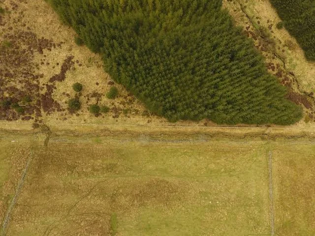
How drone-based mapping, remote sensing, and landscape archaeology can reveal abandoned agricultural terraces hidden beneath recovering forests.
Introduction: Agricultural Landscapes Hidden by Vegetation
Many ancient and historical agricultural landscapes survive long after cultivation has ended. Hillsides once divided into terraces may now be covered by shrubs, woodland, or dense vegetation. From the ground, these features can be difficult to recognize, especially where retaining walls have collapsed or soil has accumulated over centuries.
Agricultural terraces were constructed to modify slopes, manage water, reduce soil movement, and create more usable land. Their design varied according to local terrain, available building materials, crops, and farming traditions.
When terraces are abandoned, vegetation may gradually reclaim the land. This ecological recovery can obscure the original agricultural layout while preserving parts of the landscape's physical structure.
Drone-based mapping offers a way to document these features in detail. By collecting aerial photographs and other remote-sensing data, researchers can create precise models of terrain and identify patterns that may be difficult to see from the ground. However, the detection of a terrace does not automatically establish its age or original use.
Why Terraces Are Difficult to Identify
Terraces can take several forms, including stone retaining walls, earthen banks, level cultivation surfaces, and combinations of built structures and modified slopes. Some are clearly visible, while others have been reduced to subtle changes in ground elevation.
Vegetation can conceal walls and create misleading surface patterns. Tree roots may move stones, fallen branches can imitate linear features, and natural erosion may form ledges resembling abandoned agricultural structures.
Researchers therefore combine aerial imagery with ground inspection. A suspected terrace should be examined for construction materials, repeated geometry, drainage arrangements, and relationships with neighboring features.
The wider landscape is equally important. A sequence of roughly parallel benches following the contour of a slope may support an agricultural interpretation, but researchers must consider other possible explanations, including paths, quarrying, defensive earthworks, and natural geological formations.
Drone Photogrammetry and Three-Dimensional Models
One of the most useful drone-based methods is photogrammetry. A drone captures overlapping photographs from different positions, and software identifies common features across the images to reconstruct the surface in three dimensions.
The resulting model can be used to generate a digital elevation model, orthophotograph, and other spatial products. These allow researchers to examine terrace boundaries, retaining walls, slope gradients, and relationships between agricultural features and the surrounding terrain.
Accurate results depend on flight planning, image overlap, lighting, camera quality, and ground control. Ground control points or other reliable positioning methods help ensure that the model aligns with real-world coordinates.
Dense vegetation creates a major limitation. Photogrammetry primarily records visible surfaces, so a model may represent the tops of trees rather than the ground beneath them. Researchers must not mistake a detailed forest-canopy model for an accurate representation of hidden terrace structures.
LiDAR and the Ground Beneath the Canopy
Light detection and ranging, commonly called LiDAR, measures distances using laser pulses. Airborne LiDAR systems can sometimes record returns from the ground through gaps in vegetation, allowing researchers to create terrain models that reveal features beneath forest cover.
This can be particularly useful for locating subtle terraces, abandoned paths, drainage channels, and other landscape modifications. However, performance depends on vegetation density, instrument specifications, flight conditions, and the quality of the data-processing methods.
LiDAR is not automatically available or necessary for every project. Drone photogrammetry, satellite imagery, historical maps, and ground survey may provide sufficient information in more open landscapes.
The choice of method should depend on the research question and the environmental conditions. In dense forest, LiDAR may offer advantages; in an open agricultural landscape, high-resolution photography may be more cost-effective.
Mapping Terrace Networks and Water Management
Terraces rarely functioned as isolated features. Their construction could be part of a wider system involving paths, irrigation channels, drainage routes, storage areas, and settlements.
Drone-derived terrain models can help researchers map these relationships. Digital elevation analysis can reveal how water may have moved across a slope and identify places where drainage structures might have been necessary.
However, modern terrain reflects both natural and human processes since the terraces were abandoned. Erosion, landslides, tree growth, and later construction may have altered the original design.
Hydrological modeling can test plausible water-flow patterns, but it cannot independently establish how ancient farmers managed their fields. Researchers must compare the model with physical evidence of channels, walls, sediment deposits, and other agricultural features.
Dating Abandoned Terraces
Mapping can reveal the form and extent of a terrace system, but establishing its age requires separate evidence. A terrace may have been constructed in one period and reused, repaired, or expanded in later centuries.
Researchers can excavate carefully selected sections to examine construction layers, buried soils, and associated artifacts. Radiocarbon dating may be possible where suitable organic material is securely associated with construction or use, while other dating methods may be appropriate in particular settings.
Soil formation can provide additional information about the sequence of cultivation and abandonment. However, soil characteristics are influenced by climate, vegetation, erosion, and agricultural practices, so they rarely provide a precise date on their own.
Historical maps and documents may establish when some terraces were cultivated, but they do not necessarily identify the original construction date. The most reliable chronology combines several independent forms of evidence.
Forest Recovery and Long-Term Land Use
The return of woodland to abandoned terraces can reveal changes in land use, population, agricultural economics, and environmental conditions. Yet forest recovery does not always indicate a simple decline in human activity.
Some terraces may have been abandoned because of changing markets, new farming methods, labor shortages, conflict, or shifts in settlement patterns. Others may have remained in use intermittently, with cultivation alternating between periods of activity and abandonment.
Researchers can compare vegetation records, soil profiles, historical sources, and archaeological settlement patterns to investigate these possibilities. Pollen and charcoal sequences may reveal changes in vegetation and burning, while tree-ring evidence can sometimes contribute to local environmental chronology.
The relationship between abandonment and forest growth must be established for each landscape. Natural succession can occur at different rates depending on climate, seed availability, soil condition, and continued human disturbance.
Conservation and the Future of Terrace Landscapes
Abandoned terraces can be valuable cultural landscapes, preserving evidence of agricultural engineering and long-term environmental adaptation. They may also provide habitats for plants and animals, making conservation decisions relevant to both cultural heritage and ecology.
Drone surveys can create detailed records before restoration, construction, or vegetation management changes the landscape. Repeated surveys may also reveal erosion, wall collapse, or other deterioration.
However, remote sensing should not replace field verification. Conservation plans require an understanding of the structures' age, significance, and current condition. Clearing vegetation without careful assessment can damage fragile walls or expose soils to erosion.
Access, land ownership, privacy, and local regulations must also be considered when conducting drone surveys. Collaboration with landowners and local communities can help ensure that mapping supports responsible research and conservation.
Conclusion: Reconstructing Agricultural Landscapes from Above
Drone mapping and related remote-sensing methods have expanded the ability of archaeologists to document abandoned agricultural terraces. High-resolution imagery and terrain models can reveal patterns of land modification that remain difficult to see beneath recovering vegetation.
Nevertheless, remote sensing identifies physical features more readily than it establishes their date, purpose, or social history. Ground survey, excavation, environmental analysis, and documentary evidence remain essential for interpreting the landscape.
By combining these approaches, researchers can reconstruct how people transformed hillsides into productive agricultural spaces and how those landscapes changed after cultivation declined. The result is not merely a map of old fields, but a record of long-term relationships between farming, environmental management, settlement, and ecological recovery.