Introduction
For decades, the Amazon rainforest was viewed as a pristine, sparsely populated wilderness unsuited for large-scale civilization. However, revolutionary 2026 satellite and airborne LiDAR (Light Detection and Ranging) surveys across the Amazon basin have permanently dismantled this model.
By shooting millions of laser pulses per second through the dense jungle canopy, researchers mapped over 10,000 previously hidden pre-Columbian geoglyphs, earthworks, and urban settlements beneath the forest floor.
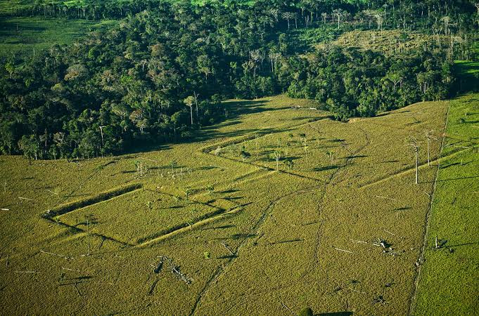
The 2026 LiDAR discoveries revealed an extensive interconnected network of geometric earthworks across the upper Amazon basin, particularly in Acre, Brazil, and northern Bolivia, highlighting the region's sophisticated landscape engineering. These earthworks included geometric enclosed ditches, raised causeways, and ring-ditch settlements, each serving distinct social and functional purposes. The geometric enclosed ditches, which were circular, square, or octagonal in shape and measured up to 300 meters wide and 3 meters deep, functioned as ceremonial gathering plazas, defensive enclosures, and astronomical markers. Raised causeways consisted of straight, elevated earthen roads that connected distant settlements, facilitating transportation between villages and providing flood-free routes during the rainy season. Meanwhile, ring-ditch settlements featured radial ditches surrounding central plazas and served as densely populated urban centers sustained by domesticated forest gardens, demonstrating advanced planning and sustainable land management.
Alongside these geometric structures, ground-truthing confirmed vast deposits of Terra Preta de Índio (Amazonian Dark Earth)—artificially enriched soils created by pre-Columbian populations through the controlled addition of biochar, bone fragments, manure, and pottery sherds.
These fertile soils allowed dense populations to practice intensive agroforestry, cultivating domesticated tree species such as Brazil nut, açai, and peach palm across millions of hectares.
Conclusion
The 2026 Amazon LiDAR discoveries prove that the Amazon was a dynamic, human-modified landscape populated by complex, interconnected societies. This research fundamentally reshapes global understanding of indigenous South American urbanism and forest management.