How settlements, artifacts, fortifications, and everyday objects reveal the complicated realities of life along the edges of ancient political territories.
Introduction: Borders Were More Than Lines on a Map
Modern borders are often represented as precise lines separating one state from another. Ancient political boundaries were frequently more complicated. They could follow rivers, mountain ranges, deserts, coastlines, or chains of settlements, and their positions might change as political authority expanded or contracted.
Frontier zones were not necessarily empty spaces between rival powers. They could contain farms, trading posts, villages, fortified settlements, pastoral routes, and communities whose relationships with neighboring authorities changed over time.
Archaeology provides a way to investigate these environments beyond official maps and political narratives. Material culture—pottery, tools, coins, building techniques, clothing accessories, and other objects—can reveal patterns of exchange, cultural interaction, and everyday life in regions where different political or cultural systems met.
However, an artifact's style does not automatically identify the political identity of its owner. Objects moved through trade, migration, gift exchange, military service, and imitation. Understanding ancient borders therefore requires attention to context rather than a simple division between objects considered local and foreign.
How Ancient Frontiers Were Organized
Ancient frontiers took many forms. Some were marked by walls, forts, watchtowers, ditches, or guarded crossings. Others relied on natural features, settlement networks, military patrols, or negotiated arrangements between communities.
A frontier could function as a zone of contact as well as a barrier. Merchants might cross it regularly, pastoralists could move between seasonal grazing areas, and families might maintain relationships across political divisions.
The degree of control varied. A fortified boundary might concentrate movement at designated gates, while a broad frontier landscape could remain difficult to monitor continuously. Archaeological evidence can help determine where authorities invested in infrastructure and where movement may have been less restricted.
Researchers must also distinguish a political frontier from a cultural boundary. Communities speaking different languages or using different material traditions did not necessarily live under separate states. Likewise, a political border could divide communities that shared many cultural practices.
Material Culture and Cultural Interaction
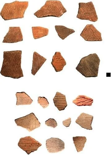
Pottery is often used to investigate frontier relationships because ceramic styles, fabrics, and production techniques can be compared across settlements. If pottery associated with one region appears in another, it may indicate exchange or movement.
Yet the interpretation depends on how the pottery arrived. A vessel could have been imported as a finished product, made locally by a migrant craftsperson, or produced by a local potter adopting an external style.
Petrographic analysis can help identify the mineral composition of pottery and compare it with possible clay sources. Chemical analysis may provide additional information about production origins, although some geological materials are widespread and difficult to distinguish precisely.
Other objects offer similar opportunities. Coins can reveal monetary circulation, while metalworking traditions may indicate technical connections. Building methods, burial practices, and food remains can also reveal relationships across a frontier.
No single artifact establishes the political status of a settlement. Researchers must combine material evidence with chronology, spatial distribution, and historical context.
Trade, Migration, and the Movement of People
Frontier zones often provided opportunities for exchange. Goods could move through formal markets, informal networks, military supply systems, and personal relationships. The presence of imported objects may therefore reveal contact even when the precise mechanism remains uncertain.
Migration can create more complicated patterns. People arriving from another region might retain familiar practices, adopt local customs, or combine different traditions. Their material possessions may reflect several stages of cultural adaptation.
Scientific methods can contribute to the study of mobility. Isotope analysis may identify individuals whose childhood environments differed from the place where they were buried, while ancient DNA can help investigate biological relationships and population histories. Neither method directly determines a person's political allegiance or cultural identity.
The strongest interpretations combine biological evidence with artifacts, settlement patterns, and the chronology of frontier development. This allows researchers to distinguish individual mobility from broader population change where the evidence permits.
Fortifications and the Everyday Frontier
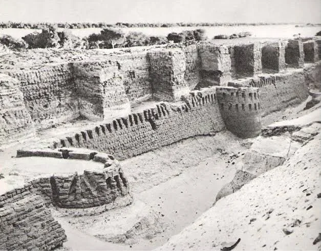
Fortifications are among the most visible archaeological features associated with ancient borders. Walls, towers, gates, and defensive ditches can reveal investments in surveillance, military organization, and the control of movement.
However, a fortified settlement does not necessarily stand directly on a political boundary. It may protect a road, secure a resource, guard a river crossing, or serve as a regional administrative center.
Researchers examine the relationship between defensive structures and their surroundings. Visibility, access routes, nearby settlements, and the distribution of military objects can help establish how a fortification functioned.
Evidence of daily life is equally important. Cooking pottery, tools, animal remains, and household structures may reveal whether a frontier installation supported a permanent population or was occupied mainly during particular periods.
A border was not maintained solely by soldiers. It could depend on farmers supplying food, craftspeople repairing equipment, merchants moving goods, and local residents negotiating with officials.
Borders as Changing Social Landscapes
Political boundaries rarely remained static over long periods. Warfare, treaties, economic change, and shifts in administrative power could alter the organization of frontier regions.
Archaeologists investigate these changes by comparing settlement patterns and material culture across successive periods. A fort abandoned during one phase might be occupied again under a different authority, while a trading settlement could continue functioning despite changes in political control.
Changes in artifact distributions do not necessarily indicate population replacement. They may reflect new trade networks, revised taxation systems, or changes in the goods available to consumers.
Likewise, continuity in pottery or building techniques does not prove that political authority remained unchanged. Local communities may preserve familiar practices while adapting to new rulers.
This distinction is essential for reconstructing frontier history. Material culture records human activity, but political boundaries must be inferred through a combination of archaeological, geographical, and historical evidence.
Conclusion: Recovering Life Between Political Powers
Ancient frontiers were often active landscapes where movement, exchange, and authority intersected. Archaeological evidence can reveal how people lived within these regions and how political boundaries affected their daily activities.
Imported objects, fortifications, settlement patterns, and scientific evidence of mobility help reconstruct frontier relationships, but none independently identifies a person's political identity or the exact position of a border.
By treating frontiers as changing zones rather than fixed lines, researchers can better understand the complexity of ancient political geography. The material remains of these regions show how people navigated authority, maintained relationships across boundaries, and adapted to changing systems of power.