• MAIN PAGE
  • LATEST NEWS
    • Lost Cities
    • Archaeology's Greatest Finds
    • Underwater Discoveries
    • Greatest Inventions
    • Studies
    • Blog
  • PHILOSOPHY
  • HISTORY
  • RELIGIONS
    • Africa
    • Anatolia
    • Arabian Peninsula
    • Balkan Region
    • China - East Asia
    • Europe
    • Eurasian Steppe
    • Levant
    • Mesopotamia
    • Oceania - SE Asia
    • Pre-Columbian Civilizations of America
    • Iranian Plateau - Central Asia
    • Indus Valley - South Asia
    • Japan
    • The Archaeologist Editor Group
    • Scientific Studies
    • Aegean Prehistory
    • Historical Period
    • Byzantine Middle Ages
    • Predynastic Period
    • Dynastic Period
    • Greco-Roman Egypt
  • Rome
  • PALEONTOLOGY
  • About us
Menu

The Archaeologist

  • MAIN PAGE
  • LATEST NEWS
  • DISCOVERIES
    • Lost Cities
    • Archaeology's Greatest Finds
    • Underwater Discoveries
    • Greatest Inventions
    • Studies
    • Blog
  • PHILOSOPHY
  • HISTORY
  • RELIGIONS
  • World Civilizations
    • Africa
    • Anatolia
    • Arabian Peninsula
    • Balkan Region
    • China - East Asia
    • Europe
    • Eurasian Steppe
    • Levant
    • Mesopotamia
    • Oceania - SE Asia
    • Pre-Columbian Civilizations of America
    • Iranian Plateau - Central Asia
    • Indus Valley - South Asia
    • Japan
    • The Archaeologist Editor Group
    • Scientific Studies
  • GREECE
    • Aegean Prehistory
    • Historical Period
    • Byzantine Middle Ages
  • Egypt
    • Predynastic Period
    • Dynastic Period
    • Greco-Roman Egypt
  • Rome
  • PALEONTOLOGY
  • About us

Giza: What Researchers Discovered Beneath the Pyramids Using Radar

March 27, 2025

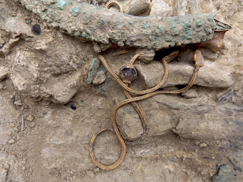
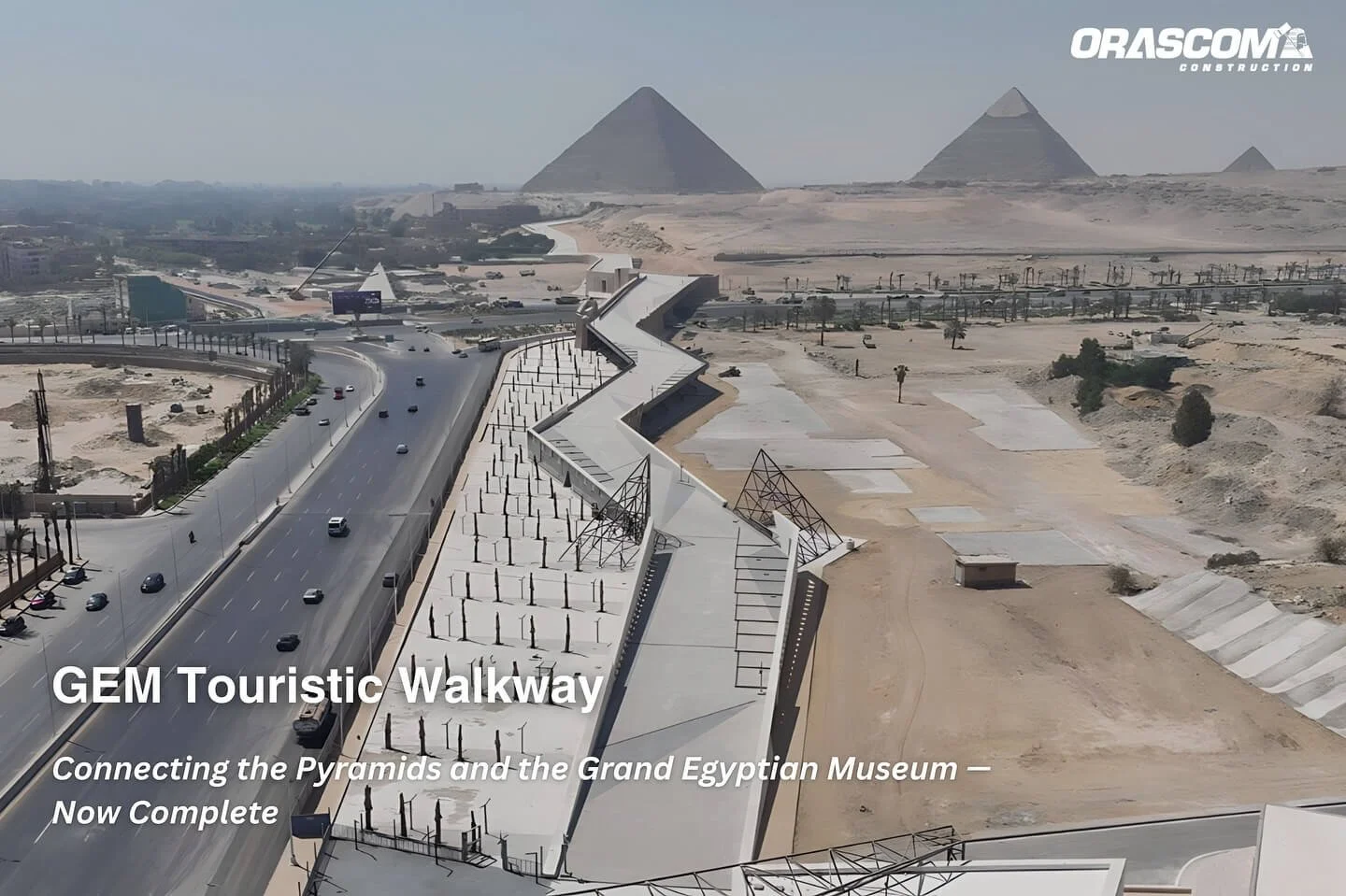
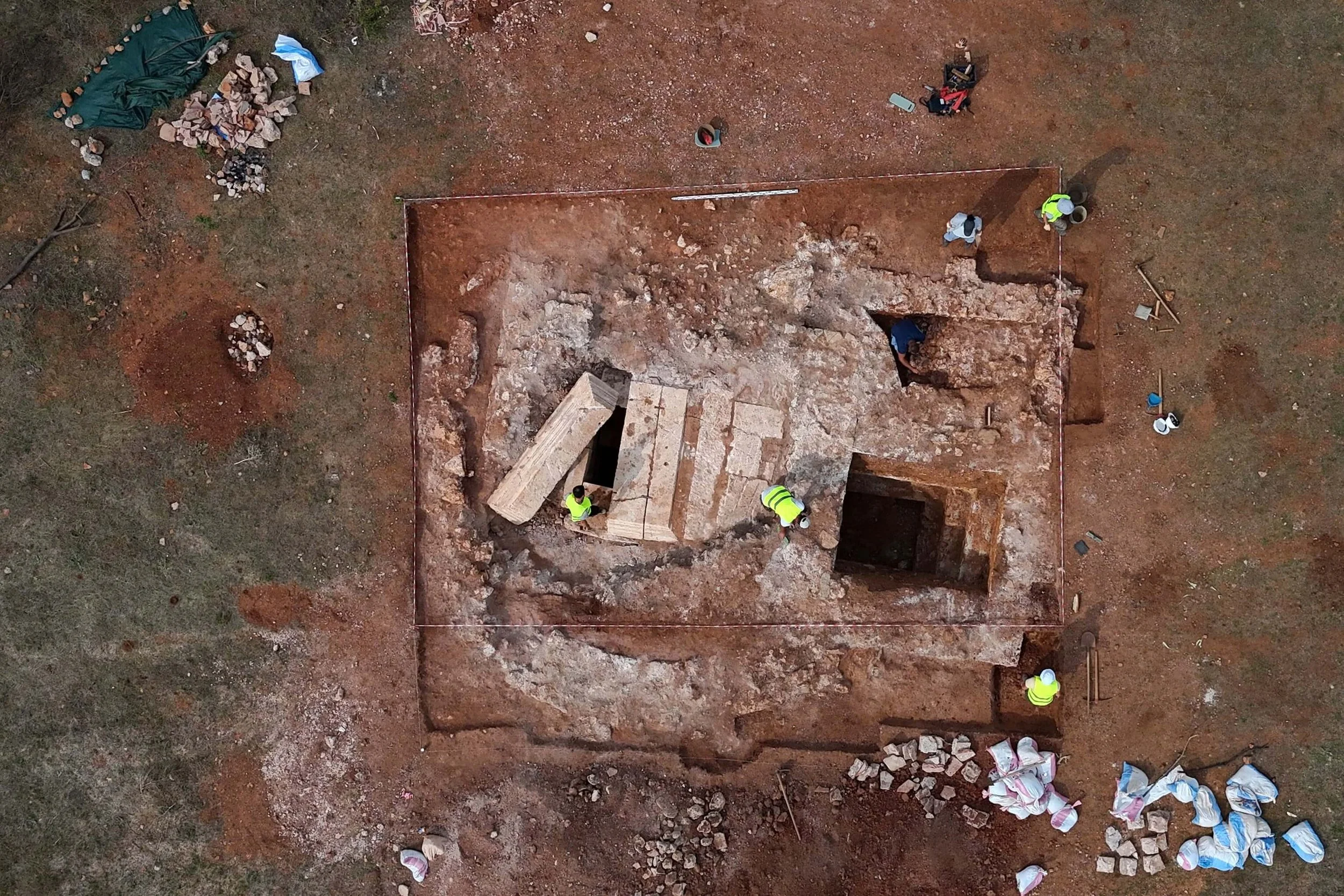
A Controversial Discovery Beneath the Giza Pyramids

Scientists claim to have found the legendary Halls of Amenti beneath Egypt’s Giza Pyramids, an alleged "vast underground city." However, archaeologists remain skeptical, dismissing these claims as "false news."

Breakthrough Radar Analysis Redefines Archaeological Exploration

Italian and Scottish researchers studying the Pyramid of Khafre argue that their pioneering study has pushed the boundaries of satellite data analysis and archaeological discovery. According to spokesperson Nicole Ciccolo, the research—dubbed the "Khafre Project"—was led by Corrado Malanga from the University of Pisa, Italy, and Filippo Biondi from the University of Strathclyde, Scotland. Their mission focused on investigating the second-largest pyramid at Giza.

Hidden Structures Revealed by Advanced Radar Technology

Using synthetic aperture radar (SAR) technology, scientists detected five small chamber-like structures within the pyramid. One of these structures contained a sarcophagus, previously misidentified as the tomb of the pharaoh, according to the research team.

These previously unknown structures, now visible through advanced imaging, were discovered at the pyramid’s center. They appear to connect to underground pathways, hinting at the existence of hidden chambers and wells beneath the 4,500-year-old wonder.

A Vast Underground Network?

Electromagnetic signals converted into acoustic data revealed even larger subterranean formations extending hundreds of meters below the surface. The research suggests that eight vertical structures—believed to be wells or shafts—span nearly two kilometers in width and descend almost a kilometer underground.

The purpose of these massive underground formations remains unclear. However, researchers plan further analysis and possible excavations to verify whether they are man-made.

The Role of Space-Based Radar Imaging

Utilizing two satellites orbiting 420 miles above Earth, the team captured radar images of the pyramids. These data were compiled into detailed images, generating an approximate model of what lies beneath Giza, including the eight massive wells.

One of the hollow structures appears to feature spiraling pathways leading deeper underground. Researchers used the gathered data to create a rough 3D model, offering a glimpse of what might remain hidden from the world.

Speculation and Skepticism

Malanga suggested that with enhanced imaging, what lies beneath could be described as a true underground city. However, skepticism quickly arose when the research findings were released without peer-reviewed validation from independent experts.

Expert Dismissal of the Findings

Dr. Zahi Hawass, a renowned Egyptologist and former Minister of Antiquities, dismissed the claims as "completely false" and "fake news." He stated that radar technology was not used inside the pyramid and that the techniques employed were neither scientifically approved nor verified.

Similarly, a researcher from the University of Denver called the claims "exaggerated," arguing that current technology is not advanced enough to produce such detailed imagery. Radar expert Lawrence Conyers added that the five smaller structures detected just below the surface could simply be remnants of the region’s long and sacred history.

According to Conyers, the Giza Plateau was a significant spiritual site for ancient civilizations long before the pyramids were built.

Theories Fuel Interest in Ancient Egyptian Mysteries

Despite skepticism, the claims have intensified interest in the possibility of discovering ancient texts and artifacts linked to Egyptian mythology. Ciccolo noted a striking resemblance between the layout of the underground chambers and the legendary Halls of Amenti described in ancient myths.

The Halls of Amenti are believed to include the mythical Hall of Records—a hidden chamber supposedly located beneath the pyramid complex or the Great Sphinx, containing knowledge about ancient civilizations.

“These new archaeological findings could redefine our understanding of ancient Egypt’s sacred geography,” Ciccolo added, suggesting they provide spatial coordinates for previously unknown and unexplored subterranean structures.

What’s Next?

While the discovery remains controversial, ongoing technological advancements may soon provide definitive answers about what truly lies beneath the Giza Pyramids. Whether this is a groundbreaking revelation or just another speculative theory, the mystery of Egypt’s ancient wonders continues to captivate the world.


Has the Legendary "Hall of Records" Been Discovered in Egypt? Scientists Investigate What Lies Beneath Giza

March 27, 2025

For centuries, legends have spoken of a hidden chamber beneath the Giza Plateau—an ancient archive containing vast amounts of lost wisdom and knowledge about one of the world’s most enigmatic civilizations. Now, a new discovery is reigniting speculation about the existence of this so-called "Hall of Records."

Mysterious Anomalies Detected Beneath the Pyramid of Khafre

Using advanced radar wave technology, researchers have identified unusual cylindrical objects buried more than 2,000 feet beneath the Pyramid of Khafre, one of the three main pyramids in the Giza complex. These findings, linked to a structure that is over 4,500 years old, have sparked intense curiosity among archaeologists and historians alike.

What Could Be Hidden Beneath Giza?

The idea of a secret underground chamber in Egypt has long captured the imagination of historians, researchers, and conspiracy theorists. According to various accounts, the Hall of Records is believed to hold ancient manuscripts, maps, and artifacts that could provide unprecedented insights into the origins and achievements of early civilizations. Some even speculate that it may contain evidence of lost technologies or knowledge far ahead of its time.

Scientific Investigation and Skepticism

While these recent findings are intriguing, experts urge caution. Similar discoveries in the past have led to excitement but ultimately proved inconclusive. Geophysical scans can sometimes detect natural formations that resemble man-made structures, leading to misinterpretations. Nevertheless, ongoing research and excavations may soon shed light on the truth behind these mysterious anomalies.

The Future of the Search

Whether the Hall of Records is real or merely a myth, the latest technological advancements are allowing scientists to explore hidden parts of Egypt’s ancient sites like never before. If further investigations confirm the existence of a subterranean chamber beneath Giza, it could revolutionize our understanding of ancient Egyptian civilization and its lost secrets.

As researchers continue their quest, the world waits in anticipation. Could we be on the verge of uncovering one of the greatest archaeological discoveries of all time?

Mysterious 5,000-Year-Old Egyptian Map May Depict America

March 25, 2025

A mysterious artifact, allegedly discovered in an ancient Egyptian tomb, has sparked widespread speculation among historians and researchers.

The artifact in question is a 5,000-year-old map that some claim depicts the American continents—centuries before Columbus and long before any recorded transatlantic contact. Though unverified, the claims surrounding the map have ignited debates about what ancient civilizations might have truly known.

A Map That Challenges History

According to an archaeologist, the artifact was found in a sealed tomb. What makes it remarkable is not just its age but also what it appears to depict: coastlines, landmasses, and topographical features that bear a striking resemblance to North and South America.

Theories about possible contact between Old and New World civilizations are not new. Scholars have long noted architectural parallels between Egyptian pyramids and Mesoamerican step pyramids. While mainstream archaeologists often attribute these similarities to coincidence or parallel development, some wonder if there is more to the story.

If authentic, such a map could serve as the missing link—tangible evidence of early cultural exchange.

Suppressed Evidence or Ancient Misinterpretation?

Skeptics are quick to point out that no peer-reviewed publication has confirmed the existence of this map. No images, coordinates, or academic references have surfaced to support the claim, leaving it shrouded in mystery. Is the artifact being deliberately kept from public view, or could the reported findings stem from a misinterpretation of an unrelated object?

Ancient Egyptian artwork and inscriptions frequently incorporate symbolic geography—stylized representations of known and mythological lands. It is possible that what appears to be a map of America is actually a depiction of Duat (the Egyptian underworld), the four corners of the Earth, or an unknown allegorical vision.

Without access to the physical artifact or independent verification, the line between legend and history remains thin.

The Power of a Mystery

Despite the doubts, the claim has gained traction online, fueled by a fascination with ancient mysteries, lost civilizations, and alternative history. For many, this story stirs a deeper curiosity: What if history, as we’ve been taught, only scratches the surface?

Whether the map is a misinterpreted relic or a groundbreaking discovery, the very idea touches on an enduring human intrigue—the possibility that early civilizations were far more connected than we ever imagined.

In an era dominated by satellite imagery and digital cartography, the notion of a 5,000-year-old map redrawing our historical boundaries is nothing short of captivating.

Awe-Inspiring Discovery: Archaeologists Uncover a 3,000-Year-Old Secret in Tutankhamun’s Tomb

March 25, 2025

The discovery of Tutankhamun’s tomb in 1922 was one of the most remarkable archaeological finds of the 20th century.

Located in Egypt’s Valley of the Kings, the tomb of the young pharaoh contained over 5,000 priceless treasures, including the iconic golden death mask.

Now, more than a century later, new research suggests that Tutankhamun’s tomb still holds secrets waiting to be uncovered.

Dr. Nicholas Brown, an Egyptologist at Yale University, argues that a seemingly "humble" set of objects within the tomb has long been overlooked in its significance.

In his latest study, he sheds light on the true purpose of the clay disks and wooden rods found near Tutankhamun’s sarcophagus.

A Sacred Ritual Hidden in Plain Sight

The clay disks and rods were key elements of the "Osirian Funerary Ritual," an ancient ceremony dedicated to Osiris, the god of the underworld, which Tutankhamun himself may have revived.

Tutankhamun ascended the throne as a young boy in 1332 BCE and ruled for about a decade before his untimely death at 18 or 19 years old.

Although his reign was brief, he remains one of the most famous pharaohs of ancient Egypt due to the legendary treasures uncovered when British archaeologist Howard Carter opened his tomb in 1922.

During the excavation, archaeologists discovered an enigmatic set of objects in the burial chamber. Dr. Brown suggests that a deeper examination of their religious and archaeological context reveals their true function.

More Than Just Functional Objects

Tutankhamun’s tomb was filled with immense wealth—his golden death mask, gilded sandals, exquisite jewelry, and more. However, the seemingly simple clay disks and four wooden rods—each standing three feet tall and placed about five feet from the pharaoh’s sarcophagus—appeared unremarkable in comparison.

Initially, the clay basins were thought to be purely functional, serving as stands for more elaborate ceremonial items found nearby.

However, Dr. Brown now proposes a new interpretation: these clay disks, made from Nile River mud, were used for libations—ritual offerings of liquid to deities or to honor the dead.

Water from the Nile was likely poured into them, symbolizing purity and the rejuvenation of the deceased’s body.

Meanwhile, the wooden rods positioned near Tutankhamun’s head may have played a central role in a ceremonial "awakening" of the young pharaoh.

A Connection to Osiris

In ancient Egyptian mythology, Osiris, the god of the underworld, was said to be revived using rods placed behind his head.

Dr. Brown suggests that the arrangement of the disks and rods mirrors the awakening of Osiris, reinforcing the connection between the deceased king and the god of resurrection.

According to the American Research Center in Egypt, the earliest known depiction of the Osiris awakening ritual dates back to Egypt’s 19th Dynasty (1292–1189 BCE).

However, since Tutankhamun reigned earlier, during the 18th Dynasty, Dr. Brown believes the young pharaoh may have pioneered this ritual at the time of his death.

"I am quite convinced that what we are seeing inside Tutankhamun’s burial chamber is likely the earliest known version of this ritual found in the archaeological record," he told New Scientist.

Restoring Ancient Beliefs

Osiris, one of the most significant gods in ancient Egyptian religion, was the "Lord of the Underworld" and judge of the dead.

According to myth, Osiris was murdered by his brother Set and dismembered, with his body parts scattered across Egypt. His wife and sister, Isis, gathered the pieces and restored him, briefly resurrecting him.

Dr. Brown notes that Tutankhamun’s predecessor, Akhenaten, had altered Egypt’s religious beliefs, shifting the focus to the worship of Aten, the sun disk.

"This also affected official beliefs about the afterlife, where resurrection through Osiris was no longer permitted," Dr. Brown told MailOnline.

"Tutankhamun and the officials acting on his behalf had the opportunity to adjust, modify, and reshape royal funerary practices, bringing Osiris back to the forefront."

Alternative Interpretations

Jacobus van Dijk, an Egyptologist at the University of Groningen who was not involved in the study, agrees that the disks had a ritual purpose but remains uncertain about the rods.

He speculates they may have been part of a different, lesser-known ceremony called the "Spell of the Four Torches."

In this ritual, four torchbearers stood at the corners of the sarcophagus, guiding the king’s soul to the underworld. The torches were then extinguished in the clay basins, which were filled with "the milk of a white cow."

A Discovery That Continues to Amaze

Dr. Brown’s study, published in the Journal of Egyptian Archaeology, emerges more than a century after Howard Carter and his benefactor, Lord Carnarvon, unearthed Tutankhamun’s tomb.

On November 4, 1922, in the Valley of the Kings, Carter’s team discovered a staircase leading to a sealed door marked with oval stamps and hieroglyphics.

They spent months meticulously documenting an antechamber packed with thrones, alabaster vessels, musical instruments, and dismantled chariots.

Less than three weeks later, Carter peered through a small breach in another doorway deeper inside the tomb. Holding up a candle, he glimpsed an astonishing sight.

"Can you see anything?" asked Lord Carnarvon.

Carter, overwhelmed, famously replied: "Yes—wonderful things!"

Finally, in February of the following year, the team opened the burial chamber and discovered the sarcophagus—the magnificent stone coffin that held the mummified remains of the young pharaoh.

Tutankhamun’s tomb remains one of the most extraordinary archaeological discoveries in history, filled with treasures meant to aid the young king on his journey to the afterlife.


Archaeologists Uncover Rare Artifacts on the Seafloor – Shedding Light on a Lost Civilization and the Future of Our Planet

March 25, 2025

A Lost Prehistoric World Beneath the North Sea: Stone Age Artifacts Reveal Pivotal Events in Britain's History

Archaeologists have begun uncovering the secrets of a vanished prehistoric landscape, now submerged beneath the North Sea. Using specialized dredging equipment, scientists have retrieved 100 flint artifacts crafted by Stone Age humans between 15,000 and 8,000 years ago.

These artifacts—comprising small flint cutting tools and dozens of flint flakes from tool-making activities—were discovered on the seafloor at three different locations within this ancient sunken region. Each site, now lying roughly 20 meters below the turbulent waters of the North Sea, was once positioned along the banks of long-lost river estuaries.

Situated 12 to 15 miles off the Norfolk coast, these newly discovered sites are expected to yield hundreds more finds that will help reconstruct the way of life in this lost land.

The Hidden Treasures of the North Sea Seafloor

Experts believe that the economy of this submerged world was based on hunting red deer and wild boar, as well as fishing for shellfish. Parts of the North Sea’s seabed hold immense archaeological significance because they have remained relatively undisturbed since they were inundated between 10,000 and 7,500 years ago.

On land, successive waves of settlement—from the Neolithic, Bronze, and Iron Ages to the Roman, medieval, and modern periods—along with roads, deforestation, and agriculture, have eroded vast portions of early human archaeology.

In Britain, 99% of human habitation predates the Neolithic farming period. However, much of this early history has been overwritten by the most recent 1% of human development. In contrast, the seabed of the North Sea has largely escaped such disturbances, preserving Stone Age hunter-gatherer sites in remarkable condition.

“Our studies beneath the North Sea can fundamentally reshape our understanding of Stone Age civilization and the prehistoric landscapes that connected Britain to the European mainland,” said Professor Vince Gaffney, lead archaeologist from the University of Bradford’s Submerged Landscapes Research Centre.

The Disappearance of a Prehistoric Coastal Settlement

Around 8,000 BC, approximately 80,000 square kilometers of the southern North Sea region was dry land. However, by 6,500 BC, only 5,000 square kilometers remained above water.

During this period, around 50 square kilometers of land were lost each year—sometimes even more. As sea levels rose, coastal Stone Age populations became increasingly vulnerable to seasonal flooding. Over generations, communities were forced to abandon their ancestral homelands as the waters consumed their land.

Future archaeological investigations may shed more light on the human experience of this slow-moving catastrophe. However, what happened to this prehistoric world serves as a stark warning for 21st-century populations about the potential consequences of modern global warming on coastal and low-lying communities worldwide.

A Collaborative Effort to Understand the Past and Prepare for the Future

The ongoing archaeological research in the North Sea is a joint effort between the University of Bradford and the Belgian Flanders Marine Institute. The project is supported by North Sea offshore wind farm initiatives and England’s historical maritime planning department.

The submersion of vast prehistoric landscapes due to rising post-Ice Age sea levels was a defining moment in Britain’s history—marking the transformation of Britain into an island. This ancient event offers crucial insights into how climate change has shaped, and continues to shape, human civilization.

Three 9th-Century Tombs of Wealthy Viking Women Discovered on a Norwegian Farm – A "Small Treasure," Say Archaeologists

March 25, 2025

A Remarkable Discovery on the Norwegian Coast

Archaeologists have uncovered an extraordinary piece of Viking Age history at a farm in Skumsnes, Fitjar, along Norway’s western coast. Excavations have revealed three high-status women’s graves dating back to the early 9th century, with evidence suggesting that up to 20 burials may be present at the site.

Unlike many Viking Age graves, these burials were elaborately adorned, pointing to a community of significant wealth and influence.

The findings, which include precious jewelry, rare coins, and textile-making tools, provide a fascinating glimpse into the social structure, trade networks, and cultural practices of the time.

"A Small Treasure" for Researchers

“Many of the buried individuals were adorned with expensive jewelry. The discovery of such well-preserved artifacts in a burial site is remarkable,” said archaeologist Søren Diinhoff from the University Museum of Bergen. Diinhoff described the find as “a small treasure” for researchers studying Viking-era society.

The Three Viking Women and Their Unique Burials

The three women lived during the first half of the 9th century, at the dawn of the Viking Age. Given the farm's coastal location, it may have belonged to a local or regional king who provided safe harbor for passing ships—likely a lucrative enterprise.

“These vessels were offered shelter on behalf of the king, which may explain why the graves are richer than those typically found,” Diinhoff explained.

Each of the three burials, unearthed during excavations in the fall, exhibited distinct funerary customs.

The Tomb in the Stone Crevice

This grave was covered with stones, and the woman was buried within the natural contours of the rock. Her jewelry, which suggested connections beyond Norway, included oval brooches and other artifacts that may have originated from England or Ireland.

The Boat Grave

The most elaborate burial belonged to a high-status woman. She was laid to rest in a four-meter-long boat, with carefully arranged stones mimicking a ship's structure. Among the grave goods were silver coins—including one from the Hedeby settlement and others from the Carolingian dynasty—46 glass beads, and weaving tools such as a weaving sword and spindle whorl.

A significant artifact was a bronze key, symbolizing her role as the household’s leader. However, no human remains were found, raising the possibility that this grave was a cenotaph.

A large stone placed at the center of the boat grave symbolized a ship’s mast. When turned over, it revealed a shape resembling a vulva, which archaeologists believe was intentional—perhaps representing a woman who was meant to be buried there but never was.

This theory could explain why the grave contained artifacts without a corresponding skeleton. The discovery of the Hedeby coin is particularly noteworthy, as it was minted in the early 9th century in southern Denmark and highlights the Vikings’ vast trade networks.

The presence of additional Carolingian coins suggests connections to the Frankish Empire, emphasizing the region’s economic and political ties.

The Incomplete Burial

The third burial, still under excavation, has already yielded beads and fragments of silver jewelry, indicating another wealthy individual.

The Women’s Role in Viking Society

A necklace with 46 beads further underscores the burial’s international character. In major Viking trading hubs like Birka, Hedeby, Ribe, and Kaupang, mosaic glass beads from distant regions such as the Middle East and Europe were highly prized, showcasing the Vikings' extensive trade networks.

“Both women had ties beyond Norway. This is likely not a coincidence. Perhaps they were of foreign origin and married into the local community,” Diinhoff speculated.

The presence of weaving tools in the boat grave highlights the importance of textile production in Viking society. Finds such as a weaving sword, a brush, and wool shears suggest that these women were not only responsible for household duties but also played a crucial economic role, particularly in large-scale textile production.

Textiles—especially sailcloth—were highly valuable in the Viking Age, symbolizing both wealth and status.

A Burial Site with More to Reveal

Archaeologists have identified two additional graves and estimate that as many as 20 burials might exist at the site. Metal detectors have already signaled potential discoveries.

These graves reinforce the significant role Viking women played—not only as household leaders but also as key figures in production, trade, and community leadership. The findings at Skumsnes provide a rare and valuable window into the lives of high-status women in the Viking Age, shedding new light on their power, influence, and connections across the medieval world.


10-Year-Old Boy on a School Trip Stumbles Upon a 200-Year-Old Gold Cross – A “Treasure” That Thrilled Archaeologists

March 25, 2025

A routine school trip turned into an unforgettable adventure for a 10-year-old boy who accidentally made a remarkable discovery—an ornate gold cross, estimated to be between 100 and 200 years old. The find not only captivated the young explorer but also excited archaeologists, offering new insights into the religious significance of the region.

The Unexpected Discovery

Earlier this month, during a school excursion to Ein Karem, a historic district of Jerusalem, young Nehorai Nir stumbled upon a small, unusual cross pendant. According to the Israel Antiquities Authority (IAA), the artifact highlights Jerusalem’s long-standing importance as a pilgrimage site for Christians over the centuries.

A School Trip with a Surprising Twist

Nir and his classmates from a school in the nearby neighborhood of Kiryat Hayovel were on a nature outing, collecting wild plants in Ein Karem. "While gathering edible plants, I suddenly saw something colorful and shiny in the mud," he recalled. "I picked it up and was immediately excited. My teachers told me to call the Israel Antiquities Authority, and when they arrived, they were just as thrilled as I was."

A Cross with a Unique History

The small pendant—a beautifully crafted gold cross made using the intricate mosaic technique—originated in Rome around 1800 and remained popular until the early 20th century, according to the IAA.

“The craftsmanship required extraordinary skill,” explained Dr. Amit Re’em, an archaeologist with the IAA’s Jerusalem District. “The technique involves setting tiny pieces of glass and microscopic gemstones in different colors, arranged with incredible precision to create intricate patterns.”

What the Cross Reveals About Jerusalem

“This cross tells the personal story of a pilgrim who visited Ein Karem,” said Re’em. “For centuries, people were willing to cross deserts, mountains, and seas—sometimes traveling for years—just to set foot on the sacred soil where Christianity began. The cross may have belonged to a European pilgrim and was lost on their journey to the Holy Land, or perhaps it was purchased here in Jerusalem.”

Ein Karem: A Place of Pilgrimage

Nestled in the scenic hills on the western outskirts of Jerusalem, Ein Karem is a popular tourist destination steeped in Christian history. It is traditionally identified as the birthplace of John the Baptist, and its two ancient churches—The Church of the Visitation and The Church of St. John—have been pilgrimage sites for centuries. Christian travelers often made a stop in Ein Karem on their way to the Old City of Jerusalem.

Since the cross was crafted after 1700, Israeli law does not classify it as an ancient artifact, meaning its discovery was not subject to mandatory reporting. However, the IAA praised Nir for his curiosity and quick action.

“I would like to personally thank Nehorai for his attentiveness and for reporting the cross to us immediately,” said IAA Director Eli Escusido. “His discovery sheds light on Ein Karem’s role as a major Christian pilgrimage site in the Land of Israel.”

The Church of the Visitation: A Site of Biblical Significance

One of Ein Karem’s most revered landmarks, the Church of the Visitation, commemorates the meeting of Mary, the mother of Jesus, and Elizabeth, the mother of John the Baptist, as described in the Gospel of Luke (1:39-56). This sacred connection continues to make Ein Karem a significant site for Christian pilgrims worldwide.

Archaeologists Discover Lost Royal Necropolis, Redefining the Region’s History – The Mysterious Tomb Marked with a Red Cross

March 25, 2025

In the heart of Pavia, along the ancient route leading to Piedmont and the Alps, archaeologists have uncovered a historic site that is reshaping our understanding of the Lombards in Italy.

A Royal Burial Ground Hidden for Centuries

During the 7th century AD, King Aripert I established the first royal family mausoleum in the capital, intended to house the burials of his sons and heirs until the early 8th century. This marked a significant shift in burial practices for the Lombards, distinguishing them from other Germanic traditions and signaling a new era in royal funerary customs.

The First Necropolis in a Royal Church

This necropolis, the first of its kind excavated within a royal church, played a crucial role in Lombard culture. Unlike other Germanic burial sites, it represented a transformation in how rulers were laid to rest.

In the 10th century, Queen Adelaide, wife of Emperor Otto I of the Holy Roman Empire, commissioned the construction of an imperial monastery on the site. Later, in the 15th century, this was replaced by the Basilica of San Salvatore, which still stands today.

Since 2017, a team of experts from the Catholic University of the Sacred Heart, led by Professor Caterina Giostra, has been conducting in-depth research to uncover the secrets of this necropolis. The project, supported by the Swiss foundation Plus Patrum Lumen Sustine, has enabled meticulous excavation using advanced technology.

Unveiling Over 20 Medieval Tombs

Archaeologists have uncovered more than twenty remarkably well-preserved tombs from the early medieval period in the small nave adjacent to the modern church. Among these, one of the oldest features a striking red cross painted on its surface—a rare and mysterious symbol.

According to Professor Giostra, these tombs likely belonged to individuals of high social status. Interestingly, many of them were reused over time, suggesting that human remains were exhumed and repositioned as part of burial rituals. This practice may have served to create space for additional burials or to recover symbolic objects associated with funerary customs.

Monastic Graves Above Royal Tombs

Above the elite Lombard tombs, researchers identified a second layer of simpler burials—those of monks who lived at the site during the late Middle Ages. This discovery was complemented by the identification of an underground passage connecting the monastery’s cellars to a central well, ensuring a steady water supply.

The excavation team has employed cutting-edge tools, including drones, 3D photogrammetry, and forensic analysis, to document and preserve the findings. Collected samples will undergo further examination at the Laboratory of Anthropology and Forensic Odontology (LABANOF) at the University of Milan, under the direction of Professor Cristina Cattaneo.

These investigations will be complemented by ancient DNA analysis to determine biological profiles, possible familial relationships, gender, social status, diet, and lifestyle. Additionally, researchers will explore whether the buried individuals were native to the region or had genetic ties to Northern European populations, as seen in other Lombard necropolises across Italy.

This groundbreaking discovery sheds new light on the history of the Lombards and their burial practices, offering invaluable insights into a civilization that shaped medieval Europe.

Archaeologists Stunned by Accidental Discovery of a Mysterious 300-Year-Old Building Complex

March 25, 2025

A team of archaeologists was left astonished after an unexpected discovery during routine construction work at a historic estate in Northern Ireland. Hidden beneath dense vegetation for centuries, the remnants of a mysterious 300-year-old building complex were uncovered entirely by chance.

A Surprise Discovery in an Unexpected Location

The site, located on private land near the village of Strangford, had no recorded evidence of previous structures on historical maps or documents. Archaeologists overseeing the installation of a new sewage filtration system at a castle wing were prepared for minor finds but never expected to unearth a significant architectural complex.

During excavation work for a drainage pipe, construction workers uncovered a series of red bricks. As the team continued digging, an entire network of buildings—hidden for three centuries—gradually emerged.

A Glimpse Into the Past

The discovery revealed a central cobbled courtyard surrounded by multiple structures, some featuring tiled flooring and decorative patterns. Among the findings were a stone-lined drainage system, a fireplace, a cellar, and even a stone-built sink—offering insights into the daily lives of those who once inhabited the site.

The excavation also yielded artifacts such as ceramic fragments, glass bottles, and discarded animal bones, hinting at the activities that once took place within these buildings.

Dating the Structures

According to experts, the structures likely date back to the late 1600s or early 1700s. They are believed to have been part of a settlement linked to the first estate built on the castle grounds before being demolished to make way for later developments.

Malachy Conway, an archaeologist for the Northern Ireland-based company overseeing the project, described the find as “truly remarkable.”

"This discovery was entirely unexpected," Conway explained. "We carefully planned the drainage system route using old maps to avoid disturbing any known historical sites. Yet, to our surprise, we uncovered a completely unknown architectural complex."

The Purpose of the Buildings

The structures are believed to have functioned as stables, a dairy, or a laundry facility. According to Conway, the buildings likely served as an early version of the later estate structures still standing today.

Archaeologist Michael Fearon, who was supervising the drainage project when the discovery was made, shared his excitement:

"At first, it was just a few bricks. But as we cleared more earth, we realized we were uncovering something much larger and more significant."

A Lost Complex, Deliberately Erased?

Fearon speculated that the building complex might have been deliberately demolished to improve the castle’s surroundings. "It’s possible that this settlement predated the construction of the main estate house. Perhaps it was seen as an eyesore, and they chose to remove it to preserve the scenic view from the castle’s windows."

A Major Archaeological Find

Adrian McAleenan, lead archaeologist at the Historic Environment Division (HED) of the Department for Communities, emphasized the significance of the

Archaeologists Uncover 300-Year-Old Shipwreck Buried in Sand Dunes – A Mystery Superfood Found in Its Cargo

March 25, 2025

A 300-year-old shipwreck has been revealed near a coastal village after strong winds shifted the sand dunes that had concealed it for centuries. However, the most surprising discovery was hidden within its cargo hold—large quantities of a now well-known superfood.

Tracing the Origins of the Ship

Experts studying the vessel suggest that its construction techniques point to the 18th century, with a design possibly originating from Russia, specifically from the Volga Basin or the Caucasus region.

Dimensions and Remains of the Wreck

Excavations have uncovered a remarkably well-preserved section of the wooden hull, measuring 28 meters in length. The remains include the keel, planking, wooden framework, hull panels, bulkheads, and even fragments of two masts.

Inside the wreck, archaeologists discovered ropes, mats, remnants of rope ladders, and three baskets containing plant material—offering a fascinating glimpse into the ship’s original cargo.

The Archaeobotanical Analysis

Further analysis of the plant remains revealed that the baskets contained fruits and seeds from six plant families, six genera, and five distinct species. The majority of the findings consisted of buckwheat—a crop for which Russia is now the world’s leading producer.

Examinations of the ship's wooden components indicate that it was primarily built using pine (Scots pine) and spruce, while an additional tool found aboard was crafted from poplar wood.

Shedding Light on Maritime Trade

According to a study published in the Journal of Maritime Archaeology, the discovery provides valuable insight into maritime trade and agricultural activity in the Caspian region during the 18th century.

"The findings suggest that this vessel played a significant role in transporting agricultural goods along key trade routes in the region," researchers noted.

This unexpected discovery not only unveils details about historical trade networks but also raises intriguing questions about the role of certain staple crops—such as buckwheat—in shaping global food systems centuries ago.

Accidental Discovery Unveils 100,000-Year-Old Neanderthal Settlement

March 25, 2025

A surprising archaeological discovery has captured the attention of researchers after construction workers in the Czech Republic stumbled upon an ancient Neanderthal settlement, estimated to be between 126,000 and 115,000 years old. The site was uncovered in Northern Bohemia during excavation work for an emergency telephone center, revealing evidence of a long-lost prehistoric community.

A Rare Window into the Middle Paleolithic Era

Archaeologists from the Bohemian Paradise Museum in Turnov made the discovery while conducting rescue excavations at the construction site. The findings, unearthed between late October and early November last year, include around 40 artifacts that provide valuable insight into Neanderthal life during the Middle Paleolithic period.

Roman Sirovátka, one of the lead archaeologists on the project, described the significance of the find:

"We discovered trenches filled with charcoal and burned earth, which suggests they were used as fire pits. Additionally, we found numerous stone tools and remains of shelters. By analyzing soil samples from the site, we can start reconstructing the natural environment that surrounded it."

According to Sirovátka, the site likely served as a temporary camp for Neanderthal hunter-gatherers. The dating is based on the discovery of tools, such as a jasper scraper and other small artifacts.

"The area was buried beneath a river terrace of sand and gravel, concealed under a layer of yellow calcareous clay. This sediment was deposited during the late Ice Age, which is why we are quite certain the site dates back to the Middle Paleolithic. The settlement must have existed at least 110,000 years ago," he explained.

A Unique Discovery in Central Europe

This marks the first known open-air Neanderthal settlement found in the Czech Republic—and possibly in Central Europe. Most previous discoveries of Neanderthal sites have been inside caves, making this an exceptional and rare find.

Sirovátka suggests that one reason such sites are rarely discovered is that excavations in geological deposits are typically not monitored by archaeologists. While the artifacts themselves provide limited details about their owners, researchers can reconstruct aspects of Neanderthal life by analyzing their environment and known behaviors.

"Neanderthals were hunter-gatherers, just like early Homo sapiens. They moved across the landscape, hunting animals and foraging for berries and herbs. It remains unclear whether this was a permanent or temporary settlement. However, we are certain that during this time, the area was covered in forest—until the onset of the Ice Age, which wiped it out. At this stage, we cannot determine much more from the findings," Sirovátka concluded.

This groundbreaking discovery not only sheds light on Neanderthal life in the region but also opens up new avenues for research into how our ancient relatives adapted to their environment.

Unexpected Archaeological Discovery Unveils Hidden Treasure of Rare Coins

March 25, 2025

A remarkable collection of 321 silver coins from the 11th century has been uncovered during excavation work at the site of the future Sizewell C nuclear power station in England. The coins, originally wrapped in fabric that has since decomposed and encased in a lead container, are described by Andrew Pegg of Oxford Archaeology (OCA) as a "pristine archaeological time capsule." OCA is currently leading the excavations at the site.

A Glimpse into England’s Past

Minted between 1046 and 1044, the coins span the reigns of Harold I, Harthacnut, and Edward the Confessor. While most were struck in London, others originated from regional mints in Thetford, Norwich, and Ipswich, as well as smaller towns like Langport and Axbridge in southwestern England.

Experts believe the hoard was buried during a period of political unrest following Edward the Confessor’s coronation in 1042, marking the restoration of the House of Essex after 25 years of rule by Viking King Cnut and his sons.

A Treasure Hidden for Centuries

Archaeologist Andrew Pegg recalls the moment of discovery, likening the hoard’s compact shape to a lump of dough. "When we pulled it from the ground, I trembled at the sight of the first coin. The insights we gain from this find are incredible, and I am proud to have contributed, even in a small way, to the history of Suffolk."

The collection consists mostly of silver pennies, shedding light on England’s 11th-century economy and social structures. At the time, its value was equivalent to 16 cows—suggesting it belonged to a wealthy individual, possibly a successful farmer or merchant. The burial site, located at the intersection of two medieval boundary lines, was likely chosen for ease of recovery—though the original owner never returned to claim it.

A Window into Medieval England

Coin expert Alexander Bliss from Oxford Archaeology highlights the broader historical significance of the find:

"This new collection of coins offers rich insights into the historical landscape of the period, reinforcing evidence that Edward the Confessor’s ascent to the English throne was accompanied by uncertainty and social unrest."

The discovery is part of an extensive archaeological study preceding the construction of Sizewell C, a nuclear power station with two reactors set to generate 3.2 gigawatts of electricity.

Previous Archaeological Discoveries

Earlier excavations at the site have unearthed a variety of artifacts, including World War II equipment and an Iron Age axle.

Damian Leydon, site director for the Sizewell C nuclear project, describes the coin hoard as an "extraordinary find" that enriches our understanding of Suffolk’s deep history.

"This project provides a rare and fascinating glimpse into Suffolk’s past, offering a deeper understanding of this part of Britain. In collaboration with Oxford Archaeology, we plan to make these discoveries accessible to the public," Leydon explains.

Elon Musk Praises the "Winged Victory of Samothrace" with a Single Word

March 25, 2025

Elon Musk recently expressed his admiration for the iconic statue, The Winged Victory of Samothrace, summing up his appreciation in just one word: "Beauty."

The tech mogul, known for sharing ancient Greek maxims on social media, highlighted the Apollonian aesthetics of classical Greek art. Many of his followers agreed, marveling at the breathtaking craftsmanship of ancient Greek sculptures and lamenting that modern art seldom reaches such grandeur.

The Legacy of The Winged Victory of Samothrace

This celebrated masterpiece has been housed at the Louvre Museum since 1884. It is one of three winged representations of Nike discovered at the Sanctuary of the Great Gods on Samothrace. The other two include a Roman copy found by Austrian archaeologists, now exhibited at Vienna’s Kunsthistorisches Museum, and a second fragment unearthed in 1949 by American archaeologists Karl and Phyllis Williams-Lehmann, which is displayed at the Archaeological Museum of Samothrace.

In a remarkable turn of events, further excavations in 1950 led Karl Lehmann and his wife to discover parts of the statue’s right hand. A few months later, they identified fingers from the same hand in the Austrian museum’s collection—pieces that had been left unclassified, their connection to the Winged Victory unknown until then.

The reconstructed right palm, now displayed separately near the statue at the Louvre, revealed an unexpected truth: Nike had not been holding a trumpet, as many previously believed.

A Monument of Triumph

Standing at an impressive 3.28 meters (10.7 feet) in height, or 5.58 meters (18.3 feet) when including the marble ship prow on which it is mounted, the Winged Victory was created to honor the goddess Nike and commemorate a naval victory—though the exact battle remains uncertain. The statue was originally dedicated at a sanctuary on Samothrace, a site renowned in antiquity for its spiritual significance, and is estimated to date between 220 and 190 BCE, with most scholars favoring the latter date.

The statue was designed as part of a sculptural ensemble depicting the goddess landing lightly upon the prow of a ship. While her exact gesture remains a subject of debate, scholars suggest she may have been raising a victory wreath, cupping her hand to her mouth to proclaim triumph, or offering a salute. The ship itself, sculpted from Rhodian marble quarried in Lartos, adds to the dynamic illusion that Nike has just descended onto its deck.

Today, The Winged Victory of Samothrace remains one of the most awe-inspiring treasures of Hellenistic art, capturing the essence of movement, power, and divine grace—qualities that continue to captivate admirers, from scholars to visionaries like Elon Musk.

2,700-Year-Old Sanctuary Discovered – A Find That Rewrites History

March 25, 2025

Archaeologists have uncovered a remarkable 2,700-year-old religious sanctuary in Spain, shedding new light on the expansion of the Tartessian civilization into the Iberian Peninsula's interior during the Iron Age. The discovery, led by a research team from Spain’s National University of Distance Education (UNED), was made at the La Bienvenida-Sisapo site in Almodóvar del Campo, Ciudad Real.

A Monumental Religious Structure

The excavation, part of an ongoing research initiative into Castilla-La Mancha’s archaeological heritage, has revealed the remains of an imposing religious structure influenced by Eastern traditions. Dating back to the 7th century BCE, the sanctuary provides crucial evidence of Tartessian presence in the region and their quest for new mineral resources beyond their traditional territories.

Strategically positioned on elevated terrain near a volcanic formation, known as the eastern "castro" of La Bienvenida, the site exhibits architectural and ritual features that closely link it to Phoenician and Tartessian religious centers.

One of the most striking elements uncovered is a ritual altar shaped like a stretched bull hide, a distinctive feature of Tartessian sanctuaries previously identified at key sites in Seville and Málaga.

A Sacred Site with a Complex History

Through meticulous archaeological investigation, researchers have traced the sanctuary’s usage phases from the mid-7th to the mid-6th century BCE. The findings reveal a sequence of careful renovations, with each reconstruction involving a deliberate process of disassembly, cleansing, and preparation for new structures—reflecting the deep reverence and spiritual significance attributed to the site by its users.

The artifacts uncovered confirm the site's religious function and its strong ties to the broader Mediterranean world. Among the most significant discoveries are fragments of Proto-Corinthian Greek ceramics, often used in ritual feasts, and large vessels associated with the worship of the Phoenician goddess Astarte.

Additionally, archaeologists have found basalt betyls—sacred stones representing deities—alongside evidence of metallurgical activities, including smelting funnels, blowpipes, and copper and lead slag.

Unveiling Ritual Practices

One of the most revealing aspects of the discovery is the identification of a ritual storage area containing the remains of various animals, which had undergone distinctive treatment. These remains were found alongside symbolic items such as seashells and modified goat knucklebones, possibly used in divination practices.

This collection of artifacts provides invaluable insights into the ceremonial traditions and economic foundations of the early inhabitants of Sisapo.

Why This Discovery Matters

The discovery has profound implications for understanding the urbanization processes of the Iberian Peninsula. According to lead researcher Professor Mar Zarzalejos Prieto, the site’s foundations suggest that Sisapo was a strategic settlement established by the Tartessians to control the region’s mineral wealth—including silver, lead, cinnabar, mercury, and copper—and integrate it into Mediterranean trade networks under Phoenician influence.

The research is being carried out by an interdisciplinary team from UNED, the Autonomous University of Madrid, and other institutions, with financial support from the Junta de Castilla-La Mancha, the Ministry of Science, Technology, and Research, and the Almodóvar del Campo City Council.

The findings not only illuminate a pivotal period in the early history of the Iberian Peninsula but also enhance our understanding of the formative processes that eventually led to the emergence of the Oretanian civilization in later centuries.

2,000-Year-Old Roman Basilica Discovered Beneath Office Building – Why Archaeologists Are Thrilled

March 25, 2025

Archaeologists in London have made a groundbreaking discovery beneath a modern office building—an ancient public structure dating back 2,000 years. This remarkable find is believed to be the city's very first Roman basilica, a place where critical political, economic, and administrative decisions were made.

Uncovering the Heart of Roman London

The excavation at 85 Gracechurch Street revealed the stone foundations of the basilica, which is thought to have been a two-story structure. Sophie Jackson, from the Museum of London Archaeology (MOLA), described the find as “the heart of Roman London,” emphasizing its significance in understanding the city’s origins and its development as the capital of Britain.

A Discovery Hidden Beneath a Modern Office

The discovery occurred during preparations for demolishing an existing office building and constructing a new one. Earlier archaeological surveys had suggested the approximate location of the ancient structure, prompting the excavation of test trenches beneath the concrete flooring.

It wasn’t until the third attempt that the team uncovered a significant portion of Roman architecture. The basilica, built around 80 CE—shortly after the Roman invasion of Britain—was part of London’s forum, the city’s social and commercial hub. The forum was a vast open square surrounded by shops and offices, with the basilica serving as the town hall.

This grand structure hosted public gatherings, business transactions, legal proceedings, and crucial decision-making for the city and beyond.

Preserving the Past in a Modern City

Although the first basilica and forum were in use for only about 20 years before being replaced by a newer marketplace, their rediscovery has reshaped development plans for the site’s owner, Hertshten Properties. The Roman remains will be fully excavated and integrated into the new office design, pending approval. Once completed, they will be opened to the public.

Architect James Taylor of Woods Bagot highlighted the technical challenges of redesigning the office building around the archaeological site. Adjustments, including repositioning columns and reducing the building’s height to preserve the ancient stonework, are being considered. Taylor expressed excitement about the project, saying, “It’s amazing to see people in awe of these historic discoveries.”

Showcasing London’s Roman Heritage

This find adds to the growing collection of Roman history hidden beneath London’s Square Mile. Efforts are underway to creatively showcase these sites to the public. For example, parts of a Roman amphitheater are displayed beneath glass panels at the Guildhall Art Gallery, while Bloomberg’s London office houses the Temple of Mithras, brought to life through an immersive sound and light installation.

Chris Hayward of the City of London Corporation spoke about the emotional connection people can feel with Roman London, noting the striking contrast between the city’s ancient past and its modern skyline. He emphasized the importance of balancing progress with preservation, giving Londoners and visitors a chance to engage with the rich history beneath their feet.

Archaeologists Discover 1,800-Year-Old Tomb of Roman Soldier – Buried with His Dagger, but His Legs Were Cut Off

March 25, 2025

Archaeologists excavating an ancient fortress in Almendralejo, Spain, have uncovered a striking burial site—believed to belong to a Roman soldier who died around 1,800 years ago.

The discovery was made during an archaeological survey conducted before the installation of solar panels at a solar farm. This excavation not only revealed a remarkable ancient settlement but also the eerie remains of a man buried in a highly unusual and unsettling manner.

A Disturbing Burial with a Roman Dagger

The remains were found in a shallow grave near one of the fortress’s defensive trenches. The individual, estimated to have been between 25 and 35 years old at the time of death, was buried face down with a Roman dagger—a pugio—deliberately placed on his back. Even more chillingly, his legs had been severed.

Experts believe this type of burial suggests punishment, potentially an execution for desertion or theft.

The dagger, still in pristine condition and sheathed, dates back to the late first century BCE. While the exact cause of death remains unknown, the presence of the dagger strongly indicates a military connection.

“The deliberate placement of the pugio in the burial signifies the individual’s social standing and affiliation with the military,” explained César M. Pérez, lead archaeologist from Tera S.L., in an interview with El País.

An Unusual and Dishonorable Burial – The Mystery of the Severed Legs

The removal of the man’s legs adds another layer of complexity to this discovery. Some archaeologists speculate that this act could represent a punishment for fleeing—a fate not uncommon for deserters in the Roman army.

Under Roman military law, deserters faced severe consequences. One infamous punishment was fustuarium—a brutal execution method where fellow soldiers would beat the accused to death. Whether this individual met such a fate remains uncertain.

The burial has been dated to the second or third century CE, aligning with the presence of the Legio VII Gemina in Spain, which was established in 74 CE. Unlike other legions frequently engaged in warfare, the Legio VII Gemina primarily served in escort and security roles.

This raises intriguing questions about why this particular soldier’s burial was so unusual and seemingly dishonorable.

Investigating the Soldier’s Origins

To better understand his background, researchers extracted DNA from one of his teeth. This analysis aims to uncover his ancestry and potentially link him to a specific cultural group.

If his burial customs differ from traditional Roman military practices, it could suggest that he came from outside Spain or that his death was part of a local ritual.

The Fortress and Its Hidden Treasures

This remarkable burial is just one piece of a larger, culturally significant archaeological discovery. The site, known as Cortijo Lobato, dates back nearly 5,000 years to the Bronze Age.

Strategically positioned atop a hill, the fortress features three concentric stone walls, 25 bastions, and three defensive trenches—some as wide as four meters and as deep as two meters.

Archaeologists believe the fortress was originally built to protect agricultural production during a period of severe drought. By around 2450 BCE, it was abandoned.

For nearly three millennia, the site remained largely uninhabited until the Roman administration took control in the second or third century BCE.

Within the fortress, researchers have unearthed a wealth of artifacts, including arrowheads, stone figurines, axes, grinding tools, plates, pottery, and loom weights.

The discovery of a water reservoir, along with charred wood remnants, suggests that attackers may have eventually overrun and destroyed the fortress. The abundance of arrowheads further supports this theory.

Unraveling the Soldier’s Fate

Genetic analysis and further excavations may shed light on the soldier’s identity, the cause of his death, and whether he was indeed a deserter or faced another form of punishment.

Iron Age Jewelry Unearthed in Ancient Cemetery – The Secret Ingredient They Contain

March 25, 2025

Archaeologists have made an extraordinary discovery in an ancient Polish cemetery—jewelry and ornaments from the Early Iron Age that contain iron from meteorites. This groundbreaking find suggests that the people who lived in the region were skilled metalworkers far earlier than previously believed.

Meteorite Iron in Ancient Jewelry

The study, published in the Journal of Archaeological Science: Reports, analyzed 26 jewelry samples, including bracelets, an ankle ring, and a brooch, all found in an ancient burial site in Poland. Researchers discovered that these artifacts contained iron from meteorites.

“Although the number of samples is relatively small, this collection represents one of the largest known assemblages of meteorite iron artifacts ever found at a single archaeological site,” the researchers explained.

Mastering the Art of Meteorite Iron Processing

Scientists believe that the people of the Lusatian Culture, who lived between 750 BCE and 600 BCE, had the knowledge to melt and work with meteorite iron, shaping it into distinct patterns on their jewelry.

The study focused on artifacts from two Early Iron Age cemeteries in southern Poland—Częstochowa-Raków and Częstochowa-Mirów—located just six kilometers apart.

Using advanced techniques such as X-ray fluorescence and electron microscopy, archaeologists analyzed the composition of the artifacts. They found that four out of the 26 examined pieces—three bracelets and a brooch—were made from meteorite iron, likely sourced from a single cosmic object.

The analysis also revealed that the objects contained both cast iron from terrestrial metal sources and meteorite iron. The cast iron was probably imported through trade, possibly from ore deposits in the Alps or the Balkans, but was forged locally. This raw material was then supplemented with extraterrestrial iron.

A Rare Space Rock with Unique Properties

Further analysis identified the meteorite iron as coming from an “exceptionally rare” space rock—an ataxite meteorite, which is rich in nickel. “Extensive examination suggests that only one meteorite source was used,” the researchers noted.

The study indicates that meteorite iron was treated much like naturally occurring iron ore. These findings challenge previous assumptions, proving that the ancient inhabitants of southern Poland were capable of working with iron long before archaeologists had thought.

Moreover, the use of meteorite iron seems to have lost its symbolic significance by this time. In the Bronze Age, before the discovery of iron smelting, meteorite iron was highly valued. However, this study suggests that by the Early Iron Age, it was intentionally used to create specific patterns in jewelry—almost a thousand years before the development of wootz steel and Damascus steel.

While the discovery is relatively small in scale, its implications are enormous. The results place Poland among the most significant archaeological sites for meteorite iron finds, ranking alongside those of ancient Egypt.

Stunning Discovery on an Island Linked to Alexander the Great – Archaeologists Unearth a 2,300-Year-Old "Treasure"

March 25, 2025

A remarkable archaeological discovery has been made on Failaka Island, a historically significant site in the Persian Gulf with ties to Alexander the Great. Kuwait’s National Council for Culture, Arts, and Letters (NCCAL) has announced the unearthing of an ancient courtyard and building dating back nearly 2,300 years to the Hellenistic period.

A Glimpse into Failaka’s Hellenistic Past

Failaka Island was once home to a Greek city founded by Alexander the Great, known as "Ikaros." The island's modern name is believed to have originated from the Greek word fylakio (meaning "outpost" or "garrison").

This latest discovery was made by a Kuwaiti-Italian archaeological team excavating the Al-Qurainiya site, which has been a focal point of research since 2014.

Mohammad bin Redha, Deputy Director of the Department of Antiquities and Museums, revealed details of the find through the Kuwait News Agency (KUNA).

A 2,000-Year-Old Structure Filled with Ceramic Artifacts

Located in the northern part of Failaka, overlooking the sea, Al-Qurainiya has yielded evidence of human activity spanning multiple historical periods—from pre-Islamic times to the early and late Islamic eras.

Excavations have uncovered stone foundations, an inner wall, and an entrance connecting an outdoor courtyard to a room containing gypsum-plastered walls and a wealth of ceramic artifacts, all estimated to be over 2,000 years old.

Bin Redha explained that the site's oldest layers date back to the 3rd and 2nd centuries BCE, making it one of the island’s most significant archaeological sites.

A key factor in the success of these ongoing excavations has been the collaboration between NCCAL and the University of Perugia in Italy, led by Dr. Andrea De Micheli.

Failaka: A Hub of Ancient Greek Influence in the Persian Gulf

Currently, NCCAL is expanding its partnerships with institutions such as Kuwait University and international laboratories to analyze construction materials like gypsum and clay used in the site's ceramics.

Dr. Hassan Ashkanani, a professor of archaeology and anthropology at Kuwait University, described the discovery as a major breakthrough in the study of Failaka’s history.

Previously, most Hellenistic-period findings were concentrated in the southwestern part of the island. However, these newly uncovered structures in the north suggest that Greek influence extended much further than previously believed.

This hints that Al-Qurainiya may have been more than just a residential settlement—it could have served as a strategic control point or a port, alongside hosting Greek-style homes, fortifications, and temples.

The Site’s Abandonment and Rediscovery

Dr. De Micheli noted that the 2025 excavation season will focus on the western section of Al-Qurainiya, which predates the Islamic era.

Findings so far indicate that the site was continuously inhabited for over 1,800 years, with structures from the Hellenistic period coexisting alongside early and late Islamic-era buildings.

From 2014 to 2020, excavations uncovered several structures, mainly houses from the 8th century CE, during the early Islamic period. Evidence suggests the site was abandoned between the late 8th and early 9th centuries but saw renewed human activity in the second half of the 18th century, lasting into the early 20th century.

Daily Life in Ancient Failaka

The discovery of large quantities of pottery and ancient kilns provides valuable insights into the daily lives of Al-Qurainiya’s past inhabitants.

The archaeological site spans approximately 500 meters along the coastline and extends 250 meters inland. Within this area, numerous limestone, mudbrick, and ceramic structures from various historical periods have been uncovered—solidifying Al-Qurainiya’s status as one of Failaka Island’s most significant archaeological sites.

Metal Detector Enthusiasts Discover Rare 600-Year-Old Medieval Sword and Axes – Archaeologists Call It a “Treasure”

March 25, 2025

A remarkable archaeological discovery has come to light thanks to members of the metal detecting group “Gryf.” While exploring near the village of Wielka Tymawa in Poland’s Warmian-Masurian Voivodeship, they unearthed a rare medieval longsword and two axe heads dating back to the 14th and 15th centuries.

A Rare Find in Exceptional Condition

The discovery, made during a licensed search, has been hailed as a medieval weapons treasure. The artifacts have now been handed over to the Ostróda Museum for conservation and future exhibition.

Experts and archaeologists have been particularly impressed by the exceptional preservation of the finds. The sword, measuring about one meter in length, remains largely intact, with its hilt, crossguard, and blade still in remarkable condition.

This level of preservation makes the discovery extremely rare and historically significant.

The weapon’s design resembles the "hand-and-a-half sword" (also known as a bastard sword), a versatile weapon widely used throughout the Middle Ages. Its sharp, pointed blade suggests it was crafted for both slashing and piercing through armor. This type of sword was often wielded alongside a shorter secondary blade, giving warriors greater combat flexibility.

“A Valuable Addition to the Museum”

Łukasz Szczepański, an archaeologist at the Ostróda Museum, believes the discovery greatly enriches the museum’s collection. The medieval weapons were found near the Osa River, a historically turbulent and meandering waterway. Experts suggest that the artifacts may have been submerged for centuries, which contributed to their remarkable preservation.

One of the axe heads even retained a fragment of its original wooden shaft—an extremely rare occurrence for weapons of this age.

This is not the first time that members of the “Gryf” group have played a key role in uncovering important historical artifacts. A few years ago, they were instrumental in discovering a hoard of Carolingian silver coins near Biskupiec. That find included more than 130 silver denarii and fragments of 9th-century currency.

The recent discovery of the medieval sword and axes provides further insight into the rich history of the Warmia and Masuria regions. The Ostróda Museum has already begun X-ray analysis and conservation work on the artifacts, with plans to eventually display them in a permanent exhibition.

Archaeologists Uncover the Oldest Irrigation Network in History – Over 4,000 Channels Sustained 700 Farms

March 25, 2025

A groundbreaking discovery has revealed what may be the oldest known irrigation system in human history. Archaeologists have identified and mapped an extensive network of irrigation channels in Eridu, an ancient Mesopotamian city that was abandoned and left remarkably well-preserved.

Unveiling a Forgotten Agricultural Marvel

The discovery was made in the heart of ancient Mesopotamia, in Eridu, located in southern Iraq. According to the Sumerian King List, Eridu is considered the world’s first city. It was inhabited from the 6th to the 1st millennium BCE and played a vital role in early civilization.

A multidisciplinary team of archaeologists and geologists from various universities and research institutions conducted the study, confirming that Eridu contains one of the oldest and best-preserved irrigation networks in Mesopotamia.

Historically, Mesopotamian agriculture depended on the Euphrates River and its tributaries. The ability to divert water through man-made channels was essential for sustaining urban settlements in this region.

The Oldest Irrigation System in History

Many of the earliest irrigation structures have either been buried under river sediments or replaced by later systems, making it difficult to study early agricultural practices. However, Eridu presents a rare exception. The city was abandoned after the Euphrates changed course, leaving its archaeological landscape largely intact. This unique preservation allowed researchers to accurately identify and map a complex network of artificial canals dating back over 3,000 years.

To analyze the system, the research team employed an interdisciplinary approach, combining geomorphological analysis, historical map reviews, and remote sensing technology. High-resolution satellite imagery, including 1960s CORONA spy satellite photos, drone surveys, and on-site photography, helped verify their findings.

One of the key methods used to distinguish natural from artificial waterways was the study of water flow patterns, topography, stream directions, and hydraulic control structures such as dams and intentional breaks in riverbanks that regulated water distribution across the floodplain.

The results revealed a sophisticated irrigation network consisting of over 200 primary canals—some stretching up to 9 kilometers in length and ranging from 2 to 5 meters in width. These channels were directly connected to the ancient course of the Euphrates.

In addition, more than 4,000 smaller canals, measuring between 10 and 200 meters long, were identified. These smaller channels played a crucial role in distributing water to agricultural fields. The team also recorded approximately 700 organized farms surrounding the secondary canals.

The farmlands varied in size, spanning from 500 to 20,000 square meters, demonstrating an intensive and well-planned agricultural system that relied on equitable water distribution.

A Unique Glimpse into Ancient Water Management

One of the most remarkable aspects of the discovery is that, unlike other regions of Mesopotamia where river courses changed dramatically over time, the Euphrates in Eridu remained relatively stable. This allowed the primary irrigation channels to function for centuries, providing a long-term water supply to the region.

The study confirms that Mesopotamian agriculture was not solely reliant on the natural fertility of the land but also on advanced hydraulic engineering. The construction and maintenance of these canals required a deep understanding of water management and a highly organized society capable of overseeing its operation.

One of the challenges now is precisely dating different sections of the irrigation network. To achieve this, researchers plan to conduct stratigraphic excavations at key points and analyze sediment deposits to establish a more accurate timeline for the use of the canals.

Additionally, the team hopes to compare their findings with cuneiform inscriptions, potentially linking written records to physical evidence. Such comparisons could offer new insights into water management policies in ancient Mesopotamian states.

This discovery not only sheds light on the ingenuity of early civilizations but also provides a deeper understanding of how ancient societies harnessed water resources to sustain large-scale agriculture.

← Newer Posts Older Posts →
Featured
image_2025-05-14_034909245.png
May 13, 2025
"Wounded" Antiquities Come to Life at the Acropolis Museum
May 13, 2025
Read More →
May 13, 2025
image_2025-05-14_034029865.png
May 13, 2025
Excavations at the Sanctuary of Hecate Reveal the Ancient City Gate and Marketplace
May 13, 2025
Read More →
May 13, 2025
image_2025-05-14_033843495.png
May 13, 2025
Nature Enthusiast Discovers Hidden Treasure of Ancient Roman Coins on a Forest Walk in Romania
May 13, 2025
Read More →
May 13, 2025
image_2025-05-14_033742133.png
May 13, 2025
What Does the Powerful Ancient Greek Word “ὀΐζυς” Really Mean?
May 13, 2025
Read More →
May 13, 2025
image_2025-05-14_032711531.png
May 13, 2025
The World’s Oldest Wooden Spears Reveal Two Surprising Neanderthal Abilities—Challenging What We Thought We Knew
May 13, 2025
Read More →
May 13, 2025
image_2025-05-14_023634948.png
May 13, 2025
A Giant Replica of the Antikythera Mechanism Stands at a Mexican University
May 13, 2025
Read More →
May 13, 2025
read more

Powered by The archaeologist