Introduction
Southeast Asia contains some of the world's most complex ancient agricultural landscapes.
Many of these landscapes are difficult to see from the ground because vegetation, flooding, sediment deposition, and centuries of cultivation have obscured their original forms.
LiDAR—Light Detection and Ranging—is transforming archaeological research by allowing scientists to detect subtle variations in elevation beneath vegetation.
One particularly promising area of research involves raised fields and wetland agriculture.
What Is LiDAR?
LiDAR uses laser pulses to measure distances between an aircraft or other platform and the Earth's surface.
When many measurements are collected, researchers can build detailed three-dimensional models.
In heavily forested landscapes, some laser pulses can pass through gaps in vegetation and reach the ground.
Researchers can then digitally remove vegetation from the model.
This produces a remarkably detailed representation of the underlying terrain.
Raised-Field Agriculture
Raised fields are agricultural plots deliberately elevated above surrounding terrain.
They can improve drainage in wet environments.
Alternatively, associated canals and depressions can retain water.
Such systems allow farmers to manipulate moisture conditions rather than simply accepting natural flooding patterns.
Raised-field agriculture has been documented in various parts of the world, but Southeast Asian examples must be interpreted according to their specific environmental and cultural contexts.
Wetland Agriculture in Southeast Asia
Rice cultivation is strongly associated with Southeast Asian agricultural history.
Wetlands can be extremely productive, but they also present challenges.
Flooding, waterlogging, drought, and soil conditions require careful management.
Ancient farmers developed different strategies depending on local geography.
Some landscapes incorporated canals, embankments, ponds, terraces, and raised plots.
What LiDAR Can Reveal
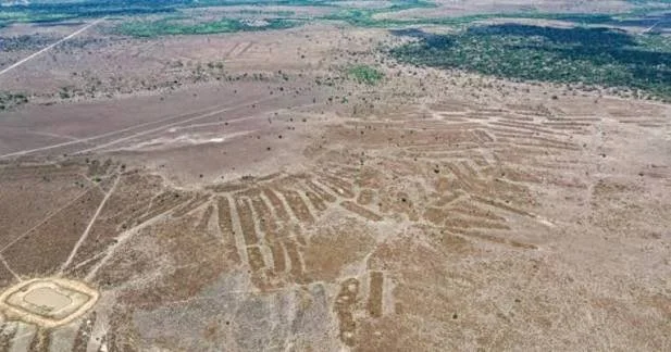
LiDAR can identify features that are almost invisible at ground level.
These may include:
linear embankments
field boundaries
canals
terraces
ancient pathways
settlement mounds
water-management structures
drainage channels
The patterns can reveal the organization of entire agricultural landscapes.
This is especially important where modern farming has reused ancient fields.
The Landscape Rather Than the Artifact
Traditional archaeology often focuses on objects such as pottery, tools, buildings, and burials.
LiDAR encourages archaeologists to think at a landscape scale.
A field boundary may not contain artifacts.
A canal may contain very little material culture.
Yet thousands of such features together can reveal the organization of an ancient agricultural society.
Dating the Fields
LiDAR can identify a structure, but it cannot automatically tell archaeologists when it was built.
Dating requires additional evidence.
Researchers may use:
excavation
ceramics
radiocarbon dating
sediment analysis
buried soils
associated settlements
environmental reconstruction
This distinction is critical.
A visually impressive LiDAR pattern is only the beginning of an archaeological investigation.
Climate Change and Ancient Water Management
Ancient wetland agriculture also provides information about environmental adaptation.
Communities faced changing rainfall, floods, droughts, and river patterns.
Their infrastructure represents accumulated knowledge about local ecosystems.
Studying these systems can therefore contribute to discussions about sustainable water management today.
Risks of Overinterpretation
LiDAR images can reveal geometric patterns that are not necessarily archaeological.
Natural drainage systems, modern agricultural boundaries, roads, and vegetation patterns can create similar shapes.
Ground verification is therefore essential.
Archaeologists must combine remote sensing with excavation and environmental analysis.
Conclusion
LiDAR is revolutionizing archaeological landscape research in Southeast Asia.
By revealing subtle topographic patterns beneath vegetation, it allows researchers to investigate ancient wetland agriculture at scales that were previously difficult to achieve.
The technology does not replace archaeology; instead, it provides a powerful new way to identify landscapes that can then be tested through excavation and scientific dating.