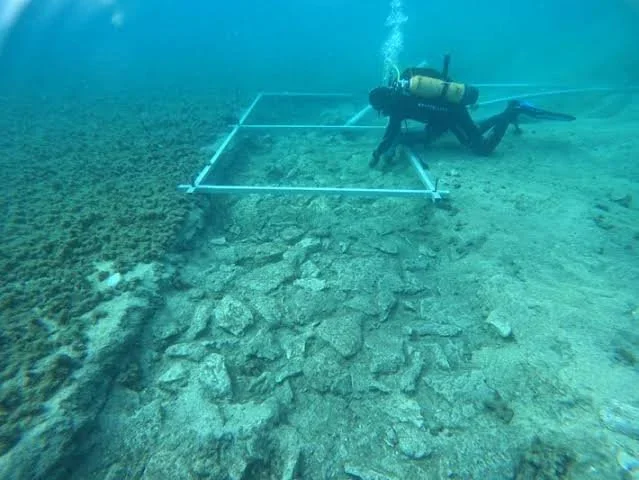
The English Channel contains a complex underwater landscape that has changed dramatically since the end of the last Ice Age. During periods when sea levels were lower, areas now covered by water formed part of a broader landscape connecting what are today southern Britain and northern continental Europe. Rivers crossed low-lying plains, animals moved across open terrain, and human communities occupied places that later became submerged. The possibility of Neolithic causeways beneath the Channel raises important questions about prehistoric mobility, settlement, and the relationship between people and changing coastlines. However, submerged stone alignments or linear features cannot automatically be identified as causeways, and claims of specific Neolithic structures require reliable archaeological evidence.
The landscape of the English Channel was profoundly affected by postglacial sea-level rise. As ice sheets melted, seawater flooded low-lying areas and gradually transformed the geography of northwestern Europe. The timing and pace of inundation varied across different locations, influenced by global sea-level change, regional land movements, erosion, and the shape of the seabed. During the Neolithic, communities occupied landscapes that included coastlines, river valleys, wetlands, and islands whose boundaries differed from those of the modern world. Reconstructing these landscapes is essential for understanding where prehistoric people could have traveled and which areas may now lie underwater.
A causeway is a constructed or deliberately prepared route that allows people to cross wet or difficult terrain. In prehistoric environments, causeways could have consisted of timber, stone, compacted earth, or combinations of materials. Some may have crossed marshes or shallow waterways, while others connected settlements with islands, ritual locations, or resource-gathering areas. A structure described as a causeway must be distinguished from natural gravel ridges, geological formations, submerged river channels, and later maritime installations. Establishing its function requires evidence of deliberate construction, an appropriate date, and a plausible relationship with human movement.
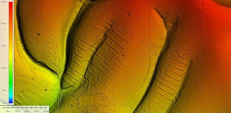
Underwater archaeological survey is the first step in locating possible submerged causeways. Multibeam bathymetry can map the shape of the seabed, while side-scan sonar can identify linear features and differences in surface texture. Sub-bottom profiling may reveal buried structures beneath layers of sediment. These methods can help researchers locate areas that deserve closer investigation, but they cannot always distinguish archaeological remains from natural features. Direct examination by divers or remotely operated vehicles may be necessary to document construction details, although visibility, depth, currents, and sediment disturbance can make underwater work difficult.
Sediment cores can help reconstruct the environment surrounding a possible causeway. Researchers may identify peat, freshwater deposits, marine sediment, or other layers that indicate changing environmental conditions. Organic remains within secure geological contexts can sometimes be radiocarbon dated, providing information about when an area was dry land, wetland, or submerged. Such dates do not automatically establish when a causeway was built, but they can define the period during which a structure could have been used. The relationship between archaeological features and surrounding sediment is therefore crucial.
Timber would be particularly valuable if preserved in a submerged causeway. Wood can survive for long periods in waterlogged environments when oxygen levels are low, although preservation varies with sediment chemistry, water movement, and exposure. Dendrochronology may provide precise dates when sufficient tree rings and suitable reference chronologies are available. Radiocarbon dating can be used where tree-ring dating is not possible, but it generally offers a less precise estimate. Researchers must also determine whether the wood was used in the original structure or introduced by later natural processes.
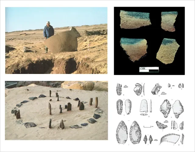
Stone-built causeways present different challenges. Stones can remain visible after other construction materials have disappeared, but they are also vulnerable to movement by currents, storms, and human activity. A regular arrangement of stones may suggest deliberate construction, yet natural processes can produce surprisingly linear features. Archaeologists should examine the size and selection of the stones, their placement, the presence of a prepared foundation, and their relationship to surrounding deposits. Evidence of repeated maintenance or associated artifacts may strengthen the interpretation of a feature as a constructed route.
The Neolithic context is particularly important because the period witnessed major changes in settlement, farming, material culture, and social organization across Britain and continental Europe. Communities cultivated crops, managed animals, built monuments, and participated in exchange networks, although practices varied by region and time. A causeway could have supported movement between settlement areas, access to wetlands, or travel to resource-rich locations. It might also have served a ceremonial or symbolic purpose. These possibilities should not be treated as mutually exclusive, but researchers need evidence before assigning a specific role to a submerged structure.
The English Channel should not be imagined as a single land bridge that remained intact throughout the Neolithic. The inundation of the region occurred over an extended period, and the geography of waterways and islands changed as sea levels rose. People could have traveled between Britain and continental Europe during periods when suitable routes existed, but the feasibility of a particular journey depended on the precise landscape at the time. Reconstructing these routes requires models of paleogeography supported by geological and archaeological data rather than assumptions based on the modern map.
If submerged Neolithic causeways are identified, they could reveal how communities engineered routes through wetlands and coastal environments. They might also provide evidence of the social importance of particular crossings and the ways people adapted to changing landscapes. Even without a confirmed causeway, the study of submerged prehistoric terrain remains valuable because it restores landscapes that have largely disappeared from view. Underwater archaeology, sediment analysis, scientific dating, and paleogeographic reconstruction together offer a way to investigate how Neolithic communities moved through a world whose coastlines were very different from those seen today.