Introduction
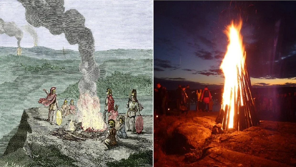
Before the development of telegraphs, telephones, and modern communication systems, communities relied on visible signals to transmit information across long distances. Among the most recognizable methods was the beacon fire: a controlled flame or column of smoke raised from a prominent location to communicate warnings, announcements, or military information. Positioned on hills, towers, coastal headlands, or fortified settlements, beacon fires could make messages visible to neighboring communities.
Archaeologists face a difficult challenge when investigating these systems because fire leaves an incomplete and sometimes ambiguous record. Charcoal, ash, burned stones, and altered soil may indicate repeated burning, but they do not automatically prove that a location functioned as a communication station. Reconstructing ancient beacon networks therefore requires combining environmental evidence, landscape analysis, dating techniques, and historical interpretation.
The Purpose of Ancient Beacon Fires
Beacon fires served several possible purposes. In military settings, they could warn nearby settlements about approaching enemies, signal the movement of troops, or announce the arrival of ships. In coastal communities, elevated fires might have helped communicate between settlements or guide travelers toward recognizable locations.
Fire signals could also have ceremonial or political meanings. A prominent flame might mark a festival, announce a ruler's arrival, or communicate the beginning of a public event. In some societies, the ability to maintain visible signals across a landscape may have demonstrated political authority and control over territory.
Not every elevated fire was necessarily a beacon. A hilltop fire could have been used for cooking, warmth, metalworking, religious ceremonies, or temporary occupation. Archaeologists must therefore consider the wider context of each burning location.
Charcoal as Archaeological Evidence
Charcoal is one of the most durable materials left by ancient fires. When wood burns under suitable conditions, portions of it may become carbonized rather than completely consumed. These fragments can survive in soil deposits for centuries or even millennia.
Archaeologists examine charcoal deposits to determine the type of wood burned, the conditions of combustion, and the possible frequency of fires. Microscopic examination can identify characteristics of different tree species, providing information about fuel selection and local vegetation.
Repeated layers of charcoal and ash may suggest that a location experienced multiple episodes of burning. If these layers occur within a prepared platform or a deliberately maintained structure, they may provide evidence of organized fire use.
However, charcoal has several possible origins. It can result from domestic hearths, forest fires, agricultural burning, industrial activities, or charcoal production. Its presence alone cannot establish that a communication system existed.
Identifying Possible Beacon Stations
The physical location of a suspected beacon site is an important part of archaeological interpretation. Elevated positions are especially significant because they provide wider visibility across surrounding terrain.
Researchers examine whether a site can be seen from other elevated locations. Geographic information systems and digital elevation models allow archaeologists to reconstruct possible lines of sight between hills, towers, settlements, and coastal features.
A group of sites with overlapping visibility may suggest that messages could have been passed from one location to another. Nevertheless, visibility does not prove communication. The locations may have been selected for defense, religious activities, settlement, or other practical purposes.
Archaeologists also investigate whether the locations contain prepared fire platforms, repeated hearths, stone supports, or evidence of controlled fuel storage. Such features may strengthen the interpretation that fires were deliberately maintained for a specific function.
Fuel Selection and Fire Management
The type of fuel used in a beacon can reveal how people managed fire. Different woods burn at different rates and produce varying amounts of heat and smoke. Dry branches may ignite quickly, while denser wood can sustain a longer-lasting fire.
A communication station may have required a reliable supply of fuel. Archaeologists can investigate whether nearby vegetation was harvested selectively or whether wood was transported from elsewhere.
The presence of similar charcoal species at multiple locations could suggest shared fuel preferences or comparable environmental conditions. However, similar vegetation across a region can produce similar charcoal assemblages without implying that the sites belonged to a coordinated network.
Fire management may also have involved preparing dry fuel, maintaining a clear burning area, and protecting the station from wind or rain. Evidence of repeated maintenance can help distinguish an organized installation from an occasional fire.
Reconstructing Communication Networks
To investigate a possible beacon network, archaeologists combine several types of evidence. First, they identify elevated locations that could support visible signals. Next, they examine the distance and terrain between these locations.
A theoretical network may be modeled by connecting sites that can potentially see one another. Researchers can then estimate how a message might travel across a landscape through successive stations.
Such models must account for more than elevation. Weather, fog, vegetation, smoke direction, daylight, and the intensity of the fire could all affect visibility. A site that appears connected in a digital model may not have been practically useful under ordinary environmental conditions.
Researchers must also consider the time needed to prepare and ignite a fire, recognize a signal, and relay information. A network of beacon stations would have required agreed signals or established conventions. Without evidence of such arrangements, a proposed network remains a hypothesis rather than a demonstrated communication system.
Dating Charcoal and Reconstructing Fire Activity
Radiocarbon dating can help establish when charcoal deposits were formed. By analyzing organic carbon remaining in a sample, researchers can estimate the period when the wood stopped exchanging carbon with the atmosphere.
However, the age of charcoal does not always equal the date of the fire. Wood from the interior of an old tree may have formed centuries before it was burned. This problem, often called the old-wood effect, can produce dates older than the actual event.
Stratigraphy is equally important. A charcoal layer beneath a later occupation surface may represent an earlier activity, while charcoal mixed into disturbed soil may have been redeposited.
Dating several samples from different layers and locations can provide a more reliable picture of repeated fire use. Archaeologists may also compare these results with historical accounts, settlement chronologies, and changes in regional vegetation.
Alternative Explanations and Archaeological Limitations
One of the greatest challenges in identifying beacon systems is separating deliberate signaling from other forms of burning. A charcoal concentration on a hilltop could represent a domestic hearth, a temporary camp, a ritual fire, or the remains of vegetation clearance.
Wildfires may also leave extensive charcoal deposits across elevated terrain. Agricultural communities sometimes burned vegetation to clear fields or encourage new growth. In areas with a history of charcoal production, burning installations may be mistaken for signaling stations.
Archaeologists therefore look for several independent indicators rather than relying on a single feature. Evidence of repeated controlled fires, strategic placement, prepared installations, and plausible connections with neighboring sites provides a stronger interpretation.
The Importance of Landscape Archaeology
Beacon systems demonstrate why archaeology must examine entire landscapes rather than isolated structures. A small charcoal deposit may seem insignificant when studied alone, but its location can become more meaningful when considered alongside nearby settlements, defensive structures, roads, and natural landmarks.
Landscape analysis also reveals how communities understood and used their surroundings. Hills, ridges, coastlines, and river valleys could become part of an organized communication environment.
Modern technologies make it possible to investigate these relationships with greater precision. Yet digital models must always be tested against archaeological evidence and realistic environmental conditions.
Conclusion
Ancient beacon fires offer an important perspective on how communities communicated before modern technologies. Charcoal trails, ash deposits, prepared fire platforms, and elevated locations can help archaeologists identify places where controlled fires were repeatedly maintained.
However, charcoal alone cannot establish the existence of a communication network. Strong interpretations require evidence from multiple sources, including site organization, visibility analysis, dating, fuel selection, and historical context.
By combining these methods, archaeologists can investigate how ancient people used fire to connect settlements, defend territories, and transmit information across landscapes. Even when the original signals have disappeared, the traces left in the soil can help reconstruct the systems that once connected distant communities.