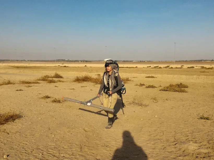
Ancient roads and tracks played an essential role in connecting settlements, agricultural areas, markets, military installations, and religious centers. Some routes were constructed with durable paving stones, while others consisted of compacted earth, gravel, or repeatedly used natural paths. Over time, erosion, vegetation growth, construction, and sediment accumulation may conceal these routes beneath the ground. Geophysical survey methods can help archaeologists investigate such buried features without excavating the entire landscape. Among these methods, magnetic surveying can reveal subtle differences in the physical properties of soil and buried materials that may indicate the presence of an ancient road.
Magnetic surveying measures variations in the Earth's magnetic field at or near the ground surface. Archaeological materials can disturb this field because some soils, rocks, and human-made deposits possess different magnetic properties from their surroundings. Heating may strengthen the magnetic signal of certain materials, while the accumulation of organic matter, ash, and occupation debris can alter the magnetic characteristics of soil. Instruments used in archaeological geophysics record these variations, allowing researchers to create maps of magnetic anomalies.
A magnetic anomaly is simply a measurable departure from the expected local magnetic field. It does not automatically indicate an archaeological feature, much less an ancient road. Natural geological variations, modern metal objects, buried utilities, and other sources can all create anomalies. The archaeological challenge is to determine which patterns are consistent with human activity and which are better explained by natural or modern processes.
Buried roads can produce magnetic signatures in several ways. A road constructed from imported stone or gravel may differ magnetically from the surrounding soil. Repeated traffic can compact the ground, change drainage, and create a distinct subsurface layer. In some cases, the road margins may accumulate organic material or debris, producing a contrast with the central track. If the route passed through areas where fires, workshops, or settlements were present, associated deposits may also influence the magnetic pattern.
However, many roads produce weak or inconsistent magnetic signals. A simple path worn into natural soil may have little magnetic contrast with its surroundings. A road made from nonmagnetic materials may be difficult to identify using magnetic survey alone. Conversely, a strong linear anomaly might represent a ditch, wall, drainage channel, geological boundary, or modern feature rather than a road. Researchers must therefore avoid assuming that every straight magnetic pattern corresponds to an ancient transport route.
The shape and continuity of an anomaly can help guide interpretation. Long, relatively linear features that connect known settlements or follow plausible routes across the landscape may be worth investigating. Changes in width, branching patterns, or intersections could provide clues about how a route developed. Yet ancient roads were not always straight, and paths could shift in response to terrain, watercourses, erosion, or changing settlement patterns. Landscape context is essential when evaluating the significance of a magnetic map.
Archaeologists often combine magnetic surveying with other remote-sensing techniques. Ground-penetrating radar can reveal subsurface structures by measuring reflected radar signals, while electrical resistance surveys detect differences in how soil conducts electrical current. Aerial photography, satellite imagery, and lidar can identify surface features such as embankments, cuttings, and abandoned route corridors. Each method responds to different physical properties, so using several techniques can provide a more reliable interpretation than relying on one survey alone.
Ground-truthing is also necessary. After a possible road has been identified through geophysical data, archaeologists may conduct targeted excavation to determine whether the anomaly corresponds to a constructed surface, compacted track, drainage feature, or another deposit. Excavation can reveal construction materials, road layers, wheel ruts, maintenance episodes, and associated artifacts. Pottery fragments or other datable materials found within the road's construction layers may help establish its chronology, although the age of loose objects does not always match the date when the road was built.
The dating of ancient roads is often difficult because routes may remain in use for centuries. A road could be repaired, widened, resurfaced, or redirected several times, leaving multiple construction phases beneath the same alignment. Researchers must distinguish the earliest formation from later modifications and determine whether the magnetic signal reflects one phase or several. Stratigraphic evidence and carefully selected samples can help establish this sequence.
Remote detection has several practical advantages. Large areas can be surveyed more quickly than they could be excavated, allowing researchers to identify promising locations before committing to intrusive fieldwork. Geophysical mapping can also help protect archaeological remains by reducing unnecessary excavation. In urban and agricultural settings, it may reveal buried routes that are no longer visible at the surface.
Despite these benefits, magnetic surveying has limitations. Results can be affected by soil conditions, modern infrastructure, nearby metal objects, survey spacing, and the sensitivity of the equipment. Some archaeological features may remain invisible if they produce little magnetic contrast. A lack of detected anomalies should therefore not be treated as proof that an ancient road was absent.
The study of magnetic anomalies over buried roads illustrates how modern scientific tools can expand archaeological investigation. By combining geophysical measurements with landscape analysis, excavation, and chronological evidence, researchers can reconstruct routes that once connected communities and supported economic, military, and social activity. The magnetic signal is only the beginning of the investigation, but when interpreted carefully, it can help reveal hidden elements of ancient transportation networks.