Introduction
The Persian Gulf has long connected communities through maritime travel, fishing, trade, and the movement of people and goods. Its coastline includes shallow bays, tidal flats, islands, estuaries, and areas where sediment movement continually changes the shoreline.
The idea of lost harbor chains raises questions about how early coastal communities organized maritime access and whether they used constructed barriers, landing structures, or other forms of harbor infrastructure before the development of more substantial port facilities.
The phrase harbor chains should not be understood as proof that a particular prehistoric chain system has been discovered. It is a research theme that invites investigation of possible docking structures, stone alignments, mooring features, and other coastal installations. Establishing their age and function requires underwater archaeology, geological reconstruction, and careful distinction between natural formations and human construction.
Maritime Life in the Persian Gulf
The Persian Gulf provides access to marine resources and connects coastal settlements with inland regions.
Fishing, shellfish collection, boat travel, and the exchange of goods have all been important activities in different periods of the region's history.
The Gulf's environmental conditions create both opportunities and challenges. Shallow waters can support certain forms of coastal activity, but tides, sediment movement, heat, and local changes in water depth can affect navigation.
Communities may have used natural coves, beaches, sheltered inlets, and constructed landing areas according to their needs and the technology available at the time.
What Were Prehistoric Dockworks?
Dockworks are structures or installations that facilitate the loading, unloading, mooring, or repair of boats.
In prehistoric contexts, these features may have been relatively simple. They could include stone platforms, prepared landing surfaces, timber elements, mooring stones, or barriers that helped protect a landing area.
However, identifying a prehistoric dock is challenging because many coastal structures can serve several functions.
A stone alignment might represent a breakwater, a fish trap, a boundary, or a natural geological feature. Researchers must establish how the structure relates to the water, the shoreline, and nearby archaeological remains.
Harbor Chains and Their Possible Meaning
The term harbor chains could refer to linked structures or a sequence of installations that helped organize access to a harbor. It might also evoke physical chains used to control harbor entrances in later historical settings.
For a prehistoric interpretation, the existence of actual metal chains would require direct evidence and a secure chronological context. It would be inappropriate to assume that a chain-based harbor defense existed simply because the title uses the term.
A broader archaeological investigation could examine whether multiple structures formed a connected system of landing points, barriers, or mooring features.
The distinction between a descriptive hypothesis and a confirmed archaeological discovery is essential.
Reconstructing Ancient Shorelines
A major challenge is that the coastline has changed through time.
Relative sea-level change, tectonic movement, sediment accumulation, erosion, and human modification can alter the position of the shore.
A structure now underwater may once have stood beside a beach or on dry land. Conversely, a feature that appears to be a dock may have been constructed in a tidal zone that was already partially submerged.
Researchers can investigate ancient shorelines through sediment cores, coastal landforms, archaeological structures, and sea-level indicators.
The reconstruction must be specific to the site because different parts of the Gulf may have experienced different environmental histories.
Underwater Archaeological Methods
Researchers can use several techniques to investigate submerged harbor features.
Sonar and bathymetric surveys map the seabed and may identify raised structures, depressions, or linear arrangements. Diver surveys can document exposed stonework and construction details.
Photogrammetry creates three-dimensional models from overlapping photographs, while sediment sampling can reveal whether structures are partly buried.
These techniques help locate and record possible dockworks, but they do not automatically establish age or function.
A suspected structure must be evaluated in relation to local geology, nearby settlements, and the distribution of artifacts.
Distinguishing Natural Formations from Human Construction
Coastal environments often produce rock alignments, ridges, and depressions that resemble built structures.
Researchers examine the arrangement of stones, the presence of repeated dimensions, evidence of tool marks, and the relationship between the feature and the surrounding seabed.
Natural geological layers may produce regular-looking patterns without human intervention.
The strongest evidence for construction includes clear placement of materials, identifiable architectural features, and a relationship with other human-made installations.
Even then, the function may remain uncertain without additional evidence.
Dating Coastal Structures
Dating a submerged structure requires secure association between the structure and the material being dated.
Artifacts found nearby may have moved through water or been deposited much later. Organic material trapped beneath a structure may provide information about the time before construction, while material sealed above it may help establish when the structure was abandoned or covered.
Radiocarbon dating may be useful when suitable organic samples are available. Sediment-based methods may also contribute, depending on the geological setting.
Researchers must distinguish the date of construction from the date of submergence and from the date of later disturbance.
Trade and Coastal Exchange
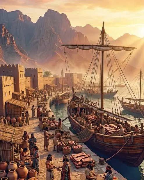
If prehistoric dockworks are identified, they may help explain how coastal communities managed maritime exchange.
Landing facilities could have supported the movement of food, stone, pottery, metals, shell, and other goods. They might also have provided places for repairing boats or transferring cargo between vessels and land transport.
However, a harbor structure does not automatically prove that the settlement was part of a large international trading network.
Researchers need evidence of imported materials, production activities, settlement scale, and connections with other sites before making claims about the volume and direction of trade.
Harbor Protection and Environmental Adaptation
Coastal communities may have selected sheltered locations to reduce the effects of waves and currents.
Some may have modified the shoreline to create more convenient landing areas, while others relied on natural protection.
The design of a landing facility would depend on boat size, tidal range, water depth, and local materials.
Yet it is important not to project later harbor engineering directly onto prehistoric communities. Early installations may have been modest and adapted to the vessels and activities of their time.
Conservation and Modern Threats
Submerged coastal heritage can be affected by dredging, port development, fishing, anchoring, erosion, and changes in water conditions.
Sediment movement may expose structures that were previously protected, while construction can damage archaeological layers before they are documented.
Survey and monitoring can help identify vulnerable sites and guide decisions about preservation.
Researchers should also consider legal protections, local community interests, and the broader environmental context when investigating possible harbor remains.
Conclusion
The study of lost harbor chains and prehistoric dockworks in the Persian Gulf provides an opportunity to investigate early maritime infrastructure and changing coastal landscapes. Possible landing platforms, stone alignments, mooring features, and barriers may reveal how communities organized access to the sea.
However, the existence of a particular prehistoric chain system cannot be assumed from the title alone. Each feature must be assessed through underwater survey, geological analysis, secure dating, and comparison with alternative explanations.
By combining archaeological evidence with environmental reconstruction, researchers can investigate how early coastal communities adapted their maritime practices to the changing Gulf shoreline. The result can contribute to a broader understanding of prehistoric navigation, coastal settlement, and the long history of human interaction with the sea.