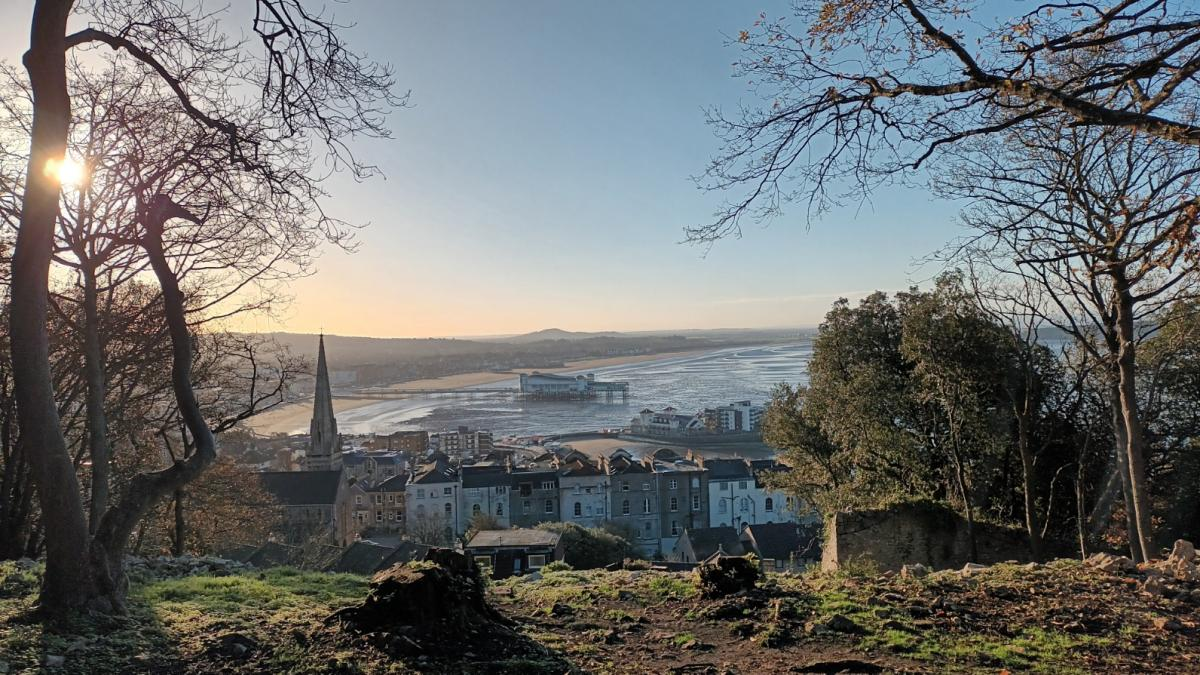
Volunteers have cleared undergrowth at Worlebury Camp, unveiling striking views over Weston-super-Mare’s seafront.
The group aims to protect and restore the Iron Age hillfort, making it accessible to locals, visitors, and schools. Built around 300 BC, the hillfort reflects Weston’s long history. At the time of construction, Britain had few trees due to earlier Bronze Age deforestation for crops and livestock. Today, the site is overgrown with trees, which obscure and damage archaeological remains.
Historic England lists Worlebury Camp as “vulnerable” on its Heritage at Risk Register, citing threats from trees, vegetation, stone rearrangement, vandalism, littering, fly-tipping, and fire-setting.
Volunteers and supporters are working to improve the site. A rustic wooden bench has been donated for walkers to enjoy the views, and another seating addition—a church pew—is planned for the New Year. North Somerset Council has cut ash trees affected by ash dieback as part of a management plan. Volunteers have also removed fallen trees, brambles, and other overgrowth to restore limestone grassland, encouraging insects, birds, butterflies, and wildflowers like cowslips, bluebells, and orchids.
Historic England identified earthworks east of the hillfort, later included in the scheduled ancient monument. These may be Bronze Age defenses reinforced by the later Iron Age fort. LiDAR surveys and theodolite measurements have been used to map the site where vegetation permits.
Worlebury Camp sits on the site of earlier Neolithic and Bronze Age settlements, with discoveries including flint arrowheads, axe heads, and a rare bronze collar, possibly from Germany. It was inhabited by the Celtic Dobunni tribe, covering roughly 10 hectares, and likely functioned as a small town rather than a purely military fort. Around 200 people lived there during the Iron Age, with life expectancy averaging 25, though survivors of childhood could live longer.
The hillfort served as a base for tribal leaders and a court for settling disputes, reflecting social hierarchy. The Dobunni were known for farming, crafts, and minting gold and silver coins used in local and regional trade. Some coins featured trees, the sun, and horses, symbolizing the tribe’s connection to nature, seasonal rituals, and Druid-led festivals.
Strategically positioned on a limestone cliff overlooking Weston Bay, Sand Bay, and the Bristol Channel, Worlebury Camp functioned as a defensive stronghold for about 350 years. Its fortifications were responses to increasing warfare and elite power struggles.
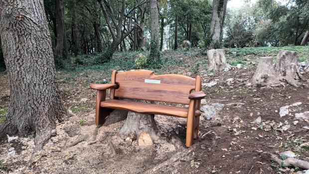
Wooden bench, so visitors can enjoy the view.
The site is an impressive engineering feat, constructed with skill and significant physical effort. It is protected by seven valla—defensive ramparts originally up to 20 ft high—and ditches, visible from the inland side. Building it would have required hundreds of people working for months or years.
Over 90 bedrock-cut pits are found on the site, likely used to store grain such as barley and wheat, other food supplies, and possibly beer and mead. Some pits are lined with stone and described by Historic England as “extraordinary.” They have yielded pottery, jewellery, tools, weapons, and spindle wheels for weaving, now displayed at Weston Museum.
Timber-framed huts or roundhouses with wattle-and-daub walls and thatched roofs—now lost—probably housed extended families. The settlement also included paved areas, gullies, hearths and ovens, granaries, livestock enclosures, and workshops for metalworking, weaving, and pottery production.
The site may have been abandoned shortly after the Roman invasion of Britain in AD 43, though some archaeologists suggest the Dobunni left earlier. Evidence of a possible attack exists: remains of 18 individuals were found during 19th-century excavations of the pits, at least 10 showing violent deaths, alongside bones of farmed animals such as cows, sheep, and pigs.
Isotope analysis indicates most people grew up in a coastal area of southern Britain, while at least one individual may have come from a warmer region, like the Iberian Peninsula or Mediterranean, suggesting mobility even across the English Channel.
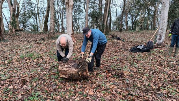
Volunteers clearing the site.
After the Celtic tribe left, the land around the hillfort remained in use for farming, with few trees. Discoveries of a hoard of Roman coins dating to AD 450, glass beads, Roman pottery, and burials indicate continued occupation during the Romano-British period.
A Saxon chronicle from 998 records the Danes marching from Worlebury to Biddisham, suggesting the area was reoccupied in the early Middle Ages.
The hillfort’s appearance began to change in 1823 when John Hugh Smyth-Pigott, Lord of the Manor, established a game reserve and planted a wood, which has largely concealed the monument for 200 years. Some trees were removed during the First World War, but the forest later regrew.
During the Second World War, the area around Worlebury Hillfort was used as a camp by US Army troops and General Dwight D. Eisenhower, preparing for the Normandy invasion in June 1944. The dense tree cover offered protection from German reconnaissance.
Although there may appear to be little link between the archaeological remains and modern Weston, town development has significantly influenced discoveries. Historic England notes that Iron Age burials were found along the southern slope of Worle Hill during house construction, and notable Victorian visitors to Weston participated in local archaeology.