Introduction
The Sahel is a broad transitional region south of the Sahara, extending across parts of West and Central Africa. Its landscapes include grasslands, shrublands, seasonal wetlands, river corridors, and areas where rainfall varies greatly from year to year.
For pastoral communities, movement between water sources and grazing areas has long been an important way to manage livestock. Routes used by herders may connect dry-season water, seasonal pasture, settlements, markets, and places of cultural significance.
The archaeology of early pastoral corridors investigates how these routes developed and how they changed through time. Because livestock movement often leaves subtle or dispersed evidence, researchers must combine settlement archaeology, animal remains, environmental records, remote sensing, and historical or oral traditions where appropriate.
The goal is not simply to draw ancient routes on a map. It is to reconstruct the relationships among mobility, climate, livestock management, and social organization.
Pastoralism in the Sahel
Pastoralism involves raising and managing livestock, often through movement between different grazing areas.
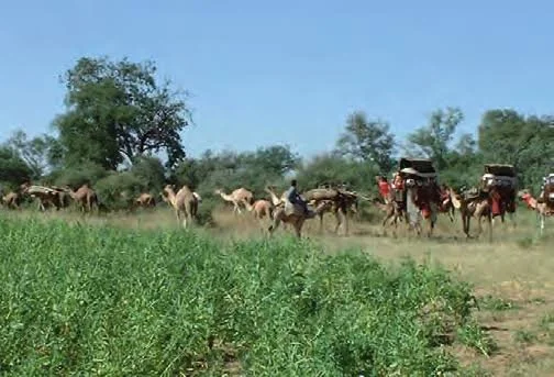
The animals kept vary across the region and may include cattle, sheep, goats, and camels, depending on local ecological conditions and historical periods.
Some communities practice extensive mobility, while others combine herding with farming, trade, or settled activities. Herd movements may be organized at the household, lineage, community, or wider regional level.
The Sahel should not be treated as a uniform pastoral landscape. Rainfall, vegetation, water availability, and political boundaries differ significantly from place to place.
Why Corridors Matter
A pastoral corridor is a route or connected series of routes used to move livestock between resources.
The route may follow a river, cross a plain, pass through a gap in a ridge, or connect seasonal grazing zones.
Some corridors are shaped primarily by ecology. Others may reflect established rights of access, agreements between communities, or the need to avoid cultivated land and conflict zones.
Routes can also change over time as water sources disappear, vegetation shifts, settlements expand, or political conditions change.
A corridor is therefore not always a single fixed line. It may be a flexible network of alternative paths.
Archaeological Evidence of Herd Movement
Pastoral routes can leave several types of evidence.
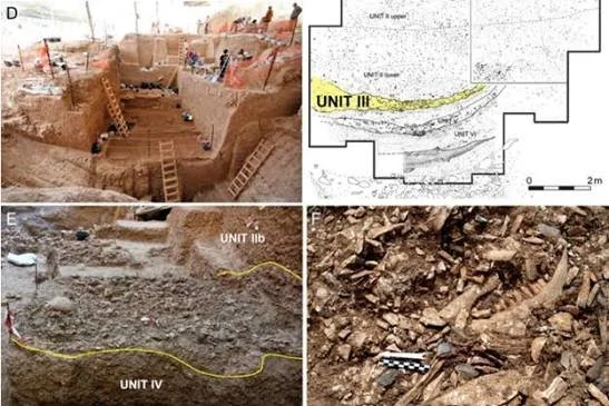
Archaeologists may investigate animal enclosures, settlement remains, wells, watering places, tracks, dung deposits, and concentrations of artifacts associated with repeated visits.
Animal bones can reveal which species were present and how they were managed. Age profiles may indicate whether animals were kept for meat, milk, breeding, or other purposes.
However, a settlement containing livestock bones does not automatically identify a long-distance pastoral corridor. The evidence must be connected with other sites and with the environmental conditions that made movement practical.
Water Sources and Seasonal Mobility
Water is one of the most important factors shaping pastoral movement in the Sahel.
Seasonal rainfall can create temporary pools, fill wetlands, and support the growth of grasses. During dry periods, herders may depend more heavily on permanent rivers, wells, springs, or managed water points.
Archaeological research can investigate how access to water influenced settlement and movement.
Ancient wells, reservoirs, and other water-management features may provide evidence of repeated use. Yet their dates and functions must be established carefully, because structures can be repaired or reused over long periods.
Environmental records can help reconstruct whether particular water sources were available during the period under investigation.
Climate and Pastoral Corridors
The Sahel has experienced substantial climatic variation over the course of human history.
Changes in rainfall can influence the distribution of vegetation, the reliability of water sources, and the location of suitable grazing land.
Researchers study these changes through lake sediments, pollen, plant remains, archaeological settlement patterns, and other environmental indicators.
However, climate does not determine human behavior in a simple way. Communities may respond to similar conditions differently depending on livestock species, technology, social relationships, and access to trade.
A shift in settlement locations may reflect environmental change, political conflict, economic opportunity, or several factors acting together.
Mobility and Archaeological Visibility
Mobile communities can be difficult to study because their camps may leave fewer durable structures than permanent settlements.
Temporary shelters, portable equipment, and repeated movement may produce a dispersed archaeological record.
This does not mean pastoral communities lacked stable social systems or detailed knowledge of the landscape. Mobility can be organized through established seasonal routines and long-standing relationships between groups.
Researchers may identify repeated occupation through artifact scatters, animal remains, hearths, soil chemistry, and the relationship between camps and water sources.
Corridors and Exchange Networks
Pastoral routes can also connect communities through trade and social interaction.
Herders may exchange livestock products, hides, milk, meat, and other goods for grain, tools, textiles, or manufactured objects.
A corridor may therefore serve as more than a path for animals. It can be part of a wider network linking markets, settlements, and political centers.
Archaeologists investigate these connections through the distribution of materials, settlement patterns, and evidence of production and exchange.
However, an object found far from its source does not necessarily prove that pastoralists transported it. Other traders or intermediary communities may have been involved.
Conflict, Cooperation, and Access Rights
Access to pasture and water can require negotiation between different groups.
Communities may establish customary routes, seasonal agreements, or rules about when livestock can enter particular areas. These arrangements can change over time as populations, environmental conditions, and political institutions change.
Archaeology rarely preserves the rules themselves directly. Instead, researchers may investigate settlement boundaries, defensive structures, resource locations, and patterns of movement.
Historical records and oral traditions can provide additional context, although each source must be evaluated within its own historical setting.
Pastoral mobility should not automatically be interpreted as a source of conflict. Cooperation, exchange, and negotiated access are also important parts of the history of herding.
Remote Sensing and Landscape Mapping
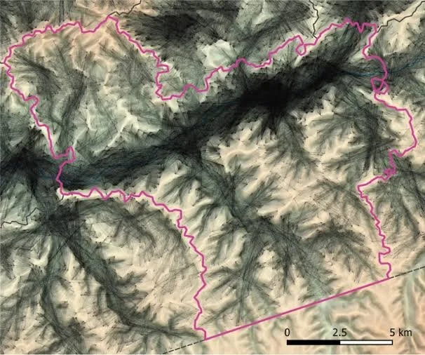
Satellite imagery and digital mapping can help identify possible routes, abandoned water features, settlement remains, and changes in vegetation.
Remote sensing is especially valuable in large or difficult-to-access regions.
However, visible tracks may be modern, and old paths may follow the same corridors used by contemporary herders. Identifying an ancient route requires chronological evidence.
Ground survey, artifact recording, and environmental analysis remain essential for distinguishing historical features from recent activity.
Pastoral Corridors and Modern Change
Modern roads, fences, cultivation, mining, urban growth, and changing land policies can alter traditional movement routes.
These changes may affect access to water and pasture and can transform the archaeological landscape.
Studying earlier corridors can help researchers understand the long history of mobility, but archaeological findings should not be used to claim that one historical route must remain unchanged today.
Pastoral communities adapt their movements in response to changing conditions, and modern decisions require consideration of current rights, needs, and environmental circumstances.
Conclusion
The archaeology of early pastoral corridors in the Sahel can reveal how herders moved livestock through changing environments and maintained connections between water sources, grazing zones, settlements, and markets.
The evidence may include wells, animal enclosures, camp remains, artifact scatters, and environmental records. Yet no single feature proves that a long-distance herd route existed.
Reliable reconstruction requires mapping multiple sites, establishing their chronology, and understanding the ecological and social conditions that influenced movement. By studying these relationships, archaeologists can investigate pastoralism as a flexible and organized way of life rather than simply a pattern of wandering across the landscape.