The Aegean Sea contains a complex archaeological landscape shaped by islands, peninsulas, coastal plains, and submerged environments. During the Bronze Age, communities across the region depended on agriculture, fishing, maritime exchange, and access to freshwater. Some areas that were once dry land are now underwater because sea levels rose, coastlines shifted, and local geological processes altered the landscape. The possibility of submerged garden terraces is particularly interesting because it raises questions about ancient agriculture, coastal settlement, and the relationship between human activity and environmental change. However, a submerged stone arrangement cannot automatically be identified as a garden terrace, and any proposed Bronze Age example requires direct archaeological evidence.
Sea-level change has influenced the Aegean coastline over thousands of years. Following the last Ice Age, global sea levels rose as large quantities of ice melted, flooding low-lying landscapes and transforming coastal environments. During the Bronze Age, sea levels were generally much closer to modern levels than they had been during earlier prehistoric periods, but local conditions continued to vary. Tectonic uplift or subsidence, sediment accumulation, coastal erosion, and changes in river systems could all influence the relative position of the sea. Consequently, a terrace that is now submerged may have been located on dry land in the past, but its age and original function must be established independently.
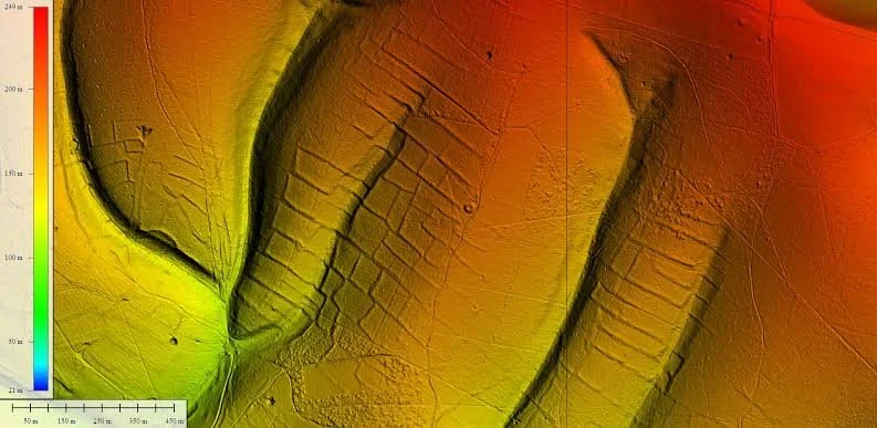
Garden terraces are constructed platforms or stepped surfaces designed to create usable ground on sloping terrain. In agricultural landscapes, terraces can reduce soil erosion, improve water management, and increase the amount of land available for cultivation. They may be formed by retaining walls, embankments, or carefully arranged stones that hold soil in place. In the Aegean, where steep hillsides and rocky terrain are common, terracing has been an important agricultural strategy in many periods. Archaeologists investigating submerged terraces must determine whether the structures were intended for cultivation, served as retaining walls for buildings, or formed part of another coastal installation.
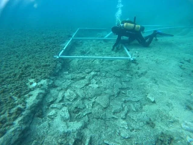
Underwater survey provides the first opportunity to identify possible submerged agricultural features. Divers, remotely operated vehicles, side-scan sonar, and multibeam bathymetry can help map structures on the seabed. Regular rows of stones, parallel retaining walls, and stepped surfaces may suggest deliberate construction. Yet similar patterns can result from natural geological formations, collapsed buildings, harbor structures, or later shoreline modifications. Researchers therefore need to document the dimensions, orientation, construction techniques, and relationship between the features before proposing an agricultural interpretation. The presence of soil trapped behind a wall may be significant, but sediment movement can also produce accumulations that resemble cultivated surfaces.
Sediment analysis can help reconstruct the environment in which a submerged structure originally existed. Core samples may reveal layers of soil, marine sediment, freshwater deposits, or organic material. If a terrace once supported cultivation, the deposits behind its retaining walls might contain evidence of disturbed soils, plant remains, charcoal, or other materials associated with human activity. Pollen and phytolith analysis may help identify vegetation, although these indicators can be transported from elsewhere and do not automatically demonstrate the cultivation of a particular crop. The strongest interpretations combine sediment evidence with structural analysis and archaeological materials found in secure contexts.
Dating submerged terraces is another major challenge. Stone walls themselves are often difficult to date directly. Researchers may use radiocarbon dating on suitable organic material associated with the construction or use of a feature, provided that the sample's relationship to the structure is secure. Pottery or other datable artifacts can also contribute to chronology, but an object found nearby may have been deposited long after the wall was built. Underwater sites are particularly vulnerable to the movement of artifacts through currents, storms, and sediment disturbance. Establishing a reliable date therefore requires careful assessment of stratigraphy and the history of the surrounding seabed.
Agricultural interpretation depends on identifying evidence that cultivation actually occurred. Possible indicators include preserved seeds, pollen patterns consistent with managed crops, agricultural tools, irrigation features, and soil characteristics associated with repeated cultivation. However, each indicator has limitations. Pollen from a crop may originate from a distant field, while a stone terrace could have supported a building, vineyard, orchard, or other land use. Archaeologists should avoid assigning a specific agricultural function until several forms of evidence converge. Comparisons with known terraced landscapes on nearby islands may help generate hypotheses, but similarities in construction do not prove identical functions or dates.
The reconstruction of ancient coastlines is essential for understanding submerged agricultural landscapes. Researchers can combine bathymetric mapping, geological cores, archaeological survey, and models of relative sea-level change to estimate where shorelines may have existed during the Bronze Age. Such reconstructions must account for local tectonic movements, which can cause land to rise or sink independently of global sea-level trends. A structure submerged today may have been exposed to the air in antiquity, but the depth of the structure alone cannot establish when it was flooded. Local geological evidence is necessary to reconstruct the sequence of environmental changes.
If submerged terraces are securely identified as agricultural features, they could reveal how Bronze Age communities adapted to limited arable land and changing coastal environments. Terracing may have helped make steep slopes productive, while proximity to the sea could have supported transport and exchange. In some locations, agricultural land may have formed part of a broader settlement system involving harbors, storage facilities, and maritime routes. Nevertheless, researchers should not assume that every coastal structure served a combined agricultural and maritime purpose. Each site needs to be evaluated within its own environmental and archaeological context.
The study of submerged garden terraces in the Aegean demonstrates how underwater archaeology can expand knowledge of ancient land use. Sea-level change has placed former landscapes beneath the water, preserving some features while eroding or concealing others. By combining underwater mapping, sediment analysis, scientific dating, botanical evidence, and geological reconstruction, archaeologists can investigate whether submerged stone structures represent ancient agricultural installations. Where evidence is strong, these investigations may reveal how communities managed land and water in the Bronze Age. Where evidence remains incomplete, careful documentation and cautious interpretation help distinguish genuine archaeological discoveries from intriguing but unverified possibilities.