Introduction
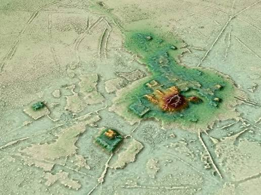
Revolutionary archaeological research conducted in 2026 using advanced satellite imaging and airborne LiDAR (Light Detection and Ranging) technology dramatically transformed the world's understanding of the ancient Amazon Basin. For centuries, archaeologists believed that the dense tropical rainforest had supported only small, scattered communities because the nutrient-poor soils and thick vegetation appeared unsuitable for large permanent settlements. However, the 2026 LiDAR surveys challenged this long-held assumption by revealing an astonishing network of more than 10,000 previously hidden pre-Columbian geoglyphs, earthworks, roads, canals, and settlements concealed beneath the forest canopy. Unlike conventional aerial photography, LiDAR emits millions of laser pulses that penetrate gaps in the vegetation and reflect off the ground surface, allowing researchers to generate highly accurate three-dimensional maps of the landscape even in areas completely covered by rainforest. These discoveries demonstrated that the Amazon was not an untouched wilderness before European contact but instead contained extensive, well-organized societies that reshaped their environment through sophisticated engineering, agriculture, and urban planning.
Earthwork Systems and Agroforestry
The LiDAR surveys mapped an enormous interconnected landscape extending across Acre in western Brazil, northern Bolivia, and other regions of the upper Amazon Basin. Rather than isolated villages, researchers identified networks of settlements connected by carefully engineered infrastructure that reflected long-term planning and regional cooperation. These findings revealed that ancient Amazonian societies invested significant labor in constructing monumental earthworks, transportation routes, and agricultural landscapes while preserving the surrounding forest ecosystem.
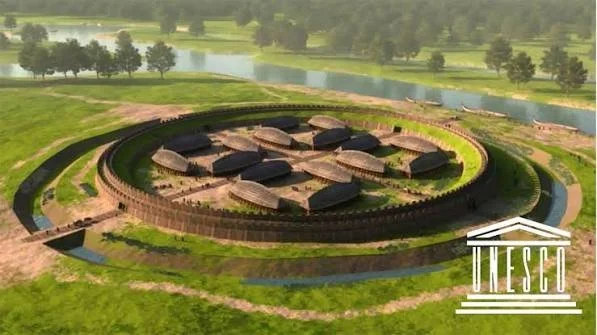
One of the most remarkable discoveries was the presence of geometric enclosures, consisting of perfectly shaped circles, squares, rectangles, and octagons measuring approximately 100 to 300 meters in diameter. These impressive earthworks were created by excavating large ditches and using the removed soil to build surrounding embankments. Archaeologists believe these enclosures functioned as ceremonial plazas, locations for public gatherings, religious rituals, political assemblies, and important community events. Some structures also display alignments corresponding with astronomical phenomena such as the sunrise during solstices and equinoxes, suggesting that they may have served as observational markers for seasonal calendars used in agriculture and religious ceremonies.
Connecting many of these settlements were extensive raised causeways, broad elevated earthen roads that stretched for more than 10 kilometers across flood-prone landscapes. These causeways provided reliable transportation routes during the rainy season when much of the surrounding terrain became inundated. By linking villages, ceremonial centers, agricultural fields, and resource areas, the roads facilitated trade, communication, migration, and political interaction between neighboring communities. Their straight alignments and standardized construction indicate careful planning and coordinated labor on a regional scale, demonstrating that these societies possessed advanced organizational abilities comparable to those of other ancient civilizations.
Equally significant was the widespread identification of terra preta, or Amazonian Dark Earth, one of the clearest indicators of long-term environmental management. Unlike the naturally nutrient-poor soils common throughout much of the Amazon, terra preta consists of deep black, highly fertile earth enriched through centuries of human activity. Ancient inhabitants intentionally created these productive soils by combining biochar (charcoal) with organic waste such as food scraps, animal bones, plant remains, ash, pottery fragments, and other biodegradable materials. This process greatly increased the soil's ability to retain nutrients, moisture, and beneficial microorganisms, allowing intensive agriculture to be sustained over many generations. The presence of extensive terra preta deposits demonstrates that pre-Columbian Amazonians actively engineered their environment rather than merely adapting to it, creating productive agricultural systems capable of supporting dense populations while maintaining the surrounding forest.
LiDAR Mapping Process
The success of the 2026 discoveries relied on the remarkable capabilities of LiDAR technology. Mounted on aircraft, sophisticated LiDAR laser arrays emitted millions of laser pulses toward the forest below. While many of these pulses reflected off leaves and branches, a significant number penetrated gaps in the canopy and reached the ground surface. By measuring the time required for each laser pulse to return, researchers generated highly detailed Digital Elevation Models (DEMs) that digitally removed the vegetation and revealed subtle landscape features previously invisible from the ground. These models exposed thousands of geometric earthworks, ancient roads, ditches, embankments, canals, reservoirs, and settlement patterns that had remained hidden beneath the rainforest for centuries. The application of LiDAR has therefore revolutionized Amazonian archaeology by making it possible to study entire regional landscapes rather than isolated excavation sites.
Significance of the Discoveries
The 2026 LiDAR findings fundamentally changed scholarly understanding of the Amazon's ancient past. Instead of being sparsely populated by small nomadic groups, the evidence indicates that much of the region supported large, interconnected populations living in organized settlements linked through transportation networks and cooperative systems of land management. These communities demonstrated sophisticated knowledge of engineering, urban planning, astronomy, and sustainable agriculture while carefully managing forests instead of clearing them completely. Their ability to enrich soils through terra preta, construct monumental ceremonial centers, and maintain extensive infrastructure illustrates that environmental sustainability and urban development were not mutually exclusive in the ancient Amazon.
The discoveries also highlight the importance of Indigenous knowledge and long-term ecological stewardship. Many modern forest landscapes once considered entirely "natural" are now understood to have been shaped by centuries of careful human management. This realization has significant implications for archaeology, ecology, conservation, and climate research, as ancient Amazonian practices may provide valuable insights into sustainable land use and soil restoration in the present day.
Conclusion
The 2026 LiDAR surveys represent one of the most significant archaeological breakthroughs in recent decades, revealing that the pre-Columbian Amazon Basin was home to dense, highly organized societies connected by thousands of monumental earthworks, ceremonial centers, raised causeways, and engineered agricultural landscapes. The discovery of more than 10,000 geoglyphs, together with extensive terra preta deposits and regional transportation networks, demonstrates that ancient Amazonians actively transformed and enriched their environment through advanced engineering and sustainable land management rather than simply living within an untouched rainforest. These findings have fundamentally reshaped our understanding of Amazonian civilization, confirming that the world's largest tropical forest once supported complex urban networks whose technological ingenuity and environmental stewardship rivaled those of many other great civilizations of the ancient world.