Introduction
In southwestern Colorado lies one of the densest archaeological landscapes in North America: Canyons of the Ancients National Monument.
The title of this article refers to the area's historically cited figure of approximately 6,000 recorded archaeological sites. That figure was used extensively in earlier descriptions of the monument. Today, however, the Bureau of Land Management reports more than 8,300 documented archaeological sites, while estimates suggest that tens of thousands of additional sites may remain unrecorded.
The difference illustrates an important fact about archaeology:
The archaeological record is not fixed.
New surveys, remote sensing, mapping, and fieldwork continually expand our knowledge.
Canyons of the Ancients covers approximately 176,000 acres and preserves evidence representing more than 12,000 years of human activity.
A Cultural Landscape Rather Than a Single Ruin
The name "Canyons of the Ancients" can give the impression of a single archaeological site.
It is not.
It is an enormous cultural landscape containing thousands of individual archaeological features.
These include:
pueblos
field houses
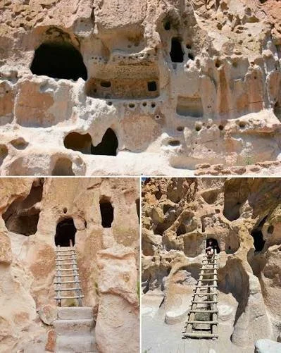
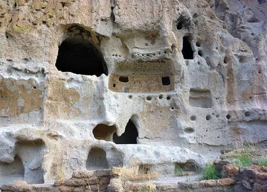
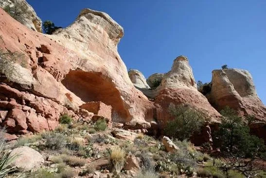
cliff dwellings
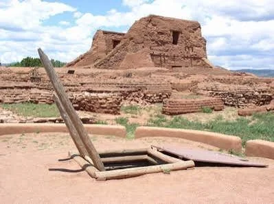
kivas
great kivas
check dams
reservoirs
agricultural fields
shrines
petroglyphs
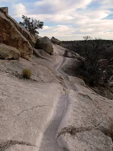
roadways
storage structures
The distribution of these features allows archaeologists to investigate entire settlement systems rather than isolated buildings.
Twelve Thousand Years of Human History
The monument's archaeology begins long before the construction of Pueblo villages.
Evidence demonstrates human activity extending back more than 12,000 years.
This means the landscape contains traces of hunter-gatherers, early agricultural communities, ancestral Pueblo societies, and later Indigenous use.
The Ancestral Pueblo period represents only one portion of this enormous chronology.
The Four Corners
Canyons of the Ancients lies within the Four Corners region, where Colorado, Utah, Arizona, and New Mexico meet.
This area was not divided by modern state boundaries in ancient times.
People moved across the region.
Ideas spread.
Pottery styles changed.
Trade networks connected distant settlements.
Agricultural practices were adapted to local environments.
Archaeologists therefore study the monument as part of a broader Four Corners system.
Farming the High Desert
Agriculture was central to many ancestral Pueblo communities.
Maize, beans, and squash formed the foundation of agricultural production.
But the environment was challenging.
Rainfall was variable.
Growing seasons could be short.
Soils were not uniformly productive.
Farmers developed strategies for conserving water.
Check dams could slow runoff.
Terraces could reduce erosion.
Reservoirs could capture water.
Fields could be positioned where runoff accumulated.
These features demonstrate environmental engineering.
Check Dams
Check dams are particularly revealing.
A small wall placed across a drainage can slow flowing water.
When water loses speed, sediment accumulates.
Over time, this can create productive agricultural surfaces.
Such features demonstrate that ancient farmers understood water movement.
The landscape was therefore actively engineered.
The natural environment provided the materials and processes, while people modified them to support agriculture.
Pueblos and Community Centers
Some settlements developed into substantial villages.
Structures could include dozens or hundreds of rooms.
Kivas provided communal and ceremonial spaces.
Large settlements required organization.
Construction involved gathering stone, transporting timber, producing mortar, and coordinating labor.
Food production had to support the population.
The resulting architecture is evidence of social cooperation.
Lowry Pueblo
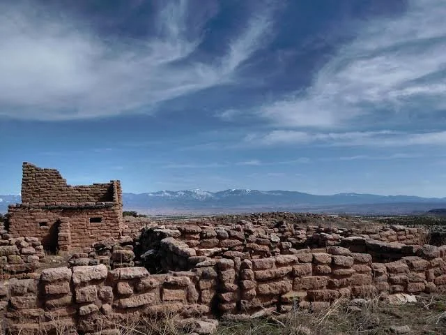
One of the best-known publicly accessible sites within the monument is Lowry Pueblo.
The site contains approximately 40 rooms, eight kivas, and a great kiva.
The great kiva is particularly significant.
Its scale suggests communal activities extending beyond individual households.
Such structures may have served ceremonial, social, and political purposes.
Architecture Across the Landscape
The archaeological record demonstrates enormous architectural diversity.
Some structures are large pueblos.
Others are tiny field houses.
Some are built along canyon walls.
Others stand on mesa tops.
This variation tells archaeologists that ancient communities did not have one standardized settlement pattern.
People used different structures for different purposes.
A small field house could be associated with agricultural production.
A large pueblo could serve as a residential and communal center.
A granary could store food.
A kiva could provide communal ceremonial space.
Rock Art
Petroglyphs form another major part of the monument's archaeological record.
Rock art can depict:
humans
animals
geometric designs
abstract symbols
weapons
hunting scenes
ceremonial imagery
However, interpreting rock art requires caution.
An image cannot automatically be translated into a specific meaning.
Some meanings may survive through Indigenous traditions, while others may no longer be recoverable.
Roads and Movement
Perhaps one of the most fascinating aspects of Canyons of the Ancients is evidence of ancient roads.
Roads demonstrate that archaeological sites were connected.
A settlement was not an isolated village.
It belonged to a network.
People moved between agricultural fields, households, ceremonial centers, water sources, and neighboring communities.
The road system therefore provides a different kind of archaeological evidence: evidence of social geography.
Climate
Climate influenced settlement decisions.
Periods of drought could place pressure on agricultural systems.
But climate alone does not explain population movement.
People could respond through:
crop diversification
water management
food storage
trade
migration
social reorganization
The archaeology of the Southwest demonstrates that human responses to climate were complex.
The Thirteenth-Century Transformation
By the late thirteenth century, many ancestral Pueblo communities in the Mesa Verde region experienced major population movements.
Large settlements were abandoned.
People migrated southward and toward the Rio Grande and other regions.
Archaeologists increasingly understand this as a period of social transformation rather than a simple disappearance.
The descendants of ancestral Pueblo communities remain part of the modern Indigenous landscape.
Descendant Communities
Canyons of the Ancients is therefore a living cultural landscape.
The Bureau of Land Management emphasizes that the area remains connected to traditional Indigenous uses.
Modern Pueblo peoples maintain cultural relationships with ancestral landscapes throughout the Southwest.
This matters when discussing archaeological sites.
A ruin is not necessarily culturally "dead."
It can remain meaningful to communities whose ancestors built and occupied it.
Modern Land Use
The monument is also a working landscape.
BLM reports that livestock grazing occurs across much of the monument and that oil and gas leases cover a substantial portion of the area.
This creates difficult management questions.
How can archaeological resources be protected while allowing other forms of land use?
How should roads, pipelines, grazing, recreation, and energy development be managed around fragile sites?
These questions make Canyons of the Ancients an important case study in modern cultural-resource management.
Archaeological Survey
The enormous number of sites creates a unique scientific opportunity.
Archaeologists can study settlement density at a regional scale.
Instead of examining only famous ruins, researchers can investigate relationships among thousands of sites.
Modern technologies include:
aerial photography
satellite imagery
LiDAR
GIS mapping
drone photography
magnetometry
electrical resistivity
pedestrian survey
These technologies can identify features without extensive excavation.
Why "6,000 Sites" Became Famous
The historical figure of approximately 6,000 recorded sites helped communicate the monument's extraordinary archaeological density.
But the newer count demonstrates why archaeological numbers must be understood as measurements made at particular points in research history.
As survey continues, the number changes.
The current BLM description lists more than 8,300 documented sites and estimates that more than 30,000 additional sites may remain to be recorded.
Preservation
The archaeological resources are fragile.
Visitors are asked to stay on established trails where appropriate, avoid touching structures, and leave artifacts where they are found.
This is particularly important because archaeological context is irreplaceable.
A pottery fragment removed from a site becomes less informative.
A projectile point separated from its original location loses information about how the site was used.
Archaeology depends on relationships among objects, structures, soil, and landscape.
Conclusion
Canyons of the Ancients is extraordinary because its archaeological significance does not depend on one spectacular ruin.
Its importance lies in its scale.
Thousands of archaeological sites form a connected cultural landscape.
Pueblos, field houses, farms, roads, kivas, reservoirs, rock art, and storage structures collectively reveal how people lived across the Southwest for thousands of years.
The famous "6,000 sites" figure captures only an earlier stage of discovery.
Today, more than 8,300 sites have been documented, and thousands more may remain unidentified.
The monument therefore represents not merely an archaeological collection but a vast archive.
Every field wall, trail, granary, petroglyph, and foundation contributes another fragment to the story of human adaptation in the American Southwest.