Introduction
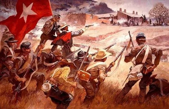
In the spring of 1862, the American Civil War reached the mountains and valleys of New Mexico Territory. Far from the major battlefields of Virginia and Tennessee, Union and Confederate soldiers fought along the Santa Fe Trail at Glorieta Pass, a strategically important corridor through the Sangre de Cristo Mountains.
The battle was part of the Confederate New Mexico Campaign, an ambitious attempt to extend Confederate influence westward, threaten Union control of the Southwest, and potentially gain access to the Colorado gold fields and routes toward the Pacific coast. The campaign ultimately failed, and the Battle of Glorieta Pass became a decisive moment in preventing the Confederacy from establishing a lasting presence in the region.
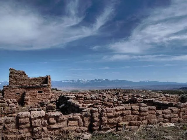
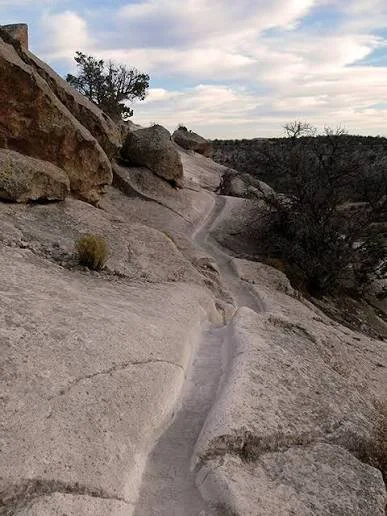
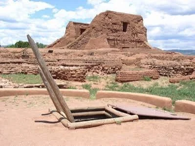
Today, the battlefield is preserved within and around Pecos National Historical Park. Its significance extends beyond the movements of soldiers. The landscape contains traces of the Santa Fe Trail, ranching, Indigenous history, Hispanic settlement, and the enormous geographic challenges faced by armies operating in the nineteenth-century Southwest.
The Santa Fe Trail Before the Battle
Glorieta Pass was strategically important long before 1862.
The Santa Fe Trail connected Missouri with Santa Fe and had become a major commercial route after Mexican independence in 1821. Traders, wagon trains, mail carriers, migrants, soldiers, and travelers crossed the route for decades.
The pass itself crossed rugged terrain.
The Sangre de Cristo Mountains created a significant barrier between the Great Plains and the Rio Grande Valley. A route through the mountains therefore had enormous military value.
An army controlling the pass could potentially influence movement between eastern New Mexico and Santa Fe.
The same geographic feature that made the trail useful to merchants made it strategically important to armies.
The Confederate New Mexico Campaign
The Confederacy had broader ambitions in the Southwest.
Confederate leaders hoped to expand their influence into New Mexico Territory, threaten Union holdings, and potentially reach the Colorado gold fields. From there, western expansion could potentially connect Confederate ambitions with Pacific ports.
Brigadier General Henry Hopkins Sibley commanded the Confederate forces.
Beginning in Texas, Confederate troops advanced into New Mexico during early 1862.
They captured Albuquerque and Santa Fe, creating the impression that Confederate control might expand farther north.
But one major obstacle remained.
Fort Union.
Fort Union was the principal federal military supply center in the region and was connected directly to the Santa Fe Trail. If Confederate forces could capture the fort and its supplies, they could potentially strengthen their position in New Mexico and continue toward Colorado.
Union Reinforcements
Union forces understood the danger.
The First Colorado Volunteers were organized rapidly and marched hundreds of miles toward New Mexico.
According to the National Park Service, approximately 950 Colorado volunteers traveled from Denver toward Fort Union, arriving after a difficult march through winter conditions. They were joined by other Union and New Mexico forces.
The conditions were harsh.
Glorieta Pass rises above 7,000 feet.
In March, soldiers faced cold temperatures, snow, rocky terrain, forests, and steep mountain slopes.
These environmental conditions influenced the battle.
The conflict was not simply a contest between two armies on an open plain.
Terrain determined movement, visibility, supply routes, and the ability of commanders to communicate with separated units.
The First Fighting
The initial clashes occurred on March 26, 1862.
Union troops encountered Confederate forces moving along the Santa Fe Trail near Glorieta Pass.
The fighting developed into a series of engagements over several days.
On March 26, Union troops under Major John M. Chivington encountered Confederate forces under Major Charles Pyron near Apache Canyon.
The fighting forced Confederate troops to withdraw toward Johnson's Ranch.
Both sides prepared for larger combat.
March 28: The Main Battle
The decisive fighting took place on March 28.
The battlefield stretched across a relatively small section of the Santa Fe Trail, but the action involved several ridges, ranches, valleys, and mesa terrain.
Union Colonel John P. Slough commanded the main Union force.
Confederate Colonel William R. Scurry commanded the Confederate troops.
The Confederates initially pushed Union forces backward.
From a purely tactical perspective, the Confederates appeared to be gaining ground.
But another Union movement was taking place.
The Flanking Maneuver
Major John Chivington led approximately 500 Union soldiers on a flanking maneuver over Glorieta Mesa.
Their objective was to strike the Confederate supply train.
The maneuver succeeded.
Union soldiers discovered the Confederate wagon train at Johnson's Ranch.
They destroyed the wagons and supplies, killed or drove away draft animals, and effectively eliminated the logistical foundation of the Confederate advance.
This was crucial.
Armies cannot operate without food, ammunition, clothing, animals, transportation, and other supplies.
The Confederates might hold parts of the battlefield, but without their supply train they could no longer sustain an advance toward Fort Union.
Tactical Victory and Strategic Defeat
This creates an interesting distinction in the history of Glorieta Pass.
The Confederates achieved several battlefield successes during the fighting.
They pushed Union forces back in portions of the engagement.
Yet the destruction of their supply train made the campaign unsustainable.
Consequently, the Union forces achieved the strategic objective.
The Confederates withdrew toward Santa Fe and eventually abandoned their attempt to establish control over New Mexico.
Approximately 375 casualties occurred during the three days of fighting.
Why the Battle Mattered
The importance of Glorieta Pass went far beyond the immediate battlefield.
Had Confederate forces captured Fort Union and maintained control over New Mexico, the strategic situation in the western United States could have changed considerably.
The campaign threatened:
Union military supply lines
control of New Mexico Territory
access to Colorado
commercial routes
communication networks
federal military installations
The Confederate withdrawal ensured that the Union retained control over the Southwest for the remainder of the Civil War.
The Landscape as Historical Evidence
Modern visitors can still see portions of the terrain associated with the battle.
Windmill Hill, Pigeon's Ranch, Glorieta Mesa, and other locations preserve the physical geography through which the armies moved.
The landscape helps explain military decisions.
A ridge provides elevation.
A mesa provides concealment and a route around an opposing force.
A canyon restricts movement.
A ranch can become a temporary headquarters, defensive position, or logistical point.
This is one of the greatest advantages of battlefield archaeology.
Maps provide information, but standing on the terrain can reveal why certain movements were possible.
Archaeology of the Battlefield
Battlefield archaeology can involve much more than locating bullets.
Archaeologists may investigate:
musket balls
bullets
cartridge cases
buttons
buckles
weapon fragments
camp debris
horse equipment
food remains
wagon-related artifacts
The spatial distribution of these objects can reveal firing positions and troop movements.
For example, concentrations of projectiles can help identify where soldiers exchanged fire.
Artifacts can also help distinguish military units and periods.
The Hispanic and Indigenous Landscape
It is important not to treat the battlefield as a place that existed only because of the Civil War.
The landscape had a much longer history.
Indigenous peoples had used routes through the region long before European colonization.
The Santa Fe Trail later connected Hispanic New Mexico with American commercial networks.
Ranches and settlements occupied the landscape before the battle.
The National Park Service notes that Glorieta Pass had been used by Indigenous travelers and was subsequently improved through repeated use by Santa Fe Trail travelers and the U.S. military.
The Civil War therefore represents one layer in a much older landscape.
Pigeon's Ranch
Pigeon's Ranch became one of the best-known landmarks associated with the battle.
The ranch had served as a stage stop along the Santa Fe Trail.
Its location placed it directly within the fighting.
The surviving historic landscape helps demonstrate how transportation infrastructure became military infrastructure during the campaign.
A road used by merchants could become the route of an army.
A ranch used by travelers could become a battlefield position.
"Gettysburg of the West"
Glorieta Pass is sometimes called the "Gettysburg of the West."
The phrase appears in National Park Service historical interpretation, although it should be understood as a later comparison rather than the original name of the battle.
The comparison emphasizes the battle's strategic significance in preventing Confederate expansion westward.
However, Glorieta Pass was a very different conflict from Gettysburg in scale, geography, and military context.
Its importance comes from the particular objectives of the New Mexico Campaign.
Preservation Today
The battlefield is protected as part of the broader cultural landscape of Pecos National Historical Park.
Preservation is especially important because battlefield evidence can be extremely fragile.
Metal objects can corrode.
Soil can erode.
Unauthorized artifact collecting can remove objects from their original positions.
Once an artifact is removed, archaeologists lose the spatial information that makes battlefield archaeology so valuable.
The location of an artifact can sometimes tell researchers more than the artifact itself.
Conclusion
The Battle of Glorieta Pass demonstrates how geography, logistics, transportation, and military strategy shaped the American Civil War in the West.
The fighting occurred because control of New Mexico mattered.
The Santa Fe Trail mattered.
Fort Union mattered.
The Colorado gold fields mattered.
And the mountain pass connecting these regions mattered.
The decisive moment came not simply from who occupied the battlefield at the end of the day, but from what happened to the Confederate supply train.
The destruction of that logistical system forced the Confederate army to abandon its advance.
Today, the landscape remains an important historical resource because it preserves the physical setting in which these events unfolded.
Glorieta Pass is therefore not merely a Civil War battlefield.
It is a layered landscape representing Indigenous movement, Hispanic settlement, international commerce, military expansion, and the struggle over the future of the American Southwest.