A previously unknown medieval castle has been uncovered in Switzerland’s canton of Thurgau after researchers examined high-resolution LiDAR maps. The structure was spotted in the Töbeli area when archaeologists noticed two small plateaus surrounded by steep ditches classic signs of a motte-and-bailey castle, an early medieval design.
Motte-and-bailey castles first appeared across northern Europe from the 10th century onward, especially in regions like Normandy and Anjou in France. They were relatively easy to construct using untrained workers. The design featured a raised earth mound called a motte, topped with a wooden or stone tower, alongside one or more enclosed courtyards, known as baileys.
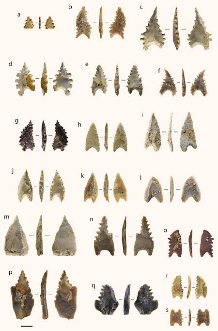
After identifying the site through LiDAR, the Thurgau cantonal archaeology office carried out a licensed survey. Excavations uncovered a small piece of pottery, several iron objects, and three medieval arrowheads.
Historical records mention a castle at Töbeli that was destroyed in 1079 during a conflict involving Abbot Eckehard II of Reichenau and Abbot Ulrich III of St. Gallen. The Lords of Ittingen later rebuilt it, but the exact location was never clearly recorded.
For years, archaeologists have debated where the Ittingen stronghold actually stood, considering three main locations: the Chrüzbuck castle mound in Warth-Weiningen, the grounds of the modern Ittingen Charterhouse, and the newly identified site at Töbeli.
Adding to the uncertainty, a papal document from 1152 granted the Ittingen brothers permission to establish a monastery “on their castle,” implying that parts of the original fortification may have once stood on the land where the Charterhouse is now located.
For the moment, the Thurgau Office of Archaeology has decided not to disturb the area further, keeping the site protected for later study. The artifacts recovered during the survey are now being conserved and will be examined in greater detail by experts.