Introduction
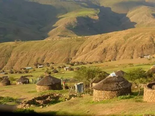
Semonkong Valley is associated with the dramatic highland landscape of Lesotho, where steep terrain, deep valleys, flowing water, and scattered settlements create a distinctive environment for human life. The title Semonkong Valley: Lesotho's Remote Settlements invites an exploration of how people have established communities in places where travel, communication, and access to services can be challenging.
The word “remote” is relative. A settlement may appear isolated to an outside visitor while remaining closely connected to neighboring communities through family networks, livestock routes, markets, schools, religious institutions, and seasonal movement. Understanding settlement in Semonkong Valley therefore requires attention not only to geography but also to the relationships that connect people across the highlands.
The Influence of Highland Geography
Lesotho's mountainous terrain has shaped where communities build homes, cultivate crops, keep livestock, and travel. Elevation, slope, rainfall, temperature, and access to water can vary considerably over relatively short distances.
Valley floors may offer access to water and some relatively level land, while surrounding slopes provide grazing areas or routes between settlements. Yet not all valley land is suitable for cultivation. Flooding, steep banks, shallow soils, and the risk of erosion can limit agricultural use.
The placement of a settlement often reflects several practical considerations at once. Households need water, shelter, access to food-producing land, and routes to other communities. They may also consider the availability of building materials and the suitability of nearby grazing.
A location that offers one advantage may create another difficulty. A remote hillside might provide good grazing but make travel to markets or schools more demanding. Settlement decisions therefore reflect compromises between environmental opportunity and social need.
How Remote Settlements Function
A settlement's relationship with the wider region is often more important than its distance from a major town. Families may maintain strong connections with relatives living elsewhere, while households exchange labor, food, livestock, and other resources.
Seasonal activities can also connect settlements. Livestock management may require movement between grazing areas, while agricultural work follows the cycle of planting, tending, harvesting, and storage. People may travel to attend ceremonies, visit relatives, obtain supplies, or participate in community events.
These movements create networks that are not always visible in maps showing roads and permanent buildings. Footpaths, tracks, river crossings, and customary routes can be essential parts of the local transport system.
The idea of isolation should therefore be examined in practical terms. A community may be geographically distant from a town but socially and economically well connected to nearby settlements.
Architecture and Adaptation
Building practices in highland settlements must respond to cold conditions, wind, rain, and the availability of materials. Stone, earth, timber, thatch, and modern construction materials may be used in different combinations depending on household resources and local traditions.
The placement of buildings can influence their exposure to wind and water. A structure located on a slope may require drainage arrangements, while buildings near streams must account for changing water levels and flooding.
Households may also adapt their living spaces as needs change. A family might add storage space, construct an enclosure, repair a roof, or build additional rooms as its circumstances evolve.
Settlement patterns are therefore not static. What appears to be a traditional village may contain buildings from several different periods, reflecting gradual changes in materials, income, family size, and access to transport.
Agriculture, Livestock, and Local Resources
Many highland households combine several livelihood strategies rather than depending on a single activity. Cultivation, livestock keeping, wage employment, small-scale trade, and other sources of income may contribute to household security.
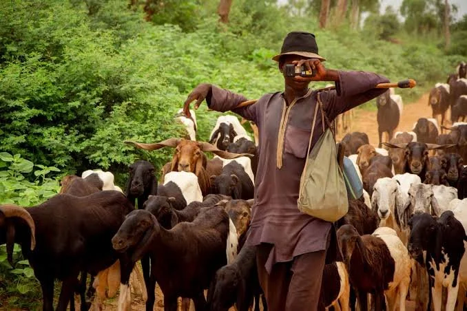
Livestock can be particularly important in environments where access to agricultural land is limited. Grazing patterns must respond to seasonal conditions, and households may need to balance animal health with the availability of pasture and water.
Cultivation is influenced by the length of the growing season, soil quality, rainfall, and exposure to frost. In difficult years, households may rely more heavily on stored food, purchased supplies, assistance from relatives, or alternative income.
The economic life of a remote settlement should not be described only in terms of hardship. Residents develop detailed environmental knowledge, practical skills, and systems of cooperation that help them manage local conditions. At the same time, challenges such as limited transport, changing weather, and unequal access to services can create significant pressures.
Roads, Tourism, and Economic Change
Improved roads and transport can strengthen connections between remote settlements and regional centers. Better access may make it easier to obtain medical care, attend school, transport agricultural products, and reach markets.
Tourism can also create opportunities in highland areas. Visitors may be attracted by mountain scenery, waterfalls, traditional architecture, local food, and outdoor activities. Tourism can support guides, accommodation providers, craftspeople, and small businesses.
However, tourism does not automatically benefit every household. Income may be concentrated among a limited number of businesses, while increased traffic, waste, and pressure on land can create local problems.
Responsible tourism should involve local residents in planning and decision-making. Community members should have opportunities to shape how their heritage is presented and to benefit fairly from visitor spending.
Climate and Settlement Resilience
Highland settlements face environmental risks that may include severe storms, erosion, changing rainfall, and periods of cold weather. These pressures can affect roads, buildings, crops, livestock, and access to essential services.
Resilience depends on more than infrastructure. Strong community networks, access to reliable information, diversified livelihoods, and the ability to maintain or repair local facilities can all help households respond to difficult conditions.
Research into settlement history can reveal how communities adjusted to earlier environmental and economic changes. Archaeological and historical evidence may show movement between locations, changes in building techniques, or shifts in the use of land.
Conclusion
Semonkong Valley provides a valuable setting for examining the relationship between geography, settlement, and community life in Lesotho's highlands. Its settlements should not be understood simply as isolated places but as parts of networks connecting households to land, livestock, markets, institutions, and neighboring communities.
A detailed account of the valley would combine local history, settlement mapping, environmental research, and the experiences of residents. Such an approach reveals both the challenges of highland life and the knowledge, adaptability, and social connections that allow communities to thrive in a demanding landscape.