Charting the Unknown
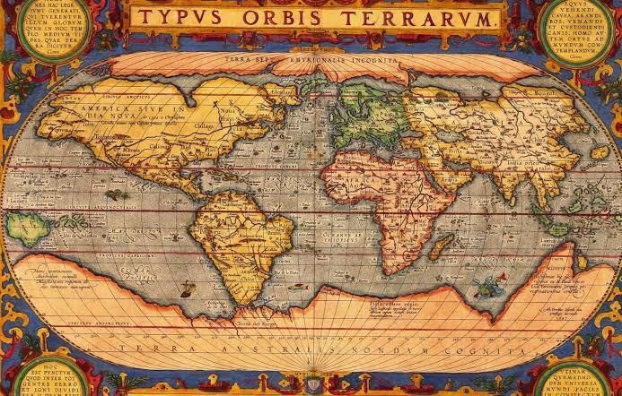
Humans have always sought to understand the world around them. The earliest maps, dating back thousands of years, reveal an innate curiosity about geography and exploration. They were practical tools, guiding trade, travel, and settlement, but they also reflected cultural and spiritual perspectives.
Early Cartography
Some of the oldest maps, like those found in Babylonian clay tablets (~2300 BCE), depict rivers, fields, and settlements. These maps were symbolic rather than precisely scaled, serving administrative and religious purposes. Similarly, ancient Egypt produced maps for mining regions and agricultural planning along the Nile.
Materials and Techniques
Early maps were often etched on clay, drawn on papyrus, or carved into stone. These materials were durable and portable, allowing maps to circulate among officials, traders, or explorers. Techniques varied: some maps emphasized landmarks and paths, while others focused on celestial alignments or sacred geography.
Exploration and Trade
Maps facilitated trade and exploration. They enabled travelers to navigate deserts, mountains, and rivers. They also recorded trade routes, resources, and strategic locations, reflecting a growing understanding of the wider world.
In some cases, maps were used to claim territory or demonstrate power. They became tools of administration and diplomacy, connecting geography with governance.
Symbolism in Early Maps
Ancient maps were not purely practical—they often carried symbolic meanings. Mountains, rivers, and cities could represent spiritual or political significance. Some maps depicted the world as circular or flat, illustrating cosmological beliefs rather than geographic accuracy.
Legacy of Ancient Cartography
These early maps laid the groundwork for later exploration and scientific cartography. By combining observation, symbolism, and measurement, early humans transformed abstract landscapes into tangible representations, bridging imagination and reality.