Introduction
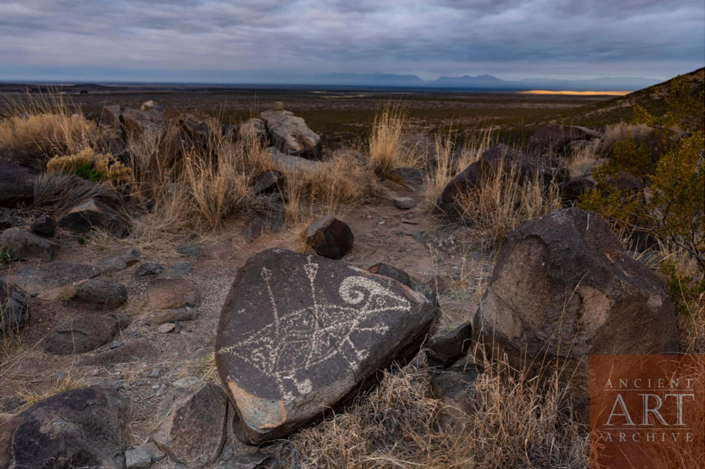
The Three Rivers Petroglyph Site in southern New Mexico contains one of the largest concentrations of prehistoric rock art in the American Southwest.
More than 21,000 petroglyphs are distributed across approximately 50 acres of basalt. The Bureau of Land Management identifies the artwork as primarily associated with the Jornada Mogollon tradition.
What Is a Petroglyph?
A petroglyph is an image created by modifying a rock surface.
At Three Rivers, ancient artists used stone tools to remove the darker weathered surface, exposing lighter rock underneath.
The resulting contrast made the designs visible.
What Was Depicted?
The site contains images of:
humans;
animals;
birds;
insects;
fish;
geometric designs;
masks;
handprints;
abstract forms;
possible supernatural or ceremonial imagery.
The enormous variety makes interpretation challenging.
Who Created Them?
The petroglyphs are associated with Jornada Mogollon communities.
Nearby archaeological remains include a prehistoric village, creating an important relationship between rock art and settlement.
Recent BLM interpretation emphasizes that the iconography found at the village and the rock art provides an important connection between the two archaeological contexts.
Why Make Thousands of Images?
There is no single answer.
Rock art may have served multiple purposes.
Some images could have been ceremonial.
Others may have communicated identity or social information.
Some may have marked places of importance.
Others may have represented animals, supernatural beings, or concepts that are no longer understandable to us.
Landscape and Meaning
The location of rock art is often as important as the image itself.
A petroglyph placed near a trail, water source, settlement, or distinctive geological feature may have had meanings connected to the landscape.
The rock itself became a medium through which people interacted with place.
Dating
The petroglyphs are broadly associated with a long prehistoric period.
Different sources give somewhat different chronological ranges because individual carvings are difficult to date precisely.
This is an important methodological issue.
Archaeologists often date rock art indirectly through style, associated artifacts, weathering, and nearby archaeological deposits.
Preservation
Rock art is extremely vulnerable.
Natural erosion can gradually damage images.
Human contact, graffiti, scratching, and vandalism can cause irreversible destruction.
Even touching the surface can contribute to deterioration.
Conclusion
Three Rivers is extraordinary because of the sheer scale of its artistic record.
More than 21,000 images transform a basalt landscape into an enormous prehistoric visual archive.
The site demonstrates that Jornada Mogollon communities expressed complex ideas through imagery and maintained meaningful relationships with particular landscapes.