Introduction
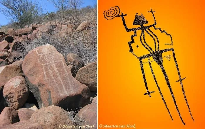
The Andean highlands contain a remarkable variety of archaeological landscapes, including ancient settlements, ceremonial centers, agricultural terraces, roads, and rock art. Among the most intriguing forms of evidence are petroglyphs: images and symbols carved or pecked into exposed rock surfaces. These markings may represent animals, human figures, geometric patterns, hunting scenes, or abstract designs.
Beyond their artistic and symbolic significance, petroglyphs may also have played a role in defining relationships between communities and their surrounding territories. Some researchers investigate whether particular rock-art locations marked routes, resource areas, boundaries, or places of collective identity. Understanding these possibilities requires examining the relationship between the images, their landscape, and the archaeological remains around them.
Understanding Andean Petroglyphs
Petroglyphs are images created by removing or modifying the surface of a rock. Ancient artists used techniques such as pecking, scratching, incising, and abrasion to produce recognizable forms.
In the Andes, rock art appears in a wide range of environments, from high-altitude valleys and mountain slopes to river corridors and desert margins. Its imagery varies by region and period.
Common subjects include camelids, such as llamas and alpacas, as well as wild animals, human figures, footprints, weapons, and geometric patterns. Some compositions may represent activities such as hunting, herding, travel, or ceremonial gatherings.
The meaning of individual images is not always clear. A figure that appears to represent a boundary marker may instead have religious, commemorative, or decorative significance.
Territorial Organization in the Andean Highlands
Andean communities developed complex systems for organizing land and resources. Access to agricultural terraces, grazing areas, water sources, mineral deposits, and transportation routes could be essential to their survival.
Territorial organization did not always depend on permanent fences or clearly defined property lines. Communities could recognize customary rights through shared knowledge, seasonal practices, kinship relationships, and agreements with neighboring groups.
In this context, prominent rock formations could become meaningful reference points. A carved rock might identify a location associated with a community, a route, a resource area, or a ceremonial landscape.
However, the presence of petroglyphs near a resource area does not automatically establish that they marked ownership. Their function must be evaluated within the wider archaeological and cultural context.
Petroglyphs and Natural Boundaries
The physical placement of rock art can provide important clues about its possible purpose.
Some carvings occur near mountain passes, river crossings, valley entrances, and natural corridors. These locations were significant because they connected different ecological zones and facilitated the movement of people and animals.
A marked rock at a narrow passage may have served as a recognizable landmark. It could have helped travellers identify a route or understand that they were entering an area associated with a particular community.
Other carvings appear on isolated boulders or prominent rock faces visible from considerable distances. Their visibility may have contributed to their social or symbolic importance.
Researchers must distinguish between deliberate territorial signaling and the practical use of recognizable landmarks.
Camelid Imagery and Pastoral Territories
Camelids were central to many Andean economies. Llamas and alpacas provided transport, wool, meat, and other resources, while wild vicuñas and guanacos were also important in hunting and resource management.
Petroglyphs depicting camelids may therefore be connected with pastoral life.
A group of animal figures near a traditional grazing route could reflect the economic importance of herding in that landscape. It might also represent ritual practices associated with animal fertility, protection, or community identity.
In some settings, repeated imagery may help researchers investigate relationships between rock-art locations and seasonal livestock movement.
Nevertheless, animal carvings cannot be treated as direct maps of ancient pasture boundaries without supporting evidence.
Rock Art and Community Identity
Territorial identity can involve more than the control of land. It may include ancestry, shared history, religious beliefs, and relationships with particular mountains, springs, or other natural features.
Petroglyphs could have helped preserve these connections by marking places where people gathered, conducted ceremonies, or remembered significant events.
Repeated visits to a marked location may have strengthened its importance across generations. The images could become part of a shared visual tradition recognized by members of a community.
Different communities might also have used distinctive artistic styles. Comparing these styles can help researchers investigate cultural relationships, although artistic similarities do not necessarily prove common political authority.
Archaeological Methods for Studying Territorial Functions
Researchers begin by documenting the location and physical characteristics of petroglyphs. Detailed photography, three-dimensional scanning, and digital mapping can preserve information about individual carvings.
Geographic information systems can help examine the relationship between rock-art sites and nearby resources, settlements, routes, and natural boundaries.
Archaeologists may also compare the imagery with nearby pottery, architecture, burial sites, and other material remains.
Dating petroglyphs is particularly challenging because the act of carving does not always leave organic material suitable for radiocarbon analysis. Researchers may instead use associated archaeological deposits, superimposed images, weathering studies, or other chronological evidence.
Even these methods require caution because a rock surface may have been used repeatedly over centuries.
Petroglyphs and Long-Distance Routes
The Andean highlands contained extensive networks of paths connecting settlements and ecological zones.
People moved between highland pastures, agricultural valleys, mineral sources, and regional exchange centers. Marked rocks could have helped travellers recognize important locations along these routes.
Some petroglyphs may have communicated information about water sources, dangerous passages, or places of social significance.
Others may have been associated with ritual activities performed before or after a journey.
Comparing rock-art locations with reconstructed transportation networks can help researchers investigate whether certain carvings were associated with movement through the landscape.
Challenges of Interpretation and Preservation
Petroglyphs are vulnerable to natural weathering, erosion, mineral deposits, and biological growth. Modern activities such as construction, mining, tourism, and deliberate vandalism can cause irreversible damage.
Another difficulty is the temptation to interpret unfamiliar symbols using modern assumptions. A geometric pattern may appear to represent a territorial boundary, but its original meaning could be entirely different.
Ethnographic research and collaboration with Indigenous communities can provide valuable perspectives. Local traditions may preserve knowledge about the cultural significance of particular rocks and landscapes.
However, present-day interpretations should not automatically be projected backward onto every ancient carving.
Conclusion
Petroglyphs in the Andean highlands may have contributed to the ways communities recognized, remembered, and organized their territories. Their locations near mountain passes, resource areas, and transportation corridors make them particularly valuable for investigating relationships between rock art and landscape use. Nevertheless, territorial marking is only one possible interpretation among several. Through detailed documentation, geographic analysis, archaeological comparison, and collaboration with local communities, researchers can better understand how carved rocks participated in the social and symbolic organization of Andean landscapes.