• MAIN PAGE
  • LATEST NEWS
    • Lost Cities
    • Archaeology's Greatest Finds
    • Underwater Discoveries
    • Greatest Inventions
    • Studies
    • Blog
  • PHILOSOPHY
  • HISTORY
  • RELIGIONS
    • Africa
    • Anatolia
    • Arabian Peninsula
    • Balkan Region
    • China - East Asia
    • Europe
    • Eurasian Steppe
    • Levant
    • Mesopotamia
    • Oceania - SE Asia
    • Pre-Columbian Civilizations of America
    • Iranian Plateau - Central Asia
    • Indus Valley - South Asia
    • Japan
    • The Archaeologist Editor Group
    • Scientific Studies
    • Aegean Prehistory
    • Historical Period
    • Byzantine Middle Ages
    • Predynastic Period
    • Dynastic Period
    • Greco-Roman Egypt
  • Rome
  • PALEONTOLOGY
  • About us
Menu

The Archaeologist

  • MAIN PAGE
  • LATEST NEWS
  • DISCOVERIES
    • Lost Cities
    • Archaeology's Greatest Finds
    • Underwater Discoveries
    • Greatest Inventions
    • Studies
    • Blog
  • PHILOSOPHY
  • HISTORY
  • RELIGIONS
  • World Civilizations
    • Africa
    • Anatolia
    • Arabian Peninsula
    • Balkan Region
    • China - East Asia
    • Europe
    • Eurasian Steppe
    • Levant
    • Mesopotamia
    • Oceania - SE Asia
    • Pre-Columbian Civilizations of America
    • Iranian Plateau - Central Asia
    • Indus Valley - South Asia
    • Japan
    • The Archaeologist Editor Group
    • Scientific Studies
  • GREECE
    • Aegean Prehistory
    • Historical Period
    • Byzantine Middle Ages
  • Egypt
    • Predynastic Period
    • Dynastic Period
    • Greco-Roman Egypt
  • Rome
  • PALEONTOLOGY
  • About us

The Mysterious Healing Temples of the Ancients

January 6, 2026

Healing as a Sacred Act
In ancient civilizations, healing was never separated from religion or spirituality. Illness was often believed to result from divine displeasure, spiritual imbalance, or supernatural intrusion. As a result, early healing centers were not hospitals in the modern sense but sacred spaces where medicine, ritual, prayer, and symbolism merged into a single system of care.

Dream Temples and Incubation Rituals
One of the most remarkable healing practices occurred in the Asclepieia of ancient Greece. These temples, dedicated to Asclepius, the god of medicine, practiced dream incubation, where patients slept in sacred chambers hoping to receive divine visions that revealed cures. Priests interpreted these dreams and prescribed treatments combining herbs, diet, baths, and ritual purification.

Sacred Springs and Water Healing
Across Europe, the Middle East, and Asia, sacred springs were believed to possess healing powers. Water was seen as a living force capable of cleansing both body and soul. Many of these springs later became associated with saints or religious figures, showing continuity between pagan and later religious traditions.

Egyptian and Mesopotamian Medical Rituals
In Egypt, healing involved surgical tools, herbal remedies, and magical spells recorded in medical papyri. Mesopotamian healers combined diagnosis with incantations, believing disease could be expelled through spoken words and ritual gestures.

Proto-Medicine and Observation
Despite their spiritual framework, ancient healers were keen observers. They recognized symptoms, tracked recovery, and passed down empirical knowledge. These temples represent the foundation upon which later medical science was built.

The Oldest Known Maps of the Earth

January 6, 2026

Mapping Before Modern Geography
Ancient humans mapped their world long before satellites or compasses. Early maps were symbolic as well as practical, blending geography, cosmology, and religion.

Babylonian World Maps
One of the oldest known maps, the Babylonian Map of the World, depicts Mesopotamia at the center, surrounded by water and mythical regions. This map reflects how geography and belief were inseparable.

Celestial Maps and Sky Charts
Ancient cultures mapped the heavens as carefully as the earth. Star charts from Egypt, China, and Mesopotamia guided agriculture, navigation, and religious rituals.

Prehistoric Petroglyph Maps
Rock carvings found in Europe, Africa, and Asia may represent rivers, hunting grounds, or seasonal routes. These early maps relied on memory and shared knowledge rather than scale accuracy.

Maps as Power and Knowledge
Controlling geographic knowledge meant controlling trade, warfare, and exploration. Ancient maps were tools of authority, teaching people not just where they lived—but how they understood the universe.

Deep-Sea Civilizations: Myths or Reality?

January 6, 2026

Legends of Sunken Kingdoms
Ancient texts describe advanced civilizations lost beneath the sea. Plato’s account of Atlantis describes a powerful island empire destroyed in a single catastrophic event. Similar stories exist in Indian texts describing submerged cities like Dwarka, as well as legends from Japan, Polynesia, and the Americas.

Flood Myths and Collective Memory
Nearly every ancient culture contains flood myths, suggesting shared memories of rising sea levels or catastrophic flooding at the end of the last Ice Age. These stories may preserve real events experienced by early coastal populations.

Geological Evidence
Modern science confirms that sea levels rose dramatically after the Ice Age, submerging vast areas of land. Underwater structures discovered near Japan, India, and the Mediterranean have sparked debate over whether they are natural formations or human-made ruins.

Underwater Archaeology
Sunken ports, roads, and settlements have been confirmed, such as submerged Neolithic villages in the North Sea. While no definitive evidence of a global lost civilization exists, localized coastal cultures were certainly lost to rising waters.

Myth Meets Science
Rather than fantasy, deep-sea civilization myths may be exaggerated memories of real human settlements erased by natural disasters, transformed into legends over generations.

The Bronze Age “Internet”: Trade Routes That Connected the World

January 6, 2026

A Connected Ancient World
Long before modern technology, the Bronze Age world was already interconnected through vast trade networks that linked Europe, Africa, and Asia. Goods moved across thousands of kilometers, creating an ancient system of communication often described as a prehistoric “internet.”

Goods That Traveled Across Continents
Tin from Central Asia was transported to Mesopotamia and the Mediterranean to produce bronze. Amber from the Baltic reached Mycenaean Greece. Lapis lazuli from Afghanistan appeared in Egyptian tombs. These exchanges prove sustained, organized trade rather than occasional contact.

Trade as Cultural Exchange
Trade routes carried more than materials. Religious ideas, artistic styles, myths, and technologies spread along the same paths. Writing systems influenced one another, and shared iconography appeared across distant regions.

Languages and Diplomacy
Diplomatic correspondence, such as the Amarna Letters, reveals kings communicating across empires using shared languages and protocols. These letters show a world of political alliances, marriages, and negotiations maintained through long-distance networks.

Collapse of the Network
When the Bronze Age trade system collapsed around 1200 BCE, civilizations fell rapidly. This demonstrates how deeply interconnected they were—when trade stopped, economies, food supplies, and political stability collapsed together.

When Giants Ruled the Memories of Men

January 6, 2026

Giants in Global Mythology
Stories of giants appear in the mythologies of nearly every ancient culture. In Mesopotamia, the Epic of Gilgamesh describes heroes of immense strength and size. Greek myths tell of the Titans and Gigantes, primordial beings who preceded the Olympian gods. In Norse tradition, the Jötnar were ancient giants tied to chaos and the natural world. The Bible references the Nephilim, described as mighty beings from a distant age. Similar legends appear among Native American, African, and Polynesian cultures, suggesting a shared mythic memory rather than isolated invention.

Symbolism of Giants
Giants often symbolize a primordial era when the world was wilder and less ordered. They are frequently portrayed as builders of ancient structures, guardians of forbidden knowledge, or enemies of later gods and humans. In this sense, giants may represent earlier cultures or civilizations remembered imperfectly through oral tradition.

Possible Real-World Origins
Several theories attempt to explain the widespread belief in giants. One possibility is the discovery of fossilized bones of large animals, such as mammoths or dinosaurs, which ancient people may have interpreted as human remains. Another theory suggests encounters with unusually tall individuals or populations suffering from gigantism.

Ancient Ruins and the Giant Builder Myth
Massive stone structures—megaliths, cyclopean walls, and colossal statues—often inspired legends of giant builders. The walls of Mycenae, for example, were said to be built by Cyclopes because later Greeks could not imagine ordinary humans constructing them.

Cultural Memory and Myth Preservation
Rather than literal beings, giants may reflect distorted memories of lost civilizations, social upheaval, or environmental disasters. These stories preserved the idea that humanity once lived alongside forces far greater than itself, reinforcing humility and reverence for the past.

Ancient Desert Nomads and Their Secret Knowledge

January 6, 2026

Masters of Harsh Environments
Desert nomads thrived in landscapes others could not survive. They memorized stars, wind patterns, and terrain to navigate vast expanses without maps.

Hidden Trade Routes
Nomads controlled secret caravan routes linking empires. Their knowledge allowed safe passage through deserts, making them essential to long-distance trade.

Herbal Medicine and Survival Skills
They identified medicinal plants, water sources, and survival techniques passed down orally. This knowledge often surpassed that of settled populations.

Spiritual and Cultural Wisdom
Desert life shaped spiritual beliefs centered on endurance, balance, and respect for nature. Storytelling preserved history and law.

Enduring Influence
Modern navigation, medicine, and trade routes still reflect knowledge first mastered by ancient desert nomads.

The World’s First Astronomers

January 6, 2026

Priests as Sky Watchers
Ancient astronomers were often priests who observed the heavens to understand divine order. Long before telescopes, they tracked stars using sight, shadow, and stone alignments.

Solstices and Seasonal Timekeeping
Structures like Stonehenge, Nabta Playa, and Mayan temples align with solstices and equinoxes, marking agricultural cycles and religious festivals.

Eclipses and Planetary Cycles
Babylonian astronomers recorded lunar eclipses and planetary movements with remarkable accuracy. These records allowed prediction, not just observation.

Astronomy and Power
Controlling calendars meant controlling society. Rulers used astronomical knowledge to legitimize authority, claiming divine favor through celestial alignment.

Foundation of Science
These early astronomers laid the groundwork for mathematics, astrology, and later scientific astronomy.

Lost Cities Swallowed by Sandstorms

January 6, 2026

Cities Lost to the Desert
Across Arabia, North Africa, and Central Asia, entire cities vanished beneath shifting sands. Legends spoke of cursed cities destroyed by divine punishment, but archaeology has uncovered real settlements buried by environmental change.

The Case of Ubar (Iram of the Pillars)
Mentioned in ancient texts and later Islamic tradition, Ubar was once a thriving trade hub linked to frankincense routes. Satellite imagery revealed buried caravan paths leading to its remains beneath the Rub’ al Khali desert.

Environmental Collapse and Abandonment
Climate shifts, overgrazing, and groundwater depletion caused cities to collapse. Sandstorms completed the burial, preserving structures beneath dunes for millennia.

Archaeological Rediscovery
Modern technology—radar, satellite scans, and excavation—has allowed researchers to rediscover these cities, offering insight into trade, architecture, and survival strategies.

Cultural Memory
These lost cities remind us how fragile civilizations are when environmental balance is lost.

The Pyramid Codes Hidden in Desert Geometry

January 6, 2026

Mathematical Precision of Pyramid Layouts
Egyptian pyramids were not randomly placed monuments. Their layouts reflect advanced geometry, precise cardinal alignment, and proportional design based on sacred mathematics. The Great Pyramid is aligned to true north with astonishing accuracy.

Astronomical Alignments
Many pyramids align with star constellations such as Orion, associated with Osiris, god of the afterlife. Shaft alignments within pyramids may have served as symbolic pathways for the soul’s ascent to the stars.

Sacred Geometry and Proportion
Ratios embedded in pyramid dimensions reflect harmonic proportions used in later sacred architecture. These measurements suggest intentional design rather than coincidence.

Landscape as Symbolic Map
The placement of pyramids across the desert forms patterns that mirror cosmic order. The desert itself became a sacred canvas representing creation, death, and rebirth.

Hidden Knowledge Debate
While mainstream scholars emphasize practical engineering, others argue pyramids encoded spiritual knowledge about time, space, and eternity—messages carved into geometry rather than text.

Ancient Banking Before Money Existed

January 6, 2026

Economic Systems Without Coinage
Before coins and paper money, ancient societies developed complex systems to store value, manage debt, and track transactions. In Mesopotamia, temples and palaces acted as economic centers where grain, livestock, and labor were recorded and redistributed.

Clay Tablets and Accounting
Cuneiform tablets recorded loans, interest, wages, and contracts. These records functioned as early bank ledgers, documenting who owed what and when repayment was due. Interest rates were standardized, proving advanced financial planning.

Grain Storage as Wealth
Grain served as a unit of value and survival resource. Large granaries functioned like vaults, allowing surplus to be stored during good harvests and distributed during famine. Depositing grain with a temple was equivalent to safeguarding wealth.

Tokens and Symbolic Exchange
Before writing, clay tokens represented quantities of goods. These were sealed in clay envelopes, forming an early system of abstract accounting. Over time, these symbols evolved into written numerals.

Legacy of Proto-Banking
These systems laid the foundation for modern finance. Concepts such as credit, interest, contracts, and institutional trust all trace back to these ancient proto-banks.

The Forgotten Stone Wizards of Anatolia

January 6, 2026

Prehistoric Builders Before Writing
Long before writing systems emerged, Anatolia was home to highly skilled stone carvers who created monumental structures that still puzzle archaeologists today. Sites such as Göbekli Tepe reveal massive T-shaped limestone pillars carved with animals, symbols, and abstract motifs dating back over 11,000 years. These builders possessed advanced knowledge of stoneworking despite lacking metal tools or written language.

Stone-Carving Techniques and Engineering Skill
The builders quarried enormous limestone blocks using stone tools, carefully shaping and transporting them across uneven terrain. The precision of joints, symmetry of pillars, and durability of construction suggest an inherited technical tradition passed orally across generations. These achievements challenge the idea that complex engineering only developed after agriculture and writing.

Symbolism and Mythic Interpretations
Carvings of snakes, foxes, birds, and humanoid figures suggest ritual or mythological meaning. Some scholars believe these “stone wizards” acted as ritual specialists who encoded cosmological beliefs into stone. Later folklore in Anatolia preserves legends of stone magicians—figures said to command earth and rock—possibly echoes of these ancient priest-builders.

Cultural Significance
These megaliths were not dwellings but ceremonial spaces, implying organized religion before settled cities. The Anatolian stone builders reshaped our understanding of civilization’s origins, proving that spiritual and symbolic expression preceded urban life.

Archaeologists Discovered an Underground Inca Labyrinth, Confirming a Centuries-Old Rumor

January 5, 2026

Here’s what you’ll learn from this story:

  • A tunnel network beneath the ancient Peruvian city of Cusco had been rumored for centuries.

  • Stretching over a mile in some places, the labyrinth connected the Temple of the Sun to important sites, including a fortress.

  • Incan builders used a technique called the cut-and-cover method to construct the tunnels.

The Incan Temple of the Sun in Cusco has long been celebrated as a cultural and architectural jewel of the ancient empire. But there’s more to discover beneath its foundations. Archaeologists have recently confirmed a long-standing rumor: a labyrinth of underground tunnels radiates out from the temple, in some areas extending more than a mile.

References to this hidden network, known as a chincana, appear in historical texts dating back to the 16th century. For years, scholars debated whether it actually existed—and now we know it does.

Archaeologist Jorge Calero Flores announced the findings at a press conference, revealing that the research team had identified a main branch connecting the temple to the fortress of Sacsahuaman, just over a mile away. The tunnel system also includes three smaller branches: one near the Church of San Cristóbal, another leading toward an area close to the fortress, and a third extending to a site known as Callispuquio.

Exploring Nintendo 64DD Code Remnants In Ocarina Of Time

January 5, 2026

What if a Nintendo 64 cartridge-based game could also use a large-capacity magnetic disc format? That was the idea behind the Nintendo 64DD, explored in a recent video by [Skawo], which performs a kind of archaeological dive into the game’s code to uncover remnants of the abandoned peripheral.

The 64DD plugged into the bottom of the console via its peripheral connector, allowing the Nintendo 64 to read and write 64DD magnetic discs. At 64 MB, the discs matched the storage capacity of cartridges but had the added advantage of being writable — something cartridges and CDs could not offer. The concept followed in the footsteps of earlier expansions like the Famicom Disk System.

One notable project was a 64DD expansion for 1998’s The Legend of Zelda: Ocarina of Time, a Game of the Year title. Although both the expansion and the 64DD were ultimately cancelled, the recently decompiled Zelda source code still contains extensive traces of 64DD-related features, which [Skawo] examines in the video.

Like many CD- or magnetic-based formats, the 64DD suffered from slow access times and poor transfer speeds compared with a cartridge’s mask ROM. This clearly forced developers to rethink how to make the 64DD a meaningful enhancement. Since the 64DD was never released outside Japan and had a very short lifespan, it became evident that disc-based formats were a poor fit for the console’s design.

Looking at the game code, the intended interface with the 64DD mostly revolved around swapping on-cartridge resources — for example, using different dungeon maps. While this content eventually appeared commercially as the Master Quest option on the GameCube re-release, it shows what might have been.

Although features like tracking the player’s full route or permanently updating maps in-game never materialized, the surviving code offers a fascinating glimpse into the expansion possibilities the 64DD could have brought to Ocarina of Time.

Woody Bay Station in Martinhoe was one of the properties given a Grade II listed status in 2025

Ten buildings given protected status in 2025

January 5, 2026

A train station, a barracks, and a dairy are among ten buildings in the South West that received protected status in 2025.

Historic England (HE) added nine buildings in Devon and one in Cornwall to the National Heritage List for England, recognising their special architectural, historical, or archaeological significance.

The list now includes more than 400,000 buildings, sites, and landscapes, with 199 locations across England added over the past year.

Historic England co-chief executives Claudia Kenyatta and Emma Squire said the newly listed sites “highlight the fascinating history that surrounds us all.”

Historic England gave Sharlands House a Grade II listing

There are three levels of listing — Grade II, Grade II*, and Grade I — which provide legal protection to buildings of special architectural or historic interest.

Historic England has awarded Grade II status to the following buildings:

  • Casemate Barracks, Whitsand Bay Holiday Park, near Torpoint

  • Former sexton’s house, next to the Church of St Michael and All Angels, Honiton

  • Sharlands House, including the front wall and former stable, Braunton

  • Beara Court, including the attached service wing, stable block, garage, gate piers, garden walls, and steps, Black Torrington

  • Woody Bay Station, including the lever hut and stable, Martinhoe

  • Gullet Farmhouse, including entrance gate piers, garden walls, steps, and sea wall, as well as the Home Barn with attached former laundry, a boathouse, Drive Cottage, a former motor garage, and a dairy, South Pool

The front wall and former stable at Sharlands House were all given a Grade II listing

Prosecutors investigate damage to Ajdabiya heritage sites

January 5, 2026

Prosecutors in eastern Benghazi have launched an investigation into alleged attacks on archaeological sites in the Ajdabiya region.

The Public Order Prosecution said it is examining complaints concerning damage to several sites under the supervision of the Ajdabiya Antiquities Office.

The Benghazi Antiquities Authority reported that a specialised committee has been established, bringing together prosecutors, representatives from the tourist police and antiquities protection units, as well as a team of archaeologists. The group has conducted on-site inspections together with the head of the Ajdabiya office.

Officials said the inspections are intended to determine the scale of the damage and gather evidence to document the violations, with the goal of pursuing legal action against those responsible.

LiDAR reveals lost ancient landscape in Andean Chocó

January 5, 2026

Deep beneath the dense rainforest of the Andean Chocó, northwest of Quito, an ancient pre-Hispanic landscape is coming to light through the use of LiDAR (Light Detection and Ranging). Archaeologists have identified hundreds of ancient mounds, terraces, and roads that had been hidden for centuries by thick vegetation, greatly expanding understanding of human settlement in one of Ecuador’s most biologically rich regions.

The findings stem from an archaeological investigation conducted in December 2025 by the Metropolitan Institute of Heritage (IMP) in the commune of San Francisco de Pachijal, within the parish of Pacto. The project was designed to document and safeguard cultural heritage in the Andean Chocó, where steep terrain and dense jungle have long restricted traditional archaeological surveys.

LiDAR technology uses laser pulses to penetrate forest canopies and produce highly detailed maps of the ground surface. What initially appeared to be a relatively small site containing around 40 mounds and 10 terraces was dramatically redefined once the LiDAR data were analysed.

The results revealed more than 200 mounds and over 100 terraces distributed across approximately 600 hectares.

This scale is particularly notable given that the surveyed area represents only about two per cent of the Andean Chocó, which spans more than 280,000 hectares. Researchers now suggest the region may hold one of the largest documented pre-Hispanic landscapes in northwestern Ecuador.

IMP consultant archaeologist Juan Jijón explained that the structures clearly reflect intentional human shaping of the environment. Circular and rectangular constructions linked by ancient roadways point to a carefully organised settlement system associated with productive, social, and ceremonial life.

Field investigations also identified a sunken rectangular structure near the San Francisco River, resembling architectural features found at the Tulipe Archaeological Complex in nearby Gualea and Nanegalito. This similarity indicates a sophisticated understanding of water management among the region’s former inhabitants.

Based on associated artefacts, specialists have attributed the remains to the Yumbo culture, a pre-Hispanic society known to have inhabited the northwestern Andes.

For IMP archaeologist Dayuma Guayasamín, the project’s importance extends beyond academic study. “Our goal is to protect these sites, understand how cultural landscapes developed, and strengthen Quito’s cultural heritage,” she said.

Egypt's New Alamein City

Egypt welcomes record 19 mln tourists in 2025, outpacing global growth

January 5, 2026

Egypt’s tourism industry recorded an unprecedented year in 2025, welcoming approximately 19 million visitors — a 21 per cent rise compared with 2024 — according to a statement released Saturday by the Ministry of Tourism and Antiquities.

Tourism Minister Sherif Fathy noted that this growth significantly outpaced the global average increase of 5 per cent projected by the United Nations World Tourism Organisation (UNWTO), the ministry said.

Charter flights to Egyptian destinations increased by 32 per cent, while New Alamein experienced an exceptional 450 per cent surge, establishing itself as a prominent new destination on the international tourism scene. Archaeological sites and museums nationwide — excluding the Grand Egyptian Museum (GEM) and the National Museum of Egyptian Civilisation (NMEC) — welcomed 18.6 million visitors, marking a year-on-year rise of 33.5 per cent.

Fathy attributed the record results to coordinated government action, stating that the political leadership, Cabinet, and public institutions worked together to create a favourable environment for tourism expansion. He also praised the private sector and ministry employees for their contributions to the sector’s success.

“The results highlight Egypt’s strength as a safe and diverse destination, as well as the effectiveness of our strategy to diversify tourism offerings and enhance service quality,” Fathy said.

Cairo, Hurghada, Sharm El-Sheikh, and Marsa Alam airports accounted for the highest number of arrivals, reflecting both Egypt’s geographic diversity and the impact of ongoing infrastructure and service improvements. In 2025, Egypt was connected by air to 193 cities worldwide, demonstrating the continued growth of its international aviation network.

The ministry said it intends to build on this strong performance to support sustainable tourism growth, further stimulate the national economy, and reinforce Egypt’s standing as a leading global tourism destination.

Ancient Qin Dynasty Inscription Found on Qinghai-Xizang Plateau Links the Kunlun Legend to Real History

January 5, 2026

An inscription dating back to the Qin Dynasty, discovered on the Qinghai–Xizang Plateau, connects the legendary Kunlun Mountains to a real geographic location, prompting a reassessment of China’s early western frontier.

A recently authenticated stone carving found on the windswept plateau is transforming our understanding of early Chinese civilization. Known as the Garitang Engraved Stone, the inscription shows that the influence of the Qin Dynasty reached much farther into the western highlands than scholars had previously assumed. It records an imperial journey ordered by Emperor Qin Shihuang in 210 BC, during which envoys traveled toward the fabled Kunlun Mountains in search of medicinal plants associated with the quest for immortality. Written in small seal script and located near the northern shore of Gyaring Lake, the inscription offers rare physical evidence of cultural exchange, geographic exploration, and long-distance communication at the very beginning of China’s imperial age.

Standing before the stone today, one can almost picture the moment of its creation: exhausted court envoys guiding a carriage across the desolate plateau after a long, bitter journey from the Qin capital of Xianyang, stopping beneath a rocky outcrop to carve a brief record of their progress before continuing toward the sacred peaks. For more than two millennia, this message lay exposed to wind, snow, and isolation, until modern researchers rediscovered it and confirmed that it was neither myth nor hearsay, but the authentic trace of a state-sponsored expedition — the highest-altitude Qin-era inscription ever identified.

The importance of the stone lies not only in its dramatic location, but in the historical insight it provides. The text records that the envoys’ carriage reached the site on the jimao day of the third month in the thirty-seventh year of Qin Shihuang’s reign, noting that Kunlun lay 150 li farther ahead. This precise geographic detail anchors a once-mythical landscape to a real place, situating Kunlun near the source region of the Yellow River and bridging ancient cosmology with a tangible, navigable world. What had long belonged to legend and poetry is here preserved in stone as evidence of actual movement across the plateau.

To confirm the inscription’s authenticity, archaeologists and cultural heritage experts conducted extensive multidisciplinary investigations at the site. They employed high-resolution photogrammetry, 3D modeling, and microscopic analyses of weathering patterns to study every incision, crack, and tool mark in the quartz sandstone. The carving techniques matched those of the Qin period, mineral deposits within the characters indicated prolonged natural exposure, and the surrounding terrain showed that the stone had remained in its original position since antiquity. Far from a later reproduction, the Garitang inscription stands as a genuine and undisturbed record from the final years of the Qin Empire.

The Garitang Keshi, or the Garitang Engraved Stone.

Beyond confirming its authenticity, the stone also overturns long-held ideas about how early China expanded and engaged with its frontier regions. The journey described in the inscription could not have taken place without assistance from local plateau communities who understood the terrain, climate, and travel routes. Rather than depicting a one-directional imperial push into an uninhabited wilderness, the discovery points to shared navigational knowledge, guidance, and a form of cultural interaction shaped jointly by the Central Plains and highland societies. The mission to collect medicinal herbs from Kunlun thus reflects not only imperial ambition, but also communication, cooperation, and contact across diverse landscapes.

The inscription further reveals the early roots of transportation networks that would later develop into major trans-Asian corridors. The mention of a carriage reaching the lakeside site implies the presence of defined routes and established pathways leading toward the source region of the Yellow River — the early foundations of what would eventually become the Qinghai branch of the Silk Road and the Tang–Xizang Ancient Road. Long before these routes were formally recorded, the Garitang stone shows that movement, exchange, and mobility were already shaping the Qin Dynasty’s western frontier.

At the same time, the discovery reinvigorates the Kunlun myth itself. For thousands of years, Kunlun has stood as a powerful symbol in Chinese cosmology — a sacred mountain linked to creation, immortality, and the connection between Heaven and Earth. The inscription captures the moment when this symbolic landscape entered the realm of physical geography. It shows that by the late Qin period, Kunlun was not only imagined, but actively pursued, approached, and incorporated into imperial missions and state knowledge. Myth and geography no longer exist separately; instead, they meet on the plateau, reflecting a fusion of belief and exploration.

The location of the Garitang Keshi engraved stone on the Qinghai-Xizang Plateau.

The surrounding area further underscores this long continuity of human activity. Extensive cultural heritage surveys have identified dozens of archaeological sites within a broad radius of the stone, dating from the Paleolithic period through to modern times. Rather than an empty, untouched wilderness, the plateau emerges as a long-used corridor of settlement, migration, and interaction — a landscape repeatedly traversed by travelers, herders, and envoys over thousands of years.

Today, as sunlight settles over the snow-covered peaks of the Three-River-Source region, the Garitang Engraved Stone stands as more than a relic of the past. It marks a pivotal shift in historical understanding, extending the western reach of the Qin Dynasty, grounding the Kunlun legend in physical reality, and revealing a civilization shaped not only by political unification, but by connection, movement, and shared cultural space. What began as a quiet message carved into an isolated rock has become a landmark discovery, transforming how the early history of China is understood, explored, and imagined.

Origins of Dental Braces Aren't as Ancient as We Once Thought

January 5, 2026

Ancient Egyptians and Etruscans are often credited with pioneering orthodontics, supposedly using delicate gold wires and catgut to straighten teeth. This idea has appeared in dentistry textbooks for decades, portraying our ancestors as surprisingly modern in their pursuit of the perfect smile.

But when archaeologists and dental historians closely examined the evidence, they found that much of this story is a myth.

Take the El-Quatta dental bridge from Egypt, dated to around 2500 BC. The gold wire discovered with the remains was not used to move teeth into alignment. Instead, it stabilized loose teeth or secured replacement ones. In other words, it functioned as a prosthesis, not a brace.

Gold bands found in Etruscan tombs tell a similar story. These were likely dental splints designed to support teeth loosened by gum disease or injury, rather than devices intended to reposition teeth.

There are also practical reasons why these ancient tools could not have worked as braces. Tests on Etruscan appliances show the gold used was about 97% pure—and pure gold is extremely soft. It bends and stretches easily, making it unsuitable for orthodontics. Braces require continuous, controlled pressure over long periods, which demands strong, springy metal. Pure gold would simply deform or break.

Another clue lies in who wore these gold bands. Many were found with the skeletons of women, suggesting they may have served as status symbols or decorative items rather than medical devices. Notably, none were found on children or adolescents—the age group most likely to receive orthodontic treatment.

Perhaps most revealing of all is that ancient people rarely needed braces. Malocclusion, or crowded and misaligned teeth, was uncommon in the past. Studies of Stone Age skulls show little to no crowding. The key difference lies in diet.

Malocclusion is far more common today than it was in the ancient past.

In ancient times, crooked teeth were extremely rare, so there was little need to develop techniques to straighten them.

Even so, people in antiquity sometimes tried simple ways to address dental irregularities. The Romans offer one of the earliest dependable accounts of orthodontic treatment.

Aulus Cornelius Celsus, a Roman medical writer from the first century AD, wrote that if a child’s tooth erupted out of alignment, it should be gently pushed into place with a finger each day until it moved into the correct position. Although very basic, this approach relies on the same principle used today: steady, gentle pressure can shift a tooth.

After the Roman period, progress in this area was minimal for many centuries. By the 18th century, interest in straightening teeth returned, though the methods were often quite painful.

People without access to advanced dental instruments used wooden “swelling wedges” to create space between crowded teeth. A small piece of wood was placed between the teeth, where it absorbed saliva and expanded, gradually forcing them apart. While crude and uncomfortable, this technique showed a growing understanding that pressure could be used to move teeth.

Scientific orthodontics

The foundations of scientific orthodontics were laid in 1728 by the French dentist Pierre Fauchard. Widely regarded as the father of modern dentistry, Fauchard published a groundbreaking two-volume work, The Surgeon Dentist, which included the first detailed explanation of how to treat malocclusions.

He also invented the “bandeau,” a curved metal strip fitted around the teeth to expand the dental arch. This was the first appliance specifically designed to move teeth using controlled force.

The Greek graffiti found on the central carling are dated to the first half of the 1st century AD.

Archaeologists Unearth Ancient "Party Boat" in Alexandria's Harbor

January 5, 2026

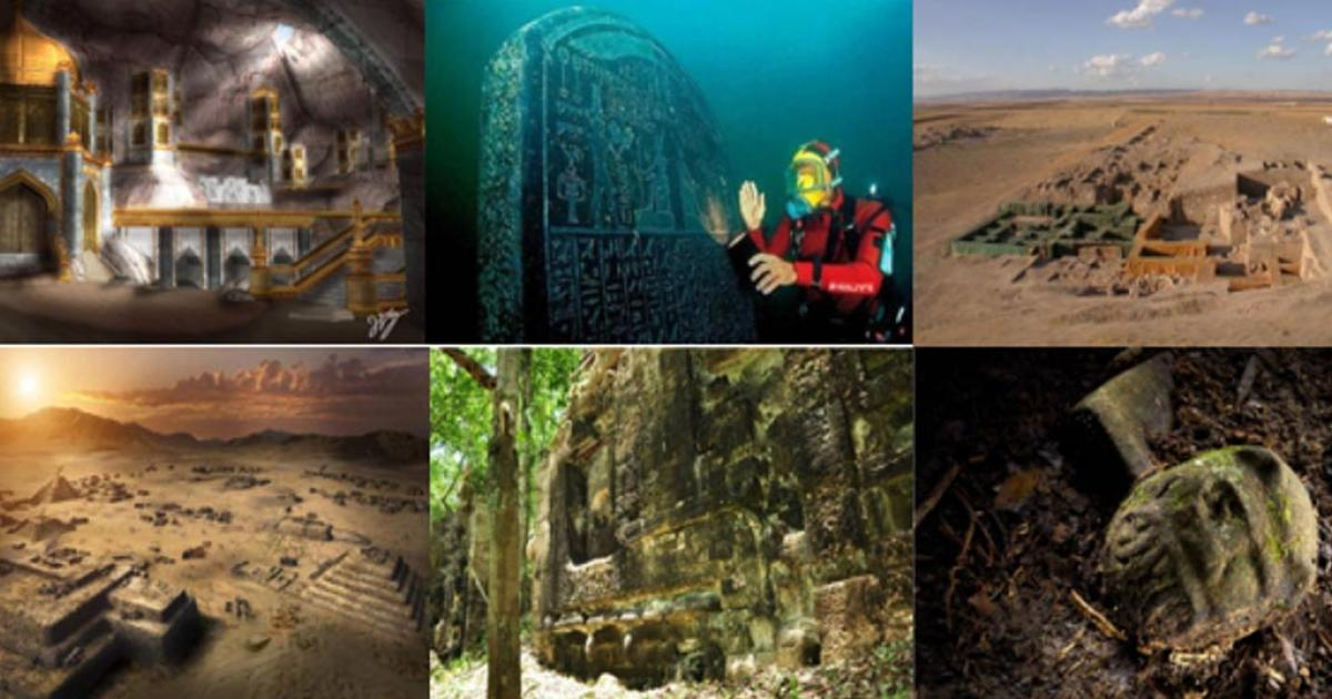
Beneath the shifting waters of Alexandria’s eastern harbour on Egypt’s Mediterranean coast lie the drowned remnants of a once-splendid city—ports, palaces, and temples swallowed by the sea. Submerged by earthquakes and rising sea levels, these lost monuments have become the focus of surveys and excavations by the European Institute for Underwater Archaeology, in conjunction with Egypt’s Ministry of Tourism and Antiquities.

Much of the recent work has centered on Antirhodos Island, revealing a temple dedicated to the ancient Egyptian goddess Isis, which was renovated by Cleopatra VII, as well as the Timonium—a palace built by her partner, the Roman general Mark Antony.

The shipwrecks discovered in the Royal Port of Antirhodos tell the story of Alexandria’s transformation from a city defined by the wealth and extravagance of the Ptolemaic dynasty into an economic powerhouse of the Roman world.

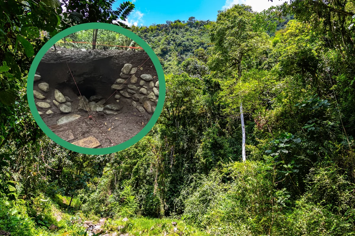
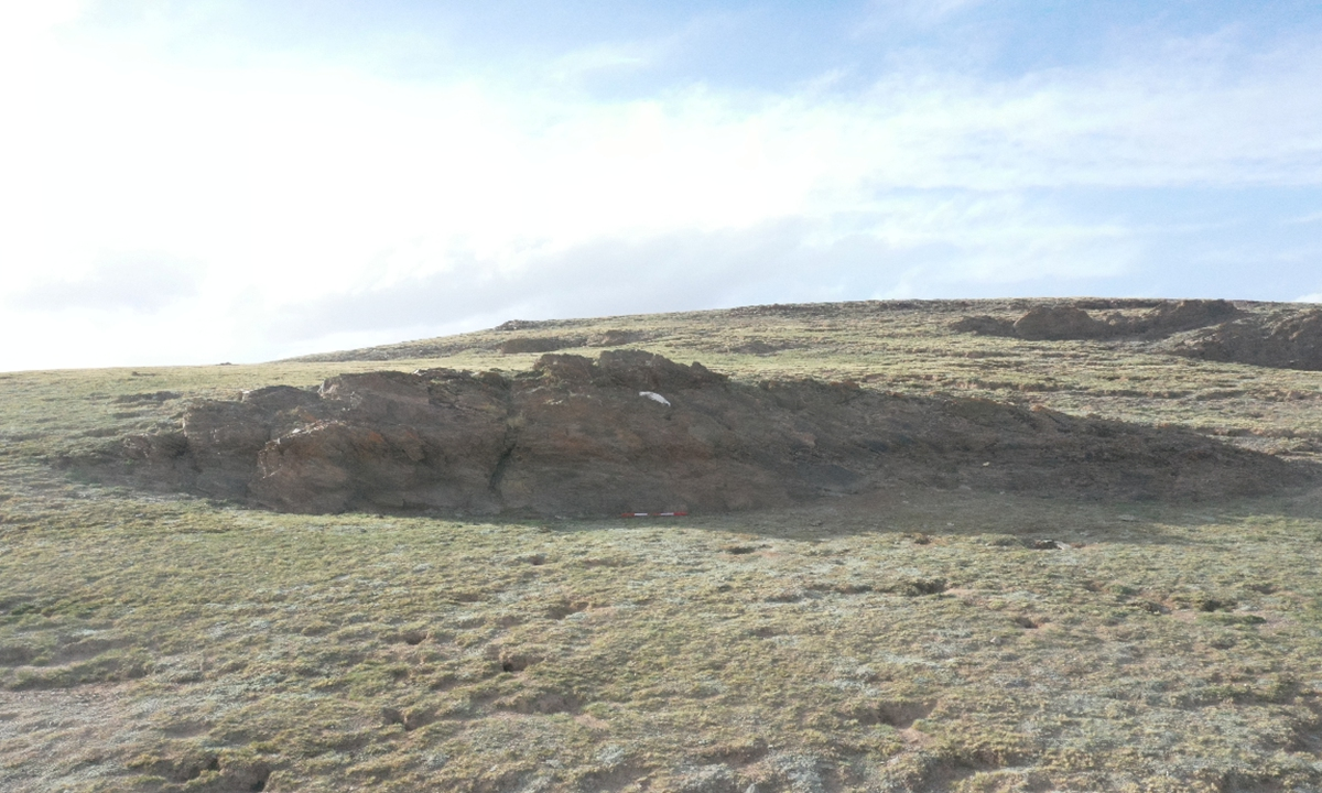
The most recent excavations have uncovered a shipwreck dating to the early Roman period. Buried beneath the sand were the remains of a thalamagos, a type of Nile yacht with a colorful reputation in Roman literature as a “party boat.” However, the discovery of such a vessel in a busy commercial harbor was unexpected, prompting researchers to ask whether the wreck was being interpreted correctly.

Discovering the ship

The wrecks in the Royal Port were identified through a new high-resolution sonar survey of the seabed. This survey produced vast quantities of data, which were processed using a machine-learning algorithm trained to recognize the distinctive “signatures” of shipwrecks. The initial results were promising, with excavations of algorithm-generated targets revealing a small boat and a 30-meter-long merchant ship.

Together with a similar merchant vessel found in the early years of the project, these discoveries illustrate the increasing commercialization of the Royal Port during the Roman period.

At the outset of the 2025 mission, researchers were confident that the newly identified wreck was another merchant ship. However, with each dive, new evidence reshaped this interpretation, gradually revealing a vessel unlike the one originally expected.

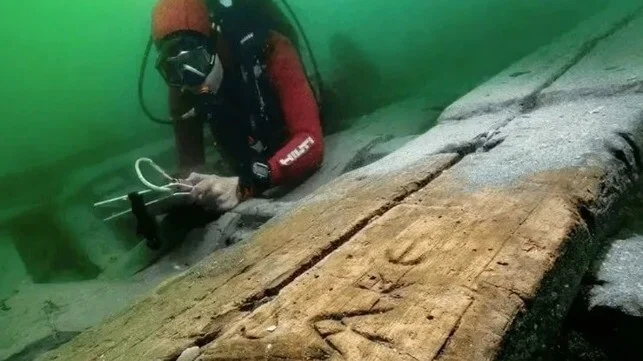
The wreck displays many features typical of Roman Imperial shipbuilding, yet Greek graffiti carved into its planks suggests that it was built and repaired in Alexandria. Its form also differs from the cargo vessels found elsewhere in the Royal Port. Measuring approximately 28 meters in length and 7 meters in width, the preserved remains indicate a flat-bottomed boat with a relatively wide, boxy hull. The bow and stern were asymmetrical, forming sweeping curves at each end. Notably, the vessel lacked a mast step, suggesting that it was propelled by oars rather than sails. These characteristics make it ill-suited for long-distance seafaring, deepening the mystery of its function.

Searching for clues in ancient texts

To better understand the vessel, researchers turned to roughly 500 fragments of Ptolemaic and Roman papyri documenting nautical activity. About 200 of these texts mention different types of river vessels, often named after the cargoes they carried, ranging from grain, wine, and stone to manure and corpses.

Among the less frequently mentioned vessels is the thalamagos, or cabin boat. This type of craft is depicted in the Palestrina mosaic, a roughly contemporary landscape scene discovered in a temple near Rome.

With its crescent shape and rows of oars, the mosaic vessel bears a striking resemblance to the remains uncovered in the Royal Port. While research on the wreck is still in its early stages, the evidence strongly suggests that it is indeed a thalamagos—one of the Nile’s infamous “party boats.”

What happened on ancient party boats?

The Palestrina mosaic depicts a cabin boat used for hunting hippopotami, a ritual associated with the pharaohs of ancient Egypt. The association of such vessels with royalty is echoed in the philosopher Seneca’s dismissive description of them as “the plaything of kings.”

Although the Ptolemaic royal family owned luxurious Nile yachts, including oversized ceremonial versions, vessels of this size were likely common along the river. The ancient geographer Strabo described Alexandrians holding feasts aboard cabin boats in shaded waterways around the city, linking them to the revelry and licentious behavior associated with public festivals in the nearby town of Canopus.

However, Roman authors often exaggerated the luxury and excess of their recently defeated enemies to portray Ptolemaic society as decadent and morally corrupt. Interpreting the thalamagos solely as a party boat risks accepting this propaganda uncritically.

Administrative papyri present a more practical picture. Thalamagoi were not merely pleasure vessels; they could transport cargo and carry officials up and down the Nile. From this perspective, the presence of a cabin boat in a bustling commercial harbor is not entirely unexpected.

There is, however, another intriguing possibility. The vessel was found close to the temple of Isis and may have been destroyed in the same seismic event that caused the sanctuary’s collapse. This raises the question of whether it served as a ceremonial barge during festivals such as the Navigation of Isis.

This festival celebrated the “opening of the sea” after the winter season and sought divine protection for the grain fleet upon which Rome depended to feed its population. Although Strabo focused on the excesses of the festival’s participants, his account likely reflects Roman prejudice rather than the event’s true purpose.

Detailed post-excavation analysis of the wreck is now underway. Researchers aim to reconstruct the vessel’s original form, understand how it functioned on the Nile, and further examine ancient texts for additional clues. What is certain is that scholars are only beginning to uncover the secrets of this remarkable thalamagos.

← Newer Posts Older Posts →
Featured
image_2026-02-05_125041404.png
Feb 5, 2026
Lost burial grounds rediscovered through folklore
Feb 5, 2026
Read More →
Feb 5, 2026
image_2026-02-05_124043984.png
Feb 5, 2026
Falklands’ Port Louis settlement discoveries shared with Dr. Robert Philpott
Feb 5, 2026
Read More →
Feb 5, 2026
image_2026-02-05_122201600.png
Feb 5, 2026
Treasures worth thousands: homeowners discover vintage items hidden in walls during renovation
Feb 5, 2026
Read More →
Feb 5, 2026
image_2026-02-05_121624777.png
Feb 5, 2026
Egyptian and Indus Valley civilisations ‘were in contact’
Feb 5, 2026
Read More →
Feb 5, 2026
image_2026-02-05_121035022.png
Feb 5, 2026
British Museum Deletes AI-Generated Pictures After Backlash
Feb 5, 2026
Read More →
Feb 5, 2026
image_2026-02-05_120112871.png
Feb 5, 2026
A Subterranean City Of Salt Has Been Preserved Within This Cave-Like Mine For Centuries
Feb 5, 2026
Read More →
Feb 5, 2026
read more

Powered by The archaeologist