• MAIN PAGE
  • LATEST NEWS
    • Lost Cities
    • Archaeology's Greatest Finds
    • Underwater Discoveries
    • Greatest Inventions
    • Studies
    • Blog
  • PHILOSOPHY
  • HISTORY
  • RELIGIONS
    • Africa
    • Anatolia
    • Arabian Peninsula
    • Balkan Region
    • China - East Asia
    • Europe
    • Eurasian Steppe
    • Levant
    • Mesopotamia
    • Oceania - SE Asia
    • Pre-Columbian Civilizations of America
    • Iranian Plateau - Central Asia
    • Indus Valley - South Asia
    • Japan
    • The Archaeologist Editor Group
    • Scientific Studies
    • Aegean Prehistory
    • Historical Period
    • Byzantine Middle Ages
    • Predynastic Period
    • Dynastic Period
    • Greco-Roman Egypt
  • Rome
  • PALEONTOLOGY
  • About us
Menu

The Archaeologist

  • MAIN PAGE
  • LATEST NEWS
  • DISCOVERIES
    • Lost Cities
    • Archaeology's Greatest Finds
    • Underwater Discoveries
    • Greatest Inventions
    • Studies
    • Blog
  • PHILOSOPHY
  • HISTORY
  • RELIGIONS
  • World Civilizations
    • Africa
    • Anatolia
    • Arabian Peninsula
    • Balkan Region
    • China - East Asia
    • Europe
    • Eurasian Steppe
    • Levant
    • Mesopotamia
    • Oceania - SE Asia
    • Pre-Columbian Civilizations of America
    • Iranian Plateau - Central Asia
    • Indus Valley - South Asia
    • Japan
    • The Archaeologist Editor Group
    • Scientific Studies
  • GREECE
    • Aegean Prehistory
    • Historical Period
    • Byzantine Middle Ages
  • Egypt
    • Predynastic Period
    • Dynastic Period
    • Greco-Roman Egypt
  • Rome
  • PALEONTOLOGY
  • About us

Shark Size Comparison 3D | 3d Animation Comparison

February 1, 2026

Sharks Compared: A Jaw-Dropping Journey Through Size and Scale

Dive into the ocean depths with this Shark Size Comparison 3D Animation, where some of the most fascinating predators on Earth are brought to life in stunning detail. From small, agile reef sharks to the largest shark species ever known, this visual experience reveals just how vast — and varied — the shark family truly is.

Using realistic 3D animation, the comparison places modern sharks side by side, allowing viewers to grasp their true scale in a way photos and numbers never quite can. Familiar species suddenly feel larger, faster, and more imposing, while lesser-known sharks gain a new level of appreciation once their size is put into context.

The journey doesn’t stop with living species. The animation also ventures into the prehistoric past, stacking today’s sharks against legendary giants like Megalodon. Seeing these ancient predators alongside modern sharks offers a striking reminder of how dramatically life in the oceans has evolved — and just how massive some creatures once were.

Whether you’re an ocean lover, a shark enthusiast, or simply curious about the real size of these apex predators, this comparison delivers both education and awe. It’s a visual deep dive into scale, evolution, and the power of nature beneath the waves.

Watch the video below to see the full Shark Size Comparison 3D Animation and discover how these incredible creatures truly measure up:

Mysterious Hominins Overlapped with Homo sapiens on Sulawesi

February 1, 2026

Sulawesi: The Island That Refuses to Be a Footnote

There is a certain kind of island that breaks theories. Sulawesi is one of them.

It sits in Wallacea, the restless middle zone between Asia and Australia — a fractured landscape of deep sea trenches, limestone towers, and jungle ridgelines. This is a place that never quite belonged to the Asian continent, and never quite belonged to the Australian one either. Even during the Ice Age, when falling sea levels joined vast landmasses elsewhere, Wallacea remained stubbornly fragmented. To pass through it, one always had to cross water.

In the familiar National Geographic narrative, this region is treated as little more than a corridor. Homo sapiens enters Southeast Asia around 50,000 years ago, island-hops across Wallacea, reaches Sahul, becomes “the ancestors of Indigenous Australians,” and then history properly begins. Everything before this moment is framed as a preface — provisional, incomplete, almost not allowed to happen.

But in the caves of Sulawesi, the preface has become the story.

Hidden within its limestone caverns are paintings that rank among the oldest known artworks in the world. Hand stencils, animals, and hunting scenes emerge from the rock with a confidence that defies the idea of a temporary stopover. These images suggest not just survival, but imagination — people who paused long enough to observe, to remember, and to create meaning.

Sulawesi complicates the linear story of human progress. It challenges the assumption that culture bloomed only after humans reached their “destination.” Instead, it hints that symbolic thought and artistic expression were already alive in places long considered marginal. This island was not simply passed through. It was inhabited, experienced, and remembered.

In Wallacea, history does not move neatly from point A to point B. It fractures, overlaps, and resurfaces in unexpected places. And Sulawesi stands as quiet evidence that the human story is older, messier, and far more expansive than the simplified timelines we once trusted.

Watch the video below to explore Sulawesi’s caves, its ancient art, and why this island is rewriting what we thought we knew about early human history:

Deadly Storm Surge Reveals Ancient Lost City!

February 1, 2026

Storm Harry and the Rediscovery of a Lost Ancient City

On Monday night and into Tuesday, Storm Harry battered the Mediterranean, unleashing hurricane-force winds and towering waves that left scenes of destruction across coastal regions. In Tunisia, the storm triggered severe flooding, damaged infrastructure, and reshaped parts of the coastline — but it also revealed something extraordinary.

In Nabeul, a coastal city in northeastern Tunisia, the scale of the rainfall was unprecedented. The region typically receives just over 50 mm of rain during the entire month of January, yet 151 mm fell in a single day — nearly three times the monthly average. As floodwaters surged and coastlines were stripped back by powerful waves, remnants of the ancient world began to emerge.

What captured global attention wasn’t only the storm’s devastation, but what the freak weather uncovered: submerged remains believed to belong to the lost ancient city of Neapolis.

Neapolis was once an important Roman-era city, known from historical texts but long thought to be lost beneath the sea. The storm surge and erosion exposed underwater structures, streets, and architectural features that align with ancient descriptions of the city. For archaeologists and historians, this unexpected revelation has offered rare physical evidence of a place that had lived largely in legend.

Extreme weather events are often discussed only in terms of destruction, but in rare cases like this, they also reshape our understanding of history. Storm Harry reminded us that the past is never truly gone — sometimes it lies hidden just beneath the surface, waiting for the right moment to reappear.

Watch the video below to learn more about the ancient city of Neapolis and exactly what has been discovered:

Africa Is Splitting Into Two Continents

February 1, 2026

The Birth of a New Ocean: Africa’s Rift That Is Changing the Planet

A new ocean is forming in Africa — and for the first time in human history, scientists are able to witness the birth of an ocean in real time.

Deep beneath Ethiopia’s Afar region, the Earth’s crust is slowly tearing apart. Tectonic plates are separating, magma is rising from the mantle, and the continent itself is beginning to split. What is happening beneath this arid landscape could eventually give rise to the world’s newest ocean, transforming deserts into coastlines and reshaping Africa’s geography forever.

Where Continents Break Apart

At the heart of this process lies the East African Rift System, one of the most active and complex geological zones on Earth. Stretching thousands of kilometers across eastern Africa, this rift marks the boundary where tectonic plates are pulling away from one another. Over millions of years, this slow but relentless movement thins the crust, allowing molten rock to rise and new landforms to emerge.

Scientists studying the region use seismic data, satellite imagery, and geological and oceanographic research to peer beneath the surface. Their findings point to a powerful mantle plume beneath Africa, a column of hot material rising from deep within the Earth that is driving the breakup of the continent.

Volcanoes, Fissures, and Real-Time Change

This process is not just theoretical — it is happening now. The Hali Y Gubbi eruption in the Afar region recently opened new fissures and spread fresh basalt across the landscape, offering a rare, real-time glimpse into how rifting progresses. Events like this mirror the forces that once split ancient supercontinents and paved the way for oceans like the Atlantic.

One of the most dramatic moments occurred in 2005, when a massive rift event in Ethiopia caused the ground to crack open over dozens of kilometers in a matter of days. These sudden ruptures reveal just how dynamic and active the region remains.

A Glimpse Into Earth’s Deep Past — and Future

The same geological process that once created the Atlantic Ocean is unfolding again in Africa. While the formation of a full ocean basin will take millions of years, the early stages are already visible today. This makes the East African Rift one of the most important natural laboratories on the planet — a place where scientists can watch continents split apart and oceans begin their life cycle.

What stands today as desert may one day lie beneath rolling waves, reminding us that Earth’s surface is never truly fixed, only temporarily familiar.

Explore the science, eruptions, and tectonic forces behind the birth of a new ocean in the video below:

Why Does the Man In This 2000 Year Old Mummy Portrait Look So Familiar?

February 1, 2026

Nearly two thousand years old, this Roman-period Egyptian mummy portrait is a striking testament to the artistry and humanism of the ancient world. Painted in encaustic, a technique using hot beeswax and pigment, the portrait once rested over the face of a mummified body, creating a unique bridge between Egyptian funerary tradition and Greco-Roman naturalism.

What makes this portrait so remarkable is its startling realism. Wrinkles, graying hair, a receding hairline, and penetrating hazel eyes are rendered with an honesty rarely associated with antiquity. Unlike many ancient depictions that idealized their subjects, this likeness embraces imperfection and individuality, offering a rare, intimate glimpse into the life behind the mask.

Though the sitter’s name has been lost to history, the portrait preserves something far deeper than identity. Its extraordinary realism anticipates the long arc of Western portraiture — an enduring drive to capture not only appearance, but presence, emotion, and inner life. Standing before it today, it’s impossible not to feel the centuries collapse, replaced by the uncanny sensation that someone from the ancient world is quietly meeting your gaze — human, familiar, and unmistakably alive.

This piece reminds us that art has always been about more than technique; it is a bridge across time, connecting hearts, stories, and souls that might otherwise be lost to history.

Science news this week: 'Cloud People' tomb found in Mexico, pancreatic cancer breakthrough, and the AI swarms poised to take over social media

February 1, 2026

This week’s science headlines highlighted both the promise and the risks of technological progress. A new study raised alarms about next-generation AI “swarms” on social media: unlike current bots, these systems could act in coordinated groups, mimic real human behavior, adaptively target users, spread misinformation, and influence public opinion. Already, over half of written content online in 2025 is estimated to be generated by large language models, but these next-gen bots take automation to a more deceptive, socially manipulative level.

On the brighter side, AI continues to deliver breakthroughs in health and science. Researchers unveiled a tool that detects early signs of cognitive decline from doctors’ notes, while AI-assisted analysis of Hubble telescope archives revealed hundreds of previously unexplained cosmic objects. In technology, advances included a major battery innovation, Microsoft’s release of a cutting-edge AI chip, a laser-based power system enabling near-“infinite” drone flight, and even a robot capable of moving its lips with eerie realism.

The week underscores the dual nature of AI and technology: immense potential for discovery and efficiency, alongside significant risks that demand careful monitoring and ethical consideration.

5,000-Year-Old Sinai Inscription Identified as Earliest Known Visual Display of Political Domination

February 1, 2026

5,000-Year-Old Egyptian Rock Inscription Reveals Early Colonial Power in Sinai

A rock inscription dating back nearly 5,000 years in Egypt’s southwestern Sinai Peninsula has provided rare insight into the earliest expressions of Egyptian colonial authority, according to Professor Ludwig Morenz of the University of Bonn. The carving, discovered in Wadi Khamila by Mustafa Nour El-Din of Egypt’s Ministry of Antiquities, depicts a towering figure—interpreted as an Egyptian ruler or the god Min—standing over a kneeling local pierced by an arrow, a clear statement of Egyptian dominance.

One of the Earliest “Smiting Scenes”
Professor Morenz notes that the inscription represents one of the oldest known “smiting scenes,” a visual motif later central to Egyptian royal ideology. The imagery conveys absolute power, designed to intimidate populations in regions that lacked formal political organization or writing at the time.

Economic Motives Behind Expansion
The Sinai Peninsula was rich in resources such as copper and turquoise, attracting Egyptian expeditions for economic gain. Wadi Khamila had previously been known only for Nabataean inscriptions, making this early Egyptian carving a surprising expansion of the known reach of Egypt’s initial colonial activities.

Dating the Inscription
Researchers dated the rock carving using iconographic, stylistic, and epigraphic analysis. The posture of the figures and symbolic elements align with Egyptian artistic conventions from the late fourth millennium BCE, a period when organized Egyptian expeditions were active in the southwest Sinai. Similar early rock art in Wadi Ameyra and Wadi Maghara supports the interpretation of a wider system of territorial marking by early Egyptians.

This discovery highlights how economic ambition, religious authority, and displays of violence intersected in Egypt’s earliest colonial endeavors, offering a unique glimpse into the mechanisms of power at the dawn of civilization.

Al-Arada: Protecting antiquities national responsibility

February 1, 2026

Marib Governor Stresses National Duty to Protect Yemeni Antiquities

The Member of the Presidential Leadership Council and Governor of Marib, Sultan al-Arada, emphasized that safeguarding Yemen’s archaeological heritage is a national responsibility, calling for coordinated efforts between official authorities and local communities.

“The protection of archaeological sites is a national duty,” al-Arada stated. He added that the Marib local authority is preparing to launch a project to fence off the governorate’s archaeological sites.

His comments were made during a meeting on Saturday with Minister of Information, Culture, and Tourism Muammar al-Eryani, Yemen’s UNESCO ambassador Dr. Mohammed Jameih, and Dr. Zaydoon Zaid, President of the American Institute for Human Studies and Special Advisor to the American Council for Overseas Research Centers.

Al-Arada praised the longstanding cooperation between Yemen and the American Foundation for Human and Civilization Studies in preserving the country’s antiquities.

Dr. Jameih noted that UNESCO can support training and capacity-building initiatives, stressing that fencing projects must align with the 1972 Convention for the Protection of Cultural and Natural Heritage.

Dr. Zaid confirmed that the American Foundation is ready to collaborate with the Yemeni government and Marib authorities to preserve antiquities and provide local staff with training programs. He also announced plans to hold the next session of the Sabaean Conference in Marib governorate.

Saint Mary's College of California Student Christopher Baker Conducts Global Archaeological Research On Bronze Age Shipwreck

February 1, 2026

Saint Mary’s College Expands Undergraduate Research Through International Archaeology

Saint Mary’s College of California continues to offer students immersive research opportunities, exemplified by Christopher Baker’s 2025 summer work in Turkey and subsequent studies in Rome.

Baker participated in a field project investigating a 3,300-year-old shipwreck off the Turkish coast, contributing to research on ancient maritime trade and seafaring practices. The hands-on work allowed him to engage directly with archaeological methods, material analysis, and collaborative research alongside an international team of scholars.

After the fieldwork, Baker pursued academic study in Rome, expanding his knowledge of classical history, archaeology, and the broader contexts of ancient civilizations. By combining field experience with classroom learning, he benefited from

A researcher takes soil samples from the southern city wall of the Archaeological Ruins of Liangzhu City in Hangzhou, east China's Zhejiang Province

Xinhua Headlines: How archaeology reveals roots of China's uninterrupted civilization

February 1, 2026

How Archaeology Reveals China’s Unbroken Civilizational Roots

On a crisp winter morning in early 2026, hundreds of runners gathered at the Liangzhu Archaeological Ruins in Hangzhou, Zhejiang Province, a UNESCO World Heritage Site over 5,300 years old. At the starting signal, participants ran along paths once marked by ancient city walls and waterways, turning a modern New Year’s ritual into an encounter with deep history.

For many, the run was less about competition and more about experiencing firsthand one of East Asia’s earliest urban civilizations. This reflects a broader trend in China, where the past is increasingly explored not only in classrooms but as part of everyday life. With roughly 1.5 billion museum visits annually, the public’s interest in understanding the uninterrupted story of Chinese civilization is evident.

This enthusiasm parallels a national push for archaeological research. From 2021 to 2025, more than 7,700 projects across China uncovered over 130,000 cultural relics, offering fresh insights into the country’s roots and contributing to global discussions on human civilization’s continuity, diversity, and evolution.

Enriching the Global Understanding of Human History

Recent Chinese archaeological discoveries also carry international significance. They have provided new evidence on early human migration, long-term tool-making practices, and adaptation to extreme environments.

At the Salawusu site in Inner Mongolia, one of China’s earliest Paleolithic sites, researchers have found fossils, stone tools, and signs of fire use dating back at least 50,000 years. Chen Fuyou of the Chinese Academy of Sciences notes that the finely crafted tools reflect a consistent technological tradition in northern China, offering strong evidence for the continuous evolution of early human populations in East Asia.

Further southwest, discoveries on the eastern Qinghai-Tibet Plateau have challenged assumptions about human resilience. Paleolithic sites at approximately 4,300 meters elevation demonstrate that prehistoric groups adapted to low oxygen levels and harsh climates much earlier than previously believed.

Taken together, these sites and artifacts create a broader mosaic, gradually reconstructing a multidimensional picture of China’s long and continuous civilizational history.

Archaeologists Unearth unprecedented 16th-Century River Pier on the Banks of Russia’s Volkhov River

February 1, 2026

Archaeologists in Veliky Novgorod, one of Russia’s oldest cities, have uncovered a large wooden riverside structure that may date back to the 16th century, possibly forming part of a river pier. Found along the banks of the Volkhov River, the discovery is being described as unprecedented for the region and could offer new insights into the city’s early river infrastructure and trade networks.

Excavations took place on the Sofia Side of Veliky Novgorod, near the Victory Monument and close to the Novgorod Kremlin. Across the river lies Yaroslav’s Court, historically called the Torq, which served as the city’s main commercial hub in medieval times. While Novgorod has a rich archaeological record, its riverbank zones have been little explored, making this find particularly significant.

A Unique Wooden Construction
The structure is composed of massive pine logs, some up to 50 centimeters in diameter, extending about 24 meters toward the river.

“This is an exceptionally sturdy construction built from large logs,” said Pyotr Gaidukov, advisor to the director of the Institute of Archaeology of the Russian Academy of Sciences and a lead researcher at Novgorod State University. “We believe this forms the lower foundation of a major riverside structure, possibly a navigable pier. Nothing like this has been found in Novgorod before.”

Archaeologists initially thought the remains were part of a defensive wall running parallel to the river, but the downward slope toward the Volkhov River indicates the structure was likely linked to water transport rather than fortification.

Dating the Pier to the Early 1500s

The age of the wooden structure was established through dendrochronology, which analyzes tree-ring patterns to determine when the wood was cut. Results indicated that one log was felled in 1509 and another in 1510. Coins and seals found in the same archaeological layer further corroborate this dating.

Historians suggest the pier may have been constructed in the aftermath of the catastrophic 1508 fire, which destroyed much of Novgorod’s Trade Side and reportedly killed around 2,000 people. The disaster also destroyed the Great Bridge across the Volkhov River.

“According to one of the Novgorod chronicles, the bridge was rebuilt in 1509, just before Grand Prince Vasily III of Moscow visited,” explained Pyotr Gaidukov. “It is likely that major construction projects were underway across the city at the time, including the structure we uncovered.”

Evidence from a 17th-Century City Plan

Further support comes from a 1611 city plan showing a bulwark extending into the river exactly where the pier was discovered. Archaeologists suggest that later fortifications may have incorporated or reused parts of the earlier wooden structure.

Experts also believe the pier fell out of use before 1582, when work began on the Small Earthen Town—a defensive system surrounding the city’s inner fortress (detinets). During the construction of moats, earth was piled over the pier’s foundation, burying it for centuries.

Preservation and Public Display

Following careful documentation and excavation, all the wooden components of the pier were removed and transferred to the Vitoslavlitsy Museum of Wooden Architecture near Veliky Novgorod.

“The logs are currently undergoing conservation under expert supervision,” said Pyotr Gaidukov. “Once the process is complete, the Novgorod Museum intends to showcase this unique early 16th-century riverside structure to the public.”

The discovery was officially presented at the 40th Scientific Conference Novgorod and the Novgorod Land: History and Archaeology, with contributions from researchers of the Institute of Archaeology of the Russian Academy of Sciences, including Oleg Oleinikov, Sergey Chernykh, Andrey Berezkin, and Vyacheslav Kolobrodov.

Archaeologists emphasize that the find not only provides fresh insights into river transport and trade in medieval Novgorod, but also underscores the untapped potential of the city’s riverbank areas. As research continues, this structure could become one of the most important archaeological discoveries in the region in recent years.

Israel closes Hebron's center to secure settlers' storming of archaeological site

February 1, 2026

On Saturday, Israeli forces sealed off the Bab al-Zawiya area and Beersheba Street, a main route to Hebron’s city center, to facilitate a settler incursion into an archaeological site.

Sanad News Agency cited local sources saying that large numbers of Israeli soldiers entered the Bab al-Zawiya area, forcing shop owners to shut their businesses. Residents were dispersed and the area was cleared to provide security for dozens of settlers who entered the archaeological site on Beersheba Street.

Hebron has recently seen a sharp increase in settler incursions into archaeological and religious locations, alongside heightened restrictions, closures, and repressive measures imposed by Israeli forces on local residents to enable these activities.

Archaeologists Johanna Steffestun and Rudolf Sebastian at the site in Schieren 

Archaeologists toil to preserve Roman villa site next to roadworks

February 1, 2026

Archaeologists are continuing efforts to protect a Roman villa site located close to planned construction works to expand the Schieren bypass.

For years, motorists using the Schieren bypass have been able to see the excavation area situated directly beside the roadway.

Construction to widen the B7 to two lanes in each direction between Schieren and Ettelbruck is scheduled to begin in September. The project will start with the building of a new viaduct in Schieren and is expected to last three years,

The excavations are covered with plastic sheeting before they are backfilled

This process involves reburying the uncovered and recorded remains, but it is far more careful than simply piling soil back on top.

Because the structures are extremely delicate, they are first protected with a geo-textile layer. A layer of sand is then added, followed by the final covering of soil. Steffestun explained that the sand serves a specific purpose: “We call it an indicator layer. If someone excavates this area again in the future, the sand clearly signals that something important lies beneath.”

One shovel at a time

Asked whether it is disheartening to see carefully excavated remains disappear underground again, the archaeologists agree that this approach is ultimately the best option.

“Once it is backfilled, I know the villa is as well protected as possible,” said Steffestun. Rudolf Sebastian, who is supervising the work on site, shares this view: “Ideally, it would never have been excavated at all. This is the next best solution.”

However, backfilling is a slow and highly controlled process. While transporting the soil is relatively straightforward, applying it safely is not. Some of the earth comes from the construction of the new tunnel at Ettelbrück railway station, where the N7 is set to run from 2028.

The soil is delivered by truck to the villa site, where small excavators spread it across designated areas. The final layer, however, is applied manually with shovels to prevent damage to the buried walls.

As a result, fully covering the entire site will take considerable time.

Archaeologists Rediscover Alexandria on the Tigris, a Lost City Founded by Alexander the Great

February 1, 2026

For centuries, one of the ancient world’s most significant cities lay buried beneath layers of dust, conflict, and changing river courses. Alexandria on the Tigris—once a major hub of long-distance trade linking Mesopotamia with India and regions beyond—gradually disappeared from historical awareness after late antiquity. Today, an international research team led by Professor Stefan Hauser of the University of Konstanz has rediscovered and reinterpreted this long-lost city, shedding new light on its central role in early global commerce.

A City Established by Alexander the Great

In the 4th century BCE, Alexander the Great overthrew the Achaemenid Persian Empire, dramatically reshaping political and economic networks across the Near East. Ancient sources recount his return from the Indus Valley to Mesopotamia, where he intended to travel by water from Susa to Babylon. Along this route, Alexander identified a growing problem: sediment buildup in southern Mesopotamia was steadily pushing the Persian Gulf coastline southward, rendering older ports ineffective.

To address this challenge, he founded a new harbor city—Alexandria on the Tigris—near the junction of the Tigris and Karun rivers, about 1.8 kilometers from the ancient shoreline. In later periods, the city became known as Charax Spasinou or Charax Maishan. Roman writers mentioned it, and inscriptions referring to the city have been found as far away as Palmyra in present-day Syria. Yet despite these references, its precise location remained a mystery for hundreds of years.

Tracing the Lost City

The first modern clue emerged in the 1960s, when British scholar John Hansman detected large settlement patterns and city walls in Royal Air Force aerial photographs. Political instability and armed conflict near the Iranian border, however, prevented any follow-up investigations for decades. The site—now identified as Jebel Khayyaber—was later occupied as a military base during the Iran–Iraq War, further delaying research.

It was not until 2014 that international archaeological teams cautiously returned to southern Iraq. British archaeologists working near the ancient city of Ur were directed to Jebel Khayyaber by local authorities. Despite strict security constraints, they were struck by the sheer scale of what they found: enormous city walls extending for several kilometers and still standing up to eight meters high in some areas.

Location of Alexandria/Charax.

Mapping a Megacity Without Digging

Because of persistent security risks, the research team initially avoided excavation and instead turned to non-invasive techniques. Over several years, they carried out intensive surface surveys, walking more than 500 kilometers and recording thousands of pottery fragments and bricks. Drone imagery was then used to create a high-resolution digital terrain model, which revealed a striking conclusion: Alexandria on the Tigris was an enormous, deliberately planned urban center.

Professor Hauser compares the city to Alexandria in Egypt, describing it as its eastern counterpart. Both were established at strategic junctions where river systems met maritime trade routes, acting as vital intermediaries between inland regions and the wider seas. For over five centuries—more than 550 years—Alexandria on the Tigris functioned as one of the most important nodes in ancient long-distance trade networks.

Streets, Sanctuaries, and Industry

Geophysical investigations were crucial in reconstructing the city’s internal organization. By using cesium magnetometers, archaeologists were able to detect streets, walls, canals, and industrial features beneath the surface without disturbing the site. These surveys revealed some of the largest residential blocks known from the ancient world, laid out in an orderly grid that extended several kilometers beyond the northern city wall.

The urban plan, however, was not entirely uniform. At least four different grid orientations were identified, pointing to multiple building phases and distinct functional areas. The city comprised large residential quarters, monumental temple precincts, industrial zones with kilns and smelting furnaces, an inner harbor linked by canals, and a palace-like complex that may have been surrounded by gardens or cultivated land.

In addition, satellite imagery exposed an extensive irrigation network north of the city, indicating large-scale agricultural production—likely grain farming—to sustain the city’s substantial population.


Still impressive today: the fortification walls of Alexandria

A Key Hub in Ancient Global Trade

From around 300 BCE to 300 CE, trade between Mesopotamia and India expanded rapidly, with networks stretching as far as Afghanistan and China. During this era, the twin cities of Seleucia and Ctesiphon rose along the Tigris as major imperial capitals. Ancient accounts suggest that Seleucia alone may have had a population of up to 600,000, generating immense demand for luxury and everyday imported goods.

Hauser explains that almost all trade coming from India passed through Alexandria on the Tigris. Even after new ports were established farther south as sedimentation altered the coastline, merchandise was still routed through Alexandria first. Its geographic position made it a crucial choke point in regional commerce—until environmental changes once again altered the landscape.

Decline, Abandonment, and Enduring Impact

Alexandria’s prosperity depended on the river that sustained it. Geological evidence shows that the Tigris slowly shifted westward, eventually isolating the city from its main water route. By the 3rd century CE, Alexandria was left far from both the river and the Persian Gulf, which itself had retreated nearly 180 kilometers to the south.

Deprived of river access, the city lost its commercial and political importance and was gradually abandoned. Yet its influence did not disappear. In later centuries, the city of Basra would assume Alexandria’s former role as the region’s principal port.

Today, with support from the Gerda Henkel Foundation, the German Research Foundation (DFG), and the British Council’s Cultural Protection Fund, further archaeological work is planned. As Professor Hauser emphasizes, Alexandria on the Tigris still holds many unanswered questions—and its rediscovery is transforming how scholars understand the early history of global trade and connectivity.

Is This 2,000-Year-Old Artifact Actually a Battery?

February 1, 2026

The phrase Baghdad Battery may sound unfamiliar or even meaningless at first, but it refers to an archaeological mystery that has intrigued scholars for almost a century.

Discovered in Iraq in the 1930s, the object was a broken clay jar whose purpose has long been debated. Some believe it was simply a ritual container with no technological importance, while others argue it may have functioned as an ancient battery—potential evidence of early electrical knowledge. Sadly, the artifact can no longer be examined directly, as it was lost during the 2003 invasion of Iraq. Even so, enough documentation remains to keep the debate alive.

The jar contained a copper cylinder and an iron rod, a configuration strikingly similar to a galvanic cell, the basic mechanism behind modern batteries. This resemblance sparked the provocative idea that people living 2,000 years ago may have unknowingly discovered principles of electricity.

A recent study from the University of Pennsylvania, reported by Chemistry World, has reignited discussion. Independent researcher Alexander Bazes recreated the artifact and concluded that it could have generated up to 1.4 volts—comparable to the output of a modern AA battery. His reconstruction suggests that the jar’s porous clay may have acted as a separator, enabling an electrolyte such as lye to interact with the metals and produce an electrical charge.

However, Bazes stops short of claiming the device was used for advanced technology. He dismisses the popular theory that it served to electroplate jewellery and instead proposes a ritual-based explanation. In his view, the electrical reaction may have been used to visibly corrode inscribed prayers, giving worshippers tangible evidence that a supernatural force had acknowledged their offering.

On the opposing side, University of Pennsylvania archaeologist William Hafford argues that the object more closely resembles known sacred prayer jars rather than any form of battery. Archaeologists have uncovered similar vessels in Iraq containing multiple copper items—far too many to function electrically. Hafford suggests that the iron rod may not have been an electrode at all, but simply a nail used in a ritual sealing process before the jar was buried as an offering to underworld deities.

Whether technological device or ritual object, the Baghdad Battery remains a fascinating artifact. The question of its true purpose is still unresolved and is likely to remain a topic of debate for many years to come.

Ivar and his brother Ubba ravaged England during the 9th Century

Hill could hide Viking grave of Ivarr the Boneless

February 1, 2026

An archaeologist has suggested that a large earth mound in west Cumbria may be the final resting place of the legendary Viking leader Ivarr the Boneless.

Ivarr, also known as The Legless or The Dragon, established a powerful Viking dynasty in Dublin and commanded forces that devastated much of England in the 9th century. Despite his historical significance, his burial site has never been identified.

Steve Dickinson, an archaeologist, believes that Ivarr was laid to rest inside his ship beneath a hill known in medieval sources as The King’s Mound. He described the possibility as “exciting,” noting that it could indicate the presence of a hidden Viking burial complex, or necropolis, along the Cumbrian coast.

If Dickinson’s interpretation proves accurate, The King’s Mound would represent one of just 16 known monumental ship burials in north-west Europe—and the first of its kind ever discovered in the UK.

Ship burials were practiced by certain ancient cultures as a mark of honor and status. Britain’s most famous example is the Anglo-Saxon ship burial uncovered at Sutton Hoo in Suffolk.

The top of the hill could contain a Viking ship and the remains of Ivarr the Boneless, according to archaeologist Steve Dickinson

Dickinson, a member of the European Association of Archaeologists, explained that this burial practice reflects a belief system very different from those held today. According to him, an important ruler—such as a king or queen—would be placed inside a ship and buried beneath a mound of earth.

The vessel would be filled with items symbolising the community’s honour and respect for the deceased, including jewellery, royal insignia, weapons, food offerings, and even sacrificed animals, sometimes household pets.

People at the time believed the ship would serve as a vessel to carry the ruler into the afterlife.

Steve Dickinson used medieval manuscripts to find what he believes is a Viking grave

Ivarr—sometimes spelled Ivar—was the son of the legendary king Ragnar Lothbrok and is also known to modern audiences as a character in the Amazon TV series Vikings.

There have been previous attempts to locate Ivarr’s burial place, and at one point it was thought he may have been buried at Repton in Derbyshire. However, while studying an Icelandic saga, Dickinson repeatedly encountered references to a site known as Coningeshou, meaning “The King’s Mound”. This prompted him to consider it as a possible location for Ivarr’s burial.

Dickinson also noted that even if a grave were uncovered, there would be no definitive physical evidence to confirm the identity of the individual buried there.

To protect the site, the exact location of the mound has not been disclosed. What is known is that it measures roughly 60 metres (197 feet) across, stands about 6 metres (20 feet) high, and lies close to the coastline.

Later this year, Dickinson plans to conduct ground scans to assess whether the mound is indeed a burial site. He added that archaeological finds in the surrounding area support his hypothesis.

Additional €350k in funding for scheme to safeguard Irish UNESCO World Heritage sites announced

January 28, 2026

€350,000 Funding Available for Irish World Heritage and Tentative List Sites in 2026

The Irish Government has announced €350,000 in capital investment funding to support the protection, conservation, and promotion of UNESCO World Heritage Properties and Tentative List Sites across Ireland. The funding is part of the continued pilot World Heritage Strategic Investment Fund, managed by the National Monuments Service in collaboration with local authorities.

This follows the 2025 pilot, which allocated €240,000 to nine projects, demonstrating growing government support for safeguarding Ireland’s heritage and promoting sites internationally.

Key Details:

  • Eligibility:
    Sites must be within:

    • Boundaries of Irish World Heritage Properties,

    • Boundaries of Tentative List Sites, or

    • Buffer zones protecting Outstanding Universal Value (OUV).

    Additional conditions include inclusion in the Record of Monuments and Places (RMP), Sites and Monuments Record, Record of Protected Structures (RPS), or within Architectural Conservation Areas. Sites owned by the Minister or OPW are generally excluded unless prior approval is granted.

  • Funding Streams:
    Stream A: Up to €30,000 for interpretation, understanding, and presentation of sites (including digital/online access).
    Stream B: Up to €100,000 for protection, conservation, essential repairs, conservation advice, preparation of Conservation Management Plans, and Archaeological Impact Assessments.

  • Applications: Local authorities may submit up to three applications per site.

Government Statements:

  • Minister James Browne, TD: The fund continues Ireland’s commitment to UNESCO World Heritage sites and helps move Tentative List sites toward inscription.

  • Minister of State Christopher O’Sullivan, TD: Investing in World Heritage protects cultural treasures, supports local communities, and grows tourism while ensuring future generations can enjoy Ireland’s heritage.

The Ta Mone Temple has been international recognised as Cambodian territory for more than a century.

Twisting Narratives on the History of “Khom” and the Authentic Heritage of Prasat Chan

January 28, 2026

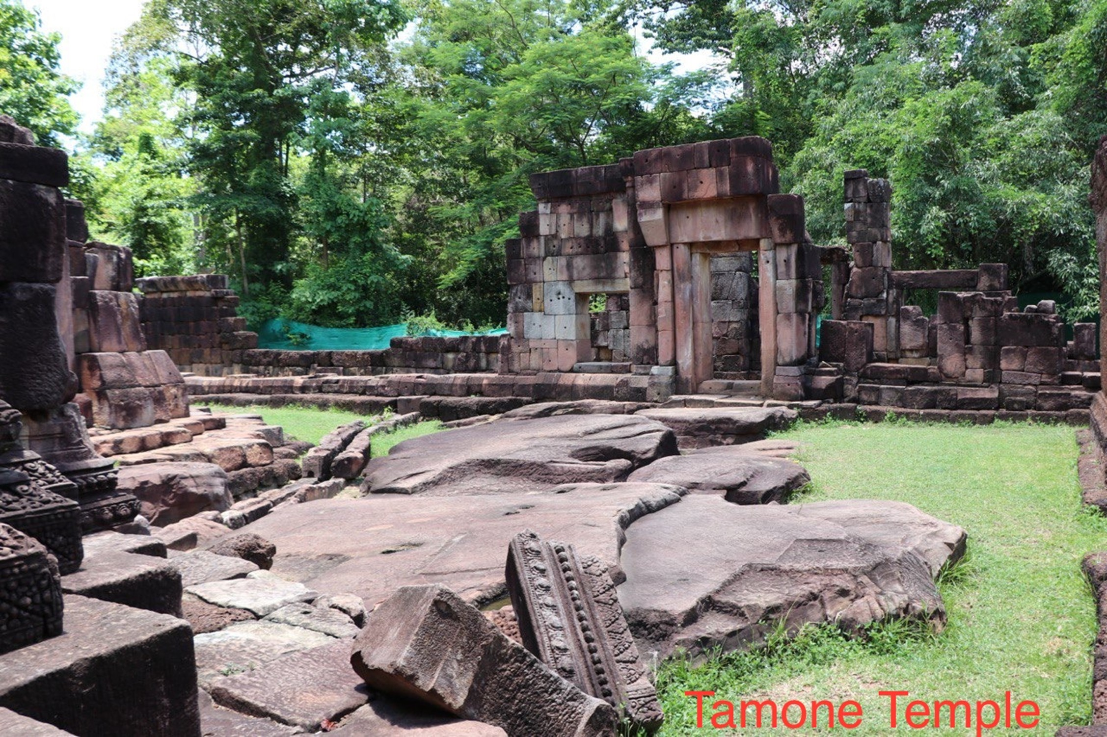
Prasat Chan and Ta Mone Thom: Historical and Cultural Clarifications

Recent Thai narratives regarding Prasat Chan and the Ta Mone Temple complex reveal a profound misunderstanding of history, archaeology, international law, and accepted principles of cultural heritage conservation. More concerningly, they employ rhetorical strategies aimed at implying that Ta Mone Thom belongs to Thailand, despite the temple being situated within Cambodian sovereignty, as clearly established under international law.

1. “Khom” = Khmer
Contrary to claims in some Thai sources, the term “Khom” does not refer to a separate ethnic group or civilization. In historical, epigraphic, and archaeological scholarship, “Khom” is a later exonym used in Thai and Lao chronicles to describe the Khmer people and their civilization, particularly during and after the Angkorian period.

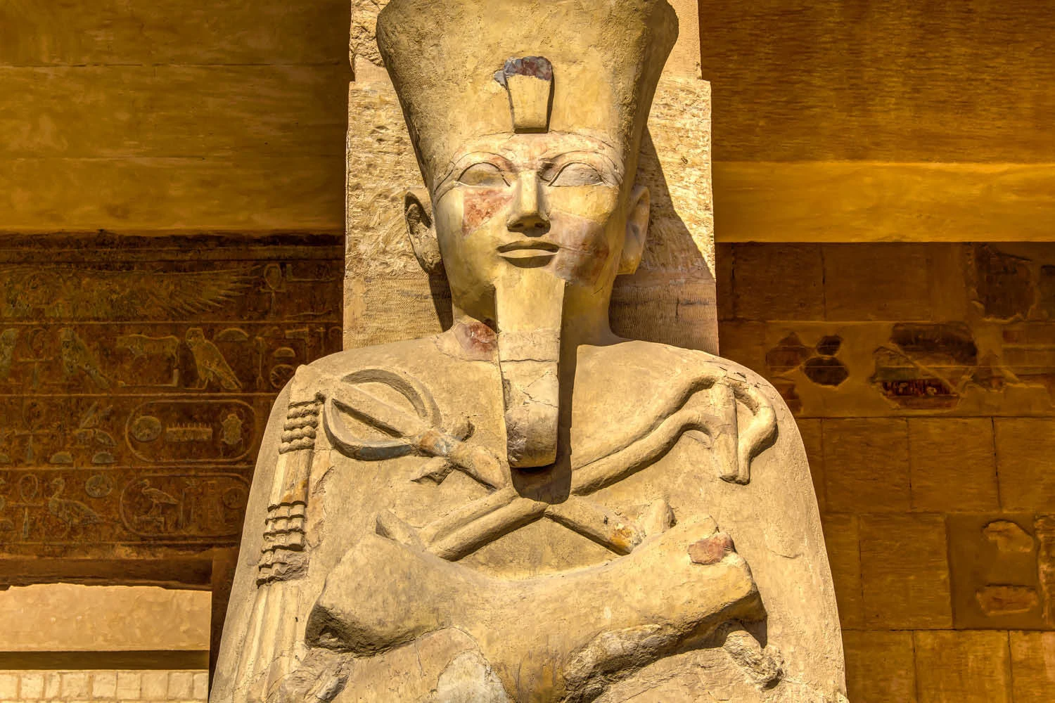
All so-called “Khom temples” are Khmer temples built between the 9th and 13th centuries. Evidence for their Khmer origin includes:

  • Sanskrit and Old Khmer inscriptions identifying Khmer kings, deities, and donors

  • Khmer architectural styles (Baphuon, Angkor Wat, Bayon, etc.)

  • Hydraulic, symbolic, and cosmological planning consistent with Angkor

  • Integration into the Khmer imperial political, administrative, and religious system

Claims that modern Thai people are descendants of “Khom” while Khmer are not are historically false and unsupported by credible scholarship. Thai ethnogenesis occurred centuries later, shaped by Tai migrations and distinct state formation processes.

2. Thai Are Not Descendants of “Khom”
Historically, the Khmer civilization predates Thai kingdoms such as Sukhothai and Ayutthaya. Large parts of present-day Thailand were part of the Khmer empire during the Angkorian period. Thai states later adopted Khmer court practices, religious concepts, and administrative models, acknowledging their borrowing from Khmer civilization. The suggestion that Thai people are rightful heirs of “Khom heritage” is revisionist and serves political rather than historical purposes.

3. Misrepresentation Through Rhetoric
The Thai narrative equates modern reconstruction with historical legitimacy while portraying authentic ruins as evidence of neglect. This flawed reasoning suggests that Ta Mone Thom “belongs” to Thailand because it has been rebuilt, conflating restoration with ownership, modern construction with ancient heritage, and financial capacity with historical legitimacy.

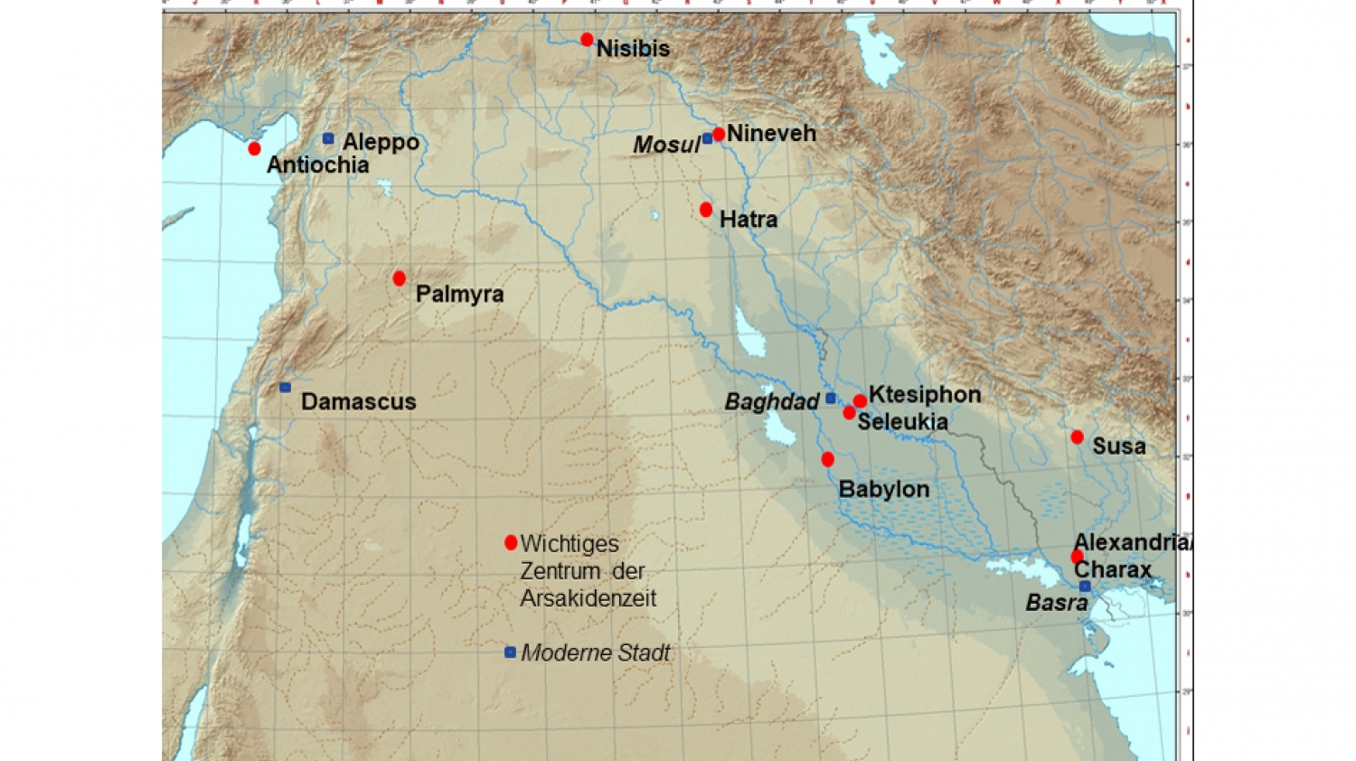
4. Cambodian Sovereignty Over Ta Mone Thom
Ta Mone Thom is situated within Cambodian territory, as defined by the Franco–Siamese Treaties of 1904 and 1907. These treaties are internationally recognized, legally binding, and cannot be overridden by reconstruction or narrative manipulation.

5. Restoration Is Not Proof of Authenticity
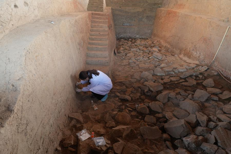
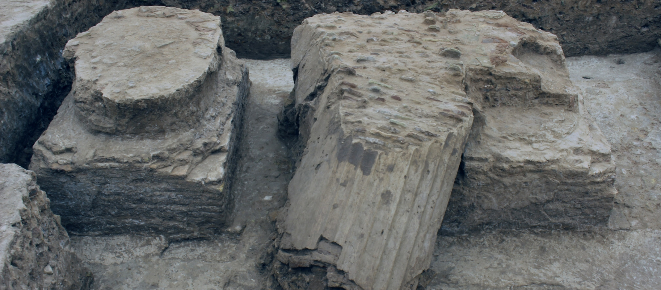
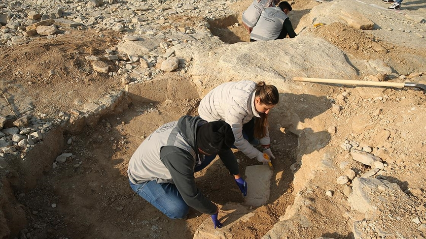
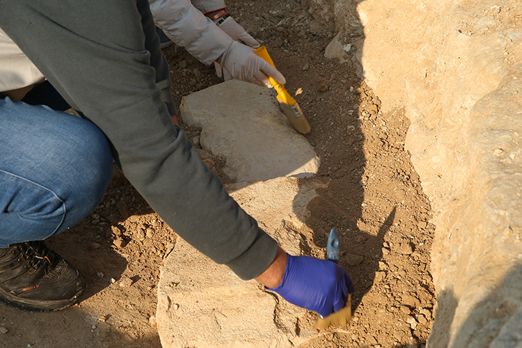
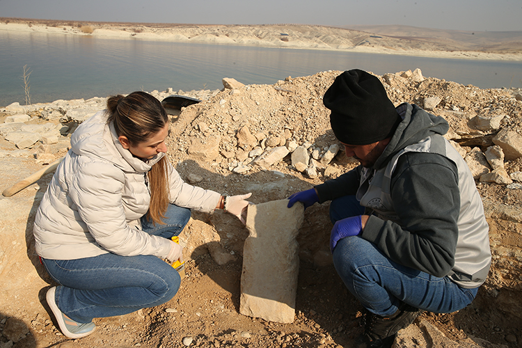
Complete reconstruction that replaces original fabric destroys authenticity, even if visually impressive. In contrast, Prasat Chan, though in a ruined state, remains archaeologically authentic, stratigraphically intact, and a truthful record of history. Preservation of ruins is an ethical decision, not neglect.

6. Preservation Reflects Responsibility, Not Poverty
Modern heritage conservation prioritizes:

  • Risk mapping and structural diagnosis

  • Minimum intervention

  • Reversibility

  • Respect for original materials

Choosing not to rebuild ensures historical integrity. Equating heritage value with financial capacity or cosmetic restoration misrepresents the principles of professional conservation.

7. Heritage Cannot Be Claimed Through Reconstruction
Cultural heritage legitimacy arises from history, archaeology, and sovereignty, not modern rebuilding. Prasat Chan and the Ta Mone complex are part of the same Khmer cultural landscape; legitimacy does not depend on visual completeness or tourism readiness.

8. Authentic Heritage Matters Most
Real heritage resides in original stones, placement, and uninterrupted historical truth. Prasat Chan preserves this authenticity. Rebuilt monuments may impress visitors, but ruins educate humanity. Khmer civilization is the builder of these monuments; history should be respected, protected, and presented honestly.

Heritage should serve humanity, not politics. Authenticity, not spectacle, must remain the guiding principle.

The Taş Tepeler Horizon Expands: Göbeklitepe-Style T-Pillars Discovered in Adıyaman

January 28, 2026

Göbeklitepe-Style T-Shaped Pillars Found in Adıyaman Expand Understanding of Taş Tepeler Culture

A significant new archaeological discovery in southeastern Türkiye is changing how researchers view the Neolithic period. In the Samsat district of Adıyaman, structures resembling the famous T-shaped pillars of Göbeklitepe have been exposed after water levels dropped in the Atatürk Dam reservoir. This suggests that the cultural sphere associated with Göbeklitepe—or the Taş Tepeler culture—was far more extensive than previously thought.

The site, near Kızılöz village, became visible as receding waters revealed stone features along the shore. After a local report, teams from the Adıyaman Museum Directorate investigated and identified T-shaped stone structures dating back roughly 11,000 years, placing them in the Pre-Pottery Neolithic period.

A New Node in the Göbeklitepe Network

Prof. Dr. Sabahattin Ezer of Adıyaman University explains that the newly uncovered structures share architectural and symbolic features with Göbeklitepe and other Taş Tepeler sites in Şanlıurfa. These include small enclosures, stone slabs arranged around pits, and centrally located T-shaped pillars—all key elements of early ritual architecture.

The Taş Tepeler project has already documented several Neolithic sites, including Karahantepe, Sayburç, Sefertepe, Kurttepesi, and Çakmaktepe. The Adıyaman find shows that this cultural horizon extended northwest into the Euphrates basin, reinforcing the idea of a widespread and interconnected prehistoric landscape.

Meaning of the T-Shaped Stones
The T-shaped pillars remain some of the most intriguing features of early human history. At Göbeklitepe, these monumental stones are often interpreted as stylized human figures, complete with carved arms, hands, belts, and depictions of symbolic animals. While the Adıyaman examples are smaller, their shape and arrangement suggest they served similar ritual or communal purposes.

Their presence in Adıyaman points to shared belief systems, architectural knowledge, and social organization across a wide region. This challenges earlier views of Göbeklitepe as a unique outlier and instead supports the idea of a broader regional tradition of monumental construction predating widespread agriculture.

Regional Expansion and the Upper Mesopotamian Context
The Samsat discovery is particularly significant given its location near the Euphrates River—a major route for movement, communication, and resource exchange in the Neolithic period. This context reinforces the idea that Taş Tepeler sites functioned as a network of ritual centers rather than isolated locations.

Researchers increasingly argue that communities across Upper Mesopotamia participated in shared ceremonial practices, gathering periodically at monumental sites. The Adıyaman structures may reflect a local adaptation of this wider tradition, maintaining key symbolic elements while responding to regional conditions.

Threats and Rescue Archaeology
Museum Deputy Director Mustafa Çelik noted that the site was originally buried 2–3 meters below the surface, but fluctuating water levels in the Atatürk Dam reservoir gradually eroded the sediment, exposing the structures. While this process allowed the discovery, it also poses a serious threat to the site’s preservation.

Rescue excavations are now underway to document and safeguard the remains before rising waters submerge them again. Discoveries like this highlight both the vulnerability of submerged heritage and the importance of systematic archaeological surveys in reservoir zones.

From Local Find to Global Significance
Artifacts from the site are now displayed at Perre Ancient City, giving the public a chance to engage with one of humanity’s earliest monumental traditions. More importantly, the discovery strengthens the argument that southeastern Türkiye was a central hub of innovation during the Neolithic transition.

Ongoing excavations may reveal additional structures, potentially uncovering a larger settlement or ritual complex. Each new find reinforces a transformative conclusion: the origins of complex symbolic behavior and monumental architecture were regional, collaborative, and deeply rooted in Upper Mesopotamia.

Long before Cleopatra, another female pharaoh redefined ancient Egyptian power

January 28, 2026

Cleopatra’s story is often framed through drama, romance, and spectacle, with her reign marking the final chapter of pharaonic Egypt. Yet her status as the iconic “female pharaoh” tends to overshadow an earlier and arguably more revealing example of women wielding supreme power in ancient Egypt.

More than 1,400 years before Cleopatra, another woman ruled Egypt as pharaoh within one of the most conservative political systems of the ancient world. Her name was Hatshepsut.

Speaking on the HistoryExtra podcast, Egyptologist Campbell Price explains why Hatshepsut’s reign is crucial to understanding how authority functioned in ancient Egypt, and how her rule helped shape the path for later leaders.

An ancient civilisation with a deep past

Hatshepsut ruled from approximately 1479 to 1458 BC, nearly fifteen centuries before Cleopatra’s death in 30 BC. Her power base was Thebes in southern Egypt, then the kingdom’s political and religious centre. From there, she governed an expansive and stable state that stretched from the Nile Delta in the north to deep into Nubia in the south.

“Hatshepsut belongs to the Eighteenth Dynasty,” Price explains, “the first of several dynasties that make up what Egyptologists call the New Kingdom.”

Yet by this time, Egypt was already an ancient civilisation. It had passed through multiple phases of development, including the Old Kingdom.

“The Old Kingdom is the age of the pyramids,” Price notes. “By Hatshepsut’s reign, the pyramids were already about a thousand years old.”

Hatshepsut therefore inherited a civilisation with a long and complex history—one that had endured periods of war, fragmentation, collapse, and foreign domination during the Second Intermediate Period. In such a world, kingship existed to uphold cosmic order and prevent chaos in a society that understood how fragile stability could be.

This was not a culture inclined toward experimentation in power.

This fresco from the tomb of Sennedjem at Deir el-Medina depicts agricultural labour in the Fields of Ialu – the Egyptian paradise of the afterlife. Painted during the New Kingdom’s 19th Dynasty, the scene reflects the belief that eternal life mirrored the best aspects of earthly existence, with abundant harvests promised to the righteous.

What it meant to be an ancient Egyptian pharaoh

Ancient Egyptian pharaohs were expected to uphold maat—the principle of balance, justice, and cosmic order. The ruler acted as a mediator between the gods and humanity, commanded armies, and symbolically embodied the state of Egypt itself. The visual and ideological language of kingship was highly fixed and explicitly masculine.

While royal women in ancient Egypt could wield significant political and religious influence, formal kingship was almost exclusively male. Before Hatshepsut, no woman had ruled for an extended period as a fully recognised pharaoh in her own right. Queens often served as regents, particularly when an heir was still a child, but assuming full royal authority meant crossing a deeply entrenched cultural boundary.

This context explains why Hatshepsut was depicted in what scholars describe as “male-coded” imagery, according to Price.

“It’s not that Hatshepsut is dressing up as a man,” he explains. “Rather, the only way to be represented as a legitimate pharaoh was through a male form. That is how kingship was visually expressed, and that is how she had to appear in statues and reliefs.”

← Newer Posts Older Posts →
Featured
image_2026-02-04_191651038.png
Feb 4, 2026
Mystery Under the Moss: 3,000-Year-Old Rock Carvings Discovered in Norway
Feb 4, 2026
Read More →
Feb 4, 2026
image_2026-02-04_190020554.png
Feb 4, 2026
Items found in dig reveal town's medieval past
Feb 4, 2026
Read More →
Feb 4, 2026
image_2026-02-04_184821530.png
Feb 4, 2026
Wreck of ancient Roman ship found off coast of Puglia
Feb 4, 2026
Read More →
Feb 4, 2026
image_2026-02-04_184452374.png
Feb 4, 2026
Bears in a Sacrificial Pose: A Bronze Plaque from Early Medieval Altai Reveals an Unknown Southern Tradition
Feb 4, 2026
Read More →
Feb 4, 2026
image_2026-02-04_183549378.png
Feb 4, 2026
This 430,000-Year-Old Stick Could Actually Be One of Humanity’s Earliest Tools
Feb 4, 2026
Read More →
Feb 4, 2026
image_2026-02-04_183314949.png
Feb 4, 2026
Exceptional Discovery in the Ionian Sea: Newly Revealed Roman Shipwreck Found off Gallipoli, Italy
Feb 4, 2026
Read More →
Feb 4, 2026
read more

Powered by The archaeologist