• MAIN PAGE
  • LATEST NEWS
    • Lost Cities
    • Archaeology's Greatest Finds
    • Underwater Discoveries
    • Greatest Inventions
    • Studies
    • Blog
  • PHILOSOPHY
  • HISTORY
  • RELIGIONS
    • Africa
    • Anatolia
    • Arabian Peninsula
    • Balkan Region
    • China - East Asia
    • Europe
    • Eurasian Steppe
    • Levant
    • Mesopotamia
    • Oceania - SE Asia
    • Pre-Columbian Civilizations of America
    • Iranian Plateau - Central Asia
    • Indus Valley - South Asia
    • Japan
    • The Archaeologist Editor Group
    • Scientific Studies
    • Aegean Prehistory
    • Historical Period
    • Byzantine Middle Ages
    • Predynastic Period
    • Dynastic Period
    • Greco-Roman Egypt
  • Rome
  • PALEONTOLOGY
  • About us
Menu

The Archaeologist

  • MAIN PAGE
  • LATEST NEWS
  • DISCOVERIES
    • Lost Cities
    • Archaeology's Greatest Finds
    • Underwater Discoveries
    • Greatest Inventions
    • Studies
    • Blog
  • PHILOSOPHY
  • HISTORY
  • RELIGIONS
  • World Civilizations
    • Africa
    • Anatolia
    • Arabian Peninsula
    • Balkan Region
    • China - East Asia
    • Europe
    • Eurasian Steppe
    • Levant
    • Mesopotamia
    • Oceania - SE Asia
    • Pre-Columbian Civilizations of America
    • Iranian Plateau - Central Asia
    • Indus Valley - South Asia
    • Japan
    • The Archaeologist Editor Group
    • Scientific Studies
  • GREECE
    • Aegean Prehistory
    • Historical Period
    • Byzantine Middle Ages
  • Egypt
    • Predynastic Period
    • Dynastic Period
    • Greco-Roman Egypt
  • Rome
  • PALEONTOLOGY
  • About us
No results found

Submerged Orchards: Underwater Evidence of Ancient Mesopotamian Farming

October 12, 2026

Introduction

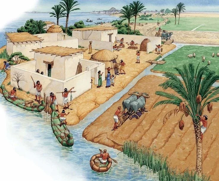
Ancient Mesopotamia is traditionally associated with irrigation canals, wheat and barley cultivation, date palms, and the great cities of the Tigris and Euphrates.

But the archaeological study of ancient agriculture increasingly extends beyond visible fields and abandoned canals.

Submerged landscapes may preserve evidence of agricultural environments that later disappeared beneath rivers, wetlands, reservoirs, or shifting sediments.

The concept of "submerged orchards" is particularly intriguing because perennial crops such as date palms leave different archaeological signatures from annual cereals.

Mesopotamian Agriculture

Agriculture was fundamental to Mesopotamian civilization.

Irrigation allowed communities to cultivate large areas in environments where rainfall alone was insufficient.

Canals transported water from rivers into agricultural zones.

Farmers cultivated cereals, legumes, vegetables, fruits, and dates.

Date palms were particularly important because they provided food, shade, fiber, wood, and other useful products.

Why Orchards Can Disappear

Ancient agricultural landscapes were vulnerable to environmental change.

Rivers shifted their channels.

Floods deposited sediment.

Canals filled with silt.

Marshes expanded and contracted.

Human communities also abandoned fields because of political disruption, salinization, changing water management, or economic transformation.

Over centuries, former agricultural landscapes can become buried or submerged.

Underwater Archaeology

Underwater archaeology can investigate landscapes that are inaccessible from the surface.

Researchers may use:

  • sonar mapping

  • sediment cores

  • underwater excavation

  • remote sensing

  • pollen analysis

  • phytolith analysis

  • botanical remains

  • wood identification

These methods can reconstruct former environments even when buildings have disappeared.

Evidence for Ancient Orchards

Tree cultivation may leave traces in several forms.

Charred seeds, date pits, pollen, phytoliths, root channels, irrigation structures, and wooden agricultural equipment can all contribute to interpretation.

Ancient texts also provide valuable information.

Mesopotamian administrative documents record agricultural production, land ownership, labor, and crop management.

Combining written and environmental evidence provides a much stronger reconstruction than relying on either source alone.

Date Palms

The date palm was particularly significant.

It could support intensive agricultural systems because the canopy provided shade beneath which other crops could grow.

This created a layered agricultural environment.

Such systems could maximize productivity in limited irrigated areas.

The archaeological study of date cultivation therefore contributes to understanding not only food production but also landscape engineering.

Climate and Water Management

Mesopotamian farming depended on controlling water.

Too little water caused crop failure.

Too much could create flooding.

Poor drainage could also lead to increasing soil salinity.

Ancient farmers developed sophisticated strategies to manage these problems.

Submerged or buried agricultural landscapes can reveal how these systems changed over time.

Caution About "Submerged Orchards"

The phrase should not be interpreted as evidence that archaeologists have discovered vast intact orchards beneath Mesopotamian waters.

Organic remains rarely survive in perfect form.

Instead, the concept represents a research opportunity: using underwater and environmental archaeology to identify traces of ancient cultivation in landscapes that are no longer visible.

Conclusion

The study of submerged Mesopotamian agricultural landscapes expands our understanding of one of humanity's earliest farming civilizations.

Ancient orchards were complex systems involving irrigation, labor, crop management, trade, and environmental adaptation.

Recovering their traces can reveal how Mesopotamian communities engineered landscapes and responded to changing rivers and climates.
The Bronze Age Blacksmiths of the Caucasus: New Metallurgical Insights

October 12, 2026

Introduction

The Caucasus was one of the most important metallurgical regions of the ancient world.

Its mountains contained rich deposits of copper, arsenic, tin-related minerals, gold, silver, and iron-bearing ores, while its location between Anatolia, the Eurasian steppe, Iran, and the Near East encouraged technological exchange.

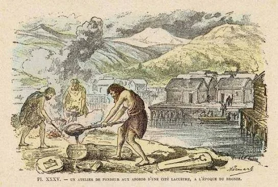
Bronze Age metalworkers transformed these resources into tools, weapons, ornaments, vessels, and symbols of social status.

Modern archaeological science is now allowing researchers to reconstruct their techniques with increasing precision.

The Caucasus as a Metallurgical Landscape

The Caucasus contains a remarkable diversity of geological environments.

Mountainous terrain exposed mineral deposits that could be exploited using relatively simple mining technologies.

Ancient communities could collect ore from surface exposures before developing deeper extraction techniques.

Mining and metallurgy therefore developed alongside broader changes in settlement and social organization.

Copper and Bronze

Bronze is primarily an alloy of copper and tin, although ancient metallurgists also used arsenic and other elements.

Arsenical copper alloys were particularly important in some prehistoric contexts.

The addition of particular materials changed the hardness, color, casting properties, and durability of metal.

This means that metallurgical traditions cannot always be understood simply through the modern definition of "bronze."

Blacksmiths and Metalworkers

The term "blacksmith" is convenient but can be misleading for Bronze Age contexts.

Many Bronze Age metals were cast rather than forged in the manner associated with later ironworking.

Ancient metalworkers could use molds to produce standardized forms.

They also reheated, hammered, polished, sharpened, and repaired objects.

Their expertise required extensive practical knowledge of heat, ore, fuel, molds, and alloy composition.

Archaeological Metallurgy

Modern research can analyze ancient metal objects at microscopic and chemical levels.

Researchers can examine:

  • alloy composition

  • trace elements

  • metallurgical inclusions

  • casting structures

  • hammer marks

  • heat treatment

  • corrosion patterns

These analyses can reveal how an object was manufactured.

Provenance and Trade

One of the most important questions concerns where metals originated.

Lead-isotope analysis can sometimes help compare metal objects with geological ore sources.

However, provenance is rarely straightforward.

Ore may have been transported far from its original source.

Metal could also be recycled repeatedly.

Therefore, chemical signatures must be interpreted together with archaeological context.

Social Importance of Metal

Metal objects were not merely practical tools.

Weapons could symbolize authority.

Ornaments could communicate identity and status.

Ceremonial objects could participate in religious rituals.

Access to metal production may therefore have contributed to social inequality.

Specialized metallurgical knowledge could also have given certain communities economic advantages.

The Caucasus and Wider Eurasia

Caucasian metallurgical traditions did not develop in isolation.

The region was connected to Anatolia, Mesopotamia, Iran, and the Eurasian steppe.

Metal objects and technological concepts moved between communities.

The Caucasus therefore provides a valuable case study for examining how technology spreads without requiring entire populations to migrate.

New Research Directions

Archaeologists increasingly combine excavation with experimental archaeology.

Researchers can reproduce ancient furnaces, molds, and alloying processes to understand what ancient metalworkers could realistically achieve.

Microscopic analysis can then compare experimental products with archaeological artifacts.

This approach transforms metallurgy from a study of objects into a study of human skill.

Conclusion

The Bronze Age metalworkers of the Caucasus were highly skilled technological specialists operating within complex economic networks.

Modern scientific analysis is revealing the sophistication of their production methods and the extensive exchange networks that connected the region.

Their story demonstrates that technological innovation in ancient Eurasia was often collaborative, mobile, and deeply connected to geography.

LiDAR and the Lost Wetlands: Revealing Southeast Asian Raised Fields

October 12, 2026

Introduction

Southeast Asia contains some of the world's most complex ancient agricultural landscapes.

Many of these landscapes are difficult to see from the ground because vegetation, flooding, sediment deposition, and centuries of cultivation have obscured their original forms.

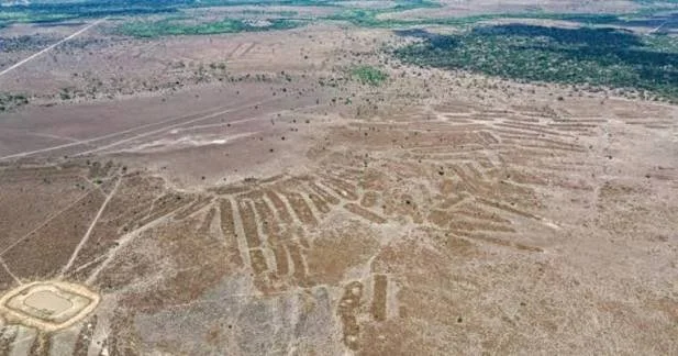
LiDAR—Light Detection and Ranging—is transforming archaeological research by allowing scientists to detect subtle variations in elevation beneath vegetation.

One particularly promising area of research involves raised fields and wetland agriculture.

What Is LiDAR?

LiDAR uses laser pulses to measure distances between an aircraft or other platform and the Earth's surface.

When many measurements are collected, researchers can build detailed three-dimensional models.

In heavily forested landscapes, some laser pulses can pass through gaps in vegetation and reach the ground.

Researchers can then digitally remove vegetation from the model.

This produces a remarkably detailed representation of the underlying terrain.

Raised-Field Agriculture

Raised fields are agricultural plots deliberately elevated above surrounding terrain.

They can improve drainage in wet environments.

Alternatively, associated canals and depressions can retain water.

Such systems allow farmers to manipulate moisture conditions rather than simply accepting natural flooding patterns.

Raised-field agriculture has been documented in various parts of the world, but Southeast Asian examples must be interpreted according to their specific environmental and cultural contexts.

Wetland Agriculture in Southeast Asia

Rice cultivation is strongly associated with Southeast Asian agricultural history.

Wetlands can be extremely productive, but they also present challenges.

Flooding, waterlogging, drought, and soil conditions require careful management.

Ancient farmers developed different strategies depending on local geography.

Some landscapes incorporated canals, embankments, ponds, terraces, and raised plots.

What LiDAR Can Reveal

LiDAR can identify features that are almost invisible at ground level.

These may include:

  • linear embankments

  • field boundaries

  • canals

  • terraces

  • ancient pathways

  • settlement mounds

  • water-management structures

  • drainage channels

The patterns can reveal the organization of entire agricultural landscapes.

This is especially important where modern farming has reused ancient fields.

The Landscape Rather Than the Artifact

Traditional archaeology often focuses on objects such as pottery, tools, buildings, and burials.

LiDAR encourages archaeologists to think at a landscape scale.

A field boundary may not contain artifacts.

A canal may contain very little material culture.

Yet thousands of such features together can reveal the organization of an ancient agricultural society.

Dating the Fields

LiDAR can identify a structure, but it cannot automatically tell archaeologists when it was built.

Dating requires additional evidence.

Researchers may use:

  • excavation

  • ceramics

  • radiocarbon dating

  • sediment analysis

  • buried soils

  • associated settlements

  • environmental reconstruction

This distinction is critical.

A visually impressive LiDAR pattern is only the beginning of an archaeological investigation.

Climate Change and Ancient Water Management

Ancient wetland agriculture also provides information about environmental adaptation.

Communities faced changing rainfall, floods, droughts, and river patterns.

Their infrastructure represents accumulated knowledge about local ecosystems.

Studying these systems can therefore contribute to discussions about sustainable water management today.

Risks of Overinterpretation

LiDAR images can reveal geometric patterns that are not necessarily archaeological.

Natural drainage systems, modern agricultural boundaries, roads, and vegetation patterns can create similar shapes.

Ground verification is therefore essential.

Archaeologists must combine remote sensing with excavation and environmental analysis.

Conclusion

LiDAR is revolutionizing archaeological landscape research in Southeast Asia.

By revealing subtle topographic patterns beneath vegetation, it allows researchers to investigate ancient wetland agriculture at scales that were previously difficult to achieve.

The technology does not replace archaeology; instead, it provides a powerful new way to identify landscapes that can then be tested through excavation and scientific dating.

The Coral-Carved Temples of the Swahili Coast: New Excavations

October 12, 2026

Introduction

The Swahili Coast stretches along the eastern African shoreline from southern Somalia through Kenya and Tanzania and into northern Mozambique and the offshore islands.

For centuries, coastal communities participated in maritime networks connecting Africa with Arabia, Persia, India, and beyond.

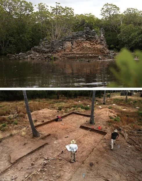
One of the most distinctive features of Swahili architecture is the extensive use of coral stone.

Coral-built mosques, houses, tombs, palaces, and other structures survive at numerous coastal settlements, creating an architectural record that reveals the sophistication of medieval and early modern Swahili society.

Coral Stone Architecture

The coral stone used in Swahili architecture generally came from reef formations and fossil coral.

After extraction, blocks could be shaped and incorporated into walls.

Coral limestone was particularly suitable for coastal construction because it was locally available and relatively workable.

Its widespread use reflects an adaptation to the island and coastal environment.

Swahili Cities

Major Swahili settlements developed as maritime trading centers.

Important archaeological sites include Kilwa Kisiwani, Songo Mnara, Gede, Manda, Pate, and numerous smaller settlements.

These cities were connected to maritime trade routes crossing the Indian Ocean.

Their inhabitants participated in commerce involving ceramics, beads, textiles, metals, ivory, gold, and other commodities.

Mosques and Religious Architecture

Mosques were among the most important coral-built structures.

Their architecture varied between settlements and periods.

Some mosques were relatively simple.

Others developed monumental forms with courtyards, prayer halls, columns, mihrabs, and elaborate masonry.

The architecture demonstrates the development of Islam within African coastal communities.

Beyond the Mosque

Coral architecture was not restricted to religious buildings.

Elite houses could contain decorated rooms, courtyards, storage areas, and specialized spaces.

Tombs were sometimes constructed from coral blocks.

Palatial complexes demonstrate the existence of powerful urban elites.

This diversity makes architecture an important source for reconstructing social hierarchy.

Archaeological Excavations

New excavations can reveal information that monumental ruins alone cannot provide.

Domestic deposits may contain pottery, animal bones, beads, metal objects, and food remains.

These materials help researchers reconstruct everyday life.

They can also reveal differences between elite and non-elite households.

Indian Ocean Connections

Imported ceramics are particularly useful for studying Swahili trade.

Chinese porcelain, Persian ceramics, Indian wares, and other imports have been found at coastal sites.

Their presence demonstrates that African communities were active participants in Indian Ocean commerce.

The Swahili Coast was therefore not an isolated African frontier.

It was part of an international maritime system.

African Foundations of Swahili Civilization

Older scholarship sometimes described Swahili civilization as primarily the product of foreign influence.

Archaeology has increasingly demonstrated the importance of local African development.

Swahili communities developed from African coastal societies while participating in international Islamic and Indian Ocean networks.

The resulting culture was neither simply imported nor isolated.

It was a dynamic synthesis rooted in East Africa.

New Excavation Questions

Contemporary archaeological research increasingly asks questions about ordinary residents, labor, food production, environmental change, and social inequality.

Researchers also investigate how coastal settlements responded to changing sea levels, storms, coral ecology, and shifting trade routes.

These questions move beyond the traditional focus on wealthy merchants and monumental buildings.

Conservation Challenges

Coral-built architecture is vulnerable to erosion, salt crystallization, vegetation, rising groundwater, coastal storms, and human development.

Climate change adds further pressure to archaeological sites near the ocean.

Conservation therefore requires both archaeological research and environmental management.

Conclusion

The coral-built temples and settlements of the Swahili Coast demonstrate the sophistication of African maritime civilization.

New excavations are helping archaeologists understand not only spectacular mosques and palaces but also the ordinary communities that built and maintained them.

The archaeological record ultimately reveals a society deeply rooted in East Africa while simultaneously connected to one of the largest commercial networks of the medieval world.

Petroglyph Chronologies: Dating African Rock Art with Micro-erosion

October 12, 2026

Introduction

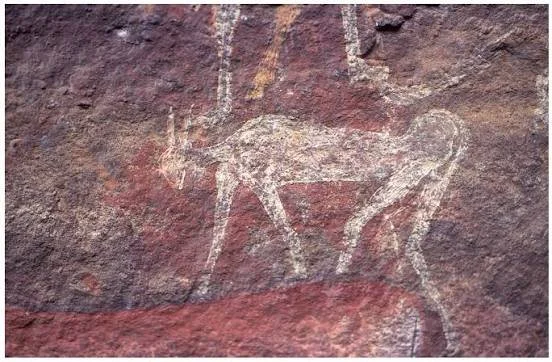
African rock art represents one of the world's most extensive records of prehistoric human expression.

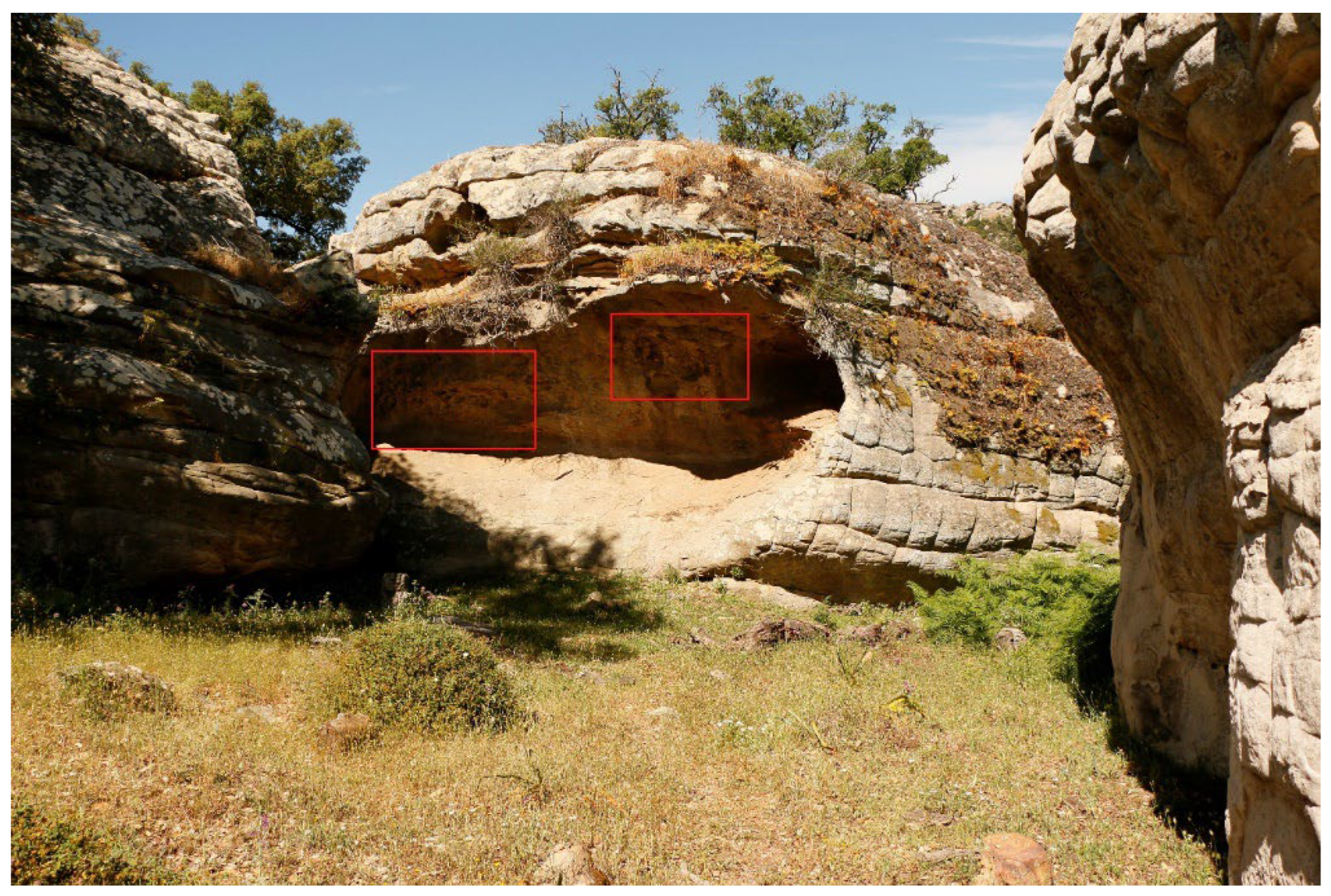
Paintings and engravings occur across deserts, mountains, rock shelters, cliffs, and open landscapes. Some depict animals and people; others consist of geometric designs, footprints, symbols, and abstract forms.

One of the major challenges in studying rock art is chronology.

Researchers frequently want to know when an image was created, but unlike a ceramic vessel or a buried bone, a petroglyph is often directly exposed to the environment.

Micro-erosion analysis offers one potential method for addressing this problem.

What Is Micro-Erosion?

Rock surfaces change gradually after they are exposed.

Mineral grains weather.

Edges become rounded.

Microscopic fractures expand.

Chemical alteration modifies exposed surfaces.

When a groove or engraving is cut into rock, the newly exposed surface begins to weather.

Researchers can therefore investigate the microscopic condition of an engraved surface.

In certain geological contexts, differences in microscopic erosion may provide clues about relative age.

Why Dating Rock Art Is Difficult

A petroglyph does not usually contain organic material that can be directly radiocarbon dated.

Researchers therefore rely on indirect techniques.

These may include:

  • mineral accretion

  • weathering analysis

  • superimposition

  • associated archaeological deposits

  • lichenometry in appropriate environments

  • cosmogenic exposure dating

  • radiocarbon dating of associated pigments or organic materials

Each method has limitations.

Relative Versus Absolute Dating

Micro-erosion is particularly valuable when used as a relative or calibrated dating method.

If two engravings were made on similar rock surfaces and one displays substantially greater microscopic weathering, researchers may be able to establish a sequence.

But weathering rates can vary.

Temperature, humidity, sunlight, rainfall, mineral composition, and surface orientation can all influence erosion.

Therefore, a universal "erosion clock" cannot simply be applied to every African rock-art site.

African Rock-Art Traditions

Africa contains extraordinarily diverse rock-art traditions.

Southern Africa is famous for painted imagery associated with hunter-gatherer communities, including scenes involving animals, humans, and ritual activities.

The Sahara preserves engravings and paintings documenting major environmental and cultural changes.

East and North Africa contain additional traditions with their own chronological histories.

These traditions should not be treated as one homogeneous artistic system.

Micro-Erosion and Petroglyphs

Researchers examine microscopic features along engraved grooves.

The shape of mineral crystals, development of weathering features, and condition of groove edges can provide chronological information.

The method works best when environmental conditions are sufficiently stable and when researchers possess suitable calibration data.

Calibration Is Essential

Suppose a modern researcher creates experimental engravings on the same type of rock.

The researchers can then monitor how those experimental surfaces change.

Modern and historically dated surfaces can provide calibration points.

This does not eliminate uncertainty, but it improves the reliability of the method.

Superimposition

Another powerful technique involves examining overlapping images.

If one engraving clearly cuts across another, the cutting image must be later.

This creates a relative sequence.

Micro-erosion can potentially strengthen such sequences by determining whether surfaces have experienced different durations of exposure.

Conservation Challenges

Rock art is vulnerable to modern damage.

Tourism, graffiti, road construction, mining, climate change, water erosion, and biological growth can alter surfaces.

Some modern damage may even mimic ancient weathering.

Digital recording is therefore increasingly important.

High-resolution photography, 3D scanning, and microscopic documentation allow researchers to create detailed records without repeatedly touching the art.

Conclusion

Micro-erosion represents an important tool for investigating African petroglyph chronologies, but it should not be treated as an automatic dating technique.

Its greatest value comes from combining microscopic analysis with geological study, archaeological context, experimental calibration, superimposition, and other dating methods.

The broader goal is to transform rock art from an undated collection of images into a chronological record of human activity across changing African landscapes.

Microplastics in Ancient Pots? Contamination vs. Preservation Debate

October 12, 2026

Introduction

The discovery and study of microscopic plastic particles in archaeological materials has opened an unusual and increasingly important question: can modern plastics become incorporated into ancient archaeological deposits, and if so, how should archaeologists distinguish genuine ancient environmental evidence from modern contamination?

Microplastics are generally defined as plastic particles smaller than five millimeters, although research often focuses on much smaller particles, including microscopic fragments and fibers. Their presence in modern environments is now widespread. They have been identified in oceans, rivers, soils, sediments, atmospheric dust, food systems, and biological tissues.

This creates a major challenge for archaeology.

Ancient pottery is frequently excavated from sediments that have been exposed to modern environments for decades or centuries. Plastic fibers from clothing, laboratory equipment, packaging, conservation materials, excavation supplies, and airborne dust can potentially enter archaeological contexts.

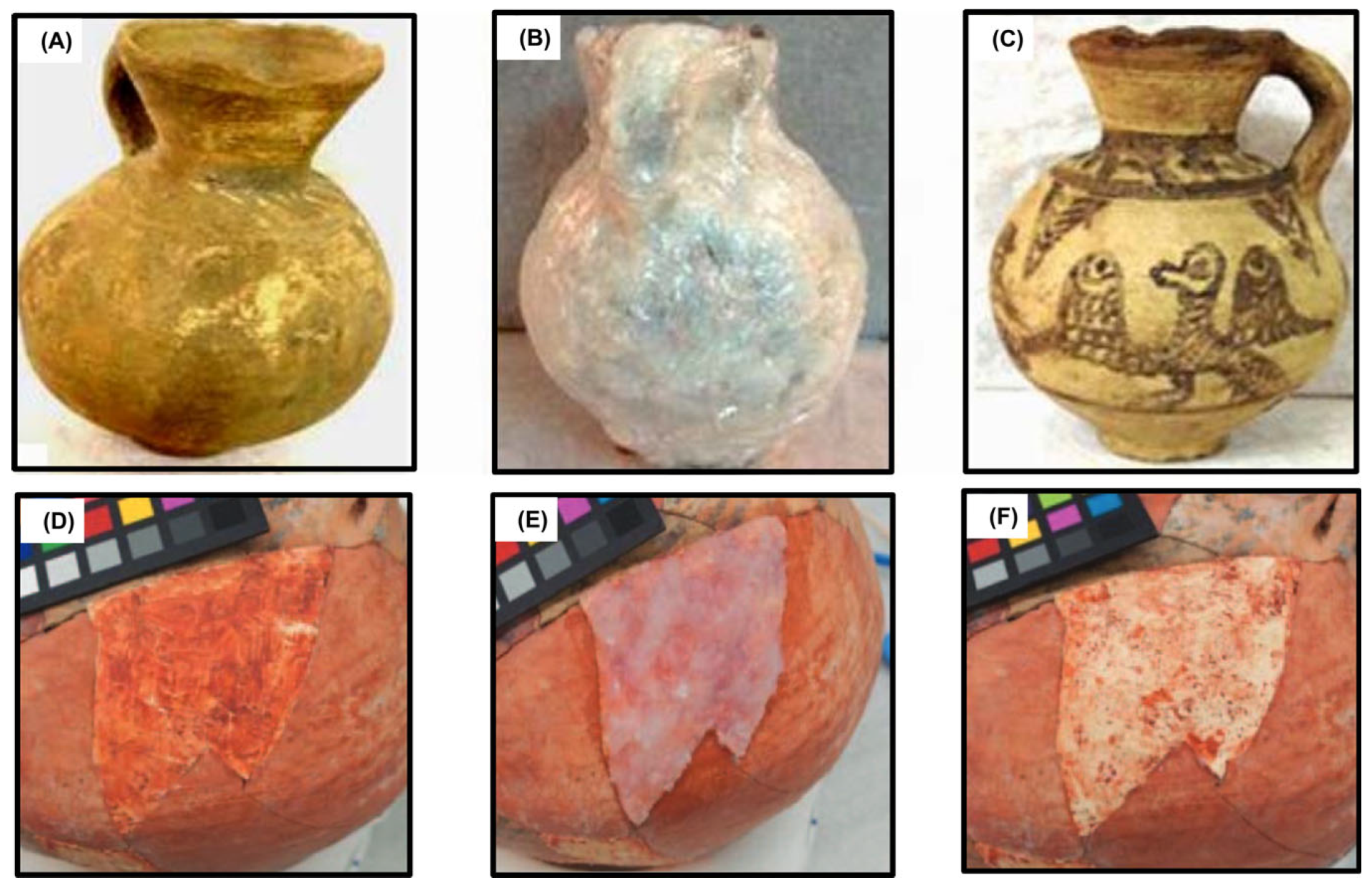
At the same time, pottery itself can preserve microscopic residues from ancient food, plants, minerals, and manufacturing processes.

The central question is therefore not simply whether microplastics occur near ancient pottery, but whether their presence can be demonstrated to belong to the archaeological context rather than representing modern contamination.

Why Ancient Pottery Is Scientifically Important

Ceramic vessels are among the most durable artifacts in archaeology.

Organic materials such as wood, textiles, leather, and food usually decay unless preserved under unusual conditions.

Pottery, by contrast, can survive thousands of years.

Its porous structure can also absorb substances during manufacture and use.

Archaeologists have long used ceramic residues to investigate ancient diets, trade, production, and technology.

Researchers may analyze absorbed lipids, starches, proteins, pigments, or other chemical signatures.

This makes pottery an attractive material for investigating environmental contaminants as well.

How Could Microplastics Enter an Archaeological Context?

There are many possible pathways.

Modern plastic fibers can enter soil through agricultural activity, wastewater, atmospheric deposition, construction, tourism, conservation work, or ordinary human activity.

During excavation, plastic gloves, bags, containers, measuring equipment, clothing, and laboratory materials can introduce additional particles.

Museum storage can also create contamination risks.

This is particularly important because microplastics can be extremely small and difficult to see without specialized equipment.

The Preservation Problem

A different question concerns whether plastic material could theoretically survive in archaeological contexts for long periods.

Many synthetic polymers are highly resistant to biological decomposition compared with natural organic materials.

However, this does not automatically mean that a plastic particle found in an ancient layer is ancient.

A particle may be physically old because it entered an archaeological deposit decades ago, while the deposit itself is thousands of years old.

This distinction between the age of the material and the age of the archaeological context is crucial.

Contamination Controls

Microplastic archaeology requires unusually strict laboratory procedures.

Researchers may need to:

  • minimize plastic equipment

  • use clean-room procedures

  • filter laboratory air

  • analyze blank samples

  • examine sediments surrounding artifacts

  • document conservation treatments

  • compare excavation and laboratory samples

  • identify particle composition chemically

Control samples are particularly important.

If the same polymer occurs in excavation samples, laboratory blanks, and clothing fibers, contamination becomes a serious possibility.

Identifying the Material

Visual identification alone is insufficient.

Advanced analytical methods can determine polymer type.

Techniques such as Fourier-transform infrared spectroscopy and Raman spectroscopy can identify chemical characteristics associated with different plastics.

Microscopy can also reveal particle shape, size, and surface characteristics.

Combining these methods improves confidence in identification.

Ancient Pottery and Modern Plastic

One of the most important distinctions is between microplastics associated with pottery and microplastics actually preserved within the ceramic matrix.

A particle lying on the surface may have been deposited recently.

A particle detected inside a protected microscopic structure could potentially have a different history.

Even then, researchers must consider whether conservation treatments or later environmental processes introduced it.

Why the Debate Matters

The issue extends beyond archaeology.

If reliable evidence demonstrates that modern plastic particles can penetrate archaeological deposits, it could help scientists understand the movement of pollution through soils and sediments.

Archaeological sites could become historical records of the early spread of plastic pollution.

However, weakly controlled studies could produce misleading conclusions about the antiquity of plastics.

Conclusion

The possibility of finding microplastics associated with ancient pottery is scientifically intriguing, but extraordinary claims require extraordinary contamination controls.

The archaeological significance of a plastic particle depends not simply on its presence but on its provenance, chemical identity, stratigraphic position, and relationship to the artifact.

The debate illustrates a broader principle of archaeological science: preservation alone does not establish age. Context, contamination control, and independent analytical evidence are essential.

Lost Logboats of the Arctic: Permafrost-Preserved Watercraft Finds

October 12, 2026

Introduction

The Arctic is one of the world's most challenging environments for archaeological research.

Extreme cold, seasonal darkness, difficult access, and rapidly changing environmental conditions complicate excavation.

Yet these same conditions can preserve organic materials that would normally disappear elsewhere.

Wooden boats are among the most remarkable examples.

In permanently or seasonally frozen environments, watercraft can survive for centuries or even millennia under exceptional conditions.

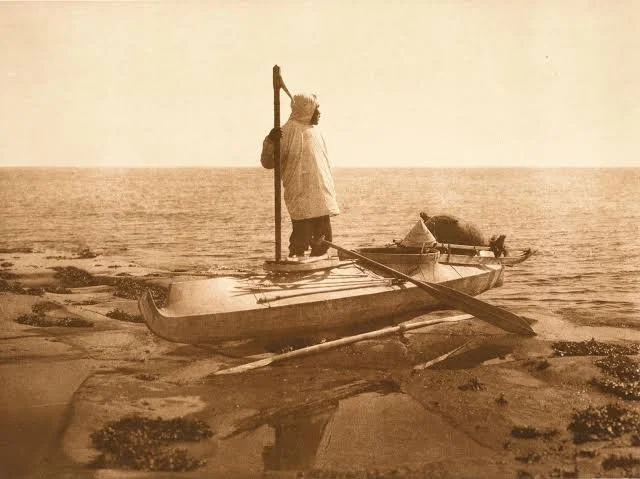
The discovery of preserved logboats provides a rare opportunity to study transportation, fishing, hunting, settlement, and technological adaptation in northern environments.

What Is a Logboat?

A logboat, often called a dugout canoe, is made by hollowing out a large tree trunk.

The basic technology is ancient and occurs in many parts of the world.

Despite its apparently simple construction, producing a stable watercraft requires considerable knowledge of wood properties, buoyancy, balance, and shaping techniques.

Why Wood Survives in Permafrost

Wood usually decomposes through microbial activity.

Low temperatures slow biological processes.

If an object becomes buried in permanently frozen sediment, microbial decomposition can be dramatically reduced.

Waterlogged environments can provide additional protection because oxygen availability is limited.

Together, cold and water saturation can create exceptional preservation conditions.

Arctic Water Transport

Waterways were essential transportation corridors in many northern societies.

Rivers, lakes, coastal channels, and seasonal waterways connected settlements that were difficult to reach over land.

Boats could transport people, food, hunting equipment, fuel, and raw materials.

For communities dependent on fishing and aquatic hunting, watercraft were fundamental technologies.

What Archaeologists Can Learn From Boats

A preserved boat can reveal much more than its shape.

Researchers can study:

  • wood species

  • tree age

  • construction technique

  • tool marks

  • repair history

  • use-wear

  • pitch or waterproofing

  • cargo traces

  • biological residues

Dendrochronology may sometimes provide information about when the tree was cut.

Radiocarbon dating can provide additional chronological evidence.

Tool Technology

Tool marks on a logboat can reveal how it was manufactured.

Cutting and scraping patterns may indicate the use of axes, adzes, chisels, or other woodworking tools.

The sequence of manufacturing marks can sometimes reconstruct the production process.

This is particularly valuable because wooden tools themselves may not survive.

Climate Change and Permafrost Archaeology

Modern warming presents a serious paradox.

Climate change can reveal previously inaccessible archaeological materials as frozen ground thaws.

At the same time, thawing can destroy them.

Once organic materials become exposed to warmer, oxygen-rich environments, decomposition can accelerate dramatically.

Archaeological sites may therefore experience a short window between discovery and irreversible deterioration.

Indigenous Knowledge

Archaeological interpretation should be connected with Indigenous knowledge wherever possible.

Arctic Indigenous communities possess extensive knowledge of waterways, seasonal movement, boat construction, animal behavior, and environmental change.

This knowledge can help researchers interpret archaeological landscapes while also ensuring that research respects living cultural traditions.

Conservation After Discovery

Recovering a frozen wooden boat is only the beginning.

If the wood dries without controlled treatment, it can shrink, crack, and collapse.

Conservators may need to stabilize the material gradually and control humidity.

Large waterlogged wooden artifacts can require years of conservation.

Conclusion

Permafrost-preserved logboats offer extraordinary windows into Arctic technological history.

They reveal how northern communities adapted to waterways and transformed available timber into sophisticated transportation technology.

At the same time, their vulnerability to climate change demonstrates the urgency of documenting Arctic archaeological landscapes before preservation conditions disappear.

The Salt Necropolises of the Sahara: Trade, Ritual and Preservation

October 12, 2026

Introduction

The Sahara is often imagined as a barren desert, but archaeology reveals a much more complicated history.

Across different periods, Saharan landscapes supported pastoral communities, caravan networks, settlements, religious traditions, and long-distance exchange.

Salt played a particularly important role.

Large salt deposits in places such as desert basins and salt-producing centers became valuable resources connecting communities across enormous distances.

The idea of "salt necropolises" refers to burial landscapes associated with extremely dry environments where salt and aridity can contribute to unusual preservation.

Salt as an Archaeological Preservative

Salt can inhibit the activity of some microorganisms.

Extremely dry environments can also slow decomposition.

When these conditions occur together, organic materials may survive far longer than expected.

Textiles, leather, plant remains, hair, and other materials can sometimes survive in desert archaeological contexts.

However, preservation is highly dependent on local conditions.

Burial Landscapes

Necropolises are large cemetery areas containing multiple graves.

Saharan burial landscapes vary enormously.

Some include simple pits.

Others contain tumuli, stone-built monuments, chambers, or monumental funerary structures.

The architecture can reveal social organization and changing religious practices.

Salt and Trade

Salt was one of the major commodities transported across parts of the Sahara.

Caravan routes connected salt-producing regions with agricultural and pastoral communities.

Camel transport later made long-distance desert movement more efficient, particularly during the historic period.

But Saharan exchange systems existed before the widespread dominance of camel caravans.

The chronology of each trade route therefore matters.

Salt Mining

Salt could be extracted in different ways.

Workers could collect naturally exposed deposits, cut blocks from salt formations, or evaporate saline water.

The technology depended on local geology.

Archaeological evidence of extraction can include cutting marks, tools, pathways, storage areas, and discarded production debris.

Ritual and Death

Burial practices reflect cultural beliefs about death and identity.

Grave orientation, body position, grave goods, monuments, and cemetery organization can provide information about social and religious systems.

Salt itself should not automatically be interpreted as a ritual substance.

If salt occurs in a burial, researchers must establish whether it resulted from intentional deposition, environmental conditions, or natural preservation.

Human Mobility

Stable isotope analysis can sometimes help investigate where people lived during different periods of their lives.

Dental isotopes and other biological indicators may reveal mobility.

When combined with burial archaeology, these techniques can illuminate whether cemetery populations were local, mobile, or connected to long-distance exchange.

Preservation and Scientific Opportunity

Exceptional preservation can make desert cemeteries extraordinarily valuable.

Organic remains may preserve evidence of clothing, diet, technology, and environmental conditions.

Yet preservation can also create misleading impressions.

An object that survives in one grave may have disappeared completely from another burial because of different soil chemistry.

Archaeologists must therefore distinguish preservation bias from actual cultural differences.

Conclusion

The salt-rich and hyper-arid environments of the Sahara provide exceptional opportunities for studying ancient trade and burial practices.

The concept of salt necropolises brings together three important archaeological themes: resource economies, ritual behavior, and unusual preservation.

Careful excavation and scientific analysis can reveal how Saharan communities navigated one of the world's most demanding environments.

Textile Impressions on Clay: Reconstructing Prehistoric Fabrics Worldwide

October 12, 2026

Introduction

Textiles are among the most fragile materials in archaeology.

Cloth usually decomposes rapidly unless preserved in exceptionally dry, frozen, waterlogged, or otherwise unusual environments.

Yet prehistoric people produced textiles across much of the world.

How, then, can archaeologists study fabrics that no longer survive?

One answer comes from impressions.

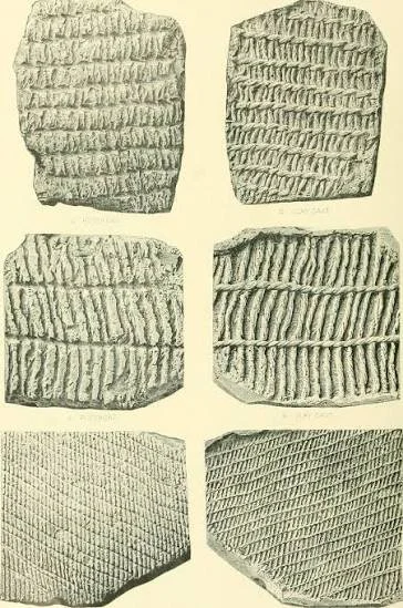
When woven fibers press against wet clay, they can leave detailed patterns behind. Once the clay hardens through firing or drying, the impression may survive long after the original textile has disappeared.

These impressions provide an indirect but remarkably detailed record of ancient textile technology.

How Textile Impressions Form

A textile impression may occur accidentally or deliberately.

Clay used to make pottery can be placed on woven material during manufacture.

A basket or cloth surface may leave impressions in wet clay.

Textiles may also be associated with clay structures or objects.

If the clay is subsequently fired, the impression can become permanently preserved.

What Impressions Reveal

A textile impression may reveal:

  • thread thickness

  • weave structure

  • fiber spacing

  • spinning direction

  • textile density

  • decorative patterns

  • manufacturing technique

This allows archaeologists to reconstruct aspects of textile production even when the fibers themselves have vanished.

Weaving Technology

Different weaving structures require different technical knowledge.

Simple plain weave can be produced with relatively straightforward equipment.

More complex patterns require additional control over warp and weft threads.

The appearance of an impression can therefore provide clues about the sophistication of textile production.

Spinning Fibers

Before yarn could be woven, fibers had to be prepared and spun.

Spindle whorls are common archaeological evidence for spinning.

The combination of spindle whorls and textile impressions can reveal relationships between spinning and weaving.

Researchers can also infer the direction of twist.

Identifying Fibers

A major challenge is determining what the original textile was made from.

Potential materials include:

  • flax

  • wool

  • cotton

  • bast fibers

  • grasses

  • reeds

  • other plant fibers

An impression alone may not always permit secure identification.

Microscopic residues or associated organic fibers can sometimes provide additional evidence.

Textiles and Social Organization

Textile production was economically important.

Clothing protected people from environmental conditions.

Textiles could also serve as containers, bedding, sails, nets, ropes, and ceremonial objects.

Specialized production could become an important household or community activity.

In some societies, high-quality textiles became markers of status.

Worldwide Evidence

Textile impressions occur in archaeological contexts across Eurasia, Africa, the Americas, and other regions.

They demonstrate that textile technology developed through multiple traditions rather than following one universal path.

Different environments encouraged different raw materials.

Coastal societies might exploit marine plant resources.

Pastoral societies often relied on wool.

Agricultural communities could cultivate flax, cotton, or other fibers.

Digital Reconstruction

Modern imaging techniques can greatly improve the study of textile impressions.

Three-dimensional scanning and digital microscopy can reveal structures too small for ordinary photography.

Researchers can create digital models of impressions and compare them across sites.

This makes it possible to study prehistoric textiles without repeatedly handling fragile artifacts.

Conclusion

Textile impressions provide a remarkable solution to one of archaeology's preservation problems.

Although the original fabrics have often disappeared, their impressions survive in clay.

By studying these traces, archaeologists can reconstruct spinning, weaving, clothing, trade, and social organization, demonstrating that textile technology was an important part of prehistoric innovation worldwide.

Under-Ice Burial Mounds: Glacial Sites Preserving Bronze Age Bodies

October 12, 2026

Introduction

The preservation of human remains in frozen environments represents one of archaeology's most extraordinary opportunities.

Normally, organic tissues decompose after death. In sufficiently cold and stable environments, however, decomposition can slow dramatically.

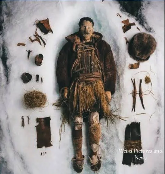
Glaciers, permanent snowfields, frozen soils, and other cold environments can preserve human bodies, clothing, equipment, and associated materials.

Bronze Age burial evidence from cold regions is particularly valuable because it can reveal details that skeletal remains alone cannot provide.

The Frozen Archaeological Record

Frozen environments can preserve:

  • skin

  • hair

  • muscle tissue

  • clothing

  • leather

  • wood

  • plant remains

  • food

  • ropes

  • weapons

Such preservation can provide a much more complete picture of ancient life.

The famous discovery of naturally preserved prehistoric bodies in Alpine and other high-altitude environments demonstrates the scientific potential of cold archaeology.

Burial Mounds and Climate

Burial mounds can create distinctive archaeological environments.

Stone, soil, vegetation, and internal structures may influence temperature and moisture.

If later climatic conditions cause persistent freezing, organic material may survive.

However, not every burial mound found beneath or near ice should automatically be interpreted as Bronze Age.

Dating requires independent evidence.

Dating the Body

Radiocarbon dating is frequently used for ancient organic remains.

However, researchers must carefully select uncontaminated material.

The "old wood" problem can affect wooden objects because the tree may have been centuries old before being used.

Textiles, hair, bone collagen, and other materials can sometimes provide more direct information about an individual's lifetime.

Clothing

Frozen burials can preserve clothing in extraordinary detail.

Researchers can study:

  • fiber types

  • weaving methods

  • stitching

  • dyes

  • footwear

  • belts

  • protective garments

Clothing can reveal technology, climate adaptation, social identity, and economic resources.

Diet and Mobility

Scientific analysis of preserved bodies can reveal aspects of diet.

Stable isotope analysis may provide information about the relative importance of different food sources.

Dental evidence can indicate dietary patterns.

Strontium and oxygen isotopes may sometimes provide information about geographic mobility.

These methods can transform an individual burial into evidence for broader patterns of movement.

The Bronze Age Environment

Bronze Age communities occupied diverse environments.

Some lived in agricultural valleys.

Others relied heavily on pastoralism.

Mountain communities developed specialized strategies for seasonal movement.

Frozen archaeological sites can reveal how people adapted to cold landscapes and high-altitude environments.

Climate Change as a Threat

The discovery of ancient bodies beneath melting ice presents a major conservation challenge.

Freezing can preserve organic remains for thousands of years.

Once exposed, the same material may decay within years, months, or even days depending on conditions.

Archaeologists therefore face an urgent race against environmental change.

Ethical Considerations

Human remains require respectful treatment.

Scientific analysis must balance research objectives with cultural and ethical responsibilities.

Where descendant communities can be identified, consultation is particularly important.

Ancient human remains should not be treated simply as specimens.

Conclusion

Frozen burial sites provide extraordinary opportunities to investigate Bronze Age life at an individual level.

They can preserve clothing, food, technology, and biological information that would otherwise disappear.

At the same time, climate change threatens the very conditions responsible for their survival, making documentation and responsible conservation increasingly urgent.

The Role of Salt Licks in Prehistoric Animal Domestication

October 12, 2026

Introduction

The domestication of animals was one of the most important transformations in human history.

The transition from hunting wild animals to managing herds changed food production, mobility, settlement, labor, trade, and social organization.

One underappreciated environmental factor in this process is the availability of mineral resources, particularly salt.

Natural salt licks may have influenced where wild animals gathered, creating predictable locations that could become important to hunters and, later, herders.

What Is a Salt Lick?

A salt lick is a naturally occurring concentration of mineral salts that animals consume.

It may occur in exposed rocks, saline soils, mineral springs, mud deposits, or other geological formations.

Many herbivores actively seek sodium and other minerals.

This behavior can concentrate animals in predictable locations.

Salt and Wild Animals

Before domestication, human hunters could exploit predictable animal behavior.

If herds repeatedly visited a mineral-rich location, hunters could identify these places as advantageous hunting grounds.

This does not mean that salt licks directly caused domestication.

Domestication is a complex process involving human selection, animal behavior, ecology, management, and social organization.

Salt licks may instead have contributed to the ecological circumstances in which human-animal relationships developed.

From Hunting to Herding

The domestication process occurred differently in different regions.

Goats and sheep were domesticated in Southwest Asia.

Cattle have complex domestication histories involving populations of wild aurochs.

Pigs, horses, camels, and other animals followed different pathways.

There was no single universal model.

Mineral Resources and Pastoral Landscapes

Once humans began managing herds, mineral resources could become even more important.

Livestock require sodium and other minerals.

Pastoralists may have known the locations of natural mineral sources and incorporated them into seasonal movement patterns.

This could influence the geography of grazing.

Archaeological Evidence

How can archaeologists identify the importance of salt licks?

Potential evidence includes:

  • repeated animal concentrations

  • mineral deposits

  • animal footprints

  • hunting structures

  • kill sites

  • dung deposits

  • herding pathways

  • changes in animal age profiles

Isotopic analysis of animal remains may also help reconstruct diets and mobility.

Salt and Animal Health

Mineral deficiencies can affect livestock health.

Access to suitable mineral sources can influence reproduction, growth, and behavior.

Modern pastoral communities often demonstrate detailed knowledge of mineral-rich landscapes.

This provides an important comparative perspective, although modern practices should not automatically be projected into prehistoric contexts.

Behavioral Archaeology

The study of salt licks highlights the importance of animal behavior in archaeology.

Humans did not domesticate animals simply by deciding to own them.

Animals had their own movement patterns, feeding preferences, social structures, and responses to human activity.

Domestication emerged through long-term interactions between humans and animals.

Environmental Change

Salt licks can change over time.

Water levels, erosion, vegetation, and mineral exposure affect their accessibility.

Ancient salt licks may therefore be difficult to identify today.

Geoarchaeology can help reconstruct former mineral environments.

Conclusion

Natural salt licks may have played an indirect but important role in prehistoric human-animal relationships.

They could concentrate wild animals, influence hunting strategies, and later become valuable resources within pastoral landscapes.

Rather than representing a simple explanation for domestication, salt licks should be understood as one component of the environmental systems within which domestication developed.

Re-examining “Empty” Caves: Microfoliage Evidence of Human Use

October 12, 2026

Introduction

Archaeologists sometimes encounter caves and rockshelters that appear to contain little evidence of human occupation.

There may be no obvious tools, pottery, architecture, or large concentrations of bones.

Such locations have sometimes been described as "empty" or archaeologically insignificant.

Modern microscopic research is challenging this assumption.

Tiny plant remains—sometimes called microbotanical or microfoliage evidence—can survive even when larger archaeological materials have disappeared.

Pollen, phytoliths, starch grains, charcoal particles, and microscopic plant tissues can reveal human activity in caves that otherwise appear nearly sterile.

What Is Microbotanical Evidence?

Microbotanical remains are extremely small plant-derived traces.

They include:

  • pollen grains

  • phytoliths

  • starch grains

  • microscopic charcoal

  • plant fibers

  • epidermal fragments

Because these materials are microscopic, they can survive where larger plant remains have decomposed.

Why Caves Preserve Microevidence

Caves provide relatively stable environments.

Sediments may accumulate gradually.

Protected surfaces can reduce exposure to wind and water.

Some deposits can remain sealed for thousands of years.

However, caves can also experience natural disturbance.

Bats, rodents, insects, water, and sediment movement can transport microscopic material.

Researchers therefore need strong controls.

Human Activity and Plant Remains

People entered caves for many reasons.

They could use them as:

  • temporary shelters

  • ritual spaces

  • storage locations

  • processing areas

  • hunting stations

  • burial places

  • seasonal camps

Plant evidence may reveal bedding, food processing, fuel use, basketry, or plant gathering.

Phytoliths

Phytoliths are microscopic silica structures formed inside many plants.

Because silica is highly durable, phytoliths can survive for very long periods.

Different plants produce different phytolith forms.

Researchers can therefore sometimes identify broad categories of vegetation.

Starch Grains

Starch residues can survive on stone tools and sediments.

Their morphology may provide clues about plants that were processed or consumed.

When starch evidence occurs alongside grinding stones or food-processing equipment, interpretations become stronger.

Pollen

Pollen can reveal the vegetation surrounding a cave.

But pollen can also be transported by wind or animals.

A pollen grain in a cave therefore does not automatically indicate that humans brought the plant inside.

Researchers need to examine concentration, spatial distribution, preservation, and associated artifacts.

Microscopic Charcoal

Tiny charcoal particles can indicate burning.

However, charcoal may come from natural fires rather than human activity.

A concentrated charcoal layer associated with hearth features and burned artifacts provides stronger evidence.

Reconstructing Invisible Occupation

Microbotanical evidence can therefore transform interpretations of caves.

A cave with no obvious tools might still contain evidence for repeated plant processing, bedding, food consumption, or fire use.

This encourages archaeologists to reconsider what counts as an archaeological site.

Conclusion

"Empty" caves are not necessarily empty.

Microscopic plant remains can preserve traces of human activity that are invisible during ordinary excavation.

The combination of microbotanical analysis, sediment chemistry, spatial mapping, and traditional archaeology can reveal subtle occupations that would otherwise remain undetected.

Obsidian Networks of the Pleistocene: Sourcing Small-Island Exchange

October 12, 2026

Introduction

Obsidian is volcanic glass formed when silica-rich lava cools rapidly.

Its sharp edges made it an excellent material for producing cutting tools.

Because geological sources of obsidian are relatively limited, archaeologists can often compare the chemical composition of artifacts with known volcanic sources.

This makes obsidian particularly valuable for reconstructing prehistoric exchange.

The problem becomes especially interesting on small islands.

If obsidian appears on an island where no natural source exists, people must have transported it from elsewhere.

Why Obsidian Is Useful

Obsidian fractures predictably.

A carefully struck piece can produce extremely sharp edges.

Pleistocene hunter-gatherers used obsidian for cutting, scraping, hunting, and other activities.

Because the geological sources are distinctive, artifacts can sometimes be chemically matched to their origin.

Sourcing Methods

Modern techniques can analyze trace elements within obsidian.

Methods may include:

  • X-ray fluorescence

  • neutron activation analysis

  • mass spectrometry

  • portable geochemical instruments

The resulting chemical profile can be compared with geological samples.

Island Archaeology

Small islands provide valuable archaeological laboratories.

They have clearly defined geographic boundaries.

When a non-local material appears, researchers can investigate how and why it arrived.

This can provide evidence for seafaring, exchange, seasonal movement, or migration.

Pleistocene Seafaring

The presence of obsidian on islands does not necessarily prove large-scale maritime trade.

Small quantities could have been carried by individuals moving between islands.

Repeated transport over generations, however, could create substantial archaeological distributions.

The distance between source and destination is also important.

Some island environments require deliberate water crossings.

Exchange Networks

Obsidian distributions can reveal social relationships.

An island community might obtain material directly from a source.

Alternatively, the material could pass through several communities.

This creates a network rather than a single route.

Archaeologists can investigate these relationships by comparing source proportions across settlements.

Tools and Mobility

Researchers can also study how obsidian was used after arrival.

A community may import large unworked blocks and manufacture tools locally.

Another may receive finished blades.

The difference can reveal aspects of trade organization and craft specialization.

Pleistocene Chronology

The Pleistocene was a period of major climatic fluctuation.

Sea levels changed dramatically.

Some islands that are separated by water today were connected to mainland regions during lower sea levels.

This is crucial when interpreting ancient exchange.

A modern island may not have been geographically isolated at every point in prehistory.

Social Meaning

Obsidian may have been valued for more than its practical sharpness.

Distinctive materials can acquire social meaning.

Objects produced from rare stone may have functioned as indicators of identity, status, or connection to distant communities.

Determining this requires contextual evidence.

Conclusion

Pleistocene obsidian networks demonstrate that small islands were not necessarily isolated worlds.

Chemical sourcing allows archaeologists to trace volcanic glass across landscapes and reconstruct ancient movement.

The resulting evidence can provide some of the strongest clues for understanding early seafaring, exchange, mobility, and social connections.

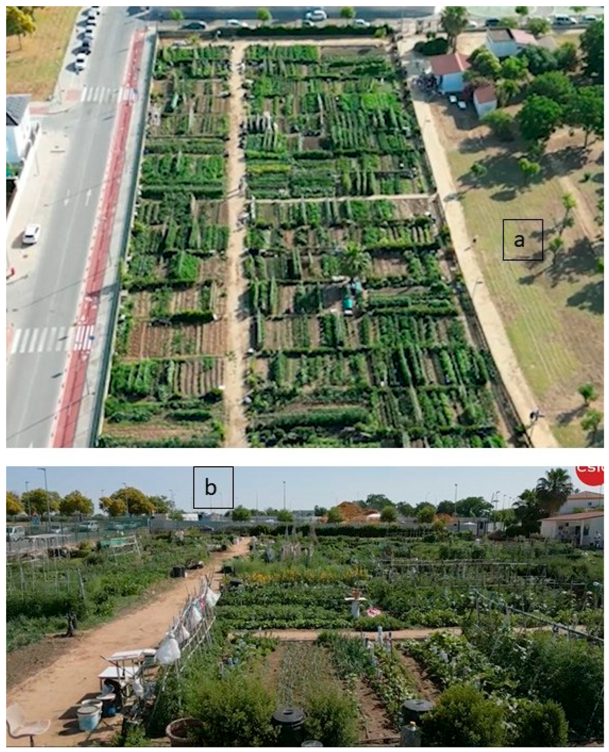
Urban Gardens of the Indus: New Soil Chemistry Evidence

October 12, 2026

Introduction

The cities of the Indus Civilization are famous for their planned streets, drainage systems, wells, standardized bricks, craft industries, and extensive settlements.

Yet urban life involved much more than monumental infrastructure.

People needed food, fuel, medicine, fibers, and other biological resources.

This raises an important archaeological question: did Indus cities contain gardens, cultivated plots, orchards, or other forms of urban agriculture?

Soil chemistry is increasingly useful for addressing this question.

The Indus Urban Landscape

The Indus Civilization flourished across large parts of present-day Pakistan and northwestern India during the third and early second millennia BCE.

Major urban centers included Harappa, Mohenjo-daro, Dholavira, and other settlements.

These cities possessed sophisticated water-management and drainage systems.

Such infrastructure could have supported intensive urban activities, including horticulture.

What Is Soil Chemistry?

Soil retains chemical traces of past human activity.

Different activities can produce different chemical signatures.

Animal waste, food processing, burning, craft production, irrigation, and plant cultivation can alter soil chemistry.

Researchers can analyze nutrients, phosphates, carbonates, trace elements, salts, and other properties.

Identifying Ancient Gardens

Gardens may be difficult to identify archaeologically.

Unlike houses, they may leave few walls.

Plant remains can disappear.

Soil may be repeatedly disturbed.

Researchers therefore examine combinations of evidence.

Potential indicators include:

  • elevated organic matter

  • distinctive phosphate concentrations

  • plant microremains

  • irrigation features

  • buried soils

  • planting pits

  • botanical residues

No single chemical signature automatically proves a garden.

Plants in Indus Cities

Archaeobotanical research has identified evidence for numerous crops and useful plants in Indus contexts.

Cereals, pulses, fruits, oil-producing plants, and other species contributed to subsistence.

Some plants could have been grown within or near settlements.

The distinction between agricultural fields and household gardens is difficult but important.

Urban Water Management

Indus cities possessed sophisticated systems for moving and storing water.

Wells were common at major sites.

Drainage systems were constructed with remarkable regularity.

These systems demonstrate that water management was a central component of urban planning.

Whether every system was connected to horticulture is another question.

Household Gardens

Small domestic gardens may have provided vegetables, herbs, fruit, or medicinal plants.

Because these gardens would have been small, their archaeological signatures may be weak.

Microbotanical analysis can therefore be particularly valuable.

Phytoliths, pollen, starches, seeds, and plant residues can complement soil chemistry.

Salinity and Urban Agriculture

One of the challenges of agriculture in parts of the Indus region was salinity.

Irrigation without adequate drainage can cause salts to accumulate.

Ancient communities would have needed strategies to maintain soil productivity.

Soil chemistry can help reconstruct these environmental processes.

Urban Agriculture and Social Organization

If gardens were widespread, they could have contributed to urban resilience.

Households might produce part of their own food.

Gardens could also provide resources unavailable through large-scale cereal agriculture.

This would complicate traditional interpretations of Indus cities as spaces divided sharply between urban centers and rural agricultural zones.

Conclusion

Soil chemistry provides a promising avenue for investigating gardens and cultivated spaces within Indus cities.

The evidence must be combined with archaeobotany, sediment studies, excavation, and spatial analysis.

If urban horticulture proves more widespread than previously recognized, it could significantly change our understanding of how Indus cities fed themselves and managed resources.

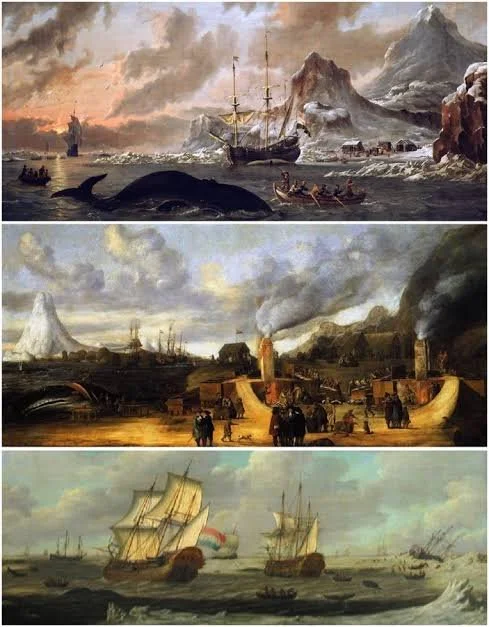
Medieval Arctic Whaling Stations: Norse and Indigenous Interactions

October 12, 2026

Introduction

The medieval Arctic was not an isolated wilderness.

Indigenous communities developed sophisticated systems for hunting, fishing, transportation, and seasonal settlement long before European expansion.

During the medieval period, Norse communities also occupied parts of the North Atlantic and Arctic world, particularly Greenland and Iceland.

The intersection of Norse and Indigenous economies created complex patterns of interaction.

Whaling is especially important because marine mammals were valuable sources of food, oil, bone, and other materials.

Arctic Whaling

Whales provided enormous quantities of biological resources.

Their meat could supplement diets.

Blubber provided oil.

Bones could be used for tools and construction.

Large baleen plates could become valuable raw materials.

Whaling therefore had economic importance far beyond food.

Indigenous Whaling Traditions

Arctic Indigenous peoples developed specialized knowledge of marine environments.

Different communities used different technologies depending on local whale species, sea conditions, boats, weapons, and seasonal patterns.

Whaling required extensive environmental knowledge.

The behavior of whales, sea ice, currents, weather, and coastal geography all influenced hunting success.

Norse Greenland

Norse settlers established communities in Greenland during the medieval period.

Their economy included livestock farming, hunting, fishing, and trade.

Marine resources were increasingly important because agriculture was constrained by the Arctic environment.

Whale products could therefore have been valuable to Norse communities.

Archaeological Evidence

Archaeologists can identify whaling through:

  • whale bones

  • cut marks

  • butchery patterns

  • hunting equipment

  • processing areas

  • settlement refuse

  • trade objects

Species identification can reveal which whales were exploited.

The spatial distribution of remains can also indicate where carcasses were processed.

Interaction Rather Than Isolation

Norse and Indigenous communities may have interacted through trade, shared landscapes, competition, or indirect exchange.

Archaeological evidence must be interpreted carefully.

An Indigenous artifact at a Norse settlement does not automatically prove direct personal contact.

Likewise, Norse objects in Indigenous contexts may have arrived through several stages of exchange.

Trade in Whale Products

Whale bone and other marine products could travel considerable distances.

Some whale products found in medieval European contexts may have originated far from where the objects were ultimately used.

This creates a large-scale research question: how did Arctic marine resources enter wider European economies?

Genetic and Isotopic Research

Modern scientific methods can identify species and investigate animal movement.

Isotopic analysis may provide clues about marine environments.

Zooarchaeological analysis can distinguish whale species and reconstruct butchery.

These methods allow researchers to move beyond simply counting bones.

Climate and Sea Ice

Medieval Arctic economies were closely connected to climate.

Sea-ice conditions affected transportation and animal migration.

Climate shifts could therefore influence settlement viability and hunting opportunities.

The archaeological record provides a long-term perspective on these environmental relationships.

Conclusion

Medieval Arctic whaling was part of a complex economic world involving Indigenous expertise, Norse settlement, marine resources, and long-distance exchange.

Rather than portraying the Arctic as a remote boundary of European history, archaeology reveals a dynamic region shaped by Indigenous societies and international connections.

Carbonate Crusts as Dating Tools on Coastal Archaeological Wood

October 12, 2026

Introduction

Wood is an extremely valuable archaeological material because it can preserve information about construction, technology, transportation, and environmental change.

Unfortunately, wood usually decomposes rapidly.

In coastal and mineral-rich environments, however, carbonate deposits can sometimes form on or around buried wood.

These mineral crusts raise an important scientific possibility: can carbonate formation provide chronological information about archaeological wooden structures?

The answer is potentially useful but requires careful geological and archaeological analysis.

What Are Carbonate Crusts?

Carbonates are minerals containing carbonate ions.

Calcium carbonate is especially common in natural deposits.

It can precipitate from groundwater or marine-influenced environments under suitable chemical conditions.

A crust may form on an exposed or buried surface over time.

Coastal Archaeological Wood

Coastal environments can preserve wooden structures under waterlogged conditions.

Examples include:

  • boats

  • piers

  • piles

  • fish traps

  • wells

  • waterfront structures

Waterlogging can slow decomposition by limiting oxygen.

Mineral-rich water can also interact with the wood and surrounding sediment.

Why Dating Is Difficult

A carbonate crust does not automatically provide the age of the wood.

The mineral may have formed long after the wood was deposited.

It may also have formed before the wood was incorporated into an archaeological structure.

Therefore, researchers must distinguish the age of the wood from the age of the carbonate.

Radiocarbon Dating

Radiocarbon dating can sometimes date organic wood directly.

Carbonate materials can also contain carbon, but the source of that carbon must be understood.

Marine and freshwater reservoir effects can produce dates that appear older than the actual formation event.

This is a major concern in coastal archaeology.

Stable Isotopes

Stable carbon and oxygen isotopes can help researchers investigate carbonate formation.

These signatures may provide information about the water from which the mineral precipitated.

If the environmental conditions are understood, the crust may contribute to reconstructing the history of the site.

Layered Mineral Growth

In some circumstances, carbonate crusts may develop sequentially.

Different layers could theoretically record environmental changes.

Microscopic analysis can reveal growth structures.

However, this requires careful calibration.

A crust is not automatically a geological clock.

Coastal Environmental Change

Mineral deposits may also preserve evidence of changing water conditions.

Changes in salinity, temperature, freshwater input, and groundwater movement can influence carbonate formation.

Consequently, carbonate associated with archaeological wood may provide environmental as well as chronological information.

Combining Methods

The strongest approach combines:

  • radiocarbon dating

  • dendrochronology where possible

  • microscopy

  • stable isotope analysis

  • sedimentology

  • mineralogical identification

  • stratigraphic analysis

Agreement between independent methods greatly strengthens interpretation.

Conservation Challenges

Wood recovered from waterlogged environments can deteriorate rapidly once exposed.

Carbonate deposits may sometimes protect portions of an artifact, but removing them can damage the wood.

Conservation therefore requires careful documentation before treatment.

Conclusion

Carbonate crusts associated with coastal archaeological wood offer an intriguing scientific research avenue.

They should not be treated as direct chronological indicators without environmental and geochemical calibration.

When combined with direct dating and sediment analysis, however, carbonate deposits may help reconstruct the formation history and environmental context of ancient wooden structures.

The Collapse of Prehistoric Irrigation in Central Asia: New Models

October 12, 2026

Introduction

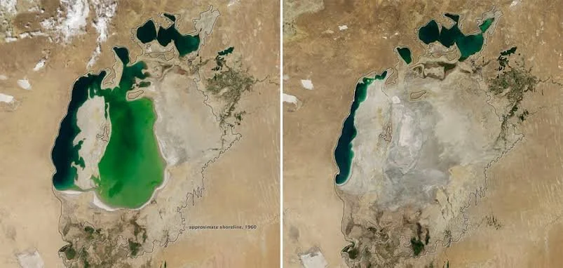
Irrigation transformed Central Asian landscapes.

In otherwise dry environments, artificial water management allowed communities to cultivate crops, support livestock, build settlements, and establish long-distance economic networks.

But irrigation systems could also fail.

Ancient canals might become blocked by sediment.

Water supplies could shift.

Soils could accumulate salts.

Climate changes could alter river flows.

Political disruption could reduce the labor available to maintain infrastructure.

The collapse of prehistoric irrigation therefore represents a complex interaction between environmental and social processes.

Irrigation in Arid Environments

Agriculture in Central Asia often depended on careful water management.

Rivers originating in mountain regions supplied water to downstream agricultural communities.

Canals diverted water toward fields and settlements.

Maintaining these systems required labor.

Canals had to be cleared, banks repaired, and water flows controlled.

Why Irrigation Systems Fail

Several mechanisms can cause agricultural decline.

Sedimentation

Rivers transport sediment.

Over time, canals can become filled.

Salinization

Evaporation in arid environments leaves salts behind.

Without adequate drainage, salts can accumulate in agricultural soils.

Climate Change

Changes in rainfall, temperature, snowmelt, or glacier conditions can affect river discharge.

Political Instability

Large irrigation systems depend on social organization.

Conflict or political fragmentation can disrupt maintenance.

Archaeological Evidence

Researchers investigate irrigation collapse through:

  • canal sediments

  • abandoned fields

  • settlement patterns

  • pollen

  • phytoliths

  • soil chemistry

  • lake sediments

  • geomorphology

  • radiocarbon dates

The combination of these methods can reveal when agricultural landscapes changed.

Climate Versus Human Agency

A major debate concerns whether environmental change or human activity was primarily responsible for collapse.

Older models sometimes attributed abandoned settlements directly to climate change.

Modern research often emphasizes more complicated interactions.

A drought may become catastrophic only when political institutions are already weakened.

Conversely, human land-use changes may make communities more vulnerable to climate fluctuations.

Salinization

Salinity is particularly important.

When irrigation water evaporates, dissolved salts can remain in the soil.

Over time, agricultural productivity may decline.

Farmers can sometimes counter this through drainage and water management.

If maintenance fails, salinization can become severe.

River Changes

Central Asian rivers have repeatedly shifted channels.

A settlement dependent on one river branch could become isolated if the channel changed.

What appears to be "collapse" may therefore represent adaptation to a changing river rather than complete abandonment of agriculture.

New Modeling Approaches

Computer models can simulate water availability, canal networks, population requirements, and environmental change.

GIS can reconstruct ancient landscapes.

Hydrological models can estimate how much water particular systems could have delivered.

These methods allow archaeologists to test hypotheses rather than relying only on visual interpretation of ruins.

Conclusion

The collapse of prehistoric irrigation in Central Asia should not be understood as a single event with a single cause.

Environmental change, salinity, river dynamics, political organization, labor, and economic transformation could interact.

New archaeological and computational models are making it possible to reconstruct these systems with greater precision and to understand both their resilience and their vulnerabilities.

Rock-Shelter Soundscapes: Acoustics and Ritual Performance in Prehistory

October 12, 2026

Introduction

Archaeology traditionally focuses on what can be seen.

Artifacts, structures, paintings, bones, and landscapes dominate archaeological interpretation.

But prehistoric people also experienced their environments through sound.

Caves and rock shelters are particularly interesting because their acoustics can differ dramatically from those of open landscapes.

Echoes, reverberation, resonance, and sound amplification may have influenced how people used these places.

This has led to increasing interest in archaeological acoustics and prehistoric soundscapes.

What Is a Soundscape?

A soundscape is the total acoustic environment experienced by people.

It includes:

  • human voices

  • music

  • animal sounds

  • water

  • wind

  • echoes

  • percussion

  • environmental noise

Archaeological soundscape research attempts to reconstruct how ancient people may have experienced these environments.

Why Rock Shelters Matter

Rock shelters and caves have distinctive acoustic properties.

A narrow chamber may amplify certain frequencies.

A large cavern may create long echoes.

A chamber with particular wall geometry may produce unusually strong resonance.

These properties could influence human behavior.

Rock Art and Acoustics

Researchers have observed that some decorated caves contain spaces with distinctive acoustic properties.

This has generated hypotheses that certain areas may have been selected partly because of their sound.

However, acoustic association alone does not prove ritual activity.

A cave may simply have favorable acoustics while serving practical functions.

Ritual Performance

If sound was deliberately incorporated into ritual behavior, it could include:

  • chanting

  • singing

  • drumming

  • clapping

  • whistles

  • flutes

  • spoken performance

Music and oral performance can create social experiences that leave very little archaeological evidence.

This makes acoustics particularly important for reconstructing intangible aspects of prehistoric culture.

Experimental Archaeology

Researchers can conduct acoustic experiments inside caves.

They can measure:

  • reverberation time

  • sound pressure

  • frequency response

  • echo patterns

  • speech intelligibility

Experimental performers can then test how voices or instruments behave in different locations.

Animal Sounds

Animal calls may also have influenced prehistoric experience.

Some caves amplify sounds from outside.

Others create echoes that could make animals seem closer or farther away.

If prehistoric hunters regularly visited such spaces, they may have developed sophisticated environmental knowledge.

Archaeological Limitations

Modern acoustic conditions are not necessarily identical to ancient conditions.

Vegetation may have changed.

Floors may have accumulated sediment.

Walls may have collapsed.

Human occupation can alter surfaces.

Researchers must therefore reconstruct ancient geometry where possible.

Sound and Social Memory

Acoustic places can become culturally meaningful.

A cave where ceremonies repeatedly occurred could become associated with ancestral stories, initiation, or sacred landscapes.

Even when physical evidence is limited, spatial and acoustic patterns may contribute to interpretations of social memory.

Conclusion

Rock-shelter acoustics expands archaeology beyond the visual record.

By studying sound, researchers can investigate how prehistoric communities experienced spaces through voice, music, echoes, and environmental noise.

The field remains interdisciplinary and requires careful interpretation, but it offers a powerful way to explore dimensions of prehistoric life that artifacts alone cannot capture.

The Archaeology of Ancient Beekeeping: Hives, Honey and Trade

October 12, 2026

Introduction

Beekeeping has a long and complex history.

Honey provided sweetness, energy, and medicinal applications, while beeswax was valuable for candles, waterproofing, cosmetics, adhesives, modeling, and craft production.

Evidence from ancient societies demonstrates that humans did not merely collect wild honey. In some regions, they developed organized systems for managing bee colonies.

The archaeology of beekeeping therefore provides insights into agriculture, trade, technology, ecology, and household economies.

Wild Honey Collection

The earliest relationship between humans and bees was probably hunting or collecting honey from wild colonies.

Rock art and other archaeological evidence from several regions depicts people interacting with bees or collecting honey.

Wild honey collection could be dangerous and required specialized knowledge.

From Collection to Management

Beekeeping represents a different relationship.

Instead of finding wild colonies, people provide structures in which bees can establish colonies.

These structures can include:

  • hollow logs

  • baskets

  • clay vessels

  • wooden boxes

  • specialized architectural hives

The transition between honey collection and deliberate management probably occurred gradually and differently in different regions.

Ancient Egyptian Beekeeping

Ancient Egypt provides some of the clearest evidence for organized beekeeping.

Egyptian art depicts beekeepers working with hives.

Beeswax and honey were used in religious, medicinal, culinary, and practical contexts.

The Nile Valley's agricultural environment was well suited to bee management.

Archaeological Hives

Ancient hives can sometimes be identified through their architecture.

Clay tube hives are particularly distinctive.

Rows of cylindrical ceramic structures could provide nesting spaces for bee colonies.

Archaeological discoveries of such installations provide direct evidence for organized beekeeping.

Honey Residues

Chemical analysis can sometimes identify traces associated with honey, beeswax, or other bee products.

Lipid and molecular analysis may reveal residues absorbed into pottery.

However, beeswax contamination can occur during later handling.

Context is therefore essential.

Beeswax and Craft Production

Beeswax had many uses beyond food.

It could be used in:

  • lost-wax casting

  • waterproofing

  • adhesives

  • cosmetics

  • medicine

  • writing tablets

  • religious objects

The presence of beeswax in archaeological contexts can therefore indicate several different activities.

Trade

Honey and beeswax were valuable commodities.

Beeswax in particular could be transported and traded over long distances because it was useful and relatively stable.

Trade in bee products connected agricultural communities with craft industries and urban markets.

Environmental Archaeology

Beekeeping also provides information about ancient landscapes.

Bees require flowering plants.

A large beekeeping operation therefore depends on suitable vegetation.

Pollen analysis can help reconstruct the plants available to ancient bees.

In some cases, researchers can analyze pollen preserved in honey or archaeological residues.

Social Organization

Large-scale beekeeping requires labor and management.

Hive production, colony maintenance, honey harvesting, processing, storage, and transportation all involve specialized activities.

This means that beekeeping can provide evidence for economic organization.

Modern Relevance

Ancient beekeeping also has environmental significance today.

Historical evidence demonstrates the long relationship between humans and pollinating insects.

Understanding ancient management practices can contribute to discussions about biodiversity, agricultural systems, and the conservation of pollinators.

Conclusion

The archaeology of ancient beekeeping reveals a sophisticated relationship between humans, insects, plants, and trade.

From wild honey collection to organized hive systems, the history of apiculture demonstrates how communities learned to manage biological resources.

Honey and beeswax were not minor commodities. They could support food systems, medicine, religion, manufacturing, and long-distance exchange.

Studying ancient beekeeping therefore provides a valuable window into the economic and ecological organization of past societies.

Gladysvale: South Africa's 2M-Year Hominin Cave

October 7, 2026

Introduction

Gladysvale Cave, situated within South Africa’s Cradle of Humankind region, is an important archaeological and palaeontological locality for understanding the evolution of early hominins and the environments they inhabited. The cave forms part of a wider limestone landscape in which underground cavities, ancient sediments, fossil-bearing breccias, and geological processes have preserved evidence of life extending far back into the Pleistocene.

The phrase “2M-Year Hominin Cave” reflects the importance of deposits of approximately two million years old in the broader region. However, not every fossil or archaeological layer at Gladysvale is exactly two million years old. Establishing the age of a particular discovery requires careful analysis of its geological position, associated fossils, and the dating methods applicable to the deposit.

Gladysvale is valuable because it contributes to a much larger scientific record of early human evolution in southern Africa. Its evidence must be interpreted alongside discoveries from nearby localities, including Sterkfontein, Swartkrans, Kromdraai, and Drimolen.

Geological Formation and the Preservation of Fossils

The caves of the Cradle of Humankind developed primarily within dolomitic bedrock. Over long periods, groundwater circulated through fractures in the rock, gradually dissolving soluble minerals and creating underground passages and cavities. Changes in water flow, erosion, sediment movement, and the collapse of cave ceilings altered these systems over time.

These processes created opportunities for fossils to become preserved. Animals could fall into natural openings, predators could bring prey into caves, and water could carry bones and sediment into underground chambers. Over time, mineral-rich deposits could cement the accumulated material into breccia, a rock containing fragments of other materials.

The resulting deposits are not simple chronological records. A cave may contain several sedimentary layers formed at different times, and some deposits may have been disturbed by later geological processes. Researchers therefore investigate the relationships between bones, sediments, mineral deposits, and the surrounding bedrock before drawing conclusions about the age and context of a fossil.

Hominins and the Study of Human Evolution

Hominins are members of the evolutionary group that includes modern humans and our extinct relatives after the lineage leading to humans diverged from that of chimpanzees. South Africa’s fossil-bearing caves have yielded remains of several early hominin species, allowing researchers to examine changes in anatomy, locomotion, diet, and adaptation.

The importance of Gladysvale lies within this broader fossil landscape. Evidence from the region helps researchers investigate how different hominin populations occupied varied environments and how their anatomical characteristics changed over time. Fossil teeth, jaws, and cranial fragments can provide information about diet and body size, while limb bones, when preserved, may offer evidence about movement and posture.

Nevertheless, identifying a hominin fossil is not always straightforward. Fragmentary remains may share characteristics with several species, and researchers can disagree about whether a specimen represents a distinct species or variation within a known group. Scientific conclusions depend on comparisons with other fossils, anatomical measurements, and the geological age of the specimen.

Reconstructing the Ancient Environment

The fossil record around Gladysvale also contains evidence of animals that lived alongside early hominins. Carnivores, herbivores, and smaller mammals help researchers reconstruct ancient ecological conditions.

Animal teeth and bones can reveal dietary preferences, while changes in the relative abundance of species may indicate shifts in vegetation, rainfall, and habitat. For example, the presence of animals adapted to open grassland can be compared with evidence of species associated with woodland or more sheltered environments.

These reconstructions matter because human evolution did not occur in a single, unchanging landscape. Early hominins experienced environmental fluctuations and had to obtain food, water, and protection under different ecological conditions. The relationship between climate and evolutionary change is complex, however. A change in climate did not automatically cause a particular evolutionary development, and researchers must consider multiple explanations for patterns in the fossil record.

Dating the Cave Deposits

Dating is one of the most important aspects of research at Gladysvale. Scientists may use several approaches, depending on the age and condition of the deposits. These can include palaeomagnetic evidence, the analysis of associated animal fossils, and dating methods applicable to minerals or sediments.

Biostratigraphy compares fossil assemblages with those from other sites whose ages are better constrained. This can help establish a broad chronological framework, but it is generally less precise than a successful direct dating method.

Researchers must also distinguish the age of a fossil from the age of the rock or sediment surrounding it. A bone may have been transported from an older deposit into a younger layer, or later disturbance may have mixed materials from different periods. Establishing the relationship between fossils and sediment is therefore essential.

Why Gladysvale Matters

Gladysvale contributes to understanding the complex archaeological and palaeontological history of the Cradle of Humankind. Rather than offering a single, uninterrupted story of human origins, the cave forms part of a network of sites that preserve different pieces of evidence.

Its wider significance lies in showing how geological processes can preserve biological remains and how carefully controlled excavation can transform those remains into scientific evidence. Each fossil must be interpreted within its geological context, and every new discovery has the potential to refine existing explanations.

The study of Gladysvale ultimately demonstrates that human evolution is best understood through the combined work of palaeontology, archaeology, geology, comparative anatomy, and environmental science. The cave is important not because every detail of its past is known, but because its deposits help researchers reconstruct a distant world in which early hominins lived alongside a diverse community of animals.

Conclusion

Gladysvale is an important component of South Africa’s fossil heritage. Its significance comes from its place within the Cradle of Humankind and the opportunities it provides for investigating early hominin evolution, ancient environments, and the geological processes responsible for preserving fossils. The description “two-million-year-old” should be understood as a broad chronological reference rather than an exact date for every find. Through continued research and careful interpretation, Gladysvale helps deepen our understanding of the evolutionary history of southern Africa.

← Newer Posts Older Posts →
Featured
images (45).jpeg
October 12, 2026
Matsieng: Lesotho's Paramount Chief Palace
October 12, 2026
Read more →
October 12, 2026
images (46).jpeg
October 12, 2026
Thota-e-Makubung: Lesotho's Initiation School
October 12, 2026
Read more →
October 12, 2026
images (47).jpeg
October 12, 2026
Khubelu: Lesotho's Cliff Dwellings
October 12, 2026
Read more →
October 12, 2026
images (48).jpeg
October 12, 2026
Mokhotlong: Lesotho's Border Forts
October 12, 2026
Read more →
October 12, 2026
images (49).jpeg
October 12, 2026
Tsoelike: Lesotho's Gold Panning Sites
October 12, 2026
Read more →
October 12, 2026
images (50).jpeg
October 12, 2026
Sani Pass: Lesotho's Drakensberg Trade Route
October 12, 2026
Read more →
October 12, 2026
read more

Powered by The archaeologist