• MAIN PAGE
  • LATEST NEWS
    • Lost Cities
    • Archaeology's Greatest Finds
    • Underwater Discoveries
    • Greatest Inventions
    • Studies
    • Blog
  • PHILOSOPHY
  • HISTORY
  • RELIGIONS
    • Africa
    • Anatolia
    • Arabian Peninsula
    • Balkan Region
    • China - East Asia
    • Europe
    • Eurasian Steppe
    • Levant
    • Mesopotamia
    • Oceania - SE Asia
    • Pre-Columbian Civilizations of America
    • Iranian Plateau - Central Asia
    • Indus Valley - South Asia
    • Japan
    • The Archaeologist Editor Group
    • Scientific Studies
    • Aegean Prehistory
    • Historical Period
    • Byzantine Middle Ages
    • Predynastic Period
    • Dynastic Period
    • Greco-Roman Egypt
  • Rome
  • PALEONTOLOGY
  • About us
Menu

The Archaeologist

  • MAIN PAGE
  • LATEST NEWS
  • DISCOVERIES
    • Lost Cities
    • Archaeology's Greatest Finds
    • Underwater Discoveries
    • Greatest Inventions
    • Studies
    • Blog
  • PHILOSOPHY
  • HISTORY
  • RELIGIONS
  • World Civilizations
    • Africa
    • Anatolia
    • Arabian Peninsula
    • Balkan Region
    • China - East Asia
    • Europe
    • Eurasian Steppe
    • Levant
    • Mesopotamia
    • Oceania - SE Asia
    • Pre-Columbian Civilizations of America
    • Iranian Plateau - Central Asia
    • Indus Valley - South Asia
    • Japan
    • The Archaeologist Editor Group
    • Scientific Studies
  • GREECE
    • Aegean Prehistory
    • Historical Period
    • Byzantine Middle Ages
  • Egypt
    • Predynastic Period
    • Dynastic Period
    • Greco-Roman Egypt
  • Rome
  • PALEONTOLOGY
  • About us
No results found

Animal Pathology in Zooarchaeology: Disease Patterns and Herd Management

October 18, 2026

How abnormalities in ancient animal bones can reveal disease, working conditions, livestock management, and the relationship between people and domesticated animals.

Introduction: Reading Disease in Animal Bones

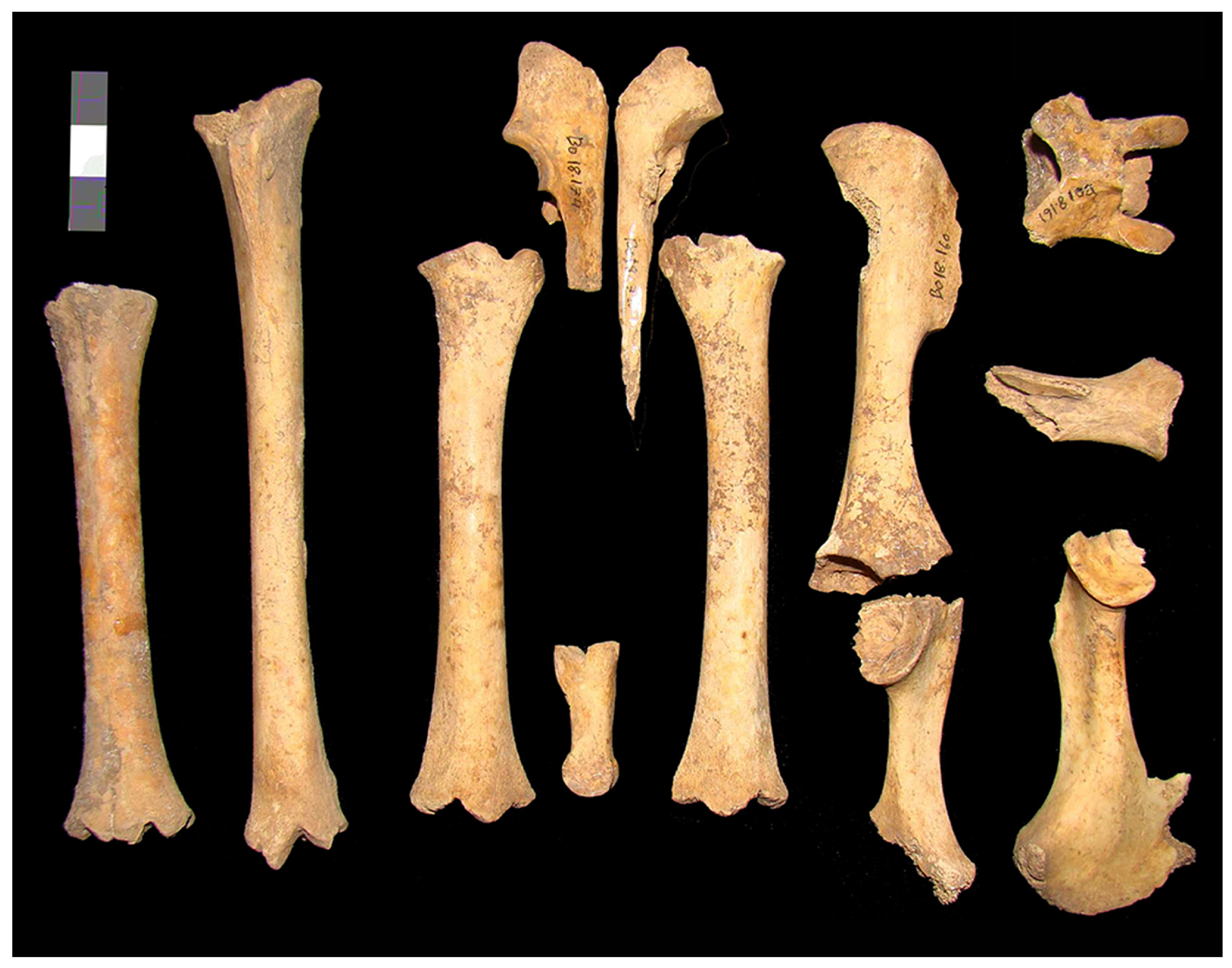
Animal bones provide evidence of diet, hunting, domestication, trade, and the organization of human settlements. They can also preserve traces of disease and physical stress, offering insight into the lives of animals that lived alongside people.

Zooarchaeological pathology is the study of disease-related and abnormal changes in animal remains recovered from archaeological contexts. These changes may include bone inflammation, joint degeneration, healed fractures, abnormal growth, and other alterations that developed during an animal's life.

Such evidence can help researchers investigate animal health and management. A herd containing animals with repeated skeletal injuries may have experienced particular working demands, while certain patterns of disease may be consistent with crowding or environmental stress.

However, skeletal abnormalities are not always diagnostic. Similar changes can result from different diseases, injuries, aging, or normal variation. Researchers must avoid assigning a specific disease without sufficient evidence.

Recognizing Pathological Changes

Bone responds to injury, infection, mechanical stress, and changes in an animal's development. Some conditions leave visible lesions, while others affect the shape and structure of joints or long bones.

Researchers examine the location, distribution, and appearance of these changes. They compare affected specimens with normal variation in the same species and consider the animal's age, body size, and likely activity.

A healed fracture may be visible as abnormal bone growth or a change in the shape of a bone. Joint degeneration can produce surface changes and the formation of additional bone, although these findings may also occur through aging or repetitive loading.

The interpretation must consider preservation. Soil pressure, erosion, and damage during excavation can create marks that resemble pathology. Detailed recording and, where appropriate, imaging help distinguish biological changes from post-depositional damage.

Disease, Herding, and Animal Management

Domesticated animals live within environments shaped by human decisions. Herd size, feeding practices, movement, housing, breeding, and the selection of animals for particular tasks can influence health.

Infections may spread more easily when animals are kept in close proximity, although the relationship depends on the pathogen, herd structure, and environmental conditions. Nutritional stress can also affect skeletal development, but many forms of nutritional deficiency do not leave a clear or unique signature in bone.

Researchers can compare pathology across different settlement types and periods. If a particular abnormality becomes more common in an assemblage associated with intensive animal keeping, the pattern may suggest a change in management, but other explanations must be considered.

Animal age profiles, sex ratios, butchery patterns, and evidence of enclosure structures can help reconstruct herd organization. Pathology becomes more informative when integrated with these independent indicators.

Working Animals and Repetitive Stress

Some domesticated animals were used for traction, transport, riding, or other forms of labor. Repeated loading can influence the musculoskeletal system, and certain patterns of bone change may be consistent with sustained physical demands.

However, it is difficult to identify a particular activity from skeletal changes alone. Joint degeneration can result from age, injury, body size, or several forms of movement.

Researchers compare skeletal patterns with experimental studies, modern veterinary knowledge, and archaeological evidence for equipment and transport. Harness fittings or vehicle remains may support an interpretation involving animal traction, but they do not prove that every animal in the same settlement performed such work.

The strongest conclusions distinguish evidence of physical stress from claims about the exact task that caused it.

Pathogens and the Limits of Skeletal Evidence

Some infectious diseases affect bone, while many do not. An animal can suffer a serious illness without leaving visible skeletal changes. Conversely, a bone lesion may resemble several different diseases.

Ancient DNA and other biomolecular methods can sometimes identify pathogens in archaeological material, although preservation and contamination create significant challenges. Molecular detection must be interpreted alongside skeletal evidence and the archaeological context.

Even when a pathogen is identified, researchers must determine whether it caused the observed lesion and how widespread the infection may have been. A single infected animal does not establish an epidemic or a herd-wide disease event.

Comparisons across multiple animals and sites can help investigate disease patterns. However, the absence of evidence may reflect preservation or sampling rather than the historical absence of a disease.

Animal Health and Human Economies

Animal disease could affect food supplies, transport, agricultural labor, and the exchange of livestock. The loss of animals might force communities to change herd composition, seek replacement stock, or alter their use of the landscape.

Archaeology can investigate these pressures through changes in animal remains, settlement patterns, and evidence of animal movement. Yet it is difficult to link a particular economic change directly to disease unless the chronology and biological evidence are strong.

Animal health also reflects human-animal relationships. Communities may have developed ways to protect valuable animals, manage reproduction, or respond to injury, even when their understanding of disease differed from modern veterinary science.

These practices are often difficult to observe directly, but patterns of survival, treatment, and herd management can offer indirect clues.

Conclusion: Reconstructing Animal Lives Through Pathology

Pathological changes in animal bones provide a valuable source of information about ancient livestock health, working conditions, and management practices. They can reveal injuries and biological stress that are otherwise absent from written records.

However, skeletal abnormalities rarely identify a specific disease or activity on their own. Researchers must distinguish pathology from normal variation, age-related changes, and damage caused after burial.

By combining osteological examination with animal demographics, biomolecular analysis, and settlement evidence, zooarchaeologists can investigate how people managed animals and responded to their health problems. This approach restores an important dimension of ancient economic life: the biological experiences of the animals on which many communities depended.
The Cultural Life of Quarries: Rituals, Graffiti and Worker Camps

October 18, 2026

Looking beyond stone extraction to investigate the social worlds, personal expressions, and possible ritual practices of ancient quarry workers.

Introduction: Quarries as Places Where People Lived

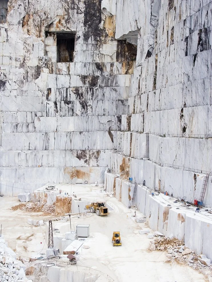
Quarries are often studied as sources of building stone, monuments, and sculpture. Archaeologists investigate their geology, extraction techniques, tool marks, and transport routes to understand how raw materials reached construction sites.

Yet quarries were also places where people spent time working, resting, communicating, and organizing daily life. Large extraction projects could require workers, supervisors, craftspeople, transport personnel, and support staff. Temporary camps or longer-lived settlements might develop around these activities.

Evidence of this social environment can survive in unexpected forms. Graffiti scratched into rock, inscriptions, small offerings, hearths, discarded objects, and traces of temporary shelters may reveal aspects of quarry life that are not visible in the finished monuments.

The interpretation of these traces requires caution. A mark on a quarry wall may be a worker's inscription, a measurement, a tool mark, or a later visitor's contribution. Likewise, an unusual object does not automatically indicate ritual activity.

Reading the Quarry Landscape

The physical organization of a quarry can reveal how work was arranged. Extraction faces, unfinished blocks, ramps, paths, tool-maintenance areas, and discarded stone may indicate the movement of workers and materials.

Researchers record these features in relation to the geological structure of the site. The direction of extraction, the size of abandoned blocks, and the distribution of tool marks can help reconstruct the stages of production.

Worker camps may be identified through foundations, hearths, storage areas, pottery, and other domestic remains. However, not every concentration of artifacts represents a permanent settlement. Some may have accumulated during seasonal work or repeated visits.

Environmental reconstruction is important because quarry sites may change significantly after abandonment. Erosion, vegetation growth, later extraction, and modern machinery can obscure the original layout.

Graffiti and the Personal Expression of Workers

Graffiti can provide a rare glimpse into the people who worked in quarries. Depending on the period and region, marks may include names, symbols, short inscriptions, sketches, or informal records of activity.

Such markings can reveal literacy, personal identity, group affiliation, or the organization of work, but their interpretation depends on context. A name carved into a wall may identify a worker, supervisor, visitor, or later traveler.

Researchers examine the technique, location, weathering, and relationship of graffiti to extraction marks and other features. If an inscription crosses an earlier surface or lies within a later quarry cut, its relative chronology may be established.

The content of an inscription may also be ambiguous. A symbol that resembles a religious sign in one context might function as a work mark or personal emblem in another. Comparisons with securely dated inscriptions can help, but interpretations should remain open when evidence is limited.

Ritual Practices and Sacred Landscapes

Quarries may have acquired religious significance for several reasons. The extraction of stone for temples, statues, tombs, or other important structures could connect a quarry with a larger sacred project. Workers might also have maintained personal religious practices while away from their homes.

Archaeological evidence for ritual activity may include deliberately deposited objects, small shrines, inscriptions invoking deities, or repeated patterns of offerings. However, such features must be distinguished from practical storage, discarded equipment, or later occupation.

The use of a quarry for monumental construction does not make the entire site sacred. A location could simultaneously function as a workplace, a transport center, and a place where particular individuals performed religious acts.

Researchers should therefore investigate the scale and context of ritual evidence rather than assuming that all workers shared the same beliefs or practices.

Worker Camps, Food, and Social Organization

Quarry workers needed food, water, tools, shelter, and systems for moving materials. Camps associated with extraction projects can reveal how these needs were met.

Pottery, animal bones, plant remains, hearths, and storage features may provide evidence of food preparation and consumption. The composition of these assemblages can help researchers investigate whether workers relied on locally available resources or received supplies from elsewhere.

Differences in housing and material access may reflect distinctions among workers, supervisors, specialists, or administrators. Yet such differences should not automatically be interpreted as a direct record of social rank.

The organization of labor also varied. Some quarry projects may have depended on seasonal workers, while others required specialized teams or long-term settlements. Archaeological evidence can reveal patterns of activity, but it rarely establishes the legal or social status of every worker.

Connecting Quarries to Monumental Architecture

Quarries are often linked to finished structures through geological sourcing. Researchers compare the mineral composition and geological characteristics of stone at the quarry with those of blocks used in buildings or monuments.

When a match is secure, it can reveal the movement of material from the extraction site to the construction project. Transport routes, unfinished blocks, and tool marks can help reconstruct the process.

However, identifying a quarry source does not automatically establish who organized the extraction or how the workers were compensated. Those questions require additional evidence from inscriptions, administrative records, settlement remains, or broader historical context.

The relationship between quarry and monument can nevertheless illuminate the scale of the undertaking. A large construction project may have depended on coordinated extraction, transport, and skilled labor across multiple locations.

Conclusion: Recovering the Human World of Stone Extraction

Quarries preserve more than evidence of raw-material production. Graffiti, worker camps, domestic debris, and possible ritual deposits can reveal the personal and social dimensions of labor.

These traces must be interpreted in context. An inscription may not identify a worker, and an unusual deposit may not represent a ritual. The strongest conclusions come from combining surface recording, archaeological excavation, material analysis, and chronological evidence.

By studying quarries as lived landscapes, archaeologists can connect the production of stone with the experiences of the people who extracted, shaped, transported, and sometimes marked it. The finished monument may preserve the work of an entire community, while the quarry offers a more direct view of the people behind that achievement.

The Social Value of Feathers: Archaeological Evidence Across Continents

October 18, 2026

How feather remains, feather-working tools, and representations of plumage can help investigate adornment, identity, exchange, and the relationships between people and birds.

Introduction: A Fragile Material with Powerful Meanings

Feathers are lightweight, visually distinctive, and available in an extraordinary range of colors, textures, and forms. Across different societies, they have been used in clothing, ornaments, ceremonial objects, fans, headdresses, and other forms of display.

Their archaeological history is difficult to reconstruct because feathers are highly perishable. They can decay rapidly in warm, humid environments, while their preservation depends on factors such as dryness, temperature, oxygen availability, and burial chemistry.

Despite these limitations, feathers can sometimes survive in exceptional conditions. Their use may also be documented indirectly through images, impressions, specialized tools, or objects designed to hold them.

The social value of feathers varied across time and place. They could indicate prestige, group identity, spiritual significance, or aesthetic preference, but these meanings cannot be assumed to have been universal. Archaeologists must establish how feathers were used in a particular cultural context.

Identifying Feather Remains

Feathers contain structures that can sometimes be distinguished microscopically, including the central shaft, branching barbs, and smaller barbules. These features may help researchers identify preserved feather material and compare it with modern reference collections.

Species identification can be difficult because feathers from related birds may share similar characteristics. Preservation may also remove important diagnostic features, while contamination can introduce modern feather fragments into archaeological deposits.

Where suitable material survives, researchers may use microscopy, chemical analysis, or biomolecular techniques to investigate the origin of the feather. These methods can help establish whether the material came from a particular bird group, although the precision of identification depends on the evidence available.

The context of discovery is equally important. A feather recovered from a sealed burial deposit may have a different interpretive significance from one found in loose surface sediment. Researchers must establish whether the material is ancient and whether it belongs to the activity under investigation.

Feathers as Indicators of Social Identity

Feathers can be used to create conspicuous forms of adornment. Their color, length, rarity, and arrangement may make them suitable for objects intended to communicate identity or status.

Archaeologists investigate these possibilities through burial contexts, representations in art, and comparisons among settlements. If feather ornaments occur disproportionately in particular contexts, researchers may explore whether they were associated with specific social roles or ceremonial practices.

However, the presence of an ornament in an elite burial does not prove that the material was reserved exclusively for elites. The object may have had a personal or symbolic meaning unrelated to wealth, and preservation differences can make some materials appear more socially restricted than they were.

The interpretation must also distinguish between an object's material value and the social meaning attached to it. A common local feather might have been culturally important, while a rare feather could have been valued primarily for its appearance.

Feathers, Trade, and the Movement of Birds

Some feathers come from birds whose habitats are geographically restricted. If these materials appear far from their likely source, they may provide evidence of exchange, travel, or the movement of finished objects.

Yet the presence of a non-local bird species does not automatically establish a commercial trade network. Feathers could have moved through personal travel, gifts, migration, or the transport of complete objects.

Researchers can compare feather identification with archaeological evidence for other imported materials. If a region contains several objects made from non-local resources, the combined evidence may support a broader interpretation of long-distance connections.

The movement of feathers can also be difficult to distinguish from the movement of birds or people. A feather ornament may have been carried across a large distance by its owner, while the raw material may have been obtained locally from a bird that had migrated into the region.

Iconography and Indirect Evidence

When feathers do not survive, images can provide clues about their use. Paintings, carvings, sculptures, and other representations may depict feathered clothing or ornaments.

However, artistic representations are not exact inventories of material culture. Artists may stylize feathers, exaggerate their size, or depict symbolic objects that were not intended to reproduce everyday clothing.

Researchers compare iconographic evidence with surviving artifacts and historical descriptions where available. A repeated motif across several representations may suggest a recognizable convention, but it does not necessarily establish the precise material or construction technique.

Tools associated with textile production, binding, or ornament assembly may also be relevant. Still, a tool that could have been used to attach feathers does not prove that feathers were actually used in a particular object.

Birds, Ecology, and Human Relationships

Feather use can provide evidence of human relationships with birds. Some societies may have collected naturally shed feathers, while others could have hunted birds or maintained relationships with particular species.

The ecological implications vary. Collecting naturally shed feathers differs from killing birds for their plumage, and the archaeological evidence may not always distinguish these practices.

Bird bones, species distributions, and evidence of processing can help investigate how people obtained feathers. Yet birds might have been hunted for meat, eggs, or other resources rather than primarily for ornamentation.

The relationship between feathers and subsistence should therefore be investigated alongside their potential social value. A single bird could provide food, raw materials, and decorative elements, depending on the community's practices.

Conclusion: Reconstructing the Value of a Fragile Material

Feathers offer an important perspective on ancient adornment, identity, exchange, and human relationships with birds. Their fragility makes direct evidence rare, but preserved fragments, tools, imagery, and contextual comparisons can help reconstruct their use.

The main challenge is establishing what a feather meant in a particular society. Its presence does not automatically indicate elite status, ritual use, or long-distance trade.

By combining microscopic identification, iconographic analysis, ecological evidence, and archaeological context, researchers can investigate how different communities transformed a natural material into an object of social meaning. Feathers demonstrate that materials with little structural durability can nevertheless hold considerable cultural importance.

The Archaeology of Timber Rafts and Riverine Trade in Prehistory

October 18, 2026

How waterways, wooden flotation technologies, and archaeological evidence can help reconstruct the movement of people and goods before the development of extensive road networks.

Introduction: Rivers as Corridors of Movement

Rivers have long shaped the movement of people, animals, and materials. They provide water, connect different ecological zones, and can offer routes through landscapes that are difficult to cross on foot. In prehistoric societies, waterways may have supported fishing, communication, migration, and the transport of resources between settlements.

Timber rafts represent one possible form of water transport. Constructed from logs, branches, or bundled plant materials, rafts can provide a relatively simple means of moving people and cargo across water. Their exact design depends on available materials, current conditions, the intended load, and the distance to be traveled.

Unlike stone or ceramic artifacts, rafts are usually made from perishable materials. Their archaeological evidence may therefore be indirect, surviving as impressions, wooden remains in waterlogged deposits, associated equipment, or patterns of resource movement.

The challenge is to distinguish evidence for raft use from broader evidence of river transport. A riverbank settlement with imported goods does not automatically prove that timber rafts carried those objects.

The Construction and Performance of Timber Rafts

A raft uses buoyant materials arranged to support a load. Logs can be bound together, while lighter plant materials may be bundled or combined with a supporting framework. The simplest designs can be made without complex joinery, although more elaborate structures may require specialized construction knowledge.

The performance of a raft depends on buoyancy, load distribution, stability, and water conditions. A design suitable for calm water may be unsafe in strong currents or rough conditions. Transporting heavy cargo also requires careful attention to how weight is distributed across the structure.

Experimental archaeology can test possible raft designs using historically plausible materials. Researchers can investigate flotation, stability, maneuverability, and the amount of cargo a replica might carry.

These experiments establish physical feasibility, not historical use. A successful reconstruction does not prove that prehistoric people built the same raft, and a modern replica may behave differently because of variations in timber, binding materials, or construction techniques.

Archaeological Evidence for River Transport

Direct evidence of prehistoric rafts is uncommon because wood and plant-fiber bindings often decay. Waterlogged environments can preserve wooden components, but preservation varies greatly with oxygen levels, water chemistry, and sediment conditions.

Researchers may investigate shaped timber, repeated notches, binding marks, or other features that suggest a component was part of a flotation structure. Yet such marks can also occur on building materials, tools, or other wooden objects.

Associated artifacts may provide additional clues. Transport equipment, landing structures, storage facilities, and concentrations of goods near navigable waterways can indicate riverine movement. However, these features can also serve local fishing, crossing, or settlement activities.

A strong interpretation combines the physical remains with environmental reconstruction and evidence that the location could support the proposed type of transport.

Rivers, Cargo, and the Movement of Resources

River transport can reduce the effort required to move heavy goods across long distances, although the advantages depend on the direction of flow, navigability, and the availability of suitable craft.

Archaeologists investigate riverine exchange by examining the distribution of raw materials, pottery, metal objects, stone tools, and other transported goods. If materials from one region appear in settlements along a river corridor, researchers can investigate whether the waterway provided a route for their movement.

Provenance analysis can help identify the geological or chemical origin of certain materials. However, identifying an object's source does not establish whether it traveled by raft, canoe, larger boat, or overland route.

The transport of bulky materials may be especially relevant to riverine systems. Timber, stone, and agricultural products can be difficult to move over land, making waterways potentially valuable. Yet the archaeological evidence must establish the relationship between the material and the proposed route.

River Seasonality and Navigation

River conditions change over time. Seasonal rainfall, snowmelt, drought, flooding, and sediment accumulation can affect water depth and current speed. These changes influence when and where a raft could be used safely.

Environmental archaeology can reconstruct aspects of past river behavior through sediment cores, flood deposits, pollen records, and geomorphological analysis. Such evidence helps determine whether a waterway was navigable during the period under investigation.

However, the modern course of a river may differ from its prehistoric route. Channels can migrate, wetlands can expand or contract, and sedimentation can change the relationship between settlements and the water.

Researchers must therefore reconstruct the relevant landscape before assuming that a present-day river was navigable in the same way during prehistory.

River Transport and Social Organization

Even simple water transport requires knowledge of materials, currents, landing places, and cargo handling. Communities may have developed shared practices for building rafts, maintaining equipment, and coordinating movement.

The scale of transport can vary from household activity to organized exchange. A raft carrying a small load between neighboring settlements does not require the same organization as repeated transport of large quantities of goods over long distances.

Archaeological evidence may reveal differences in the scale of exchange through settlement size, storage facilities, and the distribution of materials. However, it rarely identifies the precise ownership or social organization of the transport system.

Riverine trade should therefore be understood as a range of activities rather than one uniform institution. Household movement, seasonal exchange, and specialized transport may have coexisted within the same region.

Conclusion: Recovering Prehistoric Water Transport

Timber rafts offer a plausible and technologically accessible means of prehistoric water transport, particularly where suitable wood and navigable rivers were available. Their study can help researchers investigate how communities moved goods and connected settlements across landscapes.

Direct archaeological evidence is often limited, so interpretations must distinguish confirmed wooden structures from indirect indicators of river transport. Imported materials near a river do not independently establish that rafts were used.

By combining wood analysis, experimental archaeology, river reconstruction, and provenance studies, researchers can explore the potential role of rafts within prehistoric exchange systems. These investigations highlight how even relatively simple technologies may have supported complex networks of movement and interaction.

Microplastics in Compost Heaps: New Problems for Interpretation of Modern Layers

October 18, 2026

How microscopic plastic particles complicate the archaeological study of recent deposits, organic waste, and environmental change.

Introduction: A New Material in the Archaeological Record

Archaeology is increasingly concerned with deposits formed during the recent past. Household rubbish, agricultural waste, landfills, compost heaps, and other modern accumulations can preserve evidence of changing consumption patterns, environmental practices, and waste management.

These deposits also contain materials that were absent from most earlier archaeological contexts. Microplastics—small plastic particles commonly defined as less than five millimeters in size—can enter soils through packaging, synthetic textiles, agricultural films, wastewater, and the breakdown of larger plastic objects.

Compost heaps are particularly interesting because they bring together organic material, soil, food waste, and sometimes plastic contamination. Composting can change the physical and chemical composition of waste, while plastic particles may persist or fragment during processing.

For archaeologists and environmental researchers, these particles create interpretive challenges. Their presence may reveal modern contamination or waste practices, but researchers must establish when and how the particles entered a deposit before using them to reconstruct past activity.

How Microplastics Enter Compost and Soil

Microplastics can originate from the breakdown of larger plastic items or be introduced as small particles from products and materials. They may enter compost through contaminated food packaging, synthetic fibers, plastic garden materials, or other waste streams.

Wind, surface runoff, irrigation water, and the movement of contaminated soil can also transport particles into compost heaps and surrounding deposits. Once present, they may be redistributed during turning, screening, decomposition, or later disturbance.

The concentration of microplastics can therefore reflect several processes rather than one specific activity. A high concentration in a compost sample may indicate contaminated inputs, but it may also result from differences in particle retention or sampling location.

Researchers investigate these pathways by comparing particles in compost ingredients, finished compost, surrounding soil, and other potential sources. This helps determine whether contamination occurred before, during, or after the composting process.

Identifying and Measuring Microplastics

Microplastics vary in size, shape, color, and chemical composition. They may occur as fibers, fragments, films, beads, or other forms. Visual identification alone is unreliable because natural materials can resemble plastic.

Laboratory techniques such as Fourier-transform infrared spectroscopy and Raman spectroscopy can help identify polymer types. Microscopy provides information about particle shape and size, while other analytical methods may be used to investigate chemical composition.

Contamination control is essential. Synthetic fibers can enter samples from clothing, laboratory equipment, packaging, and airborne dust. Researchers use procedural blanks, appropriate sampling materials, and documented handling protocols to estimate the risk of contamination.

Particle counts also depend on the method used. Different studies may use different size thresholds, separation techniques, and identification criteria, making direct comparisons difficult unless the methods are compatible.

What Microplastics Reveal About Modern Deposits

Microplastics can help characterize the composition of recent waste deposits and investigate how plastic materials enter agricultural and domestic environments. Their polymer types and physical condition may provide clues about the sources and processes involved.

However, microplastics are not reliable chronological markers by themselves. Although plastics became widespread during the modern period, particles can move through soil and water, and older deposits can become contaminated by later materials.

A microplastic particle found in an apparently old layer does not automatically mean that the layer was deposited during the period when that plastic was manufactured. The particle may have migrated downward through roots, cracks, animal burrows, or human disturbance.

Researchers must therefore establish the integrity of the stratigraphy and compare microplastic evidence with independent dating and contextual information. The presence of a modern material can be informative, but only when its depositional history is understood.

Composting, Decomposition, and Particle Transformation

Composting involves the biological breakdown of organic matter under controlled or semi-controlled conditions. Temperature, moisture, oxygen availability, and microbial activity influence how quickly the organic material decomposes.

Many common plastics do not break down in the same way as food waste or plant material. Some may fragment into smaller pieces, while others remain relatively intact. Certain materials marketed as compostable require specific conditions to degrade effectively, and their behavior varies with the composition of the material and the composting environment.

Researchers can compare microplastic abundance before and after composting to investigate whether particles are retained, fragmented, or removed during processing. However, a change in particle count may reflect sampling differences or changes in the detection method rather than a true increase or decrease.

This is important for interpreting archaeological deposits. A compost heap may become richer in plastic particles relative to its organic content as decomposition proceeds, even if no additional plastic enters the system.

Implications for Archaeological Interpretation

Microplastics complicate the interpretation of recent deposits because they can move between layers and contaminate materials that were originally plastic-free. They may also affect attempts to distinguish primary deposition from later disturbance.

Researchers studying historical composting, agricultural practices, or waste management must separate the original contents of a deposit from later environmental inputs. This requires careful sampling, stratigraphic recording, and analysis of surrounding sediments.

Microplastics also raise broader questions about how future archaeologists will interpret contemporary life. Plastic fragments may become widespread markers of modern activity, but their distribution will reflect manufacturing, consumption, disposal, and environmental transport rather than a single uniform event.

Their presence can provide valuable evidence of human influence on the environment, provided researchers do not treat the particles as precise dates or straightforward indicators of a specific behavior.

Conclusion: Interpreting Plastic in the Recent Past

Microplastics introduce a new set of challenges for studying compost heaps, agricultural soils, and other modern archaeological deposits. Their presence can reveal contamination pathways and changes in waste management, but their movement and transformation complicate chronological interpretation.

Reliable analysis requires standardized sampling, chemical identification, contamination controls, and independent evidence of deposit formation. Researchers must distinguish the original composition of a layer from particles introduced later through water, wind, soil movement, or human activity.

By integrating microplastic analysis with environmental archaeology and stratigraphic study, researchers can investigate how modern materials enter the landscape and alter the archaeological record. The goal is not simply to detect plastic, but to understand its history within a complex system of production, disposal, decomposition, and environmental transport.

Old Fields, New Forests: Mapping Abandoned Terraces with Drones

October 18, 2026

How drone-based mapping, remote sensing, and landscape archaeology can reveal abandoned agricultural terraces hidden beneath recovering forests.

Introduction: Agricultural Landscapes Hidden by Vegetation

Many ancient and historical agricultural landscapes survive long after cultivation has ended. Hillsides once divided into terraces may now be covered by shrubs, woodland, or dense vegetation. From the ground, these features can be difficult to recognize, especially where retaining walls have collapsed or soil has accumulated over centuries.

Agricultural terraces were constructed to modify slopes, manage water, reduce soil movement, and create more usable land. Their design varied according to local terrain, available building materials, crops, and farming traditions.

When terraces are abandoned, vegetation may gradually reclaim the land. This ecological recovery can obscure the original agricultural layout while preserving parts of the landscape's physical structure.

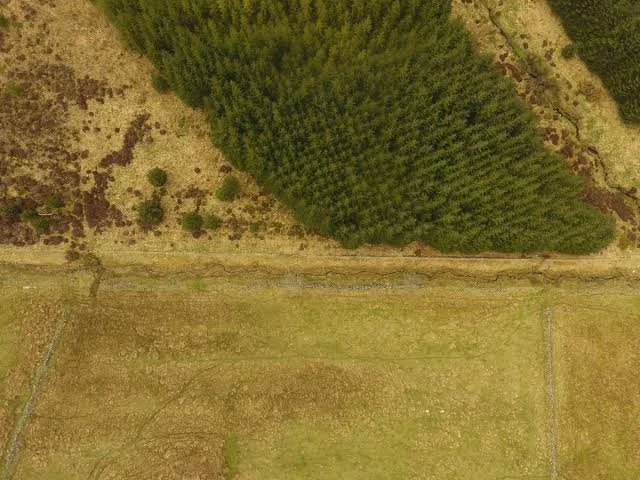
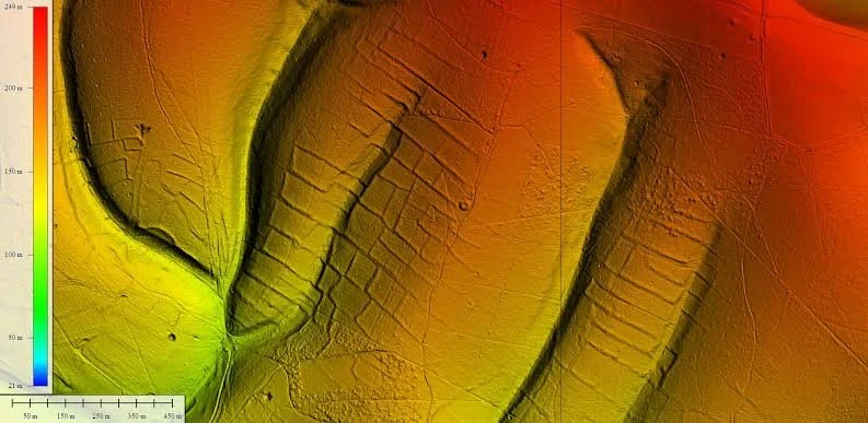
Drone-based mapping offers a way to document these features in detail. By collecting aerial photographs and other remote-sensing data, researchers can create precise models of terrain and identify patterns that may be difficult to see from the ground. However, the detection of a terrace does not automatically establish its age or original use.

Why Terraces Are Difficult to Identify

Terraces can take several forms, including stone retaining walls, earthen banks, level cultivation surfaces, and combinations of built structures and modified slopes. Some are clearly visible, while others have been reduced to subtle changes in ground elevation.

Vegetation can conceal walls and create misleading surface patterns. Tree roots may move stones, fallen branches can imitate linear features, and natural erosion may form ledges resembling abandoned agricultural structures.

Researchers therefore combine aerial imagery with ground inspection. A suspected terrace should be examined for construction materials, repeated geometry, drainage arrangements, and relationships with neighboring features.

The wider landscape is equally important. A sequence of roughly parallel benches following the contour of a slope may support an agricultural interpretation, but researchers must consider other possible explanations, including paths, quarrying, defensive earthworks, and natural geological formations.

Drone Photogrammetry and Three-Dimensional Models

One of the most useful drone-based methods is photogrammetry. A drone captures overlapping photographs from different positions, and software identifies common features across the images to reconstruct the surface in three dimensions.

The resulting model can be used to generate a digital elevation model, orthophotograph, and other spatial products. These allow researchers to examine terrace boundaries, retaining walls, slope gradients, and relationships between agricultural features and the surrounding terrain.

Accurate results depend on flight planning, image overlap, lighting, camera quality, and ground control. Ground control points or other reliable positioning methods help ensure that the model aligns with real-world coordinates.

Dense vegetation creates a major limitation. Photogrammetry primarily records visible surfaces, so a model may represent the tops of trees rather than the ground beneath them. Researchers must not mistake a detailed forest-canopy model for an accurate representation of hidden terrace structures.

LiDAR and the Ground Beneath the Canopy

Light detection and ranging, commonly called LiDAR, measures distances using laser pulses. Airborne LiDAR systems can sometimes record returns from the ground through gaps in vegetation, allowing researchers to create terrain models that reveal features beneath forest cover.

This can be particularly useful for locating subtle terraces, abandoned paths, drainage channels, and other landscape modifications. However, performance depends on vegetation density, instrument specifications, flight conditions, and the quality of the data-processing methods.

LiDAR is not automatically available or necessary for every project. Drone photogrammetry, satellite imagery, historical maps, and ground survey may provide sufficient information in more open landscapes.

The choice of method should depend on the research question and the environmental conditions. In dense forest, LiDAR may offer advantages; in an open agricultural landscape, high-resolution photography may be more cost-effective.

Mapping Terrace Networks and Water Management

Terraces rarely functioned as isolated features. Their construction could be part of a wider system involving paths, irrigation channels, drainage routes, storage areas, and settlements.

Drone-derived terrain models can help researchers map these relationships. Digital elevation analysis can reveal how water may have moved across a slope and identify places where drainage structures might have been necessary.

However, modern terrain reflects both natural and human processes since the terraces were abandoned. Erosion, landslides, tree growth, and later construction may have altered the original design.

Hydrological modeling can test plausible water-flow patterns, but it cannot independently establish how ancient farmers managed their fields. Researchers must compare the model with physical evidence of channels, walls, sediment deposits, and other agricultural features.

Dating Abandoned Terraces

Mapping can reveal the form and extent of a terrace system, but establishing its age requires separate evidence. A terrace may have been constructed in one period and reused, repaired, or expanded in later centuries.

Researchers can excavate carefully selected sections to examine construction layers, buried soils, and associated artifacts. Radiocarbon dating may be possible where suitable organic material is securely associated with construction or use, while other dating methods may be appropriate in particular settings.

Soil formation can provide additional information about the sequence of cultivation and abandonment. However, soil characteristics are influenced by climate, vegetation, erosion, and agricultural practices, so they rarely provide a precise date on their own.

Historical maps and documents may establish when some terraces were cultivated, but they do not necessarily identify the original construction date. The most reliable chronology combines several independent forms of evidence.

Forest Recovery and Long-Term Land Use

The return of woodland to abandoned terraces can reveal changes in land use, population, agricultural economics, and environmental conditions. Yet forest recovery does not always indicate a simple decline in human activity.

Some terraces may have been abandoned because of changing markets, new farming methods, labor shortages, conflict, or shifts in settlement patterns. Others may have remained in use intermittently, with cultivation alternating between periods of activity and abandonment.

Researchers can compare vegetation records, soil profiles, historical sources, and archaeological settlement patterns to investigate these possibilities. Pollen and charcoal sequences may reveal changes in vegetation and burning, while tree-ring evidence can sometimes contribute to local environmental chronology.

The relationship between abandonment and forest growth must be established for each landscape. Natural succession can occur at different rates depending on climate, seed availability, soil condition, and continued human disturbance.

Conservation and the Future of Terrace Landscapes

Abandoned terraces can be valuable cultural landscapes, preserving evidence of agricultural engineering and long-term environmental adaptation. They may also provide habitats for plants and animals, making conservation decisions relevant to both cultural heritage and ecology.

Drone surveys can create detailed records before restoration, construction, or vegetation management changes the landscape. Repeated surveys may also reveal erosion, wall collapse, or other deterioration.

However, remote sensing should not replace field verification. Conservation plans require an understanding of the structures' age, significance, and current condition. Clearing vegetation without careful assessment can damage fragile walls or expose soils to erosion.

Access, land ownership, privacy, and local regulations must also be considered when conducting drone surveys. Collaboration with landowners and local communities can help ensure that mapping supports responsible research and conservation.

Conclusion: Reconstructing Agricultural Landscapes from Above

Drone mapping and related remote-sensing methods have expanded the ability of archaeologists to document abandoned agricultural terraces. High-resolution imagery and terrain models can reveal patterns of land modification that remain difficult to see beneath recovering vegetation.

Nevertheless, remote sensing identifies physical features more readily than it establishes their date, purpose, or social history. Ground survey, excavation, environmental analysis, and documentary evidence remain essential for interpreting the landscape.

By combining these approaches, researchers can reconstruct how people transformed hillsides into productive agricultural spaces and how those landscapes changed after cultivation declined. The result is not merely a map of old fields, but a record of long-term relationships between farming, environmental management, settlement, and ecological recovery.

Matsieng: Lesotho's Paramount Chief Palace

October 12, 2026

Introduction

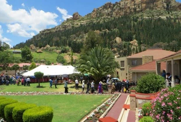
Matsieng is strongly associated with the Basotho royal and chiefly tradition and occupies an important place in Lesotho's historical geography.

The title Matsieng: Lesotho's Paramount Chief Palace evokes a formal residence associated with senior traditional leadership.

The word "palace" should not necessarily be interpreted according to the European model of monumental royal architecture. Traditional Basotho leadership was expressed through compounds, residences, meeting spaces, livestock areas, ceremonial locations, and surrounding settlements.

Understanding Matsieng therefore requires examining what political authority looked like in a Basotho context.

Traditional Leadership in Lesotho

Lesotho's political system developed through chiefly and royal institutions.

Chiefs were responsible for administering communities, managing land relationships, resolving disputes, and representing political authority.

The king occupied the highest position in the national traditional hierarchy.

Below the monarch were various levels of chiefs and local authorities.

The Chief's Residence

A senior chief's residence was an important political center.

Visitors could come to discuss disputes, request assistance, deliver messages, trade goods, or participate in ceremonies.

The residence therefore functioned as a meeting point between political authority and ordinary communities.

Its significance extended beyond architecture.

Why Call It a Palace?

The term "palace" is useful for modern readers because it communicates the importance of the residence.

However, it can also create misleading expectations.

A Basotho chiefly residence did not need enormous stone halls or monumental courtyards to represent political authority.

Authority could be expressed through social relationships and spatial organization.

Matsieng and Royal History

Matsieng has associations with the wider Basotho royal landscape.

Such places are important because royal history in Lesotho is not concentrated in a single monumental capital.

Instead, political geography is distributed across settlements, mountains, agricultural areas, roads, graves, and traditional communities.

Architecture and Landscape

A historical chiefly compound might include:

  • residential structures,

  • meeting spaces,

  • livestock enclosures,

  • storage areas,

  • kitchens,

  • agricultural land,

  • paths,

  • and ceremonial spaces.

The surrounding landscape was equally important.

Water sources, grazing areas, roads, and mountain passes influenced settlement decisions.

Oral Traditions and Genealogy

Genealogy is particularly important in Basotho historical research.

Names of chiefs and royal figures can help establish relationships between communities.

Oral traditions may preserve memories of where leaders lived or where important decisions occurred.

Such evidence becomes more powerful when compared with historical documentation.

Colonial Transformation

The colonial period altered the political environment of Lesotho.

Traditional authorities increasingly operated within administrative structures created by colonial government.

This did not eliminate chiefly authority.

Instead, traditional leadership became incorporated into new systems of administration.

Historical residences consequently became places where indigenous political traditions and colonial governance intersected.

Heritage and Modern Lesotho

Traditional leadership remains important to Lesotho's national identity.

Historic chiefly sites can therefore have significance beyond archaeology.

They may serve as places of memory, ceremony, genealogy, and community identity.

Conservation must consequently consider both physical structures and living cultural traditions.

Conclusion

Matsieng: Lesotho's Paramount Chief Palace can be understood as a study of traditional political architecture and the geography of Basotho leadership.

The historical importance of a chiefly residence does not depend on monumental construction.

Its significance lies in the people who gathered there, the decisions made there, the relationships maintained there, and the traditions associated with the site.

Thota-e-Makubung: Lesotho's Initiation School

October 12, 2026

Introduction

Initiation has historically played an important role in many southern African societies.

The title Thota-e-Makubung: Lesotho's Initiation School evokes a landscape associated with the education and social transformation of young people within Basotho cultural traditions.

The term "school" should not be understood exclusively in the modern institutional sense.

Traditional initiation involved education, discipline, social responsibility, cultural knowledge, and preparation for adult life.

Initiation in Basotho Society

Traditional initiation could mark important stages in a person's social development.

Participants learned expectations concerning adulthood, family responsibilities, community behavior, and cultural values.

Instruction could involve elders and experienced community members.

The knowledge transmitted was practical as well as symbolic.

Learning Outside Classrooms

Traditional education was often embedded within everyday life.

Young people learned through observation, participation, storytelling, work, ceremonies, and interaction with elders.

Initiation intensified this process.

A secluded or designated initiation location could provide an environment in which particular knowledge was transmitted away from ordinary daily routines.

Landscape and Initiation

Mountain landscapes could be especially suitable for initiation-related activities.

Remote locations offered privacy.

Natural features could also become part of ceremonial symbolism.

Caves, rock formations, forests, streams, and hills could acquire cultural significance.

However, the presence of an isolated structure does not automatically establish that it was an initiation school.

Knowledge Transmission

Initiation education could encompass different types of knowledge.

Depending on community and historical period, this could include:

  • social responsibilities,

  • family relationships,

  • moral expectations,

  • traditional practices,

  • songs,

  • histories,

  • community rules,

  • and practical knowledge.

Much of this information was transmitted orally.

Cultural Change

Initiation practices have changed significantly over time.

Christian missionary activity, colonial administration, formal education, urbanization, and modern social expectations affected traditional practices.

Some communities adapted older traditions.

Others abandoned particular practices.

Still others preserved them in modified forms.

Archaeological Evidence

Initiation sites can be challenging to identify archaeologically.

They may leave limited permanent structures.

Researchers may instead examine:

  • shelters,

  • hearths,

  • temporary structures,

  • rock markings,

  • artifacts,

  • oral traditions,

  • historical records,

  • and landscape organization.

Ethnographic research can be especially valuable.

Ethical Considerations

Research involving initiation traditions requires sensitivity.

Some knowledge may be restricted.

Researchers should not assume that all cultural information is intended for public publication.

Heritage research must respect community authority and cultural privacy.

Conclusion

Thota-e-Makubung: Lesotho's Initiation School provides an opportunity to explore education as a cultural institution rather than simply as a modern classroom system.

Whether a particular site can securely be identified as an initiation school requires supporting evidence.

Nevertheless, initiation traditions demonstrate that education has always involved more than literacy.

It can transmit identity, responsibility, history, ethics, and knowledge from one generation to the next.

Khubelu: Lesotho's Cliff Dwellings

October 12, 2026

Introduction

Lesotho's dramatic highland terrain contains caves, rock shelters, cliffs, overhangs, and natural formations that have attracted human occupation for thousands of years.

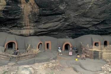
The title Khubelu: Lesotho's Cliff Dwellings evokes settlements or habitation areas constructed against steep rock faces.

Cliff-associated habitation is especially significant because natural shelters can preserve archaeological evidence better than exposed settlements.

The Lesotho Highlands

Lesotho is dominated by mountainous terrain.

The eastern highlands contain dramatic sandstone formations, deep valleys, and elevated plateaus.

These landscapes provided both opportunities and challenges for human communities.

Rock shelters offered protection from weather and potentially from predators or hostile groups.

Rock Shelters as Habitation

People have used rock shelters in southern Africa for extremely long periods.

Such locations can preserve:

  • stone tools,

  • hearths,

  • animal bones,

  • pigments,

  • pottery,

  • beads,

  • and other materials.

Layers accumulated over time can create archaeological sequences showing changes in technology and subsistence.

Cliff Dwellings and Fortification

A shelter located high above a valley can also provide visibility.

People could observe approaching travelers, livestock, or environmental changes.

However, high elevation does not automatically mean a site was defensive.

Accessibility, water supply, food resources, and economic activities must also be considered.

Basotho Settlement

Later Basotho communities developed extensive settlement systems across the highlands.

Stone-built homes and livestock enclosures became characteristic features of many landscapes.

Some structures were built close to cliffs or natural rock formations.

This created a layered landscape where prehistoric, historic, and modern occupation could occur in the same region.

Archaeological Stratigraphy

The major value of a rock shelter lies in stratigraphy.

Different layers can represent different periods.

Researchers can use radiocarbon dating, stone-tool analysis, pottery studies, animal remains, and environmental evidence to reconstruct changes over time.

A shelter may therefore preserve thousands of years of history in a relatively small area.

Climate and Human Adaptation

Highland environments can be harsh.

Cold temperatures, snow, strong winds, and seasonal changes influence settlement.

People had to adapt their diets, clothing, architecture, and mobility to these conditions.

Cliff shelters could provide valuable protection.

Conservation Problems

Rock shelters are vulnerable to several threats.

These include:

  • erosion,

  • vandalism,

  • uncontrolled tourism,

  • livestock disturbance,

  • graffiti,

  • fire,

  • and development.

Painted surfaces are particularly vulnerable.

Conservation requires careful documentation and controlled access.

Conclusion

Khubelu: Lesotho's Cliff Dwellings highlights the relationship between people and Lesotho's dramatic geology.

A specific cliff settlement requires archaeological verification before its age and function can be established.

Nevertheless, cliff and rock-shelter sites across Lesotho demonstrate how humans repeatedly adapted to mountainous environments.

The most important story is not simply that people lived beneath cliffs, but how these shelters became part of long-term relationships between communities, animals, climate, and landscape.

Mokhotlong: Lesotho's Border Forts

October 12, 2026

Introduction

Mokhotlong lies in one of Lesotho's most mountainous regions.

Its location near the eastern highlands places it within a landscape shaped by difficult passes, deep valleys, and connections across the Drakensberg.

The title Mokhotlong: Lesotho's Border Forts suggests defensive structures associated with the region's strategic position.

The term "border fort" should be used carefully because modern national boundaries do not always correspond to the political geography of earlier periods.

Mountain Passes and Political Boundaries

Mountain ranges can act as barriers, but they can also become routes.

A pass may connect communities that would otherwise be separated by steep terrain.

This makes the Mokhotlong region strategically important.

People traveling between Lesotho and neighboring territories could use mountain corridors.

Defensive Architecture

Defensive structures can take many forms.

They may include:

  • stone walls,

  • fortified settlements,

  • lookout positions,

  • enclosed compounds,

  • naturally defensible hills,

  • and temporary military camps.

Not every stone enclosure was a fort.

The Nineteenth-Century Context

The nineteenth century was a period of intense political change in southern Africa.

The Basotho kingdom developed amid conflict, migration, and competition for land.

The Free State–Basotho conflicts transformed political geography.

Mountain strongholds could therefore provide important defensive advantages.

Natural Fortifications

Lesotho's mountains themselves could serve as defensive infrastructure.

A settlement located on a steep plateau might be difficult for attackers to approach.

Narrow passes could be controlled.

High ground provided visibility.

This meant that formal fortification did not always require large walls.

Colonial Borders

The modern border between Lesotho and South Africa developed through nineteenth-century political processes.

The creation of colonial boundaries divided landscapes that had previously been connected through migration, trade, grazing, and kinship.

A site described today as a "border fort" may therefore have served a different purpose when it was constructed.

Archaeological Identification

Researchers examining possible defensive sites would look for:

  • strategic positioning,

  • walls,

  • entrances,

  • defensive terraces,

  • weapons,

  • ammunition,

  • domestic remains,

  • and evidence of occupation.

Historical maps and oral traditions can strengthen interpretations.

Heritage Importance

Mokhotlong's defensive landscapes are part of a broader history of Basotho resilience.

The mountains provided refuge, economic resources, and strategic advantages.

They also shaped the development of communities that had to negotiate difficult political conditions.

Conclusion

Mokhotlong: Lesotho's Border Forts is best understood as an exploration of defensive landscapes rather than proof that a standardized chain of border forts once guarded a modern frontier.

The region's geography was itself a powerful defensive resource.

Mountain passes, high plateaus, valleys, and settlements formed an interconnected system through which people moved, traded, fought, and protected their communities.

Tsoelike: Lesotho's Gold Panning Sites

October 12, 2026

Introduction

The possibility of gold working and gold panning in Lesotho's mountainous river systems raises interesting questions about mineral resources, local knowledge, and economic activity.

The title Tsoelike: Lesotho's Gold Panning Sites suggests a landscape where people extracted alluvial gold from river sediments.

Such activity needs to be distinguished from large-scale industrial mining.

Gold panning is a relatively simple technique in which sediment is processed to recover dense gold particles.

Gold in River Systems

Gold can become concentrated in river sediments after weathering breaks down gold-bearing rocks.

Water transports lighter materials while heavier particles can accumulate in particular parts of a river channel.

Traditional prospectors may search areas where sediment naturally concentrates.

Lesotho's Geological Landscape

Lesotho is dominated by geological formations associated with the Drakensberg and surrounding highlands.

The country's mineral resources are diverse.

However, claims of specific commercially important gold deposits require geological evidence.

A river containing occasional mineral particles does not necessarily represent a major goldfield.

Traditional Knowledge

Prospecting requires detailed knowledge of landscapes.

People can recognize particular sediment types, stream conditions, rock formations, and mineral indicators.

Local knowledge may therefore contribute to understanding historical resource use.

Archaeological Evidence

Evidence for historical gold panning could include:

  • disturbed river sediments,

  • pits,

  • stone tools,

  • washing areas,

  • processing equipment,

  • settlement remains,

  • and associated artifacts.

However, natural erosion can produce similar features.

Archaeological interpretation therefore requires careful fieldwork.

Gold and Social Value

Gold has historically been valued because of its physical properties.

It does not corrode easily.

Its appearance makes it attractive for ornaments and prestige goods.

But the economic importance of gold depends on quantity and accessibility.

Small-scale panning could supplement household income without becoming a major regional industry.

Modern Prospecting

Modern interest in mineral resources can create tension between economic development and environmental protection.

Mining can affect rivers through sediment disturbance, water pollution, habitat destruction, and landscape alteration.

Small-scale panning can also have environmental consequences.

Environmental Archaeology

Researchers studying historical mining should consider environmental evidence.

Sediment layers can reveal changes in erosion.

Heavy-metal concentrations may indicate mineral processing.

Pollen and charcoal can reveal changes in surrounding vegetation.

This allows mining history to be connected with environmental history.

Conclusion

Tsoelike: Lesotho's Gold Panning Sites should be treated as a subject requiring geological and archaeological verification rather than as evidence of a major hidden gold industry.

If historical panning occurred, its significance would lie in demonstrating how communities interacted with river systems and mineral resources.

Gold stories often attract attention because of the value of the material, but the deeper historical question is how people recognized, extracted, exchanged, and valued natural resources within their environment.

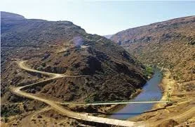
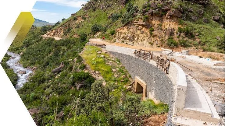
Sani Pass: Lesotho's Drakensberg Trade Route

October 12, 2026

Introduction

Few landscapes better demonstrate the relationship between geography and human movement than the Drakensberg mountain passes.

The title Sani Pass: Lesotho's Drakensberg Trade Route refers to one of the most famous routes crossing the mountains between the KwaZulu-Natal region of South Africa and Lesotho.

Sani Pass is best known today as a dramatic mountain road and tourist route, but mountain passes have long been important corridors for movement.

The Geography of Sani Pass

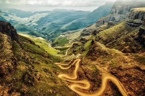
Sani Pass crosses the Drakensberg escarpment.

The route rises dramatically from the South African side toward the Lesotho highlands.

Its steep terrain makes travel difficult, especially during winter or heavy weather.

Yet the existence of a pass demonstrates that mountains do not completely isolate communities.

Trade Across Mountains

Trade routes connect environments with different resources.

Lowland communities could exchange agricultural products, livestock, manufactured goods, and other commodities with highland communities.

Pastoralists and farmers could therefore participate in complementary economic systems.

The Basotho Highlands

The Lesotho highlands provided extensive grazing and access to resources adapted to cooler environments.

Horses became particularly important in Lesotho.

The famous Basotho pony eventually became closely associated with mountain transportation.

Mountain routes could therefore support both human and animal movement.

Missionaries and Travelers

During the nineteenth century, missionaries, traders, explorers, officials, and other travelers used routes through the Drakensberg.

Their written accounts provide historical information about landscapes and communities.

However, these accounts must be interpreted critically because they reflect the perspectives and assumptions of their authors.

Colonial Border Formation

The modern political border between Lesotho and South Africa developed during the colonial period.

Earlier movement was not necessarily organized around the same boundary.

Trade, kinship, livestock movement, and seasonal travel could cross the mountains.

The later border transformed these relationships.

The Pass as a Cultural Landscape

Sani Pass is not simply a road.

It is a landscape containing:

  • geological formations,

  • mountain streams,

  • grazing areas,

  • historical routes,

  • settlements,

  • administrative boundaries,

  • and tourism infrastructure.

Each layer represents a different period of human interaction.

Archaeological Potential

Researchers studying the route might investigate:

  • old trails,

  • resting places,

  • shelters,

  • artifacts,

  • abandoned structures,

  • livestock-related remains,

  • and historical maps.

Such evidence could help reconstruct how people traveled before modern roads.

Modern Tourism

Today Sani Pass is internationally recognized as a spectacular mountain route.

Tourism has created economic opportunities but also environmental pressures.

Vehicles can damage fragile surfaces.

Increased visitor numbers can disturb archaeological sites.

Responsible tourism is therefore essential.

Conclusion

Sani Pass: Lesotho's Drakensberg Trade Route illustrates how mountain geography can simultaneously separate and connect communities.

The pass has served different functions at different times: pathway, trade corridor, political boundary, transport route, and tourist destination.

Its history demonstrates that mountains are not merely obstacles.

For the people who understand them, mountains contain routes, resources, and connections.

Underberg: South Africa's Natal San Art

October 12, 2026

Introduction

Underberg lies in the foothills of the southern Drakensberg in KwaZulu-Natal.

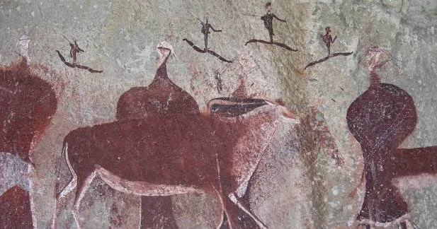
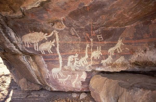
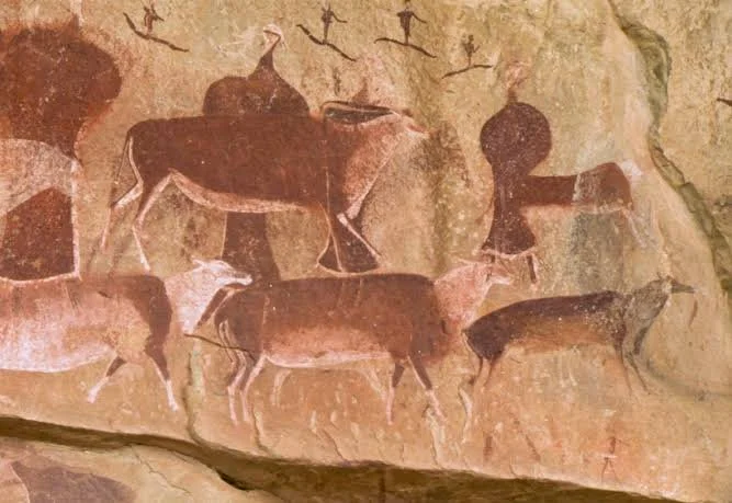
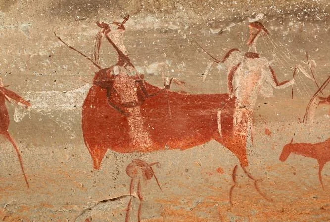
The surrounding landscape contains an extraordinary concentration of rock art associated primarily with San hunter-gatherer traditions.

The title Underberg: South Africa's Natal San Art places the region within this larger rock-art heritage.

The southern Drakensberg is especially important because its shelters preserve paintings that provide insights into the symbolic worlds, social practices, and spiritual traditions of southern African hunter-gatherer communities.

San Rock Art

San rock art is among the most important archaeological records in southern Africa.

Paintings commonly depict:

  • humans,

  • eland,

  • other animals,

  • hunting scenes,

  • dancing figures,

  • therianthropes,

  • and abstract or unusual forms.

These images were not simply illustrations.

They could have religious, social, and ritual meanings.

The Eland

The eland occupies an especially important position in many interpretations of San rock art.

It was a large and powerful animal.

Eland imagery may be associated with concepts of potency, rain, transformation, trance, and spiritual power.

However, not every eland painting necessarily carried exactly the same meaning.

Context matters.

The Drakensberg Shelters

The mountains contain thousands of rock shelters.

Some preserve paintings remarkably well because they are protected from direct rainfall.

Pigments were commonly made from mineral and organic materials.

Red, orange, white, yellow, black, and other tones could be produced from locally available substances.

Dating the Art

Dating rock art is difficult.

Researchers use multiple methods, including:

  • pigment analysis,

  • radiocarbon dating where possible,

  • archaeological deposits,

  • stylistic comparison,

  • and association with dated cultural materials.

Not every painting can be assigned a precise age.

Underberg's Landscape

The Underberg area provides an important transition between lowlands and mountains.

This environmental diversity supported different forms of subsistence.

People could hunt, collect plant foods, exploit river systems, and move between ecological zones.

The landscape therefore formed part of the cultural world represented in the art.

Colonial Contact

Later colonial expansion profoundly affected San communities.

Land dispossession, warfare, labor changes, and demographic transformation disrupted many traditional ways of life.

The disappearance of particular communities does not mean their cultural history disappeared.

Rock shelters preserve material evidence of earlier lifeways.

Conservation

Rock art is extremely fragile.

Damage can result from:

  • moisture,

  • biological growth,

  • vandalism,

  • touching,

  • smoke,

  • dust,

  • and uncontrolled tourism.

Conservation therefore requires careful management.

Conclusion

Underberg: South Africa's Natal San Art belongs to one of the world's most important traditions of prehistoric and historic rock art.

The paintings should not be treated simply as ancient decoration.

They represent a sophisticated visual record of relationships between people, animals, landscape, ritual, and spiritual experience.

Their survival provides an extraordinary opportunity to understand southern Africa's deep human history.

Howick Falls Cave: South Africa's 2M-Year-Old Axe

October 12, 2026

Introduction

The title Howick Falls Cave: South Africa's 2M-Year-Old Axe evokes one of the most dramatic possibilities in southern African archaeology: an extremely ancient stone tool associated with early hominin activity.

However, the specific claim of a 2-million-year-old axe at Howick Falls Cave should not be presented as an established discovery without secure archaeological documentation.

The Howick Falls area is nevertheless historically and archaeologically significant, and the broader KwaZulu-Natal region contains important evidence for early human and hominin activity.

The Importance of Stone Tools

Stone tools are among the oldest forms of technology known from the human archaeological record.

They demonstrate that ancient hominins could select raw materials, strike stones in controlled ways, and produce sharp edges.

The earliest technologies are generally associated with simple core-and-flake industries.

The Acheulean Tradition

The Acheulean technological tradition is famous for handaxes and other bifacial tools.

These implements became widespread in Africa and later in other parts of the Old World.

Classic handaxes can display carefully shaped cutting edges.

Their production required planning and technical skill.

Why Dating Matters

A stone tool cannot be dated simply by examining its appearance.

Archaeologists establish age through geological context and dating methods.

These can include:

  • stratigraphic relationships,

  • radiometric techniques,

  • paleomagnetic evidence,

  • volcanic deposits,

  • and associated fauna.

A tool removed from its original context becomes much harder to date securely.

Howick Falls and the KwaZulu-Natal Landscape

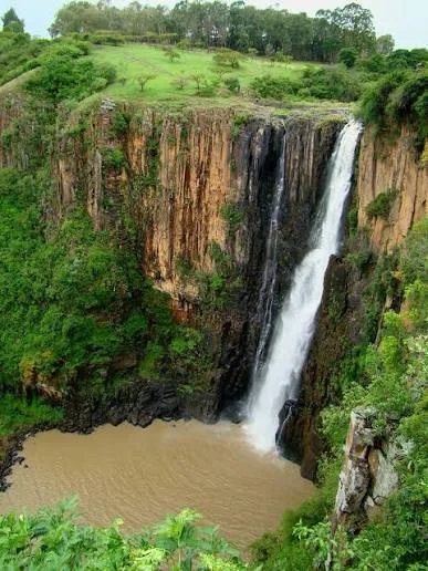
Howick Falls is part of a landscape shaped by rivers, sandstone, cliffs, and deeply eroded valleys.

The region contains numerous caves and shelters.

Such environments can preserve archaeological deposits, although preservation varies considerably.

Cave Archaeology

Caves can preserve long sequences of occupation.

Sediments accumulate over time.

Within these layers, researchers may find:

  • stone tools,

  • animal bones,

  • charcoal,

  • hearths,

  • pigments,

  • and other evidence.

The challenge is determining whether objects remained in their original position.

The Meaning of an "Axe"

The term "axe" can also create confusion.

Archaeological handaxes are generally cutting tools, not necessarily axes used for chopping wood in the modern sense.

Their exact functions varied.

They may have been used for butchery, woodworking, processing plants, or other tasks.

Avoiding Overstatement

If an artifact is described as two million years old, the claim must be supported by reliable archaeological context.

An isolated stone artifact with no secure dating cannot automatically be assigned such an age.

This distinction is essential for responsible public archaeology.

Early Human Technology in South Africa

Southern Africa contains an exceptionally important record of human evolution.

The broader region has produced evidence relevant to early hominins, Middle Stone Age technology, Later Stone Age societies, and later farming communities.

KwaZulu-Natal forms an important part of this wider archaeological landscape.

Conclusion

Howick Falls Cave: South Africa's 2M-Year-Old Axe is best treated as a title pointing toward the fascinating question of very early stone technology rather than as confirmation of a specific two-million-year-old axe at the site.

The genuine archaeological story is already remarkable.

Stone tools provide evidence of technological behavior extending deep into human evolutionary history.

The scientific challenge is to establish exactly when, where, and by whom each artifact was made.

Sibhonyweni Cave: South Africa's Pastoral Rock Art

October 12, 2026

Introduction

The rock shelters and caves of southern Africa preserve evidence from many different periods.

Some contain hunter-gatherer paintings.

Others preserve archaeological deposits associated with pastoralism, farming, or later communities.

The title Sibhonyweni Cave: South Africa's Pastoral Rock Art evokes imagery associated with pastoral communities and the introduction of livestock into southern African landscapes.

The interpretation of particular paintings must be based on archaeological context rather than assumptions from subject matter alone.

Pastoralism in Southern Africa

Pastoralism introduced a major economic transformation into parts of southern Africa.

Early herding communities kept livestock such as sheep and cattle and developed new relationships with landscapes.

Pastoralism did not necessarily replace hunting and gathering immediately.

Different economic strategies could coexist.

Rock Art and Livestock

Some southern African rock art includes animals that researchers have interpreted as domestic livestock or scenes potentially related to herding.

However, distinguishing wild from domesticated animals in paintings can be difficult.

Artists did not necessarily depict animals realistically according to modern standards.

The Archaeological Context

A painting becomes more informative when associated with archaeological deposits.

Excavations can reveal:

  • animal bones,

  • pottery,

  • stone tools,

  • beads,

  • metal objects,

  • hearths,

  • and settlement remains.

These materials can help establish whether pastoralists occupied the shelter.

Interaction Between Communities

The arrival of pastoralism did not produce a simple replacement of one population by another.

Hunter-gatherers, herders, and later farmers interacted.

They exchanged goods.

They may have intermarried.

They sometimes competed for resources.

Rock art can provide evidence for this cultural interaction.

Symbolic Meaning

Pastoral imagery may have had meanings beyond economic activity.

Animals can represent wealth, fertility, ancestry, identity, or social status.

A painted livestock animal should therefore not automatically be interpreted as an inventory illustration.

Dating

Dating rock paintings remains challenging.

Researchers may combine pigment analysis with archaeological layers and stylistic studies.

Where direct dating is possible, it can greatly improve understanding.

But many paintings remain difficult to date precisely.

Conservation

Cave art can be damaged by moisture, touching, smoke, graffiti, and changes in the cave environment.

Conservation requires minimizing disturbance.

Digital photography and three-dimensional recording can help preserve information.

Conclusion

Sibhonyweni Cave: South Africa's Pastoral Rock Art offers a valuable framework for examining the transition toward herding economies in southern Africa.

A specific painting should not automatically be labeled pastoral without contextual evidence.

Nevertheless, the wider archaeological record demonstrates that livestock keeping became an important component of southern African history and created new relationships between people, animals, landscapes, and cultural identity.

Nkuhlu Cave: South Africa's Late Stone Age

October 12, 2026

Introduction

The Late Stone Age represents one of the most important archaeological periods in southern African prehistory.

The title Nkuhlu Cave: South Africa's Late Stone Age evokes a cave landscape containing evidence of hunter-gatherer occupation during this later prehistoric period.

Caves are particularly valuable archaeological environments because sediments can preserve repeated occupations over long periods.

What Is the Late Stone Age?

The Late Stone Age is a broad archaeological term used for later hunter-gatherer traditions in southern Africa.

It is characterized by technological and cultural diversity.

People produced increasingly varied stone tools and used bone, shell, pigments, and other materials.

Small Stone Tools

Microlithic technologies are often associated with the Later Stone Age.

Small stone tools could be inserted into composite implements.

This allowed people to create flexible hunting and cutting technologies.

The technology reflects sophisticated knowledge of stone fracture and tool design.

Hunting and Gathering

Late Stone Age communities relied on diverse resources.

These could include:

  • wild game,

  • fish,

  • shellfish,

  • roots,

  • fruits,

  • seeds,

  • insects,

  • and other plant foods.

The importance of each resource depended on local ecology.

Cave Occupation

Caves could serve many purposes.

People might use them as long-term residential spaces, temporary camps, seasonal shelters, ritual locations, or places for specialized activities.

Archaeologists determine function by examining the distribution of artifacts and features.

Pigments and Symbolism

Red ochre and other pigments appear frequently in Later Stone Age contexts.

Pigments may have been used for body decoration, painting, ritual activities, hide processing, or other purposes.

Their presence demonstrates that color was an important material in prehistoric life.

Beads and Social Networks

Shell beads and other ornaments are particularly important because they can reveal social relationships.

Objects can travel considerable distances.

A bead found at a site may originate far from the location where it was deposited.

This provides evidence for exchange networks.

Environmental Change

Late Stone Age communities adapted to changing environments.

Climate fluctuations affected vegetation, water availability, and animal populations.

People responded through mobility and changes in resource use.

Archaeological Preservation

Caves can preserve organic remains better than exposed sites.

Animal bones, charcoal, shells, and occasionally plant remains may survive.

These materials allow researchers to reconstruct diet and environment.

Conclusion

Nkuhlu Cave: South Africa's Late Stone Age represents the broader importance of cave archaeology for understanding prehistoric southern Africa.

Even when a particular cave has not produced a famous discovery, its sediments can preserve evidence of everyday life.

The Late Stone Age was not a period of technological stagnation.

It was characterized by adaptation, innovation, social networks, artistic expression, and sophisticated relationships with the environment.

Goodenough Shelter: South Africa's Iron Age

October 12, 2026

Introduction

The Iron Age transformed southern African societies through new technologies, settlement patterns, agriculture, livestock keeping, craft specialization, and expanded social networks.

The title Goodenough Shelter: South Africa's Iron Age suggests a rock shelter or archaeological location associated with Iron Age activity.

The precise identification and chronology of a particular "Goodenough Shelter" should be verified through archaeological records, but the title provides a useful entry point into the wider Iron Age history of southern Africa.

The Arrival of Ironworking

Ironworking allowed communities to manufacture durable tools and weapons.

Iron technology did not simply replace stone tools.

Different materials continued to be used according to their functions and availability.

The introduction of metallurgy nevertheless transformed production.

Farming Communities

Iron Age societies increasingly practiced agriculture.

Crops varied by region and period.

Grain production could support larger and more permanent settlements than purely mobile hunting and gathering.

Livestock also became increasingly important.

Settlement Organization

Iron Age settlements could contain:

  • houses,

  • livestock enclosures,

  • grain-storage areas,

  • workshops,

  • middens,

  • and communal spaces.

The arrangement of these features can reveal social organization.

Pottery

Pottery is one of the most important archaeological indicators of Iron Age settlements.

Ceramic styles can help establish chronology and cultural relationships.

Researchers examine:

  • vessel shapes,

  • decoration,

  • manufacturing techniques,

  • clay composition,

  • and distribution.

Metalworking

Evidence for ironworking may include:

  • furnaces,

  • slag,

  • tuyères,

  • hammering areas,

  • and metal objects.

Smelting requires substantial knowledge of temperature control and raw-material selection.

Trade and Exchange

Iron Age communities participated in regional exchange.

Metals, beads, ceramics, agricultural products, livestock, and other goods could move between settlements.

Coastal and inland communities were connected through long-distance networks.

Rock Shelters and Iron Age Communities

A rock shelter could serve as a temporary camp, specialized activity location, or part of a larger settlement system.

The presence of Iron Age material does not necessarily mean that the shelter was a permanent village.

Context is essential.

Social Transformation

Iron Age societies became increasingly socially differentiated in many regions.

Some communities developed powerful chiefs and centralized political structures.

Others remained relatively decentralized.

Archaeology helps reveal these differences.

Conclusion

Goodenough Shelter: South Africa's Iron Age provides a useful lens through which to examine technological and social change in southern Africa.

A specific site's chronology must be established through excavation and dating.

Nevertheless, the broader Iron Age record demonstrates that southern African communities developed complex agricultural, pastoral, metallurgical, and exchange systems long before the colonial period.

Collingham Shelter: South Africa's Hunter-Gatherer

October 12, 2026

Introduction

The history of hunter-gatherer communities in southern Africa extends over an extraordinary span of time.

The title Collingham Shelter: South Africa's Hunter-Gatherer evokes a rock shelter associated with these communities and their distinctive archaeological traditions.

Rock shelters are particularly valuable because they can preserve evidence of activities that would otherwise disappear.

Hunter-Gatherer Lifeways

Hunter-gatherer societies were highly adaptive.

They relied on combinations of hunting, fishing, gathering plants, trapping small animals, and collecting other resources.

The balance changed according to season and environment.

Mobility

Mobility was an important strategy.

People could move between locations according to water availability, animal movements, plant seasons, and social requirements.

This does not mean that hunter-gatherers constantly wandered.

Many communities returned repeatedly to favored places.

Rock Shelters as Seasonal Homes

A shelter could be used repeatedly over generations.

Different occupations might leave separate layers.

One layer might represent a short hunting camp.

Another could represent a longer residential occupation.

This makes stratigraphy particularly important.

Stone Technology

Hunter-gatherers produced stone tools suited to different activities.

These could include:

  • scrapers,

  • points,

  • blades,

  • flakes,

  • cores,

  • and composite-tool components.

Tool assemblages provide clues about activities performed at the site.

Organic Materials

Bone tools, shell beads, ostrich eggshell beads, and other organic artifacts can provide additional evidence.

Some materials reveal technological knowledge.

Others reveal personal adornment and social identity.

Rock Art

Hunter-gatherer archaeology is closely connected with southern African rock art.

Paintings and engravings provide evidence for symbolic systems.

Researchers have connected some images with hunting, ritual, trance experiences, social identity, and relationships with animals.

Interpretations must remain sensitive to the complexity of the evidence.

Climate and Adaptation

Southern Africa experienced significant environmental changes during the Late Pleistocene and Holocene.

Hunter-gatherers responded through mobility, technological change, and adjustments in diet.

Archaeological deposits can reveal these adaptations.

Conclusion

Collingham Shelter: South Africa's Hunter-Gatherer represents the importance of preserving small archaeological locations alongside famous sites.

A modest shelter can contain evidence of human behavior accumulated over thousands of years.

Such sites reveal that hunter-gatherer societies were not technologically simple or environmentally passive.

They possessed detailed ecological knowledge and developed sophisticated systems for surviving and thriving in diverse landscapes.

Mkuzane Cave: South Africa's San Mythology

October 12, 2026

Introduction

Southern African rock shelters and caves preserve some of the most important evidence for San symbolic traditions.

The title Mkuzane Cave: South Africa's San Mythology suggests a cave landscape associated with stories, beliefs, or artistic traditions connected with San communities.

The distinction between archaeology and mythology is essential.

Archaeologists can document paintings, engravings, artifacts, and settlement remains.

They cannot automatically reconstruct the complete mythological meaning of an image without ethnographic, linguistic, or historical evidence.

San Cosmology

San societies have historically maintained diverse religious traditions.

There was never one single San religion shared identically by every community.

Nevertheless, ethnographic studies have documented recurring themes involving:

  • animals,

  • rain,

  • healing,

  • trance,

  • spiritual potency,

  • ancestors,

  • and transformation.

Rock Art and Belief

Rock paintings are frequently interpreted as expressions of spiritual experience.

Some figures appear human but display unusual features.

Others combine human and animal characteristics.

These images have sometimes been interpreted as transformed ritual specialists.

Trance and Healing

Ethnographic research among several southern African San communities has documented healing ceremonies involving dancing, music, altered states of consciousness, and perceived spiritual power.

Researchers have used this information to interpret earlier rock art.

However, ethnographic analogy must be used cautiously.

Modern practices cannot automatically be assumed to have remained unchanged for thousands of years.

The Eland

The eland frequently appears in southern African rock art.

It has been associated in some interpretations with spiritual potency and ritual transformation.

The animal's behavior and physical appearance may have contributed to its symbolic significance.

But individual paintings may have different meanings.

Mythology and Landscape

Caves and rock shelters can become culturally meaningful landscapes.

A location may be associated with particular stories, supernatural beings, ancestors, or ritual events.

Such associations may continue even after the original paintings become difficult to interpret.

Oral Traditions

Oral traditions can help preserve cultural meanings.

However, they must be recorded carefully.

Stories may change over generations.

Different communities may interpret the same landscape differently.

Archaeological Method

A responsible interpretation combines:

  • rock-art analysis,

  • archaeological deposits,

  • ethnography,

  • linguistics,

  • oral history,

  • environmental context,

  • and chronology.

No single source is sufficient.

Conclusion

Mkuzane Cave: South Africa's San Mythology highlights the extraordinary symbolic dimension of southern African archaeology.

The cave should not be treated simply as a place containing "myths carved in stone."

Instead, it represents a meeting point between material evidence and cultural memory.

Its greatest significance lies in the possibility of understanding how people connected animals, landscape, ritual, healing, and spiritual experience.

Ntabelanga: South Africa's Rock Paintings

October 12, 2026

Introduction

Southern Africa contains one of the world's richest traditions of prehistoric and historic rock art.

The title Ntabelanga: South Africa's Rock Paintings evokes a landscape in which painted rock surfaces preserve visual records created by communities long before modern written documentation.

A particular site named Ntabelanga should be identified through archaeological records before specific paintings, dates, or artists are attributed to it. Nevertheless, the subject provides an opportunity to examine the wider significance of South African rock paintings.

A Long Artistic Tradition

Rock art was produced over many thousands of years.

Different communities created different artistic traditions.

The paintings vary in:

  • subject,

  • technique,

  • pigment,

  • scale,

  • location,

  • and style.

This diversity demonstrates that there was no single "rock art culture."

Human Figures

Human figures are among the most recognizable subjects.

Some appear to be hunters.

Others may be dancers, ritual specialists, or participants in social activities.

Some unusual figures appear partly human and partly animal.

These images have generated extensive scholarly discussion.

Animals

Animals dominate many southern African rock-art sites.

Common subjects include:

  • eland,

  • antelope,

  • giraffe,

  • elephant,

  • buffalo,

  • and other species.

Animals were central to subsistence but could also carry powerful symbolic meanings.

Pigments

Artists used naturally occurring minerals and other substances to create pigments.

Red and orange colors often came from iron-rich materials.

White could be produced from mineral sources such as clay or other light-colored substances.

Black pigments could be derived from charcoal or manganese-rich materials.

The ability to prepare and apply these substances demonstrates considerable technical knowledge.

Painting Techniques

Artists could apply pigment using fingers, brushes, feathers, or other tools.

Some paintings were drawn in fine lines.

Others were filled with broad areas of color.

Superimposition is particularly valuable archaeologically.

When one painting overlaps another, researchers can sometimes establish relative chronology.

The Social Meaning of Art

Rock paintings were probably produced for many reasons.

Possible functions include:

  • ritual activity,

  • communication,

  • storytelling,

  • identity,

  • teaching,

  • commemoration,

  • and ceremonial practice.

It is unlikely that all paintings served the same purpose.

Landscape and Sacred Places

Rock-art locations were not random canvases.

The choice of shelter or cliff could itself be meaningful.

A site might overlook a valley, water source, hunting area, or important route.

The landscape therefore formed part of the artwork's context.

Conservation Challenges

Rock paintings are fragile.

Natural weathering gradually removes pigment.

Human activities can accelerate deterioration.

Graffiti, touching, smoke, water, and uncontrolled tourism can permanently damage surfaces.

Digital recording is increasingly important.

High-resolution photography and three-dimensional documentation can preserve information for future researchers.

Heritage and Indigenous Perspectives

Rock art is archaeological heritage, but it also concerns the descendants and cultural traditions of communities associated with southern Africa.

Interpretation should therefore avoid treating the paintings as anonymous curiosities.

Community involvement can help researchers understand cultural meanings and develop responsible conservation strategies.

Conclusion

Ntabelanga: South Africa's Rock Paintings represents the extraordinary depth of southern Africa's visual heritage.

Whether a particular site contains paintings from one period or several, each image forms part of a much larger history of human creativity.

The paintings demonstrate that prehistoric and historic communities communicated through visual symbolism, possessed sophisticated knowledge of pigments and landscapes, and created enduring cultural records without relying on written language.

Their survival allows modern researchers to study not only what ancient people saw, but also what they considered important enough to place upon the walls of the landscapes they inhabited.

← Newer Posts Older Posts →
Featured
images - 2026-10-28T160148.000.jpeg
October 28, 2026
Invisible Field Boundaries: Detecting Ancient Hedgerows with LiDAR
October 28, 2026
Read more →
October 28, 2026
images - 2026-10-28T160035.775.jpeg
October 28, 2026
Paleo-lakeside Cemeteries: Burials at Vanished Shorelines
October 28, 2026
Read more →
October 28, 2026
images+-+2026-10-17T225136.482.webp
October 28, 2026
Submerged Neolithic Causeways in the English Channel
October 28, 2026
Read more →
October 28, 2026
nabta-aggregate.webp
October 28, 2026
The Archaeology of Nightwatch Posts: Small Guard Stations and Social Order
October 28, 2026
Read more →
October 28, 2026
images - 2026-10-28T155920.814.jpeg
October 28, 2026
Reconstructing Ancient Roadside Inns from Faunal and Ceramic Data
October 28, 2026
Read more →
October 28, 2026
mascaras-de-ceramica-3.webp
October 28, 2026
Small-Scale Brick Kilns: Household Ceramic Production in Hinterlands
October 28, 2026
Read more →
October 28, 2026
read more

Powered by The archaeologist