CAMBRIDGE, ENGLAND—A research team from the University of Cambridge and the University of Oxford examined sediment samples taken from third-century A.D. sewer drains at Vindolanda, a Roman fort near Hadrian’s Wall in northern England, according to a statement from the University of Cambridge. Despite the presence of shared latrines, Roman soldiers at the fort still faced serious health risks due to unsanitary conditions and polluted food and water supplies. Microscopic analysis revealed the presence of roundworm and whipworm eggs, while Giardia duodenalis was identified using ELISA testing, a technique in which antibodies bind to proteins produced by single-celled organisms. This marks the first recorded identification of the protozoan Giardia duodenalis in Roman Britain. “Although the Romans understood intestinal worms, their medical practitioners had few effective treatments to eliminate these parasites or relieve diarrhea, allowing infections to continue and worsen,” said Marissa Ledger of the University of Cambridge. “Such long-term infections likely weakened the soldiers and impaired their ability to perform their duties.” The original academic study can be found in the journal Parasitology.
Fermanagh academic helps complete Irish history volume
A remarkable series of history books covering every county in Ireland from many different perspectives has concluded with the final volume on Antrim, co-edited by a Fermanagh academic.
Paul Clements has been reflecting on highlights from the Fermanagh and Tyrone volumes, and of the scope and vision of a huge literary undertaking.
The comprehensive project to write about every county in Ireland through an ambitious venture entitled ‘History and Society’ covers interdisciplinary essays on a multitude of topics.
The series began in 1985 when the Co. Tipperary volume was published, and eventually embraced all 32 counties, culminating in Co. Antrim.
The books brought together the knowledge, skills and experience of folklorists, archaeologists, historians, medievalists, environmentalists, toponymists and numerous other scholars.
The content has produced a wide interest to everyone and is a reminder of the centuries of richness in each county’s past.
The Antrim book, co-edited by Dr. Eileen Murphy, originally from Derrygonnelly, and her husband Dr. Colm Donnelly, came out in the autumn.
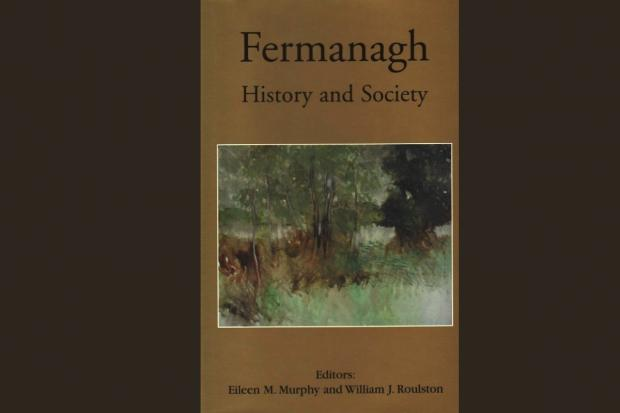
Cover of the Fermanagh volume, published in 2004.
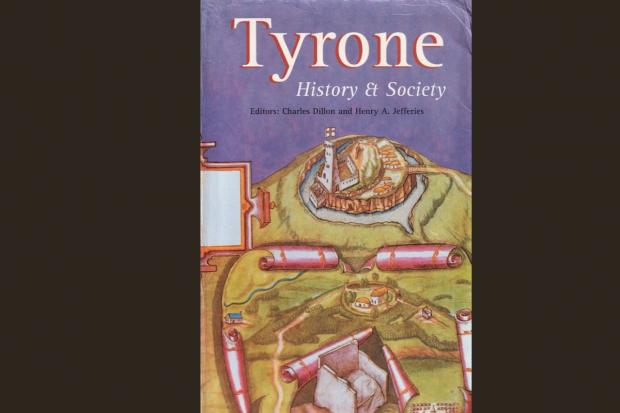
The Co. Tyrone book cover, published in 2000
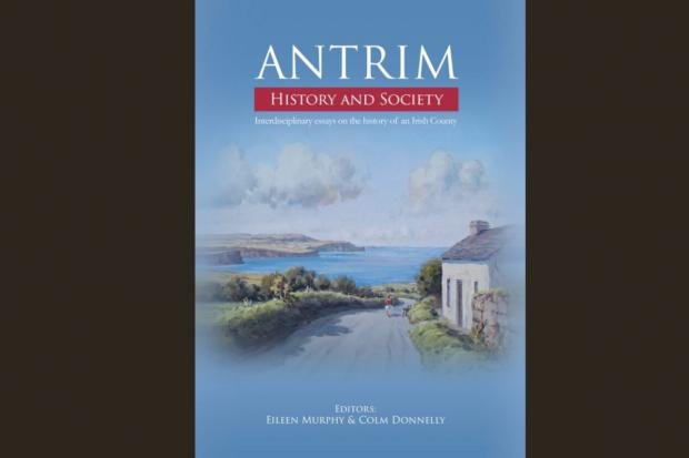
The cover of 'Antrim', the final book in the History And Society Irish County series.
A wide-ranging collection of history books examining every county in Ireland from multiple angles has reached its conclusion with the publication of the final volume on Antrim, co-edited by a Fermanagh-based academic.
Paul Clements has been looking back on key moments from the Fermanagh and Tyrone editions, as well as the ambition and scale of this major literary project.
The extensive initiative, titled History and Society, set out to document each Irish county through interdisciplinary essays covering a broad spectrum of subjects.
The series began in 1985 with the release of the County Tipperary volume and ultimately expanded to include all 32 counties, ending with County Antrim.
Contributors to the books included folklorists, archaeologists, historians, medieval scholars, environmental specialists, toponymists and many other experts, pooling their knowledge and experience.
The resulting volumes have attracted broad interest and highlight the deep historical richness present in every county.
The Antrim edition, co-edited by Dr. Eileen Murphy—originally from Derrygonnelly—and her husband Dr. Colm Donnelly, was published in the autumn.
Dr. Murphy, who attended Killyhommon Primary School in Boho and Mount Lourdes Grammar School in Enniskillen, has worked in Queen’s University Belfast’s Department of Archaeology and Palaeoecology since 2000.
She serves as Professor of Archaeology and co-director of the Centre for Community Archaeology, with research specialisms in osteoarchaeology, funerary archaeology and childhood archaeology, particularly children’s burial grounds.
She previously co-edited the Fermanagh volume with Dr. William Roulston, released in 2004.
Discussing the editorial process, Dr. Murphy noted that the Fermanagh book had a more rural character compared to Antrim, which includes Belfast and several large towns.
She explained that while each book captures a county’s distinct character, they follow a consistent structure encompassing geological, archaeological, historical, cultural, socio-political and religious themes.
Fermanagh’s rural nature was reflected in Margaret Gallagher’s afterword, Reflections from the Bog Bank, while Antrim required contextual introductions to its towns, especially Belfast.
Balancing the diversity of a large county with the identity of a major city posed a challenge for the Antrim volume.
The editors also made a point of addressing areas often overlooked in academic work, dedicating space to women’s history, including chapters on female criminality, women Unionists and, for the first time in the series, a study of camogie.
Each volume, she said, serves as a valuable resource for anyone interested in county heritage, regardless of cultural background or identity.
The Fermanagh book, like others in the series, features contributions from at least 30 authors across 26 chapters.
It was the sixteenth volume overall and the sixth focused on an Ulster county.
Topics explored include early settlement, the medieval era, the Erne estate and archive (1610–1950), the Land War, death rituals, customs and beliefs, emigration, and evolving agricultural practices.
One chapter by Dr. Roulston, titled Castle, Churches and Country House: The Lost Architecture of County Fermanagh in an Age of Improvement, c.1700–c.1750, examines gentry homes, domestic architecture, demesnes, estate management and the Church of Ireland, shedding light on the county’s early 18th-century landscape.
Beyond his work on the Fermanagh volume, Dr. Roulston also contributed to the Tyrone, Monaghan and Antrim books.
A research director with the Ulster Historical Foundation and author of several publications including Fermanagh: A Story in 100 Objects, Dr. Roulston grew up on a farm near Bready, close to Strabane.
He reflected that his family’s long connection to the land—dating back to 1830—sparked his enduring interest in the relationship between people and place.
He described the History and Society series as an extraordinary accomplishment that has reshaped understanding of Ireland’s past on many levels.
The Fermanagh volume includes a chapter on the Great Famine of the 1840s, referencing a feature from The Impartial Reporter titled Dietetic Maxims, which offered advice on food preparation and eating habits.
It suggested, among other things, that solid food was easier to digest than soups and rich sauces—advice that, as author Margaret Crawford notes, contrasted sharply with the basic diets most locals endured.
Another chapter, Fermanagh From the Air by Noel C. Mitchel (1924–2013), presents an aerial photographic essay blending geography, photography and aviation, reflecting his background as a former RAF pilot.
The essay includes 26 colour images of rivers, lakes, islands and historic structures.
Local historian Jack Johnston contributed chapters to four volumes—Fermanagh, Tyrone, Cavan and Sligo—and frequently consults the series.
His Fermanagh essay, The Towns of Magherastephana Barony, explores the development of post-Plantation towns such as Maguiresbridge, Brookeborough and Lisnaskea.
Writing about Lisnaskea, Johnston noted the town’s strong reputation for drapery businesses, intense competition among traders, and a commercial hierarchy where drapers ranked highest, followed by grocers and then publicans.
The Tyrone volume, published in 2000 as the fourteenth book in the series, was edited by Charles Dillon and Henry A. Jefferies and includes 26 chapters covering themes from prehistory to modern times.
Topics range from prehistoric settlement and the Ulster Plantation to migration, the Irish language and novelist William Carleton, who was born near Augher.
In the foreword, poet John Montague reflected on the complexity of county identity, describing an Irish county as a dense web of associations and histories, rugged yet beautiful.
Johnston’s contribution to the Tyrone volume, Society in the Clogher Valley c.1750–1900, charts population growth and rural life shaped by religion, education and strong ties to the land.
He details everyday life, from schools and sports to hunting, ploughing competitions and widespread drinking, both legal and illicit.
He recounts how poteen was so common in 1822 that it rivalled wildlife in the Ballygawley mountains.
The essay also describes how public curiosity was sparked by novelties such as early bicycles, penny-farthings and the first motor cars.
Reflecting on the overall achievement, Johnston praised general editor Willie Nolan for assembling a diverse mix of local experts and academics.
He described the series as a counterbalance to rigid historical revisionism, offering county-based studies with national significance.
Nolan’s background as a historical geographer influenced the inclusive approach, incorporating geographers, archaeologists and local historians.
Johnston also commended the editors for their flexibility, including allowing his preferred historical terminology and clerical titles.
Together, the series stands as a landmark contribution to Irish historical scholarship.
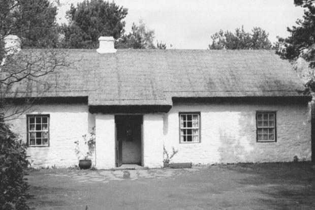
The birthplace near Augher of John Joseph Hughes, the first Roman Catholic Archbishop of New York; taken from the Tyrone book
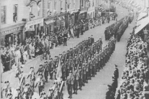
Procession of the Royal Inniskilling Fusiliers in May, 1952, when the Freedom of Enniskillen was given to the regiment.
The figures associated with the series highlight just how vast the project has been.
In a summary of the collection, Dr. Roulston outlined the combined scope of the works: 32 volumes containing 940 chapters and around 26,500 pages, amounting to an estimated 12 million words.
One of the key strengths of this long-running publishing venture is its exploratory approach, introducing perspectives and themes that had rarely been addressed in Irish local history before.
It is also worth recalling Seamus Heaney’s assessment of the series’ enduring significance: “The books will always be valued as a repository of established knowledge and original research, and they will never lose their relevance.”
Through the efforts of the editors and specialist contributors, the project has reached its conclusion, earning recognition as one of the most engaging and ambitious regional history initiatives ever completed in Ireland.
Whether reading straight through or dipping in to explore a particular subject, the books offer a sense of discovery — you never quite know what you will encounter, but it is invariably absorbing and rewarding.
The concluding volume, Antrim: History and Society: Interdisciplinary Essays on the History of an Irish County, is edited by Eileen Murphy and Colm Donnelly and published by Geography Publications.
China urged to sue over Japanese royal’s role in Unit 731 crimes
Emperor Hirohito should be held accountable, according to scholars who say the wartime ruler was shielded from prosecution by US policy
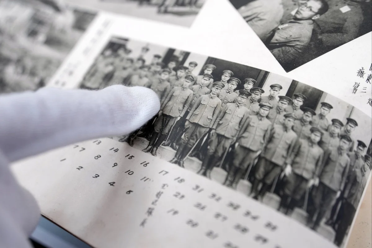
Chinese scholars argue that Japan’s late Emperor Hirohito should be held legally responsible under international law for the crimes committed by Unit 731, saying he authorised the notorious programme but avoided prosecution due to US policies after World War II.
Unit 731, a covert Japanese military operation based in northeastern China, carried out human experimentation, biological warfare, and caused the deaths of tens of thousands of civilians. According to Zhou Donghua, a professor of contemporary history at Hangzhou Normal University, the unit was established by an imperial decree issued in 1936.
Zhou stated that prior to Japan’s surrender, evidence of Unit 731’s crimes was deliberately destroyed on Hirohito’s orders. In a written statement to the South China Morning Post on December 14, Zhou said that ultimate responsibility for the unit’s atrocities could reasonably be placed on the emperor.
His remarks reflect a growing movement among Chinese legal and historical scholars who are pushing to have Unit 731 tried in an international court for crimes against humanity, with Hirohito—who ruled Japan from 1926 until his death in 1989—identified as a principal figure of responsibility.
In a study released this month, researcher Wang Xiaohua and colleagues from the Heilongjiang Provincial Institute of Cultural Relics and Archaeology contended that Unit 731’s operations amounted to a state-sponsored crime rather than isolated actions by individual personnel, meeting the criteria set out under the Nuremberg Code.
Wang added that Hirohito had ordered the expansion of Unit 731 and the relocation of its main headquarters to an area near Harbin.
Despite the scale of Japan’s biological warfare programme across Asia, Zhou noted that only 12 individuals were publicly prosecuted during the Khabarovsk trials.
Beyond aesthetics: The art market as a vector of organized crime and financial risk
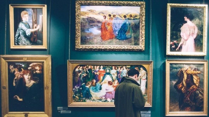
The global art market—now estimated at over $60 billion annually by leading economic studies—is among the most complex and contradictory sectors of today’s economy. It merges culture, finance, geopolitics, and status with illicit and covert practices, creating a multifaceted system that functions both openly and in secrecy.
Reports by the Financial Action Task Force (FATF), including Money Laundering and Terrorist Financing in the Art and Antiquities Market, consistently identify the art and antiquities trade as highly susceptible to money laundering and value-transfer abuse. This exposure results from several defining features: subjective pricing, minimal transparency, international reach, dominance of private transactions, and the use of storage facilities that operate beyond public scrutiny.
An artwork’s value is not determined by objective metrics but by collective agreement among experts, institutional prestige, provenance, and market conditions. As FATF highlights, an object valued at tens of thousands of euros in one context may sell for many times more in another, making it an ideal tool for legitimizing large financial movements. This lack of fixed valuation—an inherent aspect of the market’s cultural nature—is also its greatest vulnerability, enabling criminals to fabricate profits, hide losses, or artificially inflate values without immediately raising suspicion.
Another major vulnerability lies in systemic opacity. Industry estimates suggest that roughly 70–80 percent of art transactions occur privately, outside regulatory oversight, compliance frameworks, and public records. These private deals allow both parties’ identities and the source of funds to remain entirely concealed.
In effect, one of the most valuable segments of the global luxury market operates in a system where secrecy is the norm rather than the exception. As noted by the OECD in Trade in Free Ports and Illicit Financial Flows, even as auction houses strengthen anti–money laundering (AML) procedures, a significant portion of market activity remains beyond regulatory reach. When archaeology, finance, organized crime, and intelligence operations intersect within a single global marketplace, the risks intensify.
Illicit art trade extends beyond financial manipulation. UNESCO’s Illicit Trafficking of Cultural Property reports that more than 80 percent of archaeological sites in the Middle East have been looted in recent decades. Conflicts in Iraq, Syria, Afghanistan, Libya, and Yemen have transformed vast areas into zones of systematic plunder, involving both impoverished locals and organized criminal or terrorist groups.
According to Interpol’s Assessing Crimes Against Cultural Property, groups such as ISIS treated antiquities as a revenue source comparable to oil or weapons, funding military operations through their sale. Artefacts from sites like Palmyra, Apamea, and Dura-Europos later surfaced in European auction houses after passing through multiple owners and falsified provenance records, demonstrating a direct connection between looting and the legitimate market.
In Europe and North America, the illegal cultural-goods market is intertwined with financial, legal, and political networks. FATF describes this as an “industrial ecosystem” involving galleries, private banks, law firms, tax advisers, and foundations. Offshore jurisdictions such as Liechtenstein, Panama, the British Virgin Islands, and Jersey are commonly used to obscure ultimate ownership—a critical element of money laundering schemes.
Intelligence agencies also play a role. While modern services no longer pay operatives with artworks, investigative reports indicate that galleries and auction houses are sometimes used as operational fronts or financial channels in sanctioned states.
Analyses by the Financial Times and Reuters suggest that Russian and Chinese influence networks have leveraged the art market for infiltration and foreign-currency acquisition. North Korea’s Mansudae Art Studio, cited in UNESCO-related sources, operates as a state-run art export hub whose revenues support the regime.
The art market has thus become a convergence point for multiple covert and criminal activities—from looting and laundering to intelligence operations and sanctions evasion. In this context, international enforcement efforts gain importance. Europol and Interpol operations such as Pandora, Athena, and Odysseus aim to dismantle trafficking networks, recover stolen objects, and track both digital and physical flows. Recent operations resulted in the seizure of tens of thousands of items, underscoring the scale of the problem.
Illegal art market as a systemic structure
The modern illegal art market is not merely a series of isolated crimes but a structured system in which looting, smuggling, and financial crime function as interconnected components of a global economic framework.
FATF analyses emphasize that artworks are among the most mobile yet least regulated assets, making them ideal vehicles for transferring value outside traditional banking systems. This is compounded by the absence of standardized identification or ownership records, allowing manipulation of provenance, inflated valuations, and fabricated transaction histories.
Hidden infrastructure of the illegal market
The OECD notes that a fundamental issue is that a large portion of market activity occurs entirely beyond state oversight. Private sales—the dominant mechanism at the high end—carry no reporting obligations, enabling transactions worth hundreds of millions of euros to bypass financial supervision.
For decades, galleries and dealers were exempt from AML requirements, creating fertile ground for abuse. Although regulatory reforms have emerged in Europe and the United States, uneven enforcement across jurisdictions allows criminals to exploit regulatory gaps through “shopping” for the least restrictive environments.
Within this system, free ports play a critical role. These facilities serve as hubs for storing, trading, and concealing high-value assets, often allowing artworks to disappear from public—and sometimes legal—visibility altogether.
In Geneva’s free port, one of the world’s largest, the OECD estimates that hundreds of thousands of objects—paintings, sculptures, and antiquities worth billions—are stored. These sites facilitate financial “layering,” where ownership changes hands without physical movement, and values are reassessed through expert documentation outside oversight. For investigators, reconstructing ownership chains and identifying beneficiaries becomes nearly impossible.
Such mechanisms depend on organized crime groups that treat art as a specialized asset class. Europol reports that Italian mafia groups, Balkan networks, Latin American cartels, and Central European criminal organizations actively use artworks to store and transfer capital.
Documented cases show artworks being used to secure drug deals, settle accounts, or guarantee debts. Cultural objects thus replace cash or precious metals due to their discretion and high value-to-weight ratio.
International operations by Europol and Interpol
Transnational enforcement efforts have become essential tools against cultural-heritage crime. Europol and Interpol regularly conduct joint actions, most notably the Pandora series.
Since 2016, Pandora I–IX have led to the seizure of over 200,000 artefacts and hundreds of arrests related to smuggling and forgery. Pandora IX alone, according to an Interpol statement from May 2025, resulted in 37,727 objects recovered and 80 arrests across 23 countries, highlighting the scale of cooperation and the growing role of digital analytics.
These efforts extend beyond physical inspections. Cyber patrols and data analysis now play a central role. During Pandora VIII, coordinated checks of online platforms uncovered thousands of listings with questionable provenance.
Operations also target source regions in Asia, Africa, and South America, where artefacts are often routed toward European markets. These findings support UNESCO’s assessment that cultural-goods crime is both local and global, requiring cross-border collaboration.
It is crucial to note that seizures reveal only a fraction of the illicit market, as many objects remain undocumented and unregistered.
The black market in art as part of the global financial system
As enforcement agencies expose increasingly complex trade structures, it has become clear that the illicit art market is deeply embedded within the global financial system. Artworks—both high-end pieces and looted antiquities—now function as integral components of criminal infrastructure, facilitating capital concealment and laundering.
FATF reports stress that the art market, once associated primarily with cultural elites, now represents a rapidly growing financial risk sector.
A central mechanism is the use of art for financial layering. Unlike traditional investments, artworks lack transparent transaction histories, and their valuation can be adjusted through expert opinion, which—according to the OECD—is far less regulated than financial markets.
Combating art-related crime is further complicated by the lack of uniform provenance standards. Documentation is often incomplete or falsified, and national registries remain incompatible. UNESCO points out that many countries do not even require formal reporting of stolen artefacts, allowing items to re-enter the market years later with vague or incomplete histories.
These gaps enable both smugglers and legitimate intermediaries—galleries, auction houses, foundations, and law firms—to construct legal narratives around illicit objects.
Conflict zones intensify the problem. Wars in the Middle East, Africa, and Ukraine have fueled looting on a massive scale. UNESCO reports document widespread destruction and theft from museums, libraries, and monuments, with looted items moving through networks spanning local militias to professional dealers.
Developed nations—including Switzerland, the UK, the US, and the UAE—remain major hubs for storage and distribution, often via institutions with opaque legal frameworks. Free ports in these countries function as safe havens for both art and questionable capital.
In response, governments and international bodies have introduced stronger regulations. The EU’s Regulation on the Import of Cultural Goods (2019/880) requires provenance certification and age verification for imported artefacts. While groundbreaking, critics argue it may push trade toward less regulated markets in Asia or the Middle East.
Systemic gaps in combating the illegal art market
Incomplete regulation, capital mobility, secrecy, weak documentation, and advancing technology combine to make illicit art trade a global challenge requiring coordinated action. Europol and Interpol emphasize that no single reform or operation can resolve the issue.
Recent Pandora operations reveal a shift toward digital sales via e-commerce platforms and social media. Smugglers increasingly use fake accounts, cryptocurrency payments, and disguised courier shipments. Europol reports a sharp rise in online listings year over year.
These operations also confirm strong links between art crime and other illicit activities, including drug trafficking, arms trade, human trafficking, and financial crime. Success depends not only on arrests but on improved data-sharing, object cataloguing, and reporting standards—areas where harmonization remains limited.
Free ports as nodes of global financial infrastructure
Free ports in Geneva, Luxembourg, Singapore, and Dubai occupy a central role in this opaque system. As quasi-extraterritorial zones, they allow long-term storage and ownership transfers without disclosure. OECD and FATF identify them as among the least transparent elements of global finance.
Criminal networks adapt rapidly, moving into cryptocurrencies and NFT marketplaces. Pandora VIII and IX documented cases of icons, coins, and antiquities sold via crypto transactions.
Money-laundering schemes in the art world mirror those in tax havens, relying on intermediaries, private sales, offshore entities, free ports, and digital currencies. These schemes follow the classic stages of placement, layering, and integration—executed in ways that are exceptionally difficult to detect.
Future prospects
Operations such as Pandora, Athena, and Odysseus demonstrate that cultural-goods crime is large-scale and constantly evolving. The key conclusion is that illicit art trade must be treated as a global security issue, not merely a cultural or ethical concern.
Future efforts must focus on harmonized AML standards, mandatory provenance documentation, increased transparency, digital registries, and stronger international cooperation. Only a shared regulatory and operational framework can effectively counter transnational criminal networks. Until then, the illicit art market will remain one of the most challenging areas of international policy, operating in the shadows of wealth and hidden value.
Cafe dives into Taiwan's underwater heritage at Shihsanhang Museum of Archaeology
Dining blends with underwater cultural discovery at New Taipei museum
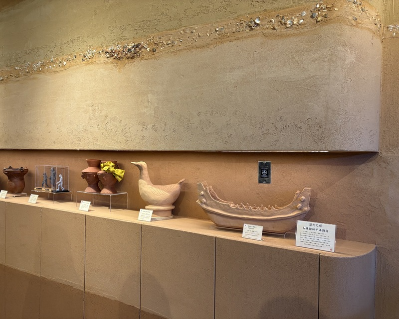
Items on display inside 13 Cafe.
TAIPEI (Taiwan News) — Food and history come together at New Taipei’s Shihsanhang Museum of Archaeology, where a newly launched cafe guides visitors from dining into Taiwan’s seafaring past.
The 13 Cafe opened on Wednesday alongside the museum’s refreshed permanent exhibition focused on underwater archaeology. According to the New Taipei City Government, the cafe integrates food service with exhibition elements, creating a seamless shift from eating to exploring the museum.
Guests pass from the cafe into exhibition halls displaying shipwreck relics and prehistoric fossils that highlight links between Taiwan’s maritime heritage and cultural development. As visitors enter the cafe, they are met with large walls designed to resemble archaeological layers, finished with locally sourced natural coatings applied by hand to mimic layers of soil and clay, CNA reported.
Displayed within the space are replica souvenirs from partner museums in Japan and South Korea, including boat-shaped haniwa figures and ceramic vessels with human faces. The menu itself is also archaeology-inspired, with dishes subtly reflecting themes of excavation, history, and locality.
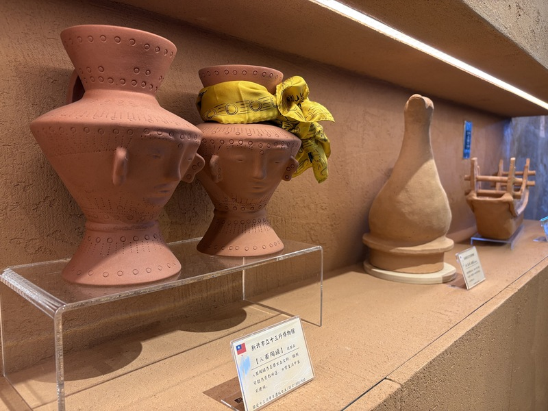
Human-faced ceramic vessel replicas displayed in 13 Cafe.
Just nearby, the exhibition shifts the focus from flavor to visuals, showcasing rare relics from the Bokhara shipwreck. The British luxury vessel SS Bokhara went down near Penghu during a typhoon on Oct. 10, 1892, killing 125 of the 173 people aboard, Capitan Creative reports.
While shipwrecks are the most well-known examples of underwater cultural heritage, they are only one part of a much broader narrative. These sites also encompass submerged inland settlements, structures lost due to land subsidence or rising sea levels, and other traces of the past, according to the Investigation Bureau.
Enhancing the immersive atmosphere is a remarkably preserved prehistoric water buffalo skull from the museum’s collection. Visual elements throughout the gallery are designed to make visitors feel as though they are beneath the ocean’s surface.
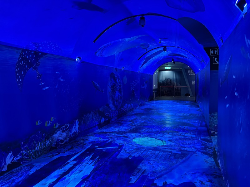
Underwater projection at Shihsanhang Museum of Archaeology's permanent exhibition.
Encircled by the ocean and abundant in marine resources, Taiwan has historically depended on the sea for livelihoods such as fishing, tourism, and maritime trade, giving rise to a wide range of cultural characteristics. Its position at the intersection of key land and sea routes further encouraged interaction and exchange between Eastern and Western societies.
Today, technological advancements enable researchers to uncover and protect these concealed heritage sites, addressing past obstacles like technical constraints and destruction caused by trawling activities.
Site of 640 potential homes could unearth archaeological finds
Suffolk council calls for assessment 640 potential homes
Proposals to build up to 640 new homes could uncover significant historical remains, council officials have said.
A report from Suffolk County Council’s archaeological service states that the proposed development site in Halesworth has a strong potential for buried artefacts.
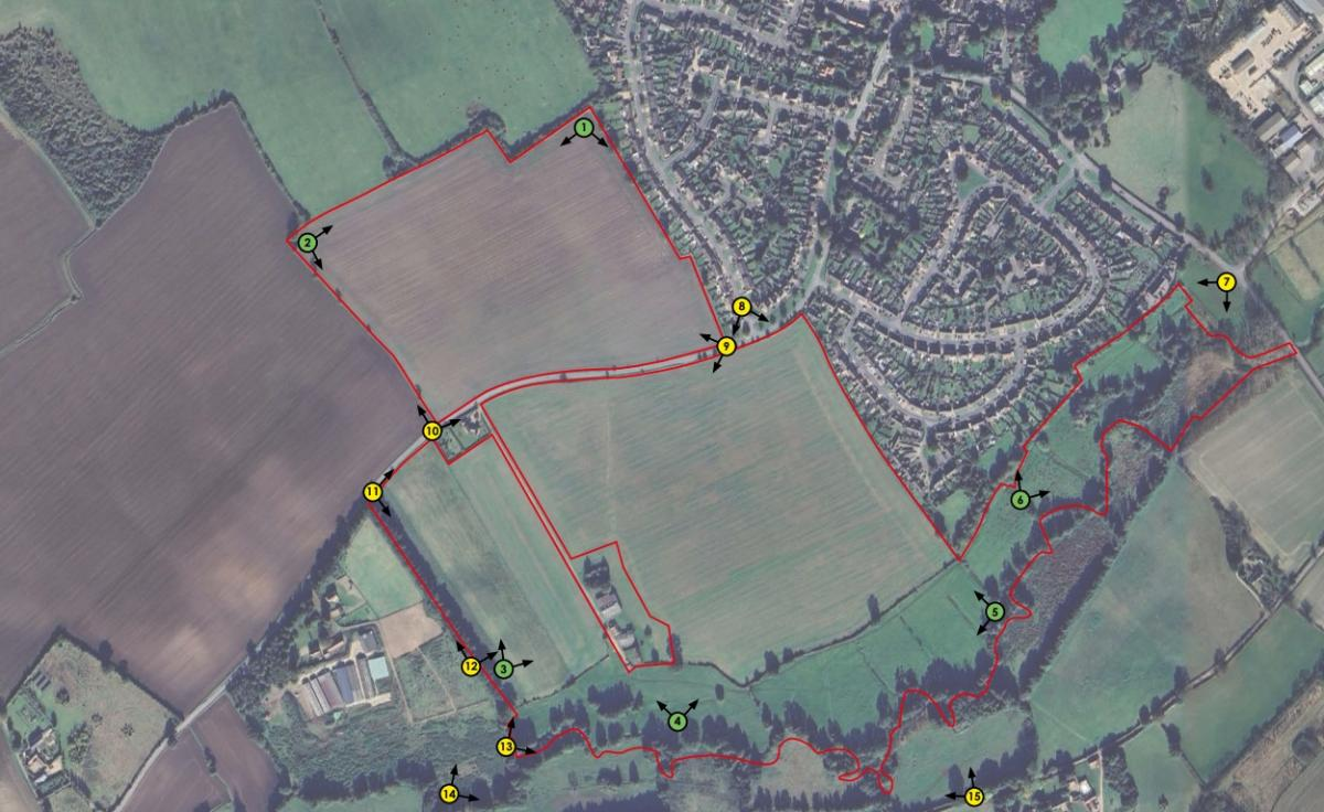
The site is planned for land south of the Suffolk market town, with access via the B1117 Walpole Road.
Hannah Cutler, an archaeological officer at the council, explained that the development would directly affect heritage assets because “the planned works will damage or destroy any surviving below-ground heritage assets within the site,” adding that without further investigation, the full extent of the impact cannot yet be determined.
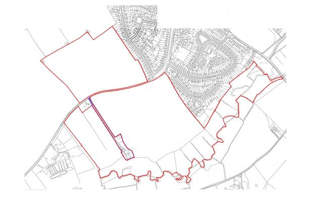
Location plan for the land off Walpole Road
She said the site is in an area that could be favourable for early occupation and there "has been no systematic investigation of the area, but there are recorded find spots of medieval and Anglo-Saxon finds".
A scoping report for the homes bid submitted by Gladman Developments Ltd to East Suffolk Council said after a desk-based assessment that "effects on built heritage or archaeological receptors is low".
The approximately 51.8 hectares of land is currently classed as agricultural, and plans state the existing ecological features, like ponds and ditches, will be retained.
3,700-Year-Old Bones Reveal the Oldest Known Case of Father-Daughter Incest
Archaeologists excavating a Bronze Age burial site in southern Italy expected to find standard evidence of familial connections, such as parents buried near their children, but instead uncovered genetic proof of what is now recognized as the earliest confirmed case of father-daughter incest.
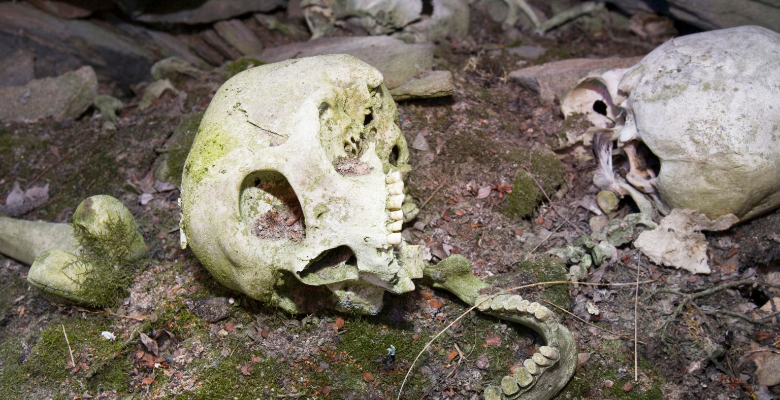
The site, Grotta della Monaca in Calabria, served as a burial ground around 3,700 years ago. Researchers analyzed DNA from 23 individuals interred there between 1780 B.C. and 1380 B.C., aiming to better understand the composition of a small mountain community. Rather than just ordinary family ties, they discovered what the study terms “extreme parental consanguinity,” focused on the remains of a teenage boy.
At first, the genetics appeared typical. Several individuals were clearly related, including a mother and daughter placed in close proximity, reflecting a common cultural practice. However, one pairing stood out. The DNA of an adult man and the boy showed an unusually high amount of identical genetic material—something seen only in reproduction within a nuclear family.
The researchers noted that the boy had “the highest sum of long ROH segments ever reported in ancient genomic datasets to date.” Additional analysis confirmed what the team described as “indisputable evidence” that he was the offspring of a first-degree incestuous union between a father and his daughter. The daughter’s remains were not recovered from the cave.
While incest has been documented in ancient populations, it usually involves siblings. Neanderthals practiced it, and some elite groups used it to maintain bloodlines. Parent-child pairings are much rarer and carry significant biological risks. In this case, analysis of the boy’s DNA revealed no severe genetic disorders.
The reasons behind this event remain unknown. The Grotta della Monaca community does not appear isolated, nor does it show signs of a hierarchical system where incest might consolidate power. “This exceptional case may indicate culturally specific behaviours in this small community,” said study co-author Alissa Mittnik of the Max Planck Institute, “but its significance ultimately remains uncertain.”
Although the genetic evidence is clear, the context is not. A parent and child produced a son, who lived long enough to be buried among his peers. The motivations and circumstances behind this remain a mystery. Archaeology does not always provide complete explanations; sometimes it merely confirms that something profoundly unusual occurred.
Archaeologists Found an ‘Anomaly’ Near the Pyramids That May Reveal an Ancient Portal
New findings beneath the desert floor hint at entrances to long-lost chambers.
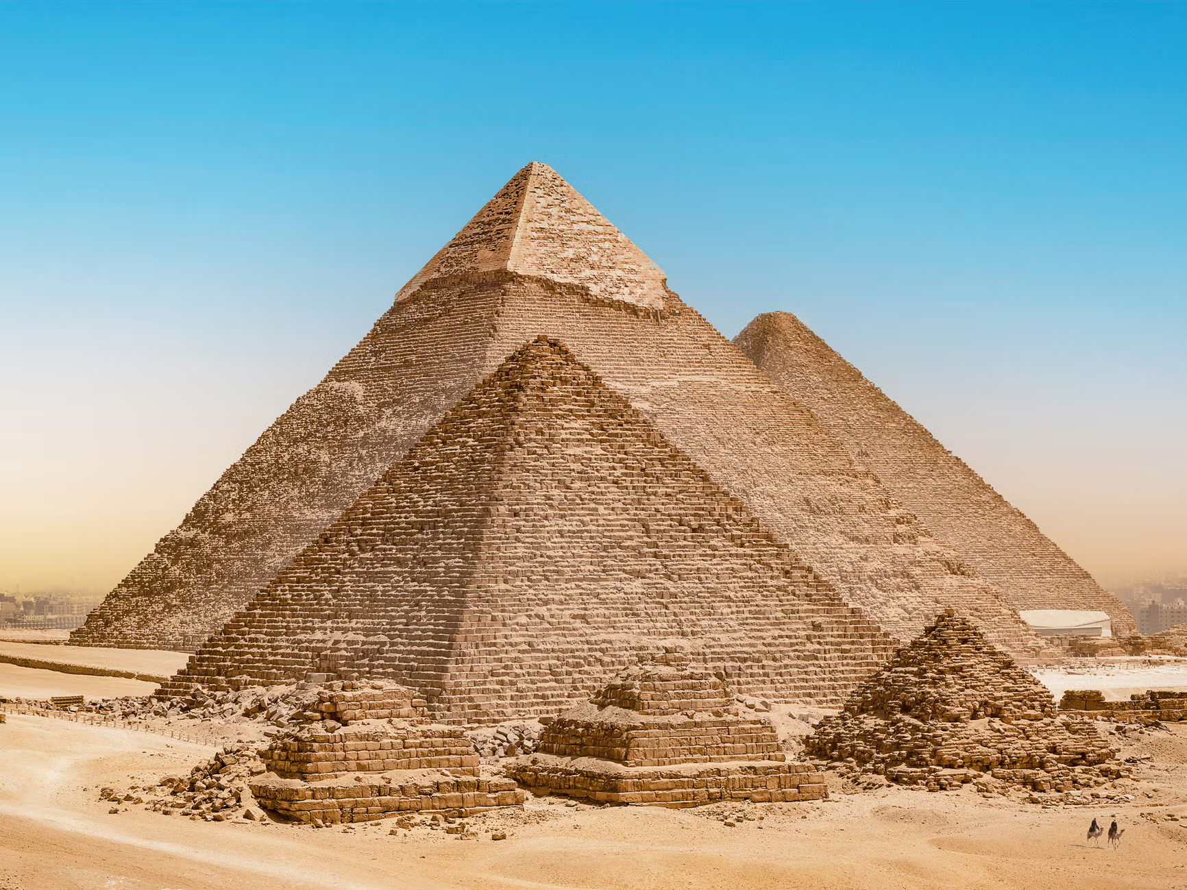
Ground-penetrating radar has enabled archaeologists to identify hidden structures beneath the surface. A new study conducted by Japanese and Egyptian researchers has revealed an L-shaped structure accompanied by a nearby anomaly next to the Great Pyramids of Giza. While the precise nature of the anomaly is unknown, the researchers speculate that the L-shaped feature could potentially be an entrance to a deeper structure.
In archaeology, ground-penetrating radar (GPR) has transformed the way sites are studied. This geophysical technique sends radar pulses into the ground to create subsurface images. Similar methods have previously uncovered Viking longships in Norway, revealed lost civilizations within the Amazon rainforest, and even mapped entire Roman cities without any excavation.
Once again, GPR has yielded discoveries near one of the world’s most thoroughly explored sites—the Great Pyramids of Giza. The research team, led by Motoyuki Sato of Tohoku University, combined GPR with electrical resistivity tomography (ERT), a method that uses variations in electrical resistance to map underground features. Using these techniques, they detected what they describe as an “L-shaped anomaly” in the western cemetery close to the pyramids.
Archaeologists Excavated the Tower of London—and Unearthed Dozens of Hidden Skeletons
Excavations revealed everything from a 14th-century Black Death group burial to three skeletons from the late 12th or early 13th centuries buried in coffins.
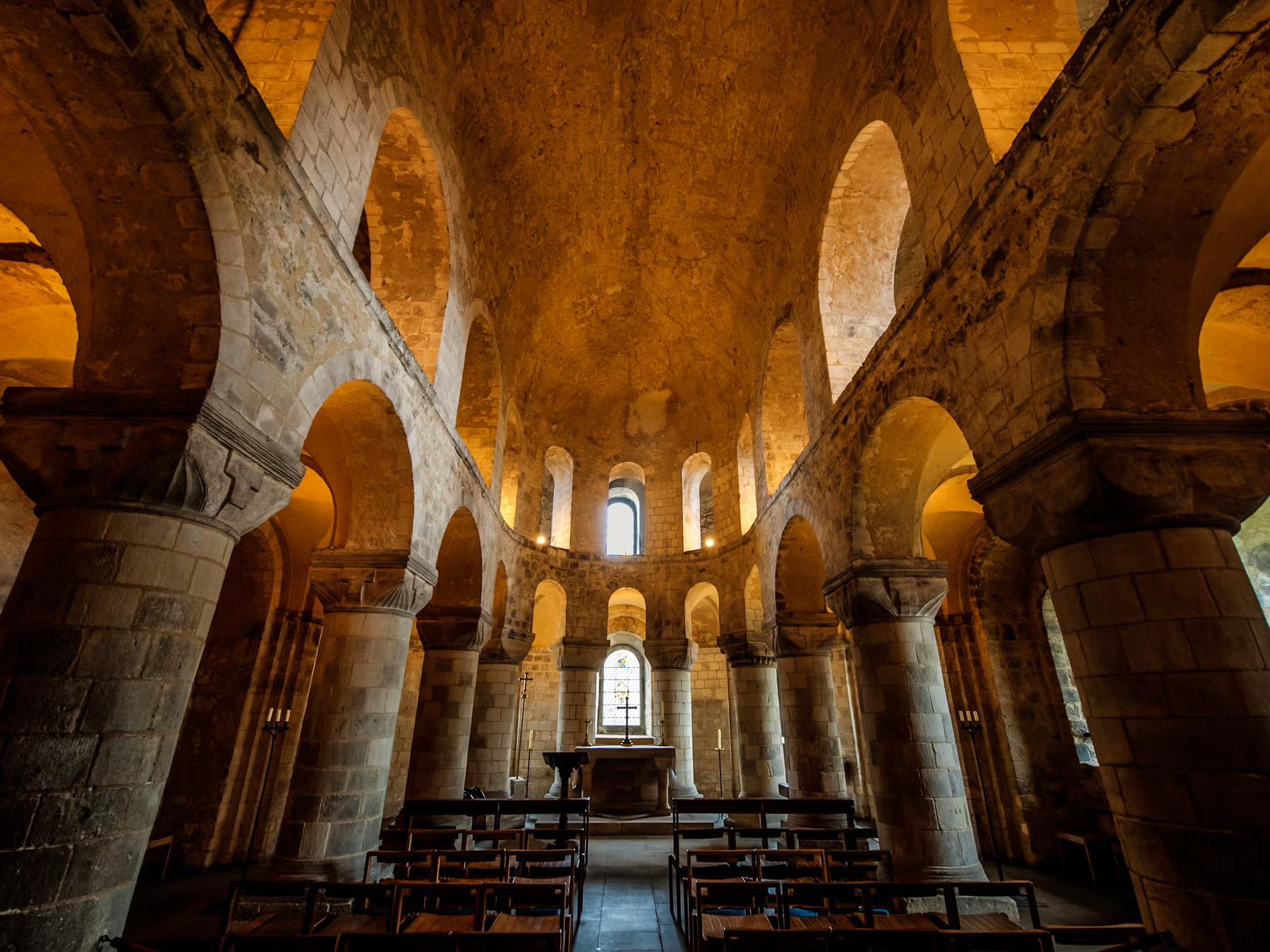
The first excavation at the Tower of London in decades uncovered over 20 skeletal remains. Archaeologists found everything from a group burial linked to the 1348 Black Death to three skeletons dating from the late 12th or early 13th centuries, buried in coffins. The on-site chapel is revealing much about London’s medieval past.
The dig, the first in a generation at the Tower, initially uncovered two skeletons dating to around 1500. Deeper excavations revealed roughly 20 additional burials, including a 14th-century mass grave likely connected to the plague.
Alfred Hawkins, curator of historic buildings at Historic Royal Palaces, said the excavations offered a rare opportunity to better understand the history of the Chapel of St Peter ad Vincula and the buildings that preceded it.
The project began in 2019 as a trial excavation to prepare the Chapel Royal for a new elevator. The initial finds of two skeletons led to further digging outside the chapel, reaching depths of up to 10 feet, uncovering burials ranging from the Black Death era to costly coffined interments from the late 12th and early 13th centuries.
King Thutmose II tomb among top 10 archaeological discoveries of 2025
The tomb of King Thutmose II has been recognized as one of the world’s top ten archaeological discoveries of 2025 by the American magazine Archaeology.
The Ministry of Tourism and Antiquities first announced the find in February. It marks the first discovery of a royal tomb from Egypt’s 18th Dynasty since the uncovering of King Tutankhamun’s tomb in 1922.
Mohamed Ismail Khaled, Secretary-General of the Supreme Council of Antiquities, said the recognition highlights the global importance of Egypt’s archaeological heritage and reinforces the country’s leading role in archaeology. He added that the discovery reflects the close collaboration and sustained efforts of Egyptian and international missions, resulting in major findings that have reshaped understanding of ancient Egyptian history.
A Major Archaeological Find
The tomb was uncovered by a joint Egyptian-British mission from the Supreme Council of Antiquities and the New Kingdom Research Foundation during excavations in the Theban Mountains west of Luxor.
At first, archaeologists believed the tomb might belong to the wife of one of the Thutmose kings, due to its location near the burial places of Thutmose III’s wives and close to Queen Hatshepsut’s tomb, which had originally been prepared for her before she became pharaoh.
Further excavation, however, revealed clear evidence identifying the tomb as that of King Thutmose II. Among the finds were fragments of mortar decorated with blue and yellow star motifs, along with inscriptions and scenes from the Book of Amduat.
The tomb’s relatively simple architectural layout later influenced the design of several royal tombs built during the Eighteenth Dynasty after Thutmose II’s reign.
We will not be defeated in this 2000-year-old war, archaeology proves Tamil is cradle and pinnacle of Indian civilisation: Stalin
The Chief Minister, describing the Tamil Vs Sanskrit North as a 2000-year-old war, made it clear that the DMK government was making every effort to keep aloft Tamil antiquity and pride.

Chief Minister and DMK president M.K. Stalin on Sunday reaffirmed that the Tamil region was both the birthplace and the height of Indian civilisation, stating that archaeological findings clearly support this claim. He said the Porunai Museum, the second museum established by his government in Tirunelveli, was created to scientifically affirm the antiquity of Tamil civilisation.
Referring to what he described as a 2,000-year-old Tamil–Sanskrit conflict, Stalin said the DMK government remains committed to preserving Tamil history and pride.
“Our culture is unique and progressive. The Tamil land was the cradle and the pinnacle of civilisation in the Indian subcontinent. We have literary proof, and through archaeological excavations we are now scientifically validating these claims. That is why sites like Porunai and Keezhadi are so important,” he said while addressing a government event in Palayamkottai, a day after inaugurating the museum.
He accused the BJP-led Union government of obstructing Tamil Nadu’s archaeological efforts, claiming it seeks to suppress evidence that supports Tamil antiquity. “They block excavations and refuse to publish findings that prove our history. Our struggle is against those who harbour hostility toward the Tamil language and people. Those searching for the mythical Saraswati civilisation refuse to acknowledge our discoveries,” he said, adding that the fight to protect Tamil history cannot be abandoned.
Stalin also invited Prime Minister Narendra Modi and Finance Minister Nirmala Sitharaman to visit the Porunai Museum and see the evidence firsthand.
He said the Porunai Museum and the Keezhadi museum near Madurai aim to bring Tamil history and heritage closer to the public. In a post on X, he added that understanding history enables people to shape the future, describing Porunai as a lasting symbol of Tamil antiquity and a global heritage site for Tamils.
Spread across 13 acres and built at a cost of ₹62 crore, the Porunai Museum houses artefacts from Sivagalai—considered the world’s oldest Iron Age site, predating Anatolia—as well as findings from Athichanallur in Tirunelveli. The museum is named after Porunai, the ancient name of the Thamirabarani river, long regarded as a cradle of civilisation. Archaeology, he said, has become central to Tamil pride.
The museum displays Iron Age tools from Sivagalai that push back the timeline of iron smelting by over a thousand years, along with skulls, burial urns, and pots inscribed in ancient Tamil (Tamizhi) script, believed to predate Ashokan Brahmi. Artefacts from Korkai, the historic port city of the Pandya kingdom, are also exhibited.
For the DMK and Tamil scholars, the Sivagalai findings represent a major shift in understanding Tamil antiquity, challenging the conventional Iron Age timeline of 1800 BCE based on discoveries in Uttar Pradesh.
Earlier this year, while releasing the Sivagalai excavation report supported by carbon dating, Stalin declared that iron production began in Tamil Nadu over 5,300 years ago. “I announce to the world that iron smelting technology originated in Tamil land. We are scientifically proving our history to those who dismissed our literature as non-evidence,” he said.
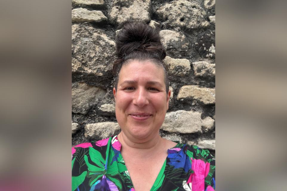
'So much of Southampton's history is hidden in plain sight'
SO: Cultured - Southampton’s history is hidden in plain sight
I’m a local neurodivergent artist and arts facilitator working with trusts, charities and councils across the city. In May, I founded Neurodivergent Arts Community Interest Company to champion neurodivergent creativity as a catalyst for wellbeing, connection and cultural change.
My work has shown me how creativity can help people reconnect – with themselves, with others and with their sense of place. So, when the opportunity came up to be a community curator for next February’s City Reflections: Illuminating Southampton’s Stories, it felt like the perfect fit. The role is about helping the neurodivergent community see themselves reflected in the city’s story – recognising that our creativity and perspectives are part of what makes Southampton unique.
I bring over 20 years’ experience working with both neurodivergent and neurotypical communities, along with wisdom and a deep understanding of the barriers the neurodivergent community can face when engaging with mainstream education, employment and the arts, culture and heritage sector. I also bring lived experience, having navigated and overcome many of these barriers myself.
My City Reflections topic is neurodivergent people/city maps and city wall, and the projection location is The Castle Vaults. My group approached the project by taking a guided walk through the city walls and vaults, which helped us connect physically with the places we’d later research.
Tracing our fingers over the old graffiti, imagining the sounds, smells and atmosphere gave us a real sense of history. That experience became a springboard when we entered the archives, where we were supported by the wonderful Jo Smith and Jo Bailey, who had already prepared collections for us to see. Their knowledge is vast and their passion palpable.
We’re also very grateful to Dan Matthews and Maria Newbury from the Maritime Archives, and to Richard Henry from Archaeology, who supported us throughout the process and helped us retrieve everything we needed to visually and orally tell our story.
So much of Southampton’s history is hidden in plain sight and tucked away within its archives. I don’t think many people realise how much of the city’s history they walk past every day. We rarely slow down for long enough to notice that we’re standing beside an ancient wall, or that an empty space marks where a building once stood before the Blitz. Even the cobbles beneath our feet tell stories, like those along Western Esplanade, where the stones are laid as public art to show where the sea line once reached.
For many, the archives themselves are also a hidden treasure. People might imagine they’re only for researchers, but they’re open to everyone. You can walk in and, within minutes, find yourself face-to-face with history – artefacts, maps and stories that bring the city to life.
That’s why it’s so important to find new ways of sharing and re-imagining these treasures. When people can see, touch, and experience this history for themselves, it reconnects them with Southampton’s rich and diverse tapestry and helps ensure that access truly is for all.
Our vibrant City Reflections installation will reflect the richness of Southampton’s people and places. We hope it will inspire visitors to get to know their city in a new way and to visit the archives themselves, or rediscover places like the vaults, the old city walls, Tudor House, or SeaCity Museum. It’s amazing how often we take a guided tour when we’re on holiday yet rarely explore the city we call home.
The biggest surprise for me when researching for this project was how much more interested in history I’ve become. My relationship with the city has changed too. I often find busy places, loud noises and crowds overwhelming, so I’d walk through Southampton quickly to get to where I needed to be. This project has helped me connect with the city in a new way, finding sanctuary in hidden places where I can slow down, breathe and take it all in.
What has stayed with me is the realisation of just how diverse Southampton has always been. A gateway city, a place of flow, ideas, people, food and customs endlessly arriving, weaving together into a rich cultural tapestry. To co-create a light installation that honours that diversity and carries the voices of our community forward has been not just work, but a privilege - a reminder that heritage is not a static past but a living, breathing conversation.
City Reflections: Illuminating Southampton’s Stories is a physical projection trail that will take place from 6pm to 8pm on Wednesday 18th to Saturday 21st February 2026.
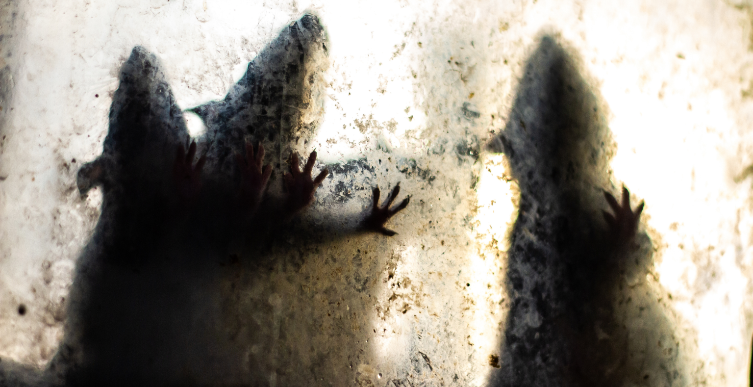
The Earliest Known Plague Wasn’t Spread by Rats, DNA Study Reveals
For millennia, a prehistoric plague swept across Eurasia with alarming speed. Scientists have detected its presence in human remains found far apart, long before the Black Death made the disease infamous. What confused researchers was how the plague spread so widely without fleas, which later played a key role in medieval outbreaks.
New research may finally explain this puzzle. A study published in Cell and reported by ScienceAlert suggests that the earliest known carrier of plague was a domesticated sheep. This provides the first solid evidence that Bronze Age plague spread through animals traveling with humans. Researchers identified DNA from Yersinia pestis, the plague-causing bacterium, in a 4,000-year-old sheep tooth uncovered at Arkaim in present-day southern Russia. The strain belongs to the Late Neolithic–Bronze Age lineage, an early form of plague incapable of infecting fleas, leaving scientists long unsure how it moved across vast regions.
The finding came from a broader project examining how livestock migrated with people from the Fertile Crescent into Eurasia. The team analyzed ancient DNA from cattle, goats, and sheep—material that is often degraded and contaminated.
“When we test livestock DNA in ancient samples, we get a complex genetic mix of contamination,” said Taylor Hermes, an archaeologist at the University of Arkansas and the study’s lead author. “That makes it hard to isolate animal DNA, but it also allows us to detect pathogens that may have infected both herds and their handlers.”
That approach paid off with the Arkaim sheep. The plague DNA matched strains previously identified in human remains found thousands of miles apart, directly linking animal movement to human infection during this era.
“It had to be more than just people moving,” Hermes said. “This sheep gave us the breakthrough.”
Researchers now believe the disease spread through interactions between humans, livestock, and an unknown natural reservoir, likely rodents native to the Eurasian steppe. As sheep grazed across wide grasslands, they may have encountered infected wildlife and transmitted the bacterium within herds and to people—or possibly the other way around.
Ancient animal diseases are rarely preserved. Livestock were not carefully buried, and many remains come from cooked food, which destroys DNA. This makes the discovery especially unusual.
While a single genome does not answer every question, this one ancient sheep significantly narrows the mystery, shedding new light on how one of humanity’s earliest pandemics may have traveled alongside the animals people relied on most.
Roman Handprints, Preserved Textiles and Possible DNA Found in Rare Gypsum Burial in England
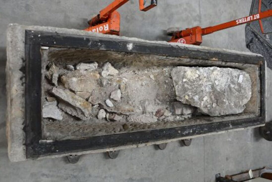
Archaeologists in England have revealed remarkable details about personal Roman burial customs after reanalyzing a rare stone sarcophagus filled with gypsum that was found in York. Nearly 2,000 years old, the burial has preserved clear impressions of textiles, possible hand and finger marks made in soft gypsum, and material that may still hold traces of DNA—providing rare insight into Roman funerary treatment of the dead.
The research forms part of the Seeing the Dead project, which examines Roman burial practices and physical remains. The sarcophagus, recorded as YORYM: 2010.1219 and curated by York Museums Trust, was originally discovered in 1877 during construction of York Railway Station. Although it has been known to researchers for generations and occasionally displayed publicly, it had never been fully excavated using modern scientific methods until this recent study.
A rare form of Roman burial
The burial stands out because of how the body was laid to rest. Once placed inside the stone coffin, liquid or semi-liquid gypsum—a refined mineral substance—was poured around the lower portion of the body. As the material set, it hardened into a solid mass that preserved delicate details of both the body and its immediate environment.
Such a burial method is extremely uncommon in Roman Britain. Researchers suggest the gypsum served as both a sealing layer and a preservative, protecting organic materials that would usually decompose. The technique is comparable to the well-known plaster casts from Pompeii, where cavities left by decayed bodies were filled to preserve detailed impressions of eruption victims.
Unique impressions created by a Roman burial ritual. Credit: Seeing the Dead Project
Handprints Captured in Gypsum
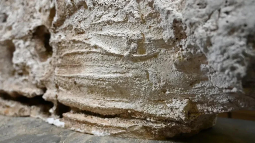
Among the most notable findings were apparent hand and finger marks preserved on the exterior of the gypsum layer. These impressions overturn earlier ideas that gypsum in Roman burials was poured at extremely high temperatures. Instead, the evidence suggests it was mixed into a thick, malleable paste and shaped manually.
Roman archaeologist Dr. Maureen Carroll of the University of York explained that these impressions point to a highly intimate stage of the burial process. The hands-on application of the gypsum may indicate an emotional bond between those performing the burial and the deceased—an element of Roman mortuary practice that is seldom visible archaeologically.
Unusually Well-Preserved Textiles
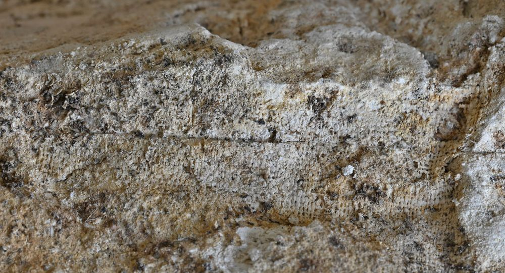
Equally significant were fabric impressions on the inside of the gypsum shell. Distinct patterns show that the body had been wrapped in garments or a burial cloth. Even more rare, tiny remnants of textile fibers were found trapped within the hardened gypsum beneath the remains.
Such preservation is exceptional in Roman contexts. Researchers suggest that the gypsum penetrated the fabric while still soft, then solidified around the fibers, shielding them over time. Why this burial retained textiles when others did not is still uncertain and is now a central question in further scientific study.
Fine details of fabrics are preserved in the hardened gypsum.
Handprints Preserved in Stone
One of the most remarkable findings was the presence of apparent hand and finger impressions on the outer layer of the gypsum casing. These marks contradict earlier beliefs that gypsum used in Roman burials was poured at extremely high temperatures. Instead, researchers now think the material had a thick, paste-like consistency and was shaped by hand.
According to Roman archaeologist Dr. Maureen Carroll of the University of York, these impressions point to an intimate and deliberate act within the burial process. Manually molding the gypsum may indicate a strong emotional bond between the mourners and the deceased—an element of Roman funerary practice that is rarely visible archaeologically.
Exceptionally Preserved Textiles
Equally striking were the impressions of textiles found on the inside of the hardened gypsum. Distinct patterns show that the body was wrapped in garments or a burial shroud at the time of burial. Even more unusual, tiny pieces of actual fabric were discovered trapped within the gypsum beneath the remains.
Such preservation is extremely uncommon in Roman contexts. Researchers suggest the wet gypsum penetrated the fabric and then hardened, encasing and safeguarding the fibers for centuries. Why textiles survived in this burial while others did not is still uncertain and remains a focus of ongoing study.
Scientific Sampling and DNA Potential
To document the burial with precision, archaeologists collected gypsum dust and fragments using a carefully mapped grid system. This method allows samples to be linked to specific body areas, including the head, hands, and feet, increasing the likelihood of extracting meaningful biological and material data.
The preserved gypsum and textile remnants may contain trace DNA, which could help identify the biological sex of the individual or offer clues about those who prepared the burial. While results are not assured, the potential alone marks a major step forward in understanding Roman burial customs.
Digital Reconstruction and Ongoing Research
High-resolution 3D scanning was carried out before and after excavation, recording details at a sub-millimetre scale. These scans enable a digital reconstruction of the burial as it originally appeared and ensure the data remains accessible for future research.
Although later contamination such as remnants from old display materials and pest treatments during museum storage—posed challenges and required protective measures, the excavation still produced exceptional findings. As laboratory analyses continue, the gypsum burial is expected to deepen knowledge of Roman craftsmanship, funerary rites, and the personal connections involved. More than a hundred years after its discovery, the sarcophagus is finally yielding its story preserved in stone and touch.
Stone Age rock paintings discovered in Tingvoll
Archaeologists have discovered previously unknown Stone Age rock paintings near Tingvoll municipality, located in Møre og Romsdal county, Norway.
Tingvoll is already recognised as one of Northern Europe’s most significant areas for prehistoric rock paintings, with previous studies documenting 25 distinct art fields distributed across two main locations.
Unlike petroglyphs, which are carved or etched into stone, these images are rock paintings, created by applying pigment (often ochre) directly onto the rock surface. Dating them precisely is challenging, but most are believed to have been produced between 3,000 and 7,000 years ago.
The newly discovered site, identified by Jan Magne Gjerde and his colleague Dag-Øyvind Engtrø Solem, constitutes a separate and previously unknown rock art area, further expanding the archaeological importance of the region.
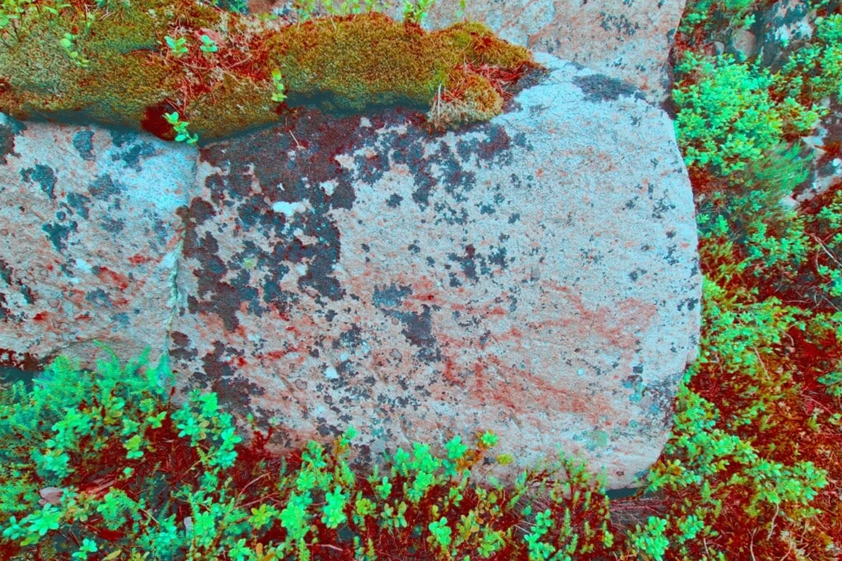
The pair identified rock paintings depicting fish – believed by experts to represent salmon or halibut, alongside geometric motifs that are thought to symbolise a boat.
Solem, said: “We colour-manipulated the images to study the marks in the rock more closely, and then there was no doubt. These red lines were painted by humans.”
“Rock art is made in rocks that are constantly exposed to natural degradation. Over time, the paintings will therefore gradually disappear through various forms of weathering, and the condition varies greatly from place to place,” said Gjerde.
Leading experts in rock art conservation have been engaged to help assess, manage, and where possible preserve the rock paintings, which are currently deteriorating at an alarming rate.
In parallel, NIKU has worked in close cooperation with Møre og Romsdal County Council and the NTNU Science Museum to support research and long-term conservation efforts.
Chinese researchers uncover record-high evidence of ancient human activity on eastern Qinghai-Tibet Plateau
Chinese archaeologists have identified an important Paleolithic site at a record-breaking elevation on the eastern Qinghai-Tibet Plateau, shedding new light on early human movement and adaptation, the Sichuan Provincial Cultural Heritage Administration announced.
The site is located near Tsungqen Co, a high-altitude lake in Daocheng County within the Garze Tibetan Autonomous Prefecture of Sichuan Province, and represents the highest-elevation evidence of ancient human activity yet found in the area.
Full research results were published in the journal Palaeogeography, Palaeoclimatology, Palaeoecology by a joint team from Peking University and the Sichuan Provincial Cultural Relics and Archaeology Research Institute.
Tsungqen Co, which means “big lake” in the local language, is one of many glacial lakes formed after the Last Glacial Maximum as glaciers retreated. Such lakes would have drawn wildlife and offered crucial resources for prehistoric hunter-gatherer groups.
Situated more than 4,300 meters above sea level, the Tsungqen Co site is part of the well-known Piluo site complex, which was named one of China’s top ten archaeological discoveries in 2021.
The main Piluo site, lying at around 3,750 meters in elevation and dating back more than 200,000 years, is considered the earliest, largest, and richest Paleolithic site on the Qinghai-Tibet Plateau. The Tsungqen Co site, however, lies even higher, with its earliest occupation layers dating to about 12,000 years ago.
Researchers recovered more than 190 stone tools from the site, most of them small to medium in size. The assemblage reflects an advanced microlithic tradition, indicating refined production methods and technological adaptations suited to life at high altitude.
The Qinghai-Tibet Plateau—often called the “Third Pole” because of its extreme height, thin air, and cold climate—has long been viewed as a difficult environment for early human settlement. The discovery at Tsungqen Co represents a major advance in Paleolithic research on the plateau’s eastern edge, significantly expanding knowledge of human presence in high-altitude regions.
“This was likely not a short-term camp, but a place people returned to repeatedly,” said Zheng Zhexuan, lead archaeologist of the Piluo project and head of the Paleolithic Archaeology Institute at the Sichuan Provincial Cultural Relics and Archaeology Research Institute.
“It indicates that more than 10,000 years ago, human groups were already using warmer climatic periods to live near highland lakes. They moved into and remained in these high-altitude areas, showing a stable ability to adapt to plateau conditions,” Zheng explained.
Scholars describe the Tsungqen Co site as a vital “spatiotemporal key” that fills an important gap in the archaeological record of human activity on the “roof of the world.” The discovery offers valuable evidence for studying early modern human dispersal routes in East Asia and their survival strategies in challenging environments.
Excavation and interdisciplinary studies at the broader Piluo site are ongoing, with researchers carrying out detailed analyses of dating, environmental context, and material remains to build a clearer picture of ancient life in this region.
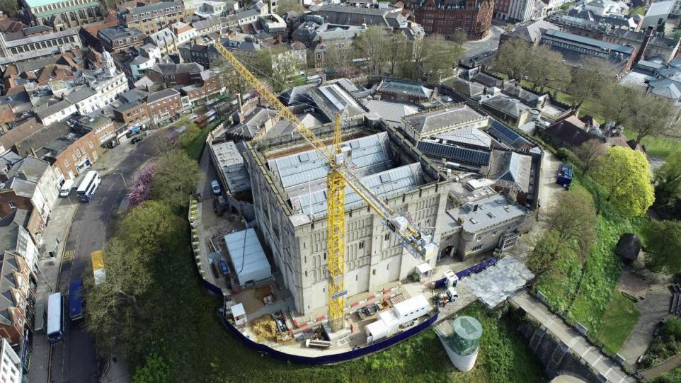
Archaeologists found human remains at Norwich Castle
Secret behind Norwich Castle's human remains revealed
Norwich Castle is well-known for the dark and complex history of its grounds.
A recent finding of centuries-old skeletons has added new intrigue to the site’s past.
The story of these bones, interred around 600 years ago within the castle mound, was shared in an engaging podcast.
Gone Medieval, hosted by historians Dr. Eleanor Janega and Matt Lewis, examines medieval myths and recently highlighted the 900-year-old Norwich landmark in a new episode.
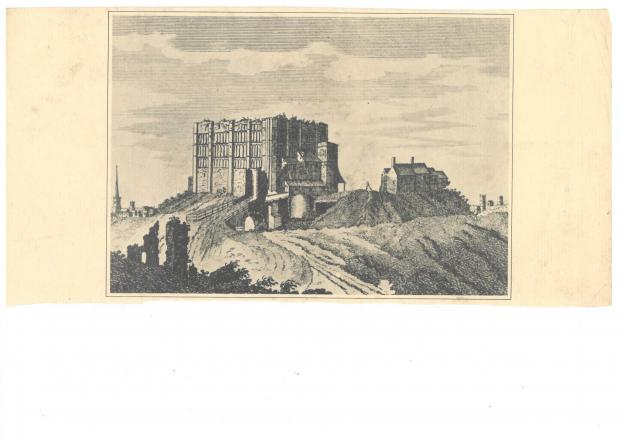
Print of Norwich Castle during the 19th century
The duo toured Norwich Castle—a site that has served as a Norman fortress, royal palace, and later a Victorian prison—exploring the massive keep with archaeologist Dr. Tim Pestell.
They investigated fire-damaged vaults from medieval sieges, examined remarkable high-status artifacts uncovered in recent digs, and visited Henry I’s feasting hall, where he celebrated Christmas in 1121.
However, the skeletons discovered during the castle’s multi-million-pound renovation arguably attracted the most attention.
Dr. Pestell, project curator for The Royal Palace Reborn and senior curator of archaeology, explained: “During the renovation, we excavated several pits on the mound.
“We were setting up a tower crane to lift materials, and inside, we found several skeletons—fragments and partial remains.”
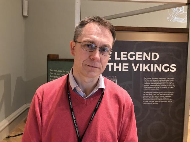
Dr Tim Pestell, senior curator at Norwich Castle Museum
“They almost certainly aren’t medieval,” Dr. Pestell explained. “They likely belonged to prisoners who had been brought into the keep.”
Norwich Castle County Gaol, the city’s prison, opened in the 14th century within the castle and served as a royal tool for administering justice.
“There had to be a place to bury those who were hanged,” he added.
Dr. Pestell noted that this wasn’t the first discovery of human remains; around 25 years ago, bones were found elsewhere on the site.
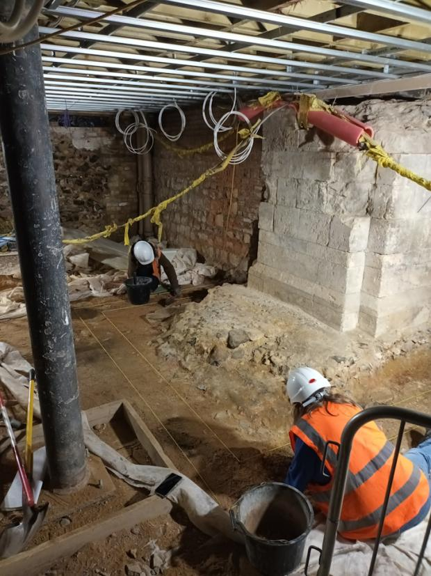
Archaeologists from Oxford Archaeology at work around the medieval pier bases at Norwich Castle
“The new finds were on the mound but in a different section,” he said. “This suggests that burials may have been more widespread. It reflects the long history of the keep and its functions.”
The castle, which developed into a medieval hub, still retains its original 12th-century vault, a key defensive feature.
Dr. Pestell observed, “The vault contains pink stonework that has clearly been burned. Significant heat likely came from below. We believe there were two sieges, in 1173 and 1216, and this damage is evidence of that.”
Mr. Lewis added humorously, “I doubt the king had planned for a massive bonfire.”
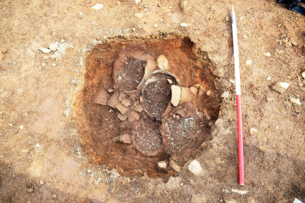
Pit with five burial urns uncovered at Twentyshilling Wind Farm, Sanquhar, Scotland
Unusual Bronze Age Burial Uncovered in Scotland
SANQUHAR, SCOTLAND—BBC News reports that archaeologists have uncovered the cremated remains of at least eight individuals inside five urns within a Bronze Age barrow in southern Scotland. Thomas Muir from Guard Archaeology and his team discovered the burial mound while surveying the area ahead of a wind farm construction. The site has been dated to between 1439 and 1287 B.C. Muir suggested that the individuals may have belonged to the same family or social group and that their deaths could have resulted from famine or another catastrophic event. “The urns were all deposited simultaneously, tightly packed in the pit, and share the same fifteenth to thirteenth century B.C. date range,” he explained. At a nearby Bronze Age site, Muir noted that bodies were sometimes exposed before being reburied in a communal burial location used over a long period.
The original research is published in Archaeology Reports Online. For more on Bronze Age Britain, see "Bronze Age Beads Go Abroad."
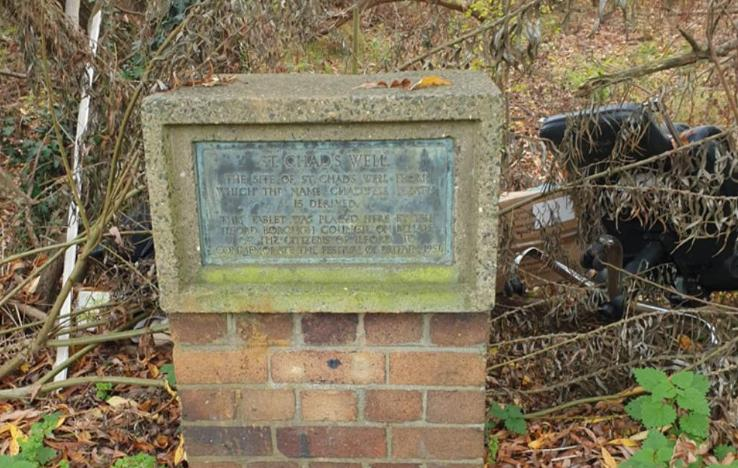
Faded plaque marks the well said to name Chadwell Heath
Where does the name Chadwell Heath originate from?
There’s a mystery surrounding Chadwell Heath—where does its name originate?
I decided to explore the area on foot, which turned into a two-hour walk.
My route took me from Collier Row Road, up Whalebone Lane North, down Forest Road, along Hainault Road, and finally onto Billet Road, looping back to Whalebone Lane North.
By the last stretch, I was feeling tired, but on Billet Road I stumbled upon a hidden piece of history tucked among roadside bushes and fly-tipped rubbish near the junction with Hainault Road.
I had seen this spot from the 296 bus almost daily, but it wasn’t until I walked past a brick and concrete monument with a faded plaque that it truly caught my eye.
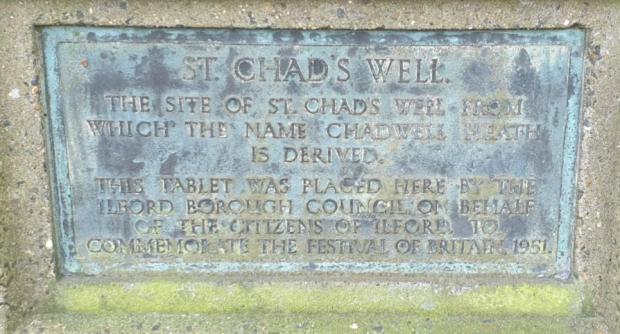
Chad’s name lives on in a monument passed daily
The plaque reads:
ST. CHAD'S WELL
THE SITE OF ST. CHAD'S WELL FROM WHICH THE NAME CHADWELL HEATH IS DERIVED.
THIS TABLET WAS PLACED HERE BY THE ILFORD BOROUGH COUNCIL ON BEHALF OF THE CITIZENS OF ILFORD, TO COMMEMORATE THE FESTIVAL OF BRITAIN, 1951.
As a former archaeology student, I was intrigued and wondered how well the monument was remembered.
I started digging and discovered the monument is listed as a historical landmark on Google Maps, including photos and a visitor comment from four years ago.
Checking Wikipedia, however, offered a different explanation for the town’s name:
“Chadwell” was first recorded in 1254 as Chaudewell, meaning “the cold spring.”
The name was initially applied to a settlement on the Barking side of the Dagenham–Barking boundary and was also called Chadwell Street (with “street” meaning hamlet).
In the 17th century, Blackheath Common in Dagenham parish was renamed Chadwell Heath.
As settlements merged, Chadwell Street was replaced by Chadwell Heath.
Searching for links to a person named Chad or St. Chad, I found St. Chad’s parish church in Chadwell Heath on St. Chad’s Road, dedicated to Chad, brother of Cedd, both bishops and saints.
Chad was a 7th-century Anglo-Saxon monk, abbot, and later bishop of the Northumbrians, Mercians, and Lindsey people. According to Bede, he and Bishop Wilfrid of Ripon introduced Christianity to Mercia. Chad died around March 2, 672, probably from the plague, and was canonized in Anglican, Roman Catholic, Celtic Orthodox, and Eastern Orthodox traditions. His feast day is March 2.
Chad is associated with wells: he dug wells for travelers, believed to have miraculous properties. While there’s no direct evidence of Chad overseeing springs, the Spa Research Fellowship calls him the patron saint of medicinal springs. This might explain why St. Chad’s Well, linked to a “cold spring” in Essex, bears his name despite him not ministering there.
Pixy Led Publications notes:
A reputed medicinal well on Billet Lane, near Little Heath, was frequented by people with weak eyesight, as the water was believed to help the eyes.
Missionaries often baptized converts at local wells, which were sometimes named after famous saints. It’s said Cedd baptized people here, and the well became associated with Chad due to its healing properties.
Nearby waterways on Google Maps show an irrigation ditch across the road and small creeks behind the monument.
Questions remain:
Should the Wikipedia explanation of Chadwell Heath’s name reconcile with St. Chad’s Well?
Is the similarity between Chaudewell and Chad’s Well coincidental?
What exactly does Chaudewell mean?
The name Chad comes from the Celtic Ceadda, derived from Proto-Brythonic kad (“battle”), with no link to wells or springs. “Chaude” is French for “hot” or “warm,” not related to Chad. Old English for “cold” is cald, with Proto-West Germanic roots kald, and ultimately Proto-Indo-European gel- (“cold”). Perhaps chaude was a corruption of cheald, but that seems unlikely.
Thus, there appears to be a discrepancy between Wikipedia’s etymology and local understanding in 1951. While Chad did not directly minister in Essex, missionaries or his brother Cedd may have, leading to the naming of the well (by 1254), the church (1886), and the road (c.1900) after him.
The monument deserves attention: not every area has its origin story engraved in stone, and the council should consider restoring this 74-year-old piece of local history.
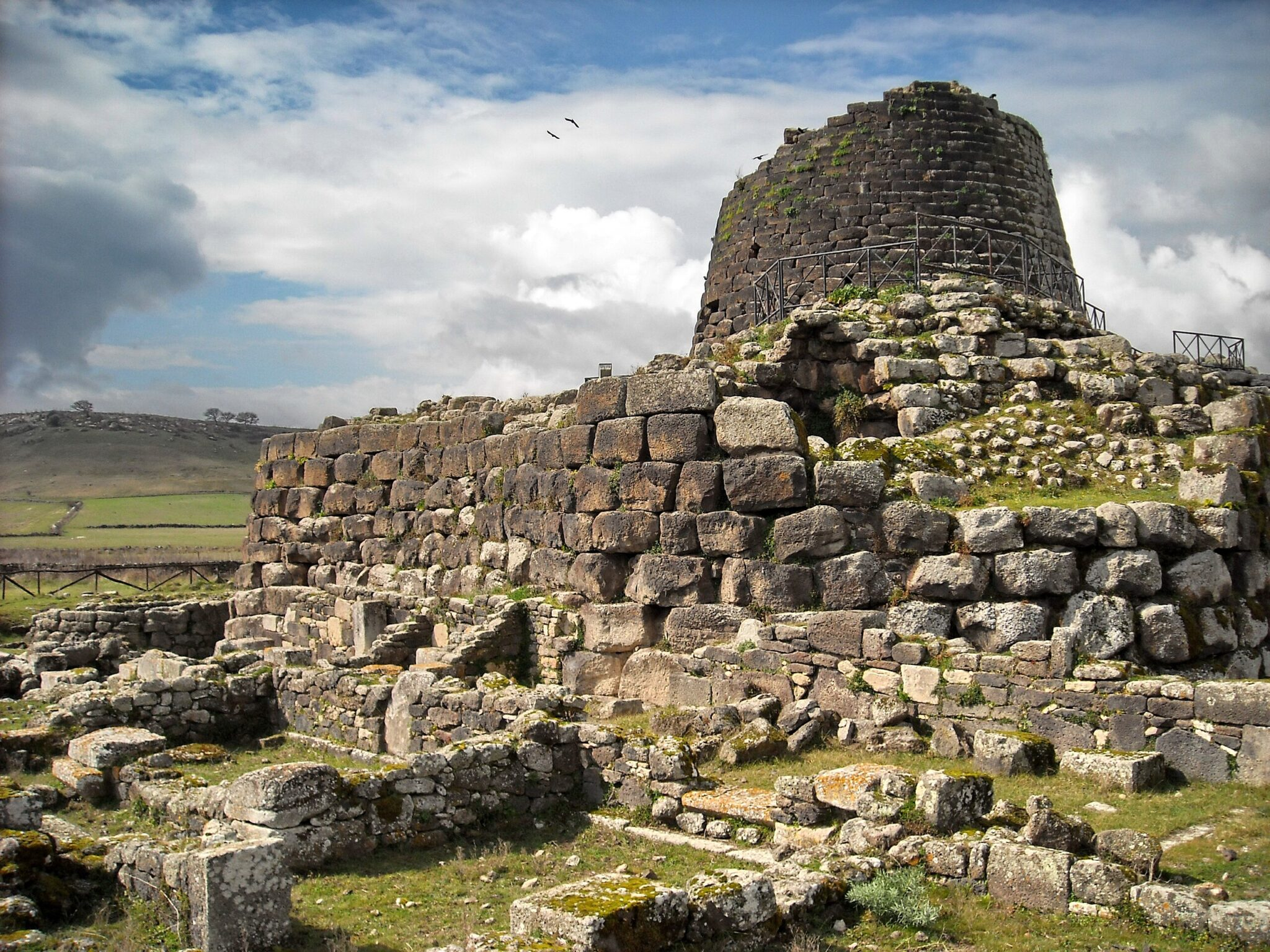
No Mortar, No Cement, No Metal – How Sardinia’s Nuragic Towers Have Defied Gravity for 3,500 Years?
Sardinia’s Nuragic towers have endured for 3,500 years without mortar, cement, or metal, and new scientific research is now explaining the ancient engineering principles that allowed these Bronze Age structures to defy gravity for millennia.
Across Sardinia’s hills, plains, and volcanic plateaus, the stone towers known as nuraghi have stood for over three thousand years. Erected by the Nuragic civilization between about 1800 and 700 BCE, these imposing monuments have long challenged archaeologists and engineers. Despite being built entirely of stone blocks, with no binding materials or metal supports, many remain standing in impressive condition today.
A recent scientific study has uncovered the structural logic behind their remarkable durability. The findings show that their strength comes not only from the size of the stones used, but also from materials once thought to be insignificant—loose rubble hidden within the walls.
An ancient puzzle shaped in stone
More than 8,000 nuraghi are spread throughout Sardinia, ranging from modest single towers to large, complex fortifications with multiple towers, walls, and courtyards. Their defining feature is a unique design: an outer tower shaped like a truncated cone that surrounds an inner chamber topped by a corbelled false dome, or tholos. The space between the inner and outer walls is filled with a thick mix of soil, small stones, and pebbles.
For many years, this fill was seen as little more than leftover material or dead weight. Researchers debated whether the towers’ stability relied mainly on the sheer mass of the stones, their circular form, or the dome-like structure of the tholos. What had not been closely examined until now was whether the fill itself played an active mechanical role in keeping the towers stable.
That question has now been answered.
Recreating the past through modern physics
In research published in the International Journal of Architectural Heritage, an Italian team led by Augusto Bortolussi used advanced computational modeling to study a typical Nuragic tower. They employed the Distinct Element Method (DEM), a technique suited for analyzing structures composed of individual blocks and granular materials, allowing them to replicate the tower as it actually functions—countless stones interacting through gravity, friction, and pressure.
The digital reconstructions matched the real proportions of nuraghi, with outer towers reaching up to 16 meters in height and inner chambers measuring up to six meters across. Importantly, the models also accounted for how the granular fill behaves when compressed.
The findings were conclusive.
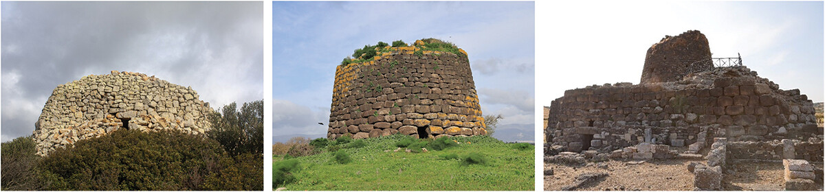
Archaic Nuraghe Sa perdaia (1), Teulada (SU); single Tower Nuraghe Lighei (2) sedilo (OR), Santu Antine complex Nuraghe (3), Torralba (SS)
The fill that holds everything together
The study demonstrates that the tholos is composed of stacked horizontal rings of stone blocks that, on their own, would be unstable. Without external support, these rings tend to rotate inward and spread outward under gravity, eventually collapsing.
The compacted fill material changes everything.
As the weight of the structure presses down, the loose fill compresses and generates horizontal radial pressure in all directions. This pressure acts inward on the tholos, locking its stone rings into a stable, continuous structure. In effect, the fill transforms independent blocks into a unified system capable of standing for centuries.
But physics is unforgivingly symmetrical. The same pressure that stabilizes the tholos also pushes outward—directly against the external tower.
Why the outer wall is built like a fortress
This is where the iconic cyclopean stones of the outer wall come into play. Often weighing several tons each, these massive blocks create enormous friction at their horizontal joints. That friction counteracts the outward thrust exerted by the compressed fill.
In structural terms, the external tower functions as a gigantic retaining wall or buttress. While the fill is essential for the stability of the inner chamber, it also places the outer wall under constant stress. The balance between these three elements—the tholos, the fill, and the external tower—is what keeps the entire structure standing.
The simulations quantified this balance. The static safety factor of the tholos was calculated at an exceptionally high 6.7, thanks to the stabilizing effect of the fill. By contrast, the external tower’s safety factor was 1.5, making it the most critical and vulnerable component of the system. Its stability depends almost entirely on friction between the massive stone blocks.
Reconstructing how the nuraghi were built
Understanding the statics also revealed how these towers must have been constructed. Building the tholos first would have caused it to collapse without lateral support. Constructing both stone walls and then adding fill later would not allow proper compaction.
The only feasible method, confirmed by the study, is construction by successive horizontal rings. The Nuragic builders raised one level at a time: an inner ring of tholos blocks, an outer ring of tower blocks, and then poured and compacted fill between them before moving upward.
This step-by-step technique ensured that the tholos received immediate horizontal support at every stage, while the outer wall resisted the growing pressure. It reflects a sophisticated empirical understanding of statics—achieved without mathematics, writing, or formal engineering theory.
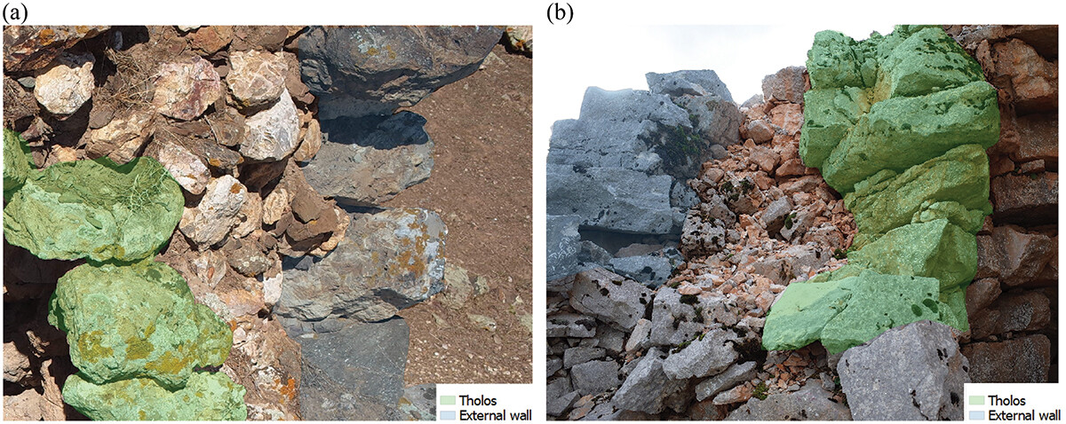
Backfill material: (a) Soil and stones of various sizes, in Nuraghe Sa Domu e’ S’Orcu, Domusnovas (SU); (b) Stones, in Nuraghe Mereu, Orgosolo (NU)
Implications for UNESCO and conservation
These discoveries come at a pivotal time, as thirty-two Nuragic sites are under consideration for UNESCO World Heritage status. Knowing how these towers function is vital for their protection.
Any restoration that removes or alters the fill or disrupts the friction between the outer wall stones could seriously threaten stability. The study offers a scientific basis for conservation practices that honor the original engineering principles rather than unintentionally weakening them.
A legacy of intuitive genius
The survival of the nuraghi is not accidental or due to sheer strength. It reflects a sophisticated construction method where every component—from the smallest stone in the fill to the largest exterior block—serves to balance forces.
Long before formal engineering existed, the Nuragic civilization mastered gravity through observation, experience, and clever design. These towers remain today not only as emblems of Sardinian heritage but as universal testaments to humanity’s early grasp of physics—a knowledge that modern science is only now fully revealing.