Scholars at Aberystwyth University are piecing together long-scattered traces of ancient speech to uncover the lost linguistic landscape of the Celtic world. For generations, the early Celtic languages of Britain and Ireland have survived only in fragments a place name carved in stone, a personal name recorded by Roman writers, or brief inscriptions cut in Ogham along remote coastlines. Now, these remnants are being unified for the first time in a single academic project. Researchers are creating the first comprehensive dictionary of the ancient Celtic languages of Britain and Ireland, a work expected to transform understanding of the region’s early language and culture.
Reassembling Voices from the Past
The dictionary concentrates on Celtic languages spoken before and during the Roman era, up to about the fifth century. These early forms underpin the modern Celtic languages still in use today, such as Welsh, Irish, Scottish Gaelic, Manx, Breton, and Cornish. Though these languages later developed along different paths, they all descend from shared linguistic ancestors rooted deep in antiquity.
Traces of this common heritage are still visible. For example, the Welsh word môr and the Old Irish muir, both meaning “sea,” reflect an ancient shared term that also appears in early place names like Moridunum (modern Carmarthen) and Morikambe (now Morecambe). Such connections point to a once-linked Celtic-speaking world spanning both sides of the Irish Sea, long before modern borders emerged.
A Major Scholarly Effort
This ambitious undertaking is led by Dr Simon Rodway, a senior lecturer in Welsh and Celtic Studies at Aberystwyth University. Supported by a three-year grant from the Leverhulme Trust, the project draws together specialists in historical linguistics, Celtic studies, and early medieval history. By consolidating scattered evidence into a single reference work, the dictionary aims to bring forgotten languages back into clearer focus and offer new insight into the early cultural history of Britain and Ireland.
Tracing Voices Beneath the Celtic Layer
Dr Rodway explains that one of the dictionary’s most challenging and exciting aims is to identify traces of languages that existed before Celtic became dominant. Certain place names, river names, and landscape terms do not fit known Celtic patterns, suggesting that earlier linguistic communities once shaped how people described their environment. These linguistic “fossils” may preserve echoes of languages otherwise completely lost to history.
River names are especially important in this respect. Across Britain and Ireland, many major rivers bear names that resist clear Celtic explanation yet are strikingly ancient in form. Scholars believe these names may belong to a pre-Celtic linguistic stratum, passed down orally for centuries even as new languages spread across the landscape. By cataloguing and comparing these anomalies, the dictionary helps illuminate the multilingual reality of prehistoric Britain and Ireland.
Rather than imagining a sudden replacement of one language by another, the project supports a more nuanced picture: a long period of linguistic overlap, borrowing, and gradual transition. Celtic languages likely spread through cultural exchange, trade, and intermarriage, absorbing elements from older tongues rather than erasing them completely.
Language, Identity, and Power in the Roman Era
The Roman conquest of Britain introduced yet another linguistic layer. Latin became the language of administration, law, and military life, while Celtic languages continued to dominate everyday speech among local populations. The dictionary captures this complex interaction by examining how Celtic names were recorded, altered, or misunderstood by Roman writers.
Many Celtic words survive only because Roman officials, historians, or geographers wrote them down—sometimes imperfectly, but often with remarkable phonetic detail. These records preserve sounds that later vanished from the living languages, offering rare glimpses into pronunciation and grammar that would otherwise be inaccessible.
Dr Rodway notes that personal names are especially revealing. Roman inscriptions frequently include Celtic names belonging to soldiers, civilians, and local elites, reflecting a society in which cultural identities were fluid rather than fixed. A person might bear a Celtic name, speak Latin in official contexts, and participate in Roman institutions while maintaining local traditions.
Rebuilding a Fragmented Lexicon
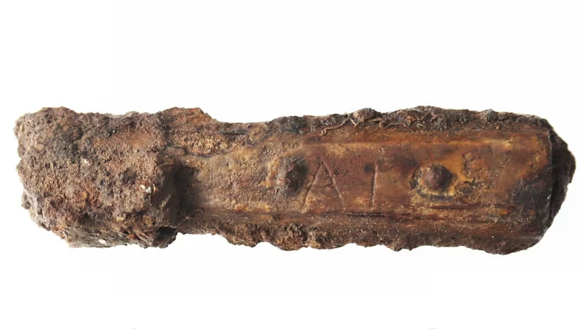
Creating the dictionary involves painstaking work. Each entry must be reconstructed from minimal evidence: a name mentioned once in a Roman text, a damaged inscription, or a short Ogham carving containing only a few letters. Scholars analyze spelling variations, phonetic patterns, and parallels in later Celtic languages to propose meanings and origins.
Where certainty is impossible, the dictionary clearly distinguishes between established interpretations and informed hypotheses. This transparency is essential, Dr Rodway emphasizes, because it allows future researchers to reassess conclusions as new discoveries emerge.
Crucially, the dictionary does not privilege one Celtic language over another. Instead, it treats Britain and Ireland as part of a single, interconnected linguistic zone, acknowledging regional diversity while highlighting shared structures and vocabulary.
A Foundation for Future Research
The impact of the project extends far beyond linguistics. Archaeologists, historians, and geneticists can use the dictionary to interpret place names, inscriptions, and historical texts more accurately. Understanding the language behind a name can reveal information about settlement patterns, migration routes, and social organization.
For modern speakers of Celtic languages, the dictionary offers a deeper sense of continuity. Words spoken today in Welsh, Irish, or Scottish Gaelic are shown to be part of a much longer story one that stretches back thousands of years and connects communities across sea and land.
Dr Rodway describes the work as both an academic resource and a cultural bridge. By bringing together scattered linguistic remnants, the project restores a sense of coherence to a fragmented past and challenges simplistic narratives of cultural replacement.
Recovering a Lost Soundscape
Ultimately, the dictionary seeks to recover not just words, but voices. It reconstructs the soundscape of ancient Britain and Ireland: the names spoken along riverbanks, carved into stone, shouted across fields, and recorded by foreign scribes. Though these voices can never be fully restored, the project brings them closer to the present than ever before.
As fragments become patterns and isolated names form systems, a forgotten linguistic world begins to take shape once more revealing that the Celtic past was richer, more diverse, and more interconnected than previously imagined.