• MAIN PAGE
  • LATEST NEWS
    • Lost Cities
    • Archaeology's Greatest Finds
    • Underwater Discoveries
    • Greatest Inventions
    • Studies
    • Blog
  • PHILOSOPHY
  • HISTORY
  • RELIGIONS
    • Africa
    • Anatolia
    • Arabian Peninsula
    • Balkan Region
    • China - East Asia
    • Europe
    • Eurasian Steppe
    • Levant
    • Mesopotamia
    • Oceania - SE Asia
    • Pre-Columbian Civilizations of America
    • Iranian Plateau - Central Asia
    • Indus Valley - South Asia
    • Japan
    • The Archaeologist Editor Group
    • Scientific Studies
    • Aegean Prehistory
    • Historical Period
    • Byzantine Middle Ages
    • Predynastic Period
    • Dynastic Period
    • Greco-Roman Egypt
  • Rome
  • PALEONTOLOGY
  • About us
Menu

The Archaeologist

  • MAIN PAGE
  • LATEST NEWS
  • DISCOVERIES
    • Lost Cities
    • Archaeology's Greatest Finds
    • Underwater Discoveries
    • Greatest Inventions
    • Studies
    • Blog
  • PHILOSOPHY
  • HISTORY
  • RELIGIONS
  • World Civilizations
    • Africa
    • Anatolia
    • Arabian Peninsula
    • Balkan Region
    • China - East Asia
    • Europe
    • Eurasian Steppe
    • Levant
    • Mesopotamia
    • Oceania - SE Asia
    • Pre-Columbian Civilizations of America
    • Iranian Plateau - Central Asia
    • Indus Valley - South Asia
    • Japan
    • The Archaeologist Editor Group
    • Scientific Studies
  • GREECE
    • Aegean Prehistory
    • Historical Period
    • Byzantine Middle Ages
  • Egypt
    • Predynastic Period
    • Dynastic Period
    • Greco-Roman Egypt
  • Rome
  • PALEONTOLOGY
  • About us
No results found

Huntersquoy: Eday's Orkney-Cromarty Tomb

September 9, 2026

Huntersquoy on Eday belongs to Orkney's extraordinary tradition of Neolithic chambered tombs.

The monument is particularly interesting because it is associated with the architectural traditions often classified within the Orkney-Cromarty group of chambered cairns.

The Orkney-Cromarty Tradition

Archaeologists use architectural classifications to compare prehistoric monuments.

Orkney-Cromarty chambered cairns generally feature distinctive internal arrangements.

These may include:

  • a passage;

  • a main chamber;

  • internal compartments;

  • and stone divisions.

Tomb Architecture

The design allowed communities to organize the internal space.

Different compartments could have served different mortuary purposes.

The exact rituals conducted inside remain unknown.

Burial

The monument was associated with prehistoric funerary practices.

Multiple individuals could be represented within chambered tombs.

This suggests that the monuments were connected to collective memory and ancestry.

Eday's Prehistoric Landscape

Eday is one of Orkney's northern islands.

Its archaeological landscape contains evidence of prehistoric occupation.

The island's environment offered:

  • agricultural land;

  • grazing;

  • marine resources;

  • and access to surrounding islands.

Monument Building

Stone architecture was particularly suited to Orkney.

Local builders could obtain large quantities of suitable stone.

However, the construction of a chambered tomb still required considerable organization.

Social Meaning

Monuments such as Huntersquoy may have helped communities define their relationship with territory.

A visible tomb could function as an enduring landmark.

It could communicate that a community had ancestral ties to a particular place.

Conclusion

Huntersquoy: Eday's Orkney-Cromarty Tomb illustrates the architectural diversity of Neolithic Orkney.

Its importance lies in demonstrating how prehistoric communities combined stone engineering with collective burial practices and landscape-based identities.

The monument is part of a broader tradition that makes Orkney one of Europe's most important regions for Neolithic archaeology.

Braeside: Eday's Neolithic Settlement

September 9, 2026

Braeside represents the settlement side of Eday's prehistoric landscape.

While Orkney is internationally famous for monumental tombs and stone circles, settlements such as Braeside are equally important because they reveal how ordinary people lived within the society that created those monuments.

Neolithic Settlement

Neolithic communities established permanent or semi-permanent settlements.

Houses could contain:

  • hearths;

  • sleeping areas;

  • workspaces;

  • storage;

  • and cooking facilities.

Agriculture

Farming transformed prehistoric life.

Communities cultivated crops and raised livestock.

Cattle and sheep were particularly important.

Agriculture provided food while also producing materials such as:

  • wool;

  • hides;

  • bone;

  • and horn.

Domestic Technology

Neolithic households used a range of tools.

Stone tools could include:

  • axes;

  • knives;

  • scrapers;

  • grinding stones;

  • and points.

Pottery provided containers for:

  • cooking;

  • storage;

  • and food preparation.

Food

People ate a combination of agricultural and wild foods.

Their diet could include:

  • grains;

  • dairy products;

  • meat;

  • shellfish;

  • fish;

  • and wild resources.

Island Communities

Eday's location encouraged interaction with neighboring islands.

Boats allowed people to transport goods and communicate across the archipelago.

Social Organization

Settlement construction demonstrates cooperation.

People had to organize:

  • food production;

  • building;

  • animal management;

  • tool manufacture;

  • and communal activities.

Relationship With Monuments

Settlements should not be separated from nearby monuments.

The people who lived in houses were the same communities participating in burial and ceremonial traditions.

Conclusion

Braeside: Eday's Neolithic Settlement provides a valuable perspective on everyday prehistoric life.

Its significance lies in showing that Neolithic Orkney was not simply a landscape of impressive monuments.

It was a living agricultural society made up of households, farms, workers, craftspeople, and families whose daily activities supported the extraordinary monumental traditions of the islands.

Onziebust: Eday's Standing Stone

September 9, 2026

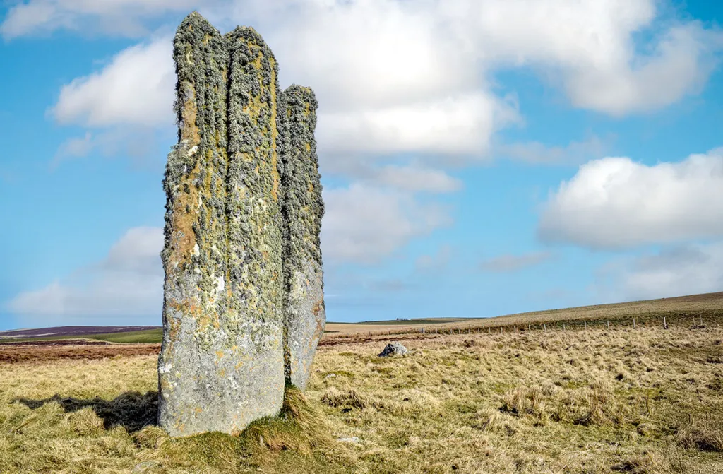
Onziebust represents another aspect of Eday's prehistoric landscape: the standing stone.

Unlike chambered cairns, which primarily contain internal burial architecture, standing stones transform the landscape through a single monumental vertical element.

Standing Stones in Neolithic Orkney

Standing stones are among the most recognizable prehistoric monuments in Britain.

They could stand individually or form part of larger arrangements.

In Orkney, standing stones occur alongside:

  • chambered cairns;

  • stone circles;

  • henges;

  • settlements;

  • and ceremonial centers.

Monumental Simplicity

A standing stone may appear simple.

Yet placing a large stone upright required substantial effort.

Builders had to:

  1. locate a suitable stone;

  2. extract or collect it;

  3. transport it;

  4. prepare the ground;

  5. and raise it vertically.

Social Cooperation

Such activities required cooperation.

The project could involve groups working together with ropes, wooden supports, levers, and prepared pits.

The monument therefore represents social organization as much as physical labor.

Landscape Meaning

The exact meaning of an individual standing stone is rarely known.

Possible functions include:

  • territorial marking;

  • ceremonial activity;

  • commemorative purposes;

  • astronomical observation;

  • or participation in wider ritual landscapes.

However, these interpretations must be evaluated individually.

Eday's Monumental Landscape

Onziebust should be considered within Eday's wider archaeological environment.

The island contains:

  • chambered cairns;

  • settlements;

  • standing stones;

  • and other prehistoric remains.

This demonstrates that the landscape was repeatedly organized and reinterpreted by prehistoric communities.

The Human Dimension

Standing stones also reveal something about prehistoric social life.

A monument required people to agree upon:

  • where it should be placed;

  • how it should be constructed;

  • and what it represented.

It therefore created a physical expression of shared ideas.

Conclusion

Onziebust: Eday's Standing Stone represents the enduring monumental traditions of prehistoric Orkney.

Although we cannot know with certainty what ceremonies took place around the stone, its construction demonstrates the ability of Neolithic communities to organize labor and transform their environment.

Together with Eday's chambered cairns and settlements, it forms part of a landscape in which farming, ancestry, ceremony, architecture, and geography were deeply interconnected.

Mill Lade: Eday's Neolithic House

September 9, 2026

Mill Lade: Eday's Neolithic House

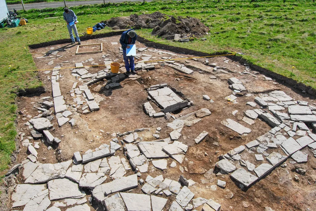
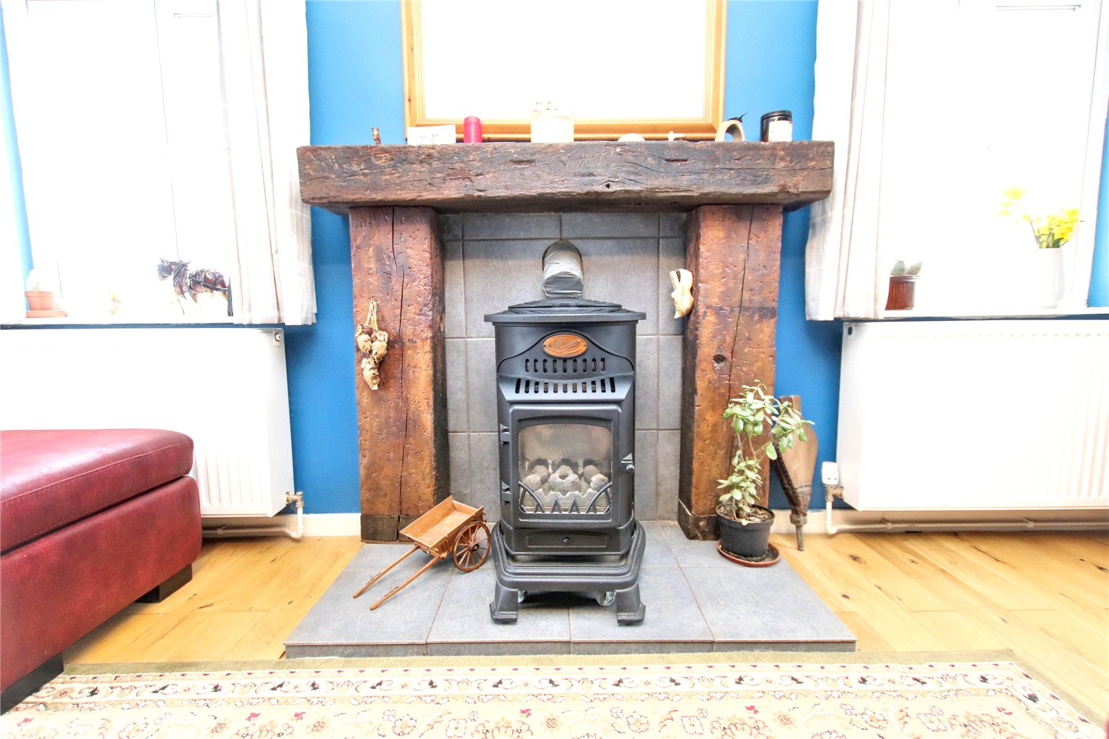
The island of Eday, in the northern part of the Orkney archipelago, preserves an extraordinary concentration of prehistoric remains. Its landscape contains chambered cairns, standing stones, settlements, later farmsteads, and Iron Age structures, making it an important place for understanding how communities repeatedly used Orkney's islands over thousands of years. Among the less spectacular but potentially significant archaeological remains are settlement sites such as Mill Lade, associated with the long Neolithic tradition of domestic occupation on Eday.

Unlike monumental sites such as Maeshowe or the Ring of Brodgar, a Neolithic house represents something much more intimate: the physical setting in which prehistoric people actually lived. Archaeological houses can reveal how families organized domestic space, prepared food, stored possessions, manufactured tools, and interacted with one another.

Eday During the Neolithic

The Neolithic period in Orkney began roughly in the fourth millennium BC and witnessed major changes in settlement, agriculture, architecture, ritual, and social organization.

Orkney is particularly important because its Neolithic communities constructed substantial stone architecture. Skara Brae, Barnhouse, the Knap of Howar, and the settlements around the Ness of Brodgar demonstrate that domestic buildings could be carefully planned and constructed from locally available stone.

Eday participated in this broader cultural world.

The island's geology provided abundant stone, while its fertile areas and access to marine resources made it suitable for settlement. Communities could combine farming with fishing, shellfish collection, hunting, and exploitation of other coastal resources.

A house such as the one associated with Mill Lade therefore needs to be understood as part of a wider settlement landscape rather than as an isolated building.

What a Neolithic House Looked Like

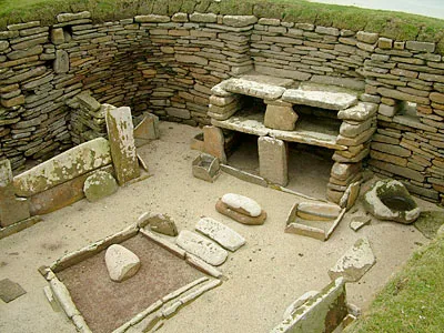
Orkney's Neolithic houses commonly used thick stone walls to create substantial, durable structures. Many had circular or sub-circular interiors, although architectural arrangements varied considerably.

A typical Orcadian Neolithic domestic building could include:

  • A central hearth

  • Stone-built internal furniture

  • Sleeping platforms

  • Work areas

  • Storage compartments

  • Entrances carefully positioned within the structure

  • Thick walls providing insulation and structural stability

These features make Neolithic Orcadian houses especially valuable because stone survives far better than the wooden architecture found elsewhere in prehistoric Europe.

The surviving archaeological architecture gives researchers an unusual opportunity to reconstruct domestic life.

More Than a House

One of the most important lessons from Orkney's Neolithic settlements is that the distinction between "domestic" and "ritual" spaces was probably not as rigid as modern categories suggest.

People lived, worked, cooked, repaired tools, processed food, socialized, and perhaps conducted ceremonies within interconnected settlements.

Some houses were repeatedly rebuilt or modified. Floors could be resurfaced, walls altered, entrances changed, and internal spaces reorganized.

Such modifications suggest that buildings were not disposable shelters. They accumulated histories.

A house could therefore become part of a family's or community's identity.

Food and Daily Life

Archaeological deposits from Orcadian Neolithic houses demonstrate that inhabitants depended on both agriculture and wild resources.

Cereal cultivation, particularly barley, formed an important part of the agricultural economy. Cattle, sheep, goats, and pigs were also important domestic animals.

Marine resources added another dimension.

The surrounding waters provided:

  • Fish

  • Shellfish

  • Seabirds

  • Marine mammals

  • Seaweed and other coastal resources

The combination of farming and maritime exploitation gave island communities considerable economic flexibility.

Technology

Stone tools were fundamental to everyday life.

People manufactured cutting tools, scrapers, axes, grinding equipment, and other implements from locally available stone and imported materials.

Orkney's Neolithic communities also participated in wider exchange networks. Certain types of stone and artifacts traveled considerable distances, demonstrating that prehistoric island communities were not isolated.

Objects found within domestic contexts can therefore reveal connections extending far beyond Eday.

Why Mill Lade Matters

Mill Lade is important precisely because sites like this complement the spectacular monuments that dominate discussions of Orkney's prehistory.

A chambered cairn tells us something about death, ancestry, and ritual.

A standing stone tells us something about landscape and monumentality.

A domestic house tells us about ordinary life.

Together, these categories create a more complete picture of Neolithic society.

The archaeological significance of Mill Lade therefore lies in placing Eday's inhabitants back into the landscape as active communities rather than simply as builders of monuments.

Knowe of Trotty: Eday's Cairn

September 9, 2026

Knowe of Trotty: Eday's Cairn

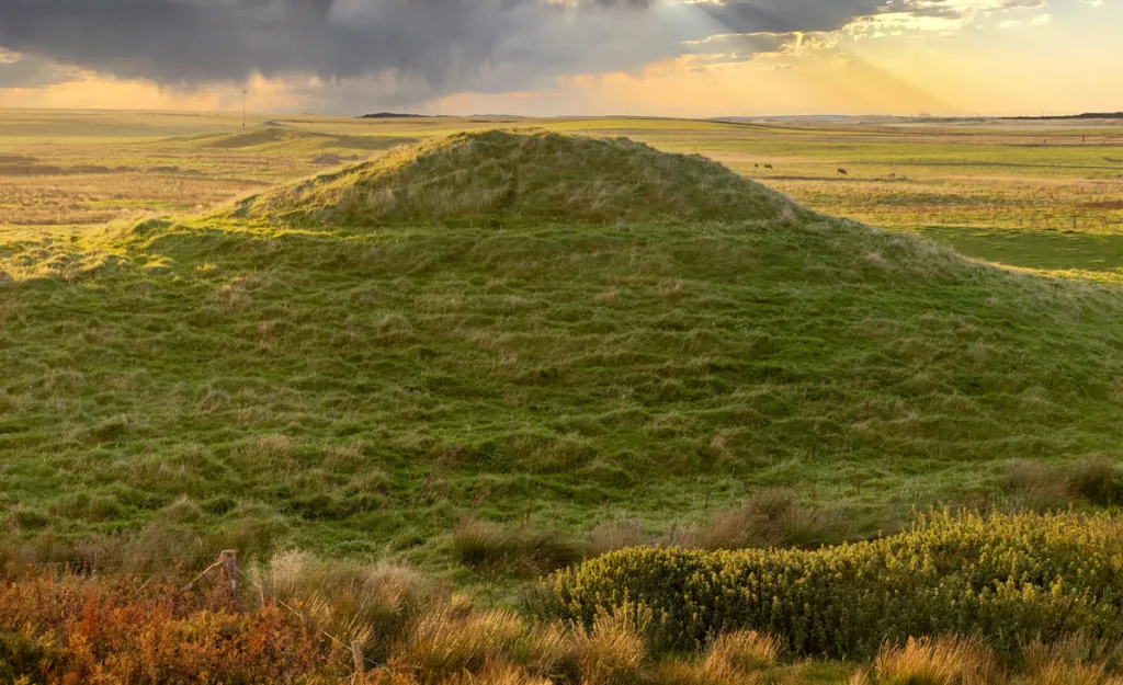
The prehistoric landscape of Eday contains numerous mounds and cairns, reflecting a long tradition of constructing monuments for burial, remembrance, ceremony, and possibly territorial display. The Knowe of Trotty belongs to this wider tradition of Orcadian prehistoric monument construction.

The word "knowe" is itself revealing. Across Scotland and particularly Orkney, names containing knowe often refer to prominent artificial or natural mounds. Such places frequently preserve archaeological remains beneath what appears today to be an ordinary hill.

Cairns in Orkney

Stone cairns were among the most enduring monuments created by prehistoric communities.

They could contain:

  • Human burials

  • Cremated remains

  • Stone chambers

  • Cists

  • Grave goods

  • Later prehistoric deposits

But not every cairn necessarily served exactly the same function.

Some were primarily funerary monuments, while others may have had ceremonial or commemorative roles.

The Importance of Mounds

A mound changes how people experience a landscape.

Even a relatively small cairn can become a visible landmark. Its height distinguishes it from the surrounding ground, while its construction demonstrates that people intentionally transformed the landscape.

Over generations, later inhabitants could encounter the monument and assign new meanings to it.

This long-term visibility is particularly important in Orkney because prehistoric monuments often remained prominent long after the societies that constructed them had disappeared.

Eday's Archaeological Landscape

The Knowe of Trotty should therefore not be studied in isolation.

Eday contains a network of prehistoric monuments distributed across hills, agricultural areas, and coastal landscapes. Their locations may reflect choices concerning visibility, access, terrain, and relationships with other monuments.

Archaeologists increasingly approach such sites through landscape archaeology.

Instead of asking simply, "What is inside the cairn?" researchers also ask:

  • Why was it built here?

  • What could people see from it?

  • Which other monuments could be seen?

  • Was it positioned near settlement?

  • Did later communities continue to use the surrounding landscape?

These questions can transform a small cairn into evidence for broader social behavior.

Burial and Memory

Prehistoric burial monuments were not simply containers for dead bodies.

They could have acted as places where communities negotiated relationships with ancestors.

Constructing a cairn required labor.

Stone had to be gathered, transported, arranged, and maintained. The process could have brought people together and created a shared experience.

The finished monument then remained as a physical reminder of those activities.

In this sense, monuments could preserve social memory.

Later Use

One of the recurring characteristics of Orkney's archaeological landscape is reuse.

Later prehistoric and historic populations frequently encountered earlier monuments. Some were disturbed, incorporated into fields, used as landmarks, or occasionally reused for burial.

Consequently, the archaeological layers associated with a cairn may represent several different periods.

Archaeological Significance

The Knowe of Trotty contributes to a much larger story about how Eday's inhabitants constructed relationships between community, ancestry, and landscape.

It is a reminder that prehistoric Orkney was not simply a collection of isolated monuments. It was a carefully inhabited landscape in which houses, graves, fields, stones, hills, and coastlines formed interconnected places.

Eday Manse: Eday's Stone Circles

September 4, 2026

Eday Manse: Eday's Stone Circles

Stone circles are among the most recognizable monuments of prehistoric Britain, and Orkney possesses several important examples. The landscape around Eday Manse adds another element to Eday's tradition of prehistoric stone monument construction.

Stone circles are particularly intriguing because their exact purposes remain uncertain.

They were clearly deliberate constructions, but their meanings probably changed according to place and period.

Building a Stone Circle

Constructing a stone circle required organization.

People had to:

  1. Select an appropriate location.

  2. Identify suitable stones.

  3. Extract or move them.

  4. Transport them to the chosen site.

  5. Arrange them according to a planned design.

  6. Potentially modify or replace stones over time.

The labor involved tells us something about prehistoric communities.

Stone circles were not random collections of rocks. Their placement reflects planning and social coordination.

Circles and the Sky

Astronomical interpretations have long fascinated researchers.

Some prehistoric monuments appear to have relationships with:

  • Solstices

  • Equinoxes

  • Lunar movements

  • Horizon features

  • Seasonal changes

However, archaeologists increasingly caution against assuming that every stone circle was designed as a precise astronomical observatory.

The sky undoubtedly mattered to prehistoric agricultural societies, but astronomical alignments should be demonstrated through careful measurement rather than assumed simply because a monument is circular.

Social Gathering

Stone circles may also have served as gathering places.

People could have assembled for:

  • Ceremonies

  • Feasting

  • Mortuary activities

  • Seasonal celebrations

  • Community negotiations

  • Ancestor-related rituals

The circular form creates a defined space while allowing participants to face toward the center.

This arrangement could have had powerful social implications.

Eday in the Orcadian Tradition

Eday's stone monuments form part of the same broad prehistoric cultural landscape that produced the famous monuments of Mainland Orkney.

This does not necessarily mean that all communities followed an identical religious system.

Instead, it suggests participation in shared architectural traditions.

Ideas about monuments, ancestors, seasons, community, and landscape appear to have circulated throughout the islands.

Why Small Monuments Matter

Archaeological attention naturally concentrates on famous monuments.

Yet smaller circles and less spectacular structures can provide crucial information.

They demonstrate that monument construction was not restricted to a few major ceremonial centers.

Instead, monumental traditions could be distributed throughout the islands.

The Eday Manse area therefore helps broaden our understanding of Orcadian prehistoric society beyond its most famous sites.

Eday Church: Eday's Viking Graves

September 4, 2026

Eday Church: Eday's Viking Graves

The arrival of Scandinavian settlers transformed Orkney.

From the late first millennium AD, Norse language, political institutions, settlement patterns, religious traditions, and burial practices became deeply embedded within the islands.

The area around Eday Church preserves evidence connected with this Viking and Norse presence.

Burials are especially valuable because they provide direct archaeological evidence for individuals rather than merely buildings or artifacts.

Vikings in Orkney

Scandinavian activity in Orkney began before permanent settlement.

Viking raiders used the Northern Isles strategically because of their position along maritime routes between Scandinavia, Britain, Ireland, and the North Atlantic.

Eventually, Norse settlement became substantial.

Orkney became part of the Norse political world and later the earldom of Orkney.

Viking Burial Practices

Norse burial traditions varied.

Some individuals were buried in:

  • Simple graves

  • Stone-lined graves

  • Cists

  • Boat burials

  • Burial mounds

Grave goods could include weapons, jewelry, tools, dress accessories, and personal possessions.

However, the presence or absence of grave goods does not automatically determine whether an individual was "Viking."

Burial practices changed through time and were influenced by Christianity.

Christianity Changes Burial

One of the most important transformations in Norse Orkney was Christianization.

Earlier pagan traditions could involve grave goods and burial monuments.

Christian burial increasingly emphasized churchyards and inhumation without the extensive object assemblages characteristic of some earlier graves.

This makes sites around medieval churches particularly interesting because they can represent a transition between religious traditions.

What Graves Can Tell Us

Modern archaeology can extract far more information from graves than nineteenth-century excavators could.

Human remains can provide evidence concerning:

  • Age

  • Biological sex

  • Trauma

  • Disease

  • Diet

  • Childhood stress

  • Mobility

  • Physical activity

Isotopic analysis can sometimes identify whether individuals grew up locally or elsewhere.

Ancient DNA can also provide information about biological relationships and population movement when preservation permits.

Eday's Strategic Position

Eday's position in northern Orkney placed it within maritime networks connecting the islands.

Its archaeological record demonstrates that Norse settlement was not confined to Mainland Orkney.

Farmsteads, churches, graves, place names, and landscape features collectively demonstrate the depth of Scandinavian influence.

Beyond the Warrior Stereotype

The archaeological evidence also challenges the popular image of every Viking burial belonging to a warrior.

Most Norse settlers were farmers, craftspeople, traders, fishers, and household members.

A grave therefore provides evidence about a community rather than simply about warfare.

The Viking presence on Eday was part of a broader transformation in which Scandinavian settlers became permanent participants in Orcadian society.

Redland: Eday's Farm Mound

September 4, 2026

Redland: Eday's Farm Mound

The archaeological landscape of Eday is not limited to prehistoric monuments. Agricultural activity has shaped the island for thousands of years, leaving behind settlement mounds, field systems, buildings, and other traces.

Redland represents the importance of farm-related archaeological remains in reconstructing how people used Eday's landscape.

Farming in Orkney

Agriculture became established in Orkney during the Neolithic.

Early farmers cultivated cereals and kept domesticated animals. Over succeeding centuries, agricultural practices changed but remained central to island life.

The landscape therefore contains evidence for repeated cycles of:

  • Cultivation

  • Pastoralism

  • Settlement

  • Abandonment

  • Reoccupation

  • Field expansion

A mound associated with farming may preserve multiple phases of this history.

What a Farm Mound Can Preserve

Archaeological mounds can contain layers representing former occupation.

These may include:

  • Stone structures

  • Floors

  • Hearths

  • Animal bone

  • Charcoal

  • Pottery

  • Metal objects

  • Agricultural debris

The accumulation of these materials can gradually produce a raised feature.

What appears to be a natural mound may therefore contain evidence for centuries of human activity.

Landscape Change

Modern agricultural fields can obscure prehistoric landscapes.

Fences, drainage channels, roads, and later buildings may cover or disturb older archaeological remains.

Archaeologists therefore increasingly combine fieldwalking, aerial photography, LiDAR, geophysical survey, and environmental sampling to reconstruct former landscapes.

Farm Life

Farm archaeology gives us access to the practical realities of life.

People had to manage livestock, cultivate crops, repair buildings, process food, maintain tools, and respond to weather.

On an island such as Eday, farming was also inseparable from the sea.

Fishing and marine resources provided important supplements to agricultural production.

Significance

Redland's importance lies in showing that archaeology is not only about monumental structures.

The history of ordinary agricultural communities is equally important.

Farm mounds can preserve evidence of the people who maintained the landscape generation after generation.

Sandhill Smithy: Eday's Neolithic Site

September 4, 2026

Sandhill Smithy: Eday's Neolithic Site

The name Sandhill Smithy presents an interesting archaeological puzzle because the word "smithy" evokes metalworking, while the title identifies the site as Neolithic.

This distinction is important.

The Neolithic predates widespread metallurgy in Orkney, so an archaeological site with Neolithic evidence should not automatically be interpreted as an ancient blacksmith's workshop simply because of its later place-name.

Understanding Place Names

Scottish archaeological landscapes often preserve names that were assigned centuries after the original archaeological activity.

A location may be called:

  • Smithy

  • Chapel

  • Castle

  • Kirk

  • Temple

  • Giants' Grave

without the archaeological remains actually belonging to the period implied by the name.

Archaeologists therefore distinguish between traditional place names and excavated evidence.

The Neolithic Background

If Neolithic material survives at Sandhill Smithy, it belongs to the period when Orkney communities were establishing increasingly permanent agricultural settlements.

This was an era of remarkable architectural development.

People constructed stone houses, chambered tombs, standing stones, and ceremonial complexes.

Craft Production

Neolithic communities were highly skilled craftspeople.

They worked:

  • Stone

  • Bone

  • Antler

  • Shell

  • Clay

  • Wood

  • Organic fibers

Stone tools could be shaped through flaking, grinding, polishing, and drilling.

Pottery was also an important technology.

These crafts were essential to farming and household life.

The Importance of Context

A single artifact rarely tells the whole story.

A stone axe found in isolation has limited interpretive value.

An axe found beside a hearth, animal bones, pottery fragments, and a building provides much richer evidence.

Archaeologists therefore focus heavily on context.

Where something was found can be as important as what it is.

Eday's Wider Neolithic Network

Sandhill Smithy belongs within a much larger archaeological environment.

Eday's Neolithic monuments and settlements demonstrate that communities occupied and transformed the island repeatedly.

The site's value is therefore greatest when considered alongside other evidence rather than as an isolated archaeological curiosity.

Stove: Eday's Broch

September 4, 2026

Stove: Eday's Broch

Brochs are among Scotland's most distinctive Iron Age architectural traditions.

These massive stone towers are especially associated with northern Scotland and the Northern Isles, where they dominate parts of the prehistoric landscape.

Stove represents Eday's contribution to this remarkable architectural tradition.

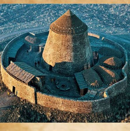
What Is a Broch?

A broch is generally characterized by a thick circular stone wall enclosing an internal space.

Many possessed:

  • Double-skinned walls

  • Internal galleries

  • Staircases

  • Cells

  • Intramural chambers

  • A central courtyard or interior

  • Substantial entrances

Their exact function remains debated.

For many years, archaeologists interpreted brochs primarily as defensive towers.

Modern research has increasingly emphasized their social and architectural significance.

Defense and Status

A broch's massive construction certainly provided security.

But building such a structure also required considerable resources.

Large quantities of stone had to be quarried, transported, and carefully assembled.

This suggests that brochs could communicate:

  • Wealth

  • Authority

  • Community identity

  • Social status

  • Architectural ambition

They may therefore have been simultaneously practical and symbolic.

Life Inside a Broch

Brochs were not necessarily empty fortifications.

Archaeological deposits from broch sites can contain evidence for domestic activity.

People could have:

  • Cooked food

  • Kept livestock

  • Stored grain

  • Crafted tools

  • Worked textiles

  • Socialized

  • Conducted ceremonies

Some brochs were occupied for generations.

Eday's Iron Age Landscape

Stove should be considered alongside other Iron Age structures on Eday and neighboring islands.

The Northern Isles contained a dense network of settlements.

Communities interacted through trade, kinship, marriage, competition, and possibly conflict.

Brochs may have served as visible centers within these local territories.

The Broch as a Monument

A broch was more than a building.

Its enormous stone walls made it a permanent landmark.

Anyone traveling across the surrounding landscape would recognize it.

Its architectural presence could therefore reinforce the identity and authority of the people associated with it.

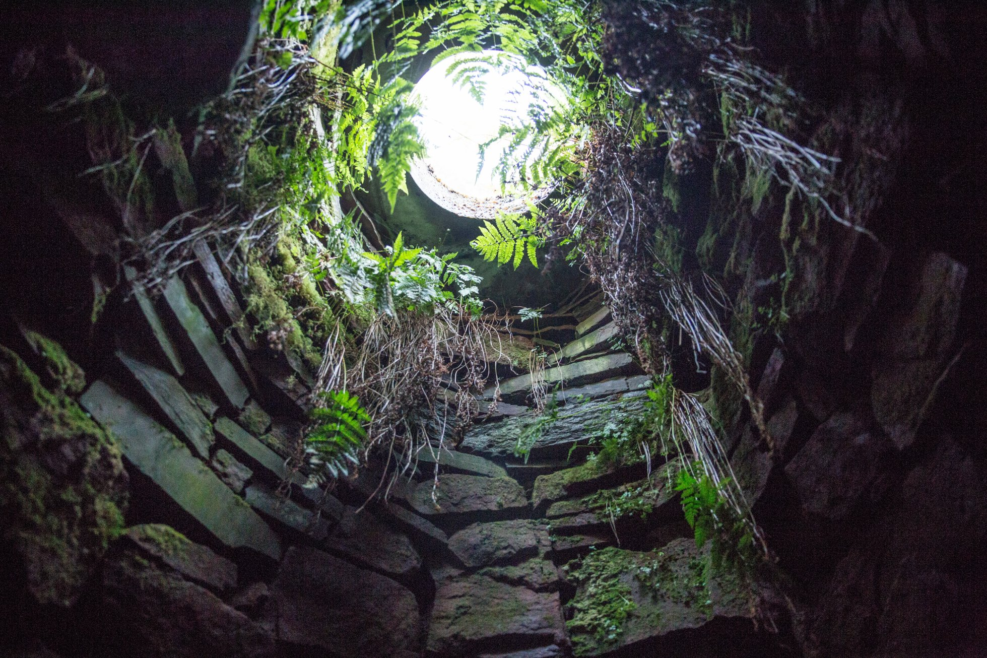
Vinquoy: Eday's Chambered Cairn

September 4, 2026

Vinquoy: Eday's Chambered Cairn

The Vinquoy chambered cairn is one of the major prehistoric monuments associated with Eday.

Chambered cairns are among the most important sources for understanding Neolithic beliefs concerning death, ancestry, and community.

What Is a Chambered Cairn?

A chambered cairn is a large stone monument containing an internal chamber or series of chambers used for funerary purposes.

Typically, its architecture may include:

  • An outer cairn

  • A passage

  • A central chamber

  • Side compartments

  • Upright structural stones

The architecture varies considerably across Britain.

Orkney possesses some of the most sophisticated examples.

Collective Burial

Many Neolithic chambered cairns appear to have accommodated the remains of multiple individuals.

This suggests that burial was not necessarily an individual event.

Instead, communities could have returned repeatedly to ancestral monuments.

Human remains may have been moved, rearranged, or deposited over extended periods.

The monument therefore became a place of continuing interaction with the dead.

Architecture and Cosmology

The passage and chamber arrangement created a carefully controlled experience.

A visitor entered from the outside world into a darker interior.

Such movement may have had symbolic meaning.

At some monuments, astronomical orientations appear important.

At others, architecture emphasizes enclosure, restricted access, or relationships with surrounding monuments.

These differences remind us that Neolithic ritual was diverse.

Eday and the Orcadian Tradition

Vinquoy belongs to the broader Orcadian chambered-cairn tradition represented by sites such as Maeshowe, Cuween Hill, Quoyness, Taversoe Tuick, and Midhowe.

These monuments demonstrate that the islands shared architectural ideas while also developing local variations.

Importance of the Monument

Vinquoy provides evidence for a society that invested substantial labor in commemorating the dead.

Its significance is therefore not simply architectural.

It reflects how Neolithic communities understood ancestry, identity, place, and continuity.

Braes of Verwick: Stronsay's Neolithic Farm

September 4, 2026

Braes of Verwick: Stronsay's Neolithic Farm

Moving from Eday to neighboring Stronsay, the archaeological landscape continues to reveal evidence for prehistoric agriculture and settlement.

The Braes of Verwick represents the importance of early farming sites in understanding how Neolithic communities transformed the Northern Isles.

The Neolithic Farmer

Neolithic farmers were not simply primitive versions of modern agriculturalists.

They possessed sophisticated knowledge of:

  • Soil

  • Seasons

  • Animal husbandry

  • Crop cultivation

  • Stone technology

  • Food storage

  • Landscape management

Farming required long-term planning.

Crops had to be planted and harvested at appropriate times, while animals required year-round management.

Mixed Economy

Neolithic Orkney was never purely agricultural.

The sea remained essential.

A household could combine:

  • Cereal cultivation

  • Cattle keeping

  • Sheep and goat husbandry

  • Fishing

  • Shellfish gathering

  • Bird hunting

  • Marine-resource exploitation

This mixed economy was especially logical for island communities.

Farm Buildings

Neolithic houses in Orkney are often substantial stone structures.

Their thick walls could provide insulation against the harsh northern climate.

Internal arrangements could include hearths, platforms, storage spaces, and working areas.

The architecture reflects both environmental adaptation and social organization.

The Wider Landscape

A farm should never be considered alone.

Fields, paths, grazing areas, water sources, nearby monuments, and coastal resources all contributed to settlement decisions.

The Braes of Verwick therefore helps illustrate how Neolithic communities integrated agriculture into a broader landscape.

Burroughston Broch: Stronsay's Iron Age Tower

September 4, 2026

Burroughston Broch: Stronsay's Iron Age Tower

The Burroughston Broch is one of Stronsay's most important Iron Age monuments.

Like other brochs across northern Scotland, it represents an extraordinary investment in stone architecture.

Construction

A broch's walls were constructed using carefully arranged stonework.

The characteristic double-wall construction produced enormous thickness while leaving internal spaces that could be used for staircases, galleries, and chambers.

This engineering technique allowed builders to create structures far taller than ordinary stone houses.

Engineering Achievement

Broch construction required detailed understanding of:

  • Stone selection

  • Load distribution

  • Wall stability

  • Drainage

  • Entrances

  • Internal circulation

The builders had no modern surveying instruments.

Yet their structures demonstrate impressive architectural knowledge.

Social Meaning

Why build such a massive tower?

Defense may have been one factor.

But a purely defensive interpretation does not explain all broch architecture.

A tower could function as a residence, meeting place, storage center, refuge, or symbol of authority.

Its size itself communicated power.

Stronsay's Position

Stronsay's location placed it within the maritime world of the Northern Isles.

Communities could move between islands by boat, exchange goods, and maintain relationships across considerable distances.

Burroughston therefore represents part of a wider Iron Age network rather than an isolated settlement.

Legacy

Today, the broch provides a rare physical connection with communities living in Orkney more than two thousand years ago.

Its walls preserve not only engineering knowledge but also evidence for social organization and identity.

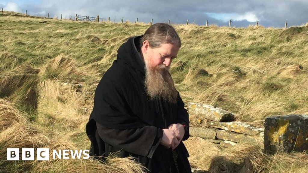
Papa Stronsay: Monastic Ruins

September 3, 2026

Papa Stronsay: Monastic Ruins

The tiny island of Papa Stronsay occupies an important position within the religious history of Orkney.

The name itself reflects the island's ecclesiastical associations. "Papa" place names across the Northern Isles are commonly connected with early Christian communities, traditionally associated with papar, an Old Norse term used for religious figures or priests.

Early Christianity in Orkney

Christianity reached Orkney before and during the period of Norse settlement.

The exact chronology and character of the earliest Christian communities remain subjects of scholarly discussion.

However, archaeological evidence demonstrates that Christian activity existed in the Northern Isles before Christianity became fully established within the Norse political system.

Norse Christianity

The conversion of Norse society was gradual.

Rather than imagining a single moment when paganism disappeared and Christianity immediately replaced it, archaeologists see a process involving:

  • New burial practices

  • Churches

  • Crosses

  • Ecclesiastical landholding

  • Changing personal names

  • New religious institutions

Orkney eventually became firmly Christian.

Monastic Landscapes

Monastic sites were more than places of prayer.

They could include:

  • Chapels

  • Burial grounds

  • Agricultural land

  • Workshops

  • Storage facilities

  • Living quarters

Religious communities depended upon the surrounding landscape for food and resources.

Papa Stronsay's Significance

The island's monastic associations contribute to our understanding of the spread and institutionalization of Christianity across the Northern Isles.

Its location also demonstrates how religious communities could establish themselves on relatively small islands.

The sea, rather than simply being a barrier, connected these communities to larger networks.

Lamb Ness: Stronsay's Cairn

September 3, 2026

Lamb Ness: Stronsay's Cairn

The Lamb Ness area of Stronsay adds another prehistoric monument to the island's archaeological landscape.

Cairns are deceptively simple structures.

A pile of stones may appear insignificant today, but prehistoric cairns could encode complicated relationships between people, ancestors, territory, and memory.

Monument Construction

Building a cairn required collective labor.

Even a modest structure involved the gathering and movement of substantial quantities of stone.

This work could have served a social function in itself.

People working together to construct a monument were not simply moving rocks; they were participating in a communal activity.

Burial

Many prehistoric cairns were associated with funerary practices.

Burials could include:

  • Complete bodies

  • Cremated remains

  • Disarticulated bones

  • Multiple individuals

  • Grave goods

The exact practices varied greatly across time.

Landscape Visibility

Cairns were often placed in visible locations.

From a distance, a mound could serve as a landmark.

It could mark a particular territory or connect a community to ancestral activity.

Stronsay's Prehistory

The cairn contributes to evidence showing that Stronsay was repeatedly occupied and modified by prehistoric populations.

Its significance becomes clearer when studied together with the island's settlements, agricultural landscapes, stone monuments, and later structures.

Vat of Kirbuster: Stronsay's Neolithic

September 3, 2026

Vat of Kirbuster: Stronsay's Neolithic

The title Vat of Kirbuster refers to a prehistoric feature associated with Stronsay's Neolithic landscape.

As with many Orcadian archaeological locations, its significance is best understood not through a single artifact but through the broader pattern of Neolithic settlement and monument construction across the island.

Neolithic Stronsay

During the Neolithic period, Stronsay formed part of the agricultural and maritime world of Orkney.

Communities settled in areas where they could exploit both land and sea.

The island offered opportunities for:

  • Farming

  • Grazing

  • Fishing

  • Shellfish collection

  • Bird exploitation

  • Gathering coastal resources

Stone Architecture

Stone was the defining building material of Orcadian prehistory.

Unlike timber structures in many other parts of Britain, stone houses survive exceptionally well in Orkney.

This creates an archaeological record that is unusually detailed.

Walls, hearths, floors, and internal furniture can sometimes survive long after roofs and wooden components have disappeared.

Environmental Evidence

Neolithic sites can also preserve microscopic evidence.

Pollen can reveal vegetation.

Charcoal can identify wood species.

Phytoliths and starch residues can sometimes provide information about plant processing.

Animal bones reveal diet and livestock management.

Together these techniques allow archaeologists to reconstruct environments that no longer exist.

Why the Site Matters

The Vat of Kirbuster belongs to the larger story of Neolithic transformation.

The people who lived on Stronsay were not simply surviving from day to day.

They were managing landscapes, constructing permanent architecture, maintaining social networks, and participating in shared cultural traditions across Orkney.

St Peter's Pool: Stronsay's Chapel Site

September 3, 2026

St Peter's Pool: Stronsay's Chapel Site

Christianity left a powerful imprint on Stronsay's landscape.

The St Peter's Pool site is associated with a chapel tradition, illustrating how Christian communities established sacred places across the Northern Isles.

Sacred Landscapes

Christianization did not necessarily erase earlier sacred landscapes.

Churches and chapels were often established in locations that already possessed significance.

In some cases, Christian sites were associated with earlier settlement or prehistoric monuments.

This could help communities integrate new religious practices into familiar landscapes.

Chapels

A medieval chapel could serve a relatively small community.

It might have consisted of:

  • A simple stone building

  • Burial ground

  • Boundary

  • Cross or carved stone

  • Associated settlement

Not every chapel was a monastery.

Many were local places of worship serving farms and small communities.

St Peter

The dedication to St Peter is significant because Peter was one of Christianity's most important apostles.

Medieval churches dedicated to him occur widely across Britain and Europe.

A dedication does not necessarily reveal when a chapel was first established, however. Sites could be rebuilt, rededicated, or altered over time.

Archaeological Evidence

Even when a chapel building survives poorly, archaeological traces may remain.

These can include:

  • Foundation trenches

  • Wall lines

  • Burial remains

  • Grave markers

  • Architectural fragments

  • Ceramic material

  • Metal objects

Burial grounds are particularly important because they can reveal demographic and health information about medieval communities.

Stronsay's Christian Transformation

St Peter's Pool forms part of the larger transformation from a Norse pagan society into a Christian medieval society.

This transformation affected burial, architecture, political institutions, landholding, art, and everyday life.

Mill of Linga Sound: Stronsay's Viking

September 3, 2026

Mill of Linga Sound: Stronsay's Viking

The Viking Age transformed the Northern Isles into a major maritime crossroads.

The Mill of Linga Sound site represents part of Stronsay's archaeological evidence for this Scandinavian period.

The Northern Isles and the Viking World

Orkney was strategically positioned between Scandinavia, the British Isles, the North Atlantic, and the Irish Sea.

Viking ships could use the islands as:

  • Stopping points

  • Bases

  • Settlement zones

  • Agricultural territories

  • Trading locations

This geographical position helps explain why Scandinavian influence became so strong.

Viking Settlement

Scandinavian settlers introduced or expanded new systems of:

  • Farming

  • Landholding

  • Naming

  • Language

  • Burial

  • Political organization

Old Norse became the dominant language of Orkney for centuries.

Many modern place names preserve this linguistic heritage.

Farming and the Sea

The Viking economy of Stronsay was not based entirely on raiding.

Settlers became farmers.

They raised livestock, cultivated crops, fished, hunted, and exploited marine resources.

The sea remained essential for transportation.

A farm situated near a sound could potentially participate in maritime networks extending across the Northern Isles and beyond.

Archaeological Evidence

Viking and Norse activity can survive archaeologically through:

  • Longhouses

  • Farm mounds

  • Burials

  • Boat-related remains

  • Metalwork

  • Norse pottery

  • Bone artifacts

  • Imported objects

  • Place names

Even a relatively modest site can therefore contribute to reconstructing the broader Viking landscape.

Stronsay in the Norse World

Stronsay was not a remote island at the edge of civilization.

From a Viking perspective, it occupied a position within a connected North Atlantic world.

People could travel between Orkney, Shetland, Caithness, the Hebrides, Ireland, Iceland, and Scandinavia.

Goods, people, stories, technologies, and religious ideas moved along these maritime routes.

From Viking Age to Medieval Orkney

The Viking Age eventually developed into the medieval Norse earldom.

Christianity became established, churches appeared, and political institutions became more formalized.

Yet the Scandinavian foundations remained visible in language, place names, settlement patterns, and cultural traditions.

The archaeological evidence from sites such as Mill of Linga Sound therefore helps bridge the transition between prehistoric Stronsay and medieval Orkney.

Conclusion

The archaeological sequence from Eday to Stronsay demonstrates just how deeply layered the Northern Isles are.

Across these fifteen sites, we move through:

  • Neolithic houses and farms

  • Chambered cairns

  • Stone circles

  • Iron Age brochs

  • Viking graves

  • Norse settlement

  • Early Christian communities

  • Medieval chapels

  • Agricultural landscapes

The most important lesson is that these sites should not be viewed as isolated curiosities. They form parts of interconnected landscapes that were repeatedly inhabited, modified, remembered, and reinterpreted.

Eday's prehistoric communities built substantial houses and funerary monuments. Iron Age communities constructed powerful broch towers. Later Scandinavian settlers transformed the islands' language, economy, politics, and religious life. Christianity subsequently created new sacred landscapes while incorporating communities into the medieval European world.

Mount Sandel: Northern Ireland's 9,000-Year Settlement

August 31, 2026

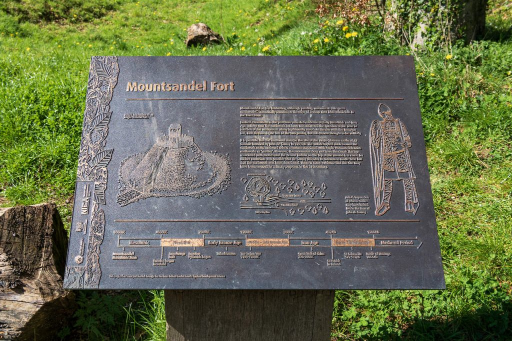
Mount Sandel, located near Coleraine in County Londonderry, Northern Ireland, is one of the most important Mesolithic archaeological sites on the island of Ireland.

Dating to approximately 9,000 years ago, the site provides evidence for some of the earliest known settled human activity in Ireland.

Its importance comes from evidence of repeated occupation, circular dwellings, hearths, stone tools, food remains, and the exploitation of the nearby River Bann.

Ireland After the Ice Age

Following the end of the last Ice Age, Ireland underwent major environmental change.

As temperatures increased:

  • forests expanded;

  • wetlands developed;

  • rivers became productive;

  • and animal populations changed.

Human groups entered and established themselves within this changing landscape.

The Mesolithic in Ireland

The Irish Mesolithic economy depended largely on wild resources.

People exploited:

  • fish;

  • shellfish;

  • birds;

  • mammals;

  • nuts;

  • and wild plants.

They possessed sophisticated knowledge of local environments.

The Mount Sandel Settlement

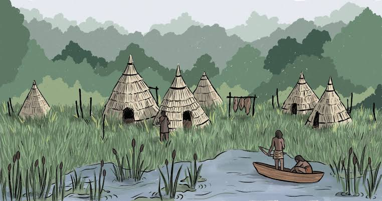
Archaeological excavations revealed evidence of circular structures.

These likely represented temporary or semi-permanent houses.

The buildings appear to have contained:

  • central hearths;

  • living areas;

  • working spaces;

  • and activity zones.

Their presence demonstrates that Mesolithic communities were capable of constructing planned dwellings.

The River Bann

The site's location near the River Bann was extremely advantageous.

Rivers provided:

  • fish;

  • water;

  • transportation;

  • plants;

  • and access to different ecological environments.

Fish could form an important part of the local diet.

Fishing Technology

Archaeologists have recovered evidence associated with fishing and aquatic resource exploitation.

The ability to harvest fish efficiently allowed communities to obtain reliable protein without depending entirely on large-game hunting.

Hazelnuts

One particularly important resource in Mesolithic Ireland was the hazelnut.

Hazelnuts are energy-rich and can be collected seasonally in large quantities.

They can also be stored.

Charred hazelnut shells found at archaeological sites provide evidence of plant gathering and food processing.

Stone Tools

Mount Sandel's inhabitants manufactured stone tools for:

  • cutting;

  • scraping;

  • woodworking;

  • hunting;

  • and processing animal products.

Tool technology demonstrates adaptation to the local environment.

Seasonal Settlement

The settlement may not have been permanently occupied throughout the year.

Mesolithic communities often practiced seasonal mobility.

Different environments offered different resources at different times.

People could therefore move between:

  • riverbanks;

  • forests;

  • wetlands;

  • and coastal areas.

Fire and Cooking

Hearths provide evidence of domestic activity.

Fire was essential for:

  • cooking;

  • warmth;

  • light;

  • and tool production.

Burned plant and animal remains can reveal what people consumed.

Social Cooperation

Building circular dwellings required coordinated labor.

People had to gather:

  • timber;

  • reeds;

  • branches;

  • and other construction materials.

This demonstrates organized community activity.

A Changing Environment

The forests surrounding Mount Sandel changed as the climate warmed.

Species such as:

  • birch;

  • hazel;

  • pine;

  • oak;

  • and other woodland plants

expanded during different stages.

Human communities adapted their subsistence strategies accordingly.

Why Mount Sandel Matters

Mount Sandel provides rare evidence for early settlement in Ireland.

It demonstrates that Mesolithic inhabitants were capable of:

  • constructing houses;

  • exploiting river resources;

  • gathering plant foods;

  • producing specialized stone tools;

  • and organizing repeated occupation.

Conclusion

Mount Sandel provides a remarkable picture of early Holocene Ireland.

Approximately 9,000 years ago, people were already building shelters and repeatedly occupying a riverside settlement while exploiting fish, plants, woodland animals, and other resources.

The site challenges the idea that hunter-gatherers were simply wandering groups without permanent connections to particular places.

Instead, Mount Sandel shows that Mesolithic communities could establish strong relationships with productive landscapes.

Star Carr: England's 10,700-Year Mesolithic Lakeside Camp

August 31, 2026

Star Carr is one of the most important Mesolithic archaeological sites in Britain and one of the most significant prehistoric sites in Europe. Located near the former shores of Lake Flixton in North Yorkshire, England, the site preserves extraordinary evidence of human activity approximately 10,700 years ago, during the early Mesolithic period.

What makes Star Carr exceptional is not simply its age. The combination of waterlogged preservation, organic artifacts, animal remains, dwellings, hunting equipment, and evidence of ritual behavior provides an unusually detailed picture of hunter-gatherer life shortly after the end of the last Ice Age.

Britain After the Ice Age

Around 10,700 years ago, Britain was undergoing major environmental transformation.

The great ice sheets that had covered northern Europe were retreating, and temperatures were becoming warmer. Forests gradually expanded across landscapes that had previously been dominated by open tundra and grassland.

Animals such as:

  • red deer;

  • roe deer;

  • elk;

  • wild cattle;

  • aurochs;

  • wild boar;

  • and other species

inhabited the changing environment.

Human communities adapted to these new ecological conditions.

The Mesolithic Period

The Mesolithic, or Middle Stone Age, represents the period between the Paleolithic hunter-gatherer world and the later Neolithic farming societies.

Mesolithic communities generally depended on combinations of:

  • hunting;

  • fishing;

  • gathering;

  • trapping;

  • and seasonal movement.

They were not simply wandering aimlessly.

Archaeological evidence demonstrates that many Mesolithic communities possessed detailed knowledge of landscapes and returned repeatedly to productive locations.

The Lakeside Environment

Star Carr was located beside a former lake or wetland.

Water environments were extremely productive.

They provided:

  • fish;

  • waterfowl;

  • reeds;

  • aquatic plants;

  • drinking water;

  • and access to animals coming to the water.

The lakeshore therefore became an ideal location for repeated human occupation.

The Preservation Miracle

One of Star Carr's greatest archaeological advantages is its waterlogged environment.

When organic materials become buried in oxygen-poor wet sediments, microorganisms responsible for decomposition can be greatly restricted.

As a result, materials that normally disappear within decades or centuries can survive for thousands of years.

At Star Carr, archaeologists discovered preserved:

  • wood;

  • antler;

  • bone;

  • plant material;

  • and other organic remains.

This dramatically expands our understanding of Mesolithic life.

Red Deer Antler Headdresses

Perhaps the most famous discoveries from Star Carr are modified red deer skulls and antlers.

These objects have frequently been interpreted as headdresses or masks.

The skull was carefully modified, and holes were made through the antler bases.

The objects could potentially have been worn over the head.

Their precise purpose remains uncertain.

They may have been associated with:

  • hunting;

  • ritual;

  • transformation;

  • animal symbolism;

  • or social identity.

Why Deer Were Important

Red deer were major resources for Mesolithic communities.

They provided:

  • meat;

  • hides;

  • sinew;

  • bones;

  • and antler.

Antler was especially useful because it was strong but relatively workable.

It could be fashioned into:

  • tools;

  • points;

  • handles;

  • and other implements.

Hunting Technology

Star Carr has provided evidence for sophisticated hunting equipment.

Antler points and other tools demonstrate that hunters possessed specialized technology for exploiting large game.

Hunting required detailed knowledge of:

  • animal behavior;

  • seasonal movements;

  • terrain;

  • and vegetation.

Wooden Structures

Evidence of wooden platforms or trackways has also been found at Star Carr.

Working with wood required considerable skill.

The presence of carefully worked timber demonstrates that Mesolithic people could undertake substantial construction projects.

These structures may have allowed people to move across wet ground or access particular areas of the lake margin.

Houses and Shelters

Evidence from the site has also contributed to understanding Mesolithic domestic structures.

The discovery of postholes and other remains suggests that people constructed substantial shelters rather than simply sleeping outdoors.

These structures may have been temporary or seasonal, but they demonstrate deliberate planning.

Fishing

The lakeside setting would have provided excellent opportunities for fishing.

Although organic fishing equipment is difficult to preserve at most archaeological sites, Star Carr's wet environment provides a much better record.

Fishing technology may have included:

  • wooden equipment;

  • bone points;

  • traps;

  • and other implements.

Plant Resources

Mesolithic people did not live entirely on meat.

They exploited a wide range of plant foods.

Possible resources included:

  • nuts;

  • berries;

  • roots;

  • seeds;

  • and edible leaves.

Wetland environments could provide additional plant resources.

Seasonal Movement

Star Carr may have been part of a wider seasonal settlement system.

Rather than remaining permanently in one location, groups could move between different landscapes according to resource availability.

A lakeside camp might be especially valuable during certain seasons when:

  • fish were abundant;

  • deer congregated;

  • plants became available;

  • or migratory birds arrived.

Social Organization

The construction of shelters and specialized tools indicates cooperation.

People had to coordinate:

  • hunting;

  • food processing;

  • tool production;

  • construction;

  • and movement.

The existence of unusual ritual objects also suggests that social and symbolic life was important.

Ritual and Identity

The deer headdresses are particularly significant.

If they were used ceremonially, they could indicate beliefs involving humans and animals.

A person wearing a deer headdress might symbolically become:

  • a deer;

  • a spirit;

  • a hunter;

  • or a ritual specialist.

We cannot know exactly what Mesolithic people believed.

Nevertheless, the artifacts demonstrate that their society involved symbolic behavior beyond basic survival.

Climate Change

The people of Star Carr lived during a period of rapid environmental change.

The landscape was becoming increasingly wooded.

This affected:

  • animal populations;

  • hunting strategies;

  • plant availability;

  • and travel routes.

Mesolithic communities adapted to these transformations.

Why Star Carr Matters

Star Carr is important because it provides unusually detailed evidence for early Holocene life in Britain.

It demonstrates that Mesolithic people possessed:

  • sophisticated hunting technology;

  • woodworking skills;

  • complex social organization;

  • symbolic traditions;

  • and extensive knowledge of wetland environments.

Conclusion

Star Carr provides one of the clearest windows into Mesolithic Britain.

Its waterlogged sediments preserved artifacts that would normally have vanished, allowing archaeologists to reconstruct a world of hunters, fishermen, craftsmen, and ritual practitioners living beside a post-Ice Age lake.

The famous deer antler headdresses are perhaps the site's most mysterious objects, but they are only one part of a much larger story.

Star Carr demonstrates that Britain's hunter-gatherers were technologically skilled, environmentally knowledgeable, and culturally complex thousands of years before the arrival of agriculture.

← Newer Posts Older Posts →
Featured
image_2026-09-01_150407961.png
September 9, 2026
Dunadd Fort: Argyll's Inauguration Rock Carvings
September 9, 2026
Read more →
September 9, 2026
image_2026-09-01_150445885.png
September 9, 2026
Kilmartin Glen: Argyll's 5,000-Year Megalithic Landscape
September 9, 2026
Read more →
September 9, 2026
image_2026-09-01_150523753.png
September 9, 2026
Nether Largie: Argyll's Clyde Tomb Alignment
September 9, 2026
Read more →
September 9, 2026
image_2026-09-01_150612586.png
September 9, 2026
Ri Cruin: Argyll's Bronze Age Cairn Circle
September 9, 2026
Read more →
September 9, 2026
image_2026-09-01_150753980.png
September 9, 2026
Barnaluasgan: Argyll's Standing Stones
September 9, 2026
Read more →
September 9, 2026
image_2026-09-01_150644895.png
September 9, 2026
Ballymeanoch: Argyll's Kerbed Cairn
September 9, 2026
Read more →
September 9, 2026
read more

Powered by The archaeologist