• MAIN PAGE
  • LATEST NEWS
    • Lost Cities
    • Archaeology's Greatest Finds
    • Underwater Discoveries
    • Greatest Inventions
    • Studies
    • Blog
  • PHILOSOPHY
  • HISTORY
  • RELIGIONS
    • Africa
    • Anatolia
    • Arabian Peninsula
    • Balkan Region
    • China - East Asia
    • Europe
    • Eurasian Steppe
    • Levant
    • Mesopotamia
    • Oceania - SE Asia
    • Pre-Columbian Civilizations of America
    • Iranian Plateau - Central Asia
    • Indus Valley - South Asia
    • Japan
    • The Archaeologist Editor Group
    • Scientific Studies
    • Aegean Prehistory
    • Historical Period
    • Byzantine Middle Ages
    • Predynastic Period
    • Dynastic Period
    • Greco-Roman Egypt
  • Rome
  • PALEONTOLOGY
  • About us
Menu

The Archaeologist

  • MAIN PAGE
  • LATEST NEWS
  • DISCOVERIES
    • Lost Cities
    • Archaeology's Greatest Finds
    • Underwater Discoveries
    • Greatest Inventions
    • Studies
    • Blog
  • PHILOSOPHY
  • HISTORY
  • RELIGIONS
  • World Civilizations
    • Africa
    • Anatolia
    • Arabian Peninsula
    • Balkan Region
    • China - East Asia
    • Europe
    • Eurasian Steppe
    • Levant
    • Mesopotamia
    • Oceania - SE Asia
    • Pre-Columbian Civilizations of America
    • Iranian Plateau - Central Asia
    • Indus Valley - South Asia
    • Japan
    • The Archaeologist Editor Group
    • Scientific Studies
  • GREECE
    • Aegean Prehistory
    • Historical Period
    • Byzantine Middle Ages
  • Egypt
    • Predynastic Period
    • Dynastic Period
    • Greco-Roman Egypt
  • Rome
  • PALEONTOLOGY
  • About us
No results found

Makhaya: Eswatini's Rock Art Panels

October 12, 2026

Introduction

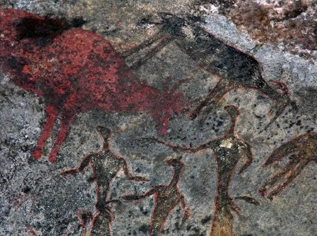
Rock art is among the most visually powerful forms of southern African archaeological heritage.

Painted and engraved images provide evidence for symbolic expression, social identity, ritual activity, and relationships between humans and animals.

The title Makhaya: Eswatini's Rock Art Panels refers to rock art associated with the Makhaya area.

The specific identification and dating of individual panels should be confirmed through archaeological documentation, but the broader rock-art traditions of Eswatini form an important part of the region's heritage.

Southern African Rock Art

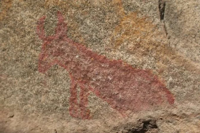
Rock art in southern Africa includes both paintings and engravings.

Paintings were commonly produced using mineral and organic pigments.

Red and orange pigments were frequently derived from iron-rich minerals.

White pigments could be produced from minerals such as kaolin.

Black could come from charcoal or manganese-rich materials.

Images of Animals

Animals appear frequently in southern African rock art.

Common subjects include:

  • eland,

  • antelope,

  • giraffe,

  • elephants,

  • and other large animals.

Animal imagery does not necessarily represent ordinary hunting scenes.

Some images may have ritual or symbolic significance.

Human Figures

Human figures may appear as hunters, dancers, ritual specialists, or supernatural beings.

Some figures have unusual postures or features.

These have been interpreted through ethnographic comparison with San religious traditions.

However, interpretation must account for the possibility that imagery changed across different periods and communities.

Trance and Ritual Interpretations

One influential approach connects some southern African rock art with San trance experiences.

In ethnographic accounts, ritual specialists could enter altered states during healing ceremonies.

Researchers have suggested that some rock-art imagery represents aspects of these experiences.

This interpretation is valuable but should not be treated as a universal explanation for every image.

Dating Rock Art

Dating paintings can be difficult.

Researchers may use:

  • radiocarbon analysis of suitable pigments,

  • archaeological association,

  • superimposition,

  • mineral alteration,

  • and stylistic comparison.

Not every painting can be directly dated.

Preservation Challenges

Rock art is vulnerable to both natural and human damage.

Water can erode pigment.

Lichen can grow over painted surfaces.

Temperature changes can affect rock.

Modern visitors may touch surfaces, apply graffiti, or unintentionally damage paintings.

Heritage Significance

Rock-art sites are not merely archaeological records.

They may also be connected to Indigenous heritage and cultural memory.

Interpretation should therefore be undertaken respectfully.

Local communities should be involved in decisions concerning access, recording, and presentation.

Conclusion

Makhaya: Eswatini's Rock Art Panels represents the intersection of archaeology, artistic expression, religion, and landscape.

The images preserved on rock surfaces can provide rare evidence for symbolic worlds that existed long before written records.

Their greatest value lies not in treating them as mysterious pictures, but in carefully studying their chronology, context, technique, and relationship to the societies that produced them.
Shewula: Eswatini's Remote Village Sites

October 12, 2026

Introduction

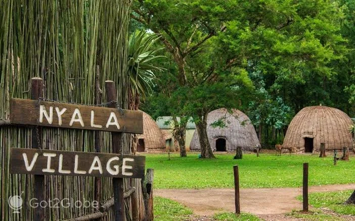
Shewula lies within the mountainous landscape of eastern Eswatini and is associated with rural communities, traditional agriculture, biodiversity, and cultural heritage.

The title Shewula: Eswatini's Remote Village Sites draws attention to settlement archaeology beyond the country's major towns and better-known monuments.

Remote villages are particularly valuable for archaeological research because they can preserve evidence of everyday life that is often absent from elite historical records.

Rural Settlement Archaeology

Archaeology frequently focuses on large monuments.

But ordinary settlements can provide equally important information.

A village may contain evidence of:

  • houses,

  • storage structures,

  • cooking areas,

  • livestock enclosures,

  • agricultural fields,

  • tools,

  • pottery,

  • and paths.

Together, these remains reveal how people organized daily life.

Mountain Environments

The landscape around Shewula contains slopes, valleys, grasslands, forests, and water sources.

Communities living in such environments must adapt agriculture to topography.

Terracing may sometimes be used to control erosion.

Livestock may graze on particular slopes.

Settlements are often positioned near reliable water sources.

Agriculture

Traditional farming systems could involve crops such as sorghum, millet, maize, beans, and other locally suitable plants, depending on period and environment.

Agricultural archaeology can examine:

  • field boundaries,

  • terraces,

  • grinding stones,

  • storage structures,

  • botanical remains,

  • and soil changes.

Architecture

Traditional rural architecture can vary according to period and community.

Structures may use mud, grass, timber, stone, or combinations of materials.

Because some materials decay quickly, archaeology may identify former homes primarily through postholes, floors, hearths, artifacts, and compacted surfaces.

Village Social Organization

The spatial arrangement of houses can reveal social relationships.

Households may be grouped according to family networks.

Livestock enclosures can occupy central or peripheral positions.

Communal spaces may have special importance.

Archaeologists therefore study settlement patterns rather than isolated buildings.

Oral History

Modern communities are essential sources of information about older landscapes.

Elders may remember:

  • former homesteads,

  • abandoned fields,

  • traditional pathways,

  • old wells,

  • burial locations,

  • and changes in settlement patterns.

Such knowledge can guide archaeological investigation.

Heritage and Development

Remote settlements are not frozen archaeological sites.

People continue to live, farm, build, and modify the landscape.

This means heritage management must recognize that archaeological landscapes can also be living cultural environments.

Conservation strategies should therefore involve local communities.

Conclusion

Shewula: Eswatini's Remote Village Sites demonstrates why archaeology should look beyond monumental structures.

Small settlements preserve evidence of ordinary people whose work sustained communities for generations.

Through houses, agricultural features, pottery, tools, livestock areas, and oral histories, researchers can reconstruct the everyday organization of rural Eswatini.

Mlilwane: Eswatini's Neolithic Settlement

October 12, 2026

Introduction

The term "Neolithic" refers broadly to periods characterized by new forms of food production, sedentary or semi-sedentary settlement, domestication, and technological change.

However, the concept must be applied carefully in southern Africa.

African societies did not necessarily follow the same chronological sequence as Europe or the Near East.

The title Mlilwane: Eswatini's Neolithic Settlement therefore requires archaeological qualification.

A settlement described as "Neolithic" would need securely dated evidence showing characteristics appropriate to the relevant southern African archaeological sequence.

Food Production and Settlement

The transition toward farming and herding was one of the most important transformations in human history.

In southern Africa, the development of food production occurred through complex processes involving local hunter-gatherers, incoming farming communities, livestock, crops, and technological exchange.

It was not simply a sudden replacement of one population by another.

Settlement Archaeology

An early farming settlement might contain:

  • house remains,

  • pottery,

  • grinding stones,

  • animal remains,

  • crop residues,

  • ironworking evidence in later contexts,

  • and storage facilities.

The combination of these materials helps establish economic activities.

Pottery

Ceramics are particularly important.

Pottery can be analyzed through:

  • vessel shape,

  • decoration,

  • manufacturing technique,

  • clay composition,

  • and chronological comparison.

Decorative styles can sometimes reveal relationships between communities.

However, pottery styles can also spread through exchange and imitation.

Livestock

The arrival and spread of domesticated animals transformed economic life.

Cattle, sheep, and goats provided meat, milk, hides, and social wealth.

Zooarchaeological evidence can reveal which species were present and how they were managed.

Crops

Agriculture can be identified through charred seeds, phytoliths, pollen, grinding stones, and agricultural features.

Crops suitable for southern African environments could support increasingly settled communities.

However, farming did not necessarily eliminate hunting and gathering.

Many communities maintained mixed economies.

Landscape

Mlilwane is located within a landscape of hills, grasslands, and wildlife habitats.

The environmental setting would have influenced settlement decisions.

Access to water, fertile soil, grazing, firewood, and wild resources could all shape where communities established settlements.

Chronological Caution

Calling a site "Neolithic" can create misleading expectations.

African archaeological chronologies often use terms such as Early Farming Community traditions or other regional classifications rather than European Neolithic terminology.

The correct terminology depends on the archaeological evidence.

Conclusion

Mlilwane: Eswatini's Neolithic Settlement offers a useful framework for discussing early food production and settlement in Eswatini, but the term "Neolithic" should be used cautiously.

The important archaeological questions concern when farming and herding appeared, how communities organized settlements, what technologies they used, and how they interacted with earlier hunter-gatherer populations.

These processes reveal a gradual transformation of the landscape rather than a simple technological revolution.

Malolotja: Eswatini's 4,000-Year Rock Art

October 12, 2026

Introduction

The Malolotja Nature Reserve occupies a mountainous region of northwestern Eswatini characterized by dramatic terrain, grasslands, cliffs, and valleys.

The region's archaeological significance includes evidence of human activity extending deep into the past.

The title Malolotja: Eswatini's 4,000-Year Rock Art refers to rock-art traditions attributed to a period approximately four millennia ago.

Specific dates must be established through archaeological analysis, because not every painting at a rock-art site is necessarily the same age.

A Long Human Presence

Southern Africa has one of the world's longest archaeological records of human activity.

People have occupied its landscapes for tens of thousands of years.

Rock art forms one component of this enormous record.

By several thousand years ago, hunter-gatherer communities had developed sophisticated symbolic traditions.

Mountain Landscapes

Malolotja's mountainous environment provided numerous rock surfaces and shelters.

Such places could serve as:

  • temporary camps,

  • observation points,

  • shelters,

  • ritual locations,

  • or places for creating rock art.

The landscape itself may have influenced where paintings were placed.

The Artists

Rock art was produced by human communities with extensive knowledge of local environments.

Artists understood pigments, surfaces, application techniques, and symbolic conventions.

The production of art was therefore an intellectual and technical activity.

Pigments

Red and orange pigments often derive from iron oxides.

White pigments can originate from clay minerals.

Black pigments may contain charcoal or manganese.

Pigments could be mixed with binders to help them adhere to rock.

Different techniques created variations in line quality and durability.

Animals and Humans

Southern African rock art frequently includes animals and human figures.

Large antelope species can be particularly prominent.

Researchers have proposed that some animal imagery had religious significance.

However, the meaning of individual images cannot always be determined with certainty.

The 4,000-Year Question

A claim of approximately 4,000 years old must be treated as a chronological estimate rather than automatically assigned to every image.

Rock-art panels can be used repeatedly.

Different paintings may have been added centuries or millennia apart.

Superimposition can sometimes reveal the relative sequence.

Cultural Context

Rock art should be studied alongside other archaeological evidence.

Nearby stone tools, hearths, animal remains, and settlement deposits can provide information about the communities using the landscape.

This integrated approach is stronger than interpreting paintings alone.

Conservation

Rock art is extremely fragile.

Even apparently stable paintings can deteriorate through:

  • moisture,

  • sunlight,

  • biological growth,

  • mineral deposition,

  • and human contact.

Digital recording and high-resolution photography can preserve information about panels without physically disturbing them.

Conclusion

Malolotja: Eswatini's 4,000-Year Rock Art highlights an extraordinary aspect of Eswatini's prehistoric heritage.

If securely dated to around four millennia ago, such imagery would provide valuable evidence for symbolic expression in southeastern Africa during a period of major environmental and social change.

The paintings are more than decorative images. They are fragments of intellectual and spiritual history preserved directly on the landscape.

Ngwenya Mine: Eswatini's World's Oldest Mine

October 12, 2026

Introduction

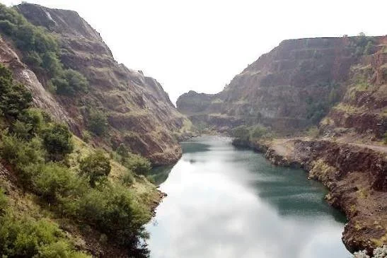
Ngwenya Mine is one of Eswatini's most important archaeological and industrial heritage sites.

Located in the northwestern part of the country, the mine is famous for evidence of ancient mineral extraction, particularly iron ore and hematite.

It is often described as one of the world's oldest known mining areas.

The title Ngwenya Mine: Eswatini's World's Oldest Mine reflects this remarkable reputation, although the phrase "world's oldest mine" should be understood in the context of what is being mined and how archaeological mining sites are defined.

Ancient Mining

Mining is much older than written history.

Prehistoric communities extracted:

  • ochre,

  • flint,

  • stone,

  • salt,

  • copper,

  • and other minerals.

Mining required knowledge of geology and the physical properties of materials.

Ngwenya and Hematite

Ngwenya is particularly associated with hematite and iron-rich minerals.

Hematite can be used as a pigment.

Red ochre derived from iron-rich minerals was important in prehistoric symbolic practices.

It could be used for:

  • body decoration,

  • rock painting,

  • ritual activity,

  • and possibly burial practices.

Evidence for Ancient Extraction

Ancient mining can leave distinctive traces.

These include:

  • open pits,

  • shafts,

  • hammerstones,

  • stone tools,

  • discarded ore,

  • working surfaces,

  • and sediment deposits.

At Ngwenya, archaeological research has documented evidence of ancient extraction.

Mining Before Iron Smelting

One of the most important distinctions is between extracting iron-rich ore and smelting iron.

People could mine hematite long before they developed iron-smelting technology.

The mineral's pigment value may have been more important during earlier periods.

Later communities could exploit the same geological resources for metallurgical purposes.

Dating the Mine

Dating mining activity can be difficult because the geological feature itself is extremely old.

Archaeologists date human activity through associated artifacts and deposits.

Radiocarbon dating can sometimes date charcoal from mining contexts.

Other techniques may be used depending on the site.

The Significance of Ochre

Ochre has extraordinary archaeological importance.

It appears at prehistoric sites across Africa.

Its repeated use suggests that color played an important role in human symbolic behavior.

Red pigments may have been associated with life, blood, ritual, identity, or transformation, although interpretations vary.

Industrial Mining

Ngwenya's significance continued into the modern period.

The mine became an industrial resource, particularly during the twentieth century.

This creates a rare archaeological landscape where ancient extraction and modern industrial mining can be studied together.

Heritage Conservation

Ancient mining landscapes can be vulnerable to modern extraction, erosion, vandalism, and tourism.

Preserving the site requires documenting both archaeological and geological features.

Interpretation should explain that the mine's importance extends across thousands of years.

Conclusion

Ngwenya Mine: Eswatini's World's Oldest Mine represents one of Africa's most important examples of ancient mineral exploitation.

Its significance lies not simply in the age of the mining activity but in what it reveals about prehistoric technological knowledge.

People understood the properties of minerals, identified valuable geological resources, developed extraction techniques, and transported materials across landscapes.

Ngwenya demonstrates that sophisticated resource management existed in southern Africa long before written records.

Gebel Adda: Nubia's Medieval Fortress

October 12, 2026

Introduction

Gebel Adda was an important archaeological site in Lower Nubia, an area historically shaped by interactions among Nubian kingdoms, Egypt, Rome, Byzantium, Christianity, and Islam.

The site became particularly significant during the medieval period, when Nubian Christian kingdoms controlled parts of the Nile Valley.

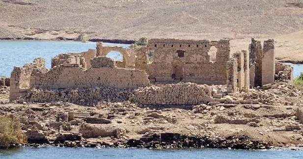
The title Gebel Adda: Nubia's Medieval Fortress refers to the fortified settlement that developed on the rocky elevation overlooking the Nile.

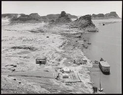
Gebel Adda is especially important because archaeological work at the site preserved evidence from multiple historical periods before the area was affected by the creation of Lake Nasser.

Nubia and the Nile

Nubia occupies the Nile Valley south of Egypt.

The region was never simply a peripheral zone.

It developed powerful kingdoms and participated in long-distance networks connecting northeastern Africa with the Mediterranean and sub-Saharan Africa.

The Nile served as both transportation route and source of agricultural productivity.

A Strategic Location

Gebel Adda occupied an elevated position.

Such locations were strategically valuable because they allowed inhabitants to observe movement along the river.

A settlement overlooking a major transportation route could serve military, administrative, and economic purposes.

The site's defensive characteristics were therefore closely connected with its geography.

Christian Nubia

During the medieval period, much of Nubia became Christian.

The Christian kingdoms of Nobadia, Makuria, and Alodia developed distinctive religious and political traditions.

Churches, monasteries, cemeteries, and fortified settlements became important features of the landscape.

Gebel Adda was associated particularly with the political world of Nobadia and later Makurian influence.

Architecture

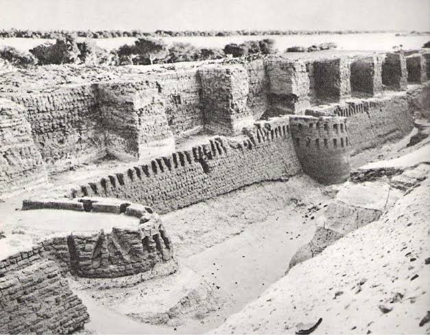
Fortified Nubian settlements could include:

  • defensive walls,

  • towers,

  • gateways,

  • residential buildings,

  • churches,

  • storage spaces,

  • and administrative structures.

The use of mud brick was particularly important because it was readily available in the Nile environment.

Stone was also used for selected architectural features.

Christianity and Material Culture

Archaeological excavations at medieval Nubian sites have recovered evidence of Christian religious life.

This can include:

  • crosses,

  • church architecture,

  • painted plaster,

  • inscriptions,

  • liturgical objects,

  • and Christian burials.

Such evidence helps reconstruct both religious practice and the political importance of Christianity.

Medieval Nubian Administration

Fortified settlements were not only military installations.

They could function as administrative centers.

Officials needed to collect taxes, organize agricultural production, manage trade, and communicate with regional authorities.

A strategically positioned settlement could therefore serve several functions simultaneously.

Islamic Transition

Over time, Islamic influence expanded through Nubia.

The transition was gradual rather than instantaneous.

Christian communities continued for centuries.

Eventually, political and demographic changes transformed the region.

Gebel Adda therefore preserves evidence from a period of major cultural transition.

Archaeological Rescue

The construction of the Aswan High Dam and the resulting Lake Nasser transformed Lower Nubia.

Many archaeological sites were threatened by inundation.

International and Egyptian archaeological campaigns documented and excavated numerous locations.

Gebel Adda became part of this enormous archaeological rescue effort.

Conclusion

Gebel Adda: Nubia's Medieval Fortress represents a crucial chapter in the archaeology of Christian Nubia.

Its strategic position, fortifications, churches, domestic structures, and historical sequence demonstrate that Nubian settlements were sophisticated political and economic centers.

The site's history also illustrates the vulnerability of archaeological heritage to modern environmental transformation.

Much of what is known about Gebel Adda exists because archaeologists documented the site before the Nile landscape was permanently transformed by modern dam construction.

Serra East: Nubia's Meroitic Temple

October 12, 2026

Introduction

The Meroitic civilization developed in the Middle Nile region and became one of the most important states of ancient Nubia.

Its political center eventually shifted southward toward Meroe, while religious and economic networks extended across the Nile Valley.

The title Serra East: Nubia's Meroitic Temple points toward an archaeological landscape associated with Meroitic-period remains in northern Nubia.

Because the identification of individual structures as Meroitic temples requires archaeological documentation, the title should be interpreted within the broader context of Nubian temple architecture.

The Kingdom of Kush

Meroitic civilization developed from the earlier Kingdom of Kush.

Kush became a major power in northeastern Africa.

At one point, Kushite rulers controlled Egypt as the Twenty-Fifth Dynasty.

Later, the political center shifted farther south.

Meroe

Meroe became an important royal center.

The region contained:

  • palaces,

  • temples,

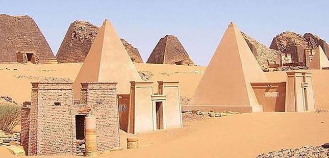
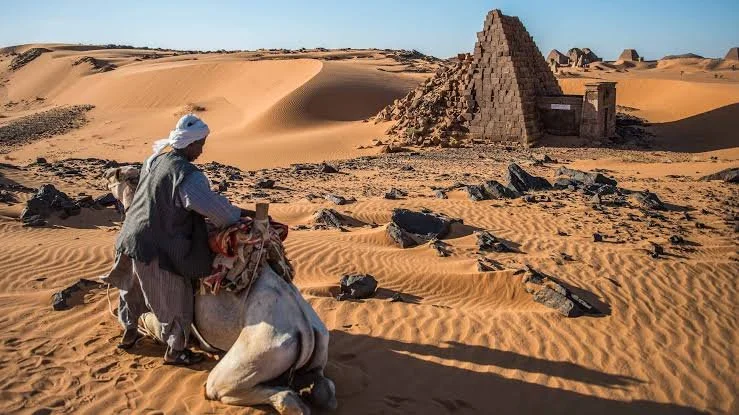
  • pyramids,

  • workshops,

  • settlements,

  • and cemeteries.

Ironworking was also associated with the Meroitic world, although interpretations of its scale and organization continue to be studied.

Religious Architecture

Meroitic temples could be dedicated to several deities.

Important religious figures included:

  • Amun,

  • Isis,

  • Apedemak,

  • Hathor,

  • and other Egyptian and Nubian deities.

The coexistence of Egyptian religious traditions with local Nubian beliefs produced distinctive religious architecture.

Temple Design

Temples could contain:

  • pylons,

  • courtyards,

  • sanctuaries,

  • columns,

  • offering areas,

  • and relief decoration.

Their layouts reflected both Egyptian architectural traditions and local developments.

The Meroitic Script

One of the most fascinating features of Meroitic civilization is its writing system.

Meroitic used both hieroglyphic and cursive scripts.

Although scholars can read much of the script's signs, the Meroitic language itself remains only partially understood.

This limits our ability to reconstruct the exact meaning of many inscriptions.

Religious Imagery

Meroitic art often portrayed rulers and gods.

One particularly distinctive deity is Apedemak, frequently represented as a lion-headed figure.

His prominence demonstrates that Nubian religion was not simply an imitation of Egypt.

Local religious traditions developed their own distinctive expressions.

Serra and the Nile

Northern Nubia was connected to both Egypt and the wider Meroitic world.

The Nile functioned as the principal transportation route.

Temples positioned along the river could therefore participate in economic, religious, and political networks.

Archaeological Context

A temple cannot be understood simply as an isolated building.

Researchers examine its relationship with settlements, cemeteries, roads, river channels, agricultural areas, and other religious structures.

This broader context reveals how religion interacted with everyday life.

Conclusion

Serra East: Nubia's Meroitic Temple provides an entry point into the complex religious world of ancient Nubia.

Meroitic temples demonstrate the interaction between Egyptian religious traditions and indigenous Nubian beliefs.

Their inscriptions, architecture, and imagery provide evidence for a civilization that developed its own political and cultural identity while maintaining long-standing connections with the Nile Valley world.

Kawa: Nubia's Napatan Pyramid Town

October 12, 2026

Introduction

Kawa was one of the most important religious centers of the ancient Kingdom of Kush.

Located in northern Sudan along the Nile, the site became particularly important during the Napatan period.

The title Kawa: Nubia's Napatan Pyramid Town combines two elements of Kushite civilization: the religious importance of Kawa and the royal funerary tradition represented by pyramids elsewhere in Nubia.

Kawa itself is best known particularly for its temples and inscriptions rather than for being primarily a pyramid cemetery.

This distinction is important for accurately understanding the archaeological landscape.

Kawa and Kush

Kawa was located within the territory of the ancient Kingdom of Kush.

The site became especially prominent during the Napatan period, when Kushite rulers maintained strong religious connections with the god Amun.

Amun at Kawa

The great temple at Kawa was dedicated to Amun.

Amun was one of the most important gods in the Kushite religious system.

The temple connected the Kushite monarchy with divine authority.

Royal inscriptions emphasize the relationship between kingship and the god.

Napatan Kings

The Napatan rulers are particularly famous because several Kushite kings conquered and ruled Egypt during the Twenty-Fifth Dynasty.

Kings such as Piye, Shabaka, Shebitku, and Taharqo participated in a political system linking Nubia and Egypt.

Their monuments demonstrate the strength of Kushite civilization.

Temple Architecture

The temples at Kawa incorporated Egyptian architectural traditions.

They included monumental entrances, columns, courts, sanctuaries, and decorated walls.

However, their existence in Nubia also demonstrates that Egyptian architectural forms were adapted within Kushite society.

Inscriptions

Kawa is especially important because of its inscriptions.

Royal texts record:

  • religious devotion,

  • royal achievements,

  • building projects,

  • military events,

  • and relationships with the gods.

Such inscriptions provide some of the most valuable evidence for reconstructing Napatan political history.

Pyramids and Kushite Burials

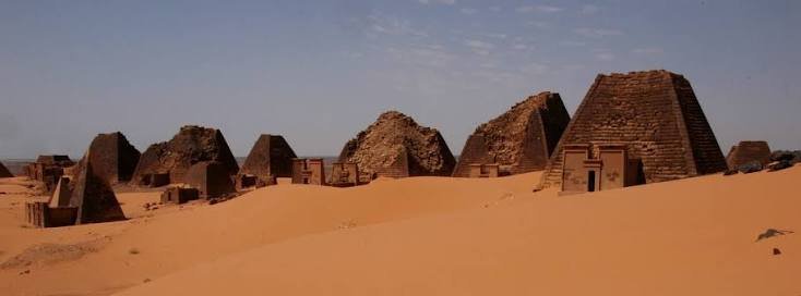
Kushite kings were buried in pyramids.

The major royal cemeteries were located at sites including El-Kurru, Nuri, and Meroe.

These pyramids were smaller and steeper than many Egyptian pyramids but represented an important continuation and transformation of the pyramid tradition.

Why Kawa Matters

Kawa demonstrates that Kushite civilization was deeply connected to Egyptian religious traditions without simply being Egyptian.

Kushite rulers adopted the worship of Amun and monumental architecture while maintaining their own political institutions and cultural identity.

Archaeological Excavation

Archaeological excavations at Kawa have produced architecture, inscriptions, pottery, sculpture, and other material.

These finds allow researchers to reconstruct both elite religious life and aspects of everyday settlement.

The Nile Environment

Kawa's position beside the Nile was fundamental.

The river provided water, agricultural resources, transportation, and communication.

Without understanding the Nile environment, it is difficult to understand the success of Kushite settlements.

Conclusion

Kawa: Nubia's Napatan Pyramid Town is best understood as a major Napatan religious and royal center rather than simply a pyramid settlement.

Its temples, inscriptions, and connection to Kushite kingship reveal the extraordinary political and religious sophistication of the Kingdom of Kush.

The pyramids of Kush are essential to Nubian history, but sites such as Kawa demonstrate that Kushite civilization was equally dependent on temples, river settlements, agricultural systems, and religious institutions.

Sanam: Nubia's Amun Temple Complex

October 12, 2026

Introduction

Sanam is an important archaeological site in Sudan associated with the Kingdom of Kush and particularly the Napatan period.

The site lies near the Nile and forms part of a broader archaeological landscape that includes temples, cemeteries, settlements, and royal monuments.

The title Sanam: Nubia's Amun Temple Complex highlights the site's connection with the worship of Amun.

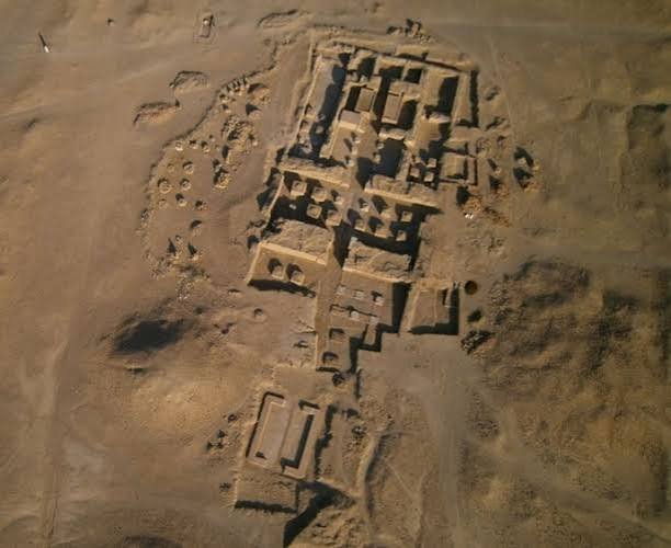
Sanam is especially important because it demonstrates how religious architecture operated alongside administrative and residential spaces within Kushite society.

The Napatan World

The Napatan period represents an important stage in the development of the Kingdom of Kush.

During this era, Kushite rulers maintained strong religious connections with Amun.

They also interacted extensively with Egypt.

Kushite rulers adopted and transformed elements of Egyptian political and religious traditions.

The Temple of Amun

The temple complex at Sanam was dedicated to Amun.

Amun was associated with kingship and divine authority.

Temples dedicated to him could therefore serve important political functions.

Religious institutions were closely connected with royal ideology.

Temple Architecture

A large ancient temple could contain several architectural zones.

These might include:

  • entrance structures,

  • courtyards,

  • columns,

  • offering areas,

  • sanctuaries,

  • storage rooms,

  • and priestly spaces.

The organization of the temple controlled movement from public to increasingly sacred areas.

Religious Practice

Temple rituals could involve offerings of:

  • food,

  • drink,

  • incense,

  • textiles,

  • precious objects,

  • and animals.

Priests performed rituals according to established religious traditions.

Although the exact daily routine is difficult to reconstruct, inscriptions and comparative evidence help scholars understand the role of temples in ancient Nubia.

Sanam and the Wider Landscape

Sanam should not be considered independently from nearby archaeological sites.

The region around the Nile contains a network of ancient settlements and cemeteries.

Royal pyramids, temples, administrative buildings, and residential areas formed interconnected landscapes.

The location of Sanam within this network helps explain its significance.

The Cemetery

Sanam is also associated with a substantial cemetery.

Burial evidence can reveal social differences.

Grave size, architecture, objects, and burial treatment can provide clues about status and identity.

The cemetery therefore complements evidence from the temple.

Everyday Life

Temples depended on people.

Farmers produced food.

Craft workers manufactured goods.

Administrators organized supplies.

Transport workers moved materials.

Priests maintained rituals.

The archaeological remains around temple complexes therefore provide opportunities to reconstruct a society extending far beyond kings and gods.

Kushite and Egyptian Connections

Sanam illustrates the cultural relationship between Kush and Egypt.

The worship of Amun and the use of Egyptian architectural traditions demonstrate strong connections.

But Kushite society developed its own political and cultural identity.

It is therefore misleading to describe Kush simply as a southern extension of Egypt.

Conservation

Sudan's archaeological heritage faces serious challenges.

Environmental erosion, development, looting, political instability, and limited conservation resources can threaten sites.

Digital documentation and international archaeological collaboration are important tools for preserving information.

Conclusion

Sanam: Nubia's Amun Temple Complex provides a powerful example of how religion, politics, economy, and settlement were interconnected in ancient Kush.

The temple of Amun was not merely a place where people worshipped.

It formed part of a wider institutional system involving priests, administrators, craftspeople, farmers, traders, and rulers.

Together with its cemetery and surrounding settlement landscape, Sanam helps reconstruct the complexity of Napatan Nubia and demonstrates that the civilization of Kush deserves to be understood on its own terms—as one of the great civilizations of ancient northeastern Africa.

Final Perspective

Across Coldstream, Eswatini, and Nubia, these archaeological landscapes demonstrate how much human history can survive outside famous monumental centers.

Stone circles reveal settlement organization.

Rockshelters preserve traces of hunter-gatherer life.

Granite landscapes record the interaction between geology and human activity.

Iron furnaces reveal technological expertise.

Royal kraals connect livestock with political authority.

Rock art preserves symbolic traditions.

Ancient mines demonstrate sophisticated resource extraction.

Further north, Nubian fortresses, temples, pyramids, and cemeteries reveal powerful African kingdoms whose histories were deeply connected to Egypt while remaining culturally distinctive.

Together, these sites demonstrate an essential principle of archaeology: the past is not represented only by spectacular monuments. It is also preserved in walls, hearths, pigments, slag, burial grounds, tools, landscapes, and the ordinary spaces where people lived, worked, worshipped, and remembered their ancestors.

Tabo: Nubia's Middle Kingdom Fort

October 12, 2026

Introduction

The archaeological landscape of Nubia preserves some of the most important evidence for ancient Egypt's interaction with the regions south of the First Cataract. Among the settlements and defensive installations associated with these interactions is Tabo, a site in the broader Nubian archaeological landscape whose significance is connected with the long history of Egyptian administration, military organization, trade, and cultural exchange along the Nile.

The phrase "Middle Kingdom fort" should be approached carefully. Nubia contained numerous Egyptian fortifications during the Middle Kingdom, particularly during the Twelfth Dynasty, when Egyptian rulers established a chain of defensive settlements and fortresses between the First and Second Cataracts and farther south. These installations were not simply military bases. They served as administrative centers, customs points, storage facilities, residences, and mechanisms for controlling movement through the Nile corridor.

Tabo therefore belongs to a larger archaeological story: the transformation of the Nile Valley into a politically interconnected landscape in which Egyptian authorities and Nubian societies negotiated power, trade, migration, and cultural identity.

Egypt's Middle Kingdom Expansion into Nubia

The Middle Kingdom, particularly the reigns of rulers of the Twelfth Dynasty, witnessed a major expansion of Egyptian state activity into Lower Nubia. Earlier Egyptian rulers had already conducted expeditions southward, but Middle Kingdom governments developed a much more systematic strategy.

Fortresses were constructed at strategically important points along the Nile. Their locations allowed authorities to monitor river traffic and protect communication routes.

The fortification system is particularly associated with rulers such as Senusret I, Senusret III, and Amenemhat III. Senusret III is especially famous for strengthening Egypt's southern frontier and establishing or expanding a network of fortifications.

These installations demonstrate that Nubia was not a peripheral region in Egyptian history. It was an economically and strategically significant zone.

Architecture of Nubian Fortresses

Middle Kingdom fortresses could contain massive mud-brick walls, towers, gates, internal streets, administrative structures, granaries, magazines, and residential quarters.

Their architecture was adapted to the geography of the Nile. Some were constructed on rocky islands or elevated river terraces, while others occupied strategic bends and narrow passages.

The thick walls provided protection, but the fortresses also controlled access. Gates and river approaches could be monitored, allowing officials to regulate the movement of people and goods.

Archaeological remains from comparable Middle Kingdom fortresses show sophisticated planning. Buildings were often arranged according to administrative and military requirements, revealing the organizational capabilities of the Egyptian state.

Trade and Administration

Military control was only one component of the fortress system.

Nubia supplied Egypt with valuable resources including gold, livestock, ebony, ivory, animal products, stone, and other commodities. Egyptian authorities therefore had strong economic reasons to maintain a presence in the region.

Fortresses could function as distribution centers where goods were recorded, stored, and transported northward.

Administrative documents and archaeological materials from Middle Kingdom Nubia reveal an environment in which soldiers, officials, merchants, laborers, and local communities interacted.

This makes sites such as Tabo important not only for military history but also for reconstructing ancient economic networks.

Egyptians and Nubians

The presence of Egyptian architecture does not mean that Nubia was culturally empty before Egyptian expansion.

Nubian communities had long-established political and economic traditions. The Middle Kingdom therefore represented interaction between established societies rather than the arrival of civilization into an otherwise undeveloped landscape.

Objects found in Nubian contexts can demonstrate both Egyptian influence and local traditions. Pottery, burial practices, architecture, and personal objects provide evidence for cultural interaction.

Some individuals may have adopted Egyptian customs while retaining local identities, illustrating the complexity of ancient cultural boundaries.

The Archaeological Importance of Tabo

The importance of Tabo lies within this wider historical framework.

A Middle Kingdom fortress can reveal:

  • Egyptian military organization

  • Nile transportation systems

  • taxation and administration

  • long-distance trade

  • interactions between Egyptian and Nubian communities

  • frontier management

  • architectural engineering

Archaeology therefore allows researchers to reconstruct political relationships without relying exclusively on Egyptian royal inscriptions.

Conclusion

Tabo's association with Nubia's Middle Kingdom fortress tradition highlights one of the most important periods of ancient Nile Valley history. Egyptian expansion created a chain of installations designed to secure territory, regulate movement, and facilitate economic activity, but these fortresses also became places where Egyptian and Nubian societies interacted.

The archaeology of such sites demonstrates that the Middle Kingdom frontier was not simply a line dividing two civilizations. It was a dynamic zone of exchange, negotiation, and cultural transformation.

Soleb: Nubia's Amenhotep III Temple

October 12, 2026

Introduction

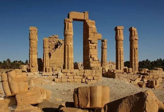
Soleb is one of the most spectacular surviving monuments of ancient Nubia. Located in what is now northern Sudan, the site contains the remains of a monumental temple constructed during the reign of the Egyptian pharaoh Amenhotep III in the fourteenth century BCE.

The temple was dedicated primarily to Amun and to the deified form of Amenhotep III himself. Its architecture demonstrates the extraordinary scale of Egyptian royal investment in Nubia during the New Kingdom.

Soleb is particularly important because it illustrates how Egyptian rulers used monumental architecture to express political authority far beyond the traditional boundaries of Egypt.

Amenhotep III and the Nubian Frontier

Amenhotep III ruled during the Eighteenth Dynasty, a period of considerable wealth and international influence.

Egypt's control over Nubia had expanded dramatically during the preceding centuries. Gold production, trade, military power, and administrative expansion made the southern territories extremely important to the Egyptian state.

Monumental temples became instruments through which Egypt expressed its authority.

Soleb was therefore not simply a religious building. It was also a political statement.

The Temple Complex

The temple at Soleb was built on a grand scale.

Its architecture included monumental gateways, courtyards, columns, sanctuaries, and extensive decorative programs. Reliefs portrayed gods, royal ceremonies, offerings, and other scenes connected with Egyptian religious ideology.

The temple's layout followed principles recognizable from major Egyptian religious architecture, yet its presence in Nubia gave the building a distinctive political meaning.

The temple transformed the landscape into a monumental expression of pharaonic authority.

Amenhotep III as a Divine Figure

One of the most remarkable features of Soleb is the association between the temple and the king's divine identity.

Egyptian kings were understood through a complex theological system in which the ruler occupied a special position between gods and humanity.

At Soleb, Amenhotep III became associated with divine worship. The temple therefore contributed to a larger program through which royal monuments could reinforce the ideological legitimacy of Egyptian rule.

This did not necessarily mean that Nubians simply accepted Egyptian religion unchanged. Religious practices in Nubia developed through interaction between Egyptian traditions and local beliefs.

The Temple and Amun

Amun was one of the most important gods of the New Kingdom.

The god's major cult center was at Karnak in Thebes, but Amun's influence extended throughout the Egyptian-controlled Nile Valley.

Soleb's association with Amun linked Nubia directly to the religious ideology of the Egyptian state.

The temple could consequently serve as a ceremonial center while also reinforcing political relationships between the Egyptian administration and local populations.

The Columns and Reliefs

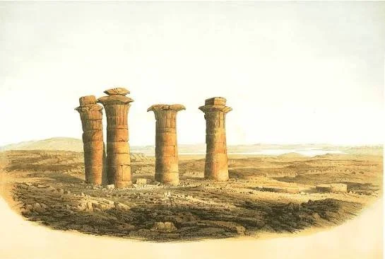
The surviving architectural fragments at Soleb provide valuable information about New Kingdom artistic conventions.

Reliefs depict royal and divine imagery, while inscriptions commemorate Amenhotep III and his achievements.

The craftsmanship demonstrates the resources available to the Egyptian monarchy during one of its wealthiest periods.

The monument also helps researchers study the development of imperial iconography. Images of the king, gods, foreign peoples, and conquered or subordinate territories formed part of a visual language through which Egypt represented its place in the wider world.

Soleb and Modern Archaeology

The site was investigated by modern archaeologists during the twentieth century, particularly through major work associated with Michela Schiff Giorgini and later researchers.

Archaeological work has documented the architecture, inscriptions, sculpture, and surrounding settlement landscape.

Soleb has also become important for understanding relationships between Nubian monuments and Egyptian imperial centers.

The temple's survival is remarkable considering the environmental conditions and the long history of reuse.

Conclusion

Soleb is one of the clearest examples of how architecture became an instrument of empire in ancient Nubia.

The temple combined religion, royal ideology, artistic expression, and political authority. Its monumental remains demonstrate the wealth and organizational capabilities of the Egyptian New Kingdom while simultaneously reminding researchers that Nubia was a complex cultural region rather than merely an extension of Egypt.

Sesebi: Nubia's New Kingdom Town

October 12, 2026

Introduction

Sesebi was an important New Kingdom settlement in Nubia associated with the reign of Akhenaten and the dramatic religious and political changes of the fourteenth century BCE.

Located near the Nile in modern Sudan, Sesebi provides archaeologists with evidence for Egyptian settlement and administration in a region where political power, trade, and cultural interaction were closely connected.

The site is especially interesting because of its association with the Amarna period, when Akhenaten promoted the worship of the Aten and reorganized Egypt's religious institutions.

The Foundation of Sesebi

Sesebi appears to have been developed as an organized Egyptian settlement during the reign of Akhenaten.

Its layout included substantial mud-brick architecture, administrative buildings, residential areas, and a temple complex.

The settlement's planned character suggests that it served a significant administrative and political function.

Its location along the Nile made it strategically useful for transportation and communication.

Akhenaten's Religious Revolution

Akhenaten's reign is famous for the promotion of the Aten, represented as the solar disk whose rays ended in hands.

The king established a new capital at Akhetaten, modern Amarna, and dramatically reduced the political prominence of traditional cults.

The ideological transformation was not limited to Egypt.

Monuments in Nubia also reflected the changing religious environment.

Sesebi therefore provides an opportunity to study how the Amarna religious reforms affected Egypt's southern territories.

The Temple

The temple complex at Sesebi is particularly significant.

Its architecture and inscriptions demonstrate connections with the religious policies of Akhenaten. However, subsequent rulers altered the site, reflecting the political reversal that followed Akhenaten's death.

The restoration of traditional Egyptian religious institutions under later rulers transformed many monuments associated with the Aten.

Sesebi therefore preserves evidence for both ideological change and ideological restoration.

The Town's Population

A major archaeological question concerns who lived at Sesebi.

The settlement was associated with Egyptian administration, but Nubia itself was home to diverse communities.

Workers, soldiers, administrators, craftspeople, merchants, and local populations could have interacted at the site.

Pottery, architecture, tools, food remains, and other archaeological materials can help researchers investigate everyday life.

Such evidence is often more revealing than monumental inscriptions because it provides clues about ordinary people.

The Archaeology of Mud Brick

Much of Sesebi's architecture was constructed from mud brick.

Mud brick was one of the most common building materials throughout the Nile Valley because suitable clay and water were readily available.

Although less durable than stone, mud-brick architecture could be constructed rapidly and on a large scale.

Its preservation therefore requires specialized archaeological methods.

Wall foundations, collapsed structures, streets, and room layouts can reveal how settlements were organized.

Sesebi and Imperial Administration

Sesebi illustrates how Egyptian power operated outside the traditional Egyptian heartland.

Military authority alone could not maintain a large territory.

The Egyptian state required administrative centers, agricultural production, transportation, taxation, religious institutions, and labor systems.

Settlements such as Sesebi were therefore components of a broader imperial infrastructure.

Conclusion

Sesebi provides a valuable window into New Kingdom Nubia during one of the most transformative periods in Egyptian history.

Its architecture and archaeological remains connect southern Egyptian administration with the religious revolution of Akhenaten. At the same time, the settlement demonstrates that imperial landscapes were inhabited by diverse communities whose experiences cannot be reconstructed solely through royal inscriptions.

Sai Island: Nubia's Fortress Island

October 12, 2026

Introduction

Sai Island is one of the most important archaeological landscapes in the Nile Valley. Situated between the Second and Third Cataracts in modern Sudan, the island contains evidence spanning thousands of years, including prehistoric occupations, Kerma-period remains, Egyptian settlements, New Kingdom fortifications, and later cultural phases.

Its strategic position made Sai Island especially valuable during periods when control of the Nile corridor was politically important.

Geography and Strategic Importance

An island in the Nile offered several advantages.

The surrounding water could provide natural protection, while the location allowed settlements to monitor river traffic.

Sai Island lies within an important section of Nubia where river transportation, agricultural land, mineral resources, and routes toward the interior converged.

This geography helps explain why the island attracted repeated settlement.

Kerma and Egyptian Interaction

Archaeological evidence indicates that Sai was important before the major Egyptian expansion of the New Kingdom.

The island was connected to the Kerma cultural sphere, associated with the powerful Nubian kingdom that developed farther south.

Egyptian expansion later introduced new settlements and administrative structures.

The archaeological record therefore documents a transition from Nubian political influence to stronger Egyptian control.

The New Kingdom Fortress

The New Kingdom Egyptian settlement at Sai included substantial defensive architecture.

Fortifications were intended to protect strategic installations and support Egyptian administration.

As with other Nubian fortresses, however, military purposes were only one aspect of the settlement.

Administrative buildings, temples, workshops, storage areas, and residences demonstrate that Sai functioned as a complex community.

Gold and Economic Resources

Nubia's gold resources were one of the major motivations for Egyptian expansion.

Gold had enormous economic and symbolic importance in ancient Egypt. It was used for jewelry, religious objects, royal equipment, diplomatic gifts, and temple decoration.

Sai Island's position within the larger Nubian economic landscape made it relevant to these networks.

Archaeologists can investigate trade and resource extraction through pottery, tools, metallurgical remains, and settlement patterns.

Archaeological Layers

One of Sai Island's greatest strengths is chronological depth.

Different archaeological layers allow researchers to examine changing political systems over long periods.

Instead of representing a single civilization, the island preserves a sequence of communities and administrations.

This makes Sai especially useful for studying cultural transformation.

Conclusion

Sai Island demonstrates why Nubia cannot be understood simply through the history of Egypt.

Its archaeological record preserves Nubian kingdoms, Egyptian imperial expansion, economic activity, religious institutions, and everyday settlement.

The island's fortifications were part of a much larger network connecting the Nile Valley's political and economic systems.

Argin: Nubia's Battle Site

October 12, 2026

Introduction

Argin is associated with the archaeology and historical landscape of Lower Nubia, a region repeatedly transformed by conflict between Egyptian and Nubian political powers.

The identification of a particular archaeological location as a "battle site" requires careful examination because battlefield archaeology is considerably more difficult than the excavation of permanent settlements. Buildings can disappear, weapons can be removed, and natural processes can obscure evidence.

Nevertheless, the broader landscape around Argin provides an important setting for understanding military conflict in Nubia.

Warfare Along the Nile

Control of Nubia was strategically important because the Nile was the principal transportation corridor.

Armies moving south or north depended heavily on river routes.

Control of cataracts, riverbanks, fortified settlements, and supply points could determine military success.

Nubian warfare therefore involved more than open-field battles. Raids, sieges, patrols, defensive installations, and control of transportation routes were equally important.

Evidence for Ancient Battles

Archaeologists searching for battlefields may examine:

  • weapons

  • arrowheads

  • fortification damage

  • human remains

  • unusual concentrations of artifacts

  • mass graves

  • inscriptions describing campaigns

  • changes in settlement patterns

However, individual artifacts rarely prove a battle by themselves.

An arrowhead may have been lost during hunting, training, or ordinary military activity.

A concentration of weapons becomes meaningful only when interpreted alongside other evidence.

Egyptian-Nubian Conflict

Egyptian sources frequently describe campaigns into Nubia.

Royal inscriptions celebrated military victories and portrayed pharaohs as powerful conquerors.

Nubian perspectives are often less directly represented in Egyptian written records.

Archaeology can therefore provide an alternative source of evidence.

Settlement destruction, changes in political administration, defensive architecture, and material culture can reveal consequences of conflict even when written narratives are incomplete.

Nubian Military Organization

Nubian societies developed their own military traditions.

Archers were particularly prominent in ancient Nubia. Egyptian sources frequently recognized the effectiveness of Nubian archers.

Nubian soldiers also served in Egyptian armies, illustrating the complex political relationships between the two regions.

The same communities could experience warfare as enemies in one period and allies in another.

The Importance of Caution

Because the title identifies Argin specifically as a battle site, archaeological interpretation should remain cautious unless a securely documented excavation establishes the association.

This distinction is important in archaeological writing.

A historical battle described in a text does not automatically correspond to a particular archaeological concentration, and a damaged settlement does not necessarily represent a battlefield.

Conclusion

Argin's importance lies within the wider military landscape of Nubia, where control of the Nile generated repeated conflict and political transformation.

Whether individual remains at Argin can be securely identified with a specific battle depends on archaeological evidence. Nevertheless, the region offers an important opportunity to investigate how warfare shaped ancient Nile Valley societies.

Fidrid: Nubia's Cemetery

October 12, 2026

Introduction

Cemeteries are among the most valuable archaeological sources for reconstructing ancient Nubian societies.

The cemetery landscape associated with Fidrid contributes to a much broader archaeological record in which graves reveal information about population, health, social organization, religious beliefs, migration, and cultural interaction.

Burials are particularly valuable because they preserve objects and human remains within clearly defined contexts.

Why Cemeteries Matter

Settlements tell archaeologists how people lived.

Cemeteries can reveal how communities understood death.

Grave architecture, body position, burial orientation, pottery, jewelry, weapons, food offerings, and other objects provide evidence about social and religious traditions.

Differences between graves may also indicate distinctions in wealth or social status.

Nubian Burial Traditions

Nubia contained diverse burial traditions across different periods.

Earlier communities constructed distinctive tumuli and other monumental graves.

Kerma-period cemeteries included large and elaborate burial structures.

Later Christian Nubian communities developed different funerary practices influenced by Christianity.

Islamic periods introduced further changes.

A cemetery must therefore always be dated before its cultural significance can be interpreted confidently.

Human Remains

Skeletal remains provide information unavailable from architecture alone.

Osteological research can investigate:

  • age

  • biological sex

  • stature

  • trauma

  • dental health

  • nutritional stress

  • infectious disease

  • occupational activity

Ancient DNA and isotope analysis can sometimes provide additional information about ancestry, mobility, and diet.

These methods must be interpreted carefully because biological variation does not map neatly onto modern racial categories.

Grave Goods

Objects buried with individuals can reveal cultural and economic relationships.

Ceramics may indicate local traditions or external contacts.

Jewelry can reveal craftsmanship and access to valuable materials.

Weapons may indicate military roles.

Imported objects can demonstrate trade networks.

However, grave goods do not always represent the possessions used by an individual during life. They may have been deposited specifically as ritual offerings.

Preservation and Archaeological Ethics

Cemetery archaeology involves important ethical responsibilities.

Human remains are not simply archaeological artifacts.

Researchers must consider descendant communities, cultural heritage laws, museum policies, and respectful treatment.

Modern archaeology increasingly emphasizes ethical consultation and responsible curation.

Conclusion

Fidrid's cemetery tradition illustrates why burial archaeology is essential to Nubian history.

Cemeteries allow researchers to reconstruct social differences, health, mobility, religious practices, and cultural change while also reminding archaeologists that the people represented by these remains were members of living communities with beliefs and identities.

Missiminia: Nubia's Trading Post

October 12, 2026

Introduction

Nubia occupied a strategic position between the Mediterranean-connected world of Egypt and the deeper regions of northeastern Africa.

Missiminia, associated with the archaeological landscape of Nubia, can be understood within this long tradition of riverine trade and exchange.

The Nile was not simply a source of water. It was the principal transportation network connecting communities across thousands of kilometers.

Trade Along the Nile

Goods could travel northward toward Egypt and southward into the interior.

Important commodities included:

  • gold

  • ivory

  • animal products

  • livestock

  • ebony

  • aromatic materials

  • stone

  • ceramics

  • textiles

  • agricultural products

The precise importance of each commodity changed over time.

Trading Posts and Settlement

A trading post did not necessarily resemble a modern commercial center.

Ancient exchange could occur through markets, administrative stations, warehouses, temples, caravan routes, river ports, and private transactions.

A settlement's identification as a "trading post" therefore requires evidence such as imported objects, storage facilities, transport infrastructure, or written documentation.

Cultural Exchange

Trade also transported ideas.

Languages, artistic motifs, religious traditions, technologies, and food practices could spread through commercial networks.

Nubia's archaeology repeatedly demonstrates that cultural boundaries were porous.

Egyptian and Nubian material cultures influenced one another, while contacts with regions farther south introduced additional traditions.

The Nile as a Commercial Highway

The river made long-distance movement possible, although cataracts created major logistical challenges.

Boats could transport heavy loads efficiently along navigable stretches.

During periods of favorable political conditions, river commerce could connect settlements separated by considerable distances.

Control of river traffic was therefore both an economic and political concern.

Conclusion

Missiminia's significance can be appreciated through the larger economic system of ancient Nubia.

Rather than existing at the margins of ancient civilization, Nubia occupied a central position within African trade networks. Archaeological evidence demonstrates that goods, people, technologies, and ideas moved along the Nile for thousands of years.

Qasr Ibrim: Nubia's Medieval Cathedral Fortress

October 12, 2026

Introduction

Qasr Ibrim is one of the most remarkable archaeological sites in Nubia.

Located on a high promontory overlooking the Nile in what is now southern Egypt, the site preserves an extraordinary sequence of occupation extending from ancient Egyptian periods through the medieval Christian kingdoms of Nubia and into the Islamic era.

Its combination of defensive architecture, religious buildings, administrative structures, and written documents makes Qasr Ibrim exceptionally valuable.

A Fortress Above the Nile

Qasr Ibrim's elevated position provided natural defensive advantages.

The site could overlook surrounding territory and river traffic.

Its defensive walls transformed the elevated settlement into a powerful fortified center.

The strategic position remained important for centuries.

Christian Nubia

During the medieval period, Qasr Ibrim became part of the Christian Nubian world.

The kingdoms of Nobadia, Makuria, and Alodia formed sophisticated political societies south of Egypt.

Christianity became deeply integrated into Nubian political and cultural life.

Churches were constructed throughout the region, and religious institutions became major centers of literacy and administration.

The Cathedral

The cathedral at Qasr Ibrim is among the site's most important structures.

Its remains demonstrate the architectural traditions of medieval Nubian Christianity.

Christian buildings in Nubia often incorporated architectural influences connected to Egypt and the wider Christian Mediterranean while developing distinct local characteristics.

Written Documents

Qasr Ibrim is especially famous for the preservation of written materials.

The site's dry environment helped preserve documents that would normally decay.

Texts in languages including Greek, Coptic, Old Nubian, and Arabic have contributed enormously to understanding medieval Nubia.

These documents illuminate political administration, religious practice, legal affairs, personal communication, and economic life.

The Islamic Transition

The Christian period eventually gave way to Islamic political and cultural influence.

The transition was not necessarily instantaneous.

Different communities, institutions, and religious traditions continued to interact.

Archaeological evidence from Qasr Ibrim allows researchers to examine this transformation over long periods rather than treating it as a single historical event.

The Aswan High Dam

Modern archaeology at Qasr Ibrim was profoundly affected by the construction of the Aswan High Dam.

As the reservoir expanded, many archaeological sites in Nubia were threatened by rising water.

Qasr Ibrim's elevated location allowed it to survive above the reservoir, making it one of the few major sites from Lower Nubia still standing in its original landscape.

Conclusion

Qasr Ibrim is one of the most important surviving archaeological sites for medieval Nubia.

Its cathedral, fortress, documents, domestic structures, and long occupational sequence provide an unusually detailed record of Christian Nubian society and its transformation through later centuries.

Faras Cathedral: Nubia's Painted Wall Church

October 12, 2026

Introduction

Faras Cathedral is one of the masterpieces of medieval Nubian archaeology.

Located in Lower Nubia, the cathedral belonged to the Christian kingdom of Nobadia and became famous for its extraordinary wall paintings.

The paintings provide an unparalleled visual record of Nubian Christian religious culture, including bishops, saints, biblical figures, and royal imagery.

The Cathedral at Faras

Faras was an important religious center.

The cathedral developed through multiple construction and rebuilding phases.

Rather than representing a single moment, the building preserves centuries of architectural and artistic development.

Its religious importance was closely connected to the Christian institutions of medieval Nubia.

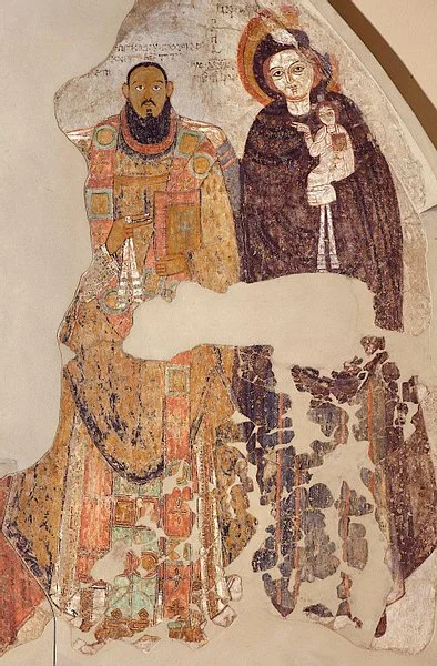
The Wall Paintings

The cathedral's paintings are among the most famous examples of Nubian Christian art.

They depict religious figures with large expressive eyes, elaborate clothing, halos, and ceremonial objects.

Some paintings show Nubian bishops and rulers under divine protection.

These images reveal the relationship between religion and political authority.

Nubian Artistic Identity

The paintings demonstrate that Nubian Christianity was not simply an imitation of Byzantine or Egyptian Christianity.

Artists incorporated broader Christian visual conventions while developing local styles.

The depiction of Nubian rulers and bishops is especially important because it places African political and religious leaders directly within Christian sacred imagery.

The Cathedral and Medieval Politics

Churches were important institutions within Nubian kingdoms.

Bishops could hold considerable influence, while religious centers could serve administrative and educational roles.

Royal imagery within churches reinforced relationships between political authority and divine legitimacy.

Rescue Archaeology

Faras became famous partly because the construction of the Aswan High Dam threatened the archaeological site.

An international archaeological campaign excavated the cathedral and recovered its paintings before the site was inundated.

Many of the paintings were removed and conserved.

Important examples are now preserved in museums, particularly the National Museum in Warsaw and the Sudan National Museum.

The Importance of Faras

Faras transformed scholarly understanding of medieval African art.

Its paintings demonstrated the sophistication of Nubian Christian visual culture and challenged older assumptions that major medieval artistic traditions were confined to Europe and the Mediterranean.

Conclusion

Faras Cathedral stands as a powerful reminder of the intellectual, artistic, and religious achievements of medieval Nubia.

Its painted walls provide a vivid record of Christian Nubian identity, while the rescue of the cathedral's artworks demonstrates the importance of archaeological preservation in the face of major environmental and infrastructure projects.

Old Dongola: Nubia's Makurian Capital Ruins

October 12, 2026

Introduction

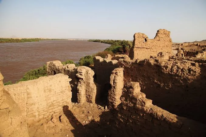
Old Dongola was the capital of the medieval kingdom of Makuria and is one of the most important archaeological sites for understanding Christian Nubia.

Located along the Nile in modern Sudan, the city developed into a major political, religious, economic, and cultural center.

Its ruins include churches, monasteries, palaces, fortifications, domestic structures, cemeteries, and industrial areas.

The Kingdom of Makuria

Makuria was one of the major Christian kingdoms of medieval Nubia.

Its political influence extended across large portions of the Nile Valley.

The kingdom maintained complex relations with Egypt, including diplomacy, trade, warfare, and religious interaction.

Old Dongola served as the political heart of this kingdom.

Urban Development

Old Dongola was not merely a royal residence.

It was a complex city with multiple neighborhoods and institutions.

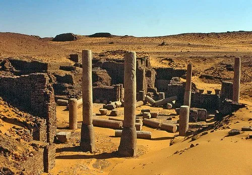
Archaeologists have identified:

  • churches

  • monasteries

  • administrative buildings

  • residential quarters

  • cemeteries

  • workshops

  • defensive structures

  • ceremonial spaces

This urban complexity demonstrates that medieval Nubia supported sophisticated city life.

The Churches

Several churches have been excavated at Old Dongola.

Their architecture reveals the development of Nubian Christianity.

Churches were not only places of worship. They could also function as centers of education, administration, and community organization.

Monasticism

Monastic institutions played a major role in medieval Nubian Christianity.

Monks participated in religious education, manuscript production, prayer, and economic activity.

Monasteries could also control agricultural land and interact with surrounding communities.

Old Dongola's archaeological remains provide important evidence for these institutions.

Palace and Political Authority

The city contained monumental structures associated with political power.

Architecture helped communicate authority.

Large buildings, ceremonial spaces, and elevated structures distinguished elite areas from ordinary residential neighborhoods.

At the same time, domestic archaeology demonstrates that ordinary people contributed to the city's economic life.

Material Culture

Pottery, glass, metal objects, coins, textiles, and other artifacts demonstrate Old Dongola's connections with neighboring regions.

Imported objects reveal trade networks extending beyond Nubia.

Local manufacturing indicates that the city also possessed specialized craftspeople.

The Decline and Transformation of Dongola

Makuria's political power changed substantially over the centuries.

The growth of Islamic political influence in the Nile Valley gradually transformed the region.

Old Dongola did not simply disappear overnight.

Parts of the city continued to be occupied, reused, or transformed.

The archaeological record therefore reveals gradual changes rather than a single moment of collapse.

Archaeological Research

Modern archaeological missions have conducted extensive excavations at Old Dongola.

The site has become one of the principal sources for reconstructing medieval Nubian history.

Archaeologists can combine architecture, inscriptions, ceramics, environmental evidence, and human remains to understand the city's development.

Conclusion

Old Dongola represents the extraordinary urban and cultural achievements of medieval Makuria.

Its ruins demonstrate that Christian Nubia possessed sophisticated political institutions, religious architecture, craft production, trade networks, and urban communities.

The city deserves to be understood not as a peripheral settlement but as one of the great centers of medieval African civilization.

Forgotten Salt Routes: Archaeology of Prehistoric Trade in Central Asia

October 12, 2026

Introduction

Salt is one of the most ordinary substances in modern life, yet throughout human history it has been a strategically important resource.

Before modern industrial production and global transportation networks, access to salt could determine where communities settled, how animals were raised, how food was preserved, and how long-distance exchange networks developed.

Central Asia is particularly important for studying prehistoric salt exchange because the region contains enormous environmental diversity. Deserts, mountain valleys, steppe grasslands, salt lakes, inland basins, and river systems created a complex geography in which communities depended on different resources.

The archaeological study of prehistoric salt routes is therefore not simply a search for ancient roads. It involves reconstructing networks of movement through environmental evidence, production sites, settlements, animal remains, ceramics, tools, and geochemical analysis.

Why Salt Was Valuable

Salt was essential for human and animal physiology.

It also had practical uses in food preservation.

Before refrigeration, salting meat and other foods could significantly extend their usability.

Salt was also important for livestock.

Pastoral communities needed reliable mineral sources for animals, particularly in environments where natural dietary supplies were limited.

These practical needs created opportunities for exchange.

Central Asia's Geography

Central Asia stretches across enormous distances.

Major ecological zones include the Eurasian steppe, deserts such as the Karakum and Kyzylkum, mountain systems including the Tien Shan and Pamirs, and fertile river valleys.

Salt sources occur in different forms.

They can include:

  • evaporated lake deposits

  • saline springs

  • salt flats

  • mineral-rich soils

  • underground deposits

Communities living far from these sources could therefore have strong incentives to establish exchange relationships.

Archaeological Evidence for Trade

Identifying a prehistoric salt route is difficult.

Salt itself rarely survives in archaeological contexts because it dissolves easily.

Researchers therefore search for indirect evidence.

Production sites may contain evaporation installations, hearths, ceramic containers, extraction tools, or unusual concentrations of salt-related residues.

Chemical analysis of artifacts can sometimes determine whether materials originated from particular geological regions.

Herding and Salt

Pastoralism was especially important in Central Asia.

Mobile herders moved animals between seasonal pastures.

Salt resources could become important stops within these seasonal landscapes.

A salt spring might therefore function simultaneously as a resource, meeting place, watering area, and exchange location.

This means that prehistoric routes did not necessarily resemble fixed roads.

They were often flexible pathways determined by climate, water availability, pasture conditions, and political relationships.

Bronze Age Networks

During the Bronze Age, Central Asia witnessed increasing long-distance interaction.

Metallurgy, livestock management, ceramics, agriculture, and settlement networks expanded.

Archaeological cultures across the region exchanged materials over significant distances.

Salt may have been one of many commodities moving through these networks.

It is important, however, not to assume that every long-distance connection was specifically a salt trade route.

Archaeologists must identify multiple lines of evidence before assigning a particular function to a route.

Scientific Methods

Modern archaeology provides new ways to investigate ancient exchange.

Geochemical fingerprinting can compare mineral residues and geological sources.

Remote sensing can identify ancient tracks and landscape modifications.

GIS can model routes according to terrain, water availability, and travel distance.

Pollen, phytolith, animal-bone, and sediment analysis can reconstruct environmental conditions.

Together, these methods make it possible to investigate landscapes that contain little visible architecture.

Conclusion

The forgotten salt routes of Central Asia represent an important research problem rather than a single known road system.

Salt probably played a role in prehistoric exchange, but the exact routes, dates, and scale of that trade must be established through archaeological evidence.

Studying these networks helps reveal how prehistoric communities transformed difficult landscapes into interconnected economic worlds.

← Newer Posts Older Posts →
Featured
images (45).jpeg
October 12, 2026
Matsieng: Lesotho's Paramount Chief Palace
October 12, 2026
Read more →
October 12, 2026
images (46).jpeg
October 12, 2026
Thota-e-Makubung: Lesotho's Initiation School
October 12, 2026
Read more →
October 12, 2026
images (47).jpeg
October 12, 2026
Khubelu: Lesotho's Cliff Dwellings
October 12, 2026
Read more →
October 12, 2026
images (48).jpeg
October 12, 2026
Mokhotlong: Lesotho's Border Forts
October 12, 2026
Read more →
October 12, 2026
images (49).jpeg
October 12, 2026
Tsoelike: Lesotho's Gold Panning Sites
October 12, 2026
Read more →
October 12, 2026
images (50).jpeg
October 12, 2026
Sani Pass: Lesotho's Drakensberg Trade Route
October 12, 2026
Read more →
October 12, 2026
read more

Powered by The archaeologist