• MAIN PAGE
  • LATEST NEWS
    • Lost Cities
    • Archaeology's Greatest Finds
    • Underwater Discoveries
    • Greatest Inventions
    • Studies
    • Blog
  • PHILOSOPHY
  • HISTORY
  • RELIGIONS
    • Africa
    • Anatolia
    • Arabian Peninsula
    • Balkan Region
    • China - East Asia
    • Europe
    • Eurasian Steppe
    • Levant
    • Mesopotamia
    • Oceania - SE Asia
    • Pre-Columbian Civilizations of America
    • Iranian Plateau - Central Asia
    • Indus Valley - South Asia
    • Japan
    • The Archaeologist Editor Group
    • Scientific Studies
    • Aegean Prehistory
    • Historical Period
    • Byzantine Middle Ages
    • Predynastic Period
    • Dynastic Period
    • Greco-Roman Egypt
  • Rome
  • PALEONTOLOGY
  • About us
Menu

The Archaeologist

  • MAIN PAGE
  • LATEST NEWS
  • DISCOVERIES
    • Lost Cities
    • Archaeology's Greatest Finds
    • Underwater Discoveries
    • Greatest Inventions
    • Studies
    • Blog
  • PHILOSOPHY
  • HISTORY
  • RELIGIONS
  • World Civilizations
    • Africa
    • Anatolia
    • Arabian Peninsula
    • Balkan Region
    • China - East Asia
    • Europe
    • Eurasian Steppe
    • Levant
    • Mesopotamia
    • Oceania - SE Asia
    • Pre-Columbian Civilizations of America
    • Iranian Plateau - Central Asia
    • Indus Valley - South Asia
    • Japan
    • The Archaeologist Editor Group
    • Scientific Studies
  • GREECE
    • Aegean Prehistory
    • Historical Period
    • Byzantine Middle Ages
  • Egypt
    • Predynastic Period
    • Dynastic Period
    • Greco-Roman Egypt
  • Rome
  • PALEONTOLOGY
  • About us
No results found

The Archaeology of Ancient Borders: Material Culture at Frontier Zones

October 18, 2026

How settlements, artifacts, fortifications, and everyday objects reveal the complicated realities of life along the edges of ancient political territories.

Introduction: Borders Were More Than Lines on a Map

Modern borders are often represented as precise lines separating one state from another. Ancient political boundaries were frequently more complicated. They could follow rivers, mountain ranges, deserts, coastlines, or chains of settlements, and their positions might change as political authority expanded or contracted.

Frontier zones were not necessarily empty spaces between rival powers. They could contain farms, trading posts, villages, fortified settlements, pastoral routes, and communities whose relationships with neighboring authorities changed over time.

Archaeology provides a way to investigate these environments beyond official maps and political narratives. Material culture—pottery, tools, coins, building techniques, clothing accessories, and other objects—can reveal patterns of exchange, cultural interaction, and everyday life in regions where different political or cultural systems met.

However, an artifact's style does not automatically identify the political identity of its owner. Objects moved through trade, migration, gift exchange, military service, and imitation. Understanding ancient borders therefore requires attention to context rather than a simple division between objects considered local and foreign.

How Ancient Frontiers Were Organized

Ancient frontiers took many forms. Some were marked by walls, forts, watchtowers, ditches, or guarded crossings. Others relied on natural features, settlement networks, military patrols, or negotiated arrangements between communities.

A frontier could function as a zone of contact as well as a barrier. Merchants might cross it regularly, pastoralists could move between seasonal grazing areas, and families might maintain relationships across political divisions.

The degree of control varied. A fortified boundary might concentrate movement at designated gates, while a broad frontier landscape could remain difficult to monitor continuously. Archaeological evidence can help determine where authorities invested in infrastructure and where movement may have been less restricted.

Researchers must also distinguish a political frontier from a cultural boundary. Communities speaking different languages or using different material traditions did not necessarily live under separate states. Likewise, a political border could divide communities that shared many cultural practices.

Material Culture and Cultural Interaction

Pottery is often used to investigate frontier relationships because ceramic styles, fabrics, and production techniques can be compared across settlements. If pottery associated with one region appears in another, it may indicate exchange or movement.

Yet the interpretation depends on how the pottery arrived. A vessel could have been imported as a finished product, made locally by a migrant craftsperson, or produced by a local potter adopting an external style.

Petrographic analysis can help identify the mineral composition of pottery and compare it with possible clay sources. Chemical analysis may provide additional information about production origins, although some geological materials are widespread and difficult to distinguish precisely.

Other objects offer similar opportunities. Coins can reveal monetary circulation, while metalworking traditions may indicate technical connections. Building methods, burial practices, and food remains can also reveal relationships across a frontier.

No single artifact establishes the political status of a settlement. Researchers must combine material evidence with chronology, spatial distribution, and historical context.

Trade, Migration, and the Movement of People

Frontier zones often provided opportunities for exchange. Goods could move through formal markets, informal networks, military supply systems, and personal relationships. The presence of imported objects may therefore reveal contact even when the precise mechanism remains uncertain.

Migration can create more complicated patterns. People arriving from another region might retain familiar practices, adopt local customs, or combine different traditions. Their material possessions may reflect several stages of cultural adaptation.

Scientific methods can contribute to the study of mobility. Isotope analysis may identify individuals whose childhood environments differed from the place where they were buried, while ancient DNA can help investigate biological relationships and population histories. Neither method directly determines a person's political allegiance or cultural identity.

The strongest interpretations combine biological evidence with artifacts, settlement patterns, and the chronology of frontier development. This allows researchers to distinguish individual mobility from broader population change where the evidence permits.

Fortifications and the Everyday Frontier

Fortifications are among the most visible archaeological features associated with ancient borders. Walls, towers, gates, and defensive ditches can reveal investments in surveillance, military organization, and the control of movement.

However, a fortified settlement does not necessarily stand directly on a political boundary. It may protect a road, secure a resource, guard a river crossing, or serve as a regional administrative center.

Researchers examine the relationship between defensive structures and their surroundings. Visibility, access routes, nearby settlements, and the distribution of military objects can help establish how a fortification functioned.

Evidence of daily life is equally important. Cooking pottery, tools, animal remains, and household structures may reveal whether a frontier installation supported a permanent population or was occupied mainly during particular periods.

A border was not maintained solely by soldiers. It could depend on farmers supplying food, craftspeople repairing equipment, merchants moving goods, and local residents negotiating with officials.

Borders as Changing Social Landscapes

Political boundaries rarely remained static over long periods. Warfare, treaties, economic change, and shifts in administrative power could alter the organization of frontier regions.

Archaeologists investigate these changes by comparing settlement patterns and material culture across successive periods. A fort abandoned during one phase might be occupied again under a different authority, while a trading settlement could continue functioning despite changes in political control.

Changes in artifact distributions do not necessarily indicate population replacement. They may reflect new trade networks, revised taxation systems, or changes in the goods available to consumers.

Likewise, continuity in pottery or building techniques does not prove that political authority remained unchanged. Local communities may preserve familiar practices while adapting to new rulers.

This distinction is essential for reconstructing frontier history. Material culture records human activity, but political boundaries must be inferred through a combination of archaeological, geographical, and historical evidence.

Conclusion: Recovering Life Between Political Powers

Ancient frontiers were often active landscapes where movement, exchange, and authority intersected. Archaeological evidence can reveal how people lived within these regions and how political boundaries affected their daily activities.

Imported objects, fortifications, settlement patterns, and scientific evidence of mobility help reconstruct frontier relationships, but none independently identifies a person's political identity or the exact position of a border.

By treating frontiers as changing zones rather than fixed lines, researchers can better understand the complexity of ancient political geography. The material remains of these regions show how people navigated authority, maintained relationships across boundaries, and adapted to changing systems of power.
Ancient Grinding Stones as Markers of Female Economic Space

October 18, 2026

Investigating how grinding technology, household architecture, and labor organization can illuminate the social geography of food processing in ancient communities.

Introduction: The Social World of Food Preparation

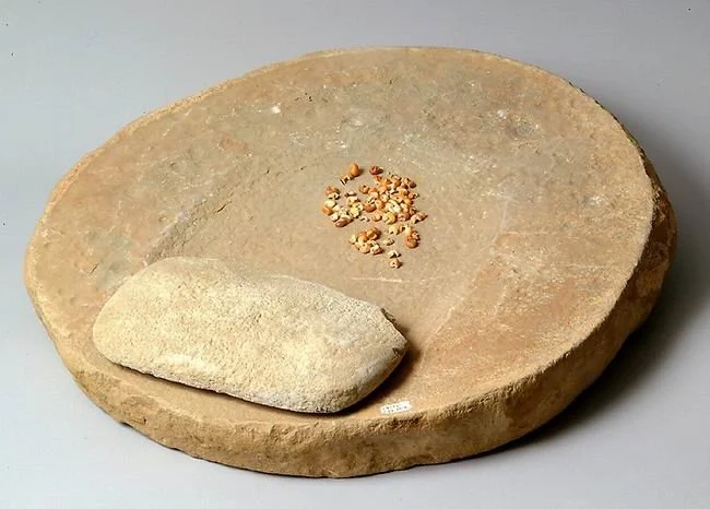
Grinding stones are among the most widespread tools in archaeological assemblages. They were used to crush, grind, and process grains, seeds, roots, pigments, minerals, and other materials. Their durability makes them especially valuable for studying everyday work that rarely appears in monumental architecture or elite written records.

Food grinding could require substantial time and physical effort. In societies that depended on cereal agriculture or other starchy plant foods, grinding and related processing activities may have been central to household economies.

The title's emphasis on female economic space raises an important research question: can the archaeological distribution of grinding stones help identify work traditionally performed by women in particular societies?

In some historical and ethnographic contexts, food processing was strongly associated with women. But this pattern cannot automatically be projected onto every ancient community. Gendered divisions of labor varied across cultures and periods, and grinding tools alone do not reveal the gender of the person who used them.

A careful archaeological approach investigates the organization of work without assuming that the same gender roles existed everywhere.

Grinding Technology and the Organization of Labor

Grinding technology includes a range of tools, from handheld grinders to larger stationary grinding installations. Their form depends on the materials being processed, the desired texture, and the physical techniques used.

Researchers examine the size, shape, surface texture, and wear patterns of grinding stones. Microscopic residues may identify plant starches or other materials, while use-wear can help distinguish grinding from pounding or other activities.

The amount of wear and the dimensions of a tool can provide clues about how it was used, but they do not directly reveal the identity of the user. A large grinding stone may have required considerable effort, yet it could have been operated by one person, several people, or individuals taking turns.

Researchers can compare tool distributions across buildings and settlements to investigate whether grinding took place primarily within households or in shared work areas. The results may reveal patterns of labor organization even when the social identities of individual workers remain uncertain.

Household Architecture and Working Spaces

The location of grinding stones can help reconstruct the spatial organization of domestic work. Tools found near hearths, storage areas, courtyards, or food-processing installations may have been used within a household's daily routines.

However, objects are often moved before they are discarded or buried. A grinding stone found in a courtyard may have been used there, stored there, or brought from another location as building material.

Researchers therefore examine the relationship between the artifact and its context. Is the stone associated with plant remains, food-processing debris, or repeated occupation surfaces? Are similar tools found in neighboring houses? Does the architecture suggest a dedicated work area?

Spatial patterns may also reveal differences in access to labor and resources. Some households may have possessed several grinding stones, while others shared equipment or used communal facilities. Such differences require interpretation alongside household size, preservation, and the chronology of occupation.

Gender and the Archaeology of Invisible Labor

The archaeology of gender seeks to understand how societies organized work, authority, identity, and social expectations. It does not assume that biological sex automatically determines a person's activities or social role.

In some societies, women may have been responsible for much of the daily processing of staple foods. In others, food production could be divided differently according to age, status, household structure, season, or the specific task involved.

Grinding stones cannot independently establish who performed the work. Researchers need additional evidence, such as historical descriptions, carefully contextualized burial evidence, skeletal indicators of repetitive activity, or comparisons with well-documented communities.

Even these sources have limitations. Skeletal changes associated with repeated labor are rarely unique to one activity, and grave goods do not provide a straightforward record of occupation. Ethnographic analogy can generate hypotheses, but it cannot prove that an ancient society followed the same division of labor.

The strongest interpretations recognize gender as a question to investigate rather than a conclusion already contained in the artifact.

Grinding, Food Security, and Household Economies

Food processing was essential to transforming many plant resources into usable meals. Grinding could improve digestibility, alter texture, and prepare ingredients for cooking or storage.

The importance of grinding varied with local diets and available technology. Some communities relied heavily on processed grains, while others used a wider range of plant and animal resources. A settlement with many grinding stones may have supported intensive plant processing, but researchers must consider other possible uses.

Tool wear and residue analysis can help identify the materials being processed. If grinding stones contain starch grains consistent with particular plants, the findings can be compared with charred seeds, storage facilities, and environmental evidence.

These data can reveal how households managed food resources. However, they rarely establish the exact quantity of food produced or the social status of the person who processed it.

The labor involved in grinding also has broader economic significance. Time spent preparing food could affect the amount of labor available for farming, craft production, childcare, and other activities. Understanding the organization of this work helps reconstruct the practical foundations of ancient economies.

Beyond the Household: Communal and Specialized Processing

Grinding did not always take place within individual homes. Some communities may have used shared processing areas, particularly when handling large quantities of grain or other materials.

Archaeologists can investigate this possibility by examining the size and concentration of tools, the presence of storage facilities, and the spatial relationship between processing areas and settlements.

A cluster of grinding stones might indicate communal production, but it could also represent accumulated household equipment or a later deposit. Secure stratigraphy and evidence of repeated activity are necessary before assigning a shared function.

Specialized processing may also have involved people whose roles cannot be inferred directly from the tools. The archaeological record can reveal the scale and organization of work more readily than the identities or social status of the workers.

Conclusion: Grinding Stones and the Archaeology of Work

Grinding stones provide a valuable record of food processing, household organization, and the labor required to sustain ancient communities. Their distribution can help identify working areas and investigate how processing activities were organized.

However, grinding stones alone cannot establish that women performed the work. Gendered interpretations require evidence from the relevant society and period, along with careful consideration of alternative explanations.

By combining tool analysis, residue studies, spatial archaeology, and contextual evidence, researchers can investigate the relationship between domestic space and economic activity without imposing modern assumptions on the past. This approach makes everyday labor more visible while acknowledging the limits of what surviving objects can tell us about the people who used them.

Prehistoric Sound Instruments: Bone Flutes Beyond Europe

October 18, 2026

Investigating ancient musical traditions through bone instruments, acoustic experiments, and archaeological evidence from diverse regions of the world.

Introduction: Music Before Written History

Music leaves a different archaeological record from stone tools, buildings, and pottery. Sound disappears almost immediately after it is produced, and the instruments used to create it may decay or break beyond recognition. Yet surviving bone, ivory, wood, and other objects can provide clues about how prehistoric people produced sound.

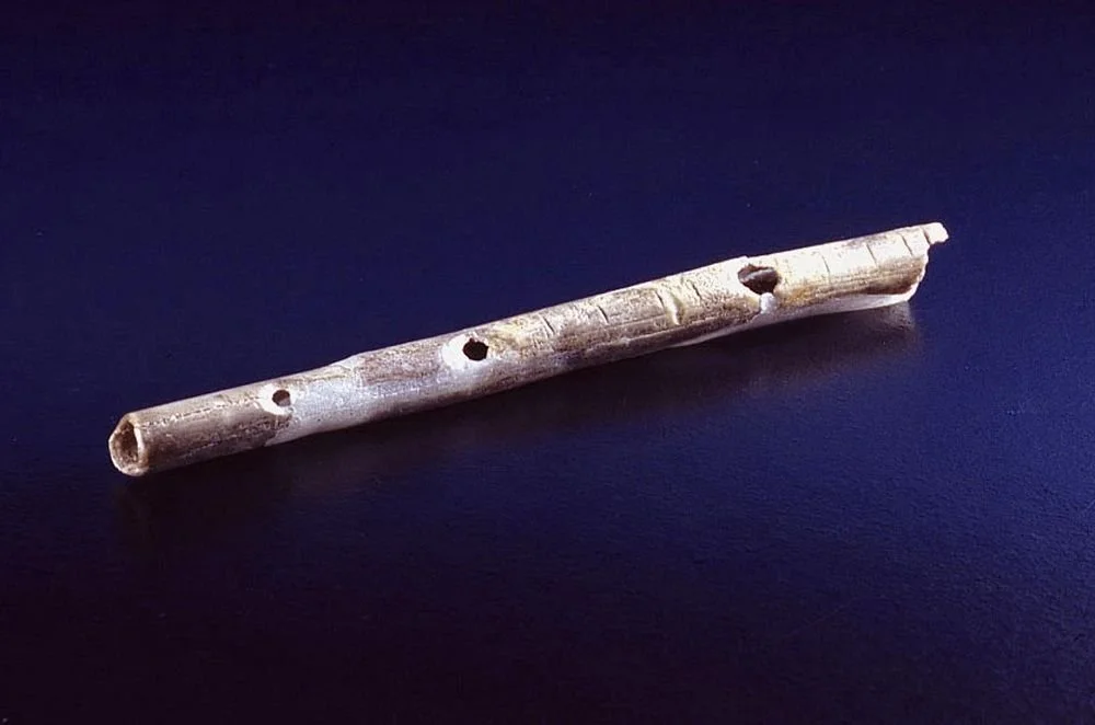
Bone flutes are especially intriguing because their holes, internal cavities, and carefully shaped surfaces may indicate deliberate sound production. Some prehistoric instruments have been recovered in Europe, where several discoveries have attracted considerable attention. However, the broader history of prehistoric music extends well beyond Europe.

Archaeological research in Africa, Asia, and other regions can contribute to understanding how people experimented with sound, developed instruments, and incorporated music into social life. The evidence is uneven, and not every hollow bone with holes is necessarily a flute.

The challenge is to identify sound-producing objects securely and interpret their possible uses without assuming that all prehistoric societies shared the same musical traditions.

Identifying a Prehistoric Bone Flute

Bone can be shaped into a tube capable of producing sound when air is directed through it. Depending on the instrument's design, holes along the body may allow the player to alter pitch by changing the effective length of the vibrating air column.

Archaeologists examine the number, spacing, shape, and placement of holes, as well as the object's overall geometry. Tool marks may reveal deliberate modification, while wear and residues can provide additional clues about how the object was handled.

However, natural cavities and damage can imitate some features of an instrument. Carnivore activity, water erosion, and accidental breakage may create holes or alter the shape of a bone. A convincing flute identification requires evidence that the features are consistent with deliberate manufacture and sound production.

Researchers also consider the anatomical origin of the bone. Different animal bones have different dimensions and internal structures, which influence their suitability for instrument making. Species identification can therefore help establish whether the raw material was appropriate for the proposed function.

Evidence Beyond Europe

Europe has produced some of the most widely discussed prehistoric bone instruments, but this does not mean that music originated there or that other regions lacked comparable traditions.

In Africa and Asia, researchers have investigated a variety of artifacts that may have produced sound, including modified bones, whistles, and other potential instruments. Their interpretation depends on the archaeological context and the quality of the surviving evidence.

The comparison must be chronological and methodological. An object identified as a musical instrument in one region should not automatically be used to classify a visually similar artifact elsewhere. Different cultures may have modified bones for different purposes, and some instruments may not have survived at all.

Preservation strongly influences the archaeological record. Bone can survive under certain conditions, while wood, reeds, bark, and other organic materials may disappear. A region with few surviving bone instruments may nevertheless have supported extensive musical traditions using perishable materials.

The absence of preserved instruments should therefore not be equated with the absence of music.

Experimental Archaeology and Reconstructing Sound

Once an artifact is identified as a possible flute, researchers can create a replica to investigate how it might have functioned. Experimental instruments can be made from comparable materials and shaped according to the surviving dimensions.

Researchers then test whether the replica can produce stable tones, whether the holes affect pitch as expected, and whether the instrument's design is practical for a human player. Acoustic measurements can record frequency, resonance, and other properties of the sound.

These experiments can establish whether a proposed instrument is physically plausible. They cannot recover its original music, however. The same instrument might produce different melodies depending on technique, musical conventions, and the player's skill.

Modern replicas also may differ from ancient objects in material quality and internal geometry. Experimental results should therefore be interpreted as evidence of possible performance rather than a definitive reconstruction of prehistoric music.

Music, Social Life, and Ritual

Sound-producing instruments can be associated with many aspects of social life. Music may accompany dance, storytelling, work, ceremonies, gatherings, or communication. A flute could have been used for entertainment, personal expression, ritual activity, or several purposes.

Archaeological context helps investigate these possibilities. An instrument found in a burial may have had symbolic significance, but it does not necessarily mean the object was used only in funerary ceremonies. An instrument recovered from a settlement could have been used for music, but it might also have served another function.

Repeated finds in similar contexts can reveal broader patterns. If instruments occur alongside evidence of communal gatherings or structured ceremonial activity, a social or ritual interpretation may become more persuasive.

Nevertheless, music itself is difficult to reconstruct from material evidence. Archaeologists can study instruments and their physical capabilities, but the rhythms, melodies, meanings, and emotional experiences associated with prehistoric performances may remain unknown.

Technology, Skill, and the Development of Musical Traditions

Making a functional bone instrument can require careful selection of raw material, controlled perforation, and knowledge of how its shape affects sound. These skills may have been passed between individuals through demonstration and practice.

The manufacture of an instrument can therefore reveal aspects of technical knowledge beyond its musical function. Researchers examine tool marks, production sequences, unfinished objects, and similarities among instruments to investigate how techniques were learned and shared.

However, similarity between instruments does not automatically prove direct cultural contact. Comparable acoustic requirements can lead to similar designs in different places.

The study of prehistoric music also encourages researchers to reconsider how technology is defined. A sound-producing object may have had little practical value in the narrow economic sense, yet it could have been important for communication, identity, coordination, and collective experience.

Conclusion: Recovering Music from Material Remains

Prehistoric bone flutes provide rare evidence of human experimentation with sound. Their shapes and manufacturing marks can help establish whether an object was designed to function as an instrument, while experimental archaeology can investigate its acoustic possibilities.

The broader record remains uneven because organic materials preserve differently across environments and regions. Archaeologists must distinguish secure instrument identifications from objects whose function remains uncertain, especially when comparing finds across continents.

By examining evidence beyond Europe, researchers can develop a more geographically inclusive understanding of prehistoric sound. Although the original melodies may be lost, the surviving instruments remind us that music and other forms of sound production were part of the human past long before written musical notation existed.

Cemeteries in Caves vs. Open-Air Burials: Cultural and Environmental Drivers

October 18, 2026

Comparing burial locations to understand how landscape, preservation, social practice, and cultural beliefs shaped the treatment of the dead.

Introduction: Why Were Some People Buried in Caves?

Burial practices vary widely across human societies. Some communities interred their dead in open-air cemeteries, while others used caves, rock shelters, chambers, or natural cavities. In certain regions, both practices occurred within the same broad cultural period.

These differences raise important questions. Did communities choose caves because they offered protection, privacy, or symbolic significance? Were open-air cemeteries preferred because they were easier to access, maintain, or associate with settlements? How much of the archaeological pattern reflects cultural decisions, and how much results from environmental preservation?

There is no universal answer. Burial location can reflect several interacting factors, including local geology, climate, settlement organization, religious beliefs, social identity, and the availability of suitable places.

The archaeological challenge is to distinguish deliberate burial choices from the effects of natural processes and unequal preservation. A cave containing human bones is not automatically a cemetery, and an open-air concentration of bones may represent secondary deposition rather than primary burial.

Caves as Burial Environments

Caves provide enclosed spaces that can shelter human remains from some environmental processes. Depending on their structure and climate, they may offer relatively stable temperatures, protection from direct rainfall, and spaces that are less accessible to animals or casual disturbance.

These properties can influence preservation. Human bones may survive well in some caves, while acidic water, humidity, salt, or other chemical conditions can cause substantial deterioration in others. Cave environments are not uniformly protective.

Caves may also have held cultural significance. Their darkness, enclosed spaces, and relationships with prominent landscape features could have influenced how people understood them. However, such meanings cannot be assumed from the physical characteristics of the cave alone.

Researchers investigate cave burials by examining the position of the remains, the arrangement of bones, associated artifacts, sediment layers, and evidence of repeated visits. These features can help distinguish deliberate burial from accidental death, natural accumulation, or the later movement of remains.

Open-Air Cemeteries and Their Archaeological Signatures

Open-air cemeteries can take many forms, including individual graves, clustered burials, burial mounds, stone-lined structures, and large organized burial grounds. Their layouts may reveal patterns of social organization and the repeated use of particular places.

Burial placement can reflect proximity to settlements, access routes, boundaries, or other features of the landscape. Yet the relationship between a cemetery and a nearby settlement does not automatically establish why the site was selected.

Open-air burials are often exposed to environmental processes that can disturb or destroy evidence. Erosion, farming, construction, animal activity, and changing water conditions may alter the original arrangement of graves.

Archaeologists therefore record stratigraphy and grave structure carefully. They examine whether remains were placed in articulated positions, whether grave cuts are visible, and whether the bones show evidence of later disturbance.

The absence of an intact skeleton does not necessarily mean that a burial never existed. Preservation and later land use can leave only fragments of the original mortuary landscape.

Cultural Beliefs and the Treatment of the Dead

Burial practices are closely connected to cultural ideas about death, ancestry, identity, and the relationship between the living and the dead. However, the specific meanings associated with caves or open-air cemeteries vary across societies and periods.

Some communities may have used caves for repeated burial, while others used them for temporary deposition or as one stage in a longer mortuary process. Open-air cemeteries could likewise accommodate diverse practices, including primary burial, secondary burial, cremation, and the placement of grave goods.

Researchers investigate these possibilities by studying the condition and arrangement of bones. Disarticulated remains may indicate secondary handling, but natural disturbance can produce similar patterns. Cut marks, burning, and other modifications must be assessed in relation to the entire context.

Grave goods and associated structures may provide clues about the treatment of the dead, but their meanings are rarely straightforward. Objects may represent status, identity, ritual obligations, or choices made by surviving relatives.

Environmental Factors and Preservation Bias

The archaeological distribution of cave and open-air burials is shaped by preservation. Caves can accumulate sediment and protect remains in some circumstances, while open-air sites may be more vulnerable to erosion and development.

This creates a potential bias: researchers may discover more cave burials in regions where cave environments preserve bones well, even if the original population used several burial locations.

Geology also influences site availability. Limestone landscapes may contain extensive cave systems, whereas other regions offer few natural cavities. Communities cannot choose a cave burial tradition where suitable caves are absent unless they construct alternative enclosed spaces.

Climate and hydrology further affect preservation. Water movement can transport bones, while soil acidity may dissolve them. The modern condition of a site may therefore obscure the original differences between burial environments.

A meaningful comparison must consider how many potential burial locations survive, how extensively they have been surveyed, and whether the archaeological record is likely to preserve each type of site equally.

Comparing Cave and Open-Air Burial Populations

Scientific methods can help determine whether cave and open-air burials belonged to the same community or reflected different populations and periods.

Radiocarbon dating can establish chronology when suitable material survives. Stable isotope analysis may contribute information about diet and mobility, while ancient DNA can help investigate biological relationships. These methods do not directly reveal religious identity or explain why a burial location was chosen.

Osteological analysis can compare age profiles, patterns of disease, trauma, and other characteristics. Differences between burial groups might reflect social selection, environmental conditions, population change, or differences in preservation.

Researchers must also account for sampling bias. A cave used for several centuries may contain individuals from different periods, while an open-air cemetery might represent a narrower interval. Direct comparison is unreliable unless the chronological and contextual differences are understood.

When Both Practices Occur in the Same Region

The coexistence of cave and open-air burials is particularly informative because it demonstrates that burial location may have been a choice rather than an unavoidable environmental outcome.

However, different burial places do not necessarily represent separate social groups. A community might have used different locations according to age, family relationships, status, ritual requirements, or changes in custom over time.

The archaeological sequence matters. If cave burials predate an open-air cemetery, the change may reflect a transformation in mortuary practice. If both were used simultaneously, researchers can investigate whether they served different functions.

Even then, the interpretation should remain grounded in evidence. Differences in grave goods or skeletal characteristics may suggest social distinctions, but they require corroboration from other patterns.

Conclusion: Burial Location as a Complex Cultural Choice

Cave and open-air cemeteries offer complementary perspectives on how communities treated the dead. Their distribution reflects cultural practice, environmental opportunity, settlement organization, and the uneven preservation of human remains.

Neither location has a universal meaning. A cave is not automatically sacred, and an open-air cemetery is not necessarily a marker of social openness or political organization. Both settings may have served multiple functions across different periods.

By combining burial archaeology, environmental reconstruction, scientific dating, and bioarchaeological analysis, researchers can investigate why communities selected particular places for the dead. The result is a more careful understanding of mortuary traditions—one that recognizes cultural diversity while avoiding explanations based on geography alone.

Soot Stains and Hearth Architecture: Reconstructing Paleodiets in Shelters

October 18, 2026

How combustion residues, hearth construction, and food remains can help researchers reconstruct prehistoric cooking practices and dietary choices.

Introduction: Food Preparation in Sheltered Spaces

Rock shelters and shallow caves have preserved evidence of human activity across many prehistoric periods. Their overhangs offer protection from rainfall and wind, while their floors can accumulate layers of charcoal, ash, food remains, and discarded tools.

Among the most informative features are hearths. These fire installations could be used for warmth, lighting, cooking, and other activities. Their shape, location, and repeated rebuilding can reveal how people organized domestic or temporary occupation.

Soot stains and other combustion residues add another dimension to the investigation. They can help researchers reconstruct the movement of smoke, the frequency of fire use, and the relationship between hearths and shelter architecture.

However, soot does not directly reveal a person's diet. Dietary reconstruction requires evidence from food remains, residues, botanical material, animal bones, and other indicators. The challenge is to connect hearth evidence with food preparation without assuming that every fire was used for cooking.

Hearth Architecture and the Organization of Fire

Prehistoric hearths vary from simple concentrations of ash and charcoal to carefully prepared features lined with stones or cut into the ground. Their design depends on the activity, available materials, and the length of time a place was occupied.

Researchers examine the shape, dimensions, depth, and construction of each hearth. Stone arrangements may help retain heat, while shallow depressions can contain fuel and ash. Some features were repeatedly cleaned and reused, producing distinct layers of combustion material.

The location of a hearth can reveal how people organized a shelter. A fire near an entrance might provide warmth and light while allowing smoke to escape. A hearth farther inside could be protected from wind but may require a different arrangement to manage ventilation.

These relationships are not universal. Airflow depends on the shelter's geometry, entrance orientation, prevailing winds, and the presence of other openings. Modern observations can help test possible ventilation patterns, but the ancient environment must be reconstructed as closely as possible.

What Soot Stains Can Tell Us

Soot forms when combustion produces fine carbon-rich particles that deposit on surfaces. In shelters, soot may accumulate on ceilings, walls, overhangs, and objects exposed to smoke.

The distribution of soot can help researchers identify likely smoke pathways and areas repeatedly exposed to fire. Thick deposits may indicate sustained or repeated combustion, although their formation also depends on fuel type, ventilation, and the distance between the fire and the surface.

Soot does not necessarily originate from a hearth located directly beneath it. Smoke can travel through a shelter, and later fires may contribute to deposits formed during earlier occupation phases.

Microscopic analysis can distinguish soot from other dark deposits, while chemical and mineral analysis may clarify the composition of the residue. Researchers must also consider modern contamination from visitors, campfires, and conservation activities.

Dating soot-covered surfaces is difficult because the residue may contain material from several episodes of burning. Secure chronology requires careful sampling and comparison with associated archaeological layers.

Animal Bones and the Reconstruction of Diet

Animal remains are among the most direct forms of evidence for prehistoric food consumption. Researchers identify species, estimate the age and size of animals, and examine the distribution of skeletal elements.

Cut marks may indicate butchery, while burning can suggest exposure to fire. However, bones can be burned accidentally after disposal, and carnivores may introduce or modify remains. Researchers must distinguish human food processing from natural accumulation.

The relative abundance of species can reveal changes in hunting or resource use. A shelter containing many small mammals, birds, or fish may reflect a different pattern of food acquisition from one dominated by large herbivores.

Yet the number of bones recovered is not a direct measure of dietary importance. Large animals produce more bone than small animals, and different skeletal elements preserve differently. Researchers use standardized quantification methods and account for fragmentation and preservation when comparing assemblages.

Plant Foods and Invisible Ingredients

Prehistoric diets included plant foods that may leave little visible evidence. Seeds, nutshells, fruit remains, starch grains, and phytoliths can survive under favorable conditions, but preservation varies considerably.

Charred plant remains can indicate that seeds or other materials were exposed to fire, although they may have been burned accidentally or introduced from fuel and bedding. Researchers examine their context to distinguish food preparation from other sources.

Starch grains recovered from grinding stones or other artifacts may provide evidence of plant processing. Residue analysis can sometimes identify the types of plants involved, but contamination and ambiguous identification remain important concerns.

Combining plant evidence with animal remains can reveal the diversity of foods available to prehistoric communities. Even so, the archaeological record rarely preserves every ingredient used in a meal, and absence of evidence should not be treated as proof that a food was not consumed.

Cooking Methods and the Chemistry of Food

Cooking can alter the physical and chemical properties of food. Direct roasting, heating in pits, boiling in containers, and other methods may leave different archaeological traces.

Researchers investigate these techniques through hearth architecture, heat-altered stones, residues on tools, pottery where available, and changes in the condition of animal and plant remains. Experimental archaeology can help determine whether particular traces are consistent with proposed cooking methods.

However, similar traces may be produced by different processes. Heat-altered stones, for example, can be associated with cooking, but they may also have been used in other heating activities. A burnt bone may have been cooked, discarded into a fire, or exposed during a later burning episode.

Chemical analysis may reveal residues associated with particular food categories, although exact recipes are rarely recoverable. The most reliable interpretations combine several indicators rather than relying on one chemical signature or burned object.

Seasonal Occupation and Changing Food Choices

Rock shelters may have been occupied briefly during hunting trips, repeatedly during particular seasons, or for longer periods. Changes in animal age profiles, plant remains, hearth construction, and sediment accumulation can help investigate these patterns.

Seasonality is difficult to establish from a single indicator. The age of a hunted animal, the availability of particular plants, or the condition of a hearth may provide clues, but each requires comparison with local ecology and other archaeological evidence.

A sequence of hearths may reveal repeated visits, while differences in food remains may suggest that people used the shelter during changing resource conditions. However, these changes could also reflect different occupants or shifts in the activities performed at the site.

Secure dating and detailed stratigraphic recording are therefore essential. Researchers need to know whether two hearths represent separate visits, successive generations, or distinct activities during one occupation.

Conclusion: From Fire Residues to Prehistoric Meals

Soot stains and hearth architecture provide important evidence for reconstructing the use of prehistoric shelters. They can reveal how fires were built, where smoke traveled, and how people organized spaces for warmth, light, and potentially cooking.

Dietary reconstruction requires additional evidence. Animal bones, plant remains, residues, and tools help identify the foods people obtained and the methods they used to process them, while careful contextual analysis distinguishes cooking from other forms of fire use.

The strongest reconstructions integrate all these sources within a secure chronology. By doing so, archaeologists can move beyond the visible traces of a hearth to investigate the practical choices that shaped prehistoric meals, seasonal routines, and the daily relationship between people and their environment.

Traces of Ancient Fermentation Vessels in Sub-Saharan Contexts

October 18, 2026

How ceramic residues, vessel shapes, and archaeobotanical evidence can illuminate the history of fermented foods and drinks across sub-Saharan Africa.

Introduction: Fermentation as an African Food Technology

Fermentation has played an important role in food preparation and preservation across many societies. By using microorganisms to transform sugars and other compounds, people can produce beverages, sour foods, and other products with distinctive flavors, textures, and storage properties.

Across sub-Saharan Africa, fermented foods and drinks have developed in connection with diverse agricultural systems, local plants, livestock, and cultural traditions. Products made from grains, fruits, milk, and other ingredients demonstrate the range of possibilities offered by fermentation. Their histories, however, vary considerably by region and period.

Archaeology can investigate these histories through ceramic vessels, food residues, plant remains, animal products, and the organization of food-processing spaces. A vessel used repeatedly for fermentation may preserve traces of its contents, while its shape and manufacturing technique may offer clues about how it was used.

The main challenge is that fermentation rarely leaves a single unmistakable archaeological signature. Residues may also result from cooking, ordinary storage, brewing without long fermentation, or later contamination. Researchers must therefore combine several forms of evidence before identifying an ancient vessel as a fermentation container.

Ceramic Vessels and the Preservation of Residues

Pottery is valuable for studying ancient food preparation because its porous structure can absorb and retain certain substances from the materials placed inside it. Organic compounds may survive within the ceramic fabric even when the original contents have disappeared.

Researchers can analyze absorbed lipids, organic acids, starch grains, proteins, and other microscopic remains. These analyses may help distinguish broad categories of contents, although their ability to identify a particular fermented product depends on the preservation of diagnostic compounds.

Vessel morphology also matters. Large jars may have been suitable for storage or batch processing, while narrow-necked containers might have reduced exposure to the surrounding environment. Yet these characteristics do not establish a fermentation function by themselves. The same vessel could have been used for several activities over its lifetime.

Archaeologists therefore examine residues alongside vessel size, surface treatment, evidence of heating, and the context in which the pottery was found. A large container from a food-processing area with consistent chemical and botanical evidence may support a fermentation interpretation more strongly than a similar vessel recovered from mixed rubbish.

Reconstructing Ingredients and Fermentation Methods

Fermentation depends on the ingredients available to a community and the microorganisms capable of transforming them. Cereal-based products, fruit beverages, fermented dairy products, and plant-based preparations can produce different chemical patterns, although these patterns are not always uniquely identifiable after burial.

Archaeobotanical remains can help establish which crops and wild plants were available. Charred grains, seeds, fruit stones, and other plant remains may reveal agricultural production and food processing. However, finding a crop at a settlement does not prove that it was fermented.

Animal remains and dairy residues may provide evidence for the use of milk, while vessel residues can contribute information about how animal products were processed. In some cases, several independent findings may support the possibility of fermented dairy foods.

Experimental archaeology offers another approach. Researchers can prepare plausible fermented products in replicas of ancient vessels and examine which chemical compounds remain after processing and burial-like conditions. These experiments can test whether a proposed interpretation is chemically plausible, but they cannot prove that ancient producers followed the same recipe.

Regional Diversity and Local Knowledge

Sub-Saharan Africa encompasses a wide range of environments and histories, from the Sahel and savannas to tropical forests, highlands, and southern African landscapes. Fermentation practices developed within these different ecological and social settings.

Local ingredients influenced the products people could make. Grain-growing communities had different options from communities relying more heavily on pastoralism, fruit gathering, or mixed subsistence strategies. Trade and migration could introduce new ingredients and techniques, but similar fermentation practices could also develop independently.

Researchers should avoid treating a single vessel form or residue pattern as representative of the entire continent. Comparisons must be geographically and chronologically specific, and modern food traditions should be used as sources of research questions rather than direct proof of ancient practice.

Ethnographic research can document how fermentation works in living communities, including the role of vessel reuse, starter cultures, temperature, and preparation techniques. Such observations can help formulate archaeological hypotheses, provided researchers recognize that practices change through time.

Fermentation, Storage, and Social Life

Fermented foods and drinks can contribute to household nutrition, food preservation, exchange, hospitality, and collective gatherings. Their production may involve shared knowledge passed between generations, as well as decisions about labor, ingredients, and timing.

Archaeological evidence may reveal differences between household production and more specialized processing. Large quantities of vessels, repeated processing installations, and storage areas could suggest substantial output, but these features must be interpreted within their local context.

Fermented products may also have circulated beyond the households that produced them. Yet pottery found far from a production center does not automatically demonstrate the trade of a finished beverage. Containers, ingredients, and production knowledge can move separately.

Written records, where available, may help establish the economic or social importance of particular products. They should not be assumed to describe every community, especially where documentary evidence is sparse.

Conclusion: Recovering Fermentation from Fragile Evidence

Ceramic residues and vessel forms provide important opportunities to investigate ancient fermentation in sub-Saharan Africa. They can help researchers explore food processing, agricultural resources, technological knowledge, and the movement of products between communities.

However, the identification of a fermentation vessel requires more than a particular shape or an organic residue. Archaeologists must consider alternative uses, contamination, preservation, and the diversity of regional food traditions.

By combining residue chemistry, botanical analysis, vessel studies, experimental archaeology, and contextual evidence, researchers can develop more reliable accounts of fermentation's history. This approach recognizes African communities as active innovators in food technology while avoiding unsupported claims about specific recipes or production traditions.

Micro-charcoal Records from Urban Cores: Industrial Activity in Antiquity

October 18, 2026

How microscopic charcoal preserved in urban sediments can help reconstruct ancient combustion, craft production, and changing patterns of human activity.

Introduction: Reading Fire in Urban Sediments

Fire was central to ancient urban life. Households used it for cooking and heating, craftspeople relied on it for activities such as metalworking and pottery production, and larger installations sometimes required substantial quantities of fuel. These activities contributed to the accumulation of charcoal and other combustion residues in urban environments.

Much of this material is too small to be recognized as an individual artifact. Microscopic charcoal fragments, however, can survive in soil, sediment, drainage deposits, and other layers formed through urban activity. Their abundance and distribution may help researchers reconstruct changes in the use of fire over time.

Urban cores—sediment sequences collected from areas within or near former settlements—can preserve layered records of human and environmental change. These records may contain evidence of burning, vegetation changes, construction debris, and waste disposal.

Yet micro-charcoal is not a direct measurement of industrial production. It may originate from household hearths, wildfires, nearby vegetation burning, or charcoal transported from other locations. The challenge is to determine which processes best explain the observed pattern.

What Is Micro-charcoal?

Micro-charcoal consists of small carbonized plant fragments that can be identified through microscopic examination. It forms when vegetation or wood is exposed to combustion under conditions that leave carbon-rich residues.

The size, shape, and abundance of charcoal particles can provide clues about the source of burning. Larger fragments may remain close to the place where wood burned, while smaller particles can travel through air or water and become deposited farther away.

These relationships are not absolute. Particle movement depends on fire intensity, fuel type, wind, topography, drainage, and the physical properties of the sediment. A high concentration of microscopic charcoal therefore indicates a history of combustion or charcoal input, but it does not identify a particular workshop by itself.

Researchers examine charcoal alongside pollen, phytoliths, sediment chemistry, and other indicators. These comparisons help distinguish local burning from broader changes in vegetation or regional fire activity.

Collecting Urban Cores and Establishing Chronology

Sediment coring allows researchers to obtain relatively continuous sequences without excavating an entire area. Cores may be collected from former canals, ponds, wetlands, abandoned channels, or other places where sediment accumulated.

The first task is to understand how the deposit formed. Urban sediments can contain redeposited soil, construction material, waste, and natural sediment. A core may include material transported from several parts of a city rather than evidence of activity directly above the sampling point.

Researchers establish chronology through radiocarbon dating, stratigraphic comparison, or other appropriate dating methods. The choice depends on the material available and the nature of the deposit.

Dating must account for possible disturbances. Charcoal may have been redeposited from older deposits, while later construction can introduce younger material into deeper layers. A robust chronology uses multiple lines of evidence rather than assuming that depth alone establishes age.

Distinguishing Domestic Fire from Industrial Combustion

Industrial and craft activities can generate substantial charcoal, but they differ in their fuel requirements and waste products. Metalworking, lime production, pottery firing, and glassmaking may involve distinct installations and temperature regimes.

Micro-charcoal records can be compared with archaeological evidence for these activities. A rise in charcoal coinciding with the development of furnaces, workshops, or kiln complexes may support the interpretation that craft production contributed to the increase.

However, domestic cooking and heating may also produce substantial charcoal, especially in densely occupied settlements. Population growth can increase fuel consumption without a corresponding rise in specialized industry.

Researchers therefore compare charcoal patterns with other evidence, including slag, furnace debris, kiln fragments, metalworking residues, and changes in settlement density. Chemical and microscopic analyses may help characterize the combustion materials, but they rarely identify a particular industry without contextual support.

Fuel Selection and Urban Environmental Change

Ancient communities used different fuels depending on availability, cost, and technological requirements. Wood, charcoal, crop residues, and other combustible materials can produce different combustion products and leave different archaeological signatures.

Charcoal anatomy can sometimes identify the types of wood used. If a sequence shows changes in the species represented, researchers may investigate whether fuel procurement shifted as the surrounding landscape changed or as urban demand increased.

Yet the relationship between charcoal and woodland depletion is not straightforward. A change in charcoal composition could reflect fuel preference, trade, selective harvesting, or differences in preservation rather than widespread deforestation.

Pollen and other vegetation indicators can help reconstruct changes in the surrounding environment. When these records are combined with evidence of settlement expansion and craft production, researchers can investigate whether urban fuel demand contributed to landscape transformation.

Spatial Variation Within Ancient Cities

An urban core does not represent an entire city equally. Different neighborhoods may have specialized functions, and the movement of sediment can redistribute charcoal from its original source.

Researchers compare cores from multiple locations where possible. A localized increase near a known industrial district may indicate concentrated activity, while a widespread rise across several sites could reflect broader fuel consumption or regional burning.

Spatial analysis can also help identify changes in urban organization. The appearance of new workshops, expansion of residential areas, or the relocation of craft activities may correspond with changing charcoal patterns.

These relationships require secure dating. If the sediment record and archaeological features belong to different periods, apparent associations may be misleading.

Conclusion: Reconstructing Ancient Industry Through Microscopic Evidence

Micro-charcoal records offer a valuable way to investigate combustion and environmental change in ancient cities. They can reveal changes in the frequency or intensity of burning and help researchers develop hypotheses about fuel consumption and craft production.

However, charcoal abundance is not a direct measure of industrial output. Domestic fires, wildfires, redeposition, and changes in sediment movement can produce similar signals.

The strongest interpretations combine micro-charcoal analysis with secure chronology, environmental proxies, archaeological installations, and evidence of production waste. This approach helps researchers reconstruct the role of fire in urban economies while recognizing that microscopic particles record a mixture of human and natural processes.

The Role of Small Harbours in Bronze Age Piracy Networks

October 18, 2026

Investigating how minor coastal anchorages may have supported maritime raiding, informal exchange, and the movement of people and goods during the Bronze Age.

Introduction: The Maritime World Beyond Major Ports

The Bronze Age connected many coastal communities through maritime travel. Ships and boats carried metals, pottery, agricultural products, textiles, and other commodities between settlements separated by islands, peninsulas, and stretches of open water.

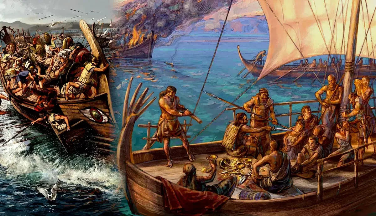
Not every voyage depended on a major harbor. Small coves, sheltered beaches, river mouths, and natural inlets could provide temporary places to land, repair vessels, obtain water, or transfer cargo. Some of these locations may have supported routine commerce, while others could have been used by people engaged in raiding or unauthorized trade.

Piracy is difficult to reconstruct archaeologically because it is an activity rather than a distinctive type of settlement. A small harbor does not become a pirate base simply because it was isolated or strategically positioned. Evidence of violence, maritime movement, and the handling of goods must be evaluated alongside the site's chronology and regional context.

The most useful approach is to investigate how small harbors functioned within wider maritime networks and whether particular locations could plausibly have supported both legitimate exchange and predatory activity.

What Counts as a Small Harbor?

A small harbor may be a natural anchorage with limited construction or a more developed facility containing landing places, storage buildings, quays, or protective structures. In the Bronze Age, many coastal landing sites may have relied on the natural shape of the shoreline rather than elaborate engineering.

Researchers examine sheltered water, beach gradients, access to freshwater, visibility from the sea, and connections with inland routes. These features help establish whether a location was suitable for anchoring and landing vessels.

Coastal landscapes have changed substantially since the Bronze Age. Sea-level fluctuations, tectonic movement, sediment accumulation, erosion, and harbor silting can alter the relationship between an archaeological site and the modern shoreline. A place that now lies inland may once have stood beside navigable water.

Marine geophysics, sediment cores, underwater survey, and coastal geomorphology can help reconstruct these changes. Without this environmental context, the original maritime function of a small site may be difficult to determine.

Piracy and the Limits of Archaeological Evidence

Piracy generally involves unauthorized seizure or predation at sea, but ancient maritime violence did not always fit a clear distinction between pirates, raiders, private armed groups, and political authorities. The same community might engage in trade during one period and violent appropriation during another.

Archaeology rarely identifies piracy through a single artifact. Weapons, burned buildings, imported goods, or defensive structures may indicate conflict, but they can also result from warfare, local disputes, or ordinary settlement activity.

Evidence becomes more informative when several indicators occur together. A harbor associated with repeated destruction, unusual concentrations of valuable cargo, defensive modifications, and contemporary evidence of maritime conflict may warrant closer investigation.

Even then, the interpretation should remain cautious. Looted cargo can be difficult to distinguish from ordinary trade, and the absence of defensive architecture does not prove that a harbor was peaceful. The evidence must support the specific claim being made.

Geography, Concealment, and Maritime Strategy

Small anchorages may have offered practical advantages to people seeking to avoid larger ports. Sheltered coves could provide temporary protection from weather, while nearby inlets and islands might create alternative routes along a coastline.

Geographic information systems can help researchers examine the relationship between anchorages, navigable channels, settlements, and major trade corridors. Visibility analysis may indicate which locations could be observed from nearby high ground or from the sea.

However, modern visibility does not necessarily reproduce Bronze Age conditions. Vegetation, coastal erosion, and changing sea levels can alter what was visible to sailors and people on land. Archaeologists must reconstruct the landscape before drawing conclusions about concealment or surveillance.

A harbor's location may also have supported peaceful functions. The same secluded cove could shelter fishing boats, provide access to a small agricultural settlement, or serve as a seasonal anchorage for traders. Geography establishes possibility, not criminal identity.

Trade Goods, Cargo, and Maritime Exchange

Small harbors can preserve evidence of maritime exchange through pottery, metal objects, stone materials, storage vessels, and other transported goods. Their composition may reveal connections between coastal communities and more distant production centers.

The distribution of artifacts can help reconstruct movement, but objects do not always travel with the people who originally produced them. A vessel may have been traded repeatedly, while a metal object could have been recycled or transported far from its place of manufacture.

Underwater archaeology can provide additional evidence where shipwrecks or submerged deposits survive. Cargo assemblages, ship construction, and associated objects may clarify the nature of a voyage, although identifying a wreck as the result of piracy requires more than finding valuable goods.

A cargo could have been lost in a storm, abandoned during an emergency, or transported for ordinary commercial purposes. The interpretation must account for these alternatives.

Small Harbors and Regional Political Change

Maritime violence can influence the organization of trade, settlement, and political authority. Communities exposed to raiding might alter their routes, fortify coastal locations, or concentrate goods in more secure settlements.

Archaeologists can investigate such changes through the chronology of harbor use, settlement abandonment, defensive construction, and shifts in the distribution of imported materials. A decline in activity at one anchorage alongside the growth of another might indicate changing patterns of movement, although environmental and economic factors must also be considered.

Small harbors may also reveal the limits of political control. A state or regional authority might supervise major ports while exercising less direct influence over minor coastal locations. Yet this possibility must be tested against the specific political and archaeological context.

Conclusion: Small Anchorages Within a Complex Maritime World

Small harbors were potentially important components of Bronze Age maritime networks. They could provide shelter, support local exchange, connect inland settlements to the sea, and offer temporary stopping points along longer voyages.

Some may have been used by raiders or other groups involved in maritime violence, but a secluded anchorage is not evidence of piracy by itself. Archaeologists need converging evidence from settlement history, cargo remains, conflict indicators, and environmental reconstruction.

Studying these smaller coastal locations broadens our understanding of Bronze Age seafaring beyond monumental ports and well-documented trade centers. It also highlights the complexity of maritime life, where commerce, travel, political authority, and violence could overlap within the same coastal landscape.

Freshwater Pearl Harvesting and Its Socioeconomic Role in Antiquity

October 18, 2026

How Freshwater Pearls Form

Freshwater pearls develop within certain molluscs when layers of mineral material and organic compounds accumulate around an irritant or another initiating structure. Their appearance varies according to species, biological conditions, and the circumstances of formation.

Not every freshwater mussel produces a pearl, and naturally formed pearls may differ considerably in size, shape, and luster. These characteristics help explain why pearls could be valued as unusual objects, although modern commercial grading systems should not be projected directly onto ancient societies.

Pearls are composed largely of calcium carbonate and organic material. Their preservation depends on burial chemistry, moisture, acidity, and other environmental conditions. In some archaeological settings, pearls may survive, while in others they may deteriorate or become difficult to identify.

Scientific analysis can investigate composition and structure, but determining whether a pearl came from a freshwater or marine mollusc may require careful comparison with suitable reference materials. Provenance claims should not be made solely from the pearl's appearance.

Archaeological Evidence for Harvesting

Freshwater mussel shells may accumulate at archaeological sites through food collection, tool production, bait use, or other activities. A shell midden can therefore provide evidence of freshwater resource exploitation without necessarily indicating pearl harvesting.

Researchers examine the species represented, shell size, breakage patterns, and the location of deposits relative to rivers and lakes. Evidence of deliberate opening may indicate consumption or processing, but the method of opening does not always reveal the intended product.

A stronger case for pearl collection might include securely identified pearls, concentrations of suitable mussel shells, specialized processing evidence, or historical descriptions of pearl fisheries. Even then, researchers must establish that the pearls and shell deposits belong to the same activity and period.

The absence of pearls does not prove that harvesting never occurred. Pearls may have been rare, removed from the site, traded elsewhere, or lost through poor preservation. Archaeological conclusions must account for these limitations.

Pearls, Ornamentation, and Social Identity

Pearls could have been incorporated into necklaces, pendants, clothing decorations, or other forms of personal adornment. Their visual qualities may have made them attractive for display, gifting, or ceremonial use.

However, an ornament's social meaning cannot be inferred from its material alone. Pearls might have represented wealth or prestige in some contexts, while serving as ordinary decorative objects in others. Their value depended on local traditions and access to alternative materials.

Burial evidence may provide clues about the use of pearls. A pearl recovered from a grave could have been part of a personal ornament or a deliberate funerary offering, but its original position and association with other objects must be recorded carefully.

Researchers should also consider the possibility of later disturbance. Small objects can move through soil, animal activity, or human excavation, making their association with a particular burial uncertain.

Exchange Networks and Resource Geography

Freshwater pearl sources were geographically restricted to suitable river and lake environments. If pearls moved beyond these areas, they could provide evidence of exchange between inland communities and distant consumers.

Establishing this movement is difficult. A pearl found far from a freshwater habitat may have been traded, transported by a person who migrated, or introduced through later disturbance. Its location alone does not reveal the mechanism of movement.

Researchers can compare pearl finds with other imported materials, settlement patterns, and historical records. If several types of objects connect an inland region to a distant center, the pearl may be part of a broader exchange system.

Nevertheless, the presence of a rare object does not automatically demonstrate an organized trade network. Individual gifts, personal travel, and small-scale exchange can move objects across long distances without a formal commercial system.

Harvesting, Labor, and Environmental Management

Collecting freshwater mussels can involve wading, diving, searching riverbeds, or gathering shells from exposed banks. The practical demands vary according to water depth, current, season, and the species being collected.

Pearl harvesting may require opening many molluscs to obtain a relatively small number of pearls. If undertaken intensively, it could affect local populations, although the archaeological impact would depend on harvesting pressure and the ecology of the waterway.

Researchers can investigate freshwater resource use through shell assemblages, sediment evidence, and changes in local aquatic environments. However, linking an environmental change specifically to pearl harvesting requires stronger evidence than the presence of shells alone.

Historical ecology and modern mollusc biology can help develop plausible models of harvesting, but the results should be tested against the archaeological record.

Conclusion: A Rare Resource with a Complex History

Freshwater pearls offer a potential window into ancient ornamentation, resource use, and exchange. Their rarity and geographic distribution make them interesting evidence for investigating how natural materials acquired social and economic value.

Yet freshwater mussel harvesting should not be equated automatically with pearl production. Researchers must establish whether pearls were deliberately collected, how they were used, and whether they moved beyond their source regions.

By combining mollusc studies, artifact analysis, burial context, and environmental evidence, archaeologists can develop a more nuanced understanding of freshwater resources in antiquity. The history of pearls is not simply a story of luxury; it is also a study of local knowledge, natural variability, and the social meanings people attached to rare objects.

The Archaeology of Proto-Urban Marketplaces in the Zagros Foothills

October 18, 2026

Investigating how exchange spaces, settlement growth, and specialized production may have contributed to the development of early urban communities in the Zagros region.

Introduction: Before the City Had a Market Square

The Zagros Mountains and their foothills form a geographically diverse region extending across parts of present-day western Iran and neighboring areas. Mountain valleys, upland pastures, river corridors, and adjoining plains created opportunities for different forms of agriculture, pastoralism, craft production, and exchange.

Over long periods, communities in this region developed settlements of varying sizes and degrees of social complexity. Some became connected to wider political and commercial systems, while others maintained smaller-scale economies rooted in household production and local exchange.

The concept of a proto-urban marketplace offers a way to investigate how economic activity may have become increasingly concentrated as settlements grew. Such a marketplace need not resemble a modern commercial district. It might have consisted of open spaces, clusters of workshops, storage areas, or places where people periodically gathered to exchange goods.

The central archaeological challenge is identifying organized exchange without imposing later urban institutions on earlier communities. A settlement with imported pottery or specialized production is not automatically evidence of a formal marketplace.

What Is a Proto-Urban Marketplace?

The term “proto-urban” generally describes communities exhibiting some characteristics associated with urban development before fully developed cities emerged. These characteristics may include larger populations, specialized occupations, increasingly complex settlement layouts, storage facilities, and stronger links between production and exchange.

A marketplace is more difficult to identify archaeologically than a workshop or storage building. Exchange can take place in homes, courtyards, temporary gathering places, or along routes used by merchants and pastoralists.

Researchers therefore look for combinations of evidence. Repeated concentrations of different goods, standardized measures, storage facilities, specialized production, and accessible open spaces may indicate organized exchange. Yet each feature can have alternative explanations.

The chronological relationship between these features is essential. If a settlement developed specialized production before an identifiable exchange area appeared, researchers can investigate whether increasing production encouraged more organized distribution.

The Geography of the Zagros Foothills

The foothills connected environments with different resources. Highland communities could access pasture and certain mineral resources, while lower areas supported different agricultural opportunities. Rivers and valleys provided routes through terrain that might otherwise be difficult to cross.

These environmental contrasts could encourage exchange between communities with complementary resources. However, the presence of different ecological zones does not prove that their inhabitants traded with one another. Archaeological evidence is needed to establish actual movement and interaction.

Researchers can reconstruct regional connections by examining pottery fabrics, stone materials, metals, plant remains, and other objects. Geological sourcing may help determine whether particular materials originated locally or in more distant areas.

Landscape analysis can also identify plausible movement corridors between settlements. Nevertheless, modern routes may not correspond to ancient travel patterns, and environmental changes can alter the accessibility of valleys and water sources.

Identifying Exchange Through Material Culture

Artifacts provide several ways to investigate exchange. Pottery from one region found in another may indicate the movement of finished vessels, while locally produced pottery with non-local stylistic features may suggest the adoption of external techniques or designs.

Chemical and petrographic analysis can help distinguish imported objects from locally manufactured examples. Yet the results depend on the availability of reference materials and the distinctiveness of local geological sources.

Weights, seals, tokens, or other objects may be relevant where they are securely dated and their functions can be established. However, objects used for administration, household storage, or personal display can sometimes resemble items associated with exchange.

Researchers must avoid treating any unusual artifact as proof of a market. Stronger evidence emerges when different kinds of objects occur in a spatial pattern consistent with repeated transactions or specialized distribution.

Household Production and Economic Specialization

As settlements expanded, some households may have concentrated on particular crafts or activities. Pottery production, textile manufacture, metalworking, and food processing could generate goods for exchange beyond immediate household needs.

Archaeologists investigate specialization by comparing tools, production waste, workshop layouts, and the distribution of finished products. A concentration of similar tools may indicate a specialized activity, but it could also represent shared domestic work or the accumulation of objects over time.

The presence of specialized production does not automatically imply a marketplace. Goods might have circulated through household networks, tribute systems, communal redistribution, or direct exchange between producers and consumers.

To reconstruct a market-like system, researchers must establish how production related to storage, movement, and consumption. This requires examining multiple settlement areas and comparing them across a secure chronology.

Markets, Authority, and Settlement Growth

Organized exchange can contribute to the development of larger communities by connecting producers, consumers, and people responsible for storage or distribution. Concentrated economic activity may also create opportunities for authorities to regulate goods, collect obligations, or manage access to resources.

However, marketplaces do not necessarily emerge under centralized political control. Exchange can be organized through community agreements, family networks, itinerant traders, or periodic gatherings.

Evidence for administrative oversight may include seals, storage complexes, standardized accounting materials, or buildings associated with institutional activity. Their significance depends on context; a seal or storage room alone cannot establish the existence of a market authority.

Chronology is especially important. Researchers should determine whether evidence of administration preceded, accompanied, or followed the concentration of exchange. This helps distinguish economic changes that contributed to political complexity from those that occurred after authority had already developed.

Conclusion: Reconstructing Exchange Before Full Urbanization

The archaeology of the Zagros foothills can help investigate how exchange operated as settlements became larger and more economically complex. Imported materials, specialized production, storage, and spatial organization can reveal growing connections between households and regional networks.

Yet a proto-urban marketplace should not be identified solely from the presence of foreign goods or craft production. The evidence must demonstrate a meaningful pattern of repeated exchange and establish how it related to the settlement's development.

By combining landscape archaeology, material sourcing, architectural analysis, and chronology, researchers can explore the economic foundations of early urbanization. The result may reveal that marketplaces emerged gradually from overlapping household, communal, and regional systems rather than appearing suddenly as formal commercial institutions.

Ancient Roof Terraces as Microclimate Adaptation in Arid Cities

October 18, 2026

Exploring how rooftop spaces may have helped ancient urban communities manage heat, ventilation, domestic activity, and limited living space in dry environments.

Introduction: Living Above the Street

In arid and semi-arid environments, the design of a building can make a substantial difference to everyday comfort. Strong sunlight, high daytime temperatures, cool nights, dust, and limited rainfall influence how people use indoor and outdoor spaces.

Roof terraces offer a particularly interesting architectural feature. A flat or accessible roof can provide space for sleeping, working, drying food, storing materials, or conducting household activities away from the street. Depending on the building's construction and orientation, it may also contribute to ventilation and temperature management.

Archaeologists studying ancient cities can investigate whether rooftops formed part of a broader strategy for adapting to local climate. Yet a flat roof does not automatically indicate an intentional microclimate design. It may have been chosen because it was structurally practical, suited to available materials, or compatible with local building traditions.

Reconstructing rooftop use requires careful attention to surviving architecture, climate, building materials, and the social organization of domestic space.

The Thermal Behavior of Roofs

A roof is a major point of interaction between a building and its environment. During the day, solar radiation can heat the roof surface, while nighttime cooling can reduce temperatures. The extent of these changes depends on material, thickness, color, insulation, airflow, and exposure.

Massive earthen roofs may absorb and release heat differently from thin timber structures. The timing of heat transfer can influence indoor conditions, although the effect depends on the entire building rather than the roof alone.

Researchers can study these properties through architectural recording, material analysis, and thermal modeling. Experimental reconstructions may test how different roof materials respond to simulated environmental conditions.

However, modern experiments cannot automatically reproduce ancient performance. Original roof coverings may have included perishable materials that no longer survive, and the surrounding urban environment may have influenced airflow and shade.

Roof Terraces and Household Activities

Accessible rooftops could extend the usable space of a house. In dense settlements, where ground-level courtyards were small or unavailable, roofs might provide space for sleeping, drying crops, preparing materials, or performing other domestic tasks.

Archaeological evidence for these activities is often indirect. Staircases, roof access points, parapets, and architectural arrangements may indicate that the roof was intended to be accessible. Yet they rarely establish precisely how the space was used.

Ethnographic comparison can suggest possible activities, but modern practices should not be treated as direct proof of ancient behavior. Roof use can change with household structure, climate, cultural expectations, and the availability of alternative spaces.

The social dimensions of rooftop architecture are also important. Roofs may have been shared by households, restricted to particular family members, or used for activities that required privacy. These arrangements are difficult to reconstruct without unusually detailed architectural or documentary evidence.

Urban Density and Microclimate

In dense cities, buildings affect one another's access to sunlight and airflow. Narrow streets may provide shade during part of the day, while closely spaced roofs can influence wind patterns and heat exchange.

Roof terraces may have provided spaces with greater exposure to breezes or open skies, but their usefulness depended on local conditions. In some settings, rooftop exposure could increase heat stress during the day; in others, evening airflow might make roofs more comfortable than enclosed rooms.

Researchers can model ancient urban layouts to investigate sunlight, shade, and airflow. Such models require estimates of building height, roof materials, street width, and the surrounding topography.

Because these variables are often uncertain, results should be treated as plausible reconstructions rather than exact measurements of ancient temperatures. The most useful models compare alternative designs and show how different architectural choices might have affected comfort.

Water Management and Roof Design

Flat roofs in dry environments can serve practical purposes, but they also create challenges when rain arrives. Roof surfaces must direct water away from vulnerable walls and foundations, often through slopes, drainage openings, or channels.

Archaeologists examine roof drains, spouts, waterproofing layers, and associated water-management features to understand how buildings handled rainfall. In some cases, rooftops may have contributed to collecting water, although such an interpretation requires evidence of storage or drainage systems designed for that purpose.

Waterproofing materials may include earth, plaster, stone, or other substances available locally. Their effectiveness depends on maintenance and the environmental conditions under which they were used.

A roof designed for domestic activity may also have served water-management functions. These uses are not mutually exclusive, and researchers should avoid assigning a single purpose where the architecture could have supported several.

Roof Terraces and Social Organization

Roof access and construction require decisions about labor, materials, and the distribution of space. Some buildings may have provided accessible roofs to many occupants, while others may have restricted access because of structural design or household arrangements.

Differences in roof design can therefore contribute to broader interpretations of housing and social organization. However, a larger or more elaborate roof does not automatically indicate higher status. Building size, material availability, local custom, and practical requirements must also be considered.

Where historical descriptions or images survive, they may help clarify rooftop uses. Archaeological evidence remains necessary to establish whether these descriptions apply to a particular building or period.

Conclusion: Rooftops as Climate-Responsive Architecture

Ancient roof terraces may have provided valuable additional space and contributed to the management of heat, airflow, and domestic activity in arid cities. Their design can reveal how builders responded to environmental pressures and made use of limited urban space.

Yet the presence of a flat roof does not prove that microclimate adaptation was its primary purpose. Researchers must consider structural requirements, water management, household practices, and local building traditions.

By combining architectural analysis with environmental reconstruction and thermal modeling, archaeologists can investigate the practical intelligence embedded in ancient buildings. Roof terraces become evidence of how urban communities negotiated the climate not only through walls and windows, but through the organization of space across the entire building.

The Rise of Milking: Dairy Lipid Markers on Pottery from Marginal Lands

October 18, 2026

How chemical residues on ancient pottery can illuminate the development of dairying in environments where crop cultivation was difficult or unreliable.

Introduction: Dairy Beyond the Best Farmland

The development of dairying transformed the relationship between people and domesticated animals. Instead of relying exclusively on animals for meat, hides, or labor, communities could obtain milk repeatedly from living herds. This created new opportunities for nutrition, food processing, storage, and exchange.

Dairying could be especially valuable in environments where agriculture was constrained by limited rainfall, poor soils, steep terrain, or short growing seasons. Such areas are sometimes described as marginal lands, although the term is relative: a landscape unsuitable for intensive cereal farming may be well suited to grazing.

Archaeologists investigate early dairying through animal remains, settlement evidence, genetic research, and chemical residues preserved in pottery. Certain lipid compounds absorbed into ceramic vessels can help distinguish dairy fats from fats associated with meat processing.

These markers provide a powerful way to investigate the history of milk use, but they do not independently establish when milking began in a particular region or how important dairy products were within an entire economy.

What Are Dairy Lipid Markers?

Lipids are fats and related compounds that can survive in archaeological materials under suitable conditions. When milk or other animal products are processed in pottery, some lipids may be absorbed into the vessel's porous fabric.

Researchers extract these compounds and analyze their chemical composition. Particular distributions of fatty acids and their stable isotope values can help distinguish dairy fats from many non-dairy animal fats.

The method is especially useful because pottery may preserve residues long after the vessel's original contents have disappeared. Chemical analysis can therefore reveal aspects of food processing that are not visible from the vessel's shape or decoration.

However, the interpretation depends on preservation, contamination, and the chemical composition of the available reference materials. Different products may generate overlapping signatures, and the same vessel may have been used repeatedly for different foods.

A dairy-like lipid signature supports the interpretation that milk products were processed in a vessel, but researchers must still establish the date and archaeological context of the residue.

From Animal Domestication to Milking

The domestication of livestock and the development of dairying were related but distinct processes. People could manage herds for meat or other resources before routinely exploiting milk.

The emergence of milking depended on animal behavior, herd management, human knowledge, and the ability to process milk into usable products. Some populations also developed biological adaptations that improved their ability to digest fresh milk into adulthood, although dairying itself could exist without widespread adult lactase persistence.

Fermentation and other processing techniques could reduce lactose content in some dairy products, making milk-derived foods more accessible to people who had difficulty digesting fresh milk.

Archaeological evidence can help distinguish these developments. Animal age profiles may reveal whether herds were managed in ways consistent with milk production, while pottery residues can provide direct evidence of dairy processing.

Neither line of evidence is definitive alone. Herd age profiles can reflect several management strategies, and dairy residues do not necessarily reveal whether milk was consumed fresh, fermented, or transformed into other products.

Why Marginal Lands Matter

Pastoralism can be advantageous where crop yields are unreliable but grazing resources remain available. Animals can convert grasses and other vegetation into milk, meat, hides, and other products that people can use or exchange.

The value of dairying depends on the environment. In some regions, seasonal grazing and herd mobility allowed communities to exploit resources distributed across large areas. In others, mixed farming combined livestock with crop cultivation.

Archaeologists investigate these systems through settlement locations, animal remains, botanical evidence, and the distribution of processing facilities. Isotope analysis of animal teeth or bones can sometimes provide information about movement and diet, helping researchers investigate how herds used different landscapes.

The term “marginal” should not imply that such regions were economically unimportant. Their value may have depended precisely on resources that could not be exploited through intensive farming.

Pottery Residues and the Scale of Dairy Production

A single dairy residue can establish that a vessel was used to process milk products, but it cannot reveal the scale of production. To investigate whether dairying became a major economic activity, researchers need larger assemblages and evidence from several parts of the settlement system.

If dairy residues occur in many household vessels across successive periods, they may indicate that milk processing was widespread. Specialized containers, storage facilities, and evidence of repeated production could support a more intensive interpretation.

Yet the distribution of pottery residues is influenced by excavation methods, vessel preservation, and the types of containers sampled. A low proportion of dairy markers does not necessarily mean that dairy products were unimportant, because milk could have been processed in perishable containers or consumed without leaving identifiable residues.

Researchers should therefore compare the chemical evidence with animal-bone assemblages, settlement patterns, and environmental conditions.

Dairying, Trade, and Cultural Change

Dairy products can be processed into forms with different storage properties. Some products are more suitable for transport than fresh milk, potentially allowing producers to supply distant consumers.

Archaeological evidence may reveal changes in dairy processing over time, but identifying the movement of finished dairy products is difficult. Pottery containing dairy residues at a distant settlement could have been imported, locally manufactured, or reused for several purposes.

The spread of dairying knowledge may also occur without the large-scale movement of populations. Communities can adopt livestock management techniques through contact, trade, or observation.

Genetic and archaeological evidence can help investigate these possibilities, but genetic ancestry does not directly establish the transfer of a particular food practice. The development of dairying is best understood through the interaction of biology, technology, environment, and cultural learning.

Conclusion: Reconstructing the Growth of Dairy Economies

Lipid analysis of pottery has transformed the study of ancient dairying by allowing researchers to identify evidence of milk processing in vessels that may otherwise reveal little about their contents.

In marginal lands, dairy production may have offered an important way to use grazing resources and diversify household economies. Nevertheless, the presence of dairy markers does not by itself establish the scale of production, the precise processing method, or the social organization of herding.

The strongest reconstructions combine chemical residues with animal-bone analysis, environmental evidence, and regional chronology. Together, these sources can reveal how people developed new ways of obtaining food from livestock and adapted their economies to landscapes where other forms of subsistence were less reliable.

Early Salt Making on High Plateaus: Techniques and Trade Routes

October 18, 2026

Investigating how salt production in elevated landscapes may have connected local communities with pastoral economies, regional exchange, and long-distance transport.

Introduction: Salt Above the Lowlands

High plateaus present distinctive challenges and opportunities for salt production. Some contain saline springs, mineral deposits, or salt-bearing soils, while others have limited natural sources of usable salt. Communities living in these landscapes may have developed different ways to obtain, process, and distribute this essential resource.

Salt could be produced by evaporating saline water, collecting naturally occurring deposits, or processing salt-rich soils and sediments. The method depended on local geology, climate, available fuel, and the quantity of salt required.

The archaeological study of high-plateau salt production connects technology with economic geography. A production site may reveal how people exploited local resources, while nearby routes and settlements may provide clues about where the salt went.

However, salt production is not always easy to identify archaeologically. Salt dissolves readily, and some methods leave few durable remains. Researchers must distinguish deliberate production from natural mineral accumulation and avoid assuming that every saline deposit was exploited by ancient communities.

Sources of Salt in Elevated Landscapes

Salt occurs in several geological and environmental settings. It may be present in saline springs, evaporative basins, mineral deposits, or soils affected by the movement of dissolved salts.

On high plateaus, evaporation can concentrate salts where saline water collects and subsequently loses moisture. In some locations, communities may have harvested natural deposits directly; elsewhere, they may have processed brine to obtain usable crystals.

Researchers investigate the geology and hydrology of a site to determine whether a proposed salt source was available during the relevant period. Modern springs and saline soils can provide useful comparisons, but their chemistry and accessibility may have changed through time.

Evidence of ancient exploitation may include modified basins, heating installations, specialized vessels, production waste, or repeated activity surfaces. No single feature is universally diagnostic, so interpretation depends on the combination of archaeological and environmental evidence.

Techniques for Extracting Salt

Salt production techniques differ according to the concentration of the brine and the climate. In dry environments, solar evaporation may be sufficient to concentrate saline water. Where evaporation is less effective, heating may accelerate the process.

Some communities could have collected salt directly from naturally formed deposits. Others may have used vessels or shallow basins to concentrate brine before collecting the crystals.

Archaeologists examine residues, ceramic fragments, hearths, fuel remains, and the layout of production areas to reconstruct these processes. Specialized vessels may show signs of repeated heating, but pottery exposed to fire can also be associated with cooking and other crafts.

Experimental archaeology can test proposed production methods. Researchers may reproduce plausible techniques using local materials and compare the resulting deposits with archaeological evidence. The experiments can demonstrate feasibility but cannot prove that a particular method was used without supporting context.

Salt, Pastoralism, and Subsistence

Salt has biological importance for humans and many animals. In pastoral economies, access to mineral resources can influence herd management, especially where natural sources are unevenly distributed.

Salt may also be used in food processing and preservation, although the importance of these functions varies across environments and historical periods. In high-plateau communities, its role could have included household consumption, livestock management, or exchange with neighboring settlements.

Researchers can investigate these possibilities by comparing salt-production sites with grazing areas, seasonal settlements, and routes used by people and animals. However, proximity alone does not establish a direct economic relationship.

Animal remains, settlement patterns, and environmental evidence can help reconstruct the wider subsistence system. Where historical records survive, they may clarify how salt was obtained or distributed, but their relevance must be assessed for the specific region and period.

Reconstructing Ancient Salt Routes

Salt can be transported in relatively compact quantities, but the cost and difficulty of moving it depend on distance, terrain, and available transport. High plateaus may be connected to lowland settlements through passes, valleys, rivers, and established travel corridors.

Archaeologists use geographic analysis to identify plausible routes between production areas and settlements. Evidence of roads, caravan stops, storage facilities, and associated trade goods can help reconstruct movement.

The distribution of salt itself is often difficult to trace because it leaves limited durable evidence. Researchers may therefore investigate indirect indicators, including distinctive containers, changes in settlement organization, and written references to salt exchange.

However, the movement of other goods along the same route does not prove that salt was transported there. A convincing reconstruction requires evidence linking the production site to the communities that may have consumed or exchanged its output.

Labor, Political Authority, and Control of Resources

Salt production can require specialized knowledge, organized labor, and access to water, fuel, and suitable terrain. Where production was intensive, these demands may have encouraged cooperation or competition over resources.

Some historical states regulated salt production or distribution, but such arrangements cannot be assumed for early high-plateau societies. Production might have been organized by households, communities, merchants, or local authorities.

Archaeologists investigate control through the layout of installations, storage areas, administrative evidence, and changes in production over time. Standardized facilities may suggest shared technical conventions, but they do not automatically demonstrate centralized management.

The relationship between salt production and political power must therefore be established chronologically. Salt may have contributed to the development of exchange networks or administrative systems without being the sole cause of political centralization.

Conclusion: Salt as a Link Between Highlands and Lowlands

Early salt production on high plateaus offers a way to investigate how communities exploited mineral resources and connected them with broader economic networks. Production techniques, geological settings, settlement patterns, and transport routes can help reconstruct the movement of salt across varied landscapes.

The principal challenge is distinguishing ancient exploitation from natural salt accumulation and demonstrating that particular routes carried salt rather than other goods.

By combining environmental analysis, archaeological excavation, experimental research, and landscape modeling, researchers can explore how salt supported subsistence and exchange in elevated regions. These investigations show how a relatively ordinary mineral could connect remote production sites with the wider social and economic systems of ancient communities.

Stone-Thrown Tools: Reinterpreting Early Projectiles in Hunting Strategies

October 18, 2026

How stone artifacts, impact damage, and experimental archaeology can help reconstruct the use of thrown weapons in early human hunting.

Introduction: The Earliest Technologies of Distance

Hunting has involved a wide range of strategies, from close-range encounters to the use of tools that allow people to strike animals from a distance. Projectiles changed the relationship between hunters and their prey by creating opportunities to attack without maintaining direct physical contact.

Stone artifacts can provide clues about these strategies, but identifying early projectiles is difficult. Many stones can be used for striking, cutting, scraping, or throwing, and some acquire impact damage through natural processes.

The phrase “stone-thrown tools” can refer to stones deliberately selected or modified for throwing, as well as stone components used in more complex projectile systems. These categories should not be confused. A stone thrown directly by hand behaves differently from a stone point attached to a spear or another delivery system.

Archaeologists must therefore establish what an artifact was designed to do, how it was used, and whether it was associated with hunting rather than another activity.

Identifying Potential Projectiles

Potential projectiles may be identified through their shape, mass, surface modification, impact damage, and archaeological context. Some stones may have been selected because their weight and shape made them suitable for throwing, while others could have been modified to improve their effectiveness.

However, naturally occurring stones can have the same general shapes as deliberately selected projectiles. Researchers must determine whether the artifact shows evidence of human selection or modification rather than assuming that every rounded stone found at a hunting site was a weapon.

Impact damage can provide additional clues. Fractures, crushing, and localized surface damage may be consistent with high-energy contact, but similar marks can result from trampling, sediment pressure, or repeated movement within a deposit.

Microscopic analysis and comparison with experimentally used stones can help distinguish these possibilities. Even then, the interpretation depends on the artifact's geological properties and the conditions under which it was preserved.

Direct-Thrown Stones and Complex Weapons

A stone thrown directly by hand is not the same as a projectile launched by a spear, sling, or other mechanism. Different delivery systems influence speed, accuracy, range, and the kinds of damage produced on impact.

Researchers must distinguish these possibilities when interpreting archaeological evidence. A stone point may have been attached to a weapon, while an unmodified stone may have been thrown directly. The absence of a point does not establish that an object was thrown by hand, and the presence of a point does not automatically reveal the weapon's exact configuration.

The technological history of projectile systems also varies by region. Archaeologists should avoid assuming that a weapon documented in one period or culture was used in the same way by much earlier communities.

The strongest interpretations combine artifact analysis with the chronology of the site, the materials available, and experimental evidence about possible functions.

Experimental Archaeology and Performance Testing

Experimental archaeology can test whether a proposed projectile design is practical. Researchers may select comparable stones, reproduce plausible modifications, and examine how the objects behave when thrown at targets or into suitable test materials.

Experiments can measure distance, accuracy, impact patterns, and the kinds of damage produced under controlled conditions. They may help determine whether a stone's shape is consistent with a proposed function.

Yet modern experiments have limitations. Participants may differ from ancient hunters in skill and experience, while reconstructed weapons may not perfectly match the original objects. The physical conditions of an experiment also rarely reproduce every aspect of a prehistoric hunt.

Experimental results should therefore be used to evaluate plausibility, not to claim that an artifact was definitely used in a particular manner.

Hunting Strategies and Cooperation

Projectile technologies can influence how hunters approach animals, coordinate movement, and manage risk. A weapon that allows an attack from a distance may support different strategies from one requiring close contact.

However, hunting behavior depends on more than weapon design. Terrain, prey species, group size, animal behavior, and environmental conditions all influence the choice of strategy.

Archaeological evidence may help reconstruct these relationships. Animal remains can reveal which species were hunted, while the distribution of artifacts may indicate activity areas or repeated use of particular landscapes.

Yet a concentration of projectiles and animal bones does not automatically represent a single coordinated hunt. The remains may accumulate over many visits or reflect activities that occurred at different times.

Projectiles, Learning, and Technological Change

Making and using projectiles requires knowledge of materials, motion, and animal behavior. Such knowledge may be transmitted through observation and practice across generations.

Changes in projectile design can reveal shifts in hunting technology, but they do not necessarily indicate a single moment of invention. Similar forms may develop independently because they solve comparable practical problems.

Researchers compare artifact dimensions, manufacturing methods, and use-wear across dated assemblages to investigate technological change. They must also consider the preservation of organic weapon components, which can disappear while stone elements survive.

The archaeological record is therefore incomplete. A stone artifact may represent only one component of a weapon system whose wooden, fiber, or other parts have not survived.

Conclusion: Reconstructing Early Hunting Through Stone

Stone projectiles and potential thrown tools can help researchers investigate how early hunters used distance, accuracy, and material selection in their strategies. Impact analysis, experimental testing, and archaeological context are essential for distinguishing weapons from ordinary stones or tools used for other purposes.

The evidence rarely supports a complete reconstruction from a single artifact. Researchers must consider alternative functions, natural damage, the delivery system, and the chronology of the site.

By integrating these approaches, archaeologists can investigate the development of hunting technologies without assuming that every unusual stone was a weapon. The resulting picture emphasizes the practical knowledge and adaptability involved in human hunting across diverse environments.

Animal Pathology in Zooarchaeology: Disease Patterns and Herd Management

October 18, 2026

How abnormalities in ancient animal bones can reveal disease, working conditions, livestock management, and the relationship between people and domesticated animals.

Introduction: Reading Disease in Animal Bones

Animal bones provide evidence of diet, hunting, domestication, trade, and the organization of human settlements. They can also preserve traces of disease and physical stress, offering insight into the lives of animals that lived alongside people.

Zooarchaeological pathology is the study of disease-related and abnormal changes in animal remains recovered from archaeological contexts. These changes may include bone inflammation, joint degeneration, healed fractures, abnormal growth, and other alterations that developed during an animal's life.

Such evidence can help researchers investigate animal health and management. A herd containing animals with repeated skeletal injuries may have experienced particular working demands, while certain patterns of disease may be consistent with crowding or environmental stress.

However, skeletal abnormalities are not always diagnostic. Similar changes can result from different diseases, injuries, aging, or normal variation. Researchers must avoid assigning a specific disease without sufficient evidence.

Recognizing Pathological Changes

Bone responds to injury, infection, mechanical stress, and changes in an animal's development. Some conditions leave visible lesions, while others affect the shape and structure of joints or long bones.

Researchers examine the location, distribution, and appearance of these changes. They compare affected specimens with normal variation in the same species and consider the animal's age, body size, and likely activity.

A healed fracture may be visible as abnormal bone growth or a change in the shape of a bone. Joint degeneration can produce surface changes and the formation of additional bone, although these findings may also occur through aging or repetitive loading.

The interpretation must consider preservation. Soil pressure, erosion, and damage during excavation can create marks that resemble pathology. Detailed recording and, where appropriate, imaging help distinguish biological changes from post-depositional damage.

Disease, Herding, and Animal Management

Domesticated animals live within environments shaped by human decisions. Herd size, feeding practices, movement, housing, breeding, and the selection of animals for particular tasks can influence health.

Infections may spread more easily when animals are kept in close proximity, although the relationship depends on the pathogen, herd structure, and environmental conditions. Nutritional stress can also affect skeletal development, but many forms of nutritional deficiency do not leave a clear or unique signature in bone.

Researchers can compare pathology across different settlement types and periods. If a particular abnormality becomes more common in an assemblage associated with intensive animal keeping, the pattern may suggest a change in management, but other explanations must be considered.

Animal age profiles, sex ratios, butchery patterns, and evidence of enclosure structures can help reconstruct herd organization. Pathology becomes more informative when integrated with these independent indicators.

Working Animals and Repetitive Stress

Some domesticated animals were used for traction, transport, riding, or other forms of labor. Repeated loading can influence the musculoskeletal system, and certain patterns of bone change may be consistent with sustained physical demands.

However, it is difficult to identify a particular activity from skeletal changes alone. Joint degeneration can result from age, injury, body size, or several forms of movement.

Researchers compare skeletal patterns with experimental studies, modern veterinary knowledge, and archaeological evidence for equipment and transport. Harness fittings or vehicle remains may support an interpretation involving animal traction, but they do not prove that every animal in the same settlement performed such work.

The strongest conclusions distinguish evidence of physical stress from claims about the exact task that caused it.

Pathogens and the Limits of Skeletal Evidence

Some infectious diseases affect bone, while many do not. An animal can suffer a serious illness without leaving visible skeletal changes. Conversely, a bone lesion may resemble several different diseases.

Ancient DNA and other biomolecular methods can sometimes identify pathogens in archaeological material, although preservation and contamination create significant challenges. Molecular detection must be interpreted alongside skeletal evidence and the archaeological context.

Even when a pathogen is identified, researchers must determine whether it caused the observed lesion and how widespread the infection may have been. A single infected animal does not establish an epidemic or a herd-wide disease event.

Comparisons across multiple animals and sites can help investigate disease patterns. However, the absence of evidence may reflect preservation or sampling rather than the historical absence of a disease.

Animal Health and Human Economies

Animal disease could affect food supplies, transport, agricultural labor, and the exchange of livestock. The loss of animals might force communities to change herd composition, seek replacement stock, or alter their use of the landscape.

Archaeology can investigate these pressures through changes in animal remains, settlement patterns, and evidence of animal movement. Yet it is difficult to link a particular economic change directly to disease unless the chronology and biological evidence are strong.

Animal health also reflects human-animal relationships. Communities may have developed ways to protect valuable animals, manage reproduction, or respond to injury, even when their understanding of disease differed from modern veterinary science.

These practices are often difficult to observe directly, but patterns of survival, treatment, and herd management can offer indirect clues.

Conclusion: Reconstructing Animal Lives Through Pathology

Pathological changes in animal bones provide a valuable source of information about ancient livestock health, working conditions, and management practices. They can reveal injuries and biological stress that are otherwise absent from written records.

However, skeletal abnormalities rarely identify a specific disease or activity on their own. Researchers must distinguish pathology from normal variation, age-related changes, and damage caused after burial.

By combining osteological examination with animal demographics, biomolecular analysis, and settlement evidence, zooarchaeologists can investigate how people managed animals and responded to their health problems. This approach restores an important dimension of ancient economic life: the biological experiences of the animals on which many communities depended.

The Cultural Life of Quarries: Rituals, Graffiti and Worker Camps

October 18, 2026

Looking beyond stone extraction to investigate the social worlds, personal expressions, and possible ritual practices of ancient quarry workers.

Introduction: Quarries as Places Where People Lived

Quarries are often studied as sources of building stone, monuments, and sculpture. Archaeologists investigate their geology, extraction techniques, tool marks, and transport routes to understand how raw materials reached construction sites.

Yet quarries were also places where people spent time working, resting, communicating, and organizing daily life. Large extraction projects could require workers, supervisors, craftspeople, transport personnel, and support staff. Temporary camps or longer-lived settlements might develop around these activities.

Evidence of this social environment can survive in unexpected forms. Graffiti scratched into rock, inscriptions, small offerings, hearths, discarded objects, and traces of temporary shelters may reveal aspects of quarry life that are not visible in the finished monuments.

The interpretation of these traces requires caution. A mark on a quarry wall may be a worker's inscription, a measurement, a tool mark, or a later visitor's contribution. Likewise, an unusual object does not automatically indicate ritual activity.

Reading the Quarry Landscape

The physical organization of a quarry can reveal how work was arranged. Extraction faces, unfinished blocks, ramps, paths, tool-maintenance areas, and discarded stone may indicate the movement of workers and materials.

Researchers record these features in relation to the geological structure of the site. The direction of extraction, the size of abandoned blocks, and the distribution of tool marks can help reconstruct the stages of production.

Worker camps may be identified through foundations, hearths, storage areas, pottery, and other domestic remains. However, not every concentration of artifacts represents a permanent settlement. Some may have accumulated during seasonal work or repeated visits.

Environmental reconstruction is important because quarry sites may change significantly after abandonment. Erosion, vegetation growth, later extraction, and modern machinery can obscure the original layout.

Graffiti and the Personal Expression of Workers

Graffiti can provide a rare glimpse into the people who worked in quarries. Depending on the period and region, marks may include names, symbols, short inscriptions, sketches, or informal records of activity.

Such markings can reveal literacy, personal identity, group affiliation, or the organization of work, but their interpretation depends on context. A name carved into a wall may identify a worker, supervisor, visitor, or later traveler.

Researchers examine the technique, location, weathering, and relationship of graffiti to extraction marks and other features. If an inscription crosses an earlier surface or lies within a later quarry cut, its relative chronology may be established.

The content of an inscription may also be ambiguous. A symbol that resembles a religious sign in one context might function as a work mark or personal emblem in another. Comparisons with securely dated inscriptions can help, but interpretations should remain open when evidence is limited.

Ritual Practices and Sacred Landscapes

Quarries may have acquired religious significance for several reasons. The extraction of stone for temples, statues, tombs, or other important structures could connect a quarry with a larger sacred project. Workers might also have maintained personal religious practices while away from their homes.

Archaeological evidence for ritual activity may include deliberately deposited objects, small shrines, inscriptions invoking deities, or repeated patterns of offerings. However, such features must be distinguished from practical storage, discarded equipment, or later occupation.

The use of a quarry for monumental construction does not make the entire site sacred. A location could simultaneously function as a workplace, a transport center, and a place where particular individuals performed religious acts.

Researchers should therefore investigate the scale and context of ritual evidence rather than assuming that all workers shared the same beliefs or practices.

Worker Camps, Food, and Social Organization

Quarry workers needed food, water, tools, shelter, and systems for moving materials. Camps associated with extraction projects can reveal how these needs were met.

Pottery, animal bones, plant remains, hearths, and storage features may provide evidence of food preparation and consumption. The composition of these assemblages can help researchers investigate whether workers relied on locally available resources or received supplies from elsewhere.

Differences in housing and material access may reflect distinctions among workers, supervisors, specialists, or administrators. Yet such differences should not automatically be interpreted as a direct record of social rank.

The organization of labor also varied. Some quarry projects may have depended on seasonal workers, while others required specialized teams or long-term settlements. Archaeological evidence can reveal patterns of activity, but it rarely establishes the legal or social status of every worker.

Connecting Quarries to Monumental Architecture

Quarries are often linked to finished structures through geological sourcing. Researchers compare the mineral composition and geological characteristics of stone at the quarry with those of blocks used in buildings or monuments.

When a match is secure, it can reveal the movement of material from the extraction site to the construction project. Transport routes, unfinished blocks, and tool marks can help reconstruct the process.

However, identifying a quarry source does not automatically establish who organized the extraction or how the workers were compensated. Those questions require additional evidence from inscriptions, administrative records, settlement remains, or broader historical context.

The relationship between quarry and monument can nevertheless illuminate the scale of the undertaking. A large construction project may have depended on coordinated extraction, transport, and skilled labor across multiple locations.

Conclusion: Recovering the Human World of Stone Extraction

Quarries preserve more than evidence of raw-material production. Graffiti, worker camps, domestic debris, and possible ritual deposits can reveal the personal and social dimensions of labor.

These traces must be interpreted in context. An inscription may not identify a worker, and an unusual deposit may not represent a ritual. The strongest conclusions come from combining surface recording, archaeological excavation, material analysis, and chronological evidence.

By studying quarries as lived landscapes, archaeologists can connect the production of stone with the experiences of the people who extracted, shaped, transported, and sometimes marked it. The finished monument may preserve the work of an entire community, while the quarry offers a more direct view of the people behind that achievement.

The Social Value of Feathers: Archaeological Evidence Across Continents

October 18, 2026

How feather remains, feather-working tools, and representations of plumage can help investigate adornment, identity, exchange, and the relationships between people and birds.

Introduction: A Fragile Material with Powerful Meanings

Feathers are lightweight, visually distinctive, and available in an extraordinary range of colors, textures, and forms. Across different societies, they have been used in clothing, ornaments, ceremonial objects, fans, headdresses, and other forms of display.

Their archaeological history is difficult to reconstruct because feathers are highly perishable. They can decay rapidly in warm, humid environments, while their preservation depends on factors such as dryness, temperature, oxygen availability, and burial chemistry.

Despite these limitations, feathers can sometimes survive in exceptional conditions. Their use may also be documented indirectly through images, impressions, specialized tools, or objects designed to hold them.

The social value of feathers varied across time and place. They could indicate prestige, group identity, spiritual significance, or aesthetic preference, but these meanings cannot be assumed to have been universal. Archaeologists must establish how feathers were used in a particular cultural context.

Identifying Feather Remains

Feathers contain structures that can sometimes be distinguished microscopically, including the central shaft, branching barbs, and smaller barbules. These features may help researchers identify preserved feather material and compare it with modern reference collections.

Species identification can be difficult because feathers from related birds may share similar characteristics. Preservation may also remove important diagnostic features, while contamination can introduce modern feather fragments into archaeological deposits.

Where suitable material survives, researchers may use microscopy, chemical analysis, or biomolecular techniques to investigate the origin of the feather. These methods can help establish whether the material came from a particular bird group, although the precision of identification depends on the evidence available.

The context of discovery is equally important. A feather recovered from a sealed burial deposit may have a different interpretive significance from one found in loose surface sediment. Researchers must establish whether the material is ancient and whether it belongs to the activity under investigation.

Feathers as Indicators of Social Identity

Feathers can be used to create conspicuous forms of adornment. Their color, length, rarity, and arrangement may make them suitable for objects intended to communicate identity or status.

Archaeologists investigate these possibilities through burial contexts, representations in art, and comparisons among settlements. If feather ornaments occur disproportionately in particular contexts, researchers may explore whether they were associated with specific social roles or ceremonial practices.

However, the presence of an ornament in an elite burial does not prove that the material was reserved exclusively for elites. The object may have had a personal or symbolic meaning unrelated to wealth, and preservation differences can make some materials appear more socially restricted than they were.

The interpretation must also distinguish between an object's material value and the social meaning attached to it. A common local feather might have been culturally important, while a rare feather could have been valued primarily for its appearance.

Feathers, Trade, and the Movement of Birds

Some feathers come from birds whose habitats are geographically restricted. If these materials appear far from their likely source, they may provide evidence of exchange, travel, or the movement of finished objects.

Yet the presence of a non-local bird species does not automatically establish a commercial trade network. Feathers could have moved through personal travel, gifts, migration, or the transport of complete objects.

Researchers can compare feather identification with archaeological evidence for other imported materials. If a region contains several objects made from non-local resources, the combined evidence may support a broader interpretation of long-distance connections.

The movement of feathers can also be difficult to distinguish from the movement of birds or people. A feather ornament may have been carried across a large distance by its owner, while the raw material may have been obtained locally from a bird that had migrated into the region.

Iconography and Indirect Evidence

When feathers do not survive, images can provide clues about their use. Paintings, carvings, sculptures, and other representations may depict feathered clothing or ornaments.

However, artistic representations are not exact inventories of material culture. Artists may stylize feathers, exaggerate their size, or depict symbolic objects that were not intended to reproduce everyday clothing.

Researchers compare iconographic evidence with surviving artifacts and historical descriptions where available. A repeated motif across several representations may suggest a recognizable convention, but it does not necessarily establish the precise material or construction technique.

Tools associated with textile production, binding, or ornament assembly may also be relevant. Still, a tool that could have been used to attach feathers does not prove that feathers were actually used in a particular object.

Birds, Ecology, and Human Relationships

Feather use can provide evidence of human relationships with birds. Some societies may have collected naturally shed feathers, while others could have hunted birds or maintained relationships with particular species.

The ecological implications vary. Collecting naturally shed feathers differs from killing birds for their plumage, and the archaeological evidence may not always distinguish these practices.

Bird bones, species distributions, and evidence of processing can help investigate how people obtained feathers. Yet birds might have been hunted for meat, eggs, or other resources rather than primarily for ornamentation.

The relationship between feathers and subsistence should therefore be investigated alongside their potential social value. A single bird could provide food, raw materials, and decorative elements, depending on the community's practices.

Conclusion: Reconstructing the Value of a Fragile Material

Feathers offer an important perspective on ancient adornment, identity, exchange, and human relationships with birds. Their fragility makes direct evidence rare, but preserved fragments, tools, imagery, and contextual comparisons can help reconstruct their use.

The main challenge is establishing what a feather meant in a particular society. Its presence does not automatically indicate elite status, ritual use, or long-distance trade.

By combining microscopic identification, iconographic analysis, ecological evidence, and archaeological context, researchers can investigate how different communities transformed a natural material into an object of social meaning. Feathers demonstrate that materials with little structural durability can nevertheless hold considerable cultural importance.

The Archaeology of Timber Rafts and Riverine Trade in Prehistory

October 18, 2026

How waterways, wooden flotation technologies, and archaeological evidence can help reconstruct the movement of people and goods before the development of extensive road networks.

Introduction: Rivers as Corridors of Movement

Rivers have long shaped the movement of people, animals, and materials. They provide water, connect different ecological zones, and can offer routes through landscapes that are difficult to cross on foot. In prehistoric societies, waterways may have supported fishing, communication, migration, and the transport of resources between settlements.

Timber rafts represent one possible form of water transport. Constructed from logs, branches, or bundled plant materials, rafts can provide a relatively simple means of moving people and cargo across water. Their exact design depends on available materials, current conditions, the intended load, and the distance to be traveled.

Unlike stone or ceramic artifacts, rafts are usually made from perishable materials. Their archaeological evidence may therefore be indirect, surviving as impressions, wooden remains in waterlogged deposits, associated equipment, or patterns of resource movement.

The challenge is to distinguish evidence for raft use from broader evidence of river transport. A riverbank settlement with imported goods does not automatically prove that timber rafts carried those objects.

The Construction and Performance of Timber Rafts

A raft uses buoyant materials arranged to support a load. Logs can be bound together, while lighter plant materials may be bundled or combined with a supporting framework. The simplest designs can be made without complex joinery, although more elaborate structures may require specialized construction knowledge.

The performance of a raft depends on buoyancy, load distribution, stability, and water conditions. A design suitable for calm water may be unsafe in strong currents or rough conditions. Transporting heavy cargo also requires careful attention to how weight is distributed across the structure.

Experimental archaeology can test possible raft designs using historically plausible materials. Researchers can investigate flotation, stability, maneuverability, and the amount of cargo a replica might carry.

These experiments establish physical feasibility, not historical use. A successful reconstruction does not prove that prehistoric people built the same raft, and a modern replica may behave differently because of variations in timber, binding materials, or construction techniques.

Archaeological Evidence for River Transport

Direct evidence of prehistoric rafts is uncommon because wood and plant-fiber bindings often decay. Waterlogged environments can preserve wooden components, but preservation varies greatly with oxygen levels, water chemistry, and sediment conditions.

Researchers may investigate shaped timber, repeated notches, binding marks, or other features that suggest a component was part of a flotation structure. Yet such marks can also occur on building materials, tools, or other wooden objects.

Associated artifacts may provide additional clues. Transport equipment, landing structures, storage facilities, and concentrations of goods near navigable waterways can indicate riverine movement. However, these features can also serve local fishing, crossing, or settlement activities.

A strong interpretation combines the physical remains with environmental reconstruction and evidence that the location could support the proposed type of transport.

Rivers, Cargo, and the Movement of Resources

River transport can reduce the effort required to move heavy goods across long distances, although the advantages depend on the direction of flow, navigability, and the availability of suitable craft.

Archaeologists investigate riverine exchange by examining the distribution of raw materials, pottery, metal objects, stone tools, and other transported goods. If materials from one region appear in settlements along a river corridor, researchers can investigate whether the waterway provided a route for their movement.

Provenance analysis can help identify the geological or chemical origin of certain materials. However, identifying an object's source does not establish whether it traveled by raft, canoe, larger boat, or overland route.

The transport of bulky materials may be especially relevant to riverine systems. Timber, stone, and agricultural products can be difficult to move over land, making waterways potentially valuable. Yet the archaeological evidence must establish the relationship between the material and the proposed route.

River Seasonality and Navigation

River conditions change over time. Seasonal rainfall, snowmelt, drought, flooding, and sediment accumulation can affect water depth and current speed. These changes influence when and where a raft could be used safely.

Environmental archaeology can reconstruct aspects of past river behavior through sediment cores, flood deposits, pollen records, and geomorphological analysis. Such evidence helps determine whether a waterway was navigable during the period under investigation.

However, the modern course of a river may differ from its prehistoric route. Channels can migrate, wetlands can expand or contract, and sedimentation can change the relationship between settlements and the water.

Researchers must therefore reconstruct the relevant landscape before assuming that a present-day river was navigable in the same way during prehistory.

River Transport and Social Organization

Even simple water transport requires knowledge of materials, currents, landing places, and cargo handling. Communities may have developed shared practices for building rafts, maintaining equipment, and coordinating movement.

The scale of transport can vary from household activity to organized exchange. A raft carrying a small load between neighboring settlements does not require the same organization as repeated transport of large quantities of goods over long distances.

Archaeological evidence may reveal differences in the scale of exchange through settlement size, storage facilities, and the distribution of materials. However, it rarely identifies the precise ownership or social organization of the transport system.

Riverine trade should therefore be understood as a range of activities rather than one uniform institution. Household movement, seasonal exchange, and specialized transport may have coexisted within the same region.

Conclusion: Recovering Prehistoric Water Transport

Timber rafts offer a plausible and technologically accessible means of prehistoric water transport, particularly where suitable wood and navigable rivers were available. Their study can help researchers investigate how communities moved goods and connected settlements across landscapes.

Direct archaeological evidence is often limited, so interpretations must distinguish confirmed wooden structures from indirect indicators of river transport. Imported materials near a river do not independently establish that rafts were used.

By combining wood analysis, experimental archaeology, river reconstruction, and provenance studies, researchers can explore the potential role of rafts within prehistoric exchange systems. These investigations highlight how even relatively simple technologies may have supported complex networks of movement and interaction.

Microplastics in Compost Heaps: New Problems for Interpretation of Modern Layers

October 18, 2026

How microscopic plastic particles complicate the archaeological study of recent deposits, organic waste, and environmental change.

Introduction: A New Material in the Archaeological Record

Archaeology is increasingly concerned with deposits formed during the recent past. Household rubbish, agricultural waste, landfills, compost heaps, and other modern accumulations can preserve evidence of changing consumption patterns, environmental practices, and waste management.

These deposits also contain materials that were absent from most earlier archaeological contexts. Microplastics—small plastic particles commonly defined as less than five millimeters in size—can enter soils through packaging, synthetic textiles, agricultural films, wastewater, and the breakdown of larger plastic objects.

Compost heaps are particularly interesting because they bring together organic material, soil, food waste, and sometimes plastic contamination. Composting can change the physical and chemical composition of waste, while plastic particles may persist or fragment during processing.

For archaeologists and environmental researchers, these particles create interpretive challenges. Their presence may reveal modern contamination or waste practices, but researchers must establish when and how the particles entered a deposit before using them to reconstruct past activity.

How Microplastics Enter Compost and Soil

Microplastics can originate from the breakdown of larger plastic items or be introduced as small particles from products and materials. They may enter compost through contaminated food packaging, synthetic fibers, plastic garden materials, or other waste streams.

Wind, surface runoff, irrigation water, and the movement of contaminated soil can also transport particles into compost heaps and surrounding deposits. Once present, they may be redistributed during turning, screening, decomposition, or later disturbance.

The concentration of microplastics can therefore reflect several processes rather than one specific activity. A high concentration in a compost sample may indicate contaminated inputs, but it may also result from differences in particle retention or sampling location.

Researchers investigate these pathways by comparing particles in compost ingredients, finished compost, surrounding soil, and other potential sources. This helps determine whether contamination occurred before, during, or after the composting process.

Identifying and Measuring Microplastics

Microplastics vary in size, shape, color, and chemical composition. They may occur as fibers, fragments, films, beads, or other forms. Visual identification alone is unreliable because natural materials can resemble plastic.

Laboratory techniques such as Fourier-transform infrared spectroscopy and Raman spectroscopy can help identify polymer types. Microscopy provides information about particle shape and size, while other analytical methods may be used to investigate chemical composition.

Contamination control is essential. Synthetic fibers can enter samples from clothing, laboratory equipment, packaging, and airborne dust. Researchers use procedural blanks, appropriate sampling materials, and documented handling protocols to estimate the risk of contamination.

Particle counts also depend on the method used. Different studies may use different size thresholds, separation techniques, and identification criteria, making direct comparisons difficult unless the methods are compatible.

What Microplastics Reveal About Modern Deposits

Microplastics can help characterize the composition of recent waste deposits and investigate how plastic materials enter agricultural and domestic environments. Their polymer types and physical condition may provide clues about the sources and processes involved.

However, microplastics are not reliable chronological markers by themselves. Although plastics became widespread during the modern period, particles can move through soil and water, and older deposits can become contaminated by later materials.

A microplastic particle found in an apparently old layer does not automatically mean that the layer was deposited during the period when that plastic was manufactured. The particle may have migrated downward through roots, cracks, animal burrows, or human disturbance.

Researchers must therefore establish the integrity of the stratigraphy and compare microplastic evidence with independent dating and contextual information. The presence of a modern material can be informative, but only when its depositional history is understood.

Composting, Decomposition, and Particle Transformation

Composting involves the biological breakdown of organic matter under controlled or semi-controlled conditions. Temperature, moisture, oxygen availability, and microbial activity influence how quickly the organic material decomposes.

Many common plastics do not break down in the same way as food waste or plant material. Some may fragment into smaller pieces, while others remain relatively intact. Certain materials marketed as compostable require specific conditions to degrade effectively, and their behavior varies with the composition of the material and the composting environment.

Researchers can compare microplastic abundance before and after composting to investigate whether particles are retained, fragmented, or removed during processing. However, a change in particle count may reflect sampling differences or changes in the detection method rather than a true increase or decrease.

This is important for interpreting archaeological deposits. A compost heap may become richer in plastic particles relative to its organic content as decomposition proceeds, even if no additional plastic enters the system.

Implications for Archaeological Interpretation

Microplastics complicate the interpretation of recent deposits because they can move between layers and contaminate materials that were originally plastic-free. They may also affect attempts to distinguish primary deposition from later disturbance.

Researchers studying historical composting, agricultural practices, or waste management must separate the original contents of a deposit from later environmental inputs. This requires careful sampling, stratigraphic recording, and analysis of surrounding sediments.

Microplastics also raise broader questions about how future archaeologists will interpret contemporary life. Plastic fragments may become widespread markers of modern activity, but their distribution will reflect manufacturing, consumption, disposal, and environmental transport rather than a single uniform event.

Their presence can provide valuable evidence of human influence on the environment, provided researchers do not treat the particles as precise dates or straightforward indicators of a specific behavior.

Conclusion: Interpreting Plastic in the Recent Past

Microplastics introduce a new set of challenges for studying compost heaps, agricultural soils, and other modern archaeological deposits. Their presence can reveal contamination pathways and changes in waste management, but their movement and transformation complicate chronological interpretation.

Reliable analysis requires standardized sampling, chemical identification, contamination controls, and independent evidence of deposit formation. Researchers must distinguish the original composition of a layer from particles introduced later through water, wind, soil movement, or human activity.

By integrating microplastic analysis with environmental archaeology and stratigraphic study, researchers can investigate how modern materials enter the landscape and alter the archaeological record. The goal is not simply to detect plastic, but to understand its history within a complex system of production, disposal, decomposition, and environmental transport.

Old Fields, New Forests: Mapping Abandoned Terraces with Drones

October 18, 2026

How drone-based mapping, remote sensing, and landscape archaeology can reveal abandoned agricultural terraces hidden beneath recovering forests.

Introduction: Agricultural Landscapes Hidden by Vegetation

Many ancient and historical agricultural landscapes survive long after cultivation has ended. Hillsides once divided into terraces may now be covered by shrubs, woodland, or dense vegetation. From the ground, these features can be difficult to recognize, especially where retaining walls have collapsed or soil has accumulated over centuries.

Agricultural terraces were constructed to modify slopes, manage water, reduce soil movement, and create more usable land. Their design varied according to local terrain, available building materials, crops, and farming traditions.

When terraces are abandoned, vegetation may gradually reclaim the land. This ecological recovery can obscure the original agricultural layout while preserving parts of the landscape's physical structure.

Drone-based mapping offers a way to document these features in detail. By collecting aerial photographs and other remote-sensing data, researchers can create precise models of terrain and identify patterns that may be difficult to see from the ground. However, the detection of a terrace does not automatically establish its age or original use.

Why Terraces Are Difficult to Identify

Terraces can take several forms, including stone retaining walls, earthen banks, level cultivation surfaces, and combinations of built structures and modified slopes. Some are clearly visible, while others have been reduced to subtle changes in ground elevation.

Vegetation can conceal walls and create misleading surface patterns. Tree roots may move stones, fallen branches can imitate linear features, and natural erosion may form ledges resembling abandoned agricultural structures.

Researchers therefore combine aerial imagery with ground inspection. A suspected terrace should be examined for construction materials, repeated geometry, drainage arrangements, and relationships with neighboring features.

The wider landscape is equally important. A sequence of roughly parallel benches following the contour of a slope may support an agricultural interpretation, but researchers must consider other possible explanations, including paths, quarrying, defensive earthworks, and natural geological formations.

Drone Photogrammetry and Three-Dimensional Models

One of the most useful drone-based methods is photogrammetry. A drone captures overlapping photographs from different positions, and software identifies common features across the images to reconstruct the surface in three dimensions.

The resulting model can be used to generate a digital elevation model, orthophotograph, and other spatial products. These allow researchers to examine terrace boundaries, retaining walls, slope gradients, and relationships between agricultural features and the surrounding terrain.

Accurate results depend on flight planning, image overlap, lighting, camera quality, and ground control. Ground control points or other reliable positioning methods help ensure that the model aligns with real-world coordinates.

Dense vegetation creates a major limitation. Photogrammetry primarily records visible surfaces, so a model may represent the tops of trees rather than the ground beneath them. Researchers must not mistake a detailed forest-canopy model for an accurate representation of hidden terrace structures.

LiDAR and the Ground Beneath the Canopy

Light detection and ranging, commonly called LiDAR, measures distances using laser pulses. Airborne LiDAR systems can sometimes record returns from the ground through gaps in vegetation, allowing researchers to create terrain models that reveal features beneath forest cover.

This can be particularly useful for locating subtle terraces, abandoned paths, drainage channels, and other landscape modifications. However, performance depends on vegetation density, instrument specifications, flight conditions, and the quality of the data-processing methods.

LiDAR is not automatically available or necessary for every project. Drone photogrammetry, satellite imagery, historical maps, and ground survey may provide sufficient information in more open landscapes.

The choice of method should depend on the research question and the environmental conditions. In dense forest, LiDAR may offer advantages; in an open agricultural landscape, high-resolution photography may be more cost-effective.

Mapping Terrace Networks and Water Management

Terraces rarely functioned as isolated features. Their construction could be part of a wider system involving paths, irrigation channels, drainage routes, storage areas, and settlements.

Drone-derived terrain models can help researchers map these relationships. Digital elevation analysis can reveal how water may have moved across a slope and identify places where drainage structures might have been necessary.

However, modern terrain reflects both natural and human processes since the terraces were abandoned. Erosion, landslides, tree growth, and later construction may have altered the original design.

Hydrological modeling can test plausible water-flow patterns, but it cannot independently establish how ancient farmers managed their fields. Researchers must compare the model with physical evidence of channels, walls, sediment deposits, and other agricultural features.

Dating Abandoned Terraces

Mapping can reveal the form and extent of a terrace system, but establishing its age requires separate evidence. A terrace may have been constructed in one period and reused, repaired, or expanded in later centuries.

Researchers can excavate carefully selected sections to examine construction layers, buried soils, and associated artifacts. Radiocarbon dating may be possible where suitable organic material is securely associated with construction or use, while other dating methods may be appropriate in particular settings.

Soil formation can provide additional information about the sequence of cultivation and abandonment. However, soil characteristics are influenced by climate, vegetation, erosion, and agricultural practices, so they rarely provide a precise date on their own.

Historical maps and documents may establish when some terraces were cultivated, but they do not necessarily identify the original construction date. The most reliable chronology combines several independent forms of evidence.

Forest Recovery and Long-Term Land Use

The return of woodland to abandoned terraces can reveal changes in land use, population, agricultural economics, and environmental conditions. Yet forest recovery does not always indicate a simple decline in human activity.

Some terraces may have been abandoned because of changing markets, new farming methods, labor shortages, conflict, or shifts in settlement patterns. Others may have remained in use intermittently, with cultivation alternating between periods of activity and abandonment.

Researchers can compare vegetation records, soil profiles, historical sources, and archaeological settlement patterns to investigate these possibilities. Pollen and charcoal sequences may reveal changes in vegetation and burning, while tree-ring evidence can sometimes contribute to local environmental chronology.

The relationship between abandonment and forest growth must be established for each landscape. Natural succession can occur at different rates depending on climate, seed availability, soil condition, and continued human disturbance.

Conservation and the Future of Terrace Landscapes

Abandoned terraces can be valuable cultural landscapes, preserving evidence of agricultural engineering and long-term environmental adaptation. They may also provide habitats for plants and animals, making conservation decisions relevant to both cultural heritage and ecology.

Drone surveys can create detailed records before restoration, construction, or vegetation management changes the landscape. Repeated surveys may also reveal erosion, wall collapse, or other deterioration.

However, remote sensing should not replace field verification. Conservation plans require an understanding of the structures' age, significance, and current condition. Clearing vegetation without careful assessment can damage fragile walls or expose soils to erosion.

Access, land ownership, privacy, and local regulations must also be considered when conducting drone surveys. Collaboration with landowners and local communities can help ensure that mapping supports responsible research and conservation.

Conclusion: Reconstructing Agricultural Landscapes from Above

Drone mapping and related remote-sensing methods have expanded the ability of archaeologists to document abandoned agricultural terraces. High-resolution imagery and terrain models can reveal patterns of land modification that remain difficult to see beneath recovering vegetation.

Nevertheless, remote sensing identifies physical features more readily than it establishes their date, purpose, or social history. Ground survey, excavation, environmental analysis, and documentary evidence remain essential for interpreting the landscape.

By combining these approaches, researchers can reconstruct how people transformed hillsides into productive agricultural spaces and how those landscapes changed after cultivation declined. The result is not merely a map of old fields, but a record of long-term relationships between farming, environmental management, settlement, and ecological recovery.

← Newer Posts Older Posts →
Featured
Whaling-scenes-a-English-whalers-in-the-North-Atlantic-19th-century-Cheever-1853.webp
October 18, 2026
Medieval Arctic Whaling Stations: Norse and Indigenous Interactions
October 18, 2026
Read more →
October 18, 2026
images+(71).webp
October 18, 2026
Carbonate Crusts as Dating Tools on Coastal Archaeological Wood
October 18, 2026
Read more →
October 18, 2026
images - 2026-10-17T223455.684.jpeg
October 18, 2026
The Collapse of Prehistoric Irrigation in Central Asia: New Models
October 18, 2026
Read more →
October 18, 2026
acoustics-05-00018-g004 (1).png
October 18, 2026
Rock-Shelter Soundscapes: Acoustics and Ritual Performance in Prehistory
October 18, 2026
Read more →
October 18, 2026
images - 2026-10-17T223602.054.jpeg
October 18, 2026
The Archaeology of Ancient Beekeeping: Hives, Honey and Trade
October 18, 2026
Read more →
October 18, 2026
October 18, 2026
Forgotten Ironworks: Sub-Saharan Bloomery Sites off the Mainstream Map
October 18, 2026
Read more →
October 18, 2026
read more

Powered by The archaeologist