• MAIN PAGE
  • LATEST NEWS
    • Lost Cities
    • Archaeology's Greatest Finds
    • Underwater Discoveries
    • Greatest Inventions
    • Studies
    • Blog
  • PHILOSOPHY
  • HISTORY
  • RELIGIONS
    • Africa
    • Anatolia
    • Arabian Peninsula
    • Balkan Region
    • China - East Asia
    • Europe
    • Eurasian Steppe
    • Levant
    • Mesopotamia
    • Oceania - SE Asia
    • Pre-Columbian Civilizations of America
    • Iranian Plateau - Central Asia
    • Indus Valley - South Asia
    • Japan
    • The Archaeologist Editor Group
    • Scientific Studies
    • Aegean Prehistory
    • Historical Period
    • Byzantine Middle Ages
    • Predynastic Period
    • Dynastic Period
    • Greco-Roman Egypt
  • Rome
  • PALEONTOLOGY
  • About us
Menu

The Archaeologist

  • MAIN PAGE
  • LATEST NEWS
  • DISCOVERIES
    • Lost Cities
    • Archaeology's Greatest Finds
    • Underwater Discoveries
    • Greatest Inventions
    • Studies
    • Blog
  • PHILOSOPHY
  • HISTORY
  • RELIGIONS
  • World Civilizations
    • Africa
    • Anatolia
    • Arabian Peninsula
    • Balkan Region
    • China - East Asia
    • Europe
    • Eurasian Steppe
    • Levant
    • Mesopotamia
    • Oceania - SE Asia
    • Pre-Columbian Civilizations of America
    • Iranian Plateau - Central Asia
    • Indus Valley - South Asia
    • Japan
    • The Archaeologist Editor Group
    • Scientific Studies
  • GREECE
    • Aegean Prehistory
    • Historical Period
    • Byzantine Middle Ages
  • Egypt
    • Predynastic Period
    • Dynastic Period
    • Greco-Roman Egypt
  • Rome
  • PALEONTOLOGY
  • About us
No results found

Submerged Timber Piers: Dating Techniques for Watery Woodworks

October 24, 2026

Introduction

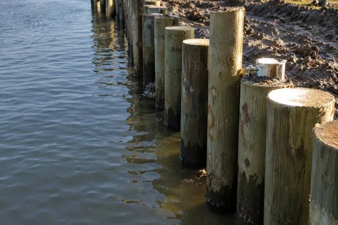
Timber piers have helped people cross waterways, load boats, transport goods, and establish connections between land and water for thousands of years. In rivers, lakes, marshes, and coastal environments, wooden structures could provide access to boats and stabilize places where shorelines were soft or frequently flooded.

When these structures become submerged, they can preserve remarkable evidence of ancient engineering. Waterlogged wood sometimes survives for centuries or millennia because limited oxygen slows the activity of organisms that normally decompose timber. Yet underwater preservation also creates challenges: currents can move objects, sediments can bury structures, and changes in water chemistry can affect the condition of the wood.

Dating submerged timber piers is therefore more complicated than simply identifying old wood. Researchers must determine when the tree grew, when it was cut, when the timber was installed, and whether the structure was repaired or reused later.

Why Timber Piers Matter

A pier creates a stable platform or landing point beside or above water. Depending on its design, it may consist of upright posts, horizontal beams, planks, stone supports, or a combination of materials.

Timber piers could serve fishing communities, agricultural settlements, trading centers, military installations, and towns with busy waterways. Their design depended on water depth, currents, seasonal flooding, the weight of expected loads, and the availability of suitable timber.

A simple structure may have been built for local access, while a larger installation could indicate sustained transportation or commercial activity. Nevertheless, size alone does not establish a pier's importance. A small landing could have served a strategically important crossing, while a large structure might have been temporary.

Why Waterlogged Wood Can Survive

Wood decomposes through the combined effects of microorganisms, oxygen, moisture, temperature, and physical disturbance. In waterlogged sediments with limited oxygen, some of these processes slow considerably.

This does not mean that submerged wood is automatically preserved. Certain bacteria and fungi can degrade timber even in wet environments, and wood may deteriorate rapidly when exposed to oxygen after excavation.

The surrounding sediment also matters. Fine-grained deposits can protect timber from currents and mechanical damage, while shifting sand may expose and erode a structure.

Understanding the preservation environment helps archaeologists decide how to sample, date, and conserve the wood.

Dendrochronology: Dating Through Tree Rings

One of the most valuable methods for dating timber is dendrochronology, the study of annual growth rings. Trees growing in seasonal climates often produce rings that reflect variations in temperature, rainfall, and growing conditions.

By comparing a timber sample's ring pattern with a regional reference chronology, researchers may establish when the tree grew. If the outermost ring and bark edge survive, the felling year may sometimes be determined with considerable precision.

However, not every timber can be dated this way. Some species produce unclear rings, and reference chronologies may not exist for every region or period. A sample with too few rings may also be difficult to match confidently.

The preservation of the outer rings is especially important. If the outer portion of the tree has been removed through shaping, decay, or later damage, the estimated felling date may be earlier than the actual date of construction.

Radiocarbon Dating

Radiocarbon dating measures the remaining radioactive carbon in once-living material. It can be useful when dendrochronology is not possible or when researchers need an independent chronological estimate.

The method generally produces a date range rather than a precise calendar year. Results must be calibrated against changes in atmospheric radiocarbon levels over time.

Timber introduces a particular complication known as the old-wood problem. A beam may have been cut from the inner part of a tree that had already grown for decades or centuries. The dated wood could therefore be much older than the pier itself.

For this reason, radiocarbon dating is strongest when researchers sample short-lived material or the youngest available wood from a securely understood context.

Dating the Construction Event

The age of a tree is not necessarily the age of a pier. Timber may have been stored, reused, or incorporated into a later structure.

Researchers must examine how individual pieces relate to one another. A row of posts may represent a single construction episode, or it may contain repairs made over many years.

Evidence such as overlapping joints, differences in tool marks, sediment layers, and the condition of the wood can help establish the sequence of construction.

Where several timbers can be dated independently, researchers can compare the results. A coherent set of felling dates may support a shared construction phase, while widely separated dates may indicate repair or reuse.

Sediment Stratigraphy and Associated Finds

Sediment surrounding a pier can help reconstruct when the structure was built, used, and abandoned. Researchers examine the order of deposits, the nature of the sediment, and the relationship between the timber and nearby artifacts.

Pottery, coins, tools, and other objects may provide chronological clues. However, objects can move through water or be redeposited, so an artifact found near a pier does not automatically date its construction.

A reliable interpretation depends on whether the object was deposited at the same time as the structure or entered the area later.

Sediment cores can also reveal changes in water depth, flooding, erosion, and shoreline position. These environmental changes may help explain why a pier became submerged.

Underwater Survey and Recording

Before excavation, researchers can use underwater photography, photogrammetry, sonar, and direct measurements to document the structure.

Photogrammetry creates a three-dimensional model from overlapping photographs. It can record the position of posts, beams, joints, and associated artifacts with considerable detail.

Survey data also help distinguish a coherent structure from scattered timber. Currents, storms, dredging, and boat traffic can move wooden objects away from their original positions.

Recording the structure before sampling is essential because excavation can disturb the very relationships needed to interpret its history.

Conservation After Recovery

Waterlogged timber can shrink, crack, and deform when it dries too quickly. During burial, water may occupy spaces within the wood that would otherwise contain air. Removing that water without appropriate treatment can cause the structure to collapse.

Conservation may involve controlled drying or other stabilization methods selected according to the condition and size of the timber.

Researchers should plan conservation before removing major wooden elements. Large structural timbers may be difficult to store or stabilize, and poorly planned excavation can result in the loss of information and material.

Conclusion

Submerged timber piers provide evidence of how communities adapted to waterways, built transportation infrastructure, and managed the challenges of working with wood in wet environments. Their dating requires more than a single scientific test.

Dendrochronology can sometimes identify a precise felling year, while radiocarbon dating, sediment analysis, associated finds, and construction relationships provide additional evidence. The key is distinguishing the age of the tree from the date when its timber entered the structure.

When these methods are combined, submerged piers can reveal not only when people built waterfront infrastructure but also how they maintained, repaired, and adapted it as waterways changed. These structures are valuable records of engineering and daily life, preserved in environments that can both protect and endanger archaeological evidence.
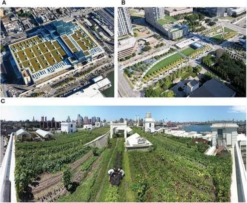
The Archaeology of Small-Scale Dye Workshops in Medieval Towns

October 24, 2026

Introduction

Color played an important role in medieval clothing, textiles, household goods, and decorative arts. Producing colored fabrics required knowledge of plants, insects, minerals, water, heat, and the chemical behavior of dyes. In many towns, dyeing was a specialized craft that connected farmers, collectors, merchants, textile producers, and consumers.

Small-scale dye workshops are particularly interesting because their remains may be less monumental than those of large industrial installations. They may leave traces in ordinary buildings, courtyards, drainage systems, storage areas, and waste deposits.

The archaeology of these workshops can help reconstruct craft production and urban economic life. However, identifying a dye workshop requires more than finding a colored residue or a container. Archaeologists must distinguish dyeing from other activities that used similar equipment or materials.

The Craft of Medieval Dyeing

Dyeing involves introducing color into a material, usually through a liquid preparation containing a colorant. Different dyes behave differently, and successful coloring may require careful control of temperature, concentration, timing, and the properties of the fabric.

Some colorants were obtained from plants, while others came from insects or mineral sources. Their availability varied by region, season, and trade network.

Dyers needed practical knowledge of how to prepare materials and achieve consistent results. Some techniques also required additional substances to help the dye bind to the fibers or change its final color.

The craft was therefore both technical and economic. A workshop had to manage raw materials, fuel, water, labor, and the quality of finished products.

Identifying a Workshop Archaeologically

A small dye workshop may not have a distinctive architectural form. It could occupy a room within a mixed-use building or share space with other crafts.

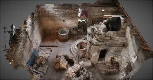
Potential evidence includes large containers, heating installations, drains, storage vessels, tools, chemical residues, and waste associated with dye preparation.

However, many of these features could also belong to cooking, brewing, metalworking, tanning, or other activities.

A strong identification requires a combination of evidence. Researchers must ask whether the arrangement of the space, the associated artifacts, and the residue chemistry fit a plausible dyeing process.

Containers, Heating, and Water

Dyeing often involves preparing liquids and immersing textiles or fibers. Containers may therefore be important parts of the workshop.

Heating installations could maintain the temperature required for particular processes, while water access and drainage would support repeated washing and preparation.

Yet a large vat is not automatically a dyeing vessel. Similar containers could be used for food production, fermentation, cleaning, or other crafts.

The interpretation depends on residue analysis, wear patterns, spatial organization, and comparisons with known workshop contexts.

Pigments, Dyes, and Residue Analysis

A dye is not the same as a pigment. Dyes generally color a material through chemical interaction or absorption, while pigments are usually particles that remain distributed on a surface or within a binding medium.

Archaeological workshops may contain evidence of both, depending on the crafts practiced there.

Chemical analysis can sometimes identify compounds associated with particular dye sources. However, residues may degrade, become contaminated, or lose diagnostic features over time.

A colored stain on a vessel could result from dye preparation, mineral deposits, corrosion, or another process. Researchers should not identify a specific dye source unless the analytical evidence supports it.

Raw Materials and Trade

Medieval dyeing depended on access to raw materials. Some colorants could be collected locally, while others required long-distance trade.

The cost and availability of a dye influenced the range of products a workshop could produce. A craftsperson might specialize in a particular color or use different materials according to customer demand.

Imported dye materials can reveal connections between urban workshops and wider commercial networks. Yet the presence of an imported substance does not necessarily mean the finished textiles were exported. The material may have been used for local production.

Researchers must distinguish the movement of raw materials from the movement of finished goods.

Water Quality and Workshop Location

Water is important in many textile processes. Its mineral composition can influence how dyes interact with fibers, while access to a reliable supply affects production capacity.

Workshops might be located near streams, wells, or drainage systems, although urban conditions and local regulations varied.

Wastewater disposal could create environmental problems if dye residues or other substances entered shared water sources. Medieval communities did not necessarily understand these effects in modern chemical terms, but practical experience may have influenced workshop placement and local rules.

Archaeological evidence can help investigate the relationship between craft production, water access, and waste management.

The Organization of Small Workshops

Not all dye production took place in large specialized facilities. Some work may have been carried out by individual craftspeople, households, or small groups within mixed-use urban buildings.

A small workshop could depend on relationships with weavers, merchants, and customers. The dyer might receive unfinished cloth, process it, and return it for further work.

This arrangement creates a network of interdependent crafts. Archaeological evidence from nearby weaving tools, textile fragments, storage areas, and commercial spaces may help reconstruct these relationships.

However, proximity alone does not prove that two workshops worked together. Documentary evidence, shared materials, or other connections may be needed to establish the relationship.

Craft Regulation and Urban Life

Medieval towns often developed rules governing trades, markets, property, and the use of shared resources. The degree of regulation varied by location and period.

Craft organizations could establish standards, control access to certain materials, or influence training and commercial practices. Yet not every dyer belonged to a formal guild, and the existence of specialized production does not automatically prove guild control.

Written records, where they survive, can complement archaeological evidence by identifying craftspeople, taxes, workshop locations, and disputes.

The combination of material and documentary evidence can provide a more detailed picture of how dyeing fitted into the town's economy.

Color, Clothing, and Social Distinction

Dyed textiles could communicate wealth, profession, group affiliation, or personal taste. Some colors and materials were more expensive or technically demanding than others.

However, color should not be treated as a universal indicator of social rank. The cost of a dyed garment depended on the fiber, dye source, labor, quality, and local market conditions.

Clothing could also be repaired, reused, and passed between individuals. The color of a surviving textile may have changed since its original use.

Archaeologists must therefore avoid assigning a fixed social meaning to a color without evidence from the specific historical context.

Waste and Environmental Evidence

Dye workshops could generate discarded plant matter, spent dye baths, broken containers, ash, and other waste. Such materials may accumulate in pits, drains, or nearby deposits.

Their distribution can help identify areas of repeated craft activity. Chemical traces in sediment may also indicate the handling of certain materials.

Yet waste can move after deposition, and urban deposits often contain materials from multiple activities. Researchers must determine whether the evidence is contemporary with the workshop and whether it originated there.

Reconstructing Workshop Production

A detailed reconstruction may combine artifact analysis, residue chemistry, spatial mapping, experimental work, and documentary research.

Experiments can test how particular dyes behave on different fibers and how their preparation might affect vessels or heating installations. These results can then be compared with archaeological traces.

However, modern experiments cannot reproduce every aspect of medieval production. Raw materials may differ, and ancient recipes may be incompletely understood.

The aim is not to invent a single definitive recipe for every workshop, but to identify the range of techniques consistent with the evidence.

Conclusion

The archaeology of small-scale dye workshops in medieval towns provides a valuable view of specialized craft production and urban economic relationships. Containers, heating features, drains, residues, and waste deposits may reveal how dyers prepared colorants and worked with textile producers.

Yet the identification of a workshop requires careful analysis because similar features occur in many crafts. Residue chemistry must be combined with spatial and archaeological context, while historical documents can help establish the social and commercial organization of production.

When these sources are considered together, small dye workshops can illuminate the connections between technical knowledge, raw-material supply, water management, trade, and clothing. They remind us that medieval towns were not simply centers of administration and commerce; they were also places where skilled craftspeople transformed natural resources into products that shaped everyday life and visual culture.

Urban Rooftop Agriculture in Antiquity: Soil Traces and Seeds

October 24, 2026

Introduction

Urban agriculture is often associated with modern sustainability initiatives, community gardens, and efforts to produce food close to where people live. Yet growing plants within settlements is not a modern idea. Ancient households and cities maintained gardens, cultivated fruit trees, and made use of courtyards and other available spaces.

The idea of rooftop agriculture in antiquity is especially intriguing because rooftops offer limited space and create particular challenges for soil, water, drainage, and structural stability. Some ancient buildings may have supported plants in raised or roof-level spaces, but the existence of a specific rooftop garden must be demonstrated through archaeological evidence.
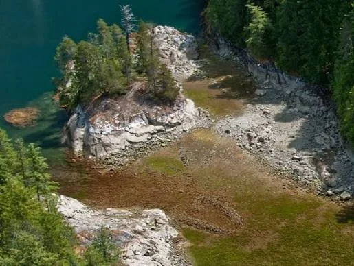
Soil traces, seeds, plant remains, building features, and historical descriptions can help researchers investigate whether roofs were used for cultivation and how such practices might have functioned.

Why Grow Plants in Cities?

Urban residents may grow plants for food, medicine, fragrance, shade, decoration, or religious purposes. Gardens can also provide convenient access to herbs and vegetables without requiring a journey outside the settlement.

In densely occupied areas, available ground space may be limited. Courtyards, terraces, balconies, and rooftops could offer additional growing areas if buildings were designed to support them.

However, rooftop cultivation is not necessarily the most practical solution in every urban environment. Access to water, suitable containers, building materials, and sufficient sunlight all affect feasibility.

Researchers must therefore consider the architectural and environmental conditions of each site.

The Difference Between a Roof Garden and Rooftop Agriculture

A roof garden might contain ornamental plants, sacred vegetation, or small household plantings. Rooftop agriculture implies cultivation with a productive purpose, although gardens can serve multiple functions.

The distinction may be difficult to establish archaeologically. A few seeds could represent food preparation, storage, bird activity, or plant material carried onto a roof by wind.

Evidence becomes stronger when plant remains occur alongside features that support cultivation, such as prepared soil deposits, planting containers, water-management systems, or repeated arrangements of growing areas.

Even these indicators require careful contextual analysis.

Soil Traces on Ancient Roofs

Soil is a valuable source of archaeological information. Its composition can reveal whether material was brought from elsewhere, whether it accumulated naturally, and whether it contains traces of human activity.

Researchers may examine soil depth, grain size, organic matter, mineral composition, and evidence of repeated disturbance.

A roof that once supported plants might contain a deliberately prepared growing layer, although later repairs or collapses could alter the original deposit.

Researchers must also distinguish garden soil from construction fill, insulation materials, and sediment that accumulated after the building was abandoned.

Seeds and Plant Remains

Seeds can reveal which plants were present in a settlement. Archaeobotanical analysis may identify cultivated crops, fruit trees, herbs, weeds, and wild species.

The method of preservation matters. Seeds may survive through charring, waterlogging, mineralization, or desiccation, depending on the archaeological environment.

However, a seed found in a building does not prove that the plant grew there. Seeds can enter a site through food storage, waste disposal, animal activity, or construction materials.

To investigate rooftop agriculture, researchers must establish how the seeds entered the deposit and whether their distribution is consistent with cultivation.

Architecture and Structural Capacity

Rooftop agriculture places additional weight on a building. Soil, water, containers, plants, and people can create substantial loads.

Ancient builders may have used terraces, flat roofs, waterproofing layers, and drainage features in ways that made certain forms of rooftop planting possible. Yet not every flat roof was designed to support heavy soil.

Archaeologists can examine roof construction, support systems, waterproofing materials, access points, and drainage arrangements to assess whether cultivation was feasible.

Even if a roof could physically support plants, that does not establish that it was actually used for agriculture.

Water Management

Plants require water, and rooftops can be exposed to rapid drying, heat, and wind. Cultivation may therefore depend on access to stored water, rainfall collection, or nearby water sources.

Drainage is equally important. Waterlogged soil can damage plants and place additional stress on the building.

Ancient societies developed diverse methods for moving and storing water, including channels, cisterns, containers, and roof drainage systems. These features could potentially support cultivation, but their presence alone does not prove a gardening function.

Researchers must examine how the water system connects with the proposed growing area.

Rooftop Gardens and Urban Heat

Rooftop plants can affect the local microclimate by providing shade and influencing moisture and heat exchange. Ancient residents may have valued roof-level vegetation for comfort as well as food.

However, the scale of any cooling effect would depend on the number of plants, the area covered, the type of roof, and the local climate.

It would be misleading to assume that ancient rooftop gardens functioned like modern green roofs. Their design, materials, and intended purposes may have been very different.

The comparison is useful only when those differences are acknowledged.

Social Access and Ownership

A roof might be part of a private house, a shared residential building, a public structure, or a religious complex. Who could access it would influence how the space was used.

A household garden might support family consumption, while a larger cultivated area could supply several households or serve an institutional purpose.

However, building size alone cannot establish the ownership or distribution of produce. Researchers need evidence from architecture, household organization, historical sources, and associated artifacts.

Trade and Seed Sourcing

Seeds and plant remains can also contribute to research on exchange networks. Some crops were introduced to new regions through trade, migration, and changing agricultural practices.

If a plant species was not locally native, its presence may indicate that people obtained it through cultivation or exchange.

Yet the presence of an imported plant in a city does not establish that it was grown on a roof. It could have been imported as food, stored for later use, or cultivated in a nearby field.

The location of the seed deposit and the evidence for growing conditions remain essential.

The Limits of Archaeological Identification

Rooftop gardens are difficult to identify because roofs often collapse, are repaired, or are reused after buildings are abandoned. Soil layers can be mixed, and organic materials may disappear.

A convincing case requires several types of evidence: suitable architecture, prepared growing material, plant remains, water management, and a reliable chronology.

Even then, the most defensible conclusion may be that a roof was suitable for cultivation rather than that a specific crop was definitely grown there.

Conclusion

Urban rooftop agriculture in antiquity is a valuable subject for examining how people used limited space, managed water, and incorporated plants into the built environment. Soil traces and seeds can provide important clues, but they must be interpreted alongside architecture, drainage, and the history of the building.

Rooftop cultivation is plausible in some contexts, particularly where flat roofs, terraces, and suitable water systems were available. However, the existence of a garden must be demonstrated rather than inferred from a seed or a flat roof alone.

Careful research can reveal whether urban residents used elevated spaces for food production, household gardening, or other purposes. The investigation also encourages a broader understanding of ancient cities as landscapes containing not only streets and buildings, but potentially a variety of small growing spaces that connected everyday life with the natural world.

Prehistoric Granite Quarry Sanctuaries: Sacred Extraction Sites

October 24, 2026

Introduction

Granite has been used in many regions for monuments, buildings, tools, and other durable objects. Its hardness makes it difficult to work compared with softer stone, but its strength and appearance can make it valuable for particular purposes.

A prehistoric granite quarry is a place where people extracted stone before or during the construction of buildings, monuments, or other objects. The title's reference to sanctuaries raises a further question: could certain extraction sites also have held sacred significance?

This is possible in principle, because resource gathering and ritual activity can overlap in human societies. However, a quarry should not be described as a sanctuary merely because it contains unusual stone features or lies near a ceremonial monument. The interpretation requires evidence that distinguishes ordinary extraction from culturally significant practices.

Granite and Its Geological Properties

Granite is an igneous rock composed primarily of minerals such as quartz and feldspar, often with mica and other components. Its properties vary according to geological formation and mineral composition.

The stone's hardness and durability can make it useful for long-lasting structures. However, working granite requires appropriate tools, considerable effort, and knowledge of how fractures develop.

The location of granite outcrops therefore influences where extraction could occur. A quarry may be situated close to the intended construction site or at a distance if the stone's quality justified the effort of transport.

Recognizing a Prehistoric Quarry

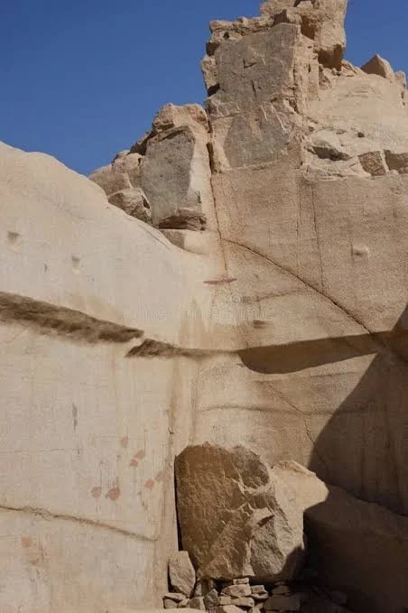
Archaeologists may identify quarries through extraction scars, unfinished blocks, discarded fragments, tool marks, and patterns of stone removal.

The surrounding landscape can provide additional clues. Routes leading away from an outcrop may indicate how blocks were transported, while nearby workshops may contain evidence of shaping and finishing.

However, an exposed granite outcrop is not automatically a quarry. Natural fractures and weathering can resemble human extraction features.

A reliable interpretation requires careful examination of the stone surfaces, associated artifacts, and the geological processes that shaped the outcrop.

Extraction Techniques

Prehistoric quarrying methods varied according to the stone, available tools, and desired block size. Workers could exploit natural fractures, remove unwanted material, or use repeated percussion to separate stone.

Some extraction methods leave distinctive marks, but weathering can obscure them. Later quarrying may also damage earlier features, making it difficult to distinguish different periods of activity.

Experimental studies can help researchers understand how particular marks might have been produced. Comparisons with known quarry sites may also clarify the sequence of extraction.

From Quarry to Monument

The relationship between a quarry and a nearby monument can reveal aspects of planning and labor organization.

If the stone types match, researchers may investigate whether the quarry supplied the monument. Geological comparison can help identify the source of stone, although visually similar granite may occur at multiple locations.

Transporting large blocks may require sledges, rollers, boats, ropes, or other equipment, depending on the terrain and historical period. The precise methods should be inferred from evidence rather than assumed.

A quarry associated with a monument may demonstrate a coordinated building project, but it does not necessarily reveal the political structure behind that project.

Why Might a Quarry Be Sacred?

A quarry can occupy a culturally important position because it is the place where material for a significant monument originated. The act of extracting stone may also have been governed by customs or ceremonies.

In some societies, natural features such as mountains, springs, caves, and distinctive rock formations are associated with ancestors or spiritual beings. A quarry located within such a landscape might have acquired religious significance.

Nevertheless, this possibility must not be projected onto every prehistoric extraction site. Practical work and sacred meaning can coexist, but their relationship varies across cultures.

Archaeological Evidence for Ritual Activity

Researchers may investigate several kinds of evidence when considering whether a quarry had ritual significance:

  • Repeated deposits of selected objects in particular locations.

  • Distinctive arrangements of stones that are not easily explained by extraction.

  • Evidence of structured gatherings or repeated ceremonial activity.

  • Human or animal remains deposited in unusual contexts.

  • Historical or ethnographic evidence connecting similar places with ritual practices.

None of these indicators is decisive in isolation. A deposit might represent ordinary disposal, while an unusual stone arrangement might have served a practical function.

The interpretation becomes stronger when several independent lines of evidence converge.

Quarries and Social Organization

Large-scale stone extraction may require cooperation among workers, transport specialists, craftspeople, and people responsible for supplying food and other necessities.

This can reveal the capacity of a community to coordinate labor. However, labor organization does not necessarily imply a centralized state or a permanent professional workforce.

People may have participated in quarrying during particular seasons, as part of communal obligations, or under the direction of local leaders.

Archaeologists must consider the scale of extraction, the duration of activity, the tools used, and the settlement context before reconstructing the social system.

The Symbolic Value of Stone

Stone can acquire significance through its color, texture, durability, geological origin, or association with a particular place.

A community might select granite because it was strong, readily available, visually distinctive, or connected with a meaningful landscape.

These explanations are not mutually exclusive. Practical suitability may have influenced the choice of stone even when the finished monument carried cultural or religious significance.

The challenge is to identify which aspects can be demonstrated through material evidence and which remain interpretive possibilities.

Dating Quarry Activity

Dating a quarry is difficult because extraction surfaces are often exposed and contain few organic materials. Researchers may use associated deposits, tools, unfinished objects, or evidence linking the quarry to a dated structure.

A quarry may have been used repeatedly over centuries. Different extraction scars could therefore belong to different periods.

Stone provenance can connect an outcrop with an artifact or monument, but it does not independently establish when the extraction occurred.

Chronology requires contextual evidence that links the quarry with specific phases of activity.

Conservation of Quarry Landscapes

Historic quarries can be damaged by modern extraction, construction, vegetation growth, erosion, and uncontrolled access. Quarry marks and unfinished blocks may be lost before researchers document them.

Recording should include mapping, photography, geological analysis, and information about nearby archaeological features.

If a site is considered culturally significant by a local or Indigenous community, that relationship should be respected in research and management decisions.

Conclusion

Prehistoric granite quarries provide valuable evidence of stone technology, labor organization, resource selection, and the relationship between geological landscapes and monumental construction. Their extraction scars and unfinished blocks can reveal how people worked difficult materials and transported them into wider landscapes of human activity.

The possibility that some quarries also functioned as sanctuaries is worth investigating, but it should not be treated as a universal feature of prehistoric stone extraction. Sacred significance must be supported by contextual evidence rather than inferred from the monumentality of the stone alone.

By studying quarrying practices alongside ritual deposits, landscape relationships, and the history of nearby monuments, archaeologists can explore how practical work and cultural meaning may have intersected. A quarry may ultimately tell a story not only about where stone came from, but also about how people organized labor and understood the places from which important materials were taken.

The Plasticity of Flint: Healed Stone Tools and Resharpening Life Histories

October 24, 2026

Introduction

Flint was an important raw material for many prehistoric communities because it can fracture in predictable ways and produce sharp cutting edges. People used flint to manufacture knives, scrapers, projectile points, and many other tools.

The title's reference to "healed stone tools" requires clarification. Stone does not heal in the biological sense. Instead, flint tools can develop wear, edge damage, repairs, and resharpening scars that alter their appearance through repeated use.

These changes create a life history for each tool. A flint artifact may have been manufactured, used, repaired, reshaped, transported, and eventually discarded. Archaeologists can study these stages to understand how people maintained tools and made decisions about valuable materials.

Why Flint Is Suitable for Toolmaking

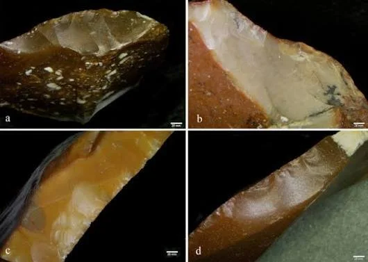
Flint is a fine-grained form of silica-rich rock that can fracture conchoidally, producing curved surfaces and sharp edges. Skilled toolmakers can control the removal of flakes by striking the stone with a hammerstone or using other techniques.

The quality of flint varies. Some varieties fracture cleanly, while others contain inclusions or irregularities that make controlled shaping more difficult.

Access to good raw material could influence where people settled, traveled, and exchanged goods. In some regions, flint was obtained locally; elsewhere, communities transported it over considerable distances.

The Manufacturing Process

Stone tool production often begins with the selection of a suitable nodule. The toolmaker removes flakes to create a desired shape, then refines the edge through additional flaking.

Different tools require different approaches. A projectile point may need a symmetrical shape and carefully prepared edges, while a scraper may be designed for repeated contact with hide or another material.

The production sequence leaves recognizable scars on the stone. Researchers can examine these scars to reconstruct how flakes were removed and whether the tool was modified after its initial manufacture.

Resharpening and Tool Maintenance

A sharp edge becomes dull through use. It may also develop chips or fractures.

Rather than discarding a tool immediately, its owner could remove small flakes to restore the edge. Repeated resharpening changes the tool's size and shape.

A tool that begins as a large flake may eventually become much smaller. Its final form may therefore look very different from the original design.

This process is important because archaeologists often classify tools by their final appearance. Without considering resharpening, they may mistakenly treat a modified tool as a separate type rather than a later stage in the life of the same object.

What Could "Healed" Mean?

The term "healed" can be used metaphorically to describe repaired or modified stone tools, but it should not be confused with biological healing.

A stone tool cannot regenerate missing material. Its owner can, however, reshape damaged edges, remove fractured sections, or alter its form to make it useful again.

A tool may also acquire surface deposits after burial that partly obscure earlier damage. Such deposits do not indicate repair; they are part of the object's post-depositional history.

Researchers must distinguish manufacturing scars, use-wear, resharpening, and burial-related changes.

Reading a Tool's Life History

Archaeologists can investigate tool biographies through several methods.

  • Technological analysis: Studies how the tool was made and modified.

  • Use-wear analysis: Examines microscopic damage associated with contact with materials.

  • Residue analysis: Investigates surviving substances that may be associated with use.

  • Refitting: Attempts to reconnect flakes removed during manufacturing or resharpening.

  • Raw-material sourcing: Investigates where the flint may have originated.

Each method answers different questions. For example, a tool may show repeated edge modification, but its precise function may remain uncertain if wear patterns are poorly preserved.

The strongest interpretations combine several lines of evidence.

Flint and the Value of Raw Materials

The effort invested in a tool can depend on the availability of raw material, the skill required to manufacture it, and the importance of the task it performed.

When high-quality flint is scarce, people may be more likely to maintain and resharpen tools. Where suitable material is abundant, replacing a damaged tool may be easier.

However, tool maintenance is not determined by scarcity alone. A familiar tool may be retained because it is comfortable to use, has a specialized shape, or carries personal or social significance.

Archaeologists should therefore avoid assuming that every resharpened tool reflects poverty or a shortage of raw material.

Mobility and Portable Technology

Tools can travel with their owners. A flint artifact found far from its geological source may indicate movement, exchange, or the transport of raw material before manufacture.

A portable tool may be maintained across several journeys. Resharpening can reduce its size while extending its useful life.

The relationship between tool size, wear, and archaeological location may therefore help researchers investigate mobility.

However, the presence of imported flint does not prove that its user traveled to the source. The material may have passed through exchange networks.

Use-Wear and Functional Interpretation

Microscopic marks on a tool's edge can sometimes reveal how it contacted another material. Cutting plant fibers, scraping hide, working wood, and processing animal tissue can produce different wear patterns.

Yet these differences are not always clear. Tool edges can be damaged during manufacture, use, burial, or excavation.

Researchers must compare archaeological specimens with experimental tools used under controlled conditions. Even then, an exact function may remain uncertain.

A tool may also have served several purposes during its lifetime.

Discard, Recycling, and Archaeological Survival

Tools were discarded for many reasons. They might become too small to use, break beyond repair, or lose their usefulness as activities changed.

Some fragments could be recycled into new tools. Others might be used as cores from which additional flakes were removed.

The final deposit represents only the last known stage of the object's history. Earlier activities may be reconstructed from scars and residues, but they are not always preserved completely.

Post-depositional processes can further alter the artifact. Soil movement, trampling, water transport, and later human activity may change its location or surface condition.

Experimental Archaeology

Experimental archaeology can help researchers understand resharpening. Researchers manufacture tools using traditional techniques, use them for controlled tasks, and record how their edges change.

Comparing experimental specimens with archaeological artifacts can help identify plausible sequences of use and maintenance.

However, experiments cannot reproduce every aspect of prehistoric life. Modern users may have different skills, habits, and physical conditions from ancient toolmakers.

Experimental results are therefore most useful when combined with archaeological evidence rather than treated as exact replicas of past behavior.

Conclusion

The plasticity of flint tools lies in their ability to be reshaped, maintained, and reused. Their forms are not always fixed at the moment of manufacture. Repeated use and resharpening can transform an artifact, leaving evidence of changing needs, technical choices, and material management.

Although stone does not heal biologically, the idea of a tool's "healing" can serve as a metaphor for repair and continued use. Archaeologists can reconstruct parts of this process through technological analysis, use-wear, refitting, and raw-material studies.

By studying the full life history of flint tools rather than only their final shapes, researchers gain a richer understanding of prehistoric technology. A small stone artifact can reveal not just what a tool looked like, but how people maintained useful objects, responded to damage, and extended the value of materials across repeated activities.

Biofilm Analysis of Amphora Interiors: Fermentation vs. Contamination

October 24, 2026

Introduction

Amphorae were widely used in ancient Mediterranean commerce to transport and store liquids and other commodities. These ceramic containers played important roles in the movement of wine, oil, fish products, and other goods. Their standardized shapes and manufacturing traditions can help archaeologists investigate trade, production, and consumption.

The interior of an amphora may retain residues from its contents. In some cases, researchers investigate mineral deposits, organic compounds, microbial traces, or surface films that could provide clues about how the vessel was used.

The analysis of biofilms introduces an important question: can surviving biological material help distinguish fermentation from contamination? The answer is sometimes, but the problem is complex. A biological residue does not automatically prove that fermentation occurred, and modern contamination can complicate interpretation.

What Is a Biofilm?

A biofilm is a community of microorganisms attached to a surface and often embedded within a surrounding matrix. Biofilms can form on many materials, including stone, metal, glass, and ceramics.

In modern environments, biofilms may develop when microorganisms encounter suitable moisture, nutrients, and surfaces. Archaeological vessels can also accumulate biological material during use, burial, excavation, or later storage.

However, an ancient residue may no longer retain a recognizable biofilm structure. Microorganisms can die, degrade, or become mixed with mineral deposits and other organic materials.

Researchers must therefore distinguish between a genuine ancient biological residue and substances introduced after the vessel was discarded.

Amphorae and Ancient Fermentation

Fermentation is a biological process in which microorganisms transform substances such as sugars into other compounds. In alcoholic fermentation, yeasts can convert sugars into ethanol and carbon dioxide.

Ancient communities used fermentation to produce beverages and preserve certain foods. Wine production was especially important in many Mediterranean societies, although the practices and technologies varied by region and period.

An amphora could have been used to store or transport a fermented product, but it might also have contained oil, fish sauce, brine, or another commodity. Its shape alone does not establish its contents.

The strongest interpretation combines the vessel's form, manufacturing context, inscriptions, residues, and archaeological associations.

What Residues Can Reveal

Chemical residues may preserve clues about past contents. Researchers can analyze organic compounds, mineral deposits, and other traces that remain on the vessel's interior.

Some compounds are associated with particular products, but many are not uniquely diagnostic. Lipids, for example, can survive in ceramics and may indicate the presence of fats or oils, yet their interpretation depends on the full chemical profile.

Residues can also reflect repeated use. A vessel might have been cleaned, reused for a different product, or exposed to substances during burial.

Consequently, one residue should not be treated as a complete record of an amphora's entire history.

The Potential Role of Microbial Evidence

Microorganisms can be associated with fermentation, spoilage, and other biological processes. In principle, biological traces in an amphora might help investigate whether a vessel held a fermented product.

However, the survival of ancient microbial DNA or other biological indicators is uncertain. DNA can degrade, while modern microbes may enter a vessel during excavation, storage, or laboratory handling.

Even when microbial material is detected, researchers must determine whether it is ancient, whether it is connected with the original contents, and whether it indicates fermentation rather than later contamination.

The presence of a microorganism associated with wine production, for example, does not independently prove that the vessel contained wine. Similar organisms may occur in other environments.

Fermentation Versus Contamination

Fermentation and contamination are not always easily separated. Fermentation itself depends on microorganisms, and unwanted microbes can participate in spoilage or alter the product.

An amphora may have contained a deliberately fermented beverage, a product that underwent unintended microbial activity, or a mixture of residues accumulated through several uses.

The distinction requires chemical and contextual evidence.

Researchers should consider whether the residue profile fits a known product, whether the vessel's use is supported by inscriptions or associated artifacts, and whether contamination could have occurred after burial.

Sampling and Laboratory Controls

Biofilm and residue analysis require strict contamination control. Samples should be collected with clean equipment, documented thoroughly, and processed in facilities appropriate to the analytical method.

Researchers may analyze surrounding sediment, unused areas of the vessel, and modern handling materials to identify possible sources of contamination.

Laboratory blanks and reference samples can help reveal whether detected compounds were introduced during processing.

Without these controls, a result may reflect modern contamination rather than ancient activity.

The Importance of Ceramic Porosity

Ceramic vessels are not perfectly impermeable. Depending on the clay, firing conditions, surface treatment, and vessel history, liquids and compounds may penetrate the ceramic body.

This can help preserve some residues, but it also complicates interpretation. Material absorbed during one use may remain after the vessel is washed or repurposed.

Surface deposits may also form through chemical reactions between the vessel and its contents.

Researchers therefore examine both the surface and, where appropriate, the ceramic matrix to understand how residues were preserved.

Trade and Product Identification

Amphorae are important for reconstructing ancient trade. Their forms, clay composition, and manufacturing marks can sometimes connect vessels with particular production regions.

If residue analysis suggests that an amphora carried a particular product, the combination of provenance and contents may illuminate commercial networks.

However, a vessel made in one region may have been reused elsewhere. Its origin does not necessarily identify the location where its contents were produced.

Similarly, a vessel type commonly associated with wine could have held another commodity. Archaeological interpretations should remain open to evidence that challenges conventional assumptions.

Fermentation Technology and Ancient Knowledge

Fermentation does not require modern scientific theory. People can develop reliable techniques through observation, experience, and repeated practice.

Ancient producers may have understood practical indicators of fermentation, such as bubbling, changes in taste, or the behavior of stored liquids, without knowing the microbiological mechanisms involved.

Archaeological residues can help investigate these technologies, but they cannot fully reconstruct the knowledge of ancient producers. Written sources, installations, vessels, and comparative evidence may provide additional context.

Conclusion

Biofilm analysis of amphora interiors offers a promising approach to studying ancient storage, fermentation, and the use of ceramic containers. Biological and chemical residues may preserve clues about what a vessel held and how it was used.

Yet distinguishing deliberate fermentation from contamination is not a simple matter of detecting microorganisms. Researchers must account for the survival of ancient material, the possibility of reuse, modern contamination, ceramic porosity, and the limitations of chemical identification.

The strongest conclusions come from combining residue analysis with vessel provenance, archaeological context, inscriptions, and rigorous laboratory controls. Through this approach, amphora interiors can reveal important aspects of ancient food technology and trade while preserving the uncertainty that is essential to responsible scientific interpretation.

Salt Preserved Textiles in Coastal Caves: Patterns and Dyes

October 24, 2026

Introduction

Textiles are among the most informative forms of archaeological evidence, yet they rarely survive for long in ordinary burial environments. Fibers made from plants or animals can decay through microbial activity, moisture, oxygen exposure, and other environmental processes.

In certain settings, however, textiles may survive long enough to reveal details about weaving, clothing, trade, dyeing, and cultural identity. Coastal caves are one possible environment where unusual conditions can preserve organic materials. Salt may influence preservation, but its effects are complicated and depend on the concentration of salts, humidity, temperature, and the material itself.

The study of salt-preserved textiles therefore requires a careful distinction between genuine preservation mechanisms and the assumption that salt always protects organic remains.

Why Textiles Are Archaeologically Valuable

Textiles provide information that stone, pottery, and metal objects cannot always reveal. Their fibers can indicate the use of plant or animal materials, while weave structures reveal technical knowledge and production choices.

Patterns may show how threads were arranged or how separate pieces were joined. Seams, repairs, and wear can provide clues about how an item was used and maintained.

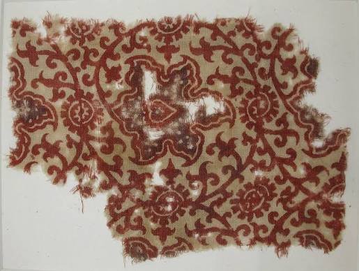
Textiles may also preserve evidence of dyes, finishing techniques, and decorative methods. These details can contribute to understanding the economy of a community, including the production of fibers, spinning, weaving, and the sourcing of colorants.

Because textiles are fragile, even a small fragment can be exceptionally valuable.

Coastal Caves as Preservation Environments

Caves can protect objects from direct sunlight, rainfall, and some forms of physical disturbance. Their internal environments may be relatively stable, although conditions vary substantially from one cave to another.

A coastal cave may also be affected by sea spray, salt-rich air, groundwater, and changes in humidity. These conditions can influence both the survival and deterioration of organic materials.

A cave's apparent dryness does not necessarily mean it provides a suitable preservation environment. Salt can attract moisture under certain conditions, and repeated cycles of wetting and drying may damage fibers.

Researchers must therefore measure the cave's environmental conditions and examine the specific context in which a textile was found.

How Salt Affects Organic Fibers

Salt has complex effects on preservation. In some environments, high concentrations of dissolved salts can reduce the availability of water for certain microorganisms. This may slow some forms of biological activity.

However, salt is not a universal preservative. When salts crystallize inside or around a material, they can exert pressure and cause physical damage. Changes in humidity can cause salts to dissolve and recrystallize, weakening delicate fibers.

Different textile materials respond differently. Wool, linen, cotton, and other fibers have distinct chemical and physical properties. The effects of salt also depend on whether it is present as a surface deposit, dissolved in groundwater, or embedded within the fibers.

A claim that salt preserved a textile must therefore be supported by analysis of the object and its burial environment.

Identifying Ancient Fibers

Microscopy can help identify textile structure and, in favorable cases, distinguish between plant and animal fibers. Researchers examine the shape, surface characteristics, and organization of the threads.

More specialized analytical methods may provide additional information about fiber composition or degradation.

However, preservation can alter the features used for identification. Soil minerals may coat the fibers, and microbial activity may remove diagnostic structures.

Researchers must also distinguish original fibers from modern conservation materials, especially when textiles have been handled or treated since excavation.

Reconstructing Weaving Patterns

The arrangement of threads forms the structure of a textile. Basic weave types include plain weave, twill, and more complex patterns created through different arrangements of warp and weft threads.

A preserved fragment may reveal how the cloth was produced, how tightly it was woven, and whether different techniques were combined.

Researchers can document thread thickness, density, twist direction, and the relationship between yarns. These features may help compare textiles from different sites.

Yet a shared weave does not necessarily indicate that two textiles were produced in the same workshop. Similar techniques can spread widely or develop independently.

Dyes and Color Reconstruction

Ancient textiles could be colored with materials derived from plants, insects, minerals, and other sources. Dyeing techniques varied according to available resources and the properties of the fibers.

Some colorants bind more effectively to certain materials than others. Additional substances, sometimes called mordants, may help dyes attach to fibers or alter the resulting color.

Identifying a dye requires more than examining the textile's present appearance. Colors can fade, shift chemically, or be obscured by salt deposits and soil staining.

Chemical analysis may identify compounds associated with particular dye sources, but degradation can make identification difficult. In some cases, researchers may only be able to identify a broad class of colorant rather than a specific plant or insect.

Trade and the Movement of Textiles

Textiles can travel long distances. Cloth may be exchanged as a finished product, while fibers and dyes can move separately through trade networks.

A textile found in a coastal cave might have been locally produced, imported, reused, or carried by a traveler. Its location alone does not establish where it was manufactured.

Researchers can investigate possible origins through fiber identification, weaving techniques, dye analysis, and comparison with securely documented textiles from other regions.

Even when a material source is identified, the route by which the textile traveled may remain uncertain. Goods often passed through several intermediaries before reaching their final destination.

Clothing, Status, and Identity

Textiles may reflect differences in wealth, occupation, climate adaptation, or social convention. Fine weaving and costly dyes can indicate substantial investment in production.

However, not every richly colored textile was a status object, and not every plain textile belonged to a poor individual. Materials may have been inherited, repaired, reused, or repurposed.

Clothing can also communicate identity through patterns, construction, and customary styles. Yet interpreting a particular design as an ethnic or religious marker requires contextual evidence.

Archaeologists should avoid projecting modern meanings onto ancient textile patterns without historical support.

Dating Textiles

Textiles can sometimes be dated directly through radiocarbon analysis, provided that a suitable sample can be taken and contamination is controlled. Associated materials and the stratigraphic context may offer additional chronological information.

The context is especially important in caves, where objects may be displaced by water, animals, visitors, or later occupation.

A textile found near a dated artifact is not necessarily the same age. Direct dating and careful contextual analysis provide a stronger foundation for interpretation.

Conservation Challenges

Textiles that survive in salt-rich environments may deteriorate rapidly when excavated. Changes in moisture, temperature, and salt concentration can destabilize the fibers.

Conservation specialists may need to control humidity, remove harmful deposits carefully, and support fragile structures during handling. Salt removal is not always simple because aggressive treatment can damage the textile itself.

Documentation before treatment is essential. Photographs, microscopic images, and detailed records preserve information that might be altered during conservation.

Conclusion

Salt-preserved textiles in coastal caves can offer rare evidence of ancient weaving, dyeing, clothing, and exchange. Their patterns and fibers may reveal technical skill and help reconstruct aspects of everyday life that are often invisible in the archaeological record.

Yet salt does not automatically preserve textiles. Under some conditions, it may contribute to deterioration through moisture retention and crystallization. The survival of a textile depends on a combination of environmental, chemical, and burial factors.

A reliable investigation therefore combines fiber identification, weave analysis, dye chemistry, dating, and environmental reconstruction. When these methods are applied carefully, even a small fragment of cloth can illuminate the production choices, material networks, and cultural practices of the people who made and used it.

Megalithic Doorways: Threshold Rituals in Atlantic Europe

October 24, 2026

Introduction

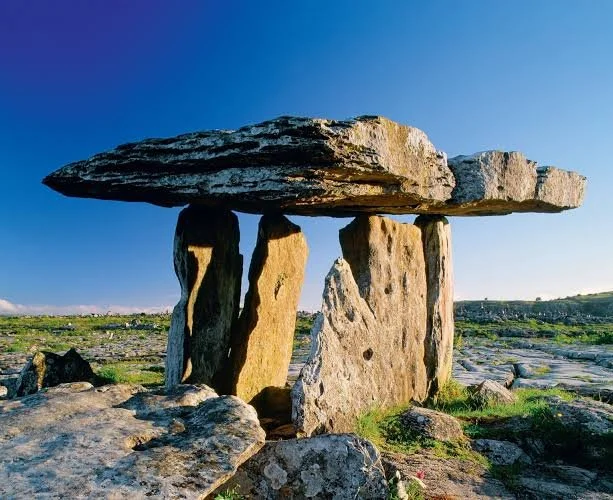
Across Atlantic Europe, prehistoric communities constructed monumental stone structures that continue to shape how people understand the ancient past. Passage graves, stone chambers, standing stones, and other megalithic monuments demonstrate substantial investment in building, planning, and the organization of communal activity.

Among the most intriguing architectural features are narrow entrances and carefully defined thresholds. A doorway can separate the outside world from an enclosed interior, control movement, frame a view, or create a particular experience for someone entering a monument.

The idea of threshold rituals offers a way to investigate these architectural choices. However, a megalithic doorway does not automatically prove that a ceremony occurred there. Archaeologists must examine its construction, orientation, associated deposits, patterns of access, and wider cultural context before proposing a ritual function.

What Is a Megalithic Monument?

Megalithic monuments are structures built using large stones. Across Atlantic Europe, they include passage graves, chambered tombs, stone circles, standing stones, and other forms of monumental architecture.

Their dates, purposes, and construction methods vary by region. Some were primarily associated with burial, while others may have supported gatherings, ceremonial activities, territorial marking, or several functions over time.

These monuments required knowledge of stone selection, transportation, placement, and structural stability. Their construction may also have depended on shared labor and coordination between households or communities.

The term "megalithic" therefore describes a broad architectural tradition rather than a single cultural system with identical beliefs throughout Atlantic Europe.

The Doorway as a Boundary

A doorway is more than an opening in a wall. It marks a transition between spaces.

In ordinary buildings, thresholds can distinguish private from public areas, control access, or separate different activities. In monumental structures, the same architectural feature can create a carefully managed entrance experience.

A narrow passage may require visitors to move in single file. A low entrance may require a person to bend. A doorway aligned with a chamber can direct attention toward a particular feature inside.

These effects can be practical, symbolic, or both. The challenge is determining which interpretations are supported by the archaeological evidence.
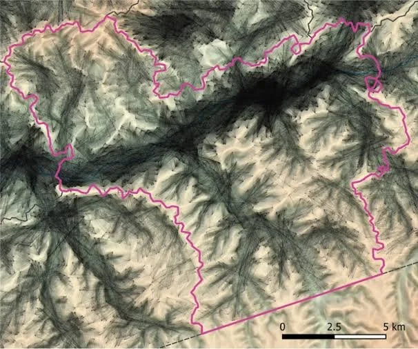
Passage Graves and Controlled Access

Some Atlantic European monuments contain long passages leading to internal chambers. Their architecture creates a distinction between the exterior landscape and the enclosed interior.

In certain cases, access may have been restricted by the dimensions of the passage, the presence of blocking stones, or the way the chamber was constructed.

Such arrangements could have practical purposes, including structural stability and protection of human remains. They could also have influenced who entered the monument and how visitors experienced the space.

However, the presence of a restricted entrance does not prove that access was limited to priests, leaders, or an elite group. Such claims require evidence about the monument's use and the society that built it.

Light and Orientation

Some megalithic monuments are oriented in ways that produce striking relationships with sunlight at particular times of year. These alignments have generated considerable interest because they may indicate deliberate astronomical observation.

The most famous examples include monuments whose internal spaces receive sunlight during particular seasonal periods. Yet each proposed alignment requires careful measurement and chronological analysis.

A doorway facing a certain direction may reflect topography, available building space, prevailing weather, or other practical considerations. Researchers must also consider whether the alignment was intentional and whether the relevant architectural elements belong to the same construction phase.

Astronomical significance should be established through a clear pattern of evidence rather than inferred from a single coincidence.

Burial, Ancestors, and Monumental Space

Many passage graves contain human remains, demonstrating that at least some megalithic monuments had funerary functions.

A doorway in such a monument may have regulated movement into a place associated with the dead. The act of entering could have been connected with remembrance, offerings, burial ceremonies, or other practices.

Nevertheless, the specific beliefs associated with prehistoric burials are difficult to reconstruct. Archaeologists should not assume that all communities understood death, ancestors, or the afterlife in the same way.

Human remains and grave goods can reveal patterns of treatment, but they rarely provide a complete account of the ceremonies or beliefs that accompanied burial.

Repeated Movement and Ritual Experience

A threshold can influence movement through a monument. Visitors may pause, change direction, lower their bodies, or pass through a narrow space before reaching an interior chamber.

Repeated movement through the same architectural sequence could create a shared experience. If access occurred during ceremonies, the building itself may have helped organize the event.

Yet an architectural experience does not necessarily establish ritual. Narrow doorways can arise from construction constraints, available materials, or the dimensions of an existing chamber.

Researchers must compare the doorway with other features and evidence of use before interpreting it as a ceremonial threshold.

Offerings and Deposits Near Entrances

Deposits near entrances can sometimes provide clues about how monuments were used. These might include pottery, animal remains, charcoal, selected objects, or other materials.

If deposits occur repeatedly in a particular position and are securely associated with the monument's use, they may suggest structured activity.

However, artifacts near a doorway could have arrived through ordinary disposal, later disturbance, animal activity, or natural processes.

The date of a deposit is also important. A monument might have remained meaningful for centuries after its original construction, and later visitors could have introduced objects unrelated to its earliest use.

Atlantic Europe Was Not a Single Cultural Region

The megalithic traditions of Ireland, Britain, Brittany, Iberia, and other Atlantic regions show both similarities and differences.

Architectural forms may reflect contact, shared knowledge, independent experimentation, or a combination of these processes.

It would be misleading to assume that every doorway had the same symbolic meaning simply because monuments share a broad architectural category.

Local landscape, burial customs, construction traditions, and chronology must guide interpretation.

Conservation and Modern Interpretation

Megalithic monuments are vulnerable to weathering, vegetation, tourism pressure, and inappropriate restoration. Changes to entrances or surrounding surfaces can alter how the monument is experienced and may damage archaeological evidence.
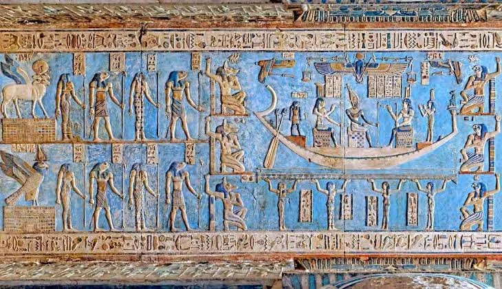
Conservation should preserve the structure while documenting any necessary intervention.

Public interpretation should also communicate uncertainty. Visitors can learn about proposed ritual meanings without being told that a hypothesis is a proven fact.

Conclusion

Megalithic doorways offer an important opportunity to investigate how prehistoric architecture shaped movement, access, and the experience of monumental space. In Atlantic Europe, entrances to chambered tombs and other stone structures may have separated different activities or created meaningful transitions between exterior and interior environments.

Some doorways may have participated in ritual practices, especially where their arrangement is supported by associated burials, repeated deposits, or evidence of structured movement. Yet the architecture alone cannot reveal the full beliefs of the people who built it.

A careful archaeological approach examines construction, chronology, orientation, and use together. Through this method, thresholds become more than architectural details: they become evidence for asking how communities organized spaces, managed access, and potentially gave particular places significance beyond their practical function.

The Hidden Landscape of Submerged Prehistoric Vineyards

October 24, 2026

Introduction

Rising sea levels, coastal erosion, and tectonic changes have transformed shorelines throughout human history. Places that once stood on dry land may now lie beneath shallow seas, lakes, or estuaries. Submerged prehistoric landscapes can preserve evidence of ancient settlements, routes, fields, and other activities that are difficult to recognize from the modern shoreline.

The title raises the possibility that some submerged landscapes may contain evidence of prehistoric grape cultivation. This is an intriguing research topic, but the existence of particular underwater vineyards must be demonstrated. A submerged agricultural landscape cannot be identified as a vineyard simply because it contains terraces, stones, or plant remains.

Investigating the possibility requires combining underwater archaeology, palaeoenvironmental reconstruction, archaeobotany, and the study of ancient grape use.

How Landscapes Become Submerged

Coastlines change for several reasons. Global sea levels rise and fall as water is stored in or released from ice sheets and glaciers. Land can also rise or sink because of tectonic activity, sediment compaction, or other geological processes.

In some locations, these changes gradually inundate former plains and valleys. Elsewhere, earthquakes or coastal erosion can alter the landscape more rapidly.

Submerged archaeological remains therefore need to be understood within a local geological history. A feature underwater today may have formed when the area was dry land, but the date and conditions of inundation must be established.

What Counts as a Prehistoric Vineyard?

A vineyard is a landscape in which grapevines are cultivated, usually in an organized arrangement. Archaeological evidence for vineyards may include planting patterns, agricultural terraces, supporting structures, grape remains, pollen, and evidence of grape processing.

However, grapes can grow naturally, and wild grapevines may be collected without being cultivated. The presence of grape seeds does not automatically demonstrate a vineyard.

The distinction between gathering wild grapes, managing wild vines, and deliberately cultivating domesticated vines is important. These practices may leave overlapping traces, so researchers need multiple forms of evidence.

Grape Domestication and Early Use

The history of grape cultivation is complex and regionally varied. Wild grapevines existed across parts of Eurasia, and people used grapes for food long before every region developed established viticulture.

Domestication involves changes in plant characteristics and human practices over time. Archaeobotanists examine seeds, stems, pollen, and other plant remains to investigate these developments.

Grape seeds can provide useful evidence, but their shape varies and preservation may be incomplete. Reliable identification often requires comparison with modern and archaeological reference material.

Even if grape remains are securely identified, additional evidence is needed to establish whether they came from a cultivated vineyard.

Archaeobotany Beneath the Water

Underwater deposits can preserve plant material in favorable conditions, particularly when sediment is waterlogged and oxygen is limited. Seeds, wood, and other organic remains may survive in environments where they would decay on land.

However, water can also transport plant remains away from their original location. Currents, flooding, erosion, and sediment movement may redeposit material from different environments.

Researchers must therefore examine whether grape remains are directly associated with an archaeological feature or were transported into the site later.

Sediment cores can provide information about vegetation and environmental change, but pollen from grape relatives may be difficult to identify precisely. Pollen evidence must be interpreted alongside other indicators.

Recognizing Agricultural Terraces Underwater

Terraces are constructed or modified surfaces that can support cultivation on sloping terrain. In submerged environments, stone alignments and level surfaces might resemble agricultural terraces.

Yet similar forms can result from natural geology, shoreline processes, defensive structures, or other human activities.

To identify an agricultural terrace, archaeologists examine its shape, construction, relationship with the surrounding terrain, and associated environmental evidence. If grape cultivation is proposed, the case becomes stronger when the feature is connected with grape remains or other evidence of viticulture.

A terrace alone cannot establish what crop was grown there.

Underwater Survey Techniques

Submerged landscapes can be investigated using several methods.

  • Bathymetric mapping: Measures underwater topography and identifies unusual landforms.

  • Side-scan sonar: Helps locate objects and features on the seabed.

  • Sub-bottom profiling: Investigates sediment layers beneath the seabed.

  • Underwater photography and photogrammetry: Records structures and creates detailed spatial models.

  • Sediment coring: Collects samples for environmental reconstruction and dating.

  • Targeted excavation: Examines selected features where preservation and research permits allow.

These techniques can locate possible archaeological features, but remote sensing rarely establishes their function by itself. Direct investigation and contextual analysis are often required.

Dating Submerged Vineyards

Dating a possible underwater vineyard is particularly challenging because the landscape may contain several periods of activity.

Researchers might date organic remains associated with planting features or analyze sediments that record the transition from dry land to submerged conditions. Radiocarbon dating can be useful when appropriate material is available, while other methods may help establish geological changes.

The age of the surrounding sediment is not necessarily the age of a structure. A feature may have been built before the sediment accumulated, or it may have been modified after the area began flooding.

A reliable chronology must distinguish these events.

Viticulture, Wine, and Cultural Exchange

If a prehistoric vineyard were securely identified, it could provide evidence about agricultural knowledge, land management, and the development of grape cultivation.

Grapes can be consumed fresh or dried, while fermented grape products require additional processes. The presence of a vineyard would not automatically prove wine production.

Evidence for fermentation might include installations, containers, chemical residues, or other archaeological indicators. Each line of evidence has limitations, and the interpretation should distinguish grape cultivation from the later processing of grapes.

Climate and Environmental Change

Submerged landscapes can preserve evidence of changing climate and vegetation. The transition from terrestrial to marine conditions may reveal how communities adapted to rising water levels or changing coastlines.

If cultivated landscapes were inundated, people may have relocated their farms, altered agricultural practices, or abandoned the area.

However, environmental change does not always cause immediate abandonment. Communities can adapt over generations, and the timing of agricultural decline may not coincide exactly with inundation.

Heritage Protection

Underwater sites are vulnerable to dredging, construction, fishing activity, looting, and natural erosion. Once disturbed, their spatial relationships may be difficult or impossible to reconstruct.

Research should prioritize documentation and protection. Excavation should be undertaken only when the research questions justify the intervention and conservation resources are available.

Public claims about a submerged vineyard should also be made carefully, because dramatic announcements can attract attention before the evidence has been fully evaluated.

Conclusion

The hidden landscape of submerged prehistoric vineyards is a promising research theme at the intersection of coastal archaeology, plant history, and environmental change. Underwater landscapes can preserve traces of former agricultural activity, and scientific methods can help reconstruct their history.

However, identifying a prehistoric vineyard requires more than discovering terraces or grape remains beneath the water. Researchers must establish that the features are human-made, demonstrate that grape cultivation occurred, and construct a reliable chronology for the landscape.

If such evidence is found, it could reveal how early communities managed vines and how environmental change reshaped agricultural life. Until then, submerged vineyards should be treated as a research possibility rather than an assumed archaeological discovery. Their investigation illustrates how changing coastlines can preserve lost landscapes while also making their interpretation unusually challenging.

Ancient Wetland Fish Smoking Ramps: Smoke Residues and Structures

October 24, 2026

Introduction

Wetlands have long supported human communities by providing fish, birds, plants, and other resources. Rivers, marshes, lakes, and coastal lagoons can produce abundant food, but many aquatic resources spoil quickly after capture. Preserving fish can therefore be essential when catches exceed immediate needs or when communities want to transport food to other settlements.

Smoking is one possible preservation method. It exposes fish to smoke and, depending on the process, heat, helping dry the flesh and sometimes reducing microbial activity. The title's reference to fish-smoking ramps suggests specialized structures associated with preparing fish for smoking or moving fish through a processing area.

Such structures must be identified carefully. Archaeologists cannot assume that every sloped feature near a wetland was a smoking ramp, and smoke residues alone may have several possible sources.

Why Preserve Fish?

Fresh fish can deteriorate rapidly, particularly in warm conditions. Preservation extends the period during which food can be stored and consumed.

Different methods include drying, salting, fermenting, and smoking. These methods may be used separately or in combination.

Smoking can change the surface and flavor of fish while contributing to drying. The effectiveness of the process depends on the temperature, duration, airflow, moisture content, and type of fuel.

Preservation also allows communities to manage seasonal abundance. Fish caught during a productive period may be saved for times when catches are smaller or when travel makes fresh food difficult to obtain.

How Fish Smoking Works

Traditional smoking processes vary widely. In some methods, fish is exposed primarily to smoke at relatively low temperatures. In others, heat cooks the fish while smoke contributes flavor and preservation effects.

Fish may be hung, laid on racks, placed in chambers, or arranged above a fire. The choice depends on the species, the equipment available, and local environmental conditions.

A ramp could hypothetically provide access to a raised platform, connect a shoreline with a processing area, or support the movement of materials. But the term "smoking ramp" should be used only when archaeological evidence supports that function.

What Would a Smoking Structure Look Like?

A smoking installation might leave traces of repeated burning, heat-altered surfaces, ash deposits, postholes, rack supports, or a built chamber. Depending on construction materials, the structure could have been made from stone, clay, wood, or combinations of these.

Organic materials such as wooden racks may disappear unless conditions favor preservation. Stone foundations may survive, but their function can be ambiguous.

A sloping stone feature could have served as a walkway, drainage structure, loading area, retaining wall, or part of another installation. Its shape alone cannot establish a fish-smoking function.

Detecting Smoke Residues

Scientific analysis can investigate residues associated with burning. Charcoal, soot, and heat-altered materials may indicate repeated exposure to fire.

Organic residue analysis may sometimes identify compounds associated with fish processing or particular types of fuel. However, residues can be contaminated or altered through burial and conservation.

A deposit containing fish bones and charcoal is not automatically evidence of smoking. The bones may represent food preparation beside a hearth, while the charcoal may come from cooking or another activity.

Researchers must establish whether the evidence is spatially and chronologically connected.

Fish Bones and Processing Patterns

Fish remains can reveal which species were used and how they were processed. Bone size, species identification, cut marks, and the distribution of skeletal parts may help reconstruct butchery and consumption.

Large quantities of fish remains at a site might indicate intensive processing, but they could also reflect long-term occupation or repeated meals rather than preservation for storage.

Evidence for smoking becomes stronger when fish remains are found in a consistent relationship with a suitable installation and other traces of preservation activity.

Even then, researchers must consider whether the fish were smoked, dried, cooked, or prepared through another method.

Wetland Archaeology and Preservation

Wetlands can preserve materials that usually decay in ordinary archaeological contexts. Waterlogged deposits may retain wood, plant fibers, and other organic remains when oxygen levels are low enough to slow decomposition.

At the same time, wetland conditions can complicate interpretation. Water movement may transport artifacts and bones, while seasonal flooding can mix deposits from different periods.

Researchers need detailed stratigraphic and sediment analysis to understand whether materials were deposited where they were originally used.

Changes in wetland extent can also affect how a site functioned. An installation that now lies inland may once have stood beside a water channel.

Fuel and Environmental Knowledge

Smoking requires fuel, and the choice of fuel influences the process. Wood species differ in burning behavior, while wet or dry materials produce different smoke and heat conditions.

Archaeologists may analyze charcoal to identify the types of wood used. This can provide information about fuel selection and local vegetation.

However, charcoal may have come from several activities. A site could contain cooking fuel, heating fuel, and industrial fuel in the same deposit.

The identification of fuel should therefore be connected to a specific feature only when the contextual evidence supports that relationship.

Storage, Transport, and Exchange

Preserved fish can become part of wider economic networks. Dried or smoked fish may be easier to transport than fresh fish, particularly over routes where refrigeration is unavailable.

A wetland community could supply neighboring settlements, trading centers, or seasonal gatherings. Evidence for such exchange might include fish remains at distant sites, differences in species distribution, or documentary references where available.

However, fish remains at another settlement do not prove that the fish were smoked at a particular wetland site. Similar species may have been obtained independently, and preservation methods often leave limited direct evidence.

Distinguishing Food Preservation from Other Activities

One challenge is that the same place may have served multiple purposes. A hearth could have been used to cook meals, dry plants, process animal products, or dispose of waste.

A raised platform might have supported equipment unrelated to fish smoking. Smoke deposits can accumulate from repeated domestic fires.

Researchers must consider the full range of possible activities and look for converging evidence before assigning a specialized function.

Conservation and Research Ethics

Wetland deposits can be highly vulnerable when exposed to oxygen or changes in moisture. Excavation may cause organic remains to deteriorate quickly unless appropriate conservation measures are in place.

Research plans should include documentation, sampling strategies, and long-term storage conditions. Where sites are associated with living communities, local knowledge and heritage concerns should be included in the investigation.

Conclusion

Ancient wetland fish-smoking installations offer a valuable subject for studying food preservation, seasonal resource management, and the relationship between aquatic environments and human settlement. Structural remains, fish bones, charcoal, and chemical residues can help researchers investigate how fish may have been processed and stored.

Yet a smoking ramp cannot be identified through shape or smoke residue alone. The interpretation requires careful analysis of the feature's construction, associated materials, environmental setting, and chronology.

When multiple lines of evidence converge, such installations may reveal how communities converted seasonal catches into food that could last longer and travel farther. They can also illuminate the practical knowledge that supported life in wetlands, where the abundance of aquatic resources created both opportunities and challenges for long-term food security.

The Archaeology of Seasonal Hunting Corridors in Central Asia

October 24, 2026

Introduction

Central Asia contains a wide range of environments, including mountain valleys, open grasslands, deserts, river systems, and high plateaus. These landscapes have supported mobile communities for thousands of years. In different periods, people moved to exploit seasonal resources, follow animal herds, exchange goods, and reach water or sheltered areas.

The archaeology of seasonal hunting corridors investigates how people may have used recurring routes to reach hunting grounds or move between ecological zones. Such corridors could be shaped by animal migration, terrain, water availability, vegetation, and human knowledge passed between generations.

However, an archaeological route is not automatically a hunting corridor. Establishing its purpose requires evidence of movement and hunting, along with a reliable understanding of the landscape and its changing conditions.

Why Seasonal Movement Matters

Many animals change their location according to season. They may move toward higher elevations during warmer months, descend to lower valleys in winter, or travel between feeding and breeding areas.

Human communities can respond to these patterns by organizing hunting activities around predictable movements. Rather than searching randomly for animals, hunters may travel to locations where herds are more likely to pass.

Seasonal mobility can also help people balance different resources. A community might hunt in one area during part of the year and gather plants, fish, or other resources elsewhere.

The timing and distance of these movements vary considerably. Not every community moved over long distances, and some hunting took place close to residential settlements.

Central Asia's Diverse Landscapes

Central Asia is not a single ecological region. Its mountain systems, steppe zones, desert margins, and river valleys differ in climate, vegetation, and water availability.

Mountain passes can channel movement through narrow routes. River valleys may provide water and grazing. Open plains can support large herds but may offer limited shelter. Desert environments impose particular constraints on travel and require detailed knowledge of reliable water sources.

These differences shape where hunting corridors might develop. A route that works in one region may be unsuitable elsewhere.

Researchers must therefore reconstruct local environmental conditions rather than treating all Central Asian hunting practices as part of one uniform tradition.

How Archaeologists Identify Possible Corridors

Evidence for ancient movement can come from several sources. Archaeologists may map concentrations of stone tools, animal bones, hunting structures, temporary shelters, and repeated activity sites across a landscape.

A sequence of sites along a valley could suggest regular movement. If these locations also contain evidence of animal processing or hunting equipment, the interpretation may become stronger.

However, spatial patterns have alternative explanations. Sites may cluster near water, raw-material sources, or naturally sheltered places even when no formal corridor existed.

A convincing interpretation requires the relationship between the sites, the landscape, and the archaeological materials to be examined together.

Stone Tools and Hunting Technology

Stone tools can reveal how people processed animals and maintained hunting equipment. Projectile points, cutting tools, scrapers, and other implements may be associated with hunting and carcass processing.

The precise function of a tool is not always obvious. Similar forms can be used for different tasks, and a tool's shape may change as it is resharpened.

Researchers can examine wear patterns, residues, manufacturing methods, and the location of tools within a site. When combined with animal remains, this evidence can help reconstruct hunting activities.

Nevertheless, the presence of projectile points alone does not establish that a site was a seasonal hunting camp. The objects may have been carried there for other reasons or deposited during a later occupation.

Animal Remains and Hunting Practices

Animal bones can provide important information about the species hunted, the age and condition of animals, and the way carcasses were processed.

Patterns in the age or sex of animals may sometimes suggest selective hunting, although natural mortality and preservation biases must be considered. Cut marks, impact damage, and the distribution of skeletal parts can help researchers understand butchery and transport.

If particular species appear at multiple sites along a possible corridor, the pattern may support a connection with animal movement. Yet changes in species abundance can also reflect climate, habitat, or differences in preservation.

Zooarchaeological evidence must therefore be interpreted alongside environmental data.

Temporary Camps and Repeated Visits

Seasonal hunting sites may have been occupied briefly and repeatedly. Their remains can be sparse compared with those of permanent settlements.

Evidence may include small hearths, lightweight structures, tool-maintenance areas, food-processing remains, and localized concentrations of artifacts.

Repeated visits can sometimes be identified through overlapping occupation layers or patterns of deposition. However, several episodes of activity may be difficult to separate, especially when erosion or later disturbance has mixed the deposits.

Researchers should avoid assuming that every small site was temporary or that every temporary site was associated with hunting.

Environmental Reconstruction

The ancient environment may have differed substantially from the modern landscape. Climate shifts, changes in vegetation, river movement, and human land use can alter the routes available to both people and animals.

Researchers can investigate these changes through pollen, charcoal, sediment cores, animal remains, and other environmental indicators.

Digital terrain models and geographic information systems can help analyze slopes, passes, water sources, and possible travel routes. Such tools can identify plausible corridors, but they do not independently prove that people used them.

The models must be tested against archaeological evidence.
Hunting Corridors and Social Knowledge

Successful hunting often depends on shared knowledge. People may know when animals are likely to move, which passes they use, where water is available, and how weather affects travel.

This information can be passed between generations through storytelling, instruction, repeated journeys, and practical experience.

A corridor may therefore represent more than a physical route. It can also reflect a body of knowledge about animals, seasons, and landscape.

Yet archaeologists cannot directly recover the complete content of that knowledge. They can investigate its possible material consequences while acknowledging the limits of the evidence.

Corridors as Routes of Exchange

Movement for hunting may overlap with routes used for other purposes. People traveling between valleys could also exchange tools, raw materials, food, and information.

This does not mean that every hunting corridor functioned as a major trade route. The importance of a route may have changed over time, and different groups may have used the same passage for different reasons.

Comparing artifacts across sites can help researchers investigate these possibilities. Similar materials may suggest interaction, but they do not necessarily demonstrate direct contact between the people who deposited them.

Conclusion

The archaeology of seasonal hunting corridors in Central Asia provides a way to explore how people adapted to varied environments and coordinated their activities with animal movement. Stone tools, animal remains, temporary camps, and landscape analysis can help identify possible routes and patterns of seasonal use.

However, a corridor must be demonstrated rather than assumed. Environmental conditions can change, and archaeological site distributions may reflect several different activities.

The strongest reconstructions combine material evidence with environmental history and careful spatial analysis. They reveal how mobility could support survival, how landscape knowledge accumulated over generations, and how the same routes might connect hunting grounds with wider networks of human interaction.

Clay Sealings from Peripheral Markets: Pre‑State Record Keeping

October 24, 2026

Introduction

Long before states developed elaborate bureaucracies, communities needed ways to manage goods, verify transactions, and maintain trust between people who did not necessarily know one another personally. Markets and exchange centers created practical problems: How could a trader show that a container had not been opened? How could a community distinguish one shipment from another? How could people recognize responsibility for goods in the absence of written contracts?

Clay sealings offer an important way to investigate these questions. These small objects were often created when a seal was pressed into wet clay attached to a container, cord, door, or other item. Their impressions could provide evidence of authority, ownership, control, or the closure of goods.

The study of sealings from peripheral markets can help researchers understand administrative practices before fully developed states emerged. However, not every clay sealing represents a market transaction, and the precise role of an object must be established through its archaeological context.

What Is a Clay Sealing?

A clay sealing is a piece of clay used to secure or mark something. In many ancient systems, a lump of wet clay was pressed over a cord, fastening, container opening, or door closure. A stamp or cylinder seal could then be impressed into the clay.

Once dried, the sealing preserved the impression. If someone broke the fastening or opened the container, the sealing could be damaged, revealing that access had occurred.

The system did not make theft impossible. Instead, it helped make unauthorized access more visible and could identify the person or institution responsible for a shipment or storage area.

Sealings could also be used for identification or administrative tracking even when their main function was not physical security.

Seals Before Widespread Writing

Seal imagery could communicate information without requiring a long written text. Designs might include geometric patterns, animals, human figures, symbols, or scenes whose meanings depended on cultural convention.

In some ancient societies, seal impressions became part of increasingly complex administrative systems. They could be associated with individuals, households, officials, institutions, or commercial activities.

However, interpreting a seal is not always straightforward. A repeated motif may indicate a workshop or shared visual tradition rather than one specific individual. A seal might also be inherited, reused, or transferred between owners.

The relationship between a seal design and the person who used it must therefore be investigated rather than assumed.

Peripheral Markets and Exchange Networks

The term "peripheral market" can refer to exchange locations outside major political centers or administrative capitals. Such places may have connected villages, pastoral groups, craft producers, and traveling merchants.

These markets could operate through personal relationships, customary rules, and repeated transactions. Clay sealings may have helped participants manage goods moving between communities.

A small settlement located far from a royal center could still be connected to a wider economic network. It might receive raw materials, distribute local products, or act as a meeting point between people with different languages and traditions.

However, archaeologists must establish that a site functioned as a market through multiple indicators, such as storage facilities, diverse goods, craft production, or patterns of repeated exchange.

What Sealings Can Tell Us About Administration

Sealings may provide evidence of organized procedures. If similar impressions occur repeatedly in a particular context, they could indicate the use of shared conventions for controlling access to goods.

The placement of sealings is particularly important. Sealings found near storage rooms, containers, or administrative spaces may suggest that they were used to manage stored materials. Those found in refuse deposits might have been discarded after the associated containers were opened.

A large collection of sealings could indicate substantial administrative activity, but the number alone does not prove the existence of a state bureaucracy. A community-based institution, household network, or local authority might also have used systematic controls.

Clay Sealings and the Development of Record Keeping

Record keeping does not begin only when people write sentences on tablets. Communities can preserve information through objects, tokens, repeated symbols, standardized containers, and recognizable impressions.

Clay sealings formed part of this broader history of information management. They could help track who controlled goods, whether a closure remained intact, or which authority was associated with a transaction.

In some regions, sealing practices existed alongside other forms of accounting. Over time, systems of marking and counting could interact with increasingly formal administrative methods.

However, this development did not follow one universal sequence. Different societies created different solutions according to their economic needs and available technologies.

Archaeological Context and Interpretation

Sealings can be displaced from their original locations. A broken sealing might enter a floor deposit, a rubbish pit, or construction fill long after it was first used.

Researchers therefore examine the surrounding artifacts, stratigraphy, building phases, and evidence of storage or production. Residue analysis and microscopic study may sometimes help identify the material or fastening associated with a sealing.

Impressions can also be compared across collections. Repeated designs may indicate shared practices or networks, although identical motifs do not necessarily prove that objects came from the same workshop.

The strongest interpretation combines the physical properties of the sealing with the broader archaeological setting.

Trade, Trust, and Social Relationships

Markets depend on trust, but trust does not always arise from formal contracts. Reputation, kinship, shared religious practices, personal guarantees, and repeated interactions can all support exchange.

Sealings added a material form of verification. They could help identify goods or reveal whether a container had been opened, reducing uncertainty in transactions that involved storage or transportation.

They did not eliminate the need for social relationships. A seal impression was meaningful only because people recognized or trusted the conventions behind it.

This combination of material control and social trust is an important theme in the study of early economic life.

The Limits of Pre-State Interpretation

The term "pre-state" can be useful, but it should not imply that societies without states lacked complex organization. Communities may have maintained elaborate trading networks, craft specialization, religious institutions, and shared rules without centralized government.

Likewise, the presence of sealings does not automatically mean that a society was approaching statehood. Administrative practices can exist in many different political arrangements.

Researchers should examine local evidence rather than assuming that all communities followed a linear path from simple exchange to centralized bureaucracy.

Conclusion

Clay sealings provide valuable evidence for how ancient communities controlled access to goods, identified responsibility, and organized transactions. Their impressions can preserve traces of authority and economic practice even when written records are absent or limited.

At peripheral markets, sealings may reveal connections between local producers and wider exchange networks. They can also demonstrate that record keeping was not exclusively a written activity: physical objects and recognizable marks could help preserve information and build trust.

However, the interpretation of sealings depends on context. A sealing is not automatically proof of a market, a state bureaucracy, or a formal accounting system. When examined alongside storage facilities, artifacts, settlement patterns, and other evidence, these small clay objects can illuminate the practical foundations of administration in early complex societies.

Rock Shelter Calendars: Alignments and Lunar Markers Worldwide

October 24, 2026

Introduction

Across human history, observing the sky has helped people understand the passage of time. The changing position of the Sun, the phases of the Moon, and the appearance of seasonal stars can provide information about the timing of migrations, harvests, ceremonies, and other recurring activities.

Rock shelters offer an especially interesting setting for investigating ancient timekeeping. These places may contain engravings, paintings, occupation layers, and openings that frame views of the surrounding landscape or sky. Some researchers have explored whether particular markings or architectural features were associated with lunar observations.

The idea of a rock shelter calendar is compelling, but it requires careful testing. Not every alignment is intentional, and not every repeated symbol represents a celestial event. Establishing that a prehistoric community deliberately used a shelter to track lunar cycles requires archaeological, astronomical, and cultural evidence.

Why the Moon Matters

The Moon provides a visible and recurring measure of time. Its appearance changes through a sequence of phases, from new Moon to crescent, quarter, gibbous, and full Moon before the cycle begins again.

The complete phase cycle, known as the synodic month, lasts approximately 29.5 days. Because the Moon is easy to observe without specialized equipment, lunar cycles can be useful for organizing events over short periods.

However, a lunar month does not correspond exactly to the solar year. Communities relying on lunar observations would need additional methods if they wanted to maintain a calendar aligned with the seasons.

Ancient timekeeping systems could therefore combine lunar observations with solar events, seasonal indicators, ecological knowledge, or local traditions.

Rock Shelters as Observation Points

A rock shelter may provide a stable place from which to observe the surrounding landscape. Its entrance can frame part of the horizon, while overhanging rock offers protection from weather.

The visibility of the sky depends on the shelter's orientation, depth, surrounding terrain, and the position of the observer. A narrow opening might make a particular direction visually prominent, but this does not automatically mean that the opening was designed for astronomical observation.

Researchers need to reconstruct the ancient landscape as accurately as possible. Trees, sediment, erosion, and changes in the shelter itself may have altered what people could see.

How Lunar Alignments Might Work

A lunar alignment could involve a natural opening or a deliberately positioned feature that frames the Moon's appearance near a particular point on the horizon.

The Moon's rising and setting positions change over time. Its extreme positions along the horizon occur through a longer cycle lasting approximately 18.6 years, related to the changing orientation of the Moon's orbital plane.

This means that an apparent lunar alignment may be meaningful only at particular times within that cycle.

To test a proposed alignment, researchers can reconstruct the horizon, calculate the Moon's historical positions, account for the site's age, and determine whether the observed geometry fits a plausible pattern of use.

Markings and Possible Calendrical Symbols

Engravings and paintings inside shelters may include repeated lines, dots, circles, animal forms, or other motifs. Some have been interpreted as counting systems or records of recurring natural events.

However, simple shapes are highly ambiguous. A sequence of marks might represent counting, decoration, ritual activity, ownership, or something that modern researchers cannot confidently identify.

A convincing calendrical interpretation should explain more than one isolated feature. It should account for the arrangement of marks, their repetition, the archaeological context, and any independent evidence for timekeeping.

The Importance of Archaeological Dating

A shelter may have been used repeatedly over thousands of years. Paintings, engravings, hearths, and occupation layers may belong to different periods.

This creates a major problem for alignment studies. A shelter's present-day orientation cannot automatically be connected with a marking that was created much earlier or later.

Researchers need to establish the dates of the relevant features as precisely as possible. Dating may involve associated deposits, pigment analysis, radiocarbon methods where suitable material is available, or other archaeological techniques.

The chronology must be strong enough to support the proposed astronomical interpretation.

Lunar Observation and Seasonal Knowledge

Lunar calendars can help organize recurring activities, but they do not independently predict every seasonal change. The timing of rainfall, plant growth, animal migrations, and food availability depends on local environmental processes.

Communities may have used multiple indicators together. A lunar phase could signal an occasion or mark a period, while observations of plants, animals, temperature, or water levels helped people determine the season.

Such knowledge is often practical and culturally embedded rather than expressed as a formal calendar.

Comparing Sites Worldwide

Rock shelters occur in many parts of the world, but their uses differ substantially. Some were temporary camps, others were repeatedly occupied places, and still others held artistic or ceremonial importance.

Comparing shelters can reveal broad questions about how humans observed the sky. However, similar arrangements of marks or openings do not necessarily indicate a shared tradition. Independent communities may develop similar methods because they observe the same celestial cycles.

Researchers should therefore avoid treating every proposed lunar alignment as evidence of a single worldwide system.

Testing Competing Explanations

An alignment may appear meaningful because researchers select a particular date, direction, or celestial event after examining the site. This creates a risk of finding patterns by chance.

A stronger investigation begins with clearly defined criteria. Researchers can calculate how likely a proposed alignment would be under different assumptions and compare the result with alternative explanations.

They should also consider whether the feature served a practical purpose unrelated to astronomy, such as drainage, shelter construction, or movement through the landscape.

Cultural Responsibility

Some rock shelters remain culturally significant to Indigenous communities and other local groups. Their meanings may include knowledge that is not intended for unrestricted public interpretation.

Research should involve relevant cultural custodians where possible and respect restrictions on access, photography, sampling, and publication.

Scientific investigation is strongest when it recognizes that archaeological sites are not merely technical puzzles but places connected with living histories and cultural responsibilities.

Conclusion

Rock shelter calendars offer a valuable framework for studying the relationship between landscape, observation, and timekeeping. Lunar cycles were visible and recurring, while rock shelters could provide sheltered locations from which to observe the sky and preserve cultural markings.

Yet demonstrating that a particular shelter functioned as a lunar calendar requires more than identifying an apparent alignment. Researchers must establish chronology, reconstruct the ancient horizon, analyze the markings, and test alternative explanations.

The broader lesson is that ancient timekeeping may have involved combinations of celestial observation, environmental knowledge, and social tradition. Carefully documented rock shelters can help illuminate these practices without requiring every mysterious mark or unusual opening to be interpreted as an astronomical instrument.

Early Urban Waste Fires: Evidence for Organized Refuse Disposal

October 24, 2026

Introduction

Waste management has been a persistent challenge wherever people have lived in dense settlements. As towns and cities grew, residents generated ash, broken pottery, food remains, animal waste, discarded tools, and other refuse. The accumulation of these materials could create unpleasant smells, attract pests, obstruct movement, and affect water quality.

One possible response was the use of controlled fires to reduce certain kinds of waste. Archaeological deposits containing burned refuse can therefore provide clues about how urban communities handled discarded materials. However, burnt rubbish does not automatically demonstrate a formal municipal disposal system. Fires can result from domestic activity, industrial work, accidental burning, conflict, or the later reuse of waste deposits.

Understanding early urban waste fires requires researchers to distinguish routine disposal from other sources of burning.

The Growth of Urban Waste

Urbanization concentrates people and economic activities in relatively small areas. Houses, workshops, markets, kitchens, animal enclosures, and public spaces all generate waste.

The types of refuse vary according to local practices and available resources. Food scraps may be fed to animals or composted. Ash may be reused in construction or discarded. Broken pottery may enter fill deposits, while metal objects may be repaired or recycled.

Waste was therefore not necessarily treated as useless material. Many communities reused items whenever practical, and disposal practices changed according to the value and condition of different materials.

As settlements expanded, the distance between waste-producing activities and disposal areas could become increasingly important.

Why Burn Waste?

Burning can reduce the volume of certain combustible materials. It may also destroy some organic matter and make selected types of refuse easier to transport or bury.

However, not all waste burns effectively. Wet food remains, soil, stone, ceramics, and metals behave differently under heat. Burning can also produce smoke and harmful gases, especially when refuse contains mixed materials.

Ancient communities may have burned waste for several reasons: to clear a household area, dispose of organic refuse, reduce fuel or garden debris, prepare a surface, or reuse an existing fire pit.

The presence of burned refuse should therefore be examined within its setting rather than assigned a single explanation.

Recognizing Waste Fires Archaeologically

Archaeologists look for evidence of heat exposure and the materials associated with it. Burned layers may contain charcoal, ash, reddened soil, heat-altered stones, and fragments of objects affected by high temperatures.

The distribution of these materials is important. A concentrated ash deposit may indicate repeated burning at a specific location. A thin burned layer across a large area could instead represent a destructive fire or a widespread burning event.

Researchers also examine the contents of the deposit. Food remains, broken household objects, animal bones, pottery fragments, and other refuse may help establish whether the material was discarded before or after burning.

Even so, an assemblage of mixed rubbish may have been moved from another location, so its original context must be investigated carefully.

Domestic Hearths or Waste-Burning Areas?

One of the main interpretive challenges is distinguishing a waste fire from an ordinary cooking or heating hearth.

A domestic hearth may contain charcoal, ash, animal bones, and broken pottery because these materials were used nearby or later swept into the fire area. A waste-burning location might contain a wider variety of discarded objects, but this difference is not universal.

The size of a feature is not decisive either. A large fire could have been used for cooking, craft production, or another activity, while small fires might have been used to burn rubbish repeatedly.

Micromorphology, residue analysis, spatial mapping, and the study of heat alteration can help distinguish these possibilities.

Organized Disposal and Urban Planning

The phrase "organized refuse disposal" implies a degree of planning or repeated coordination. Archaeologists may investigate whether waste was directed to designated spaces, removed from residential areas, or burned according to a recurring pattern.

Evidence might include repeated deposits in the same location, standardized pits, access routes, drainage arrangements, or written regulations describing waste handling.

A city with designated dumping areas may have had a more organized system than one in which refuse was deposited wherever space was available. However, even designated areas do not necessarily indicate centralized government management. Neighborhood groups, householders, private contractors, or individual property owners could have organized disposal.

The nature of the organization must be established from the evidence.

Waste, Sanitation, and Public Health

Waste management can influence the quality of urban living conditions. Accumulated organic refuse may attract pests, produce odors, and contaminate nearby water sources. Smoke from repeated burning may also affect air quality.

Ancient communities did not need modern germ theory to recognize that some waste practices were unpleasant or dangerous. Their responses could develop through practical experience, customary rules, religious concerns, or administrative decisions.

Nevertheless, archaeological evidence for waste fires cannot independently establish disease rates or the effectiveness of a sanitation system. Public health interpretations require additional evidence, including settlement density, water infrastructure, human remains, environmental conditions, and historical documentation where available.

Industrial Fires and Accidental Burning

Burned deposits can also arise from industrial activities. Metalworking, pottery production, lime burning, and other crafts require high temperatures and may leave substantial ash or charcoal deposits.

A workshop containing burned waste might be misidentified as a refuse site if researchers overlook the production evidence. Similarly, an accidental urban fire could destroy houses and leave large quantities of burned household goods.

The distinction depends on patterns of heat exposure, the architecture of the feature, associated tools, material residues, and the distribution of burned remains.

Recycling and the Afterlife of Refuse

Some materials were valuable enough to be recovered rather than discarded permanently. Metal could be melted down, pottery fragments could be reused as building material, and ash could be incorporated into other processes.

A burned refuse deposit might therefore represent only one stage in a longer sequence of reuse and disposal.

Archaeologists can investigate these processes by examining repair marks, recycling debris, material selection, and the relationship between waste deposits and nearby workshops.

This perspective challenges the assumption that ancient people followed a simple linear pattern from consumption to disposal. In many cases, materials circulated through several uses before entering the archaeological record.

Dating and Environmental Analysis

Dating waste fires requires secure context. Charcoal may be suitable for radiocarbon dating, but it can produce misleading results if old wood was burned or older material was redeposited.

Researchers may compare several dates with pottery styles, building phases, and stratigraphic relationships. Soil chemistry and microscopic analysis can also reveal whether burning occurred once or repeatedly.

Environmental evidence may indicate what was burned, although distinguishing different fuel sources can be difficult. A mixture of wood charcoal and organic debris may reflect multiple activities rather than a single organized event.

The Bioarchaeology of Ancient Tattoo Pigments in Mummified Skin

October 24, 2026

Introduction

Tattooing is one of the oldest known forms of permanent body modification. Across different societies, tattoos have been used to express identity, social position, spiritual beliefs, personal achievement, healing practices, or aesthetic preferences. When tattooed skin survives through natural or deliberate mummification, researchers gain a rare opportunity to investigate the materials and techniques used to create these markings.

The bioarchaeology of tattoo pigments combines the study of human remains with chemistry, microscopy, conservation science, and cultural interpretation. It can reveal how pigments entered the skin, what materials were used, and how tattooing practices varied across time and place.

However, pigment identification alone rarely establishes what a tattoo meant to its wearer. Scientific evidence must be interpreted alongside archaeological context and the cultural history of the individual or community.

How Tattoo Pigments Become Preserved

Tattooing generally involves introducing pigment into the skin so that particles remain within deeper layers after the surface heals. The original material may be mineral-based, carbon-based, or derived from other substances available to the tattooist.

Ordinary burial conditions often destroy skin before tattoos can be studied. Preservation is more likely when environmental conditions slow decomposition. These may include extreme cold, dryness, oxygen-poor environments, or deliberate mummification.

Different preservation environments create different research challenges. Frozen skin may retain fine anatomical details, while dry skin can become fragile and shrink. Chemical treatment during mummification may also alter the appearance or composition of pigments.

Consequently, the material visible on a preserved body may not perfectly represent the tattoo's original appearance.

Identifying Pigments Through Scientific Analysis

Researchers can use several methods to investigate tattoo materials. Microscopy may reveal the distribution of particles within preserved skin. Chemical analysis can help identify elements or compounds associated with particular pigments.

Potential methods include:

  • Optical microscopy: Examines the placement and appearance of pigment particles.

  • Scanning electron microscopy: Provides detailed images of skin structure and pigment distribution.

  • Energy-dispersive X-ray spectroscopy: Identifies elements present in analyzed areas.

  • Raman spectroscopy: Can help distinguish certain molecular and mineral compounds.

  • X-ray fluorescence: Detects elements in a sample, although it may not independently identify a specific pigment compound.

No single technique answers every question. For example, detecting carbon does not necessarily establish the exact source of a black pigment. Carbon could come from soot, charcoal, or another carbon-rich material.

Reliable identification often requires multiple analytical techniques and careful comparison with known materials.

Mineral, Carbon, and Organic Pigments

Ancient tattooists could use materials obtained from their local environments. Carbon-rich substances were possible sources of dark pigment, while certain mineral compounds could produce different colors.

The exact palette depended on geography, trade, available technology, and cultural preference. Some materials might have been collected directly from the landscape, while others could have required processing.

Organic pigments present particular difficulties because many degrade over time. Even when a tattoo survives, its original color may have changed through exposure to moisture, oxygen, temperature fluctuations, or conservation treatments.

Researchers must therefore avoid assuming that a modern visual examination reveals the full original color range.

Tattooing Techniques and Skin Structure

Tattooing techniques vary. Pigment may be introduced through repeated punctures, cuts, or other forms of controlled skin penetration. Archaeological interpretations sometimes compare tattoo patterns with known tools, but a tool's shape alone rarely proves its exact purpose.

Microscopic examination may help distinguish pigment embedded within the skin from material deposited on the surface after death. This distinction is crucial because burial substances, conservation chemicals, and environmental contaminants can produce misleading results.

Researchers must also take care when sampling mummified skin. Sampling can damage an exceptionally rare specimen, so non-destructive methods are generally preferable whenever they can answer the research question.

What Tattoos Can Reveal About Identity

Tattoos can provide clues about the ways people represented themselves and their relationships with others. Repeated designs might be associated with shared cultural practices, while individual markings could reflect personal choices.

However, the meaning of a design cannot be inferred confidently from appearance alone. Geometric shapes, animals, lines, and dots may have different meanings in different societies. Similar patterns can also arise independently.

Interpretation becomes stronger when tattoo designs are considered alongside burial practices, clothing, jewelry, written accounts, and evidence from other individuals within the same cultural context.

Even then, the distinction between an individual's personal meaning and a community-wide convention may remain difficult to establish.

Tattoos, Healing, and Ritual

Some historical and ethnographic accounts describe tattooing in connection with healing, protection, rites of passage, or religious identity. These comparisons can generate useful research questions, but they cannot automatically explain ancient tattoos.

A tattoo located near a joint, for example, does not by itself demonstrate a therapeutic purpose. The location might reflect aesthetic preference, symbolic meaning, or a cultural convention that is no longer understood.

Evidence for healing-related tattooing would need to come from a combination of anatomical placement, relevant historical or ethnographic documentation, and broader contextual analysis.

Researchers should also avoid treating all tattooed individuals within one region or period as members of a single ritual tradition.

The Importance of the Individual

Bioarchaeological research is most meaningful when human remains are treated as evidence of individual lives rather than merely as scientific specimens.

Age, sex estimation where appropriate, health indicators, burial context, and associated objects may help researchers understand the circumstances of a person's life. These details should be interpreted cautiously, especially when preservation is incomplete.

Where descendant communities or cultural custodians can be identified, their perspectives should be included in decisions about analysis, display, sampling, and publication.

Scientific interest does not eliminate ethical responsibilities toward human remains.

Contamination and Conservation

Mummified skin can contain materials introduced after death. Soil minerals, conservation chemicals, handling residues, and substances used during embalming may complicate pigment analysis.

Before attributing a chemical signature to a tattoo, researchers must consider whether the substance could have come from another source.

Conservation is equally important. Repeated sampling, exposure to unsuitable lighting, changes in humidity, and poorly chosen cleaning methods may damage the remains.

A good research program therefore establishes preservation conditions, documents all interventions, and uses the least destructive analytical methods possible.

Limits of Bioarchaeological Interpretation

Pigment analysis can answer questions about material composition, but it cannot independently reconstruct an entire tattooing tradition.

It may identify a pigment consistent with a particular mineral, but this does not necessarily reveal where the material was collected. The pigment could have been traded, mixed with other ingredients, or obtained from several sources.

Likewise, a chemically distinctive pigment does not prove that tattooing was restricted to an elite group or used exclusively for ritual purposes.

The strongest conclusions are those that distinguish direct observations from interpretations and acknowledge where evidence remains incomplete.

Conclusion

The bioarchaeology of ancient tattoo pigments in mummified skin opens a rare window into body modification, material technology, and personal expression in the past. Scientific analysis can reveal pigment composition, its distribution within preserved tissue, and possible methods of application.

Yet chemistry is only one part of the story. Understanding tattoos also requires archaeological context, careful study of human remains, and respect for the cultural identities associated with them.

When these forms of evidence are combined responsibly, ancient tattoos can help researchers investigate how people marked their bodies, expressed belonging, and carried meaningful designs through life. Their exact significance may remain uncertain, but the surviving pigments offer valuable evidence of human creativity and the enduring importance of the body as a medium of expression.

Coastal Stone Fish Traps in West Africa: Engineering and Ritual

October 24, 2026

Introduction

Coastal communities have developed ingenious ways to obtain food from marine environments. Among the most enduring examples are stone fish traps, structures built to take advantage of tides, coastal currents, and the movement of fish through shallow water. Across the world, fish traps have taken many forms, from simple stone lines to carefully arranged enclosures that retain fish as the tide retreats.

West Africa's long Atlantic coastline offers a valuable setting for investigating the relationship between coastal engineering, subsistence, social organization, and ritual practice. However, the existence, age, and cultural significance of particular stone fish traps must be established through local archaeological evidence rather than assumed from their appearance.

How Stone Fish Traps Work

Stone fish traps generally rely on the predictable movement of water. Builders arrange stones into walls, semicircular barriers, or enclosures along suitable shorelines. During high tide, fish may swim over or through the structures. As the water level falls, the barriers can restrict their movement, allowing people to collect fish in shallow pools or enclosed spaces.

The effectiveness of a trap depends on several factors:

  • Tidal range: A substantial change in water level can expose the trap at low tide.

  • Coastal topography: Sheltered bays, rocky platforms, and shallow inlets may provide suitable locations.

  • Stone availability: Local geology determines which materials can be collected and moved.

  • Fish behavior: Trap placement must account for the movement and size of target species.

  • Maintenance: Storms, erosion, and shifting sediment can damage the structure.

Some traps require relatively little construction, while others demand considerable knowledge of local tides and coastal conditions.

Engineering Knowledge in Coastal Communities

Building a functional trap involves more than stacking stones. Builders must understand how waves, currents, and tides affect the structure. They must also recognize which coastal locations offer the best chance of catching fish.

Such knowledge can be developed through repeated observation and transmitted across generations. Experienced fishers may understand how seasonal conditions influence fish movement, when a trap should be repaired, and which gaps must remain open for water to flow.

Stone traps can therefore represent accumulated environmental knowledge. Their construction may reflect practical experimentation rather than formal engineering in the modern sense.

Fishing and Community Organization

Large traps can require cooperation. Collecting suitable stones, building barriers, clearing channels, and repairing storm damage may involve multiple households or groups.

Where access to a trap is shared, communities may establish rules about ownership, maintenance, harvesting times, and the distribution of catches. These arrangements can help prevent disputes and ensure that the structure remains useful.

However, the size of a fish trap does not automatically reveal the social organization behind it. A substantial structure might have been built gradually by many generations, while a smaller one could have been maintained by a single household.

Archaeologists must investigate construction phases, use patterns, and local historical traditions before drawing conclusions about labor and authority.

Food Security and Seasonal Adaptation

Coastal fishing can provide an important supplement to farming, livestock keeping, gathering, and trade. Stone traps may be especially useful when tidal conditions make fish accessible without requiring boats or specialized equipment.

They can also help communities diversify their food sources. If catches are preserved through drying, smoking, or salting, the benefits of a successful fishing period may extend beyond the day of harvest.

Nevertheless, fish traps do not guarantee a stable supply. Storms, changing water temperatures, habitat loss, pollution, and shifts in fish populations can affect their productivity.

Could Stone Fish Traps Have Ritual Significance?

The title also raises the question of ritual. In many societies, fishing has been connected with seasonal ceremonies, offerings, restrictions, and community traditions. Certain fishing locations may hold cultural significance beyond their economic value.

A stone trap might be associated with customary rules about when fishing is permitted or how the catch should be shared. A community could also connect particular coastal places with ancestors or local histories.

Yet a structure's practical function does not prove that it was built for ritual purposes. Archaeologists would need additional evidence, such as documented ceremonial practices, distinctive deposits, repeated patterns of offerings, or reliable oral histories.

It is also possible for a structure to have both practical and cultural significance. These functions are not mutually exclusive.

Dating Coastal Structures

Determining the age of stone fish traps can be difficult because stone itself is not easily dated. Researchers may examine associated organic remains, sediment deposits, nearby archaeological sites, historical maps, and changes in the shoreline.

Radiocarbon dating may be possible when suitable organic material is securely associated with a construction or use phase. However, material found nearby may be older or younger than the structure itself.

Coastal landscapes are also dynamic. Sea levels change, shorelines erode, and sediment accumulates. A trap that now appears far inland or underwater may once have occupied a different tidal environment.

Environmental and Heritage Protection

Modern coastal development can damage traditional fishing structures. Ports, seawalls, tourism facilities, sand extraction, and changes in water flow may affect their survival.

Recording these structures can help communities and researchers understand their historical importance. Documentation should include local knowledge, photographs, measurements, environmental conditions, and information about continued use.

Research must also respect community rights. Traditional fishing knowledge may belong to local practitioners, and publicizing a site could create problems if it attracts uncontrolled tourism or threatens access to resources.

Conclusion

Coastal stone fish traps provide a compelling example of how human communities have adapted to marine environments through practical knowledge and collective labor. Their design can reveal an understanding of tides, fish behavior, coastal geology, and the maintenance of shared resources.

For West Africa, each proposed site must be studied within its own environmental and cultural context. Archaeology can investigate when a trap was constructed and how it functioned, while oral histories and ethnographic research may clarify its social significance.

The relationship between engineering and ritual remains an important question, but it should be established through evidence rather than assumption. These structures may ultimately reveal not only how people caught fish, but also how coastal communities organized work, managed food resources, and maintained meaningful relationships with the sea.

The Mnemotechnique of Landscapes: Memory Mapping in Preliterate Societies

October 23, 2026

Introduction

Long before writing became widespread, human communities developed sophisticated ways to remember places, events, routes, and collective knowledge. Landscapes were not simply physical environments. Mountains, rivers, caves, trees, coastlines, and distinctive rock formations could serve as reference points for remembering stories, laws, ancestral histories, seasonal activities, and sacred traditions.

The study of these practices can be approached through the concept of memory mapping: the use of geographical features and spatial relationships to organize and recall information. In preliterate societies, where written records were absent or limited, knowledge could be transmitted through oral narratives, repeated journeys, ceremonies, songs, and practical demonstrations.

The term mnemotechnique refers to a method that supports memory. Although the specific techniques used by ancient communities cannot always be reconstructed, research into oral tradition, cognitive science, anthropology, and archaeology suggests that familiar landscapes can provide powerful structures for remembering complex information.

Landscapes as External Memory Systems

Human memory does not operate independently of the surrounding world. People often remember information by associating it with familiar places, objects, routes, and experiences.

A person might remember where a medicinal plant grows by recalling a particular bend in a river. A hunter might associate an animal migration route with a distinctive ridge. An elder might recount a community's origins by naming a sequence of hills, springs, or ancestral settlements.

These associations transform geography into a practical memory system.

A landscape can preserve information without requiring physical writing. Its features remain available for repeated observation, while the stories associated with them can be passed from one generation to another.

However, the landscape itself does not automatically preserve a fixed message. The knowledge depends on people who understand the relevant traditions and can interpret the features correctly.

Oral Tradition and Spatial Memory

Oral traditions often combine narrative with movement. A story may be told while traveling through the places it describes, allowing listeners to connect verbal information with direct experience.

This can strengthen recall because several forms of memory operate together. A listener hears the story, sees the landscape, experiences the route, and associates particular events with specific locations.

The result is more than memorizing a sequence of words. It is learning a relationship between a narrative and the physical environment.

Such methods may be especially useful when knowledge contains many connected elements. A route, for example, can organize information into a sequence of landmarks, each associated with a particular instruction or story.

Researchers should not assume that every oral tradition was deliberately designed as a formal mnemonic system. Nevertheless, the interaction between place and memory is a useful framework for understanding how knowledge can be transmitted without written records.

Routes as Organized Knowledge

A familiar route can function as a sequence of mental reference points.

Travelers may remember a journey through landmarks such as a water source, a narrow pass, a large tree, a rocky slope, or a distinctive bend in a trail. Each landmark helps establish where the traveler is and what comes next.

This method can support several kinds of knowledge:

  • Navigation: remembering how to reach a destination.

  • Ecological knowledge: recalling where plants, animals, and water sources can be found.

  • Social knowledge: remembering territorial boundaries and relationships between communities.

  • Historical knowledge: associating events with particular locations.

  • Ritual knowledge: following a prescribed sequence of places during a ceremony.

Repeated travel reinforces these associations. The more frequently a route is used, the more familiar its landmarks become.

Sacred Geography and Collective Memory

In many societies, landscapes have spiritual as well as practical importance.

A mountain may be associated with an origin story. A spring may be remembered as the location of a healing event. A cave may be linked with ancestors or a community's emergence into the world.

These associations can help preserve collective identity.

When people revisit a meaningful location, they may renew their connection with a shared past. Ceremonies, songs, offerings, and storytelling can reinforce the significance of the place.

Yet sacred landscapes are culturally specific. The same mountain or river may carry very different meanings for different communities. Researchers must learn how a particular society understands its own landscape rather than imposing an external interpretation.

Archaeological Evidence for Memory Mapping

Archaeologists cannot directly excavate a person's memory. Instead, they investigate material evidence that may reveal how people organized their relationships with places.

Potential evidence includes repeated patterns of movement, long-used paths, concentrations of activity around natural landmarks, rock art, ceremonial structures, and settlement arrangements.

For example, a series of sites distributed along a river corridor may indicate that the river organized travel and settlement. If oral traditions independently associate those sites with a connected narrative, the evidence may support a broader interpretation of landscape-based memory.

However, spatial patterns alone cannot prove that a community deliberately used a mnemonic system. Roads, resource availability, defense, and environmental conditions can also explain settlement patterns.

The strongest interpretations combine archaeology with ethnography, environmental reconstruction, historical documents where available, and carefully collected oral histories.

The Role of Rock Art and Marked Landscapes

Rock art can contribute to the study of memory and place, although its meanings are often uncertain.

Paintings, engravings, and other markings may identify locations of cultural importance or preserve elements of shared traditions. Their placement can matter as much as their imagery.

A marked rock near a route, water source, or shelter might have served as a point of recognition. However, determining whether it functioned as a navigational marker, ritual object, territorial sign, or artistic expression requires contextual evidence.

Researchers should avoid assuming that all prehistoric markings formed a written language or encoded a detailed message.

Memory Mapping and Indigenous Knowledge

Many Indigenous knowledge systems demonstrate how environmental observation, oral transmission, and cultural practice can operate together.

Knowledge may include seasonal changes, animal behavior, plant uses, weather patterns, water sources, and responsibilities associated with particular places.

Such knowledge is often maintained through participation rather than abstract instruction alone. Younger members learn by accompanying experienced community members, observing their actions, listening to explanations, and repeating activities.

These traditions should not be treated as universal examples of one prehistoric system. Each community has its own history, protocols, and intellectual traditions. Research should respect community authority over cultural knowledge and recognize that some information may not be intended for public disclosure.

Cognitive Science and the Memory Palace

Modern cognitive research offers a useful comparison through the method of loci, sometimes called the memory palace technique. It involves associating pieces of information with imagined or familiar locations.

The method demonstrates how spatial relationships can help organize recall.

However, it would be misleading to conclude that every preliterate society used a formal memory palace. The modern technique is a comparison, not proof of a universal ancient practice.

What can be said more confidently is that human beings often use spatial cues to structure memory. Landscapes provide rich, repeatable cues because they connect information to physical experiences.

Limitations and Research Challenges

Reconstructing prehistoric memory systems is difficult for several reasons.

First, oral traditions change over time. Stories may be adapted to new political circumstances, environmental changes, or social needs.

Second, physical landscapes are not permanent. Rivers shift, coastlines change, forests disappear, and paths become inaccessible.

Third, similar patterns can arise for different reasons. A ceremonial route and a practical travel corridor may overlap without having the same purpose.

Finally, researchers may misunderstand a tradition when they lack the language or cultural context needed to interpret it.

Responsible scholarship therefore distinguishes between observed patterns, community explanations, and hypotheses proposed by researchers.

Conclusion

The mnemotechnique of landscapes offers a valuable way to understand how people could organize and transmit knowledge without relying on written records. Through routes, landmarks, oral narratives, ceremonies, and repeated experiences, familiar environments could support navigation, ecological understanding, historical memory, and collective identity.

Archaeology cannot directly recover the contents of ancient minds, but it can investigate the places where memory and daily life intersected. When archaeological evidence is considered alongside oral history, anthropology, and cognitive research, landscapes emerge not merely as settings for human activity but as active components of how knowledge was remembered, taught, and preserved.

The Use of Blue Pigments Outside Egypt: Sources and Symbolism

October 23, 2026

Introduction

Blue has held a distinctive place in the visual cultures of many ancient societies. It can evoke the sky, water, distance, protection, prestige, and the supernatural. Yet producing a stable blue pigment was often technically challenging because many naturally occurring blue minerals were scarce, geographically restricted, or difficult to process.

Ancient Egypt is especially famous for Egyptian blue, an artificially manufactured pigment used in painting, sculpture, and decorative objects. However, blue pigments and blue-colored materials were used in numerous other regions, including Mesopotamia, the Mediterranean, Central Asia, and parts of Europe.

Investigating blue pigments outside Egypt reveals how technological knowledge, mineral resources, trade, artistic practice, and symbolism interacted across the ancient world.

What Is a Blue Pigment?

A pigment is a material that produces color when dispersed in a binding medium or applied to a surface. It differs from a dye, which generally colors materials through a process of absorption or chemical interaction.

Ancient blue coloration could come from minerals, manufactured compounds, or organic colorants.

Important examples include:

  • Azurite: a naturally occurring copper carbonate mineral with a blue appearance.

  • Lapis lazuli: a deep-blue semiprecious stone used for inlays, beads, and ground pigment.

  • Indigo: an organic colorant obtained from certain plants.

  • Smalt: a blue glass pigment containing cobalt, especially important in later historical periods.

  • Egyptian blue: a manufactured calcium copper silicate pigment that originated in ancient Egypt but later became known beyond its place of invention.

These materials differ in chemical composition, durability, cost, and suitability for particular artistic techniques.

Blue in Mesopotamia

Mesopotamian societies developed extensive traditions of glazed architecture, decorative objects, seals, and luxury materials.

Blue and blue-green colors appeared in glazed bricks and other manufactured objects. The color could be produced through mineral compounds and glaze technologies rather than relying solely on ground natural stone.

Glazed architectural decoration required knowledge of raw materials, firing conditions, and surface chemistry. The production of consistent colors therefore involved specialized craftspeople and workshop traditions.

Blue-colored objects could be associated with palaces, temples, and elite settings. Their visual effect was especially powerful when used across large architectural surfaces.

However, the meaning of a blue glaze cannot be assumed from color alone. Its interpretation depends on the object, its location, its imagery, and its historical context.

Lapis Lazuli and Long-Distance Exchange

Lapis lazuli was one of the most valued blue materials in antiquity.

Major ancient sources were located in what is now northeastern Afghanistan, especially the Badakhshan region. From there, the stone traveled through networks connecting Central Asia, Iran, Mesopotamia, and other parts of the ancient world.

Because lapis lazuli was difficult to obtain in many regions, objects made from it could carry considerable prestige.

The material was used for beads, inlays, seals, and other decorative items. When ground into pigment, it could provide a rich blue, although its cost and physical properties made it different from more readily available pigments.

Lapis lazuli demonstrates that the history of color is also a history of transportation. A blue object discovered far from a geological source may reveal the movement of raw materials, finished goods, and specialist knowledge.

Azurite and Local Mineral Resources

Azurite offered another route to blue coloration.

Unlike lapis lazuli, azurite is a copper mineral that can occur in geological environments associated with copper deposits. Its availability therefore depended on local geology and access to mining or collecting sites.

The mineral could be ground into pigment for artistic use.

Its behavior differs from that of other blue materials. Under some conditions, azurite can alter or become less stable, which affects how it survives in archaeological contexts.

Identifying azurite in ancient artwork requires material analysis. A visually blue surface may have been produced by a different mineral or a mixture of compounds.

Egyptian Blue Beyond Egypt

Egyptian blue deserves special attention because it demonstrates that pigment technologies could travel.

The pigment was manufactured through a controlled process involving silica, a copper source, calcium, and heat. The resulting material has a characteristic crystalline structure that can be identified through scientific analysis.

Egyptian blue was used beyond Egypt in parts of the ancient Mediterranean, including the Greek and Roman worlds.

Its presence outside Egypt does not necessarily mean that the finished pigment was imported directly from Egypt. Knowledge of the technology, raw materials, or manufactured pigment could have moved through several routes.

Scientific identification can help researchers determine whether a blue material is Egyptian blue, but the wider question of where it was manufactured may require additional evidence.

Blue Pigments in Greek and Roman Art

Greek and Roman artists used different materials to create blue surfaces in painting, sculpture, and decorative arts.

The exact palette varied according to period, region, available resources, and the type of object being decorated.

Blue could be used in wall paintings, architectural decoration, pottery-related contexts, and representations of clothing or divine figures. Roman artists, in particular, made use of Egyptian blue in a variety of settings.

Ancient painted surfaces can be misleading today because pigments may fade, transform chemically, or become obscured by dirt and later treatments. A statue or building that appears largely white today may originally have included colored details.

Modern pigment analysis has therefore changed how scholars understand ancient visual culture.

Blue in Central Asia and the Wider Eurasian World

Blue materials circulated across Central Asia through trade and political networks connecting different cultural regions.

Lapis lazuli was particularly important because its geological sources lay far from many of the societies that valued it.

The movement of blue materials illustrates how luxury goods could connect communities separated by large distances.

However, the appearance of blue decoration in different regions does not automatically indicate that all societies shared the same symbolic interpretation. A color could be valued for rarity, technical difficulty, religious associations, or simply its visual impact.

Symbolism: Sky, Water, Protection, and Power

Blue can carry many meanings, and those meanings vary by culture and period.

Because blue is associated with the sky and water in human perception, it can become linked with weather, fertility, cosmic order, or divine presence. In some contexts, blue-colored materials were used in protective objects or elite decoration.

Yet symbolism must be established from evidence rather than inferred solely from modern associations.

An object decorated in blue might have been valued for its beauty or expense without representing a specific deity. Conversely, a blue object in a ritual setting may have carried meanings that cannot be recovered from color alone.

Inscriptions, repeated iconographic patterns, burial contexts, and comparisons with contemporary texts can help researchers interpret these possibilities.

Scientific Methods for Identifying Pigments

Modern analysis has greatly improved the study of ancient pigments.

Methods may include:

  • X-ray fluorescence: identifies many elements present in a material.

  • Raman spectroscopy: helps identify molecular and crystalline structures.

  • X-ray diffraction: can identify crystalline compounds.

  • Microscopy: reveals pigment particles, layering, and manufacturing characteristics.

  • Infrared imaging: can sometimes reveal underlayers or features not visible to the naked eye.

Each method has strengths and limitations. Some provide elemental information but cannot independently distinguish all compounds. Others may require careful sampling or specialized equipment.

The best results often come from combining several analytical methods with archaeological context.

Trade, Technology, and Artistic Choice

Blue pigment history is not simply a catalogue of minerals. It reflects decisions made by artists, patrons, traders, and craftspeople.

A painter might choose a locally available mineral for affordability, a manufactured pigment for consistency, or a costly stone for a prestigious commission.

A workshop might adopt a new technology through trade or migration. Another community might imitate the appearance of an expensive pigment using a cheaper alternative.

These choices help explain why similar colors can be produced through very different material processes.

Conservation Challenges

Blue pigments can be vulnerable to environmental conditions.

Light, moisture, chemical reactions, salts, and incompatible restoration materials may change their appearance. Some pigments darken or fade, while others may detach from their supporting surfaces.

Conservators must identify the materials before choosing cleaning or restoration methods.

Incorrect treatment can destroy evidence about the original pigment, its layering, or its relationship with the surrounding artwork.

Conclusion

The use of blue pigments outside Egypt demonstrates the close relationship between geology, technology, trade, and artistic expression. Natural minerals such as azurite and lapis lazuli provided important sources of blue, while manufactured materials such as Egyptian blue show how technical knowledge could spread beyond its original center of production.

Blue could communicate prestige, beauty, protection, or religious significance, but its meaning varied according to context. By combining scientific pigment analysis with archaeology and historical interpretation, researchers can reconstruct not only how ancient people produced blue but also how the search for color connected distant societies.

Urban Clay Pipes: Smoking, Sanitation and Class in Early Modern Cities

October 23, 2026

Introduction

Clay pipes became an important part of urban material culture after tobacco smoking spread through Europe and other regions from the sixteenth century onward. Small, fragile, and often inexpensive, tobacco pipes were used by people from a wide range of social backgrounds. Their broken stems and bowls accumulated in streets, taverns, homes, workshops, ports, and waste deposits.

These artifacts offer archaeologists an unusually detailed view of everyday life. They can reveal patterns of consumption, manufacturing, trade, social distinction, and urban waste disposal.

The relationship between clay pipes, sanitation, and class is especially important because cities were not simply places where people lived and worked. They were also environments where refuse accumulated, public health problems emerged, and authorities attempted to regulate behavior.

The Arrival of Tobacco Smoking

Tobacco smoking spread beyond the Americas following European contact in the late fifteenth and sixteenth centuries.

By the seventeenth century, smoking had become established in many European cities. Tobacco circulated through maritime trade, colonial networks, merchants, and specialized retailers.

The growth of smoking created demand for suitable pipes. Clay was a useful material because it could be molded, fired, and manufactured in large quantities.

Early modern pipes were often made with relatively small bowls, partly reflecting the cost of tobacco and changing patterns of consumption. Designs varied across time and region.

How Clay Pipes Were Manufactured

A clay pipe generally consisted of a bowl that held tobacco and a narrow stem through which smoke was drawn.

Manufacturers shaped pipes from prepared clay, often using molds. The pipes were then dried and fired.

The quality of the clay, the firing process, the mold design, and the skill of the maker influenced the finished object.

Some pipes were plain, while others carried decorative elements, maker's marks, initials, or recognizable bowl shapes.

Because pipes were inexpensive and easily broken, large quantities entered the archaeological record. Their fragility, once a disadvantage for the user, became an advantage for researchers studying patterns of everyday consumption.

Clay Pipes as Chronological Evidence

Pipe styles changed over time.

Bowl size, stem length, manufacturing details, and decorative features can help archaeologists estimate the date of a deposit. In some regions, securely dated pipe sequences provide a useful chronological tool for studying seventeenth-, eighteenth-, and nineteenth-century sites.

However, a pipe fragment does not provide an exact date on its own. Old objects can remain in use, and broken materials may be moved into later deposits.

Researchers must therefore consider the archaeological context, associated artifacts, stratigraphy, and local manufacturing history.

Smoking in Taverns, Homes, and Public Spaces

Smoking took place in many social environments.

Taverns and inns offered spaces where travelers, laborers, merchants, and local residents could gather. Pipes could also be used in private homes, workshops, ships, military settings, and outdoor spaces.

The social meaning of smoking varied. In some contexts, it was a routine leisure activity. In others, it became associated with sociability, masculine identity, commercial life, or status.

Archaeologists can investigate these patterns by comparing pipe fragments from different types of sites.

A high concentration of pipe fragments in a tavern deposit might reflect intensive use, cleaning practices, or the disposal of broken pipes. It should not automatically be interpreted as evidence that the site's entire population smoked equally often.

Class and the Cost of Consumption

Clay pipes were generally more accessible than expensive objects made from precious materials. This made them useful for examining consumption across social groups.

Plain pipes might have been used by people with limited resources, while decorated or finely manufactured examples could appeal to customers seeking a distinctive object.

Nevertheless, material simplicity does not necessarily identify a poor owner. An inexpensive pipe might be used by a wealthy person, while a fragment from a decorated pipe might have reached a site through trade or reuse.

Class interpretations become stronger when pipe evidence is combined with building types, other household objects, documentary records, and the broader economic context.

Maker's Marks and Urban Industry

Some pipe makers marked their products with initials, symbols, names, or other identifying features.

These marks can help researchers investigate production and distribution.

If similar marks appear at multiple sites, they may suggest that a workshop supplied a wider market. Documentary sources may identify manufacturers, apprentices, retailers, or guilds.

The evidence can also reveal how urban industries operated. Pipe production required access to clay, fuel, tools, workspace, and distribution networks.

Workshops could serve local customers while also supplying merchants and neighboring settlements.

Broken Pipes and the Archaeology of Waste

Clay pipes frequently broke during use. Their fragments could be discarded in household rubbish, swept into street deposits, thrown into pits, or incorporated into construction fill.

Urban refuse therefore contains traces of both consumption and sanitation practices.

The presence of pipe fragments in a drain or cesspit does not necessarily mean the pipes were used there. Such features could receive material from nearby streets, buildings, or later cleaning operations.

Understanding waste disposal requires reconstructing the formation of the deposit, not simply identifying the objects inside it.

Sanitation and Public Health

Early modern cities faced substantial challenges in removing waste and maintaining clean streets.

Refuse could accumulate near houses, markets, workshops, and waterways. Drains and cesspits served different functions, and their maintenance varied according to local infrastructure and resources.

Broken clay pipes became part of this wider waste stream.

Their presence can help researchers understand how everyday consumption contributed to the material burden of urban life.

However, pipe fragments alone cannot measure disease or establish a direct relationship between smoking and sanitation conditions. Public health interpretations require additional evidence from written records, environmental archaeology, and studies of urban infrastructure.

Regulation and Public Attitudes Toward Smoking

Authorities in different places responded to tobacco smoking in different ways.

Some governments attempted to regulate its sale or use, while other authorities collected revenue through taxation and trade controls.

Public attitudes also changed over time. Smoking could be criticized on moral, medical, religious, or social grounds while remaining popular in everyday life.

Clay pipes provide a material record of consumption, but they rarely reveal the user's opinions. Regulations, court records, personal writings, and commercial documents are needed to understand the debates surrounding tobacco.

Archaeological Distribution and Social Space

Mapping pipe fragments across a city can reveal patterns of activity.

Concentrations around commercial districts may reflect taverns, workshops, markets, or transport facilities. Deposits near ports may be connected with sailors, travelers, and imported goods.

Comparisons between elite residences and working-class neighborhoods may reveal differences in the types or quantities of pipes discarded.

Yet such comparisons must account for excavation size, preservation, cleaning practices, and differences in waste disposal. A site with more excavated soil may naturally produce more artifacts.

What Chemical Analysis Can Reveal

Scientific analysis can sometimes help identify the composition of pipe clay and compare it with known geological sources or production regions.

Elemental analysis may distinguish some groups of raw materials, although similar clays can produce overlapping chemical signatures.

Residue analysis may also be considered in particular cases, but identifying the contents of an ancient pipe is not always straightforward. Organic material can degrade, contamination can occur, and many substances leave no distinctive surviving trace.

Claims about specific tobacco blends or other smoked materials should therefore be based on demonstrable evidence.

Conclusion

Urban clay pipes provide a valuable record of smoking, commerce, social life, and waste disposal in early modern cities. Their changing forms can help date archaeological deposits, while maker's marks and material analysis can illuminate production and trade.

Their distribution also reveals how ordinary consumption became part of the urban environment. Broken pipes entered streets, drains, pits, and household rubbish, linking private habits with public sanitation.

Although clay pipes cannot independently reconstruct social class or public health, they become powerful evidence when studied alongside buildings, documents, environmental remains, and other artifacts. Through this combined approach, a small and fragile object can reveal much about the organization of early modern urban life.

The Archaeology of Small Sacred Groves in West Africa

October 23, 2026

Introduction

Sacred groves are areas of vegetation that communities protect because of their religious, ancestral, social, or ecological importance. In parts of West Africa, such places have served as settings for ceremonies, shrines, community obligations, and relationships with spiritual beings or ancestors.

Unlike monumental temples, sacred groves may contain few obvious architectural remains. Their significance can be expressed through particular trees, restricted access, ritual objects, oral histories, and patterns of land use. This makes them especially interesting to archaeologists, who must investigate cultural landscapes where meaning is not always represented by durable structures.

The archaeology of small sacred groves requires a combination of environmental research, material analysis, oral history, and collaboration with the communities that maintain them. It also requires care: a grove's sacred status cannot be established from vegetation alone, and some knowledge may be culturally restricted.

Sacred Groves in West African Landscapes

West Africa contains diverse environments, including forest zones, savannas, coastal areas, wetlands, and agricultural landscapes. Sacred groves vary considerably across this region.

Some are small clusters of trees within or near settlements. Others occupy larger areas of forest or occur beside rivers, hills, springs, or ancestral sites.

Their meanings are also diverse. A grove might be associated with a deity, a lineage, a founding ancestor, a community's origin story, or a particular ritual institution.

There is no single West African sacred-grove tradition. Each site must be understood within its own linguistic, religious, political, and ecological context.

Why Small Groves Matter

A small grove may occupy little land yet have considerable social importance.

It can mark a boundary, preserve the memory of a founding event, provide a place for communal ceremonies, or represent a relationship between people and the nonhuman world.

Its importance may be maintained through rules about cutting trees, collecting wood, entering particular areas, or conducting certain activities.

These rules can influence how a community manages its environment. A grove protected for ritual reasons may also preserve vegetation that has disappeared from nearby farmland.

However, ecological conservation should not be assumed to be the original purpose of every sacred grove. Environmental benefits may emerge from cultural practices without being the sole reason for those practices.

Oral History and Community Knowledge

Oral history is often essential for interpreting sacred landscapes.

Community members may explain why a grove exists, who is permitted to enter it, what ceremonies occur there, and how its boundaries have changed.

Such accounts can provide information that archaeology alone cannot recover.

Oral traditions should not be treated as interchangeable or automatically consistent. Different families or social groups may preserve different versions of a site's history. These differences can themselves reveal changing authority, contested land claims, or shifts in religious practice.

Researchers should follow local protocols when collecting testimony. Some knowledge may be restricted to particular people or occasions, and community members should have a say in how information is recorded and shared.

Archaeological Features Within Groves

Small sacred groves may contain material evidence, although it is often subtle.

Possible features include:

  • stone arrangements,

  • small shrines or platforms,

  • postholes,

  • hearths,

  • pottery fragments,

  • beads or metal objects,

  • offerings,

  • paths,

  • and modified trees or other landscape features.

Each feature requires careful interpretation.

A stone platform may have had a ritual function, but it might also have served as a practical working surface. A pottery fragment may relate to a ceremony, ordinary domestic activity, or later disturbance.

Archaeologists must establish the object's context, date, and relationship to other evidence before assigning a sacred function.

Sacred Trees and Living Heritage

Trees can have cultural importance because of their age, size, species, location, or association with historical events.

Some communities may regard particular trees as dwelling places or manifestations of spiritual power. Others may use trees as markers of boundaries or as symbols of lineage and authority.

Because trees are living organisms, their histories can extend beyond the lifespan of many buildings. Yet a tree's age does not necessarily equal the age of the sacred tradition associated with it.

Environmental analysis can estimate tree age in some cases, while historical records and oral traditions may help reconstruct changes in the grove's use.

Environmental Archaeology

The vegetation within a sacred grove can provide evidence about past land use.

Researchers may study pollen, seeds, charcoal, phytoliths, soils, and tree species to reconstruct environmental change.

A grove containing plant species that are uncommon in surrounding farmland may indicate long-term protection or a distinct ecological history. However, this pattern may also result from soil differences, water availability, or other natural factors.

Comparing a grove with nearby agricultural and settlement areas can help researchers determine whether its vegetation is unusual and how that difference developed.

Sacred Groves and Community Boundaries

A grove may be linked with a community's understanding of territory.

Its location can mark the limits of a settlement or establish a relationship between neighboring groups. Ceremonies conducted there may renew agreements, recognize leadership, or reinforce collective identity.

These functions can be difficult to detect through artifacts alone.

Landscape mapping, oral histories, historical maps, and records of land ownership can help establish how the grove relates to settlement patterns and political organization.

Researchers should also consider that boundaries may change. A grove that once stood outside a settlement may later become surrounded by houses or farmland as the community expands.

Colonialism and Religious Change

Colonial rule, missionary activity, urbanization, and changes in land tenure affected many traditional institutions in West Africa.

Some sacred groves continued to be maintained, while others were damaged, abandoned, or incorporated into new forms of land use.

The impact varied by location and period. It would be inaccurate to assume that all groves declined under colonial rule or that all communities responded in the same way.

Historical records can provide evidence of conflict over land, religious practice, forest use, and local authority. These sources should be compared with archaeological evidence and community histories.

Sacred Groves and Biodiversity

Some sacred groves support distinctive plant and animal communities because they are protected from certain forms of extraction or development.

They may serve as small ecological refuges in heavily modified landscapes.

However, their conservation value depends on size, connectivity, disturbance, local climate, and management practices. A small grove cannot necessarily preserve all the species found in a larger forest.

Conservation programs should therefore avoid treating sacred groves merely as ecological resources. Their cultural and spiritual significance must remain central, and local custodians should participate in decisions about access, research, and management.

Archaeological Ethics and Access

Sacred places present special ethical challenges.

Excavation may damage a site, disturb objects considered spiritually significant, or reveal information that community members do not wish to disclose.

Before beginning fieldwork, researchers should consult the appropriate local authorities and custodians. Non-invasive techniques may be preferable when excavation is not necessary or permitted.

The goal should not be to expose every object or ritual practice to public scrutiny. Responsible archaeology recognizes that communities have rights over their heritage and may choose to keep some aspects private.

Conclusion

The archaeology of small sacred groves in West Africa demonstrates how cultural significance can be preserved in landscapes with few monumental remains. Trees, paths, ritual objects, oral histories, vegetation patterns, and community rules can all contribute to understanding a site's history.

No single form of evidence is sufficient on its own. Archaeologists must combine environmental analysis with material study and community knowledge, while respecting local authority and restrictions on sacred information.

Small groves can preserve important evidence of religious practice, territorial identity, ecological management, and historical change. Their significance lies not simply in the objects they contain, but in the continuing relationships between communities, landscapes, and inherited traditions.

← Newer Posts Older Posts →
Featured
images - 2026-10-28T160148.000.jpeg
October 28, 2026
Invisible Field Boundaries: Detecting Ancient Hedgerows with LiDAR
October 28, 2026
Read more →
October 28, 2026
images - 2026-10-28T160035.775.jpeg
October 28, 2026
Paleo-lakeside Cemeteries: Burials at Vanished Shorelines
October 28, 2026
Read more →
October 28, 2026
images+-+2026-10-17T225136.482.webp
October 28, 2026
Submerged Neolithic Causeways in the English Channel
October 28, 2026
Read more →
October 28, 2026
nabta-aggregate.webp
October 28, 2026
The Archaeology of Nightwatch Posts: Small Guard Stations and Social Order
October 28, 2026
Read more →
October 28, 2026
images - 2026-10-28T155920.814.jpeg
October 28, 2026
Reconstructing Ancient Roadside Inns from Faunal and Ceramic Data
October 28, 2026
Read more →
October 28, 2026
mascaras-de-ceramica-3.webp
October 28, 2026
Small-Scale Brick Kilns: Household Ceramic Production in Hinterlands
October 28, 2026
Read more →
October 28, 2026
read more

Powered by The archaeologist