• MAIN PAGE
  • LATEST NEWS
    • Lost Cities
    • Archaeology's Greatest Finds
    • Underwater Discoveries
    • Greatest Inventions
    • Studies
    • Blog
  • PHILOSOPHY
  • HISTORY
  • RELIGIONS
    • Africa
    • Anatolia
    • Arabian Peninsula
    • Balkan Region
    • China - East Asia
    • Europe
    • Eurasian Steppe
    • Levant
    • Mesopotamia
    • Oceania - SE Asia
    • Pre-Columbian Civilizations of America
    • Iranian Plateau - Central Asia
    • Indus Valley - South Asia
    • Japan
    • The Archaeologist Editor Group
    • Scientific Studies
    • Aegean Prehistory
    • Historical Period
    • Byzantine Middle Ages
    • Predynastic Period
    • Dynastic Period
    • Greco-Roman Egypt
  • Rome
  • PALEONTOLOGY
  • About us
Menu

The Archaeologist

  • MAIN PAGE
  • LATEST NEWS
  • DISCOVERIES
    • Lost Cities
    • Archaeology's Greatest Finds
    • Underwater Discoveries
    • Greatest Inventions
    • Studies
    • Blog
  • PHILOSOPHY
  • HISTORY
  • RELIGIONS
  • World Civilizations
    • Africa
    • Anatolia
    • Arabian Peninsula
    • Balkan Region
    • China - East Asia
    • Europe
    • Eurasian Steppe
    • Levant
    • Mesopotamia
    • Oceania - SE Asia
    • Pre-Columbian Civilizations of America
    • Iranian Plateau - Central Asia
    • Indus Valley - South Asia
    • Japan
    • The Archaeologist Editor Group
    • Scientific Studies
  • GREECE
    • Aegean Prehistory
    • Historical Period
    • Byzantine Middle Ages
  • Egypt
    • Predynastic Period
    • Dynastic Period
    • Greco-Roman Egypt
  • Rome
  • PALEONTOLOGY
  • About us
No results found

The Archaeology of Cliff-Top Signal Towers: Communication Networks Pre-Radio

October 27, 2026

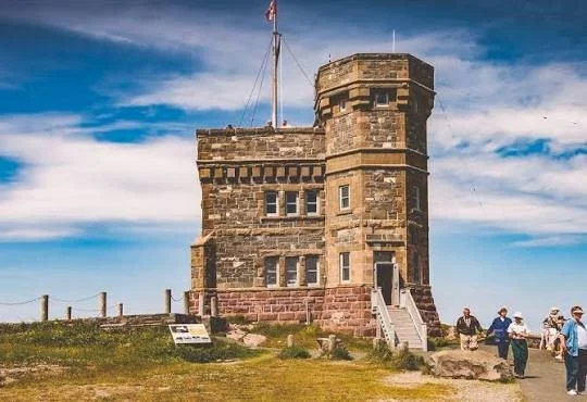
Before the development of radio, telegraphy, and modern telecommunications, communities relied on visual and acoustic signals to communicate across long distances. Elevated locations were especially useful because they offered wide views of the surrounding landscape and allowed signals to be seen from distant settlements or neighboring towers. Cliff-top signal towers represent one possible component of these early communication networks. Their archaeological remains can help researchers investigate how societies transmitted warnings, coordinated movement, and maintained connections across difficult terrain.

Signal towers could take several forms depending on the period, region, and purpose of the network. Some were substantial stone structures incorporated into defensive systems, while others may have consisted of modest platforms, timber constructions, or watch posts positioned on naturally elevated ground. Their effectiveness depended on visibility, weather conditions, and the availability of observers who could recognize and relay a signal. A tower did not necessarily need to be architecturally impressive to perform an important role within a larger communication system.

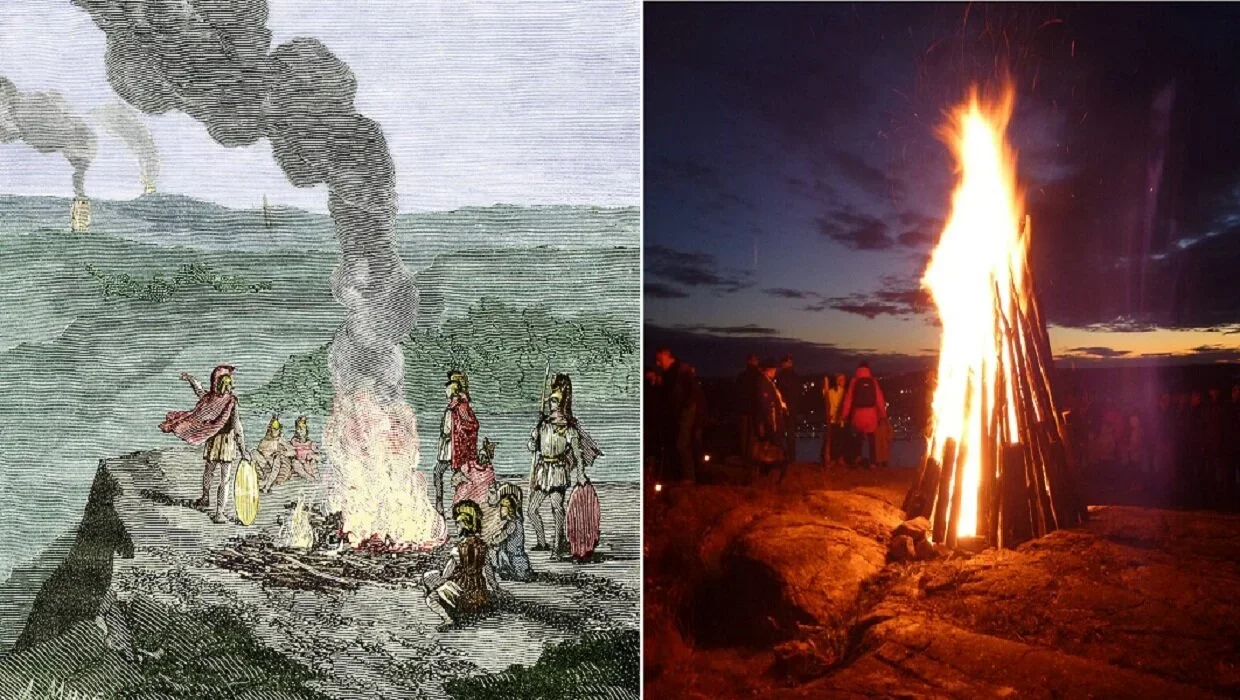
Fire and smoke were among the most recognizable signaling methods used before modern communications. During daylight, smoke could provide a visible indication of activity, while flames were more useful after dark. Horns, bells, drums, and other sound-producing instruments could supplement visual signals, particularly when visibility was poor or a receiving station was nearby. The precise method depended on the intended message, the distance between stations, and the environmental conditions.

A network of signal towers could allow information to travel farther than a single observer could communicate directly. When one station detected an approaching vessel, an enemy force, or another important event, its operators could transmit a signal to the next station. The receiving station would then repeat the signal or send a different message to another location. With carefully positioned towers, information could move across a coastline, valley, mountain range, or border region relatively quickly.

Archaeologically identifying such a network is challenging. A tower on a cliff may have served as a defensive stronghold, a watch post, a refuge, or a location for controlling movement through a landscape. Its elevated position alone does not establish that it was used for signaling. Researchers must examine the structure's architectural features, its visibility from other sites, its chronology, and its relationship to nearby roads, settlements, ports, and defensive installations.

Line-of-sight analysis is an important tool in investigating possible networks. Digital elevation models can help researchers calculate whether two locations would have been visible to one another under reconstructed landscape conditions. Modern vegetation and buildings may obstruct views that were available in the past, while erosion and changes in terrain can alter the apparent visibility of a site. Researchers therefore use topographic modeling as a guide rather than as definitive proof of historical communication.

The arrangement of towers can also reveal possible network organization. Sites positioned at regular intervals along a coast or near strategic passes may indicate a coordinated system, especially when their construction dates and architectural characteristics are similar. However, geographical convenience can produce similar patterns even when structures were not part of a single network. Establishing a connection between towers requires chronological and contextual evidence as well as spatial analysis.

Excavations may uncover evidence of occupation, maintenance, and signaling activities. Hearths, charcoal, storage vessels, lamps, and domestic artifacts can indicate that people occupied a tower for extended periods or visited it regularly. Metal fittings, architectural fragments, and construction materials may help reconstruct the building's design. Specialized signaling equipment may not survive, particularly if it was made from wood, textiles, or other perishable materials.

Historical sources can sometimes clarify the purpose of a tower system. Written records may describe warning signals, beacon chains, military communications, or the maintenance of watch stations. Yet records from one period should not automatically be applied to structures built centuries earlier. Towers could change function over time, shifting from military signaling to local observation, taxation, or other administrative uses.

The social organization of communication networks is another important subject. Signal towers required people to monitor the surrounding area, interpret incoming messages, maintain equipment, and relay information. Such responsibilities may have been assigned to soldiers, local residents, officials, or specialized personnel. The archaeological record rarely identifies these individuals directly, but the scale of the installation and evidence of repeated occupation may provide clues about how it operated.

Environmental conditions influenced the reliability of the system. Fog, rain, strong winds, and darkness could interrupt visual communication, while rugged terrain could limit the effectiveness of sound signals. Networks might therefore have used alternative routes, additional stations, or different signaling methods to overcome local difficulties. The effectiveness of a network depended not only on the towers themselves but also on the people and procedures that connected them.

The archaeology of cliff-top signal towers offers insight into how societies overcame the limitations of distance before electronic communication. By combining architectural analysis, visibility modeling, historical research, and landscape archaeology, researchers can investigate whether isolated towers formed coordinated networks or served more localized purposes. These structures demonstrate that communication infrastructure was an important part of political organization, defense, and regional connectivity long before the arrival of radio technology.
Reconstructing Ancient Orchard Layouts from Charcoal and Pollen Profiles

October 27, 2026

Orchards have played an important role in the history of agriculture, providing fruit, nuts, shade, timber, and other useful products. Unlike annual crops, trees can remain productive for many years, making orchard management a long-term investment that requires knowledge of soil conditions, water availability, pruning, and seasonal cycles. Ancient orchards may have formed part of household gardens, agricultural estates, religious landscapes, or specialized production areas. Although their trees often disappear after abandonment, traces of their former presence may survive in pollen, charcoal, soil deposits, and other environmental evidence.

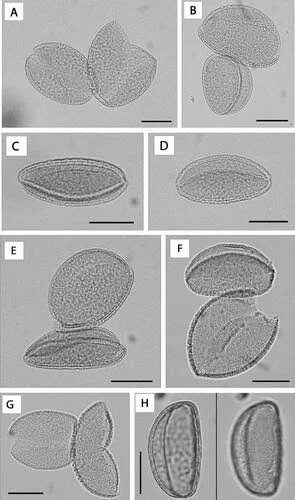
Reconstructing an ancient orchard requires researchers to determine which plants grew in a particular location, when they were present, and whether their distribution resulted from deliberate cultivation. Pollen analysis is one of the most useful methods for investigating past vegetation. Plants release pollen grains that can accumulate in lake sediments, wetlands, soils, and other depositional environments. Because pollen from many plant groups has recognizable microscopic features, researchers can identify broad vegetation patterns and track changes through successive layers.

However, pollen records do not provide a simple map of an orchard. Some trees release large amounts of pollen that travel considerable distances, while others produce pollen that is dispersed less widely. Wind, insects, water movement, and the surrounding terrain influence where pollen accumulates. A high concentration of tree pollen may indicate nearby woodland, cultivated trees, or a broader regional change in vegetation. Identifying an orchard therefore requires additional evidence about the local landscape and the species represented.

Charcoal provides a different kind of information. When wood burns, it can leave fragments that survive in archaeological deposits and environmental sediments. These fragments may be identified through their anatomical structure, allowing specialists to determine the broad type of tree or shrub from which they originated. Charcoal can accumulate through domestic fires, land clearance, woodland burning, industrial activity, or natural wildfires. Its presence demonstrates that woody vegetation was burned, but it does not necessarily mean that the trees grew directly beside the archaeological site.

The combination of pollen and charcoal can nevertheless reveal important changes in vegetation management. A pollen profile showing an increase in particular tree types, combined with charcoal from related species, may suggest that people used or managed those trees. If the evidence occurs near settlement remains, storage facilities, agricultural boundaries, or other features associated with cultivation, the orchard interpretation may become more plausible. Researchers must still consider alternative explanations, including natural woodland expansion and the use of wild trees for fuel.

The identification of fruit trees presents particular challenges. Some cultivated species have wild relatives that produce similar pollen or charcoal. Morphological differences may be too subtle to distinguish confidently in every sample. Researchers may therefore combine pollen analysis with plant macrofossils, such as seeds, fruit stones, nutshells, and wood fragments. These remains can sometimes identify particular crops more precisely and provide stronger evidence that people gathered or cultivated them.

Spatial analysis is essential when reconstructing orchard layout. Archaeologists may investigate the distribution of tree pits, planting holes, terraces, irrigation channels, boundary walls, and other landscape features. Rows of planting pits or repeated spacing between tree locations may suggest an organized planting system, although erosion and later land use can obscure the original arrangement. Pollen and charcoal profiles can then be compared with these physical features to determine whether the environmental evidence supports the proposed layout.

The chronology of an orchard is equally important. Trees may have been planted, replaced, pruned, or removed over several generations. A pollen record showing a change in vegetation does not necessarily indicate that an orchard was established at that precise moment. Researchers may date suitable charcoal fragments or associated organic deposits, but they must consider the possibility that the charcoal came from older wood or was redeposited from an earlier layer. Combining several dating methods can improve the reliability of the reconstruction.

Ancient orchards may also reflect broader economic and social relationships. Fruit and nuts could be consumed locally, preserved for later use, or exchanged with neighboring communities. Some orchards may have supplied households, while larger cultivated areas could have supported estates or commercial production. The presence of storage facilities, processing equipment, and transport-related features may help researchers investigate how orchard products were used and distributed.

Environmental conditions shaped orchard management. Trees require suitable temperatures, soil, and water, although their needs differ by species. Ancient farmers may have selected sheltered slopes, developed terraces, or managed irrigation to improve growing conditions. Changes in climate or water availability could influence productivity and encourage shifts in cultivation. Pollen records may reveal broad environmental changes, while archaeological structures can provide evidence of the ways people responded to them.

It is also important to distinguish cultivated orchards from landscapes where useful trees were managed without formal planting. Communities may have protected naturally occurring fruit trees, cleared competing vegetation, grafted selected varieties, or maintained woodland containing valuable species. Such practices can represent sophisticated tree management even if they did not create a regularly spaced orchard.

The reconstruction of ancient orchards from charcoal and pollen profiles demonstrates how environmental archaeology can recover traces of agricultural landscapes that no longer survive visibly. Pollen helps researchers understand the composition and development of vegetation, while charcoal provides evidence of the burning and use of woody plants. When combined with plant remains, dating, and landscape analysis, these records can reveal how people cultivated trees, managed resources, and shaped their surroundings over long periods of time.

The Forensic Identification of Fasting in Skeletal Populations

October 27, 2026

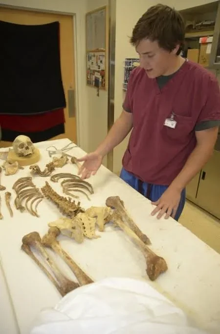
Human skeletal remains preserve evidence of growth, physical activity, disease, injury, and aspects of nutrition during life. In archaeological and forensic investigations, researchers examine these remains to understand the biological experiences of individuals and the conditions affecting past populations. One particularly challenging subject is fasting, a practice that may occur for religious, cultural, medical, economic, or survival-related reasons. Because fasting is a behavior rather than a disease, identifying it from skeletal remains requires careful interpretation and an understanding of the limitations of biological evidence.

Fasting involves a period of reduced or absent food intake, but its effects depend on many factors. Duration, frequency, hydration, physical activity, age, health, and access to food all influence the body's response. A brief fast may leave no identifiable skeletal changes, while prolonged or repeated nutritional deprivation may contribute to changes in growth, bone remodeling, or general health. These changes are not unique to fasting, however, and may also occur under conditions of chronic malnutrition, illness, or other physiological stress.

Bone is living tissue that continually undergoes remodeling. Specialized cells remove older bone material while other cells form new tissue, allowing the skeleton to respond to growth, physical demands, and changes in metabolism. When the body experiences nutritional stress, bone formation and maintenance may be affected, particularly when the deficiency is severe or prolonged. Yet the relationship between food intake and skeletal change is complex. A skeleton does not record every meal or missed meal, and a period of fasting may occur without leaving any distinctive anatomical signature.

Researchers sometimes examine indicators of physiological stress, including changes in bone growth, dental development, and the structure of certain skeletal elements. In children, severe or prolonged nutritional problems may disrupt normal growth, although similar patterns can arise from infection and other health conditions. Dental enamel defects can record episodes of stress during tooth formation, but they cannot identify fasting as the specific cause. In adults, bone loss may be associated with nutritional deficiencies, hormonal changes, reduced physical activity, illness, and aging.

This lack of specificity is central to the forensic identification of fasting. A skeletal feature may indicate that an individual experienced physiological stress, but it rarely reveals the exact behavior responsible. Even when several indicators occur together, researchers must consider alternative explanations. The most scientifically defensible conclusion may be that the individual experienced nutritional or metabolic stress, rather than that the person deliberately fasted.

Population-level research presents additional challenges. Archaeologists may compare skeletal indicators across groups from different periods, social settings, or burial contexts to investigate whether some communities experienced greater nutritional stress than others. Differences between populations can be informative, but they may reflect food availability, disease exposure, social inequality, migration, environmental change, or differences in the preservation of remains. A pattern observed in a burial population cannot automatically be attributed to a particular religious or cultural practice.

Stable isotope analysis can contribute to the investigation of diet, although it does not directly identify individual fasting episodes. The ratios of certain isotopes in bone and tooth tissues can reflect aspects of long-term dietary patterns and, in some cases, geographic origins. Because different tissues form and remodel at different rates, they represent different periods of an individual's life. These measurements can help reconstruct broad dietary histories, but a short fast is unlikely to produce a clear, uniquely identifiable isotopic signature in skeletal tissue.

Historical and archaeological context can sometimes make the investigation more informative. Written sources may describe fasting customs, periods of food scarcity, or religious calendars. Burial locations and material culture may also provide evidence about community practices. When independent historical records indicate that fasting occurred, researchers can investigate whether skeletal patterns are consistent with broader conditions of nutritional stress. Even then, it is difficult to establish whether a particular individual participated in the practice or how frequently it occurred.

Modern forensic investigations require particular caution. Skeletal remains may be discovered in contexts where the cause and circumstances of death are uncertain. Researchers must distinguish evidence of starvation or severe malnutrition from evidence of deliberate fasting, because these conditions have different implications. Starvation caused by deprivation or inability to obtain food is not equivalent to voluntary or ritual fasting. Skeletal findings alone generally cannot establish a person's intentions, beliefs, or access to food.

Ethical considerations also shape the study of human remains. Researchers should avoid making unsupported claims about the behavior or religious identity of deceased individuals. Interpretations should be grounded in validated methods, transparent about uncertainty, and respectful of descendant communities. Where living communities maintain relevant traditions, consultation may help contextualize historical evidence without replacing scientific evaluation.

The forensic identification of fasting therefore remains a difficult problem. Skeletal remains can reveal aspects of nutritional health and physiological stress, but they rarely preserve a specific marker of deliberate food abstention. The most reliable investigations combine skeletal analysis with archaeological context, dietary evidence, historical documentation, and careful consideration of alternative explanations. This approach allows researchers to study the biological consequences of nutritional stress while avoiding conclusions that the physical evidence cannot support.

Micromorphology of Floor Replacements: House-Lives in Neolithic Villages

October 27, 2026

Neolithic villages provide valuable evidence of the transition toward more settled ways of life in many parts of the world. As communities increasingly relied on cultivation, animal management, and permanent or semi-permanent dwellings, houses became important spaces for cooking, sleeping, storing food, making tools, and maintaining family relationships. These buildings were not necessarily static structures. Floors became worn, surfaces accumulated waste, and walls and roofs required maintenance. The repeated replacement of floors offers archaeologists an opportunity to reconstruct the changing life of a house and understand how domestic spaces were maintained over generations.

Micromorphology is the microscopic study of undisturbed soil and sediment samples. Archaeologists collect small blocks of sediment, preserve their original structure, and prepare thin sections that can be examined under a microscope. These sections reveal the arrangement of mineral grains, organic particles, ash, charcoal, plant remains, and other microscopic components. Because many household activities leave traces too small to recognize during ordinary excavation, micromorphology can provide detailed evidence of how a floor was used, cleaned, repaired, and eventually replaced.

A Neolithic floor might consist of compacted earth, clay, plaster, stone, or a combination of materials. The choice depended on local resources, construction traditions, and the intended function of the building. Some floors were deliberately smoothed or coated to create a more comfortable surface, while others were little more than compacted soil. Over time, repeated walking could compress the surface, and domestic activities might introduce small quantities of ash, food remains, plant fibers, and other materials. Water, animals, and changes in humidity could further modify the floor.

When a floor became damaged or dirty, its occupants might clean it, spread fresh material over it, or construct a completely new surface. These actions could produce distinct layers in the archaeological record. A thin deposit of clean clay above a compacted surface, for example, might represent a deliberate resurfacing episode. Several such layers could indicate repeated maintenance. However, similar deposits can form through natural sediment accumulation, flooding, or the gradual buildup of materials within an abandoned building. Microscopic analysis helps distinguish intentional floor replacement from these alternatives.

The composition of a floor can reveal how the space was used. Ash and charcoal particles may indicate nearby burning, while plant fragments could reflect food processing, bedding, thatching, or other domestic activities. Small bone fragments may be associated with food preparation, although they could also have entered the deposit through cleaning or later disturbance. Mineral particles and plaster fragments may reveal the materials used in construction and repair. The interpretation becomes stronger when several indicators occur together in a consistent pattern.

Spatial differences within a house are equally important. A hearth area may contain heat-altered minerals and ash, while a storage corner may preserve residues associated with containers or organic materials. Areas used for walking may show greater compaction than locations protected by furniture or stored goods. By collecting samples from different parts of the same building, researchers can compare activity zones and investigate whether the arrangement of domestic work changed over time.

Floor replacement also provides information about the duration of occupation. A house with several successive floors may have remained in use through multiple episodes of maintenance. In some Neolithic settlements, buildings were occupied, modified, and eventually abandoned before new structures were erected nearby. The sequence of floors can help establish whether the same building was repeatedly used or whether successive layers belong to different structures. This distinction is important when reconstructing the growth and organization of a village.

Dating these sequences requires careful attention to context. Organic materials trapped within a floor layer may sometimes be suitable for radiocarbon dating, but they do not always provide an exact date for the construction of the surface. Charcoal may have come from older wood, and plant remains could have been redeposited from earlier deposits. Researchers therefore combine dating evidence with stratigraphic relationships and other archaeological materials to establish the most reliable chronology possible.

Micromorphology can also reveal the relationship between domestic cleanliness and everyday activity. Some floors may contain evidence of repeated sweeping or the deliberate addition of clean material. Others may preserve thick accumulations of waste, suggesting different maintenance practices or changing patterns of occupation. These differences should not be interpreted automatically as signs of social status or hygiene. They may instead reflect the building's function, the season of occupation, the availability of labor, or the type of activity conducted inside.

The method has limitations. Microscopic samples represent only small portions of a floor, so a single sample cannot necessarily describe an entire room. Processes such as flooding, burrowing animals, root growth, and later construction may disturb the original deposits. Archaeologists must select samples strategically and compare their findings with the visible stratigraphy, artifacts, and building remains.

The micromorphology of floor replacements offers a detailed way to investigate the lives of Neolithic houses. Tiny fragments of ash, plant material, compacted soil, and construction debris can reveal repeated episodes of use and maintenance that would otherwise remain invisible. By connecting microscopic evidence with architectural remains and settlement chronology, researchers can reconstruct how households adapted their living spaces and how ordinary acts of repair contributed to the long-term development of Neolithic villages.

The Archaeology of Seasonal Salt Harvesting by Coastal Communities

October 27, 2026

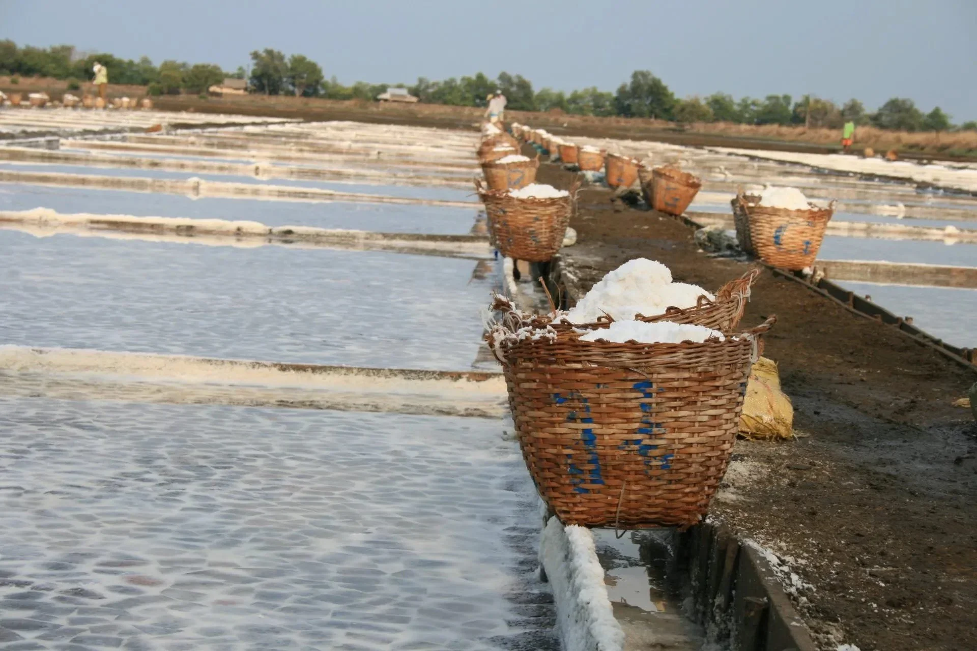
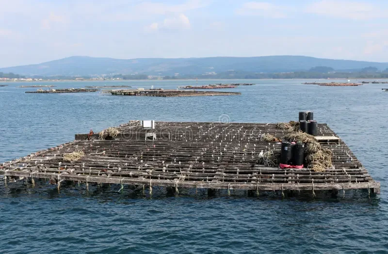
Salt has been an important resource throughout human history. It has contributed to food preservation, supported the preparation of animal products, and played roles in trade, craft production, and cultural practices. Although salt is widely available in some environments, obtaining it required specialized knowledge and labor in others. Coastal communities developed different methods for collecting and producing salt, taking advantage of seawater, tidal flats, shallow lagoons, and naturally saline soils. Archaeological evidence of seasonal salt harvesting can reveal how people organized their work around environmental cycles and how an apparently ordinary mineral became an important part of local and regional economies.

Seawater contains dissolved salts that remain behind when the water evaporates. In warm, dry, and windy conditions, shallow pools of seawater can lose water relatively quickly, allowing salt crystals to form. Communities could exploit this process by using natural tidal flats or by creating shallow evaporation areas where seawater could be concentrated. In other environments, people might heat brine in containers to accelerate evaporation, although this approach required substantial fuel and suitable equipment. The method used depended on climate, geology, access to fuel, and the amount of salt needed.

Seasonality was particularly important because salt production depends on environmental conditions. Periods of low rainfall and high evaporation generally favor the concentration of seawater, while heavy rain can dilute brine and disrupt salt crystallization. Tidal patterns determine when coastal areas are flooded, and seasonal changes in wind and temperature can influence how quickly water evaporates. Communities with long experience of their local coastlines could schedule harvesting around these patterns, adjusting their activities as weather and water conditions changed.

The archaeological evidence for salt production can take several forms. Shallow basins, channels, embankments, and prepared surfaces may indicate areas where seawater was collected or concentrated. Concentrations of broken pottery, especially vessels that show signs of repeated heating, may be associated with the evaporation of brine. Hearths, ash deposits, and fuel remains can provide evidence of heating installations, while mineral residues may help identify the processing of saline water. However, no single feature proves that salt was produced, because similar structures and artifacts could have served other purposes.

Pottery can be particularly informative in sites where brine was heated. Repeated exposure to high temperatures may leave thermal alterations on vessels, while deposits can accumulate on interior surfaces during the evaporation process. Chemical analysis may identify traces consistent with saline solutions, although salt is highly soluble and can be lost through burial and exposure to groundwater. Researchers must also consider contamination from the surrounding soil and later use of the same containers for other activities.

Landscape reconstruction is essential for understanding coastal salt harvesting. Ancient shorelines often differ from modern ones because of sediment accumulation, erosion, sea-level change, and tectonic movement. A site now located inland may once have been close to a lagoon or tidal inlet. Conversely, a modern coastal feature may not have existed in its current form when the archaeological activity took place. Sediment analysis and geological mapping can help reconstruct the conditions that made salt production possible.

Seasonal harvesting may leave evidence of repeated but intermittent occupation. Workers could have visited a coastal site during favorable months, established temporary shelters, prepared evaporation areas, and returned to permanent settlements after the harvest. Archaeologists might identify such activity through short-lived hearths, limited domestic debris, and production installations that were used repeatedly. Yet intermittent occupation must be distinguished from other forms of seasonal activity, including fishing, shellfish gathering, and livestock management.

Salt production could also influence the organization of labor. Gathering seawater, maintaining evaporation basins, collecting fuel, monitoring weather, and transporting the finished product all required time and coordination. The scale of production might range from household needs to larger operations that supplied neighboring settlements. Differences in installation size, fuel consumption, and the volume of processing debris may help researchers estimate the intensity of production, although such estimates are often uncertain.

The economic importance of salt depended on local circumstances. In coastal areas where salt could be obtained relatively easily, it might have been used primarily for household consumption and food preservation. In places where production required specialized equipment or substantial fuel, salt could become a valuable commodity. Coastal communities might exchange it for grain, livestock, pottery, metal goods, or other resources that were less readily available nearby. Archaeological evidence of transport containers and connections with inland settlements may help reveal how salt moved through these networks.

Salt also had social and cultural significance. It could be associated with hospitality, food preparation, ritual offerings, and the preservation of resources for difficult seasons. Written records and historical accounts sometimes describe the regulation, taxation, or trade of salt, but such evidence varies across regions and periods. Archaeologists must avoid assuming that later systems of salt production or taxation existed in the same form in earlier societies.

Environmental impacts are another consideration. Large-scale evaporation may require substantial fuel if brine is heated, potentially placing pressure on nearby woodland. The construction of basins and channels can alter coastal surfaces, while repeated extraction may affect local water management. The scale of these effects would depend on the production method and intensity of harvesting. Evidence of fuel use and landscape modification can help assess whether salt production was a small household activity or a more extensive industry.

The archaeology of seasonal salt harvesting reveals how coastal communities adapted their work to the rhythms of the environment. Through the study of processing installations, pottery, sediments, fuel remains, and settlement patterns, researchers can investigate when salt was produced, how people organized harvesting, and whether the finished material circulated beyond the local area. Although the evidence can be difficult to interpret, salt-production sites offer a valuable perspective on the relationship between environmental knowledge, seasonal labor, and the development of ancient economies.

Magnetic Anomalies over Buried Roads: Remote Detection of Ancient Tracks

October 27, 2026

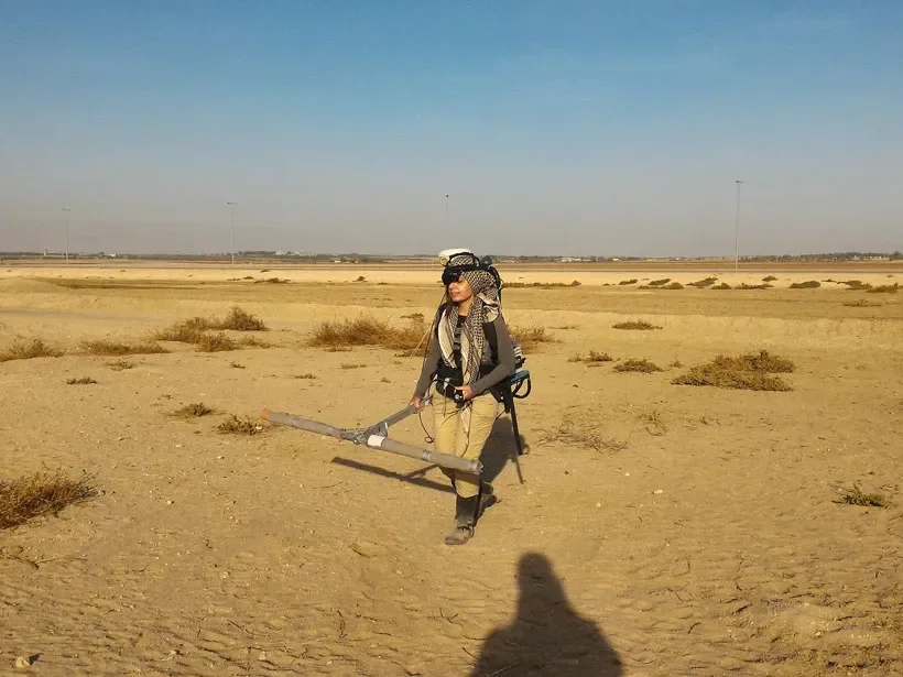
Ancient roads and tracks played an essential role in connecting settlements, agricultural areas, markets, military installations, and religious centers. Some routes were constructed with durable paving stones, while others consisted of compacted earth, gravel, or repeatedly used natural paths. Over time, erosion, vegetation growth, construction, and sediment accumulation may conceal these routes beneath the ground. Geophysical survey methods can help archaeologists investigate such buried features without excavating the entire landscape. Among these methods, magnetic surveying can reveal subtle differences in the physical properties of soil and buried materials that may indicate the presence of an ancient road.

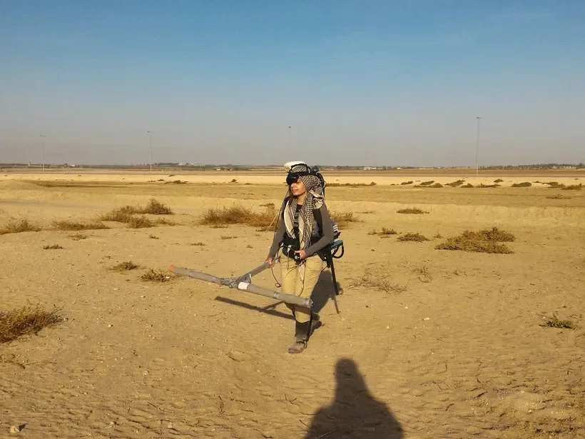
Magnetic surveying measures variations in the Earth's magnetic field at or near the ground surface. Archaeological materials can disturb this field because some soils, rocks, and human-made deposits possess different magnetic properties from their surroundings. Heating may strengthen the magnetic signal of certain materials, while the accumulation of organic matter, ash, and occupation debris can alter the magnetic characteristics of soil. Instruments used in archaeological geophysics record these variations, allowing researchers to create maps of magnetic anomalies.

A magnetic anomaly is simply a measurable departure from the expected local magnetic field. It does not automatically indicate an archaeological feature, much less an ancient road. Natural geological variations, modern metal objects, buried utilities, and other sources can all create anomalies. The archaeological challenge is to determine which patterns are consistent with human activity and which are better explained by natural or modern processes.

Buried roads can produce magnetic signatures in several ways. A road constructed from imported stone or gravel may differ magnetically from the surrounding soil. Repeated traffic can compact the ground, change drainage, and create a distinct subsurface layer. In some cases, the road margins may accumulate organic material or debris, producing a contrast with the central track. If the route passed through areas where fires, workshops, or settlements were present, associated deposits may also influence the magnetic pattern.

However, many roads produce weak or inconsistent magnetic signals. A simple path worn into natural soil may have little magnetic contrast with its surroundings. A road made from nonmagnetic materials may be difficult to identify using magnetic survey alone. Conversely, a strong linear anomaly might represent a ditch, wall, drainage channel, geological boundary, or modern feature rather than a road. Researchers must therefore avoid assuming that every straight magnetic pattern corresponds to an ancient transport route.

The shape and continuity of an anomaly can help guide interpretation. Long, relatively linear features that connect known settlements or follow plausible routes across the landscape may be worth investigating. Changes in width, branching patterns, or intersections could provide clues about how a route developed. Yet ancient roads were not always straight, and paths could shift in response to terrain, watercourses, erosion, or changing settlement patterns. Landscape context is essential when evaluating the significance of a magnetic map.

Archaeologists often combine magnetic surveying with other remote-sensing techniques. Ground-penetrating radar can reveal subsurface structures by measuring reflected radar signals, while electrical resistance surveys detect differences in how soil conducts electrical current. Aerial photography, satellite imagery, and lidar can identify surface features such as embankments, cuttings, and abandoned route corridors. Each method responds to different physical properties, so using several techniques can provide a more reliable interpretation than relying on one survey alone.

Ground-truthing is also necessary. After a possible road has been identified through geophysical data, archaeologists may conduct targeted excavation to determine whether the anomaly corresponds to a constructed surface, compacted track, drainage feature, or another deposit. Excavation can reveal construction materials, road layers, wheel ruts, maintenance episodes, and associated artifacts. Pottery fragments or other datable materials found within the road's construction layers may help establish its chronology, although the age of loose objects does not always match the date when the road was built.

The dating of ancient roads is often difficult because routes may remain in use for centuries. A road could be repaired, widened, resurfaced, or redirected several times, leaving multiple construction phases beneath the same alignment. Researchers must distinguish the earliest formation from later modifications and determine whether the magnetic signal reflects one phase or several. Stratigraphic evidence and carefully selected samples can help establish this sequence.

Remote detection has several practical advantages. Large areas can be surveyed more quickly than they could be excavated, allowing researchers to identify promising locations before committing to intrusive fieldwork. Geophysical mapping can also help protect archaeological remains by reducing unnecessary excavation. In urban and agricultural settings, it may reveal buried routes that are no longer visible at the surface.

Despite these benefits, magnetic surveying has limitations. Results can be affected by soil conditions, modern infrastructure, nearby metal objects, survey spacing, and the sensitivity of the equipment. Some archaeological features may remain invisible if they produce little magnetic contrast. A lack of detected anomalies should therefore not be treated as proof that an ancient road was absent.

The study of magnetic anomalies over buried roads illustrates how modern scientific tools can expand archaeological investigation. By combining geophysical measurements with landscape analysis, excavation, and chronological evidence, researchers can reconstruct routes that once connected communities and supported economic, military, and social activity. The magnetic signal is only the beginning of the investigation, but when interpreted carefully, it can help reveal hidden elements of ancient transportation networks.

Ancient Pet Cemeteries: Social Meanings of Animal Burials

October 27, 2026

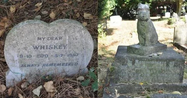
Animals have occupied important places in human societies for thousands of years, serving as sources of food, companions, working partners, religious symbols, and members of domestic households. Archaeological evidence shows that people in different periods sometimes buried animals deliberately, occasionally placing them in individual graves or alongside objects that suggest special treatment. These discoveries offer an opportunity to investigate how ancient communities understood their relationships with animals and how those relationships reflected social identity, religious beliefs, and everyday emotional life.

An animal cemetery is generally understood as a place where animals were buried repeatedly or according to some organized practice. Such sites can differ considerably in size and purpose. Some may contain the remains of companion animals, while others may be associated with religious offerings, sacrifices, military animals, livestock disposal, or specialized economic activities. Identifying a cemetery devoted to pets therefore requires more than finding several animal skeletons in the same location. Archaeologists must establish whether the burials were intentional, whether they occurred during the same period, and whether the animals received treatment consistent with their possible roles as companions.

The arrangement of the remains can provide important clues. Individual graves, carefully positioned skeletons, burial containers, or objects placed beside an animal may indicate deliberate treatment. In some cases, the animal may have been buried in a location separate from ordinary refuse deposits or food-processing areas. Repeated burials in the same place could suggest that the location held a recognized social or ritual significance. However, the absence of grave goods does not mean that an animal lacked importance, because burial practices vary widely between cultures and social groups.

The species represented at a burial site can also help researchers understand its function. Dogs and cats are often associated with human companionship in historical contexts, but their roles were not limited to that purpose. Dogs could assist with hunting, guarding, herding, and transport, while cats could help control pests. Horses and other working animals might also develop close relationships with their handlers. Consequently, the species alone cannot determine whether a burial reflects affection, practical value, ritual obligation, or a combination of these factors.

Osteological analysis provides information about the animals themselves. Examination of bones and teeth may help identify species, estimate age at death, and reveal evidence of disease, injury, or physical stress. Healed fractures or long-term joint damage can sometimes indicate the demands placed on an animal during its life. Such evidence may help researchers explore whether an animal performed physically demanding work, although the interpretation depends on the type and location of the injury and the animal's natural biology.

Burial position and skeletal condition can also reveal details about how the remains were deposited. A relatively complete skeleton in an articulated position may indicate that the body was buried before extensive decomposition or disturbance. Scattered bones, by contrast, may reflect natural processes, later construction, scavenging, or secondary deposition. Researchers must distinguish deliberate burial from the accidental accumulation of animal remains through careful excavation and documentation.

The placement of animals near human graves can be particularly significant. In some societies, animals were buried alongside people, potentially reflecting beliefs about companionship, protection, status, or the afterlife. Yet proximity does not necessarily prove that the human and animal died at the same time or were intentionally buried together. Stratigraphic relationships and dating methods are needed to establish whether the deposits are connected.

Social differences may also be visible in the treatment of animals. Some communities may have devoted greater resources to the burial of valuable working animals, while others may have reserved elaborate funerary practices for animals associated with powerful households or religious institutions. Differences in grave construction, location, and accompanying objects can help researchers investigate these possibilities. Still, expensive or elaborate burials should not automatically be interpreted as proof of wealth or affection without considering the cultural context.

Ancient texts and artistic representations can supplement the archaeological evidence. Images of animals, inscriptions, and written accounts may reveal how people described particular species and what roles those animals played in social life. These sources can be especially valuable when they identify named animals or describe funerary customs. However, written evidence often reflects the perspectives of particular social groups and may not represent the experiences of the wider population.

Scientific analysis can sometimes provide further information about an animal's life. Stable isotope studies of bone and teeth may reveal aspects of diet and movement, depending on the material preserved and the environmental conditions. Genetic analysis can help identify relationships between animals or distinguish populations, although preservation quality and sampling restrictions may limit the results. Such methods can contribute to understanding whether an animal lived locally, moved between regions, or belonged to a particular breeding population.

The concept of a pet also requires historical caution. Modern distinctions between pets, working animals, livestock, and sacred animals do not always correspond to categories used in ancient societies. An animal could perform practical tasks while also receiving affection and individual attention. Archaeologists should therefore investigate the evidence for the relationship rather than assume that ancient people separated animal roles in the same way modern societies often do.

Ancient animal cemeteries reveal that human relationships with animals extended beyond food production and labor. Through burial practices, communities may have expressed affection, status, religious beliefs, or obligations toward particular animals. By combining skeletal analysis, burial context, dating, and historical evidence, researchers can investigate these relationships while recognizing that the meaning of an animal burial may remain uncertain in some cases. Such discoveries offer a valuable perspective on the social and emotional dimensions of life in the ancient world.

The Hidden Life of Small Workshops under Byzantine Cities

October 27, 2026

Byzantine cities were centers of administration, religion, trade, and craft production. Their streets and neighborhoods contained churches, residences, commercial spaces, public buildings, and workshops that supported the daily needs of urban populations. While monumental architecture often dominates historical accounts, much of city life depended on smaller production spaces where craftspeople repaired objects, processed raw materials, and manufactured goods on a limited scale. Archaeological investigations beneath Byzantine urban landscapes can reveal these workshops, offering a closer look at the labor and technical knowledge that sustained city communities.

The Byzantine Empire existed for more than a thousand years, from the fourth century until the fifteenth century, and its cities changed substantially during that period. Some urban centers retained elements of earlier Roman planning, while others developed new street patterns and neighborhoods in response to political, economic, and demographic changes. Workshops could be established in purpose-built premises, converted domestic rooms, courtyards, basement spaces, or small structures attached to larger buildings. Their size and organization depended on the craft being practiced, the materials available, and the needs of local customers.

Small workshops were often practical rather than architecturally impressive. A metalworker might use a compact hearth and an area for shaping or repairing objects. A potter could work with clay preparation surfaces, tools, and storage containers, while a textile worker might rely on looms, spinning equipment, and space for handling fibers. Other crafts could involve leatherworking, woodworking, glassworking, jewelry production, or the repair of household goods. Because different activities required different equipment and temperatures, the archaeological signatures of workshops vary considerably.

The identification of a workshop begins with the examination of its physical remains. Hearths, furnaces, work surfaces, storage pits, waste deposits, and specialized installations may indicate production. Artifacts such as slag, crucibles, molds, unfinished objects, broken tools, and manufacturing debris can provide further clues. The presence of several related features within a confined area may suggest that production occurred on-site. However, researchers must distinguish primary production waste from materials brought in from elsewhere or deposited after a building had been abandoned.

Stratigraphy is especially important in urban archaeology because cities are built, modified, damaged, and rebuilt over long periods. A room that functioned as a residence during one period might later have become a workshop, storage area, or commercial space. Subsequent construction could cover earlier floors, while demolition might scatter workshop debris into neighboring areas. Archaeologists therefore examine the sequence of floors, walls, deposits, and repairs to reconstruct how a building's function changed over time.

The location of workshops within the city can reveal the relationship between production and urban planning. Some crafts generated smoke, heat, noise, or unpleasant odors, making it practical to place them away from densely occupied residential areas. Other activities, such as textile repair, jewelry work, and the sale of small household objects, could be conducted close to customers and shops. Workshops near markets, roads, ports, or major public spaces may have benefited from access to customers and transport, although the precise relationship depended on the city's layout and economic conditions.

Archaeological evidence can also help identify how craftspeople obtained raw materials. Chemical and compositional analyses may reveal whether metal, glass, stone, or clay originated locally or came from distant sources. Differences between raw materials, production waste, and finished objects can show whether a workshop manufactured goods from the beginning or specialized in repair and finishing. For example, the discovery of unfinished objects and manufacturing debris may indicate production, whereas a concentration of worn items and replacement components might suggest a repair-oriented business.

Not every workshop was operated by a single independent craftsperson. Some production may have involved family members, apprentices, hired laborers, or several specialists working together. The archaeological record rarely identifies individual workers directly, but the size of the workspace, the organization of equipment, and the volume of production debris may provide clues about the scale of activity. Written records, inscriptions, seals, and other historical evidence can sometimes add information about occupational identities and economic relationships.

The relationship between workshops and households is another important aspect of urban life. Production could take place within or beside residential buildings, allowing families to combine domestic responsibilities with economic work. This arrangement may have reduced the cost of renting separate premises and allowed customers to visit craft workers directly. Yet a building containing domestic objects and production debris does not automatically represent a household workshop; materials may have accumulated during different phases of occupation. Chronological analysis is necessary to determine whether residential and industrial activities occurred simultaneously.

Small workshops also contributed to the wider economic networks of the Byzantine world. Urban craftspeople supplied local residents, religious institutions, merchants, and administrative organizations. Certain goods may have circulated across regional trade routes, while other products were intended for neighborhood use. The materials found in a workshop can therefore connect a seemingly modest room to larger patterns of commerce, taxation, migration, and technological exchange.

Environmental and conservation conditions strongly influence what survives beneath modern cities. Organic materials such as wood, textiles, and leather may disappear in dry or oxygen-rich deposits, while metalworking waste, fired clay, and stone installations can remain recognizable for centuries. Modern construction can expose archaeological layers but may also destroy them before they are properly documented. Careful excavation and recording are essential because even a small workshop can preserve evidence that is absent from historical documents.

The hidden workshops of Byzantine cities demonstrate that urban history extends beyond palaces, churches, and monumental streets. Small production spaces reveal how ordinary people transformed materials, repaired possessions, learned specialized skills, and participated in local economies. By studying their tools, installations, waste, and changing architectural contexts, archaeologists can reconstruct the practical labor that helped Byzantine cities function across generations.

Early Market Stalls: Post-Holes, Hearths and Small-Scale Commerce

October 27, 2026

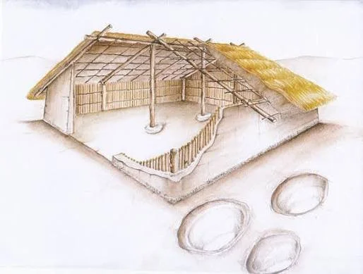
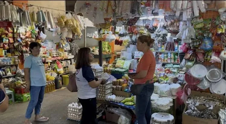
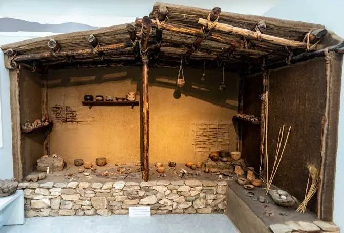
Markets have long provided spaces where people exchange goods, share information, and maintain relationships beyond their immediate households. Although modern markets often occupy permanent buildings or organized commercial districts, earlier forms of trade may have taken place in open areas where sellers assembled temporary shelters, prepared food, and displayed products. Archaeological evidence for these activities can be subtle. Post-holes, hearths, concentrations of artifacts, and repeated patterns of occupation may offer clues to early market stalls and small-scale commerce, even when no recognizable market building survives.

A post-hole is a cavity in the ground that once held a wooden post or similar structural support. In an archaeological setting, post-holes can indicate the former positions of walls, fences, roofs, shelters, and other wooden constructions. A series of post-holes arranged in a regular pattern may represent a temporary stall or covered workspace. However, these features are not unique to markets. They can also belong to domestic buildings, storage structures, workshops, animal enclosures, or later construction. Their function must be interpreted in relation to the wider site.

Temporary market stalls would have required relatively simple structures. Wooden poles could support a roof made from branches, woven material, fabric, or other locally available resources. A stall might have been dismantled after a trading day or left standing between market sessions. In some settings, traders may have used movable tables, baskets, mats, and portable containers rather than constructing permanent buildings. Organic materials often decay, meaning that the surviving evidence may consist largely of post-holes and the traces left by repeated use of the same location.

Hearths can provide another line of evidence. A small fire near a possible stall might have been used to prepare food, warm liquids, process materials, or support a craft activity. If hearths occur alongside structural remains and concentrations of discarded food or production debris, they may indicate a space where goods were prepared or sold. Nevertheless, hearths are common in domestic and industrial contexts, so their presence alone cannot establish commercial activity.

The distribution of artifacts can help distinguish a possible market area from a residential settlement. Researchers may find pottery fragments, animal bones, metal objects, weights, coins, imported goods, or materials associated with crafts. The variety of objects may suggest that people from different economic activities gathered in the same location. Evidence of goods originating from distant regions can indicate participation in wider exchange networks, although imported objects might also have arrived through household consumption, gifts, taxation, or other forms of transfer.

Small-scale commerce does not always leave behind coins or written records. People may have exchanged food, tools, textiles, pottery, livestock, and other goods through barter or informal arrangements. Some transactions may have involved standardized weights or measures, while others depended on negotiation and established social relationships. Archaeologists therefore cannot assume that the absence of currency means an absence of trade.

The location of a potential market can also provide useful information. Open spaces near roads, river crossings, settlement entrances, ports, or other meeting points may have offered convenient places for exchange. Such locations could attract farmers, craft workers, travelers, and neighboring communities. If the same area contains evidence of repeated temporary structures and commercial activities, researchers may consider whether it served as a recurring gathering place rather than a permanent residential zone.

Establishing that an area functioned as a market requires careful comparison with alternative explanations. A concentration of pottery and animal bones might represent a household refuse area or a communal feast rather than a trading site. Post-holes could belong to a festival structure, temporary camp, or work area. Archaeologists need to assess the spatial relationships among the features, the range of materials present, and the chronology of occupation. Evidence that different structures and activities were repeatedly concentrated in the same open space would strengthen an interpretation of recurring public use.

Scientific methods can reveal additional details about the goods and activities associated with a site. Chemical analysis of pottery residues may identify traces of food preparation, while metallurgical examination can distinguish imported metal objects from materials produced locally. Animal-bone analysis may reveal the species consumed and the methods used to process them. Where suitable evidence survives, botanical remains can help identify traded plant foods or the presence of agricultural products.

Markets also had social functions beyond the exchange of goods. They could provide opportunities to meet people from other settlements, establish partnerships, negotiate agreements, and share news. Repeated gatherings may have strengthened connections between rural producers and urban consumers. In some societies, trading areas may also have been associated with religious events, festivals, or public administration, making the distinction between economic and social activity less clear-cut.

The archaeology of early market stalls reveals how temporary structures and ordinary discarded materials can preserve evidence of complex economic relationships. Post-holes, hearths, and artifact distributions do not independently prove that a market existed, but together they may support a convincing interpretation of repeated commercial activity. Through careful spatial analysis and comparison with other evidence, researchers can reconstruct how small-scale exchange helped connect households, settlements, and wider trading networks in the ancient world.

Portable Stone Heaters: Cold-Climate Domestic Technology in Antiquity

October 27, 2026

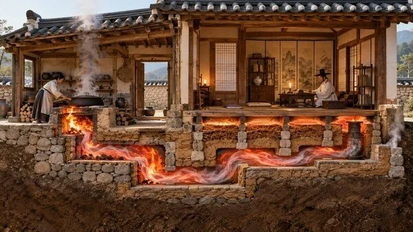
In cold-climate environments, maintaining warmth was essential for survival, comfort, and everyday domestic activity. Ancient communities developed a variety of heating methods using locally available materials, including wood, charcoal, animal products, and stone. While large hearths and permanent fireplaces are well documented in many archaeological settings, smaller heating devices and heat-retaining stones offer another perspective on how people managed temperature within their homes, temporary shelters, and working spaces. The study of portable stone heaters provides an opportunity to examine the relationship between material technology, fuel consumption, mobility, and adaptation to cold environments.

Stone has several properties that make it useful for retaining heat. When heated, certain stones absorb thermal energy and release it gradually as they cool. This characteristic, known as thermal mass, allows stone to function as a temporary heat reservoir. The effectiveness of a stone depends on its mineral composition, density, moisture content, size, and exposure to heat. Not every rock is suitable for repeated heating, because some stones contain moisture or mineral structures that cause them to crack or fragment when exposed to sudden temperature changes.

Ancient people could have taken advantage of these properties in several ways. Heated stones might have been placed near sleeping areas, used to warm food or containers, or incorporated into temporary heating arrangements. In some circumstances, stones could have been heated in a fire and moved to another location where their retained warmth was useful. Such practices would have been particularly valuable in settings where constructing a permanent fireplace was impractical or where people needed to move between temporary camps.

However, the phrase portable stone heater should not automatically be applied to every heated stone recovered from an archaeological site. Stones found near hearths may have been used for cooking, boiling water, processing materials, or lining fire installations. Others may have been damaged by natural fires or geological processes. To identify a stone as a heating device, archaeologists must consider its shape, surface condition, heat-related fractures, position within the site, and association with other artifacts.

Evidence of repeated heating can sometimes be recognized through changes in the stone's surface and internal structure. Thermal cracking, discoloration, and mineral alteration may indicate exposure to high temperatures. Microscopic examination can help researchers distinguish some forms of heat damage from weathering or mechanical breakage. Yet heat-altered stones do not necessarily reveal their intended function, and several different activities can produce similar traces.

The archaeological context is therefore especially important. A cluster of heated stones beside a sleeping area might suggest a domestic heating function if the surrounding deposits support that interpretation. Stones located within a cooking installation would more likely be associated with food preparation, although multiple functions are possible. Researchers may compare the distribution of stones with charcoal, ash, animal bones, pottery, and evidence of indoor activity to reconstruct how the heating arrangement operated.

Experimental archaeology can test the practical performance of candidate stone materials. Researchers can heat stones under controlled conditions, measure how quickly they absorb and release warmth, and document the fractures produced by repeated heating and cooling. Experiments can also investigate how stone size and placement affect heat transfer. These results provide useful comparisons with archaeological specimens, although a successful experiment does not establish that ancient people used the same technique.

Portable heating technologies would have been particularly relevant to mobile communities. Hunters, pastoralists, and travelers often occupied temporary shelters that lacked permanent heating structures. A reusable heat-retaining object could potentially supplement a small fire or provide warmth after a hearth had been extinguished. The practicality of such a system would depend on the weight of the stone, the availability of fuel, and the risks involved in handling heated material.

Safety would also have influenced ancient practices, even if people did not describe the risks in modern scientific terms. Stones heated unevenly can fracture unexpectedly, while direct contact with hot surfaces can cause burns. Moving heated stones through enclosed shelters could introduce additional risks, especially if the process involved burning charcoal or other fuels that produced dangerous gases. Archaeological evidence may not preserve the specific precautions people used, but the design and placement of heating arrangements can sometimes reveal efforts to manage fire and heat.

Portable stone heaters also illustrate how technological solutions often emerge from ordinary observations of natural materials. People did not need a formal understanding of thermodynamics to recognize that some stones remained warm after a fire had died down. Repeated experience could have guided their selection of suitable materials and their methods of use. Such practical knowledge would have been passed through observation, teaching, and daily activity.

The study of portable stone heating technologies broadens our understanding of domestic life in antiquity. By examining heat-altered stones alongside hearths, artifacts, and environmental evidence, archaeologists can investigate how ancient communities managed warmth in permanent homes and temporary shelters. Although individual interpretations require caution, the evidence can help reveal the ingenuity with which people adapted available materials to the demands of cold environments.

The Archaeology of Ice-Season Hunting Drives in High Latitudes

October 27, 2026

56. The Archaeology of Ice-Season Hunting Drives in High Latitudes

In high-latitude environments, seasonal ice and snow have shaped human movement, hunting strategies, and settlement patterns for thousands of years. During colder periods, frozen rivers, snow-covered plains, and expanding ice surfaces could transform landscapes that were difficult to cross during warmer months. For communities that depended on wild animals, these seasonal conditions sometimes created opportunities to guide or concentrate prey along predictable routes. Archaeologists studying possible ice-season hunting drives investigate how people used terrain, animal behavior, and environmental conditions to improve hunting success in cold climates.

A hunting drive is a coordinated strategy in which hunters influence the movement of animals toward a selected location. Depending on the species and landscape, people might use barriers, lines of hunters, visual signals, noise, or constructed features to direct prey toward a narrow passage or waiting hunting group. Some systems could involve substantial communal effort, while others might be relatively small and temporary. The effectiveness of a hunting drive would depend on knowledge of animal behavior, the terrain, and the timing of seasonal movements.

Ice can influence these strategies in several ways. Frozen waterways may provide routes across landscapes that are difficult to traverse in other seasons. Snow can make tracks easier to detect, while exposed terrain may help hunters observe animal movements from a distance. In certain circumstances, narrow passages between water, cliffs, snowbanks, or other obstacles could restrict the directions in which animals could travel. However, ice does not automatically make hunting easier. Unstable surfaces, blizzards, extreme cold, and limited daylight could create serious dangers for both hunters and prey.

The archaeological traces of hunting drives can vary considerably. Researchers may encounter stone alignments, low walls, stakes or postholes, narrow corridors, pits, and concentrations of animal remains. Some features may have served as barriers or guides, while others may represent ordinary landscape modifications unrelated to hunting. In regions where wood and other organic materials were used, the most important components of a drive may have disappeared, leaving only faint traces in the soil or scattered archaeological evidence.

Landscape analysis is therefore essential. Archaeologists examine the relationship between suspected structures, animal migration routes, natural bottlenecks, water crossings, and nearby camps. A line of stones positioned across a natural passage might have helped guide animals, but its purpose cannot be established from its shape alone. Researchers must determine whether the structure is artificial, establish its age, and compare it with evidence from other sites before assigning it a hunting function.

Animal remains can provide additional clues. Species identification may reveal which animals were hunted, while the age and sex of individuals can sometimes offer information about the composition of the prey population. Butchery marks, impact damage, and patterns of bone fragmentation may indicate how animals were processed. A large concentration of bones could reflect a communal hunting event, repeated hunting over many years, natural deaths, or a location where predators accumulated remains. Distinguishing these possibilities requires careful examination of the archaeological context.

Seasonality is particularly difficult to establish directly. Animal age profiles, tooth development, bone growth, and other biological indicators may sometimes suggest the season in which an animal died. Environmental evidence, including preserved plant remains and sediment records, can help reconstruct the conditions surrounding a hunting event. Yet no single indicator is always decisive, and the interpretation may be complicated by the movement of animal remains after death or by repeated use of a site.

Dating is another important challenge. A landscape feature may have been reused across multiple periods, especially if it occupied a naturally convenient hunting location. Radiocarbon dating of suitable organic remains can provide chronological estimates, while stratigraphic relationships may establish the order in which deposits formed. Researchers must ensure that dated materials are directly associated with the feature being studied rather than with a later or earlier episode of activity.

Ice-season hunting could also have involved substantial social organization. Coordinated drives require participants to communicate, understand the terrain, and perform complementary tasks. Communities may have developed specialized knowledge about migration patterns, weather conditions, and the behavior of particular species. Successful hunts could provide food, hides, bones, and other materials, while the distribution and storage of these resources might reveal how communities organized cooperation and shared risk.

The importance of hunting drives would have varied between regions and periods. Some communities relied heavily on fishing, gathering, or other hunting methods, while others may have used coordinated drives only under particular environmental conditions. It would be misleading to assume that all high-latitude societies practiced the same techniques or that every concentration of animal bones resulted from a communal hunt.

Modern climate change creates additional challenges for studying cold-region archaeology. Thawing ground, retreating ice, and changes in permafrost can expose organic materials that have remained preserved for centuries or millennia. Although these discoveries can provide exceptional scientific information, they may also be rapidly damaged by erosion, decomposition, and human activity. Archaeologists and local communities therefore face the task of documenting vulnerable sites while respecting Indigenous knowledge, land rights, and cultural heritage.

The archaeology of ice-season hunting drives reveals how people adapted their subsistence strategies to changing environments. By combining landscape reconstruction, animal-bone analysis, dating methods, and evidence of human activity, researchers can investigate whether ancient communities used ice and snow as part of coordinated hunting systems. The most convincing interpretations emerge when physical features and environmental evidence support one another, allowing archaeologists to reconstruct not only how people obtained food but also how they developed detailed knowledge of the landscapes they inhabited.

Prehistoric Micro‑gardens in Sheltered Recesses: Pollen and Phytoliths

October 27, 2026

Prehistoric communities interacted with plants in many ways, from gathering wild fruits and seeds to cultivating crops and managing useful vegetation near their homes. While large agricultural fields and established settlements often receive the most attention in archaeological research, smaller cultivated spaces may also have played an important role in prehistoric life. Sheltered recesses, protected courtyards, rock overhangs, and small areas near dwellings could have provided opportunities to grow herbs, edible plants, medicinal species, or other useful vegetation. The concept of prehistoric micro-gardens offers a way to investigate these localized practices through environmental evidence, particularly pollen and phytoliths.

A micro-garden can be understood as a small, intensively managed growing area rather than a large agricultural field. Such spaces may have been useful where land was limited, soil conditions were difficult, or people needed convenient access to particular plants. A sheltered recess might offer protection from strong winds, excessive sunlight, or some forms of animal disturbance. Depending on local conditions, it could also retain moisture or collect organic material that improved the soil. These advantages would not have been universal, however, because a sheltered location could also suffer from poor drainage, limited sunlight, or insufficient space for plant growth.

Identifying prehistoric micro-gardens is challenging because small cultivated plots rarely leave obvious structural remains. Unlike fields marked by extensive boundaries, irrigation channels, or repeated plowing, a tiny growing area might have consisted of disturbed soil, scattered plant remains, and simple arrangements that disappeared after abandonment. Archaeologists must therefore rely on multiple lines of evidence to determine whether a small area was deliberately cultivated or simply contained naturally growing vegetation.

Pollen analysis is one method for investigating ancient plant communities. Plants release pollen grains that may become trapped in sediment, soil, waterlogged deposits, or other materials. Because pollen from different plant groups often has distinctive microscopic characteristics, specialists can identify many grains and estimate which types of vegetation were present in a particular environment. Changes in pollen abundance through successive layers can reveal shifts in plant communities, climate, and land use.

However, pollen is not a direct map of a garden. Some plants produce large amounts of pollen that can travel considerable distances, while others release relatively little. Wind direction, insect activity, water movement, and the shape of the surrounding landscape all influence where pollen accumulates. A high concentration of a particular plant's pollen could indicate nearby vegetation, but it does not necessarily prove that the plant was deliberately cultivated in that exact location.

Phytoliths provide another source of evidence. These microscopic silica structures form within certain plant tissues and can remain in soil long after the original plant material has decomposed. Different plant groups may produce phytoliths with recognizable shapes, making them useful for studying vegetation in environments where pollen preservation is poor. Phytoliths can sometimes survive in archaeological deposits associated with food preparation, plant processing, and cultivated soils.

The strongest evidence for a micro-garden would emerge from the combination of these botanical remains with soil characteristics and archaeological context. Researchers might investigate whether a small recess contains unusual concentrations of plant remains, traces of repeated soil disturbance, evidence of organic enrichment, or residues associated with particular cultivated species. Nearby grinding stones, storage containers, or plant-processing tools could help explain how people used the vegetation, although such artifacts would not independently establish that gardening occurred at the site.

Microscopic soil analysis can be especially valuable. Soil micromorphology examines undisturbed blocks of sediment under a microscope, revealing the arrangement of particles, organic residues, ash, and other components. Repeated cultivation may disturb natural soil structures, while the addition of plant matter or other materials may produce distinctive patterns. Even so, these patterns must be compared with alternative explanations, including natural sediment accumulation, animal activity, and ordinary domestic waste.

The distinction between cultivation and plant management is also important. Prehistoric people may have encouraged useful plants to grow near their homes without planting them in formally prepared plots. They might have cleared competing vegetation, protected seedlings, scattered seeds, or repeatedly harvested plants from a convenient location. Such practices can represent intentional environmental management even when the evidence does not support the existence of a conventional garden.

Small growing areas could have served several purposes. Edible herbs and vegetables might have supplemented gathered foods, while medicinal plants could have been maintained near dwellings for practical use. Fibers, dyes, and aromatic plants might also have been valuable for crafts, clothing, or household activities. The plants selected would have depended on local ecology, cultural knowledge, seasonal availability, and the needs of each community.

Interpreting these spaces requires caution because modern assumptions about gardening may not match prehistoric behavior. A cluster of useful plants near a dwelling might have grown naturally, and a concentration of pollen could reflect regional vegetation rather than human intervention. Researchers need secure dating and several independent indicators before describing a deposit as evidence of a cultivated micro-garden.

The study of prehistoric micro-gardens broadens our understanding of how people managed plants at a small scale. Pollen, phytoliths, soil analysis, and archaeological context can help reveal forms of plant use that would otherwise remain invisible. Although proving the existence of a particular garden may be difficult, these methods offer valuable insight into the close relationships between prehistoric households, local vegetation, and the gradual development of plant management practices.

Ancient Soap Recipes: Lipid Residues Indicating Cleaning Practices

October 27, 2026

The history of cleaning practices provides valuable insight into the daily lives, technologies, and resource management of ancient societies. Although modern soap is commonly associated with industrial production and standardized chemical formulations, people in the ancient world also developed ways to remove dirt, grease, and unpleasant odors from their bodies, clothing, tools, and domestic spaces. These methods varied across cultures and periods, drawing on locally available plants, animal fats, oils, minerals, and alkaline materials. Archaeological evidence, particularly residues preserved in pottery and other containers, can help researchers investigate how ancient communities produced and used substances associated with cleaning.

Soap, in its chemical sense, is generally produced through a reaction between fats or oils and an alkaline substance. This process, known as saponification, transforms the fats into compounds that can help disperse grease in water. Ancient people did not need to understand the underlying chemistry to discover that certain mixtures were effective for cleaning. Through repeated experimentation, they could identify useful combinations of ingredients and refine their preparation methods over generations. However, not every ancient cleaning mixture was technically soap. Some substances may have functioned as detergents, abrasives, fragrances, or treatments for textiles rather than as products created through saponification.

One of the challenges in studying ancient cleaning practices is that the materials involved do not always survive clearly in the archaeological record. Organic fats and oils can degrade through exposure to oxygen, moisture, microorganisms, and changes in soil chemistry. Nevertheless, some residues become trapped in the pores of pottery, allowing traces of their original contents to survive long after the vessel itself has been discarded. These residues can be examined using chemical techniques designed to identify surviving lipid compounds.

Lipid analysis is particularly useful because different fats and oils can contain characteristic combinations of fatty acids and other molecular compounds. Researchers extract small samples from archaeological materials and analyze them using methods such as gas chromatography and mass spectrometry. The resulting chemical profiles can help distinguish broad categories of animal fats, plant oils, and other organic substances. In favorable circumstances, researchers may identify evidence consistent with the heating, mixing, or processing of particular materials.

Yet identifying a fatty residue does not automatically establish that a vessel contained soap. Animal fat and plant oil were used for many purposes, including cooking, food storage, lighting, lubrication, medicine, cosmetics, and craft production. A container holding an oily residue could have served several functions during its lifetime. Archaeologists must therefore interpret chemical findings alongside the vessel's shape, manufacturing characteristics, location, associated artifacts, and the broader archaeological context.

Alkaline substances provide another important part of the investigation. Historically, ash from burned plants could supply alkaline compounds when processed with water. Certain mineral materials could also contribute to cleaning mixtures, depending on their chemical composition. Researchers studying a possible soap-making site may examine hearths, ash deposits, mixing vessels, heating installations, and evidence of repeated production. However, ash alone is not proof of soap manufacture because it can result from cooking, heating, metalworking, and many other activities.

The distinction between personal hygiene and textile cleaning is also significant. A substance used to wash wool or other fibers might not have been intended for washing the body. Similarly, materials applied to leather, household equipment, or working surfaces could contain fats and alkaline ingredients without serving as personal soap. Residue studies become more informative when several types of evidence suggest a specific activity rather than a general association with oils or cleaning.

Ancient written sources, where available, can help researchers understand how people described cleansing substances and their uses. Historical texts may refer to oils, plant preparations, mineral powders, or substances used in washing and grooming. Such records can guide archaeological interpretation, but they must be treated carefully because the meaning of a term may change over time, and written instructions may not represent everyday practice across an entire population.

Experimental archaeology can further investigate how plausible ancient recipes might have worked. Researchers can prepare candidate mixtures using historically appropriate ingredients and compare their chemical characteristics with archaeological residues. These experiments may reveal which processes are chemically feasible and which traces are likely to survive. Nevertheless, a successful modern reconstruction does not prove that an identical recipe was used in antiquity. It demonstrates possibility, not historical certainty.

The study of ancient soap recipes ultimately reveals how chemistry, craft knowledge, and domestic life intersected in the past. Lipid residues can provide clues about the materials people processed, while pottery, production installations, and written evidence help establish how those materials may have been used. By combining these sources, archaeologists can distinguish probable cleaning practices from other activities involving fats and oils, offering a more detailed picture of everyday technology in ancient societies.

The Role of Minor Streams in Prehistoric Settlement Placement

October 27, 2026

Water has always influenced where human communities choose to live. Rivers and lakes often receive the greatest attention in archaeological studies because they provide visible sources of drinking water, transport routes, and access to aquatic resources. However, smaller streams can be equally important when examining prehistoric settlement patterns. These modest waterways may supply water for domestic use, support plant and animal life, provide access to fertile soils, and connect communities with nearby resources. Their role in settlement placement demonstrates that prehistoric people often made decisions based on local environmental conditions rather than simply choosing the largest available water source.

Minor streams can offer several advantages for settlement. They may provide reliable water for drinking, cooking, cleaning, and watering domesticated animals. Where seasonal rainfall supports their flow, streams can also create moist areas suitable for growing crops or gathering wild plants. The surrounding vegetation may attract animals and provide materials such as reeds, branches, and other useful resources. For communities that relied on hunting, gathering, herding, or small-scale cultivation, these nearby resources could reduce the time and effort required to meet daily needs.

The value of a stream depends on its seasonal behavior. Some small waterways flow throughout the year, while others become shallow or disappear during dry periods. Prehistoric communities would have needed to understand these variations through experience. A location beside a seasonal stream might be suitable for temporary occupation during wetter months but less practical during a prolonged dry season. In contrast, a stream fed by springs or groundwater might offer a more dependable supply. Archaeologists can investigate these possibilities by examining the local geology, ancient sediment deposits, and evidence of past environmental conditions.

Settlement placement also reflects the relationship between water and land. Small streams can deposit fine sediment along their banks, sometimes creating fertile areas that support vegetation and cultivation. At the same time, low-lying ground near a stream may be vulnerable to flooding. Communities might therefore establish houses on slightly elevated terraces or gentle slopes that provide convenient access to water while reducing exposure to flood damage. The location of archaeological remains in relation to ancient stream channels can reveal how people balanced these advantages and risks.

The movement of streams over time creates challenges for archaeological interpretation. Erosion, sediment accumulation, and changes in rainfall can alter a waterway's course. A settlement that appears far from a modern stream may once have stood beside an active channel. Conversely, a present-day stream may have developed or changed direction after a settlement was abandoned. Reconstructing prehistoric landscapes therefore requires more than measuring the distance between archaeological sites and modern waterways.

Geomorphology helps researchers understand how these landscapes evolved. Sediment cores, soil profiles, and geological mapping can reveal former channels, flood deposits, and changes in water availability. Archaeologists may compare these findings with the distribution of houses, storage pits, tools, and food remains. If several settlements repeatedly occur near reconstructed stream corridors, the pattern may suggest that small waterways influenced settlement decisions. Nevertheless, researchers must also consider other factors, including defensible terrain, access to farmland, social relationships, and proximity to trade routes.

Minor streams could have played different roles in different economic systems. Agricultural communities might value them for irrigation and fertile soils, while pastoral groups could use them as watering points for livestock. Hunter-gatherer communities might establish seasonal camps nearby because streams attract animals and support edible plants. In some locations, streams may also have provided routes through otherwise difficult terrain, linking valleys, uplands, and neighboring settlements.

The archaeological evidence for water use is not always straightforward. Stone tools, pottery fragments, and building remains near a stream demonstrate human activity in the area, but they do not necessarily prove that the stream determined the settlement's location. The relationship becomes more convincing when several independent forms of evidence point in the same direction. Researchers may compare settlement density, environmental reconstructions, water availability, and evidence of agricultural or domestic activity to evaluate the significance of small waterways.

Climate change and environmental variability are also important to understanding prehistoric settlement choices. Shifts in rainfall could transform a minor stream from a dependable resource into an unreliable seasonal feature. Such changes might encourage communities to modify their water-management practices, relocate certain activities, or establish new settlements closer to more reliable sources. These responses would depend on the severity of environmental change and the social and technological resources available to each community.

The study of minor streams broadens our understanding of prehistoric landscapes by drawing attention to features that can be overlooked when research focuses only on major rivers. Small waterways often connected people with water, fertile land, vegetation, wildlife, and travel routes on a daily basis. By combining archaeological surveys with geological and environmental research, scientists can reconstruct how these streams influenced settlement placement and how prehistoric communities adapted to the opportunities and limitations of their surroundings.

Soot Layer Mapping in Rock Shelters: Temporal Use and Seasonal Signals

October 27, 2026

Rock shelters have provided natural protection for human communities throughout prehistory. Formed beneath overhanging rock faces or within shallow recesses, these spaces could offer shelter from rain, wind, and intense sunlight while remaining accessible to surrounding landscapes. Archaeological investigations of rock shelters frequently uncover hearths, stone tools, food remains, and deposits accumulated through repeated visits. Among the most informative traces are layers of soot and smoke residue, which can help researchers investigate the use of fire, changes in occupation intensity, and possible patterns of seasonal activity.

Soot forms when the incomplete combustion of organic material produces fine carbon-rich particles that settle on nearby surfaces. In a rock shelter, smoke from a hearth may leave dark deposits on the ceiling, walls, and overhanging rock. Repeated fires can gradually create visible layers or stains, although the appearance of these deposits depends on fuel type, airflow, fire temperature, and the shape of the shelter. Wood, brush, grasses, and other fuels do not necessarily produce identical combustion residues, and different burning conditions can change the amount of soot deposited.

Mapping these deposits allows archaeologists to examine how people used space over time. Darkened ceilings above a particular area may indicate repeated fire use, while variations in soot thickness could reflect differences in fire intensity or duration. Areas with little residue may have been used for sleeping, storage, tool production, or other activities that did not involve frequent fires. However, the absence of soot is not definitive evidence that a location was never occupied. Smoke may have escaped through openings, and later erosion or cleaning could have removed earlier traces.

The distribution of soot can also help researchers identify changes in the arrangement of domestic activities. If a shelter contains several hearth locations, their relationship to soot deposits may reveal whether fires were repeatedly built in one place or moved as the occupants reorganized the space. Archaeologists can compare the soot map with the positions of stone tools, animal bones, charcoal, and other materials. Such comparisons may show whether particular activities occurred together or were separated within the shelter.

Establishing a reliable chronology is essential because a rock shelter may have been used for thousands of years. Soot deposits can accumulate through repeated visits, but they may also be interrupted by erosion, rockfall, cleaning, or later occupation. Charcoal associated with a particular hearth may sometimes be radiocarbon dated, providing an estimate of when the burned material was formed. Yet a date from charcoal does not automatically date every soot layer on the surrounding rock. Researchers must establish the physical relationship between the sample and the deposit before drawing conclusions.

Seasonal use is a particularly interesting question. Some shelters may have served as temporary camps during hunting seasons, while others may have been occupied repeatedly throughout the year. Evidence of seasonal activity can come from animal remains, plant residues, growth patterns in certain biological materials, and other environmental indicators. For example, the presence of animals associated with particular seasons may suggest when a hunting episode occurred, although the interpretation depends on local ecology and the possibility that remains were transported or stored.

Soot alone rarely provides enough information to identify a season. Smoke deposits can indicate repeated burning, but they do not directly reveal whether a fire was used during winter, summer, or another part of the year. Stronger conclusions emerge when soot mapping is combined with independent evidence, such as seasonally available food resources, environmental changes, and occupation layers that can be dated. This integrated approach reduces the risk of interpreting a simple difference in fire use as a seasonal pattern.

Microscopic analysis can further reveal details that are not visible to the naked eye. Researchers may examine soot particles, charcoal fragments, mineral deposits, and the surfaces beneath the residue. These observations can help distinguish ancient smoke deposits from modern pollution, recent fires, or natural darkening of the rock. In some cases, chemical analysis may provide clues about the combustion materials, although fuel identification is not always possible from soot alone.

Rock shelters are also vulnerable to modern damage. Visitors may light fires, touch painted or soot-covered surfaces, or introduce new residues that obscure archaeological evidence. Conservation efforts therefore benefit from accurate documentation before deposits are disturbed. High-resolution photography, digital mapping, and carefully selected samples can preserve information that might otherwise be lost through erosion or human activity.

Soot layer mapping offers a valuable method for investigating how prehistoric people organized their shelters and managed fire. When interpreted alongside archaeological chronology and environmental evidence, smoke deposits can help reconstruct changing patterns of occupation, domestic activity, and resource use. The strongest interpretations recognize both the information preserved in soot and the limitations of using a single type of evidence to reconstruct the lives of people who inhabited these spaces long ago.

The Archaeology of Sky Burials: Taphonomy and Cultural Practice

October 27, 2026

Sky burials represent a distinctive form of funerary practice in which a deceased person's body is exposed in an elevated or open-air location, allowing natural processes and scavenging animals to participate in the decomposition of the remains. Such practices have been documented in particular cultural and religious traditions, most notably in parts of Tibet and the Himalayan region. They demonstrate that societies have developed different ways of understanding death, the body, the natural world, and the relationship between the living and the dead. From an archaeological perspective, sky burials offer an important opportunity to examine how cultural beliefs interact with environmental conditions and the physical processes that affect human remains after death.

The study of sky burials requires an understanding of taphonomy, the scientific investigation of what happens to biological remains between death and their discovery by researchers. Taphonomic processes include decomposition, scavenging, weathering, exposure to sunlight, soil movement, and the eventual destruction or preservation of skeletal material. These processes can substantially alter the remains before archaeologists encounter them. Unlike conventional graves, where bones may be protected by soil or a burial structure, exposed remains can be dispersed across a wide area or disappear entirely.

Environmental conditions play a major role in determining what survives. Temperature influences the speed of decomposition, while rainfall and humidity affect the breakdown of soft tissue and the weathering of bone. Wind may move smaller skeletal fragments, and scavenging animals can carry bones away from the original location. In mountainous environments, steep slopes and changing weather conditions may further complicate the archaeological record. Consequently, the absence of a complete skeleton does not necessarily indicate that a site was never used for funerary purposes.

Archaeologists investigating possible sky-burial locations must distinguish cultural activity from natural processes. Bone fragments found on a rocky plateau, for example, could result from human funerary practices, animal activity, erosion, or the movement of material from another location. Researchers therefore examine the distribution of skeletal remains, the condition of the bones, associated artifacts, and the surrounding landscape. Evidence of repeated human activity may strengthen an interpretation, but no single feature should automatically be treated as proof of a particular burial custom.

The location of a funerary site can also provide information about its cultural significance. Elevated places may have been selected because of their visibility, separation from settlements, accessibility to particular animals, or religious meaning. In some traditions, the landscape itself forms an important part of the relationship between the deceased and the wider world. Mountains, open plateaus, and designated ritual spaces may carry meanings that cannot be understood through physical evidence alone.

Ethnographic research can help archaeologists interpret these landscapes, particularly when communities maintain knowledge of the relevant traditions. However, comparisons must be approached carefully. A practice documented in one community cannot automatically be used to explain an archaeological site from another period or region. Cultural traditions change over time, and different societies may use similar landscapes for very different purposes. Collaboration with descendant communities and cultural specialists is therefore essential when interpreting sensitive funerary evidence.

Modern scientific methods can provide additional information about the remains and their context. Osteological analysis can identify human bones and, where preservation allows, estimate age at death, biological characteristics, and evidence of disease or injury. Microscopic examination may reveal surface modifications associated with weathering, animal activity, or human handling. Chemical and isotopic analyses may offer information about diet and geographic origins, although results must be interpreted in relation to the individual's environment and the limitations of the samples.

Ethical considerations are especially important in the archaeology of sky burials. Human remains are not merely scientific specimens; they may be part of living religious traditions and hold deep significance for communities. Researchers must follow applicable laws, consult relevant communities, and avoid disturbing active or sacred sites without appropriate authorization. Documentation, photography, sampling, and publication should be guided by respect for cultural beliefs and the wishes of those connected to the site.

The archaeology of sky burials demonstrates that funerary practices cannot be reconstructed through bones alone. The physical remains record the effects of weather, animals, and time, while the wider landscape and cultural context help explain the choices people made concerning death. By combining taphonomic analysis with careful archaeological interpretation and community collaboration, researchers can develop a more complete understanding of how societies have understood mortality and expressed their beliefs through the treatment of the dead.

Reconstructing Pastoral Feasting Sites from Burn Patterns and Bones

October 26, 2026

Feasting has played an important role in many societies, providing opportunities for communities to gather, exchange resources, strengthen relationships, and mark significant events. In pastoral communities, where wealth and daily life may be closely connected to herds of sheep, goats, cattle, or other livestock, large meals can carry particular economic and social importance. Animals represent more than a source of food: they may also symbolize wealth, household security, status, and long-term obligations between families. Archaeological evidence of large-scale animal processing and cooking can therefore help researchers investigate how pastoral communities organized gatherings and used food to maintain social relationships.

Reconstructing a feast from archaeological remains is not as simple as finding a large collection of animal bones beside a fire. Burned soil, charcoal, hearths, and animal remains can result from many different activities, including ordinary cooking, repeated domestic use, waste disposal, craft production, or accidental fires. A large deposit may have accumulated over a long period rather than during a single event. Archaeologists must determine whether the remains represent a distinct episode of activity or a mixture of materials deposited through repeated use of the same location.

Burn patterns can provide useful evidence about how fire was used at a site. The distribution of charcoal, ash, reddened soil, and heat-altered stones may help identify the position and approximate extent of a hearth. In some cases, burned areas may show that several fires operated at the same time, potentially indicating an activity involving more than one cooking station. The shape and depth of heat alteration can offer clues about the intensity and duration of burning, although soil composition, moisture, and the availability of fuel also influence these patterns.

Different methods of cooking can leave different archaeological traces. Meat may have been roasted over open fires, cooked in vessels, or prepared through combinations of heating and boiling. Large animals might have required substantial fires and considerable fuel, while smaller portions could have been prepared using more limited equipment. However, burned bones do not always represent food cooked directly over a fire. Bones may be burned after a meal when discarded remains are thrown into a hearth, or they may be exposed to fire during the cleaning of an activity area. Researchers must distinguish between evidence of cooking and evidence of later disposal whenever possible.

Animal bones are particularly valuable because they can reveal which species were present, how animals were processed, and whether the remains represent a large or small portion of a herd. Species identification may show whether the deposit contains mostly sheep and goats, cattle, or a mixture of livestock. Differences in the ages of the animals can provide information about herd management and the selection of animals for consumption. For example, the presence of animals of several ages may reflect a different pattern of slaughter from a deposit dominated by young adults. These patterns, however, must be interpreted in relation to the local economy and the natural characteristics of each species.

Butchery marks can help reconstruct how carcasses were divided. Cut marks made by stone or metal tools may indicate where joints were separated, while fracture patterns can provide evidence of marrow extraction or the processing of bones for other purposes. The distribution of body parts may also be informative. A deposit containing many meat-rich portions could reflect food preparation or consumption, while an assemblage dominated by less desirable portions might represent waste brought from another location. Yet bones can be transported, sorted, reused, and discarded in different places, so the remains found at a feast site may not represent every stage of animal processing.

The minimum number of animals represented in a deposit is another important consideration. A large collection of bone fragments does not necessarily indicate that a large number of animals were slaughtered, because a single carcass can produce many fragments. Archaeologists compare repeated skeletal elements, side, size, age, and other characteristics to estimate how many individual animals are represented. Fragmentation can make this process difficult, particularly when bones have been broken, burned, trampled, or affected by soil conditions. Estimates should therefore reflect the limitations of the surviving material rather than present an uncertain count as an exact figure.

Reconstructing the scale of a feast requires even greater caution. The number of animals consumed does not translate directly into a reliable estimate of attendees. Some meat may have been distributed to households that were not present, while other portions may have been stored, exchanged, or carried away. Bones from the meal may have been deposited in several locations, and some remains may have disappeared through decay or later disturbance. Researchers can estimate the potential amount of edible meat represented by an assemblage, but calculations of the number of participants need to account for these uncertainties and should generally be presented as broad possibilities.

Pastoral feasting may also have been connected to the seasonal movement of herds. Some gatherings could have taken place when animals were readily available near a settlement or seasonal camp. Others may have coincided with marriage arrangements, alliances, religious observances, funerary events, or negotiations between households. Large meals could help redistribute food and demonstrate a host's ability to provide resources for others. In some contexts, slaughtering valuable animals may have reinforced relationships between groups, while in others a feast may have served a more practical purpose, such as marking a seasonal gathering or bringing together people involved in herding and trade.

The archaeological evidence for these social functions is often indirect. A large concentration of bones does not independently prove that an event was ceremonial, and a large hearth does not necessarily indicate a communal gathering. Stronger interpretations emerge when the remains are associated with other evidence, such as unusual arrangements of structures, specialized objects, repeated deposits, or a settlement layout capable of accommodating groups of visitors. Comparisons with other sites from the same region can help establish whether the scale and composition of the assemblage differ from ordinary household activity.

The location of a possible feasting site may also reveal practical decisions. Pastoral groups needed access to water, fuel, grazing areas, and places where animals could be gathered or slaughtered. A site positioned near a seasonal route or a reliable water source may have been well suited to temporary gatherings. Evidence of temporary shelters, animal enclosures, or repeated occupation could support an interpretation involving seasonal use. Environmental remains, including charcoal and plant fragments, may help reconstruct the surrounding landscape and indicate which fuel sources were available. These clues can provide a broader picture of how people organized large meals within mobile or semi-mobile ways of life.

Dating is essential when researchers want to determine whether a deposit represents one feast or repeated activity. Stratigraphy can reveal whether burned layers formed during separate episodes, while radiocarbon dating may establish the age of suitable charcoal or bone collagen. However, charcoal from long-lived trees can produce dates older than the event in which it was burned, a problem known as the old-wood effect. Bones may also be difficult to date when preservation is poor or when the animal's diet introduces complications. A combination of dating evidence and careful examination of the deposit's formation is therefore preferable to relying on a single sample.

Taphonomic analysis, which examines what happened to remains between their original deposition and archaeological recovery, is especially important. Animal bones can be affected by scavengers, trampling, weathering, soil acidity, water movement, and later human activities. These processes may change the apparent proportions of species and skeletal elements or create patterns that resemble deliberate disposal. Burned remains may also be moved from their original location before burial. By studying surface modifications, fragmentation, weathering, and the relationship between bones and sediment, researchers can evaluate how closely the surviving assemblage reflects the original event.

Reconstructing pastoral feasting sites ultimately involves bringing together several incomplete forms of evidence. Burn patterns can reveal where and how fires were used, while bones provide information about animal selection, slaughter, food preparation, and disposal. Environmental remains, settlement features, and dating evidence help place these activities within a wider landscape and chronology. The social meaning of a gathering is more difficult to establish, but the combination of archaeological clues can show whether an assemblage differs from ordinary household consumption and whether it may represent a larger communal event. Through careful analysis, even fragmented bones and traces of ancient fires can contribute to understanding how pastoral communities shared resources, maintained relationships, and created occasions for collective life.

Ancient Sound Mirrors: Echo-Enhancing Structures in Ritual Sites

October 26, 2026

Sound is an important but often overlooked part of archaeological research. Buildings and open spaces are usually studied through their visible forms, construction materials, and physical relationships, yet their acoustic properties may also have influenced how people experienced them. A structure that produces a strong echo, amplifies a voice, or directs sound toward a particular location can change the way a gathering feels. At archaeological sites associated with communal ceremonies or other formal activities, these acoustic effects raise questions about whether builders intentionally shaped spaces to influence sound or whether the effects developed as an incidental result of architecture.

The expression sound mirror can refer to a surface or structure that reflects sound waves toward a listener or another area. In modern acoustic engineering, specially shaped surfaces can be used to direct sound over a distance. Ancient builders did not need a formal scientific understanding of acoustics to notice that certain spaces made voices carry farther or caused particular sounds to reverberate. Repeated experience could have allowed communities to recognize useful acoustic effects and incorporate them into buildings or gathering places. However, an archaeological structure should not automatically be classified as an intentional sound mirror simply because it produces an unusual echo.

Acoustic behavior depends on several physical factors, including the shape of a space, the size and arrangement of its surfaces, the materials used in construction, and the openings through which sound travels. Hard surfaces such as stone can reflect sound more strongly than soft, absorbent materials, although the actual result depends on surface texture and the frequency of the sound. Curved walls may direct sound toward particular areas, while enclosed spaces can produce overlapping reflections that create reverberation. Narrow passages and openings can also influence how sound moves between connected spaces.

The geometry of a building can therefore affect its acoustic character. A room with a curved wall might concentrate some sound reflections, while a long corridor could produce a noticeable echo when a sharp sound is made. A partially enclosed courtyard may allow voices to carry differently depending on the position of surrounding walls. Yet these effects do not necessarily demonstrate deliberate acoustic planning. The same architectural choices may have been made for structural stability, protection from weather, efficient use of space, or symbolic reasons unrelated to sound. Archaeologists must consider the practical functions of a structure before interpreting its acoustics as evidence of intentional design.

Ritual sites are especially interesting because sound may have played an important role in collective experiences. Ceremonies can involve chanting, singing, spoken instructions, musical instruments, percussion, or periods of silence. Architectural features that affect how these sounds are heard may influence the relationship between participants, performers, and observers. A voice that carries clearly across a gathering space can create a different experience from one that becomes difficult to distinguish among competing sounds. Echoes may also change the perceived timing and direction of a sound, potentially affecting the atmosphere of a ceremony.

However, the presence of unusual acoustics at a ritual site does not establish that sound was the reason the structure was built. A chamber may echo because it is small and enclosed, not because its builders intended to produce a supernatural effect. Similarly, a large stone structure may reflect voices effectively simply because it contains extensive hard surfaces. To argue that acoustic effects were deliberately designed, researchers would need to identify patterns that are difficult to explain through ordinary architectural requirements and demonstrate that the effects were likely to have been perceptible under the conditions in which the building was used.

Archaeological context is essential for making this distinction. Researchers examine the structure's layout, entrances, sightlines, access restrictions, and relationship to nearby buildings. Evidence of repeated ceremonial activity, specialized objects, offerings, or particular patterns of deposition may support an interpretation of ritual use, although each category of evidence has its own limitations. If a space appears to have accommodated gatherings, investigators can consider how sound may have contributed to the activities that took place there. Even so, the exact meaning of those activities may remain uncertain when written records or direct cultural testimony are unavailable.

Modern acoustic measurements can help researchers investigate the sound properties of surviving structures. Researchers may record how sounds reflect within a space, measure reverberation, and test how clearly speech can be heard at different locations. Digital models can simulate how sound might behave under reconstructed architectural conditions. These approaches allow comparisons between competing explanations and help identify which features of a building contribute most strongly to its acoustic character. Measurements should be interpreted carefully because modern environmental conditions may differ from those experienced by ancient visitors.

One major difficulty is that archaeological structures rarely survive in their original condition. Roofs may have collapsed, walls may have been reduced in height, and openings may have been blocked or enlarged over time. Floors could once have been covered with mats or other materials that absorbed sound, while textiles, furnishings, and groups of people may have changed the way a space behaved acoustically. A reconstruction based only on the surviving stone walls could therefore produce an acoustic environment that differs substantially from the original. Researchers need to make their assumptions explicit and, where possible, test several plausible reconstructions.

The role of human activity also matters. An empty chamber does not sound the same as a space occupied by dozens of people. Conversations, footsteps, musical instruments, and movement can create background noise that changes the clarity of other sounds. The position of a speaker and the direction in which they face may influence how effectively a voice reaches an audience. If researchers want to understand how a space functioned during a ceremony, they must consider not only the architecture but also the likely number and distribution of participants and the activities that took place.

Comparisons between sites may help reveal whether particular acoustic arrangements were part of a broader architectural tradition. If several structures from the same region share unusual shapes and similar sound behavior, researchers might investigate whether builders intentionally reproduced a familiar design. Such similarities could also arise because communities used the same construction materials or faced comparable environmental constraints. The chronological relationship between sites, evidence of cultural contact, and differences in their functions all need to be considered before proposing that acoustic knowledge spread from one community to another.

Sound mirrors and echo-enhancing structures offer a useful reminder that ancient architecture was experienced through more than sight alone. The movement of people, the quality of light, the temperature of a chamber, and the behavior of sound could all contribute to how a place was understood. Acoustic research cannot independently establish the religious meaning of a structure, but it can help reconstruct the sensory conditions under which people gathered and interacted. When measurements, architectural analysis, and archaeological context are combined, sound becomes another valuable source of evidence for investigating the design and experience of ancient spaces.

The Geochemistry of Bronze Corrosion in Wetland Burials

October 26, 2026

Bronze artifacts recovered from wetland environments can provide valuable information about ancient metalworking, burial practices, and the environmental conditions that affected objects after they were deposited. Bronze, commonly made from copper and tin, was used to manufacture tools, weapons, ornaments, vessels, and objects associated with social or ceremonial activities. Although bronze is generally more resistant to certain forms of damage than some other metals, it can undergo complex chemical changes during burial. In wetlands, where water, organic matter, dissolved minerals, and fluctuating oxygen levels interact, corrosion can develop in ways that are difficult to understand through visual examination alone.

Corrosion is often described as the deterioration of metal through chemical or electrochemical reactions with its surroundings. In archaeological bronze, the process may begin soon after an object is buried, although the rate and character of corrosion depend on the local environment. Copper reacts with substances in soil and water to form different corrosion products, while tin may behave differently and sometimes become concentrated in particular layers. Other elements, including lead, may also be present depending on the original alloy. The composition of an artifact therefore influences how it responds to burial conditions, and two bronze objects from the same site may develop noticeably different surfaces.

Wetlands create particularly complicated burial environments because their chemistry can change over short distances. Some areas remain waterlogged and oxygen-poor for long periods, while others experience seasonal flooding, drainage, or fluctuations in groundwater. Organic material in the sediment can support microbial activity and influence the availability of chemical compounds. Dissolved salts and minerals may enter the deposit through groundwater or surrounding geological formations. These conditions affect the reactions that take place on the metal surface and can produce corrosion layers with different colors, textures, and mineral compositions.

Copper corrosion products may include oxides, carbonates, chlorides, and sulfide minerals, depending on the substances available in the burial environment. Green or blue-green surfaces are often associated with copper compounds, but color alone cannot identify a specific mineral. Similar colors may arise from different chemical processes, and corrosion layers can contain several compounds mixed together. Dark or black surfaces may also develop under particular conditions, including environments where sulfur compounds are present. The visible appearance of an artifact is therefore a useful starting point for examination, but it is not a reliable substitute for laboratory analysis.

Chloride-bearing environments can be especially problematic for copper alloys. Chloride compounds may become incorporated into corrosion layers and contribute to continuing deterioration when moisture and oxygen conditions change. Some forms of chloride-related corrosion can remain active even after an artifact has been removed from the ground. An object that appears stable during excavation may begin to develop powdery deposits, pits, or new areas of corrosion after exposure to air. This is one reason why wetland bronze requires careful handling and appropriate conservation assessment soon after recovery.

Sulfur chemistry can also influence the condition of bronze buried in wetlands. In oxygen-poor sediments rich in decomposing organic matter, microbial processes may contribute to the formation of sulfide compounds. These compounds can interact with copper and other metals, producing corrosion layers that differ from those formed in more oxygenated soils. The resulting mineral patterns may preserve information about the burial environment, including changes in water saturation and the availability of particular chemical substances. However, the relationship between a corrosion layer and a specific environmental event is rarely simple. Different processes can occur at the same time, and later changes may alter the original deposits.

Geochemical analysis allows researchers to investigate these processes in greater detail. X-ray diffraction can help identify crystalline minerals, while Raman spectroscopy can provide information about molecular structure and mineral composition. Scanning electron microscopy combined with elemental analysis can reveal the distribution of elements across a corrosion layer and show how the layer is organized. These methods can be used together to examine the relationship between the original metal, the corrosion products, and the surrounding sediment. Soil and water samples may also be analyzed to identify chemical conditions that contributed to corrosion.

The internal structure of a corrosion layer can be as important as its outer appearance. Some artifacts develop several distinct layers, reflecting changes in the substances that interacted with the metal over time. A relatively compact layer may form close to the original surface, while more porous deposits develop farther outward. In other cases, corrosion penetrates deeply into the metal, leaving only a fragile remnant of the original object. Researchers can examine these layers to understand how deterioration progressed, although the sequence may have been modified by groundwater movement, soil disturbance, or changes that occurred after excavation.

The original composition of the bronze must also be considered. Ancient metalworkers did not always produce alloys with perfectly uniform proportions of copper and tin. Differences in the materials used, the melting process, and the manufacturing technique could create variations within a single object. Some artifacts also contain lead or other elements that affect their physical properties and corrosion behavior. By comparing alloy composition with the distribution of corrosion products, researchers can investigate whether particular parts of an object were more vulnerable to deterioration. Such comparisons may also contribute to broader research into ancient metalworking practices and the selection of raw materials.

Corrosion can reveal information about burial conditions, but it should not be treated as direct proof of an object's original purpose. A heavily corroded bronze weapon is not necessarily evidence of a violent event, just as a beautifully preserved ornament does not automatically indicate ritual use. The condition of the metal reflects a combination of its composition, burial environment, duration of exposure, and later treatment. To investigate whether an object was deliberately deposited as an offering, buried with an individual, discarded as waste, or lost accidentally, archaeologists must examine its position, associated finds, and the wider context of the site.

The transition from burial to excavation creates another important stage in the object's history. When bronze is removed from a wetland, its exposure to oxygen, changing humidity, and new temperatures can alter the chemical balance that existed underground. Salt crystals may form as moisture evaporates, while unstable corrosion products can react with the new environment. Conservators therefore need to document the object's condition and assess its composition before deciding how to clean or stabilize it. Aggressive removal of corrosion may destroy surface details, manufacturing marks, or evidence of the object's burial history.

The study of bronze corrosion in wetlands brings together archaeology, chemistry, geology, and conservation science. Through the analysis of mineral composition, alloy structure, soil conditions, and changes after excavation, researchers can better understand how ancient metal objects survived and deteriorated. These findings help distinguish original manufacturing features from later damage and support decisions about long-term preservation. More broadly, the geochemistry of corrosion demonstrates that archaeological objects continue to interact with their environments long after their original use has ended, recording a complicated history that extends from metalworking and deposition to burial and modern recovery.

Early Harpoon Technology Outside the Arctic: Global Diffusion Cases

October 26, 2026

Harpoons are specialized tools designed to strike and retain aquatic animals, making them important evidence for the history of fishing, hunting, and human adaptation to water-based environments. They are often associated with Arctic communities because of the prominent role that marine mammals played in many northern subsistence systems. However, specialized hunting equipment used in aquatic environments developed in many regions of the world. Studying harpoon-like technologies outside the Arctic allows archaeologists to investigate how different communities responded to similar practical challenges and whether particular designs spread between populations or emerged independently.

A harpoon generally differs from a simple spear or pointed fishing implement because it is designed to improve the chance of retaining an animal after impact. Some examples include a detachable head connected to a shaft by a line or other fastening arrangement. Others use barbs, toggling points, or different mechanisms that help prevent the prey from escaping. The exact design depends on the intended target, the material used, and the hunting conditions. Not every pointed bone object or barbed implement should automatically be classified as a harpoon. Archaeologists must examine its shape, manufacturing marks, wear patterns, and archaeological context to establish its likely function.

The development of aquatic hunting technology was closely connected to local environments. Communities living near rivers, lakes, wetlands, and coastlines encountered different prey species and different conditions for hunting. A tool suitable for capturing large marine animals would not necessarily be practical for catching fish in a shallow river. Water depth, visibility, current, animal behavior, and the distance between hunter and prey all influenced how tools were designed and used. These environmental differences help explain why aquatic hunting technologies could vary significantly between regions even when communities faced broadly similar challenges.

Materials also shaped the development of harpoons. Bone and antler could be carved into strong, relatively lightweight points, while ivory was suitable for some specialized forms in regions where it was available. Wood could provide shafts, although it rarely survives in many archaeological settings. In other periods, metal components became possible as metalworking technologies developed and spread. The survival of these materials is uneven. Stone, bone, and antler may remain recognizable after long burial, while wood, cord, and other organic components often decay. Archaeologists therefore need to consider the possibility that the surviving archaeological record represents only part of the original tool.

The discovery of similar harpoon designs in distant regions raises questions about technological diffusion. Diffusion occurs when ideas, techniques, or objects spread between communities through contact. Such contact may happen through trade, migration, intermarriage, travel, or the movement of individuals with specialized knowledge. If a distinctive harpoon design appears in several regions, researchers may investigate whether the similarities reflect a shared technological tradition. However, similarity alone does not prove direct contact. People living in comparable environments may independently develop similar solutions to the same practical problems.

Distinguishing diffusion from independent invention requires more than comparing the general appearance of tools. Researchers examine details such as the shape of the head, the position of barbs, the method used to attach the point, the manufacturing sequence, and the materials selected. A cluster of highly specific similarities may be more informative than a broad resemblance. Chronology is equally important. If a design appears in one region long before it is documented elsewhere, researchers can investigate possible routes of transmission, although the earliest surviving example does not necessarily mark the actual beginning of the technology. Earlier examples may have disappeared or remain undiscovered.

Intermediate forms can provide additional evidence. If related designs occur at sites between two distant regions, they may help researchers reconstruct how a technology changed as it moved between communities. Yet the absence of intermediate examples does not automatically rule out contact, especially when archaeological preservation is poor or large areas remain insufficiently investigated. Researchers must also consider whether similar forms could have been produced through local experimentation. Technological traditions are not always copied without modification; communities may adapt an imported idea to suit their own materials, prey species, and hunting practices.

Secure dating is essential for these comparisons. Archaeologists may use radiocarbon dating on associated organic material or, when appropriate, on the bone or antler from which a harpoon was made. Stratigraphic evidence can establish the relative sequence of deposits, while other dating techniques may help determine the age of surrounding structures or occupation layers. Marine materials require particular care because radiocarbon dates can be affected by reservoir effects. Aquatic organisms may contain carbon that is older than the carbon in the contemporary atmosphere, meaning that uncorrected dates can make an object appear older than it actually is. Local environmental conditions and the animal's diet can influence the size of this effect.

Harpoons also provide insight into the relationship between technology and social organization. Producing specialized tools may require knowledge of material selection, shaping, repair, and the behavior of target animals. Some equipment could have been made by individual hunters, while other forms may have reflected shared traditions maintained within a community. The use of detachable heads and lines, where documented, could involve coordinated hunting practices and an understanding of how to recover prey after the initial strike. Nevertheless, the presence of sophisticated equipment does not automatically indicate a highly centralized society or a particular level of social complexity. Tool design must be interpreted within the broader evidence for settlement, subsistence, exchange, and community life.

Animal remains found alongside harpoons can help researchers evaluate how the tools were used. The species represented, the age and size of the animals, and the pattern of butchery marks may reveal whether hunting focused on particular prey. The location of a site near a river, lake, or coast may offer further clues, although ancient shorelines and watercourses may differ substantially from those visible today. Evidence of repeated occupation could suggest that hunting took place seasonally, while specialized equipment and processing remains might indicate that aquatic resources played a major role in the local economy.

Global comparisons must also account for differences in archaeological research and preservation. Some regions have extensive records of bone tools, while others have produced few examples because organic materials decay rapidly. Modern excavation methods can also influence which objects are recovered. Small fragments may be missed at sites where sediment is not carefully screened, and older collections may contain tools whose original contexts were poorly recorded. These limitations make it difficult to compare the apparent frequency of harpoon technology between regions without considering how the evidence was collected.

Research into early harpoons outside the Arctic is therefore not simply a search for matching objects across a map. It involves reconstructing the practical challenges that shaped aquatic hunting, understanding how communities selected and modified materials, and testing whether similarities reflect contact or independent invention. The strongest diffusion arguments rely on secure chronology, distinctive technological details, evidence from intermediate regions, and a plausible history of interaction. By combining these approaches, archaeologists can develop a more balanced account of how aquatic hunting technologies emerged, spread, and changed across different parts of the world.

← Newer Posts Older Posts →
Featured
pompeii.webp
November 8, 2026
The Archaeology of Small-Scale Water Filtration Systems in Arid Zones
November 8, 2026
Read more →
November 8, 2026
images - 2026-11-08T152443.003.jpeg
November 8, 2026
The Life Cycle of a Pottery Sherd: Repairing, Recycling, Reusing
November 8, 2026
Read more →
November 8, 2026
cultivation-mussels-oysters-semi-submerged-platform-batea-marine-cultivation-o-grove-galicia-spain-cultivation-mussels-158592606.webp
November 8, 2026
Submerged Platforms for Shellfish Cultivation in Estuaries
November 8, 2026
Read more →
November 8, 2026
images - 2026-11-08T152317.218.jpeg
November 8, 2026
The Archaeology of Hedge‑row Folklore: Material Correlates of Rituals
November 8, 2026
Read more →
November 8, 2026
Fryktoria+a+fire+communication+system+of+ancient+Greece.webp
November 8, 2026
Ancient Beacon Fires: Detecting Signal Networks via Charcoal Trails
November 8, 2026
Read more →
November 8, 2026
images - 2026-11-08T151855.502.jpeg
November 8, 2026
The Use of Ostrich Egg Sacs in Prehistoric Container Technologies
November 8, 2026
Read more →
November 8, 2026
read more

Powered by The archaeologist