• MAIN PAGE
  • LATEST NEWS
    • Lost Cities
    • Archaeology's Greatest Finds
    • Underwater Discoveries
    • Greatest Inventions
    • Studies
    • Blog
  • PHILOSOPHY
  • HISTORY
  • RELIGIONS
    • Africa
    • Anatolia
    • Arabian Peninsula
    • Balkan Region
    • China - East Asia
    • Europe
    • Eurasian Steppe
    • Levant
    • Mesopotamia
    • Oceania - SE Asia
    • Pre-Columbian Civilizations of America
    • Iranian Plateau - Central Asia
    • Indus Valley - South Asia
    • Japan
    • The Archaeologist Editor Group
    • Scientific Studies
    • Aegean Prehistory
    • Historical Period
    • Byzantine Middle Ages
    • Predynastic Period
    • Dynastic Period
    • Greco-Roman Egypt
  • Rome
  • PALEONTOLOGY
  • About us
Menu

The Archaeologist

  • MAIN PAGE
  • LATEST NEWS
  • DISCOVERIES
    • Lost Cities
    • Archaeology's Greatest Finds
    • Underwater Discoveries
    • Greatest Inventions
    • Studies
    • Blog
  • PHILOSOPHY
  • HISTORY
  • RELIGIONS
  • World Civilizations
    • Africa
    • Anatolia
    • Arabian Peninsula
    • Balkan Region
    • China - East Asia
    • Europe
    • Eurasian Steppe
    • Levant
    • Mesopotamia
    • Oceania - SE Asia
    • Pre-Columbian Civilizations of America
    • Iranian Plateau - Central Asia
    • Indus Valley - South Asia
    • Japan
    • The Archaeologist Editor Group
    • Scientific Studies
  • GREECE
    • Aegean Prehistory
    • Historical Period
    • Byzantine Middle Ages
  • Egypt
    • Predynastic Period
    • Dynastic Period
    • Greco-Roman Egypt
  • Rome
  • PALEONTOLOGY
  • About us
No results found

Pech de l'Azé: France's Neanderthal Hearths

August 7, 2026

Introduction

Located in the Dordogne region of southwestern France, Pech de l'Azé is a group of prehistoric cave sites that preserve some of the most important evidence of Neanderthal life during the Middle Paleolithic, dating between approximately 120,000 and 40,000 years ago. The caves are especially renowned for their exceptionally preserved hearths, making them among the earliest known archaeological sites demonstrating the controlled and repeated use of fire by Neanderthals. Excavations have uncovered stone tools, fireplaces, butchered animal bones, and traces of daily domestic activities, providing remarkable insight into how Neanderthals adapted to Ice Age environments.

Geological Setting and Occupation

Pech de l'Azé consists of several limestone caves overlooking the Vézère River Valley, an area rich in freshwater, forests, and migrating herds of large mammals. The natural rock shelters protected occupants from harsh weather while offering excellent vantage points for observing game. Archaeological evidence indicates that Neanderthal groups repeatedly occupied the caves over tens of thousands of years, returning seasonally as they followed animal migrations.

The site's deep sediment layers preserve numerous occupation floors, allowing archaeologists to reconstruct changing climates, technologies, and settlement patterns throughout the Middle Paleolithic.

Neanderthal Hearths

One of Pech de l'Azé's greatest archaeological contributions is the discovery of numerous well-preserved hearths. Circular patches of charcoal, ash, reddened soil, and heat-fractured stones demonstrate that Neanderthals intentionally constructed and maintained fireplaces inside the caves.

These hearths served multiple essential purposes. Fire provided warmth during cold Ice Age winters, illuminated the dark cave interiors, cooked meat to improve nutrition, deterred predators, and created central gathering places where families could prepare food, manufacture tools, and interact socially. The repeated rebuilding of fireplaces over thousands of years suggests that fire had become an integral part of Neanderthal daily life.

Stone Tools and Hunting

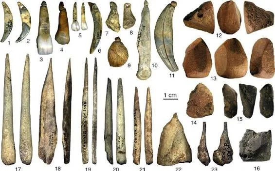
Excavations have yielded large collections of Mousterian stone tools, including scrapers, knives, Levallois flakes, denticulates, and spear points. These implements were primarily fashioned from locally available flint using sophisticated prepared-core techniques.

Animal remains recovered from the site include horse, red deer, reindeer, bison, and woolly rhinoceros. Numerous bones bear cut marks produced during butchering, while fractured long bones indicate deliberate extraction of nutrient-rich marrow. Together, these discoveries demonstrate highly organized hunting and food-processing practices.

Scientific Importance

Pech de l'Azé has played a major role in understanding Neanderthal behavior, particularly regarding the controlled use of fire. Modern microscopic analyses of hearth sediments have revealed repeated burning episodes and careful maintenance of fireplaces, challenging earlier assumptions that Neanderthals used fire only opportunistically.

Conclusion

Pech de l'Azé offers compelling evidence of Neanderthal technological skill and domestic life. Its remarkably preserved hearths, Mousterian tools, and hunting remains reveal that Neanderthals possessed sophisticated survival strategies, making the site one of the most significant Middle Paleolithic localities in France.

La Ferrassie: France's Neanderthal Family Burials

August 7, 2026

Introduction

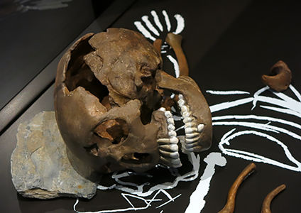
Situated in the Dordogne region of southwestern France, La Ferrassie is one of the world's most important Neanderthal archaeological sites. Dating primarily between 70,000 and 50,000 years ago, the rock shelter has yielded one of the largest collections of Neanderthal human remains ever discovered, including the skeletons of adults, children, and infants. The remarkable preservation of these individuals has led many archaeologists to interpret the site as evidence for intentional burial practices, offering valuable insight into Neanderthal social relationships, family life, and attitudes toward death.

Discovery and Excavation

Excavations beginning in the early twentieth century uncovered the remains of at least eight Neanderthal individuals, including men, women, adolescents, young children, and infants. The skeletons were found within carefully prepared sediment layers rather than randomly scattered, suggesting deliberate placement after death.

The exceptional preservation of the burials has made La Ferrassie one of the primary reference sites for studying Neanderthal anatomy, growth, and variation across different age groups.

Evidence of Burial Practices

Several of the skeletons appear to have been placed in shallow pits excavated into the cave floor before being carefully covered with sediment. Some burials show distinct body positioning and separation from ordinary occupation debris, leading many researchers to argue that Neanderthals intentionally buried their dead.

Although debate continues regarding the symbolic meaning of these burials, the evidence strongly suggests that Neanderthals demonstrated concern for deceased members of their community and may have practiced simple funerary rituals.

The presence of infants and young children among the burials also indicates that family groups occupied the shelter together rather than consisting solely of adult hunting parties.

Stone Tools and Daily Life

The archaeological layers contain abundant Mousterian flint tools, including scrapers, knives, spear points, and Levallois flakes. Hearths, butchered animal bones, and charcoal deposits demonstrate that La Ferrassie functioned as a long-term residential camp where families prepared food, manufactured tools, and shared daily activities.

Animal remains include horse, bison, red deer, and reindeer, reflecting skilled hunting strategies adapted to Ice Age environments.

Scientific Importance

La Ferrassie has become one of the world's most influential sites for understanding Neanderthal biology and behavior. The exceptional preservation of individuals from multiple age groups enables researchers to study childhood development, aging, disease, skeletal anatomy, and population diversity.

The site continues to contribute to debates concerning Neanderthal cognition, social organization, and symbolic behavior.

Conclusion

La Ferrassie remains one of the finest examples of Neanderthal family life ever discovered. Through its remarkable burials, extensive Mousterian artifacts, and well-preserved human fossils, the site provides extraordinary insight into the social complexity and humanity of our closest extinct relatives.

Le Moustier: France's Neanderthal Type Site

August 7, 2026

Introduction

Located in the Vézère Valley of Dordogne, Le Moustier is one of the most influential archaeological sites in prehistoric research. It is the type site for the Mousterian culture, the Middle Paleolithic stone tool industry closely associated with Neanderthals throughout Europe and western Asia. Occupied between approximately 160,000 and 40,000 years ago, the rock shelters preserve abundant evidence of Neanderthal technology, hunting, and daily life, making Le Moustier a cornerstone of Paleolithic archaeology.

The Discovery of the Mousterian Culture

During nineteenth-century excavations, archaeologists recognized a distinctive stone tool tradition unlike earlier Acheulean hand axes or later Upper Paleolithic blade industries. Because these tools were first systematically described at Le Moustier, the industry became known as the Mousterian.

This technological tradition spread widely across Europe and remained the dominant stone tool culture throughout much of the Neanderthal period.

Stone Tool Technology

The Mousterian industry at Le Moustier is characterized by the widespread use of the Levallois prepared-core technique, allowing stoneworkers to produce flakes of predetermined size and shape. These flakes were transformed into scrapers, knives, denticulates, points, and specialized cutting implements.

The efficiency of Mousterian technology enabled Neanderthals to maximize the usefulness of available raw materials while producing versatile tools suited for numerous tasks.

Neanderthal Fossils

Le Moustier is also famous for the discovery of two Neanderthal skeletons, including a remarkably preserved adolescent known as Le Moustier 1. The fossil provides valuable information about Neanderthal growth, anatomy, and muscular development.

Studies of these remains have helped scientists understand how Neanderthals matured and adapted physically to the demanding conditions of Ice Age Europe.

Daily Activities

Archaeological evidence indicates that Le Moustier functioned as a repeatedly occupied residential site. Hearths, butchered animal bones, stone-knapping debris, and hide-processing tools reveal a wide range of domestic activities.

The site's occupants hunted horses, bison, reindeer, and deer while using fire for cooking, warmth, and social interaction.

Conclusion

Le Moustier stands as one of the most influential archaeological sites in the world. As the defining locality of the Mousterian culture, it has shaped modern understanding of Neanderthal technology, adaptation, and daily life for more than a century.

La Chapelle-aux-Saints: France's Old Man Neanderthal

August 7, 2026

Introduction

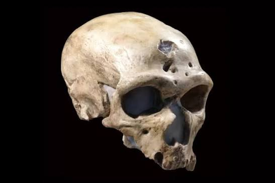
Located in Corrèze, southwestern France, La Chapelle-aux-Saints became internationally famous in 1908 following the discovery of one of the most complete Neanderthal skeletons ever found. Known as the "Old Man of La Chapelle," the individual lived approximately 60,000 years ago and has become one of the best-studied Neanderthal fossils in history. The skeleton provided groundbreaking evidence of Neanderthal anatomy, aging, healthcare, and possible intentional burial.

Discovery of the Skeleton

The nearly complete skeleton belonged to an elderly Neanderthal male estimated to have been around 50 to 60 years old, an unusually advanced age for the harsh conditions of the Middle Paleolithic. The body was found lying within a shallow pit beneath cave sediments, leading many archaeologists to interpret the discovery as an intentional burial.

The careful positioning of the skeleton remains one of the strongest pieces of evidence supporting the existence of Neanderthal funerary practices.

An Elderly Survivor

Examination of the skeleton revealed severe arthritis affecting the spine and limbs, as well as the complete loss of most teeth before death. Despite these debilitating conditions, the individual survived for many years after becoming largely unable to chew tough foods or participate fully in hunting.

Researchers believe that other members of the community must have provided food and care, suggesting strong social bonds and compassion among Neanderthals.

Scientific Legacy

Although early reconstructions portrayed the Old Man as stooped and primitive, later studies demonstrated that many of these characteristics resulted from advanced arthritis rather than typical Neanderthal anatomy. Modern research has corrected these misconceptions, presenting Neanderthals as intelligent, adaptable humans with sophisticated social lives.

The fossil continues to play an important role in studies of human evolution and prehistoric healthcare.

Conclusion

La Chapelle-aux-Saints transformed scientific understanding of Neanderthals by revealing that they cared for elderly individuals and possibly practiced intentional burial. The Old Man remains one of the most iconic fossils in the history of paleoanthropology.

Regourdou: France's Neanderthal Bear Cult Cave

August 7, 2026

Introduction

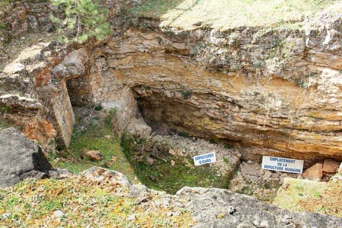
Located near Montignac in Dordogne, France, Regourdou Cave is a remarkable Middle Paleolithic site dating to approximately 70,000 years ago. The cave is famous for preserving both a Neanderthal burial and an extraordinary concentration of cave bear remains, leading some researchers to propose that the site represents evidence of a possible Neanderthal bear cult. Although this interpretation remains debated, Regourdou continues to provide important evidence regarding Neanderthal ritual behavior, hunting, and symbolic thought.

The Neanderthal Burial

Excavations uncovered the partial skeleton of an adult Neanderthal placed within a carefully prepared burial area. Stone tools, animal bones, and other archaeological materials surrounded the grave, suggesting that the burial occurred within an active occupation site.

The placement of the body has contributed to broader discussions concerning intentional burial practices among Neanderthals.

The Cave Bears

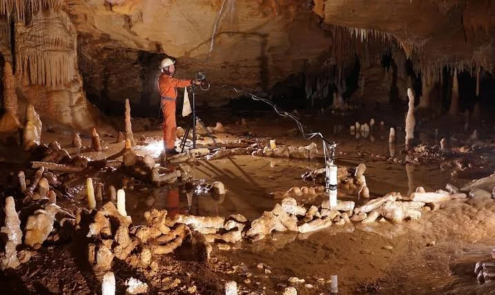
Hundreds of cave bear bones were discovered within specially arranged stone enclosures inside the cave. Some researchers suggested that these accumulations reflected ritual treatment of bears, perhaps indicating symbolic beliefs or ceremonial practices associated with these powerful animals.

Other archaeologists argue that the bear remains accumulated naturally through repeated hibernation and later geological processes. Regardless of interpretation, the concentration of cave bear fossils at Regourdou is among the richest in France.

Stone Tools and Occupation

The site yielded numerous Mousterian flint tools manufactured using Levallois techniques. Scrapers, knives, spear points, and flakes indicate a wide variety of activities including hunting, butchering, woodworking, and hide preparation.

Charcoal deposits and hearths demonstrate repeated occupation by Neanderthal hunting groups over many thousands of years.

Scientific Importance

Regourdou occupies a unique position in Paleolithic archaeology because it combines evidence of Neanderthal burial with abundant cave bear remains. Whether or not a true bear cult existed, the site continues to stimulate important discussions regarding Neanderthal cognition, symbolism, and ritual behavior.

Conclusion

Regourdou Cave remains one of France's most intriguing Neanderthal sites. Its remarkable combination of human fossils, cave bear deposits, and Mousterian artifacts.

Isturitz Cave: France's Magdalenian Flutes

August 7, 2026

Introduction

Located in the French Basque Country near the Pyrenees, Isturitz Cave is one of Europe's richest Upper Paleolithic archaeological sites. Occupied by prehistoric hunter-gatherers between approximately 35,000 and 12,000 years ago, the cave preserves evidence from several cultural periods, including the Aurignacian, Gravettian, Solutrean, and especially the Magdalenian culture. Isturitz is internationally renowned for its remarkable collection of bone flutes, making it one of the earliest known centers of prehistoric music in Europe.

The Magdalenian Occupation

During the Magdalenian period (approximately 17,000–12,000 years ago), Isturitz Cave became an important seasonal settlement where hunter-gatherers processed game, manufactured tools, created artwork, and participated in ceremonial activities. Extensive occupation layers contain hearths, stone blades, bone implements, engraved objects, and abundant animal remains.

The cave's large chambers provided an ideal environment for communal gatherings and long-term seasonal occupation.

The Bone Flutes

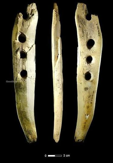
Isturitz Cave has yielded dozens of carefully crafted musical instruments made primarily from the hollow wing bones of vultures and other large birds. Craftspeople drilled evenly spaced finger holes into the bones, creating flutes capable of producing a range of musical notes.

These instruments represent some of the oldest directly preserved evidence of music in prehistoric Europe. Their careful craftsmanship demonstrates sophisticated knowledge of acoustics and suggests that music played an important role in ceremonies, storytelling, social gatherings, or ritual performances.

Art and Craftsmanship

In addition to its famous flutes, the cave contains engraved antler objects, decorated spear throwers, carved animal figures, pierced ornaments, and finely crafted bone needles. Stone tools include long blades, burins, end scrapers, and backed points characteristic of Magdalenian technology.

Many engraved artworks depict horses, bison, ibex, and reindeer with remarkable anatomical accuracy, reflecting the close relationship between prehistoric artists and the animals they depended upon.

Conclusion

Isturitz Cave is one of Europe's greatest Upper Paleolithic archaeological treasures. Its extraordinary collection of Magdalenian bone flutes, artistic engravings, and sophisticated hunting technology reveals the rich cultural life of Ice Age hunter-gatherers and provides some of the earliest evidence for the universal human tradition of making music.

Veyrier-du-Lac: France's Alpine Rock Shelter

August 7, 2026

Introduction

Located on the eastern shores of Lake Annecy in Haute-Savoie, France, Veyrier-du-Lac is an important prehistoric rock shelter situated at the foot of the French Alps. Occupied primarily during the Upper Paleolithic, particularly between 15,000 and 12,000 years ago, the site preserves evidence of Magdalenian hunter-gatherers who adapted to the mountainous environments that emerged as the last Ice Age came to an end. Excavations have uncovered stone tools, bone implements, hearths, ornaments, and animal remains that reveal how prehistoric communities successfully exploited alpine forests, lakes, and valleys while maintaining sophisticated cultural traditions.

Alpine Environment

During the Late Glacial period, glaciers were gradually retreating from the Alps, creating new valleys, freshwater lakes, and expanding forests. Veyrier-du-Lac occupied a strategic location overlooking Lake Annecy, where prehistoric hunters had access to freshwater, fish, migratory animals, edible plants, and high-quality stone suitable for tool production.

The rock shelter offered natural protection from harsh mountain weather while providing excellent visibility across surrounding valleys used by herds of red deer, ibex, reindeer, horses, and other game animals.

Settlement and Daily Life

Archaeological evidence suggests that Veyrier-du-Lac served as a seasonal hunting camp rather than a permanent village. Small groups of hunter-gatherers occupied the shelter during favorable seasons while pursuing migrating animals and collecting plant resources from the alpine landscape.

Numerous hearths indicate repeated occupations over many generations. Around these fireplaces, families prepared food, repaired hunting equipment, processed animal hides, manufactured tools, and shared social activities. The repeated use of the shelter demonstrates an intimate knowledge of seasonal migration patterns and environmental resources.

Stone and Bone Technology

Excavations have yielded finely crafted Upper Paleolithic blade tools, including burins, end scrapers, backed blades, and projectile points manufactured from high-quality flint. Bone and antler artifacts include needles, spear points, awls, and decorative objects that illustrate the remarkable craftsmanship of Magdalenian societies.

These specialized tools allowed prehistoric communities to sew tailored clothing, manufacture efficient hunting weapons, and construct shelters capable of withstanding changing climatic conditions.

Scientific Importance

Veyrier-du-Lac provides valuable evidence of how Late Ice Age hunter-gatherers adapted to newly emerging alpine ecosystems. The site documents changes in settlement patterns as glaciers retreated and demonstrates the flexibility of Magdalenian populations in exploiting a wide range of mountain resources.

Its archaeological remains also contribute to understanding the spread of Upper Paleolithic cultures throughout southeastern France.

Conclusion

Veyrier-du-Lac stands as an important example of prehistoric adaptation to alpine environments. Through its well-preserved stone tools, hearths, hunting evidence, and seasonal occupation layers, the site offers a detailed picture of Magdalenian life in the French Alps during the closing stages of the Ice Age.

Balma de l'Aubrac: France's Magdalenian Camp

August 7, 2026

Introduction

Situated within the rugged highlands of the Aubrac Plateau in southern France, Balma de l'Aubrac is an important Upper Paleolithic rock shelter associated with the Magdalenian culture, dating between approximately 17,000 and 12,000 years ago. The shelter preserves evidence of repeated seasonal occupations by highly mobile hunter-gatherers who followed migrating herds across the upland grasslands and river valleys of central France. Excavations have revealed hearths, stone blades, bone tools, ornaments, and butchered animal remains that illustrate the sophisticated lifeways of Europe's final Ice Age hunters.

Landscape and Seasonal Occupation

The Aubrac Plateau offered rich hunting grounds where large herbivores such as reindeer, wild horses, red deer, and bison grazed across open meadows. Balma de l'Aubrac overlooked important migration routes, making it an ideal temporary camp for hunting expeditions.

Rather than functioning as a permanent settlement, the shelter was occupied repeatedly during different seasons as Magdalenian groups moved across the landscape in search of game and other natural resources. This seasonal mobility allowed prehistoric communities to maximize food availability throughout the year.

Camp Organization

Excavations have identified several well-preserved hearths surrounded by concentrations of stone-knapping debris, butchered animal bones, and bone-working areas. These activity zones indicate that families organized their camps carefully, assigning specific areas for food preparation, tool manufacture, hide processing, and sleeping.

The repeated rebuilding of fireplaces suggests that the shelter remained an important stopping point within broader seasonal migration routes for many centuries.

Technology and Hunting

Stone artifacts recovered from the site include long blades, burins, end scrapers, backed points, and finely retouched projectile inserts. Bone and antler tools include spear tips, needles, fish hooks, and decorative pendants.

Animal bones display cut marks from systematic butchering, while fractured long bones indicate marrow extraction. Evidence suggests that hunters used spear throwers (atlatls) to increase the accuracy and force of their hunting weapons.

Artistic and Symbolic Objects

Alongside practical tools, archaeologists have recovered personal ornaments made from perforated animal teeth, shells, and carved bone. These decorative items likely expressed individual identity, social status, or cultural affiliation and demonstrate that artistic expression formed an important part of Magdalenian life.

Conclusion

Balma de l'Aubrac provides an excellent example of a Magdalenian seasonal hunting camp. Its organized living areas, advanced hunting technology, and symbolic artifacts reveal the adaptability and cultural sophistication of Upper Paleolithic hunter-gatherers living in the uplands of southern France.

Combe Grenal: France's Mousterian Sequence

August 7, 2026

Introduction

Nestled within the famous Vézère Valley of Dordogne, Combe Grenal is one of the world's most important Middle Paleolithic archaeological sites. The rock shelter preserves an exceptionally long sequence of occupation spanning approximately 200,000 to 40,000 years ago, documenting numerous climatic changes and repeated Neanderthal settlement. Its remarkable succession of archaeological layers has made Combe Grenal one of the key reference sites for studying the development of the Mousterian culture and the long-term adaptation of Neanderthals to fluctuating Ice Age environments.

A Long Archaeological Record

Unlike many prehistoric sites representing only a single occupation period, Combe Grenal contains more than 60 distinct archaeological layers, each recording separate episodes of human activity. These layers preserve evidence of changing climates, evolving stone tool technologies, shifts in hunting practices, and repeated returns by Neanderthal groups over tens of thousands of years.

The site's exceptional stratigraphy allows archaeologists to reconstruct one of the most complete chronological records of the European Middle Paleolithic.

Mousterian Technology

The archaeological sequence contains numerous varieties of Mousterian stone industries, reflecting technological adaptations through time. Neanderthal toolmakers employed prepared-core techniques such as the Levallois method to manufacture standardized flakes, which were transformed into scrapers, knives, denticulates, notched tools, and spear points.

Changes in tool design between different occupation layers demonstrate how Neanderthals adjusted their technology in response to shifting climates, available raw materials, and hunting strategies.

Hunting and Environmental Change

Animal remains recovered throughout the sequence include horse, bison, reindeer, red deer, mammoth, ibex, and woolly rhinoceros. Variations in species composition reflect repeated climatic shifts between warmer forested environments and colder open grasslands during the Pleistocene.

Cut marks, broken bones, and hearth remains demonstrate that Neanderthals consistently hunted, butchered, cooked, and processed large mammals throughout these environmental transitions.

Scientific Importance

Combe Grenal is considered one of Europe's most valuable archaeological sequences because it documents nearly the entire history of Neanderthal occupation in southwestern France. Its detailed stratigraphy has enabled researchers to correlate archaeological evidence with climatic fluctuations and technological development over more than 150,000 years.

The site continues to serve as a benchmark for studies of Neanderthal evolution, settlement patterns, and adaptation.

Conclusion

Combe Grenal provides one of the most complete records of Middle Paleolithic life ever discovered. Its extensive Mousterian sequence, well-preserved archaeological layers, and evidence of long-term Neanderthal occupation make it an indispensable site for understanding human adaptation during the European Ice Age.

Chucalissa: Tennessee's Shell-Tempered Pottery Site

August 2, 2026

Introduction

Situated on a bluff overlooking the Mississippi River near Memphis, Tennessee, Chucalissa was an important Mississippian village occupied between approximately 1000 and 1500 CE. The name Chucalissa, meaning "abandoned house" in the Choctaw language, was assigned to the site in modern times. Covering nearly 40 acres (16 hectares), the settlement contained platform mounds, residential neighborhoods, ceremonial plazas, and workshops where skilled artisans produced distinctive shell-tempered pottery, one of the defining technologies of the Mississippian world. Today, the site is preserved as the C.H. Nash Museum at Chucalissa, providing valuable insight into prehistoric life in the Mississippi Valley.

Settlement and Monumental Architecture

The village was centered around a broad ceremonial plaza surrounded by earthen platform mounds supporting temples, council houses, and elite residences. Ordinary families lived in rectangular houses constructed from wooden poles woven with cane and covered in clay plaster. The carefully organized layout reflects the hierarchical social structure characteristic of Mississippian communities.

The mounds were built through repeated additions of compacted earth transported in woven baskets. Elevated public buildings protected important structures from flooding while emphasizing the authority of political and religious leaders.

Shell-Tempered Pottery Technology

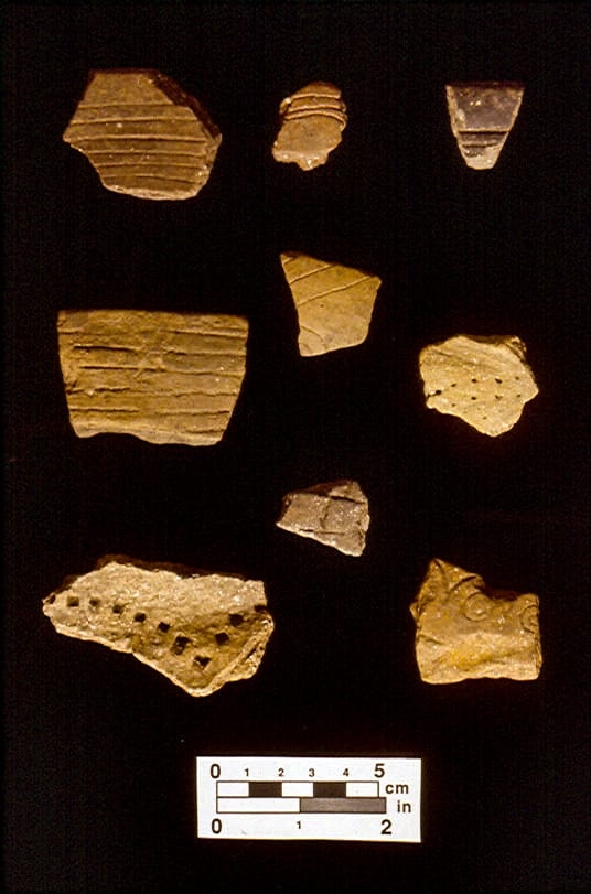
One of Chucalissa's most significant archaeological discoveries is its extensive production of shell-tempered pottery. Potters crushed freshwater mussel shells into fine particles and mixed them with clay before shaping vessels by hand. During firing, the shell temper strengthened the pottery, making it lighter, more durable, and more resistant to cracking than earlier ceramic traditions.

Artisans produced cooking pots, storage jars, serving bowls, ceremonial vessels, and decorated containers featuring incised geometric designs, animal motifs, and symbolic patterns. These ceramics were widely traded throughout the Mississippi Valley and became one of the defining characteristics of Mississippian culture.

Daily Life and Economy

The inhabitants relied on intensive maize agriculture supplemented by beans, squash, sunflower cultivation, hunting, fishing, and gathering wild resources. The nearby Mississippi River provided abundant fish, freshwater mussels, and transportation routes connecting Chucalissa with neighboring communities.

Craft specialists manufactured pottery, stone tools, shell ornaments, bone implements, and woven textiles. Trade networks brought exotic materials such as marine shell, copper, and high-quality stone from distant regions, demonstrating Chucalissa's participation in extensive regional commerce.

Archaeological Importance

Excavations have uncovered house floors, storage pits, hearths, pottery kilns, food remains, ceremonial artifacts, and burial features that provide detailed evidence of Mississippian daily life. Chucalissa is particularly valuable because its well-preserved shell-tempered ceramics have allowed archaeologists to better understand prehistoric manufacturing techniques and regional trade.

Conclusion

Chucalissa represents one of Tennessee's finest examples of a Mississippian farming village, combining monumental earthworks with advanced ceramic technology. Its platform mounds, organized community layout, and mastery of shell-tempered pottery illustrate the technological innovation, agricultural prosperity, and artistic achievements of prehistoric Native American societies in the Mississippi Valley.

Renfrew Mounds: Mississippi's Moundville Satellite

August 2, 2026

Introduction

Located in northeastern Mississippi, the Renfrew Mounds represent an important regional ceremonial center associated with the expansion of Mississippian culture across the Tennessee–Tombigbee river system. Occupied between approximately 1200 and 1450 CE, the settlement functioned as a smaller political and ceremonial community closely connected to the larger Mississippian centers of the Southeast, particularly Moundville in present-day Alabama. Because of similarities in architecture, pottery, and ceremonial artifacts, archaeologists regard Renfrew as one of the satellite communities that participated in the broader Moundville cultural network. The site demonstrates how Mississippian political influence extended across multiple river valleys through shared religious traditions, trade, and architectural practices.

Settlement Layout and Platform Mounds

The Renfrew Mounds were organized around a central ceremonial plaza bordered by several earthen platform mounds. These elevated structures were constructed by transporting compacted clay and soil in woven baskets over many years. The largest mound likely supported a temple or the residence of a local chief, while smaller mounds served as council houses, ceremonial buildings, and elite residences.

The surrounding residential area consisted of rectangular wooden houses arranged around the ceremonial center. Storage pits, workshops, and agricultural fields indicate that Renfrew supported a permanent farming population while serving as an important gathering place for nearby villages.

Connections to Moundville

Archaeological evidence demonstrates strong cultural ties between Renfrew and Moundville, one of the largest Mississippian cities in the Southeast. Pottery styles, engraved shell ornaments, ceremonial stone tools, and architectural layouts closely resemble those found at Moundville, suggesting frequent interaction through trade, migration, or political alliances.

The site likely functioned as a regional administrative center where local leaders maintained relationships with larger chiefdoms while governing surrounding farming communities. These connections illustrate the widespread influence of Mississippian civilization throughout the southeastern United States.

Economy and Religious Life

Residents cultivated maize, beans, squash, and sunflowers while hunting deer and fishing in nearby rivers. Agricultural surpluses supported priests, craftsmen, and community leaders responsible for organizing ceremonies and maintaining public buildings.

Religious festivals held within the central plaza included ritual dances, feasting, ancestor veneration, and agricultural ceremonies associated with seasonal cycles. Temples atop the platform mounds reinforced the sacred authority of local chiefs and strengthened community identity.

Archaeological Importance

Excavations have uncovered pottery, shell ornaments, stone tools, food remains, and building foundations that reveal the daily life of a regional Mississippian community. Renfrew is especially important because it demonstrates how large ceremonial capitals such as Moundville influenced surrounding settlements without direct political control.

Conclusion

The Renfrew Mounds illustrate the regional expansion of Mississippian civilization beyond its major urban centers. Its platform mounds, ceremonial plaza, agricultural economy, and strong cultural ties with Moundville highlight the interconnected political and religious landscape of the prehistoric Southeast. The site remains an important example of how smaller ceremonial communities contributed to the success and spread of Mississippian culture.

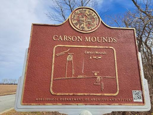
Carson Mounds: Mississippi's Mound Group Metropolis

August 2, 2026

Introduction

Situated near Clarksdale, Mississippi, in the fertile Yazoo Basin, the Carson Mounds comprise one of the largest prehistoric mound complexes in the Lower Mississippi Valley. Occupied primarily between 1200 and 1500 CE, the site served as a major regional center during the late Mississippian Period, functioning as a political, ceremonial, and economic metropolis. Spread across several hundred acres, Carson originally contained more than 80 earthen mounds, making it one of the most extensive mound groups ever constructed in North America. Its impressive scale demonstrates the remarkable organizational abilities and engineering expertise of the Indigenous societies that inhabited the Mississippi Delta.

Urban Planning and Monumental Earthworks

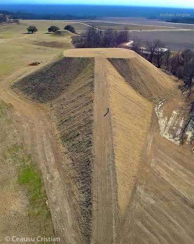
Unlike many Mississippian towns organized around a single plaza, Carson consisted of numerous mound groups distributed across a broad landscape connected by open spaces and residential districts. The largest platform mounds supported temples, council houses, and elite residences, while smaller mounds served ceremonial, administrative, or funerary purposes.

Builders transported enormous quantities of clay and earth using woven baskets, constructing each mound through repeated stages over several generations. The careful layering of soils improved stability and resistance to erosion, allowing many of the earthworks to survive for centuries despite periodic flooding.

The site's expansive layout suggests that Carson functioned as a regional capital serving numerous surrounding farming communities rather than a single compact settlement.

Political, Religious, and Economic Role

Carson Mounds served as an important political center where hereditary chiefs governed surrounding communities and organized large public ceremonies. Religious rituals conducted atop the platform mounds honored ancestral spirits, agricultural deities, and celestial forces believed to influence fertility and prosperity.

The central plazas hosted seasonal festivals, public feasts, ritual dances, athletic competitions, and diplomatic gatherings that strengthened regional alliances. Agricultural surpluses from nearby villages supported priests, craftsmen, political leaders, and other specialists living within the ceremonial center.

Carson also participated in extensive trade networks linking communities throughout the Mississippi Valley. Artifacts recovered from the site include decorated pottery, shell ornaments, stone tools, copper objects, and exotic materials imported from distant regions, demonstrating its importance as a commercial hub.

Engineering and Archaeological Importance

The construction of more than eighty mounds required careful planning, centralized leadership, and coordinated labor over many centuries. Archaeological excavations have uncovered house foundations, storage pits, workshops, ceremonial buildings, burial areas, and thousands of artifacts that provide valuable information about Mississippian social organization and urban development.

The sheer number and diversity of mounds make Carson one of the most significant archaeological landscapes in North America, illustrating how regional political centers evolved after the decline of Cahokia while maintaining many of the same religious and architectural traditions.

Conclusion

The Carson Mounds represent one of the largest and most impressive Mississippian mound complexes ever constructed in North America. Its vast network of platform mounds, ceremonial plazas, residential districts, and trade connections reflects a highly organized civilization capable of coordinating monumental public works and sustaining complex political and religious institutions. Today, Carson remains one of Mississippi's most significant archaeological sites, offering invaluable insight into the engineering achievements, urban planning, and cultural legacy of the Indigenous peoples who flourished in the Lower Mississippi Valley before European contact.

Feltus Mounds: Mississippi's Plaquemine Culture

August 2, 2026

Introduction

Located in Jefferson County, Mississippi, overlooking the fertile floodplains of the Mississippi River, the Feltus Mounds represent one of the best-preserved ceremonial centers of the Plaquemine culture, which flourished between approximately 1200 and 1540 CE. The Plaquemine people were descendants of earlier Mississippian societies who developed distinctive political and religious traditions in the Lower Mississippi Valley. Covering more than 36 acres (15 hectares), Feltus consisted of several large platform mounds arranged around broad ceremonial plazas, serving as an important center for religious rituals, political gatherings, trade, and community celebrations.

Site Layout and Platform Mounds

The Feltus complex contains four large earthen platform mounds surrounding a spacious rectangular plaza. These mounds were constructed through repeated additions of compacted clay and soil, transported in thousands of woven baskets over many generations. Their flat summits supported wooden temples, council houses, elite residences, and ceremonial buildings elevated above the surrounding landscape.

The carefully planned arrangement of the mounds created a formal ceremonial precinct where public rituals and community gatherings could take place. Broad ramps connected the plaza with the elevated structures, allowing processions to move between sacred spaces during religious festivals.

Religious and Ceremonial Functions

Feltus served primarily as a ceremonial center rather than a densely populated town. The expansive plaza hosted seasonal festivals, dances, feasts, athletic competitions, and diplomatic meetings involving neighboring communities. Priests conducted rituals atop the platform mounds to honor ancestral spirits, agricultural deities, and supernatural beings associated with fertility and cosmic order.

The site's architecture reflects the Plaquemine emphasis on sacred landscapes, where elevated mounds symbolized the connection between the human world and the spiritual realm. Ceremonial gatherings strengthened alliances between communities while reinforcing the authority of hereditary leaders.

Agriculture and Daily Life

Nearby villages surrounding Feltus cultivated maize, beans, squash, sunflowers, and other crops in the fertile alluvial soils of the Mississippi River Valley. Hunting deer, turkey, and small game, together with fishing and gathering wild plants, supplemented agricultural production.

Archaeological excavations have uncovered finely crafted pottery, stone tools, shell ornaments, and food remains, indicating a prosperous farming society supported by extensive regional trade. The community maintained cultural connections with neighboring Mississippian and Plaquemine settlements while preserving its own distinctive artistic traditions.

Archaeological Significance

The Feltus Mounds provide valuable evidence for understanding the evolution of the Plaquemine culture after the decline of Cahokia and other major Mississippian centers. Excavations have revealed multiple construction phases, ceremonial buildings, domestic structures, and numerous artifacts that illuminate changes in political organization, religious practices, and regional interaction.

Because the site remained relatively undisturbed for centuries, archaeologists have been able to reconstruct its original layout with considerable accuracy, making Feltus one of the most important Plaquemine archaeological sites in Mississippi.

Conclusion

The Feltus Mounds stand as an outstanding example of Plaquemine ceremonial architecture, demonstrating the continued tradition of platform mound construction in the Lower Mississippi Valley after the height of the Mississippian Civilization. Its monumental earthworks, organized plazas, agricultural economy, and rich ceremonial life reveal a sophisticated Indigenous society whose cultural achievements continued to shape the region well into the centuries preceding European contact.

Grand Village of the Natchez: Mississippi's 17th-Century Site

August 2, 2026

Introduction

Located near present-day Natchez, Mississippi, the Grand Village of the Natchez served as the principal political, religious, and ceremonial center of the Natchez Nation during the 17th and early 18th centuries CE. Occupied from approximately 1680 to 1730 CE, the settlement became one of the last great Indigenous ceremonial centers in the Lower Mississippi Valley before European colonization permanently altered Native American societies. The site consisted of three large platform mounds surrounding an open central plaza, where temples, elite residences, and council buildings symbolized the close relationship between political leadership and religious authority. The Grand Village was also the residence of the Great Sun, the hereditary ruler of the Natchez, whose authority was believed to have divine origins. Today, the site provides one of the clearest archaeological and historical records of a Mississippian-descended society encountered by European explorers.

Settlement Layout and Monumental Mounds

The Grand Village was carefully organized around a spacious central ceremonial plaza, bordered by three prominent earthen platform mounds. Each mound supported an important structure associated with government, religion, or elite residence. The largest mound, known as the Temple Mound, housed the sacred temple where an eternal fire was maintained by priests and priestesses. This fire symbolized the spiritual continuity and divine protection of the Natchez people.

A second mound supported the residence of the Great Sun, while another served as the location for council meetings and administrative functions. Surrounding the plaza were clusters of ordinary houses constructed from wooden poles covered with woven cane mats and coated with clay plaster. The orderly arrangement of buildings reflected a well-planned community centered on ceremonial and political life.

Political and Religious Organization

Natchez society was highly stratified, with hereditary social classes headed by the Great Sun, who functioned as both political ruler and sacred leader. His authority was reinforced through elaborate religious ceremonies held atop the platform mounds, where priests conducted rituals honoring the Sun, ancestral spirits, and agricultural deities.

Public festivals celebrated seasonal events such as planting and harvesting, while diplomatic councils and legal proceedings took place within the central plaza. The sacred temple also housed important ceremonial objects, including carved wooden statues, ritual offerings, and the remains of distinguished ancestors. These religious traditions preserved many features inherited from the earlier Mississippian Civilization while adapting to changing historical circumstances.

European Contact

French explorers first encountered the Natchez during the late seventeenth century and recorded detailed descriptions of the Grand Village, making it one of the best-documented Indigenous ceremonial centers in North America. The French observed the impressive platform mounds, the sacred temple with its perpetual fire, and the elaborate rituals performed by Natchez priests.

Relations between the Natchez and French settlers gradually deteriorated because of expanding colonial settlements and increasing demands for land. Tensions culminated in the Natchez Revolt of 1729, during which Natchez warriors attacked the French settlement at Fort Rosalie. The French and their Native allies eventually defeated the Natchez, leading to the destruction of the Grand Village and the dispersal of the Natchez Nation throughout the Southeast.

Archaeological Importance

Excavations at the Grand Village have uncovered house foundations, pottery, stone tools, shell ornaments, food remains, ceremonial objects, and evidence of multiple construction phases. Because these archaeological discoveries can be compared directly with historical accounts written by French observers, the site provides a rare opportunity to verify and better understand Indigenous political organization, religious practices, and daily life during the early colonial period.

The preservation of the platform mounds and ceremonial plaza continues to offer valuable insights into the final centuries of Mississippian cultural traditions.

Conclusion

The Grand Village of the Natchez represents one of the last flourishing ceremonial capitals of the Mississippian cultural tradition before European colonization transformed the Native societies of the Southeast. Its monumental platform mounds, sacred temples, centralized political system, and well-documented religious ceremonies demonstrate the remarkable continuity of Indigenous civilization in the Lower Mississippi Valley. Today, the site remains one of the most important archaeological and historical landmarks in Mississippi, preserving the legacy of the Natchez people and their enduring cultural achievements.

Winterville Mounds: Mississippi's Temple Complex

August 2, 2026

Introduction

Located near Greenville, Mississippi, the Winterville Mounds formed one of the most important ceremonial centers of the Mississippian Civilization between approximately 1000 and 1450 CE. Positioned within the fertile Mississippi Delta, the site served primarily as a religious and political complex rather than a densely populated city. Covering more than 40 acres (16 hectares), Winterville originally contained at least 23 earthen mounds surrounding expansive ceremonial plazas. These earthworks supported temples, elite residences, and council buildings, making Winterville one of the principal ceremonial centers of the lower Mississippi Valley.

Monumental Earthworks

The largest mound at Winterville rises approximately 55 feet (17 meters) above the surrounding plain, making it one of the tallest prehistoric platform mounds in Mississippi. Builders transported countless basket loads of earth to construct flat-topped platforms capable of supporting large wooden structures.

The mounds were arranged around broad open plazas that served as gathering places for ceremonies, public meetings, athletic contests, and seasonal festivals. Carefully planned pathways connected the mounds, allowing processions to move between sacred buildings during important religious events.

The repeated enlargement of the mounds over several centuries reflects the continued importance of Winterville as a regional ceremonial center.

Religious Functions

Unlike many Mississippian settlements that combined residential and ceremonial functions, Winterville appears to have been occupied mainly during religious festivals and major public gatherings. Temples atop the mounds housed priests who conducted rituals honoring agricultural deities, ancestors, and supernatural beings believed to control the natural world.

The central plazas provided space for communal feasts, ritual dances, diplomatic meetings, and ceremonies that strengthened alliances among neighboring communities. Religious leaders likely used these events to reinforce social order and maintain political influence across the surrounding region.

Artifacts associated with the Southeastern Ceremonial Complex, including engraved shell ornaments, decorated pottery, ceremonial stone pipes, and symbolic artwork, indicate that Winterville participated in the broader Mississippian religious tradition.

Agriculture and Regional Influence

Although relatively few people lived permanently at Winterville, nearby farming villages supplied food and labor for the ceremonial center. Residents cultivated maize, beans, squash, and other crops while hunting, fishing, and gathering resources from the rich wetlands of the Mississippi Delta.

Trade connected Winterville with other Mississippian centers throughout the Southeast, facilitating the exchange of raw materials, ceremonial goods, artistic styles, and religious ideas. These interactions helped maintain Winterville's importance as a regional spiritual center for centuries.

Archaeological Importance

Archaeological investigations have uncovered evidence of temples, plazas, pottery workshops, ceremonial artifacts, food remains, and multiple construction phases. These discoveries demonstrate that Winterville was one of the most significant ceremonial complexes in the Mississippi Delta and contributed to the spread of Mississippian religious traditions throughout the region.

Today, the site is preserved as Winterville Mounds Archaeological Park, where ongoing research continues to reveal new information about the political, religious, and cultural life of Mississippian societies.

Conclusion

Winterville Mounds represents one of the most important ceremonial landscapes of the Mississippian Civilization, showcasing monumental platform mounds, sacred temples, expansive plazas, and sophisticated earthwork engineering. Its role as a regional religious center demonstrates the deep spiritual traditions, political organization, and architectural achievements of Indigenous societies in the Mississippi Delta, preserving an enduring legacy of one of North America's most remarkable prehistoric civilizations.

Emerald Mound: Mississippi's Second-Largest Platform

August 2, 2026

Introduction

Located near Natchez, Mississippi, Emerald Mound is one of the largest prehistoric earthworks ever constructed in the United States and the second-largest platform mound in North America after Monks Mound at Cahokia. Built primarily between 1200 and 1730 CE, the mound served as a major ceremonial and political center for the Natchez people, descendants of the Mississippian cultural tradition. Covering approximately 8 acres (3.2 hectares) and rising nearly 35 feet (11 meters) above the surrounding landscape, Emerald Mound was the location of temples, elite residences, and sacred ceremonies that reinforced the authority of Natchez rulers. Its immense scale reflects centuries of organized labor, sophisticated engineering, and religious significance.

Construction and Architecture

Unlike many platform mounds that consist of a single elevated platform, Emerald Mound was constructed by enlarging a natural hill and reshaping it into a massive ceremonial terrace. Builders transported enormous quantities of clay and earth, depositing them in carefully compacted layers to create a stable platform capable of supporting numerous wooden buildings.

Along the summit, smaller secondary mounds were built to elevate temples, council houses, and the residences of hereditary chiefs above the main platform. Broad ramps and stairways connected these sacred buildings to the plaza below, allowing ceremonial processions to ascend during important religious festivals.

The careful shaping of the mound demonstrates advanced engineering knowledge, including effective drainage systems and soil compaction techniques that preserved the structure despite centuries of weathering.

Political and Religious Importance

Emerald Mound functioned as the ceremonial heart of the Natchez chiefdom. The summit housed temples where sacred fires were maintained continuously by priests, reflecting beliefs in the divine authority of the ruling elite. The Natchez Great Sun, regarded as both a political leader and a sacred figure, likely presided over important ceremonies conducted atop the mound.

The surrounding plaza hosted seasonal festivals, diplomatic meetings, public feasts, dances, and religious rituals attended by communities from throughout the region. These gatherings reinforced social unity while strengthening the political authority of Natchez leaders.

Ancestor worship, agricultural ceremonies, and solar symbolism played central roles in the religious life centered at Emerald Mound, continuing traditions inherited from earlier Mississippian societies.

Economy and Society

The Natchez cultivated large fields of maize, beans, squash, and sunflowers, taking advantage of the fertile soils of the Mississippi River Valley. Agricultural surpluses supported skilled artisans, priests, warriors, and political leaders who lived near the ceremonial center.

Trade connected Emerald Mound with neighboring communities throughout the Southeast. Archaeologists have discovered pottery, stone tools, shell ornaments, copper artifacts, and ceremonial objects that illustrate extensive regional exchange and participation in the broader Mississippian cultural network.

Archaeological Importance

Excavations at Emerald Mound have uncovered house remains, ceremonial structures, pottery, stone tools, food remains, and evidence of repeated construction phases. These discoveries provide valuable information about the evolution of Natchez society during the centuries immediately preceding European contact.

Because the Natchez were among the few Mississippian descendants encountered and documented by early French explorers, Emerald Mound also serves as an important link between archaeological evidence and historical accounts describing Indigenous political and religious traditions.

Conclusion

Emerald Mound stands as one of North America's greatest prehistoric monuments, representing the political power, religious traditions, and engineering achievements of the Natchez people. Its enormous platform, ceremonial buildings, and sacred plazas illustrate the continuation of Mississippian culture into the early historic period, preserving an extraordinary example of Indigenous monumental architecture in the Lower Mississippi Valley.

Aztalan: Wisconsin's Stockaded Pyramid Village

August 2, 2026

Introduction

Located along the Crawfish River in present-day Jefferson County, Wisconsin, Aztalan was one of the northernmost settlements influenced by the Mississippian Civilization. Occupied between approximately 1000 and 1300 CE, the site flourished as a fortified ceremonial, political, and trading center that connected the cultures of the Upper Midwest with the great Mississippian cities farther south, particularly Cahokia in present-day Illinois. Covering nearly 20 acres (8 hectares), Aztalan featured massive earthen platform mounds, defensive stockades, residential neighborhoods, ceremonial plazas, and specialized workshops. Although considerably smaller than Cahokia, Aztalan demonstrates how Mississippian culture spread hundreds of kilometers beyond the Mississippi Valley while adapting to the forests and river systems of Wisconsin.

Urban Planning and Settlement Layout

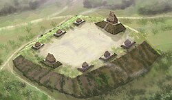
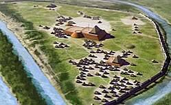
Aztalan was carefully planned around a large rectangular central plaza, which served as the heart of religious ceremonies, public gatherings, athletic competitions, and community celebrations. Surrounding the plaza were several earthen platform mounds that supported important public buildings, including temples, council houses, and the residences of political and religious leaders.

The community's houses were arranged in organized neighborhoods enclosed within the defensive walls. Storage pits, workshops, cooking areas, and refuse deposits indicate that the settlement supported a permanent population engaged in farming, trade, and specialized craft production. Pathways connected the residential districts to the ceremonial center, reflecting a well-organized urban design that balanced daily life with religious and political functions.

Platform Mounds and Monumental Construction

The most recognizable features of Aztalan are its three large platform mounds, constructed by transporting thousands of basket loads of clay and earth. Builders carefully layered soils to improve stability and reduce erosion, creating flat-topped platforms that elevated important structures above the surrounding landscape.

The largest mound likely supported the residence of the ruling chief or a temple where priests conducted religious ceremonies. Other mounds housed public buildings used for administration, community meetings, and ceremonial rituals. These elevated structures symbolized political authority while protecting important buildings from seasonal flooding.

The engineering techniques used at Aztalan closely resemble those found at Cahokia, demonstrating the influence of Mississippian architectural traditions throughout the Upper Midwest.

The Defensive Stockade

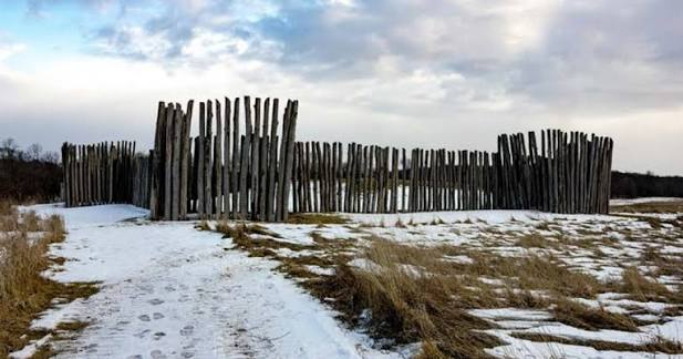
One of Aztalan's most distinctive features was its impressive wooden stockade, which surrounded much of the settlement. The wall consisted of closely spaced oak posts driven deeply into the ground and reinforced with horizontal beams. At regular intervals, rectangular bastions projected outward from the wall, allowing defenders to observe approaching visitors and protect vulnerable sections of the enclosure.

The stockade served several purposes. It provided military defense against potential enemies, controlled entry through designated gateways, and clearly marked the political and ceremonial boundaries of the community. The construction of such an extensive fortification required coordinated labor and careful planning, illustrating the organizational abilities of Aztalan's inhabitants.

Agriculture, Trade, and Daily Life

The people of Aztalan practiced intensive agriculture centered on maize (corn) cultivation, supplemented by beans, squash, and sunflowers. Hunting deer, elk, waterfowl, and fishing in the Crawfish River provided additional sources of food, allowing the community to maintain a stable year-round population.

Archaeological excavations have uncovered evidence of extensive trade with distant regions. Artifacts made from Gulf Coast marine shells, Great Lakes copper, southern chert, and exotic stone demonstrate that Aztalan participated in the widespread Mississippian trade network. Skilled artisans produced decorated pottery, stone tools, shell ornaments, and ceremonial objects that reflected both local traditions and southern cultural influences.

Religion and Ceremonial Life

Religion played a central role in Aztalan's society. Ceremonies held within the central plaza and atop the platform mounds reinforced the authority of community leaders while honoring ancestors, agricultural spirits, and supernatural beings associated with the Mississippian religious tradition.

Priests likely conducted seasonal rituals connected to planting and harvesting, while public festivals brought together neighboring communities for feasting, trade, and ceremonial performances. Decorative artifacts recovered from the site—including engraved pottery and ceremonial objects—indicate that Aztalan participated in the broader Southeastern Ceremonial Complex, sharing religious symbols and beliefs with other Mississippian centers.

Archaeological Importance

Excavations at Aztalan have revealed house foundations, defensive walls, storage pits, pottery workshops, burial areas, and thousands of artifacts that illuminate daily life in one of the northernmost Mississippian communities. The remarkable preservation of the site has enabled archaeologists to reconstruct its urban layout, defensive architecture, and cultural connections with Cahokia and other Mississippian centers.

Today, Aztalan is recognized as one of Wisconsin's most important archaeological sites, providing valuable evidence of cultural interaction, long-distance trade, and the spread of Mississippian civilization throughout eastern North America.

Conclusion

Aztalan stands as one of the finest examples of a Mississippian-influenced fortified village in the Upper Midwest. Its platform mounds, wooden stockade, central ceremonial plaza, organized neighborhoods, and thriving agricultural economy demonstrate the successful adaptation of Mississippian urban planning to Wisconsin's river valleys. The site remains a testament to the engineering skill, political organization, and cultural achievements of the Indigenous peoples who flourished there nearly one thousand years ago.

Cahokia's Woodhenge: Illinois' Solar Calendar Circles

August 2, 2026

Introduction

Located within the ancient city of Cahokia near present-day Collinsville, Illinois, Woodhenge was a remarkable circular arrangement of massive wooden posts that functioned as a prehistoric solar observatory and ceremonial calendar. Constructed between approximately 900 and 1200 CE, Woodhenge formed part of the largest urban center of the Mississippian Civilization, whose population may have reached 15,000 to 20,000 people at its peak, making Cahokia the largest city north of Mexico before European contact. Archaeologists have identified at least five successive versions of Woodhenge, each consisting of carefully positioned wooden posts arranged in concentric circles of increasing diameter. These structures demonstrate the advanced astronomical knowledge of the Cahokian people and reveal how celestial observations were closely integrated with religion, agriculture, and political authority.

Construction and Design

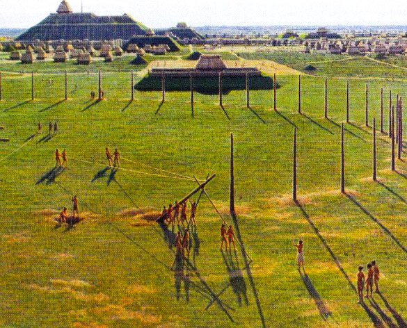
Woodhenge consisted of large red cedar posts placed upright in circular patterns surrounding a central observation point. The earliest circle contained approximately 24 posts, while later versions expanded to as many as 72 posts, with diameters exceeding 120 meters (394 feet). Builders dug deep postholes, inserted massive tree trunks, and packed the surrounding soil tightly to ensure stability. The cedar posts likely stood several meters above the ground, creating a prominent ceremonial landmark visible from nearby mounds and plazas.

Each successive reconstruction expanded the circle while preserving its astronomical alignments, demonstrating careful planning and long-term maintenance over several centuries. The repeated rebuilding of Woodhenge suggests that the structure remained central to Cahokia's ceremonial life and reflected the growing importance of astronomical observations within the city.

Astronomical Functions

Woodhenge functioned as an accurate solar calendar. Standing at the center of the circle, an observer could watch the rising sun align precisely with specific wooden posts during important events in the solar year.

During the spring (vernal) and autumn (autumnal) equinoxes, the rising sun appeared directly above designated posts marking equal lengths of day and night. Other posts aligned with the sunrise during the summer solstice, when daylight reached its maximum length, and the winter solstice, when daylight was shortest. These observations allowed Cahokian priests and astronomers to determine the changing seasons with remarkable accuracy.

The solar calendar helped establish the timing of agricultural activities such as planting maize, harvesting crops, and organizing seasonal ceremonies. By monitoring the movement of the sun throughout the year, religious leaders could predict important seasonal transitions and maintain ceremonial calendars essential to community life.

Religious and Political Significance

Woodhenge served not only as an astronomical instrument but also as a sacred ceremonial space. Many scholars believe priests conducted rituals at sunrise during solstices and equinoxes, celebrating the renewal of life, agricultural fertility, and the cosmic order believed to govern the universe.

The site's location west of Monks Mound, the largest earthen pyramid at Cahokia, suggests a symbolic relationship between the solar observatory and the city's political-religious center. Chiefs and priests may have used the accurate prediction of celestial events to reinforce their spiritual authority, demonstrating their ability to interpret divine signs and maintain harmony between the heavens and the human world.

Large public gatherings likely accompanied these astronomical events, strengthening community identity while reinforcing the legitimacy of Cahokia's ruling elite.

Engineering and Scientific Achievement

The construction of Woodhenge required remarkable mathematical precision and engineering skill. Builders carefully surveyed the landscape to establish a true central observation point before placing each cedar post according to specific astronomical alignments. Maintaining accurate orientations across multiple generations demonstrates sophisticated knowledge of geometry, horizon observations, and solar movement.

Unlike Europe's Stonehenge, which was built from massive stone blocks, Cahokia's Woodhenge utilized renewable timber resources available in the Mississippi Valley. Although the wooden posts eventually decayed, successive generations reconstructed the observatory with impressive consistency, preserving its scientific and ceremonial functions for centuries.

Archaeological Importance

Excavations at Cahokia have uncovered the circular arrangement of postholes left by the wooden structures, allowing archaeologists to reconstruct the observatory's original design. These discoveries have confirmed that Woodhenge was intentionally aligned with significant solar events rather than randomly arranged. Today, a modern reconstruction of one of the circles enables visitors to witness the same sunrise alignments observed by Cahokia's inhabitants over a thousand years ago.

Woodhenge remains one of the finest examples of prehistoric astronomy in North America and provides valuable evidence that Indigenous societies possessed advanced observational science long before European contact.

Conclusion

Cahokia's Woodhenge stands as one of the greatest scientific and ceremonial achievements of the Mississippian Civilization. Its carefully engineered circles of cedar posts functioned as an accurate solar calendar, enabling the people of Cahokia to track the seasons, organize agriculture, and conduct religious ceremonies according to celestial events. The monument demonstrates the civilization's sophisticated understanding of astronomy, mathematics, engineering, and urban planning, highlighting the remarkable intellectual accomplishments of North America's largest prehistoric city.

Kincaid Mounds: Illinois' Mississippian Citadel

August 2, 2026

Introduction

Situated along the Ohio River in southern Illinois, Kincaid Mounds was one of the most important regional centers of the Mississippian Civilization between approximately 1050 and 1450 CE. Covering nearly 141 acres (57 hectares), the settlement served as a fortified political, religious, and economic center that controlled trade routes throughout the lower Ohio River Valley. Although smaller than Cahokia, Kincaid was among the largest Mississippian towns in the Midwest and played a vital role in spreading Mississippian culture across the region. Its monumental earthworks, defensive fortifications, organized residential districts, and ceremonial architecture reveal a highly structured society with centralized leadership and advanced engineering capabilities.

Urban Planning and Fortified Layout

Kincaid Mounds was designed around a large central ceremonial plaza, surrounded by numerous earthen platform mounds, residential neighborhoods, public buildings, and defensive structures. Archaeologists have identified at least 19 platform mounds, although some were only partially completed or later modified during the site's occupation.

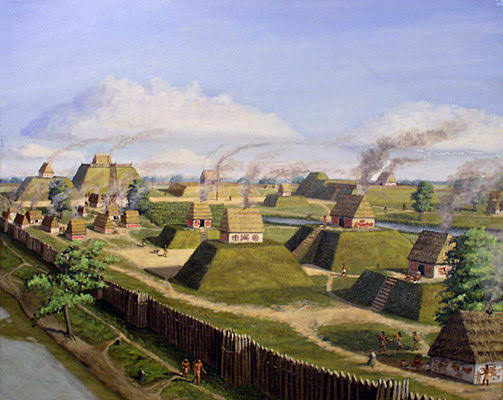
The town was enclosed by a substantial wooden palisade built from closely spaced upright logs. Guarded gateways controlled entry into the settlement, while portions of the fortification may have included watchtowers that overlooked surrounding fields and nearby river approaches. These defenses protected both the population and the ceremonial center while symbolizing the authority of the town's leaders.

The carefully planned arrangement of plazas, mounds, and residential areas demonstrates sophisticated urban planning designed to accommodate political administration, religious activities, and daily community life.

Platform Mounds and Public Buildings

The platform mounds of Kincaid served as elevated foundations for temples, council houses, elite residences, and ceremonial buildings. Builders transported thousands of basket loads of earth, constructing each mound through multiple phases over several generations. Layers of compacted clay and soil provided structural stability while protecting buildings from seasonal flooding along the Ohio River.

The largest mound overlooked the central plaza and likely supported the residence of the ruling chief or an important temple dedicated to community rituals. Additional mounds housed administrative structures where political decisions, religious ceremonies, and public gatherings reinforced the power of the governing elite.

Economy and Daily Life

The inhabitants of Kincaid practiced intensive agriculture centered on maize (corn) cultivation, supplemented by beans, squash, sunflowers, and other crops grown in the fertile floodplains of the Ohio River. Hunting deer, wild turkey, waterfowl, and fishing in nearby rivers provided additional food resources that supported a substantial permanent population.

Kincaid also developed into an important center of craftsmanship. Archaeological excavations have uncovered finely decorated pottery, stone tools, shell ornaments, copper artifacts, bone implements, and ceremonial objects reflecting both local production and long-distance trade. The settlement maintained commercial connections with Cahokia and numerous Mississippian communities throughout the Mississippi and Ohio River valleys, facilitating the exchange of raw materials, finished goods, and religious ideas.

Religion and Ceremonial Life

Religion played a central role in Kincaid's social organization. The large central plaza served as the setting for seasonal ceremonies, ritual dances, communal feasts, athletic competitions, and public assemblies. Temples atop the platform mounds housed priests who conducted ceremonies associated with agriculture, ancestor worship, fertility, and celestial cycles.

Many artifacts recovered from the site—including engraved shell gorgets, ceremonial stone pipes, copper ornaments, and symbolic pottery—reflect participation in the Southeastern Ceremonial Complex, a widespread religious tradition shared among Mississippian societies. These religious practices strengthened political authority while reinforcing cultural connections with neighboring communities.

Archaeological Importance

Excavations at Kincaid Mounds have revealed house foundations, storage pits, workshop areas, defensive palisades, ceremonial plazas, and thousands of artifacts that provide detailed information about Mississippian life. Archaeologists have reconstructed the site's settlement patterns, agricultural practices, and political organization, demonstrating that Kincaid functioned as an important regional capital rather than a simple farming village.

The site is particularly valuable because it illustrates how Mississippian urban planning and ceremonial architecture spread beyond Cahokia while adapting to local environments and regional political systems.

Conclusion

Kincaid Mounds stands as one of the most significant fortified towns of the Mississippian Civilization, showcasing advanced urban planning, monumental platform mounds, defensive palisades, organized agriculture, and extensive trade networks. Its carefully planned ceremonial plazas and elevated public buildings reveal a highly organized society capable of coordinating large-scale construction projects and maintaining complex political and religious institutions. Today, Kincaid Mounds remains a vital archaeological site for understanding the expansion and regional diversity of Mississippian culture throughout the Ohio River Valley before European contact.

Angel Mounds: Indiana's Mississippian Town

August 2, 2026

Introduction

Located along the banks of the Ohio River near present-day Evansville, Indiana, Angel Mounds is one of the best-preserved archaeological sites of the Mississippian Civilization in the Midwestern United States. Occupied between approximately 1000 and 1450 CE, the site served as a thriving political, religious, and economic center for thousands of Native Americans. Covering nearly 100 acres (40 hectares), Angel Mounds contained a carefully planned town with large earthen platform mounds, residential neighborhoods, defensive palisades, ceremonial plazas, workshops, and agricultural fields. The settlement was named after the Angel family, who owned the land during the nineteenth century before archaeological excavations revealed the significance of the ancient city. Today, Angel Mounds is recognized as one of the most important Mississippian sites outside of Cahokia and provides valuable insight into the complex societies that flourished in the Ohio River Valley before European contact.

Urban Planning and Settlement Layout

Angel Mounds was carefully designed according to a centralized urban plan that reflected the political and religious organization of Mississippian society. At the heart of the settlement was a large central plaza, an open space used for public ceremonies, community gatherings, markets, games, and religious festivals. Surrounding this plaza were eleven large earthen platform mounds, each constructed by transporting thousands of basket loads of earth over many generations.

The largest mound, known as Mound A, served as the political and ceremonial center of the community. A large wooden temple or the residence of the chief likely stood atop its flat summit, symbolizing both religious authority and political leadership. Smaller platform mounds supported council houses, temples, elite residences, and other important public buildings. Ordinary families lived in clusters of rectangular houses surrounding the central precinct, creating organized neighborhoods connected by pathways leading to the plaza.

Platform Mound Construction

The platform mounds at Angel Mounds were remarkable examples of prehistoric engineering. Builders transported enormous quantities of soil using woven baskets and carefully deposited it in successive layers. Different types of clay and earth were selected to improve stability, drainage, and resistance to erosion. Each construction phase enlarged the mounds, reflecting the continued growth of the settlement and the authority of successive leaders.

The flat tops of the mounds provided elevated foundations that protected important buildings from seasonal flooding while making them visible throughout the surrounding landscape. Wooden stairways connected the plaza to the summit of each mound, allowing priests, chiefs, and other important figures to participate in ceremonies held above the community. These elevated structures emphasized the close relationship between political power, religious leadership, and monumental architecture in Mississippian society.

Daily Life and Economy

The inhabitants of Angel Mounds practiced an advanced agricultural economy centered on the cultivation of maize (corn), beans, squash, and sunflowers, collectively providing a reliable food supply capable of supporting a large permanent population. Hunting deer, turkey, and other wildlife, together with fishing in the nearby Ohio River, supplemented their diet.

The town also became an important center of craft production. Archaeologists have uncovered evidence of skilled artisans producing pottery, stone tools, shell ornaments, copper decorations, woven textiles, and carved ceremonial objects. These products were traded throughout extensive exchange networks connecting Angel Mounds with other Mississippian communities across the southeastern and midwestern United States.

Defensive Fortifications

One of the most distinctive features of Angel Mounds was its impressive wooden palisade, which surrounded much of the settlement. Constructed from massive upright logs placed closely together, the palisade protected the community from potential attacks and controlled access through guarded entrance gates. Archaeological evidence indicates that the fortifications were repaired and rebuilt several times, suggesting that defense remained an important concern throughout the town's occupation.

In addition to providing military protection, the palisade also defined the sacred and political boundaries of the community, separating the ceremonial center from the surrounding countryside. The construction and maintenance of such large defensive works required significant cooperation and centralized organization among the town's inhabitants.

Religion and Ceremonial Life

Religion played a central role in the life of Angel Mounds. Temples built atop the platform mounds served as places of worship where priests conducted ceremonies honoring ancestral spirits, agricultural deities, and supernatural forces believed to control the natural world. The central plaza hosted seasonal festivals, ritual dances, communal feasts, and public gatherings that reinforced social unity and political authority.

Many ceremonial objects discovered at the site—including engraved shell gorgets, decorated pottery, stone pipes, and copper ornaments—reflect beliefs associated with the Southeastern Ceremonial Complex, a widespread religious tradition shared among many Mississippian societies. These artifacts illustrate the importance of symbolism, ritual, and sacred leadership within the community.

Archaeological Importance

Systematic excavations at Angel Mounds have uncovered thousands of artifacts, including pottery, stone tools, shell jewelry, copper ornaments, food remains, house foundations, storage pits, and evidence of specialized workshops. These discoveries have enabled archaeologists to reconstruct the daily lives, economic activities, and social organization of one of the largest prehistoric towns in the Midwest.

The exceptional preservation of the site has made Angel Mounds an invaluable resource for understanding Mississippian civilization. Its carefully planned layout, monumental architecture, and abundant archaeological remains provide one of the clearest pictures of life in a major Native American urban center before European colonization.

Conclusion

Angel Mounds stands as one of the finest examples of a Mississippian town, demonstrating the remarkable engineering, urban planning, and cultural achievements of Native American societies between 1000 and 1450 CE. Its monumental platform mounds, central ceremonial plaza, fortified palisade, organized residential districts, and thriving agricultural economy reveal a highly structured society capable of coordinating large-scale public works and maintaining extensive trade networks. Today, Angel Mounds remains one of North America's most important archaeological sites, preserving the legacy of a sophisticated Indigenous civilization whose political organization, religious traditions, and architectural accomplishments continue to deepen our understanding of prehistoric America.

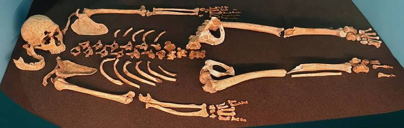
← Newer Posts Older Posts →
Featured
Artifact-France-Gravettian-Venus-Figurine.jpg
August 10, 2026
Noisetier Cave: France's Gravettian Venus Figurines
August 10, 2026
Read more →
August 10, 2026
images.jpeg
August 10, 2026
Bruniquel Cave: France's 176,000-Year Neanderthal Rings
August 10, 2026
Read more →
August 10, 2026
images (1).jpeg
August 10, 2026
Mandrin Cave: France's Neanderthal-Denisovan Mix
August 10, 2026
Read more →
August 10, 2026
images (2).jpeg
August 10, 2026
Grotte du Renne: France's Symbolic Neanderthals
August 10, 2026
Read more →
August 10, 2026
images (3).jpeg
August 10, 2026
Arcy-sur-Cure Caves: France's Continuous Occupation
August 10, 2026
Read more →
August 10, 2026
womanwithbabysm.jpg
August 10, 2026
Gönnersdorf: Germany's Late Magdalenian Art
August 10, 2026
Read more →
August 10, 2026
read more

Powered by The archaeologist