• MAIN PAGE
  • LATEST NEWS
    • Lost Cities
    • Archaeology's Greatest Finds
    • Underwater Discoveries
    • Greatest Inventions
    • Studies
    • Blog
  • PHILOSOPHY
  • HISTORY
  • RELIGIONS
    • Africa
    • Anatolia
    • Arabian Peninsula
    • Balkan Region
    • China - East Asia
    • Europe
    • Eurasian Steppe
    • Levant
    • Mesopotamia
    • Oceania - SE Asia
    • Pre-Columbian Civilizations of America
    • Iranian Plateau - Central Asia
    • Indus Valley - South Asia
    • Japan
    • The Archaeologist Editor Group
    • Scientific Studies
    • Aegean Prehistory
    • Historical Period
    • Byzantine Middle Ages
    • Predynastic Period
    • Dynastic Period
    • Greco-Roman Egypt
  • Rome
  • PALEONTOLOGY
  • About us
Menu

The Archaeologist

  • MAIN PAGE
  • LATEST NEWS
  • DISCOVERIES
    • Lost Cities
    • Archaeology's Greatest Finds
    • Underwater Discoveries
    • Greatest Inventions
    • Studies
    • Blog
  • PHILOSOPHY
  • HISTORY
  • RELIGIONS
  • World Civilizations
    • Africa
    • Anatolia
    • Arabian Peninsula
    • Balkan Region
    • China - East Asia
    • Europe
    • Eurasian Steppe
    • Levant
    • Mesopotamia
    • Oceania - SE Asia
    • Pre-Columbian Civilizations of America
    • Iranian Plateau - Central Asia
    • Indus Valley - South Asia
    • Japan
    • The Archaeologist Editor Group
    • Scientific Studies
  • GREECE
    • Aegean Prehistory
    • Historical Period
    • Byzantine Middle Ages
  • Egypt
    • Predynastic Period
    • Dynastic Period
    • Greco-Roman Egypt
  • Rome
  • PALEONTOLOGY
  • About us
No results found

Tuquoy: Westray's Viking Age Site

September 9, 2026

Tuquoy, on the island of Westray in Orkney, forms part of one of the richest Norse archaeological landscapes in Scotland.

The site provides evidence for Viking-Age and medieval settlement and helps demonstrate how Westray became integrated into the Norse world.

Westray and the Norse World

Westray is one of Orkney's northern islands.

Its location provided access to important maritime routes.

During the Viking Age, the island became part of the Norse cultural and political sphere.

Settlement

Archaeological sites such as Tuquoy provide evidence for long-term occupation.

Buildings in Orkney were frequently constructed from stone.

This was an effective response to the local environment, where timber was less abundant than in many Scandinavian regions.

Farming and Subsistence

Norse communities depended heavily on agriculture.

They raised livestock including:

  • cattle;

  • sheep;

  • goats;

  • pigs;

  • and horses.

Marine resources supplemented farming.

Fishing and the collection of shellfish and seabirds were especially important in coastal communities.

Maritime Connections

Westray's location made the sea a major transportation network.

Rather than separating communities, the sea connected them.

Boats could link Westray with:

  • mainland Orkney;

  • Shetland;

  • Caithness;

  • the Hebrides;

  • and Scandinavia.

Christianization

The Norse settlement of Orkney eventually became Christian.

This transformation can be observed archaeologically through churches, graves, crosses, and changing burial customs.

Christianization did not necessarily eliminate earlier traditions immediately.

Instead, religious change occurred gradually.

Archaeological Evidence

Settlement archaeology can reveal everyday life through:

  • animal bones;

  • hearths;

  • tools;

  • pottery;

  • stone objects;

  • and imported materials.

These finds help reconstruct diet, technology, trade, and domestic activities.

Westray's Wider Archaeological Importance

Westray is exceptionally important because it contains evidence from multiple periods.

Prehistoric settlements, Neolithic monuments, Iron Age structures, Viking sites, and medieval remains demonstrate that the island was repeatedly occupied and transformed.

Conclusion

Tuquoy: Westray's Viking Age Site illustrates the integration of northern Orkney into the Norse world.

Its importance lies not only in individual artifacts or buildings but in what the site reveals about farming, maritime connections, settlement organization, and the gradual transformation of Norse society into medieval Christian communities.
Brough of Birsay: Orkney's Norse Palace

September 9, 2026

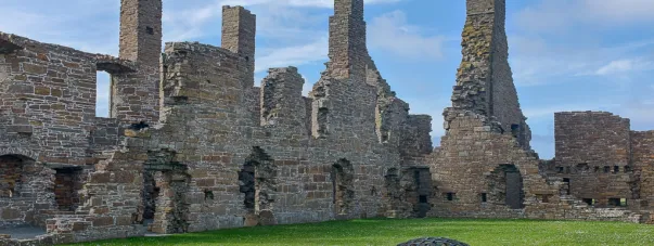
The Brough of Birsay is one of Orkney's most remarkable archaeological landscapes.

Located on a tidal island off the coast of Mainland Orkney, the site preserves evidence from the Pictish period through the Norse and medieval eras.

Its Norse remains are particularly important because Birsay became closely associated with the political elite of the Earldom of Orkney.

A Strategic Island

The Brough of Birsay occupies a commanding coastal position.

Its surrounding waters and cliffs created natural defensive advantages.

At the same time, the site was close to maritime routes connecting different parts of Orkney.

Pictish Origins

Before the Norse period, Birsay was an important Pictish center.

Archaeological evidence includes carved stones and ecclesiastical remains.

This indicates that the area already possessed political and religious significance before Scandinavian settlement.

The Norse Settlement

During the Viking Age, Birsay became an important Norse center.

Tradition and archaeological evidence associate the area with the Earls of Orkney.

The term “palace” should therefore be understood as a description of elite settlement rather than assuming the existence of a palace identical to a later European royal residence.

Elite Residence

A high-status settlement could function as:

  • a residence;

  • administrative center;

  • feasting location;

  • political meeting place;

  • and religious center.

Feasting was particularly important in Norse elite culture.

Large gatherings allowed rulers to demonstrate generosity and reinforce alliances.

Stone Architecture

The surviving structures demonstrate the durability of Orkney's stone-building tradition.

Thick stone walls provided insulation against the harsh climate.

Buildings could include residential spaces, workshops, storage areas, and ecclesiastical structures.

The Church

Christianity became increasingly important during the medieval period.

The Brough contains remains associated with a church and Christian activity.

This demonstrates the transformation of the site from a pre-Christian and potentially elite Norse environment into a Christian medieval community.

The Earls of Orkney

The Earls of Orkney controlled an important territory.

Their authority extended beyond individual islands.

The earldom formed part of the wider political world of:

  • Norway;

  • Scotland;

  • Iceland;

  • and the North Atlantic.

Archaeological Significance

Brough of Birsay is particularly valuable because multiple historical periods overlap.

Visitors can encounter evidence for:

  • Pictish culture;

  • Viking settlement;

  • Christianity;

  • medieval politics;

  • and later occupation.

Conclusion

Brough of Birsay: Orkney's Norse Palace represents one of the clearest examples of how political power, religion, and maritime geography interacted in medieval Orkney.

The site demonstrates that Birsay was not simply a settlement.

It was a place where political authority, elite culture, religion, and international connections converged.

Earl's Bu: Orkney's Viking Farmstead

September 9, 2026

Earl's Bu represents the agricultural foundations of Norse society in Orkney.

While the earls and political leaders of the islands are often remembered through historical narratives, archaeology reveals that their power ultimately depended upon farms, livestock, labor, and control over productive land.

The Meaning of a Norse Farmstead

A Norse farmstead was a complex economic unit.

It could contain:

  • a main dwelling;

  • animal shelters;

  • storage facilities;

  • workshops;

  • fields;

  • and grazing areas.

Agriculture

Orkney's climate favored pastoral farming.

Livestock were central to household survival.

Cattle provided:

  • meat;

  • milk;

  • hides;

  • and social wealth.

Sheep supplied wool and meat.

Farming Technology

Norse farmers used relatively simple tools compared with modern agriculture.

Important implements included:

  • iron knives;

  • sickles;

  • hoes;

  • axes;

  • and wooden tools.

Agriculture required extensive labor.

Marine Resources

Farming was supplemented by the sea.

Fishing provided protein and other resources.

Coastal communities also exploited:

  • shellfish;

  • seabirds;

  • eggs;

  • and occasionally marine mammals.

Social Hierarchy

The term “Earl's Bu” emphasizes the connection between agriculture and elite power.

An earl's authority depended upon access to productive estates and the ability to collect resources.

A prosperous farm could therefore have political importance.

Trade

Farm production could support trade.

Surplus:

  • wool;

  • hides;

  • livestock;

  • dried fish;

  • and other products

could enter wider exchange networks.

Imported goods, meanwhile, provide evidence of Orkney's participation in international commerce.

Household Life

Farmsteads were also homes.

Families cooked, ate, slept, worked, and socialized within these buildings.

Archaeology can reveal this domestic life through hearths, animal bones, tools, pottery, and other remains.

Conclusion

Earl's Bu: Orkney's Viking Farmstead represents the agricultural foundation of Norse society.

The site illustrates an essential historical principle: political power depended upon control of land, livestock, labor, and food production.

The great political centers of Norse Orkney could exist only because hundreds of farming communities sustained.

Buckquoy: Orkney's Pictish-Norse Cemetery

September 9, 2026

Buckquoy is one of Orkney's important archaeological sites for understanding the transition between Pictish and Norse society.

Its cemetery evidence is especially valuable because burial archaeology can reveal changes in identity, religious practice, population movement, and cultural interaction.

Pictish Orkney

Before the Norse settlement of Orkney, the islands were inhabited by Pictish communities.

The Picts left behind:

  • carved stones;

  • settlements;

  • churches;

  • burial sites;

  • and distinctive artistic traditions.

The Arrival of the Norse

From the late first millennium CE, Norse settlers increasingly became part of Orkney's population.

This did not necessarily mean that Pictish communities simply disappeared.

Instead, the archaeological record suggests a complex process of interaction.

Cemeteries as Evidence

Burial sites are particularly useful for studying cultural change.

Archaeologists can examine:

  • body position;

  • grave orientation;

  • grave construction;

  • artifacts;

  • skeletal evidence;

  • and cemetery organization.

Pictish and Norse Traditions

Pictish and Norse burial traditions were not completely fixed or uniform.

Christianity also became increasingly important.

As a result, identifying an individual as “Pictish” or “Norse” solely from a grave can be difficult.

Material Culture

Objects associated with burials may include:

  • jewelry;

  • tools;

  • weapons;

  • personal ornaments;

  • and other possessions.

These objects can demonstrate contacts across the North Atlantic.

Population and Identity

One of the most important lessons from sites such as Buckquoy is that cultural identity is complicated.

A person could live in a Norse-controlled community while retaining elements of local ancestry or tradition.

Christianization

The gradual adoption of Christianity further changed burial customs.

Earlier Scandinavian traditions could involve grave goods, while Christian burial increasingly emphasized the body within a consecrated cemetery.

Conclusion

Buckquoy: Orkney's Pictish-Norse Cemetery provides a valuable case study in cultural transition.

Rather than presenting the Pictish and Norse worlds as completely separate, archaeology reveals interaction, adaptation, intermarriage, religious transformation, and changing identities.

The cemetery therefore represents one of the most important ways archaeologists investigate the cultural transformation of medieval Orkney.

Westness: Rousay's Viking Hoard Site

September 9, 2026

Westness on Rousay is one of the most significant archaeological landscapes in Orkney.

The area is associated with Norse settlement, burial, farming, and evidence of wealth, making it an important location for understanding Viking-Age society.

Rousay and the Norse World

Rousay is located close to Mainland Orkney.

Its position provided access to maritime routes and neighboring islands.

The island contained fertile areas suitable for farming as well as extensive coastal resources.

Hoards and Viking Society

A hoard is a deliberate collection of objects that was deposited together.

Hoarding occurred for different reasons.

People might bury valuables for:

  • safekeeping;

  • ritual purposes;

  • emergency concealment;

  • or other social reasons.

A buried hoard does not automatically indicate treasure belonging to a wealthy ruler.

What Hoards Can Tell Us

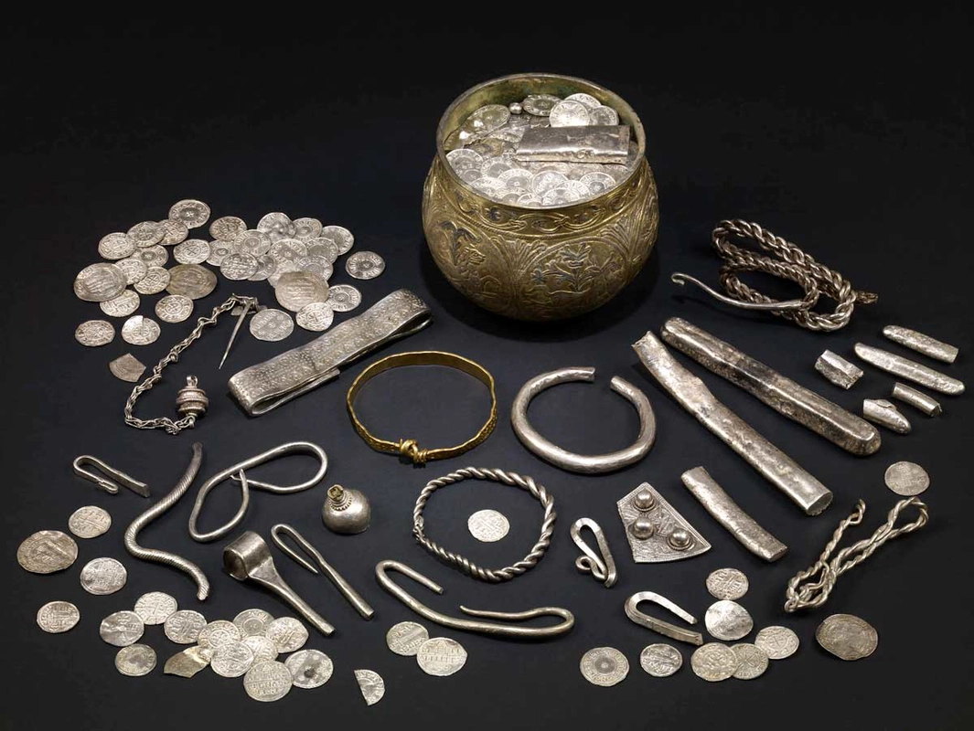
A hoard can contain:

  • coins;

  • jewelry;

  • silver fragments;

  • ingots;

  • or other valuable objects.

These materials can reveal long-distance connections.

Silver, for example, circulated widely across Viking trading networks.

Viking Trade

Orkney was strategically positioned within North Atlantic trade routes.

Connections extended toward:

  • Norway;

  • Ireland;

  • Scotland;

  • Iceland;

  • and other parts of northern Europe.

Silver Economy

Silver was particularly important in Viking economies.

It could be:

  • weighed;

  • exchanged;

  • divided;

  • melted;

  • and transformed into other objects.

This flexible use made silver useful in long-distance commerce.

The Meaning of a Hoard

A hoard represents a moment of decision.

Someone deliberately placed objects into the ground or another secure location.

The original reason may remain unknown.

That uncertainty makes hoards archaeologically fascinating.

Westness Landscape

Westness is significant because it was not merely an isolated treasure location.

It belonged to a broader settlement and burial landscape.

This allows archaeologists to connect economic evidence with everyday life.

Conclusion

Westness: Rousay's Viking Hoard Site offers insight into the wealth, trade, uncertainty, and economic practices of Viking-Age Orkney.

The site's importance lies in connecting individual valuables with the larger Norse maritime world that connected Orkney.

Westness Cemetery: Rousay's Norse Graves

September 9, 2026

Westness Cemetery on Rousay is one of the most important archaeological resources for studying Norse burial traditions in Orkney.

The cemetery forms part of a larger archaeological landscape containing evidence of settlement and long-term occupation.

Norse Burial Customs

Burial practices changed considerably during the Viking Age.

Early Scandinavian religious traditions could involve grave goods and distinctive burial arrangements.

With Christianization, burial customs changed.

Grave Goods

Norse graves may contain:

  • weapons;

  • brooches;

  • beads;

  • tools;

  • keys;

  • buckles;

  • and other personal possessions.

However, not every grave contains artifacts.

The absence of grave goods does not mean that a person lacked social importance.

Women and Men

Archaeological evidence can sometimes provide clues about gendered roles.

Weapons may occur in some male-associated burials, while women could be buried with jewelry and household implements.

However, archaeologists increasingly recognize that grave goods do not always correspond directly to biological sex or occupation.

Christianization

As Christianity became established, burial practices increasingly changed.

The transition was gradual.

Some communities maintained older traditions alongside Christian practices.

Skeletal Evidence

Human remains can provide information about:

  • age;

  • biological sex;

  • disease;

  • injuries;

  • diet;

  • and physical activity.

Modern archaeological science can also use isotopic and genetic methods to investigate mobility and ancestry.

The Rousay Landscape

Westness Cemetery should be understood alongside the surrounding settlement landscape.

Burials were connected to communities.

The cemetery therefore provides evidence for the people who lived and worked in the surrounding farms.

Conclusion

Westness Cemetery: Rousay's Norse Graves provides a valuable record of the people who lived during one of the most transformative periods in Orkney's history.

The cemetery illustrates changing religious traditions, social identity, family life, and the integration of Orkney into the wider.

Howe Harper: Orkney's Neolithic Mound

September 9, 2026

Howe Harper belongs to Orkney's remarkable tradition of prehistoric monumental landscapes.

Neolithic mounds and burial monuments demonstrate that communities living thousands of years ago invested enormous effort in constructing structures connected with death, ancestry, and collective identity.

Neolithic Orkney

The Neolithic period transformed Orkney.

Farming communities established permanent settlements and constructed monumental architecture.

These included:

  • chambered cairns;

  • stone circles;

  • standing stones;

  • houses;

  • and ceremonial complexes.

The Meaning of a Mound

A prehistoric mound could cover a burial structure.

Its visible form transformed the landscape.

Even when the original internal chamber was no longer accessible, the mound remained a physical marker.

Monumental Labor

Constructing a mound required collective effort.

Workers had to:

  1. gather stone;

  2. transport materials;

  3. construct chambers;

  4. build walls;

  5. and create the outer mound.

Such projects demonstrate organized community labor.

Ancestral Landscapes

Neolithic monuments may have served as places where communities interacted with the dead.

Ancestors could become part of the landscape itself.

The monument therefore connected:

  • people;

  • land;

  • memory;

  • and community identity.

Orkney's Monumental Network

Howe Harper belongs to a wider network of monuments.

Orkney contains one of Europe's greatest concentrations of Neolithic architecture.

The monuments were not necessarily isolated.

Their positions could relate to settlements, hills, coastlines, and other ceremonial sites.

Archaeological Interpretation

Not every mound had the same function.

Some were tombs.

Others may have had ceremonial or settlement-related purposes.

Therefore, identifying the precise role of an individual mound requires archaeological evidence.

Conclusion

Howe Harper: Orkney's Neolithic Mound represents the remarkable monumental traditions of prehistoric Orkney.

The site's broader significance lies in demonstrating how Neolithic communities transformed their environment through architecture and created enduring places associated with ancestry, ceremony, and collective memory.

Isbister Chambered Cairn: South Ronaldsay's Tomb

September 9, 2026

Isbister Chambered Cairn, located on South Ronaldsay in Orkney, is an important example of prehistoric chambered-tomb architecture.

The monument provides insight into how Neolithic communities understood death, ancestry, and the landscape.

Chambered Cairns

A chambered cairn was a stone-built funerary monument.

Its basic components could include:

  • an entrance passage;

  • a central chamber;

  • smaller compartments;

  • and an outer cairn.

Collective Burial

These tombs could contain the remains of multiple people.

The practice indicates that burial was often a communal process rather than simply an individual event.

People may have returned to the monument repeatedly over generations.

Architecture

The builders carefully selected large slabs and stones.

Some were used as:

  • roof slabs;

  • wall blocks;

  • dividing stones;

  • or structural supports.

The architecture required considerable planning.

The Tomb and the Landscape

The location of a chambered cairn was meaningful.

Prehistoric builders selected positions in relation to:

  • surrounding hills;

  • valleys;

  • coastlines;

  • and other monuments.

This suggests that the landscape itself formed part of the monument's meaning.

Mortuary Practices

The treatment of human remains could vary.

Bones might be placed or reorganized within chambers.

This suggests that Neolithic communities had complex relationships with the dead.

Daily Life Behind the Monument

The people who constructed Isbister were farmers.

Their communities cultivated crops and raised animals.

They also exploited Orkney's rich marine environment.

South Ronaldsay

South Ronaldsay occupies an important position within Orkney's prehistoric landscape.

The island is connected geographically and culturally with the wider archipelago.

Conclusion

Isbister Chambered Cairn: South Ronaldsay's Tomb demonstrates the sophistication of Neolithic funerary architecture.

The monument was more than a burial container.

It was a place where communities expressed ideas about ancestry, memory, identity, and their relationship with the landscape.

Wideford Hill Cairn: Mainland Orkney's Neolithic Tomb

September 9, 2026

Wideford Hill Cairn is one of Mainland Orkney's important prehistoric burial monuments.

Situated on Wideford Hill overlooking the surrounding landscape, the chambered cairn demonstrates how Neolithic communities incorporated monumental architecture into prominent natural settings.

The Neolithic Tomb

Wideford Hill Cairn belongs to the tradition of chambered cairns found throughout Orkney.

These monuments generally contained:

  • a passage;

  • a central chamber;

  • side compartments;

  • and a stone-built outer structure.

Monumental Construction

The cairn required substantial labor.

Large stones had to be moved into position.

The builders then constructed stable walls and roof supports.

The engineering demonstrates a sophisticated understanding of:

  • weight;

  • balance;

  • stone placement;

  • and structural stability.

Burial and Ancestry

The tomb provided a place for human remains.

The repeated use of chambered cairns indicates that prehistoric communities maintained long-term relationships with ancestors.

Wideford Hill

The hill provided a commanding view.

From the monument, the surrounding landscape could be visually connected with the tomb.

This may have contributed to the monument's significance.

Orkney's Sacred Geography

Wideford Hill Cairn belongs to a much larger archaeological landscape.

Across Mainland Orkney, Neolithic communities created:

  • settlements;

  • tombs;

  • standing stones;

  • henges;

  • and ceremonial centers.

These monuments transformed the islands into a highly structured cultural landscape.

Archaeological Interpretation

Although burial was clearly important, archaeologists continue to investigate the broader social and ritual functions of these monuments.

Funerary structures may also have served as:

  • meeting places;

  • ceremonial locations;

  • ancestral landmarks;

  • or symbols of group identity.

Conclusion

Wideford Hill Cairn: Mainland Orkney's Neolithic Tomb is an important example of the architectural and social achievements of prehistoric Orkney.

Its location, construction, and funerary function reveal how Neolithic communities combined engineering with beliefs about death, ancestry, and landscape.

Quanterness Chambered Cairn: Orkney's Excavated Tomb

September 9, 2026

Quanterness Chambered Cairn is one of Orkney's important excavated Neolithic burial monuments.

Its archaeological evidence provides an opportunity to study not only the monument's architecture but also the people and practices associated with it.

A Neolithic Chambered Cairn

Quanterness was constructed as a monumental burial structure.

Its architecture included a passage leading into an internal chamber.

The design belongs to a wider tradition of prehistoric tomb construction found throughout Orkney.

Excavation

Archaeological excavation is particularly important because it can reveal deposits that are invisible from the surface.

Researchers may recover:

  • human remains;

  • animal bones;

  • stone tools;

  • pottery;

  • charcoal;

  • and architectural fragments.

Human Remains

Human skeletal material can reveal important information.

Researchers can investigate:

  • age;

  • sex;

  • health;

  • trauma;

  • diet;

  • and population relationships.

Ritual Treatment

The arrangement of human remains can provide clues about mortuary practices.

Bones may have been moved, reorganized, or accumulated over long periods.

This indicates that burial was often an ongoing social process.

Architecture and Astronomy

Some Orkney chambered cairns have orientations connected with particular landscape or astronomical features.

However, interpretations of astronomical alignment must be based on measurable evidence rather than assumption.

Community Labor

Constructing Quanterness required collective effort.

The monument represents the ability of a prehistoric community to organize workers and resources.

Conclusion

Quanterness Chambered Cairn: Orkney's Excavated Tomb is important because excavation allows archaeologists to move beyond the visible architecture and investigate the human activity preserved inside.

The monument provides evidence for burial practices, social organization, architecture, and the enduring importance of ancestry in Neolithic Orkney.

Huntersquoy: Eday's Orkney-Cromarty Tomb

September 9, 2026

Huntersquoy on Eday belongs to Orkney's extraordinary tradition of Neolithic chambered tombs.

The monument is particularly interesting because it is associated with the architectural traditions often classified within the Orkney-Cromarty group of chambered cairns.

The Orkney-Cromarty Tradition

Archaeologists use architectural classifications to compare prehistoric monuments.

Orkney-Cromarty chambered cairns generally feature distinctive internal arrangements.

These may include:

  • a passage;

  • a main chamber;

  • internal compartments;

  • and stone divisions.

Tomb Architecture

The design allowed communities to organize the internal space.

Different compartments could have served different mortuary purposes.

The exact rituals conducted inside remain unknown.

Burial

The monument was associated with prehistoric funerary practices.

Multiple individuals could be represented within chambered tombs.

This suggests that the monuments were connected to collective memory and ancestry.

Eday's Prehistoric Landscape

Eday is one of Orkney's northern islands.

Its archaeological landscape contains evidence of prehistoric occupation.

The island's environment offered:

  • agricultural land;

  • grazing;

  • marine resources;

  • and access to surrounding islands.

Monument Building

Stone architecture was particularly suited to Orkney.

Local builders could obtain large quantities of suitable stone.

However, the construction of a chambered tomb still required considerable organization.

Social Meaning

Monuments such as Huntersquoy may have helped communities define their relationship with territory.

A visible tomb could function as an enduring landmark.

It could communicate that a community had ancestral ties to a particular place.

Conclusion

Huntersquoy: Eday's Orkney-Cromarty Tomb illustrates the architectural diversity of Neolithic Orkney.

Its importance lies in demonstrating how prehistoric communities combined stone engineering with collective burial practices and landscape-based identities.

The monument is part of a broader tradition that makes Orkney one of Europe's most important regions for Neolithic archaeology.

Braeside: Eday's Neolithic Settlement

September 9, 2026

Braeside represents the settlement side of Eday's prehistoric landscape.

While Orkney is internationally famous for monumental tombs and stone circles, settlements such as Braeside are equally important because they reveal how ordinary people lived within the society that created those monuments.

Neolithic Settlement

Neolithic communities established permanent or semi-permanent settlements.

Houses could contain:

  • hearths;

  • sleeping areas;

  • workspaces;

  • storage;

  • and cooking facilities.

Agriculture

Farming transformed prehistoric life.

Communities cultivated crops and raised livestock.

Cattle and sheep were particularly important.

Agriculture provided food while also producing materials such as:

  • wool;

  • hides;

  • bone;

  • and horn.

Domestic Technology

Neolithic households used a range of tools.

Stone tools could include:

  • axes;

  • knives;

  • scrapers;

  • grinding stones;

  • and points.

Pottery provided containers for:

  • cooking;

  • storage;

  • and food preparation.

Food

People ate a combination of agricultural and wild foods.

Their diet could include:

  • grains;

  • dairy products;

  • meat;

  • shellfish;

  • fish;

  • and wild resources.

Island Communities

Eday's location encouraged interaction with neighboring islands.

Boats allowed people to transport goods and communicate across the archipelago.

Social Organization

Settlement construction demonstrates cooperation.

People had to organize:

  • food production;

  • building;

  • animal management;

  • tool manufacture;

  • and communal activities.

Relationship With Monuments

Settlements should not be separated from nearby monuments.

The people who lived in houses were the same communities participating in burial and ceremonial traditions.

Conclusion

Braeside: Eday's Neolithic Settlement provides a valuable perspective on everyday prehistoric life.

Its significance lies in showing that Neolithic Orkney was not simply a landscape of impressive monuments.

It was a living agricultural society made up of households, farms, workers, craftspeople, and families whose daily activities supported the extraordinary monumental traditions of the islands.

Onziebust: Eday's Standing Stone

September 9, 2026

Onziebust represents another aspect of Eday's prehistoric landscape: the standing stone.

Unlike chambered cairns, which primarily contain internal burial architecture, standing stones transform the landscape through a single monumental vertical element.

Standing Stones in Neolithic Orkney

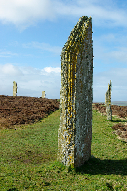
Standing stones are among the most recognizable prehistoric monuments in Britain.

They could stand individually or form part of larger arrangements.

In Orkney, standing stones occur alongside:

  • chambered cairns;

  • stone circles;

  • henges;

  • settlements;

  • and ceremonial centers.

Monumental Simplicity

A standing stone may appear simple.

Yet placing a large stone upright required substantial effort.

Builders had to:

  1. locate a suitable stone;

  2. extract or collect it;

  3. transport it;

  4. prepare the ground;

  5. and raise it vertically.

Social Cooperation

Such activities required cooperation.

The project could involve groups working together with ropes, wooden supports, levers, and prepared pits.

The monument therefore represents social organization as much as physical labor.

Landscape Meaning

The exact meaning of an individual standing stone is rarely known.

Possible functions include:

  • territorial marking;

  • ceremonial activity;

  • commemorative purposes;

  • astronomical observation;

  • or participation in wider ritual landscapes.

However, these interpretations must be evaluated individually.

Eday's Monumental Landscape

Onziebust should be considered within Eday's wider archaeological environment.

The island contains:

  • chambered cairns;

  • settlements;

  • standing stones;

  • and other prehistoric remains.

This demonstrates that the landscape was repeatedly organized and reinterpreted by prehistoric communities.

The Human Dimension

Standing stones also reveal something about prehistoric social life.

A monument required people to agree upon:

  • where it should be placed;

  • how it should be constructed;

  • and what it represented.

It therefore created a physical expression of shared ideas.

Conclusion

Onziebust: Eday's Standing Stone represents the enduring monumental traditions of prehistoric Orkney.

Although we cannot know with certainty what ceremonies took place around the stone, its construction demonstrates the ability of Neolithic communities to organize labor and transform their environment.

Together with Eday's chambered cairns and settlements, it forms part of a landscape in which farming, ancestry, ceremony, architecture, and geography were deeply interconnected.

Mill Lade: Eday's Neolithic House

September 9, 2026

Mill Lade: Eday's Neolithic House

The island of Eday, in the northern part of the Orkney archipelago, preserves an extraordinary concentration of prehistoric remains. Its landscape contains chambered cairns, standing stones, settlements, later farmsteads, and Iron Age structures, making it an important place for understanding how communities repeatedly used Orkney's islands over thousands of years. Among the less spectacular but potentially significant archaeological remains are settlement sites such as Mill Lade, associated with the long Neolithic tradition of domestic occupation on Eday.

Unlike monumental sites such as Maeshowe or the Ring of Brodgar, a Neolithic house represents something much more intimate: the physical setting in which prehistoric people actually lived. Archaeological houses can reveal how families organized domestic space, prepared food, stored possessions, manufactured tools, and interacted with one another.

Eday During the Neolithic

The Neolithic period in Orkney began roughly in the fourth millennium BC and witnessed major changes in settlement, agriculture, architecture, ritual, and social organization.

Orkney is particularly important because its Neolithic communities constructed substantial stone architecture. Skara Brae, Barnhouse, the Knap of Howar, and the settlements around the Ness of Brodgar demonstrate that domestic buildings could be carefully planned and constructed from locally available stone.

Eday participated in this broader cultural world.

The island's geology provided abundant stone, while its fertile areas and access to marine resources made it suitable for settlement. Communities could combine farming with fishing, shellfish collection, hunting, and exploitation of other coastal resources.

A house such as the one associated with Mill Lade therefore needs to be understood as part of a wider settlement landscape rather than as an isolated building.

What a Neolithic House Looked Like

Orkney's Neolithic houses commonly used thick stone walls to create substantial, durable structures. Many had circular or sub-circular interiors, although architectural arrangements varied considerably.

A typical Orcadian Neolithic domestic building could include:

  • A central hearth

  • Stone-built internal furniture

  • Sleeping platforms

  • Work areas

  • Storage compartments

  • Entrances carefully positioned within the structure

  • Thick walls providing insulation and structural stability

These features make Neolithic Orcadian houses especially valuable because stone survives far better than the wooden architecture found elsewhere in prehistoric Europe.

The surviving archaeological architecture gives researchers an unusual opportunity to reconstruct domestic life.

More Than a House

One of the most important lessons from Orkney's Neolithic settlements is that the distinction between "domestic" and "ritual" spaces was probably not as rigid as modern categories suggest.

People lived, worked, cooked, repaired tools, processed food, socialized, and perhaps conducted ceremonies within interconnected settlements.

Some houses were repeatedly rebuilt or modified. Floors could be resurfaced, walls altered, entrances changed, and internal spaces reorganized.

Such modifications suggest that buildings were not disposable shelters. They accumulated histories.

A house could therefore become part of a family's or community's identity.

Food and Daily Life

Archaeological deposits from Orcadian Neolithic houses demonstrate that inhabitants depended on both agriculture and wild resources.

Cereal cultivation, particularly barley, formed an important part of the agricultural economy. Cattle, sheep, goats, and pigs were also important domestic animals.

Marine resources added another dimension.

The surrounding waters provided:

  • Fish

  • Shellfish

  • Seabirds

  • Marine mammals

  • Seaweed and other coastal resources

The combination of farming and maritime exploitation gave island communities considerable economic flexibility.

Technology

Stone tools were fundamental to everyday life.

People manufactured cutting tools, scrapers, axes, grinding equipment, and other implements from locally available stone and imported materials.

Orkney's Neolithic communities also participated in wider exchange networks. Certain types of stone and artifacts traveled considerable distances, demonstrating that prehistoric island communities were not isolated.

Objects found within domestic contexts can therefore reveal connections extending far beyond Eday.

Why Mill Lade Matters

Mill Lade is important precisely because sites like this complement the spectacular monuments that dominate discussions of Orkney's prehistory.

A chambered cairn tells us something about death, ancestry, and ritual.

A standing stone tells us something about landscape and monumentality.

A domestic house tells us about ordinary life.

Together, these categories create a more complete picture of Neolithic society.

The archaeological significance of Mill Lade therefore lies in placing Eday's inhabitants back into the landscape as active communities rather than simply as builders of monuments.

Knowe of Trotty: Eday's Cairn

September 9, 2026

Knowe of Trotty: Eday's Cairn

The prehistoric landscape of Eday contains numerous mounds and cairns, reflecting a long tradition of constructing monuments for burial, remembrance, ceremony, and possibly territorial display. The Knowe of Trotty belongs to this wider tradition of Orcadian prehistoric monument construction.

The word "knowe" is itself revealing. Across Scotland and particularly Orkney, names containing knowe often refer to prominent artificial or natural mounds. Such places frequently preserve archaeological remains beneath what appears today to be an ordinary hill.

Cairns in Orkney

Stone cairns were among the most enduring monuments created by prehistoric communities.

They could contain:

  • Human burials

  • Cremated remains

  • Stone chambers

  • Cists

  • Grave goods

  • Later prehistoric deposits

But not every cairn necessarily served exactly the same function.

Some were primarily funerary monuments, while others may have had ceremonial or commemorative roles.

The Importance of Mounds

A mound changes how people experience a landscape.

Even a relatively small cairn can become a visible landmark. Its height distinguishes it from the surrounding ground, while its construction demonstrates that people intentionally transformed the landscape.

Over generations, later inhabitants could encounter the monument and assign new meanings to it.

This long-term visibility is particularly important in Orkney because prehistoric monuments often remained prominent long after the societies that constructed them had disappeared.

Eday's Archaeological Landscape

The Knowe of Trotty should therefore not be studied in isolation.

Eday contains a network of prehistoric monuments distributed across hills, agricultural areas, and coastal landscapes. Their locations may reflect choices concerning visibility, access, terrain, and relationships with other monuments.

Archaeologists increasingly approach such sites through landscape archaeology.

Instead of asking simply, "What is inside the cairn?" researchers also ask:

  • Why was it built here?

  • What could people see from it?

  • Which other monuments could be seen?

  • Was it positioned near settlement?

  • Did later communities continue to use the surrounding landscape?

These questions can transform a small cairn into evidence for broader social behavior.

Burial and Memory

Prehistoric burial monuments were not simply containers for dead bodies.

They could have acted as places where communities negotiated relationships with ancestors.

Constructing a cairn required labor.

Stone had to be gathered, transported, arranged, and maintained. The process could have brought people together and created a shared experience.

The finished monument then remained as a physical reminder of those activities.

In this sense, monuments could preserve social memory.

Later Use

One of the recurring characteristics of Orkney's archaeological landscape is reuse.

Later prehistoric and historic populations frequently encountered earlier monuments. Some were disturbed, incorporated into fields, used as landmarks, or occasionally reused for burial.

Consequently, the archaeological layers associated with a cairn may represent several different periods.

Archaeological Significance

The Knowe of Trotty contributes to a much larger story about how Eday's inhabitants constructed relationships between community, ancestry, and landscape.

It is a reminder that prehistoric Orkney was not simply a collection of isolated monuments. It was a carefully inhabited landscape in which houses, graves, fields, stones, hills, and coastlines formed interconnected places.

Eday Manse: Eday's Stone Circles

September 4, 2026

Eday Manse: Eday's Stone Circles

Stone circles are among the most recognizable monuments of prehistoric Britain, and Orkney possesses several important examples. The landscape around Eday Manse adds another element to Eday's tradition of prehistoric stone monument construction.

Stone circles are particularly intriguing because their exact purposes remain uncertain.

They were clearly deliberate constructions, but their meanings probably changed according to place and period.

Building a Stone Circle

Constructing a stone circle required organization.

People had to:

  1. Select an appropriate location.

  2. Identify suitable stones.

  3. Extract or move them.

  4. Transport them to the chosen site.

  5. Arrange them according to a planned design.

  6. Potentially modify or replace stones over time.

The labor involved tells us something about prehistoric communities.

Stone circles were not random collections of rocks. Their placement reflects planning and social coordination.

Circles and the Sky

Astronomical interpretations have long fascinated researchers.

Some prehistoric monuments appear to have relationships with:

  • Solstices

  • Equinoxes

  • Lunar movements

  • Horizon features

  • Seasonal changes

However, archaeologists increasingly caution against assuming that every stone circle was designed as a precise astronomical observatory.

The sky undoubtedly mattered to prehistoric agricultural societies, but astronomical alignments should be demonstrated through careful measurement rather than assumed simply because a monument is circular.

Social Gathering

Stone circles may also have served as gathering places.

People could have assembled for:

  • Ceremonies

  • Feasting

  • Mortuary activities

  • Seasonal celebrations

  • Community negotiations

  • Ancestor-related rituals

The circular form creates a defined space while allowing participants to face toward the center.

This arrangement could have had powerful social implications.

Eday in the Orcadian Tradition

Eday's stone monuments form part of the same broad prehistoric cultural landscape that produced the famous monuments of Mainland Orkney.

This does not necessarily mean that all communities followed an identical religious system.

Instead, it suggests participation in shared architectural traditions.

Ideas about monuments, ancestors, seasons, community, and landscape appear to have circulated throughout the islands.

Why Small Monuments Matter

Archaeological attention naturally concentrates on famous monuments.

Yet smaller circles and less spectacular structures can provide crucial information.

They demonstrate that monument construction was not restricted to a few major ceremonial centers.

Instead, monumental traditions could be distributed throughout the islands.

The Eday Manse area therefore helps broaden our understanding of Orcadian prehistoric society beyond its most famous sites.

Eday Church: Eday's Viking Graves

September 4, 2026

Eday Church: Eday's Viking Graves

The arrival of Scandinavian settlers transformed Orkney.

From the late first millennium AD, Norse language, political institutions, settlement patterns, religious traditions, and burial practices became deeply embedded within the islands.

The area around Eday Church preserves evidence connected with this Viking and Norse presence.

Burials are especially valuable because they provide direct archaeological evidence for individuals rather than merely buildings or artifacts.

Vikings in Orkney

Scandinavian activity in Orkney began before permanent settlement.

Viking raiders used the Northern Isles strategically because of their position along maritime routes between Scandinavia, Britain, Ireland, and the North Atlantic.

Eventually, Norse settlement became substantial.

Orkney became part of the Norse political world and later the earldom of Orkney.

Viking Burial Practices

Norse burial traditions varied.

Some individuals were buried in:

  • Simple graves

  • Stone-lined graves

  • Cists

  • Boat burials

  • Burial mounds

Grave goods could include weapons, jewelry, tools, dress accessories, and personal possessions.

However, the presence or absence of grave goods does not automatically determine whether an individual was "Viking."

Burial practices changed through time and were influenced by Christianity.

Christianity Changes Burial

One of the most important transformations in Norse Orkney was Christianization.

Earlier pagan traditions could involve grave goods and burial monuments.

Christian burial increasingly emphasized churchyards and inhumation without the extensive object assemblages characteristic of some earlier graves.

This makes sites around medieval churches particularly interesting because they can represent a transition between religious traditions.

What Graves Can Tell Us

Modern archaeology can extract far more information from graves than nineteenth-century excavators could.

Human remains can provide evidence concerning:

  • Age

  • Biological sex

  • Trauma

  • Disease

  • Diet

  • Childhood stress

  • Mobility

  • Physical activity

Isotopic analysis can sometimes identify whether individuals grew up locally or elsewhere.

Ancient DNA can also provide information about biological relationships and population movement when preservation permits.

Eday's Strategic Position

Eday's position in northern Orkney placed it within maritime networks connecting the islands.

Its archaeological record demonstrates that Norse settlement was not confined to Mainland Orkney.

Farmsteads, churches, graves, place names, and landscape features collectively demonstrate the depth of Scandinavian influence.

Beyond the Warrior Stereotype

The archaeological evidence also challenges the popular image of every Viking burial belonging to a warrior.

Most Norse settlers were farmers, craftspeople, traders, fishers, and household members.

A grave therefore provides evidence about a community rather than simply about warfare.

The Viking presence on Eday was part of a broader transformation in which Scandinavian settlers became permanent participants in Orcadian society.

Redland: Eday's Farm Mound

September 4, 2026

Redland: Eday's Farm Mound

The archaeological landscape of Eday is not limited to prehistoric monuments. Agricultural activity has shaped the island for thousands of years, leaving behind settlement mounds, field systems, buildings, and other traces.

Redland represents the importance of farm-related archaeological remains in reconstructing how people used Eday's landscape.

Farming in Orkney

Agriculture became established in Orkney during the Neolithic.

Early farmers cultivated cereals and kept domesticated animals. Over succeeding centuries, agricultural practices changed but remained central to island life.

The landscape therefore contains evidence for repeated cycles of:

  • Cultivation

  • Pastoralism

  • Settlement

  • Abandonment

  • Reoccupation

  • Field expansion

A mound associated with farming may preserve multiple phases of this history.

What a Farm Mound Can Preserve

Archaeological mounds can contain layers representing former occupation.

These may include:

  • Stone structures

  • Floors

  • Hearths

  • Animal bone

  • Charcoal

  • Pottery

  • Metal objects

  • Agricultural debris

The accumulation of these materials can gradually produce a raised feature.

What appears to be a natural mound may therefore contain evidence for centuries of human activity.

Landscape Change

Modern agricultural fields can obscure prehistoric landscapes.

Fences, drainage channels, roads, and later buildings may cover or disturb older archaeological remains.

Archaeologists therefore increasingly combine fieldwalking, aerial photography, LiDAR, geophysical survey, and environmental sampling to reconstruct former landscapes.

Farm Life

Farm archaeology gives us access to the practical realities of life.

People had to manage livestock, cultivate crops, repair buildings, process food, maintain tools, and respond to weather.

On an island such as Eday, farming was also inseparable from the sea.

Fishing and marine resources provided important supplements to agricultural production.

Significance

Redland's importance lies in showing that archaeology is not only about monumental structures.

The history of ordinary agricultural communities is equally important.

Farm mounds can preserve evidence of the people who maintained the landscape generation after generation.

Sandhill Smithy: Eday's Neolithic Site

September 4, 2026

Sandhill Smithy: Eday's Neolithic Site

The name Sandhill Smithy presents an interesting archaeological puzzle because the word "smithy" evokes metalworking, while the title identifies the site as Neolithic.

This distinction is important.

The Neolithic predates widespread metallurgy in Orkney, so an archaeological site with Neolithic evidence should not automatically be interpreted as an ancient blacksmith's workshop simply because of its later place-name.

Understanding Place Names

Scottish archaeological landscapes often preserve names that were assigned centuries after the original archaeological activity.

A location may be called:

  • Smithy

  • Chapel

  • Castle

  • Kirk

  • Temple

  • Giants' Grave

without the archaeological remains actually belonging to the period implied by the name.

Archaeologists therefore distinguish between traditional place names and excavated evidence.

The Neolithic Background

If Neolithic material survives at Sandhill Smithy, it belongs to the period when Orkney communities were establishing increasingly permanent agricultural settlements.

This was an era of remarkable architectural development.

People constructed stone houses, chambered tombs, standing stones, and ceremonial complexes.

Craft Production

Neolithic communities were highly skilled craftspeople.

They worked:

  • Stone

  • Bone

  • Antler

  • Shell

  • Clay

  • Wood

  • Organic fibers

Stone tools could be shaped through flaking, grinding, polishing, and drilling.

Pottery was also an important technology.

These crafts were essential to farming and household life.

The Importance of Context

A single artifact rarely tells the whole story.

A stone axe found in isolation has limited interpretive value.

An axe found beside a hearth, animal bones, pottery fragments, and a building provides much richer evidence.

Archaeologists therefore focus heavily on context.

Where something was found can be as important as what it is.

Eday's Wider Neolithic Network

Sandhill Smithy belongs within a much larger archaeological environment.

Eday's Neolithic monuments and settlements demonstrate that communities occupied and transformed the island repeatedly.

The site's value is therefore greatest when considered alongside other evidence rather than as an isolated archaeological curiosity.

Stove: Eday's Broch

September 4, 2026

Stove: Eday's Broch

Brochs are among Scotland's most distinctive Iron Age architectural traditions.

These massive stone towers are especially associated with northern Scotland and the Northern Isles, where they dominate parts of the prehistoric landscape.

Stove represents Eday's contribution to this remarkable architectural tradition.

What Is a Broch?

A broch is generally characterized by a thick circular stone wall enclosing an internal space.

Many possessed:

  • Double-skinned walls

  • Internal galleries

  • Staircases

  • Cells

  • Intramural chambers

  • A central courtyard or interior

  • Substantial entrances

Their exact function remains debated.

For many years, archaeologists interpreted brochs primarily as defensive towers.

Modern research has increasingly emphasized their social and architectural significance.

Defense and Status

A broch's massive construction certainly provided security.

But building such a structure also required considerable resources.

Large quantities of stone had to be quarried, transported, and carefully assembled.

This suggests that brochs could communicate:

  • Wealth

  • Authority

  • Community identity

  • Social status

  • Architectural ambition

They may therefore have been simultaneously practical and symbolic.

Life Inside a Broch

Brochs were not necessarily empty fortifications.

Archaeological deposits from broch sites can contain evidence for domestic activity.

People could have:

  • Cooked food

  • Kept livestock

  • Stored grain

  • Crafted tools

  • Worked textiles

  • Socialized

  • Conducted ceremonies

Some brochs were occupied for generations.

Eday's Iron Age Landscape

Stove should be considered alongside other Iron Age structures on Eday and neighboring islands.

The Northern Isles contained a dense network of settlements.

Communities interacted through trade, kinship, marriage, competition, and possibly conflict.

Brochs may have served as visible centers within these local territories.

The Broch as a Monument

A broch was more than a building.

Its enormous stone walls made it a permanent landmark.

Anyone traveling across the surrounding landscape would recognize it.

Its architectural presence could therefore reinforce the identity and authority of the people associated with it.

← Newer Posts Older Posts →
Featured
images (85).jpeg
September 14, 2026
Birka: Sweden's Viking Trading Island
September 14, 2026
Read more →
September 14, 2026
images (84).jpeg
September 14, 2026
Uppåkra: Sweden's Iron Age Power Center
September 14, 2026
Read more →
September 14, 2026
images (83).jpeg
September 14, 2026
Tissø: Denmark's Viking Age Lake Village
September 14, 2026
Read more →
September 14, 2026
images (82).jpeg
September 14, 2026
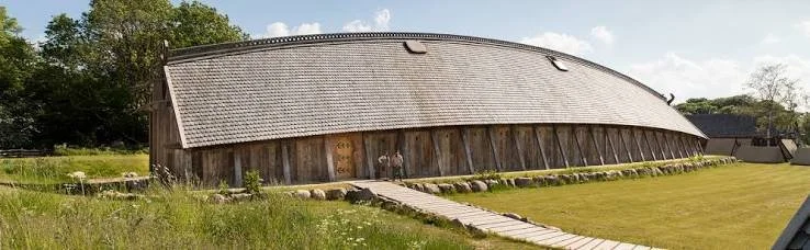
Lejre: Denmark's Royal Iron Age Hal
September 14, 2026
Read more →
September 14, 2026
images (81).jpeg
September 14, 2026
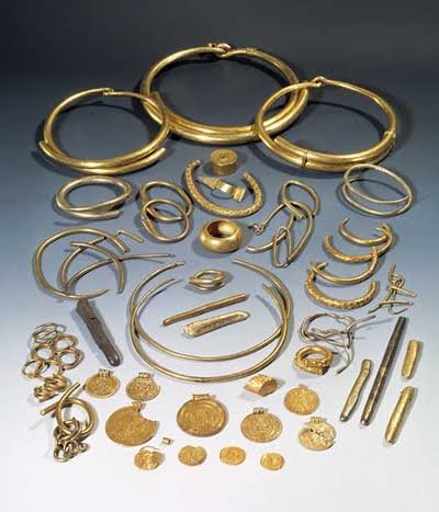
Gudme: Denmark's Iron Age Gold Hoard Site
September 14, 2026
Read more →
September 14, 2026
images (80).jpeg
September 14, 2026
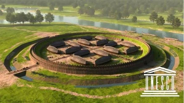
Nonnebakken: Odense's Viking Fort Remains
September 14, 2026
Read more →
September 14, 2026
read more

Powered by The archaeologist