• MAIN PAGE
  • LATEST NEWS
    • Lost Cities
    • Archaeology's Greatest Finds
    • Underwater Discoveries
    • Greatest Inventions
    • Studies
    • Blog
  • PHILOSOPHY
  • HISTORY
  • RELIGIONS
    • Africa
    • Anatolia
    • Arabian Peninsula
    • Balkan Region
    • China - East Asia
    • Europe
    • Eurasian Steppe
    • Levant
    • Mesopotamia
    • Oceania - SE Asia
    • Pre-Columbian Civilizations of America
    • Iranian Plateau - Central Asia
    • Indus Valley - South Asia
    • Japan
    • The Archaeologist Editor Group
    • Scientific Studies
    • Aegean Prehistory
    • Historical Period
    • Byzantine Middle Ages
    • Predynastic Period
    • Dynastic Period
    • Greco-Roman Egypt
  • Rome
  • PALEONTOLOGY
  • About us
Menu

The Archaeologist

  • MAIN PAGE
  • LATEST NEWS
  • DISCOVERIES
    • Lost Cities
    • Archaeology's Greatest Finds
    • Underwater Discoveries
    • Greatest Inventions
    • Studies
    • Blog
  • PHILOSOPHY
  • HISTORY
  • RELIGIONS
  • World Civilizations
    • Africa
    • Anatolia
    • Arabian Peninsula
    • Balkan Region
    • China - East Asia
    • Europe
    • Eurasian Steppe
    • Levant
    • Mesopotamia
    • Oceania - SE Asia
    • Pre-Columbian Civilizations of America
    • Iranian Plateau - Central Asia
    • Indus Valley - South Asia
    • Japan
    • The Archaeologist Editor Group
    • Scientific Studies
  • GREECE
    • Aegean Prehistory
    • Historical Period
    • Byzantine Middle Ages
  • Egypt
    • Predynastic Period
    • Dynastic Period
    • Greco-Roman Egypt
  • Rome
  • PALEONTOLOGY
  • About us
No results found

Strathnaver Clearances Sites: Sutherland's Deserted Villages

September 9, 2026

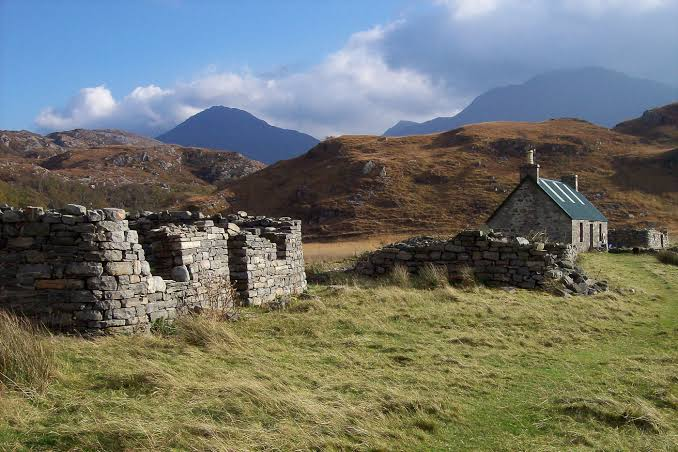
The Strathnaver Clearances Sites preserve some of the most important archaeological evidence for the social consequences of the Highland Clearances.

Across northern Sutherland, former settlements were abandoned as traditional communities were displaced during a period of profound economic and social transformation.

What Were the Highland Clearances?

The Highland Clearances were a series of processes, particularly prominent from the late eighteenth into the nineteenth centuries, in which Highland tenants were removed from traditional agricultural settlements.

Landowners increasingly sought to reorganize estates.

Large areas were converted to sheep farming.

Strathnaver

Strathnaver lies in northern Sutherland.

Before the Clearances, the valley contained numerous settlements where families practiced forms of mixed agriculture and pastoralism.

People cultivated crops while raising livestock.

Clearance and Displacement

Clearance operations resulted in the abandonment of many settlements.

Families were:

  • relocated;

  • forced toward coastal areas;

  • encouraged to emigrate;

  • or otherwise displaced from their traditional homes.

Archaeological Evidence

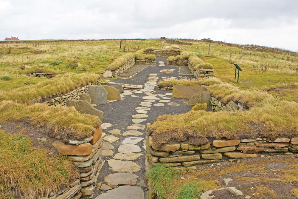
Today, abandoned settlement remains may include:

  • stone walls;

  • house foundations;

  • field boundaries;

  • enclosures;

  • clearance cairns;

  • and roads.

These apparently ordinary features provide direct evidence of former communities.

The Human Cost

The Clearances were not simply an agricultural modernization project.

For displaced families, removal could mean losing:

  • homes;

  • farmland;

  • community networks;

  • burial connections;

  • and ancestral landscapes.

Archaeology of Abandonment

Archaeologists can study deserted villages to reconstruct everyday life.

House dimensions reveal household organization.

Field systems reveal agricultural practices.

Animal remains can indicate diet and livestock management.

Artifacts can reveal household consumption.

Emigration

Many Highland families eventually emigrated.

Destinations included:

  • Canada;

  • the United States;

  • Australia;

  • New Zealand;

  • and other parts of the British Empire.

The Clearances therefore contributed to the transformation of Highland society both locally and globally.

Memory and Heritage

Clearance sites remain emotionally significant.

They represent not only archaeological remains but also the memories of communities whose descendants may live far beyond Sutherland.

Conclusion

Strathnaver Clearances Sites: Sutherland's Deserted Villages preserve the physical remains of communities transformed by the Highland Clearances.

Their ruined houses and fields demonstrate that historical change is not merely a political process.

It can reshape entire landscapes, families, economies, and patterns of settlement.
Badbea: Caithness's Clearance Village

September 9, 2026

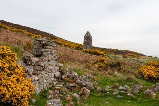
Badbea is one of the most evocative surviving landscapes associated with the Highland Clearances.

Situated on a steep coastal slope in Caithness, the abandoned settlement preserves the remains of homes occupied by families who had been displaced from traditional Highland communities.

Its harsh environment became part of the story of survival, migration, and forced relocation.

The Settlement

Badbea was established in the late eighteenth century by people displaced during Highland estate clearances.

The settlement's inhabitants faced difficult environmental conditions.

The land was poor, exposed, and steep.

Life on the Edge

Residents had to adapt to the coastal environment.

Agriculture was difficult.

People relied on combinations of:

  • small-scale cultivation;

  • livestock;

  • fishing;

  • gathering;

  • and other forms of subsistence.

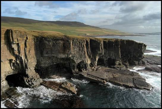
The Cliff

Badbea's dramatic location is one of its defining characteristics.

The settlement sits on a steep coastal landscape overlooking the sea.

Strong winds and difficult terrain made everyday life challenging.

Clearance Communities

Badbea illustrates an important aspect of the Clearances.

People were not always transported directly overseas.

Some displaced families were relocated within Scotland.

They often ended up on marginal lands where agricultural opportunities were limited.

Archaeological Remains

Today the settlement contains traces of:

  • houses;

  • walls;

  • fields;

  • enclosures;

  • and paths.

These remains allow visitors to reconstruct the physical structure of the community.

The Memorial

A memorial at Badbea commemorates the people who lived there and their descendants.

It connects archaeology with family history.

Emigration

Like many Highland communities, Badbea became part of a larger migration story.

Some residents eventually emigrated.

Their descendants can be found in communities around the world.

Historical Significance

Badbea is important because it makes the Clearances tangible.

Instead of encountering the Clearances only through written documents, visitors can see the actual landscape where displaced families attempted to rebuild their lives.

Conclusion

Badbea: Caithness's Clearance Village is a powerful archaeological and historical reminder of the Highland Clearances.

Its exposed landscape and ruined houses reveal the difficult conditions faced by families who lost access to their traditional homes.

The site stands as a memorial to resilience, displacement, and the global consequences of Highland migration.

Helmsdale: Sutherland's Emigration Memorial Site

September 9, 2026

Helmsdale occupies an important position in the history of Sutherland's nineteenth-century population movements.

The coastal settlement became associated with people displaced during the Highland Clearances and with the wider migration of Highland communities.

A Coastal Settlement

Helmsdale lies on the eastern coast of Sutherland.

Its position gave residents access to the North Sea and the fishing economy.

The coastal location became increasingly important as traditional Highland agricultural communities were transformed.

The Highland Clearances

During the Clearances, large numbers of people were removed from inland settlements.

Some were relocated to coastal communities.

These settlements were expected to support themselves through alternative economic activities.

Fishing and Coastal Life

Fishing became increasingly important.

Families could combine fishing with:

  • small-scale farming;

  • livestock;

  • craft production;

  • and seasonal labor.

Emigration

For many families, however, coastal resettlement did not provide sufficient economic security.

Some emigrated overseas.

The movement of people from Sutherland contributed to the creation of Highland diaspora communities.

Memorialization

Memorial sites in and around Helmsdale help preserve the memory of this period.

They recognize both the suffering caused by displacement and the resilience of those who rebuilt their lives.

Archaeological Landscape

The history of emigration is not represented only by monuments.

It is also visible through:

  • abandoned settlements;

  • old roads;

  • ruined houses;

  • burial grounds;

  • and changes in land use.

Family History

Helmsdale's Clearances history is particularly significant to genealogists.

Records of:

  • births;

  • marriages;

  • deaths;

  • tenancy;

  • migration;

  • and shipping

can sometimes be combined with archaeological evidence to reconstruct individual family histories.

Conclusion

Helmsdale: Sutherland's Emigration Memorial Site represents a landscape shaped by displacement and migration.

Its history demonstrates how the Highland Clearances transformed not only where people lived but also where their descendants would eventually establish new communities around the world.

Freswick Links: Caithness's Viking Longhouse

September 9, 2026

Freswick Links, on the northern coast of Caithness, forms part of a landscape with strong evidence for Norse settlement and maritime activity.

The area's archaeological importance lies in its ability to reveal how Scandinavian settlers adapted to the coastal environment of northern Scotland.

Norse Settlement

The Viking Age brought major changes to northern Scotland.

Norse settlers established farms and communities across Caithness and the Northern Isles.

These settlements were integrated into a wider maritime economy.

The Longhouse

The longhouse was an important building form within Scandinavian settlement traditions.

Longhouses could combine:

  • living space;

  • working areas;

  • storage;

  • and animal accommodation.

Their size and design varied according to local conditions and social status.

Building Materials

In northern Scotland, builders adapted Scandinavian building traditions to locally available resources.

Stone became particularly important in areas where timber was scarce.

Farming

Norse settlers practiced agriculture adapted to northern conditions.

They raised livestock such as:

  • cattle;

  • sheep;

  • goats;

  • and pigs.

They also cultivated crops where environmental conditions permitted.

Fishing and the Sea

Coastal settlements also exploited marine resources.

Fishing and shellfish collection could supplement agricultural production.

The sea additionally provided transportation routes.

Trade

Norse communities participated in extensive trade networks.

Goods could move between Scotland and Scandinavia through:

  • boats;

  • coastal settlements;

  • market centers;

  • and seasonal trading routes.

Archaeological Evidence

Settlement archaeology can reveal:

  • house construction;

  • food remains;

  • animal husbandry;

  • craft production;

  • and imported goods.

This provides a much richer picture than written sources alone.

Conclusion

Freswick Links: Caithness's Viking Longhouse represents the wider archaeological evidence for Norse settlement on Scotland's northern coast.

The combination of longhouse architecture, farming, fishing, and maritime trade demonstrates how Norse communities adapted Scandinavian traditions to the distinctive environment of Caithness.

Sanday Ness: Orkney's Neolithic Cairn

September 9, 2026

Sanday is one of Orkney's most archaeologically rich islands.

Its prehistoric landscape contains evidence of Neolithic settlement, farming, burial, and ceremonial activity.

The cairns and monuments around Sanday demonstrate that the island was deeply integrated into Orkney's Neolithic culture.

Neolithic Orkney

The Neolithic period transformed Orkney.

Communities built:

  • houses;

  • chambered tombs;

  • stone circles;

  • standing stones;

  • and ceremonial complexes.

Cairns

A Neolithic cairn could serve as a burial monument.

Chambered cairns were frequently designed for repeated funerary activity.

They may have housed the remains of multiple individuals over generations.

Sanday's Landscape

Sanday's fertile land and coastal environment supported prehistoric communities.

The island provided:

  • agricultural land;

  • marine resources;

  • stone;

  • and access to sea routes.

Monumental Construction

Building a cairn required organized labor.

Large stones had to be transported and positioned.

This implies cooperation and community organization.

Ancestral Memory

Burial monuments could create a physical connection between living communities and their ancestors.

The continued use or modification of monuments suggests that prehistoric people maintained relationships with earlier generations.

Archaeological Importance

The Sanday monuments help archaeologists understand how prehistoric communities used islands.

Orkney was not peripheral.

It was a major center of Neolithic innovation.

Conclusion

Sanday Ness: Orkney's Neolithic Cairn represents the island's important prehistoric heritage.

Its burial architecture provides evidence for Neolithic ideas about death, ancestry, community, and landscape.

The monument also demonstrates how Orkney's island communities created enduring structures from locally available stone.

Saville Game: Orkney's Mesolithic Site

September 9, 2026

The title “Saville Game” appears to refer to archaeological work or a site designation that requires careful verification before assigning a precise interpretation.

The broader subject of Mesolithic archaeology in Orkney is nevertheless extremely important because it reveals human activity before the famous Neolithic monuments transformed the islands.

Mesolithic Orkney

The Mesolithic period refers broadly to hunter-gatherer societies living before the widespread adoption of farming.

In Orkney, Mesolithic communities exploited both terrestrial and marine resources.

Coastal Resources

Orkney's coastline provided abundant food.

People could collect:

  • shellfish;

  • limpets;

  • mussels;

  • fish;

  • seabirds;

  • and marine mammals.

Hunting

Land animals also contributed to subsistence.

Mesolithic communities could hunt deer and other wild animals.

Mobility

Hunter-gatherer communities were often highly mobile.

They could move between seasonal resource zones.

Boats may have allowed travel among islands, although direct evidence for Mesolithic boats is extremely limited.

Archaeological Evidence

Mesolithic sites can contain:

  • stone tools;

  • animal bones;

  • shell middens;

  • hearths;

  • and charcoal.

These remains provide clues about daily life.

Transition to Farming

One of the most important questions in Orkney archaeology concerns the transition from hunter-gatherer societies to farming communities.

By the fourth millennium BCE, Orkney became famous for substantial Neolithic settlements and monuments.

Conclusion

Saville Game: Orkney's Mesolithic Site should be treated cautiously unless a specific archaeological identification is established.

Nevertheless, Mesolithic Orkney is an important field of research because it reveals the human communities that occupied the islands before the construction of monuments such as Skara Brae.

Braes of Ha'Breck: Wyre's Neolithic Houses

September 9, 2026

The Braes of Ha'Breck on the island of Wyre provides important evidence for Neolithic settlement in Orkney.

The site is particularly significant because it reveals that Neolithic communities were not only constructing monumental tombs and ceremonial structures but were also building substantial houses in which people lived, worked, and organized their communities.

Neolithic Wyre

Wyre is a small island in Orkney.

Despite its modest size, it preserves remarkable prehistoric archaeological evidence.

The Braes of Ha'Breck settlement demonstrates that small islands could support substantial farming communities during the Neolithic period.

Houses

The settlement contained stone-built structures.

The houses included:

  • walls;

  • floors;

  • hearths;

  • working spaces;

  • and internal divisions.

Farming

Neolithic communities practiced agriculture.

They cultivated crops and raised livestock.

Animal husbandry likely included:

  • cattle;

  • sheep;

  • goats;

  • and pigs.

Domestic Life

Archaeological remains can reveal everyday activities.

Grinding stones may indicate grain processing.

Pottery can reveal cooking and storage.

Animal bones provide evidence for diet and livestock management.

Community Organization

The construction of multiple houses indicates that the settlement was not merely a temporary campsite.

People lived together within an organized community.

Island Networks

Wyre was connected to other Orkney islands by sea.

This allowed communities to exchange:

  • stone;

  • food;

  • pottery;

  • tools;

  • and other materials.

Monumental Orkney

The Braes of Ha'Breck settlement is particularly important because it complements Orkney's famous monuments.

While sites such as Maeshowe and the Ring of Brodgar reveal ceremonial life, settlements reveal ordinary domestic activity.

Conclusion

Braes of Ha'Breck: Wyre's Neolithic Houses provides a valuable window into everyday life in prehistoric Orkney.

Its houses demonstrate that Neolithic island communities possessed sophisticated architectural traditions and organized agricultural economies.

The site reminds us that the people who built Orkney's monumental landscape also lived in ordinary homes where they cooked, worked, raised animals, and raised families.

Knowe of Hunclett: Rousay's Neolithic Tomb

September 9, 2026

Rousay is one of Orkney's richest archaeological islands.

Its prehistoric landscape contains numerous chambered cairns, settlements, and ceremonial monuments.

The Knowe of Hunclett belongs to this wider tradition of Neolithic burial architecture.

Chambered Tombs

Neolithic chambered cairns were monumental burial structures.

They typically consisted of:

  • a stone-built chamber;

  • passages;

  • dividing slabs or stalls;

  • and a large mound.

Communal Burial

These monuments could accommodate multiple burials.

Rather than serving one individual, they may have represented ancestral communities.

Human remains could be added over many generations.

Architecture

The construction required careful planning.

Large slabs had to be:

  1. selected;

  2. transported;

  3. positioned;

  4. stabilized;

  5. and incorporated into the chamber.

Rousay's Archaeological Landscape

Rousay contains several important chambered cairns.

The concentration of monuments suggests that the island played an important role in prehistoric Orkney.

Landscape Relationships

Neolithic monuments were often positioned in relation to:

  • hills;

  • valleys;

  • coastlines;

  • settlements;

  • and other monuments.

This indicates that burial architecture was part of a wider landscape strategy.

Ancestry

The repeated use of tombs suggests that prehistoric communities maintained strong relationships with the dead.

The monuments could have served as places where community identity was reinforced.

Conclusion

Knowe of Hunclett: Rousay's Neolithic Tomb represents the broader tradition of monumental burial architecture that makes Rousay one of Orkney's most important prehistoric landscapes.

Its significance lies in the evidence it contributes to our understanding of Neolithic burial, ancestry, architecture, and community organization.

Stennis: Orkney's Standing Stone Circle

September 9, 2026

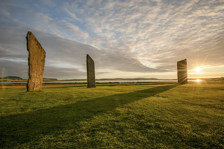
Stennis, more commonly associated with the Stones of Stenness, is one of the most extraordinary prehistoric monuments in Orkney.

The standing stones form part of a wider ceremonial landscape that includes the Ring of Brodgar, the Ness of Brodgar, and numerous Neolithic settlements and burial monuments.

One of Britain's Oldest Stone Circles

The Stones of Stenness date to the Neolithic period.

The surviving stones are enormous slabs arranged within a ceremonial enclosure.

The original monument was considerably more extensive than what survives today.

The Henge

The monument was constructed as part of a henge.

A henge typically consists of:

  • an enclosed area;

  • an external ditch;

  • and an embankment.

The Stenness monument was therefore not simply a circle of stones.

It was a carefully planned ceremonial complex.

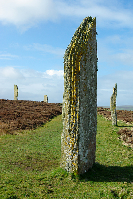
The Standing Stones

The surviving stones are exceptionally tall and thin.

Their appearance creates a dramatic vertical landscape.

The builders selected and transported enormous slabs before setting them upright.

Engineering

Moving the stones would have required substantial cooperation.

Possible methods included:

  • wooden sledges;

  • ropes;

  • timber structures;

  • and large groups of workers.

The construction therefore reveals sophisticated collective organization.

Ritual Activity

The precise ceremonies performed at Stenness remain unknown.

However, the monument's scale and relationship with other ceremonial structures demonstrate that it was an important communal gathering place.

Possible activities may have included:

  • feasting;

  • ritual processions;

  • funerary ceremonies;

  • seasonal gatherings;

  • and religious performances.

Relationship With the Ring of Brodgar

Stenness forms part of a remarkable ceremonial complex with the Ring of Brodgar.

The two stone circles are connected through the surrounding landscape.

People moving between these monuments would have experienced them as parts of a larger ceremonial environment.

The Ness of Brodgar

The nearby Ness of Brodgar provides additional evidence for major Neolithic ceremonial activity.

Its monumental buildings demonstrate that the surrounding area was an important center of social and ritual life.

Astronomy

The monument's orientation has attracted considerable interest.

Some prehistoric monuments in Orkney appear to incorporate relationships with the sun, moon, and seasonal cycles.

However, individual astronomical interpretations should be evaluated carefully rather than assuming that every alignment was deliberately astronomical.

UNESCO World Heritage

The Stones of Stenness form part of the Heart of Neolithic Orkney, a UNESCO World Heritage Site.

This group includes some of the most important surviving Neolithic monuments in Europe.

Conclusion

Stennis: Orkney's Standing Stone Circle represents one of the defining achievements of Neolithic Orkney.

Its monumental stones, henge architecture, and relationship with nearby ceremonial sites demonstrate that prehistoric communities were capable of organizing enormous collective projects.

The Stones of Stenness were not simply isolated stones in a field.

They were part of a carefully constructed ceremonial landscape where architecture, community, ritual, ancestry, and the natural environment came together.

Vestrafiold: Orkney's Viking Farm Mound

September 9, 2026

Vestrafiold is associated with the Viking and Norse archaeological landscape of Orkney, a region that became one of the most important Scandinavian settlements in the North Atlantic. The islands preserve an extraordinary concentration of evidence for Norse farming, burial, trade, political organization, and religious change.

Although the landscape has undergone extensive modification over centuries, archaeological mounds and settlement remains provide valuable clues about how Norse communities adapted to life in the Orkney Islands.

Orkney's Viking Transformation

Orkney occupied a strategically important position between Scotland and Scandinavia.

During the Viking Age, Norse settlers established themselves throughout the islands. Orkney eventually became part of a powerful Norse earldom whose influence extended across much of the northern Scottish and North Atlantic world.

The islands were attractive because they offered:

  • fertile agricultural land;

  • extensive grazing;

  • marine resources;

  • sheltered harbors;

  • and access to maritime trade routes.

The Farmstead Economy

Norse society in Orkney was heavily dependent upon farming.

A typical farmstead could combine agriculture with:

  • cattle raising;

  • sheep and goat herding;

  • fishing;

  • seabird exploitation;

  • craft production;

  • and maritime trade.

Cattle were particularly important because they provided meat, milk, hides, and labor.

Sheep supplied wool, while horses were useful for transportation and agricultural work.

Understanding Farm Mounds

Archaeological mounds can represent accumulated remains from long-term occupation.

Layers of:

  • stone;

  • soil;

  • charcoal;

  • animal bone;

  • pottery;

  • and building debris

can accumulate gradually as buildings are constructed, repaired, abandoned, and rebuilt.

Such deposits can provide a chronological record of occupation.

Viking-Age Material Culture

Archaeological discoveries from Orkney's Norse settlements frequently include objects associated with domestic and agricultural life.

These can include:

  • spindle whorls;

  • loom weights;

  • knives;

  • whetstones;

  • iron tools;

  • pottery;

  • fishing equipment;

  • and personal ornaments.

Together, these objects reveal a society that was both agricultural and maritime.

Norse Environmental Adaptation

The Norse settlers did not simply reproduce Scandinavian life unchanged.

They adapted to Orkney's environment.

Stone became an important construction material because suitable timber was comparatively limited.

Buildings could therefore be constructed with thick stone walls that provided insulation against the cold and windy climate.

Farm, Family, and Status

A Norse farmstead was more than an economic unit.

It was also a center of family life and social identity.

Large and prosperous farms could belong to influential households.

The size and quality of buildings, access to imported objects, and ownership of livestock could all reflect differences in wealth and status.

The Wider Norse Landscape

Vestrafiold should be considered within the larger archaeological landscape of Orkney.

Nearby farms, churches, burial sites, political centers, and harbors demonstrate that Norse society was highly interconnected.

Conclusion

Vestrafiold: Orkney's Viking Farm Mound represents the broader archaeological story of Norse settlement and agricultural life in Orkney.

The evidence from farm mounds demonstrates how Viking-Age communities combined farming, animal husbandry, maritime activity, and trade.

These settlements were the foundation upon which Norse society in Orkney developed for centuries.

Tuquoy: Westray's Viking Age Site

September 9, 2026

Tuquoy, on the island of Westray in Orkney, forms part of one of the richest Norse archaeological landscapes in Scotland.

The site provides evidence for Viking-Age and medieval settlement and helps demonstrate how Westray became integrated into the Norse world.

Westray and the Norse World

Westray is one of Orkney's northern islands.

Its location provided access to important maritime routes.

During the Viking Age, the island became part of the Norse cultural and political sphere.

Settlement

Archaeological sites such as Tuquoy provide evidence for long-term occupation.

Buildings in Orkney were frequently constructed from stone.

This was an effective response to the local environment, where timber was less abundant than in many Scandinavian regions.

Farming and Subsistence

Norse communities depended heavily on agriculture.

They raised livestock including:

  • cattle;

  • sheep;

  • goats;

  • pigs;

  • and horses.

Marine resources supplemented farming.

Fishing and the collection of shellfish and seabirds were especially important in coastal communities.

Maritime Connections

Westray's location made the sea a major transportation network.

Rather than separating communities, the sea connected them.

Boats could link Westray with:

  • mainland Orkney;

  • Shetland;

  • Caithness;

  • the Hebrides;

  • and Scandinavia.

Christianization

The Norse settlement of Orkney eventually became Christian.

This transformation can be observed archaeologically through churches, graves, crosses, and changing burial customs.

Christianization did not necessarily eliminate earlier traditions immediately.

Instead, religious change occurred gradually.

Archaeological Evidence

Settlement archaeology can reveal everyday life through:

  • animal bones;

  • hearths;

  • tools;

  • pottery;

  • stone objects;

  • and imported materials.

These finds help reconstruct diet, technology, trade, and domestic activities.

Westray's Wider Archaeological Importance

Westray is exceptionally important because it contains evidence from multiple periods.

Prehistoric settlements, Neolithic monuments, Iron Age structures, Viking sites, and medieval remains demonstrate that the island was repeatedly occupied and transformed.

Conclusion

Tuquoy: Westray's Viking Age Site illustrates the integration of northern Orkney into the Norse world.

Its importance lies not only in individual artifacts or buildings but in what the site reveals about farming, maritime connections, settlement organization, and the gradual transformation of Norse society into medieval Christian communities.

Brough of Birsay: Orkney's Norse Palace

September 9, 2026

The Brough of Birsay is one of Orkney's most remarkable archaeological landscapes.

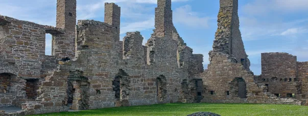
Located on a tidal island off the coast of Mainland Orkney, the site preserves evidence from the Pictish period through the Norse and medieval eras.

Its Norse remains are particularly important because Birsay became closely associated with the political elite of the Earldom of Orkney.

A Strategic Island

The Brough of Birsay occupies a commanding coastal position.

Its surrounding waters and cliffs created natural defensive advantages.

At the same time, the site was close to maritime routes connecting different parts of Orkney.

Pictish Origins

Before the Norse period, Birsay was an important Pictish center.

Archaeological evidence includes carved stones and ecclesiastical remains.

This indicates that the area already possessed political and religious significance before Scandinavian settlement.

The Norse Settlement

During the Viking Age, Birsay became an important Norse center.

Tradition and archaeological evidence associate the area with the Earls of Orkney.

The term “palace” should therefore be understood as a description of elite settlement rather than assuming the existence of a palace identical to a later European royal residence.

Elite Residence

A high-status settlement could function as:

  • a residence;

  • administrative center;

  • feasting location;

  • political meeting place;

  • and religious center.

Feasting was particularly important in Norse elite culture.

Large gatherings allowed rulers to demonstrate generosity and reinforce alliances.

Stone Architecture

The surviving structures demonstrate the durability of Orkney's stone-building tradition.

Thick stone walls provided insulation against the harsh climate.

Buildings could include residential spaces, workshops, storage areas, and ecclesiastical structures.

The Church

Christianity became increasingly important during the medieval period.

The Brough contains remains associated with a church and Christian activity.

This demonstrates the transformation of the site from a pre-Christian and potentially elite Norse environment into a Christian medieval community.

The Earls of Orkney

The Earls of Orkney controlled an important territory.

Their authority extended beyond individual islands.

The earldom formed part of the wider political world of:

  • Norway;

  • Scotland;

  • Iceland;

  • and the North Atlantic.

Archaeological Significance

Brough of Birsay is particularly valuable because multiple historical periods overlap.

Visitors can encounter evidence for:

  • Pictish culture;

  • Viking settlement;

  • Christianity;

  • medieval politics;

  • and later occupation.

Conclusion

Brough of Birsay: Orkney's Norse Palace represents one of the clearest examples of how political power, religion, and maritime geography interacted in medieval Orkney.

The site demonstrates that Birsay was not simply a settlement.

It was a place where political authority, elite culture, religion, and international connections converged.

Earl's Bu: Orkney's Viking Farmstead

September 9, 2026

Earl's Bu represents the agricultural foundations of Norse society in Orkney.

While the earls and political leaders of the islands are often remembered through historical narratives, archaeology reveals that their power ultimately depended upon farms, livestock, labor, and control over productive land.

The Meaning of a Norse Farmstead

A Norse farmstead was a complex economic unit.

It could contain:

  • a main dwelling;

  • animal shelters;

  • storage facilities;

  • workshops;

  • fields;

  • and grazing areas.

Agriculture

Orkney's climate favored pastoral farming.

Livestock were central to household survival.

Cattle provided:

  • meat;

  • milk;

  • hides;

  • and social wealth.

Sheep supplied wool and meat.

Farming Technology

Norse farmers used relatively simple tools compared with modern agriculture.

Important implements included:

  • iron knives;

  • sickles;

  • hoes;

  • axes;

  • and wooden tools.

Agriculture required extensive labor.

Marine Resources

Farming was supplemented by the sea.

Fishing provided protein and other resources.

Coastal communities also exploited:

  • shellfish;

  • seabirds;

  • eggs;

  • and occasionally marine mammals.

Social Hierarchy

The term “Earl's Bu” emphasizes the connection between agriculture and elite power.

An earl's authority depended upon access to productive estates and the ability to collect resources.

A prosperous farm could therefore have political importance.

Trade

Farm production could support trade.

Surplus:

  • wool;

  • hides;

  • livestock;

  • dried fish;

  • and other products

could enter wider exchange networks.

Imported goods, meanwhile, provide evidence of Orkney's participation in international commerce.

Household Life

Farmsteads were also homes.

Families cooked, ate, slept, worked, and socialized within these buildings.

Archaeology can reveal this domestic life through hearths, animal bones, tools, pottery, and other remains.

Conclusion

Earl's Bu: Orkney's Viking Farmstead represents the agricultural foundation of Norse society.

The site illustrates an essential historical principle: political power depended upon control of land, livestock, labor, and food production.

The great political centers of Norse Orkney could exist only because hundreds of farming communities sustained.

Buckquoy: Orkney's Pictish-Norse Cemetery

September 9, 2026

Buckquoy is one of Orkney's important archaeological sites for understanding the transition between Pictish and Norse society.

Its cemetery evidence is especially valuable because burial archaeology can reveal changes in identity, religious practice, population movement, and cultural interaction.

Pictish Orkney

Before the Norse settlement of Orkney, the islands were inhabited by Pictish communities.

The Picts left behind:

  • carved stones;

  • settlements;

  • churches;

  • burial sites;

  • and distinctive artistic traditions.

The Arrival of the Norse

From the late first millennium CE, Norse settlers increasingly became part of Orkney's population.

This did not necessarily mean that Pictish communities simply disappeared.

Instead, the archaeological record suggests a complex process of interaction.

Cemeteries as Evidence

Burial sites are particularly useful for studying cultural change.

Archaeologists can examine:

  • body position;

  • grave orientation;

  • grave construction;

  • artifacts;

  • skeletal evidence;

  • and cemetery organization.

Pictish and Norse Traditions

Pictish and Norse burial traditions were not completely fixed or uniform.

Christianity also became increasingly important.

As a result, identifying an individual as “Pictish” or “Norse” solely from a grave can be difficult.

Material Culture

Objects associated with burials may include:

  • jewelry;

  • tools;

  • weapons;

  • personal ornaments;

  • and other possessions.

These objects can demonstrate contacts across the North Atlantic.

Population and Identity

One of the most important lessons from sites such as Buckquoy is that cultural identity is complicated.

A person could live in a Norse-controlled community while retaining elements of local ancestry or tradition.

Christianization

The gradual adoption of Christianity further changed burial customs.

Earlier Scandinavian traditions could involve grave goods, while Christian burial increasingly emphasized the body within a consecrated cemetery.

Conclusion

Buckquoy: Orkney's Pictish-Norse Cemetery provides a valuable case study in cultural transition.

Rather than presenting the Pictish and Norse worlds as completely separate, archaeology reveals interaction, adaptation, intermarriage, religious transformation, and changing identities.

The cemetery therefore represents one of the most important ways archaeologists investigate the cultural transformation of medieval Orkney.

Westness: Rousay's Viking Hoard Site

September 9, 2026

Westness on Rousay is one of the most significant archaeological landscapes in Orkney.

The area is associated with Norse settlement, burial, farming, and evidence of wealth, making it an important location for understanding Viking-Age society.

Rousay and the Norse World

Rousay is located close to Mainland Orkney.

Its position provided access to maritime routes and neighboring islands.

The island contained fertile areas suitable for farming as well as extensive coastal resources.

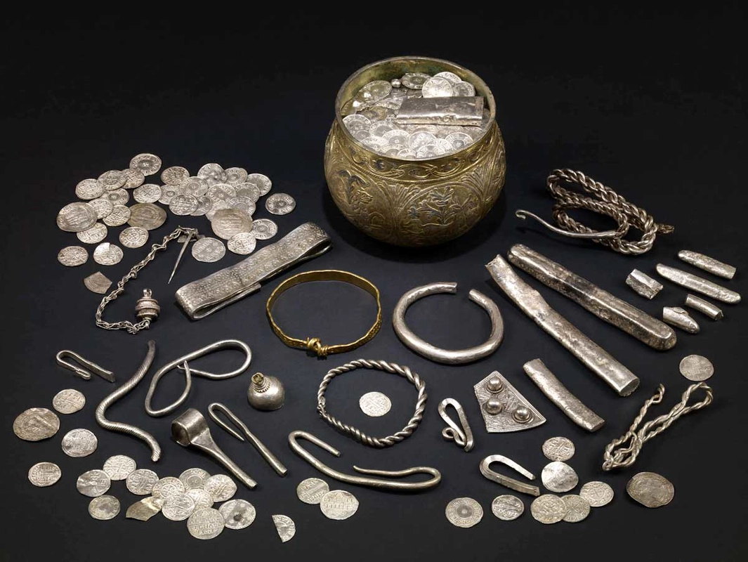
Hoards and Viking Society

A hoard is a deliberate collection of objects that was deposited together.

Hoarding occurred for different reasons.

People might bury valuables for:

  • safekeeping;

  • ritual purposes;

  • emergency concealment;

  • or other social reasons.

A buried hoard does not automatically indicate treasure belonging to a wealthy ruler.

What Hoards Can Tell Us

A hoard can contain:

  • coins;

  • jewelry;

  • silver fragments;

  • ingots;

  • or other valuable objects.

These materials can reveal long-distance connections.

Silver, for example, circulated widely across Viking trading networks.

Viking Trade

Orkney was strategically positioned within North Atlantic trade routes.

Connections extended toward:

  • Norway;

  • Ireland;

  • Scotland;

  • Iceland;

  • and other parts of northern Europe.

Silver Economy

Silver was particularly important in Viking economies.

It could be:

  • weighed;

  • exchanged;

  • divided;

  • melted;

  • and transformed into other objects.

This flexible use made silver useful in long-distance commerce.

The Meaning of a Hoard

A hoard represents a moment of decision.

Someone deliberately placed objects into the ground or another secure location.

The original reason may remain unknown.

That uncertainty makes hoards archaeologically fascinating.

Westness Landscape

Westness is significant because it was not merely an isolated treasure location.

It belonged to a broader settlement and burial landscape.

This allows archaeologists to connect economic evidence with everyday life.

Conclusion

Westness: Rousay's Viking Hoard Site offers insight into the wealth, trade, uncertainty, and economic practices of Viking-Age Orkney.

The site's importance lies in connecting individual valuables with the larger Norse maritime world that connected Orkney.

Westness Cemetery: Rousay's Norse Graves

September 9, 2026

Westness Cemetery on Rousay is one of the most important archaeological resources for studying Norse burial traditions in Orkney.

The cemetery forms part of a larger archaeological landscape containing evidence of settlement and long-term occupation.

Norse Burial Customs

Burial practices changed considerably during the Viking Age.

Early Scandinavian religious traditions could involve grave goods and distinctive burial arrangements.

With Christianization, burial customs changed.

Grave Goods

Norse graves may contain:

  • weapons;

  • brooches;

  • beads;

  • tools;

  • keys;

  • buckles;

  • and other personal possessions.

However, not every grave contains artifacts.

The absence of grave goods does not mean that a person lacked social importance.

Women and Men

Archaeological evidence can sometimes provide clues about gendered roles.

Weapons may occur in some male-associated burials, while women could be buried with jewelry and household implements.

However, archaeologists increasingly recognize that grave goods do not always correspond directly to biological sex or occupation.

Christianization

As Christianity became established, burial practices increasingly changed.

The transition was gradual.

Some communities maintained older traditions alongside Christian practices.

Skeletal Evidence

Human remains can provide information about:

  • age;

  • biological sex;

  • disease;

  • injuries;

  • diet;

  • and physical activity.

Modern archaeological science can also use isotopic and genetic methods to investigate mobility and ancestry.

The Rousay Landscape

Westness Cemetery should be understood alongside the surrounding settlement landscape.

Burials were connected to communities.

The cemetery therefore provides evidence for the people who lived and worked in the surrounding farms.

Conclusion

Westness Cemetery: Rousay's Norse Graves provides a valuable record of the people who lived during one of the most transformative periods in Orkney's history.

The cemetery illustrates changing religious traditions, social identity, family life, and the integration of Orkney into the wider.

Howe Harper: Orkney's Neolithic Mound

September 9, 2026

Howe Harper belongs to Orkney's remarkable tradition of prehistoric monumental landscapes.

Neolithic mounds and burial monuments demonstrate that communities living thousands of years ago invested enormous effort in constructing structures connected with death, ancestry, and collective identity.

Neolithic Orkney

The Neolithic period transformed Orkney.

Farming communities established permanent settlements and constructed monumental architecture.

These included:

  • chambered cairns;

  • stone circles;

  • standing stones;

  • houses;

  • and ceremonial complexes.

The Meaning of a Mound

A prehistoric mound could cover a burial structure.

Its visible form transformed the landscape.

Even when the original internal chamber was no longer accessible, the mound remained a physical marker.

Monumental Labor

Constructing a mound required collective effort.

Workers had to:

  1. gather stone;

  2. transport materials;

  3. construct chambers;

  4. build walls;

  5. and create the outer mound.

Such projects demonstrate organized community labor.

Ancestral Landscapes

Neolithic monuments may have served as places where communities interacted with the dead.

Ancestors could become part of the landscape itself.

The monument therefore connected:

  • people;

  • land;

  • memory;

  • and community identity.

Orkney's Monumental Network

Howe Harper belongs to a wider network of monuments.

Orkney contains one of Europe's greatest concentrations of Neolithic architecture.

The monuments were not necessarily isolated.

Their positions could relate to settlements, hills, coastlines, and other ceremonial sites.

Archaeological Interpretation

Not every mound had the same function.

Some were tombs.

Others may have had ceremonial or settlement-related purposes.

Therefore, identifying the precise role of an individual mound requires archaeological evidence.

Conclusion

Howe Harper: Orkney's Neolithic Mound represents the remarkable monumental traditions of prehistoric Orkney.

The site's broader significance lies in demonstrating how Neolithic communities transformed their environment through architecture and created enduring places associated with ancestry, ceremony, and collective memory.

Isbister Chambered Cairn: South Ronaldsay's Tomb

September 9, 2026

Isbister Chambered Cairn, located on South Ronaldsay in Orkney, is an important example of prehistoric chambered-tomb architecture.

The monument provides insight into how Neolithic communities understood death, ancestry, and the landscape.

Chambered Cairns

A chambered cairn was a stone-built funerary monument.

Its basic components could include:

  • an entrance passage;

  • a central chamber;

  • smaller compartments;

  • and an outer cairn.

Collective Burial

These tombs could contain the remains of multiple people.

The practice indicates that burial was often a communal process rather than simply an individual event.

People may have returned to the monument repeatedly over generations.

Architecture

The builders carefully selected large slabs and stones.

Some were used as:

  • roof slabs;

  • wall blocks;

  • dividing stones;

  • or structural supports.

The architecture required considerable planning.

The Tomb and the Landscape

The location of a chambered cairn was meaningful.

Prehistoric builders selected positions in relation to:

  • surrounding hills;

  • valleys;

  • coastlines;

  • and other monuments.

This suggests that the landscape itself formed part of the monument's meaning.

Mortuary Practices

The treatment of human remains could vary.

Bones might be placed or reorganized within chambers.

This suggests that Neolithic communities had complex relationships with the dead.

Daily Life Behind the Monument

The people who constructed Isbister were farmers.

Their communities cultivated crops and raised animals.

They also exploited Orkney's rich marine environment.

South Ronaldsay

South Ronaldsay occupies an important position within Orkney's prehistoric landscape.

The island is connected geographically and culturally with the wider archipelago.

Conclusion

Isbister Chambered Cairn: South Ronaldsay's Tomb demonstrates the sophistication of Neolithic funerary architecture.

The monument was more than a burial container.

It was a place where communities expressed ideas about ancestry, memory, identity, and their relationship with the landscape.

Wideford Hill Cairn: Mainland Orkney's Neolithic Tomb

September 9, 2026

Wideford Hill Cairn is one of Mainland Orkney's important prehistoric burial monuments.

Situated on Wideford Hill overlooking the surrounding landscape, the chambered cairn demonstrates how Neolithic communities incorporated monumental architecture into prominent natural settings.

The Neolithic Tomb

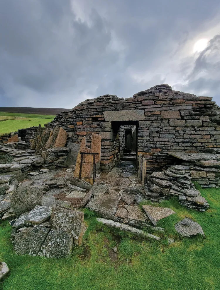
Wideford Hill Cairn belongs to the tradition of chambered cairns found throughout Orkney.

These monuments generally contained:

  • a passage;

  • a central chamber;

  • side compartments;

  • and a stone-built outer structure.

Monumental Construction

The cairn required substantial labor.

Large stones had to be moved into position.

The builders then constructed stable walls and roof supports.

The engineering demonstrates a sophisticated understanding of:

  • weight;

  • balance;

  • stone placement;

  • and structural stability.

Burial and Ancestry

The tomb provided a place for human remains.

The repeated use of chambered cairns indicates that prehistoric communities maintained long-term relationships with ancestors.

Wideford Hill

The hill provided a commanding view.

From the monument, the surrounding landscape could be visually connected with the tomb.

This may have contributed to the monument's significance.

Orkney's Sacred Geography

Wideford Hill Cairn belongs to a much larger archaeological landscape.

Across Mainland Orkney, Neolithic communities created:

  • settlements;

  • tombs;

  • standing stones;

  • henges;

  • and ceremonial centers.

These monuments transformed the islands into a highly structured cultural landscape.

Archaeological Interpretation

Although burial was clearly important, archaeologists continue to investigate the broader social and ritual functions of these monuments.

Funerary structures may also have served as:

  • meeting places;

  • ceremonial locations;

  • ancestral landmarks;

  • or symbols of group identity.

Conclusion

Wideford Hill Cairn: Mainland Orkney's Neolithic Tomb is an important example of the architectural and social achievements of prehistoric Orkney.

Its location, construction, and funerary function reveal how Neolithic communities combined engineering with beliefs about death, ancestry, and landscape.

Quanterness Chambered Cairn: Orkney's Excavated Tomb

September 9, 2026

Quanterness Chambered Cairn is one of Orkney's important excavated Neolithic burial monuments.

Its archaeological evidence provides an opportunity to study not only the monument's architecture but also the people and practices associated with it.

A Neolithic Chambered Cairn

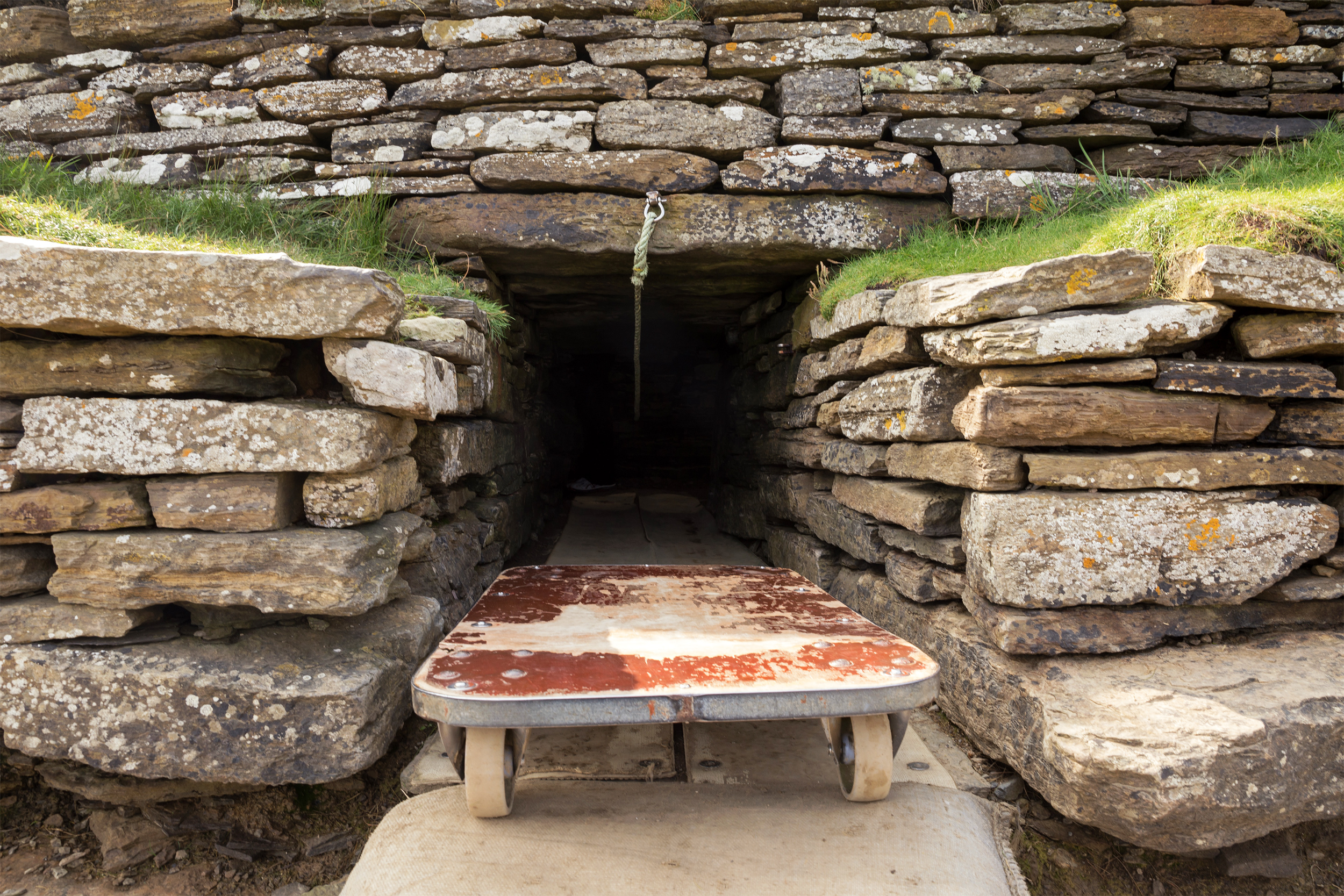
Quanterness was constructed as a monumental burial structure.

Its architecture included a passage leading into an internal chamber.

The design belongs to a wider tradition of prehistoric tomb construction found throughout Orkney.

Excavation

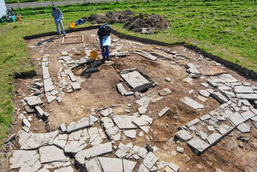
Archaeological excavation is particularly important because it can reveal deposits that are invisible from the surface.

Researchers may recover:

  • human remains;

  • animal bones;

  • stone tools;

  • pottery;

  • charcoal;

  • and architectural fragments.

Human Remains

Human skeletal material can reveal important information.

Researchers can investigate:

  • age;

  • sex;

  • health;

  • trauma;

  • diet;

  • and population relationships.

Ritual Treatment

The arrangement of human remains can provide clues about mortuary practices.

Bones may have been moved, reorganized, or accumulated over long periods.

This indicates that burial was often an ongoing social process.

Architecture and Astronomy

Some Orkney chambered cairns have orientations connected with particular landscape or astronomical features.

However, interpretations of astronomical alignment must be based on measurable evidence rather than assumption.

Community Labor

Constructing Quanterness required collective effort.

The monument represents the ability of a prehistoric community to organize workers and resources.

Conclusion

Quanterness Chambered Cairn: Orkney's Excavated Tomb is important because excavation allows archaeologists to move beyond the visible architecture and investigate the human activity preserved inside.

The monument provides evidence for burial practices, social organization, architecture, and the enduring importance of ancestry in Neolithic Orkney.

← Newer Posts Older Posts →
Featured
image_2026-09-01_150407961.png
September 9, 2026
Dunadd Fort: Argyll's Inauguration Rock Carvings
September 9, 2026
Read more →
September 9, 2026
image_2026-09-01_150445885.png
September 9, 2026
Kilmartin Glen: Argyll's 5,000-Year Megalithic Landscape
September 9, 2026
Read more →
September 9, 2026
image_2026-09-01_150523753.png
September 9, 2026
Nether Largie: Argyll's Clyde Tomb Alignment
September 9, 2026
Read more →
September 9, 2026
image_2026-09-01_150612586.png
September 9, 2026
Ri Cruin: Argyll's Bronze Age Cairn Circle
September 9, 2026
Read more →
September 9, 2026
image_2026-09-01_150753980.png
September 9, 2026
Barnaluasgan: Argyll's Standing Stones
September 9, 2026
Read more →
September 9, 2026
image_2026-09-01_150644895.png
September 9, 2026
Ballymeanoch: Argyll's Kerbed Cairn
September 9, 2026
Read more →
September 9, 2026
read more

Powered by The archaeologist