• MAIN PAGE
  • LATEST NEWS
    • Lost Cities
    • Archaeology's Greatest Finds
    • Underwater Discoveries
    • Greatest Inventions
    • Studies
    • Blog
  • PHILOSOPHY
  • HISTORY
  • RELIGIONS
    • Africa
    • Anatolia
    • Arabian Peninsula
    • Balkan Region
    • China - East Asia
    • Europe
    • Eurasian Steppe
    • Levant
    • Mesopotamia
    • Oceania - SE Asia
    • Pre-Columbian Civilizations of America
    • Iranian Plateau - Central Asia
    • Indus Valley - South Asia
    • Japan
    • The Archaeologist Editor Group
    • Scientific Studies
    • Aegean Prehistory
    • Historical Period
    • Byzantine Middle Ages
    • Predynastic Period
    • Dynastic Period
    • Greco-Roman Egypt
  • Rome
  • PALEONTOLOGY
  • About us
Menu

The Archaeologist

  • MAIN PAGE
  • LATEST NEWS
  • DISCOVERIES
    • Lost Cities
    • Archaeology's Greatest Finds
    • Underwater Discoveries
    • Greatest Inventions
    • Studies
    • Blog
  • PHILOSOPHY
  • HISTORY
  • RELIGIONS
  • World Civilizations
    • Africa
    • Anatolia
    • Arabian Peninsula
    • Balkan Region
    • China - East Asia
    • Europe
    • Eurasian Steppe
    • Levant
    • Mesopotamia
    • Oceania - SE Asia
    • Pre-Columbian Civilizations of America
    • Iranian Plateau - Central Asia
    • Indus Valley - South Asia
    • Japan
    • The Archaeologist Editor Group
    • Scientific Studies
  • GREECE
    • Aegean Prehistory
    • Historical Period
    • Byzantine Middle Ages
  • Egypt
    • Predynastic Period
    • Dynastic Period
    • Greco-Roman Egypt
  • Rome
  • PALEONTOLOGY
  • About us
No results found

The Archaeology of Mudbrick Reinforcement with Animal Hair

November 8, 2026

Introduction

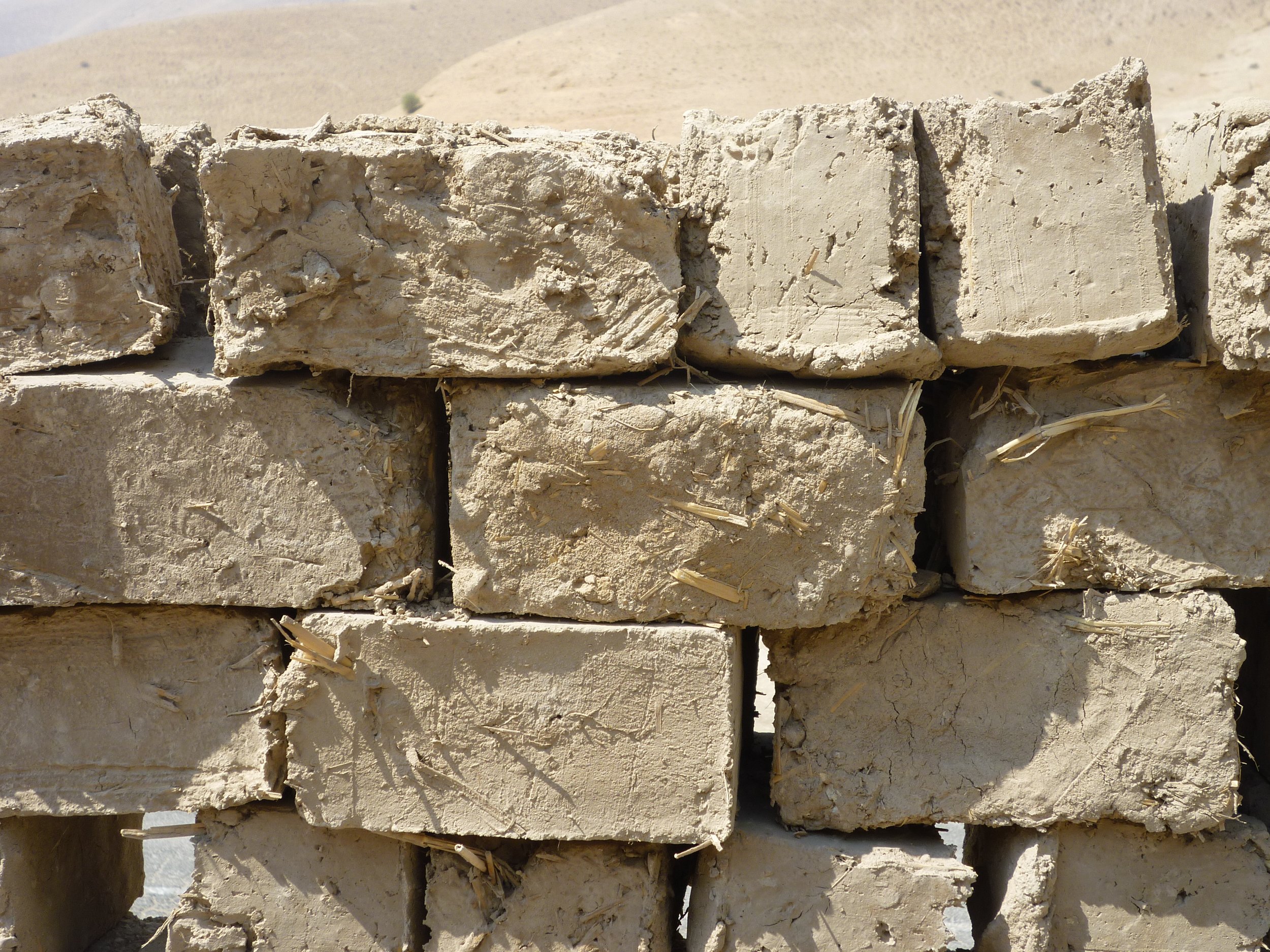
Mudbrick was one of the most widely used construction materials in ancient societies. It could be produced from locally available soil, water, and other natural materials, making it practical for communities without access to large quantities of stone or fired brick.

Although mudbrick was relatively inexpensive and easy to manufacture, it could be vulnerable to cracking, erosion, and structural weakness. Builders therefore experimented with different materials to improve its performance. Plant fibers, straw, chaff, and other organic substances were sometimes incorporated into earthen construction materials.

Animal hair is another possible reinforcement material. Its physical properties make it potentially useful in reducing certain forms of cracking and improving the cohesion of earthen mixtures. Archaeological research into this practice requires careful analysis because animal hair can be difficult to distinguish from other organic fibers and may not survive well in buried structures.

Understanding Mudbrick Construction

Mudbrick is generally made from a mixture of soil and water shaped into blocks and dried in the sun or under controlled conditions.

The composition of the mixture depends on the local environment. Clay provides binding properties, while sand and silt influence texture, shrinkage, and strength.

Builders may have added organic materials to modify the behavior of the mixture. Straw, chopped reeds, grasses, and other plant fibers could help reduce certain types of cracking and improve the handling of the material.

Once dried, mudbricks could be arranged into walls using mud mortar. Their performance depended on the quality of the mixture, construction technique, exposure to moisture, and maintenance.

Why Animal Hair Could Be Used as Reinforcement

Animal hair has several physical characteristics that make it a potential reinforcement material.

Individual hairs are flexible and can become embedded within a clay-rich mixture. When distributed throughout a mudbrick, they may help bridge small cracks and reduce the separation of material as it dries.

Hair fibers may also influence the texture and workability of the mud mixture. Depending on the type, length, quantity, and condition of the fibers, they could alter how the material behaves during shaping and drying.

The use of animal hair would not necessarily make mudbrick waterproof or capable of supporting unlimited structural loads. Its potential contribution would be more closely related to the behavior of the mixture during drying and the development of small cracks.

Possible Sources of Animal Hair

Ancient communities had access to hair from domesticated animals such as sheep, goats, cattle, horses, and camels, depending on the region and period.

Hair could have been collected during grooming, seasonal shedding, or the processing of animal hides and wool.

The use of waste material may have been economically practical. Fibers unsuitable for textile production could potentially be redirected toward construction activities.

However, identifying the exact animal source of hair in an archaeological brick is difficult. Fibers may become degraded during burial, and their microscopic features can overlap with those of other animal materials.

Archaeological Evidence and Identification

The archaeological identification of animal hair in mudbrick requires microscopic examination and careful sampling.

Researchers may begin by inspecting exposed brick surfaces and examining thin sections under a microscope. Fibers embedded within the clay matrix can sometimes be distinguished by their shape, structure, and surface characteristics.

Scanning electron microscopy may provide more detailed images of preserved fibers. Chemical analysis can also help characterize organic remains, although the survival of useful molecular signatures depends on burial conditions.

A key challenge is separating original construction materials from later contamination. Animal hair may enter a mudbrick through soil deposits, animal activity, or post-depositional processes.

Therefore, the strongest evidence comes from fibers consistently embedded throughout the original brick matrix rather than isolated hairs found on exposed surfaces.

Distinguishing Hair from Plant Fibers and Other Materials

Plant fibers and animal hair may appear similar in poorly preserved archaeological samples. Both can survive as elongated structures embedded within earthen materials.

Microscopic characteristics can help distinguish them. Animal hairs generally possess a cuticle and internal structures that differ from those of many plant fibers.

Researchers may also use chemical methods to identify proteins associated with animal materials. Proteomic analysis can sometimes detect surviving proteins, although ancient degradation and contamination make interpretation difficult.

The identification process should include comparison with reference materials and samples from surrounding soil.

Without such controls, an apparent animal fiber may be incorrectly classified.

Experimental Archaeology and Material Testing

Experimental archaeology offers a way to test whether animal hair could improve the properties of mudbrick.

Researchers can prepare several mixtures using the same soil and water proportions while varying the amount and type of reinforcement material. Some bricks can contain plant fibers, others animal hair, and additional samples can be produced without reinforcement.

After drying, the bricks can be tested for shrinkage, cracking, compressive strength, and resistance to erosion.

The results may reveal whether animal hair provides measurable advantages under particular conditions.

Experiments must also account for differences between modern materials and ancient construction practices. The quality of soil, preparation methods, climate, and drying conditions can all influence the outcome.

A successful experiment demonstrates technical possibility, not necessarily historical use.

Environmental Factors and Preservation

Mudbrick preservation depends heavily on environmental conditions.

Dry climates can allow earthen structures to survive for long periods, especially when they are protected from rainfall and flooding. In wetter environments, repeated exposure to water can weaken mudbrick and accelerate erosion.

Organic fibers may degrade through microbial activity, temperature changes, and moisture. Their survival is more likely in favorable conditions, such as exceptionally dry deposits or protected architectural contexts.

Even when the fibers disappear, their former presence may sometimes be suggested by microscopic voids or impressions within the brick. However, such features are not unique to animal hair and must be interpreted cautiously.

Cultural and Economic Implications

If animal hair reinforcement can be demonstrated at an archaeological site, it may reveal practical knowledge of construction materials and the efficient use of available resources.

It could suggest that builders recognized the value of combining different materials to improve the behavior of earthen structures.

The use of animal by-products may also reflect connections between pastoralism, household production, and construction. Communities that raised livestock could have had regular access to fibers that were not suitable for other purposes.

Nevertheless, the presence of animal hair would not necessarily indicate a specialized construction industry. It could have resulted from small-scale experimentation or household-level building traditions.

Regional Comparisons and Technological Knowledge

Mudbrick technology developed in many parts of the ancient world, but construction practices varied according to local resources and environmental conditions.

Some communities relied heavily on straw and other plant materials, while others may have used alternative organic substances.

Comparing the composition of bricks from different regions can help researchers identify shared techniques or local innovations. However, similar reinforcement practices may have developed independently because builders faced comparable problems with cracking and shrinkage.

The movement of construction knowledge may also have occurred through trade, migration, craft specialization, and contact between neighboring settlements.

Conclusion

The possible reinforcement of mudbrick with animal hair illustrates how ancient builders may have adapted natural materials to improve construction performance. Hair fibers could have helped influence cracking and cohesion, although their effectiveness would have depended on the composition of the mud mixture and the conditions of use. Archaeological identification requires careful microscopy, chemical analysis, and controls against contamination. By combining laboratory research with experimental reconstruction and architectural context, researchers can investigate whether animal hair was deliberately used in ancient building practices and what this reveals about technological knowledge and resource use.
Small-Scale Brick Streets in Rural Roman Villas

November 8, 2026

Introduction

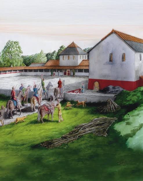
Roman roads are commonly associated with large engineering projects, military routes, and major urban centers. However, transportation infrastructure also existed within rural estates, agricultural settlements, and villa complexes. Some rural Roman properties required carefully constructed internal routes to connect residential buildings, storage facilities, workshops, baths, courtyards, and agricultural areas.

Among the possible forms of this infrastructure were small-scale brick streets and paved surfaces. These routes were not necessarily miniature versions of major Roman roads. Instead, they may have been practical features designed to improve movement, drainage, cleanliness, and access within private or semi-private estates.

The study of these smaller paved routes provides insight into everyday engineering and the organization of rural life under Roman rule.

Understanding Roman Rural Villas

A Roman villa was a rural property that could serve residential, agricultural, administrative, and commercial functions. Villas varied greatly in size, wealth, and architectural complexity.

Some were modest farmsteads focused primarily on agricultural production. Others contained elaborate residential buildings, baths, courtyards, decorated rooms, storage facilities, and extensive working areas.

The organization of a villa reflected the economic activities and social status of its owners. A large agricultural estate might include facilities for processing crops, housing workers, storing equipment, and managing livestock.

Movement between these areas was essential. Paths, paved yards, drainage channels, and internal streets helped connect different parts of the property.

The Purpose of Small-Scale Brick Streets

Brick-paved routes could serve several practical functions within a rural villa.

They provided relatively stable surfaces for people, animals, carts, and other forms of movement. In wet weather, unpaved ground could become muddy and difficult to cross, particularly near storage buildings and work areas.

Paved surfaces could also reduce the accumulation of mud and make certain spaces easier to maintain. Routes connecting kitchens, baths, courtyards, and service buildings may have benefited from more durable flooring.

Brick streets may have been particularly useful in areas where water runoff needed to be controlled. Their surfaces could be arranged with slight slopes to direct rainwater toward drains or collection areas.

However, not every brick-paved surface should be interpreted as a street. Some may have been courtyards, working floors, animal areas, or decorative architectural features.

Roman Brick-Making Technology

Roman builders used several types of fired and unfired construction materials. Fired bricks were produced by shaping clay and heating it in kilns until it became sufficiently hardened.

The quality and dimensions of bricks varied according to local materials, manufacturing traditions, and construction requirements.

Some bricks were made specifically for flooring or paving, while others were used for walls, foundations, arches, and other structures.

Brick production could occur near large settlements, agricultural estates, or specialized workshops. Transport costs and access to suitable clay influenced where bricks were manufactured.

In rural areas, locally produced bricks may have been more economical than transporting heavy construction materials over long distances.

Construction Methods and Street Design

Small-scale brick streets could be constructed using several techniques.

Builders might prepare the ground by removing unstable soil and laying a compacted foundation of gravel, crushed stone, or other materials. Bricks could then be arranged in regular patterns to create a durable walking surface.

The layout might include a central pathway, narrow side routes, or paved sections connecting specific buildings. Some surfaces may have incorporated stone borders or drainage channels.

Brick orientation and spacing could vary. Bricks laid in a repeated pattern may distribute weight more effectively, while irregular arrangements could reflect repairs or the use of available materials.

The thickness of the foundation is particularly important because it influences how well a paved route withstands repeated movement and changing ground conditions.

Drainage and Water Management

Water management was a major consideration in Roman construction. Buildings and paved surfaces needed to handle rainfall, wastewater, and runoff.

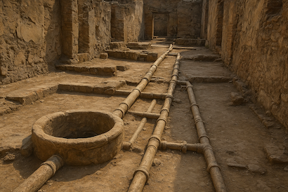
A brick street could be designed with a slight slope that directed water away from buildings. Drainage channels may have been placed alongside the route or beneath sections of the pavement.

In some villa complexes, paved areas connected with cisterns, wells, or drainage systems. These installations helped manage water for domestic and agricultural purposes.

The relationship between a paved route and nearby drains can help researchers understand its function. A surface that directs water toward a drainage channel may have been designed for regular use in an exposed outdoor environment.

However, drainage features can also serve courtyards and work areas, so they must be interpreted alongside architectural evidence.

Archaeological Identification

Identifying small-scale brick streets requires careful examination of the surrounding villa layout.

Researchers study the arrangement of buildings, entrances, working areas, and paved surfaces to determine whether a feature functioned as a route.

A pathway connecting several important parts of a property is more likely to have served as an internal street than an isolated paved platform.

The presence of wheel ruts, repeated wear patterns, compacted surfaces, and repaired sections may provide additional evidence of movement.

Excavation also reveals construction layers beneath the bricks. These layers can help distinguish deliberately engineered paving from bricks scattered through later collapse or rebuilding.

Dating Brick Streets and Their Phases of Use

Dating brick streets can be difficult because bricks may have been reused from older structures or incorporated into later repairs.

Archaeologists may use associated pottery, coins, inscriptions, and other datable materials to establish the chronology of the surrounding deposits.

Stratigraphy can reveal whether the street was constructed before or after nearby buildings. If a paved surface covers an earlier occupation layer, it must postdate that layer.

Mortar analysis and brick manufacturing characteristics may provide further chronological clues, although these methods rarely produce an exact construction date on their own.

Evidence of resurfacing can also reveal multiple phases of use. A street may have been maintained and modified throughout the occupation of the villa.

Economic and Social Significance

Internal streets helped organize the movement of people, goods, and agricultural products within rural estates.

A route connecting storage buildings with processing areas could improve the movement of crops and equipment. Access routes near residential buildings may have supported domestic activities and communication between different parts of the estate.

The quality of paving may also reflect the resources available to the property owner. Extensive brick paving could indicate investment in durable infrastructure, while simpler surfaces may reflect more modest construction priorities.

Nevertheless, expensive materials do not automatically indicate high social status. Local availability and practical needs also influenced building decisions.

Regional Variation Across the Roman World

Roman villa architecture varied considerably across the empire. Local building traditions, climate, geology, and economic conditions influenced how rural properties were constructed.

In regions where suitable clay was abundant, brick paving may have been relatively practical. In areas with limited brick production, stone slabs, gravel, or compacted earth may have been more common.

The layout of a villa also depended on its function. Agricultural estates, coastal properties, and elite residences required different types of internal circulation.

Comparing paved routes across several regions can therefore reveal how Roman engineering practices adapted to local conditions rather than following a single standardized design.

Conclusion

Small-scale brick streets in rural Roman villas provide evidence of the practical infrastructure that supported everyday movement and estate management. These routes could connect residential buildings, agricultural facilities, workshops, and service areas while improving drainage and access during unfavorable weather. Their construction reflects the adaptation of Roman building techniques to the needs of individual properties. Through architectural analysis, excavation, dating, and comparison with other villa features, researchers can better understand how rural communities organized space and maintained their infrastructure throughout the Roman period.

Ancient Bead Exchange Networks among Riverine Communities

November 8, 2026

Introduction

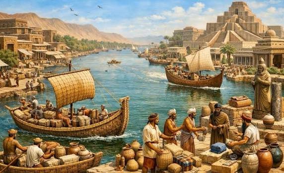
Rivers have historically connected communities through transportation, trade, fishing, agriculture, and cultural exchange. Settlements along waterways often interacted with neighboring populations and distant regions, creating networks through which materials, technologies, and ideas could circulate.

Among the objects that moved through these networks were beads. Although small in size, beads could carry considerable social and symbolic importance. They were used as ornaments, indicators of identity, objects of exchange, and sometimes as materials associated with ritual practices.

The archaeology of bead exchange networks offers an opportunity to understand how riverine communities participated in regional and long-distance connections. By examining bead materials, manufacturing techniques, styles, and distribution patterns, researchers can reconstruct aspects of trade and social relationships in ancient societies.

Beads as Archaeological Objects

Beads are small objects designed to be worn, attached, or incorporated into decorative arrangements. They may be made from stone, shell, bone, teeth, glass, ceramic, metal, or other materials.

Their shapes and manufacturing techniques vary considerably. Some are simple perforated shells, while others require careful cutting, grinding, drilling, polishing, and decoration.

The small size of beads makes them relatively easy to transport. They could be carried individually, stored in containers, or assembled into necklaces, bracelets, clothing decorations, and other personal objects.

Because they are often durable, beads can survive in archaeological deposits and provide valuable evidence of past craft production and exchange.

Why Rivers Encouraged Bead Exchange

River systems provided convenient transportation routes for communities living along their banks. Boats and other watercraft could carry goods more efficiently than travel across difficult terrain.

A river might connect inland settlements with coastal markets, agricultural centers, mining areas, and distant trading communities. Beads could move along these routes as finished products or as raw materials.

Communities located at river crossings, confluences, and navigable sections may have served as important meeting points. These locations could support exchange between people from different ecological and cultural regions.

The movement of beads along rivers does not necessarily indicate a formal trade system. Exchange may have occurred through markets, gifts, marriage relationships, seasonal gatherings, or indirect transactions involving several communities.

Materials and Their Geographic Origins

The raw materials used to produce beads can provide clues about exchange networks.

Certain stones, shells, and minerals occur only in specific geological or environmental regions. If beads made from these materials are discovered far from their natural sources, they may indicate the movement of objects or raw materials over considerable distances.

Geochemical analysis can help identify the likely origin of some stone materials. Mineral composition and trace elements may be compared with known geological deposits.

Shell identification can also reveal whether a bead was made from freshwater, coastal, or marine species. However, identifying a species does not always establish the exact location where the shell was collected.

The strongest interpretations combine material sourcing with archaeological distribution patterns and evidence of manufacturing.

Bead Production and Craft Specialization

Not all communities received beads as finished objects. Some may have produced their own ornaments using locally available materials.

Evidence of bead production can include unfinished pieces, drilling fragments, polishing tools, discarded raw materials, and workshop deposits.

The presence of these materials may indicate specialized craft activity. In some settlements, bead production could have been a household activity, while in others it may have involved dedicated artisans.

Differences in production techniques can help researchers identify relationships between communities. Similar drilling methods, shapes, and finishing techniques may suggest shared knowledge or contact.

However, similar designs can also develop independently when craftspeople face comparable material and functional requirements.

Beads as Social and Cultural Objects

Beads were not simply decorative objects. Their value could depend on material, color, craftsmanship, rarity, and cultural meaning.

Certain ornaments may have been associated with age, gender, social position, occupation, or membership in a particular community. Others may have been used during ceremonies, marriages, funerals, or important public events.

The discovery of beads in burials can provide information about how communities represented individuals after death. However, burial ornaments should not be interpreted automatically as direct indicators of wealth or status.

A simple bead made from an ordinary material may have carried deep personal or symbolic meaning. Conversely, an elaborate bead may have been valued primarily for its appearance or exchange potential.

Understanding these distinctions requires comparison with other objects, burial practices, settlement patterns, and historical evidence.

Reconstructing Exchange Networks

Archaeologists reconstruct bead exchange networks by comparing the distribution of bead types across different sites.

If a distinctive bead material or manufacturing style appears in several settlements along the same river system, researchers may investigate whether these communities were connected through exchange.

The number and concentration of beads can also provide useful information. Large quantities of unfinished beads may indicate local production, while small numbers of finished objects made from distant materials may suggest importation.

Spatial analysis can identify possible routes linking settlements. River confluences, natural harbours, portage points, and seasonal trading locations may have facilitated the movement of goods.

Researchers must avoid assuming that every shared object came directly from the same source. Beads may have passed through several communities before reaching their final archaeological location.

Scientific Methods Used in Bead Research

Several analytical techniques can help determine the origin and manufacture of ancient beads.

Microscopy can reveal drilling marks, polishing patterns, and traces of manufacturing tools. These details may help distinguish different production techniques.

X-ray fluorescence can identify the elemental composition of certain materials, while other geochemical methods may provide more detailed information about stone or glass origins.

Use-wear analysis can reveal whether beads were worn for extended periods. Surface scratches, edge rounding, and damage around perforations may indicate repeated attachment to clothing or strings.

Radiocarbon dating may be possible for beads made from suitable organic materials, although the age of a shell or bone must be interpreted in relation to its use and archaeological context.

Riverine Exchange and Cultural Interaction

Bead exchange may have contributed to the development of relationships between communities. Objects could circulate through gift exchange, diplomatic contacts, family connections, and trade.

The movement of ornaments may also have influenced local artistic traditions. Communities could adopt unfamiliar colors, shapes, or production techniques and adapt them to their own cultural preferences.

Beads made from distant materials may therefore reveal more than economic connections. They can provide evidence of social relationships and the circulation of ideas.

In some cases, imported beads may have been reworked locally, combining foreign materials with local manufacturing traditions. Such objects illustrate how cultural exchange can produce new forms rather than simply replacing existing traditions.

Limitations of the Evidence

Beads are small and easily lost, making their archaeological distribution uneven. Some materials preserve better than others, and excavation methods that do not use fine screening may overlook small objects.

The discovery of a bead made from a distant material does not necessarily prove direct contact between its place of origin and the settlement where it was found.

It may have passed through several trading communities or been carried by individuals over a long period. Its final deposition could also have occurred long after its manufacture.

Researchers must therefore interpret beads as part of broader archaeological patterns rather than relying on individual objects alone.

Conclusion

Ancient bead exchange networks reveal how riverine communities participated in systems of movement, trade, and cultural interaction. The small size and portability of beads made them suitable for exchange across local and long-distance networks, while their materials and designs could carry social and symbolic meanings. Through material sourcing, manufacturing analysis, spatial distribution, and archaeological context, researchers can investigate how beads moved between communities and how these objects contributed to the development of relationships across ancient river systems.

Submerged Wooden Walkways in Peat Bogs: Dating Techniques

November 8, 2026

Introduction

Peat bogs preserve some of the most remarkable archaeological materials found in wetland environments. Their waterlogged and often oxygen-poor conditions can slow the decomposition of organic materials, allowing wooden structures, tools, trackways, and other remains to survive for centuries or even millennia.

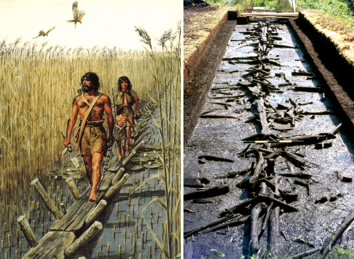
Among these discoveries are wooden walkways constructed across wetlands. These structures allowed people to cross unstable ground, reach resources, connect settlements, and travel through landscapes that were otherwise difficult to navigate. Determining their age is essential for understanding when they were built, how long they remained in use, and what role they played in past societies.

Dating submerged wooden walkways requires several scientific methods because the age of the timber does not always correspond directly to the construction date.

Understanding Peat Bog Environments

Peat bogs are wetlands where partially decomposed plant material accumulates over long periods. They commonly develop in environments with high moisture levels and limited oxygen availability.

The slow decomposition of vegetation creates layers of peat that can gradually cover objects and structures. These conditions may preserve wood, leather, textiles, plant remains, and other organic materials that would normally disappear in dry soil.

The chemical characteristics of peat can also affect preservation. Acidity may help inhibit certain microorganisms, although it can damage some materials, including bone and other mineralized remains.

Because peat develops gradually, its layers can provide a record of environmental change and human activity.

The Construction of Wooden Walkways

Wooden walkways were built to make movement across wetlands safer and more practical. Their construction varied according to available materials, terrain, and the intended purpose.

Some structures consisted of logs placed directly across wet ground. Others used split timber, branches, planks, or wooden supports arranged to create a more stable walking surface.

The simplest walkways may have been temporary and intended for seasonal use. More substantial examples could connect settlements, agricultural areas, grazing grounds, or resource-gathering locations.

Construction methods depended on local knowledge of the wetland. Builders needed to understand ground stability, water levels, available timber, and the direction of travel.

Why Accurate Dating Matters

Dating a wooden walkway helps establish when people began using a particular route. It may also reveal whether the structure belonged to a period of settlement expansion, agricultural development, or increased movement through wetlands.

However, determining the age of a walkway is not always straightforward. Timber may have been reused from older structures, while later repairs could introduce younger wood into an earlier construction.

A walkway may also have been used for generations. Its original construction date therefore does not necessarily represent the full period of activity at the site.

Archaeologists must distinguish the date of the wood, the date of construction, and the period during which the walkway was actually used.

Radiocarbon Dating

Radiocarbon dating is one of the most widely used methods for determining the age of organic archaeological materials.

Living trees absorb carbon dioxide from the atmosphere, including a small proportion of radioactive carbon-14. After a tree is cut or dies, its carbon-14 content gradually decreases through radioactive decay.

By measuring the remaining carbon-14 in a wood sample, scientists can estimate when the tree stopped exchanging carbon with the atmosphere.

Radiocarbon dating can be especially useful when wooden walkways lack distinctive construction features or associated artifacts.

However, the method dates the growth of the sampled wood, not automatically the moment when it was placed in the walkway. If builders used an old tree or reused timber, the resulting date may be older than the actual construction event.

Calibration is also necessary because atmospheric carbon-14 concentrations have changed over time.

Dendrochronology and Tree-Ring Dating

Dendrochronology is a dating method based on annual tree-ring patterns. Trees growing in seasonal climates commonly produce rings that reflect variations in environmental conditions.

Wet years, dry years, temperature changes, and other environmental factors can influence ring width. These patterns can be compared with established regional reference chronologies.

When the outermost growth rings are preserved, dendrochronology may identify the year a tree was felled with considerable precision.

This makes it especially valuable for dating wooden walkways. If several timbers show similar final ring patterns, researchers may be able to determine whether they were cut during the same period.

The method has limitations. Not all tree species produce easily readable annual rings, and reference chronologies may not exist for every region or period.

Stratigraphic Dating

Stratigraphy involves studying the arrangement of archaeological and geological layers. In peat bogs, successive layers may preserve evidence of environmental change and human activity.

If a walkway lies beneath a well-dated peat layer, researchers can establish that its construction predates the formation of that layer. Similarly, deposits covering the structure may provide evidence of when it was abandoned or buried.

Stratigraphic relationships are particularly useful when combined with radiocarbon dating and environmental analysis.

However, peat accumulation is not always uniform. Flooding, erosion, drainage, and human disturbance can alter the sequence of deposits.

Researchers must therefore examine whether the layers remain undisturbed before relying on their chronological relationships.

Archaeological and Environmental Dating Evidence

Artifacts discovered near a walkway may provide additional chronological information. Pottery fragments, tools, metal objects, and other materials can sometimes be assigned to established archaeological periods.

However, artifacts may have moved through water, animal activity, or later human disturbance. Their relationship to the walkway must be demonstrated rather than assumed.

Environmental evidence can also contribute to dating. Pollen grains, plant remains, and microscopic charcoal may reveal changes in vegetation and human activity.

Pollen analysis can help reconstruct the development of the surrounding landscape, including changes associated with agriculture, woodland clearance, and settlement.

These environmental records can provide a broader context for understanding when a walkway was constructed and how the surrounding wetland changed.

Preservation and Excavation Challenges

Peat bogs can preserve wood exceptionally well while also creating difficult excavation conditions. Archaeologists must work carefully because exposed timbers can shrink, crack, and deteriorate when they dry.

Waterlogged wood requires specialized conservation after excavation. Depending on its condition, treatment may involve controlled drying, chemical stabilization, or other conservation techniques.

Excavation must also account for the fragility of the surrounding peat. Removing large sections without proper recording can destroy the relationships between timbers, sediment layers, and associated materials.

Because wetland environments are sensitive, researchers increasingly use non-invasive survey methods before excavation. Ground-penetrating radar, remote sensing, and environmental coring may help locate structures and understand their context.

What Wooden Walkways Reveal About Ancient Mobility

Wooden walkways demonstrate that ancient communities developed practical solutions for moving through challenging environments.

Their construction may indicate repeated travel between settlements, access to natural resources, agricultural activity, or seasonal movement of livestock.

A network of walkways could connect different parts of a wetland landscape and make otherwise isolated areas more accessible.

Dating these structures can also reveal changes in land use. A walkway constructed during a period of expanding agriculture may reflect a growing need to access fields or grazing areas.

However, the exact purpose of each structure must be established through its location, construction, associated artifacts, and relationship to nearby settlements.

Conclusion

Submerged wooden walkways in peat bogs provide valuable evidence of ancient engineering and movement through wetland environments. Their organic materials may survive because of the unusual preservation conditions created by peat, but establishing their age requires careful analysis. Radiocarbon dating, dendrochronology, stratigraphy, artifact study, and environmental reconstruction each contribute different information. When combined, these methods help researchers distinguish the age of the timber from the construction and use of the walkway, allowing a more accurate reconstruction of ancient landscapes and human activity.

The Role of Minor Springs in Bronze Age Settlement Choice

November 8, 2026

Introduction

Access to freshwater was one of the most important factors influencing where ancient communities established settlements. During the Bronze Age, populations depended on reliable water sources for drinking, cooking, agriculture, livestock, craft production, and sanitation. While major rivers and large lakes often attracted settlement, smaller water sources may have been equally important in certain landscapes.

Minor springs, which produce relatively limited quantities of groundwater, could provide dependable water in locations where larger rivers were absent or difficult to access. Their importance may be overlooked when researchers focus primarily on major waterways and large settlements. Examining these smaller sources offers an opportunity to understand how Bronze Age communities evaluated their environments and selected places to live.

Understanding Minor Springs

A spring occurs when groundwater naturally emerges at the Earth's surface. Springs can develop along hillsides, geological fractures, limestone formations, and areas where underground water-bearing layers meet less permeable rock.

Minor springs generally produce smaller or more localized water flows than major springs. Some may provide water throughout the year, while others experience seasonal fluctuations depending on rainfall, groundwater levels, and geological conditions.

Despite their limited output, minor springs can be valuable because they may provide relatively accessible freshwater. In dry environments, even a modest spring could support a small settlement, a livestock enclosure, or a temporary agricultural community.

Freshwater and Bronze Age Settlement Patterns

The Bronze Age was characterized by significant developments in agriculture, metallurgy, trade, and settlement organization. These activities required access to water, although the amount needed varied according to the size and function of a community.

Agricultural settlements needed water for crops and livestock. Craft production could also require water for preparing clay, processing fibers, cooling materials, and other activities.

The availability of freshwater influenced where people could establish permanent homes. Settlements located near springs could reduce the time and labor required to obtain water, particularly in hilly or mountainous regions.

However, water was rarely the only factor involved in settlement choice. Soil fertility, defensive advantages, access to trade routes, building materials, and relationships with neighboring communities also shaped settlement decisions.

Why Small Springs Could Be More Useful Than Large Waterways

Large rivers provide substantial water supplies, but they can also present disadvantages. Seasonal flooding, changing channels, marshy terrain, and long distances between safe crossing points may make certain river environments difficult to occupy.

A minor spring may offer a more predictable and manageable source of water. Its limited flow could be sufficient for a small population while reducing the need to build complicated water-management systems.

Springs located on elevated ground may also offer strategic advantages. A settlement could occupy a defensible hillside while maintaining access to water below or nearby.

In some regions, minor springs may have been especially important for pastoral communities that moved livestock between seasonal grazing areas.

Archaeological Evidence for Spring-Related Settlements

Identifying the role of minor springs requires more than finding a settlement near a modern water source. Springs can shift, dry up, or become obscured through geological and environmental changes.

Archaeologists investigate the surrounding landscape to reconstruct ancient water availability. Geological mapping can identify natural groundwater outlets, while sediment analysis may reveal former wet areas or water channels.

Settlement remains can provide additional clues. Wells, storage containers, drainage channels, animal enclosures, and water-related installations may indicate how residents accessed and managed freshwater.

The distribution of pottery, domestic structures, and agricultural features around a spring may also reveal patterns of occupation and daily movement.

Geological and Environmental Reconstruction

Geological conditions influence whether a spring existed during the Bronze Age and whether it could have provided a reliable supply.

Researchers study rock formations, groundwater pathways, and sediment deposits to reconstruct ancient hydrological conditions. Limestone landscapes are particularly important because groundwater can move through underground channels and emerge at localized points.

Pollen analysis may help identify changes in surrounding vegetation. Wetland plants and moisture-sensitive species can provide evidence of former water availability, although they do not always identify a specific spring.

Stable isotope analysis of suitable archaeological materials may also contribute to understanding past water sources and environmental conditions.

Combining geological and archaeological evidence is essential because a spring visible today may not have existed in the same form thousands of years ago.

Springs, Livestock, and Pastoral Economies

Minor springs may have been particularly important for Bronze Age pastoral communities. Herds of sheep, goats, cattle, and other domestic animals required regular access to water.

A spring could support a temporary grazing station or a seasonal settlement where herders gathered animals before moving to other pastures.

The location of livestock remains, dung deposits, and animal enclosures may provide evidence of pastoral activity near water sources. Isotopic analysis of animal teeth and bones can sometimes help reconstruct movement between different environmental zones.

Small springs may therefore have influenced not only permanent settlements but also the wider network of seasonal occupation and livestock movement.

Social and Political Importance of Water Sources

Even a small spring could become socially significant if several households depended on it. Access to freshwater may have required shared rules, maintenance practices, or agreements between neighboring groups.

In areas with limited water availability, springs could become important meeting places and strategic resources. Their control may have influenced settlement boundaries and relationships between communities.

However, evidence of competition or ownership cannot be inferred from proximity alone. Archaeologists need supporting information, such as defensive structures, restricted access, water installations, or historical records.

Springs may also have held symbolic or ritual importance. Natural water sources sometimes became associated with religious practices, offerings, and ceremonial activity, although such interpretations must be based on specific archaeological evidence.

Limitations of the Archaeological Record

Minor springs are difficult to study because their physical traces may disappear over time. Modern construction, agricultural activity, groundwater extraction, and changes in vegetation can obscure ancient spring locations.

Furthermore, settlements may have used several water sources rather than relying on a single spring. Seasonal movement between springs, wells, streams, and rainwater collection systems could have been part of a broader water-management strategy.

The absence of visible water installations does not necessarily mean that a settlement lacked access to freshwater. Natural springs may have required little construction, leaving limited archaeological evidence.

Conclusion

Minor springs may have played an important role in Bronze Age settlement choice, particularly in landscapes where major rivers and lakes were unavailable or inconvenient. Their accessibility and potentially dependable water supplies could support households, livestock, and small agricultural communities. By combining geological reconstruction, environmental analysis, and archaeological survey, researchers can investigate how these modest water sources influenced settlement distribution, seasonal mobility, and the organization of ancient communities.

Ice‑preserved Fortresses in High Alpine Passes

November 8, 2026

Introduction

High mountain passes have long served as important routes for travel, trade, migration, and military movement. Although alpine environments can be difficult to cross, they often provide the most practical connections between valleys and neighboring regions. Communities and political authorities have therefore sought to control strategic mountain routes through watchpoints, defensive structures, and fortified positions.

In some high-altitude environments, glaciers and permanent snowfields may preserve archaeological materials that would otherwise decay or disappear. The possibility of ice-preserved fortresses in alpine passes raises important questions about mountain defense, climate history, and archaeological preservation. However, it is necessary to distinguish actual fortifications from temporary camps, shelters, abandoned equipment, and natural rock formations.

The Strategic Importance of Alpine Passes

Mountain passes provide routes through otherwise difficult terrain. They may connect agricultural valleys, pastoral regions, trading centers, and military territories.

Controlling a pass can offer several advantages. A defensive position may allow its occupants to observe approaching travellers, regulate movement, collect tolls, or protect nearby settlements.

Some passes are narrow and naturally restricted by steep slopes, cliffs, or rock formations. These geographical features can reduce the number of possible routes through a region, making a small defensive position strategically valuable.

However, not every alpine pass required a permanent fortress. Some locations may have been monitored through seasonal patrols, temporary camps, or agreements between neighboring communities.

What Qualifies as an Alpine Fortress?

A fortress is generally understood as a defensive structure designed to protect people, control territory, or resist attack. In alpine environments, fortifications may have been adapted to the limited availability of building materials and the difficulty of transporting supplies.

Possible features include stone walls, towers, defensive enclosures, timber structures, watch platforms, and barriers placed along narrow routes.

Some defensive positions may have used natural cliffs and rock outcrops as part of their protection. Rather than constructing large walls, builders could have strengthened an existing natural barrier with smaller structures.

Researchers must distinguish these features from ordinary mountain shelters, pastoral enclosures, and structures intended for storage or weather protection. Evidence of defensive function may include controlled entrances, strategic placement, weapons, and associated military materials.

Ice as a Preservation Environment

Ice can preserve archaeological materials by limiting exposure to oxygen, reducing microbial activity, and maintaining low temperatures. Under favorable conditions, organic objects that would normally decay may survive for centuries or even longer.

Wooden tools, leather equipment, textiles, ropes, and other materials have been recovered from alpine ice and snow environments. Their preservation can provide detailed information about past technologies and everyday activities.

However, ice does not preserve everything equally. Freeze-thaw cycles, glacier movement, meltwater, and exposure after melting can damage or destroy archaeological remains.

A glacier is also not a static storage container. Moving ice can transport materials away from their original locations, mix objects from different periods, and distort the archaeological context.

Archaeological Evidence in Alpine Environments

The investigation of possible ice-preserved fortresses requires the combination of conventional excavation and specialized high-altitude survey.

Researchers may use aerial photography, satellite imagery, LiDAR, and ground-based mapping to identify unusual structures or changes in terrain. These techniques can help locate stone walls, terraces, and possible defensive features beneath snow or vegetation.

Field teams then examine exposed surfaces and archaeological deposits. They record the position of wooden fragments, metal objects, ceramics, weapons, and other materials.

The relationship between artifacts and architectural remains is particularly important. A weapon found near a stone enclosure may be relevant to its interpretation, but it does not automatically establish that the structure was a fortress.

Dating Fortifications and Associated Materials

Dating alpine fortifications can be complicated because structures may have been built, repaired, and reused over long periods.

Radiocarbon dating can be applied to suitable organic remains, such as charcoal or preserved wood. Dendrochronology, which compares tree-ring patterns, may provide precise dates when suitable timber and regional reference chronologies are available.

Ceramic typology, metalworking techniques, and historical records can offer additional chronological evidence.

Researchers must also determine whether an object was deposited during the original construction phase or entered the site through later occupation. An ancient wooden object discovered near a much younger wall may not date the wall itself.

Glacial movement and redeposition create additional complications. Objects recovered from melting ice may have lost their original archaeological associations.

Military Life in High Mountain Environments

Defending an alpine pass required more than constructing walls. Soldiers or guards needed shelter, food, water, fuel, and equipment capable of functioning in cold conditions.

The seasonal availability of routes would have influenced military activity. Heavy snowfall could make a pass inaccessible for months, while warmer periods might allow greater movement.

Archaeological evidence such as hearths, animal bones, storage containers, and repair materials can provide clues about how people lived at high elevations.

Weapons and protective equipment may indicate military activity, but their presence must be interpreted carefully. Mountain routes were also used by hunters, traders, travellers, and pastoral communities.

Climate Change and the Exposure of Archaeological Remains

Modern glacier retreat is revealing archaeological materials that have remained frozen for long periods. As ice melts, previously inaccessible objects and structures may become exposed.

This creates both opportunities and risks. Newly exposed artifacts can provide valuable information, but they may deteriorate rapidly once removed from their frozen environment.

Organic materials can become vulnerable to drying, microorganisms, physical damage, and changes in temperature. Researchers must therefore prioritize documentation and appropriate conservation.

Monitoring glacial landscapes is increasingly important because archaeological discoveries may be exposed only temporarily. Delayed investigation can result in the loss of materials through meltwater, erosion, or human disturbance.

Reconstructing Alpine Trade and Conflict

A fortified pass may provide evidence of the wider networks that connected mountain communities. Imported ceramics, coins, weapons, and other objects can reveal contact with distant regions.

The distribution of such materials may help researchers identify trade routes, political boundaries, and patterns of movement.

Evidence of repeated repairs or multiple construction phases could indicate that a location remained important over several generations. Changes in defensive architecture may reflect new military technologies or shifting political conditions.

Yet the presence of a fortress does not necessarily mean that a pass experienced frequent warfare. Fortifications could also serve as symbols of authority, customs stations, or places for controlling access to valuable routes.

Conclusion

High alpine passes offer a distinctive setting for investigating the relationship between military architecture, mobility, and environmental preservation. Fortifications in these regions could control important routes, protect nearby communities, and demonstrate political authority. Ice may preserve valuable organic materials associated with mountain activity, but glacier movement and melting can complicate archaeological interpretation. Through careful survey, dating, excavation, and conservation, researchers can reconstruct how people used and defended high-altitude landscapes while also protecting archaeological evidence threatened by changing environmental conditions.

Micro-remains of Ancient Soap Scum on Pottery Rims

November 8, 2026

Introduction

Pottery is among the most common materials recovered from archaeological sites. Its durability allows fragments to survive long after the vessels have been discarded, broken, or buried. Archaeologists study pottery to understand food preparation, storage, trade, domestic activities, and technological development. Less obvious evidence may also survive on ceramic surfaces, including microscopic residues left by substances used for cleaning, washing, or personal hygiene.

The study of possible ancient soap residues on pottery rims is an especially challenging area of archaeological research. Substances that resemble soap scum can also form through natural mineral deposits, cooking residues, fats, and interactions between water and ceramic materials. As a result, researchers must use several analytical methods before identifying a residue as evidence of soap or soap-like cleaning products.

Understanding Soap and Soap Scum

Soap is generally produced through a chemical reaction between fats or oils and an alkaline substance. This process, known as saponification, creates compounds called fatty acid salts that can help remove grease and dirt.

Traditional soap production used materials such as animal fats, plant oils, wood ash, and other alkaline substances. The exact ingredients and manufacturing methods varied across cultures and historical periods.

Soap scum forms when soap compounds react with minerals, particularly calcium and magnesium ions in hard water. These reactions can produce deposits that are less soluble in water and may accumulate on surfaces.

In archaeological contexts, however, identifying such deposits is difficult because similar mineral and organic combinations can form without any use of soap.

Why Pottery Rims Are Important

The rims of pottery vessels can preserve evidence of repeated contact with liquids, oils, food, and cleaning materials. During use, substances may collect around the upper edges of containers, particularly when vessels are filled, poured, washed, or repeatedly handled.

Rims may also experience repeated wetting and drying. This process can encourage the formation of mineral deposits and leave residues that remain visible after burial.

Researchers may examine the interior and exterior surfaces separately. Deposits on the inner rim could relate to the vessel's contents, while deposits on the exterior may have resulted from handling, washing, or environmental exposure.

The location of a residue is important, but it is not sufficient on its own to establish its original function.

Possible Sources of Ancient Cleaning Residues

Several materials could have produced residues that resemble soap scum.

Animal fats and plant oils were used in food preparation, lighting, craft production, and personal care. When mixed with minerals or alkaline substances, they may leave complex deposits on pottery.

Wood ash can provide alkaline compounds, particularly when mixed with water. Such mixtures could have been used for cleaning, textile processing, or other domestic activities.

Natural mineral deposits can also develop when water evaporates from a ceramic surface. Calcium-rich water may leave pale crusts that resemble residues produced by soap.

Cooking fats, fermented liquids, and other organic substances may contribute additional chemical signatures. Archaeologists therefore need to consider several possible explanations rather than treating every fatty or pale deposit as soap.

Laboratory Methods for Identifying Residues

The analysis of suspected soap residues begins with careful sampling. Researchers must avoid introducing contamination from modern cleaning products, handling materials, or conservation treatments.

Microscopy can reveal the physical structure of a deposit. It may show layered mineral crystals, embedded particles, or organic material trapped within the residue.

Gas chromatography–mass spectrometry can help identify specific organic compounds, including fatty acids and related substances. These compounds may provide evidence of fats or oils, although they do not automatically prove soap production.

Fourier-transform infrared spectroscopy can identify chemical bonds and functional groups in a sample. It may help distinguish certain mineral and organic components.

Elemental analysis can also detect calcium, magnesium, sodium, and other elements that may be associated with particular chemical processes. The interpretation becomes stronger when several independent methods produce compatible results.

Distinguishing Soap from Other Residues

The central challenge is determining whether a deposit represents actual soap, a soap-like substance, or an unrelated accumulation.

Fatty acids can originate from food residues, animal tissues, plant oils, and natural degradation. Their presence alone is therefore insufficient.

Evidence for saponification may be strengthened by identifying fatty acid salts or chemical patterns consistent with the interaction of fats and alkaline materials. Even then, researchers must consider whether the compounds formed during use or through later burial processes.

The surrounding archaeological context is also essential. A vessel associated with textile production, washing equipment, or other cleaning-related activities may provide a more convincing interpretation than an isolated sherd from a general household deposit.

Comparisons with experimental residues can help researchers understand how ancient cleaning substances might survive over time.

The Role of Experimental Archaeology

Experimental archaeology allows researchers to recreate possible ancient cleaning practices under controlled conditions.

For example, researchers can combine animal fat or plant oil with alkaline substances derived from wood ash. The resulting mixtures can be used to clean pottery vessels, after which the vessels can be exposed to different water conditions and burial environments.

By comparing the resulting residues with archaeological samples, researchers can investigate whether particular chemical patterns are consistent with soap use.

Experiments can also test alternative explanations. A vessel used for cooking fats or exposed to mineral-rich water may produce deposits that resemble suspected soap residues.

These experiments cannot prove that a particular ancient community used a specific method, but they can help evaluate whether an interpretation is chemically and physically plausible.

What Residues Can Reveal About Daily Life

If soap or soap-like substances can be securely identified, they may provide information about domestic cleaning, textile preparation, personal hygiene, and craft activities.

Cleaning substances may have been used to remove grease from tools, wash fabrics, prepare animal hides, or maintain household equipment. Their use does not necessarily indicate the existence of modern-style bathing or personal hygiene practices.

The distribution of residues across different pottery forms may also reveal how vessels were used. Certain containers may have been reserved for preparing alkaline mixtures, storing oils, or holding cleaning solutions.

Such interpretations become more reliable when residue analysis is combined with vessel shape, wear patterns, workshop evidence, and other archaeological materials.

Preservation and Contamination Problems

Organic compounds can change significantly during burial. Microorganisms, temperature, moisture, soil chemistry, and mineral interactions may alter or destroy the original chemical signatures.

Modern contamination is another serious concern. Pottery recovered from excavations may be exposed to detergents, gloves, packaging materials, or conservation chemicals.

Researchers must therefore record the handling history of samples and use appropriate laboratory controls. Sampling from protected interior deposits or sealed archaeological contexts may provide more reliable results than analyzing exposed surfaces alone.

Conclusion

Micro-remains on pottery rims offer a promising but technically demanding way to investigate ancient cleaning practices. Deposits that resemble soap scum may preserve evidence of fats, oils, alkaline substances, and mineral-rich water, but their identification requires careful chemical analysis. By combining microscopy, spectroscopy, organic residue analysis, experimental archaeology, and archaeological context, researchers can better distinguish possible soap-related deposits from ordinary cooking residues and natural mineral formations. Such research can contribute to a broader understanding of household technology and the practical activities of ancient communities.

The Archaeology of Portable Shrines in Nomadic Empires

November 8, 2026

Introduction

Nomadic empires were often characterized by mobility, extensive territories, and political systems that connected communities across large geographical regions. Their religious and ceremonial practices had to function within societies where leaders, families, military groups, and trading communities frequently moved between settlements and seasonal camps. In such environments, portable religious objects and temporary sacred spaces may have played important roles.

Portable shrines provide a useful subject for examining how religious authority and cultural identity were maintained across mobile societies. Unlike permanent temples, these objects or structures could travel with their owners, be assembled when needed, and serve communities in different locations. Their archaeological study also presents difficulties because portable materials are easily lost, reused, or removed from their original contexts.

Understanding Portable Shrines

A portable shrine is a religious or ceremonial object, container, or small structure designed to be transported or relocated. It may house sacred images, symbolic objects, ritual equipment, or other materials associated with worship.

Portable shrines can take many forms. Some may resemble small boxes or cabinets, while others may consist of decorated frames, miniature altars, or objects that can be assembled during ceremonies.

The exact form depends on the religious traditions, available materials, and practical needs of the community. A portable shrine does not necessarily need to contain an image or statue. In some traditions, a sacred object, symbolic representation, or ritual container may serve a similar purpose.

Mobility and Religious Practice

For mobile communities, religious practices could not always depend on permanent buildings. Seasonal movement, pastoral activities, military campaigns, and long-distance travel required forms of worship that could be adapted to changing locations.

Portable shrines may have allowed religious ceremonies to continue during journeys and temporary settlement. They could provide a familiar ritual focus even when a community was far from its traditional homeland.

This continuity may have been especially important for groups whose political and social structures depended on shared cultural traditions. A portable sacred object could represent collective identity and connect individuals to a recognized religious authority.

However, the presence of portable religious objects does not mean that all nomadic communities used shrines in the same way. Religious traditions varied widely across regions and historical periods.

Portable Shrines and Political Authority

In some societies, religious objects were closely connected to political leadership. Sacred symbols could legitimize rulers, represent ancestral traditions, or communicate the authority of a ruling family.

A portable shrine associated with a leader might accompany a travelling court or military group. Its presence could make ceremonies possible in temporary camps and reinforce the connection between political leadership and religious legitimacy.

Such objects may also have served diplomatic purposes. Sacred gifts, ceremonial containers, and religious images could be exchanged between rulers or presented during important meetings.

Nevertheless, interpreting a portable object as a symbol of state authority requires more than elaborate decoration. Researchers must consider its materials, inscriptions, archaeological context, and relationship to other objects associated with political power.

Materials and Construction

Portable shrines were likely made using materials that balanced durability, weight, and symbolic value. Wood, leather, textiles, metal, bone, and precious materials could all have been used, depending on the society and the purpose of the object.

Wooden frameworks could provide a lightweight structure, while leather or textile coverings could protect objects during travel. Metal fittings might reinforce joints or provide decorative surfaces.

Some shrines may have included removable components that made transportation easier. Others may have been designed to fold, disassemble, or fit within protective containers.

The materials used can also reveal social status. A shrine made with expensive metals or decorated with imported materials may have belonged to an elite household or religious institution. More modest examples may have served family or community ceremonies.

Archaeological Evidence and Identification

Portable shrines are difficult to identify archaeologically because they may not survive as complete structures. Organic materials such as wood, leather, and cloth decay under many environmental conditions.

Researchers may therefore encounter only metal fittings, decorative plates, fragments of carved wood, or small objects that once formed part of a larger ceremonial structure.

Burial sites can sometimes preserve evidence of portable religious objects. A carefully arranged group of ritual items may suggest that the deceased was associated with particular religious practices. However, grave goods should not automatically be classified as parts of a shrine.

Archaeologists also examine settlement remains, storage areas, ceremonial deposits, and historical illustrations. Written accounts may describe religious objects carried during journeys, but such descriptions must be evaluated within their cultural and historical context.

The Importance of Iconography and Decoration

Decoration can provide important clues about the meaning of portable shrines. Images of animals, ancestors, religious figures, geometric patterns, or celestial symbols may communicate beliefs and social relationships.

The interpretation of these designs requires caution. Similar symbols can have different meanings across cultures, and a decorative motif may serve an aesthetic rather than religious purpose.

Inscriptions can be particularly valuable when they identify a deity, religious institution, owner, or ceremonial function. Even without inscriptions, comparisons with documented religious traditions may help researchers develop possible interpretations.

Material analysis can also identify where the shrine was produced and whether it incorporated imported components. This may reveal connections between mobile communities and distant craft centers.

Preservation and Archaeological Challenges

The mobile nature of portable shrines creates several difficulties for archaeological interpretation. Objects may have been carried over long distances, repaired repeatedly, inherited, or transferred between communities.

An object discovered far from its place of manufacture may have arrived through trade, migration, warfare, gift exchange, or religious travel. Its discovery location does not necessarily identify where it was originally produced or used.

Reuse is another important issue. A decorative fitting from a ceremonial structure may later have been attached to another object. Researchers must therefore distinguish original construction from later modifications.

Organic remains require specialized conservation, especially when they have survived in waterlogged, frozen, or unusually dry environments.

Portable Shrines as Evidence of Cultural Exchange

Nomadic empires connected diverse communities through trade routes, military expansion, diplomacy, and migration. Portable religious objects could move along these same networks.

A shrine or ceremonial object might combine local artistic traditions with foreign materials or religious symbols. Such combinations may reflect cultural exchange, adaptation, or the adoption of new religious practices.

The movement of religious objects could also influence how beliefs spread. A portable sacred image carried by travellers or religious specialists might introduce unfamiliar symbols to distant communities.

Studying these objects can therefore help researchers understand how religion functioned across political boundaries and mobile populations.

Conclusion

Portable shrines offer a valuable perspective on the religious and political lives of nomadic societies. Their ability to move with individuals and communities made them suitable for ceremonial practices conducted across changing landscapes. Archaeological evidence, however, is often incomplete because many shrines were constructed from perishable materials or were repeatedly reused. By combining material analysis, iconographic study, historical records, and archaeological context, researchers can investigate how portable sacred objects helped maintain religious continuity, political legitimacy, and cultural connections within mobile empires.

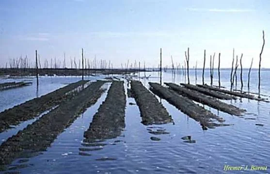
Ancient Shoreline Pools as Mollusc Culture Sites

November 8, 2026

Introduction

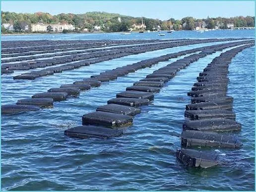
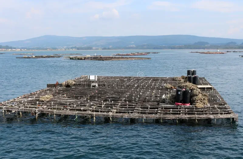
Coastal communities have depended on marine resources for thousands of years. Among the most important of these resources are molluscs, including oysters, mussels, clams, and other shellfish. Their availability in shallow waters made them accessible to people without requiring sophisticated boats or specialized fishing equipment. In some coastal environments, natural shoreline pools may also have provided opportunities for people to collect, manage, and possibly encourage the growth of particular mollusc populations.

The idea of ancient shoreline pools as mollusc culture sites raises questions about the origins of coastal resource management. Although shellfish gathering is well documented in many archaeological settings, evidence for deliberate cultivation must be distinguished from ordinary harvesting. Examining shoreline pools can therefore help researchers explore the relationship between natural abundance, human management, and early forms of aquaculture.

What Are Shoreline Pools?

Shoreline pools are shallow bodies of seawater that remain trapped among rocks, depressions, and reef formations as the tide recedes. They may be connected to the sea during high tide or replenished by waves and freshwater sources.

These pools can support a variety of marine organisms. Depending on water temperature, salinity, oxygen levels, and available surfaces, they may provide suitable habitats for oysters, mussels, limpets, snails, and other molluscs.

Their relatively limited size makes them potentially useful places for observing and collecting marine resources. Some pools may also offer protection from strong currents and predators, although conditions vary considerably between locations.

Molluscs as a Major Coastal Food Source

Shellfish were valuable because they could be gathered without the same equipment required for catching larger marine animals. They provided protein and important minerals, while their shells could be used for tools, ornaments, containers, and decorative materials.

Archaeological evidence of shellfish consumption is often found in shell middens, which are accumulations of discarded shells and other food remains. These deposits can contain information about dietary preferences, seasonal harvesting, settlement patterns, and changes in local marine environments.

The repeated collection of shellfish from particular pools may have influenced how people organized their activities. Familiar locations could become important gathering places that were revisited over many generations.

From Gathering to Resource Management

There is an important difference between collecting naturally occurring shellfish and deliberately managing their growth. Regular harvesting from a productive shoreline pool does not automatically demonstrate aquaculture.

However, people may have developed practices that increased the availability of shellfish without using modern farming techniques. These could have included protecting productive areas, leaving smaller individuals to grow, moving shellfish to more suitable locations, or modifying surfaces where shellfish could attach.

Such activities are sometimes described as resource enhancement or low-intensity management. They occupy a broad area between simple gathering and organized cultivation.

Determining whether these practices occurred requires evidence that human actions consistently influenced the growth, survival, or distribution of mollusc populations.

Archaeological Evidence for Managed Shoreline Pools

Researchers can investigate possible mollusc management by examining shell deposits, coastal sediments, and the physical structure of ancient shorelines.

One important indicator is the size distribution of shells. If a deposit contains an unusually high proportion of large individuals, it may reflect selective harvesting. Conversely, repeated collection of smaller individuals could suggest intensive exploitation, although other environmental factors may also explain the pattern.

Shell growth rings can provide information about age and seasonal conditions. Chemical analysis of shells may reveal changes in water temperature, salinity, and other environmental variables during the organism's life.

Researchers may also look for evidence of constructed barriers, modified rock surfaces, or arrangements that could have helped retain water. These features must be evaluated carefully because natural erosion can produce similar formations.

The Role of Tides and Environmental Knowledge

Successful use of shoreline pools requires an understanding of tidal cycles. Collectors must know when pools become accessible, which locations remain submerged, and how quickly water levels change.

This knowledge could have been developed through repeated observation and passed between generations. People may have learned which pools supported particular species and which seasons offered the greatest abundance.

Environmental knowledge also includes recognizing changes in water quality. Heavy rainfall, temperature fluctuations, sediment accumulation, and freshwater inflows can influence mollusc survival.

The ability to recognize favorable conditions may have encouraged communities to return to certain pools while avoiding others.

Possible Forms of Early Mollusc Management

If archaeological evidence supports deliberate management, several practices may be considered.

One possibility is the protection of naturally productive pools. Communities might have limited access to certain areas or avoided harvesting during periods when shellfish were reproducing.

Another possibility is the movement of shellfish between locations. Transferring individuals to pools with better conditions could improve their survival, although direct archaeological evidence of such behavior is difficult to establish.

People may also have modified local habitats by adding stones, clearing sediment, or maintaining surfaces suitable for attachment. These activities could increase the availability of shellfish without requiring permanent structures.

These possibilities should be treated as hypotheses unless supported by clear physical evidence, historical documentation, or ecological patterns that cannot be adequately explained by natural processes.

Scientific Methods Used in the Study

The investigation of ancient shoreline pools combines archaeology, marine biology, geology, and environmental science.

Radiocarbon dating can establish the approximate age of shell deposits, but marine reservoir corrections are important because marine organisms may appear older than equivalent terrestrial materials.

Stable isotope analysis can help reconstruct environmental conditions during shell growth. Microscopic examination may reveal growth patterns, surface damage, and evidence of environmental stress.

Archaeologists may also use sediment cores to reconstruct changes in shoreline environments. These records can show whether a pool existed during a particular period and whether its conditions were suitable for mollusc populations.

Comparing archaeological shell deposits with modern ecological observations can help researchers understand how natural and human factors influenced shellfish abundance.

Implications for the History of Aquaculture

The study of shoreline pools may contribute to a broader understanding of how people developed strategies for managing aquatic resources.

Aquaculture did not necessarily begin with large ponds, artificial enclosures, or intensive farming systems. In some settings, resource management may have developed gradually through repeated harvesting, habitat protection, and small-scale environmental modification.

Recognizing these possibilities expands the study of early food production beyond agriculture on land. It also highlights the importance of coastal knowledge and the sophisticated ways communities adapted to marine environments.

Conclusion

Ancient shoreline pools offer an important setting for investigating the relationship between shellfish gathering and early aquatic resource management. Their natural characteristics made them useful places for collecting molluscs, while repeated human activity may have encouraged practices that improved resource availability. However, evidence of harvesting should not automatically be interpreted as evidence of cultivation. By combining shell analysis, environmental reconstruction, and careful archaeological excavation, researchers can better determine whether particular coastal communities simply gathered shellfish or actively managed their marine resources.

Under‑rock Caches: Small Hoards Hidden in Coastal Reefs

November 8, 2026

Introduction

Coastal environments have long provided communities with food, materials, transportation routes, and places of cultural significance. Beyond their visible settlements and harbours, coastlines may also contain evidence of small deposits deliberately concealed beneath rocks, within reef crevices, or in sheltered spaces along the shore. These deposits, which may be described as under-rock caches, offer an interesting perspective on how people used coastal landscapes for storage, protection, ritual activity, and resource management.

The archaeological study of such caches is challenging because natural coastal processes can move objects, cover deposits with sediment, and destroy evidence of human activity. Nevertheless, carefully documented discoveries can help researchers understand how coastal communities interacted with their environments and assigned meaning to particular locations.

Understanding Under-Rock Caches

An under-rock cache is a small collection of objects intentionally placed in a concealed or protected location beneath a stone, within a rock opening, or in a natural cavity. In coastal settings, these deposits may occur around rocky shorelines, reef platforms, tidal pools, and sheltered marine environments.

The objects within a cache can vary considerably. They may include stone tools, fishing equipment, ornaments, fragments of pottery, shells, metal objects, or other materials that were valuable to the people who deposited them. However, not every group of objects found beneath a rock represents an intentional cache. Natural movement, erosion, animal activity, and the accumulation of debris can produce similar patterns.

Archaeologists therefore examine the arrangement, condition, and context of the materials before interpreting a deposit as deliberate storage.

Possible Reasons for Concealing Objects

One possible explanation for under-rock caches is temporary storage. Coastal communities may have needed safe places to keep tools, fishing equipment, or personal belongings while moving between settlements, fishing grounds, and seasonal camps. A concealed location could protect valuable objects from weather, animals, and accidental loss.

Another possibility is emergency storage. People travelling along coastlines may have hidden useful materials for later retrieval. A small deposit of tools or supplies could serve as a reserve when returning to a familiar location.

Caches may also have had ritual or symbolic purposes. Certain coastal locations, including caves, isolated rock formations, and reef areas, may have held cultural significance. Objects deposited in these places could have represented offerings, commemorations, or other forms of social practice. Such interpretations require strong contextual evidence and should not be assumed simply because an object appears unusual.

Coastal Geography and the Selection of Hiding Places

The physical characteristics of coastal landscapes would have influenced where people could conceal objects. Large rocks, overhangs, narrow crevices, and naturally protected cavities offer opportunities for hiding materials.

Tidal conditions would also have mattered. A location exposed during low tide but covered during high tide could provide a degree of concealment. However, it could also expose the deposit to saltwater, wave action, and sediment movement.

People familiar with their local coastlines may have recognized stable rock formations and predictable tidal patterns. Knowledge of these environmental features could have been passed between generations, making particular locations useful for repeated visits or temporary storage.

Archaeological Identification and Excavation

Identifying a genuine cache requires more than finding several objects in one place. Researchers examine whether the materials form a coherent deposit and whether their positions suggest intentional placement.

Important evidence includes the relationship between objects, the presence of protective stones or coverings, the condition of surrounding sediments, and signs of disturbance. A carefully arranged group of artifacts beneath a stable rock may be more consistent with intentional deposition than scattered materials distributed by waves.

Excavation must be particularly careful in coastal environments. Removing a stone without recording its position can destroy important evidence. Archaeologists document the surrounding rock structure, sediment layers, tidal exposure, and exact location of each object before removal.

Scientific Dating and Material Analysis

The age of an under-rock cache can be difficult to establish because the rock itself may be much older than the deposit. Researchers therefore rely on the objects and associated environmental materials.

Radiocarbon dating may be useful when the cache contains suitable organic material, such as charcoal, bone, or shell. However, marine organisms can produce radiocarbon ages affected by the marine reservoir effect, so appropriate corrections are necessary.

Pottery styles, metal composition, stone-tool technology, and manufacturing techniques may provide additional chronological information. Microscopic examination can also reveal whether objects were used, repaired, or intentionally placed in a particular arrangement.

Sediment analysis may help establish whether the deposit was exposed to repeated flooding, wave action, or long-term burial.

Preservation Challenges in Reef Environments

Coastal reefs create difficult conditions for archaeological preservation. Saltwater can corrode metal, weaken organic materials, and alter the chemical composition of artifacts. Strong waves may move objects away from their original positions, while marine organisms can attach themselves to surfaces and obscure evidence.

Some materials may survive better than others. Stone, ceramic, and certain mineral objects can remain recognizable for long periods, while wood, textiles, and other organic materials generally require unusually favorable conditions.

Researchers must also consider modern disturbances, including fishing activity, tourism, construction, and unauthorized artifact collection. These activities can damage archaeological deposits and complicate their interpretation.

What Coastal Caches Can Reveal About Past Communities

When properly identified, under-rock caches may provide information about mobility, resource management, and the organization of coastal activities. Their contents can help researchers identify the types of tools people carried, the materials they valued, and the locations they repeatedly visited.

A cache containing fishing-related equipment, for example, could indicate the importance of a particular coastal activity. An assemblage of ornaments or unusual objects might suggest social or symbolic practices, although its meaning would depend on the wider archaeological context.

Comparing caches with nearby settlements, burial sites, and activity areas may reveal whether people used coastal locations primarily for subsistence, travel, exchange, or ritual purposes.

Conclusion

Under-rock caches represent a potentially valuable but difficult-to-identify form of archaeological evidence. Their concealed positions can preserve traces of temporary storage, movement, resource management, and possibly ritual behavior. Yet coastal environments also create conditions in which natural processes can imitate deliberate human deposition. Through careful excavation, environmental analysis, dating, and comparison with other archaeological evidence, researchers can better understand how communities used and interpreted coastal landscapes.

The Genetics of Ancient Working Dogs in Eurasia

November 8, 2026

Introduction

Dogs have accompanied human communities for thousands of years, serving as hunting partners, livestock guardians, herders, transport animals, and companions.

Across Eurasia, different communities developed working relationships with dogs suited to their environments and economic needs. Some dogs helped control livestock, while others protected settlements or assisted hunters in tracking and retrieving animals.

The genetics of ancient working dogs offers a way to investigate how these animals developed, moved, and adapted alongside human societies.

By analyzing ancient DNA from archaeological dog remains and comparing it with modern genetic data, researchers can investigate population relationships, migration patterns, and the development of specialized dog populations.

However, identifying the exact historical job of an individual dog through genetics alone is difficult. Genetic evidence must be combined with archaeological context, skeletal analysis, and historical information.

The Domestication of Dogs

Dogs descended from ancient wolf populations, although the precise timing, location, and number of domestication processes remain subjects of scientific investigation.

Domestication involved long-term relationships between humans and wolf ancestors.

Animals that tolerated human presence and benefited from living near settlements may have become increasingly integrated into human communities.

Over generations, these relationships produced populations with physical and behavioral characteristics different from those of wild wolves.

The earliest domestic dogs were not necessarily divided into the specialized breeds recognized today. Many modern breed categories developed much more recently.

Working Dogs in Ancient Eurasia

Eurasia contains a wide variety of environments, from Arctic regions and mountain ranges to open steppe, forests, and agricultural plains.

Different environments created different demands for working dogs.

In pastoral communities, dogs could help protect livestock against predators and assist in moving herds.

In hunting societies, dogs could support tracking, pursuit, and the recovery of game.

In settlements, dogs might guard property or warn inhabitants of approaching strangers or animals.

Some dogs also served as transport or draft animals in particular regions, although such practices were not universal.

The Role of Ancient DNA

Ancient DNA analysis allows researchers to investigate the genetic relationships of animals that lived in the past.

DNA can sometimes be recovered from teeth, dense bone, and other preserved skeletal material.

The process requires careful laboratory procedures because ancient DNA is often fragmented and vulnerable to contamination.

Researchers compare genetic sequences from archaeological specimens with other ancient and modern populations.

This can reveal shared ancestry, population changes, and relationships between groups.

However, genetic similarity does not automatically demonstrate that two populations performed the same tasks or shared identical behavior.

Genetic Diversity and Population Movement

Working dogs may have moved alongside human communities.

Pastoral migrations, trade, warfare, and settlement expansion could all transport dogs across large distances.

When dogs from different populations reproduced, their genetic material became mixed.

Ancient DNA can help identify such population interactions.

A dog found in one region might share ancestry with animals from a distant area, suggesting that people or animals moved through connected networks.

Nevertheless, a genetic connection does not reveal the exact route of movement. Archaeological and historical evidence is needed to reconstruct the wider context.

Skeletal Evidence of Working Roles

The skeleton can provide clues about an animal's physical activity and health.

Joint changes, healed injuries, tooth wear, and other skeletal features may reflect aspects of an animal's life.

For example, repeated physical stress may leave traces on joints and bones.

However, these features are not unique to a particular occupation.

A dog with skeletal changes associated with heavy activity cannot automatically be identified as a herding or transport animal.

Researchers must compare skeletal evidence with the archaeological context and the characteristics of other animals from the same site.

Herding and Livestock Protection

Dogs played important roles in many pastoral societies.

Some were used to move livestock, responding to human commands and controlling the direction of animals.

Others protected herds from predators and could spend long periods near grazing animals.

These roles may favor different behavioral and physical characteristics.

Herding dogs often need responsiveness, coordination, and the ability to work closely with people. Livestock guardian dogs may need independence, territorial awareness, and the ability to remain near animals for extended periods.

These distinctions are useful for understanding modern working dogs, but ancient populations may not have been divided into clearly defined categories.

Hunting Dogs and Human Cooperation

Dogs also contributed to hunting activities.

Their sense of smell and ability to track animals made them useful companions.

Depending on the environment and hunting strategy, dogs could help locate prey, follow tracks, retrieve animals, or assist in driving game toward hunters.

Archaeological evidence may include dog burials, hunting equipment, animal remains, and representations of dogs in art.

Some burials suggest that dogs received special treatment, although their exact relationship with human owners may remain uncertain.

Dog Burials and Social Significance

The treatment of dogs after death can provide information about their social importance.

Some archaeological sites contain dog burials that appear deliberate and carefully arranged.

The presence of grave goods or association with human burials may indicate that dogs held particular cultural value.

However, burial treatment does not necessarily prove that a dog performed a specific working role.

A dog could be valued as a companion, protector, hunting partner, or symbol of social status.

The archaeological context must be considered before assigning a particular interpretation.

Genetic Adaptation and Environment

Over long periods, dog populations can develop genetic differences associated with body size, coat characteristics, metabolism, and other traits.

Some characteristics may be influenced by environmental conditions, while others result from human selection.

For example, populations living in cold environments may exhibit physical traits that help them cope with low temperatures.

However, climate adaptation is complex, and it cannot be inferred from a single genetic marker.

Researchers need large comparative datasets and careful analysis to distinguish natural selection, artificial selection, population history, and random genetic change.

The Limits of Ancient Dog Genetics

Ancient DNA provides powerful evidence, but it has limitations.

Preservation varies greatly between archaeological environments. Some regions provide abundant genetic material, while others yield very little.

The available samples may also represent only a small portion of the dogs that once lived in a region.

This creates a risk of drawing broad conclusions from limited remains.

Furthermore, genetic studies cannot directly reconstruct an animal's training, temperament, or exact daily activities.

Those questions require evidence from skeletal analysis, archaeological context, historical sources, and comparison with modern animal behavior.

The Relationship Between Humans and Dogs

The history of working dogs is closely connected with the development of human economies.

As communities adopted pastoralism, agriculture, and more complex settlement systems, their relationships with dogs changed.

Dogs could become essential partners in protecting livestock, supporting hunting, and guarding settlements.

Their movement across Eurasia also reflects the interconnectedness of human societies.

People did not transport only tools, crops, and technologies. They also moved animals that carried practical knowledge and genetic histories across regions.

Conclusion

The genetics of ancient working dogs in Eurasia offers valuable insight into the long relationship between humans and domestic animals.

Ancient DNA can reveal population ancestry, genetic diversity, and patterns of movement, while skeletal evidence and archaeological context help investigate how dogs lived and interacted with people.

It is important not to assume that genetics alone can identify a dog's occupation. Working roles must be reconstructed through multiple forms of evidence.

Together, genetic research and archaeology demonstrate that dogs were not simply passive companions in human history. They were active participants in hunting, pastoralism, settlement protection, and migration, adapting alongside the communities that depended on them.

Cliffside Olive Terraces: Micro-Agriculture in Island Landscapes

November 8, 2026

Introduction

Olive cultivation has shaped Mediterranean landscapes for thousands of years. Olive trees provided oil, food, fuel, and products used in trade, while their long lifespans made them important features of agricultural environments.

On islands with steep terrain and limited flat land, farmers developed specialized methods to make cultivation possible. One approach involved constructing small terraces along hillsides and cliffs.

These terraces transformed difficult slopes into agricultural plots by creating relatively level surfaces supported by stone walls or other retaining structures.

The study of cliffside olive terraces reveals how island communities adapted farming to limited land, variable rainfall, soil erosion, and difficult transportation routes.

The Importance of Olive Cultivation

Olive trees are well adapted to many Mediterranean environments.

They can tolerate dry conditions once established and grow in soils that may be unsuitable for more demanding crops.

Olive oil was used in cooking, lighting, personal care, and other activities.

The economic value of olives encouraged communities to maintain trees across generations.

An olive grove could therefore become a long-term investment, with trees inherited and managed by successive households.

Why Terraces Were Necessary

Island landscapes often contain steep slopes and limited agricultural plains.

Without protective structures, soil can be washed downhill by heavy rain.

Terracing reduces the effective slope of cultivated ground and helps retain soil and moisture.

A terrace is typically created by cutting into a hillside and constructing a retaining wall along the lower edge. The resulting platform provides a more manageable area for cultivation.

In cliffside environments, these structures may be narrow and irregular because they must follow the natural shape of the terrain.

Construction Techniques

Terrace walls were commonly built using locally available stone.

Dry-stone construction involves placing stones together without mortar, relying on their shape and arrangement for stability.

Some walls may include larger foundation stones and smaller material packed into gaps.

The design allows limited movement of water through the structure, reducing pressure that could otherwise build up behind a solid wall.

The terrace surface may contain soil collected from nearby areas, organic matter, and smaller stones.

Construction requires considerable labor, especially on steep terrain where transporting materials is difficult.

Micro-Agriculture on Small Plots

The term micro-agriculture describes cultivation on relatively small plots.

On islands, narrow terraces may support only a limited number of olive trees.

Although each plot is small, many terraces together can create a substantial agricultural landscape.

Families may cultivate different crops on separate levels, combining olives with vines, vegetables, or other plants where conditions allow.

The arrangement of terraces can reflect household ownership, inherited property divisions, and local agricultural traditions.

Water Management

Water availability is a major challenge in Mediterranean island environments.

Rainfall may be concentrated in particular seasons, while summers can be hot and dry.

Terraces can help slow the movement of rainwater and reduce soil loss. Their walls may also influence how water is distributed across the slope.

Some agricultural systems incorporate channels, cisterns, or small collection structures.

These features allow communities to store water or direct it toward cultivated areas.

However, terraces do not automatically function as irrigation systems. Their primary purpose may be soil retention, with water management occurring as a secondary benefit.

Olive Trees and Soil Conservation

Olive trees have root systems that help stabilize soil.

Their canopy can reduce the direct impact of rainfall on the ground, although vegetation management and soil conditions influence the extent of this protection.

Maintaining terraces and trees together can help reduce erosion.

Abandoned terraces may deteriorate as walls collapse and soil moves downhill.

The resulting changes can gradually transform the agricultural landscape.

Archaeological Dating of Terraces

Dating terrace systems is difficult because they are often repaired and rebuilt over long periods.

A retaining wall may contain stones from an older structure, while the cultivated soil behind it may have accumulated gradually.

Archaeologists can investigate construction sequences through excavation and stratigraphic relationships.

Artifacts incorporated into wall foundations may provide chronological clues, although they can be older than the construction itself.

Soil analysis, radiocarbon dating of suitable organic materials, and comparison with historical maps can help establish the development of a terrace system.

Researchers must distinguish the date of the earliest terrace from later repairs and expansions.

The Social Organization of Terrace Farming

Terrace construction requires cooperation.

A single household might build and maintain a small plot, but larger systems could involve shared labor and coordinated water management.

Property boundaries may be marked by walls, paths, or changes in terrace construction.

The division of land can reflect inheritance practices and changing household structures.

Because olive trees can remain productive for many decades, ownership and maintenance responsibilities may extend across generations.

Transport and Market Access

Harvesting olives is only one part of production.

The fruit must be collected and transported to a place where it can be processed.

On steep islands, narrow paths and difficult terrain can make transportation challenging.

Farmers may carry olives in baskets or use animals where paths permit.

Pressing facilities might be located within villages or near agricultural areas, depending on the scale of production.

The relationship between terraces and processing facilities can reveal how agricultural landscapes were connected to local economies.

Abandonment and Landscape Change

Terraces may be abandoned when rural populations decline, agricultural markets change, or transportation becomes difficult.

Once maintenance stops, walls can collapse and cultivated soil may erode.

Trees may survive for years after the terraces become overgrown.

Modern remote sensing and landscape surveys can identify abandoned terrace systems even when they are partly concealed by vegetation.

These remains preserve evidence of former agricultural organization and can help reconstruct changes in rural population and land use.

Conclusion

Cliffside olive terraces demonstrate how island communities adapted agriculture to steep terrain and limited land resources.

Through stone retaining walls, careful soil management, and long-term cultivation, farmers transformed difficult slopes into productive landscapes.

These systems were not simply agricultural structures. They reflected household organization, cooperation, inheritance, water management, and connections with local markets.

Although many terraces have been abandoned or altered, their remains provide valuable evidence of how communities made productive use of challenging environments.

The history of island olive cultivation shows that agricultural innovation does not always require large fields or advanced machinery. Sometimes it begins with a narrow strip of land, a carefully placed stone wall, and generations of work to preserve the soil.

Ancient Bee Skeps and the Rise of Apiary Economies

November 8, 2026

Introduction

Beekeeping has a long history, connecting human communities with the production of honey, beeswax, and other valuable materials. Honey provided a concentrated source of sweetness before refined sugar became widely available, while beeswax was useful in lighting, sealing, craft production, and religious activities.

One traditional form of beekeeping involved the use of bee skeps. These are basket-like structures designed to provide shelter for honeybee colonies.

Although skeps are especially associated with later European beekeeping traditions, the broader history of managed beehives extends much further into antiquity. Archaeological evidence from different regions demonstrates that people developed various methods for keeping bees and harvesting their products.

Studying ancient bee skeps and related hive technologies provides insight into the development of apiary economies and the relationship between humans, insects, agriculture, and trade.

What Is a Bee Skep?

A bee skep is traditionally a dome-shaped basket used as a hive.

It is often made from straw, grass, or other flexible plant materials woven into a compact structure.

The shape provides a sheltered space in which bees can establish a colony and construct their honeycomb.

Unlike many modern hives, traditional skeps generally lack removable frames. This can make harvesting honey more difficult because the comb is attached directly to the interior of the structure.

The use of skeps varied across regions and historical periods. They should not be treated as the universal form of ancient beekeeping.

The Early History of Beekeeping

Humans collected wild honey long before the development of managed apiaries.

Rock art, archaeological remains, and historical accounts provide evidence for the importance of honey gathering in different societies.

The transition from collecting wild honey to managing colonies was gradual and varied by region.

People could encourage bees to occupy suitable cavities, provide artificial shelters, or maintain colonies near settlements.

These practices allowed households to obtain honey more predictably than through occasional wild harvesting.

Beekeeping in the Ancient Mediterranean

Honey was widely valued in ancient Mediterranean societies.

It served as a food, sweetener, ingredient in preparations, and component of certain ceremonial practices.

Beeswax also had practical uses.

Archaeological and historical evidence from ancient Egypt, Greece, and other Mediterranean societies demonstrates that people understood the value of bees and developed methods of managing colonies.

Some ancient hives were made from clay or other durable materials rather than woven plant fibers.

This distinction is important because a discussion of ancient beekeeping should include multiple hive designs, not only the later European skep.

The Construction of Traditional Skeps

A skep requires materials that are flexible enough to be woven but strong enough to retain their shape.

Straw and other plant fibers can be arranged in coils or bundles and secured using additional binding materials.

The resulting structure creates an enclosed space with an entrance through which bees can move.

The design must balance protection and ventilation.

A hive that becomes excessively hot or damp may be unsuitable for a colony, while an entrance that is too exposed can increase vulnerability to predators or environmental conditions.

Traditional beekeepers developed practical knowledge about placement, shade, and seasonal maintenance.

Honey and Beeswax Production

Honey is produced by bees from collected nectar, which they process and store within their combs.

The colony uses honey as a food reserve.

Humans harvest a portion of this stored resource, although harvesting methods vary.

Beeswax is produced by worker bees and used to construct honeycomb.

It can be collected during honey extraction and processed for different purposes.

The relative importance of honey and wax varied between societies. In some economies, beeswax became a particularly valuable commodity because it could be used in lighting, writing materials, crafts, and religious objects.

The Development of Apiary Economies

An apiary is a location where multiple beehives are maintained.

The development of apiary economies involved more than the possession of individual hives.

It required knowledge of bee behavior, seasonal flowering, hive maintenance, harvesting, storage, and the movement of products to consumers.

Small household apiaries could supply family needs and local exchange.

Larger operations might produce enough honey and wax to supply markets, religious institutions, workshops, or merchants.

The scale and organization of production depended on environmental conditions and demand.

Bees and Agricultural Landscapes

Bees depend on flowering plants for nectar and pollen.

Their availability therefore changes according to vegetation, climate, and seasonal cycles.

Beekeepers need to understand the flowering periods of local plants and the availability of suitable forage.

The relationship between bees and agriculture is complex. Bees can contribute to pollination, although the importance of pollination varies among crops and plant species.

The presence of managed hives near agricultural settlements may indicate an understanding of the relationship between vegetation, seasonal resources, and honey production.

Archaeological Evidence of Ancient Apiaries

Identifying ancient beekeeping sites can be difficult.

Clay hives may survive, while woven skeps made from organic materials usually decay.

Archaeologists may find hive fragments, honey residues, beeswax, specialized structures, or concentrations of artifacts associated with honey processing.

Chemical analysis can identify certain organic compounds associated with beeswax.

However, beeswax may have been used in crafts or other activities unrelated to beekeeping at the site.

The archaeological interpretation must therefore consider the context in which residues are found.

Honey and Long-Distance Trade

Honey and beeswax could be transported beyond the communities where they were produced.

Honey required suitable containers to prevent leakage and contamination.

Beeswax was often easier to store and transport because it could be solidified into manageable pieces.

Trade in these products connected rural producers with towns, religious centers, and specialized craft industries.

The distribution of containers, wax residues, and written references can help researchers investigate the economic importance of bee products.

Environmental Knowledge and Conservation

Beekeeping requires detailed knowledge of local ecology.

A beekeeper must recognize suitable flowering plants, understand seasonal weather, and identify conditions that threaten colonies.

Traditional beekeeping systems often developed through generations of observation.

Today, historical research into these practices can contribute to broader discussions about biodiversity and sustainable resource management.

However, ancient beekeeping should not automatically be described as environmentally sustainable. Its impact depended on the scale of production and the condition of local ecosystems.

Conclusion

Ancient bee skeps and related hive technologies reveal the long relationship between human communities and honeybees.

Beekeeping supported food production, craft industries, trade, and household economies. Honey and beeswax were valuable products whose importance extended far beyond their immediate use.

Although organic skeps rarely survive archaeologically, evidence from clay hives, residues, historical texts, and environmental records can help reconstruct the development of apiary systems.

The rise of beekeeping demonstrates how communities transformed their understanding of local ecosystems into a productive economic activity, turning the behavior of a small insect into an important part of human history.

The Forensics of Ancient Salt Extraction Pits

November 8, 2026

Introduction

Salt has been essential to human societies for thousands of years. It played a major role in food preservation, animal husbandry, trade, domestic activities, and various forms of manufacturing.

Before modern industrial production, communities obtained salt through different methods depending on their environments. Some collected salt from coastal evaporation areas, while others extracted it from underground deposits, saline springs, salt lakes, or mineral-rich soils.

One method involved the use of extraction pits, where people collected, processed, or concentrated salt-bearing materials. These installations can be difficult to interpret because similar pits may have served other purposes, including food preparation, storage, or the extraction of different minerals.

The forensic study of ancient salt extraction pits combines archaeological excavation, soil chemistry, microscopic analysis, and environmental reconstruction to identify how these installations functioned.

The Importance of Ancient Salt Production

Salt was valuable because it served multiple purposes.

It could preserve meat and fish, improve the storage life of certain foods, and support the management of livestock. It was also used in particular craft and industrial processes.

In regions without abundant natural salt sources, communities might have traveled considerable distances to obtain it.

Salt production could therefore become an important economic activity. Some communities specialized in extraction, while others participated through transportation, exchange, or the processing of salt-bearing materials.

The scale of production varied considerably, from household-level activities to organized operations serving wider markets.

Understanding Extraction Pits

An extraction pit is a hollow or excavated feature associated with obtaining or processing a resource.

In salt production, pits may have been used to collect saline water, expose salt-bearing deposits, concentrate brine, or temporarily hold materials during processing.

Their design depended on the geological setting and the production method.

Some pits may have been relatively shallow, while others could have required substantial excavation. Their walls might have been reinforced with clay, stone, timber, or other materials.

However, a pit's shape alone cannot establish that it was used for salt extraction.

Archaeologists need evidence connecting the feature with salt-bearing materials and the activities associated with production.

Geological Sources of Salt

Salt occurs in several natural environments.

Underground deposits may form through the evaporation of ancient bodies of seawater. These deposits can sometimes be accessed through mining or extraction.

Saline springs provide another source. Water passing through salt-bearing geological layers may dissolve minerals and emerge as brine.

Coastal areas and salt lakes can also contain concentrated saline water or salt-rich sediment.

Each source requires different extraction techniques.

A pit used to collect spring water would differ from a feature excavated into a geological salt deposit.

Identifying Salt-Related Residues

Chemical analysis can help determine whether a pit was associated with salt production.

Researchers may examine concentrations of sodium and chloride, as well as other elements that could reflect the local geological environment.

However, sodium and chloride are common in many natural settings. Their presence alone does not prove ancient salt extraction.

Seawater intrusion, modern pollution, groundwater movement, and natural evaporation can all introduce salts into archaeological deposits.

The strongest interpretation combines chemical evidence with pit construction, surrounding deposits, and associated artifacts.

Microscopic Evidence

Microscopic analysis can reveal details that are difficult to observe during ordinary excavation.

Thin sections of sediment may show changes in grain structure, compacted surfaces, ash layers, or mineral crystals.

Micromorphology allows researchers to examine the arrangement of microscopic components within an undisturbed soil sample.

This can help identify whether a pit was repeatedly heated, filled with sediment, exposed to water, or used for different activities over time.

In some cases, microscopic evidence may distinguish deliberate construction from natural erosion.

Evidence of Heating and Evaporation

Some salt production methods rely on evaporating brine through heating.

If an extraction pit was part of such a process, nearby deposits may contain ash, charcoal, heat-altered sediment, or fragments of heating installations.

However, not every salt-producing community used fuel-intensive evaporation.

Solar evaporation may have been practical in hot, dry environments, while other regions relied on boiling brine.

The archaeological evidence must therefore be interpreted according to local environmental conditions.

Associated Tools and Containers

Salt production may involve baskets, pottery vessels, wooden containers, grinding tools, or implements used to collect and transport raw materials.

Fragments of ceramic vessels can be particularly informative.

Repeated heating may produce distinctive patterns of discoloration, cracking, or residue accumulation.

Yet ordinary cooking pots can show similar damage.

Researchers compare vessel residues, shapes, and archaeological contexts to investigate whether particular containers were used in salt processing.

Reconstructing the Production Sequence

A salt extraction site may contain evidence for several stages of production.

These could include collecting saline water or sediment, separating unwanted material, concentrating brine, evaporating water, and collecting the resulting salt.

Different activities might take place in separate areas.

For example, an extraction pit could be located near a spring, while evaporation and storage occurred elsewhere.

Researchers therefore examine the wider site rather than interpreting each pit independently.

Spatial analysis can reveal relationships between pits, hearths, work surfaces, storage features, and transportation routes.

Dating Salt Extraction Pits

Dating these installations can be challenging.

Organic materials such as charcoal, seeds, or wood fragments may be recovered from secure deposits within or around a pit.

Radiocarbon dating can provide chronological information when the material is directly associated with the feature.

Pottery and other artifacts may also help establish a relative date.

However, later activity can introduce younger or older material into an archaeological deposit. Researchers must therefore establish the stratigraphic relationship between samples and the original construction or use of the pit.

Economic and Social Organization

Salt extraction could involve different forms of labor organization.

A household might collect salt for its own needs, while a larger community could coordinate seasonal production.

More extensive operations may have required specialized workers, fuel collection, transport, and storage.

The distribution of salt-producing sites can reveal patterns of economic interaction.

If salt from one region appears in settlements far away, it may indicate trade or exchange networks.

Chemical analysis can sometimes help investigate the origin of salt residues, although identifying an exact source is often difficult.

Conclusion

The forensics of ancient salt extraction pits offers a way to reconstruct an important but often overlooked aspect of prehistoric and historical economies.

Through chemical testing, microscopic analysis, excavation, and environmental reconstruction, archaeologists can investigate how communities obtained and processed salt.

The presence of saline residue is not enough to identify a salt-production site. Reliable conclusions require multiple lines of evidence, including the structure of the pits, associated installations, artifacts, and geological context.

These investigations help reveal how communities transformed natural resources into valuable commodities and how salt production contributed to household economies, specialized labor, and long-distance exchange.

Petroglyph Vignettes: Narrative Panels in Australian Outback Art

November 8, 2026

Introduction

Australia contains an extraordinary archaeological record of Indigenous rock art. Across deserts, escarpments, river valleys, and remote rock shelters, generations of Aboriginal artists created paintings, engravings, and other forms of visual expression.

Among these works are petroglyphs: images produced by engraving, pecking, abrading, or carving into rock surfaces. Some appear as individual figures, while others occur in groups that may suggest relationships between people, animals, landscapes, and events.

The term vignette is useful for describing a small visual scene or group of related images. In the context of Australian Outback rock art, narrative panels may preserve aspects of cultural knowledge, ancestral traditions, hunting practices, and relationships with Country.

Interpreting these panels requires care. Indigenous rock art is culturally significant, and its meanings cannot always be reconstructed through visual analysis alone. Archaeological investigation must respect the knowledge and authority of the Traditional Owners connected with each site.

The Diversity of Australian Petroglyphs

Australian rock art is not a single artistic tradition. It includes numerous regional styles, techniques, and cultural systems developed over thousands of years.

Petroglyphs may depict human figures, animals, tracks, geometric patterns, weapons, and other recognizable or abstract forms.

Some images are deeply engraved into rock, while others consist of shallow marks that are difficult to see under ordinary lighting. The appearance of a petroglyph can also change as the rock surface weathers.

Regional differences are important. Artistic traditions in the Kimberley, Arnhem Land, the Pilbara, Central Australia, and other regions should not be treated as interchangeable.

Each area has its own cultural history and archaeological context.

Understanding Narrative Panels

A narrative panel consists of multiple images that may be understood in relation to one another.

For example, a panel could contain human figures, animal tracks, and representations of landscape features. Their arrangement may suggest movement, interaction, or an event.

However, visual proximity does not automatically establish a narrative sequence. Images could have been created at different times, by different artists, or for separate purposes.

Researchers investigate whether figures share similar engraving techniques, weathering characteristics, and spatial relationships. Superimposition, where one image crosses or covers another, can help establish the relative order in which images were made.

Animals and Human Relationships

Animals occupy an important place in many Australian Indigenous artistic traditions.

Petroglyphs may represent kangaroos, emus, reptiles, fish, and other species associated with local environments.

These representations can provide information about the animals known to artists, but they should not be interpreted only as illustrations of hunting or food gathering.

Animals may also have ancestral, ceremonial, territorial, or other cultural meanings.

Traditional knowledge is therefore essential to understanding the significance of particular images.

Tracks and Movement

Tracks are especially interesting because they can communicate movement without depicting an entire animal or person.

An engraved footprint or trackway may indicate the presence of a particular species or represent a culturally meaningful pattern.

In some contexts, tracks could be connected with hunting knowledge, animal behavior, or stories associated with particular places.

Yet the meaning of a track motif depends on the cultural tradition in which it appears.

Archaeologists should avoid assuming that a symbol has the same meaning across different Indigenous communities.

Landscape and Country

Rock art is closely connected with the landscapes in which it appears.

A panel may be located near a water source, along a travel route, beside a ceremonial place, or within a larger cultural landscape.

The surrounding geography can therefore contribute to interpretation.

Researchers use geographic information systems, landscape surveys, and mapping to examine the relationship between art sites and environmental features.

However, mapping alone cannot capture the full cultural significance of Country. Indigenous knowledge includes relationships, responsibilities, histories, and meanings that may not be visible in physical geography.

Dating Petroglyphs

Dating engravings is difficult because the images are often created by removing material from a rock surface rather than applying a pigment that can be directly dated.

Researchers may examine weathering, mineral deposits, and the relationship between engravings and dated archaeological layers.

In some cases, rock coatings or deposits associated with an engraving can provide chronological information.

Superimposition can also establish relative sequences. If one image clearly crosses another, researchers may determine which was made later.

These methods rarely provide an exact date for every individual figure.

Recording Narrative Panels

Modern recording methods allow researchers to document petroglyphs in considerable detail.

High-resolution photography can capture surface features, while photogrammetry creates three-dimensional models from overlapping images.

Reflectance transformation imaging can help reveal shallow engravings by examining how surfaces respond to different lighting angles.

These techniques are particularly useful for fragile or difficult-to-access sites.

Digital documentation also provides a record that can support future research and conservation, provided that sensitive cultural information is managed appropriately.

Indigenous Knowledge and Interpretation

Rock art is not simply an archaeological object. It may remain part of a living cultural tradition.

Some sites contain knowledge that is restricted or appropriate only for particular community members. Public interpretation may therefore be limited.

Collaboration with Traditional Owners is essential when investigating the meaning, history, and conservation of these places.

Indigenous perspectives can also challenge assumptions made through purely visual analysis and provide a richer understanding of the relationships between images, stories, and landscape.

Conservation Challenges

Outback petroglyphs face several threats.

Weathering, water movement, biological growth, vandalism, mining, tourism, and infrastructure development can damage rock surfaces.

Even repeated touching may affect fragile surfaces over time.

Conservation strategies should be developed with the relevant Indigenous communities. Protection may involve restricting access, monitoring environmental changes, documenting vulnerable panels, and managing visitor behavior.

Digital recording can support conservation, but it cannot replace the physical protection of the original site.

Conclusion

Petroglyph vignettes in Australian Outback art offer important opportunities to investigate visual expression, cultural knowledge, and relationships with the landscape.

Narrative panels may contain representations of animals, people, movement, and culturally significant events. Yet their meanings cannot always be established through appearance alone.

Archaeological recording, careful dating, landscape analysis, and collaboration with Traditional Owners are essential for responsible interpretation.

These engravings are more than ancient pictures on stone. They are part of enduring Indigenous cultural landscapes in which images, places, knowledge, and community identity remain deeply connected.

Small-Scale Waterwheels in Medieval Rural Landscapes

November 8, 2026

Introduction

Water-powered machinery played an important role in the development of medieval economies. While large mills serving towns and major estates are often emphasized, smaller waterwheels also operated in rural landscapes.

These installations could provide mechanical power for grinding grain, processing agricultural products, operating simple industrial equipment, and supporting local production.

Small-scale waterwheels were particularly valuable because they allowed communities to use the energy of flowing water rather than relying entirely on human or animal labor.

Their remains can be difficult to identify archaeologically. Wooden components often decay, channels may become filled with sediment, and later land use can erase the original structures.

Nevertheless, the study of small rural waterwheels helps reconstruct the technological and economic life of medieval communities.

The Development of Water Power

Water-powered machinery existed long before the medieval period, but its use expanded in different regions and industries over time.

The basic principle is straightforward. Moving water strikes or passes through a wheel, causing it to rotate. This movement can then be transferred through shafts, gears, and other mechanical components.

The design depends on the available water source and the amount of energy required.

Some wheels were driven by water flowing beneath them, while others received water from above or at an intermediate point.

Each design had advantages and limitations based on terrain, water flow, construction materials, and seasonal conditions.

Why Small Rural Mills Were Useful

Large mills were not always practical for isolated villages.

A smaller installation could be built near a local stream and operated by a household, landowner, or group of neighbors.

Such mills could reduce the time required for repetitive work and make agricultural production more efficient.

Grain grinding was one of the most important uses. Instead of manually processing grain, households could bring it to a water-powered mill.

Other applications could include fulling cloth, sawing timber, crushing materials, or operating equipment used in small industries.

Not every medieval waterwheel performed all these functions. Its purpose depended on the machinery connected to it.

Choosing a Suitable Location

The location of a waterwheel was critical.

Builders needed a reliable water source, sufficient flow, and a suitable difference in elevation where the design required it.

Small streams could support modest installations, although their flow might change significantly between seasons.

A site also needed access for transporting grain, timber, tools, and finished products.

Rural waterwheels were often located near settlements, agricultural fields, bridges, or existing channels.

The surrounding landscape could therefore provide clues about the mill's economic role.

Constructing the Wheel

Waterwheels were commonly constructed using timber, although stone and metal components could also be used in parts of the installation.

The wheel contained a central axle and a series of spokes or structural supports. Depending on its design, it could also include paddles or compartments that captured water.

Wooden components required regular maintenance because constant exposure to water and mechanical stress could cause deterioration.

Builders needed knowledge of carpentry, balance, and mechanical transmission.

A poorly constructed wheel could lose efficiency or fail under repeated use.

Water Channels and Control Structures

A waterwheel required a system for directing water toward the wheel.

This might include a diversion channel, a small dam or weir, a millrace, and a mechanism for controlling water flow.

The design varied according to local topography.

Some installations diverted part of a stream through a channel before returning it downstream. Others used a small reservoir to regulate water availability.

These features could leave archaeological traces even when the wheel itself has disappeared.

Researchers may identify channels, retaining walls, sluices, and sediment deposits that indicate water management.

Archaeological Identification

Small waterwheels are often reconstructed from indirect evidence.

A millrace or channel may survive as a shallow depression. Stone foundations could indicate the location of a building, while wheel pits or axle supports may reveal where the machinery operated.

Sediment deposits can also preserve evidence of repeated water movement.

Archaeologists examine the relationship between these features and nearby streams to determine whether they formed part of a mill system.

Historical maps, estate records, tax documents, and local charters may provide additional information.

Rural Economies and Ownership

Water-powered mills could be privately owned, controlled by landlords, operated by communities, or associated with religious institutions.

Ownership influenced who could use the machinery and what fees might be charged.

In some medieval regions, tenants were required to use a particular mill and pay for grinding services. In other places, communities had more direct control over local installations.

A small waterwheel could therefore become an important part of rural economic relationships.

It was not simply a machine. It was also an asset connected to land, labor, rights, and obligations.

Seasonal Operation

The reliability of a waterwheel depended on the water supply.

During dry periods, a small stream might not provide enough flow to operate the machinery. During floods, excessive water could damage channels or the wheel itself.

Some mills may therefore have operated seasonally.

Communities could adjust their production schedules according to water availability and agricultural demands.

The archaeological record may reveal repeated repairs associated with flooding or changing stream conditions.

Environmental Impact

Waterwheels altered local waterways.

Diversion channels could change water distribution, while small weirs might affect sediment movement and fish passage.

The environmental effects of a small mill were generally local, but repeated installations along the same stream could influence the wider water system.

Researchers can investigate these changes through sediment analysis, historical landscape reconstruction, and examination of surviving channels.

The study of mill sites therefore contributes to understanding how medieval communities modified their environments for economic purposes.

Technology and Knowledge Transfer

Waterwheel technology spread through contact between communities, movement of craftsmen, and the circulation of technical knowledge.

Millwrights needed practical skills in carpentry, masonry, hydraulics, and mechanical design.

A new installation might reflect local adaptation rather than direct copying of a distant model.

Regional differences in wheel design can therefore provide clues about technological traditions and patterns of exchange.

Conclusion

Small-scale waterwheels were important components of medieval rural economies. They allowed communities to harness flowing water for grinding, processing, and other forms of production, reducing dependence on manual and animal power.

Although their wooden machinery rarely survives, channels, foundations, wheel pits, and historical documents can help reconstruct their operation.

These installations also reveal relationships between technology, property, labor, and environmental management.

The history of medieval water power is not limited to monumental mills or major industrial centers. Small rural waterwheels demonstrate how communities adapted local resources to meet everyday needs and how modest engineering projects could transform agricultural and domestic life.Introduction

Water-powered machinery played an important role in the development of medieval economies. While large mills serving towns and major estates are often emphasized, smaller waterwheels also operated in rural landscapes.

These installations could provide mechanical power for grinding grain, processing agricultural products, operating simple industrial equipment, and supporting local production.

Small-scale waterwheels were particularly valuable because they allowed communities to use the energy of flowing water rather than relying entirely on human or animal labor.

Their remains can be difficult to identify archaeologically. Wooden components often decay, channels may become filled with sediment, and later land use can erase the original structures.

Nevertheless, the study of small rural waterwheels helps reconstruct the technological and economic life of medieval communities.

The Development of Water Power

Water-powered machinery existed long before the medieval period, but its use expanded in different regions and industries over time.

The basic principle is straightforward. Moving water strikes or passes through a wheel, causing it to rotate. This movement can then be transferred through shafts, gears, and other mechanical components.

The design depends on the available water source and the amount of energy required.

Some wheels were driven by water flowing beneath them, while others received water from above or at an intermediate point.

Each design had advantages and limitations based on terrain, water flow, construction materials, and seasonal conditions.

Why Small Rural Mills Were Useful

Large mills were not always practical for isolated villages.

A smaller installation could be built near a local stream and operated by a household, landowner, or group of neighbors.

Such mills could reduce the time required for repetitive work and make agricultural production more efficient.

Grain grinding was one of the most important uses. Instead of manually processing grain, households could bring it to a water-powered mill.

Other applications could include fulling cloth, sawing timber, crushing materials, or operating equipment used in small industries.

Not every medieval waterwheel performed all these functions. Its purpose depended on the machinery connected to it.

Choosing a Suitable Location

The location of a waterwheel was critical.

Builders needed a reliable water source, sufficient flow, and a suitable difference in elevation where the design required it.

Small streams could support modest installations, although their flow might change significantly between seasons.

A site also needed access for transporting grain, timber, tools, and finished products.

Rural waterwheels were often located near settlements, agricultural fields, bridges, or existing channels.

The surrounding landscape could therefore provide clues about the mill's economic role.

Constructing the Wheel

Waterwheels were commonly constructed using timber, although stone and metal components could also be used in parts of the installation.

The wheel contained a central axle and a series of spokes or structural supports. Depending on its design, it could also include paddles or compartments that captured water.

Wooden components required regular maintenance because constant exposure to water and mechanical stress could cause deterioration.

Builders needed knowledge of carpentry, balance, and mechanical transmission.

A poorly constructed wheel could lose efficiency or fail under repeated use.

Water Channels and Control Structures

A waterwheel required a system for directing water toward the wheel.

This might include a diversion channel, a small dam or weir, a millrace, and a mechanism for controlling water flow.

The design varied according to local topography.

Some installations diverted part of a stream through a channel before returning it downstream. Others used a small reservoir to regulate water availability.

These features could leave archaeological traces even when the wheel itself has disappeared.

Researchers may identify channels, retaining walls, sluices, and sediment deposits that indicate water management.

Archaeological Identification

Small waterwheels are often reconstructed from indirect evidence.

A millrace or channel may survive as a shallow depression. Stone foundations could indicate the location of a building, while wheel pits or axle supports may reveal where the machinery operated.

Sediment deposits can also preserve evidence of repeated water movement.

Archaeologists examine the relationship between these features and nearby streams to determine whether they formed part of a mill system.

Historical maps, estate records, tax documents, and local charters may provide additional information.

Rural Economies and Ownership

Water-powered mills could be privately owned, controlled by landlords, operated by communities, or associated with religious institutions.

Ownership influenced who could use the machinery and what fees might be charged.

In some medieval regions, tenants were required to use a particular mill and pay for grinding services. In other places, communities had more direct control over local installations.

A small waterwheel could therefore become an important part of rural economic relationships.

It was not simply a machine. It was also an asset connected to land, labor, rights, and obligations.

Seasonal Operation

The reliability of a waterwheel depended on the water supply.

During dry periods, a small stream might not provide enough flow to operate the machinery. During floods, excessive water could damage channels or the wheel itself.

Some mills may therefore have operated seasonally.

Communities could adjust their production schedules according to water availability and agricultural demands.

The archaeological record may reveal repeated repairs associated with flooding or changing stream conditions.

Environmental Impact

Waterwheels altered local waterways.

Diversion channels could change water distribution, while small weirs might affect sediment movement and fish passage.

The environmental effects of a small mill were generally local, but repeated installations along the same stream could influence the wider water system.

Researchers can investigate these changes through sediment analysis, historical landscape reconstruction, and examination of surviving channels.

The study of mill sites therefore contributes to understanding how medieval communities modified their environments for economic purposes.

Technology and Knowledge Transfer

Waterwheel technology spread through contact between communities, movement of craftsmen, and the circulation of technical knowledge.

Millwrights needed practical skills in carpentry, masonry, hydraulics, and mechanical design.

A new installation might reflect local adaptation rather than direct copying of a distant model.

Regional differences in wheel design can therefore provide clues about technological traditions and patterns of exchange.

Conclusion

Small-scale waterwheels were important components of medieval rural economies. They allowed communities to harness flowing water for grinding, processing, and other forms of production, reducing dependence on manual and animal power.

Although their wooden machinery rarely survives, channels, foundations, wheel pits, and historical documents can help reconstruct their operation.

These installations also reveal relationships between technology, property, labor, and environmental management.

The history of medieval water power is not limited to monumental mills or major industrial centers. Small rural waterwheels demonstrate how communities adapted local resources to meet everyday needs and how modest engineering projects could transform agricultural and domestic life.

The Social Life of Hearthstones: Exchange and Repair Across Villages

November 8, 2026

Introduction

Hearths were central features of many ancient households. They provided warmth, supported cooking, offered light, and created a gathering place for family members and visitors.

Although archaeologists often focus on the remains of fires, pottery, and food waste, the stones used to construct and maintain hearths can reveal additional information about domestic life.

Hearthstones were not necessarily ordinary building materials. Some may have been selected for their heat resistance, shape, availability, or symbolic importance. They could be reused, repaired, replaced, or transported between settlements.

Studying the social life of hearthstones provides an opportunity to investigate how household technology connected communities through exchange, craft knowledge, and everyday relationships.

The Importance of the Hearth

The hearth was more than a cooking installation.

It could serve as a focal point for household activity, especially during evenings and colder seasons. People gathered around it to prepare food, repair tools, tell stories, and perform domestic tasks.

Its location within a dwelling could influence the organization of interior space.

Some households placed the hearth near the center of the main room, while others used separate cooking areas or outdoor installations.

The arrangement depended on building design, climate, fuel availability, and cultural preferences.

Selecting Hearthstones

The materials used to construct a hearth varied according to local geology.

Some stones tolerate repeated heating better than others. Certain rocks may fracture or flake when exposed to sudden temperature changes, while others remain relatively stable.

Builders could select stones based on experience, choosing materials that performed well during cooking.

Flat stones might be used as cooking surfaces or foundations. Larger blocks could form the boundaries of a fire installation, while smaller stones filled gaps or supported cooking equipment.

Archaeological analysis can identify whether hearthstones were collected locally or transported from different geological areas.

Repair and Replacement

Hearths experienced repeated heating and cooling.

Over time, stones could crack, become displaced, or accumulate deposits from cooking activities.

Households might repair damaged installations by replacing individual stones, adding clay or sediment, or rebuilding the structure.

Evidence of repair can include changes in stone arrangement, different construction materials, and multiple layers of burned sediment.

A hearth that appears simple during excavation may actually represent several episodes of maintenance.

These repairs are important because they demonstrate that domestic structures were not static. People continually adapted their homes to changing needs.

Exchange Between Villages

Some communities may have obtained suitable hearthstones from particular geological sources.

If certain stones were considered especially effective, households might have exchanged them through trade or personal networks.

A stone could travel as part of a larger exchange of building materials, tools, or household goods.

However, the presence of non-local stone does not automatically demonstrate formal trade. It may have been collected during travel, brought by migrating families, or transported through gift exchange.

Petrographic and geochemical analysis can help identify the geological origin of particular stones.

Hearthstones and Social Relationships

Household objects can carry social meaning beyond their practical function.

A stone brought from a distant settlement might have been associated with family history, migration, marriage, or a particular event.

A hearth rebuilt after a major household transition could also have symbolic significance.

Archaeologists cannot always identify these meanings directly, but patterns of reuse and repair may provide clues.

For example, a stone repeatedly retained despite visible damage might have been valued for reasons beyond its immediate usefulness.

Such interpretations must remain cautious because practical considerations may also explain why a stone was kept.

Archaeological Evidence

Hearthstones are usually identified through their arrangement and association with burned deposits.

Researchers examine heat alteration, soot, ash, charcoal, and changes in the surrounding soil.

The spatial relationship between hearthstones and other domestic features can reveal how the cooking area was organized.

Microscopic analysis may identify traces of plant material, food residues, or repeated heating.

The geological composition of the stones can also be compared with nearby natural deposits to investigate whether they were locally collected.

Hearths and Household Organization

The number and location of hearths within a settlement may provide information about household structure.

A large dwelling with several hearths could have supported multiple families or specialized activities.

Smaller houses may have relied on one central installation for most domestic tasks.

Shared hearths could also indicate communal cooking or collective use of buildings.

However, hearth numbers should not be used alone to estimate household size. Some activities may have taken place outdoors or in structures that have not survived.

The Spread of Cooking Technology

Hearth construction techniques can spread between communities.

A new arrangement may be adopted after contact with neighboring groups, through migration, or by the movement of craftspeople.

Comparing hearth designs across villages can reveal similarities and differences in construction traditions.

Researchers should distinguish shared technology from independent invention. Similar environmental conditions may encourage similar hearth designs even without direct cultural contact.

Evidence from pottery, architecture, fuel use, and food remains can help establish whether communities shared broader domestic traditions.

Experimental Archaeology

Experiments can help researchers understand how different stones respond to repeated heating.

By constructing replica hearths, archaeologists can observe cracking, discoloration, heat distribution, and changes in stone surfaces.

They can also test different repair methods and compare the resulting archaeological traces.

Such experiments provide a practical basis for interpreting excavated installations.

They also demonstrate why material selection was important for households that depended on fire for daily activities.

Conclusion

The social life of hearthstones reveals an often-overlooked dimension of ancient domestic history.

These stones were practical components of cooking installations, but their selection, transport, repair, and replacement could also reflect household decisions and relationships between communities.

Archaeological analysis can identify the geological origins of materials, reconstruct repair sequences, and investigate the organization of domestic space.

Although the social meanings of individual hearthstones are rarely recoverable with certainty, their physical histories demonstrate how everyday objects connected people with their environment and with one another.

The hearth was a place where food, warmth, labor, and social interaction came together. Its stones preserve part of that history.

Salt-Stabilized Floors: Coastal Domestic Technology Before Modern Cement

November 8, 2026

Introduction

Salt has played an important role in human history, particularly in food preservation, trade, and industrial production. However, its relationship with architecture is more complicated.

In coastal environments, salt can become incorporated into soils, building materials, and domestic surfaces. Some traditional construction practices may have taken advantage of mineral-rich sediments or salt-bearing materials to create compacted floors and working surfaces.

The title Salt-Stabilized Floors: Coastal Domestic Technology Before Modern Cement raises an interesting question: did coastal communities deliberately use salt or salt-rich materials to stabilize household floors before modern cement became available?

This question requires careful investigation. Salt is not universally an effective construction binder. In many circumstances, soluble salts can damage building materials through crystallization and moisture movement. Nevertheless, mineral-rich coastal soils, evaporite deposits, and compacted sediment mixtures may have contributed to particular flooring technologies.

The Need for Durable Domestic Floors

A household floor must withstand repeated use, moisture, furniture, cooking activities, and movement by people and animals.

In coastal settlements, these challenges can be especially difficult. High humidity, flooding, saline groundwater, and shifting soils may weaken ordinary earthen surfaces.

Communities therefore developed different flooring methods using locally available materials.

These could include compacted earth, clay, gravel, shell fragments, lime-based mixtures, stone slabs, and other materials.

The purpose was not always to create a perfectly waterproof surface. A floor might instead need to resist erosion, remain relatively smooth, reduce dust, or provide a stable working area.

Salt and Coastal Soils

Salt accumulates naturally in many coastal environments.

Seawater evaporates and leaves dissolved minerals behind. Salt-rich deposits can also develop in tidal flats, salt marshes, and areas with limited drainage.

The composition of coastal soils varies considerably. Some contain clay, silt, sand, organic matter, and soluble salts in different proportions.

When compacted, certain soil mixtures can form relatively firm surfaces. However, their stability depends on grain size, moisture, drainage, and the mineral composition of the material.

Salt itself does not necessarily bind soil particles together in a durable way. In some conditions, salt crystallization can weaken surfaces and cause flaking.

Compacted Earthen Floors

Compacted earth was widely used in traditional architecture.

Builders could prepare a surface by removing loose material, adding selected soil, and compacting it through repeated pressure.

Some floors were constructed in layers. Coarser material might form the base, while finer clay-rich sediment created a smoother upper surface.

In coastal settlements, naturally occurring saline sediments could become part of these mixtures.

The resulting floor might appear to be salt-stabilized, even if its strength actually came from clay content, compaction, or other mineral components.

This distinction is important when interpreting archaeological evidence.

Lime, Shell, and Other Coastal Materials

Coastal communities had access to materials that could be used in construction.

Shells could be crushed and processed. Limestone and other carbonate-rich rocks could provide raw materials for lime production.

When limestone is heated, it can be transformed into quicklime, which reacts with water and can later form a hardened material under suitable conditions.

Lime-based mixtures were used in many historical building traditions.

These materials are sometimes confused with salt-based construction because coastal deposits may contain several mineral components together.

Archaeological and chemical analysis is therefore necessary to determine what actually contributed to the strength of a floor.

How Salt Affects Building Materials

Salt can influence construction materials in several ways.

When dissolved salts move through porous materials with water, they may crystallize as the water evaporates. Repeated cycles of dissolution and crystallization can create pressure within pores and cause material deterioration.

This process is especially damaging to stone, brick, plaster, and compacted surfaces exposed to changing moisture conditions.

Salt can also affect the movement of water through soil. The precise effects depend on the type of salt, soil texture, mineral composition, and environmental conditions.

For this reason, a floor containing salt should not automatically be interpreted as deliberately stabilized with salt.

Archaeological Identification

Researchers can investigate ancient floors through excavation, microscopy, chemical analysis, and sediment studies.

A floor may be identified through changes in soil compaction, surface texture, composition, and the presence of domestic residues.

Microscopic examination can reveal whether the surface contains intentionally added materials or represents naturally compacted sediment.

Chemical testing may identify elevated concentrations of sodium, chloride, calcium, or other elements.

However, salt can migrate through archaeological deposits after construction. Seawater intrusion, groundwater movement, and later evaporation may alter the chemical composition of an ancient floor.

Researchers therefore need to compare the floor with surrounding soil and examine its stratigraphic context.

Domestic Activities and Floor Surfaces

Different areas within a household may have required different flooring treatments.

Cooking spaces needed surfaces that could tolerate heat and repeated cleaning. Storage areas required stable ground for containers. Work areas might need compacted floors that reduced dust and prevented objects from sinking into soft soil.

A floor's composition could therefore reflect its function.

Traces of charcoal, ash, food residues, pottery fragments, and plant remains can help identify how particular rooms were used.

These deposits may also reveal whether a surface was repaired or resurfaced over time.

Coastal Adaptation and Local Knowledge

Traditional construction practices often developed through long experience with local environments.

Builders understood which soils became muddy after rain, which materials resisted erosion, and which locations required raised foundations.

Knowledge was transmitted through families and craft communities.

In coastal settlements, construction traditions could involve a combination of earthen techniques, shell materials, lime, timber, and stone.

The use of saline sediments may have been part of this local knowledge, even if salt was not the principal stabilizing agent.

Experimental Archaeology

Experimental reconstruction can help clarify how ancient floors were made.

Researchers can prepare different mixtures of clay, sand, shell fragments, lime, and saline sediment, then compare their strength and durability under controlled conditions.

They can expose samples to moisture, drying, foot traffic, and salt crystallization.

These experiments help determine whether a proposed construction technique is physically plausible.

They cannot prove that an ancient community used a particular recipe, but they can eliminate explanations that are inconsistent with material behavior.

Conclusion

Salt-stabilized floors present an intriguing question about coastal domestic technology, but the role of salt must be interpreted carefully.

Coastal communities certainly used local mineral resources and developed durable earthen flooring techniques. Yet soluble salts can also damage construction materials, and their presence in an ancient floor does not prove intentional use as a binder.

The strongest investigations combine archaeological excavation, soil chemistry, microscopic analysis, and experimental reconstruction.

This research helps reveal how ordinary households adapted their buildings to challenging coastal environments. It also reminds us that ancient construction technologies were often based on practical experimentation with local materials rather than standardized recipes.

The Archaeology of Oyster Farming in Roman Provincial Harbours

November 8, 2026

Introduction

Oysters were an important food resource in many coastal societies of the ancient Mediterranean. Their popularity extended beyond ordinary consumption, as they could also be associated with hospitality, trade, wealth, and elite dining.

During the Roman period, oysters were transported and consumed across different parts of the empire. Archaeological evidence from coastal settlements, military sites, villas, and urban centers demonstrates the importance of marine resources in Roman food economies.

One particularly interesting question concerns whether oysters were deliberately cultivated or managed in Roman provincial harbours. Oyster farming could involve the collection of young oysters, the transfer of shellfish to suitable growing areas, and the maintenance of environments that encouraged their development.

Investigating these practices helps researchers understand Roman aquaculture, maritime commerce, and the relationship between coastal communities and marine ecosystems.

Oysters in the Roman Diet

Oysters were widely appreciated in Roman cuisine. They could be eaten fresh, served at banquets, or incorporated into other dishes.

Their popularity was influenced by availability, transportation, and preservation methods. Coastal communities could obtain oysters relatively easily, while inland consumers depended on trade networks that moved seafood away from the shoreline.

Written sources from the Roman world occasionally mention oysters and their reputation as desirable foods. These accounts provide useful context, although they often reflect elite tastes rather than the diets of the entire population.

Archaeological shell deposits provide more direct evidence of consumption. Large concentrations of oyster shells can indicate repeated use of marine resources and may reveal changes in food preferences over time.

Understanding Oyster Farming

Oyster farming involves managing oysters so that they grow in suitable conditions and can be harvested later.

Modern aquaculture uses a variety of techniques, but ancient practices were likely more dependent on local ecological knowledge and simple installations.

People could collect young oysters from natural beds and relocate them to protected areas. They might also encourage oyster growth by placing suitable surfaces or structures in shallow water.

Such activities do not always leave obvious archaeological remains. A managed oyster bed may look similar to a naturally occurring shellfish habitat, especially after centuries of environmental change.

For this reason, archaeologists must distinguish deliberate cultivation from ordinary harvesting.

Natural Oyster Beds and Human Management

Oysters naturally attach themselves to hard surfaces in suitable marine environments. They may grow on rocks, older shells, submerged wood, or artificial structures.

A community could exploit these natural beds without actively farming them.

However, repeated harvesting might lead people to develop management strategies. They could protect certain areas, avoid collecting immature oysters, or relocate shellfish to improve their growth.

These practices represent different levels of resource management. They should not all be described as intensive aquaculture.

The archaeological challenge is identifying when human intervention became systematic enough to qualify as farming.

Roman Provincial Harbours

Roman provincial harbours connected coastal settlements with regional and long-distance commercial networks.

Ports handled agricultural products, pottery, building materials, metals, fish, and other commodities. They also provided access to marine resources.

Harbour environments could contain suitable locations for shellfish cultivation, particularly in sheltered waters with appropriate salinity and water movement.

Some ports may have supported specialized seafood production, while others relied mainly on nearby natural resources.

The presence of oyster shells in a harbour does not automatically demonstrate farming. Shell deposits could represent consumption, market waste, shipboard provisions, or discarded cargo.

Archaeological Evidence

Oyster farming can be investigated through several types of evidence.

Large and repeated concentrations of shells may indicate intensive harvesting. Measurements of shell size can help researchers investigate whether oysters were selected or managed in particular ways.

The age distribution of oysters may also be informative. A pattern dominated by mature individuals could suggest harvesting practices that allowed younger oysters to grow, although natural ecological conditions can produce similar patterns.

Artificial structures, such as submerged platforms or deliberately placed materials, may provide stronger evidence for cultivation when their function can be established.

Researchers may also examine harbour sediments for oyster shells, marine organisms, and traces of human activity.

Shell Growth and Environmental Conditions

Oyster growth depends on environmental factors such as temperature, salinity, water quality, food availability, and water movement.

Changes in these conditions can affect shell thickness, shape, growth rates, and survival.

Shells may preserve chemical signals that provide information about the environment in which the oysters lived.

Stable isotope analysis can sometimes help reconstruct aspects of water conditions and seasonal growth patterns. Elemental analysis may also contribute to understanding the environments from which oysters originated.

These methods are valuable, but interpretation requires caution. Environmental signals can be influenced by several factors, and a single shell rarely provides a complete picture.

Transporting Oysters

Transport was an important challenge for ancient seafood economies.

Oysters could survive for a limited period outside seawater if handled carefully, making short-distance transport possible.

They could be moved in baskets, containers, or other arrangements that reduced damage and dehydration. Longer journeys were more difficult because the animals needed appropriate conditions to remain alive.

The distribution of oyster shells at inland Roman sites can help researchers investigate how far seafood traveled.

However, shellfish could also be transported after death, and shell deposits do not necessarily indicate that live oysters were delivered to a settlement.

Economic and Social Significance

Oysters could serve different social groups.

For ordinary households, they provided an accessible source of food in coastal communities. For wealthy consumers, selected seafood could become part of elaborate dining practices.

The economic value of oysters depended on location and market demand. A harbour with abundant shellfish could supply nearby settlements and possibly support specialized traders.

If cultivation occurred, it may have created opportunities for seasonal work and local investment in coastal resources.

The relationship between oyster production and trade therefore deserves attention alongside the archaeological study of Roman food consumption.

Environmental Impact and Sustainability

Repeated harvesting can affect natural oyster populations.

If too many mature oysters are removed, reproduction may decline. Damage to oyster beds can also reduce habitat for other marine organisms.

Ancient communities may have developed informal rules or practices that helped maintain shellfish resources. However, the existence of sustainable management should not be assumed without evidence.

Archaeological shell deposits can sometimes reveal changes in size distributions, species composition, and harvesting intensity.

Comparing deposits from different periods may help determine whether oyster exploitation increased, declined, or changed in response to environmental and economic conditions.

Conclusion

The archaeology of oyster farming in Roman provincial harbours provides an opportunity to investigate the development of ancient aquaculture and the organization of coastal food economies.

Roman communities clearly valued oysters, and their remains appear at many archaeological sites. What remains more difficult to establish is the extent to which people deliberately cultivated oysters rather than harvesting natural beds.

By combining shell analysis, harbour archaeology, environmental reconstruction, and historical sources, researchers can distinguish different forms of marine resource management.

The study of oysters demonstrates that Roman coastal economies were not based only on shipping and trade. They also depended on detailed knowledge of marine environments and the ability to obtain, manage, and distribute resources from the sea.

Portable Looms and the Spread of Textile Traditions in Prehistory

November 8, 2026

Introduction

Textile production was one of the most important technologies in prehistoric societies. Clothing, blankets, bags, ropes, and other woven materials supported everyday life, trade, shelter construction, and cultural expression. Although textiles rarely survive in ordinary archaeological conditions, evidence from tools, impressions, fibers, and preserved fabrics demonstrates that weaving developed in many parts of the ancient world.

One particularly interesting aspect of textile history is the use of portable looms. Unlike large stationary installations, portable weaving equipment could be transported between settlements, workshops, and temporary camps. This mobility may have helped spread textile techniques across communities and geographical regions.

Studying portable looms provides insight into how technological knowledge traveled before modern transportation and communication systems. It also reveals the relationship between craft specialization, household production, migration, and cultural exchange.

Understanding Portable Looms

A loom is a device used to hold threads under tension while other threads are interlaced to create fabric. Different loom types use different arrangements of supports, weights, beams, and tensioning mechanisms.

Portable looms are generally smaller or easier to dismantle than permanent installations. Some could be assembled from wooden frames, while others relied on a relatively simple arrangement of bars and supports.

The portability of a loom depended on its design and the materials available. A lightweight frame could be carried by an individual, while a larger apparatus might require several people to transport.

It is important to distinguish portable looms from all forms of ancient weaving equipment. A set of loom weights, for example, may indicate the use of a warp-weighted loom, but it does not automatically establish whether the entire apparatus was portable.

Evidence for Prehistoric Weaving

Textiles are usually made from organic materials that decay rapidly. Wool, flax, cotton, plant fibers, and animal hair are unlikely to survive for thousands of years unless preserved under unusual conditions.

Archaeologists therefore rely on indirect evidence. Loom weights, spindle whorls, needles, weaving tools, and impressions in clay can indicate textile production.

In some cases, actual fabric survives in dry caves, waterlogged environments, frozen deposits, or mineralized contexts. Such discoveries provide direct evidence of fiber selection, spinning techniques, weave structure, and decorative patterns.

The distribution of these objects helps researchers identify areas where textile production occurred and investigate how weaving technologies changed over time.

The Relationship Between Spinning and Weaving

Textile production involves several stages. Fibers must first be collected or prepared, then spun into yarn before they can be woven into fabric.

Spindle whorls helped regulate the spinning process by adding weight and momentum to a spindle. Their size and shape could influence the characteristics of the resulting thread.

The yarn was then arranged on a loom. The lengthwise threads, known as the warp, were held under tension, while the crosswise threads, known as the weft, were passed through them.

Different combinations of warp and weft produce different textile structures. These techniques require practical knowledge that can be transmitted through observation, demonstration, and repeated practice.

How Portable Looms Supported Mobility

Portable weaving equipment could be useful for communities that moved seasonally. Pastoral groups, for example, might carry smaller tools between grazing areas while maintaining textile production during periods of travel.

A portable loom could also support craft production in temporary settlements, trading camps, or frontier communities.

However, not every mobile society necessarily used portable looms. Some may have transported finished textiles or relied on stationary production centers. The presence of weaving tools in a temporary settlement must therefore be interpreted within its broader archaeological context.

Textile Traditions and Cultural Exchange

Textile techniques can spread through migration, trade, intermarriage, apprenticeship, and contact between neighboring communities.

A particular weaving pattern might appear in distant regions because craftspeople moved between settlements. Alternatively, local weavers could adopt a technique after seeing imported fabrics or learning from visiting specialists.

Textile similarities do not always indicate direct migration. Similar patterns can develop independently when communities use comparable materials and equipment.

Researchers therefore examine multiple features, including loom design, yarn preparation, weave structure, decorative methods, and terminology where historical language evidence is available.

Household Production and Specialized Workshops

Textile production could take place at several levels of economic organization.

In some communities, weaving was primarily a household activity. Families produced clothing and domestic textiles for their own needs, sometimes exchanging surplus products with neighbors.

Other societies developed specialized workshops that produced textiles for markets, institutions, or elite households.

Portable looms may have supported both arrangements. A small apparatus could be used within a household, while a larger transportable loom might serve a craftsperson who worked in different locations.

The distribution of tools and production waste can help archaeologists investigate whether textile manufacturing was concentrated in particular buildings or dispersed across settlements.

Identifying Portable Looms Archaeologically

Wooden loom components rarely survive, so researchers often reconstruct looms from indirect evidence.

The arrangement of postholes, weights, beams, and working surfaces may indicate the dimensions and orientation of a weaving apparatus.

A small number of loom weights found together could suggest a limited weaving setup, although objects may have been moved after use.

Archaeologists also compare excavated remains with experimental reconstructions. By building and operating different loom designs, researchers can investigate how much space they require, how they are assembled, and what traces they might leave behind.

The Role of Women and Craft Knowledge

Textile production has frequently been associated with women's labor in many historical societies, although the division of work varied considerably across cultures and periods.

Archaeologists must avoid assuming that every textile tool belonged to a woman or that weaving was exclusively performed by one gender.

The social importance of textiles extended beyond clothing. Fine fabrics could communicate wealth, identity, religious affiliation, and political status.

Knowledge of weaving techniques could also be economically valuable. Skilled craftspeople might contribute to household prosperity or participate in specialized production networks.

Conclusion

Portable looms offer an important perspective on the movement of technology and craft knowledge in prehistory. Their potential use in mobile communities, temporary settlements, and household production demonstrates that textile manufacturing was not necessarily restricted to permanent workshops.

Although direct evidence for portable loom structures is often limited, tools, impressions, preserved textiles, and experimental archaeology can help reconstruct their possible designs and functions.

The spread of textile traditions reminds us that technological exchange did not depend only on the movement of finished objects. It also involved people carrying practical skills, teaching techniques, adapting equipment, and creating new forms of production wherever communities settled.

← Newer Posts Older Posts →
Featured
pompeii.webp
November 8, 2026
The Archaeology of Small-Scale Water Filtration Systems in Arid Zones
November 8, 2026
Read more →
November 8, 2026
images - 2026-11-08T152443.003.jpeg
November 8, 2026
The Life Cycle of a Pottery Sherd: Repairing, Recycling, Reusing
November 8, 2026
Read more →
November 8, 2026
cultivation-mussels-oysters-semi-submerged-platform-batea-marine-cultivation-o-grove-galicia-spain-cultivation-mussels-158592606.webp
November 8, 2026
Submerged Platforms for Shellfish Cultivation in Estuaries
November 8, 2026
Read more →
November 8, 2026
images - 2026-11-08T152317.218.jpeg
November 8, 2026
The Archaeology of Hedge‑row Folklore: Material Correlates of Rituals
November 8, 2026
Read more →
November 8, 2026
Fryktoria+a+fire+communication+system+of+ancient+Greece.webp
November 8, 2026
Ancient Beacon Fires: Detecting Signal Networks via Charcoal Trails
November 8, 2026
Read more →
November 8, 2026
images - 2026-11-08T151855.502.jpeg
November 8, 2026
The Use of Ostrich Egg Sacs in Prehistoric Container Technologies
November 8, 2026
Read more →
November 8, 2026
read more

Powered by The archaeologist