• MAIN PAGE
  • LATEST NEWS
    • Lost Cities
    • Archaeology's Greatest Finds
    • Underwater Discoveries
    • Greatest Inventions
    • Studies
    • Blog
  • PHILOSOPHY
  • HISTORY
  • RELIGIONS
    • Africa
    • Anatolia
    • Arabian Peninsula
    • Balkan Region
    • China - East Asia
    • Europe
    • Eurasian Steppe
    • Levant
    • Mesopotamia
    • Oceania - SE Asia
    • Pre-Columbian Civilizations of America
    • Iranian Plateau - Central Asia
    • Indus Valley - South Asia
    • Japan
    • The Archaeologist Editor Group
    • Scientific Studies
    • Aegean Prehistory
    • Historical Period
    • Byzantine Middle Ages
    • Predynastic Period
    • Dynastic Period
    • Greco-Roman Egypt
  • Rome
  • PALEONTOLOGY
  • About us
Menu

The Archaeologist

  • MAIN PAGE
  • LATEST NEWS
  • DISCOVERIES
    • Lost Cities
    • Archaeology's Greatest Finds
    • Underwater Discoveries
    • Greatest Inventions
    • Studies
    • Blog
  • PHILOSOPHY
  • HISTORY
  • RELIGIONS
  • World Civilizations
    • Africa
    • Anatolia
    • Arabian Peninsula
    • Balkan Region
    • China - East Asia
    • Europe
    • Eurasian Steppe
    • Levant
    • Mesopotamia
    • Oceania - SE Asia
    • Pre-Columbian Civilizations of America
    • Iranian Plateau - Central Asia
    • Indus Valley - South Asia
    • Japan
    • The Archaeologist Editor Group
    • Scientific Studies
  • GREECE
    • Aegean Prehistory
    • Historical Period
    • Byzantine Middle Ages
  • Egypt
    • Predynastic Period
    • Dynastic Period
    • Greco-Roman Egypt
  • Rome
  • PALEONTOLOGY
  • About us
No results found

Hidden Neolithic workshop floors in a Rethymno garden

November 15, 2026

Introduction

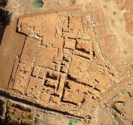
The region of Rethymno, on the island of Crete, contains an archaeological landscape shaped by thousands of years of human settlement. Its caves, coastal areas, agricultural terraces, and inland valleys provide opportunities to investigate prehistoric communities and their changing ways of life.

One particularly interesting subject is the possibility of Neolithic working areas preserved beneath modern gardens and cultivated land. These spaces may contain traces of ancient stone-tool production, pottery preparation, food processing, and other domestic activities.

A workshop floor is not necessarily a purpose-built industrial space. In early farming communities, production often took place in or around houses, courtyards, and shared outdoor areas. Identifying such activity requires careful excavation and analysis of archaeological deposits.

This article explores how researchers might investigate Neolithic workshop surfaces in the Rethymno region and what their discovery could reveal about early Cretan communities.

1. The Neolithic Background of Crete

The Neolithic period marked a major transformation in human life through the development and expansion of farming, animal domestication, settled communities, and new technologies.

Crete has a particularly important position in the study of prehistoric Mediterranean societies. Archaeological evidence indicates that farming communities were established on the island during the early Neolithic period.

Sites such as Knossos have provided important evidence for early settlement, domestic architecture, pottery, and subsistence practices. Other parts of Crete, including the Rethymno region, offer opportunities to investigate how these communities occupied different landscapes.

The precise chronology and development of Neolithic settlement varied across the island.

2. Why Rethymno Is Archaeologically Interesting

Rethymno occupies a varied landscape between the northern coastline and the mountainous interior of Crete.

Its surrounding region contains fertile valleys, freshwater sources, caves, upland routes, and coastal environments. These features would have offered different opportunities for prehistoric settlement and resource use.

The availability of stone, clay, water, and agricultural land may have influenced where early communities established their homes and production activities.

However, the presence of suitable resources does not establish that a particular modern garden contains Neolithic remains. Individual locations require archaeological investigation.

3. What Neolithic Workshop Floors Might Look Like

A workshop floor is an activity surface associated with repeated or specialized production.

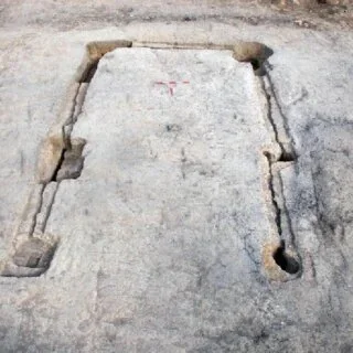
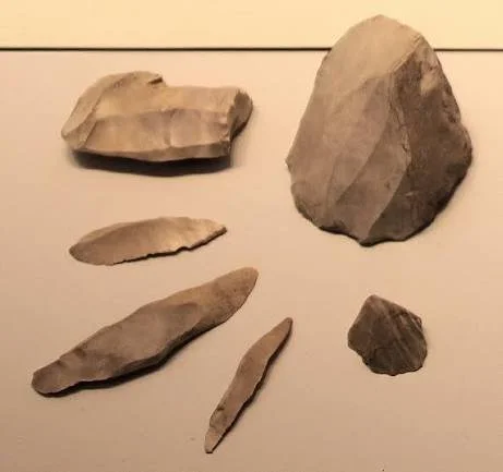
Possible archaeological indicators include concentrations of stone flakes, unfinished tools, broken pottery, grinding stones, clay fragments, and traces of burning.

A workshop surface may also contain compacted soil, localized staining, or repeated patterns of material distribution.

For example, a concentration of flint flakes around a particular working area might indicate stone-tool production. Clay fragments associated with prepared surfaces and heating installations could suggest pottery-related activities.

The identification of a workshop depends on the combination of these features rather than one artifact type alone.

4. Stone-Tool Production and Domestic Activities

Stone tools were essential to many Neolithic activities, including cutting, scraping, harvesting, and processing animal products.

The production of stone tools could take place close to domestic buildings. Archaeologists may identify these activities through cores, flakes, unfinished implements, and discarded fragments.

The distribution of these materials can reveal whether toolmaking occurred in one concentrated location or across several household spaces.

Such evidence may also help identify differences between household production and specialized craft activity.

5. Pottery and Clay Preparation

Pottery became an important technology in Neolithic communities because it provided containers for storage, cooking, serving, and other domestic tasks.

The production process involved obtaining suitable clay, preparing it, shaping vessels, drying them, and firing them.

A workshop area might preserve fragments of unfinished vessels, clay preparation surfaces, firing debris, or pottery with manufacturing defects.

However, broken pottery is common in archaeological settlements and does not automatically indicate a pottery workshop.

Researchers must distinguish production waste from objects discarded during ordinary household use.

6. Excavating Beneath Modern Gardens

Modern gardens can sometimes preserve older archaeological deposits beneath cultivated soil.

Planting, irrigation, construction, and landscaping may disturb the upper layers while leaving deeper deposits relatively intact.

Archaeologists begin by examining the property's geological setting, known archaeological records, surface materials, and historical land use.

Geophysical techniques may help identify buried walls, pits, hearths, or other features before excavation.

Where appropriate, carefully placed test trenches can establish whether undisturbed prehistoric deposits survive.

7. Reading the Microstratigraphy of a Workshop

Microstratigraphy examines the microscopic composition and formation of archaeological deposits.

Soil thin-section analysis can reveal compacted surfaces, ash layers, organic residues, and changes caused by repeated human activity.

These details may help distinguish a deliberately maintained working floor from naturally accumulated sediment.

For example, repeated episodes of sweeping, burning, and trampling can create recognizable microscopic patterns.

This approach is especially useful when the original floor surface is poorly preserved.

8. Dating the Neolithic Activity

Dating is essential for establishing whether a workshop floor belongs to the Neolithic period.

Radiocarbon dating may be possible when suitable charcoal, seeds, bones, or other organic materials are recovered from secure archaeological contexts.

Pottery styles and stone-tool technologies can provide additional chronological information.

Stratigraphic relationships are also important because later construction or cultivation may introduce younger objects into older deposits.

A convincing interpretation requires multiple lines of evidence that support the same chronology.

9. What a Workshop Could Reveal About Community Life

A Neolithic workshop could reveal how households organized production and managed resources.

The presence of specialized tools or repeated production waste may indicate technical expertise. Differences between working areas could suggest that certain households performed particular tasks.

The distribution of materials might also reveal exchange relationships between settlements.

However, a workshop does not necessarily indicate a centralized craft economy. Production could have been organized at the household level or shared among members of a community.

Conclusion

The possibility of Neolithic workshop floors beneath modern gardens in the Rethymno region provides an interesting direction for archaeological investigation.

Such surfaces could preserve evidence of stone-tool production, pottery preparation, and everyday craft activities. Their study would contribute to a broader understanding of how early Cretan communities organized domestic space and managed local resources.

Although a specific workshop beneath a particular garden should not be claimed without verified excavation evidence, the archaeological methods available today make it possible to investigate these hidden activity areas in considerable detail.

The Archaeology of Night-Time Rituals: Fire, Sound and Movement Signatures

November 15, 2026

Introduction

Night-time activities are difficult to investigate archaeologically because many of their most important elements are temporary. Fires burn down, sounds disappear, participants leave, and movement patterns are rarely preserved directly in the archaeological record.

Yet fire remains, spatial arrangements, artifacts, and environmental evidence can provide clues about activities that may have taken place after dark.

In many societies, nighttime gatherings have been associated with ceremonies, storytelling, seasonal celebrations, religious practices, and communal events. These activities may have involved controlled fires, musical instruments, dancing, processions, and other forms of coordinated movement.

The archaeology of night-time rituals explores how researchers can reconstruct these activities through material traces while avoiding interpretations that go beyond the available evidence.

1. Why Night-Time Activities Matter Archaeologically

Human activity does not stop when daylight disappears. In societies without modern lighting, nighttime gatherings required deliberate decisions about fire, visibility, movement, and the organization of space.

Some activities may have been restricted to particular times because of religious calendars, seasonal events, or social traditions.

Others could have taken place after ordinary work was completed, allowing community members to gather for storytelling, entertainment, or collective ceremonies.

Understanding these activities helps researchers develop a more complete picture of ancient daily life.

2. Fire as a Source of Light and Social Organization

Fire was one of the most important technologies for extending human activity beyond daylight hours.

Hearths, torches, oil lamps, and other lighting devices could illuminate gathering areas and provide warmth.

The position and arrangement of fires may have influenced where participants sat, stood, or moved.

A central fire might have created a shared focal point, while several smaller lights could have defined separate activity areas.

However, fire remains do not automatically indicate nighttime use. Hearths were also used for cooking, heating, craft production, and other ordinary activities.

3. Archaeological Evidence of Lighting

Researchers investigate nighttime lighting through the remains of lamps, hearths, fuel deposits, and burned surfaces.

Oil lamps may preserve soot, residues, and traces of repeated use. Their shape and placement can provide clues about how they were carried or positioned.

Charcoal and ash concentrations can reveal the location of former fires, although their original function may remain uncertain.

Microscopic analysis of burned materials can identify fuel types and sometimes distinguish between different combustion conditions.

The interpretation becomes stronger when several independent indicators are found together.

4. Sound and Musical Activities

Sound is one of the most difficult aspects of past human behavior to reconstruct because it rarely survives directly.

Nevertheless, archaeological artifacts can provide evidence of sound-producing technologies.

These may include flutes, whistles, bells, rattles, drums, and other musical or signaling instruments.

The discovery of such objects in a ceremonial context may suggest that music or sound played a role in gatherings.

Researchers can examine the material, dimensions, and acoustic properties of surviving instruments to investigate how they might have sounded.

However, an instrument's presence does not establish whether it was used during nighttime rituals.

5. Reconstructing Movement and Dance

Movement can leave indirect archaeological traces through repeated wear, patterned deposits, and the arrangement of activity spaces.

A large open area surrounded by seating or other structures may have supported collective movement.

Repeated trampling can compact soil and create distinctive surface changes, although similar evidence may result from ordinary circulation.

Researchers may also examine the distribution of artifacts, hearths, and structural features to identify areas where different activities took place.

The reconstruction of dance or ceremonial movement requires particular caution because similar spatial patterns can result from many forms of gathering.

6. The Spatial Organization of Night-Time Gatherings

The arrangement of a ritual space could influence visibility, sound, and movement.

A circular gathering area may have allowed participants to face a central feature. A processional route might have connected several locations within a settlement or landscape.

Natural features such as caves, rock shelters, elevated ground, and water sources may also have shaped the organization of nighttime activities.

Archaeologists examine entrances, pathways, seating areas, and the relationship between buildings and open spaces to investigate how gatherings were organized.

7. Fire, Sound, and Symbolic Communication

Fire and sound can have meanings beyond their practical functions.

A large communal fire might have served as a visual symbol of unity or marked an important gathering. Bells, drums, and other instruments could have communicated the beginning of an event or signaled movement between locations.

In some societies, particular sounds may have been associated with religious authority, seasonal transitions, or ceremonial identities.

However, such meanings are culturally specific. Archaeologists should not assume that similar technologies had identical symbolic functions across different societies.

8. Scientific Methods for Reconstructing Night-Time Rituals

Several scientific approaches can contribute to the study of nighttime activity.

Micromorphology can identify microscopic changes in floors and sediments caused by repeated heating or trampling.

Charcoal analysis can reveal the types of fuel used in fires. Residue analysis may identify substances burned in lamps or containers.

Acoustic modeling can help researchers explore how sound might have traveled through buildings, caves, or enclosed spaces.

Three-dimensional reconstruction can also be used to simulate visibility and movement under different lighting arrangements.

These methods provide possibilities rather than direct proof. Their conclusions must be compared with archaeological context and other evidence.

9. Distinguishing Ritual from Ordinary Night-Time Activity

One of the central challenges is determining whether a gathering was ritual, practical, or recreational.

A fire surrounded by artifacts may represent a communal ceremony, but it could also be a cooking area or ordinary domestic gathering.

Musical instruments may have been used for entertainment, communication, work, or religious activities.

Researchers therefore consider repeated patterns, unusual object deposits, spatial organization, specialized structures, and evidence of symbolic behavior.

The strongest interpretations emerge when multiple independent lines of evidence support the same explanation.

Conclusion

The archaeology of night-time rituals expands our understanding of how ancient communities organized social life beyond daylight hours.

Fire remains, lighting devices, musical instruments, spatial arrangements, and patterns of repeated activity can provide indirect evidence of nighttime gatherings. Together, these traces may reveal how people used light, sound, and movement to create shared experiences.

Although the exact sounds and movements of the past cannot usually be recovered, careful archaeological analysis can reconstruct aspects of the environments in which such activities occurred.

By combining material evidence, experimental methods, and cultural interpretation, researchers can investigate the role of nighttime gatherings in the social and symbolic lives of ancient communities.

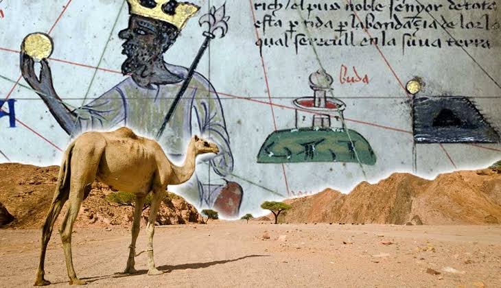
Petroglyph Caravan Signs: Mapping Routes Across Deserts

November 15, 2026

Introduction

Desert landscapes can appear empty and difficult to navigate, yet they have supported extensive systems of travel, exchange, and communication throughout human history.

Caravans moved goods, animals, people, and information between settlements separated by large distances. Their routes often depended on knowledge of water sources, grazing areas, mountain passes, seasonal conditions, and recognizable landmarks.

Rock carvings found along desert corridors provide an important archaeological resource for investigating these systems of movement. Some images may have marked routes, recorded visits, expressed group identities, or commemorated journeys.

Although not every petroglyph served as a navigational sign, the study of rock art in relation to caravan routes can reveal how communities interacted with desert environments.

1. Desert Caravans and Long-Distance Travel

Caravans were organized groups of travelers and pack animals moving together across long-distance routes.

Camels became particularly important in many desert transportation systems because of their ability to travel through arid environments with limited water.

Other animals, including donkeys and horses, were also used in different regions and historical periods.

Caravan routes connected agricultural settlements, trading centers, oasis communities, mining areas, and coastal ports.

The routes were shaped by environmental conditions as well as political, economic, and social relationships.

2. Petroglyphs as Landscape Markings

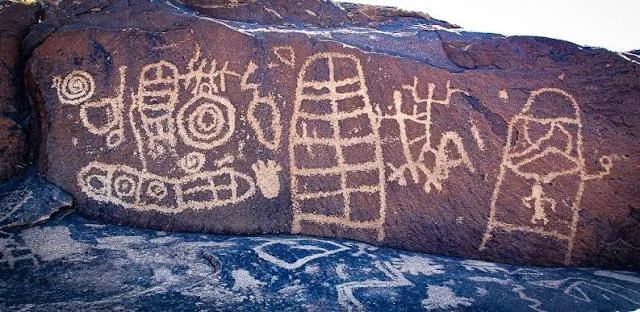
Petroglyphs are images or symbols carved into rock surfaces through techniques such as pecking, incision, and abrasion.

Desert rock art can depict animals, human figures, geometric designs, weapons, vehicles, and other recognizable forms.

Some carvings may have been produced by travelers who wanted to record their presence or identify themselves with a particular group.

Others could have commemorated important events or expressed religious and symbolic ideas.

A petroglyph's proximity to a route does not automatically prove that it functioned as a directional marker.

3. Possible Caravan-Related Symbols

Certain types of images may be especially relevant to the study of desert transportation.

Animal figures can provide clues about the species used in local travel and trade. Human figures carrying equipment or leading animals may represent activities associated with movement.

Geometric markings, repeated symbols, or groups of inscriptions might have served as recognizable signs.

However, researchers must distinguish between actual navigational markings and images with ceremonial, commemorative, or artistic purposes.

The meaning of a symbol may also have changed over time as different groups used the same landscape.

4. Rock Art and Water Sources

Water was one of the most important factors influencing desert travel.

Caravan routes often connected wells, springs, seasonal watercourses, and oasis settlements.

Petroglyphs located near these places may reflect repeated visits by travelers or the cultural importance of particular water sources.

Archaeologists can compare the location of carvings with reconstructed ancient water systems to investigate possible relationships.

However, modern water sources may differ from ancient ones because of climatic changes, geological processes, and human modification.

5. Mapping Ancient Desert Routes

Modern archaeological research combines rock-art recording with geographic information systems.

GIS mapping allows researchers to compare petroglyph locations with terrain, elevation, natural passes, water sources, and known archaeological settlements.

Least-cost path analysis can help identify routes that would have reduced travel effort or avoided difficult terrain.

These models are useful for generating hypotheses, but they cannot establish the exact route used by an ancient caravan without additional evidence.

Researchers also examine historical travel accounts, inscriptions, trade goods, and settlement remains.

6. Dating Caravan-Related Petroglyphs

Dating rock art is difficult because carvings are often made directly into exposed rock surfaces.

Relative dating may use weathering, patination, carving style, and relationships between overlapping images.

Some inscriptions can be dated through their script, language, or references to historically identifiable people and events.

Radiometric techniques may occasionally provide indirect chronological information through associated materials, but they do not always date the carving itself.

A desert rock-art site may contain images produced by different communities over hundreds or thousands of years.

7. Trade Goods and Archaeological Connections

Artifacts found along desert routes can help establish whether a particular corridor supported long-distance movement.

Imported pottery, metal objects, beads, coins, and other materials may reveal connections between distant regions.

Their distribution can be compared with the location of petroglyphs, wells, campsites, and settlements.

Such comparisons may identify areas where travelers repeatedly stopped or where exchange activities took place.

However, the movement of an artifact does not necessarily indicate that it followed a single direct caravan route.

8. Group Identity and Territorial Marking

Petroglyphs may have helped travelers express their identities within shared desert landscapes.

Repeated symbols could have represented family groups, communities, religious affiliations, or individual visitors.

Some carvings might also have communicated claims to particular resources or marked places of cultural significance.

These interpretations require careful analysis of repeated motifs, inscriptions, chronology, and regional comparisons.

The same image could have different meanings in different communities.

9. Conservation of Desert Rock Art

Desert petroglyphs may appear durable, but they are vulnerable to environmental and human damage.

Wind erosion, temperature changes, salt crystallization, and biological growth can gradually alter carved surfaces.

Modern threats include road construction, mining, tourism, vandalism, and unregulated collecting.

Digital recording, photogrammetry, detailed photography, and controlled visitor access can help preserve rock-art sites.

Local communities are also important partners in protecting landscapes that may retain cultural significance beyond their archaeological value.

Conclusion

Petroglyphs along desert travel corridors offer a valuable opportunity to investigate ancient mobility, trade, and cultural interaction.

Some carvings may have served as signs associated with travel, while others recorded visits, expressed identity, or marked places of symbolic importance.

By combining rock-art documentation with GIS analysis, environmental reconstruction, artifact distribution, and historical evidence, researchers can develop more reliable maps of ancient desert movement.

The study of caravan-related petroglyphs ultimately demonstrates that desert landscapes were not empty spaces but interconnected environments shaped by generations of travelers.

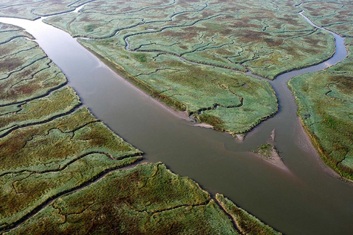
Submerged Fishtrap Networks in Tidal River Estuaries

November 15, 2026

Introduction

Tidal river estuaries are highly productive environments where freshwater and seawater interact. Their changing water levels, sediment movement, and seasonal fish migrations have supported human communities for thousands of years.

One traditional method of exploiting these environments involved constructing fish traps from wood, stones, woven branches, and other locally available materials.

Rather than relying on individual fishing devices, some communities developed interconnected systems of barriers and enclosures that guided fish into restricted spaces during changing tidal conditions.

Submerged fishtrap networks are archaeologically significant because they reveal detailed knowledge of water movement, animal behavior, and landscape management.

This article examines the construction, operation, preservation, and archaeological interpretation of fishtrap networks in tidal estuaries.

1. Understanding Tidal Fishtraps

A fishtrap is a structure designed to capture fish through the controlled movement of water and animals.

Traditional examples may use fences, stakes, woven panels, stone barriers, or enclosed spaces positioned along waterways.

In tidal environments, fishtraps can take advantage of rising and falling water levels. Fish entering an area during high tide may become concentrated in an enclosure as the water recedes.

The precise design depends on local currents, tidal range, fish species, and available construction materials.

2. Why Estuaries Were Important Fishing Environments

Estuaries provide diverse habitats for fish, crustaceans, and other aquatic organisms.

They often contain sheltered channels, mudflats, marshes, and shallow areas that support feeding, breeding, and migration.

The mixing of freshwater and seawater produces changing environmental conditions that influence the distribution of aquatic species.

For communities living near these environments, estuaries could provide reliable food resources and opportunities for seasonal fishing.

3. Construction Materials and Techniques

Fishtrap networks could be constructed from several materials.

Wooden stakes might be driven into the sediment to create barriers. Flexible branches could be woven between them to form fences, while stones could be arranged into walls or guiding structures.

Some traps used funnel-shaped entrances that directed fish into enclosed spaces. Others relied on long barriers positioned to intercept movement through tidal channels.

Construction required detailed knowledge of local currents and the behavior of target species.

4. How Networks of Fishtraps Operated

A network could include several individual traps positioned along a river channel, tidal flat, or marsh edge.

The structures might guide fish from wider waterways toward narrower collection areas.

During high tide, fish could move through the channels and enter the trapping system. As water levels declined, the arrangement of barriers could restrict their escape.

Some systems may have been designed for particular seasons or species, while others could have supported repeated fishing throughout the year.

However, reconstructing the exact operation of an archaeological network requires evidence about its original height, orientation, and relationship to historic water levels.

5. Archaeological Evidence of Submerged Fishtraps

Submerged fishtraps may survive as lines of wooden stakes, stone alignments, or preserved woven structures.

Archaeologists investigate whether these features form deliberate patterns rather than natural accumulations of wood or stone.

The spacing and orientation of stakes can indicate how a barrier was constructed. Repeated sections may suggest repairs or extensions to an existing system.

Associated fish bones, processing areas, and settlement remains can provide additional evidence of fishing activity.

6. Dating and Environmental Reconstruction

Radiocarbon dating can establish the approximate age of preserved wooden stakes or associated organic materials.

Dendrochronology may provide more precise dates when the wood preserves sufficient growth rings and a regional reference chronology is available.

Sediment analysis can reveal whether a fishtrap was constructed in a river channel, tidal flat, or marsh environment.

Researchers also reconstruct historical water levels and shoreline positions to understand how the structures functioned when they were active.

A modern fishtrap that appears submerged may originally have been built in a much shallower environment.

7. Fish Remains and Dietary Evidence

Fish bones provide important information about the species captured and the broader fishing economy.

The size and age distribution of fish remains may indicate selective harvesting or the use of particular trapping techniques.

Seasonal patterns can sometimes be investigated through growth structures in fish bones or other biological evidence.

However, fish remains found near a fishtrap may come from domestic consumption, natural accumulation, or later activities. Their association with the structure must be established carefully.

8. Community Organization and Resource Management

Constructing and maintaining a network of fishtraps could require coordinated labor.

Communities may have needed agreements about access, maintenance, ownership, and the timing of fishing activities.

Some traps may have been controlled by individual households, while larger systems could have involved collective construction and management.

The distribution of fishtraps across an estuary may reveal how different groups used particular channels and fishing grounds.

These interpretations can be strengthened through comparisons with settlement patterns, historical records, and local environmental knowledge.

9. Preservation and Threats to Submerged Networks

Submerged wooden fishtraps can survive in waterlogged sediment, particularly where oxygen levels are low.

However, erosion, dredging, boat traffic, construction, and changing tidal conditions can damage these fragile structures.

Saltwater exposure and biological activity may also accelerate the deterioration of wood.

Underwater recording, environmental monitoring, and careful management of coastal development are important for protecting these archaeological remains.

Conclusion

Submerged fishtrap networks demonstrate how communities adapted fishing technology to the changing conditions of tidal river estuaries.

Their construction required practical knowledge of currents, water levels, fish behavior, and local materials. Archaeological remains can reveal not only fishing methods but also patterns of cooperation, resource management, and settlement organization.

By combining underwater survey, timber analysis, fish-bone studies, and environmental reconstruction, researchers can better understand the role of traditional fishing systems in the development of coastal societies.

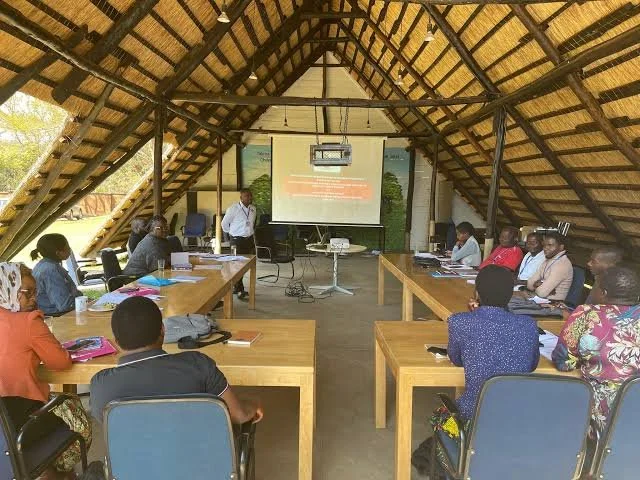
The Spatial Logic of Small Meeting Halls in Rural Societies

November 15, 2026

Introduction

In rural societies, communal decision-making often depended on spaces where people could gather, exchange information, resolve disagreements, and organize shared responsibilities. These spaces did not always take the form of monumental public buildings. Many communities relied on relatively small meeting halls, modest structures, or multipurpose buildings that served as centers of local social life.

The archaeological study of small meeting halls offers an opportunity to understand how rural communities organized authority, participation, and collective activity.

Their architectural features, internal arrangements, entrances, seating areas, and relationships with surrounding settlements may reveal how people used space to express social relationships.

This article explores the possible functions of small meeting halls and the archaeological methods used to investigate their spatial organization.

1. Understanding Small Communal Buildings

A small meeting hall can be understood as a structure used primarily or periodically for gatherings involving members of a community.

Such buildings might have been used for discussions, dispute resolution, communal planning, religious activities, or the organization of agricultural work.

Their size and construction varied according to local resources, population, and social traditions.

Some were purpose-built communal structures, while others may have been ordinary buildings adapted for meetings.

Archaeologists must therefore avoid assuming that every large room or centrally located building served as a formal assembly hall.

2. Location Within Rural Settlements

The position of a communal building can reveal important information about settlement organization.

A meeting hall located near the center of a village may have provided relatively convenient access for residents. A building positioned near a crossroads or shared open space might have supported gatherings involving people from neighboring settlements.

Other structures may have been located near religious buildings, agricultural facilities, or administrative centers.

Researchers examine the relationship between these buildings and surrounding houses, paths, boundaries, and public spaces to understand their possible role within the community.

3. Architectural Features and Interior Layout

The internal arrangement of a meeting hall could influence how gatherings took place.

A relatively open central area might have allowed participants to assemble in groups. Fixed benches, raised platforms, partitions, or separate entrances could indicate more structured patterns of use.

The presence of a hearth might suggest that the building was used during colder periods or for gatherings involving food preparation.

However, individual features rarely establish a building's function independently. Their significance depends on the overall architectural arrangement and associated archaeological evidence.

4. Seating and Social Hierarchy

Seating arrangements can provide clues about social relationships.

A raised platform or prominent seating position might have been intended for a leader, official, religious figure, or guest of importance.

Benches arranged around the walls could have supported group discussion, while an open floor may have allowed participants to stand or move during meetings.

Yet archaeologists must be cautious when interpreting hierarchy from architecture. A raised surface may have served practical purposes, such as storage or sleeping, rather than representing formal authority.

Comparisons with historical descriptions and regional building traditions can help clarify possible meanings.

5. Entrances and Patterns of Access

The location and number of entrances can influence how people entered and occupied a communal space.

A single entrance might have concentrated movement through one controlled point. Multiple entrances could have allowed easier circulation during larger gatherings.

Doorways may also have been positioned to provide access from central paths or shared outdoor areas.

Researchers examine wear patterns, thresholds, surrounding surfaces, and associated architectural features to investigate how people moved through the building.

6. Material Culture and Communal Activities

Artifacts found inside a meeting hall can help reveal its function.

Pottery fragments, food remains, tools, writing materials, gaming objects, and personal ornaments may indicate activities associated with gatherings.

Concentrations of cooking equipment could suggest communal meals, while administrative objects might indicate recordkeeping or organized decision-making.

However, the archaeological deposit may include materials from several different periods of use. Careful stratigraphic analysis is necessary to determine which objects belong to the same activity phase.

7. Meeting Halls and Rural Governance

Small communal buildings may have played an important role in local governance.

They could have provided places where residents discussed shared resources, agricultural schedules, boundary disputes, labor obligations, and local regulations.

In some societies, community meetings may have involved household representatives, elders, landholders, or other recognized authorities.

The archaeological evidence rarely reveals the precise rules governing participation. However, building size, accessibility, and spatial organization can contribute to broader interpretations of social organization.

8. Multipurpose Use and Changing Functions

A communal building may have served several purposes over its lifetime.

A meeting hall could also function as a dining space, temporary shelter, storage building, religious gathering place, or location for seasonal activities.

Changes in floor surfaces, internal partitions, hearth positions, and artifact distributions may indicate alterations in use.

Researchers should therefore avoid treating a building as having one fixed purpose throughout its entire existence.

9. Reconstructing Social Space Through Archaeology

The spatial study of meeting halls combines architectural recording with artifact distribution and settlement analysis.

GIS mapping can show how buildings relate to paths, houses, agricultural areas, and other communal structures.

Photogrammetry and three-dimensional reconstruction can help visualize the building's internal arrangement and possible circulation patterns.

Archaeologists may also compare rural meeting halls with known examples from nearby regions, while accounting for differences in chronology and cultural context.

Ethnographic research can provide additional perspectives on communal architecture, although modern practices should not be assumed to reproduce ancient social arrangements exactly.

Conclusion

Small meeting halls provide a valuable perspective on the organization of rural societies. Their locations, architectural features, and interior arrangements may reveal how communities created spaces for discussion, cooperation, governance, and shared activities.

Although their precise functions can be difficult to establish, the combination of spatial analysis, artifact study, and architectural reconstruction helps researchers investigate the social importance of modest communal buildings.

These structures remind us that the organization of ancient communities depended not only on monumental institutions but also on smaller spaces where everyday collective decisions were made.

Hidden Moorland Trackways: Peat-Preserved Road Engineering

November 15, 2026

Introduction

Moorlands and peatlands are often perceived as difficult landscapes for human movement. Their waterlogged soils, unstable surfaces, and seasonal flooding can make travel challenging. Yet archaeological discoveries have demonstrated that communities developed sophisticated ways of crossing wetlands long before modern roads and bridges existed.

One important form of infrastructure was the timber trackway: a constructed route made from wooden planks, branches, logs, or other materials laid across soft ground. In peatlands, these structures can survive for remarkably long periods because waterlogged, oxygen-poor conditions slow the decomposition of organic materials.

These trackways provide valuable evidence of prehistoric engineering, transportation, trade, and environmental adaptation. Their remains also reveal how communities transformed apparently inaccessible landscapes into usable routes.

1. Understanding Peatland Trackways

Peatland trackways are constructed pathways designed to support movement across wet or unstable terrain.

They could consist of longitudinal logs, transverse planks, brushwood bundles, or combinations of different materials. Some were relatively simple walking surfaces, while others involved substantial timber arrangements.

The construction method depended on the depth of peat, the availability of suitable timber, and the intended frequency of use.

Some trackways connected settlements, agricultural areas, and resource extraction sites. Others provided access to hunting grounds, grazing areas, or important ritual locations.

2. Why Ancient Communities Built Wooden Roads

Wetlands presented practical challenges for communities that needed to travel regularly between settlements and resource areas.

A person walking across deep peat could sink into the surface, become trapped, or struggle to carry heavy materials. Livestock and loaded transport equipment faced similar difficulties.

Constructed pathways provided more stable surfaces and could reduce the risks associated with crossing soft ground.

They also allowed communities to establish predictable routes through environments that changed with rainfall, seasonal flooding, and vegetation growth.

3. Materials and Construction Techniques

Timber was one of the most important materials used in peatland trackway construction.

Builders could place long logs parallel to the direction of travel and cover them with shorter branches or planks. Other techniques involved laying bundles of brushwood across the peat to distribute weight.

Some pathways used split timber boards positioned side by side. Wooden pegs or stakes may have helped secure individual components, depending on the construction design.

The arrangement of surviving wood can reveal whether a trackway was intended for pedestrians, animals, or potentially heavier loads.

4. Peat as a Natural Preservation Environment

Peat forms through the accumulation of partially decomposed plant material in waterlogged conditions.

When oxygen availability is limited, the organisms responsible for normal decomposition become less active. This can allow wooden structures, leather, textiles, and other organic materials to survive for centuries or even millennia.

However, preservation depends on local conditions. Changes in water levels, drainage, acidity, and exposure to oxygen can cause rapid deterioration.

Some peatland trackways survive as recognizable wooden structures, while others remain visible only as fragmented timber or discolorations within the peat.

5. Archaeological Identification of Trackways

Archaeologists identify ancient trackways through the arrangement, orientation, and physical characteristics of preserved materials.

A repeated pattern of timber placed across a wetland may indicate a deliberately constructed pathway. Researchers examine whether the wood forms a continuous route and whether its construction differs from natural fallen vegetation.

The relationship between timber and surrounding peat layers is especially important. Stratigraphic analysis can establish whether the trackway was constructed before or after particular environmental deposits formed.

Nearby artifacts, settlement remains, and evidence of repeated repairs can provide additional clues about the route's function.

6. Dating Ancient Moorland Roads

Radiocarbon dating is frequently used to establish the age of preserved organic materials associated with trackways.

Wood can sometimes be dated through dendrochronology when sufficient growth rings survive and a suitable regional reference chronology exists.

Researchers must distinguish the age of the timber from the date of construction. Reused wood or material from an older tree may produce a date earlier than the actual construction event.

Multiple samples from different sections of a trackway can help establish whether the route was built in one phase or maintained over an extended period.

7. Transportation and Economic Networks

Trackways could connect communities to resources that were otherwise difficult to access.

These might include woodland, grazing land, fishing grounds, mineral deposits, agricultural plots, and settlements located across wetlands.

Some routes may have formed part of broader regional transportation systems, linking inland communities with rivers, coastal areas, or commercial centers.

Their archaeological significance extends beyond the physical structure because they reveal how people organized movement and managed access to natural resources.

8. Trackways as Cultural and Ritual Landscapes

Not every ancient trackway served purely economic purposes.

Some wetland routes may have connected settlements with burial grounds, ceremonial locations, or places associated with communal activities.

The discovery of unusual objects near a trackway can raise questions about deposition and ritual behavior. However, an object found beside a wooden pathway does not automatically represent an offering.

Researchers must consider whether materials were deliberately placed, accidentally lost, or deposited through ordinary activity.

9. Conservation and Modern Threats

Peatland archaeology faces serious conservation challenges.

Drainage, peat extraction, agriculture, construction, and climate-related changes can lower water tables and expose previously protected timber to oxygen.

Once exposed, ancient wood can deteriorate rapidly.

Conservation strategies may include maintaining suitable water levels, restricting damaging land use, monitoring vulnerable deposits, and recording threatened sites before further deterioration occurs.

Environmental protection is therefore essential not only for biodiversity but also for preserving archaeological evidence.

Conclusion

Peat-preserved trackways demonstrate the engineering abilities of communities that developed practical solutions for moving through challenging wetland environments.

Their construction reveals knowledge of timber, soil conditions, load distribution, and landscape management. Their survival provides rare opportunities to investigate ancient transportation systems through preserved organic materials.

By combining archaeological excavation, environmental reconstruction, scientific dating, and conservation, researchers can better understand how people transformed moorlands and peatlands into connected cultural landscapes.

The Archaeology of Small-Scale Ink Production in Monastic Scriptoria

November 15, 2026

Introduction

Medieval monasteries were important centers of writing, education, religious administration, and manuscript preservation. Within these institutions, scriptoria provided spaces where manuscripts were copied, corrected, decorated, and sometimes produced from locally prepared materials.

Ink was an essential component of this work. Although finished manuscripts are among the most visible products of monastic literacy, the production and preparation of writing materials also involved practical knowledge, specialized tools, and organized labor.

Small-scale ink production may have taken place within monasteries or through relationships with outside suppliers. Archaeological evidence can help investigate these activities, although identifying a particular ink workshop requires careful interpretation.

This article explores the materials, equipment, production processes, and archaeological methods associated with ink preparation in medieval monastic environments.

1. The Role of the Monastic Scriptorium

A scriptorium was a place associated with manuscript production and copying. Its organization varied across institutions and historical periods.

Some monasteries maintained dedicated writing spaces, while others may have used rooms that served several functions.

Monks and other scribes could copy religious texts, administrative documents, historical records, and scholarly works.

Manuscript production required more than writing skill. It also depended on prepared parchment or paper, ink, quills or reed pens, pigments, binding materials, and suitable working surfaces.

The production of these materials could involve several specialized activities within or outside the monastery.

2. Types of Medieval Ink

Several ink traditions existed during the medieval period.

Carbon ink was produced using finely divided carbon, commonly obtained from soot or other burned organic materials. It was mixed with a binding medium to help it adhere to the writing surface.

Iron-gall ink became particularly important in European manuscript production. It was commonly prepared using iron salts, tannin-rich plant materials, and a liquid medium.

Other writing traditions used different combinations of pigments, binders, and additives.

The exact formula varied according to regional practices, material availability, and the intended use of the ink.

3. Raw Materials for Ink Production

Small-scale ink preparation required access to a variety of materials.

Carbon ink production could involve soot, water, and a binder such as gum. Iron-gall ink required tannin-rich materials, including certain oak galls, together with iron compounds.

Other ingredients might include vinegar, wine, water, or other liquids depending on the recipe and local tradition.

The availability of these materials influenced whether a monastery prepared ink independently or obtained it through trade.

Some ingredients could be collected locally, while others required specialized suppliers or wider commercial networks.

4. Tools and Equipment

Ink production did not necessarily require large industrial equipment.

Small vessels could be used for mixing, heating, storing, or transporting liquid ingredients. Mortars and pestles could help grind dry materials, while sieves or cloth filters might remove unwanted particles.

Archaeological remains of small ceramic containers, glass vessels, metal implements, and residue-covered surfaces may provide clues about material preparation.

However, these objects were used for many activities in medieval institutions. A small jar or grinding stone cannot be identified as an ink-production tool without supporting evidence.

5. Evidence of Ink Production in Monastic Contexts

The archaeological identification of ink production depends on the combination of artifacts, chemical residues, and spatial relationships.

A cluster of small vessels containing chemically distinctive residues may suggest repeated preparation activities. Associated grinding tools, heating installations, or storage containers could strengthen the interpretation.

Researchers may also compare archaeological finds with surviving manuscript recipes and historical inventories.

The presence of ink stains in a room is not sufficient to establish that ink was manufactured there. The room may simply have been used for writing or manuscript storage.

6. Chemical Analysis of Ink Residues

Scientific analysis can reveal the ingredients used in historical inks.

X-ray fluorescence may identify elements such as iron and other metals. Raman spectroscopy and other molecular techniques can help characterize pigments and carbon-based materials.

High-performance liquid chromatography and related analytical methods may identify organic components, including certain plant-derived compounds.

These analyses can help distinguish different ink traditions, although degradation and contamination may complicate interpretation.

Sampling should be kept to a minimum, particularly when dealing with rare manuscripts or fragile archaeological materials.

7. The Relationship Between Ink Production and Manuscript Copying

Ink preparation was closely connected to the practical demands of manuscript production.

Scribes required writing materials that flowed consistently, adhered to the writing surface, and remained legible over time.

Different writing tasks could require different ink properties. Text, headings, corrections, annotations, and decorative elements might use different materials.

A monastery producing manuscripts regularly may have needed a dependable supply of ink, whether prepared internally or acquired through exchange.

The organization of this supply can reveal how religious institutions managed specialized work.

8. Labor and Knowledge Transmission

Ink preparation required knowledge of material properties and proportions.

The process involved understanding how ingredients interacted, how mixtures should be stored, and how the finished ink behaved during writing.

This knowledge could be transmitted through written recipes, apprenticeship, observation, and practical experience.

The production of ink may therefore have formed part of a broader network of technical skills within monastic communities.

However, not every scribe necessarily prepared their own ink. Production could have been handled by other members of the institution or by external specialists.

9. Manuscripts as Evidence of Production Practices

Surviving manuscripts provide important information about ink use and preparation.

Researchers examine color, texture, chemical composition, writing behavior, and patterns of deterioration.

Differences between inks in the same manuscript may indicate changes in materials, separate production batches, or work by different scribes.

Historical recipes and inventories can also help reconstruct how monasteries obtained and used writing materials.

When manuscript analysis is combined with archaeological evidence, researchers can develop a more complete picture of production activities.

Conclusion

Small-scale ink production was an important technical activity associated with medieval manuscript culture. Monastic scriptoria depended on reliable supplies of writing materials, and some institutions may have prepared ink within their own communities.

Although the archaeological identification of ink workshops is challenging, residue analysis, vessel studies, manuscript examination, and historical documentation provide valuable evidence.

Research into these modest production activities expands our understanding of monastic life beyond the finished manuscripts, revealing the material knowledge and practical labor that supported medieval literacy.

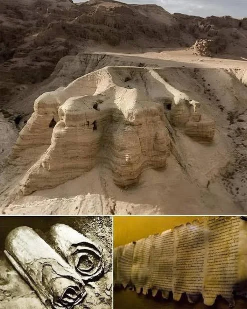
Salt Crust Preservation of Parchment Fragments in Desert Caves

November 15, 2026

Introduction

Desert caves can preserve fragile archaeological materials that would otherwise disappear in more humid environments. Among the potentially significant discoveries are fragments of parchment, an animal-skin writing material used for manuscripts, documents, and religious texts.

In some environments, mineral salts accumulate on cave walls, floors, and archaeological objects. Salt deposits can influence preservation by reducing the availability of moisture under certain conditions. However, salts can also damage organic materials through crystallization, chemical reactions, and repeated changes in humidity.

The relationship between salt crusts and parchment preservation is therefore complex. A salt-covered fragment is not necessarily a perfectly preserved manuscript, and the presence of salt does not prove that the material survived because of it.

This article examines how parchment may survive in desert caves, the possible role of mineral salts, and the scientific methods used to investigate these fragile remains.

1. Understanding Parchment

Parchment is made from prepared animal skin, commonly from sheep, goats, or calves.

The skin is cleaned, soaked, stretched, scraped, and dried under tension. This process produces a durable writing surface with a distinctive fibrous structure.

Unlike paper, which is generally made from plant fibers, parchment is primarily composed of collagen, a structural protein found in animal connective tissue.

Its preservation depends on environmental conditions, manufacturing techniques, burial history, and exposure to microorganisms and chemical agents.

2. Desert Caves as Preservation Environments

Desert caves can provide relatively stable conditions compared with exposed landscapes.

Limited rainfall may reduce the frequency of water exposure, while cave interiors can protect objects from direct sunlight, wind, and rapid surface erosion.

Some caves also contain dry sediment deposits that restrict microbial activity.

However, cave environments are not automatically stable. Seasonal humidity, groundwater movement, condensation, temperature changes, and human disturbance can affect archaeological materials.

The preservation potential of each cave must therefore be evaluated through environmental monitoring and sediment analysis.

3. How Mineral Salt Crusts Form

Salt crusts develop when dissolved minerals accumulate and crystallize as water evaporates.

In desert environments, salts may originate from groundwater, surrounding rock, soil deposits, or wind-blown particles.

Common salts include chlorides, sulfates, and carbonates, although their distribution varies with local geology.

When moisture moves through a cave wall or sediment layer, dissolved minerals may be transported toward exposed surfaces. Evaporation can then leave visible crystalline deposits.

These processes can create coatings on rocks, artifacts, and organic materials.

4. Potential Protective Effects of Salt

Certain salt-rich environments can reduce biological activity by limiting the availability of water.

Microorganisms require suitable moisture conditions to grow, and highly saline environments can create osmotic stress that restricts some forms of microbial activity.

A dry mineral crust may also reduce direct contact between an object and external environmental conditions.

However, these effects are not universal. Different microorganisms tolerate different salinity levels, and salt accumulation can produce damaging chemical and physical changes.

Salt should therefore be understood as a possible influence on preservation rather than a guaranteed protective coating.

5. How Salt Can Damage Parchment

Parchment is particularly sensitive to changes in moisture.

When humidity rises, collagen fibers absorb water and may swell. When conditions become dry, the material can contract.

Repeated cycles can cause distortion, cracking, and weakening.

Salt crystals can also grow within pores and spaces in the material. Crystallization pressure may damage the surface or disrupt the structure of the parchment.

Some salts absorb moisture from the atmosphere, while others undergo changes in hydration as environmental conditions fluctuate.

Consequently, a salt-covered parchment fragment may have survived despite the salt rather than because of it.

6. Identifying Parchment in Archaeological Deposits

Parchment fragments may be difficult to recognize when they are heavily mineralized, fragmented, or discolored.

Researchers examine surface texture, thickness, fiber structure, and microscopic characteristics to distinguish animal skin from paper, leather, plant material, or other organic remains.

Protein analysis may help identify the animal species from which the parchment was produced. Specialized methods such as peptide mass fingerprinting can sometimes identify collagen signatures.

These techniques can provide valuable information even when the fragment is too small or damaged for conventional visual identification.

7. Investigating Salt Composition

Laboratory analysis is essential for understanding the relationship between mineral salts and parchment preservation.

Techniques such as X-ray diffraction can identify crystalline mineral phases. Ion chromatography can measure soluble ions, while scanning electron microscopy can reveal crystal structures and their relationship to the parchment surface.

Researchers may also examine the distribution of salts through the material to determine whether they formed a surface coating or penetrated the object.

Combining mineralogical and organic analysis helps establish whether the salt deposits are ancient, recent, or the result of changing environmental conditions.

8. Dating and Historical Interpretation

The date of a parchment fragment can be investigated through radiocarbon analysis when sufficient material is available and sampling is ethically and scientifically justified.

The writing style, language, script, ink composition, and textual content may provide additional chronological information.

However, the age of the parchment does not necessarily establish when it entered the cave or became covered by salt.

Researchers must also consider the possibility of later reuse, movement, or disturbance of the archaeological deposit.

9. Conservation of Salt-Affected Parchment

Conserving salt-contaminated parchment requires careful environmental control.

Sudden changes in humidity can cause salt crystals to dissolve or recrystallize, potentially worsening damage.

Conservators assess the material before attempting desalination or other treatments. In some cases, removing salts may be more harmful than leaving them in place.

Stable storage conditions, detailed imaging, minimal handling, and controlled conservation procedures are essential.

Digital photography and multispectral imaging may also help reveal faded writing without requiring invasive physical treatment.

Conclusion

Salt crusts in desert caves can provide important evidence about the environmental history of archaeological deposits and the preservation of fragile parchment fragments. Dry conditions and high salinity may restrict certain biological processes, but salt crystallization and humidity changes can also damage collagen-based materials.

Understanding these opposing effects requires detailed mineralogical, chemical, and conservation research. By combining environmental analysis with manuscript studies and scientific dating, archaeologists can better reconstruct how parchment survived in challenging desert environments.

Ancient Coffee Ceremonies: Residues and Social Rituals in East Africa

November 15, 2026

Introduction

Coffee has become one of the world's most recognizable beverages, but its historical development is closely connected to the cultures and landscapes of East Africa. Ethiopia, in particular, is widely associated with coffee's botanical origins and with traditions that eventually developed into elaborate forms of social hospitality.

Coffee ceremonies are important cultural practices involving preparation, roasting, brewing, serving, and conversation. They demonstrate how an everyday agricultural product can become central to social relationships, identity, and community life.

Studying the earliest history of coffee ceremonies presents an archaeological challenge. Coffee residues are not always easy to distinguish from other plant materials, and many ceremonial practices were transmitted orally rather than recorded in written documents.

This article examines the historical background, archaeological potential, and social significance of coffee traditions in East Africa while distinguishing documented history from claims that remain difficult to verify.

1. Coffee's Botanical Origins in East Africa

The coffee plant, particularly Coffea arabica, is native to the highland forests of southwestern Ethiopia.

These landscapes provided environmental conditions suitable for the growth of wild coffee populations. Local communities had access to the plant long before coffee became an international commercial commodity.

The exact date when people first began deliberately processing coffee seeds as a beverage remains uncertain. Botanical origins, early human use, and the development of recognizable coffee-drinking traditions are separate historical questions.

This distinction is important because the existence of wild coffee does not automatically establish the presence of an organized coffee ceremony.

2. Early Uses of Coffee Plants

The earliest uses of coffee in East Africa may have included activities beyond preparing the familiar roasted beverage.

Ethnobotanical research has documented diverse traditional uses of plants, including the preparation of leaves, fruits, and seeds. Some historical accounts describe coffee-related foods or mixtures that differ from modern brewing practices.

However, reconstructing the earliest coffee consumption practices is difficult because direct archaeological evidence is limited.

Researchers must therefore distinguish between documented later traditions, historical descriptions, and hypotheses about earlier forms of use.

3. The Development of Coffee Drinking Traditions

Coffee drinking became increasingly important in the wider Red Sea and Indian Ocean world over the medieval and early modern periods.

Historical accounts connect the development of established coffee-drinking traditions with Yemen, where coffee cultivation and preparation became important before spreading into other regions.

Trade networks helped move coffee between East Africa, the Arabian Peninsula, and other commercial centers.

The movement of coffee across these routes illustrates how agricultural knowledge, consumption habits, and social practices could develop through sustained contact between communities.

4. The Ethiopian Coffee Ceremony

The Ethiopian coffee ceremony is a structured social practice involving several stages.

Green coffee beans are commonly washed, roasted in a pan, and ground before being brewed. The prepared coffee is traditionally served in small cups, often across multiple rounds.

The ceremony may be accompanied by conversation, hospitality, and the sharing of food. In many settings, its preparation is an important social activity rather than simply a method of producing a drink.

Practices vary between communities and households. There is no single uniform ceremony that represents every Ethiopian region or cultural group.

5. The Social Meaning of Coffee Preparation

Coffee ceremonies can provide opportunities for conversation, reconciliation, hospitality, and the strengthening of relationships.

The preparation process often requires time and participation, creating a shared experience among hosts and guests.

In some contexts, coffee gatherings may also mark important family events, community discussions, or informal negotiations.

These social functions demonstrate that coffee's significance extends beyond its chemical or nutritional properties.

6. What Archaeologists Can Learn from Coffee Residues

Archaeologists may investigate the history of coffee through botanical remains, residues on vessels, roasting equipment, and evidence of trade.

Plant remains can include seeds, fragments, and other materials preserved through charring or waterlogged conditions.

Chemical residue analysis may identify compounds associated with particular plant products, although distinguishing coffee from related substances requires careful laboratory validation.

Researchers also examine pottery and metal vessels for patterns of heating, staining, and repeated use. Such evidence may indicate beverage preparation, but it cannot establish a coffee ceremony on its own.

7. The Challenges of Dating Early Coffee Practices

Dating the development of coffee drinking is difficult because direct evidence is relatively scarce.

Written accounts can establish that coffee was consumed in particular places by certain historical periods, but they do not necessarily reveal when the practice first began.

Radiocarbon dating may help establish the age of preserved plant remains. However, a dated coffee-related object does not automatically prove that it was used in a ceremonial setting.

Archaeologists must combine botanical identification, chemical analysis, historical documentation, and contextual evidence.

8. Coffee and Regional Trade Networks

Coffee's movement beyond its African origins depended on commercial connections across the Red Sea and the Indian Ocean.

Ports, merchants, agricultural communities, and urban markets played roles in its distribution.

The expansion of coffee cultivation and consumption eventually transformed it into a major international commodity.

Archaeological research into coffee trade may examine imported vessels, commercial buildings, botanical remains, and written records. These sources can help reconstruct how coffee moved between producing regions and consumer markets.

9. Preserving Living Coffee Traditions

Traditional coffee ceremonies remain important cultural practices in parts of Ethiopia and neighboring regions.

Their continued performance provides an opportunity to study techniques, terminology, objects, and social meanings that may have historical depth.

Ethnographic research can document how coffee is prepared and how ceremonial objects are used. However, modern practices should not be treated as unchanged survivals from antiquity.

Communities adapt traditions over time, and historical research must recognize both continuity and change.

Conclusion

East African coffee traditions reveal the close relationship between plants, trade, hospitality, and social identity. Ethiopia's connection to the coffee plant is well established, while the precise origins and chronology of formal coffee ceremonies remain more difficult to reconstruct.

Archaeological research can contribute through botanical identification, residue analysis, vessel studies, and investigation of regional trade networks. Yet the social meaning of coffee is also preserved through living cultural practices and historical documentation.

Together, these sources provide a richer understanding of how coffee developed from a regional plant resource into a major element of social and cultural life.

The Use of Earthfast Posts in Vernacular Architecture: Preservation Evidence

November 15, 2026

Introduction

Before modern foundations and standardized construction materials became widespread, many communities built homes, storage structures, workshops, and agricultural buildings using timber posts set directly into the ground. This construction method, commonly described as earthfast architecture, allowed builders to create practical structures with relatively simple tools and locally available materials.

Earthfast posts were particularly useful in landscapes where timber was abundant and stone foundations were difficult or expensive to construct. Although the wooden structures themselves often disappeared through decay, their positions could survive as archaeological features in the soil.

The study of earthfast architecture provides valuable information about traditional building practices, settlement organization, and the relationship between construction technology and environmental conditions.

1. Understanding Earthfast Construction

Earthfast construction involves placing upright wooden posts directly into prepared holes or trenches in the ground. These posts support the roof, walls, or other structural elements of a building.

Unlike structures supported by stone foundations or raised wooden platforms, earthfast buildings depend partly on the surrounding soil to stabilize their vertical supports.

Builders may have packed stones, gravel, clay, or other materials around the posts to improve stability. Some structures also used horizontal beams and diagonal braces to distribute weight and resist movement.

The method could be adapted to houses, barns, animal shelters, fences, granaries, and other vernacular buildings.

2. Selecting and Preparing Timber

The durability of an earthfast building depended partly on the type and condition of the timber used.

Builders generally needed wood strong enough to support the intended structure. Different species offered different combinations of flexibility, resistance to decay, and availability.

Posts could be cut, shaped, pointed, or treated before installation. In some building traditions, the lower portions were charred or otherwise prepared to improve their resistance to moisture and biological deterioration.

The exact techniques varied across regions and historical periods. Archaeological wood analysis can sometimes identify the species used and provide clues about timber selection.

3. Soil Conditions and Post Preservation

The preservation of earthfast posts depends heavily on the surrounding environment.

Wood buried in well-drained soil may deteriorate relatively quickly because oxygen supports organisms that break down organic material. Waterlogged or oxygen-poor environments can sometimes preserve wooden remains for much longer.

Soil acidity, mineral content, groundwater movement, temperature, and microbial activity also influence preservation.

In some archaeological sites, the timber disappears entirely, leaving only a dark stain or a recognizable posthole. In other environments, substantial portions of the original wood may survive.

4. Archaeological Identification of Postholes

Postholes are among the most common traces of earthfast construction.

They often appear as circular, oval, or irregular soil features that differ in color and composition from the surrounding deposit. Their size and shape may reflect the original dimensions of the wooden supports.

Archaeologists examine posthole depth, spacing, orientation, and fill composition to reconstruct building plans.

Patterns are particularly important. A series of regularly spaced postholes may indicate a wall or structural framework, while larger holes at the corners may represent major supporting posts.

However, postholes can also belong to fences, drying racks, temporary shelters, or other structures.

5. Reconstructing Vernacular Building Layouts

The arrangement of surviving postholes can reveal the basic design of a vanished building.

Rectangular patterns may indicate houses or storage structures, while circular or irregular arrangements may represent other construction traditions.

Researchers examine the distance between supports and the relationship between interior and exterior post lines. These measurements can help estimate the building's size and possible roof design.

Additional evidence, such as hearths, floor surfaces, storage pits, and domestic artifacts, can help identify the building's function.

6. Construction Phases and Repairs

Earthfast buildings were not necessarily permanent structures in their original form. Timber posts could be replaced, repositioned, or reinforced as buildings aged.

Archaeological evidence may reveal several construction phases where newer postholes overlap older ones.

A replacement post placed beside an earlier support may indicate structural repair. A series of closely spaced holes may reflect repeated rebuilding or modification.

Understanding these phases is important because a settlement's archaeological plan may represent several generations of construction rather than one moment in time.

7. Environmental and Economic Significance

Earthfast construction reflects a close relationship between architecture and local resources.

Communities with access to suitable timber could build substantial structures without relying on large quantities of stone or fired brick. The technique could also be adapted to seasonal agricultural needs.

The use of timber posts may reveal how people managed woodland resources, transported construction materials, and organized labor.

Comparing building remains with pollen records, charcoal deposits, and regional vegetation evidence can help researchers investigate the availability of timber over time.

8. Scientific Techniques for Studying Preservation

Modern archaeological research uses several techniques to investigate earthfast remains.

Micromorphology examines undisturbed soil samples under a microscope, helping researchers identify differences between posthole fills and surrounding deposits.

Wood identification can reveal species selection where timber survives. Radiocarbon dating may establish the age of preserved wood or associated organic material.

Dendrochronology can sometimes provide more precise dates when sufficient growth rings survive and suitable regional reference sequences exist.

Three-dimensional recording and GIS mapping also help reconstruct the arrangement of posts across large excavation areas.

9. Conservation Challenges

Excavated earthfast remains are vulnerable because their preservation depends on environmental conditions that may change after exposure.

Waterlogged wood can shrink or crack if removed and dried without proper treatment. Soil stains and posthole fills may also become difficult to distinguish once exposed to changing weather.

Archaeologists therefore document these features carefully before excavation and use appropriate conservation procedures when organic material survives.

In some cases, preserving the archaeological deposits in place may provide better long-term protection than removing them.

Conclusion

Earthfast posts represent an important but often overlooked form of vernacular architecture. Their use allowed communities to construct practical buildings from locally available timber, while their archaeological traces preserve evidence of settlement planning, building techniques, and repeated repairs.

Although the original structures frequently disappear, postholes, soil stains, preserved timber, and associated deposits can reveal how buildings were constructed and used.

By combining architectural reconstruction with environmental and scientific analysis, archaeologists can better understand the everyday buildings that shaped historic and prehistoric communities.

Microcore Technology: Tiny Flakes and Specialized Toolkits

November 15, 2026

Introduction

Stone-tool technology is often associated with large hand axes, blades, scrapers, and other objects that are easily recognizable in archaeological collections. However, prehistoric communities also produced very small stone tools and flakes using specialized techniques.

Microcore technology involves the production of small flakes or bladelets from carefully prepared stone cores. These tiny pieces could be used directly or modified into specialized tools suited to particular activities.

Although small artifacts can be overlooked during excavation, they provide important evidence of technological planning, resource efficiency, and changes in human behavior.

This article examines microcore production, the functions of tiny flakes, archaeological identification, and the significance of miniature stone-tool technologies.

1. What Is a Microcore?

A core is a piece of stone from which flakes or blades are deliberately removed. A microcore is a relatively small core used to produce correspondingly small stone pieces.

The exact size considered a microcore varies according to archaeological tradition and research methodology. It is therefore important not to treat every small stone fragment as evidence of microcore technology.

The identification depends on the presence of deliberate flake-removal patterns, prepared striking surfaces, and other technological characteristics.

Microcores demonstrate that small tools were not necessarily accidental by-products. They could result from deliberate production strategies.

2. Preparing the Core

Producing small flakes requires control over the shape and structure of the core.

Knappers may prepare striking platforms and modify the core's surface to guide the direction of fracture. The objective is to remove flakes with predictable dimensions and useful edges.

Depending on the technological tradition, a core may be shaped to produce repeated bladelets, narrow flakes, or other standardized pieces.

The process requires an understanding of stone properties, fracture mechanics, and the relationship between striking force and flake formation.

3. Raw Materials and Resource Selection

Microcore technologies could use several types of knappable stone, including flint, chert, obsidian, and other fine-grained materials.

The choice of raw material depended on availability, quality, transport networks, and the intended use of the finished tools.

Obsidian, for example, can produce extremely sharp edges but may be geographically restricted to volcanic sources. Flint and chert were more widely available in many regions, although their quality varied.

Archaeologists use geological sourcing and microscopic analysis to investigate where stone materials originated and how they moved between communities.

4. Tiny Flakes as Specialized Tools

Small flakes can perform a variety of tasks. They may be used for cutting, scraping, engraving, piercing, or working organic materials.

Some pieces were retouched to create particular edge shapes. Others may have been inserted into wooden or bone handles to form composite tools.

The use of small stone inserts could allow communities to create lightweight equipment that was repairable and adaptable.

However, not every microflake represents a finished tool. Some are manufacturing waste, and their function must be established through technological analysis and use-wear evidence.

5. Composite Tool Construction

One important advantage of small stone pieces is their suitability for composite tools.

Several tiny stone inserts could be placed into a prepared groove in a wooden or bone handle. The resulting implement might have a cutting edge made from multiple pieces.

If one insert became damaged, it could potentially be replaced without discarding the entire tool.

Composite technology required planning and coordination between the production of stone components and the preparation of handles or binding materials.

Because organic components often decay, archaeologists may identify composite tools primarily through the surviving stone inserts and traces of adhesives or hafting materials.

6. Microscopic Evidence of Tool Use

Microwear analysis can help researchers investigate how tiny flakes were used.

Under magnification, stone surfaces may preserve microscopic polish, striations, edge rounding, and other traces associated with contact against different materials.

Residue analysis can sometimes identify substances such as plant fibers, animal materials, or adhesives.

These methods can help distinguish tools used for cutting meat, processing plants, scraping hides, or working other materials.

However, post-depositional damage and contamination can create misleading traces, so multiple lines of evidence are necessary.

7. Why Tiny Artifacts Require Specialized Excavation

Small flakes are easily missed during conventional excavation, particularly when deposits are screened using large mesh sizes.

Archaeologists may use fine-mesh sieving and flotation methods where appropriate to recover small artifacts and associated organic remains.

Careful recording of artifact locations can also reveal whether microcores and tiny flakes were produced in particular activity areas.

The spatial distribution of these materials may help identify workshops, domestic workspaces, hunting equipment production zones, or temporary camps.

8. Microcore Technology and Human Adaptation

The production of miniature stone tools may reflect changing economic and environmental conditions.

Small standardized components could reduce raw-material waste, make tools easier to transport, and allow specialized equipment to be assembled from locally available materials.

In some contexts, microblade production is associated with mobile communities that needed lightweight and maintainable toolkits. In others, it formed part of more settled technological traditions.

The significance of microcore technology therefore depends on the archaeological period and region rather than a single universal explanation.

9. Dating and Interpreting Microcore Assemblages

Microcore technology occurred in different regions and periods, and similar techniques could develop independently.

Archaeologists date microcore assemblages through their stratigraphic position, associated artifacts, radiocarbon-dated organic materials, and other chronological evidence.

Typological comparisons can help identify technological traditions, but similarities in shape do not automatically establish direct cultural contact.

Researchers also examine production sequences, known as chaîne opératoire, to reconstruct how raw stone was selected, prepared, reduced, used, and discarded.

This approach provides a more complete understanding of technology than studying finished tools alone.

Conclusion

Microcore technology demonstrates that prehistoric stone-tool production involved sophisticated methods of preparing and reducing even very small pieces of stone. Tiny flakes could serve as cutting edges, specialized implements, or components of composite tools.

Although their size makes them difficult to recover and interpret, these artifacts offer valuable evidence of technical skill, resource management, and adaptation.

By combining fine-scale excavation, technological analysis, microwear studies, and raw-material sourcing, archaeologists can reconstruct the specialized toolkits that supported everyday activities in ancient communities.

The Archaeology of Portable Shrines in Medieval Pilgrimage Paths

November 15, 2026

Introduction

Medieval pilgrimage routes connected religious centers, monasteries, churches, healing sites, and places associated with sacred figures. Pilgrims traveled across landscapes carrying food, personal belongings, religious objects, and sometimes small items used for private devotion.

Not all religious practices depended on permanent buildings. Portable shrines allowed people to carry sacred images, relics, or devotional objects between settlements and pilgrimage destinations.

These objects are archaeologically significant because they reveal how religious activity extended beyond churches and monasteries. A small shrine could accompany a traveler, serve a temporary gathering, or provide a focal point for prayer in a domestic or roadside setting.

This article examines the possible forms, archaeological traces, social functions, and interpretive challenges associated with portable shrines along medieval pilgrimage paths.

1. Understanding Portable Shrines

A portable shrine is a compact devotional structure designed to be moved or transported. It may contain a religious image, relic, inscription, or other sacred object.

Examples of portable religious objects from medieval traditions include reliquaries, folding devotional panels, small icon containers, metalwork enclosures, and miniature altars.

Not every portable devotional object is technically a shrine. A distinction should be made between a container for sacred material, an image intended for private devotion, and a structure designed to serve as a temporary sacred space.

The form and function of these objects varied across regions and religious traditions.

2. Pilgrimage Routes as Archaeological Landscapes

Pilgrimage paths were not simply roads leading from one religious destination to another. They were complex landscapes containing bridges, wells, inns, chapels, monasteries, roadside crosses, markets, and temporary resting places.

Religious travelers might stop at several locations during a journey. Some places offered shelter and practical assistance, while others were associated with prayer, healing, or the commemoration of religious events.

Portable shrines could have been used at these stopping points, allowing devotional practices to take place outside permanent religious buildings.

Archaeologists investigate these routes through historical maps, excavated structures, artifacts, and landscape surveys.

3. Materials and Construction

Portable shrines could be made from wood, metal, ivory, bone, stone, or combinations of different materials.

Wooden examples may have included hinged panels, small boxes, or carved enclosures. Metal shrines could feature decorative surfaces, inscriptions, and spaces designed to hold relics.

The choice of material influenced portability, durability, cost, and social meaning. Precious metals and elaborate decoration might indicate access to considerable resources, while simpler wooden objects could have served more modest devotional needs.

Preservation is uneven. Wooden objects are particularly vulnerable to decay, meaning that surviving archaeological examples may not represent the full range of portable shrine traditions.

4. Evidence Along Medieval Travel Routes

Portable shrines are difficult to identify archaeologically because they are small, movable, and often removed from the locations where they were originally used.

Researchers may encounter fragments of decorated metalwork, miniature religious images, hinged fittings, small reliquary containers, or inscriptions associated with devotional practices.

Such objects can appear in settlement deposits, burial contexts, abandoned buildings, and pilgrimage-related sites.

Their interpretation depends on their archaeological context. A metal fitting resembling part of a small shrine might also belong to a box, book cover, or another type of container.

5. The Relationship Between Shrines and Relics

Relics were important elements of medieval Christian devotion, although their significance and treatment varied across time and place.

Portable reliquaries provided secure containers for sacred remains or objects associated with revered religious figures. Some were designed to be displayed, carried in processions, or brought to particular gatherings.

A reliquary could therefore function as part of a portable shrine, but the two terms are not interchangeable.

Archaeologists examine inscriptions, compartments, decorative programs, and historical records to determine whether an object was intended to hold relics or serve another devotional purpose.

6. Private Devotion and Everyday Religious Practice

Portable religious objects could support personal prayer during travel. Pilgrims might carry small icons, crosses, devotional images, or containers associated with a particular sacred place.

Such objects could also provide a means of expressing religious identity in unfamiliar environments.

A traveler might use a portable shrine during an overnight stop, at a temporary shelter, or during a gathering with other pilgrims. However, direct evidence for these specific activities is often limited.

The broader archaeological significance lies in showing that medieval religious practice was not confined to monumental institutions.

7. Social Status and Access to Portable Shrines

The size, material, and decoration of a portable shrine could reflect the wealth or status of its owner.

Elaborate metalwork might have belonged to a monastery, religious official, wealthy patron, or organized pilgrimage group. More modest objects may have been accessible to ordinary travelers.

Portable shrines could also serve communal functions. A religious group might carry a shared devotional object during processions or journeys between sacred sites.

Their ownership and use therefore need to be considered in relation to the wider social organization of medieval pilgrimage.

8. Scientific and Historical Research Methods

Archaeologists combine artifact analysis with documentary and spatial evidence to investigate portable shrines.

Metal composition can be examined using scientific techniques to identify alloys and possible manufacturing traditions. Tool marks and decorative styles may help establish workshop connections.

Inscriptions can provide information about religious dedication, ownership, or the place where an object was produced. Historical inventories and pilgrimage accounts may also mention portable reliquaries or devotional equipment.

GIS mapping can help investigate the distribution of religious artifacts along known pilgrimage routes, although researchers must account for modern collection histories and uncertain find locations.

9. Problems of Attribution and Authenticity

Small religious objects can be difficult to date and identify. A miniature image may belong to a shrine, personal devotional item, or decorative fitting.

Objects discovered outside their original archaeological context may also have been transported long distances, traded, reused, or collected in later periods.

Researchers must therefore avoid assuming that every medieval religious artifact found near a pilgrimage route was used by a pilgrim.

Secure excavation records, material analysis, inscriptions, and comparisons with documented examples provide stronger foundations for interpretation.

Conclusion

Portable shrines offer a valuable perspective on medieval religious life beyond permanent churches and monasteries. They demonstrate how sacred objects could accompany travelers, support private devotion, and contribute to communal religious activities along pilgrimage routes.

Although their small size and mobility make them challenging archaeological subjects, surviving fragments and historical references can reveal important information about craftsmanship, religious identity, ownership, and movement.

Studying portable shrines alongside roads, chapels, inns, and other pilgrimage infrastructure helps reconstruct the everyday religious experiences of medieval travelers.

Submerged Burial Boats: Canoe Interments in Shallow Lagoons

November 15, 2026

Introduction

Water has held an important place in burial traditions across many societies. Rivers, lakes, coastal waters, and wetlands have served as boundaries between communities, routes of travel, sources of livelihood, and landscapes associated with spiritual beliefs.

In some archaeological contexts, boats were incorporated into funerary practices. Watercraft could function as coffins, burial containers, symbolic vehicles, or objects accompanying the deceased. Canoe interments are particularly interesting because they connect the practical technology of water travel with the social and ceremonial treatment of the dead.

Shallow lagoons offer a potentially important environment for investigating such practices. Their sediments may preserve wooden remains under favorable conditions, although preservation varies considerably.

This article examines the archaeological evidence, possible meanings, preservation conditions, and research challenges associated with submerged canoe burials.

1. Boats as Burial Containers

A boat used in a burial could serve several different purposes. In some traditions, the vessel functioned as a container for the body, while in others it formed part of a larger funerary arrangement.

The deceased might have been placed directly inside the hull, accompanied by personal belongings, tools, ornaments, or other objects. The vessel could then be buried on land, deposited in water, or placed in a location that later became submerged.

The distinction is important because a boat-shaped burial container is not necessarily evidence of a deliberate underwater interment.

2. The Archaeological Significance of Canoes

Canoes are generally lightweight watercraft constructed from materials such as hollowed tree trunks, bark, or assembled wooden components.

Their construction reflects specialized knowledge of timber selection, shaping, balance, and water movement. In communities dependent on waterways, canoes could be essential for fishing, transport, trade, and communication.

When a canoe is used in a funerary context, its practical significance may also contribute to its symbolic importance. It could represent the deceased's livelihood, social identity, journey through life, or imagined passage into another realm.

These interpretations must be evaluated within the cultural and archaeological context of each burial tradition.

3. Why Shallow Lagoons May Preserve Burial Evidence

Shallow lagoons can contain fine sediments, organic deposits, and waterlogged environments that sometimes preserve wooden objects.

When timber remains continuously submerged in oxygen-poor sediment, the microorganisms responsible for rapid decay may be restricted. This can improve the survival of wooden structures.

However, preservation is not guaranteed. Changes in salinity, oxygen levels, temperature, water movement, and microbial activity can cause significant deterioration.

Storms, dredging, shoreline development, and changes in water levels may also disturb submerged archaeological deposits.

4. Identifying a Canoe Interment

The identification of a canoe burial requires careful examination of the vessel and its surrounding deposits.

Researchers look for evidence that a human body or funerary materials were intentionally placed within the craft. This may include skeletal remains, grave goods, deliberate positioning, and sediment layers associated with a burial event.

The vessel's orientation and condition can also provide useful information. A canoe resting in a stable position within a burial deposit may suggest deliberate placement, although natural deposition must be ruled out.

A wooden boat discovered in a lagoon should not automatically be classified as a burial vessel. It may instead represent an abandoned craft, a lost fishing boat, or ordinary transport equipment.

5. Human Remains and Funerary Objects

Human remains can provide important evidence of the burial process. Their position, preservation, and relationship to the canoe may help establish whether the vessel served as a funerary container.

Grave goods can include ornaments, tools, pottery, weapons, fishing equipment, or personal objects. Their presence and arrangement may reveal social distinctions or beliefs associated with death.

Archaeologists must also consider whether objects were deposited together or accumulated at different times. A mixed deposit could contain materials from multiple activities rather than one burial event.

Where human remains are present, excavation and analysis should follow appropriate ethical, legal, and cultural protocols, including consultation with relevant descendant communities.

6. The Symbolism of Water Travel

Boats have often carried meanings beyond transportation. In some cultures, watercraft appear in myths, ceremonies, funerary art, and religious traditions.

A canoe burial might have represented the continuation of a journey after death. It could also reflect the importance of waterways as routes connecting settlements, ancestors, and distant communities.

However, there is no universal meaning for boat burials. Similar practices may emerge independently in societies with very different religious traditions.

The symbolism of a particular burial must therefore be reconstructed using local evidence rather than assumptions based on unrelated cultures.

7. Scientific Methods for Investigating Submerged Canoes

Underwater archaeology combines visual recording, sediment analysis, controlled excavation, and conservation science.

Photogrammetry can create detailed three-dimensional records of submerged vessels and surrounding features. Measurements of wood anatomy may help identify the tree species used in construction.

Radiocarbon dating can establish the approximate age of organic materials, while dendrochronology may provide more precise dates when suitable timber and reference chronologies are available.

Sediment samples can reveal environmental conditions and help reconstruct whether the lagoon was freshwater, brackish, or marine when the burial occurred.

8. Distinguishing Intentional Burial from Accidental Submergence

A major challenge is determining why a boat ended up underwater.

Natural flooding, shoreline changes, storms, erosion, and rising water levels can submerge objects that were originally deposited on dry land.

Evidence for deliberate burial may include a prepared pit, a consistent arrangement of human remains, grave goods, and sediment layers showing intentional placement.

By contrast, a vessel with scattered cargo, damage from movement, or no associated funerary evidence may be better interpreted as a lost or abandoned boat.

9. Conservation of Waterlogged Wood

Waterlogged archaeological wood is often extremely fragile. After centuries underwater, its internal structure may be weakened even when its external shape appears intact.

Removing it from water without proper treatment can cause rapid shrinkage, cracking, and deformation.

Conservation specialists therefore use controlled drying, stabilization treatments, and carefully monitored storage conditions. Large vessels may require extensive resources to preserve.

In some cases, leaving a submerged canoe in place may be safer than recovering it, particularly when the site can be protected and monitored.

Conclusion

Submerged canoe interments offer an important opportunity to investigate the relationship between watercraft, identity, and funerary traditions. Shallow lagoons may preserve wooden vessels and associated burial materials under favorable environmental conditions.

Yet the identification of an underwater canoe burial requires more than discovering an old boat. Researchers must demonstrate a meaningful association between the vessel, human remains, funerary objects, and the surrounding archaeological deposit.

Through underwater survey, scientific dating, sediment analysis, and careful conservation, archaeologists can better understand how communities incorporated boats and waterways into their treatment of the dead.

The Archaeology of Small-Scale Wattle and Daub Fortifications

November 15, 2026

Introduction

Fortifications are often associated with monumental stone walls, massive castles, and large defensive earthworks. Yet many communities relied on smaller and less permanent structures to protect homes, settlements, livestock, and stored resources.

One construction technique particularly suited to local materials was wattle and daub. It involved weaving flexible branches or wooden strips between upright supports and covering the framework with a mixture commonly containing clay, earth, water, and plant fibers.

Although wattle and daub is widely recognized in traditional architecture, its use in defensive structures presents an important archaeological question. Could relatively modest fences, reinforced barriers, and compact enclosures have served as fortifications for smaller settlements?

This article explores the construction, archaeological traces, defensive functions, and limitations of small-scale wattle and daub fortifications.

1. Understanding Wattle and Daub Construction

Wattle and daub construction uses a framework of wooden supports and interwoven branches. The woven material creates a lattice that can be covered with a thick earthen mixture.

The daub may contain clay-rich soil, sand, straw, grasses, animal hair, or other organic materials. The precise composition depends on local resources and building traditions.

This technique is relatively economical because it requires materials that may be available close to a settlement. It can also be constructed without extensive stoneworking or advanced masonry skills.

However, wooden components and unfired earthen surfaces are vulnerable to weathering, decay, insects, and fire. Archaeological remains may therefore be incomplete even when the original structures were substantial.

2. Why Small Communities Needed Defensive Barriers

Not every settlement required a large defensive wall. Small agricultural villages, pastoral communities, temporary camps, and isolated farmsteads could face more localized threats.

These might include livestock theft, disputes over resources, raids, wild animals, or unauthorized access to stored food and valuable equipment.

A small defensive enclosure could provide an additional layer of protection without requiring the labor and resources needed for a major fortification system.

Such structures may have been particularly useful where communities needed to secure entrances, protect vulnerable buildings, or create controlled spaces within a larger settlement.

3. Structural Features of Defensive Wattle and Daub

A defensive wattle and daub barrier would likely require stronger construction than an ordinary internal partition.

Upright posts could be placed in prepared holes, with woven branches connecting the supports. The resulting framework might be reinforced with additional horizontal beams, thicker timber, or closely spaced posts.

An earthen coating could strengthen the surface and reduce visibility through the woven structure. In some circumstances, a substantial barrier might also resist weather and minor physical impacts.

However, the effectiveness of such a structure would depend on its height, thickness, maintenance, and the availability of suitable timber. Wattle and daub should not automatically be understood as equivalent to a high stone defensive wall.

4. Archaeological Evidence of Wooden Frameworks

The most important evidence for timber-based structures often comes from postholes, stakeholes, foundation trenches, and preserved organic remains.

Postholes may appear as dark circular or oval features in archaeological soil. Their dimensions, spacing, and arrangement can help researchers reconstruct the position of former walls or fences.

Linear patterns of closely spaced posts may indicate a barrier, although similar arrangements can also belong to ordinary buildings, animal enclosures, or agricultural fencing.

Where wooden material survives in waterlogged or oxygen-poor conditions, researchers may be able to examine the original construction more directly.

5. Identifying Daub Fragments

Burned or collapsed wattle and daub structures can leave fragments of hardened clay. These pieces sometimes preserve impressions of branches, reeds, or other woven materials.

Such impressions are especially useful because they reveal how the original framework was assembled.

Some fragments may also preserve fingerprints, smoothing marks, or impressions left by construction tools. Microscopic analysis can identify plant fibers, tempering materials, and mineral components.

Nevertheless, daub fragments alone cannot establish that a structure was defensive. They must be studied alongside posthole arrangements, settlement layouts, entrances, and evidence of surrounding barriers.

6. Fire and the Preservation of Defensive Structures

Fire can destroy a wattle and daub structure while simultaneously improving the preservation of some of its components.

High temperatures may harden clay surfaces, preserve impressions of wooden frameworks, and create recognizable layers of burned building material.

Archaeologists sometimes find concentrations of burned daub associated with collapsed walls. The distribution of these fragments can provide clues about the original structure's orientation and collapse.

However, a burned building does not necessarily indicate warfare. Accidental fires, domestic hearths, industrial activity, and deliberate demolition can produce similar archaeological evidence.

7. Entrances, Gates, and Controlled Access

A defensive enclosure is not simply a barrier. Its effectiveness also depends on how people enter and leave the protected space.

Small-scale fortifications may have included narrow openings, movable wooden gates, reinforced entrances, or overlapping barrier sections.

Archaeologists can investigate possible access points by examining interruptions in linear posthole patterns and identifying areas where additional structural supports were placed.

The presence of an entrance alone does not prove defensive intent. Its interpretation becomes stronger when combined with restricted movement, strategic positioning, and other protective features.

8. Distinguishing Fortifications from Ordinary Fences

One of the central challenges in archaeological interpretation is distinguishing defensive barriers from agricultural or domestic structures.

Animal pens, garden fences, property boundaries, and temporary windbreaks may all produce posthole patterns resembling small fortifications.

Researchers therefore consider several factors together: the scale of the barrier, the thickness of the construction, the arrangement of entrances, its relationship to houses, and the presence of other defensive features.

A structure surrounding an elevated settlement position or protecting a concentrated group of buildings may be more plausibly interpreted as defensive than an isolated fence beside a field.

9. Conservation and Experimental Archaeology

Experimental archaeology can help researchers understand how wattle and daub barriers were constructed and how they performed under different conditions.

By recreating traditional techniques, investigators can test the strength of different post arrangements, daub mixtures, and reinforcement methods.

These experiments can also help explain the archaeological appearance of collapsed structures. Comparisons between experimental remains and excavated daub fragments may reveal construction techniques that are otherwise difficult to reconstruct.

Conservation presents additional challenges because exposed daub can deteriorate rapidly after excavation. Recording, stabilization, and controlled storage are therefore important for preserving this evidence.

Conclusion

Small-scale wattle and daub fortifications demonstrate that defensive architecture did not always require monumental construction. Communities could use timber, woven branches, and earthen materials to create barriers adapted to local security needs.

Although distinguishing defensive structures from ordinary fences and enclosures can be difficult, posthole patterns, daub impressions, settlement layouts, and evidence of controlled entrances provide valuable clues.

Further archaeological and experimental research can help clarify how these modest structures contributed to the protection and organization of ancient settlements.

Petroglyphs Near Mineral Sources: Rituals of Extraction

November 15, 2026

Introduction

Across many ancient landscapes, mineral deposits were more than valuable natural resources. Springs rich in iron, copper-bearing rocks, salt deposits, ochre outcrops, and other mineral sources could become important places of gathering, exchange, and ritual activity. Some were associated with healing, fertility, protection, or the spiritual significance of the land.

Petroglyphs—images and symbols carved or pecked into exposed rock surfaces—provide one possible way to investigate how prehistoric and early historic communities understood these locations. When rock carvings occur near mineral sources, their proximity may suggest a relationship between symbolic expression and resource extraction. However, proximity alone cannot prove that the carvings were created specifically for mining rituals.

This article examines the archaeological potential of petroglyphs near mineral deposits, the possible rituals associated with extraction, and the methods researchers can use to distinguish established evidence from interpretation.

1. Mineral Sources as Important Cultural Landscapes

Mineral deposits often attracted repeated human activity because they supplied materials that were difficult or impossible to obtain elsewhere. Ochre could be used for coloring, copper ores for metal production, salt for food preservation, and certain stones for tools or ornaments.

The locations of these resources sometimes shaped settlement patterns and travel routes. Communities could revisit the same outcrops over generations, creating places with accumulated practical and cultural significance.

A mineral source might therefore function simultaneously as a workplace, meeting point, exchange location, and place associated with local beliefs.

2. Understanding Petroglyphs in Resource Landscapes

Petroglyphs are produced by techniques such as pecking, incision, scraping, and abrasion. Their subjects vary considerably, including geometric patterns, animals, human figures, footprints, weapons, and abstract marks.

When carvings are found near mines or mineral outcrops, archaeologists examine their relationship to the surrounding landscape. Important questions include whether the images face the resource, follow paths leading to it, or appear near entrances to extraction areas.

Researchers also investigate whether the carvings belong to the same period as the earliest mining activity. Without reliable dating, an apparent relationship may represent separate episodes of human use.

3. Possible Rituals Before Extraction

Mining and mineral collection could involve uncertainty and danger. Rockfalls, unstable tunnels, difficult terrain, and unpredictable material quality made extraction potentially hazardous.

It is plausible that some communities developed practices intended to secure protection or favorable outcomes before collecting resources. These could have included offerings, spoken invocations, symbolic markings, or ceremonies conducted near important outcrops.

However, archaeological evidence must be interpreted carefully. A carved animal or geometric symbol does not automatically represent a mining deity or protective ritual. Such interpretations require support from associated deposits, repeated patterns, historical accounts, or comparable archaeological contexts.

4. Ochre, Pigments, and Symbolic Practices

Ochre is among the most widely documented mineral materials used by ancient communities. Its pigments could be applied to bodies, objects, tools, burial contexts, and rock surfaces.

The presence of ochre deposits near petroglyph sites raises interesting questions about the relationship between resource collection and symbolic expression. A community might have visited an outcrop to obtain pigment and also used the surrounding rock surfaces for marking or ceremonial activities.

In some contexts, pigment traces on carvings or nearby surfaces may help establish a connection between mineral materials and artistic practices. Yet researchers must distinguish naturally occurring discoloration from deliberate pigment application.

5. Metal Ores and the Development of Extraction Traditions

The emergence of metalworking increased the cultural and economic importance of certain mineral landscapes. Copper, tin, iron, and other ores became essential to technologies involving tools, weapons, ornaments, and exchange networks.

Mining areas sometimes developed distinctive traditions involving specialized knowledge, labor organization, and restricted access. If petroglyphs occur near ancient extraction zones, they may provide evidence of how communities represented these important places.

Possible interpretations include territorial symbols, records of group identity, commemorative images, or ritual markings. Establishing their purpose requires more than visual resemblance to familiar symbols.

6. Archaeological Methods for Investigating the Relationship

Researchers use several complementary methods to investigate petroglyphs near mineral sources.

Spatial analysis identifies the distance between carvings, extraction pits, mineral veins, water sources, and ancient pathways. Geological surveys establish the composition and distribution of available resources.

Microscopic examination can reveal carving techniques, tool marks, weathering, and possible pigment residues. Archaeologists may also compare the patination of carved and uncarved surfaces to investigate relative chronology.

Radiocarbon dating can sometimes establish the age of associated charcoal, organic offerings, or occupation layers, although it generally cannot directly date a carving made into bare rock. Other techniques, including surface exposure studies and archaeological stratigraphy, may provide additional chronological information.

7. Offerings and Depositional Evidence

Evidence of ritual activity may be found in deposits surrounding extraction sites. These can include intentionally placed objects, animal remains, pottery fragments, unusual concentrations of charcoal, or carefully arranged stones.

The context of these materials is essential. Objects deposited in a sealed archaeological layer may provide stronger evidence of deliberate placement than scattered materials found on a disturbed surface.

Even when offerings are identified, their exact purpose may remain uncertain. They could relate to mining, travel, settlement activity, burial practices, or other forms of community ceremony.

8. The Social Organization of Mineral Extraction

Mineral extraction often required cooperation, technical expertise, and knowledge passed between generations. Certain individuals or families may have controlled access to valuable deposits or possessed specialized skills in recognizing and processing ores.

Petroglyphs could have contributed to the social identity of groups associated with these resources. Repeated symbols might have marked routes, commemorated important events, or expressed connections between communities and particular landscapes.

Such interpretations become stronger when carvings can be connected to identifiable settlement networks, trade routes, or patterns of resource distribution.

9. Challenges in Interpreting Ritual Landscapes

One of the greatest difficulties in studying petroglyphs near mineral deposits is avoiding the assumption that every unusual image has a religious meaning.

Carvings may have served practical, social, commemorative, territorial, or artistic purposes. Mineral sources may also have attracted people for ordinary economic reasons without requiring formal ceremonies.

Natural erosion, later mining, quarrying, vandalism, and modern excavation can further complicate archaeological interpretation. A convincing explanation must account for both the carvings and the physical history of the surrounding site.

Conclusion

Petroglyphs near mineral sources offer a valuable opportunity to investigate the relationship between ancient communities, natural resources, and symbolic expression. These landscapes may have combined practical extraction activities with social traditions, ceremonial practices, and collective identities.

Although specific ritual interpretations require careful archaeological confirmation, the relationship between rock art and mineral resources remains an important subject of research. By combining geological analysis, spatial mapping, dating methods, and contextual excavation, researchers can better understand how ancient people experienced and organized their resource landscapes.

Ancient Salt-lick Sculptures: Animal Offerings and Hunting Magic

November 15, 2026

Introduction

Salt has been an important natural resource throughout human history. It was used for food preservation, seasoning, and various practical activities. It also played a role in animal behavior because many species seek out mineral-rich sources to obtain sodium and other nutrients.

Natural salt licks can attract wild animals, making them significant locations for hunters and pastoral communities.

The title "Ancient Salt-lick Sculptures" suggests a connection between mineral sources, carved landscape features, animal offerings, and hunting-related rituals. However, the existence of a deliberate ancient tradition of sculpting salt licks must be established through archaeological evidence rather than assumed.

The subject provides an opportunity to examine how natural animal gathering places could become meaningful human landscapes.

What Is a Salt Lick?

A salt lick is a natural or artificial source of mineral salts that animals visit to obtain nutrients.

Such locations may occur around mineral springs, exposed rock, evaporating water sources, and mineral-rich soil.

Herbivorous animals often seek sodium because many plants contain relatively low concentrations of this mineral.

Salt licks can therefore attract animals repeatedly, sometimes creating visible trails and worn surfaces.

Why Salt Licks Interested Ancient Communities

Hunters could recognize that animals returned to particular mineral sources.

These locations might offer predictable opportunities to observe or intercept wildlife.

Pastoral communities could also use salt sources to support domesticated animals.

A natural salt lick might therefore have economic value as well as environmental importance.

Repeated human visits could gradually transform the surrounding area through paths, shelters, storage features, and other modifications.

The Possibility of Deliberate Sculptures

Some natural mineral formations may resemble carved objects.

Weathering, erosion, water movement, and biological activity can create unusual shapes.

To establish that a feature is a deliberate sculpture, researchers would need evidence of human modification.

This might include tool marks, repeated geometric forms, prepared surfaces, associated artifacts, or clear archaeological context.

Without such evidence, a naturally shaped mineral formation should not be classified as an ancient sculpture.

Animal Offerings and Ritual Landscapes

Animals have played important roles in religious practices across many societies.

Offerings could involve the deposition of bones, horns, figurines, or other animal-related objects.

Certain natural features, including caves, springs, mountains, and mineral sources, may have been incorporated into ritual landscapes.

A salt lick could potentially acquire symbolic importance because animals gathered there repeatedly.

However, evidence of animal bones near a mineral source does not automatically indicate sacrifice. The remains could result from natural deaths, hunting, scavenging, or ordinary food preparation.

Hunting Magic and Symbolic Practices

The term "hunting magic" refers to beliefs and practices intended to influence hunting success through symbolic or ritual action.

Such practices are known from different historical and ethnographic contexts.

They may involve images of animals, ceremonial objects, offerings, dances, or special treatment of hunting equipment.

Archaeologists sometimes interpret animal imagery in prehistoric art in relation to hunting beliefs, but the exact meaning of such images is often uncertain.

A direct connection between salt licks and hunting magic requires evidence beyond the presence of animal remains.

Archaeological Evidence

Researchers investigating possible ritual salt-lick sites may examine several forms of evidence.

These include carved rock surfaces, animal bones, mineral deposits, stone tools, pottery, and signs of repeated human activity.

Zooarchaeological analysis can identify animal species and sometimes reveal whether bones were butchered or burned.

Microscopic study of rock surfaces may distinguish tool marks from natural erosion.

Geochemical analysis can identify mineral sources and determine whether humans modified them.

The relationship between all these materials is crucial for interpretation.

Salt and Animal Management

Salt was also important in the management of domesticated animals.

Livestock require sodium and other minerals for normal physiological functions.

Communities could guide animals toward natural salt sources or provide mineral supplements.

A salt lick might therefore form part of a pastoral route or seasonal grazing system.

Evidence of repeated livestock access could include hoof-worn surfaces, dung deposits, and nearby enclosures.

These indicators must be distinguished from patterns created by wild animals.

Preserving Salt-Related Archaeological Evidence

Salt-rich environments can create unusual preservation conditions.

Some materials may survive well, while others deteriorate through chemical reactions.

Mineral crusts can cover carved surfaces and obscure evidence of modification.

Water movement may also redistribute salt and sediment.

Conservation and excavation must account for these processes.

Conclusion

Natural salt licks could attract animals, influence hunting strategies, and support pastoral management.

They may also have become meaningful locations within ritual landscapes.

However, the idea of ancient salt-lick sculptures requires direct evidence of deliberate human carving and a reliable archaeological context.

By combining geology, animal-bone analysis, landscape archaeology, and the study of symbolic deposits, researchers can investigate how natural mineral sources became connected with human activity.

The most important insight is that ordinary environmental features could acquire economic, social, and potentially ritual significance through repeated interaction between people, animals, and the landscape.

The Role of Small Rivers as Cultural Boundaries in Prehistory

November 15, 2026

Introduction

Rivers have always influenced how people move through landscapes.

Large rivers can separate territories, support trade, and provide transportation routes. Smaller rivers may appear less significant, but they can also shape patterns of settlement, social interaction, and cultural identity.

In prehistoric landscapes, a narrow river might mark the boundary between communities, separate different resource zones, or influence where people established settlements.

However, rivers were not necessarily barriers. They could also provide bridges between groups through fishing, exchange, seasonal movement, and shared access to water.

The archaeology of small rivers therefore offers an opportunity to understand how natural features influenced cultural relationships.

Rivers as Geographic Boundaries

A river can create a visible division in the landscape.

Its banks may separate agricultural fields, grazing areas, hunting territories, and settlement zones.

A small river may also mark a transition between ecological environments.

For prehistoric communities, these distinctions could become socially meaningful.

A river might be recognized as the limit of a group's regular territory or as a place where neighboring communities met.

Such boundaries were not necessarily fixed or formally controlled.

Rivers as Corridors of Movement

Although rivers can divide landscapes, they also create routes.

River valleys often provide relatively level passages through hills and mountains.

People could follow waterways to reach hunting grounds, settlements, and exchange locations.

Small rivers may connect larger drainage systems, making them part of broader movement networks.

Seasonal changes in water levels could affect how easily these routes were used.

Archaeological Evidence for Cultural Boundaries

Researchers investigate cultural boundaries by examining settlement distribution and material culture.

Differences in pottery styles, stone tools, burial practices, and architecture may occur on opposite sides of a river.

If these differences remain consistent across several archaeological sites, they may indicate distinct cultural traditions.

However, a river should not automatically be treated as the cause.

Communities may have developed different practices for other reasons, including chronology, resource access, or social relationships.

Crossing Points and Interaction

Small rivers could become important meeting places.

Shallow crossings, natural stepping stones, and stable banks might support repeated movement.

Archaeologists may identify crossing points through paths, trackways, bridges, or concentrations of artifacts.

A crossing could become a location for exchange between neighboring communities.

It might also serve as a boundary marker where access was regulated or negotiated.

Rivers and Territorial Organization

Prehistoric territorial systems are difficult to reconstruct because boundaries were rarely marked with permanent structures.

Communities may have understood territory through repeated use rather than formal lines.

Fishing locations, grazing areas, hunting grounds, and water sources could be shared or contested.

A river might represent a boundary during one season and a shared resource during another.

This flexibility is important when interpreting prehistoric landscapes.

Environmental Change

Small rivers can change course, dry up, flood, or become buried by sediment.

A modern stream may not follow the same channel used by prehistoric communities.

Researchers reconstruct ancient river systems through sediment cores, geological mapping, and analysis of floodplain deposits.

Environmental changes may also alter settlement patterns.

A river that once supported a village could become less reliable, encouraging people to move elsewhere.

River Archaeology and Material Evidence

Artifacts found near riverbanks can reveal how people used these environments.

Fishing equipment, animal remains, stone tools, pottery, and settlement features may indicate different activities.

Organic materials can sometimes survive in waterlogged deposits.

However, rivers also transport artifacts away from their original locations.

Flooding may redeposit objects from distant settlements, making their archaeological context difficult to interpret.

Rivers and Cultural Identity

Natural features can become part of community identity.

A river may appear in place names, oral traditions, ritual practices, and stories about ancestral territories.

Archaeological evidence alone cannot fully reconstruct these meanings.

However, the repeated placement of settlements, burials, or ritual sites near a river may suggest that it held significance beyond its practical value.

Comparisons with later traditions may offer context, but they should not be used as direct proof of prehistoric beliefs.

Conclusion

Small rivers could influence prehistoric social organization by separating territories, guiding movement, and providing shared resources.

Their importance depended on local geography, seasonal conditions, and the relationships between neighboring communities.

Archaeological differences across a river may indicate cultural boundaries, but these patterns must be interpreted alongside chronology, settlement evidence, and environmental change.

Rather than viewing small rivers only as barriers, researchers should consider them dynamic spaces where communities met, exchanged goods, negotiated access, and shaped their relationships with the surrounding landscape.

The Use of Feather Insulation in Early Clothing: Osteo-trace Evidence

November 15, 2026

Introduction

Clothing in cold environments required more than protection from wind and rain. People living in high-latitude and high-altitude regions needed materials capable of retaining body heat while remaining flexible enough for movement.

Animal skins, fur, wool, plant fibers, and other materials provided different forms of insulation.

Feathers are another possible source of insulation. Their structure traps air and can reduce heat loss, making them useful in certain types of clothing and bedding.

However, identifying feather insulation in ancient garments is challenging because feathers are organic materials that rarely survive for long periods. The phrase "osteo-trace evidence" also requires clarification: bones may provide indirect evidence of feather-bearing animals, but they do not independently demonstrate that feathers were used in clothing.

How Feather Insulation Works

Feathers have structures that can trap air between their branches and barbs.

Down feathers are particularly effective at retaining warm air because of their soft, three-dimensional structure.

When placed inside clothing or bedding, feathers can create an insulating layer.

The effectiveness depends on the species, feather type, density, moisture, and construction of the garment.

Feathers can also become less effective when wet or heavily compressed.

Possible Uses in Early Clothing

Feathers may have been used in several ways.

They could have been attached to the exterior of garments for decoration or protection.

Down or other soft feathers might have been placed inside sewn layers of hide or textile.

Feather-filled coverings could also have served as blankets, bedding, or portable insulation.

These possibilities are technologically plausible, but their use in a specific prehistoric community requires direct evidence.

Why Bones Cannot Prove Feather Clothing

Bird bones can identify the presence of particular species at an archaeological site.

They may reveal hunting, consumption, or the exploitation of birds for feathers and other materials.

However, the presence of bird remains does not demonstrate that feathers were used in clothing.

Birds could have been eaten, used for ornaments, or incorporated into other activities.

Researchers therefore need additional evidence to establish textile or clothing use.

Direct Archaeological Evidence

The strongest evidence would involve preserved feathers found in a clear association with garments or bedding.

In exceptional preservation environments, feathers may survive through freezing, desiccation, waterlogging, or other conditions that slow decomposition.

Microscopic traces may also survive on hide, textile, or other materials.

Researchers can examine feather structure, barb arrangement, and microscopic characteristics to identify the material.

Context is essential because feathers may enter deposits naturally through bird activity.

Trace Evidence and Microscopy

Microscopic analysis can identify small feather fragments or impressions.

Scanning electron microscopy may reveal surface details that help distinguish feathers from other organic materials.

Protein analysis may sometimes identify biological residues, although ancient preservation and contamination create significant challenges.

Researchers must also consider whether traces were introduced by modern handling, excavation materials, or environmental processes.

A convincing interpretation requires a clear relationship between the feather traces and the suspected garment.

Archaeological Evidence from Birds

Bird bones can still provide important supporting information.

Species identification may reveal which birds were available to ancient communities.

The distribution of skeletal elements may help distinguish food preparation from other forms of exploitation.

Some bird species possess valuable feathers that could have been collected without consuming the entire animal.

Patterns of feather collection may be suggested by unusual bone distributions or repeated selection of particular species, but such interpretations remain indirect.

Clothing Technology and Environmental Adaptation

Feather insulation would have required knowledge of material properties and garment construction.

Feathers could be inserted between layers, sewn into compartments, or attached to an existing covering.

The garment would need to retain the feathers while allowing movement.

The choice of insulation may have depended on local ecology.

Communities with access to suitable birds might have used feathers alongside fur, hide, and plant fibers.

Different materials could also have been combined for different functions.

Preservation Environments

Organic clothing survives only under exceptional conditions.

Frozen deposits may preserve fibers and feathers, while dry caves can protect organic materials from moisture and microorganisms.

Waterlogged environments can preserve some organic remains when oxygen is limited.

However, preservation is uneven.

A garment may survive while its feather filling disappears, leaving only traces or impressions.

This creates a significant challenge for reconstructing ancient clothing.

The Importance of Experimental Archaeology

Experimental studies can help test how feather insulation behaves.

Researchers can produce replicas using different feather types and garment constructions.

They can examine warmth, moisture retention, compression, and durability.

These experiments can demonstrate whether a proposed design is technically practical.

They cannot prove that ancient people used a particular garment unless the archaeological evidence supports the reconstruction.

Conclusion

Feathers offer a plausible source of insulation for early clothing, particularly in environments where maintaining body heat was essential.

Their use may have involved down-filled garments, layered coverings, or feather-lined bedding.

However, bird bones alone cannot establish that feathers were used as insulation.

Direct feather preservation, microscopic traces, garment evidence, and careful archaeological context are necessary to support the interpretation.

Combining osteological evidence with organic residue analysis and experimental reconstruction can help researchers investigate how ancient communities used animal materials to adapt to demanding climates.

The Archaeology of Small-Scale Glass Recycling in Antiquity

November 15, 2026

Introduction

Glass was a valuable material in many ancient societies. It was used to produce vessels, beads, ornaments, windows, decorative objects, and specialized equipment.

Manufacturing glass from raw ingredients required considerable technical knowledge and high temperatures. Recycling existing glass offered an alternative because broken or unwanted objects could be collected, sorted, remelted, and transformed into new products.

While major glassmaking centers have received considerable archaeological attention, small-scale recycling may have occurred in workshops, households, market districts, and other local production environments.

The archaeology of glass recycling provides insight into resource management, craft organization, trade, and the circulation of materials in ancient economies.

Why Glass Was Recycled

Glass production required raw materials such as silica, alkali, and lime.

The preparation and heating of these ingredients demanded specialized equipment and fuel.

Recycling could reduce the need for some raw materials and lower the energy required to produce new objects.

Broken vessels and manufacturing waste could therefore retain economic value.

Recycling was particularly useful where glass was expensive, raw materials were difficult to obtain, or existing trade networks supplied large quantities of reusable fragments.

Evidence of Recycling Workshops

Archaeologists identify recycling activity through several types of evidence.

These include glass fragments, furnace remains, crucibles, heating installations, production waste, and tools used for handling molten material.

A concentration of broken glass alone is not sufficient.

It may represent ordinary rubbish, discarded containers, or material accumulated through trade.

Evidence becomes stronger when fragments occur alongside installations capable of heating and reshaping glass.

Sorting and Preparing Waste Glass

Before recycling, glass may have required sorting.

Different colors and compositions could produce different results when remelted together.

Workers might separate transparent, colored, and opaque fragments.

Contaminants such as ceramic, metal, and organic materials could also affect the final product.

The degree of sorting depended on the intended object and the workshop's technical capabilities.

Researchers can study fragment composition to investigate whether different glass groups were processed separately.

Remelting and Reshaping

Recycled glass could be heated until it became workable.

It might then be molded, drawn, wound around a core, or shaped through other techniques.

Some workshops produced new vessels from recycled material.

Others may have manufactured beads, decorative inlays, or small objects that required relatively limited quantities of glass.

The remains of crucibles and furnace installations can help identify the production process.

Glass adhering to ceramic vessels may provide evidence of heating and remelting.

Chemical Analysis and Provenance

Ancient glass composition can reveal information about raw materials and manufacturing traditions.

Researchers use techniques such as X-ray fluorescence and other laboratory methods to identify chemical elements.

Different production traditions may have distinctive chemical signatures.

Recycled glass often contains mixtures of materials from earlier objects.

This can complicate provenance studies because the final product may combine glass originally manufactured in different regions.

The presence of mixed compositions may therefore provide evidence of recycling rather than a single primary production source.

Small Workshops and Household Production

Not all recycling required a large industrial installation.

Some operations may have been carried out in small workshops with limited equipment.

A craftsperson could collect fragments from nearby settlements and produce new items for local markets.

Other recycling may have taken place within larger glassmaking facilities.

The scale of production can be investigated through the size of furnaces, the volume of waste, and the distribution of finished objects.

Researchers should avoid assuming that every glassworking installation was dedicated exclusively to recycling.

Trade and Material Circulation

Glass fragments could move through several stages before being recycled.

Broken vessels might be collected by merchants, waste handlers, or craft workers.

Fragments could then be transported to workshops and sold as raw material.

This created an economic network connecting consumers, collectors, traders, and manufacturers.

The distribution of recycled glass objects may reveal how local workshops participated in wider commercial systems.

Environmental and Economic Benefits

Recycling reduced the amount of usable material discarded.

It could also conserve fuel and reduce the need to transport some raw materials.

However, ancient recycling should not be equated with modern environmental policy.

Its primary motivation may have been economic efficiency and material availability rather than environmental protection.

Nevertheless, recycling demonstrates that ancient craftspeople understood the value of recovering useful materials.

Identifying Recycled Objects

An object made from recycled glass may not always be visually distinctive.

Chemical analysis can reveal mixed compositions or unusual combinations of elements.

Color variations and small inclusions may also provide clues.

However, recycling does not always produce obvious defects.

A carefully remelted object can be visually similar to one made from newly prepared glass.

Archaeological context is therefore essential.

Conclusion

Small-scale glass recycling reveals how ancient communities recovered valuable materials and incorporated them into local production systems.

Broken vessels, workshop waste, crucibles, and chemical signatures can help researchers identify recycling activities.

These practices connected household consumption with craft production and regional trade.

By examining recycled glass, archaeologists can better understand the economic decisions and technical skills that supported ancient material economies.

Early Community Bakeries: Communal Hearths and Social Organization

November 15, 2026

Introduction

Bread production has played an important role in the development of settled communities. As agriculture expanded and populations became more concentrated, preparing food required increasingly organized systems of cultivation, processing, storage, and cooking.

Although many households maintained their own cooking facilities, some communities developed shared baking areas. These communal hearths could serve several families or larger groups, creating spaces where food production became a collective activity.

The archaeology of early community bakeries provides insight into how people organized labor, distributed food, and maintained social relationships through everyday cooking.

The Development of Communal Baking

Early bread production involved several stages.

Grain had to be harvested, cleaned, ground into flour, mixed with water, and cooked.

These activities required equipment and labor. Grinding stones, storage containers, mixing vessels, and heating installations became important components of food preparation.

In some settlements, individual households carried out all these tasks.

In others, certain stages may have been organized collectively.

Shared baking facilities could reduce the need for every household to maintain a separate oven and provide a convenient place for preparing food in larger quantities.

Archaeological Evidence for Communal Hearths

A communal bakery may contain one or more substantial ovens or hearths.

Researchers examine their dimensions, construction materials, heat-altered surfaces, and relationship with nearby work areas.

Large installations may include prepared floors, fuel-storage spaces, ash deposits, and areas for handling dough.

Repeated use can create thick layers of ash, charcoal, burnt soil, and discarded cooking equipment.

However, a large oven is not automatically a community bakery. It may have served a wealthy household, a specialized workshop, or another institution.

The interpretation depends on the size of the installation, its location, and evidence for repeated production.

Bread Production Technology

Ancient bread-making techniques varied considerably.

Some communities cooked flatbreads on heated stones or simple hearth surfaces.

Others used enclosed ovens that retained heat and allowed more controlled baking.

Grain could be ground using hand-operated querns or larger milling installations.

The type of grain also mattered. Wheat, barley, and other cereals had different processing and cooking characteristics.

Archaeologists study charred bread remains, cereal grains, grinding stones, and oven structures to reconstruct ancient production methods.

Food Preparation and Labor Organization

Communal baking required coordination.

Someone had to obtain fuel, prepare grain, grind flour, mix dough, maintain the fire, and distribute the finished food.

These tasks could be divided among households or carried out by designated specialists.

A shared oven might operate according to an agreed schedule.

Families could bring prepared dough and take turns using the installation.

In larger settlements, baking could become a specialized occupation rather than a purely household responsibility.

Social Interaction Around Hearths

Communal hearths were not simply technical installations.

They could become gathering places where people exchanged information, maintained relationships, and coordinated daily activities.

Food preparation often involves cooperation.

People may share equipment, fuel, ingredients, and labor.

A communal bakery could therefore strengthen neighborhood relationships and create a sense of collective responsibility.

The social importance of these spaces may have extended beyond the food they produced.

Food Distribution and Economic Organization

A community bakery could support different forms of food distribution.

Bread might be prepared for household consumption, public gatherings, workers, religious ceremonies, or other collective activities.

In some settings, organized baking could indicate the existence of institutions responsible for supplying food.

Researchers may investigate whether production was connected with storage facilities, administrative buildings, or public spaces.

However, the presence of a communal oven does not automatically prove centralized control.

It could represent cooperation among independent households.

Identifying Production Scale

The scale of baking can be investigated through the size and number of ovens, fuel consumption, grain-processing equipment, and the volume of archaeological food remains.

Repeated use may leave substantial deposits of ash and burnt sediment.

Cereal remains can sometimes reveal which grains were processed.

Residue analysis may identify fats or other substances associated with food preparation.

Comparing household ovens with larger shared installations can help researchers estimate differences in production capacity.

Health and Environmental Considerations

Communal baking required large quantities of fuel.

Wood, charcoal, agricultural waste, or other combustible materials could be used depending on local availability.

Repeated fuel collection may have affected surrounding vegetation.

Smoke and heat also influenced the design and location of baking facilities.

Some installations may have been positioned away from residential rooms to reduce smoke exposure and fire risks.

Conclusion

Early community bakeries reveal how food production could become an organized social activity beyond the boundaries of individual households.

Communal hearths brought together labor, technology, fuel, and ingredients while creating opportunities for cooperation and exchange.

Their archaeological remains can help researchers understand the development of shared infrastructure and the social relationships that supported settled life.

A bakery was not simply a place where bread was made. It could also be a central space where communities organized their daily routines and maintained collective identities.

← Newer Posts Older Posts →
Featured
47.jpeg
November 15, 2026
Little-known Cycladic plumb lines in a Kimolos storeroom
November 15, 2026
Read more →
November 15, 2026
Spiraling-Holes.jpg
November 15, 2026
Hidden Archaic metal spirals in an Attica field
November 15, 2026
Read more →
November 15, 2026
images - 2026-11-15T145418.109.jpeg
November 15, 2026
Obscure Minoan oil-pump parts in a Malia rubble pit
November 15, 2026
Read more →
November 15, 2026
images - 2026-11-15T145351.917.jpeg
November 15, 2026
Submerged Byzantine timbers in a Saronic cove
November 15, 2026
Read more →
November 15, 2026
figure_017.jpg
November 15, 2026
Forgotten Roman tile stamps in a Peloponnese barn
November 15, 2026
Read more →
November 15, 2026
images - 2026-11-15T145244.274.jpeg
November 15, 2026
Hidden Geometric toy horses in a Messenia ceiling
November 15, 2026
Read more →
November 15, 2026
read more

Powered by The archaeologist