• MAIN PAGE
  • LATEST NEWS
    • Lost Cities
    • Archaeology's Greatest Finds
    • Underwater Discoveries
    • Greatest Inventions
    • Studies
    • Blog
  • PHILOSOPHY
  • HISTORY
  • RELIGIONS
    • Africa
    • Anatolia
    • Arabian Peninsula
    • Balkan Region
    • China - East Asia
    • Europe
    • Eurasian Steppe
    • Levant
    • Mesopotamia
    • Oceania - SE Asia
    • Pre-Columbian Civilizations of America
    • Iranian Plateau - Central Asia
    • Indus Valley - South Asia
    • Japan
    • The Archaeologist Editor Group
    • Scientific Studies
    • Aegean Prehistory
    • Historical Period
    • Byzantine Middle Ages
    • Predynastic Period
    • Dynastic Period
    • Greco-Roman Egypt
  • Rome
  • PALEONTOLOGY
  • About us
Menu

The Archaeologist

  • MAIN PAGE
  • LATEST NEWS
  • DISCOVERIES
    • Lost Cities
    • Archaeology's Greatest Finds
    • Underwater Discoveries
    • Greatest Inventions
    • Studies
    • Blog
  • PHILOSOPHY
  • HISTORY
  • RELIGIONS
  • World Civilizations
    • Africa
    • Anatolia
    • Arabian Peninsula
    • Balkan Region
    • China - East Asia
    • Europe
    • Eurasian Steppe
    • Levant
    • Mesopotamia
    • Oceania - SE Asia
    • Pre-Columbian Civilizations of America
    • Iranian Plateau - Central Asia
    • Indus Valley - South Asia
    • Japan
    • The Archaeologist Editor Group
    • Scientific Studies
  • GREECE
    • Aegean Prehistory
    • Historical Period
    • Byzantine Middle Ages
  • Egypt
    • Predynastic Period
    • Dynastic Period
    • Greco-Roman Egypt
  • Rome
  • PALEONTOLOGY
  • About us
No results found

The Roman Silk Trade: How the East Met the West 2,000 Years Ago

April 25, 2026

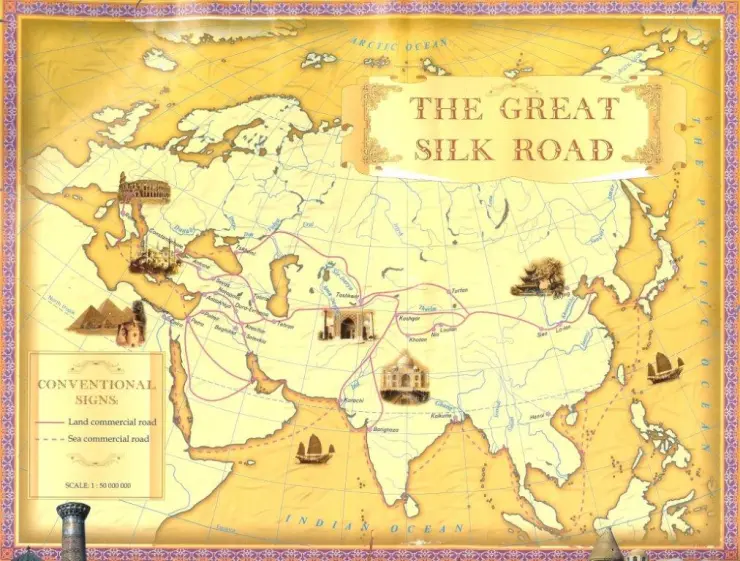
The Roman Silk Trade represents the first era of true globalism. While Rome and the Han Dynasty of China were separated by over 4,000 miles and never officially met, they were linked by a complex, multi-layered network of middlemen that spanned the steppes of Central Asia and the monsoon winds of the Indian Ocean.

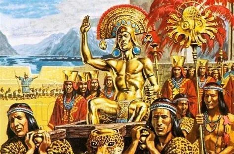
To the Romans, silk was more than a fabric; it was a controversial symbol of decadence, wealth, and the "moral decay" of the Republic.

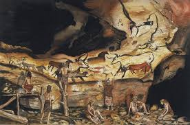
1. The Seres: The Mysterious "Silk People"

The Romans called the Chinese the Seres (derived from the Greek serikos, meaning "silken"). However, Roman knowledge of China was purely speculative.

  • The Tree Myth: For centuries, Romans believed that silk grew on trees. The naturalist Pliny the Elder described it as a fine down "combed from the leaves of trees" in the far eastern forests.

  • Lack of Direct Contact: While a few Roman merchants reached the fringes of the East, and a Chinese envoy named Gan Ying attempted to reach Rome in 97 CE (he was turned back by the Parthians), the two empires remained "ghosts" to one another.

2. The Two Paths: Land and Sea

The trade operated through two primary arteries, each fraught with distinct dangers and controlled by different powers.

  • The Overland Silk Road: Goods traveled from the Chinese capital of Chang'an through the Gansu Corridor to the oasis cities of the Tarim Basin. From there, they crossed the Pamir Mountains into the hands of the Parthians and later the Sasanian Persians, who acted as the ultimate "gatekeepers," often marking up prices by 100% or more.

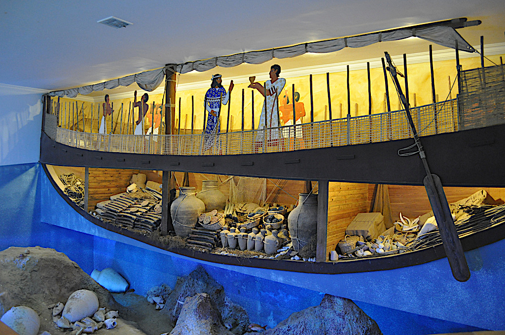
  • The Maritime Route: By the 1st century CE, Roman sailors mastered the monsoon winds. Ships would sail from Egypt across the Arabian Sea to the ports of southern India (like Muziris). There, they traded Mediterranean wine and gold for Chinese silk that had been brought south by Indian merchants.

3. The "Moral" Crisis: Silk and the Senate

When silk first arrived in Rome, it caused a sensation. Its weightless, translucent quality was unlike anything the Romans had ever seen.

  • The Scandal of Transparency: Moralists like Seneca the Younger complained that silk garments were so thin that they didn't actually hide a woman's body. He famously remarked that wearing silk was "hardly different from being naked."

  • Economic Hemorrhage: Rome was obsessed with silk but produced nothing the East wanted in return, except Gold and Silver. Pliny the Elder estimated that 100 million sesterces flowed out of the empire every year to pay for luxury goods from India and China—a massive trade deficit that contributed to Rome's long-term economic instability.

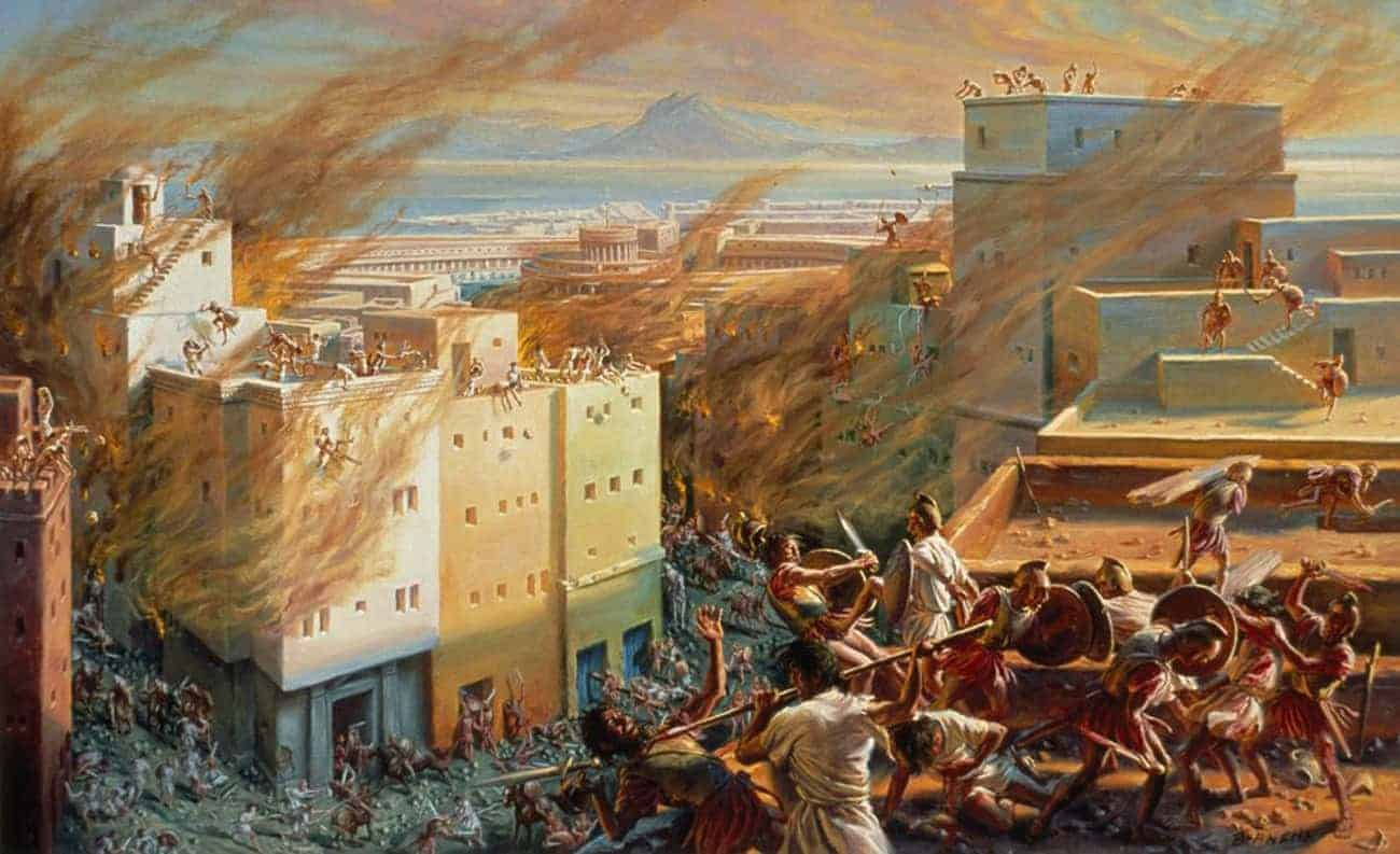
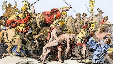
4. The "Silk War" with Persia

The Roman-Persian wars were often fueled by the silk trade. Because the Sasanians controlled the land routes, they could cut off Rome’s supply at will or tax it into oblivion.

  • The Byzantine Gambit: By the 6th century CE, the Eastern Roman (Byzantine) Emperor Justinian I grew tired of Persian monopolies. He attempted to bypass the Persians by making alliances with the Ethiopians to secure sea routes, but the Persians remained dominant.

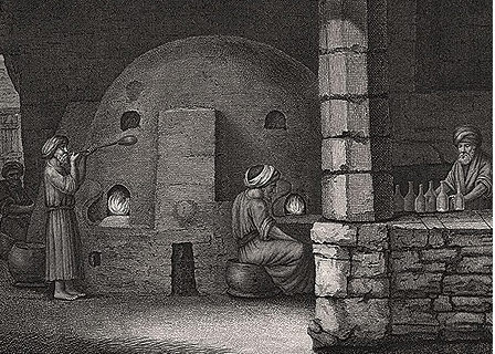
5. The Great Heist: How the Secret Broke

The most famous story in the history of the silk trade is the Smuggling of the Silkworms (c. 552 CE).

  • The Monk Spies: According to the historian Procopius, two Nestorian monks who had lived in the East traveled to Justinian's court. They revealed that silk came from caterpillars, not trees.

  • The Bamboo Cane: The monks were sent back and successfully smuggled silkworm eggs and mulberry seeds out of the East hidden inside hollowed-out bamboo walking sticks.

  • The Monopoly Ends: This heist allowed the Byzantines to start their own silk industry in Greece and Constantinople, finally breaking the 1,000-year-old Chinese monopoly and ending the era of the "Silk Road" as the West's only source.

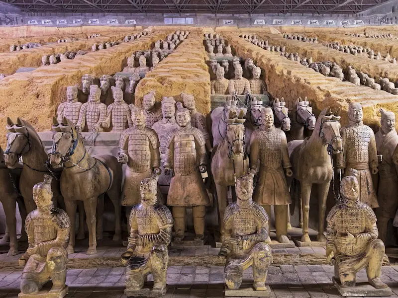
6. Archaeological Proof: Silk in the Graves

Archaeologists have found physical evidence of this trade at both ends of the world.

  • Palmyra: In the Syrian desert, tombs have revealed fragments of Chinese silk woven with local wool, showing how global materials were blended in the "middleman" cities.

  • Roman Glass in China: Conversely, high-quality Roman glassware has been found in Chinese tombs of the Han and Jin dynasties, proving that while Rome sent gold East, they also exported their own technical masterpieces.

The Roman silk trade proves that even in an age of horses and sailing ships, the demand for luxury was powerful enough to bridge continents.

Teotihuacan: Who Really Built the City of the Gods?

April 25, 2026

The mystery of Teotihuacan is one of the most significant "black holes" in Mesoamerican archaeology. Located just 30 miles northeast of modern-day Mexico City, it was once the largest city in the Americas, with a population reaching 125,000 to 200,000 at its peak (c. 1 CE – 550 CE).

Yet, when the Aztecs discovered the city centuries after it had been abandoned, it was already a ruin. They were so awestruck by its scale that they named it Teotihuacan—the "Place Where the Gods Were Created." To this day, we do not know the original name of the city, the language its citizens spoke, or the names of its rulers.

1. The Multi-Ethnic Melting Pot

Early theories suggested the city was built by the Toltecs, but we now know the Toltecs rose much later. Current archaeological evidence points to Teotihuacan being a multi-ethnic metropolis.

  • The Refugees: Evidence suggests the city’s rapid growth was spurred by volcanic eruptions (specifically Popocatépetl). Thousands of displaced people from across the Valley of Mexico likely migrated to the site, bringing diverse traditions that fused into a new "Teotihuacano" identity.

  • The Neighborhoods: Excavations of apartment compounds like Tlailotlacan have revealed distinct ethnic enclaves. Isotope analysis of bones proves that Zapotecs from Oaxaca and Maya from the lowlands lived in the city for generations, maintaining their own burial customs while participating in the city's economy.

2. The Master Plan: Sacred Geography

Whoever the architects were, they possessed an advanced understanding of geometry and astronomy. The city is laid out on a precise grid oriented 15.5 degrees east of true north.

  • The Avenue of the Dead: This 1.5-mile-long central axis connects the major monuments.

  • The Pyramid of the Sun: Built over a natural cave (which the inhabitants likely viewed as the "womb" of the earth), its alignment is synchronized with the setting sun on specific days of the solar calendar.

  • The Pyramid of the Moon: Situated at the north end of the Avenue, it mirrors the silhouette of Cerro Gordo, the sacred mountain behind it, creating a "built landscape" that harmonized with nature.

3. The Political Mystery: A Corporate State?

Unlike the Maya or the Aztecs, who obsessed over individual kings and their lineages in art and inscriptions, Teotihuacan is strangely silent about its leaders.

  • The "Corporate" Theory: Some archaeologists argue that Teotihuacan was not a monarchy but a collective or corporate state. Power may have been shared among several high-ranking lineages or councils.

  • Public over Private: The city’s art focuses on deities (like the Great Goddess or the Storm God) and generic figures in ritual processions rather than specific named rulers. The investment in high-quality apartment compounds for the middle class suggests a society that prioritized collective stability over the glorification of a single king.

4. The Feathered Serpent and the Tunnel

In 2003, a massive discovery was made beneath the Temple of the Feathered Serpent (Quetzalcoatl). A secret tunnel, sealed for 1,800 years, was found containing thousands of ritual objects.

  • The Underworld: The tunnel was filled with mercury, pyrite (fool's gold) to represent stars, and carvings of jaguars. It was a physical recreation of the underworld.

  • Mass Sacrifice: Around the temple, the remains of over 200 warriors were found, many with their hands tied behind their backs. They wore necklaces of human jawbones, suggesting that the city’s early foundation was tied to large-scale, state-sponsored military sacrifice.

5. The Violent Collapse

Teotihuacan did not fade away; it burned. Around 550 CE, the city’s monumental center was systematically torched and looted.

  • An Internal Revolt? Because the fire was focused on the elite palaces and temples along the Avenue of the Dead—rather than the residential neighborhoods—most archaeologists believe this was an internal uprising.

  • Resource Depletion: Overpopulation, deforestation (needed to create the lime plaster that covered the city), and a possible drought likely led to a collapse of the social contract, causing the lower classes to turn on the elite.

6. The Legacy: The Aztec Inheritance

The Aztecs viewed Teotihuacan as a sacred blueprint. They adopted the city’s gods (like Tlaloc and Quetzalcoatl) and attempted to mirror its architecture in their own capital, Tenochtitlan. For the Aztecs, Teotihuacan was the "First World"—a lost golden age of order and divinity.

Given that we have found DNA and artifacts from all over Mesoamerica within the city, do you think Teotihuacan’s lack of "king-centered" art means it was a rare ancient democracy, or was the state religion simply so powerful that it erased the identity of the individuals in charge?

The Discovery of King Richard III: Forensic Archaeology in a Parking Lot

April 25, 2026

The discovery of King Richard III in 2012 remains one of the most significant triumphs of modern forensic archaeology. For over 500 years, the location of the last English king to die in battle was a matter of urban legend, with some stories claiming his bones had been thrown into the River Soar.

The project, led by the University of Leicester in collaboration with the Richard III Society, combined historical detective work with cutting-edge science to locate a "needle in a haystack."

1. The Historical Compass: Finding Greyfriars

The search began not with shovels, but with maps. Historical records stated that Richard III was buried in the church of the Greyfriars, a Franciscan priory in Leicester.

  • The Parking Lot: After the Dissolution of the Monasteries in the 1530s, the priory was demolished and its location lost to time. By 2012, the site was covered by a social services parking lot.

  • The Trenching: Using Ground Penetrating Radar (GPR) and map regression, the team identified the most likely location of the church's choir—the traditional burial place for high-status individuals. Remarkably, the skeleton was found within the first few hours of excavation, directly beneath a parking space marked with a letter "R."

2. Osteology: The "Curse" of Scoliosis

Once the remains (designated Skeleton 1) were unearthed, osteological analysis provided immediate, striking physical evidence that matched historical descriptions of Richard.

  • Spinal Deformity: The skeleton exhibited severe idiopathic adolescent onset scoliosis. His spine had a pronounced "S" curve, which would have caused one shoulder to be higher than the other. This debunked the Tudor propaganda of a "hunchback" (kyphosis) but confirmed he had a noticeable physical impairment.

  • The Slender Frame: Despite his reputation as a warrior, the skeleton revealed a surprisingly gracile (slender) build, almost feminine in its bone structure, which matched contemporary accounts of his appearance.

3. Forensic Pathology: A Violent End

The bones told a grizzly story of Richard’s final moments at the Battle of Bosworth (1485). Forensic pathologists identified 11 distinct injuries, 9 of them to the skull.

  • Battlefield Execution: Two of the head wounds were fatal: one from a halberd (a poleaxe) that sliced off the back of the skull, and another from a sword that penetrated the brain.

  • "Humiliation Injuries": Several wounds, including a blade strike to the pelvis, were inflicted after death. These "post-mortem" injuries suggest that after Richard was stripped naked and thrown over a horse, the victors continued to mutilate his body as a final act of disrespect.

4. DNA: The Genetic Smoking Gun

The most definitive proof came from Mitochondrial DNA (mtDNA), which is passed down through the female line.

  • The Descendants: Researchers tracked down Michael Ibsen (a Canadian cabinet maker) and Wendy Duldig, both direct descendants of Richard's sister, Anne of York.

  • The Match: The DNA from the skeleton matched the modern descendants perfectly. The statistical probability that the skeleton was not Richard III was calculated at less than 1 in 6.7 million.

5. Diet and Environment: Isotope Analysis

By analyzing the chemical isotopes in Richard's teeth and bones, scientists reconstructed his life and habits.

  • The Royal Diet: Isotope levels showed a massive shift in his diet during the final years of his life. He began consuming huge amounts of expensive "prestige" foods, including freshwater fish and wildfowl (like swan and heron).

  • The Wine: The analysis also suggested he was drinking up to a bottle of wine every day toward the end of his reign—likely a reflection of the intense stress and lavish court life during the War of the Roses.

6. Reburial and Legacy

In 2015, Richard III was reinterred in Leicester Cathedral with full royal honors. The discovery transformed our understanding of the king, stripping away the Shakespearean villainy to reveal a man of his time—physically fragile, brutally killed, and buried in a grave that was too short for his body (forcing his head into a propped-up position).

Since we now have the physical proof of his scoliosis and the brutality of his death, do you think forensic archaeology has "redeemed" Richard III from his reputation as a villain, or does the science only tell us how he died, leaving the mystery of his character (and the Princes in the Tower) as unsolved as ever?

Ancient Soundscapes: The Acoustic Properties of Neolithic Stone Circles

April 25, 2026

The study of Archaeoacoustics has transformed how we view sites like Stonehenge and Avebury. For decades, archaeologists focused on the visual and astronomical alignments of these monuments, but recent research suggests that the sonic environment was just as critical to the Neolithic experience.

These stone circles weren't just celestial observatories; they were sophisticated acoustic chambers designed to manipulate sound in ways that would have felt supernatural to the ancient ear.

1. The "Acoustic Shadow" and Exclusion

One of the most striking properties of a complete stone circle, like Stonehenge, is its ability to act as a sound barrier.

  • Isolating the Ritual: Researchers using acoustic scale models have found that the massive sarsen stones acted as an acoustic "wall." Sound produced inside the circle was reflected inward, while sounds from the outside world were dampened.

  • The Threshold: This created a profound sense of "otherness." Moving from the outside into the center would have resulted in a sudden increase in sound clarity and volume, psychologically separating the participants from the surrounding landscape.

2. Echoes and Reverberation: The "Cave" Effect

Unlike an open field where sound dissipates quickly, the flat, hard surfaces of Neolithic stones created a high-reverberation environment.

  • Sustaining the Voice: In a finished stone circle, a single drumbeat or chant would linger far longer than natural. At Stonehenge, the reverberation time is estimated to have been roughly 0.8 seconds. This gave the space a "cavernous" quality, making a small group of people sound like a much larger, more powerful assembly.

  • The "Blurring" of Speech: This reverberation would make spoken words difficult to understand but would make rhythmic chanting or musical tones feel immersive and "all-encompassing."

3. Helmholtz Resonance and Altered States

Some researchers, such as those at the Pearce’s Farm or Wayland’s Smithy sites, have explored the frequency of the spaces themselves.

  • Infrasound: Some Neolithic chambers and stone arrangements resonate at frequencies between 95 Hz and 120 Hz. This specific range is significant because it is close to the human male baritone voice.

  • Brainwave Entrainment: Standing in a space where these frequencies are amplified can lead to a phenomenon where the brain begins to mirror the frequency. Studies have suggested that 110 Hz can shift brain activity toward the prefrontal cortex, potentially inducing meditative or trance-like states in ritual participants.

4. Standing Waves and "Dead Zones"

The circular arrangement of stones creates a complex pattern of standing waves.

  • Sonic Hotspots: As sound waves reflect off the curved perimeter, they interfere with one another. This creates "hotspots" where the sound is incredibly loud and "dead zones" where the sound almost entirely disappears just a few steps away.

  • Invisible Architecture: To a Neolithic person unaware of physics, this would have seemed like "invisible walls" of sound. Moving through the circle during a ceremony would have resulted in a disorienting, shifting landscape of audio intensity.

5. Lithophones: The Stones That Sing

In some cases, the stones themselves were chosen specifically for their musical properties.

  • The Preseli Bluestones: The smaller "bluestones" at Stonehenge were transported over 140 miles from Wales. Many of these stones are phonolitic, meaning they "ring" like a bell or a metal plate when struck.

  • Percussive Monuments: Thousands of "hammer marks" found on certain stones suggest they were used as lithophones (stone instruments). The monument wasn't just a place to hear music; the monument was the instrument.

6. Psychoacoustics: The Voice of the Ancestors

The most eerie property found in many megalithic sites is the human voice mimicry. In some passage graves and circles, certain noises can trigger an acoustic phenomenon that sounds like whispering or "mumbling" coming from the stones themselves. For a culture focused on ancestor worship, these "voices" in the stones likely provided the "proof" that the spirits were present and responding to the ritual.

The transition from a natural forest to a stone circle was a transition from a world of chaotic, dissipating noise to a world of controlled, amplified, and supernatural sound.

The Walls of Jericho: Exploring the Oldest Fortified City in the World

April 25, 2026

The site of Tell es-Sultan, better known as Jericho, is an archaeological marvel that challenges our understanding of human civilization. Located in the Jordan Valley, it is widely considered the oldest continuously inhabited city on earth. While its famous biblical walls capture the imagination, the archaeological reality reveals a story of Neolithic engineering that predates the invention of writing by thousands of years.

1. The Pre-Pottery Neolithic Fortifications (c. 8000 BCE)

Long before the Bronze Age, the inhabitants of Jericho constructed a fortification system that was unprecedented for its time.

  • The Wall: Archaeologists found a massive stone wall standing over 3.5 meters high and 1.8 meters thick at its base. It was constructed of undressed stones, yet it was sturdy enough to protect a community of approximately 2,000 people.

  • The Ditch: To further bolster their defenses, the builders hacked a ditch out of solid bedrock, measuring roughly 8.2 meters wide and 2.7 meters deep. This was accomplished using only stone and antler tools.

2. The Tower of Jericho: A Mystery in Stone

The most striking feature of the Neolithic site is the Tower of Jericho. Standing nearly 8.5 meters tall, this conical stone structure is one of the oldest man-made monuments in the world.

  • Internal Staircase: The tower contains a remarkably preserved internal staircase with 22 stone steps.

  • The Purpose: While once thought to be purely military, modern archaeologists suggest it may have served a dual purpose. Recent studies show that on the summer solstice, the shadow of nearby mountains falls directly onto the tower before engulfing the entire settlement, suggesting it was an astronomical marker or a symbol of community power and prestige.

3. The Bronze Age Walls and the Biblical Tradition

By the Middle Bronze Age (c. 1700–1550 BCE), Jericho had become a heavily fortified Canaanite city-state. This is the era most often associated with the biblical story of Joshua.

  • The Revetment Wall: The city was surrounded by a massive "glacis" (a steep, plastered slope) held up by a stone revetment wall nearly 5 meters high. On top of this sat a secondary wall made of mudbricks.

  • The Collapse: Excavations by Kathleen Kenyon in the 1950s revealed that these mudbrick walls had indeed collapsed outward, creating a "ramp" of debris that could allow an invader to climb into the city.

  • The Burn Layer: A thick layer of ash and charred grain was found across the site, indicating the city was destroyed by a massive fire. However, the dating of this destruction remains a point of intense scholarly debate, with most archaeologists placing it around 1550 BCE—significantly earlier than the traditional biblical timeline.

4. Why Build Walls? The Environmental Theory

While defense against invaders is the obvious answer, some archaeologists, including Kenyon, suggested a different motivation: The Nile of Palestine.

  • Flash Floods: Jericho is situated near the Ein es-Sultan spring. The "walls" might have originally functioned as flood barriers to protect the settlement from torrential mudflows coming off the Judean hills.

  • The Evolution of Defense: Over centuries, what began as a functional flood wall likely evolved into a defensive fortification as the city's wealth (driven by the spring's fertility) made it a target for nomadic tribes.

5. The Plastered Skulls: Ancestor Worship

Inside the city, archaeologists discovered a unique cultural practice: plastered human skulls. The inhabitants would remove the skulls of the deceased, fill them with clay, and model lifelike features—complete with shells for eyes—over the bone.

  • Social Memory: These skulls were kept inside homes, suggesting that the "walls" of the city didn't just protect the living, but also served to define a sacred space for the ancestors, rooting the community to that specific patch of desert for millennia.

The layers of Jericho act like a vertical timeline of human ingenuity, from the first stone-age masons to the fall of the Canaanite kings.

Aztec Human Sacrifice: Separating Propaganda from Archaeological Fact

April 25, 2026

The study of Aztec human sacrifice is a classic example of how archaeology can act as a corrective to historical bias. For centuries, our understanding was shaped almost entirely by Spanish Colonial accounts (like those of Bernal Díaz del Castillo or Hernán Cortés) and post-conquest codices. These sources often framed the Aztecs as bloodthirsty savages to justify the "civilizing" mission of the Spanish conquest.

Modern bioarchaeology and the ongoing excavations at the Templo Mayor in Mexico City are finally allowing us to separate the "Black Legend" propaganda from the ritual reality.

1. The Scale: Massive Slaughter or Ritual Precision?

  • The Propaganda: Spanish chroniclers claimed that during the rededication of the Templo Mayor in 1487, over 80,000 people were sacrificed in just four days.

  • The Fact: Logistically, this is impossible—it would require killing 14 people per minute, 24 hours a day. While archaeology confirms that sacrifice happened on a large scale, the numbers were likely in the low thousands per year. The discovery of the Huey Tzompantli (Great Skull Rack) in 2015 revealed roughly 650 skulls in one section; while significant, it suggests a more controlled, albeit constant, ritual cycle rather than a random massacre.

2. The Victims: Captives vs. Citizens

  • The Propaganda: Early accounts suggested the Aztecs sacrificed only their own people or innocent neighbors through "Flowery Wars" purely for the sake of blood.

  • The Fact: Isotopic analysis of the teeth found at the Templo Mayor shows that a vast majority of the victims were not local to the Valley of Mexico. They were often captured warriors or elite tributes from distant regions. Sacrifice was a sophisticated tool of psychological warfare used to intimidate subjugated provinces and demonstrate the absolute power of the Aztec state.

3. The Method: "Savage" Killing vs. Surgical Anatomy

  • The Propaganda: Many depictions show priests clumsily hacking at chests with dull stones.

  • The Fact: Analysis of the skeletal remains shows incredible anatomical knowledge.

    • The Cut: Marks on the sternum and vertebrae show that priests used razor-sharp obsidian blades.

    • Precision: The cuts were often made through the soft tissue below the ribcage or via a precise thoracotomy (cutting through the ribs) to allow for the rapid extraction of the heart. The "cleanliness" of the bone fractures suggests a practiced, surgical speed that would be impossible for an untrained person.

4. The "Why": Cruelty vs. Cosmological Debt

  • The Propaganda: Sacrifice was portrayed as a sign of a "devil-worshipping" culture that enjoyed death.

  • The Fact: To the Aztecs, sacrifice was a legal and religious obligation called nextlaualli (debt payment).

    • They believed the gods had sacrificed themselves to create the world and the sun.

    • Human blood was seen as the "sacred water" (chalchiuatl) required to repay that debt and keep the universe from collapsing. It was a terrifying but essential act of maintenance, not a display of cruelty.

5. The Templo Mayor: A Sacred Map

The architecture of the Templo Mayor itself proves that sacrifice was a reenactment of myth. The temple had two sides: one dedicated to Tlaloc (God of Rain) and one to Huitzilopochtli (God of War).

  • At the base of the Huitzilopochtli side, archaeologists found the massive Coyolxauhqui Stone.

  • Victims were sacrificed at the top and their bodies cast down the stairs, landing on this stone—ritually reenacting the myth where the sun god defeated his sister and cast her body down a mountain.

By comparing the physical evidence of the bones with the exaggerated claims of the Spanish, we see a culture that used ritual violence as a highly organized, state-sponsored tool for both cosmic and political stability.

The Bronze Age Sky Disc of Nebra: The Oldest Concrete Depiction of the Cosmos

April 25, 2026

The Nebra Sky Disc is one of the most significant archaeological discoveries of the 21st century. Found in 1999 near the town of Nebra in Germany, this bronze disc—roughly 30 centimeters in diameter and weighing 2 kilograms—dates to approximately 1600 BCE.

It represents the oldest known "concrete" depiction of cosmic phenomena, serving not just as a piece of art, but as a sophisticated astronomical tool used by the Unetice culture of the European Bronze Age.

1. The Celestial Map: Decoding the Symbols

The disc is made of bronze and features gold-leaf inlays that represent specific celestial bodies.

  • The Sun and Moon: A large gold circle is widely interpreted as the Sun (or potentially a full moon), while a gold crescent represents the Moon in its fifth day of visibility.

  • The Pleiades: A cluster of seven gold dots is almost certainly the Pleiades star cluster. In the ancient world, the Pleiades were a crucial "agricultural clock"—their appearance in the sky signaled the start of the harvest and their disappearance signaled the time for planting.

  • The Horizon Arcs: Two curved gold bands along the edges (one is missing) represent the solstices. The angle between the ends of these arcs (roughly 82.5°) perfectly matches the angle between the sunset points of the summer and winter solstices at the specific latitude where the disc was found.

2. The Function: A Portable Calendar

Archaeologists and astronomers believe the disc was an intercalary tool.

Because a lunar year is about 11 days shorter than a solar year, ancient societies struggled to keep their calendars aligned with the seasons. The Nebra Sky Disc provided a visual rule:

  • The Rule: If the crescent moon appeared next to the Pleiades when the moon was exactly in its third or fifth day of the month, a leap month (intercalary month) had to be added to the year to sync the calendar back with the sun.

  • This allowed Bronze Age farmers to predict the correct times for sowing and harvesting with scientific precision.

3. Global Trade in the Bronze Age

The disc is a testament to the vast trade networks of the 2nd millennium BCE. Through chemical analysis of the metals, researchers have traced the "DNA" of the disc:

  • Copper: Originated from the Mitterberg region in Austria.

  • Gold and Tin: Both were traced to Cornwall, England.

  • Craftsmanship: The disc was found in Germany.

This proves that even 3,600 years ago, Europe was connected by high-speed trade routes where raw materials and complex astronomical knowledge traveled thousands of miles.

4. The Final Phase: The Solar Boat

Later in its life, a final gold inlay was added: a curved arc at the bottom with small "oar" markings. This is interpreted as a Solar Boat.

This reflects a shift in religious thought. The boat represents the myth that the sun travels across the sky by day and is carried through the underworld by a boat at night. This same motif is found in Ancient Egyptian and Nordic mythologies, showing a shared European-Mediterranean religious consciousness.

5. The Archaeological Cold Case

The disc was originally found by illegal treasure hunters with a metal detector. Because it wasn't excavated by professional archaeologists in its original "context," many scholars initially thought it was a forgery. It was only after a high-stakes sting operation by the Swiss police and subsequent laboratory testing of the soil and metal patina that its authenticity was confirmed.

Ancient Metallurgy: The Gold-Working Techniques of the Varna Culture

April 25, 2026

The Varna Necropolis (c. 4600–4200 BCE) in modern-day Bulgaria represents a pivotal moment in human history. It is the site of the world's oldest processed gold, proving that a sophisticated "Golden Civilization" existed in Europe long before the first dynasties of Egypt or Mesopotamia.

The artisans of the Varna culture weren't just lucky foragers; they were master metallurgists who understood the chemical and physical properties of precious metals.

1. The Source: Native Gold and Purity

The Varna people primarily worked with native gold—gold found in its metallic state in nature, often in riverbeds.

  • Purity Levels: Chemical analysis of the artifacts shows a purity level of about 23 to 23.5 karats. This suggests they were highly selective with their raw materials, choosing high-quality nuggets that were soft enough to be worked without extensive smelting.

  • Trace Elements: Small amounts of silver and copper are present in the artifacts, which acted as natural alloys, slightly increasing the durability of the finished pieces.

2. Cold-Hammering and Annealing

The most common technique used by Varna goldsmiths was cold-hammering. However, hammering gold repeatedly makes it brittle and prone to cracking—a process called "work hardening."

  • The Annealing Process: To overcome this, the Varna smiths used annealing. They would heat the gold to a specific temperature (below its melting point) to "relax" the crystalline structure of the metal, making it malleable again.

  • Thin-Film Mastery: This cycle of hammering and annealing allowed them to create incredibly thin gold foils, which were then wrapped around wood, bone, or stone cores to create the illusion of solid gold objects, such as scepters.

3. Lost-Wax Casting (Early Evidence)

While much of the Varna gold was hammered, there is evidence that they were experimenting with casting.

  • Smelting: To cast gold, the smiths had to reach temperatures of 1064°C. They achieved this using charcoal fires and blowpipes (tuyères) to increase oxygen flow.

  • The Technique: They likely used simple open molds or two-part molds made of stone or clay. This allowed for the creation of heavy, solid objects like the massive bracelets and "elbow" rings found in high-status graves.

4. The "Golden" Social Hierarchy: Grave 43

The most famous discovery at Varna is Grave 43, belonging to a high-status male (likely a king or priest). This single grave contained more gold than has been found in the rest of the entire world from that same period.

  • Insignia of Power: The artifacts included a gold-covered scepter, solid gold bracelets weighing hundreds of grams, and even a gold phallus sheath.

  • Standardization: The presence of nearly identical gold beads and appliques suggests that the Varna culture had "mass production" workshops where artisans followed specific templates to produce jewelry for the elite.

5. Decorative Finishing: Polishing and Perforation

The Varna smiths had an eye for aesthetics that rivaled modern jewelers.

  • Polishing: They used fine abrasives—likely silt or very fine sand—to give their gold a mirror-like luster that has survived for over 6,000 years.

  • Precision Drilling: Many gold appliques feature tiny, uniform holes. These were likely drilled using flint or bone points, allowing the gold to be sewn directly onto garments, shimmering as the wearer moved.

The technical sophistication of the Varna culture suggests that metallurgy was not a hobby but a highly specialized profession, likely guarded by a secretive class of smiths.

Masada: The Archaeology of Heroism and Tragedy in the Judean Desert

April 23, 2026

Masada: The Archaeology of Heroism and Tragedy in the Judean Desert

Rising dramatically above the desert floor, Masada is one of the most powerful archaeological sites in the world. Located near the Dead Sea in Israel, Masada tells a story of resistance, survival, and a tragic end during the final phase of the First Jewish–Roman War.

Blending history, archaeology, and legend, Masada remains a symbol of courage and sacrifice.

1. The Fortress of King Herod

Masada’s story begins long before the famous siege.

  • Built by: Herod the Great in the 1st century BCE

  • Purpose: A royal refuge and military stronghold

  • Features:

    • Massive defensive walls and towers

    • Palaces with terraces overlooking the desert

    • Storerooms filled with food, weapons, and supplies

    • Advanced water system using cisterns

Herod designed Masada to withstand long sieges, making it nearly impossible to conquer.

2. The Jewish Revolt and Occupation

During the revolt against Rome, Masada became a refuge.

  • Occupants: Jewish rebels known as the Sicarii

  • Leader: Eleazar ben Ya'ir

  • Strategic Advantage: High elevation and strong defenses

  • Isolation: Provided safety but limited outside support

Masada became one of the last strongholds resisting Roman control.

3. The Roman Siege

The Roman army eventually surrounded Masada.

  • Commander: Lucius Flavius Silva

  • Roman Legion: Likely the Legio X Fretensis

  • Siege Strategy:

    • Built a wall around the mountain to prevent escape

    • Constructed camps still visible today

    • Created a massive siege ramp to reach the fortress

The Roman ramp remains one of the most impressive ancient military engineering feats.

4. The Final Tragedy

According to the historian Flavius Josephus, the siege ended in tragedy.

  • Mass Suicide Narrative: Rather than surrender, the defenders chose death

  • Estimated Deaths: Around 960 people

  • Last Stand: Only a few survivors reportedly remained

This story has become central to Masada’s legacy—but it is also debated.

5. Archaeological Evidence

Excavations have revealed both confirmation and questions.

  • Burned Structures: Suggest destruction at the end

  • Roman Camps: Clearly visible around the site

  • Siege Ramp: Still intact and accessible

  • Ostraca (Pottery Shards): Possibly used for casting lots

  • Limited Human Remains: Fewer bodies than expected

While archaeology supports a siege, it does not fully confirm every detail of Josephus’ account.

6. Myth vs. Reality

Masada exists between history and national symbolism.

  • Heroism: Seen as a story of bravery and resistance

  • Debate: Some historians question the scale of the mass suicide

  • Source Bias: Josephus wrote under Roman influence

  • Archaeological Gaps: Not all details match the written story

This makes Masada both a historical site and a powerful cultural narrative.

7. Modern Significance

Masada holds deep meaning today.

  • National Symbol: Represents resistance and identity in Israel

  • Tourism Site: Thousands visit each year

  • UNESCO Recognition: Protected as a World Heritage Site

  • Military Ceremonies: Once used for oath-taking

The phrase “Masada shall not fall again” reflects its lasting impact.

Conclusion

Masada is more than a fortress—it is a story shaped by both evidence and memory. Archaeology reveals a dramatic siege, while history and tradition add layers of meaning about courage, sacrifice, and identity.

It reminds us that the past is not always clear-cut. Sometimes, the line between fact and legend is as steep and complex as the cliffs of Masada itself.

The Hopewell Culture: Ancient North American Geometric Earthworks

April 23, 2026

The Hopewell Culture: Ancient North American Geometric Earthworks

The Hopewell Culture is one of the most fascinating ancient societies in North America. Flourishing between 100 BCE and 500 CE, this culture is best known for its massive and precisely designed earthworks—geometric shapes built using soil, often on a monumental scale. These structures, found mainly in the Ohio River Valley, reveal advanced planning, social organization, and deep spiritual meaning.

1. Who Were the Hopewell People?

The Hopewell Culture was not a single tribe, but a network of communities.

  • Region: Centered in Ohio and surrounding areas.

  • Time Period: Around 100 BCE to 500 CE.

  • Shared Traditions: Connected by similar burial practices and artifacts.

  • Trade Network: Extended across much of North America.

Rather than a centralized empire, they were a cultural interaction sphere linking many groups.

2. The Geometric Earthworks

The most striking feature of Hopewell culture is their large earthworks.

  • Shapes: Circles, squares, octagons, and complex combinations.

  • Scale: Some cover hundreds of acres.

  • Precision: Alignments are remarkably accurate.

  • Famous Sites: The Newark Earthworks and Hopewell Culture National Historical Park.

These were built by moving tons of earth using simple tools—showing strong coordination and labor organization.

3. Purpose of the Earthworks

The exact purpose remains debated, but several theories exist.

  • Ceremonial Centers: Used for rituals and gatherings.

  • Astronomical Alignments: Some structures align with lunar and solar events.

  • Burial Sites: Certain mounds contain elaborate graves.

  • Social Spaces: Places for community interaction and trade.

Their design suggests both practical and symbolic functions.

4. Astronomical Knowledge

Some Hopewell earthworks show advanced understanding of the sky.

The octagon and circle at Newark are believed to align with the moon’s cycles:

Tlunar≈18.6 yearsT_{lunar} \approx 18.6 \text{ years}Tlunar​≈18.6 years

  • This refers to the lunar standstill cycle.

  • Certain alignments match the moon’s extreme rising and setting points.

  • Suggests long-term observation and record-keeping.

This level of precision is comparable to other ancient astronomical sites worldwide.

5. Trade and Cultural Exchange

The Hopewell people were part of a vast trade network.

  • Obsidian: From the Rocky Mountains.

  • Copper: From the Great Lakes.

  • Shells: From the Gulf Coast.

  • Mica: From the Appalachian region.

These materials were used to create art, tools, and ceremonial objects, showing long-distance connections.

6. Art and Craftsmanship

Hopewell artisans created detailed and symbolic objects.

  • Intricate Carvings: Often depicting animals and human figures.

  • Ceremonial Items: Pipes, ornaments, and burial goods.

  • Symbolism: Reflects spiritual beliefs and social status.

Their craftsmanship highlights both artistic skill and cultural depth.

7. Decline of the Hopewell Culture

Around 500 CE, the Hopewell interaction network declined.

  • Possible Causes:

    • Environmental changes

    • Shifts in trade routes

    • Social transformation

  • No Clear Evidence of Conflict

  • Transition: Later cultures developed in the region

The reasons remain uncertain, adding to the mystery.

8. Historical Significance

The Hopewell Culture reshapes our understanding of ancient North America.

  • Complex Society: Demonstrates advanced planning and cooperation.

  • Scientific Knowledge: Evidence of astronomical observation.

  • Cultural Connectivity: Wide-reaching trade networks.

  • Indigenous Achievement: Built without modern technology.

Conclusion

The geometric earthworks of the Hopewell Culture are more than just mounds of earth—they are expressions of knowledge, belief, and community. They show that ancient North American societies were highly organized and intellectually sophisticated.

Carthage Must Be Destroyed: New Excavations in the Punic Neighborhoods

April 23, 2026

“Carthage Must Be Destroyed”: New Excavations in the Punic Neighborhoods

The phrase “Carthage must be destroyed”—repeated by the Roman statesman Cato the Elder—became a symbol of Rome’s determination to eliminate its greatest rival. Today, modern archaeology is uncovering what that lost world actually looked like. New excavations in the Punic neighborhoods of Carthage are revealing a thriving, sophisticated city that existed before its destruction in 146 BCE.

1. Historical Background: Rome vs. Carthage

Carthage was a powerful maritime empire in the western Mediterranean.

  • Founded by Phoenicians: Around the 9th century BCE.

  • Rivalry with Rome: Led to the three Punic Wars.

  • Final Destruction (146 BCE): Roman forces destroyed the city during the Third Punic War.

  • Aftermath: The site was later rebuilt as a Roman colony.

For centuries, much of Punic Carthage remained buried beneath later Roman layers.

2. What Are the Punic Neighborhoods?

Recent excavations focus on residential areas from before Roman conquest.

  • Urban Districts: Organized streets and housing blocks.

  • Dense Population: Evidence of tightly packed homes.

  • Mixed Use: Living spaces combined with workshops and storage areas.

  • Pre-Roman Layers: Offer a direct look at Punic life.

These areas help archaeologists move beyond war narratives to everyday life.

3. New Discoveries from Excavations

Modern digs are revealing surprising details.

  • Multi-Story Houses: Indicate advanced urban planning.

  • Courtyards and Drainage: Suggest attention to hygiene and design.

  • Craft Workshops: Evidence of metalworking, pottery, and dye production.

  • Imported Goods: Show active trade across the Mediterranean.

These findings challenge the idea that Carthage was only a military or التجاري power—it was also a complex urban society.

4. Daily Life in Punic Carthage

Excavations bring ordinary people into focus.

  • Diet: Remains of grains, fish, and olives.

  • Religion: Household shrines and ritual objects.

  • Family Life: Artifacts suggest strong domestic structures.

  • Economy: Small-scale industries within neighborhoods.

This paints a picture of a vibrant and organized community.

5. Evidence of Destruction

Archaeology also confirms the dramatic end of Punic Carthage.

  • Burn Layers: Thick ash deposits across neighborhoods.

  • Collapsed Structures: Signs of violent destruction.

  • Abandoned Items: Objects left behind during sudden evacuation.

  • Roman Overbuilding: Later construction covered earlier remains.

These layers directly connect to the events described in Roman historical accounts.

6. Rethinking Carthage

For a long time, history was told mainly from the Roman perspective.

  • Roman Bias: Ancient writers portrayed Carthage as an enemy to justify war.

  • Modern Archaeology: Provides a more balanced view.

  • Cultural Sophistication: Evidence of advanced society and innovation.

  • Human Perspective: Focus shifts from war to everyday life.

Carthage is no longer just a defeated enemy—it is recognized as a major civilization.

7. Historical Significance

The excavation of Punic neighborhoods changes how we understand ancient history.

  • Urban Development: Shows early complex city planning.

  • Mediterranean Trade: Confirms Carthage’s role as a trade hub.

  • Cultural Exchange: Blending of Phoenician, African, and Mediterranean influences.

  • Historical Correction: Helps counter centuries of one-sided narratives.

Conclusion

The story of Carthage is no longer just about its destruction—it is about its people, culture, and achievements. New excavations reveal a thriving city that was far more than Rome’s enemy.

The phrase “Carthage must be destroyed” may have ended a civilization, but archaeology is bringing it back to life.

The Uluburun Shipwreck: A Time Capsule of Late Bronze Age Trade

April 23, 2026

The Uluburun Shipwreck: A Time Capsule of Late Bronze Age Trade

The discovery of the Uluburun Shipwreck is one of the most important finds in underwater archaeology. Dating to the late 14th century BCE, this shipwreck offers a rare and detailed glimpse into the complex trade networks of the Late Bronze Age. Found off the coast of Turkey, it carried a rich cargo that reveals how interconnected ancient civilizations truly were.

1. Discovery of the Shipwreck

The shipwreck was discovered by chance but quickly became a major archaeological project.

  • 1982 Discovery: Found by a sponge diver near Uluburun.

  • Excavation: Led by the Institute of Nautical Archaeology.

  • Depth: Located about 50 meters underwater.

  • Excavation Period: Took over a decade to fully recover artifacts.

The careful excavation preserved thousands of items, making it one of the most studied shipwrecks in history.

2. The Ship and Its Journey

Although the ship itself was mostly destroyed, researchers reconstructed key details.

  • Wooden Vessel: Likely built using ancient shipbuilding techniques.

  • Trade Route: Possibly traveled between the eastern Mediterranean and Aegean regions.

  • Multicultural Crew: May have included sailors from different regions.

  • Destination Unknown: The exact route and final destination remain a mystery.

The ship represents a moving link between ancient civilizations.

3. Cargo: A Floating Marketplace

The Uluburun ship carried a wide variety of goods, showing extensive trade connections.

  • Copper Ingots: About 10 tons, likely from Cyprus.

  • Tin Ingots: Essential for making bronze.

  • Glass Ingots: Some of the earliest known examples.

  • Ivory and Ebony: Luxury goods from Africa.

  • Jewelry and Gold: High-value items, including a gold scarab linked to Nefertiti.

  • Spices and Resins: Possibly used for perfume or rituals.

  • Pottery: From different regions, showing cultural exchange.

This cargo reflects trade between Egypt, the Levant, Mesopotamia, and the Aegean.

4. Evidence of a Globalized Ancient World

The shipwreck proves that long-distance trade was highly developed.

  • International Trade: Goods from at least seven different cultures.

  • Economic Complexity: Organized systems for production and exchange.

  • Diplomatic Gifts: Some items may have been royal exchanges.

  • Standardized Materials: Ingots shaped for easy transport and trade.

This challenges the idea that globalization is only a modern concept.

5. Daily Life on Board

Artifacts also reveal insights into life aboard the ship.

  • Tools and Weapons: Used for maintenance and defense.

  • Personal Items: Jewelry, weights, and everyday objects.

  • Food Remains: Evidence of diet during the voyage.

  • Balance Weights: Suggest trade transactions happened onboard.

These findings humanize the sailors and traders behind the cargo.

6. The Shipwreck’s Significance

The Uluburun shipwreck is often described as a “time capsule.”

  • Preserved Moment: Captures a single journey frozen in time.

  • Trade Network Map: Shows connections across continents.

  • Cultural Exchange: Evidence of interaction between distant societies.

  • Historical Insight: Helps scholars understand the Late Bronze Age economy.

It is one of the richest sources of information about ancient maritime trade.

7. What Caused the Shipwreck?

The exact reason for the sinking is unknown.

  • Storms: Rough seas may have caused the ship to sink.

  • Overloaded Cargo: Heavy goods could have destabilized the vessel.

  • Navigation Errors: Possible misjudgment near rocky coastlines.

Regardless of the cause, the sinking preserved a unique historical record.

Conclusion

The Uluburun Shipwreck reveals a world that was far more connected than we might expect for such an early period. Through its cargo, we see evidence of trade, diplomacy, and cultural exchange spanning thousands of kilometers.

It reminds us that even in ancient times, civilizations were not isolated—they were part of a dynamic and interconnected global system.

Ancient Navigation: Did the Egyptians Reach Australia?

April 23, 2026

Ancient Navigation: Did the Egyptians Reach Australia?

The idea that ancient Egyptians may have reached Australia long before European explorers is a fascinating but highly debated claim. While it captures the imagination, most historians and archaeologists remain skeptical due to a lack of strong evidence. Still, exploring the theory helps us understand both ancient navigation and how historical myths develop.

1. Egyptian Seafaring Abilities

Ancient Egyptians were skilled travelers, but mainly within certain limits.

  • River Navigation: The Nile River was their primary route.

  • Sea Voyages: They traveled along the Red Sea for trade.

  • Trade Expeditions: Known journeys to the Land of Punt (possibly East Africa).

  • Shipbuilding: They built sturdy wooden boats capable of long journeys.

However, there is no confirmed record of Egyptians crossing vast oceans like the Indian Ocean to reach Australia.

2. The Claims and Theories

Several ideas are often cited to support the theory.

  • Rock Carvings in Australia: Some claim Egyptian-style hieroglyphs were found in New South Wales.

  • Cultural Similarities: Alleged parallels in symbols or burial practices.

  • Ancient Maps: Claims that Egyptians had advanced geographic knowledge.

These claims are often circulated online but are widely disputed.

3. The “Egyptian Hieroglyphs” in Australia

One of the most famous pieces of “evidence” is a set of carvings.

  • Location: Near Kariong, New South Wales.

  • Appearance: Resemble Egyptian hieroglyphs.

  • Problems:

    • Mixed symbols from different time periods

    • Incorrect grammar and structure

    • No archaeological context

Experts consider these carvings to be modern hoaxes rather than ancient artifacts.

4. Archaeological and Scientific Evidence

There is no solid proof supporting Egyptian contact with Australia.

  • No Artifacts: No Egyptian tools, pottery, or remains found in Australia.

  • No Genetic Evidence: No trace of Egyptian ancestry in ancient Australian populations.

  • No Historical Records: Egyptian texts do not mention such long-distance voyages.

  • Isolation Evidence: Indigenous Australian cultures developed independently.

In archaeology, strong conclusions require consistent and multiple lines of evidence—which are missing here.

5. Could It Have Been Possible?

While unlikely, the idea is sometimes explored hypothetically.

  • Ocean Currents: Could carry ships long distances.

  • Navigation Limits: Egyptians lacked tools for open-ocean navigation.

  • Distance: Egypt to Australia is extremely far and complex to reach.

Even if accidental drift were possible, there is no evidence it actually happened.

6. Why Do These Theories Exist?

Such theories often emerge from curiosity and misunderstanding.

  • Mystery Appeal: People are drawn to unexplained connections.

  • Misinterpretation: Natural formations or modern carvings seen as ancient.

  • Desire for Connection: Linking distant cultures creates compelling stories.

  • Pseudoscience: Some claims ignore scientific standards.

It’s important to question evidence and rely on credible research.

7. What We Know for Sure

  • Ancient Egyptians were advanced—but regionally focused explorers.

  • Indigenous Australians have one of the oldest continuous cultures in the world.

  • There is no credible evidence of contact between the two civilizations.

Conclusion

The idea that Egyptians reached Australia is an intriguing theory, but it remains unsupported by credible evidence. It serves as a reminder of how easily myths can spread when they are exciting—even if they are not true.

At the same time, it highlights something equally important: ancient civilizations were remarkable in their own right, without needing to be connected in ways that didn’t actually happen.

The Great Zimbabwe: The Sophisticated Stone City of Southern Africa

April 23, 2026

Viking Sunstones: How Ancient Mariners Navigated Without a Compass

The idea of Viking sailors crossing vast and often foggy seas without a magnetic compass may seem impossible. Yet historical accounts and scientific studies suggest they may have used special crystals known as sunstones to locate the sun—even when it was hidden. These tools may have played a role in the remarkable voyages of Norse explorers such as Leif Erikson, who reached North America centuries before Columbus.

The concept of the Viking sunstone blends history, legend, and science, offering insight into how ancient mariners navigated the open ocean with limited technology.

1. The Challenge: Navigating the Open Sea

Viking sailors traveled across the North Atlantic, a region known for harsh weather and unpredictable conditions.

  • Cloudy Skies: The sun was often hidden by fog, snow, or heavy clouds.

  • No Compass: The magnetic compass was not yet widely used in Europe.

  • Long Voyages: Journeys between Norway, Iceland, and Greenland required accurate direction.

  • Open Ocean: With no landmarks, navigation relied on natural cues.

Despite these challenges, Vikings successfully explored and settled distant lands.

2. What Is a Sunstone?

A sunstone is believed to be a type of crystal that can detect the position of the sun.

  • Possible Materials: Calcite (Iceland spar), cordierite, or tourmaline.

  • Light Polarization: These crystals can filter polarized light in the sky.

  • Hidden Sun Detection: Even when the sun is not visible, the sky’s light pattern reveals its position.

  • Simple Tool: The crystal could be rotated until light intensity changes, indicating direction.

This method would allow sailors to determine where the sun was, even in poor visibility.

3. Historical Evidence

Evidence for sunstones comes from both texts and archaeology.

  • Sagas: Norse texts mention a “sunstone” used to find the sun in cloudy weather.

  • Rauðúlfs þáttr: Describes a king using a stone to locate the sun’s position.

  • Shipwreck Discovery: A crystal found on a 16th-century ship suggests continued use even after the compass was known.

  • Indirect Proof: While no Viking sunstone has been definitively confirmed, evidence supports the possibility.

These sources suggest that sunstones were more than just legend.

4. How It Worked

The science behind sunstones is based on polarized light.

  • Sky Polarization: Sunlight scatters in the atmosphere, creating patterns invisible to the naked eye.

  • Crystal Alignment: By rotating the crystal, sailors could detect changes in brightness.

  • Direction Finding: The brightest or darkest point indicated the sun’s hidden position.

  • Navigation Aid: Combined with knowledge of time and direction, this helped maintain course.

Modern experiments have shown that this method can be surprisingly accurate.

5. Viking Navigation Techniques

Sunstones were likely part of a broader navigation system.

  • Sun Position: Used during clear weather.

  • Stars: Guided night travel.

  • Landmarks: Coastal navigation when near land.

  • Birds and Waves: Observed natural patterns to detect nearby land.

  • Experience: Skilled sailors relied heavily on memory and observation.

This combination made Viking navigation highly effective.

6. Historical Significance

The use of sunstones highlights the ingenuity of Viking sailors. Without advanced instruments, they used natural phenomena and simple tools to achieve long-distance exploration.

Their ability to navigate across open oceans contributed to the expansion of Norse culture and trade, reaching as far as North America.

It also shows how science can explain ancient techniques once thought to be mythical.

7. Myth or Reality?

The existence of Viking sunstones remains debated.

  • Supporters: Point to scientific experiments and saga descriptions.

  • Skeptics: Note the lack of direct archaeological evidence from Viking sites.

  • Modern Testing: Confirms that such crystals could work effectively.

Whether fully proven or not, the sunstone represents a fascinating blend of myth and science.

Do you think ancient technologies like the sunstone were more advanced than we give them credit for, or are they partly shaped by legend?

The Great Zimbabwe: The Sophisticated Stone City of Southern Africa

Great Zimbabwe: The Sophisticated Stone City of Southern Africa

The ancient city of Great Zimbabwe stands as one of the most impressive achievements in African history. Built between the 11th and 15th centuries, it was the center of a powerful kingdom and a symbol of advanced architecture, trade, and political organization in southern Africa. Today, it challenges outdated ideas that complex civilizations only developed outside the continent.

1. Location and Discovery

Great Zimbabwe is located in southeastern Zimbabwe, near the modern town of Masvingo.

  • Meaning of the Name: “Zimbabwe” comes from the Shona phrase meaning “houses of stone.”

  • European Encounter: First documented by European explorers in the 16th century.

  • Archaeological Work: Systematic excavations began in the late 19th century.

  • Cultural Ownership: Now recognized as the work of the ancestors of the Shona people.

For many years, outsiders refused to believe Africans built it, wrongly attributing it to foreign civilizations—an idea now fully disproven.

2. Architectural Mastery

The city is famous for its massive stone structures built without mortar.

  • Dry-Stone Construction: Stones were carefully cut and stacked.

  • Great Enclosure: One of the largest ancient structures in Africa.

  • Conical Tower: A mysterious, symbolic structure within the enclosure.

  • Hill Complex: Possibly a royal or religious center.

  • Durability: Many walls still stand today, over 10 meters high.

This level of engineering shows advanced planning, labor organization, and craftsmanship.

3. Urban Life and Society

Great Zimbabwe was more than just a stone complex—it was a thriving city.

  • Population: Estimated 10,000–20,000 people at its peak.

  • Social Structure: Likely ruled by a powerful king or elite class.

  • Housing: Most people lived in surrounding mud-and-thatch homes.

  • Cultural Practices: Evidence of rituals and symbolic structures.

  • Craft Production: Pottery, iron tools, and ornaments were produced.

The city functioned as a political, economic, and cultural center.

4. Trade and Economy

Great Zimbabwe was part of a vast trade network.

  • Exports: Gold, ivory, and animal products.

  • Imports: Glass beads, ceramics, and textiles from distant regions.

  • Trade Routes: Connected inland Africa to coastal ports.

  • Indian Ocean Trade: Linked to merchants from Arabia, India, and beyond.

  • Wealth Indicator: Imported goods show high economic status.

Its location allowed it to control and benefit from regional trade.

5. Decline of the City

By the 15th century, Great Zimbabwe was largely abandoned.

  • Resource Depletion: Overuse of land and grazing areas.

  • Environmental Changes: Possible drought or soil exhaustion.

  • Shift in Trade Routes: Trade centers moved elsewhere.

  • Political Changes: Power may have shifted to other kingdoms.

The exact cause remains uncertain, but it was likely a combination of factors.

6. Historical Significance

Great Zimbabwe is a powerful symbol of African achievement.

  • Cultural Identity: It gave its name to the modern nation of Zimbabwe.

  • Architectural Legacy: One of the largest pre-colonial stone structures in Africa.

  • Historical Correction: Disproves earlier colonial myths denying African innovation.

  • UNESCO Site: Recognized globally for its cultural importance.

It reminds us that advanced civilizations developed independently across the world.

7. Myth vs Reality

For a long time, myths overshadowed the truth.

  • Old Myths: Claimed it was built by foreigners like Phoenicians or Arabs.

  • Modern Evidence: Confirms it was built by local African societies.

  • Archaeology: Artifacts and building styles match regional traditions.

Today, Great Zimbabwe stands as clear evidence of indigenous African ingenuity.

Conclusion

Great Zimbabwe is more than ruins—it is proof of a sophisticated and organized society that thrived centuries ago. Its architecture, trade networks, and cultural importance place it among the great civilizations of the ancient world.

It also serves as a reminder: history is often shaped by perspective, and archaeology helps restore the truth.

Viking Sunstones: How Ancient Mariners Navigated Without a Compass

April 23, 2026

Viking Sunstones: How Ancient Mariners Navigated Without a Compass

The idea of Viking sailors crossing vast and often foggy seas without a magnetic compass may seem impossible. Yet historical accounts and scientific studies suggest they may have used special crystals known as sunstones to locate the sun—even when it was hidden. These tools may have played a role in the remarkable voyages of Norse explorers such as Leif Erikson, who reached North America centuries before Columbus.

The concept of the Viking sunstone blends history, legend, and science, offering insight into how ancient mariners navigated the open ocean with limited technology.

1. The Challenge: Navigating the Open Sea

Viking sailors traveled across the North Atlantic, a region known for harsh weather and unpredictable conditions.

  • Cloudy Skies: The sun was often hidden by fog, snow, or heavy clouds.

  • No Compass: The magnetic compass was not yet widely used in Europe.

  • Long Voyages: Journeys between Norway, Iceland, and Greenland required accurate direction.

  • Open Ocean: With no landmarks, navigation relied on natural cues.

Despite these challenges, Vikings successfully explored and settled distant lands.

2. What Is a Sunstone?

A sunstone is believed to be a type of crystal that can detect the position of the sun.

  • Possible Materials: Calcite (Iceland spar), cordierite, or tourmaline.

  • Light Polarization: These crystals can filter polarized light in the sky.

  • Hidden Sun Detection: Even when the sun is not visible, the sky’s light pattern reveals its position.

  • Simple Tool: The crystal could be rotated until light intensity changes, indicating direction.

This method would allow sailors to determine where the sun was, even in poor visibility.

3. Historical Evidence

Evidence for sunstones comes from both texts and archaeology.

  • Sagas: Norse texts mention a “sunstone” used to find the sun in cloudy weather.

  • Rauðúlfs þáttr: Describes a king using a stone to locate the sun’s position.

  • Shipwreck Discovery: A crystal found on a 16th-century ship suggests continued use even after the compass was known.

  • Indirect Proof: While no Viking sunstone has been definitively confirmed, evidence supports the possibility.

These sources suggest that sunstones were more than just legend.

4. How It Worked

The science behind sunstones is based on polarized light.

  • Sky Polarization: Sunlight scatters in the atmosphere, creating patterns invisible to the naked eye.

  • Crystal Alignment: By rotating the crystal, sailors could detect changes in brightness.

  • Direction Finding: The brightest or darkest point indicated the sun’s hidden position.

  • Navigation Aid: Combined with knowledge of time and direction, this helped maintain course.

Modern experiments have shown that this method can be surprisingly accurate.

5. Viking Navigation Techniques

Sunstones were likely part of a broader navigation system.

  • Sun Position: Used during clear weather.

  • Stars: Guided night travel.

  • Landmarks: Coastal navigation when near land.

  • Birds and Waves: Observed natural patterns to detect nearby land.

  • Experience: Skilled sailors relied heavily on memory and observation.

This combination made Viking navigation highly effective.

6. Historical Significance

The use of sunstones highlights the ingenuity of Viking sailors. Without advanced instruments, they used natural phenomena and simple tools to achieve long-distance exploration.

Their ability to navigate across open oceans contributed to the expansion of Norse culture and trade, reaching as far as North America.

It also shows how science can explain ancient techniques once thought to be mythical.

7. Myth or Reality?

The existence of Viking sunstones remains debated.

  • Supporters: Point to scientific experiments and saga descriptions.

  • Skeptics: Note the lack of direct archaeological evidence from Viking sites.

  • Modern Testing: Confirms that such crystals could work effectively.

Whether fully proven or not, the sunstone represents a fascinating blend of myth and science.

The Caves of Lascaux: Protecting the "Sistine Chapel of Prehistory"

April 23, 2026

The Caves of Lascaux: Protecting the "Sistine Chapel of Prehistory"

The Lascaux Cave is one of the most important archaeological discoveries of the modern era. Often called the “Sistine Chapel of Prehistory,” it contains some of the finest examples of Paleolithic cave paintings ever found. Discovered in 1940 in France, the cave dates back around 17,000 years to the Upper Paleolithic period.

These paintings provide a rare and detailed look into the minds, beliefs, and artistic abilities of early humans. However, preserving them has proven to be a major challenge.

1. Discovery of the Cave

The discovery of Lascaux was accidental but historic.

  • 1940 Discovery: Found by four teenagers exploring the countryside.

  • Hidden Entrance: A fallen tree revealed a narrow opening leading inside.

  • Immediate Significance: Archaeologists quickly recognized the importance of the artwork.

  • Public Opening: The cave was opened to visitors shortly after World War II.

This marked the beginning of global fascination with prehistoric art.

2. The Art of Lascaux

The cave contains over 600 paintings and thousands of engravings.

  • Animal Figures: Horses, deer, bulls, and bison dominate the walls.

  • Dynamic Movement: Animals are shown in motion, suggesting advanced observation skills.

  • Use of Color: Pigments like ochre, charcoal, and minerals were used.

  • Famous Chamber: The “Hall of the Bulls” features massive, detailed figures.

These artworks show that early humans had strong artistic and symbolic abilities, not just survival skills.

3. Meaning and Interpretation

The purpose of the paintings is still debated.

  • Hunting Magic Theory: Paintings may have been used to ensure hunting success.

  • Spiritual Beliefs: Some suggest ritual or religious significance.

  • Shamanism: Possible link to trance or spiritual practices.

  • Storytelling: May represent early forms of communication or teaching.

There is no single explanation, showing the complexity of prehistoric culture.

4. The Threat of Human Exposure

Opening the cave to the public caused serious damage.

  • Tourism Impact: Thousands of visitors entered daily.

  • Carbon Dioxide: Breathing altered the cave’s atmosphere.

  • Humidity Changes: Moisture encouraged mold and algae growth.

  • Microbial Damage: Green and black stains began appearing on the walls.

By the 1950s, the paintings were already deteriorating.

5. Closure and Preservation Efforts

To protect the cave, drastic action was taken.

  • 1963 Closure: The cave was closed to the public.

  • Scientific Monitoring: Experts controlled temperature and humidity.

  • Cleaning Efforts: Microbial growth was carefully removed.

  • Strict Access: Only researchers are allowed inside today.

These efforts aim to preserve the paintings for future generations.

6. Replicas and Public Access

Since the original cave is closed, replicas were created.

  • Lascaux II: A partial replica opened in 1983.

  • Lascaux IV: A full-scale modern reproduction using advanced technology.

  • Educational Value: Allows people to experience the art without damaging the original.

  • Tourism Alternative: Protects the site while maintaining public interest.

These replicas balance preservation with accessibility.

7. Historical Significance

Lascaux proves that early humans were capable of complex thought, creativity, and symbolic expression. It challenges the idea that prehistoric people were primitive.

The cave also highlights the importance of conservation. Human curiosity can unintentionally damage the very history we want to preserve.

The Qin Shi Huang Necropolis: Why We Haven’t Opened the Emperor’s Tomb

April 23, 2026

The Qin Shi Huang Necropolis: Why We Haven’t Opened the Emperor’s Tomb

The burial complex of Qin Shi Huang is one of the greatest archaeological sites in the world. Located near Xi'an, the vast Mausoleum of the First Qin Emperor is famous for the nearby Terracotta Army—but the emperor’s actual tomb remains sealed.

Despite decades of research, archaeologists have deliberately chosen not to open it. Here’s why.

1. A Massive and Mysterious Complex

The necropolis is far more than just a tomb.

  • Scale: Covers around 56 square kilometers

  • Construction: Built by hundreds of thousands of workers

  • Design: Modeled as a miniature empire for the afterlife

  • Central Tomb: Still buried beneath a large earthen mound

Ancient records suggest the tomb contains palaces, treasures, and even entire landscapes.

2. Ancient Descriptions of the Tomb

The historian Sima Qian provides the most detailed account.

  • Rivers of Mercury: Flowing like real rivers

  • Ceiling of Stars: Representing the heavens

  • Mechanical Traps: Designed to protect the tomb

  • Precious Treasures: Gold, jade, and artifacts

While some details may be exaggerated, modern science has supported at least one claim.

3. The Mercury Problem

Scientific studies have found unusually high levels of mercury in the soil.

  • Soil Testing: Indicates mercury concentration around the tomb

  • Supports Ancient Texts: Suggests “rivers of mercury” may be real

  • Health Risk: Mercury vapor is highly toxic

  • Environmental Danger: Opening the tomb could release harmful substances

This alone makes excavation risky for archaeologists.

4. Preservation Concerns

Opening the tomb could cause irreversible damage.

  • Air Exposure: Could destroy delicate artifacts

  • Oxidation: Paintings and materials may rapidly deteriorate

  • Past Lessons: Early excavation of the Terracotta Army led to color fading within minutes

  • Unknown Materials: The tomb may contain fragile organic items

Without the right technology, opening it could mean losing priceless history forever.

5. Technological Limitations

Modern archaeology is careful and slow for a reason.

  • Non-Invasive Methods: Ground-penetrating radar and remote sensing are preferred

  • Lack of Safe Techniques: No guaranteed way to preserve everything inside

  • Future Possibilities: Waiting for better technology

Archaeologists believe it’s better to wait than risk destruction.

6. Cultural and Ethical Considerations

There are also cultural reasons for leaving the tomb sealed.

  • Respect for the Dead: The tomb is the emperor’s final resting place

  • Cultural Heritage: Considered sacred by many

  • Government Policy: China has chosen preservation over excavation

This reflects a balance between science and cultural values.

7. What We Know Without Opening It

Even without entering the tomb, discoveries around it are extraordinary.

  • Terracotta Army: Thousands of life-sized soldiers

  • Weapons and Tools: Advanced craftsmanship

  • Massive Layout: Indicates a highly organized empire

  • Symbolism: Reflects beliefs about the afterlife and power

The surrounding finds already provide deep insight into Qin dynasty life.

Conclusion

The tomb of Qin Shi Huang remains one of the greatest unopened mysteries in archaeology. While the temptation to explore it is strong, the risks—scientific, environmental, and cultural—are even greater.

For now, the decision is clear: protect first, explore later.

Sometimes, the most responsible way to study history is knowing when not to disturb it.

The Tarim Mummies: Western Features in Ancient Western China

April 23, 2026

The Tarim Mummies are one of the most fascinating archaeological discoveries in China. Found in the Tarim Basin of Xinjiang, these mummies date back thousands of years and display features often associated with Western populations.

1. Discovery and Preservation

The mummies are exceptionally well-preserved due to natural conditions.

  • Dry Climate: The desert environment prevented decomposition.

  • Natural Mummification: Bodies were preserved without artificial methods.

  • Clothing and Hair: Even textiles, skin, and hairstyles remain intact.

  • Ancient Age: Some mummies date as far back as 2000 BCE.

This preservation provides rare insight into ancient human life.

2. Physical Appearance

Many of the mummies have distinct physical traits.

  • Light or Reddish Hair

  • Tall Stature

  • Deep-set Eyes and High Nose Bridges

  • European-like Features

These characteristics surprised researchers, as they differ from typical East Asian populations.

3. Cultural Connections

The Tarim Basin was a crossroads of cultures.

  • Silk Road: Later connected East and West.

  • Pre-Silk Road Contact: Some mummies existed before this network, suggesting earlier migration.

  • Textiles and Artifacts: Clothing styles resemble those found in Central Asia and Europe.

  • Trade and Movement: Indicates early interaction between distant regions.

This challenges the idea that ancient civilizations were isolated.

4. Genetic Evidence

Modern DNA analysis provides deeper understanding.

  • Mixed Ancestry: Combination of local Asian and ancient Eurasian genes.

  • Not Fully Western: Despite appearance, they are genetically unique.

  • Population Diversity: Suggests multiple groups lived in the region.

  • Cultural Exchange: Movement of people and ideas occurred earlier than expected.

This shows that identity in ancient times was more complex than simple categories.

5. Historical Significance

The Tarim Mummies reshape our understanding of ancient migration and cultural interaction. They prove that people traveled, mixed, and exchanged ideas long before recorded history suggested.

They also highlight the importance of combining archaeology with modern science.

Do you think ancient civilizations were more globally connected than we once believed?

Trojan War Myth vs. Reality: What the Layers of Hisarlik Reveal

April 23, 2026

The Trojan War, described in the Iliad, is one of the most famous stories in history. It tells of heroes, gods, and a legendary conflict between the Greeks and the city of Troy. However, archaeological discoveries at Hisarlik suggest that this story may be based on real historical events, though not exactly as described in myth.

1. The Site of Troy

Hisarlik is widely accepted as the location of ancient Troy.

  • Location: Situated in modern Turkey, near the Dardanelles, a strategic waterway linking the Aegean and Black Seas.

  • Excavation: First excavated by Heinrich Schliemann in the 1870s, who believed he had found Homer’s Troy.

  • Multiple Layers: Archaeologists discovered at least nine major layers (Troy I–IX), showing that the city was destroyed and rebuilt many times over thousands of years.

This proves that Troy was not just a myth—it was a real city with a long and complex history.

2. Evidence of Conflict

Several layers of Hisarlik show signs of destruction, suggesting warfare.

  • Troy VI & VII: These layers (around 1700–1100 BCE) are the strongest candidates for the historical Trojan War.

  • Destruction Signs: Burned structures, broken walls, and scattered weapons indicate violent events.

  • Human Remains: Some evidence suggests sudden death and possible siege conditions.

  • Repeated Conflicts: The city appears to have faced multiple attacks over time, not just one major war.

This suggests that the Trojan War may not have been a single event, but rather a combination of several conflicts remembered as one story.

3. Myth vs Reality

The Iliad, attributed to Homer, mixes history with mythology.

  • Oral Tradition: The story was passed down for centuries before being written, allowing exaggeration and changes.

  • Gods and Heroes: Divine interventions and superhuman characters are likely symbolic rather than factual.

  • Trojan Horse: There is no archaeological evidence of a giant wooden horse. It may represent a trick, siege engine, or metaphor for infiltration.

  • No Unified War Evidence: Archaeology does not support a single large-scale war involving all Greek states, as described in the epic.

Instead, the Iliad may reflect real tensions between Mycenaean Greeks and Anatolian cities, shaped into a dramatic narrative.

4. Archaeological Insights

Excavations at Hisarlik reveal a thriving and strategic city.

  • Fortifications: Massive stone walls and towers show that Troy was well-defended.

  • Trade Importance: Its location allowed control over trade routes, making it wealthy and desirable.

  • Urban Life: Houses, storage areas, and artifacts show a developed society.

  • Cultural Connections: Evidence suggests interaction with both Greek and Anatolian cultures.

These findings explain why Troy would have been a target for conflict—it was economically and strategically valuable.

5. Historical Significance

The Trojan War highlights how myth and history can merge over time. Archaeology helps uncover the truth behind legendary stories, revealing that even famous myths may have real foundations.

It also shows how storytelling preserves history, even if details change across generations.

Do you think myths are based more on real events, or shaped mainly by imagination and storytelling?

The Kingdom of Aksum: The Forgotten Empire That Rivaled Rome

April 23, 2026

The Kingdom of Aksum (c. 100–940 CE) was one of the most powerful civilizations of the ancient world, rivaling empires like Rome and Persia. Located in modern Ethiopia and Eritrea, it became a major center of trade, religion, and culture.

Despite its influence, Aksum is often overlooked in world history.

1. Strategic Location and Trade

Aksum’s success was largely due to its position.

  • Trade Routes: Connected Africa, the Middle East, and the Mediterranean.

  • Exports: Gold, ivory, and spices.

  • Coinage: One of the few African kingdoms to mint its own coins.

2. Political and Military Power

Aksum was recognized as a global power.

  • Global Recognition: Listed among great empires by Mani.

  • Strong Leadership: Kings maintained control over trade and territory.

  • Regional Influence: Extended influence across the Red Sea.

3. Religion and Conversion

Aksum played a major role in early Christianity.

  • King Ezana: Converted to Christianity in the 4th century.

  • Religious Impact: One of the earliest Christian states.

  • Cultural Change: Christianity shaped laws and traditions.

4. Architecture and Culture

Aksumite achievements are still visible today.

  • Stelae: Massive stone monuments used as grave markers.

  • Urban Centers: Included palaces, churches, and trade hubs.

  • Engineering Skill: Advanced construction techniques.

5. Decline

The empire eventually weakened.

  • Environmental Issues: Soil depletion and climate changes.

  • Trade Shifts: New routes reduced Aksum’s importance.

  • External Pressures: Rise of neighboring powers.

6. Historical Significance

Aksum shows that Africa had powerful, complex civilizations long before colonial times. It played a major role in trade, religion, and global connections.

Why do you think empires like Aksum are less emphasized in world history compared to Rome or Greece?

← Newer Posts Older Posts →
Featured
image_2026-04-28_230652982.png
Apr 28, 2026
The Olmec Cascajal Block: Is This the Oldest Writing in the Americas?
Apr 28, 2026
Read More →
Apr 28, 2026
image_2026-04-26_235342985.png
Apr 28, 2026
The Rise of the Samurai: Archaeological Evidence of Early Warrior Culture
Apr 28, 2026
Read More →
Apr 28, 2026
image_2026-04-28_231541451.png
Apr 28, 2026
Medieval Castles: Defense Architecture and Daily Life Behind the Walls
Apr 28, 2026
Read More →
Apr 28, 2026
image_2026-04-28_231937075.png
Apr 28, 2026
The Search for El Dorado: Gold, Greed, and the Muisca People
Apr 28, 2026
Read More →
Apr 28, 2026
image_2026-04-26_235446378.png
Apr 28, 2026
Ancient Seafarers: The Austronesian Expansion Across the Pacific
Apr 28, 2026
Read More →
Apr 28, 2026
image_2026-04-26_235553167.png
Apr 28, 2026
Roman Glassblowing: The Evolution of a Luxury Industry
Apr 28, 2026
Read More →
Apr 28, 2026
read more

Powered by The archaeologist