• MAIN PAGE
  • LATEST NEWS
    • Lost Cities
    • Archaeology's Greatest Finds
    • Underwater Discoveries
    • Greatest Inventions
    • Studies
    • Blog
  • PHILOSOPHY
  • HISTORY
  • RELIGIONS
    • Africa
    • Anatolia
    • Arabian Peninsula
    • Balkan Region
    • China - East Asia
    • Europe
    • Eurasian Steppe
    • Levant
    • Mesopotamia
    • Oceania - SE Asia
    • Pre-Columbian Civilizations of America
    • Iranian Plateau - Central Asia
    • Indus Valley - South Asia
    • Japan
    • The Archaeologist Editor Group
    • Scientific Studies
    • Aegean Prehistory
    • Historical Period
    • Byzantine Middle Ages
    • Predynastic Period
    • Dynastic Period
    • Greco-Roman Egypt
  • Rome
  • PALEONTOLOGY
  • About us
Menu

The Archaeologist

  • MAIN PAGE
  • LATEST NEWS
  • DISCOVERIES
    • Lost Cities
    • Archaeology's Greatest Finds
    • Underwater Discoveries
    • Greatest Inventions
    • Studies
    • Blog
  • PHILOSOPHY
  • HISTORY
  • RELIGIONS
  • World Civilizations
    • Africa
    • Anatolia
    • Arabian Peninsula
    • Balkan Region
    • China - East Asia
    • Europe
    • Eurasian Steppe
    • Levant
    • Mesopotamia
    • Oceania - SE Asia
    • Pre-Columbian Civilizations of America
    • Iranian Plateau - Central Asia
    • Indus Valley - South Asia
    • Japan
    • The Archaeologist Editor Group
    • Scientific Studies
  • GREECE
    • Aegean Prehistory
    • Historical Period
    • Byzantine Middle Ages
  • Egypt
    • Predynastic Period
    • Dynastic Period
    • Greco-Roman Egypt
  • Rome
  • PALEONTOLOGY
  • About us
No results found

Maros Hand Stencils: Sulawesi's 45,000-Year Pig Hunts

July 18, 2026

Introduction

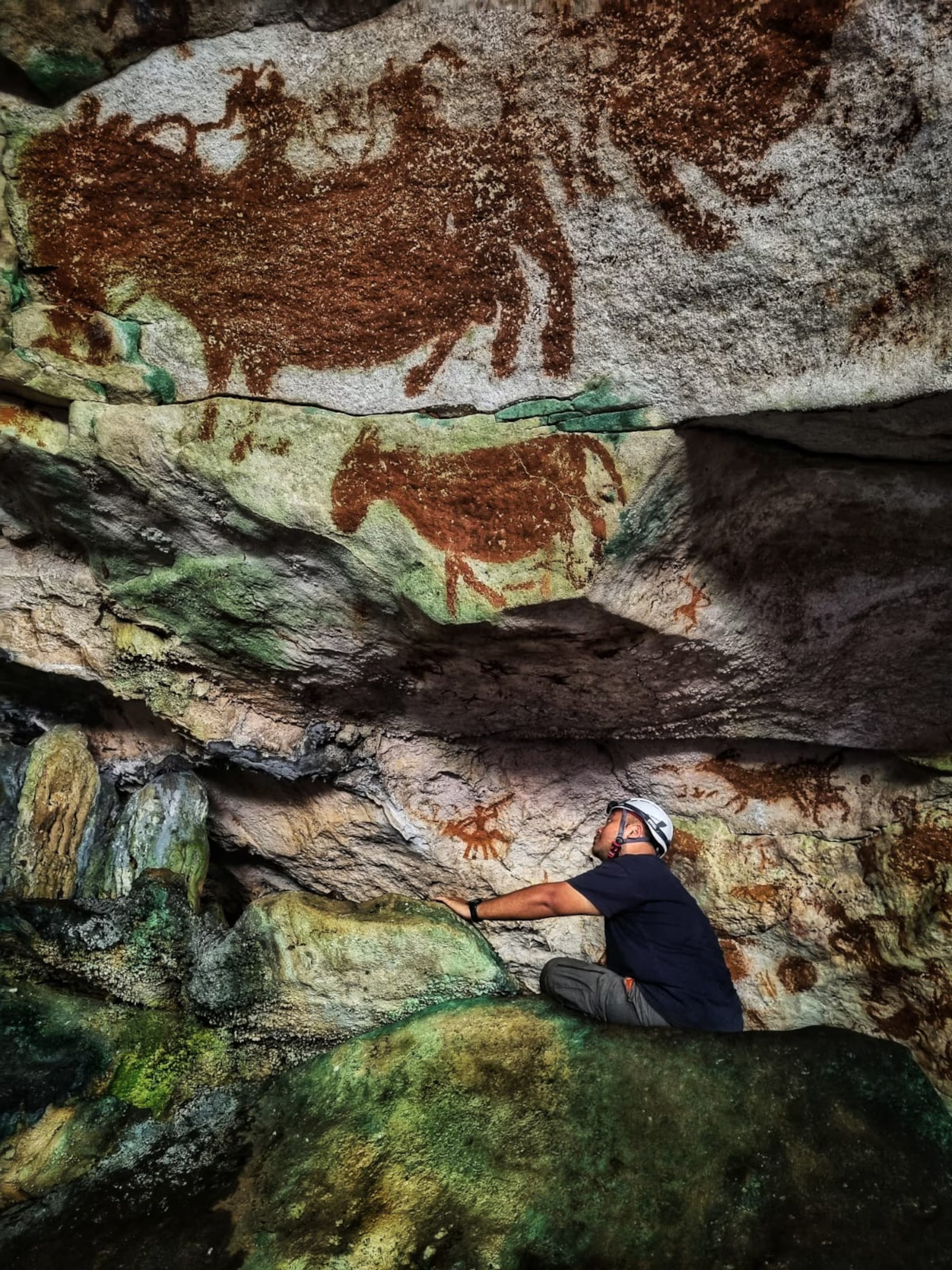
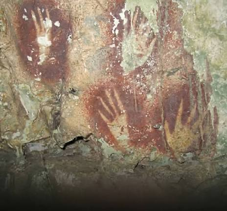
The limestone cliffs of the Maros-Pangkep region in South Sulawesi contain some of the oldest surviving records of human narrative art on Earth. At sites like Leang Tedongnge and Leang Bulu’ Sipong, prehistoric hunter-gatherers left behind breathtaking, mineral-stained tableaus that date back at least 44,000 to 45,500 years.

These masterfully composed panels combine human hand stencils with detailed figurative paintings of endemic Sulawesi warty pigs and dwarf buffaloes (anoa). They represent the earliest known evidence of figurative art and creative storytelling anywhere in the world, predating European cave paintings by several millennia and providing an unmatched look into the spiritual lives and hunting cultures of Wallacea's early human pioneers.

Pigment Chemistry, Therianthropes, and Behavioral Modernity

The artists of Maros manufactured their paint by grinding mineral-rich iron oxide (red ochre) into a fine powder, mixing it with water or organic binders to create a long-lasting, fluid pigment.

To create the iconic hand stencils, individuals placed their hands against the limestone surfaces and blew wet pigment over them through a hollow reed or bone tube, leaving a crisp negative silhouette. These stencils frequently frame large, detailed portraits of warty pigs, which are rendered with clear anatomical features such as facial crests, hair strands, and mating warts, showcasing an intimate ecological knowledge of the targeted prey.

The real conceptual breakthrough within the Maros art tradition is found in scenes depicting therianthropes—mythical figures possessing human bodies with animal heads or tails, actively hunting anoa with spears or ropes.

The deliberate depiction of therianthropes provides the world's oldest evidence of the human capacity to conceptualize supernatural beings and abstract religious mythologies. This creative ability proves that 45,000 years ago, Wallacean hunter-gatherers had achieved complete behavioral modernity, using complex visual art to pass down sacred hunt stories and ritual beliefs across generations.

Conclusion

The ancient hand stencils and hunting panels of Maros are an invaluable treasure of global cultural heritage. They prove that Indonesia was a major crucible for early human creative expression and symbolic thought during the Late Pleistocene. As modern research continues to uncover older, deeper painted panels within Sulawesi's disappearing karst towers, the Maros tableaus remind us that the human urge to leave an enduring mark of our existence is a deep-time tradition that transcends geography and connects us to our earliest ancestors.
Laili Shelter: Timor-Leste's 40,000-Year Colonists

July 18, 2026

Introduction

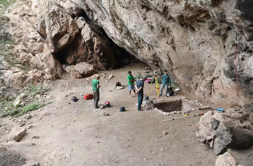
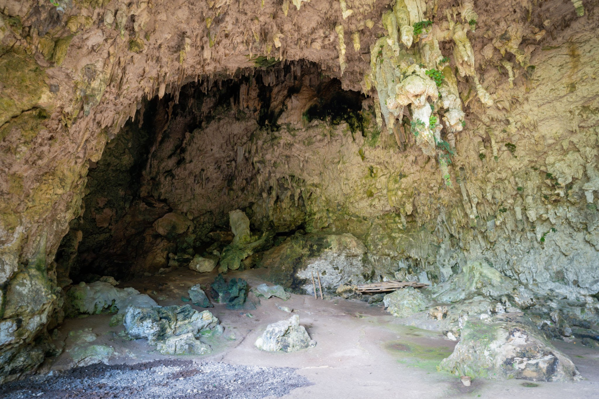
Understanding how early modern humans crossed the treacherous deep-water marine barriers of Wallacea to reach Australia has long been a central question in global archaeology. The limestone rock shelter of Laili, situated in the northern coastal foothills of Timor-Leste, has provided crucial data to resolve this mystery.

Excavations at Laili have revealed a continuous, exceptionally well-preserved sequence of human occupation extending back at least 44,000 years. This site stands as the oldest confirmed maritime colony in the southern Wallacean migration corridor, offering concrete proof of the advanced seafaring capabilities and coastal survival strategies utilized by humanity during their initial push toward Sahul (the Pleistocene landmass of Australia and New Guinea).

Maritime Migration Corridors and Broad-Spectrum Subsistence

To reach Timor during the Late Pleistocene, human populations had to navigate across the Wallace Line, a deep ocean boundary that never closed during glacial maximums, ensuring that these islands remained isolated from continental Asia.

This migration demanded intentional maritime crossings over open ocean channels exceeding 30 kilometers in width. The sudden appearance of dense occupation layers at Laili at 44,000 BP indicates that these pioneering colonists were not accidental castaways, but rather expert mariners possessing the seafaring technology and behavioral toolkits required to colonize entirely unfamiliar island environments.

The dietary remains excavated from Laili’s deep stratigraphic layers reveal a highly specialized broad-spectrum maritime economy. The pioneering colonists did not rely on large terrestrial game, which was virtually absent on the island; instead, they focused on extracting calories from the ocean and coastal canopy. The shelter floors are packed with thousands of marine shellfish fragments, fish bones, and a remarkable density of avian (bird) remains. This confirms that these early humans were skilled trackers capable of harvesting fast-moving arboreal prey and navigating the complex marine ecology of the coast, laying the adaptive foundations for the eventual settlement of Australia. Conclusion Laili Shelter provides a rare, vivid window into the lifeways of the earliest maritime wanderers of Southeast Asia. By demonstrating an absolute mastery over coastal and marine resources, the Pleistocene colonists of Timor proved that open ocean barriers were no longer an insurmountable obstacle, but rather highways for expansion. The deep-time records preserved within Laili's stone-tool and faunal assemblages confirm that the colonization of Wallacea was a deliberate, highly successful adaptation that fundamentally transformed the geographic distribution of our species.

Liang Bua Hobbits: Flores' 50,000-Year Mini Humans

July 18, 2026

Introduction

The 2003 discovery of diminutive hominin skeletal remains inside Liang Bua, a massive limestone cave on the Indonesian island of Flores, fundamentally upended established models of human evolution. Designated as Homo floresiensis—and affectionately dubbed the "Hobbit" by the international scientific community—this distinct hominin species stood a mere 1.06 meters (3.5 feet) tall and possessed a cranial capacity of roughly 400 cubic centimeters, comparable to a modern chimpanzee. Occupying the isolated island ecosystem until approximately 50,000 years ago, the Liang Bua remains provided the first definitive proof that divergent human lineages successfully coexisted alongside Homo sapiens into the deep Late Pleistocene.

Island Biogeography and Morphological Anomalies

The unique anatomical blueprint of Homo floresiensis is a classic demonstration of island dwarfism (or the island rule), an evolutionary phenomenon where large-bodied mammals isolated on resource-limited islands experience a selective reduction in body size over generations to lower their metabolic demands.

Conversely, small mammals like the local Flores giant rat (Papagomys armandvillei) grew exponentially larger. The "Hobbit" shared its isolated ecosystem with dwarf Stegodon (an extinct genus of pygmy elephants), which served as a primary prey source for both the hominins and the massive, predatory Komodo dragons that dominated the landscape

Despite their small brain size, the stratigraphic layers of Liang Bua demonstrate that Homo floresiensis possessed advanced behavioral traits. Excavated stone tool assemblages found alongside charred animal bones indicate that these small hominins engaged in coordinated group hunting, mastered fire control, and crafted complex stone tool kits.

Anatomical analyses of their wrist bones, long flat feet, and robust lower limbs suggest that while they shared deep ancestry with early Homo erectus or Homo habilis, they adapted to a distinct lifestyle that perfectly filled the apex predator niche within their isolated tropical island habitat.

Conclusion

The story of the Liang Bua hominins challenges linear models of human evolutionary progress. Homo floresiensis confirms that the human family tree was highly branched and diverse, with isolated lineages adapting in radical ways to unique environmental pressures. The disappearance of the "Hobbits" around 50,000 years ago matches the arrival of anatomically modern Homo sapiens in the region, suggesting that a mix of environmental shifts and competition with incoming modern humans ultimately closed the chapter on this fascinating island species.

Lake Toba Ash: Sumatra's 74,000-Year Supervolcano Impact

July 18, 2026

Introduction

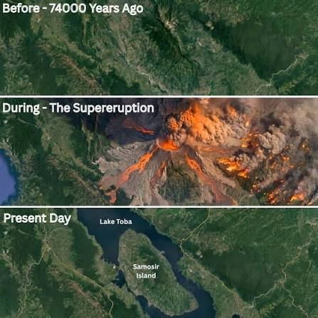
The Late Pleistocene epoch was irrevocably altered by the cataclysmic eruption of the Toba supervolcano in northern Sumatra approximately 74,000 years ago. Registering as a Magnitude 8 event on the Volcanic Explosivity Index (VEI), the Youngest Toba Tuff (YTT) eruption stands as the largest explosive volcanic event on Earth over the last two million years. This disaster ejected an estimated 2,800 cubic kilometers of volcanic material into the atmosphere, blanketed millions of square kilometers in ash, and triggered a profound macro-regional environmental disruption that forced early human populations across Wallacea and the wider Indian Ocean basin to adapt to sudden, severe ecological stress.

Stratigraphy, Climate Dynamics, and the Genetic Bottleneck Debate

The physical evidence of the Toba event is preserved within a massive global stratigraphic marker layer. The eruption column punched deep into the stratosphere, spewing billions of tons of sulfur dioxide ($SO_2$) that reacted with water vapor to create a persistent, highly reflective global sulfate aerosol veil.

This atmospheric shield caused a drastic reduction in solar radiation reaching the Earth's surface, precipitating what modelers identify as a "volcanic winter," which lowered global temperatures by several degrees Celsius for nearly a decade and devastated terrestrial vegetation across Southeast Asia.

For decades, evolutionary biologists leveraged the Toba Catastrophe Theory to explain a pronounced genetic bottleneck in Homo sapiens lineages, suggesting the volcanic winter decimated human populations down to a few thousand breeding pairs.

However, recent high-resolution archaeological excavations in South Asia and South Africa have revealed continuous stone tool records directly spanning above and below the YTT ash layers. This indicates that while the ecological shock was severe, isolated populations possessed the behavioral flexibility and resource-gathering strategies necessary to weather the volcanic winter without experiencing total demographic collapse.

Conclusion

The Youngest Toba Tuff eruption remains a foundational benchmark for studying Late Pleistocene climate instability and hominin resilience. The massive blanket of volcanic ash buried landscapes under meters of debris, reshaping river systems and choking coastal ecosystems across Sundaland and Wallacea. Yet, the survival of human lineages across this deep-time boundary underscores the remarkable evolutionary adaptability of early hominins, demonstrating that raw environmental trauma often acts as a critical evolutionary driver for behavioral innovation

The Role of Wrestling and Combat Sports in Greek Culture

July 18, 2026

Introduction

In ancient Greece, combat sports were far more than popular public entertainment; they were a vital civic institution, a sacred religious devotion, and the definitive measure of masculine excellence (arete). While track and field events were highly respected, the heavy combat disciplines—wrestling (pale), boxing (pygme), and the brutal combat sport known as pankration—held the absolute place of honor at the Panhellenic games. Governed by a cultural ideology that deeply romanticized physical struggle, these events functioned as a highly controlled, ritualized expression of real-world violence, bridging the gap between democratic athletic competition and the harsh demands of battlefield survival.

The Technical Mechanics and Cultural Status of the Heavy Events

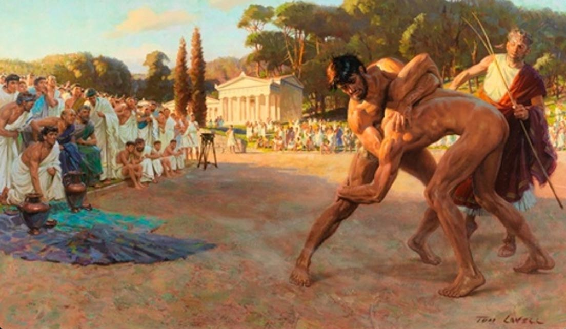
The architectural heart of combat sports training was the palaestra—a specialized, colonnaded courtyard filled with fine sand (skamma). Here, under the watchful eye of a trainer wielding a long wooden switch, athletes coated their bodies in olive oil and dusted themselves with fine powder to regulate their grip.

Wrestling (pale) was considered the ultimate test of intellectual discipline and physical leverage. To secure a victory, a wrestler had to throw his opponent to the sand three times, relying on sophisticated hip throws, sweeps, and wrist locks that prized technical skill over brute strength.

In stark contrast to the tactical discipline of wrestling stood the combat sports:

  • Boxing (Pygme): Boxers wrapped their hands in long strips of raw ox-hide leather called himantes. There were no rounds or weight classes; matches continued uninterrupted under the baking sun until one athlete raised a single finger to signal submission or collapsed unconscious.

  • Pankration: A devastating combination of boxing, wrestling, and martial arts, pankration permitted almost any attack—including bone-breaking joint locks, chokeholds, and sweeping kicks—forbidding only biting and eye-gouging.

The immense cultural prestige of these sports was directly tied to their utility in war. A hoplite who lost his spear and sword in the chaos of a collapsing phalanx relied entirely on close-quarters combat skills to survive.

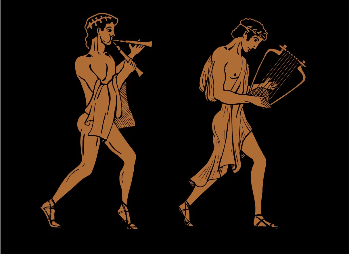
Victorious combat athletes were revered as living demigods within their home city-states; they were granted lifetime pensions, free meals in the civic hall (prytaneion), and immortalized in soaring victory odes composed by elite poets like Pindar, proving that the capacity to endure extreme physical pain was viewed as a supreme civic virtue.

Conclusion

The intense focus on combat sports unmasks a society that deliberately utilized athletics to civilize the destructive realities of human warfare. By transforming dangerous physical combat into a highly structured, rule-bound competition dedicated to the gods, the Greeks managed to celebrate raw physical power while strictly demanding institutional discipline. The sandy courtyards of the palaestra and the enduring victory hymns stand as a monument to a culture that firmly believed that true human excellence could only be fully forged through the ultimate challenge of direct struggle.

The Influence of Greek Epic Poetry on Later Civilizations

July 18, 2026

Introduction

The oral traditions of the archaic Aegean, crystallized in the monumental epics of Homer—the Iliad and the Odyssey—formed the structural bedrock of ancient Greek education, morality, and civic identity. However, the impact of these sweeping narratives stretched far beyond the borders of the classical Greek world. As empires rose and fell, the themes, characters, and metrical structures of Greek epic poetry crossed geographic and linguistic boundaries. They directly shaped the literary masterpieces, political ideologies, and cultural identities of later civilizations, establishing a foundational narrative tradition that continues to influence Western literature today.
The Transmission Vectors: From Rome to the Modern Age

The earliest and most profound adoption of Greek epic poetry occurred in the rising Roman Republic. Recognizing the immense cultural authority of Greek literature, Roman intellectuals systematically adapted Homeric frameworks to forge their own national identity. This process reached its artistic peak in the 1st century BCE with Virgil’s Aeneid.

Virgil deliberately mirrored Homer's work, structuring the first six books of his epic as a wandering maritime voyage modeled on the Odyssey, while devoting the final six books to a brutal war modeled on the Iliad. By transforming the Trojan hero Aeneas into the mythical ancestor of Rome, Virgil utilized Greek poetic structures to legitimize the imperial rule of Augustus Caesar, proving that epic poetry could function as a potent political tool.

During the European Renaissance and the subsequent Enlightenment, the rediscovery of classical Greek texts injected Homer's narrative archetypes directly into the bloodstream of Western European literature. Thinkers and poets adopted the dactylic hexameter structure and the core narrative framework of the nostos (the epic journey home).

John Milton’s Paradise Lost adopted the traditional Homeric invocation of the Muse and the epic catalog of warriors to craft a Christian cosmic drama. Centuries later, James Joyce’s modernist masterpiece Ulysses mapped the entire structure of the Odyssey onto a single day in 20th-century Dublin, demonstrating that the psychological conflicts and heroic archetypes engineered by the ancient Greeks remained universally applicable to the human condition.

Conclusion

The historical trajectory of Greek epic poetry proves that profound storytelling possesses an extraordinary capacity for cultural survival. The Iliad and the Odyssey did not remain static relics of an ancient Mediterranean past; instead, they functioned as flexible blueprints that later societies continuously adapted to solve their own artistic and political challenges. By codifying the fundamental concepts of heroism, honor, tragedy, and the human journey, the ancient Greek poets provided a lasting vocabulary that continues to shape how later civilizations interpret their world.

How Ancient Greeks Created Their Shields and Helmets

July 18, 2026

Introduction

The tactical supremacy of the classic Greek hoplite phalanx was entirely dependent on the structural integrity of its defensive equipment. Standing shoulder-to-shoulder in a tightly packed wall of metal and wood, a soldier's survival hinged on the strength of his personal armor. Crafting these defensive masterpieces required an exceptional level of specialized metallurgical knowledge and composite engineering. By masterfully manipulating bronze alloys and combining them with organic shock-absorbing layers, ancient armorers (hoplopoioi) transformed raw metals into iconic shields and helmets that could successfully withstand the crushing impacts of hand-to-hand combat.

Metallurgical Engineering and Structural Composition

The defining symbol of the infantryman was the aspis (or hoplon)—a massive, circular shield stretching roughly three feet in diameter. Far from being a simple chunk of solid metal, the aspis was a masterpiece of composite structural engineering. The core was carved from seasoned wood (typically lightweight, resilient poplar or willow), which was meticulously shaped into a deep, convex dish.

The armorers then glued a thin veneer of sheet bronze (roughly 0.5 mm thick) over the exterior face to deflect weapon tips, while lining the interior with leather to catch flying splinters.

The armorer riveted a wide bronze band (the porpax) directly into the center of the shield to slide the forearm through, and placed a leather handle (the antilabe) at the outer edge. This distributed the massive 16-pound weight across the entire arm rather than straining the wrist alone, allowing the soldier to steer the shield with immense leverage.

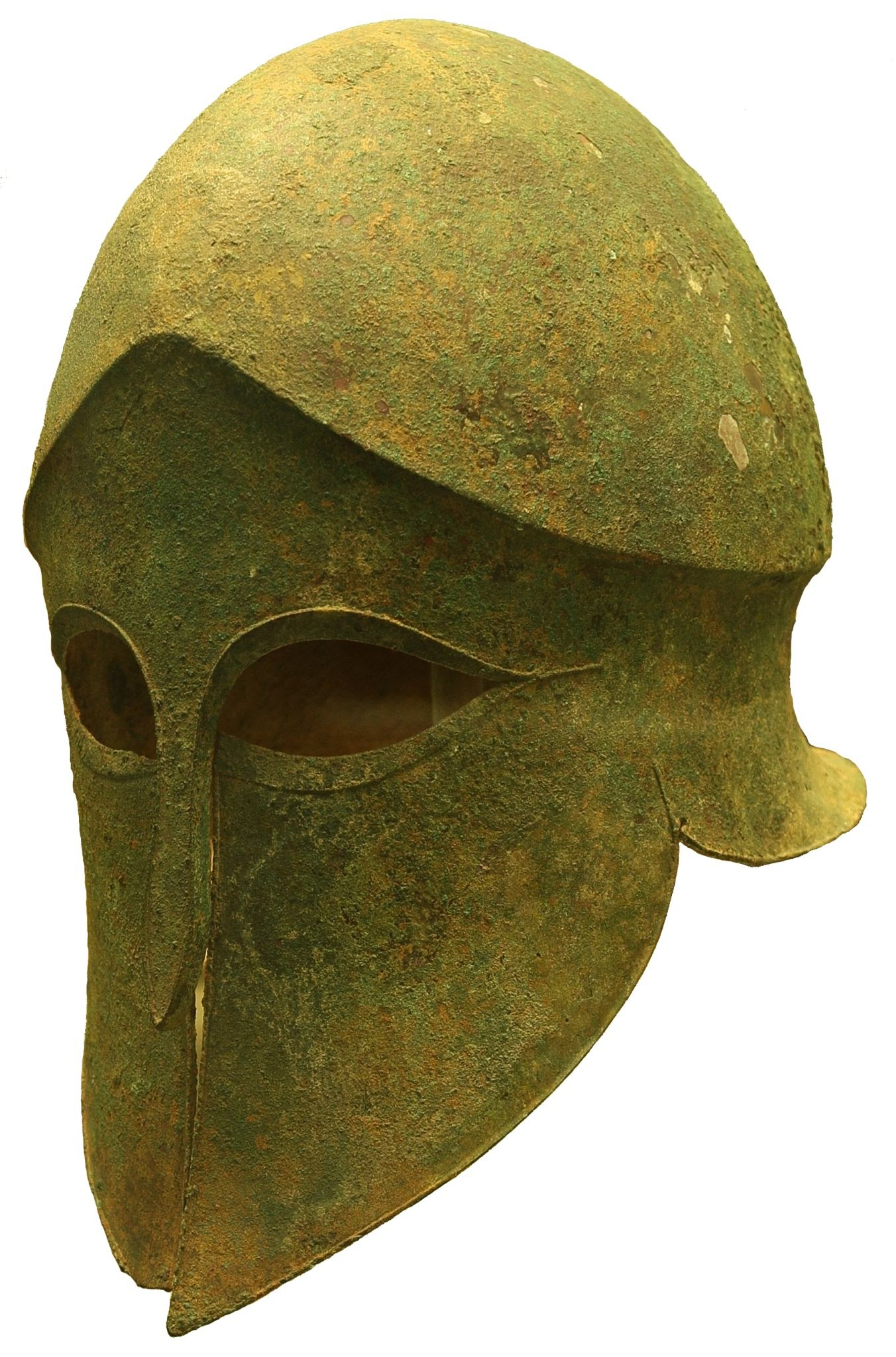
For head protection, the pinnacle of craftsmanship was the Corinthian helmet. Master armorers forged this legendary design from a single, solid ingot of high-tin bronze (approximately 90% copper, 10% tin). Through a grueling process of repeated heating and cold-hammering over custom iron anvils, the smith carefully manipulated the metal's thickness—raising a heavy, reinforced ridge across the forehead to deflect descending sword blows while thinning the cheek guards to reduce weight.

The interior was lined with soft felt or leather caps to cushion the skull against concussive forces, creating a seamless, highly resilient barrier that traded peripheral vision and hearing for absolute structural protection.

Conclusion

The construction methods undergirding ancient Greek arms armor highlight a sophisticated fusion of material science and functional geometry. The aspis and Corinthian helmet were not mere artisanal decorations; they were precisely engineered survival tools designed to absorb and redistribute extreme kinetic energy. The enduring material legacy of these bronze artifacts stands as a powerful testament to the skill of Aegean armorers, proving that the victories of the classical phalanx were built in the intense heat and ringing strikes of the blacksmith's forge.

The Role of Priests in Greek Healing Temples

July 18, 2026

Introduction

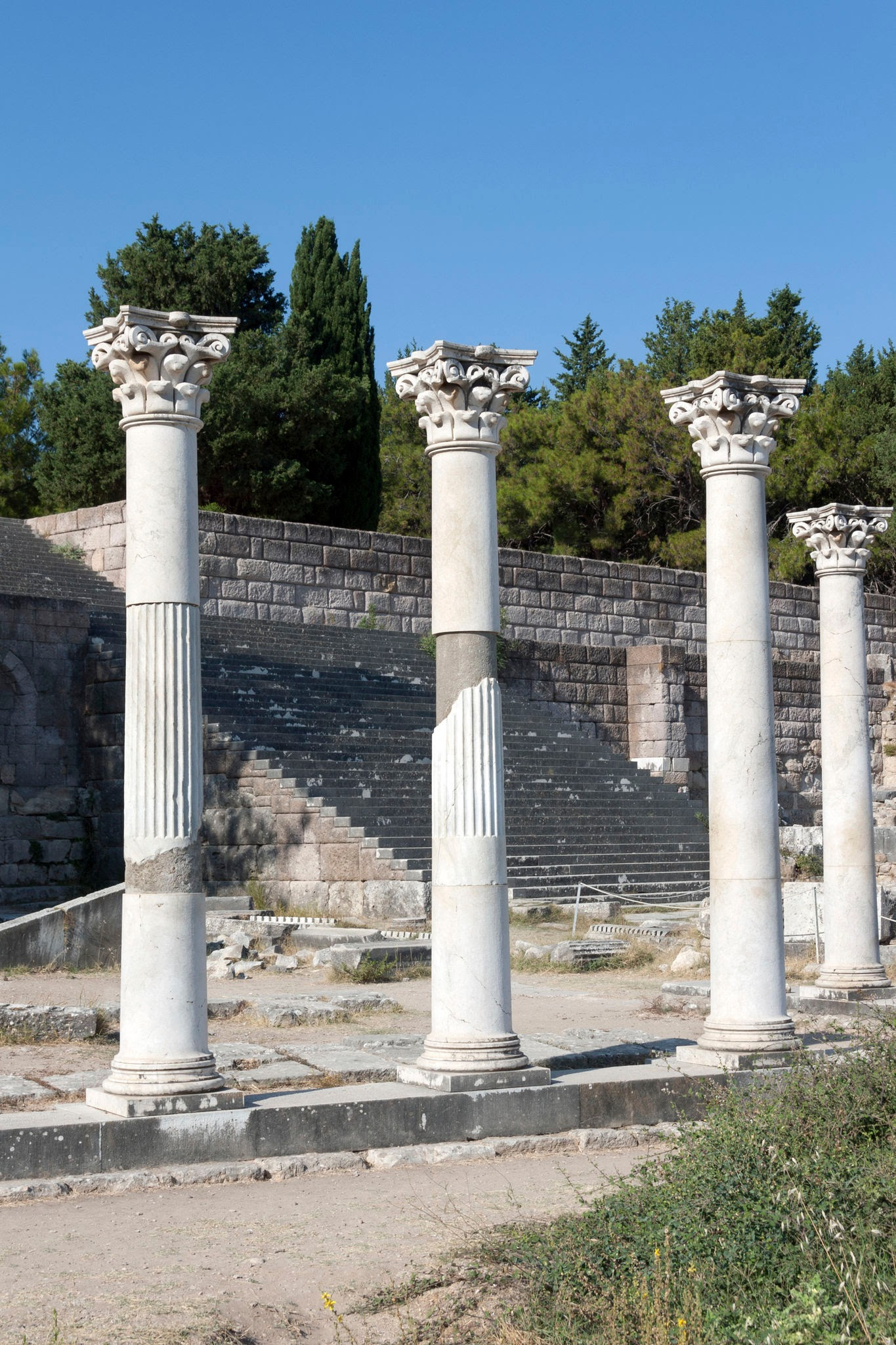
In the ancient Greek world, medicine and religion were not opposing forces, but rather deeply intertwined components of a holistic approach to human wellness. While secular physicians practiced physical treatments, thousands of citizens flocking to sanctuaries dedicated to Asclepius—the divine god of medicine—sought supernatural interventions. At the heart of these sacred sanctuaries (Asclepieia), such as the massive complexes at Epidaurus, Cos, and Pergamon, temple priests served as vital intermediaries. They were responsible for maintaining the spiritual purity of the sanctuary, guiding patients through intensive psychological preparation, and interpreting the divine dreams that laid the groundwork for recovery.

The Ritual Logistics of Incubation and Dream Interpretation

The operational core of a healing temple was centered on the practice of incubation (enkoimesis). Upon arriving at the sanctuary, a patient did not immediately receive treatment; the temple priests first subjected them to a rigorous process of physical and spiritual purification. This required ritual bathing in sacred springs, prolonged fasting, and offering animal sacrifices to clear the mind and body of profane corruption.

Once purified, the priests led the supplicants into the aton (or abaton)—a long, dimly lit portico specifically designed for sleep. Wrapped in animal skins, patients spent the night on the stone floor, waiting for the god Asclepius to visit them in their sleep.

During the night, the god was believed to manifest in dreams, either curing the affliction instantly through miraculous surgery or delivering cryptic, symbolic instructions. The following morning, the temple priests stepped in to perform their most critical task: interpreting these visions.

The priests combined deep mythological knowledge with extensive empirical observations of human psychology. They translated the patient's dream symbols into a highly detailed, practical treatment regimen. This custom plan typically mandated specific mineral baths, rigorous exercise at the temple gymnasium, strict dietary restrictions, or the application of herbal poultices, effectively bridging the gap between divine command and practical medicine.

Conclusion

The strategic role of the priests within the Asclepieia unmasks a highly sophisticated understanding of psychosomatic health. By creating a dramatic atmosphere of absolute purity and divine expectation, the priests successfully induced a powerful placebo effect that significantly reduced patient anxiety and amplified the body's natural healing capabilities. The temple ruins and surviving stone inscriptions (iamata) documenting these recoveries stand as a lasting monument to a society that recognized that true wellness requires treating the human mind, spirit, and body as a unified whole.

Puna Pau Quarry: Rapa Nui's Red Scoria Pukao Source

July 17, 2026

Introduction

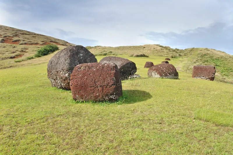
Formed within a small, extinct volcanic crater just outside the modern town of Hanga Roa, the quarry of Puna Pau represents a highly specialized, industrial node that provided the final symbolic element to Rapa Nui's monumental moai tradition. Puna Pau is the island’s exclusive source of red scoria—a highly porous, iron-rich volcanic rock prized for its vibrant crimson hue. From this single crater, ancient stone cutters excavated and carved dozens of massive, cylindrical topknots known as pukao, which were transported across the island to be placed atop the heads of select statues. While early European accounts viewed these stone cylinders as mere architectural decorations, landscape archaeology has unmasked Puna Pau as a sacred industrial landscape deeply tied to the concepts of elite status and spiritual power.

Industrial Logistics and the Symbolism of the Pukao

The industrial output of Puna Pau has been mapped through the intensive documentation of its internal crater walls and the dozens of abandoned pukao scattered along ancient transport trails. The extraction process required immense skill: stone cutters utilized heavy basalt picks (toki) to carve the soft, air-pocketed red scoria directly from the quarry walls, shaping the stone into massive cylinders weighing up to 12 metric tons.

Excavations within the quarry have unearhed specialized soil paths and stone rollers, proving that the pukao were deliberately moved out of the crater as raw cylinders, allowing them to be rolled long distances across the island's landscape without damaging the fine ornamental details.

Once a cylinder arrived at its destination ahu, sculptors carved out a distinct, recessed notch in the base, allowing the red topknot to lock securely onto the narrow, sloped head of the standing moai. Anthropological investigations have revealed that the vibrant red color carried profound spiritual significance across ancient Polynesia, directly representing sacred blood, high status, and divine power (mana). The pukao did not represent hats, but rather stylized topknots or bound hair structures common among elite warriors and deified high chiefs, serving as a powerful visual crown that amplified the spiritual authority of the ancestor staring inland.

Conclusion

The systematic unmasking of the Puna Pau quarry provides a fascinating look into the highly organized specialization of Rapanui society. It demonstrates that the construction of a moai was not an isolated project, but an integrated industrial network that required the simultaneous coordination of distant quarries, diverse geological materials, and specialized transport teams. The monumental red cylinders and ancient extraction markings preserved at Puna Pau stand as an enduring monument to Pacific engineering and artistic complexity. They show a deeply creative society that mobilized its entire landscape to materialize its grandest spiritual and political ideals.

Anakena Beach: Rapa Nui's First Settlement Site

July 17, 2026

Introduction

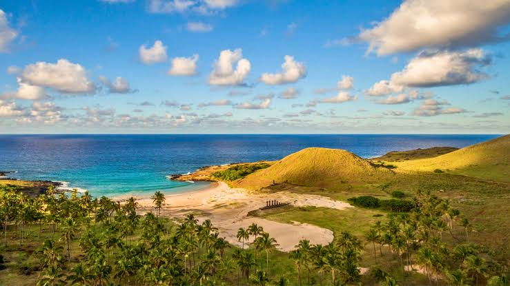
Nestled within a pristine, white-sand cove on the isolated northern coast of Rapa Nui, Anakena Beach serves as the legendary and material birthplace of the island's unique human history. According to deeply rooted oral traditions, this protected bay is the exact location where the founding voyager-king, Hotu Matuʻa, first guided his double-hulled voyaging canoes ashore after an epic journey across the open waters of East Polynesia, establishing the first permanent settlement. For decades, researchers debated the historical accuracy of these migration legends; however, multi-disciplinary stratigraphic excavations at Anakena have provided irrefutable physical proof that this cove holds the earliest occupational layers on the island, dating to approximately 1200 CE.

Palaeoenvironmental Sequences and Early Settlement Stratigraphy

The deep history of Anakena has been systematically mapped through deep stratigraphic soundings conducted within the sand dunes directly behind the modern beach line. The lowest occupational layers, buried beneath meters of windblown sand, revealed an ancient primary rainforest floor dominated by the root molds and carbonized nuts of an extinct, giant species of Rapa Nui palm tree (Paschalococos disperta).

Within this early matrix, archaeologists unearhed the structural remnants of the earliest human occupation: fire pits containing the bones of the Polynesian rat (Rattus exulans), pelagic deep-sea fish, and extinct seabirds, alongside a highly diagnostic toolkit of polished basalt adzes and pearl-shell fishhook fragments that display clear stylistic ties to the Gambier and Marquesas islands.

Directly above these initial domestic layers sits the monumental ceremonial site of Ahu Nau Nau. Excavations at this platform yielded an extraordinary architectural discovery: during a phase of intense political rebuilding, the ancient masons dismantled older stone structures and incorporated weathered carved fragments into the new platform's facade. The seven beautifully preserved moai standing atop Ahu Nau Nau today survived structural decay because they were buried in protective sand drifts shortly after being toppled, preserving their fine details, anatomical carvings, and coral-and-scoria inlaid eyes that originally brought the ancestral spirits to life.

Conclusion

The scientific unmasking of Anakena Beach provides a vital foundation for tracking the colonization timeline of the remote Pacific. It demonstrates an unbroken line of development from a classic East Polynesian maritime settlement into the highly specialized, megalithic culture that came to define Rapa Nui. The deep sand stratigraphy and pristine architectural remnants preserved at the site show a resourceful population that successfully transformed a wild palm forest into a highly structured ceremonial and political landscape. Today, the majestic statues of Ahu Nau Nau overlooking the northern waves stand as an enduring monument to those first Pacific voyagers.

Vinapū Walls: Rapa Nui's Inca-Like Stone Fitting

July 17, 2026

Introduction

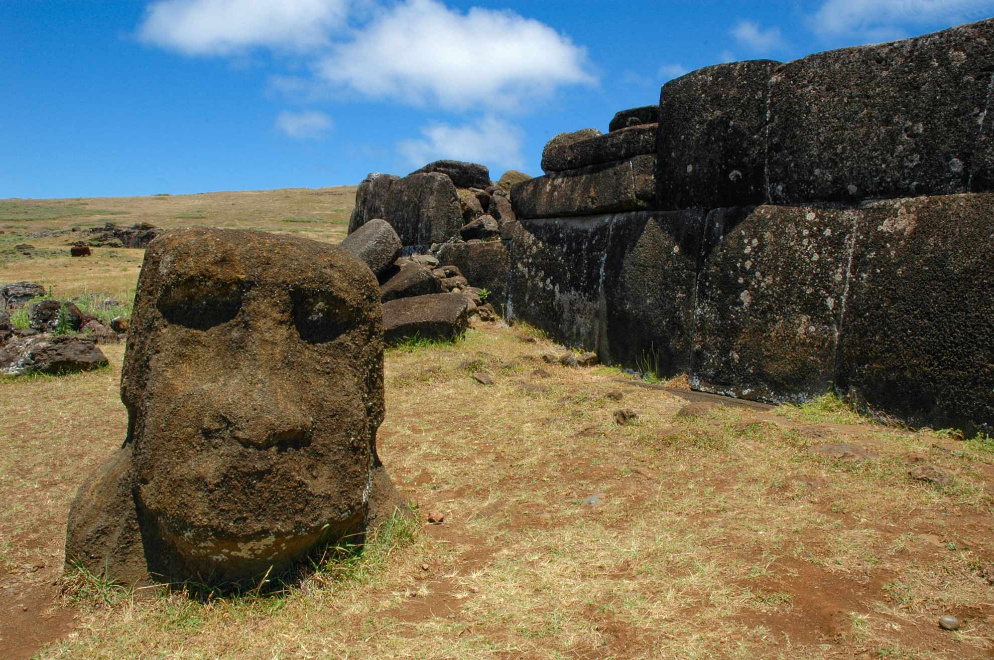
Located on the windswept southeastern coast of Rapa Nui, the archaeological complex of Vinapū preserves one of the most structurally unique and intensely debated examples of megalithic masonry in the entire Pacific. While the island is renowned for its iconic moai statues, Vinapū stands out because of the extraordinary architectural refinement of its stone platforms (ahu). The rear wall of Ahu Tahiri (Vinapū I) displays a level of precision-cut, interlocking stone fitting that is completely distinct from the standard masonry techniques utilized across the rest of the island.

For nearly a century, this striking visual parallel led diffusionist explorers to claim that the site was constructed by pre-Columbian architects from South America. Modern landscape archaeology, stratigraphy, and architectural forensics have thoroughly dismantled these colonial theories, unmasking Vinapū as a brilliant, fully indigenous evolution of Polynesian engineering that pushed stone-cutting technology to its absolute limit.

Architectural Forensics and the Trans-Pacific Debate

The exceptional engineering of Vinapū is centered on the facade of Ahu Tahiri. Unlike standard ahu platforms, which typically feature rough volcanic boulders or flat slabs filled with loose rubble, the rear wall of Ahu Tahiri is faced with massive, multi-ton basalt blocks that have been meticulously shaped, smoothed, and fitted together without mortar. The joints are so tight that a knife blade cannot be inserted between them. The corners of the blocks are precisely rounded, and the stones interlock along irregular, curvilinear lines—a technique that visually mirrors the imperial Inca masonry of the Peruvian Andes, such as the walls of Sacsayhuamán or Cusco.

This uncanny similarity was the cornerstone of Thor Heyerdahl’s Kon-Tiki theory, which argued that South American voyagers colonized the island and introduced megalithic engineering. However, systematic excavations and structural comparisons have revealed fundamental differences that prove independent indigenous development:

  • Internal Structural Engineering: Imperial Inca walls are solid throughout, relying on three-dimensional interlocking blocks to withstand seismic activity. In contrast, the Rapanui engineers utilized these precision-cut basalt blocks as a highly refined exterior veneer or facade. The massive blocks form a retaining wall designed to anchor a core composed of heavy, unshaped volcanic rubble and earth filler.

  • Chronological Mismatch: Radiocarbon dating of organic materials buried beneath the foundation layers places the initial construction phase of Vinapū around 700 to 800 CE, with the advanced masonry work completed by approximately 1200 CE. This timeline predates the rise of the classic imperial Inca masonry style in Peru by several centuries.

  • Tools and Material Procurement: Mineralogical testing confirms the blocks were quarried locally from nearby basalt outcroppings. The ancient masons relied entirely on heavy basalt picks (toki) and abrasive water-and-sand grinding techniques to smooth the faces, adapting traditional Polynesian woodworking adze techniques to the medium of hard volcanic stone.

Celestial Mechanics and the Red Column

Beyond its structural veneer, Vinapū was engineered as a sophisticated astronomical instrument. The front facade of the main platform is oriented with geographic precision, aligned to face the exact point of the horizon where the sun rises during the winter solstice. This architectural alignment unified the ancestral spirits represented by the moai with the annual solar cycle, regulating seasonal fishing bans (tapu) and agricultural planning.

Directly adjacent to the primary wall sits Ahu Vinapū II, which exhibits an older, less refined construction style. In front of this second platform stands a singular, highly eroded column carved from the red volcanic scoria of Puna Pau quarry. Discovered half-buried and re-erected during modern excavations, iconographic analysis suggests this rare monument is a female moai—originally carved with two distinct heads—which likely functioned as a sacred mortuary pillar used to support wooden scaffolding during traditional funerary rituals.

Conclusion

The meticulous unmasking of the Vinapū walls provides a profound lesson in the capacity for independent human innovation. It demonstrates that under similar environmental pressures and societal complexities, isolated human groups can independently develop strikingly similar engineering solutions. The seamless basalt walls of Vinapū stand as an enduring monument to Rapanui craftsmanship, proving that the ancient master builders possessed a mathematical and material sophistication that rivaled the greatest megalithic cultures of the ancient world.

Orongo Village: Rapa Nui's Birdman Cult Houses

July 17, 2026

Introduction

Perched precariously on a razor-thin volcanic ridge between the sheer 300-meter cliffs of the Pacific Ocean and the deep crater lake of Rano Kau, the ceremonial village of Orongo documents one of the most abrupt and fascinating religious transformations in human history. Flourishing between the 17th and late 19th centuries CE, Orongo served as the exclusive stage for the Tangata Manu (Birdman) cult—a competitive, resource-driven religious system that completely replaced the classic, ancestor-worshiping moai era. While popular media long attributed this cultural shift to total societal collapse, systematic landscape archaeology at Orongo has revealed a highly organized, adaptive response to environmental stress, where the islanders engineered a new political structure based on merit and religious competition rather than inherited royal lineages.

Lithic Architecture, Petroglyphs, and the Tangata Manu Logistics

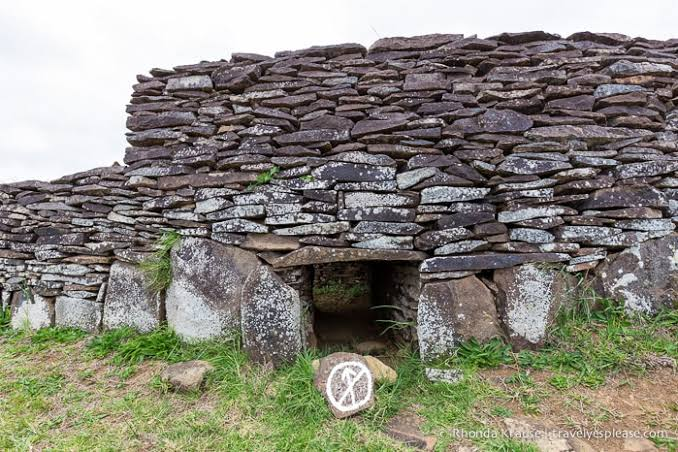
The architectural design of Orongo stands completely apart from the residential settlements found across the rest of the island. Rather than using standard timber-framed thatch houses, the builders constructed 53 low-slung, oval-shaped buildings using a corbeled masonry technique with thin, naturally split slabs of basaltic slate. These stone structures were intentionally designed to withstand the fierce, continuous gales of the high crater ridge. They feature tiny, tunnel-like entrances that forced individuals to crawl inside on their stomachs, maximizing internal heat retention and creating a highly secure, restricted space for elite religious chiefs.

Excavations around the complex and the adjacent sea cliffs have documented an extraordinary density of rock art, mapping out the ritual logistics of the Birdman competition. The natural basalt rocks at Orongo are carved with over 400 complex petroglyphs, predominantly depicting the Tangata Manu—a hybrid figure possessing a human body and the long, curved beak of a frigatebird or sooty tern.

The annual ritual required chosen athletes from each clan to scale down the vertical 300-meter cliffs of Orongo, swim through shark-infested waters on reed floats to the isolated islet of Motu Nui, retrieve the first laid egg of the migrating sooty tern, and climb back up the cliff face intact. The winning clan secured absolute political dominance and priority access to the island's scarce remaining resources for the following year, showing that Orongo functioned as a highly sophisticated civic mechanism designed to regulate tribal warfare through controlled religious competition.

Conclusion

The systematic unmasking of Orongo Village provides a brilliant example of ideological adaptation under extreme environmental constraints. It proves that the ancient Rapanui did not passively slide into chaos when their forest ecosystems collapsed; instead, they completely reinvented their architectural styles, political structures, and religious expressions to match their changing world. The unique slate village and dramatic birdman petroglyphs stand as an enduring monument to human adaptability, proving that cultural resilience can forge entirely new social systems on the very edge of survival.

Ahu Tongariki: Rapa Nui's Restored Moai Platform

July 17, 2026

Introduction

Sweeping along the dramatic, wave-battered southeastern coast of Rapa Nui (Easter Island), Ahu Tongariki represents the undisputed zenith of megalithic ceremonial architecture in Remote Oceania. Constructing this colossal platform between the 14th and 17th centuries CE, the eastern island clans engineered a monumental ancestral sanctuary that stands as the largest intact ahu ever raised in the Pacific. For centuries, the site stood as a tragic symbol of cultural collapse and environmental disaster; its original moai were toppled face-down during 18th-century tribal conflicts, and in 1960, a cataclysmic 9.5 magnitude earthquake off Chile triggered a massive tsunami that scattered the multi-ton statues hundreds of meters inland. The systematic, multi-national restoration of the site in the 1990s stands as a triumph of modern forensic archaeology, completely unmasking the advanced structural mechanics used by ancient Rapanui engineers.

Megalithic Infrastructure, Forensics, and Astronomical Engineering

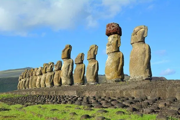
The sheer scale of Ahu Tongariki requires a radical rethinking of precolonial Pacific labor organization. The main basalt-faced platform stretches over 100 meters in length and supports 15 towering moai, carved from the volcanic tuff of the nearby Rano Raraku quarry, with weights ranging from 30 to over 80 metric tons. Excavations during the restoration project uncovered the highly complex internal foundation engineering: the ancient masons laid a deep pavement of tightly packed vesicular basalt boulders over a leveled volcanic clay surface, creating a flexible, earthquake-resistant foundation capable of bearing the immense vertical load.

Archaeological analysis of the platform's facade revealed a sophisticated solar design. The main axis of Ahu Tongariki is engineered with highly precise astronomical intent, oriented exactly to face the rising sun during the summer solstice. During this celestial event, the 15 ancestors stood with their backs to the Pacific Ocean, casting immense, elongated shadows directly across the expansive, paved ceremonial plaza (marae) in front of them. This deliberate design physically and visually unified the ruling elite, the ancestral spirits, and the cosmic order at the exact moment the seasons turned.

Conclusion

The archaeological resurrection of Ahu Tongariki provides an irreplaceable baseline for understanding the limits of non-industrial human engineering. It proves that Rapanui society possessed an extraordinarily sophisticated command of structural logistics, geometry, and astronomical observation, allowing them to coordinate thousands of workers across generations. The massive platform and its 15 re-erected guardians stand as an enduring monument to indigenous resilience, showing that even after centuries of warfare and natural disasters, the material record of human genius remains written indelibly into the landscape.

Marquesas' Hiva Oa Petroglyphs: 1,000-Year Tiki Rocks

July 17, 2026

Introduction

Deep within the dense, tropical rainforests of Hiva Oa in the Marquesas Islands (Te Henua 'Enana), the sacred ceremonial site of Lipona near Atuona preserves one of the most spectacular collections of monumental stone sculpture and rock art in all of East Polynesia. Flourishing around 1000 CE to 1300 CE, Lipona served as the spiritual and political heart of a wealthy chiefdom, defined by its massive stone platforms (me'ae) and towering anthropomorphic stone carvings known as tiki.

For a long time, early European travelogues treated these carvings as crude tribal idols; modern iconographic analysis and landscape archaeology have completely revised this perspective, revealing Lipona as a highly structured, sacred landscape where stone engineering was deployed to materialize divine ancestral power (mana) and solidify the line of ruling chiefs.
Megalithic Sculpture, Iconography, and Sacred Space

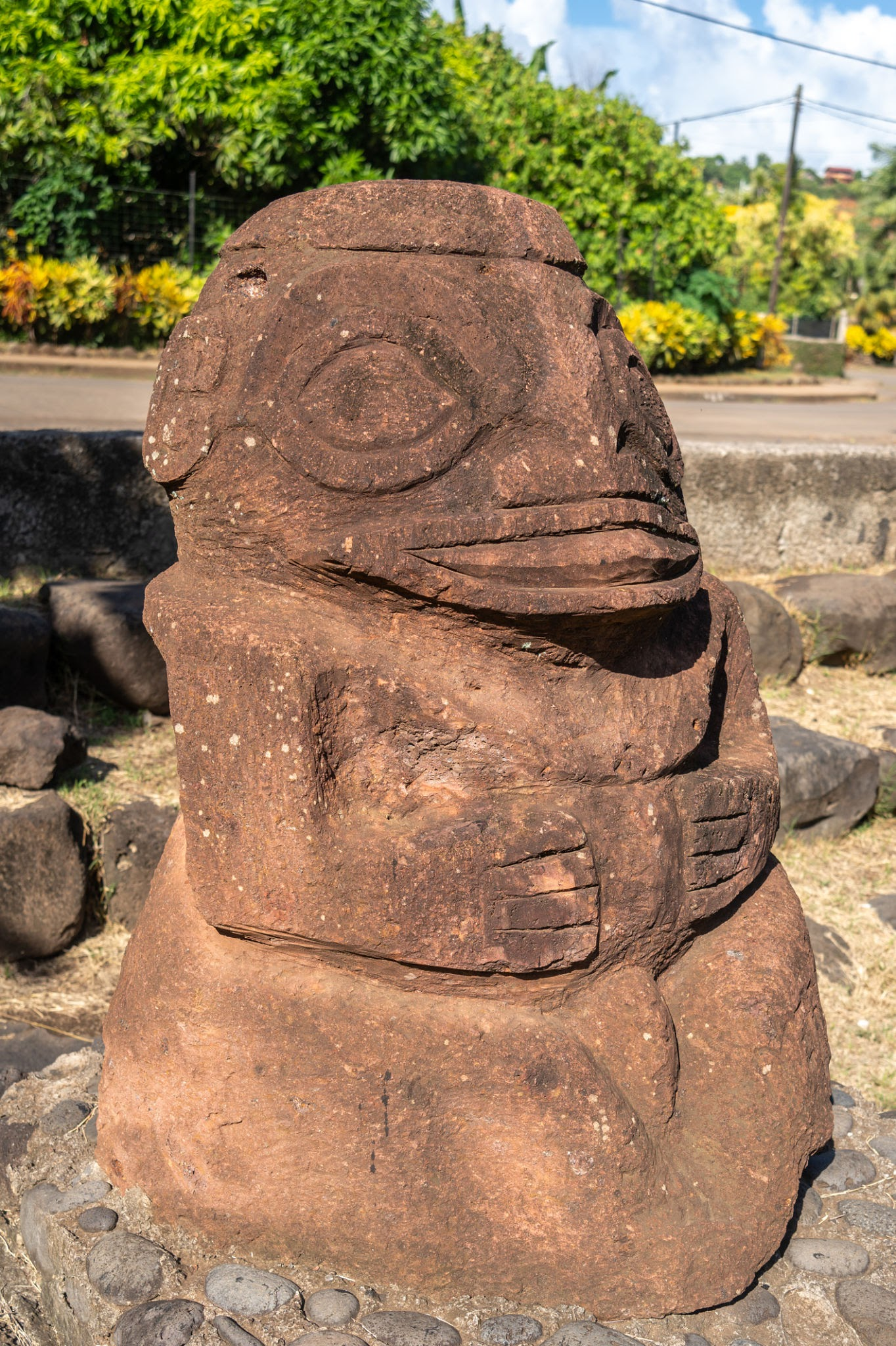
The architectural power of Lipona is centered around a massive, multi-tiered stone terrace constructed from huge blocks of unmortared basalt rock. Standing proudly upon these terraces are several larger-than-life tiki statues carved out of soft red volcanic tuff—a material chosen specifically for its sacred symbolic associations. The most famous statue, Takaii, stands over 2.5 meters tall and features an imposing posture with wide, deeply carved eyes, a broad mouth, and hands resting firmly on its stomach, representing a powerful deified ancestor or chief.

Excavations around the stone bases have revealed specialized offering pits containing polished pearl shell scrapers, bone ornaments, and deep caches of basalt adzes. Surrounding the statues, the flat faces of the natural rock formations are covered in hundreds of complex petroglyphs.

Iconographic mapping of these rock carvings has identified diverse motifs, including stylized turtles, stick-figure humans, concentric circles, and the rare moko (lizard) design, which served as a protective guardian symbol for the elite. The complex relationship between the towering statues, the stone terraces, and the surrounding petroglyphs demonstrates an advanced layout designed to direct the flow of sacred rituals, control access to elite spaces, and visually assert the divine authority of the chiefs over the island's population.

Conclusion

The systematic archaeological unmasking of the Hiva Oa petroglyphs and tiki structures provides an invaluable window into the complex religious and political systems of East Polynesia. It proves that Marquesan society possessed independent artistic and engineering traditions capable of transforming natural stone landscapes into highly structured centers of political and religious power.

The unique sculptural style and sacred spatial planning documented at Lipona demonstrate a highly resilient society with a profound artistic identity. Today, the enigmatic stone giants of Hiva Oa stand as an enduring monument to Polynesian.

How Ancient Greeks Built Their Harbors and Docks

July 17, 2026

Introduction

The economic wealth and geopolitical dominance of maritime powers like Athens, Rhodes, and Corinth were entirely dependent on their access to the sea. However, the Mediterranean coastline offered few natural bays capable of safely sheltering massive commercial fleets and state-managed navies from violent winter storms. To overcome this ecological barrier, ancient Greek engineers pioneered advanced maritime infrastructure and hydraulic engineering. By inventing underwater construction techniques and designing specialized, permanent dry-docks, they transformed open coastlines into highly secure, heavily fortified naval hubs that could rapidly project military and commercial power across the ancient world.

Hydraulic Engineering, Moles, and Trireme Shipsheds

The foundational challenge of Greek harbor construction was creating the choma—a massive, artificial breakwater or mole designed to absorb the crushing energy of incoming waves. To lay these foundations underwater, engineers utilized a highly resource-intensive stone-dropping method. They packed large merchant barges with multi-ton blocks of quarried limestone and raw volcanic pozzolana earth, towing them to the designated line and deliberately sinking them.

Over multiple seasons, workers piled thousands of tons of rock atop this submerged foundation, eventually raising a wide, stone-faced barrier above the sea level that created a calm, protected basin inside the harbor area.

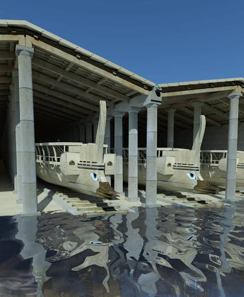
Once the outer basin was secured, engineers constructed the ultimate crown jewel of Greek naval infrastructure: the neosoikoi (shipsheds).

The stone ramps were capped with wooden rollers and heavily lubricated with animal fat. When a warship (trireme) returned from patrol, its crew attached ropes to the hull and utilized heavy mechanical winches to pull the vessel completely out of the sea into a dry dock chamber.

Protected beneath expansive timber roofs, the vulnerable wooden hulls were insulated from the blistering summer sun and wet winters, effectively preventing the wood from warping and stopping catastrophic infestations of marine wood-boring shipworms (Teredo navalis). This ensured that the navy remained structurally sound and ready for instant deployment.

Conclusion

The construction of these monumental harbor complexes stands as a brilliant monument to ancient civil engineering, proving that the Greeks possessed a highly advanced command of structural geometry, logistics, and hydraulic dynamics. By systematically mastering underwater foundations and building highly specialized dry-dock networks, they effectively conquered the volatile coastal environment. These heavily fortified ports served as the secure launching pads for the maritime trade and naval dominance that directly financed the Golden Age of classical civilization.

Leang Burung: Sulawesi's 40,000-Year Cave Art

July 17, 2026

Introduction

For over a century, Eurocentric paradigms dominated the study of prehistoric art, positioning western Europe as the exclusive birthplace of complex human creative expression. This narrative was shattered by deep-time discoveries within the Maros-Pangkep karst networks of South Sulawesi, Indonesia—most notably at the limestone rock shelter of Leang Burung.

Stratigraphic excavations and advanced uranium-series dating of cave art panels at Leang Burung have pushed the antiquity of figurative art back over 40,000 years. This proves that complex visual storytelling emerged just as early, if not earlier, in the tropical settings of Wallacea as it did in the ice-age caves of France and Spain.

Karst Geomorphology and Uranium-Series Chronology

The cave art of Leang Burung is situated within a dramatic landscape of towering tower-karst limestone cliffs. The rock shelters are not deep, pitch-black caverns, but rather well-lit, open-faced rock overhangs where prehistoric communities lived, knapped stone, and painted.

The art features large silhouettes of endemic Wallacean megafauna—primarily the babirusa (pig-deer) and the Sulawesi warty pig (Sus celebris)—alongside negative stencils of human hands created by spraying red ochre pigments over a hand pressed flat against the limestone wall.

To establish the absolute age of these paintings, geochronologists utilized uranium-series dating on tiny, popcorn-like calcium carbonate deposits known as "cave popcorn" (coralloid speleothems) that grew directly on top of the painted pigments.

Because the mineral layer formed after the art was created, dating the speleothems provides a definitive minimum age for the underlying painting. At Leang Burung, these tests yielded dates exceeding 40,000 years ago, demonstrating that the human impulse to externalize complex myths and abstract thoughts onto stone was a universal feature of early modern human behavior, developed long before our ancestors completed their global migrations.

Conclusion

Leang Burung stands as an invaluable monument to the global evolution of human cognition and creative expression. The ancient animal portraits and hand stencils preserved on its weathering limestone walls prove that early Wallacean hunter-gatherers possessed a sophisticated symbolic culture deeply connected to the unique wildlife of their island home. By anchoring the origins of world art firmly in the Indonesian archipelago, Leang Burung continues to reshape our understanding of where, when, and why humanity first began to paint its story onto the world.

Samoa's Mulifanua: 3,500-Year Lapita Potsherds

July 14, 2026

Introduction

Discovered accidentally during the expansion of a ferry berth on the western tip of Upolu, the underwater site of Mulifanua represents one of the most critical and technologically significant Lapita locations in the entire South Pacific. Inhabited around 1000 BCE, Mulifanua is the only confirmed early Lapita site found in the Samoan archipelago.

The site presents a unique archaeological landscape: due to tectonic subsidence and rising sea levels, the ancient village now rests completely submerged beneath several meters of coral sand and shallow lagoon water. The discovery of Mulifanua completely shattered previous migration models that placed the dawn of Samoan culture much later, proving that the earliest Lapita navigators colonized the Samoan islands during their initial, rapid push into Western Polynesia.

Submerged Stratigraphy and the Ceramic Record

Unlocking the secrets of Mulifanua required highly specialized underwater archaeological techniques, including controlled scuba excavations, hydraulic dredging, and precise underwater spatial mapping within the active lagoon. Beneath the modern seabed, researchers uncovered a pristine, waterlogged cultural layer packed with thousands of highly diagnostic ceramic fragments.

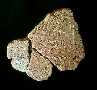
The recovered pottery assemblage stands out for its incredible aesthetic refinement, featuring classic early Lapita dentate-stamping—an intricate technique where geometric motifs, human faces, and abstract symbols were pressed into wet clay using fine-toothed bone or shell stamps before firing.

Petrographic and chemical analysis of the clay paste yielded fascinating insights into early Pacific economics: while most vessels were produced using local Samoan volcanic clays and tempers, a significant portion was manufactured using materials exotic to Upolu. This provides indisputable physical proof that the first inhabitants of Mulifanua maintained active, long-distance voyaging networks, trading ceramics, raw materials, and prestige goods with distant communities in Fiji and Tonga.

The anaerobic, waterlogged environment also successfully preserved organic materials, including carbonized coconut husks, marine shells, and fish bones, mapping out a maritime economy that expertly combined lagoon fishing with early agro-forestry.

Conclusion

The underwater unmasking of Mulifanua provides an indispensable baseline for reconstructing the deep history of Polynesian origins. It proves that Samoa was an active participant in the earliest waves of Lapita maritime migration, serving as a critical staging ground for the development of distinct Polynesian cultural traditions.

The exquisite ceramic craftsmanship and inter-island trade networks preserved within this submerged lagoon demonstrate a highly sophisticated and interconnected maritime society. Ultimately, the drowned village of Mulifanua stands as a powerful monument to early Pacific exploration, proving that the foundations of Samoan history are deeply intertwined with the global history of ocean navigation.

Tonga's Ha'amonga 'a Maui Trilithon: 13th-Century Stone Gate

July 14, 2026

Introduction

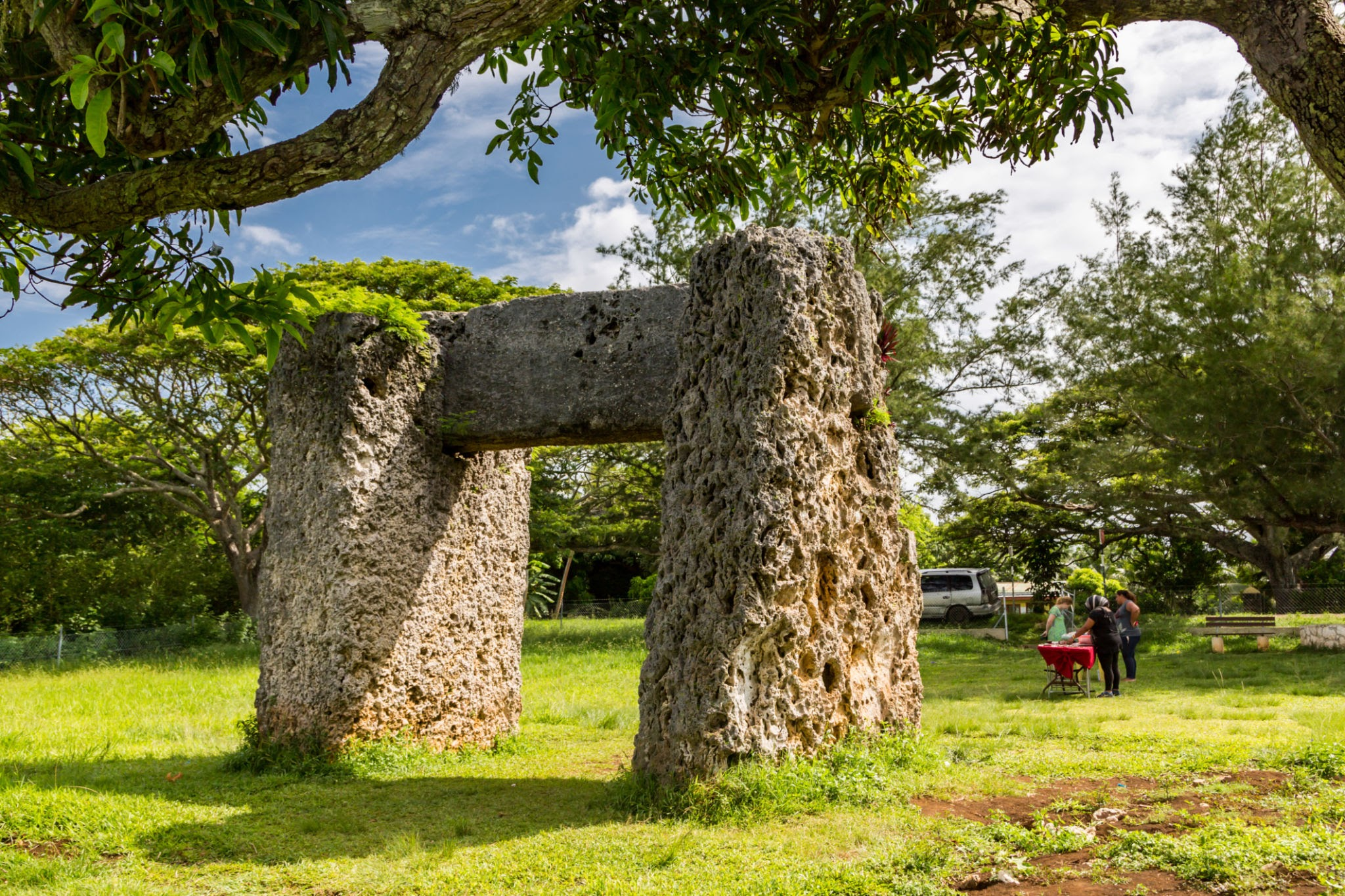
Standing prominently on the eastern fringe of Tongatapu, the Ha'amonga 'a Maui (The Burden of Maui) trilithon represents an absolute pinnacle of monumental stone engineering within the pre-colonial Tu'i Tonga Empire. Erected around 1200 CE during the reign of the 11th Tu'i Tonga, King Tu'itatui, this colossal coral limestone monument stands as a powerful symbol of centralized dynastic authority and territorial sovereignty.

For generations, Eurocentric explorers popularized far-fetched myths attributing the structure to wandering ancient Mediterranean civilisations. Modern architectural analysis and landscape archaeology have completely dismantled these colonial theories, confirming the monument as a fully indigenous masterpiece of stone cutting and structural engineering that anchored the sacred capital of Heketa.

Megalithic Engineering and Celestial Alignment

The construction of the Ha'amonga 'a Maui required an extraordinary mobilization of state labor and specialized engineering. The monument stands over 5 meters high, composed of two vertical coral limestone pillars weighing roughly 30 to 40 tons each, supporting a massive horizontal lintel stone weighing approximately 15 tons. To secure the lintel without modern mortar or metal clamps, Tongan stonemasons cut deep mortise grooves into the tops of the vertical pillars, allowing the perfectly squared lintel to lock securely into place using gravity alone.

Excavations around the base of the monument have revealed large extraction pits, proving that the massive stones were quarried directly from the nearby coastline using specialized wooden wedges, fire-splitting techniques, and woven fiber ropes.

Crucially, ethno-astronomical investigations led by King Tāufaʻāhau Tupou IV revealed that the monument also functioned as a highly precise solar calendar. Etched lines on the upper surface of the horizontal lintel align perfectly with the rising sun during both the summer and winter solstices. This dual purpose as a symbol of royal power and a celestial clock demonstrates that the Tu'i Tonga dynasty possessed an advanced understanding of mathematical astronomy, utilizing this knowledge to regulate agricultural cycles, harvest times, and religious ceremonies across their sprawling maritime domain.

Conclusion

The architectural and astronomical unmasking of the Ha'amonga 'a Maui trilithon fundamentally alters our understanding of political complexity in ancient Polynesia. It proves that medieval Tonga possessed a highly sophisticated, centralized state capable of directing complex engineering projects that required vast labor and precise geometry.

The monument's long-term stability and astronomical accuracy provide clear material proof of independent scientific and engineering excellence. Today, the majestic stone archway of Heketa stands as a powerful testament to Tongan statecraft, engineering, and cultural pride.

Sigatoka Sand Dunes: Fiji's 3,700-Year Burials

July 14, 2026

Introduction

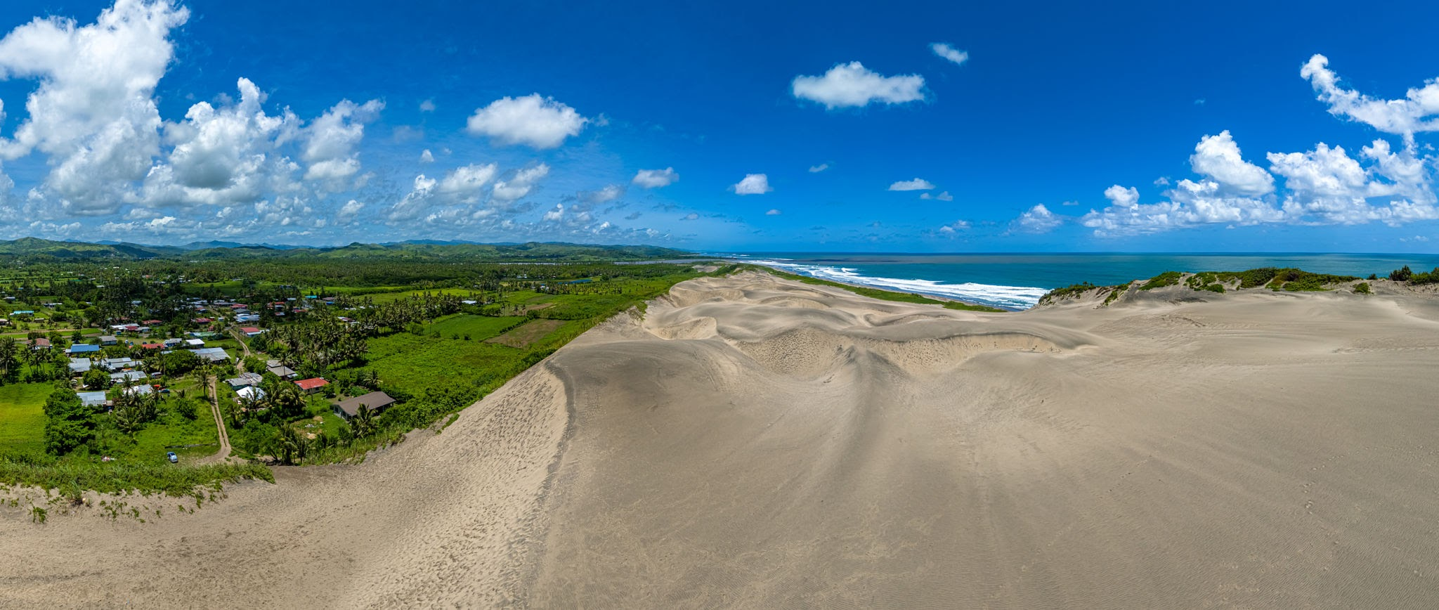
Rising up to 60 meters along the wind-swept southern coast of Viti Levu, the Sigatoka Sand Dunes preserve one of the most structurally complex and extensive archaeological sequences in the entire Pacific. This dynamic, shifting ecosystem contains an incredibly intact cultural record spanning nearly four millennia, marking the very dawn of human expansion into Remote Oceania. While early research treated Oceanic migrations as brief, untraceable events, the systematic excavation of Sigatoka has yielded the largest and best-preserved Lapita-era skeletal assemblage in the Pacific, providing an unparalleled look at the biology, health, and mortuary practices of the region's first seafaring pioneers.

Stratigraphic Horizons and Palaeodemographic Signatures

The immense historical significance of Sigatoka is documented within three distinct, deeply buried cultural horizons exposed by continuous wind erosion. The lowest and oldest layer, dating to approximately 1500 BCE, represents the initial Lapita settlement phase. Here, within highly compacted palaeosols (ancient soils), archaeologists unearhed a spectacular concentration of dentate-stamped pottery fragments, fire pits, and stone adzes.

Directly above this layer lies the monumental Lapita-era cemetery, containing the remains of over 60 individuals buried in highly structured, supine positions. Anthropological and isotopic analyses of these bones have completely transformed our understanding of early Pacific life. Stable isotope testing of teeth indicates that these first settlers possessed a remarkably varied diet, balancing marine foraging with the consumption of early cultivated root crops like taro and yam.

Osteological analysis revealed that these individuals were exceptionally robust and tall, exhibiting skeletal markers consistent with long-distance ocean voyaging, heavy continuous lifting, and intensive deep-water swimming. The burials were systematically aligned with the ancient coastline, indicating a deeply rooted spiritual and ancestral connection to the sea that guided their epic eastward expansion.

Conclusion

The multi-disciplinary investigation of the Sigatoka Sand Dunes provides a foundational baseline for the field of Pacific archaeology. It demonstrates that the initial colonization of Fiji was not a chaotic, accidental landfall, but a highly organized, permanent settlement managed by culturally resilient populations.

The deep stratigraphic horizons and well-preserved skeletal records documented at the site offer an irreplaceable window into early human adaptation and survival across the open ocean. Today, the enduring dunes of Sigatoka stand as a powerful monument to indigenous maritime initiative, revealing the profound human history buried beneath the shifting sands of the Pacific.

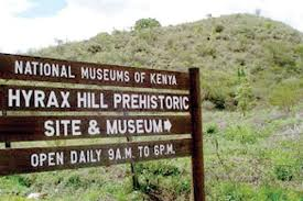
Hyrax Hill: Kenya's Neolithic Cairn Tombs

July 14, 2026

Introduction

Overlooking the seasonal waters of Lake Nakuru within the Kenyan Rift Valley, Hyrax Hill is a vital, multi-component site that charts thousands of years of human technological and social evolution. First excavated by Mary Leakey in 1937, the site’s deep stratigraphy spans from the late Pastoral Neolithic period (ca. 3,000 years ago) through the Iron Age, serving as a critical global sequence for tracking the dawn of food production and sedentary lifestyles in East Africa. For generations, Hyrax Hill has provided the material baseline for defining early pastoral movements, completely dismantling older notions that early African herders were entirely nomadic and left no permanent mark on the landscape.

The Stratigraphy of Ancestral Veneration and Herd Management

The deep history of Hyrax Hill has been meticulously unpacked through the excavation of its prominent stone features and low earth mounds. The earliest Pastoral Neolithic layers are defined by a series of low stone burial cairns containing human skeletons accompanied by a distinct material toolkit: beautifully carved Savanna Pastoral Neolithic stone bowls, razor-sharp obsidian scrapers, and highly decorated pottery vessels used for milk processing.

As the stratigraphic layers transition into the later Iron Age horizons, the landscape exhibits a profound structural shift. The site reveals dozens of semi-subterranean "Sirikwa holes"—large, circular depressions engineered with stone-walled perimeters and narrow, single-file entrances designed specifically to pen livestock safely against predators. Excavations within these depressions have yielded substantial deposits of domesticated cattle and sheep-goat bones, alongside specialized bao game boards carved directly into nearby flat rock outcrops, providing an intimate look at the daily leisure and socio-economic life of these early herders.

Conclusion

The multi-disciplinary investigation of Hyrax Hill provides a foundational baseline for understanding the long-term history of pastoralism and climate adaptation in East Africa. It proves that thousands of years ago, early African communities were deeply anchored to specific landscapes, investing immense labor into ancestral veneration, stone tomb construction, and specialized livestock architecture. The rich artifact sequences and continuous occupational horizons documented at the site demonstrate a highly adaptable cultural tradition that successfully navigated changing lake levels and environmental shifts over millennia. Ultimately, Hyrax Hill stands as a powerful monument to early African agricultural roots, proving the deep antiquity of complex pastoral life in the Rift Valley.

← Newer Posts Older Posts →
Featured
image_2026-07-26_233654475.png
July 30, 2026
Mill Creek Chert Mines: Illinois' Quarry Complex
July 30, 2026
Read more →
July 30, 2026
image_2026-07-26_233854464.png
July 30, 2026
Cave-in-Rock: Illinois' Saltpeter Mining Cave
July 30, 2026
Read more →
July 30, 2026
image_2026-07-26_233924513.png
July 30, 2026
Black Hand Site: Ohio's Adena Earthworks
July 30, 2026
Read more →
July 30, 2026
image_2026-07-26_234003346.png
July 30, 2026
Stubbs Earthworks: Ohio's Hopewell Enclosure
July 30, 2026
Read more →
July 30, 2026
image_2026-07-26_234137845.png
July 30, 2026
Tremper Mound: Ohio's Pipe Cache Burial
July 30, 2026
Read more →
July 30, 2026
image_2026-07-26_234210983.png
July 30, 2026
Seip Earthworks: Ohio's Hopewell Geometric Complex
July 30, 2026
Read more →
July 30, 2026
read more

Powered by The archaeologist