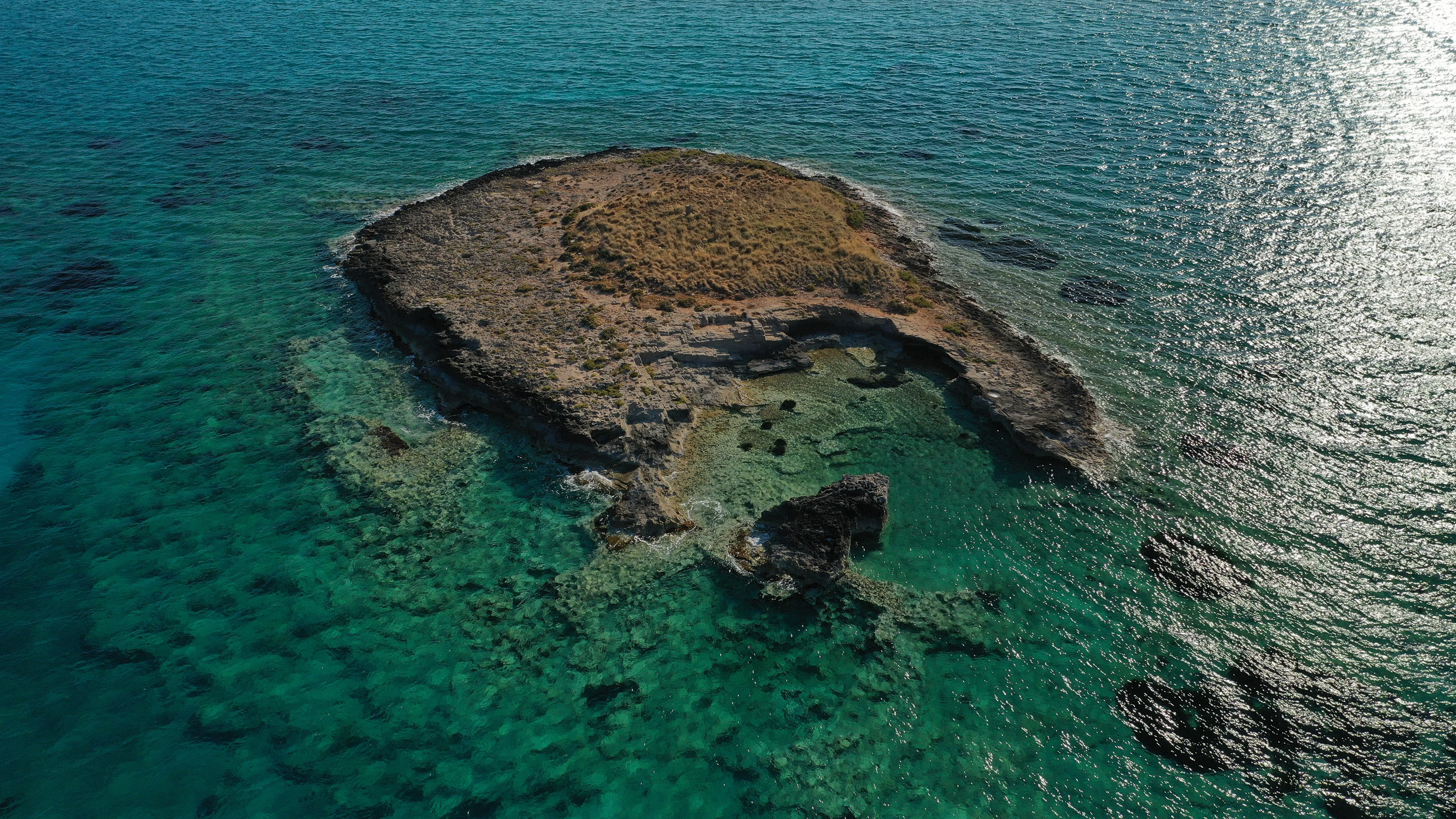
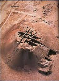
While Göbekli Tepe and Karahan Tepe represent monumental, isolated ritual sanctuaries where people gathered but did not permanently live, the newly excavated site of Boncuklu Tarla ("The Field of Beads") provides the missing link: a permanent, sedentary village where humans lived alongside their temples at the absolute dawn of history. Located in the Dargeçit district of Mardin province in southeastern Turkey, Boncuklu Tarla dates back to an astonishing 10,000 to 11,000 BCE, making it over 12,000 years old—predating the earliest cities of Sumer by over 7,000 years.
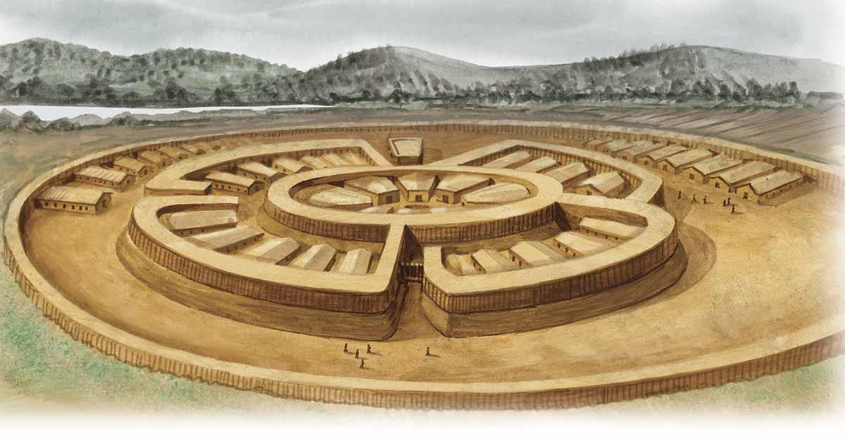
The site is a dense, layered ecosystem of continuous human habitation spanning the Late Epipaleolithic to the Pre-Pottery Neolithic A and B periods. Here, the transition from wild nomadic hunting to settled village life is preserved directly in the stone architecture.
The Evolution of the Circular House
The architectural layers of Boncuklu Tarla document a profound cognitive shift in how humans conceptualized space:
The Earliest Layers: The oldest residential structures are small, circular semi-subterranean huts dug directly into the soil, utilizing basic timber posts and reed roofs, mimicking temporary nomad base camps.
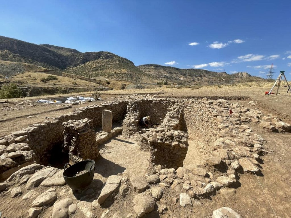
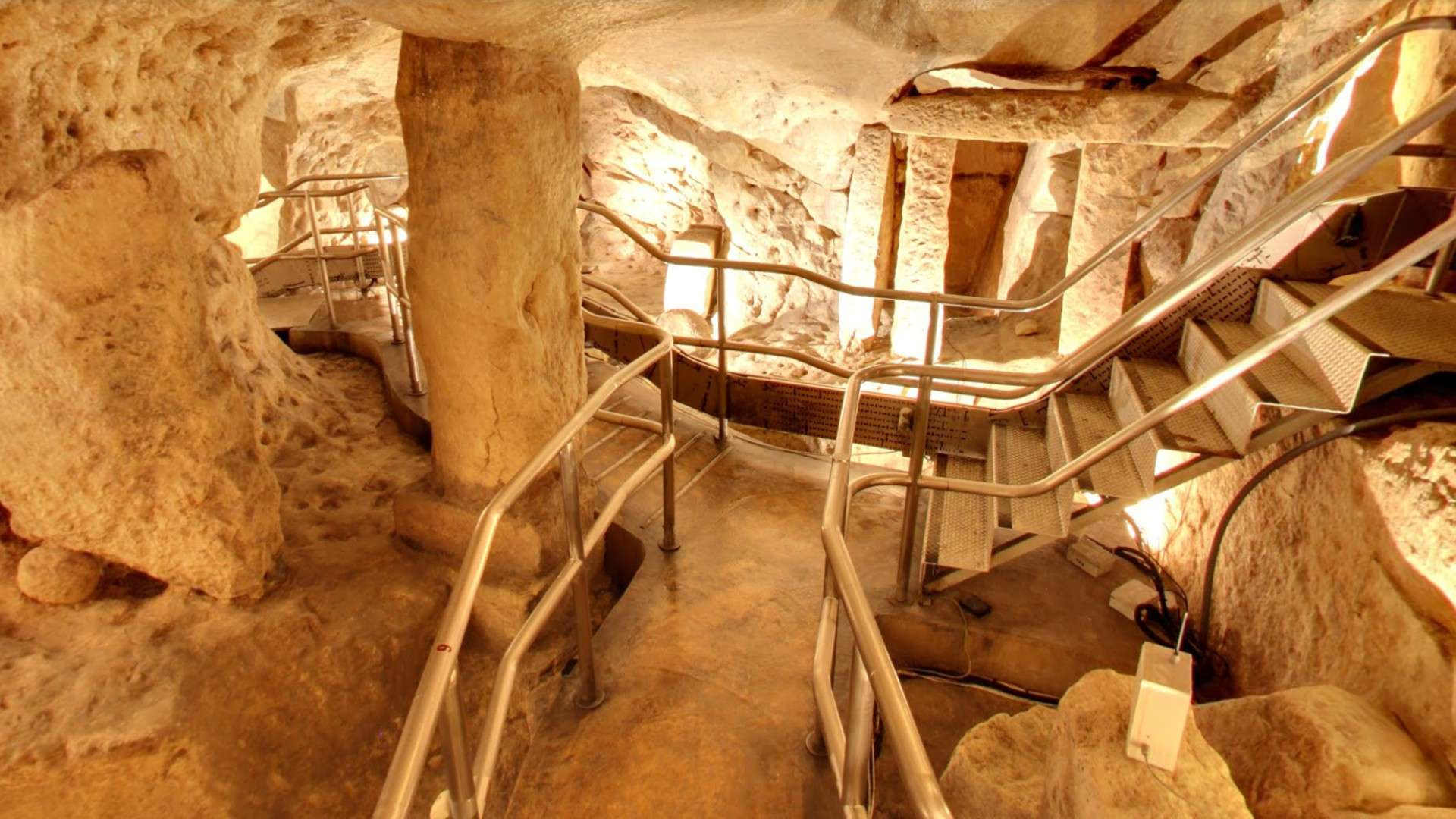
The Transitional Peak: As the centuries progressed, the architecture shifted away from single-family huts into massive, communal, multi-room complexes featuring perfectly plastered floors made of burnt lime and crushed clay (terrazzo).
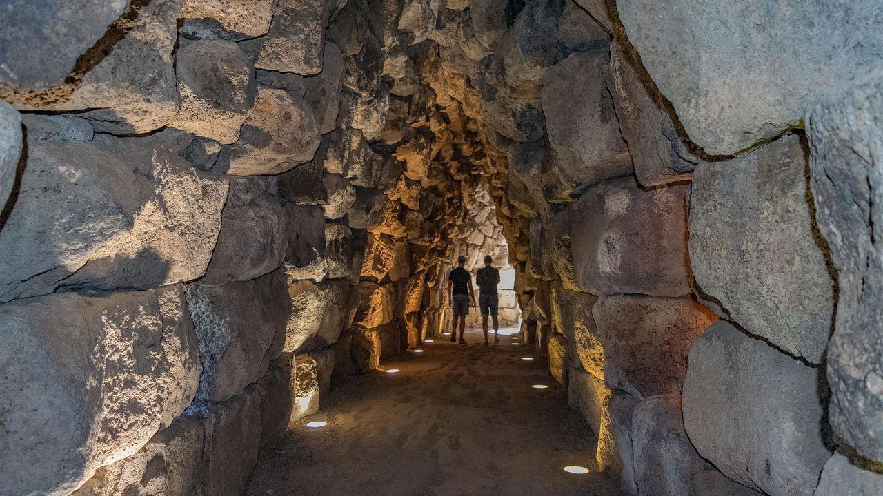
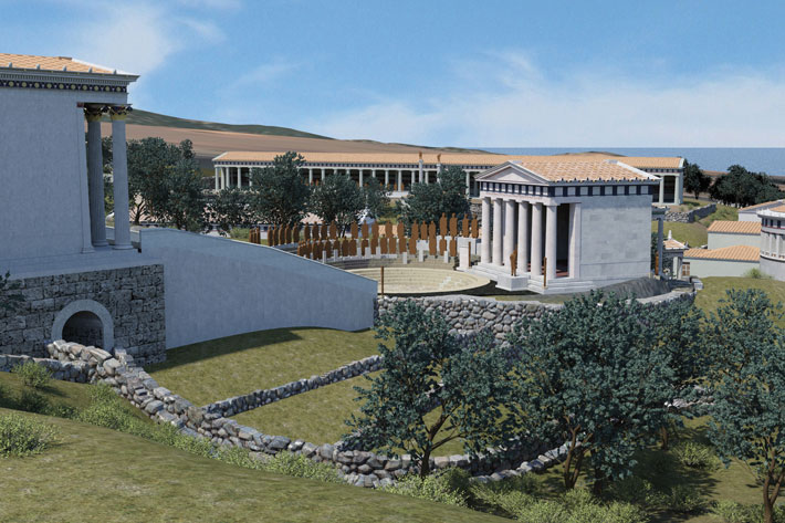
The Public Temples: In the center of the residential village, the community erected a series of monumental public buildings featuring heavy stone walls, stone benches running along the interior perimeters, and freestanding pillars that mirror the elite architecture of Göbekli Tepe.
                         [ THE ARCHITECTURAL STRATIGRAPHY ]
                                         │
         ┌───────────────────────────────┴───────────────────────────────┐
         ▼                                                               ▼
 [ RESIDENTIAL SECTOR ]                                        [ TEMPLE SECTOR ]
 Plastered terrazzo floors, circular stone huts                Communal stone benches, freestanding pillars
         │                                                               │
         └───────────────────────────────┬───────────────────────────────┘
                                         ▼
                 [ HISTORICAL MATRIX: Intra-mural Infant Burials ]
The Field of Beads and the Ancestor Cult
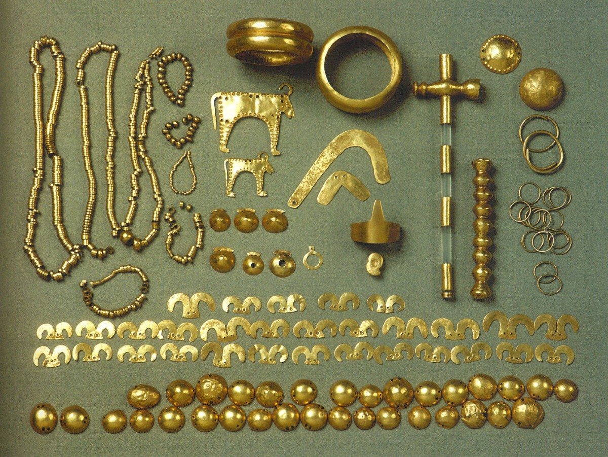
The site earned its modern name due to the discovery of tens of thousands of miniature, highly sophisticated ornamental beads made of colorful local stones, serpentines, carnelian, and marine shells. These beads were woven into intricate necklaces, bracelets, and, most notably, elaborate waistbelts found directly on the skeletons of the deceased.
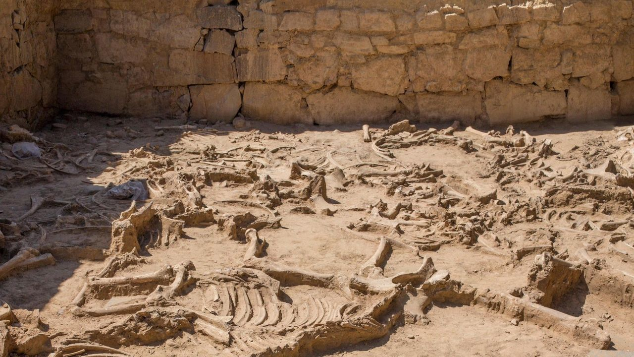
The burial customs at Boncuklu Tarla highlight a deeply spiritual, chthonic ancestor cult. The villagers practiced intra-mural burial, cutting through the plastered floors of their own active living rooms to bury their deceased family members—particularly infants—directly beneath the house.
Often, the skulls of the dead were removed, treated with red ochre pigment, and displayed within the public temple structures before being reburied. This constant, physical proximity to the bones of the ancestors provided the social glue necessary to hold a permanent community together.
Long before humans had mastered the art of making pottery or baking bread, the residents of Boncuklu Tarla were already engineers, master lapidaries, and architects, creating a permanent, bead-adorned home base that witnessed the birth of the modern settled world.
5. Architectural and Cultural Breakdown of Near EasteWhile Göbekli Tepe and Karahan Tepe represent monumental, isolated ritual sanctuaries where people gathered but did not permanently live, the newly excavated site of Boncuklu Tarla ("The Field of Beads") provides the missing link: a permanent, sedentary village where humans lived alongside their temples at the absolute dawn of history. Located in the Dargeçit district of Mardin province in southeastern Turkey, Boncuklu Tarla dates back to an astonishing 10,000 to 11,000 BCE, making it over 12,000 years old—predating the earliest cities of Sumer by over 7,000 years.
The site is a dense, layered ecosystem of continuous human habitation spanning the Late Epipaleolithic to the Pre-Pottery Neolithic A and B periods. Here, the transition from wild nomadic hunting to settled village life is preserved directly in the stone architecture.
The Evolution of the Circular House
The architectural layers of Boncuklu Tarla document a profound cognitive shift in how humans conceptualized space:
The Earliest Layers: The oldest residential structures are small, circular semi-subterranean huts dug directly into the soil, utilizing basic timber posts and reed roofs, mimicking temporary nomad base camps.
The Transitional Peak: As the centuries progressed, the architecture shifted away from single-family huts into massive, communal, multi-room complexes featuring perfectly plastered floors made of burnt lime and crushed clay (terrazzo).
The Public Temples: In the center of the residential village, the community erected a series of monumental public buildings featuring heavy stone walls, stone benches running along the interior perimeters, and freestanding pillars that mirror the elite architecture of Göbekli Tepe.
                         [ THE ARCHITECTURAL STRATIGRAPHY ]
                                         │
         ┌───────────────────────────────┴───────────────────────────────┐
         ▼                                                               ▼
 [ RESIDENTIAL SECTOR ]                                        [ TEMPLE SECTOR ]
 Plastered terrazzo floors, circular stone huts                Communal stone benches, freestanding pillars
         │                                                               │
         └───────────────────────────────┬───────────────────────────────┘
                                         ▼
                 [ HISTORICAL MATRIX: Intra-mural Infant Burials ]
The Field of Beads and the Ancestor Cult
The site earned its modern name due to the discovery of tens of thousands of miniature, highly sophisticated ornamental beads made of colorful local stones, serpentines, carnelian, and marine shells. These beads were woven into intricate necklaces, bracelets, and, most notably, elaborate waistbelts found directly on the skeletons of the deceased.
The burial customs at Boncuklu Tarla highlight a deeply spiritual, chthonic ancestor cult. The villagers practiced intra-mural burial, cutting through the plastered floors of their own active living rooms to bury their deceased family members—particularly infants—directly beneath the house.
Often, the skulls of the dead were removed, treated with red ochre pigment, and displayed within the public temple structures before being reburied. This constant, physical proximity to the bones of the ancestors provided the social glue necessary to hold a permanent community together.
Long before humans had mastered the art of making pottery or baking bread, the residents of Boncuklu Tarla were already engineers, master lapidaries, and architects, creating a permanent, bead-adorned home base that witnessed the birth of the modern settled world.