• MAIN PAGE
  • LATEST NEWS
    • Lost Cities
    • Archaeology's Greatest Finds
    • Underwater Discoveries
    • Greatest Inventions
    • Studies
    • Blog
  • PHILOSOPHY
  • HISTORY
  • RELIGIONS
    • Africa
    • Anatolia
    • Arabian Peninsula
    • Balkan Region
    • China - East Asia
    • Europe
    • Eurasian Steppe
    • Levant
    • Mesopotamia
    • Oceania - SE Asia
    • Pre-Columbian Civilizations of America
    • Iranian Plateau - Central Asia
    • Indus Valley - South Asia
    • Japan
    • The Archaeologist Editor Group
    • Scientific Studies
    • Aegean Prehistory
    • Historical Period
    • Byzantine Middle Ages
    • Predynastic Period
    • Dynastic Period
    • Greco-Roman Egypt
  • Rome
  • PALEONTOLOGY
  • About us
Menu

The Archaeologist

  • MAIN PAGE
  • LATEST NEWS
  • DISCOVERIES
    • Lost Cities
    • Archaeology's Greatest Finds
    • Underwater Discoveries
    • Greatest Inventions
    • Studies
    • Blog
  • PHILOSOPHY
  • HISTORY
  • RELIGIONS
  • World Civilizations
    • Africa
    • Anatolia
    • Arabian Peninsula
    • Balkan Region
    • China - East Asia
    • Europe
    • Eurasian Steppe
    • Levant
    • Mesopotamia
    • Oceania - SE Asia
    • Pre-Columbian Civilizations of America
    • Iranian Plateau - Central Asia
    • Indus Valley - South Asia
    • Japan
    • The Archaeologist Editor Group
    • Scientific Studies
  • GREECE
    • Aegean Prehistory
    • Historical Period
    • Byzantine Middle Ages
  • Egypt
    • Predynastic Period
    • Dynastic Period
    • Greco-Roman Egypt
  • Rome
  • PALEONTOLOGY
  • About us
No results found

Becán: Mexico's Triple-Moated Fortress City

July 13, 2026

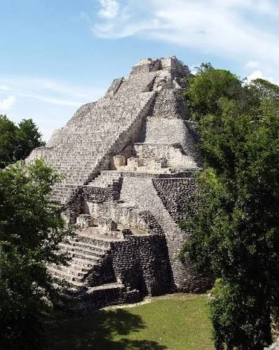
Located in the heart of the rugged Calakmul biosphere region in southern Campeche, Becán occupies a uniquely dramatic chapter in Mesoamerican history. Founded in the Late Preclassic period around 550 BCE and continuously occupied for well over a millennium, Becán stands as one of the definitive examples of defensive militarism within the Maya civilization. The site’s name, which translates in Yucatec Maya to "Ditch or Ravine Formed by Water," refers directly to its most famous and defining architectural feature: a massive, continuous defensive moat and earthen rampart system that completely encircles the city’s ceremonial and administrative core, transforming the site into a formidable prehistoric citadel.

For many decades, early twentieth-century Mayanists championed the romantic theory that Classic Maya cities were peaceful vacant ceremonial centers populated only by quiet priests. The discovery and intensive excavation of Becán profoundly dismantled this perspective, providing irrefutable physical evidence that warfare, territorial defense, and geopolitical conflict were endemic components of Classic Maya life. The defensive moat at Becán is a staggering feat of ancient labor. Measuring approximately two kilometers in circumference, the moat averages sixteen meters in width and cuts up to four meters deep into the natural limestone bedrock. The stone excavated from this massive trench was piled onto the inner side to create an elevated earthen rampart, topped by a defensive wooden palisade wall that effectively created a vertical barrier over eleven meters high.

To access the heavily fortified urban interior, visitors and defenders had to cross one of seven strategic stone causeways that bridged the moat. These land bridges were engineered to be easily defensible; they were narrow, forcing potential invaders into bottleneck formations where they could be easily targeted by defenders positioned high atop the rampart walls with spears, atlatl darts, and sling stones. Within this secure perimeter, the elite of Becán constructed an extremely dense, labyrinthine urban environment characterized by the Río Bec architectural style, which is defined by massive solid towers, false temple facades, and highly complex, multi-story palace complexes with internal staircases and vaulted chambers.

The architectural heart of Becán is Structure VIII, a towering building that dominates the Central Plaza. This building features twin solid stone towers that mimic the steep, unclimbable pyramids of Tikal, a stylistic choice intended to project cosmic power and architectural prestige. On the western side of the site lies Structure IX, the tallest pyramid at Becán, which rises over thirty-two meters into the jungle canopy. This structure served as the primary religious stage for the city’s rulers, offering an unobstructed view of the surrounding landscape and allowing sentries to spot approaching enemy armies kilometers away across the dense forest.

The interior of Becán's buildings reveals a highly sophisticated and protective urban planning strategy. Structure IV, for example, is a massive residential palace complex featuring a maze of interconnected rooms arranged around a private inner courtyard. The rooms are dark and cool, insulated by thick limestone walls that provided relief from the intense tropical heat. Many of these elite chambers contain stone benches that served as both beds and throne platforms, where rulers met with generals and ambassadors to negotiate alliances or plan military campaigns during the turbulent centuries of the Classic Maya collapse.

The intensive fortification of Becán suggests that the city was a critical geopolitical prize, likely serving as a strategic regional capital that controlled vital trade routes cutting across the base of the Yucatán Peninsula. The presence of Teotihuacán-style artifacts, including green obsidian projectile points and cylindrical tripod pottery vessels, indicates that Becán maintained deep, sometimes volatile connections with the militaristic empires of Central Mexico. As an enduring archaeological monument, Becán remains a stark reminder of the fragile balance between artistic brilliance and raw military survival, its deep moat standing as a silent testament to an era when the Maya built not just to honor the gods, but to survive the wrath of their neighbors.
Teopanzolco: Morelos' Dual Aztec Pyramid Temple

July 13, 2026

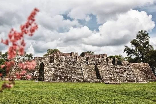
Nestled directly within the modern, bustling urban neighborhoods of Cuernavaca, the capital of Morelos, lies Teopanzolco, a remarkable archaeological site that offers an invaluable tangible link to the complex history of the Aztec Empire. The site’s name is derived from the Nahuatl language, translating roughly to "In the Old Temple Place." Built and inhabited primarily during the Late Postclassic period between 1300 and 1521 CE, Teopanzolco was founded by the Tlahuica people, a Nahuatl-speaking ethnic group closely related to the Mexica of Tenochtitlan. This site stands as a profound architectural prototype, showcasing the classic dual-pyramid design that would later reach its monstrous, ultimate expression at the Huey Teocalli (Templo Mayor) in the Aztec capital.

The defining feature of Teopanzolco is its Grand Basal Platform, which supports the unique Dual Pyramid. This architectural style represents a profound Mesoamerican ideological concept: the balance of opposing cosmic forces. The pyramid base rises in a series of stepped, sloping terraces constructed from local volcanic stone and river boulders, coated in a thick layer of smooth lime plaster. At the broad summit of this single platform sat two independent, side-by-side temples, accessed by a massive, divided central staircase. The northern temple was dedicated entirely to Tlaloc, the ancient god of rain, water, and agricultural fertility, while the southern temple was consecrated to Huitzilopochtli, the fierce Mexica patron deity of war, fire, and the sun.

This architectural duality reflected the delicate balance required to sustain human life and empire. The Tlaloc side was symbolized by the cool, life-giving rains necessary to cultivate maize in the fertile valleys of Morelos, while the Huitzilopochtli side represented the burning heat of the sun and the raw military force required to capture sacrificial victims to feed that sun. On the Huitzilopochtli side, the remains of a sacrificial stone (techcatl) can still be traced, where high priests performed cardiotomy—the ritual extraction of the human heart—before rolling the bodies down the steep steps of the pyramid to re-enact celestial myths.

A major archaeological discovery occurred at Teopanzolco following the catastrophic 7.1 magnitude earthquake that struck Central Mexico on September 19, 2017. The violent seismic activity caused severe structural shifting within the core of the Grand Pyramid. When archaeologists from the National Institute of Anthropology and History (INAH) used advanced radar and exploratory shafts to assess the damage, they discovered a hidden, older temple structure buried deep inside the pyramid’s core. This interior temple, dating back to roughly 1150 CE, contained a wealth of offerings, including ceramic vessels, charcoal remains, and a primary burial, proving that the Tlahuica practiced the traditional Mesoamerican custom of building new, larger pyramids directly over older structures to encapsulate their sacred power.

Surrounding the dual pyramid are several smaller, specialized structures that complete the ceremonial precinct. Among these is a unique circular temple dedicated to Ehecatl-Quetzalcoatl, the Aztec god of the wind. Mesoamerican architects engineered these wind temples with round, sweeping walls to offer no resistance to the blowing gales, allowing the deity to sweep through the valley unimpeded, bringing the rain clouds in his wake. Nearby are several rectangular platforms used for elite residences and administrative functions, where the Tlahuica lords collected tribute—such as cotton textiles, a major agricultural product of Morelos—to send to their Aztec overlords in Tenochtitlan.

Teopanzolco is a monument to the resilience of cultural heritage. Despite being completely surrounded by contemporary urban infrastructure, roads, and modern residential homes, the ancient volcanic stone pyramids continue to command a powerful presence. They stand as a physical testament to the sophisticated engineering, deeply rooted religious cosmos, and dramatic historical shifts that shaped the Tlahuica people before the cataclysm of the Spanish conquest transformed the sacred valley of Morelos forever.

Dzibilchaltún: Yucatan's Cenote Ritual Platform

July 13, 2026

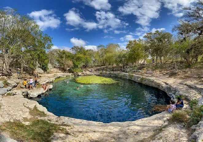
Situated just a short drive north of Mérida, the modern capital of Yucatán, lies Dzibilchaltún, an archaeological site whose name translates poetically from the Yucatec Maya language as "Place of the Writing on Flat Stones." This ancient metropolis stands as one of the oldest and longest-inhabited urban centers in the northern Maya lowlands, with a continuous occupational history spanning from the Middle Preclassic period around 500 BCE until the arrival of Spanish conquistadors in the sixteenth century. While the site features an extensive network of plazas and administrative buildings, its unique geographic layout and spiritual life are profoundly tied to a singular geological feature: Cenote Xlacah, an open-air natural sinkhole that served as both a life-giving water source and a sacred ritual platform.

Cenote Xlacah is the literal and spiritual heart of Dzibilchaltún. Reaching depths of over forty meters, this expansive, crystal-clear body of water provided the necessary hydration for an urban population that at its peak surpassed twenty thousand residents. In the arid landscape of the northern Yucatán Peninsula, where surface rivers are entirely absent due to the porous limestone bedrock, cenotes were critical for physical survival. However, to the ancient Maya, Xlacah was far more than an ecological resource; it was a physical portal to Xibalba, the watery underworld inhabited by the rain god Chaac and the spirits of the ancestors.

The relationship between the natural world and Maya architecture is manifest in the immediate vicinity of the cenote. Specialized ritual platforms and stone causeways, known as sacbeob, were constructed to directly connect the water’s edge with the city’s major administrative and religious complexes. During archaeological underwater excavations conducted in the mid-twentieth century by National Geographic and the Middle American Research Institute, divers recovered thousands of artifacts from the dark depths of Cenote Xlacah. These findings included thousands of utilitarian pottery shards, alongside highly prized ritual offerings such as carved bone ornaments, jade beads, human skeletal remains, and delicate wooden objects that had been deliberately cast into the abyss to appease the underworld deities during times of drought and political crisis.

Directly connected to this sacred aquatic landscape by a grand limestone causeway is Dzibilchaltún’s architectural masterpiece: the Temple of the Seven Dolls (Templo de las Siete Muñecas). This unique, square-shaped structure is the only known Maya temple to feature windows, a deliberate architectural adaptation designed for sophisticated astronomical observation. The building receives its modern name from a collection of seven small, crude clay figurines discovered buried beneath the temple’s floor during excavations. Each of these figurines displays distinct physical deformities, leading archaeologists to hypothesize that they were used in late post-classic shamanic healing rituals aimed at curing ailments before being ritually interred within the ancient, sacred space.

The Temple of the Seven Dolls is a profound testament to the Maya mastery of archaeoastronomy. The building was engineered with such mathematical precision that during the spring and autumn equinoxes, the rising sun aligns perfectly with the eastern and western portals of the temple. For a few spectacular minutes, the sun bursts directly through the center of the stone doorway, casting a brilliant beam of light along the grand causeway toward the ceremonial core of the site. This solar phenomenon served as an indispensable cosmic calendar, signaling to the ruling elites and farmers the exact moment to prepare the land for planting or to harvest their crops, tying human agricultural cycles directly to the movements of the cosmos.

Dzibilchaltún also presents a striking layer of historical syncretism. Standing directly in the center of the site's primary pre-Columbian plaza are the roofless stone ruins of an early Spanish Franciscan chapel, constructed in the late sixteenth century using the carved stones dismantled from the surrounding Maya temples. This deliberate spatial placement represents the aggressive spiritual conquest of the region. Yet, despite centuries of colonial intervention and environmental change, Dzibilchaltún endures. The sacred platform of Cenote Xlacah and the solar alignments of its temples remain as monuments to a civilization that harmonized urban design, cosmological mathematics, and natural geography into an enduring sacred landscape.

Edzná: Campeche's 5-Story Pyramid House

July 13, 2026

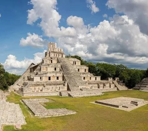
In the semi-arid valley of northern Campeche, rising above the surrounding savannas like an artificial mountain, stands Edzná, an ancient Maya capital of staggering engineering complexity and architectural grandeur. Inhabited as early as 400 BCE and reaching its cultural and political zenith during the Late Classic period between 600 and 900 CE, Edzná—likely derived from Itzá, meaning "House of the Itzás"—developed an exceptionally unique urban layout. The city is celebrated across Mesoamerica for its pioneering hydraulic engineering and its distinct architectural style, which seamlessly blends the regional Puuc and Chenes traditions into a monumental complex centered around the Great Acropolis and its crowning jewel: the Building of the Five Stories (Edificio de los Cinco Pisos).

The Building of the Five Stories at Edzná, featuring tiered palace rooms and a central staircase.. Source: Matt Champlin / Getty Images

The Great Acropolis of Edzná is a massive raised platform that hosts an array of elite residential, administrative, and religious structures. Unlike typical Mesoamerican pyramids, which were solid, layered masses built purely to support a small shrine at the summit, the Building of the Five Stories is a highly functional hybrid of a public temple and an elite palace residential complex. Rising over thirty-one meters above the grand plaza, this five-tiered structure features dozens of vaulted rooms built directly into each level, complete with interior chambers, exterior porticoes, and elegant stone pillars. It represents a vertical neighborhood for the divine and the ruling elite, where the supreme lord of Edzná could live, govern, and conduct sacred rituals in full view of the populace below.

A grand, sweeping central staircase cuts directly through the five tiers of the palace, ascending toward a classic cross-shaped shrine at the very top. This summit temple was once adorned with a soaring roof comb, a decorative stone lattice that made the building appear even taller and more imposing against the Campeche sky. The architecture of the building exhibits the hallmark characteristics of the Chenes style, featuring heavy limestone masonry, recessed doorways, and intricate geometric friezes. Walking through the lower levels, one can still see the stone benches used by Maya nobles, and the small holes drilled into the door jambs where woven curtains were once hung to provide privacy for the royal inhabitants.

Equally spectacular, yet hidden beneath the earth and the surrounding landscape, is Edzná’s revolutionary hydraulic network. The valley in which Edzná sat suffered from a volatile climate: it was plagued by intense tropical torrential downpours during the summer months, followed by severe, life-threatening droughts during the winter. To overcome this environmental hostility, the engineers of Edzná designed a massive, centralized system of canals and reservoirs that was entirely unprecedented in the Maya world. They excavated a network of twelve main canals radiating outward from the city center, covering a distance of over twenty-two kilometers.

These canals served a brilliant dual purpose. During the rainy season, they acted as an urban drainage system, channeling catastrophic floodwaters away from the plazas and agricultural fields into vast, man-made reservoirs (aguadas) lined with impermeable clay and stone blocks to prevent seepage. During the long dry season, this stored water was redirected through a series of smaller distribution channels to irrigate thousands of hectares of intensive maize and vegetable farms, ensuring a stable food supply that allowed the city to survive regional famines. Furthermore, the main canals were wide and deep enough to be used as aquatic highways, allowing merchants to transport heavy goods by canoe directly into the central marketplace of the city.

Near the Great Acropolis, visitors can explore the Temple of the Masks (Templo de los Mascarones), another architectural wonder that emphasizes Edzná's artistic sophistication. This structure features two remarkably preserved stucco masks located at its base, depicting the Maya Sun God, Kinich Ahau. Modeled in high-relief stucco and painted in rich shades of red and blue, these masks represent the sun at sunrise and sunset, complete with cross-eyed pupils—a trait of elite Maya beauty—and ornate nose rings. Through its mastery of hydraulic engineering and its architectural innovations, Edzná stands as a supreme monument to Maya ingenuity, proving that human civilization could flourish within a challenging environment by transforming an arid valley into an engineered oasis of monumental power.

Bonampak Murals: Chiapas' Bloody Maya Court Scenes

July 13, 2026

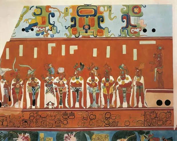
Hidden away in the dense, emerald canopy of the Lacandon jungle, the small Classic Maya site of Bonampak holds an artistic legacy that forever altered our understanding of Mesoamerican civilization. Discovered by American explorer Giles Healey in 1946 with the guidance of the local Lacandon Maya, Bonampak—meaning "Painted Walls" in ancient Yucatec—is home to Structure 1, a modest three-room building constructed around 790 CE. Within this unassuming exterior lies the "Sistine Chapel of the Americas," a breathtaking series of narrative frescoes that wrap entirely around the walls and vaulted ceilings of three distinct rooms, offering an explosive, technicolor account of courtly life, warfare, and human sacrifice.

A view of the vibrant, preserved frescoes inside Structure 1 at Bonampak.. Source: nathan kelly / Getty Images

Before the discovery of these murals, mainstream archaeology largely viewed the ancient Maya as an isolated, peaceful race of priests and astronomers who engaged in quiet philosophical contemplation. The Bonampak frescoes shattered this historical illusion with vivid, unapologetic realism. Executed using a sophisticated wet-fresco technique where natural mineral pigments were applied directly to damp lime plaster, the paintings have survived over twelve centuries due to a protective layer of calcium carbonate that naturally sealed the walls over time. The narrative unfolded across the three rooms details a singular, high-stakes historical sequence under the reign of King Yajaw Chan Muwaan.

Room 1 introduces the viewer to the opulent world of the royal court and the celebration of a young heir's presentation. Here, the walls are filled with images of aristocrats dressed in elaborate, floor-length white capes, heavy jade pectorals, and towering headdresses fashioned from the iridescent green feathers of the quetzal bird. Below the royal dais, a lively procession of musicians beats upon turtle shells with deer antlers, blows into elongated wooden trumpets, and shakes gourds, creating a visual rhythm that leaps off the walls. The atmosphere is one of immense wealth, stability, and cultural refinement, highlighting the complex social hierarchy and theatricality of the Late Classic Maya elite.

The narrative takes a violent and dramatic turn in Room 2, which contains the most famous and harrowing battle scene in Pre-Columbian art. The walls depict a chaotic, hand-to-hand raid launched against a rival city to capture high-ranking prisoners. Warriors are shown locked in ferocious combat, clad in jaguar pelts and brandishing flint-tipped spears. The climax of this room is the iconic "Judgment of the Captives," set upon the steep steps of a ceremonial pyramid. King Chan Muwaan stands triumphantly at the apex, holding a lance, while bound, bleeding prisoners cower at his feet. One captive lies dead on the steps below, while others look in horror at their own fingers, from which streams of bright red blood drip down onto the stone, a prelude to their ultimate sacrifice.

Room 3 shifts the narrative to the grand celebration of victory and the culmination of the sacrificial rites. The murals show noblewomen, including the king's mother and wife, performing ritual bloodletting by piercing their tongues to offer thanks to the gods. Outside, on the exterior terraces, massive public dances are underway. Dancers wearing enormous, stylized backpacks shaped like aquatic monsters and celestial deities spin in ecstatic motion, their movements captured with an astonishing sense of fluid realism by the ancient painters. The use of a rich palette of blues, greens, yellows, and deep iron reds creates a sensory overload that underscores the symbiotic relationship between political victory and religious devotion.

The Bonampak murals are a monument to the narrative capability of indigenous American art. They reveal a world where the preservation of cosmic order demanded immense human cost, where warfare was a highly ritualized tool of statecraft, and where royal courts were centers of dazzling aesthetic sophistication.

Yaxchilán Lintels: Mexico's Jaguar King Carvings

July 13, 2026

Deep within the dense lacandon jungle of Chiapas, along the horseshoe bend of the Usumacinta River, lies the ancient Maya city of Yaxchilán. Accessible primarily by boat, this remote archaeological site holds some of the most sophisticated artistic treasures of the pre-Columbian world: the Yaxchilán Lintels. These carved limestone blocks, positioned above the doorways of major temples, functioned as structural supports and public political manifestos. Commissioned predominantly during the Late Classic period by the city’s powerful dynastic rulers, Shield Jaguar II and his son Bird Jaguar IV, these masterpieces offer an uncompromised window into the esoteric rituals, bloodletting practices, and martial triumphs that legitimized the Maya ruling elite.

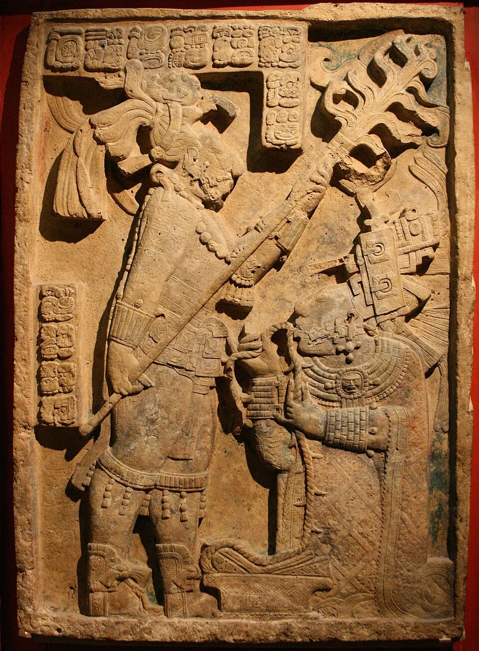
The lintels are renowned for their exceptional stylistic depth, high-relief carving technique, and detailed hieroglyphic texts. Unlike the public stelae found in open plazas across the Maya region, these lintels were set within the dark, intimate thresholds of elite architectural structures, creating a spatial transition between the secular world and the sacred interior chambers. The most famous sequence of these carvings, discovered in Structure 23, depicts the domestic and ritual life of Lady K'abal Xook, the principal wife of Shield Jaguar II. Through these reliefs, modern historians have gained an unprecedented understanding of the essential political and spiritual power wielded by royal women within Maya society.

In Lintel 24, one of the undisputed masterpieces of Mesoamerican art, Lady Xook performs a solemn bloodletting ritual. She is shown kneeling, pulling a thick, thorned rope directly through a self-inflicted wound in her tongue. The droplets of her blood fall onto strips of bark paper gathered in a woven basket beneath her feet. Standing over her is King Shield Jaguar II, holding a massive torch that illuminates the subterranean dark of the temple. The sheer detail carved into the limestone is staggering; the intricate woven patterns of Lady Xook’s ceremonial huipil tunic, the individualized facial expressions of pain and meditative focus, and the delicate jewelry underscore the unparalleled skill of the Yaxchilán master sculptors.

This act of self-sacrifice was not a punishment but a profound religious obligation. For the Maya, royal blood was the ultimate cosmic currency required to nourish the gods and maintain the structural equilibrium of the universe. The sequel to this painful ceremony is captured on Lintel 25, which portrays the visionary aftermath of the bloodletting. The blood-soaked bark paper has been burned, and from the rising plumes of sacred copal smoke, an enormous, two-headed Vision Serpent materializes. Emerging from the gaping jaws of this supernatural creature is a warrior ancestor, armed and ready to protect the kingdom, effectively legitimizing Shield Jaguar II’s right to rule.

The political utility of the Yaxchilán Lintels expanded under Bird Jaguar IV, who used these stone narratives to solidify his claim to the throne after an apparent dynastic interregnum. On Lintels 1 through 8, carved for Structure 33, Bird Jaguar IV is repeatedly depicted alongside his allies and subordinates, engaged in ritual dances, holding the majestic K'awiil scepters of divine power, and capturing high-ranking foreign prisoners. These carvings served as permanent historical documents, ensuring that every visitor who crossed the threshold of the building was visually reminded of the king's military prowess, cosmic favor, and unassailable lineage.

Today, while some of these priceless pieces remain in situ at the jungle-choked ruins of Yaxchilán, many of the finest examples are housed in the British Museum and Mexico’s National Museum of Anthropology. As historical documents, the Yaxchilán Lintels shattered the early Western archaeological myth of the Maya as a peaceful, utopian society of stargazers. Instead, they revealed a highly dynamic, competitive, and deeply spiritual civilization where art, statecraft, and blood were irrevocably bound together, ensuring that the legacy of the Jaguar Kings would remain forever etched into the limestone bones of Chiapas.

Palenque's Temple of the Cross: Pakal's Star Map?

July 13, 2026

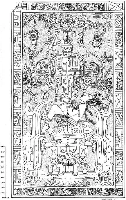
In the foothills of the Chiapas mountains, the site of Palenque represents an artistic and architectural high point of Maya civilization. While the Temple of the Inscriptions houses the legendary tomb of King K'inich Janaab' Pakal, his son and successor, K'inich Kan Bahlam II (r. 684–702 CE), built an equally brilliant architectural complex known as the Group of the Cross. The largest structure in this group, the Temple of the Cross, houses a series of detailed limestone relief panels that have driven a fascinating debate regarding the Maya integration of architecture, mythology, and astronomy.

The interior sanctuary of the temple contains a large carved panel depicting King Kan Bahlam II receiving the symbols of rulership from his deified father. At the center of this composition stands a massive, cross-like design that early explorers mistook for a Christian icon, but which epigraphers have identified as the World Tree (Wakah Chan), the central axis of Maya cosmology that links the underworld, the earthly plane, and the heavens.

The debate centers on how this architectural layout aligns with the cosmos. Archaeoastronomers have demonstrated that the Temple of the Cross was built using a precise astronomical matrix. During the winter solstice—the shortest day of the year—the sun sets directly in line with the temple's main axis, casting a beam of light that illuminates the carved image of the dead King Pakal, symbolizing his descent into the underworld. Furthermore, computer models of the Classic period night sky indicate that the arrangement of the World Tree and its accompanying glyphs mirrors the exact position of the Milky Way across the horizon during key calendar dates in 692 CE. This suggests the temple panel functioned as a stone star map designed to prove that the succession of the new king was written into the movements of the stars.

Toniná: Chiapas' Pyramid of the Inscriptions

July 13, 2026

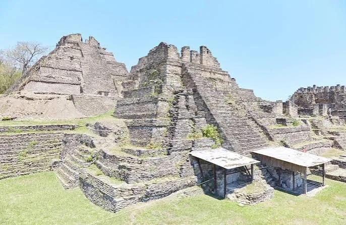
Perched on a hillside overlooking the Ocosingo Valley in Chiapas, Mexico, Toniná is a unique Classic period Maya site defined by its vertical architecture. Unlike lowland cities like Tikal or Copán, which spread across flat plains, Toniná's builders transformed an entire natural hillside into a massive, seven-tiered acropolis, creating a single, colossal 71-meter-tall step-pyramid structure that dominates the landscape.

This multi-level acropolis is a complex maze of stone temples, vaulted administrative chambers, long galleries, and elite burial vaults connected by a web of stone staircases. At the sixth level sits the famous Temple of the Inscriptions, a sanctuary decorated with extensive stucco reliefs and hieroglyphic panels. These inscriptions record a detailed, aggressive history of military victories, the capture of foreign lords, and the performance of sacred bloodletting rituals by Toniná's rulers.

The site is famous for its distinct artistic style, which favored highly expressive, fully three-dimensional stone and stucco sculptures over traditional flat relief carvings. The acropolis walls display large, dramatic murals, including the "Frieze of the Four Suns," a complex limestone relief depicting a skeletal death god holding decapitated heads, representing the underworld layers of Maya cosmology. Toniná operated as a fierce, militaristic state that specialized in high-altitude defensive warfare, using its towering acropolis to watch over the trade routes connecting the Chiapas highlands with the Usumacinta river basin.

Calakmul: Mexico's Rival Maya Superpower Ruins

July 13, 2026

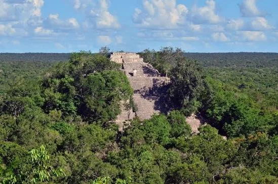
Deep within the Tierras Bajas region of Campeche, Mexico, the ancient ruins of Calakmul lie enveloped by a vast biosphere reserve. During the Classic Maya period (c. 250–900 CE), Calakmul was the capital of the formidable Kaanul Dynasty—the "Kingdom of the Snake"—operating as the direct, bitter rival to Tikal. This city was an expansive, low-density superpower urban center that controlled a vast network of vassal states across the Maya world through strategic marriages, diplomatic gifts, and military force.

The architectural centerpiece of Calakmul is Structure II, one of the largest pyramids ever built by the Maya civilization. This massive temple-pyramid base covers an area of over two hectares and rises 50 meters above the jungle floor, housing multiple elite tombs and structural phases stacked on top of one another across centuries. From the upper terraces of this monument, rulers could look out over the flat canopy, visually confirming their control over the landscape.

What sets Calakmul apart is its immense wealth of historical records. The site has yielded 117 carved stone monuments (stelae), the highest concentration in the Maya area. Although the soft local limestone has suffered significant erosion, advanced epigraphic methods have deciphered these carvings, revealing a detailed history of the Snake Kingdom's geopolitics. The inscriptions detail the exploits of great kings like Yuknoom the Great, who built a complex network of political alliances to encircle and isolate Tikal, showing that Calakmul relied on sophisticated international diplomacy just as much as military strength to maintain its empire.

Tikal's Lost Causeways: Guatemala's Jungle Highways

July 13, 2026

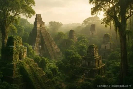
Deep within the Petén rainforest of Guatemala, the ancient Maya metropolis of Tikal stands as a monument to Classic period urban planning. While its towering pyramids dominate the jungle canopy, the true arteries of this superpower city were its massive, elevated limestone causeways, known as sacbeob (singular: sacbe, meaning "white road"). These jungle highways were not simple dirt trails; they were heavily engineered stone causeways that measured up to 60 meters wide and extended for miles across the urban landscape.

The construction of a sacbe required immense collective labor and raw material processing. Maya engineers first laid down two parallel retaining walls built from massive, dressed limestone blocks. The interior space between these walls was then filled with millions of rough limestone fragments, flint nodules, and soil to create a stable, elevated roadbed that sat up to three meters above the forest floor. The surface was finished with a thick layer of crushed limestone mortar and polished white stucco, creating a smooth, weather-proof highway that reflected the moonlight and remained completely functional during the heavy tropical wet season.

The causeways served a vital combination of military, logistical, and religious functions. They connected Tikal’s central acropolis with distant suburban complexes and agricultural zones, allowing the rapid deployment of troops and the efficient transport of maize and trade goods into the city center. Spiritually, causeways like the Maler, Maudslay, and Méndez Sacbeob functioned as formal ceremonial avenues. During major calendar shifts, the Maya elite marched along these white roads in elaborate costumes, creating a grand public theater that physically bound the distant corners of the landscape to the sacred authority of Tikal's divine rulers.

Batad Terraces: Philippines' UNESCO Spiral Fields

July 13, 2026

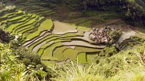
Located in a remote valley accessible only by foot trail near Banaue, the Batad Rice Terraces are a visually stunning component of the UNESCO World Heritage designation. Unlike the linear, ridge-following terraced structures found elsewhere in the Cordilleras, the Batad fields are built within a steep, natural volcanic amphitheater, creating a massive, concentric stone structure that resembles a giant architectural colosseum or spiral staircase.

The amphitheater layout showcases the pinnacle of Ifugao spatial engineering. Because the slopes curve continuously around a central basin, the water delivery channels had to be designed to wrap around complex, circular geometries. Water enters from a single high-altitude stream at the top rim of the bowl and is directed through a sequence of stone sluice gates that distribute the flow radially across the entire amphitheater.

The dry-stone walls of Batad are among the highest in the region, with some individual walls reaching up to six meters in vertical height to support narrow, high-altitude planting platforms. The community maintains these structures through a strict, ancestral code of cooperative labor called ubbo. If a wall collapses due to a typhoon or seismic shift, the entire village mobilizes to clean the debris, re-carve the mountainside, and restack the heavy river stones block by block. This collective effort ensures that the ancient hydrological cycle remains functional across generations.

Banaue Engineering: Ifugao's Stone-Wall Megastructures

July 13, 2026

Within the cluster of Cordilleran agricultural networks, the Banaue rice terraces stand out for their sheer vertical scale and advanced masonry engineering. Unlike terraced fields built on gentle clay slopes, the Banaue structures are carved into near-vertical mountain inclines, requiring the construction of massive stone retaining walls that function as functional megastructures.

The engineering of a Banaue stone wall begins with the creation of a stable foundation trench cut deep into the mountain's bedrock. Ifugao masons then selected heavy, water-worn river stones, transport-carrying them up from the valley floors below. These stones were laid dry—without cement or mortar—using a specialized interlocking pattern that allows the wall to flex safely during the region's frequent earthquakes. The wall is built with a slight inward lean (batter) to press directly into the hillside, resisting the immense outward pressure of the water-saturated mud inside the rice pond.

To manage the heavy weight of the water, the interior of each terrace is layered like a geological filter. The base is packed with large boulders, followed by layers of river gravel, coarse sand, and finally a thick, impermeable top layer of puddled volcanic clay that forms the agricultural bed. This specific configuration allows excess groundwater to seep slowly through the dry-stone joints without causing the wall to burst, preventing the cataclysmic mudslides that regularly threaten lesser terraced hillsides during the typhoon season.

Ifugao Rice Terraces: Philippines' 2,000-Year Engineering

July 13, 2026

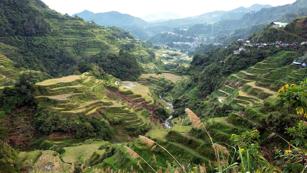
The rice terraces of the Cordillera mountains in northern Luzon, Philippines, represent an exceptional monument to sustainable agricultural engineering. Carved into steep mountainsides by the indigenous Ifugao people over generations, these terraced landscapes cover thousands of square kilometers. While early historical estimates suggested the terraces were over 2,000 years old, current archaeological investigations indicate the intensive terracing system expanded rapidly around 400 years ago, driven by social reorganization and the need for food security during the Spanish colonial incursion into the lowlands.

The engineering of the terraces is a masterpiece of landscape modification accomplished entirely without iron tools, draft animals, or sophisticated surveying equipment. The Ifugao builders worked by following the natural contours of the mountain ridges, transforming near-vertical slopes into flat, stepped pond fields (payo). The entire system is built out of compacted clay and local river stones, carefully stacked to prevent landslides and manage water flow.

The long-term survival of the terraces depends on an advanced understanding of watershed dynamics and communal water management. The system relies on a continuous supply of water from intact, high-altitude rainforests (muyong) preserved directly above the terrace fields. These protected forests function as a natural sponge, storing monsoon rainwater and releasing it slowly into a network of mountain springs and streams. The Ifugao built a complex web of hand-carved stone channels, bamboo pipes, and earth dikes to route this water down through the terraced steps, ensuring that every individual pond field receives an equal, controlled flow of nutrient-rich water.

Lanna Kingdom: Chiang Saen's 800-Year Golden Teak Temples

July 13, 2026

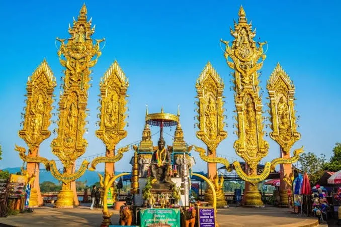
Situated along the banks of the Mekong River in northern Thailand, the historic city of Chiang Saen served as a vital capital of the Lanna Kingdom, an independent state that ruled northern Thailand from the 13th to the 18th centuries. While Lanna architects built impressive brick fortifications and stupas, their true artistic signature was expressed through the construction of monumental temples made entirely out of old-growth golden teak wood (Tectona grandis), harvested directly from the dense monsoon forests of the region.

Teak wood was prized for its natural resistance to water damage, fungal decay, and termites, allowing Lanna carpenters to construct large wooden assembly halls (viharns) without modern chemical preservatives. The structural engineering relied on an advanced post-and-beam system held together by precision tongue-and-groove joinery and wooden dowels, avoiding iron nails which would rust in the tropical humidity. Massive, single-tree teak logs were stripped and carved to serve as primary weight-bearing pillars, supporting sweeping, multi-tiered roofs designed to shed heavy monsoon downpours.

The artistic style of these teak temples is defined by their dramatic proportions and delicate wood carvings. The low-slung, sweeping rooflines create a sense of shelter, while the exterior gables are decorated with intricate filigree work depicting scrolling floral designs (lai krau), mythical protective creatures, and celestial figures. Inside, the golden teak surfaces were sealed with coats of natural black lacquer and stenciled with delicate gold leaf patterns, creating a warm interior space that reflected the unique spiritual identity of northern Thai Buddhism.

Candi Borobudur Reliefs: Java's Forgotten Narratives

July 13, 2026

Candi Borobudur, built in Central Java during the 8th and 9th centuries under the Sailendra Dynasty, is the largest Buddhist monument in the world. Constructed as a colossal step-pyramid mandala out of millions of andesite stone blocks, it features nine stacked platforms that pilgrims ascend pathwise to simulate the journey to enlightenment. While its architectural scale is famous, its deep historical value is preserved in its 2,672 individual narrative relief panels. These relief carvings wrap around the lower galleries, covering a surface area of over 2,500 square meters.

These stone panels are organized into distinct narrative cycles that guide the viewer as they perform ritual circumambulation (pradaksina). The journey begins at the hidden base with the Kamavibhangga, which illustrates the law of karma by depicting scenes of daily life, earthly desires, and their subsequent punishments or rewards in the afterlife. Higher levels present the Lalitavistara, a highly detailed biography of the historical Buddha from his descent from heaven to his first sermon, followed by the Gandavyuha, which follows the young seeker Sudhana on his quest for ultimate wisdom.

Beyond their spiritual meaning, the Borobudur reliefs function as an invaluable visual encyclopedia of 9th-century Javanese society. Because the ancient artists modeled their historical scenes on the world around them, the panels provide precise depictions of Javanese palace architecture, domestic village houses, traditional clothing, musical instruments, and agricultural tools. One famous panel depicts a large, double-outrigger maritime vessel—now known as the "Borobudur Ship"—confirming Java's role as a major maritime trade superpower in the ancient Indian Ocean network.

Sambisari: Java's Buried 9th-Century Shiva Temple

July 10, 2026

Discovered accidentally by a local farmer plowing his field in 1966, Candi Sambisari is a remarkably intact 9th-century Hindu temple complex located near Yogyakarta on the island of Java, Indonesia. Built during the height of the Mataram Kingdom under the Sanjaya Dynasty, the temple vanished from historical records around the 10th century. It was completely buried beneath a six-meter-thick layer of dense volcanic ash and mud lahar thrown out by the eruptions of the nearby Mount Merapi volcano.

Because it was sealed underground for a millennium, Sambisari escaped the stone looting and weathering that damaged other Javanese monuments. The excavation and restoration project, which lasted over two decades, revealed a temple complex that sits inside a large, sunken walled courtyard. The complex consists of a single large main temple facing west, accompanied by three smaller ancillary shrines (pervara) lined up directly in front of it.

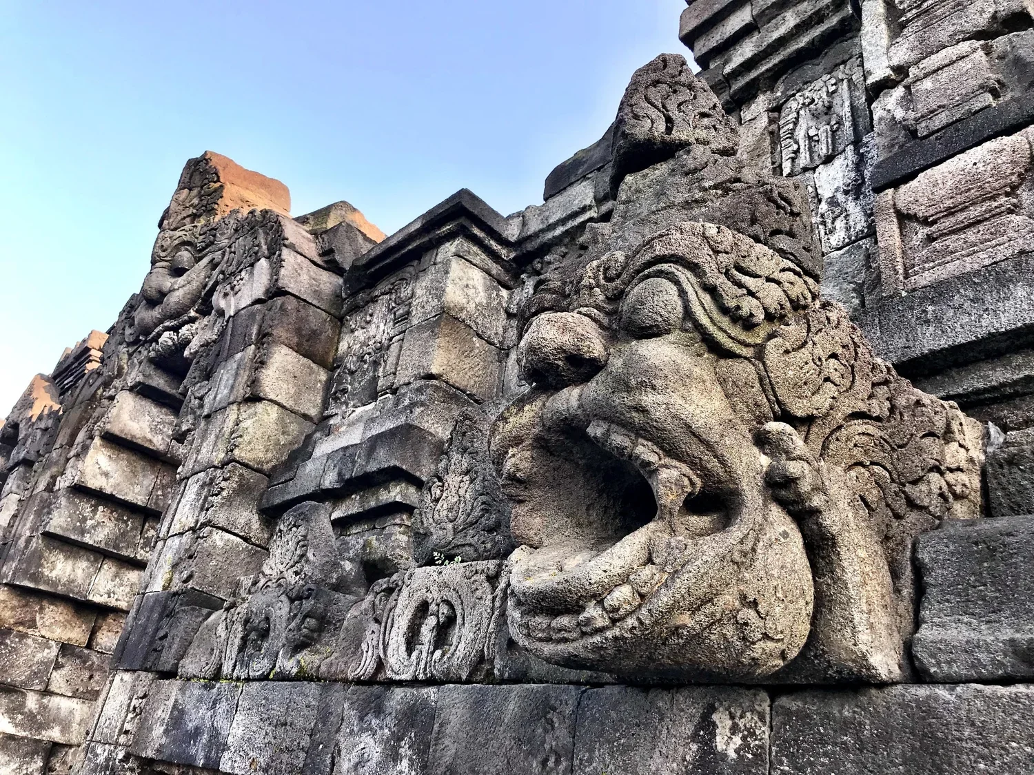
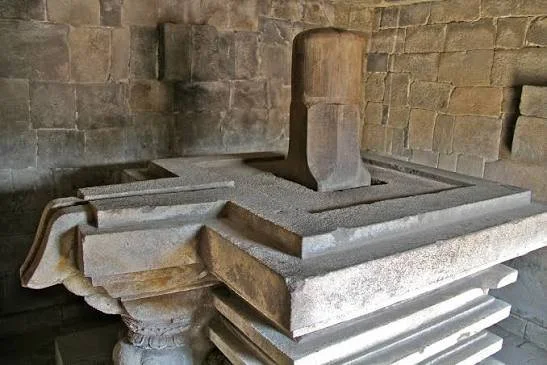
The main temple rests on a plain rectangular basement canvas, accessed via a stone staircase guarded by detailed sea-monster carvings (Makara). Inside the elevated square cellar sits a highly revered stone lingam and yoni pair, the traditional abstract representations of Shiva and Parvati, along with three outer niches housing intact statues of Durga, Ganesha, and Agastya. The discovery of gold foil dedication plates inscribed with protective mantras beneath the temple floor confirms that Sambisari operated as a high-status regional shrine, preserved by the volcanic force that originally buried it.

Wat Phu: Laos' 1,000-Year Mountain Sanctuary

July 10, 2026

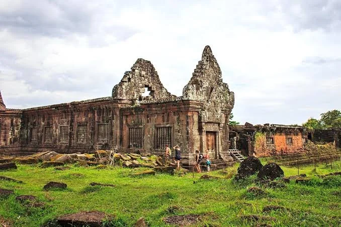
Resting at the base of Mount Phu Kao in Champasak Province, southern Laos, Wat Phu is an exceptional Khmer archaeological complex that predates Angkor Wat. The site's location was chosen due to a striking natural feature: the summit of Phu Kao displays a prominent, 15-meter-tall monolithic rock formation that resembles a natural Shiva lingam. Recognizing this as a direct sign of divine presence, early Khmer rulers transformed the mountain into a sacred landscape, naming it Shrestapura and developing a terraced temple complex that operated for over a thousand years.

The architecture of Wat Phu is organized along a dramatic, 1.4-kilometer oriental axis that rises up the steep lower slopes of the mountain. Visitors enter through a lower plain dominated by two massive, rectangular stone pavilions—popularly called the Northern and Southern Palaces—dating to the 11th-century Baphuon style. From these palaces, a processional causeway flanked by stone pillars leads pilgrims up a series of steep laterite staircases, framed by ancient frangipani trees, to reach the main sanctuary terrace perched high on the cliffside.

The upper terrace houses the primary sanctuary building, a sandstone structure covered in detailed carvings of Krishna, Vishnu, and Shiva. Directly behind this sanctuary, a natural mountain spring flows from the rocky cliff face. Khmer engineers built a system of stone channels to collect this water, routing it straight through the inner sanctum to continuously bathe the central stone lingam before draining down to the lower plains to irrigate the agricultural fields below. This integration of geology, hydrology, and architecture allowed Wat Phu to transition smoothly from an early Hindu shrine into a Buddhist place of worship, remaining an active pilgrimage site to this day.

Muang Tam: Thailand's Khmer Water Temple Complex

July 10, 2026

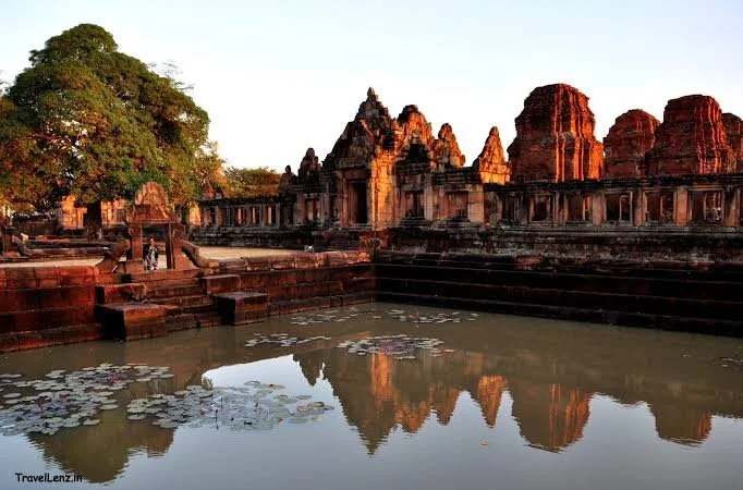
Situated at the base of the Phnom Rung volcano in Buriram Province, northeastern Thailand, Prasat Muang Tam is an elegant example of 10th-century Khmer provincial temple architecture. Built primarily during the late 10th and early 11th centuries under the patronage of local elites aligned with the Angkorian court, this Hindu sanctuary was dedicated to Shiva. While smaller than its mountain-top neighbor, Phnom Rung, Muang Tam stands out for its layout, which balances monumental stone masonry with an advanced, symbolic water management network.

The central sanctuary consists of five brick towers (prasats) arranged in a unique two-row layout (three in the front, two in the back) resting on a shared laterite platform. The central, largest tower, which historically housed a sacred stone lingam, is missing its upper tiers but retains exquisitely carved sandstone lintels depicting Hindu deities like Indra riding his elephant, Airavata. This central sacred core is tightly bounded by an inner galleries enclosure featuring intricately carved windows and entry gates (gopuras).

The defining feature of Muang Tam is its outer water network. The central courtyard is wrapped by four large, L-shaped holy ponds, separated by paved causeways that align with the main cardinal directions. Each basin is lined with stepped laterite blocks and bordered by an ornate, continuous sandstone balustrade sculpted in the likeness of a multi-headed serpent, the Naga. These ponds served a dual purpose: practically, they acted as urban reservoirs that collected monsoon rainwater from the temple’s stone roofs to supply the surrounding settlement during dry spells. Spiritually, they transformed the sanctuary into a physical model of Hindu cosmology, with the central brick towers representing the peaks of Mount Meru and the surrounding ponds symbolizing the primordial oceans that encircle the universe.

Khmer Jayavarman: Angkor's Hidden Hydraulic Network

July 10, 2026

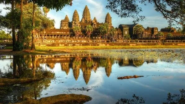
The expansion of the Khmer Empire under its most prolific builder, King Jayavarman VII (r. 1181–1219 CE), is traditionally celebrated through the construction of monumental stone temples like the Bayon and Ta Prohm. However, modern airborne LiDAR surveys over the Angkor region have revealed that Jayavarman’s true architectural triumph was a hidden, subterranean hydraulic network. This vast water management matrix turned the capital into a highly resilient, climate-proof agro-city capable of sustaining a population of nearly one million people in a challenging monsoon environment.

Jayavarman VII inherited a water system that was already facing structural strain from shifting climate patterns and silt buildup. His engineers responded by restructuring the landscape on an unprecedented scale. They connected natural river systems to massive, human-made storage basins called barays, including the Jayatataka (Northern Baray), which measured 3.5 kilometers long and 900 meters wide. At the center of this reservoir, they built the island temple of Neak Pean, which functioned as both a spiritual monument and a central hydrological regulation valve.

The hidden mechanics of this network relied on a delicate layout of earthen dikes, elevated canals, and subterranean overflow channels. During the torrential summer monsoons, the system intercepted raging floodwaters rushing down from the Kulen Hills, diverting them into the immense reservoirs to prevent urban flooding and soil erosion. During the subsequent dry season, gravity-fed sluice gates slowly released this stored water into a dense grid of thousands of small agricultural channels, feeding successive rice crops. By transforming the landscape into a living hydraulic machine, Jayavarman VII ensured a continuous food supply that funded his military campaigns and stone construction projects, making water management the true foundation of Khmer imperial authority.

Nan Madol Boulders: Pohnpei's 2,500-Year Floating City

July 10, 2026

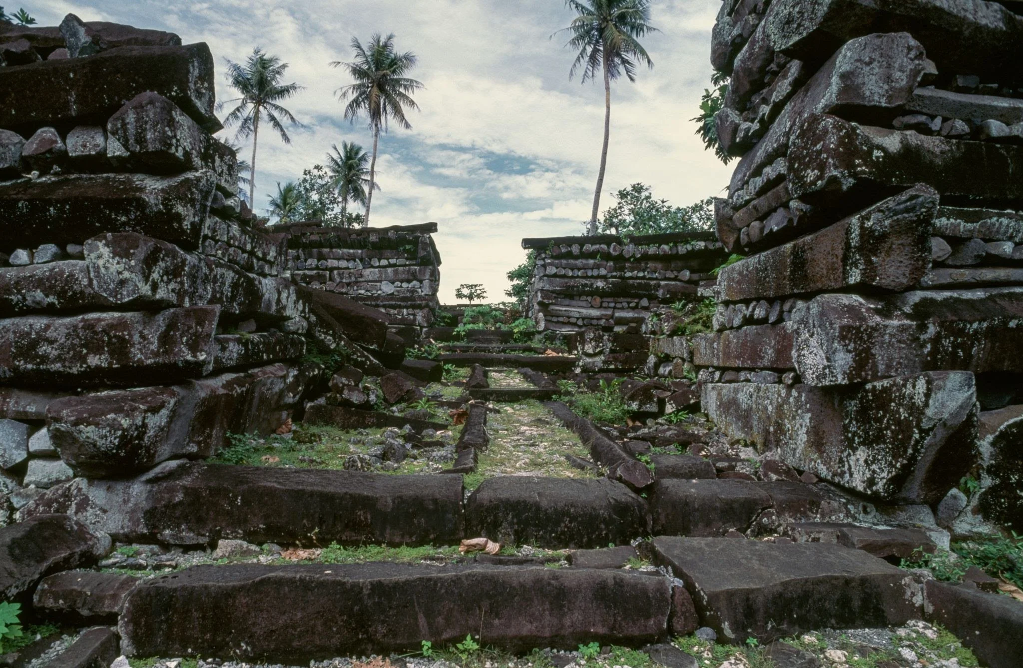
Resting off the eastern shore of the island of Pohnpei in Micronesia, the ruined city of Nan Madol is an engineering feat of the ancient Pacific. Known as the "Venice of the Pacific," this archaeological complex consists of 92 artificial islets constructed directly on top of a live coral reef flats, linked together by an intricate network of tidal canals. Serving as the ritual, residential, and political headquarters of the Saudeleur Dynasty from roughly 1200 to 1600 CE, the entire city was constructed out of hundreds of thousands of massive, naturally formed columnar basalt rocks.

The construction process relied on a sophisticated understanding of logistics and lever mechanics. The building blocks of the city are prismatic, five- to eight-sided basalt columns that formed naturally in volcanic vents on the opposite side of Pohnpei. Prehistoric builders quarried these dense, heavy boulders—some weighing up to 50 tons—and transported them across miles of open ocean lagoon without metal tools, draft animals, or pulleys. While local legends attribute the movement of the stones to twin sorcerers who flew them through the air, experimental archaeology suggests laborers used large bamboo rafts to float the blocks during high tide, then systematically maneuvered them into place using wood levers and coconut-fiber ropes.

The layout of Nan Madol was designed to isolate and protect the ruling elite. The islets are organized into two primary zones: Madol Powe, the sacerdotal sector housing mortuary complexes and burial tombs, and Madol Pah, the administrative core containing palatial residences and food storage depots. The largest and most spectacular islet, Nandauwas, is bounded by exterior walls standing over 8 meters tall and 5 meters thick, built by stacking the basalt columns horizontally in an interlocking, Lincoln-log style grid. This massive stone configuration resisted the destructive force of Pacific typhoons and tidal surges, providing a permanent, secure monument to Saudeleur dynastic rule.

← Newer Posts Older Posts →
Featured
image_2026-07-26_232306564.png
August 2, 2026
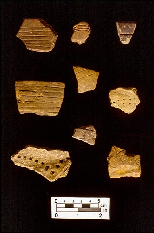
Chucalissa: Tennessee's Shell-Tempered Pottery Site
August 2, 2026
Read more →
August 2, 2026
image_2026-07-26_232234845.png
August 2, 2026
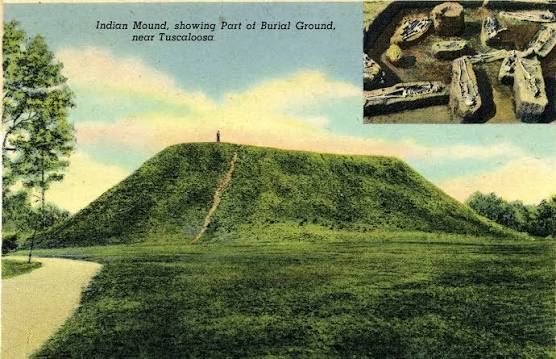
Renfrew Mounds: Mississippi's Moundville Satellite
August 2, 2026
Read more →
August 2, 2026
image_2026-07-26_232049483.png
August 2, 2026
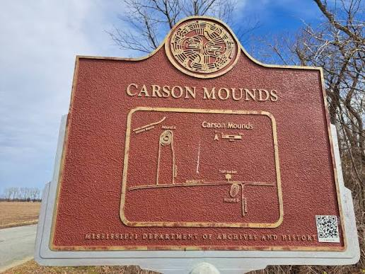
Carson Mounds: Mississippi's Mound Group Metropolis
August 2, 2026
Read more →
August 2, 2026
image_2026-07-26_232020672.png
August 2, 2026
Feltus Mounds: Mississippi's Plaquemine Culture
August 2, 2026
Read more →
August 2, 2026
image_2026-07-26_231915672.png
August 2, 2026
Grand Village of the Natchez: Mississippi's 17th-Century Site
August 2, 2026
Read more →
August 2, 2026
image_2026-07-26_231627735.png
August 2, 2026
Winterville Mounds: Mississippi's Temple Complex
August 2, 2026
Read more →
August 2, 2026
read more

Powered by The archaeologist