• MAIN PAGE
  • LATEST NEWS
    • Lost Cities
    • Archaeology's Greatest Finds
    • Underwater Discoveries
    • Greatest Inventions
    • Studies
    • Blog
  • PHILOSOPHY
  • HISTORY
  • RELIGIONS
    • Africa
    • Anatolia
    • Arabian Peninsula
    • Balkan Region
    • China - East Asia
    • Europe
    • Eurasian Steppe
    • Levant
    • Mesopotamia
    • Oceania - SE Asia
    • Pre-Columbian Civilizations of America
    • Iranian Plateau - Central Asia
    • Indus Valley - South Asia
    • Japan
    • The Archaeologist Editor Group
    • Scientific Studies
    • Aegean Prehistory
    • Historical Period
    • Byzantine Middle Ages
    • Predynastic Period
    • Dynastic Period
    • Greco-Roman Egypt
  • Rome
  • PALEONTOLOGY
  • About us
Menu

The Archaeologist

  • MAIN PAGE
  • LATEST NEWS
  • DISCOVERIES
    • Lost Cities
    • Archaeology's Greatest Finds
    • Underwater Discoveries
    • Greatest Inventions
    • Studies
    • Blog
  • PHILOSOPHY
  • HISTORY
  • RELIGIONS
  • World Civilizations
    • Africa
    • Anatolia
    • Arabian Peninsula
    • Balkan Region
    • China - East Asia
    • Europe
    • Eurasian Steppe
    • Levant
    • Mesopotamia
    • Oceania - SE Asia
    • Pre-Columbian Civilizations of America
    • Iranian Plateau - Central Asia
    • Indus Valley - South Asia
    • Japan
    • The Archaeologist Editor Group
    • Scientific Studies
  • GREECE
    • Aegean Prehistory
    • Historical Period
    • Byzantine Middle Ages
  • Egypt
    • Predynastic Period
    • Dynastic Period
    • Greco-Roman Egypt
  • Rome
  • PALEONTOLOGY
  • About us
No results found

Lindsley Park Mounds: Tennessee's Woodland Burials

August 2, 2026

Introduction

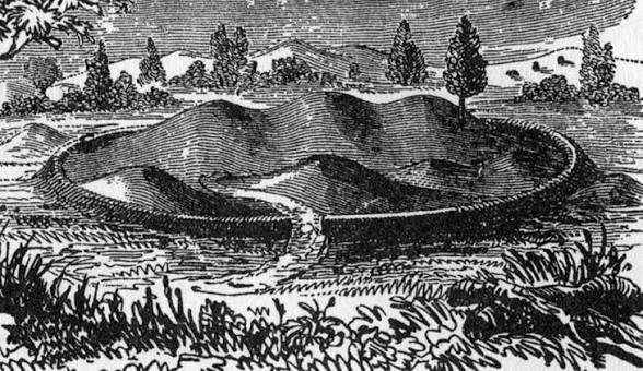
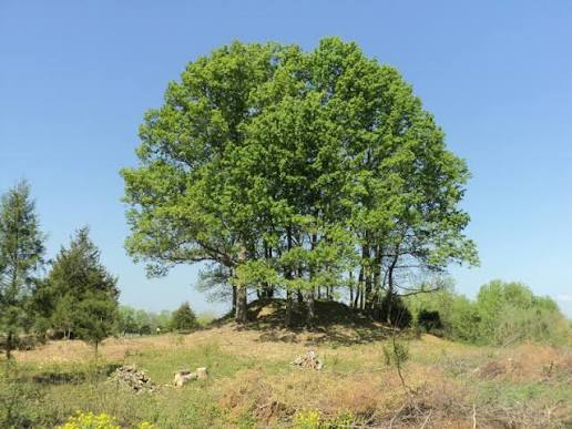
Located in present-day Nashville, Tennessee, the Lindsley Park Mounds represent one of the most important Woodland Period archaeological sites in the Middle Cumberland region. Constructed between approximately 200 BCE and 500 CE, these earthen burial mounds predate the Mississippian civilization by several centuries and are associated primarily with the Middle Woodland and Hopewell Interaction Sphere. The site served as a ceremonial cemetery where communities gathered to honor their dead through elaborate funerary rituals, demonstrating the growing social complexity of prehistoric societies long before the construction of Mississippian platform mounds.

Burial Mound Construction

The mounds were built by carefully placing prepared burials on the ground before covering them with successive layers of soil carried in woven baskets. Over time, repeated ceremonies and additional burials enlarged the mounds into prominent earthworks visible across the surrounding landscape.

Some graves contained log tombs or stone-lined burial chambers, while others were accompanied by carefully arranged grave offerings that reflected the social status and spiritual beliefs of the deceased.

Artifacts and Trade

Excavations have uncovered finely crafted pottery, polished stone tools, copper ornaments, shell beads, mica sheets, ceremonial pipes, and exotic materials imported from distant regions. Many of these items originated through the extensive Hopewell Interaction Sphere, a vast trade network connecting communities throughout eastern North America.

The presence of imported materials demonstrates that Middle Cumberland societies participated in long-distance exchange centuries before the rise of Mississippian civilization.

Religion and Mortuary Practices

The Lindsley Park Mounds functioned primarily as sacred burial grounds rather than permanent settlements. Funeral ceremonies included ritual offerings, communal feasts, and ancestor veneration. The careful placement of grave goods suggests widespread beliefs concerning the afterlife and the continued importance of ancestral spirits within community life.

Archaeological Importance

The Lindsley Park Mounds have provided archaeologists with important evidence regarding Woodland social organization, trade networks, burial customs, and ceremonial traditions. The site bridges the transition between earlier Archaic cultures and the later Mississippian civilizations that would dominate Tennessee centuries afterward.

Conclusion

The Lindsley Park Mounds preserve one of Tennessee's finest examples of Woodland Period ceremonial burial architecture. Their carefully constructed earthworks, elaborate grave goods, and participation in long-distance trade illustrate the remarkable cultural achievements of prehistoric communities long before the emergence of Mississippian chiefdoms.
Old Stone Fort: Tennessee's Prehistoric Hilltop Enclosure

August 2, 2026

Introduction

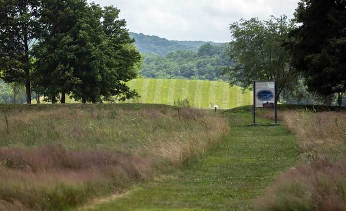
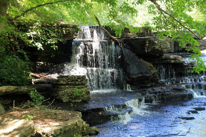
Situated near Manchester, Tennessee, at the junction of the Duck River and Little Duck River, the Old Stone Fort is one of the most remarkable prehistoric ceremonial enclosures in North America. Constructed during the Middle Woodland Period between approximately 80 and 550 CE, the site occupies a naturally defended peninsula surrounded on three sides by steep river gorges. Despite its name, the structure was not a military fortification but rather a large ceremonial complex used for religious gatherings, trade, and social interaction. Massive earthen embankments reinforced with stone walls enclosed approximately 50 acres (20 hectares), making Old Stone Fort one of Tennessee's most impressive prehistoric monuments.

Engineering and Construction

Builders took advantage of the natural landscape by constructing earthen embankments across the narrow neck of the peninsula while using limestone slabs to stabilize portions of the walls. These embankments reached several meters in height and were carefully engineered to control access to the enclosed ceremonial space.

The strategic placement of gateways suggests that movement into the enclosure followed organized ceremonial routes rather than defensive military purposes. The site's construction demonstrates advanced knowledge of landscape engineering and communal labor organization.

Ceremonial Functions

Archaeological evidence indicates that Old Stone Fort served as a regional gathering place where Woodland communities assembled for seasonal festivals, religious ceremonies, trade fairs, and social events. Rituals likely involved ancestor worship, feasting, exchange of goods, and astronomical observations associated with seasonal cycles.

Unlike Mississippian mound centers dominated by hereditary chiefs, Old Stone Fort appears to have functioned as a communal ceremonial landscape serving multiple surrounding communities.

Artifacts and Archaeological Discoveries

Excavations have uncovered pottery, projectile points, ceremonial pipes, stone tools, shell ornaments, and food remains that reveal repeated seasonal occupation. The variety of artifacts suggests that people traveled considerable distances to participate in gatherings held within the enclosure.

Conclusion

Old Stone Fort represents one of the finest examples of Woodland ceremonial architecture in eastern North America. Its unique hilltop enclosure, sophisticated engineering, and carefully planned ceremonial landscape demonstrate the remarkable social organization and religious traditions of prehistoric Tennessee communities centuries before the rise of the Mississippian civilization.

Seven Mile Island: Tennessee's Mississippian Village

August 2, 2026

Introduction

Located along the Tennessee River near present-day Seven Mile Island in eastern Tennessee, this archaeological site preserves the remains of a thriving Mississippian village occupied between approximately 1000 and 1450 CE. The settlement served as a regional farming community connected to larger ceremonial centers throughout the Tennessee River Valley. Its strategic riverside location provided fertile agricultural land, abundant aquatic resources, and access to major transportation routes that linked communities across the Southeast.

Village Layout

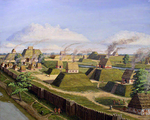
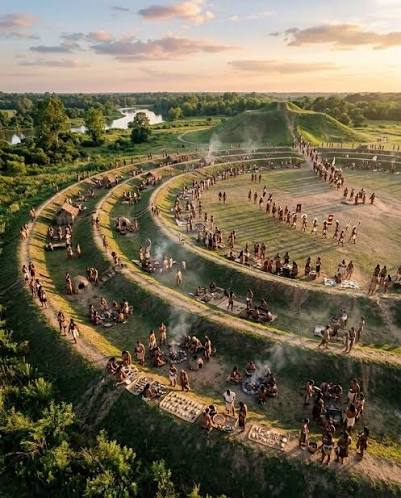
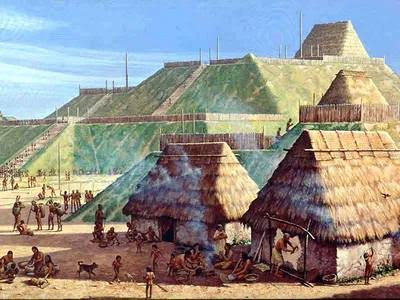
Seven Mile Island consisted of residential neighborhoods arranged around open communal spaces, with one or more platform mounds serving as ceremonial and political centers. Houses were rectangular structures built from timber frames, woven cane walls, and clay plaster, each containing central hearths and underground storage pits.

The platform mound supported a temple or council house overlooking the surrounding settlement, while nearby workshops produced pottery, stone tools, and bone implements used in everyday life.

Agriculture and Subsistence

Residents cultivated maize, beans, squash, and sunflowers on the fertile floodplains of the Tennessee River. Fishing supplied freshwater mussels, catfish, and other river species, while hunting deer, turkey, and small mammals supplemented agricultural production.

Seasonal harvesting of nuts, berries, and wild plants provided additional food resources, creating a balanced subsistence economy capable of supporting permanent village life.

Trade and Cultural Connections

Seven Mile Island participated in regional Mississippian trade networks that distributed shell ornaments, copper artifacts, pottery, and high-quality stone tools throughout the Southeast. Shared ceramic styles and ceremonial objects indicate close cultural relationships with larger Mississippian centers in Tennessee, Alabama, and Georgia.

These connections allowed the community to exchange not only goods but also religious beliefs, artistic traditions, and technological innovations.

Archaeological Importance

Excavations have uncovered house remains, storage pits, pottery fragments, shell-tempered ceramics, food remains, and stone tools that provide valuable information about everyday Mississippian life in the Tennessee River Valley. The site contributes significantly to understanding how smaller farming villages supported the larger ceremonial chiefdoms of the prehistoric Southeast.

Conclusion

Seven Mile Island illustrates the importance of river-based Mississippian villages in sustaining the economic and political foundations of prehistoric Tennessee. Its agricultural prosperity, organized settlement layout, participation in regional trade, and ceremonial traditions demonstrate the adaptability and sophistication of Indigenous communities that flourished along the Tennessee River centuries before European arrival.

Spiro Mounds: Oklahoma's Caddoan Ceremonial Center

August 2, 2026

Introduction

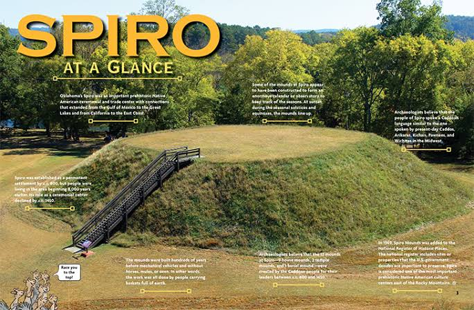
Located along the Arkansas River near present-day Spiro, Oklahoma, the Spiro Mounds represent one of the most important archaeological sites of the Caddoan Mississippian culture. Occupied from approximately 850 to 1450 CE, the site served as a major political, religious, and commercial center connecting the Great Plains, the Mississippi Valley, and the American Southwest. Covering nearly 150 acres (61 hectares), the complex originally consisted of twelve earthen mounds surrounding a large central plaza. Unlike many Mississippian centers, Spiro became renowned for its extraordinary ceremonial wealth, long-distance trade, and elaborate mortuary practices. Although salt production existed in parts of the Caddoan region, Spiro's primary importance was as a ceremonial and trade center rather than a salt-production site.

Settlement Layout and Monumental Architecture

The settlement was organized around a broad rectangular central plaza bordered by twelve platform and burial mounds. The largest platform mound supported the residence of the ruling chief or an important temple where political and religious ceremonies were conducted. Smaller mounds housed council buildings, elite residences, and sacred structures used during seasonal festivals.

The plaza functioned as the center of civic life, accommodating public ceremonies, ritual dances, athletic competitions, diplomatic meetings, and communal feasts. Residential neighborhoods surrounded the ceremonial precinct, with houses constructed from wooden posts covered by woven cane and clay plaster.

The Craig Mound and Sacred Burials

Spiro is particularly famous for the Craig Mound, one of the richest prehistoric burial mounds ever discovered in North America. Over several centuries, priests and elites placed ceremonial offerings within a sacred mortuary chamber constructed from cedar logs.

Archaeologists uncovered thousands of remarkable artifacts, including engraved marine shell cups, copper plates, carved wooden sculptures, woven textiles, pearl beads, stone pipes, and ceremonial masks. Many of these objects originated hundreds or even thousands of kilometers away, demonstrating Spiro's participation in one of North America's largest prehistoric trade networks.

Trade Networks and Economy

The inhabitants cultivated maize, beans, squash, and sunflowers, while hunting bison, deer, turkey, and fishing in the Arkansas River. Agriculture provided the surplus necessary to support priests, artisans, merchants, and political leaders.

Trade connected Spiro with communities throughout the Mississippi Valley, the Great Lakes, the Gulf Coast, the Rocky Mountains, and the American Southwest. Marine shells arrived from the Gulf of Mexico, copper from the Great Lakes, obsidian from the western United States, and turquoise from the Southwest. These imported materials were transformed into elaborate ceremonial objects by highly skilled artisans.

Religion and Ceremonial Life

Religion dominated life at Spiro. Priests conducted rituals atop the platform mounds while sacred ceremonies took place within the central plaza. Many artifacts display imagery associated with the Southeastern Ceremonial Complex, including falcons, serpents, sun symbols, and mythological beings that represented warfare, fertility, and the supernatural world.

The Craig Mound functioned as both a burial monument and a sacred repository for ritual objects, emphasizing the close relationship between ancestor worship, political authority, and religious belief.

Archaeological Importance

Excavations have revealed temples, houses, workshops, storage pits, plazas, burial chambers, and one of the richest collections of Mississippian ceremonial artifacts ever discovered. These findings have made Spiro indispensable for understanding Caddoan civilization, long-distance trade, and prehistoric religious traditions throughout eastern North America.

Conclusion

Spiro Mounds stands as the greatest ceremonial center of the Caddoan Mississippian culture, demonstrating advanced mound construction, extensive trade networks, remarkable artistic achievements, and sophisticated religious practices. Its monumental earthworks and extraordinary archaeological discoveries continue to provide invaluable insight into one of North America's most influential Indigenous civilizations.

Hughes Mound: Missouri's Mississippian Site

August 2, 2026

Introduction

Located in southeastern Missouri, Hughes Mound is an important archaeological site associated with the Mississippian culture, dating between approximately 1000 and 1400 CE. Situated within the fertile floodplains of the Mississippi River, the settlement served as a regional ceremonial and political center connected to larger Mississippian communities such as Cahokia. The site included platform mounds, residential villages, storage facilities, and ceremonial spaces that illustrate the expansion of Mississippian culture throughout the central Mississippi Valley.

Settlement Layout

Hughes Mound was organized around a central ceremonial plaza bordered by one or more platform mounds. These earthen structures supported temples, council houses, and elite residences overlooking the surrounding village. Residential neighborhoods composed of rectangular wooden houses occupied the areas surrounding the ceremonial center.

Builders transported compacted clay and soil in woven baskets, gradually enlarging the platform mounds over multiple generations. Their elevated design protected important buildings from flooding while emphasizing political and religious authority.

Economy and Daily Life

Residents cultivated maize, beans, squash, and sunflowers while hunting deer, turkey, and fishing in nearby rivers. Storage pits preserved agricultural surpluses that supported specialized craftsmen and community leaders.

Potters manufactured shell-tempered ceramics, while artisans produced stone tools, bone implements, and shell ornaments. Long-distance trade brought marine shells, copper, and high-quality stone from distant regions, reflecting Hughes Mound's integration into the wider Mississippian exchange network.

Religion and Community Life

Religious ceremonies centered on temples built atop the platform mounds. Priests performed rituals honoring agricultural spirits, ancestors, and celestial forces, while the central plaza hosted public gatherings, seasonal festivals, communal feasts, and diplomatic meetings.

Artifacts recovered from the site display stylistic influences associated with the Southeastern Ceremonial Complex, demonstrating the community's participation in widespread religious traditions.

Archaeological Importance

Excavations have uncovered pottery, house remains, food remains, ceremonial objects, and construction phases of the platform mounds. These discoveries contribute significantly to understanding the spread of Mississippian culture into southeastern Missouri.

Conclusion

Hughes Mound illustrates the successful expansion of Mississippian civilization throughout the central Mississippi Valley. Its ceremonial architecture, organized settlement, thriving agriculture, and regional trade networks highlight the cultural sophistication of prehistoric communities in southeastern Missouri.

Towosahgy: Missouri's 10-Mound Complex

August 2, 2026

Introduction

Located near East Prairie, Missouri, Towosahgy State Historic Site preserves one of Missouri's finest examples of a Mississippian mound center. Occupied between approximately 1200 and 1400 CE, the settlement served as a regional political, ceremonial, and residential community connected to the broader Mississippian world. The name Towosahgy, meaning "old village" in the Osage language, reflects the site's ancient origins. Archaeologists have identified ten earthen mounds surrounding a large rectangular plaza enclosed by defensive walls, making Towosahgy one of Missouri's most significant prehistoric settlements.

Urban Planning and Earthworks

Towosahgy was carefully planned around a spacious central plaza bordered by ten platform mounds of varying sizes. The largest mound supported a temple or the residence of the ruling chief, while smaller mounds housed ceremonial structures, council houses, and elite residences.

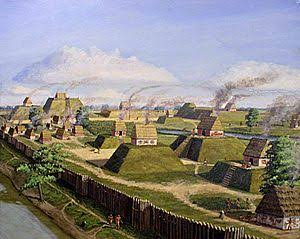
The settlement was protected by a wooden palisade with guarded gateways that enclosed the ceremonial center and nearby residential areas. Builders transported thousands of basket loads of earth to create the platform mounds, which were repeatedly enlarged as the community developed.

Agriculture and Economy

Residents cultivated maize, beans, squash, and sunflowers in the fertile Mississippi River floodplain. Hunting deer, turkey, and waterfowl, along with fishing, supplemented the agricultural economy.

Craft specialists produced shell-tempered pottery, chipped stone tools, shell ornaments, and bone implements. Trade connected Towosahgy with Cahokia and other Mississippian centers, facilitating the exchange of copper, marine shell, stone, and ceremonial goods.

Religion and Society

Temples atop the platform mounds served as sacred spaces where priests conducted ceremonies honoring ancestors and agricultural deities. The central plaza hosted religious festivals, athletic competitions, public assemblies, and communal feasts that strengthened social cohesion.

The site's architecture and ceremonial artifacts demonstrate participation in the broader Mississippian religious tradition shared across much of the southeastern United States.

Archaeological Importance

Excavations have revealed house foundations, defensive palisades, pottery workshops, storage pits, ceremonial buildings, and numerous artifacts that illustrate everyday life in a Mississippian town. Towosahgy remains one of Missouri's best-preserved prehistoric archaeological sites.

Conclusion

Towosahgy represents one of Missouri's most important Mississippian ceremonial centers, showcasing advanced urban planning, defensive engineering, monumental earthwork construction, and thriving agricultural communities. Its ten platform mounds and fortified layout demonstrate the remarkable political and religious organization of prehistoric Indigenous societies.

Kincaid's Fortified Village: Illinois' Palisade Site

August 2, 2026

Introduction

Located along the Ohio River in southern Illinois, Kincaid Mounds included one of the most impressive fortified villages of the Mississippian period. Occupied between approximately 1050 and 1450 CE, the settlement functioned as a regional political and ceremonial center protected by substantial defensive works. Its fortified village illustrates the importance of security, territorial control, and organized leadership within Mississippian chiefdoms while complementing the site's monumental platform mounds and ceremonial plazas.

The Palisade System

The village was enclosed by a massive wooden palisade constructed from closely spaced upright logs deeply embedded in the ground. Controlled gateways regulated access into the settlement, while projecting bastions allowed defenders to observe approaching visitors and monitor vulnerable sections of the wall.

The palisade likely served multiple purposes beyond defense. It clearly defined the sacred and political boundaries of the community while protecting important temples, elite residences, storage facilities, and the central plaza.

Village Organization

Inside the enclosure, rectangular houses surrounded a large ceremonial plaza bordered by platform mounds supporting temples and administrative buildings. Organized pathways connected residential districts with public spaces, reflecting careful urban planning.

Residents cultivated maize, beans, squash, and sunflowers while participating in extensive trade networks that connected Kincaid with Cahokia and other Mississippian centers.

Archaeological Discoveries

Excavations have uncovered postholes from the palisade, house foundations, storage pits, pottery, shell ornaments, copper objects, and ceremonial artifacts. These discoveries demonstrate repeated rebuilding of the defensive wall, suggesting that the fortifications remained an essential feature throughout the settlement's occupation.

Conclusion

Kincaid's Fortified Village highlights the advanced defensive engineering of the Mississippian Civilization. Its impressive palisade, organized settlement, monumental mounds, and ceremonial architecture reveal a highly structured society capable of coordinating large-scale public construction while protecting one of southern Illinois' most important prehistoric communities

Mill Creek Chert Mines: Illinois' Quarry Complex

July 30, 2026

Introduction

Located in southern Illinois near present-day Mill Creek, the Mill Creek Chert Mines formed one of the most important prehistoric quarry complexes in eastern North America. Beginning as early as 700 CE and reaching peak production during the Mississippian Period (1000–1400 CE), Indigenous miners extracted high-quality Mill Creek chert, a durable fine-grained stone prized for manufacturing hoes, axes, knives, spear points, scrapers, and other essential tools. The quarry became a major industrial center supplying stone implements to farming communities throughout the Mississippi Valley.

Mining Operations

Miners identified exposed chert deposits within limestone bedrock and excavated shallow pits and trenches using stone hammers, antler picks, and wooden digging tools. Large chert nodules were removed, split into workable pieces, and roughly shaped near the quarry before transport.

Specialized craftsmen produced standardized blanks that could later be refined into finished agricultural tools and weapons. This efficient production system allowed large quantities of stone implements to be distributed across extensive trade networks.

Manufacturing and Trade

Mill Creek chert was especially valued for producing hoe blades, which were essential for cultivating large maize fields. Thousands of finished tools traveled hundreds of kilometers through Mississippian exchange networks, reaching communities across Illinois, Missouri, Kentucky, Tennessee, Arkansas, and beyond.

Archaeological evidence shows that Mill Creek chert became one of the most widely distributed stone materials in prehistoric eastern North America, reflecting the economic importance of specialized quarry industries.

Archaeological Importance

Excavations have uncovered quarry pits, manufacturing debris, hammerstones, unfinished tool blanks, and evidence of large-scale stone production. These discoveries reveal one of North America's earliest examples of specialized industrial resource extraction and regional distribution.

The quarry provides crucial evidence for understanding Mississippian technology, labor organization, agricultural expansion, and long-distance trade.

Conclusion

The Mill Creek Chert Mines represent one of the most significant prehistoric quarry and manufacturing complexes in North America. Their large-scale extraction of high-quality chert supplied countless Mississippian communities with essential agricultural and hunting tools, demonstrating the technological innovation, economic specialization, and extensive trade networks that characterized Indigenous civilizations of the Mississippi Valley.

Cave-in-Rock: Illinois' Saltpeter Mining Cave

July 30, 2026

Introduction

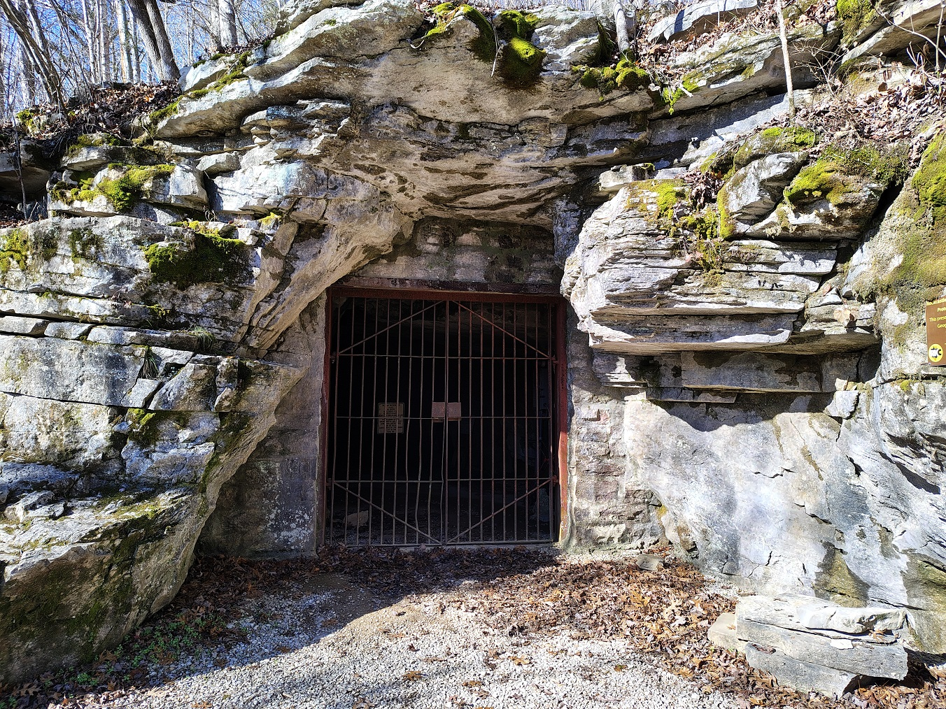
Located along the towering limestone bluffs of the Ohio River in Hardin County, Illinois, Cave-in-Rock is one of the largest natural cave systems in the American Midwest. Formed through thousands of years of erosion within Mississippian limestone, the cave features a massive entrance measuring nearly 55 feet (17 m) wide and extending more than 120 feet (37 m) into the bluff. Long before European settlement, Indigenous peoples visited the cave for shelter, ceremonies, and resource gathering. During the late eighteenth and nineteenth centuries, Cave-in-Rock gained additional importance as a source of saltpeter (potassium nitrate), an essential ingredient in gunpowder. Its strategic river location later made it famous as a refuge for traders, river travelers, and, at times, notorious river pirates.

Geology and Saltpeter Formation

Saltpeter formed naturally inside the cave through the slow decomposition of bat guano mixed with moisture-rich limestone sediments. Over many years, mineral-rich deposits accumulated along the cave floor, producing nitrate-bearing earth suitable for extraction.

During the early nineteenth century, miners excavated these deposits and processed the nitrate-rich soil by soaking it in water, filtering the solution, and evaporating it to produce potassium nitrate crystals. These crystals were then transported to nearby gunpowder mills, where they were combined with sulfur and charcoal to manufacture black powder.

Indigenous Use

Archaeological evidence indicates that Native American communities visited Cave-in-Rock for thousands of years before European arrival. Stone tools, pottery fragments, charcoal, and food remains suggest that the cave functioned as a temporary shelter, hunting camp, storage location, and ceremonial gathering place.

Its prominent location overlooking the Ohio River also made it a recognizable landmark along one of eastern North America's most important prehistoric transportation corridors.

Historical Importance

Beyond its geological significance, Cave-in-Rock became a well-known stop for flatboats and keelboats traveling the Ohio River during the late eighteenth century. Its protected interior offered temporary shelter for travelers, although it also became associated with outlaw gangs and river pirates who exploited the cave's strategic location.

Today, the cave is preserved within Cave-In-Rock State Park, where visitors can explore one of Illinois' most remarkable natural and historical landmarks.

Conclusion

Cave-in-Rock combines remarkable geological formation, prehistoric Indigenous occupation, valuable saltpeter resources, and colorful frontier history. Its limestone cavern, mineral deposits, and strategic river setting make it one of Illinois' most significant natural and archaeological sites.

Black Hand Site: Ohio's Adena Earthworks

July 30, 2026

Introduction

Situated near the famous Black Hand Sandstone Gorge along the Licking River in central Ohio, the Black Hand Site preserves evidence of ceremonial earthworks associated with the Adena culture, dating from approximately 800 BCE to 100 CE. The surrounding landscape of sandstone cliffs, river terraces, and fertile valleys provided an ideal location for ceremonial gatherings and seasonal occupation. Although much of the original earthwork has been altered through natural erosion and later development, archaeological investigations have identified burial mounds, habitation areas, and ceremonial features that demonstrate the importance of the region within the Adena cultural tradition.

Earthwork Construction

The Adena people constructed circular burial mounds using thousands of basket loads of soil carefully layered over prepared graves. Some burials were placed within wooden log tombs before being covered by successive earthen deposits, gradually creating prominent mounds visible across the surrounding landscape.

Unlike later Mississippian platform mounds, Adena earthworks primarily served mortuary and ceremonial purposes rather than supporting temples or elite residences.

Artifacts and Trade

Excavations have recovered finely crafted stone tools, pottery vessels, polished gorgets, copper ornaments, shell beads, and ceremonial pipes. Many exotic materials originated hundreds of kilometers away, indicating participation in extensive trade networks connecting communities throughout eastern North America.

These artifacts illustrate the growing social complexity and ceremonial traditions of Early Woodland societies.

Religion and Ceremony

The Black Hand Site likely served as a regional ceremonial center where dispersed communities gathered to conduct funeral rituals, honor ancestors, and reinforce social relationships. Seasonal gatherings may have included feasting, gift exchange, religious ceremonies, and communal construction of new burial mounds.

Archaeological Importance

The site contributes significantly to understanding Adena burial customs, early earthwork engineering, and the development of ceremonial landscapes throughout the Ohio Valley. It also demonstrates how natural landmarks influenced the placement of sacred sites.

Conclusion

The Black Hand Site preserves valuable evidence of Adena ceremonial earthwork traditions, illustrating early mound construction, regional trade, and complex religious practices that laid the foundation for later Hopewell and Mississippian civilizations.

Stubbs Earthworks: Ohio's Hopewell Enclosure

July 30, 2026

Introduction

Located near Morrow in Warren County, Ohio, the Stubbs Earthworks represent one of the major ceremonial centers of the Hopewell culture, dating between approximately 100 BCE and 400 CE. Situated along the Little Miami River, the site formed part of an extensive network of geometric earthworks constructed throughout southern Ohio. The complex consisted of large earthen embankments, ceremonial enclosures, burial mounds, and open plazas where communities gathered for religious ceremonies, trade, and social interaction. Stubbs demonstrates the remarkable surveying skills and engineering abilities achieved by Hopewell builders nearly two thousand years ago.

Geometric Earthwork Design

The earthworks consisted of carefully constructed geometric embankments enclosing large ceremonial spaces. Builders measured straight lines, precise angles, and symmetrical layouts using wooden stakes, cords, and repeated observations of the surrounding landscape.

Low earthen walls defined sacred precincts while gateways controlled movement into ceremonial areas. Unlike defensive fortifications, these embankments emphasized ritual organization rather than military protection.

Construction Techniques

Thousands of basket loads of soil were transported from nearby river terraces and compacted into broad earthen walls several feet high. Construction required the coordinated labor of hundreds of individuals over many years, reflecting a highly organized society capable of managing large communal projects.

Ceremonial Activities

Stubbs Earthworks likely hosted seasonal festivals, religious ceremonies, funerary rituals, and long-distance trade gatherings. Participants traveled from across the Ohio Valley, exchanging exotic materials such as obsidian, copper, mica, marine shell, and finely crafted ceremonial objects.

The carefully planned geometry of the enclosure may also have incorporated astronomical alignments associated with solar or lunar events.

Archaeological Importance

Excavations have recovered pottery, stone tools, ceremonial pipes, ornaments, and evidence of repeated construction episodes. The site provides valuable insight into Hopewell engineering, ritual landscapes, and regional interaction throughout eastern North America.

Conclusion

The Stubbs Earthworks demonstrate the extraordinary planning, surveying, and ceremonial traditions of the Hopewell culture. Their geometric precision and monumental scale reflect one of the most sophisticated earthwork-building traditions of prehistoric North America.

Tremper Mound: Ohio's Pipe Cache Burial

July 30, 2026

Introduction

Located near Portsmouth, Ohio, along the Scioto River Valley, Tremper Mound is one of the most remarkable ceremonial burial mounds of the Hopewell culture, dating between approximately 100 BCE and 400 CE. The site is internationally renowned for the discovery of an extraordinary cache of carved stone smoking pipes, making it one of the richest collections of Hopewell ceremonial artifacts ever uncovered. Tremper Mound functioned as both a mortuary monument and a sacred ceremonial center where elaborate rituals honored important members of the community.

Burial Construction

The mound was built by carefully layering basket loads of earth over prepared ceremonial structures and burials. Beneath the mound, archaeologists discovered wooden mortuary buildings where funeral ceremonies were performed before the final earthen covering was added.

Repeated construction episodes gradually enlarged the mound, demonstrating its continued ceremonial significance over several generations.

The Famous Pipe Cache

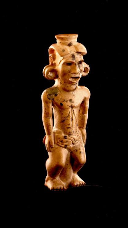
Tremper Mound is best known for its remarkable cache of more than 130 expertly carved stone pipes, many depicting birds, mammals, reptiles, and mythical creatures with extraordinary realism. Crafted primarily from fine-grained pipestone, these ceremonial objects were likely used by religious leaders during sacred rituals before being intentionally deposited within the mound.

The diversity and artistic quality of the pipes reflect the remarkable craftsmanship and symbolic traditions of Hopewell artisans.

Religion and Trade

The ceremonial importance of Tremper Mound extended beyond local communities. Exotic materials recovered from the site—including copper from the Great Lakes, obsidian from Yellowstone, marine shell from the Gulf Coast, and mica from the Appalachian Mountains—demonstrate participation in the vast Hopewell exchange network.

The mound likely served as a gathering place where religious ceremonies, diplomatic meetings, and long-distance trade reinforced social relationships across eastern North America.

Archaeological Importance

Excavations have made Tremper Mound one of the most significant Hopewell archaeological sites in North America. Its exceptional pipe cache provides invaluable evidence for prehistoric religious symbolism, artistic achievement, and ceremonial traditions.

Conclusion

Tremper Mound stands among the finest examples of Hopewell ceremonial architecture, combining monumental burial construction with one of the richest collections of prehistoric ritual pipes ever discovered. The site remains essential for understanding Hopewell religion, artistry, and long-distance interaction.

Seip Earthworks: Ohio's Hopewell Geometric Complex

July 30, 2026

Introduction

Located in Ross County, Ohio, within the fertile Paint Creek Valley, the Seip Earthworks form one of the largest ceremonial complexes constructed by the Hopewell culture between approximately 100 BCE and 400 CE. The monumental site originally covered more than 120 acres (49 hectares) and consisted of an enormous geometric enclosure, burial mounds, ceremonial plazas, and carefully engineered earthen embankments. As one of the principal Hopewell centers in southern Ohio, Seip served as a regional gathering place where communities met for religious ceremonies, funerals, feasts, and long-distance exchange.

Geometric Earthwork Engineering

Seip Earthworks featured a massive combination of circular and rectangular embankments laid out with remarkable geometric precision. Builders transported thousands of basket loads of earth to construct broad walls that enclosed sacred ceremonial spaces while leaving carefully planned entrances aligned with important pathways.

The site's design reflects advanced knowledge of surveying, landscape planning, and communal engineering. Although not defensive structures, the embankments clearly defined ceremonial areas reserved for ritual activities.

Burial Mounds and Ritual Life

Several burial mounds stood within the enclosure, containing elaborate tombs filled with finely crafted ceremonial objects. Archaeologists recovered copper ornaments, mica cutouts, obsidian blades, marine shell jewelry, carved stone pipes, and decorative pottery, many originating from distant regions through the Hopewell trade network.

Large public ceremonies likely included funerary rituals, communal feasting, gift exchange, music, dancing, and religious observances centered on ancestor veneration and cosmological beliefs.

Astronomical and Cultural Significance

Many researchers believe that portions of the Seip Earthworks were aligned with important celestial events, including seasonal sunrises and sunsets. These alignments may have helped determine the timing of agricultural festivals and ceremonial gatherings while reinforcing Hopewell cosmological traditions.

The site's monumental scale reflects the cooperative efforts of numerous communities working together over several generations.

Archaeological Importance

Excavations have revealed burial structures, ceremonial buildings, artifact caches, and construction phases that continue to expand knowledge of Hopewell engineering, religion, trade, and social organization. Seip Earthworks remains one of the best-preserved examples of Hopewell monumental architecture in North America.

Conclusion

The Seip Earthworks represent one of the greatest achievements of the Hopewell culture, demonstrating exceptional engineering, geometric planning, ceremonial complexity, and long-distance interaction. Their monumental earthworks and richly furnished burials illustrate the sophistication of one of prehistoric North America's most influential ceremonial traditions.

Thap Mam: Vietnam's Oc Eo-Style Brick Temples

July 28, 2026

Tháp Mẫm is one of the most important archaeological and artistic sites associated with the late Champa Kingdom, lending its name to the distinctive Tháp Mẫm artistic style that flourished during the 12th and 13th centuries CE in present-day Bình Định Province. This period represented the final golden age of Cham architecture and sculpture, when royal patronage encouraged the construction of monumental brick temples richly decorated with elaborate stone carvings. Unlike earlier Cham artistic traditions, which emphasized relatively restrained ornamentation, the Tháp Mẫm style became famous for its dramatic sculptural compositions, densely decorated architectural surfaces, and powerful representations of mythological creatures inspired by Hindu beliefs. These temples served not only as sacred places of worship but also as symbols of royal authority, religious devotion, and the artistic maturity achieved by the Champa civilization.

Architectural Features

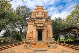
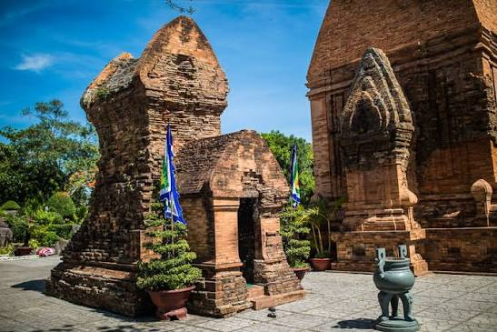
The temples of the Tháp Mẫm style were constructed primarily from fired red bricks, carefully arranged with exceptionally thin mortar joints that remain one of the enduring mysteries of Cham engineering. Their soaring towers featured multiple tiers, richly decorated entrances, ornamental columns, and elaborate roof structures that emphasized verticality and grandeur. Stone architectural elements such as doorframes, lintels, pedestals, and decorative corner ornaments were carved from durable dark gray sandstone, creating a striking visual contrast against the warm red brick walls. The harmonious combination of brick architecture and finely sculpted sandstone decoration produced some of the most visually impressive religious monuments in medieval Southeast Asia.

Sculptural Motifs

The defining characteristic of the Tháp Mẫm style was its extraordinary sculptural program featuring dynamic representations of mythological creatures carved in deep high relief. Skilled Cham artisans employed advanced carving techniques that created dramatic undercut details, giving the sculptures remarkable depth, movement, and realism.

Among the most iconic figures was the Gajasimha, a mythical guardian creature combining the head of an elephant with the body of a lion. This hybrid beast symbolized both immense physical strength and royal authority, serving as a protective guardian for temple entrances and sacred spaces. The careful rendering of muscular limbs, curling trunks, expressive faces, and intricate decorative patterns demonstrated the exceptional skill of Cham sculptors.

Equally important were the majestic Garudas, the mythical bird-like beings associated with the Hindu god Vishnu. These massive sandstone sculptures were frequently positioned beneath heavy architectural lintels, appearing to support the weight of the temple itself. Their broad wings, powerful bodies, and expressive features conveyed divine protection and spiritual authority. Alongside them appeared elaborately carved Nagas, the sacred multi-headed serpents of Hindu mythology, whose flowing forms framed doorways, staircases, and temple corners. The intertwining Garudas and Nagas symbolized cosmic balance, protection, and the interconnected relationship between heaven, earth, and the divine realm.

Conclusion

The Tháp Mẫm style represents the culmination of Cham artistic achievement, showcasing a remarkable fusion of sophisticated brick architecture, advanced stone carving, and richly symbolic Hindu iconography. Its monumental temples, dramatic high-relief sculptures, and powerful mythological guardians reflect the creativity, technical expertise, and religious devotion that characterized the late Champa Kingdom. More than simply decorative monuments, these temples embodied royal power, spiritual belief, and cultural identity during one of the most prosperous periods of Cham history. Today, the surviving Tháp Mẫm sculptures continue to be regarded as masterpieces of Southeast Asian art, preserving the legacy of a civilization whose architectural and sculptural accomplishments remain among the finest in the region.

Binh Dinh Citadels: Vietnam's Vijaya Kingdom Walls

July 28, 2026

Introduction

During the 11th century CE, the political and military center of the Champa Kingdom shifted southward to present-day Bình Định Province, where the city of Vijaya (Thành Đồ Bàn) became the kingdom's new capital. This relocation marked a significant turning point in Cham history as the kingdom faced increasing military pressure from neighboring states, particularly Đại Việt to the north and the Khmer Empire to the west. To strengthen its defenses and protect the royal capital, Cham rulers invested heavily in the construction of an extensive regional defense system consisting of fortified citadels, massive city walls, deep moats, and strategically positioned hilltop watchtowers. These fortifications transformed Vijaya into one of the strongest political, military, and administrative centers in medieval Southeast Asia while preserving its role as an important center of trade and religion.

Regional Defense Network

The defense of Vijaya relied on an integrated network of fortifications designed to protect the capital from both land and river-based attacks. At the heart of this system stood the heavily fortified Thành Đồ Bàn Citadel, surrounded by thick defensive walls and broad moats that served as formidable obstacles against invading armies. Beyond the city itself, elevated structures such as Tháp Bánh Ít (also known as the Silver Tower) were constructed on prominent hilltops overlooking the surrounding plains, rivers, and coastal routes. These towers functioned not only as sacred Hindu temples but also as military observation posts where guards could monitor approaching enemies and relay signals to nearby settlements. Their elevated locations provided extensive visibility across the landscape, allowing the Cham kingdom to respond quickly to potential threats while maintaining communication throughout the region.

Citadel Engineering

The construction of the Thành Đồ Bàn Citadel demonstrates the advanced engineering knowledge of late Cham builders. Its defensive walls were built using large rammed-earth cores, a construction technique that compressed layers of soil into dense, durable embankments capable of supporting enormous structures. These earthen walls were reinforced with carefully placed laterite stone blocks and fired bricks, providing greater stability while protecting the fortifications from erosion and weathering. Surrounding the citadel were wide water-filled moats, which made direct assaults more difficult by slowing advancing armies and preventing the use of siege equipment near the walls. Gates and controlled entry points further strengthened the city's defenses while allowing commerce and transportation to continue under close supervision.

Complementing the citadel were impressive hilltop towers such as Tháp Bánh Ít, whose strategic position enabled them to serve multiple purposes. Although primarily constructed as Hindu religious sanctuaries dedicated to the worship of deities such as Shiva, these towers also functioned as elevated lookout stations and signaling posts. From their commanding heights, sentries could observe movement along major rivers, agricultural plains, and coastal approaches, transmitting warnings of approaching enemies through visual signals such as smoke, fire, or flags. This combination of religious architecture and military utility reflects the practical ingenuity of the Cham people, who integrated spiritual life with the kingdom's defensive infrastructure.

Conclusion

The Bình Định Citadels represent the peak of late Cham military architecture, demonstrating how the Kingdom of Vijaya adapted to an increasingly unstable political landscape through sophisticated engineering and strategic planning. The combination of fortified city walls, rammed-earth embankments, laterite stone reinforcements, fired-brick construction, protective moats, and elevated watchtowers created a highly effective regional defense network capable of protecting the kingdom's political and economic center. At the same time, the dual role of structures like Tháp Bánh Ít as both religious sanctuaries and military observation towers illustrates the seamless integration of faith, governance, and defense in Cham society. Today, the surviving citadels stand as enduring monuments to the engineering skill, architectural innovation, and resilience of one of Southeast Asia's greatest medieval civilizations.

Maçon: Louisiana's Prehistoric Platform Mounds

July 28, 2026

Introduction

The Macon Ridge region of northeastern Louisiana contains numerous prehistoric mound sites that illustrate the long tradition of Indigenous earthwork construction throughout the Lower Mississippi Valley. Occupied by successive Native American cultures over thousands of years, these mound centers served as ceremonial, political, and residential landscapes that connected local communities with broader regional exchange networks. The fertile soils and elevated natural ridges of the area made it an ideal location for permanent settlement and monument building.

Platform Mound Construction

The prehistoric platform mounds of the Macon Ridge region were built by transporting thousands of basket loads of earth to create elevated rectangular platforms. These flat-topped mounds supported temples, council houses, elite residences, and ceremonial buildings that stood above the surrounding floodplain.

Builders carefully layered different soils to improve stability and drainage, ensuring the long-term durability of the structures. Repeated construction episodes enlarged the mounds over centuries, reflecting changing political leadership and continued ceremonial use.

Cultural Significance

These mound centers functioned as important gathering places where surrounding communities assembled for religious ceremonies, seasonal festivals, trade, and political decision-making. Their elevated platforms symbolized sacred space while providing protection from seasonal flooding.

The platform mounds also demonstrate increasing social organization, as their construction required coordinated labor, planning, and leadership. They represent an important stage in the long architectural tradition that later culminated in the great Mississippian mound cities such as Cahokia.

Conclusion

The prehistoric platform mounds of Louisiana's Macon Ridge region highlight the engineering skill, environmental adaptation, and ceremonial traditions of Native American societies. Together with sites such as Watson Brake and Poverty Point, they illustrate a continuous legacy of monumental earthwork construction spanning thousands of years across the Lower Mississippi Valley.

Tra Kieu: Vietnam's Champa Capital Ruins

July 28, 2026

Introduction

Located along the fertile banks of the Thu Bồn River in present-day Quảng Nam Province, Vietnam, Trà Kiệu is one of the most significant archaeological sites associated with the early Champa Kingdom. Known in ancient Sanskrit inscriptions as Simhapura, meaning "City of the Lion," Trà Kiệu served as the kingdom's political and administrative capital from approximately the 4th to the 8th century CE. Its strategic location near the Thu Bồn River allowed the city to control important inland and maritime trade routes that connected central Vietnam with the South China Sea, facilitating commerce with neighboring kingdoms as well as merchants from India, China, and other parts of Southeast Asia. As the seat of Cham rulers, Trà Kiệu became a thriving center of government, religion, diplomacy, and economic activity. The city also played a crucial role in introducing and spreading Indian cultural influences, particularly Hinduism, Sanskrit literature, and Indian artistic traditions, while simultaneously developing a unique Cham identity reflected in its architecture, sculpture, and urban organization.

Urban Planning and Masterpiece Art

The city of Trà Kiệu was carefully designed to function as both a fortified capital and an important religious center. It was enclosed by massive earthen embankments reinforced with brick ramparts, providing strong defenses against invasion and demonstrating the advanced engineering capabilities of the Cham people. Defensive water channels and moats surrounded sections of the city, serving both military and practical purposes by strengthening the fortifications, improving drainage, and helping regulate water supplies. Within these protective walls were royal residences, administrative buildings, religious sanctuaries, workshops, marketplaces, and residential neighborhoods that supported a vibrant urban population. The city's well-planned layout illustrates the sophisticated political organization of the early Champa Kingdom and its ability to manage both defense and commerce along one of central Vietnam's most important river systems.

Trà Kiệu also became renowned for producing some of the finest examples of Cham sandstone sculpture, reflecting the kingdom's extraordinary artistic achievements and the influence of Indian religious traditions. Among its greatest masterpieces is the famous Trà Kiệu Pedestal, a single monolithic sandstone block intricately carved with continuous narrative friezes illustrating scenes from the Hindu epic Ramayana. The carvings portray episodes involving Prince Rama, Princess Sita, Hanuman, and other legendary figures, demonstrating the sculptors' remarkable ability to transform religious stories into detailed visual narratives. The pedestal not only served a ceremonial function within Hindu temples but also symbolized the close relationship between royal authority and Hindu religious beliefs in Champa society.

Another outstanding work is the Dancers' Frieze, a beautifully carved high-relief sandstone panel depicting graceful apsaras, or celestial dancers from Hindu mythology. The figures are shown in elegant, fluid poses that convey movement and rhythm despite being carved from solid stone. Each dancer is adorned with elaborate necklaces, bracelets, belts, earrings, and intricately detailed conical crowns, reflecting both artistic sophistication and the luxurious ceremonial attire of the Cham court. The exceptional craftsmanship displayed in the delicate facial expressions, flowing garments, and finely executed jewelry demonstrates the maturity of Cham sculpture and its ability to blend Indian artistic inspiration with local creativity. These masterpieces reveal not only technical excellence but also the spiritual and cultural ideals that shaped the Champa Kingdom.

Conclusion

Trà Kiệu stands as one of the most important archaeological and historical sites of the early Champa Kingdom, illustrating the civilization's achievements in urban planning, military engineering, religion, and artistic expression. Its fortified walls, brick ramparts, and defensive water systems demonstrate how the Cham rulers protected and administered one of Southeast Asia's earliest urban capitals, while its magnificent sandstone sculptures reveal a highly developed artistic tradition deeply influenced by Hindu culture yet uniquely Cham in style. As the political heart of Simhapura, Trà Kiệu served as a center of royal authority, religious worship, international trade, and cultural exchange along the strategic Thu Bồn River corridor. Today, the site's remarkable architecture, urban remains, and sculptural masterpieces continue to provide valuable insights into the political power, religious devotion, and artistic brilliance that defined early Champa civilization and secured its place in the history of Southeast Asia.

My Son Sanctuary: Vietnam's Cham Towers

July 28, 2026

Introduction

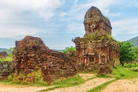
Nestled in a valley beneath Cat’s Tooth Mountain (Hòn Quặp) in Quảng Nam Province, central Vietnam, Mỹ Sơn Sanctuary served as the spiritual heartland of the Champa Kingdom from the 4th to the 14th century CE. Dedicated to Shiva (Bhadresvara), this UNESCO World Heritage complex features over seventy brick towers (kalan) reflecting a thousand years of Cham religious architecture.

It was the principal religious center of the Champa Kingdom from the 4th to the 13th centuries CE. Nestled within a mountain valley in central Vietnam, the sanctuary consists of dozens of brick temple towers dedicated primarily to the Hindu god Shiva. Constructed over several centuries by successive Cham rulers, the temples served as places of worship, royal ceremonies, and commemorative monuments honoring deceased kings. The Cham builders demonstrated exceptional architectural skill by constructing brick structures with remarkably thin joints whose bonding techniques remain only partially understood today. Intricate sandstone carvings depict Hindu deities, celestial dancers, sacred animals, and scenes from Indian epics such as the Ramayana. Mỹ Sơn illustrates the profound influence of Indian religion, art, and architecture on Southeast Asia while preserving the distinctive artistic identity of the Cham civilization

Construction Innovations

The red-brick towers of Mỹ Sơn were built using a distinct mortarless masonry technique. Cham builders stacked fired clay bricks using an organic resin binder (dầu rái tree resin) and carved elaborate bas-reliefs directly into the completed brick walls before applying a final surface firing to seal the structure.

Conclusion

Mỹ Sơn Sanctuary remains the longest-utilized site of religious architecture in Southeast Asia, standing as a monumental testament to Cham spiritual and architectural artistry.

Claiborne Mounds: Louisiana's 3,500-Year Canals

July 28, 2026

Introduction

The Claiborne Mounds, located in Louisiana's Lower Mississippi Valley, represent an important prehistoric ceremonial center dating to approximately 1500 BCE, or about 3,500 years ago. The site is notable not only for its earthen mounds but also for evidence of engineered canals and drainage systems that demonstrate the remarkable environmental knowledge of Late Archaic Native American communities. Situated within a landscape of rivers, wetlands, and seasonal floodplains, the inhabitants developed innovative methods of controlling water while supporting ceremonial activities, transportation, and settlement. These discoveries reveal that prehistoric societies were capable of modifying their environment through planned hydraulic engineering long before the arrival of European settlers.

Canal Construction and Water Management

Archaeological investigations have identified a network of shallow canals and artificial drainage features associated with the Claiborne Mounds. These canals were excavated by hand using stone, bone, and wooden tools, connecting nearby waterways with the ceremonial complex. They likely served multiple functions, including directing excess floodwater away from important structures, improving drainage around the mounds, and providing convenient transportation routes for canoes carrying people, construction materials, and trade goods.

The canals also helped stabilize the surrounding landscape by reducing erosion during seasonal flooding. Combined with elevated earthen platforms, these hydraulic systems allowed the inhabitants to maintain year-round ceremonial spaces despite the challenging environmental conditions of the Mississippi floodplain.

Ceremonial and Economic Functions

The Claiborne Mounds functioned as an important gathering place where surrounding communities assembled for religious ceremonies, seasonal festivals, trade, and social interaction. The nearby canals facilitated the movement of goods and visitors from neighboring settlements, strengthening regional exchange networks. Archaeologists have recovered stone tools, projectile points, shell ornaments, and other artifacts indicating that the site participated in long-distance trade extending across much of the southeastern United States.

The combination of ceremonial earthworks and engineered waterways suggests that water itself held symbolic as well as practical significance. Rivers and canals likely formed part of ritual processions while simultaneously supporting communication and economic exchange.

Engineering Significance

The construction of canals alongside monumental earthworks demonstrates an advanced understanding of hydrology and landscape management. Rather than simply adapting to seasonal flooding, the inhabitants actively reshaped their environment to improve drainage, transportation, and access to ceremonial spaces. These achievements illustrate that early Native American communities possessed practical engineering knowledge that allowed them to thrive within complex wetland ecosystems.

Conclusion

The Claiborne Mounds highlight the ingenuity of Louisiana's prehistoric inhabitants in combining monumental earthwork construction with effective water management. Their canals, drainage systems, and ceremonial mounds demonstrate sophisticated planning, environmental adaptation, and regional cooperation approximately 3,500 years ago. Together, these features provide important evidence of the engineering skills and cultural achievements of the early mound-building societies of the Lower Mississippi Valley.

Óc Eo: Mekong Delta's Funan Empire Port

July 28, 2026

Introduction

Situated in An Giang Province in the southwest Mekong Delta, Óc Eo was the principal cosmopolitan port city and economic engine of the Funan Empire from the 1st to the 7th century CE. First excavated by French archaeologist Louis Malleret in the 1940s, Óc Eo revealed a sprawling, canal-linked urban metropolis that served as a vital crossroads on the maritime Silk Road connecting China, India, Persia, and the Roman Mediterranean.

Urban Canal Engineering & Global Trade Network

Óc Eo was engineered around an intricate network of artificial canals that served as transportation highways, agricultural irrigation channels, and flood control systems:

  • Hydraulic Urban Planning: A network of long, straight canals connected the inland city center directly to the Gulf of Thailand port at Ba Thê, allowing deep-draft merchant vessels to dock directly at city warehouses.

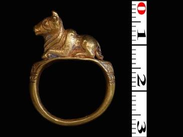
  • Artisanal Goldworking: Óc Eo contained extensive jewelry-making workshops producing delicate gold leaf ornaments, beaded necklaces, and signet rings engraved with Sanskrit or Roman-style motifs.

  • Global Material Evidence: Archaeological finds include Roman gold medallions dating to the reign of Antoninus Pius and Marcus Aurelius, Sasanian Persian glassware, and Han Dynasty bronze mirrors.

It was one of the most prosperous trading ports of the ancient Kingdom of Funan, flourishing between the 1st and 7th centuries CE in the Mekong Delta. Archaeological excavations have revealed canals, warehouses, jewelry workshops, temples, coins, ceramics, and imported luxury goods, demonstrating that Óc Eo functioned as a major commercial center linking Southeast Asia with India, China, and the Roman world.

Artifacts discovered at the site include Roman coins, Indian religious sculptures, Chinese ceramics, gold jewelry, and locally produced goods, illustrating the city's multicultural character. Merchants exchanged spices, precious stones, ivory, silk, metals, and exotic products through extensive maritime trade routes. The prosperity of Óc Eo reflects the Funan Empire's role as one of Southeast Asia's earliest international trading powers and a center for the spread of Hinduism and Buddhism.

Key Funan Takeaway: Óc Eo proves that 2,000 years ago, the Mekong Delta hosted a sophisticated, multi-ethnic maritime empire that integrated Indian Ocean trade routes with East Asian maritime networks.

Conclusion

Óc Eo stands as one of the most significant ancient port cities in Asian history. Its canal infrastructure and global trade goods highlight the key role early Southeast Asian empires played in early global commerce.

← Newer Posts Older Posts →
Featured
Artifact-France-Gravettian-Venus-Figurine.jpg
August 10, 2026
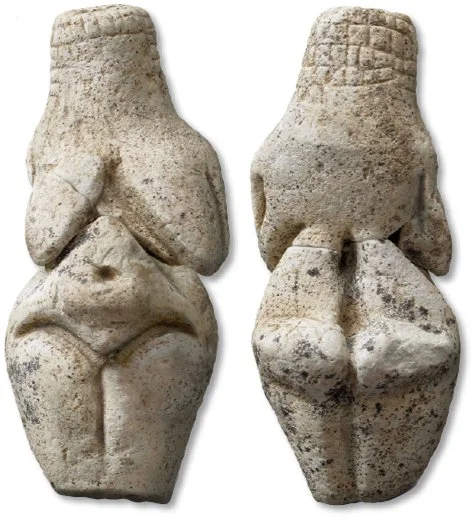
Noisetier Cave: France's Gravettian Venus Figurines
August 10, 2026
Read more →
August 10, 2026
images.jpeg
August 10, 2026
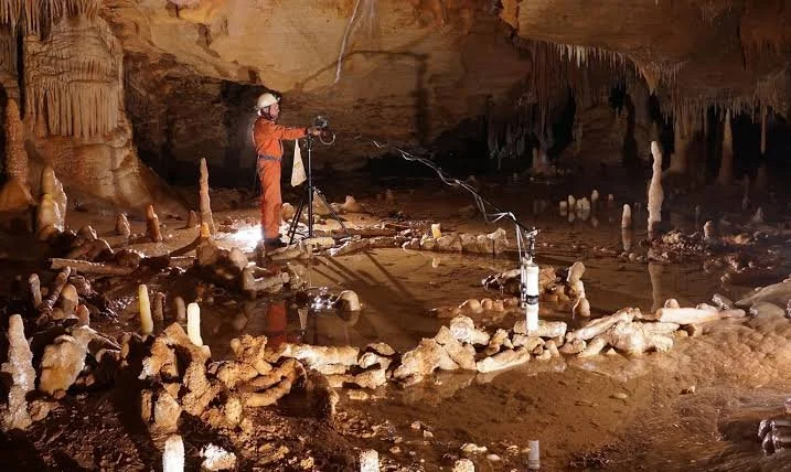
Bruniquel Cave: France's 176,000-Year Neanderthal Rings
August 10, 2026
Read more →
August 10, 2026
images (1).jpeg
August 10, 2026
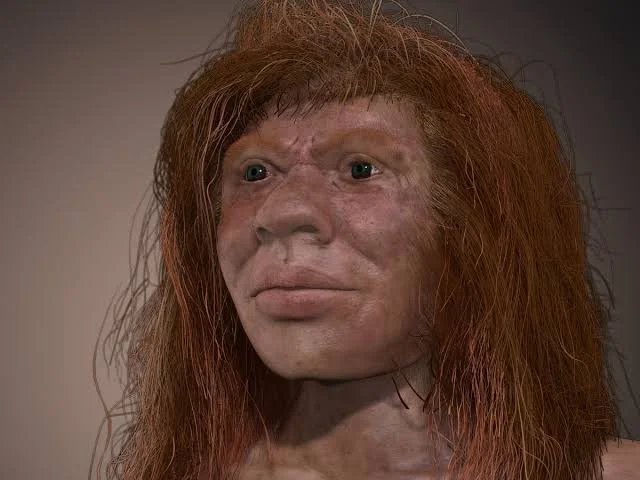
Mandrin Cave: France's Neanderthal-Denisovan Mix
August 10, 2026
Read more →
August 10, 2026
images (2).jpeg
August 10, 2026
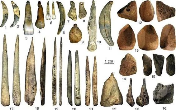
Grotte du Renne: France's Symbolic Neanderthals
August 10, 2026
Read more →
August 10, 2026
images (3).jpeg
August 10, 2026
Arcy-sur-Cure Caves: France's Continuous Occupation
August 10, 2026
Read more →
August 10, 2026
womanwithbabysm.jpg
August 10, 2026
Gönnersdorf: Germany's Late Magdalenian Art
August 10, 2026
Read more →
August 10, 2026
read more

Powered by The archaeologist