• MAIN PAGE
  • LATEST NEWS
    • Lost Cities
    • Archaeology's Greatest Finds
    • Underwater Discoveries
    • Greatest Inventions
    • Studies
    • Blog
  • PHILOSOPHY
  • HISTORY
  • RELIGIONS
    • Africa
    • Anatolia
    • Arabian Peninsula
    • Balkan Region
    • China - East Asia
    • Europe
    • Eurasian Steppe
    • Levant
    • Mesopotamia
    • Oceania - SE Asia
    • Pre-Columbian Civilizations of America
    • Iranian Plateau - Central Asia
    • Indus Valley - South Asia
    • Japan
    • The Archaeologist Editor Group
    • Scientific Studies
    • Aegean Prehistory
    • Historical Period
    • Byzantine Middle Ages
    • Predynastic Period
    • Dynastic Period
    • Greco-Roman Egypt
  • Rome
  • PALEONTOLOGY
  • About us
Menu

The Archaeologist

  • MAIN PAGE
  • LATEST NEWS
  • DISCOVERIES
    • Lost Cities
    • Archaeology's Greatest Finds
    • Underwater Discoveries
    • Greatest Inventions
    • Studies
    • Blog
  • PHILOSOPHY
  • HISTORY
  • RELIGIONS
  • World Civilizations
    • Africa
    • Anatolia
    • Arabian Peninsula
    • Balkan Region
    • China - East Asia
    • Europe
    • Eurasian Steppe
    • Levant
    • Mesopotamia
    • Oceania - SE Asia
    • Pre-Columbian Civilizations of America
    • Iranian Plateau - Central Asia
    • Indus Valley - South Asia
    • Japan
    • The Archaeologist Editor Group
    • Scientific Studies
  • GREECE
    • Aegean Prehistory
    • Historical Period
    • Byzantine Middle Ages
  • Egypt
    • Predynastic Period
    • Dynastic Period
    • Greco-Roman Egypt
  • Rome
  • PALEONTOLOGY
  • About us
No results found

Djelfa Petroglyphs: Algeria's Saharan Hunter Art

August 23, 2026

When Algeria Was Green: The Mysterious Rock Carvings of Djelfa's Ancient Hunters

The region around Djelfa in Algeria contains one of North Africa's important concentrations of prehistoric rock art.

Across rocky landscapes, ancient artists carved animals, human figures, and scenes that provide evidence of societies that existed long before written history.

These petroglyphs are particularly valuable because they preserve traces of environmental conditions that no longer exist in the same form.

The Art of Engraving

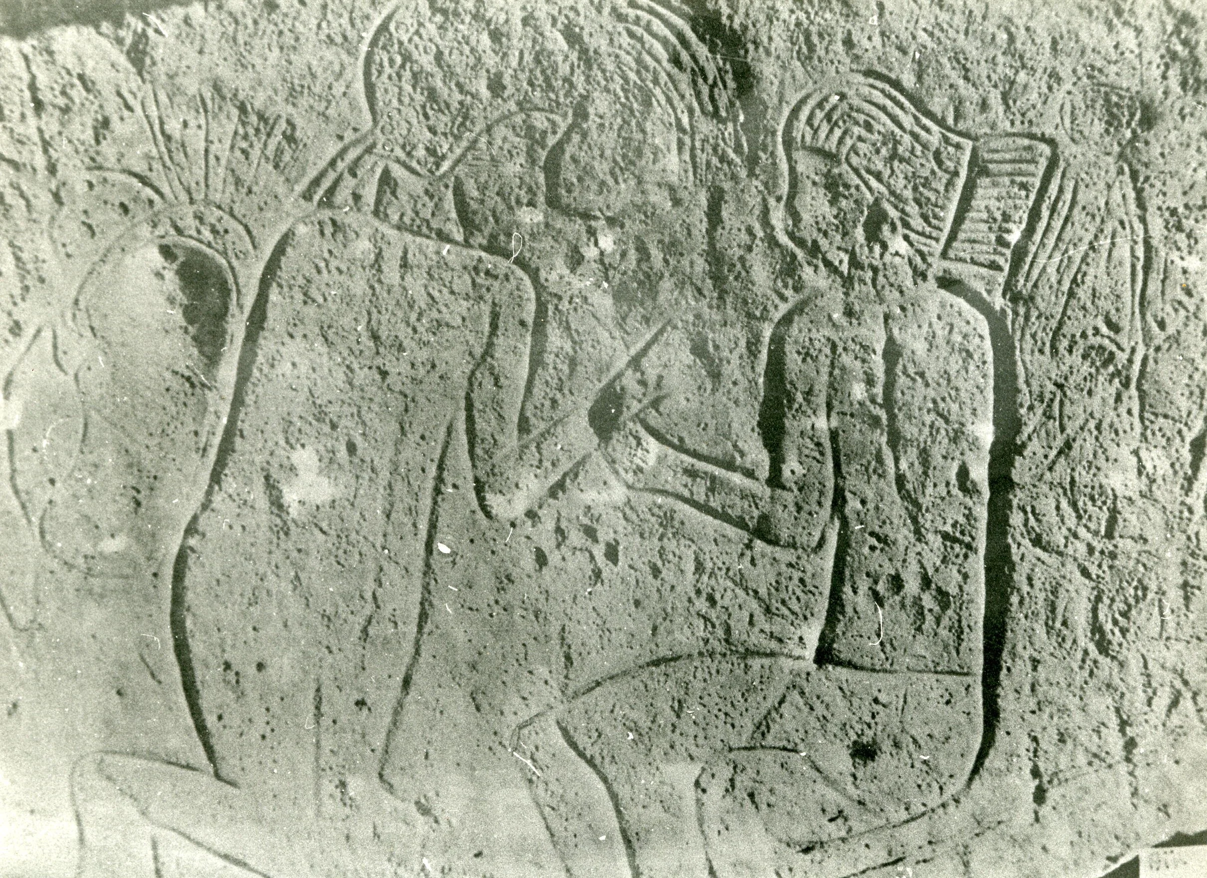
Unlike painted rock art, petroglyphs were created directly into stone.

Artists could use techniques such as:

  • Pecking.

  • Incising.

  • Scraping.

  • Abrasion.

The work required time and skill.

An image was not created accidentally.

Someone deliberately selected a surface and transformed it.

The Animals of a Lost Environment

Some of the most important images depict animals.

These may include species associated with prehistoric hunting landscapes.

Their presence suggests environmental conditions different from those of the modern region.

Rock art therefore contributes to the study of climate history.

Hunters and Weapons

Human figures may be shown carrying weapons or interacting with animals.

Such scenes can provide clues about hunting technology and social activity.

However, interpretation must remain cautious.

A carved figure is not a photograph.

It may represent:

  • A real event.

  • A symbolic narrative.

  • A ritual.

  • A mythological concept.

The Pastoral Revolution

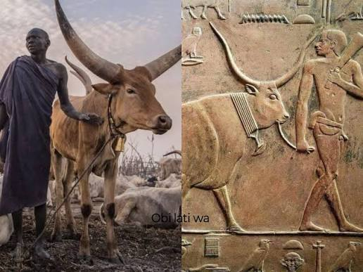
Some later images show the importance of domesticated cattle.

This reflects one of the major transformations of prehistoric North Africa.

Pastoralism changed:

  • Mobility.

  • Food production.

  • Social organization.

  • Relationships with animals.

The art provides visual evidence for these changes.

Why the Djelfa Petroglyphs Matter

The petroglyphs are a reminder that prehistoric societies were not primitive in the sense of being without culture.

They possessed:

  • Artistic traditions.

  • Symbolic systems.

  • Economic knowledge.

  • Social organization.

The images were part of communication.

Although we may not fully understand their meaning, their survival demonstrates the extraordinary depth of Algeria's human history.

Tassili n'Ajjer: Algeria's 12,000-Year Rock Paintings

August 23, 2026

The Sahara Was Once Green—and 12,000-Year-Old Paintings Prove It

Deep within southeastern Algeria lies one of the world's greatest prehistoric archives.

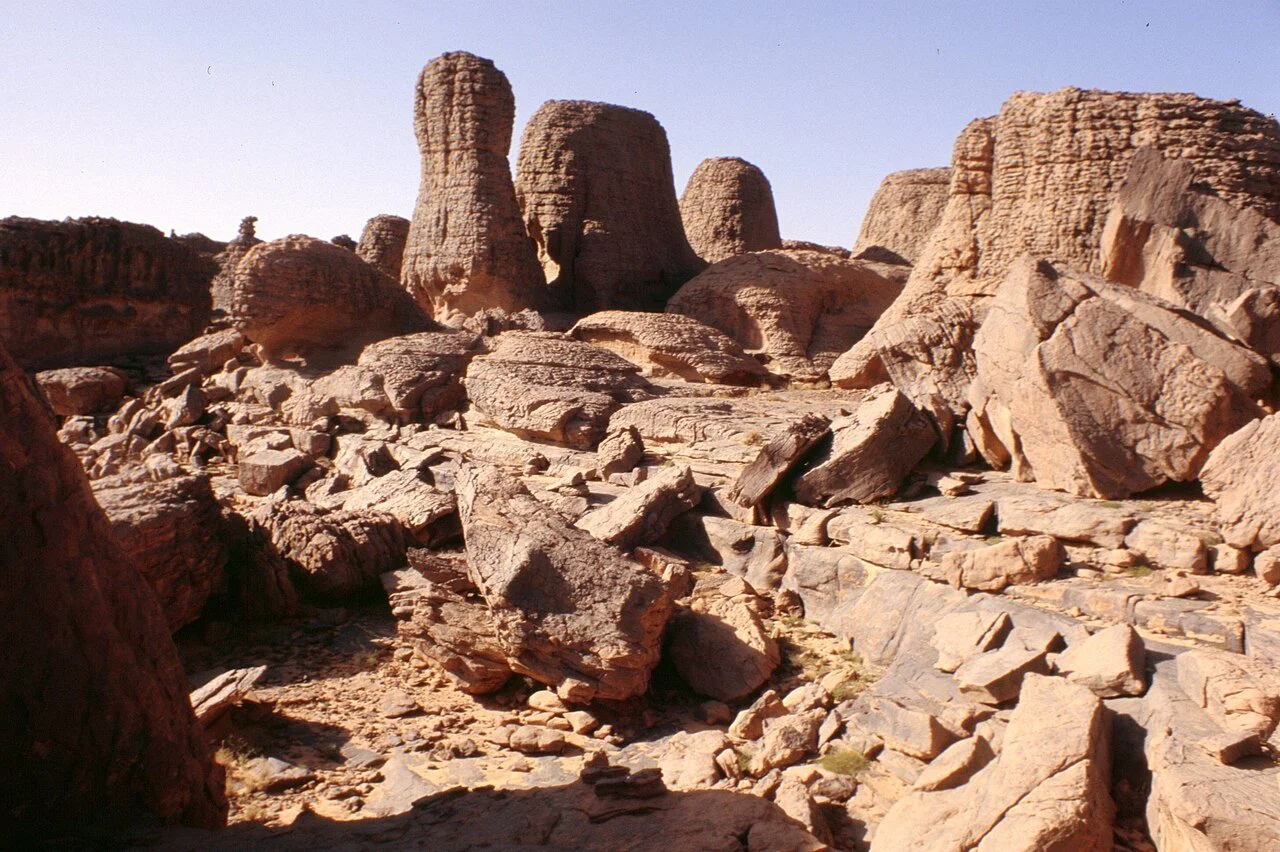
The Tassili n'Ajjer is a vast plateau of sandstone formations, rock shelters, cliffs, and extraordinary prehistoric art.

Thousands of paintings and engravings have been recorded across the region.

Together, they preserve evidence of human life extending across enormous periods of environmental and cultural change.

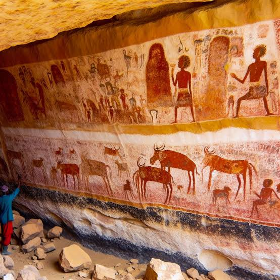
The images include animals, hunters, cattle herders, human figures, ceremonial scenes, and mysterious symbolic forms.

They tell a story that seems almost impossible when viewed against the modern Sahara.

Once, this region was dramatically wetter.

And the art proves it.

The Green Sahara

The Sahara has experienced major climatic changes.

During wetter prehistoric periods, rainfall patterns differed significantly from those of today.

Lakes expanded.

Vegetation increased.

Animals inhabited regions that later became desert.

Human populations followed available resources.

The paintings of Tassili n'Ajjer preserve animals associated with wetter landscapes, including species that could not survive in the modern desert environment.

A Prehistoric Archive

The exact dates of individual artworks vary, and some are difficult to establish with precision.

The broader artistic sequence spans several millennia.

Researchers often classify the imagery into overlapping stylistic and cultural phases.

These include traditions associated with:

  • Large wild animals.

  • Human figures.

  • Pastoral cattle societies.

  • Later horse and camel periods.

The sequence reflects enormous social change.

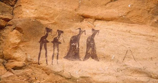
The Round Head Paintings

Among the most famous and mysterious images are the so-called Round Head paintings.

These depict human-like figures with distinctive rounded heads.

Some are extremely large.

Their meaning remains uncertain.

Modern popular culture has sometimes exaggerated these images into stories about astronauts or extraterrestrials.

There is no reliable archaeological evidence that they depict aliens.

The paintings should instead be studied within their prehistoric cultural context.

Their mystery is real—but the mystery is human, not extraterrestrial.

The Arrival of Cattle

One of the most important transformations visible in the art is the growing importance of cattle.

Pastoral scenes depict herders and domesticated animals.

This represents a major change in human economic life.

Instead of relying primarily on hunting and gathering, communities increasingly managed livestock.

Cattle also acquired social and symbolic importance.

Art as Environmental Evidence

The animals depicted at Tassili n'Ajjer help reconstruct ancient environments.

Images include species associated with grasslands and wetter habitats.

The art therefore provides a visual complement to environmental archaeology.

Scientists can compare artistic evidence with:

  • Lake sediments.

  • Pollen.

  • Fossils.

  • Geological records.

Together, these sources reconstruct the changing Sahara.

The Threats to the Art

The paintings are vulnerable.

Threats include:

  • Natural weathering.

  • Human damage.

  • Tourism.

  • Graffiti.

  • Climate change.

Unlike a museum object, a rock shelter cannot simply be moved indoors.

Conservation must protect the art in its original landscape.

Why Tassili n'Ajjer Is One of Humanity's Greatest Archives

The site preserves evidence of human imagination across thousands of years.

The artists left no written books.

Yet their images communicate across time.

They show us animals.

Bodies.

Tools.

Social relationships.

Changing economies.

The modern Sahara appears dry and empty.

But the paintings reveal another world.

A world of water.

Grass.

Animals.

Communities.

And human beings who transformed stone walls into history.

Oued Athmen: Algeria's Berber Rock Art

August 23, 2026

The Ancient Images Hidden on Algeria's Rocks: Who Created Them and Why?

Across North Africa, ancient rock art provides one of the most important records of prehistoric life.

In areas associated with Oued Athmen and other Algerian landscapes, researchers have documented carvings, markings, and artistic traditions that may preserve evidence of ancient communities.

However, individual rock-art sites require careful archaeological identification and dating. Popular lists can sometimes attach broad labels to poorly documented locations, making it essential to distinguish between securely studied sites and generalized descriptions.

The wider story of Algerian rock art is nevertheless extraordinary.

It reveals that landscapes now associated with dry environments were once inhabited by communities whose lives depended on hunting, herding, water sources, and changing climates.

What Is Rock Art?

Rock art includes two major categories.

Petroglyphs are images created by carving, pecking, incising, or abrading rock surfaces.

Pictographs are painted images applied to stone.

The distinction matters because the techniques differ.

A carved image may survive differently from a painted one.

The Problem of Dating Rock Art

Dating ancient images is difficult.

Stone itself cannot simply be radiocarbon dated.

Researchers instead examine:

  • Archaeological context.

  • Superimposed images.

  • Weathering.

  • Associated organic materials.

  • Artistic style.

  • Depicted animals.

For example, an image of an animal no longer present in the Sahara may provide clues about the environmental conditions under which it was created.

But caution is essential.

Style alone rarely provides an exact date.

Ancient Climate Change

One of the most important lessons of North African rock art is that the Sahara has not always looked as it does today.

During periods sometimes referred to as the African Humid Period, large areas of what are now deserts received significantly more rainfall.

Grasslands and lakes existed.

Animal populations were different.

Human communities occupied regions that are now extremely arid.

Rock art preserves visual evidence of this lost environment.

Hunters, Herders, and Artists

The images found across Algeria and the Sahara may depict:

  • Wild animals.

  • Domestic cattle.

  • Hunters.

  • Human figures.

  • Weapons.

  • Ritual scenes.

  • Geometric symbols.

These changes can help archaeologists trace transformations in human society.

A region dominated by hunting imagery may later display evidence of pastoralism.

The art becomes a visual record of economic change.

Why Oued Athmen Matters

Even lesser-known rock-art landscapes are important because they expand the geographical record of prehistoric North Africa.

The history of ancient Algeria was not limited to the Mediterranean coast.

Human communities occupied valleys, mountains, and desert margins.

The challenge today is ensuring that poorly documented sites are studied rather than sensationalized.

Every authentic engraving may preserve information about a prehistoric community that left no written history.

Ikosimida: Algeria's Byzantine Fort

August 23, 2026

Before Modern Algiers: The Forgotten Forts and Empires That Controlled This North African Coast

The ancient and medieval history of Algiers is complicated because the region has been known by multiple names.

One of the most important ancient names associated with the area is Ikosim, later Romanized as Icosium.

Descriptions such as “Ikosimida” may refer to later or variant naming traditions, but the historical record must be handled carefully because ancient place names can become distorted through translation, transcription, and later historical writing.

The wider story, however, is clear.

The site of modern Algiers occupied an important position through successive periods of Phoenician, Punic, Roman, Byzantine, Islamic, Ottoman, French, and modern history.

Icosium and the Ancient Coast

The coastal location made settlement valuable.

Natural maritime access connected the region with Mediterranean trade routes.

Earlier populations participated in the commercial world of the Punic Mediterranean.

Roman expansion later incorporated the settlement into imperial territory.

Roman Icosium

Under Roman control, Icosium became part of the administrative and urban network of North Africa.

Roman influence introduced:

  • Administrative structures.

  • Roads.

  • Public architecture.

  • Latin inscriptions.

  • New legal systems.

But Romanization did not erase local identity.

The population remained culturally diverse.

The Collapse of Western Roman Authority

By the fifth century, the western Roman political system was undergoing profound change.

North Africa came under the control of the Vandal Kingdom.

This transformed political structures but did not instantly destroy urban life.

Cities adapted.

Trade continued in altered forms.

Religious and political tensions persisted.

The Byzantine Reconquest

In the sixth century, Emperor Justinian launched campaigns to restore former Roman territories to imperial control.

Byzantine forces reconquered parts of North Africa.

Fortifications became especially important.

The Byzantine Empire inherited a landscape shaped by Roman urbanization but faced new military threats.

Defensive structures were repaired or constructed.

What Is a Byzantine Fortress?

A Byzantine fort was not necessarily a massive castle like those imagined from later medieval Europe.

It could involve:

  • Repaired Roman walls.

  • Compact defensive enclosures.

  • Towers.

  • Military garrisons.

  • Strategic coastal positions.

The goal was to maintain imperial authority in a politically unstable environment.

The Arrival of Islamic Rule

By the late seventh and early eighth centuries, Arab Muslim armies expanded across North Africa.

The Byzantine political presence gradually disappeared.

The region entered a new historical era.

Centuries later, the settlement associated with modern Algiers would emerge as a major Islamic and Mediterranean city.

Why the Ancient Layers Matter

Modern Algiers contains an extraordinary sequence of historical layers.

The challenge is that many are physically hidden.

Urban development can erase visible traces.

Archaeology therefore becomes essential.

A single excavated structure can change historians' understanding of the city's past.

The Fortress That Became a City

The history of Algiers demonstrates how strategic locations repeatedly attract settlement.

Different empires may disappear.

But geography remains.

The harbor remains useful.

The coastline remains strategically important.

A Roman town can become a Byzantine defensive location.

A Byzantine landscape can become part of the Islamic Maghreb.

And eventually, a modern capital rises above all of them.

61. Oued Athmen: Algeria's Little-Known Landscape of Ancient Rock Art

The Ancient Images Hidden on Algeria's Rocks: Who Created Them and Why?

Across North Africa, ancient rock art provides one of the most important records of prehistoric life.

In areas associated with Oued Athmen and other Algerian landscapes, researchers have documented carvings, markings, and artistic traditions that may preserve evidence of ancient communities.

However, individual rock-art sites require careful archaeological identification and dating. Popular lists can sometimes attach broad labels to poorly documented locations, making it essential to distinguish between securely studied sites and generalized descriptions.

The wider story of Algerian rock art is nevertheless extraordinary.

It reveals that landscapes now associated with dry environments were once inhabited by communities whose lives depended on hunting, herding, water sources, and changing climates.

What Is Rock Art?

Rock art includes two major categories.

Petroglyphs are images created by carving, pecking, incising, or abrading rock surfaces.

Pictographs are painted images applied to stone.

The distinction matters because the techniques differ.

A carved image may survive differently from a painted one.

The Problem of Dating Rock Art

Dating ancient images is difficult.

Stone itself cannot simply be radiocarbon dated.

Researchers instead examine:

  • Archaeological context.

  • Superimposed images.

  • Weathering.

  • Associated organic materials.

  • Artistic style.

  • Depicted animals.

For example, an image of an animal no longer present in the Sahara may provide clues about the environmental conditions under which it was created.

But caution is essential.

Style alone rarely provides an exact date.

Ancient Climate Change

One of the most important lessons of North African rock art is that the Sahara has not always looked as it does today.

During periods sometimes referred to as the African Humid Period, large areas of what are now deserts received significantly more rainfall.

Grasslands and lakes existed.

Animal populations were different.

Human communities occupied regions that are now extremely arid.

Rock art preserves visual evidence of this lost environment.

Hunters, Herders, and Artists

The images found across Algeria and the Sahara may depict:

  • Wild animals.

  • Domestic cattle.

  • Hunters.

  • Human figures.

  • Weapons.

  • Ritual scenes.

  • Geometric symbols.

These changes can help archaeologists trace transformations in human society.

A region dominated by hunting imagery may later display evidence of pastoralism.

The art becomes a visual record of economic change.

Why Oued Athmen Matters

Even lesser-known rock-art landscapes are important because they expand the geographical record of prehistoric North Africa.

The history of ancient Algeria was not limited to the Mediterranean coast.

Human communities occupied valleys, mountains, and desert margins.

The challenge today is ensuring that poorly documented sites are studied rather than sensationalized.

Every authentic engraving may preserve information about a prehistoric community that left no written history.

Rusguniae: Algeria's Punic Trading Post

August 23, 2026

The Ancient Trading City Hidden Beneath Modern Algeria's Capital

Long before modern Algiers became one of North Africa's major cities, the coastline around it was already connected to Mediterranean trade.

One ancient settlement associated with this landscape was Rusguniae, located east of the historic center of modern Algiers.

Today, much of its ancient environment has been transformed by urban development.

But archaeological evidence and historical references reveal that this coastal area was once part of a much older network of commerce and settlement.

The Phoenician and Punic Mediterranean

The earliest trading communities of the central North African coast participated in networks connected with Phoenician maritime activity.

The Phoenicians established commercial links across the Mediterranean.

Their settlements and trading stations connected distant regions.

Later, Carthage became the dominant Punic power in North Africa.

Rusguniae developed within this broader commercial environment.

Why Coastal Trading Posts Were Important

A trading post did not need to become a massive city to be historically significant.

Its importance could depend on location.

A useful harbor could connect:

  • Local agricultural communities.

  • Inland populations.

  • Mediterranean merchants.

Goods could move between land and sea.

Roman Control

When Rome expanded into North Africa, existing settlements were incorporated into the Roman political system.

Rusguniae became part of Roman Mauretania.

The settlement developed under Roman administration.

Roman roads and maritime networks connected it with other coastal cities.

Urban Development

Like other Roman settlements, Rusguniae contained elements of urban life.

Archaeological evidence may include:

  • Architectural remains.

  • Funerary monuments.

  • Inscriptions.

  • Ceramics.

  • Religious structures.

However, modern urban development makes the archaeological study of such sites particularly difficult.

The Problem of Archaeology Beneath Modern Cities

A famous archaeological site like Timgad can be extensively excavated because much of the ancient city remained outside modern urban development.

Rusguniae faced the opposite problem.

Modern construction covered or disturbed portions of the ancient landscape.

Archaeologists may have only fragments.

This makes interpretation difficult.

A broken inscription.

A buried wall.

A group of ceramics.

Each may represent a surviving fragment of a much larger lost city.

Christianity and Late Antiquity

Like many Roman settlements in North Africa, Rusguniae later became connected with Christian institutions.

The growth of Christianity transformed the social and religious landscape.

Bishops, churches, and Christian communities became increasingly important.

Why Rusguniae Matters

Rusguniae demonstrates that modern cities often sit directly on top of ancient ones.

The development of Algiers did not begin with the modern era.

The coastline had been inhabited, traded through, and politically controlled for centuries.

The ancient port may be difficult to see today.

But its historical significance remains.

Beneath roads, buildings, and modern neighborhoods lies the memory of a Mediterranean world that existed long before the modern capital.

Cuicul: Algeria's Constantine Roman CityCuicul: Algeria's Constantine Roman City

August 23, 2026

The Roman City With Two Names: Why Cuicul and Djemila Are the Same Ancient Mystery

One of the most important corrections in North African archaeology concerns the name Cuicul.

Cuicul is not a separate Roman city from Djemila.

Cuicul is the ancient Roman name of the archaeological site now known as Djemila.

This distinction may appear simple, but it reveals a broader issue in historical writing: ancient places often acquire multiple names over centuries.

Modern languages rename them.

Empires change.

Archaeologists use ancient forms.

Local communities preserve new names.

The result can sometimes make one city appear to be several.

The history of Cuicul is therefore the history already explored through Djemila—but it deserves attention under its original Roman identity.

Cuicul in Roman Numidia

The city developed as part of the Roman province of Numidia.

Its foundation and expansion occurred within the wider process of Roman urbanization in North Africa.

Roman cities were connected through:

  • Roads.

  • Military networks.

  • Administrative systems.

  • Agricultural economies.

  • Mediterranean trade.

Cuicul occupied an important place within this network.

A City That Adapted to the Mountains

The mountainous terrain created a challenge.

Roman architects adapted their planning.

The resulting urban landscape demonstrates that Roman engineering was flexible.

Rather than abandoning difficult sites, Roman builders developed infrastructure suited to the available geography.

The Original Colonial Core

The earliest city contained the basic institutions associated with Roman urban life.

These included:

  • A forum.

  • Streets.

  • Public monuments.

  • Religious buildings.

  • Residential areas.

As the city grew, the original core became only one part of a larger urban environment.

Expansion Under Later Emperors

Imperial prosperity encouraged new construction.

Monuments were added.

Markets developed.

Baths were expanded.

Triumphal architecture celebrated imperial authority.

The city became more complex.

Constantine and the Late Roman World

The phrase “Constantine Roman City” can be misleading if it suggests that Cuicul was founded by Emperor Constantine.

The city existed centuries before his reign.

However, like many Roman cities, it continued to exist and develop during the period of Constantine and the transformation of the Roman Empire.

The fourth century was a period of major religious and political change.

Christianity increasingly received imperial support.

Urban institutions changed.

New religious architecture appeared.

The Christian Transformation

Churches became major components of late antique urban life.

The conversion of emperors and the increasing influence of Christianity altered the relationship between religion and political power.

Cuicul reflects this transformation.

The city that had originally been designed around Roman civic and pagan institutions became increasingly shaped by Christian architecture.

Archaeological Interpretation

The study of Cuicul/Djemila demonstrates why archaeological interpretation must avoid simple narratives.

A city is not “Roman” in only one sense.

Its history changed.

People changed.

Religions changed.

Buildings changed.

The ruins represent centuries, not one moment.

Why the Two Names Matter

Calling the city Cuicul emphasizes its ancient Roman identity.

Calling it Djemila recognizes its modern Algerian context.

Both names belong to its history.

The site reminds us that ancient cities do not disappear completely.

Sometimes they survive by changing names.

Sometimes their ruins become new landscapes.

And sometimes, centuries later, archaeologists uncover the streets of a city whose original inhabitants would never have imagined that their name would one day be forgotten—and then rediscovered.

Lambaesis: Algeria's Legionary Fortress Camps

August 23, 2026

Rome Built a Giant Military Fortress in Algeria—Then an Entire City Grew Around It

In the Aurès Mountains of Algeria lie the remains of Lambaesis, one of the most important Roman military sites in North Africa.

Unlike Timgad, which began primarily as a colonial settlement, Lambaesis developed around the presence of one of Rome's most powerful institutions:

the legion.

For centuries, the site served as the headquarters of the Legio III Augusta, a major Roman legion responsible for military operations across North Africa.

The history of Lambaesis reveals how Rome controlled distant provinces—not simply through monuments and administrators, but through permanent military infrastructure.

The Roman Legion

A Roman legion was a highly organized military institution.

During the imperial period, a legion could include several thousand soldiers.

It required:

  • Barracks.

  • Training grounds.

  • Storage facilities.

  • Workshops.

  • Administrative offices.

  • Roads.

  • Water supplies.

A permanent legionary base was therefore effectively a small city.

Why Lambaesis Was Strategically Important

The location allowed Roman forces to operate near the Aurès Mountains and surrounding frontier regions.

Military forces could respond to unrest.

Roads connected the fortress with other settlements.

The legion also supported broader Roman authority.

The presence of soldiers affected the economy.

Merchants supplied food.

Artisans provided equipment.

Families and civilians settled nearby.

A military camp gradually produced an urban community.

The Fortress

Roman military camps were carefully organized.

Typical features included:

  • Defensive walls.

  • Gates.

  • Straight internal roads.

  • Headquarters buildings.

  • Barracks.

  • Granaries.

  • Workshops.

The layout reflected discipline.

Military space was controlled.

Movement could be organized.

The Legio III Augusta

The Legio III Augusta became the central military force associated with Roman Numidia.

Its history reflects changing imperial policies.

The legion participated in military campaigns and frontier security.

At certain points, political decisions affected its status.

Its presence or absence had major consequences for regional stability.

Soldiers as Builders

Roman soldiers did more than fight.

They built.

Military units could construct:

  • Roads.

  • Bridges.

  • Fortifications.

  • Public buildings.

  • Water infrastructure.

In frontier provinces, the Roman army played a major role in engineering.

Lambaesis therefore became a center of technical expertise.

Civilian Settlement

A major military base attracted civilians.

A settlement developed around the fortress.

People supplied the soldiers with:

  • Food.

  • Clothing.

  • Equipment.

  • Entertainment.

  • Services.

Over time, the boundary between military and civilian life became increasingly important.

The Praetorium and Command

The headquarters building served as an administrative center.

Military records, official ceremonies, and command functions were organized from such spaces.

The Roman army depended on bureaucracy.

Orders had to travel.

Supplies had to be recorded.

Personnel had to be managed.

The ruins of Lambaesis reveal the administrative side of imperial power.

Religion in a Military Community

Roman soldiers came from diverse regions.

They brought religious traditions with them.

Military communities could worship:

  • Jupiter.

  • Mars.

  • Local deities.

  • Eastern Mediterranean gods.

  • Imperial cult figures.

Religion was therefore part of military identity.

Inscriptions provide evidence for individual soldiers and their beliefs.

Inscriptions and Forgotten Lives

One of the greatest sources of information about Lambaesis comes from inscriptions.

These can record:

  • Names.

  • Military ranks.

  • Units.

  • Dedications.

  • Construction projects.

  • Funerary memorials.

An inscription may preserve the name of a soldier who would otherwise be completely forgotten.

For historians, these texts transform anonymous ruins into human history.

Decline of the Military System

Roman frontier organization changed over time.

Political instability affected the empire.

Military units were reorganized.

Economic systems changed.

Eventually, the great legionary base lost its earlier importance.

But the physical remains survived.

Why Lambaesis Matters

Lambaesis demonstrates how the Roman Empire actually functioned on the ground.

Rome did not control North Africa from Italy alone.

It built permanent institutions.

It stationed soldiers.

It created roads.

It established administrative systems.

And around one enormous legionary fortress, an entire city developed.

The ruins are therefore evidence of something extraordinary:

an empire could build a military machine so powerful that its permanent camp became a civilization of its own.

Calama: Algeria's Augustine of Hippo Bishopric

August 23, 2026

The Lost Roman City Behind One of Christianity's Most Turbulent Eras

The ancient city of Calama, located near modern Guelma in northeastern Algeria, was an important urban center of Roman North Africa.

Although less internationally famous than Timgad or Djemila, Calama played a significant role in the political, religious, and urban history of the region.

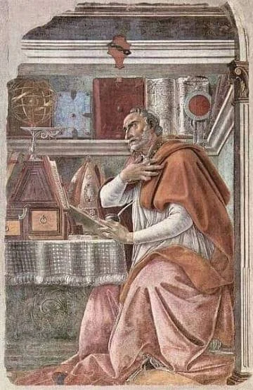
Its story also intersects with one of the most influential figures of late antique Christianity: Augustine of Hippo.

However, historical precision is essential.

Augustine himself was bishop of Hippo Regius, not Calama. Calama was governed by its own bishops and formed part of the wider North African Christian world in which Augustine lived, wrote, debated, and exercised influence.

From Earlier Settlement to Roman City

Like many North African urban centers, Calama developed through multiple historical stages.

The region had earlier local populations before Roman political and urban systems became dominant.

Under Roman rule, the settlement developed into an important city.

Urbanization brought:

  • Roads.

  • Public buildings.

  • Baths.

  • Administrative institutions.

  • Religious structures.

Numidia and Roman Africa

Calama was located in the Roman province of Numidia, one of the most important regions of Roman North Africa.

The province contained:

  • Agricultural wealth.

  • Military installations.

  • Major cities.

  • Diverse populations.

Roman authority depended on cooperation and interaction with local communities.

The region was never culturally identical to Italy.

Roman Africa developed its own identity.

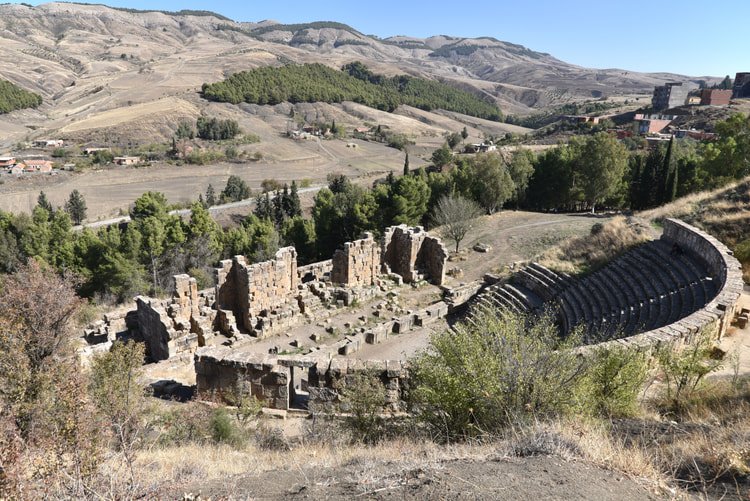
The Roman Theater

One of the most important surviving monuments associated with ancient Calama is its Roman theater.

The existence of such a structure demonstrates the city's urban importance.

Theater architecture required:

  • Skilled construction.

  • A substantial population.

  • Cultural and economic resources.

Entertainment was part of Roman civic identity.

The Forum and Public Space

Like other Roman cities, Calama possessed civic spaces associated with administration and public life.

These spaces were where imperial identity became visible.

Inscriptions could honor emperors.

Statues could commemorate local elites.

Buildings demonstrated wealth.

Christianity in Calama

By Late Antiquity, Christianity had become deeply established across North Africa.

Calama developed an important Christian community.

The region was also affected by theological conflict.

One of the most significant controversies involved Donatism, a Christian movement that challenged the legitimacy of certain clergy and institutions.

The dispute was not simply theological.

It involved:

  • Political authority.

  • Religious legitimacy.

  • Social divisions.

  • The memory of persecution.

Augustine and the Bishop of Calama

Augustine's world included constant interaction with other bishops across North Africa.

Calama became significant in this religious network.

Its bishop, Possidius, is particularly important because he was a close associate and later biographer of Augustine.

Possidius wrote one of the earliest surviving biographies of Augustine, preserving valuable information about his life.

This connection gives Calama an important place in the intellectual history of Christianity.

Violence and Religious Conflict

Late antique North Africa was not a peaceful religious landscape.

Catholic and Donatist communities competed.

Political intervention could intensify conflict.

Churches represented not only spiritual institutions but also social power.

Calama experienced periods of tension that reflect these wider divisions.

The Vandal Period

During the fifth century, the Vandal conquest transformed North Africa.

The Vandals established a kingdom that included major parts of the region.

Political authority shifted.

Religious institutions were affected.

Urban life continued but changed.

Byzantine and Later Transformations

Byzantine forces later reconquered parts of North Africa.

But the region had already experienced centuries of transformation.

The ancient Roman urban system was changing.

Cities survived in different forms.

Some declined.

Others adapted.

Why Calama Matters

Calama is important because history is not only created in famous capitals.

A provincial city can reveal major transformations.

Through Calama, historians can study:

  • Roman urbanization.

  • North African Christianity.

  • Donatist conflict.

  • Augustine's intellectual network.

  • Vandal and Byzantine political change.

The ruins may be less famous than those of Timgad, but the city stood at the center of one of the most intellectually important regions of the late ancient world.

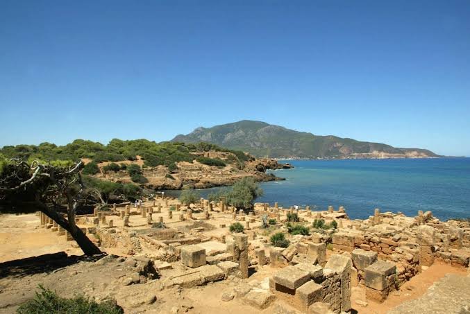
Tipasa: Algeria's Phoenician-Punic-Roman Port

August 23, 2026

Three Civilizations Built This Algerian City—Then the Mediterranean Took It Back

Along Algeria's Mediterranean coast lies Tipasa, an archaeological landscape shaped by thousands of years of cultural contact.

Phoenician traders used the coast.

Punic influence followed.

The Romans transformed the settlement into an important urban center.

Christian communities built churches and cemeteries.

Later political changes altered the city again.

Few sites demonstrate the layered history of North Africa as clearly as Tipasa.

The Phoenician Mediterranean

The Phoenicians were among the great maritime traders of the ancient Mediterranean.

Originating primarily from the eastern Mediterranean, Phoenician communities established commercial relationships and settlements across coastal regions.

Their network eventually extended to North Africa, Iberia, and beyond.

Tipasa's coastal location made it valuable.

A harbor could connect local communities with wider trade routes.

The Punic World

The growth of Carthage transformed the political landscape of North Africa.

Carthage developed from a Phoenician foundation into a major Mediterranean power.

Settlements along the coast participated in a wider Punic commercial and cultural network.

Tipasa became connected with this world.

Roman Conquest and Transformation

After Rome defeated Carthage and expanded into North Africa, coastal settlements increasingly entered the Roman imperial system.

Tipasa was transformed.

Roman institutions appeared.

Urban architecture expanded.

The settlement developed into a municipium and later an important Roman city.

A City Beside the Sea

The location shaped Tipasa's identity.

The Mediterranean was a highway.

Ships carried:

  • Grain.

  • Olive oil.

  • Wine.

  • Ceramics.

  • Metals.

  • Luxury goods.

  • People.

A coastal city could participate in networks extending across the entire Roman world.

The Roman Urban Landscape

The archaeological remains include evidence of:

  • Streets.

  • Houses.

  • Baths.

  • Public buildings.

  • Temples.

  • Cemeteries.

  • Christian churches.

The combination of structures demonstrates that Tipasa was not merely a port.

It was a functioning urban community.

Christianity and the Basilica Landscape

Tipasa became particularly important during the Christian period.

Large basilicas and cemeteries demonstrate the growth of Christian communities.

The location contains significant evidence for the transformation of Roman cities during Late Antiquity.

Christianity reshaped urban space.

New religious buildings became important.

Burial practices changed.

The relationship between the living city and the dead also became visible through extensive cemeteries.

Saint Salsa and Religious Memory

Tipasa is associated with the Christian martyr Saint Salsa, whose story became part of local religious tradition.

Her cult demonstrates how local communities created sacred histories connected with particular places.

Such traditions transformed ordinary landscapes into religious geography.

The Vandals and Byzantine Period

The political collapse of western Roman authority led to new forms of rule.

The Vandals established a kingdom in North Africa.

Later, Byzantine forces attempted to restore imperial authority.

Tipasa's history reflects these larger Mediterranean transformations.

The Landscape and the Ruins

Tipasa is unusual because the archaeological remains exist in a coastal environment of extraordinary natural beauty.

But beauty can create conservation problems.

Salt air.

Humidity.

Vegetation.

Tourism.

All can affect ancient stone.

The ruins are therefore constantly exposed to environmental pressure.

Why Tipasa Matters

Tipasa represents the Mediterranean as a space of connection.

The sea did not separate civilizations.

It connected them.

Phoenician sailors, Punic merchants, Roman officials, Christian clergy, and local North African communities all participated in the history of this coastline.

The ruins demonstrate that civilization was not created by one culture replacing another.

Instead, Tipasa accumulated layers.

And beside the Mediterranean, those layers remain visible.

Djemila: Algeria's Trajan-Era Mountain City

August 23, 2026

Rome Built a City in the Mountains of Algeria—and Its Ruins Still Defy the Landscape

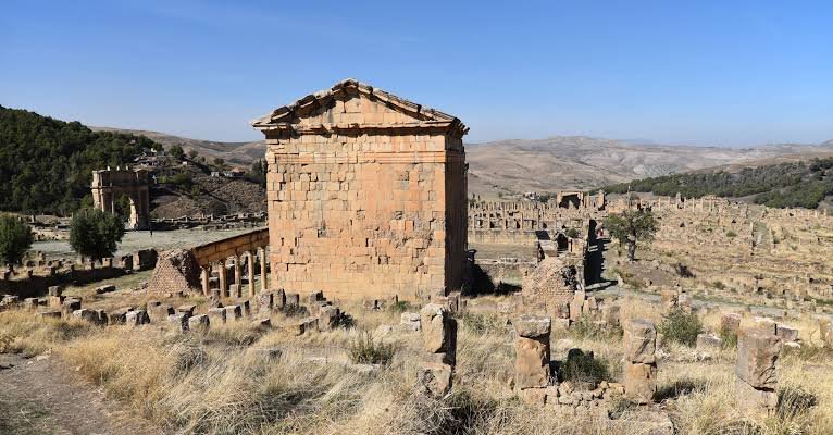
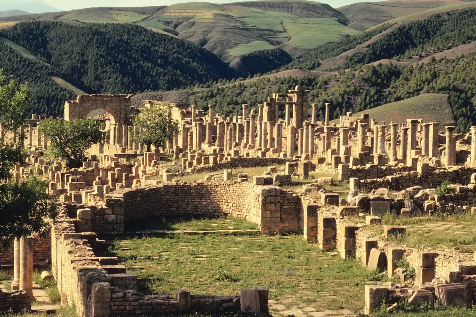
Djemila, known in antiquity as Cuicul, is one of the most spectacular surviving Roman archaeological sites in North Africa.

Its location is immediately striking.

Unlike many Roman cities built on broad plains, Cuicul developed in a mountainous environment at a significant elevation.

The terrain presented enormous challenges.

Yet Roman planners built streets, forums, temples, houses, markets, baths, and churches into the landscape.

The result is a city that demonstrates both the ambition and adaptability of Roman urban civilization.

Cuicul and Djemila: Understanding the Name

The modern name is Djemila.

The ancient Roman name was Cuicul.

This distinction is important because historical site lists sometimes treat the two as separate ancient cities when they are actually different names associated with the same archaeological location.

Cuicul became the Roman settlement.

Djemila is the modern name connected with the site.

Foundation Under Roman Expansion

The city was founded during the period of Roman imperial expansion in North Africa.

Traditionally, its establishment is associated with the reign of Emperor Nerva, around the late first century CE, although its major development continued under later emperors.

The city became part of the Roman province of Numidia.

Roman settlement in the region was supported by military infrastructure and agricultural development.

Building Against the Terrain

The most remarkable aspect of Cuicul is its geography.

Roman urban planning is often associated with straight streets and rectangular grids.

But Cuicul demonstrates that Roman planners could adapt when the environment required flexibility.

The terrain prevented a perfectly regular city plan.

Therefore, streets and buildings followed the available land.

This produced a city with a distinctive architectural character.

The Forum and Civic Life

The original forum formed the center of civic activity.

Here, inhabitants could encounter:

  • Public monuments.

  • Administrative institutions.

  • Religious structures.

  • Commercial activity.

Roman cities depended on public space.

The forum was not simply an open square.

It represented urban citizenship.

The Growth of the City

Cuicul did not remain within its original boundaries.

As the population and economy developed, new areas were added.

This expansion demonstrates a fundamental archaeological principle:

Cities are processes, not finished objects.

The original Roman plan changed.

New neighborhoods appeared.

Public buildings were expanded.

Later generations reshaped the city.

The Arch of Caracalla

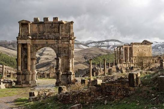
One of the most famous monuments at Djemila is the triumphal arch associated with Emperor Caracalla and his family.

Like other Roman arches, the structure communicated imperial authority.

The emperor's image and name could be physically embedded in the urban environment.

Monuments reminded provincial populations that their city existed within a much larger imperial system.

The Market and the Economy

Urban life depended on trade.

Markets brought agricultural products and manufactured goods into the city.

The surrounding countryside supported urban populations.

Roman North Africa became one of the empire's most economically productive regions.

Agricultural products, especially grain and olive oil, became important within Mediterranean trade.

Baths and Social Life

Djemila contained multiple bathing facilities.

The Roman bathhouse was a technological achievement.

Heating systems circulated warmth through specialized spaces.

Water had to be collected and distributed.

Architects designed rooms for different temperatures.

But the baths also functioned socially.

They created spaces where citizens and residents interacted.

Christianity Arrives

During Late Antiquity, Christianity transformed the urban landscape.

Churches and basilicas were constructed.

Christian communities developed institutions.

Older religious buildings could be abandoned or repurposed.

The city therefore provides evidence of the transition from the classical Roman religious world to a Christian urban environment.

North Africa and Early Christianity

North Africa was one of the intellectual centers of early Christianity.

The region produced major theologians and religious writers.

Christianity was not simply imported into North Africa.

African Christian communities played an important role in shaping the religion itself.

The churches of Cuicul form part of this larger historical story.

Decline

Changing political conditions affected the city.

The region passed through periods of Roman, Vandal, and Byzantine influence.

Economic patterns changed.

Some urban institutions weakened.

Eventually, Cuicul declined as a major urban center.

The mountain city became a ruin.

Why Djemila Matters

Djemila demonstrates the flexibility of Roman civilization.

Rome did not simply copy the same city everywhere.

Builders adapted.

Administrators responded to local conditions.

Urban life changed over centuries.

Today, the ruins show what happened when one of history's greatest imperial systems encountered a difficult mountain landscape—and refused to give up.

The result was a city that should have been difficult to build but became one of the most impressive Roman settlements in Africa.

Timgad: Algeria's Roman North African Colony

August 23, 2026

The Roman City Buried for Centuries: How Timgad Preserved an Entire Ancient World

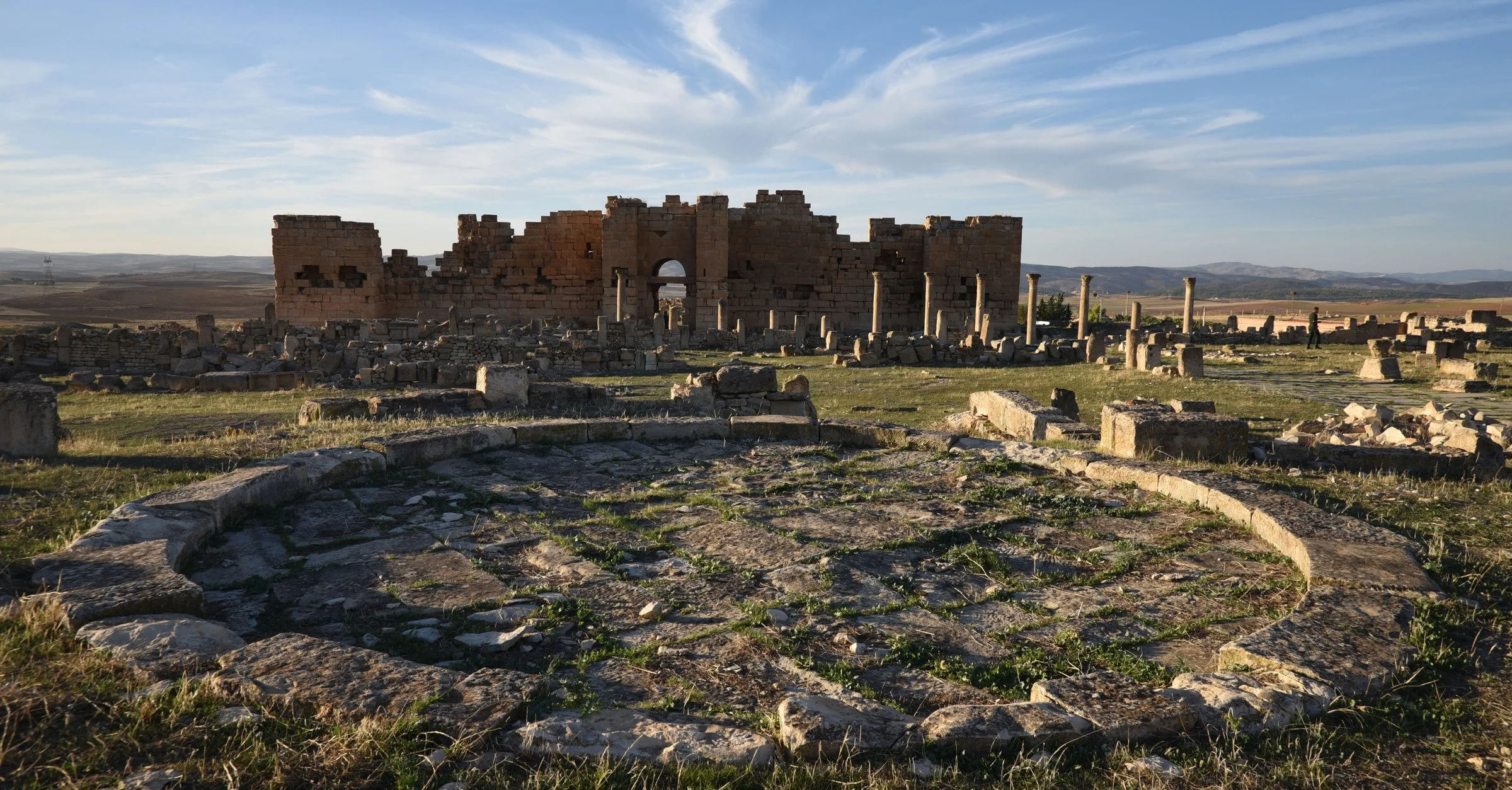
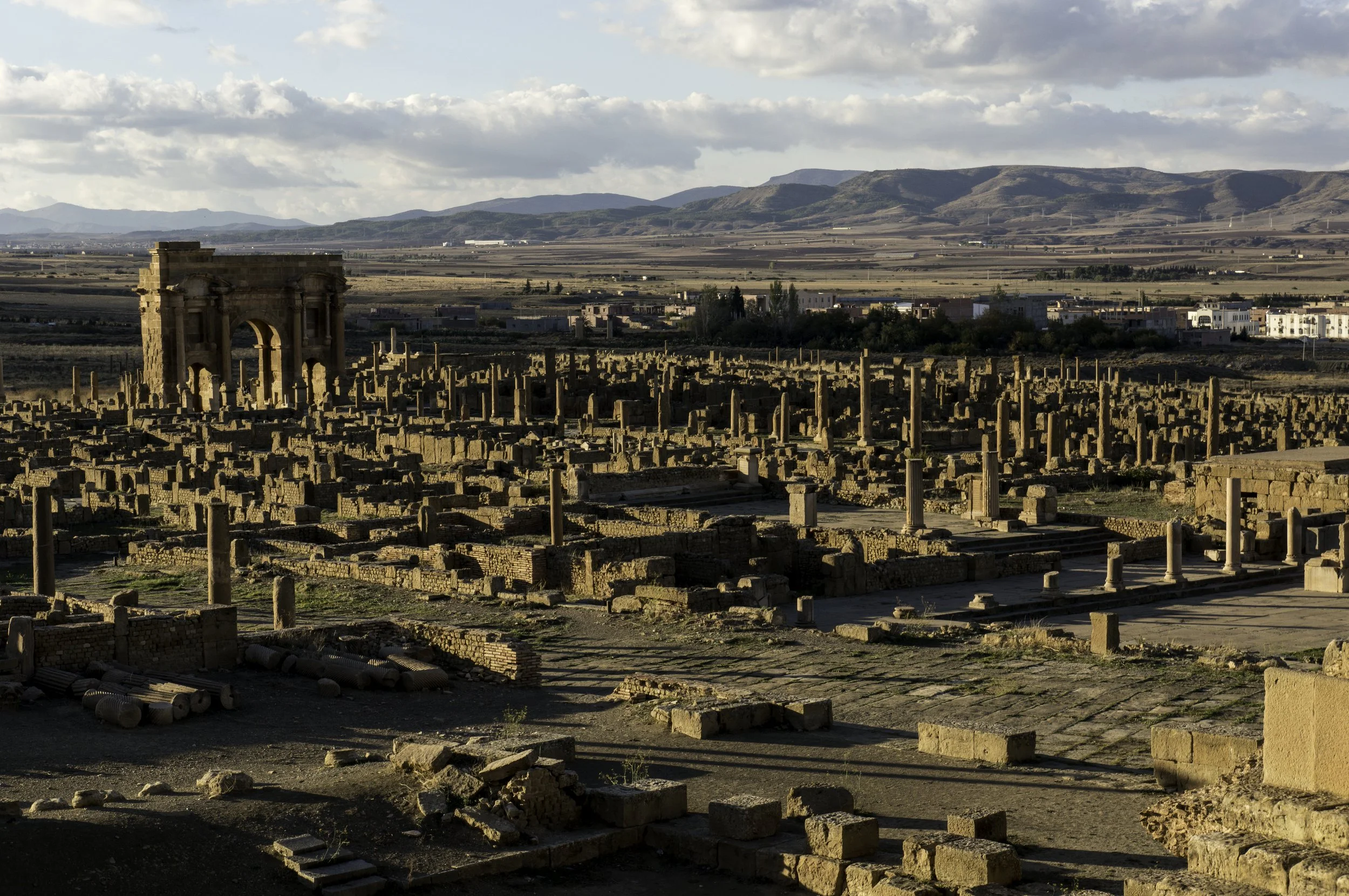
Few archaeological sites demonstrate Roman urban planning as clearly as Timgad, the ancient city of Thamugadi in present-day Algeria.

From above, its streets reveal a strikingly organized pattern.

A central avenue cuts through the city.

Perpendicular roads divide neighborhoods.

Public buildings occupy important locations.

A forum formed the political heart.

Temples, baths, theaters, and houses served the population.

For centuries after its abandonment, much of the city was covered by sand and sediment.

This burial helped preserve portions of its ancient urban layout.

Today, Timgad is often described as one of the best examples of a Roman colonial city in North Africa.

The Foundation Under Emperor Trajan

Timgad was founded around 100 CE during the reign of Emperor Trajan.

The Roman Empire at this time was approaching the height of its territorial expansion.

North Africa was already deeply integrated into the Roman world.

Roman administration, roads, military infrastructure, and cities transformed the region.

Timgad was established as a colony, originally associated with the settlement of Roman veterans.

This was an important imperial strategy.

Retired soldiers could receive land.

Their settlement strengthened Roman presence in strategically important regions.

Why Build a City Here?

The location was not chosen randomly.

The Roman government needed to consolidate control in North Africa.

A colony could serve several purposes:

  • Settlement of veterans.

  • Expansion of agriculture.

  • Administrative control.

  • Cultural integration.

  • Support for military operations.

The city became part of a wider Roman network.

Roads connected settlements.

Military installations protected frontier regions.

Trade linked rural producers with urban markets.

The Roman Grid

Timgad is famous for its relatively clear street plan.

Roman urban planning often relied on a grid.

Two major streets commonly formed the central axes:

  • The cardo maximus, generally oriented north-south.

  • The decumanus maximus, generally oriented east-west.

The intersection of these roads created an important urban center.

The layout made movement and administration more organized.

However, cities were not permanently frozen in their original designs.

As populations grew, buildings expanded beyond original limits.

Timgad eventually developed beyond its earliest grid.

The Arch of Trajan

One of the most recognizable monuments of Timgad is the monumental arch traditionally associated with Trajan.

The arch stood near a major entrance to the city.

Roman monumental arches were not merely decorative.

They communicated imperial power.

A person entering the city encountered a visible symbol of Roman authority.

Architecture therefore participated in propaganda.

The empire was present not only through soldiers and officials but also through stone.

The Forum

The forum was the civic heart of the Roman city.

Public life could involve:

  • Political announcements.

  • Commercial activity.

  • Religious ceremonies.

  • Legal affairs.

  • Social interaction.

Important buildings surrounded or stood near the forum.

For archaeologists, these spaces reveal how Roman urban communities were organized.

The Theater

Timgad contains the remains of a theater capable of accommodating a substantial audience.

The presence of a theater demonstrates that entertainment was an important part of urban life.

Performances could include:

  • Drama.

  • Music.

  • Public events.

The theater also reveals something about the Romanization of the city.

Roman cultural forms were reproduced far from Italy.

A citizen in North Africa could participate in institutions and entertainments associated with the broader empire.

Baths: More Than Places to Wash

Roman bathhouses were among the most important social institutions in urban life.

A bath complex could contain rooms with different temperatures.

These commonly included:

  • Cold rooms.

  • Warm rooms.

  • Hot rooms.

Heating systems such as the hypocaust circulated hot air beneath floors and sometimes through walls.

But baths were not simply about hygiene.

They were social spaces.

People met.

Discussed business.

Relaxed.

Exercised.

Roman urban life was deeply connected with the bathhouse.

Religion in Timgad

The population of Timgad did not worship a single god.

The Roman religious world included numerous deities and cults.

Public temples could be dedicated to Roman gods.

Local traditions could continue.

Foreign religious ideas could arrive through trade and migration.

Later, Christianity became increasingly important.

This demonstrates that Timgad's religious history changed over time.

The Library and Education

One of Timgad's most fascinating discoveries is a building interpreted as a library.

The identification and function of ancient buildings can be debated, but the structure is associated with the intellectual life of the city.

If correctly interpreted, it provides remarkable evidence for literacy and the preservation of texts in a provincial Roman community.

Books in the Roman world existed primarily as scrolls and later codices.

A library required organization, storage, and access.

The possibility of such an institution at Timgad demonstrates that Roman provincial cities could support sophisticated cultural life.

The Population Beyond Rome

It would be inaccurate to imagine that Timgad was inhabited only by people from Italy.

Roman North Africa was ethnically and culturally diverse.

The city included populations connected with:

  • Roman settlers.

  • Local Amazigh communities.

  • Merchants.

  • Officials.

  • Soldiers.

  • Migrants from other parts of the empire.

Roman identity itself could be complex.

A person could participate in Roman political and urban institutions while maintaining local cultural connections.

Christianity and Late Antiquity

As Christianity expanded across the Roman Empire, North Africa became one of its most important regions.

Christian communities established churches and religious institutions.

Theological debates became politically significant.

North Africa produced major Christian intellectual figures.

Timgad itself reflects the transformation of urban life during Late Antiquity.

Decline and Abandonment

Like many Roman cities, Timgad experienced political and economic changes.

The collapse of Roman imperial authority in western regions did not happen overnight.

Instead, different areas experienced gradual transformation.

The city passed through periods associated with Vandal and Byzantine control.

Eventually, population and urban activity declined.

Parts of the city were abandoned.

Sand and sediment accumulated.

The once-busy streets disappeared.

Rediscovery

The burial of Timgad contributed to its preservation.

When archaeological excavation began in the modern era, researchers uncovered an unusually visible Roman urban plan.

This created the impression that an entire city had been “frozen in time.”

Of course, excavation also transforms a site.

Once structures are exposed, they become vulnerable to weather.

Therefore, archaeology and conservation must work together.

Why Timgad Matters

Timgad is more than a collection of ruins.

It provides a physical map of Roman urban civilization.

Walking through its streets reveals how a Roman city was organized.

The forum demonstrates civic life.

The baths reveal social habits.

The theater reveals entertainment.

The temples reveal religion.

The streets reveal planning.

And the expansion beyond the original grid reveals that even the most carefully designed city eventually changed.

Timgad's greatest lesson may be that the Roman Empire was not confined to Rome.

Its cities stretched across continents.

And in the mountains of Algeria, one of those cities still survives—its streets silently preserving the blueprint of an ancient world.

Qal'at Bani Hammad: Algeria's 11th-Century Aghlabid City

August 23, 2026

The Forgotten Islamic City in Algeria That Vanished Into the Mountains

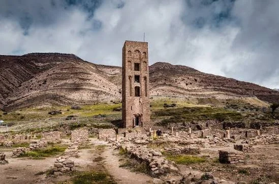
In the mountains of northern Algeria lie the ruins of one of the most remarkable cities of medieval North Africa: Qal'at Bani Hammad, sometimes called the Fortress of the Banu Hammad.

Today, visitors encounter walls, foundations, monumental remains, and traces of structures that once formed the capital of a powerful medieval dynasty. But a thousand years ago, this remote location was not a forgotten archaeological site.

It was a royal capital.

A fortified city.

A center of Islamic architecture.

A political symbol.

And one of the most important urban centers in the history of the central Maghreb.

Despite occasional simplified descriptions connecting the site with the Aghlabids, Qal'at Bani Hammad was actually founded by the Hammadid dynasty in the early eleventh century. The Hammadids emerged from the political world of the Zirids, who themselves had been connected with the Fatimid Caliphate.

The city's history reveals a period when North Africa was home to powerful independent and semi-independent states whose influence extended across the Mediterranean and Sahara.

The Foundation of a New Capital

Qal'at Bani Hammad was founded around the beginning of the eleventh century by Hammad ibn Buluggin, from whom the dynasty took its name.

The choice of location was strategic.

The city was established in a mountainous environment that provided natural defensive advantages.

This was essential during a period of political rivalry.

A fortified capital could protect the ruling dynasty while also demonstrating its independence and authority.

The city was not built accidentally.

It was a deliberate political project.

The Hammadids and the Politics of the Maghreb

The medieval Maghreb was politically complex.

It contained competing dynasties, religious movements, tribal confederations, and trading networks.

The Hammadids operated within a world shaped by:

  • The Fatimid Caliphate.

  • The Zirid dynasty.

  • Regional Amazigh political groups.

  • Mediterranean trade.

  • Trans-Saharan commerce.

  • Rival Islamic states.

Qal'at Bani Hammad became the physical expression of Hammadid power.

A City Built Like a Fortress

The word Qal'at means fortress or fortified place.

The city's defensive position was one of its defining characteristics.

Fortifications protected the capital from attack, but the city was not merely a military camp.

Within its walls existed a complex urban environment.

Archaeological remains indicate the presence of:

  • Palaces.

  • Mosques.

  • Residential structures.

  • Defensive walls.

  • Water installations.

  • Gardens.

  • Administrative spaces.

The combination of military and ceremonial architecture transformed the site into a royal city.

The Great Mosque

Among the most important structures at Qal'at Bani Hammad was its great mosque.

The mosque formed a central part of urban life.

In medieval Islamic cities, a congregational mosque could serve as:

  • A place of worship.

  • A site for Friday prayers.

  • A center of public gathering.

  • A symbol of political legitimacy.

The ruler's name could be associated with the Friday sermon, making the mosque politically important as well as religiously significant.

The surviving remains demonstrate the scale of the Hammadid capital.

The Famous Minaret

One of the site's best-known architectural elements is the surviving minaret associated with the Great Mosque.

Minarets served multiple purposes.

They were associated with the call to prayer, but they also became visual symbols of urban and religious identity.

A monumental minaret could be seen from a considerable distance.

It announced the presence of the city.

Even in ruins, the surviving structure demonstrates the ambition of the Hammadid builders.

Palaces and Royal Power

The ruling elite constructed elaborate palatial environments.

These were not simply private residences.

Palaces served political functions.

A ruler needed spaces for:

  • Receiving envoys.

  • Conducting administration.

  • Holding ceremonies.

  • Demonstrating wealth.

  • Housing members of the royal court.

Architecture therefore became political theater.

A visitor approaching the palace encountered the physical power of the dynasty.

Water in a Mountain City

A city cannot survive without reliable water.

For a fortified settlement, water management becomes even more important because a siege can cut access to outside resources.

Qal'at Bani Hammad contained sophisticated water infrastructure.

Reservoirs and basins helped manage water supplies.

The presence of large water installations also contributed to the city's visual and ceremonial environment.

Water was practical.

But it could also be luxurious.

Pools and gardens represented prosperity and royal refinement.

The Palace of the Sea

One of the most famous structures associated with the archaeological site is often referred to as the Palace of the Sea.

The name reflects the impressive water basin associated with the complex.

Such monumental water features reveal an important aspect of Islamic palace architecture.

Water could symbolize:

  • Wealth.

  • Control over nature.

  • Paradise.

  • Royal sophistication.

In a mountainous environment, the ability to organize and distribute water also demonstrated technological capability.

Artistic Influence

Qal'at Bani Hammad was not isolated.

Its architecture and decorative traditions participated in a larger Mediterranean and Islamic artistic world.

The site provides evidence for the development of:

  • Decorative stucco.

  • Geometric ornament.

  • Architectural planning.

  • Ceramics.

  • Islamic palace design.

Some artistic traditions associated with the site demonstrate connections with later architectural developments across North Africa and al-Andalus.

The ruins therefore have significance beyond Algeria.

They help scholars understand the evolution of Islamic art across the western Mediterranean.

The City's Decline

The location that initially provided security eventually became less suitable for a changing political and economic environment.

During the eleventh century, major population movements and political instability affected the region.

The Hammadids eventually shifted their political center toward the coast, especially toward Béjaïa, which offered greater access to Mediterranean trade.

The importance of Qal'at Bani Hammad declined.

The royal capital was abandoned.

A city that had been constructed as a symbol of power gradually became an archaeological landscape.

Archaeology and Rediscovery

When archaeologists investigate an abandoned medieval city, they do not find a complete picture.

Wood disappears.

Organic materials decay.

Walls collapse.

Stone may be reused elsewhere.

What survives must be interpreted.

Researchers reconstruct the city's history through:

  • Foundations.

  • Standing walls.

  • Ceramics.

  • Decorative fragments.

  • Inscriptions.

  • Historical texts.

  • Comparison with other Islamic sites.

Each fragment contributes to a larger reconstruction.

Why Qal'at Bani Hammad Is So Important

The ruins reveal that medieval North Africa was not a peripheral region of history.

It contained powerful states, sophisticated architecture, international trade networks, and important cultural centers.

Qal'at Bani Hammad was once one of those centers.

Its ruins are particularly valuable because they preserve evidence of an entire royal city rather than only a single monument.

The fortress walls represent military power.

The mosque represents religious authority.

The palaces represent royal administration.

The water systems reveal engineering.

The decorative remains reveal artistic sophistication.

Together, they reconstruct a civilization that disappeared from the mountain almost a thousand years ago.

Today, the silence of the ruins creates a powerful contrast.

Once, rulers, soldiers, merchants, scholars, artisans, and ordinary families moved through these spaces.

Now, only the remains survive.

But those remains tell an extraordinary story:

a forgotten Islamic capital once rose in the mountains of Algeria—and its ruins still reveal the ambitions of a dynasty determined to build a kingdom of its own.

Mudejar Sintra: Portugal's Islamic Palace Remains

August 23, 2026

The Hidden Islamic Secrets of Sintra: What Portugal’s Fairy-Tale Palaces Don’t Tell You

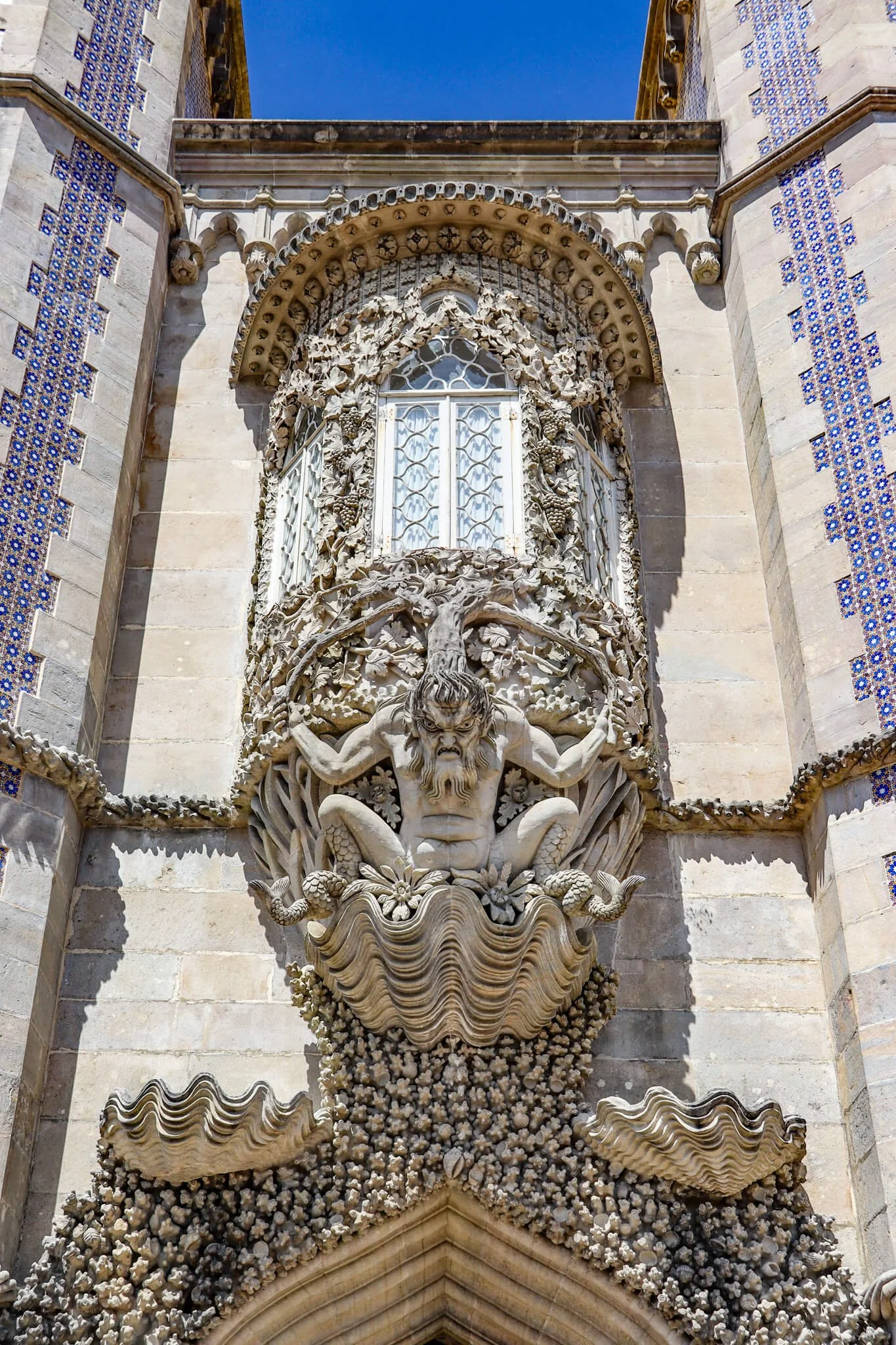
Sintra is internationally famous for its romantic palaces, mist-covered mountains, extravagant nineteenth-century architecture, and royal residences. Yet long before the colorful towers of Pena Palace became symbols of Portugal, the hills surrounding Sintra were part of a very different political and cultural world.

For centuries, the Iberian Peninsula was home to al-Andalus, the Islamic civilization that emerged after the Muslim conquest of much of Iberia in the early eighth century. Portugal, including the region around Sintra, was deeply affected by this period. Fortifications were constructed, agricultural systems developed, settlements expanded, and artistic traditions crossed religious and political boundaries.

The surviving Islamic past of Sintra is not always immediately visible. It exists beneath later Christian, royal, Romantic, and modern layers of history. The most important surviving monument connected with this earlier period is the Castle of the Moors, or Castelo dos Mouros, which occupies a commanding position above the town.

The story of Sintra demonstrates an important truth about European monuments: what visitors see today is often only the latest layer of a much older historical landscape.

Sintra Before the Fairy-Tale Palaces

The modern image of Sintra is dominated by monuments constructed or transformed during Portugal's royal and Romantic periods. However, the Serra de Sintra had strategic importance long before the nineteenth century.

The hills provided several advantages.

They offered:

  • Elevated positions for surveillance.

  • Natural defensive terrain.

  • Access to surrounding routes.

  • Visibility toward the Atlantic region and surrounding lowlands.

  • A defensible location for fortified settlements.

Human occupation in the region extends far beyond the Islamic period. Archaeological evidence demonstrates that the wider Sintra area contains traces of prehistoric and ancient communities. This means that the Islamic occupation was itself only one stage in a much longer sequence of settlement.

However, the Islamic period fundamentally changed the political landscape of the region.

The Arrival of al-Andalus

In 711 CE, Muslim armies crossed from North Africa into the Iberian Peninsula. Within a relatively short period, much of the peninsula came under Islamic political control.

The territory became known as al-Andalus.

Over the following centuries, al-Andalus was governed by different political powers, including:

  • The Umayyad rulers of Córdoba.

  • Regional taifa kingdoms.

  • North African dynasties such as the Almoravids.

  • The Almohads.

The boundaries of these states changed repeatedly.

Portugal did not yet exist as an independent kingdom.

The territory that would later become Portugal formed part of the larger political geography of medieval Iberia.

Sintra's Islamic fortifications developed within this world.

The Castle of the Moors

The Castle of the Moors occupies one of the most dramatic locations in the Sintra Mountains.

Its walls follow the irregular contours of the rocky landscape.

From the elevated position, defenders could observe wide areas of the surrounding region.

This was not simply an aesthetic choice.

Medieval military architecture depended heavily on geography.

A fortress built on high ground could provide:

  • Early warning of approaching enemies.

  • Difficult access for attacking forces.

  • Greater visibility.

  • Natural defensive barriers.

  • Strategic control over nearby settlements and routes.

The Islamic fortification at Sintra was therefore part of a wider system of defensive organization.

Why the Walls Follow the Mountain

One of the most visually striking features of the castle is the way its walls appear to move across the mountaintop.

Unlike a perfectly symmetrical palace, a mountain fortress must adapt to terrain.

Builders could not simply impose a rectangular plan on steep and irregular rock formations.

Instead, the walls followed the available geography.

This produced an architecture that appears almost to emerge from the mountain itself.

The fortress is an excellent example of the relationship between military engineering and landscape.

Islamic Sintra and the Reconquista

The political situation of medieval Iberia changed dramatically between the eighth and thirteenth centuries.

Christian kingdoms gradually expanded southward.

This long and complex process is commonly described as the Reconquista, although historians increasingly recognize that the term can oversimplify centuries of warfare, alliances, coexistence, migration, diplomacy, and political change.

Sintra eventually came under Christian control during the expansion of the Portuguese kingdom.

The conquest of Lisbon in 1147 was especially significant in the consolidation of Portuguese power in the region.

The Castle of the Moors subsequently entered a new political and religious world.

But conquest did not mean that the physical structures of the previous period disappeared.

The fortress was reused.

Modified.

Repaired.

And incorporated into the developing kingdom of Portugal.

The Meaning of “Moorish”

The term “Moorish” is widely used in discussions of Iberian architecture, but it requires caution.

Historically, “Moor” was a broad European term applied to Muslim populations associated with North Africa and Iberia. It did not refer to a single ethnic group.

The people who lived in al-Andalus included communities of diverse backgrounds.

These could include:

  • Arabs.

  • Amazigh, or Berber, populations.

  • Local Iberian converts to Islam.

  • Christians living under Islamic rule.

  • Jewish communities.

  • Migrants from different parts of the Mediterranean.

Therefore, describing the castle as “Moorish” provides a general historical reference but should not erase the diversity of al-Andalus.

Islamic Influence Did Not End With Political Conquest

One of the most important aspects of Iberian history is that political conquest did not immediately eliminate earlier cultural traditions.

Islamic influence continued in many forms.

Agricultural knowledge remained important.

Arabic vocabulary entered Iberian languages.

Artistic and architectural ideas survived.

Craft traditions continued.

This is where the concept of Mudéjar becomes especially significant.

The term traditionally refers to Muslims living under Christian rule in medieval Iberia and, by extension, to artistic and architectural traditions associated with Islamic craftsmanship within Christian-controlled territories.

Mudéjar art is therefore evidence that cultural exchange did not end when political borders changed.

A Christian ruler might commission artisans influenced by Islamic traditions.

Decorative motifs could cross religious boundaries.

Architectural techniques could survive for generations.

Was Sintra a “Mudéjar Palace”?

The phrase “Mudéjar Sintra” should be understood carefully.

Sintra contains architectural layers from Islamic occupation, medieval Portuguese rule, Manueline royal architecture, and nineteenth-century Romanticism.

It is not accurate to treat the entire modern palace landscape as a surviving medieval Islamic complex.

Instead, Sintra represents a layered cultural environment in which Islamic, Christian, Portuguese royal, and later European artistic traditions intersect.

This distinction is important because popular history often turns complicated heritage into a simple story.

The real story is more fascinating.

Sintra was repeatedly transformed.

The National Palace of Sintra and Cultural Layers

The Palácio Nacional de Sintra, famous for its distinctive twin chimneys, represents centuries of royal development.

Although primarily associated with Portuguese monarchy, its architecture and decorative traditions reveal the broader history of Iberian cultural exchange.

The palace contains artistic elements influenced by changing European and Iberian traditions.

Over time, rulers rebuilt and expanded the complex.

The result is not a single historical building frozen in one century.

It is an architectural archive.

The Archaeology of Hidden History

Much of Sintra's ancient past is difficult to identify because later construction transformed earlier landscapes.

Archaeologists must therefore work carefully.

A wall may have been rebuilt.

Foundations may contain material from different periods.

Objects may have been moved.

Researchers examine:

  • Stratigraphy.

  • Construction techniques.

  • Ceramic evidence.

  • Coins.

  • Organic materials.

  • Architectural relationships.

Archaeology is especially important in places like Sintra because visible monuments can conceal much older structures.

Romanticism Changed How the World Saw Sintra

By the nineteenth century, Sintra experienced another extraordinary transformation.

European Romanticism celebrated:

  • Medieval ruins.

  • Dramatic landscapes.

  • Exotic architecture.

  • Gothic imagery.

  • Islamic-inspired forms.

King Ferdinand II transformed the hilltop landscape through the construction of Pena Palace, creating one of Europe's most famous Romantic monuments.

Ironically, the nineteenth-century fascination with “Moorish” and medieval imagery sometimes made the distinction between authentic medieval Islamic remains and later architectural fantasy more difficult for modern visitors.

This is why historical interpretation matters.

A building inspired by Islamic architecture is not necessarily an Islamic building.

A Romantic reconstruction of a medieval ruin is not identical to the original medieval structure.

Conservation and Restoration

The Castle of the Moors has undergone extensive restoration.

This raises a major question in heritage studies:

How much should a ruined monument be rebuilt?

If nothing is repaired, the structure may collapse.

If too much is reconstructed, modern additions may create an inaccurate image of the past.

Conservation therefore involves constant decision-making.

The goal is not simply to make a monument look ancient.

It is to preserve evidence while making the site understandable and structurally secure.

Why Sintra's Islamic History Matters

Sintra is often presented as a world of Portuguese kings, Romantic palaces, and fairy-tale towers.

But beneath this famous image lies a much older and more complicated story.

The Islamic fortress on the mountain reminds us that Portugal was once part of al-Andalus.

The walls preserve evidence of a medieval world in which the political boundaries of modern Europe did not yet exist.

Later Portuguese rulers transformed the landscape.

Nineteenth-century architects reimagined it.

Modern tourism turned it into a global destination.

Yet the mountain still preserves the traces of the civilization that occupied it centuries before Portugal became the nation known today.

Sintra's greatest secret is not hidden inside a palace.

It is built into the mountain itself.

Djemila: Algeria's Trajan-Era Mountain City

August 23, 2026

Djemila, known in antiquity as Cuicul, is one of Algeria's most important Roman archaeological sites. Situated in a mountainous region of northeastern Algeria, the city demonstrates how Roman urban planning could be adapted to difficult terrain.

The title “Trajan-Era Mountain City” reflects the settlement's foundation during the Roman imperial period, traditionally associated with the reign of Emperor Nerva or Trajan at the end of the first and beginning of the second century CE.

Unlike Timgad, whose landscape allowed for a highly regular grid, Djemila was built in a more rugged environment.

Its architecture therefore reveals how Roman planners adapted roads and public spaces to the natural contours of the land.

The Foundation of Cuicul

Cuicul began as a Roman colony in the mountainous region of Numidia.

The establishment of a Roman city in such a location demonstrates the expansion of Roman political and economic systems across North Africa.

The settlement provided a center for:

  • administration;

  • trade;

  • agriculture;

  • and cultural integration.

Over time, the city expanded beyond its original core.

Building a Roman City in the Mountains

Roman urban planning is often associated with straight streets and rectangular blocks.

Djemila demonstrates that these ideals could be modified.

The uneven terrain forced builders to adapt.

Instead of imposing a perfectly uniform grid across the landscape, roads and buildings followed practical possibilities created by slopes and natural features.

This produced an urban landscape that was both recognizably Roman and uniquely adapted to its location.

The Forum and Civic Life

The forum formed the heart of public life.

Residents could gather there for:

  • commercial activity;

  • political announcements;

  • religious ceremonies;

  • and social interaction.

The buildings surrounding the forum reflected the organization of Roman civic institutions.

Temples and administrative structures gave physical form to Roman authority.

The Arch of Caracalla

Djemila contains monumental structures constructed during later phases of the city's history, including an arch associated with Emperor Caracalla.

Such monuments were important expressions of loyalty and political identity.

They linked a provincial city with the authority of the emperor.

Even residents who never traveled to Rome could experience imperial symbolism within their own urban environment.

Markets and Economic Activity

Markets were essential to the functioning of Roman cities.

Farmers, artisans, merchants, and consumers needed spaces where goods could be exchanged.

The economy of Djemila depended on relationships between the city and its surrounding agricultural territory.

Products could include:

  • grain;

  • olives;

  • livestock;

  • pottery;

  • textiles;

  • and other regional goods.

Roman Baths

Bathhouses were important social institutions.

The construction of a bath required:

  • reliable water;

  • furnaces;

  • drainage;

  • heating systems;

  • and skilled labor.

Public baths allowed people from different backgrounds to participate in a shared urban activity.

They were therefore important centers of social life.

Christianity in Djemila

As Christianity spread through North Africa, Djemila developed a substantial Christian presence.

Churches and religious structures became part of the city's architecture.

The transformation from a predominantly pagan Roman religious landscape to a Christian one can be traced archaeologically through changes in building use and the construction of basilicas.

North African Christianity

Roman North Africa was one of the major intellectual centers of early Christianity.

The region produced influential theologians and religious leaders.

However, Christian communities were also divided by theological and political disagreements.

Movements such as Donatism became particularly influential in parts of North Africa.

These conflicts demonstrate the diversity of religious life during late antiquity.

The End of Roman Urban Prosperity

Djemila experienced changes as Roman political authority weakened in North Africa.

The region passed through periods of Vandal and later Byzantine control.

Urban institutions gradually changed, and some areas of the city were abandoned or reused.

The transformation was gradual rather than a single moment of sudden collapse.

Why Djemila Matters

Djemila provides an important example of Roman adaptation.

It demonstrates that Roman urban planning was flexible enough to function in difficult mountain environments.

The site preserves evidence of:

  • civic architecture;

  • economic activity;

  • Roman engineering;

  • Christianity;

  • and the long transformation of a provincial city.

Conclusion

Djemila was a Roman mountain city shaped by both imperial planning and local geography.

Its forums, temples, baths, markets, and churches reveal how Roman institutions developed in North Africa, while its irregular terrain demonstrates that Roman urbanism was never simply copied from a standard design.

The ruins of ancient Cuicul preserve the story of a community that changed repeatedly as political and religious transformations reshaped the Mediterranean world.

Wadi Barhat: Libya's Cattle Cult Engravings

August 23, 2026

Wadi Barhat is part of the extraordinary prehistoric rock-art landscape of the central Sahara, where engravings and paintings preserve evidence of societies that lived in an environment radically different from the desert seen today. Across Libya and neighboring regions, prehistoric artists recorded animals, people, hunting scenes, and symbolic forms on exposed rock surfaces.

The title “Cattle Cult Engravings” refers to one of the most important themes in Saharan prehistoric art: the repeated depiction of domesticated cattle. Cattle imagery is particularly significant because it reflects a period when parts of the Sahara supported grasslands, seasonal water sources, and communities whose lives were closely connected to herding.

Rather than being merely decorative, these engravings may provide evidence for changing economic systems, ritual beliefs, social identity, and relationships between humans and animals.

The Green Sahara

The Sahara was not always the immense desert it is today.

During periods of the African Humid Period, roughly between the early Holocene and several thousand years ago, increased rainfall transformed large portions of North Africa.

Grasslands, lakes, wetlands, and seasonal rivers developed across regions that are now extremely arid.

These environmental changes allowed communities to exploit:

  • wild plants;

  • fish;

  • game animals;

  • and eventually domesticated livestock.

The archaeological record of Saharan rock art is therefore also a record of climate change.

Cattle in Saharan Rock Art

Cattle are among the most recognizable subjects in prehistoric Saharan art.

Artists depicted animals with:

  • large curved horns;

  • elongated bodies;

  • carefully rendered legs;

  • and sometimes decorative markings.

Some representations appear to show individual animals, while others form groups or appear alongside humans.

The repeated emphasis on cattle suggests that these animals held significance beyond their value as food.

The Meaning of Cattle

Cattle could provide:

  • milk;

  • meat;

  • hides;

  • bone;

  • and social wealth.

For herding societies, livestock could also represent status.

A person or family with a large herd possessed an important economic resource.

Animals could therefore become symbols of:

  • wealth;

  • fertility;

  • family identity;

  • social prestige;

  • and religious significance.

What Does “Cattle Cult” Mean?

The phrase “cattle cult” should be used cautiously.

Archaeologists cannot directly interview prehistoric artists about the meaning of their images.

However, the extraordinary frequency and careful treatment of cattle in Saharan art has encouraged researchers to consider whether cattle played an important symbolic or ritual role.

Some scholars have proposed connections between cattle imagery and:

  • fertility;

  • death;

  • ancestral beliefs;

  • ceremonial activity;

  • or supernatural traditions.

These interpretations remain hypotheses rather than proven facts.

Engraving Techniques

Rock engravings were created through techniques such as:

  • pecking;

  • pounding;

  • scraping;

  • and incising.

An artist could strike the rock repeatedly with a harder stone to remove small fragments from the surface.

Over time, these individual marks could form detailed outlines.

The amount of labor involved in producing a large animal image may have been considerable.

The Skill of Prehistoric Artists

Saharan engravings demonstrate that prehistoric artists possessed a sophisticated understanding of animal anatomy.

Artists could represent:

  • horns;

  • limbs;

  • backs;

  • tails;

  • and body proportions.

Some images are surprisingly naturalistic.

The ability to recognize and reproduce distinctive animal features suggests close observation of the surrounding environment.

Climate Change Recorded in Stone

The cattle engravings are especially valuable because they indirectly document an environment that no longer exists.

Cattle require reliable water and vegetation.

Their presence in large numbers within prehistoric art therefore supports archaeological evidence for a wetter Sahara.

As the African Humid Period ended, rainfall declined.

Lakes and grasslands contracted.

Communities increasingly moved toward areas where water remained available.

The Disappearance of Cattle Art

The changing environment affected both human societies and their artistic traditions.

As aridification progressed, cattle herding became increasingly difficult in many parts of the Sahara.

Pastoral groups developed different strategies, including greater reliance on:

  • sheep;

  • goats;

  • and eventually camel pastoralism.

Rock-art styles changed alongside these economic transformations.

Why Wadi Barhat Matters

The rock art of Wadi Barhat belongs to a much larger prehistoric record documenting human occupation of the Sahara.

It provides evidence for:

  • pastoralism;

  • changing climates;

  • animal symbolism;

  • artistic traditions;

  • and the transformation of human societies.

Conclusion

Wadi Barhat's cattle imagery provides a remarkable glimpse into a greener Sahara.

The engravings preserve the memory of communities whose lives were closely connected with herding and whose artists repeatedly represented cattle on the walls of the desert.

Whether these animals were primarily economic resources, symbols of social identity, religious beings, or a combination of all three remains an open question.

What is certain is that the images preserve evidence of a prehistoric world in which cattle and humans lived within landscapes that climate change would eventually transform beyond recognition.

Jebel Arkenu: Libya's Pre-Dynastic Egyptian Links

August 23, 2026

Jebel Arkenu is part of the extraordinary archaeological landscape of the eastern Libyan Sahara, near the border region with Egypt. The surrounding area contains prehistoric rock art, ancient travel routes, and evidence of human occupation that demonstrate the long-standing connections between the Sahara and the Nile Valley.

The title “Pre-Dynastic Egyptian Links” reflects an important archaeological question: how did communities living in the Sahara interact with populations in the Nile Valley before the emergence of the unified Egyptian state?

The answer appears to involve movement, trade, environmental change, and cultural interaction across a landscape that was once considerably wetter than it is today.

The Jebel Arkenu Landscape

Jebel Arkenu is a striking geological formation rising from the surrounding desert.

Its location near the Libyan-Egyptian border places it within a region that historically functioned as a corridor between:

  • the Nile Valley;

  • the central Sahara;

  • and northeastern Africa.

Today, crossing this environment is extremely difficult.

In prehistoric periods, however, climatic conditions were often more favorable.

The Sahara Before Desertification

During the African Humid Period, rainfall was substantially greater across North Africa.

The eastern Sahara contained:

  • grasslands;

  • seasonal lakes;

  • wetlands;

  • and vegetation.

Animals such as:

  • cattle;

  • giraffes;

  • antelope;

  • elephants;

  • and other large mammals

could inhabit regions that are now hyper-arid.

Human communities followed these resources.

Rock Art and Cultural Connections

Rock art provides some of the most important evidence for prehistoric life in the region.

Artists represented:

  • wild animals;

  • cattle;

  • hunters;

  • human figures;

  • and symbolic motifs.

Certain artistic themes appear across large parts of the Sahara and Nile Valley.

Similarities do not necessarily prove direct migration, but they can indicate contact or shared cultural traditions.

Predynastic Egypt

The Predynastic period refers broadly to the centuries before the political unification of Upper and Lower Egypt.

During this period, communities along the Nile were developing:

  • agriculture;

  • pottery traditions;

  • long-distance trade;

  • social hierarchies;

  • and increasingly complex political structures.

These developments did not occur in isolation.

The Nile Valley was connected to surrounding regions, including the eastern Sahara.

Trade Across the Desert

Prehistoric trade could involve relatively small but valuable items.

Communities might exchange:

  • stone;

  • pigments;

  • animal products;

  • shells;

  • beads;

  • tools;

  • and exotic materials.

Long-distance exchange did not necessarily require permanent merchant caravans.

Goods could move through chains of relationships connecting neighboring communities.

Jebel Arkenu as a Corridor

The location of Jebel Arkenu is significant because mountains and water sources can serve as navigation points.

In an otherwise featureless desert, distinctive geological formations can help travelers orient themselves.

Ancient routes likely connected reliable wells and seasonal water sources.

Such routes could become increasingly important as the Sahara dried.

The End of the Wet Sahara

The gradual decline of rainfall changed everything.

As grasslands disappeared, communities had to concentrate around:

  • the Nile;

  • oases;

  • permanent springs;

  • and other reliable water sources.

Some populations may have moved toward the Nile Valley.

This environmental migration may have contributed to increasing contact between Saharan pastoral communities and developing Egyptian societies.

Cattle and Social Identity

Cattle were particularly important to prehistoric Saharan societies.

Their representation in rock art may have reflected:

  • wealth;

  • fertility;

  • ritual;

  • ancestry;

  • or social status.

The importance of cattle in both Saharan archaeology and early Nile Valley traditions raises interesting questions about cultural interaction.

Avoiding a Simple “Egyptian Origin” Narrative

It would be misleading to interpret every Saharan artifact or artistic similarity as evidence of Egyptian colonization.

Prehistoric North Africa contained many independent communities.

Cultural similarities could result from:

  • trade;

  • migration;

  • intermarriage;

  • shared environmental conditions;

  • or parallel development.

Archaeologists therefore compare multiple types of evidence before proposing direct connections.

Why Jebel Arkenu Matters

The Jebel Arkenu region contributes to the study of:

  • prehistoric Saharan pastoralism;

  • environmental change;

  • rock art;

  • early trade networks;

  • and relationships between the Sahara and Nile Valley.

Conclusion

Jebel Arkenu belongs to a vast prehistoric cultural landscape that existed before the emergence of pharaonic Egypt.

Its archaeological context demonstrates that the Sahara was once a connected world of mobile communities, animals, seasonal water sources, and trade routes.

As the climate became drier, these networks changed, pushing populations toward more reliable sources of water and creating new relationships between Saharan communities and the Nile Valley.

The story of Jebel Arkenu therefore helps place the emergence of ancient Egypt within a much broader North African history.

Nabta Playa: Egypt's 7,000-Year Megalithic Calendar

August 23, 2026

Nabta Playa is one of the most remarkable prehistoric archaeological sites in the Egyptian Sahara. Located in the Western Desert approximately 100 kilometers west of Abu Simbel, the site contains stone arrangements dating back thousands of years and provides evidence for complex pastoral communities living in an environment that was once much wetter than the modern desert.

Nabta Playa is particularly famous for a prehistoric stone arrangement often described as an astronomical calendar.

The site is important not because it proves that prehistoric Egyptians possessed a fully developed astronomical science comparable to later pharaonic astronomy, but because it demonstrates that early pastoral communities carefully observed the sky and incorporated celestial cycles into their cultural practices.

A Lake in the Desert

Today, Nabta Playa is an extremely dry landscape.

Thousands of years ago, seasonal rainfall created a shallow lake in the region.

This water source attracted:

  • cattle herders;

  • wild animals;

  • plants;

  • and mobile human communities.

The presence of water transformed the desert into a temporary ecological refuge.

The African Humid Period

Nabta Playa existed during the African Humid Period, when the Sahara received substantially more rainfall than it does today.

Seasonal monsoon systems extended farther north.

Rainfall created temporary lakes and grasslands.

Communities could therefore live in areas that would later become inhospitable.

Pastoral Communities

Archaeological evidence indicates that people associated with Nabta Playa practiced cattle herding.

Cattle were valuable because they provided:

  • milk;

  • meat;

  • hides;

  • and social wealth.

Herding required knowledge of:

  • seasonal water availability;

  • grazing conditions;

  • animal health;

  • and movement across the landscape.

The Stone Circle

Nabta Playa is famous for a stone arrangement consisting of upright stones organized within a larger archaeological landscape.

Some stones appear to have been deliberately positioned according to astronomical orientations.

Researchers have proposed that the arrangement may have been connected with:

  • the summer solstice;

  • seasonal changes;

  • or the rising and setting positions of celestial objects.

Was It Really a Calendar?

Calling the structure a “calendar” is useful as a general description but should not be interpreted too literally.

We do not possess written records explaining how the stones were used.

Researchers can identify astronomical alignments, but determining their exact function is more difficult.

The stones may have served several purposes simultaneously.

Possible functions include:

  • marking seasonal changes;

  • organizing ritual activities;

  • identifying important celestial events;

  • or reinforcing social traditions.

Astronomy Before Civilization?

Nabta Playa demonstrates that sophisticated astronomical observation does not require cities or writing.

Humans have always depended on predictable environmental cycles.

Pastoralists could benefit from knowing:

  • when seasonal rains might arrive;

  • when particular stars appeared;

  • and how the annual cycle changed.

The sky provided a reliable reference system when landscapes were constantly changing.

The Summer Solstice

One of the most frequently discussed astronomical relationships at Nabta Playa concerns the summer solstice.

The solstice marks the point in the year when the Sun reaches its northernmost or southernmost position relative to Earth's equator.

For prehistoric communities dependent on seasonal rainfall, the timing of the Sun's annual cycle could have had practical and symbolic significance.

The Importance of Sirius

Some interpretations have proposed connections between Nabta's astronomical orientations and Sirius, the brightest star in the night sky.

Sirius later became enormously important in Egyptian religious and calendrical traditions because its annual heliacal rising was associated with the coming Nile flood.

However, the precise relationship between Sirius and Nabta Playa remains debated.

It is important not to project fully developed later Egyptian astronomical concepts backward onto a much earlier community.

Cattle Burials

One of Nabta Playa's most unusual discoveries involves cattle remains.

Some cattle were deliberately buried or deposited in ways that appear different from ordinary food refuse.

This has encouraged archaeologists to consider whether cattle had ritual importance.

The evidence reinforces the possibility that cattle represented more than simple economic resources.

Social Organization

Constructing a stone monument requires cooperation.

People had to:

  • identify suitable stones;

  • transport them;

  • position them;

  • and maintain the site.

Such work implies some level of communal organization.

However, it does not necessarily indicate a centralized state.

Small mobile communities can organize impressive projects through cooperation and shared beliefs.

Climate Change and Abandonment

As the African Humid Period ended, the region became increasingly dry.

Seasonal lakes disappeared or became less reliable.

Pastoral groups had to move toward environments where water remained available.

Many communities eventually concentrated closer to the Nile Valley.

The environmental transformation of Nabta Playa therefore forms part of the larger story of desertification in North Africa.

Did Nabta Influence Ancient Egypt?

The relationship between Nabta communities and later Egyptian civilization is an important area of research.

The chronological gap and differences between archaeological traditions make direct claims difficult.

Nevertheless, the broader movement of people, animals, technologies, and ideas between the Sahara and Nile Valley is undeniable.

Nabta Playa demonstrates that complex cultural traditions existed in the Western Desert before the rise of pharaonic civilization.

Why Nabta Playa Matters

Nabta Playa is important because it provides evidence for:

  • prehistoric pastoralism;

  • early monumental construction;

  • astronomical observation;

  • ritual behavior;

  • and adaptation to changing climate.

Conclusion

Nabta Playa's stone monuments preserve evidence of an ancient community that watched the sky while living beside a now-vanished desert lake.

Its inhabitants were pastoralists rather than pyramid-building pharaohs, yet they were capable of organizing communities, managing livestock, constructing monuments, and observing seasonal celestial cycles.

The site offers a powerful reminder that scientific observation and monumental construction existed long before writing and centralized states.

Gilf Kebir: Egypt's Cave of Swimmers Discovery

August 23, 2026

The Gilf Kebir is a vast plateau in southwestern Egypt, near the Libyan border, whose cliffs and valleys preserve some of the most spectacular prehistoric rock art in the Sahara.

The region became internationally famous after the discovery and popularization of the “Cave of Swimmers,” whose paintings appear to depict human figures in positions that resemble swimming.

The cave's imagery has inspired enormous public fascination, particularly because the surrounding landscape is now one of the driest places on Earth.

The paintings provide compelling evidence that the region once supported human communities under dramatically wetter environmental conditions.

The Discovery of the Cave

The Cave of Swimmers became famous after being documented by explorers in the early twentieth century, particularly through the work of Hungarian explorer László Almásy.

The cave later became widely known through popular literature and film, especially after appearing in discussions surrounding The English Patient.

However, the archaeological importance of the site goes far beyond its cinematic reputation.

The Meaning of the Figures

The most famous paintings depict small human forms whose arms and legs appear extended.

Because their bodies resemble swimming positions, they became known as “swimmers.”

However, archaeologists cannot prove that the artists intended to depict people swimming.

Alternative interpretations have suggested:

  • floating;

  • dancing;

  • ritual postures;

  • or symbolic representations of the dead.

The true meaning remains uncertain.

A Once-Wetter Sahara

The surrounding desert provides the most important context.

During earlier climatic periods, the region received significantly more rainfall.

Seasonal water sources supported:

  • vegetation;

  • wildlife;

  • and human settlement.

The existence of people in the Gilf Kebir therefore reflects a dramatically different environment.

Rock Art as Environmental Evidence

Artists depicted animals and humans on the cave walls.

These images may include species associated with wetter environments.

The presence of such animals provides indirect evidence for the former ecology of the Sahara.

Rock art therefore functions as a kind of environmental archive.

How Prehistoric Artists Made the Paintings

The artists used mineral pigments and other naturally available materials.

Common prehistoric pigments included:

  • red ochre;

  • yellow ochre;

  • white mineral pigments;

  • and dark charcoal-like substances.

Pigments could be:

  • brushed;

  • rubbed;

  • blown;

  • or applied directly with fingers.

The persistence of these materials for thousands of years demonstrates the remarkable stability of the dry cave environment.

The Human Figures

The human representations at Gilf Kebir vary in style.

Some figures appear elongated or highly simplified.

Others are more naturalistic.

This variation suggests that artists were not necessarily attempting photographic realism.

Instead, they may have been communicating:

  • identity;

  • movement;

  • ritual;

  • or symbolic meaning.

The “Swimmers” and Death

One particularly interesting interpretation connects the figures with ritual or funerary ideas.

Some researchers have suggested that the unusual body positions might represent people undergoing a transformation or traveling into another realm.

This cannot be proven.

Nevertheless, the possibility highlights a major problem in prehistoric art interpretation: images may have meanings that are impossible to recover completely without written explanations.

The Gilf Kebir as a Cultural Landscape

The Cave of Swimmers is only one part of a much larger archaeological region.

The Gilf Kebir contains numerous:

  • rock shelters;

  • engravings;

  • painted caves;

  • campsites;

  • and stone artifacts.

Together, these remains demonstrate repeated human occupation.

Why Did People Leave?

The same climatic changes that created the prehistoric Sahara eventually transformed it.

Rainfall decreased.

Water sources became increasingly scarce.

Grasslands disappeared.

Communities were forced to migrate toward:

  • oases;

  • permanent water sources;

  • and the Nile Valley.

The abandonment of the Gilf Kebir was therefore part of a much larger environmental transformation.

Why the Cave Is Important

The Cave of Swimmers is important because it provides evidence for:

  • prehistoric human occupation;

  • Saharan climate change;

  • symbolic art;

  • human movement;

  • and changing relationships between people and water.

Conclusion

The Cave of Swimmers is one of the most evocative archaeological sites in the Sahara.

Its paintings preserve images created by people who lived in an environment radically different from today's desert.

Whether the famous figures truly depict swimmers remains uncertain, but their existence demonstrates that water once played a central role in a landscape now defined by extreme aridity.

The cave is therefore not simply an artistic mystery. It is evidence of a vanished ecological world.

Wadi Sura: Egypt's Wells of the Swimmers II

August 23, 2026

Wadi Sura, located in Egypt's Western Desert within the Gilf Kebir region, contains one of the most extraordinary collections of prehistoric rock art in the Sahara.

The area became particularly famous because of the discovery of Wadi Sura II, a large rock shelter containing thousands of painted and engraved images.

The site has sometimes been called the “Cave of Beasts”, a name inspired by its extraordinary collection of human and animal figures.

Its art provides evidence of a prehistoric society that lived in a wetter Sahara and developed a complex symbolic relationship with animals, humans, and possibly ritual activities.

Wadi Sura I and Wadi Sura II

The first famous site in the region was the Cave of Swimmers, known as Wadi Sura I.

A second site, Wadi Sura II, was discovered and documented later.

Wadi Sura II is significantly larger and contains an enormous number of images.

The paintings include:

  • humans;

  • cattle;

  • giraffes;

  • ostrich-like birds;

  • antelope;

  • and unusual composite or unidentified figures.

The “Beasts”

One of the most intriguing aspects of Wadi Sura II is the presence of strange animal forms.

Some figures appear to combine characteristics of different animals or lack clear anatomical identities.

These images have led researchers to consider whether they represent:

  • mythical beings;

  • supernatural entities;

  • masked humans;

  • or animals depicted in symbolic ways.

There is no definitive answer.

Human Figures

Human figures appear throughout the shelter.

Some are represented in dynamic poses.

Others are associated with animals or unusual forms.

The repeated use of particular body postures suggests that the artists may have been communicating social or ritual meanings.

However, without written records, interpretations remain provisional.

The Importance of Dogs

Among the remarkable images are representations resembling dogs.

These may provide evidence concerning early relationships between humans and domesticated or semi-domesticated animals.

Dogs could have been used for:

  • hunting;

  • protection;

  • companionship;

  • or symbolic purposes.

Their depiction alongside humans may reveal something about how people understood animal-human relationships.

Cattle and Pastoralism

Cattle are also represented.

Their presence reinforces evidence for prehistoric pastoralism in the region.

Pastoral communities depended on livestock for:

  • food;

  • milk;

  • hides;

  • and social wealth.

Cattle may also have played ritual roles.

The repeated representation of livestock suggests that animals were deeply embedded in the social and symbolic world of these communities.

The Environment Behind the Art

The modern desert can make the existence of prehistoric pastoral communities seem surprising.

But during the African Humid Period, the Gilf Kebir region experienced substantially wetter conditions.

Seasonal rainfall produced:

  • grasslands;

  • waterholes;

  • and temporary lakes.

Human groups could therefore move through the region while following water and grazing resources.

Dating the Paintings

Dating rock art is difficult.

Researchers use multiple approaches, including:

  • stylistic comparison;

  • archaeological context;

  • pigment analysis;

  • and radiocarbon dating where suitable organic material survives.

Different images within the same shelter may have been created at different times.

The walls therefore represent a sequence of artistic activity rather than one single event.

The Meaning of the Rock Art

The central mystery of Wadi Sura II is not simply what the images depict, but why they were created.

Possible purposes include:

  • ritual activity;

  • storytelling;

  • social identity;

  • religious symbolism;

  • hunting-related beliefs;

  • or communication between generations.

It is possible that different images had different purposes.

The End of the Pastoral Landscape

As the Sahara dried, the environment changed.

Communities could no longer depend on the same seasonal water and grazing systems.

The population gradually shifted toward more reliable water sources.

This environmental change explains why Wadi Sura became a record of a vanished human landscape.

Why Wadi Sura Matters

Wadi Sura II provides evidence for:

  • prehistoric pastoralism;

  • symbolic behavior;

  • rock-art traditions;

  • human-animal relationships;

  • and climate change.

Its enormous collection of images makes it one of the most significant prehistoric art sites in the eastern Sahara.

Conclusion

Wadi Sura II preserves a remarkable visual archive created by prehistoric communities in a once-green Sahara.

Its mysterious beasts, human figures, cattle, and other animals reveal a symbolic world that modern researchers can only partially reconstruct.

The site is a reminder that the Sahara was once a populated landscape filled with water, vegetation, animals, and human communities—and that climate change transformed this world into the desert we know today.

Laas Geel: Somaliland's 5,000-Year Rock Paintings

August 23, 2026

Laas Geel is one of the most important prehistoric rock-art complexes in the Horn of Africa. Located near Hargeisa in Somaliland, the site consists of numerous rock shelters and granite outcrops covered with exceptionally well-preserved paintings.

The artwork is generally associated with early pastoral communities and is often dated broadly to the fifth or fourth millennium BCE, although the chronology remains an area of archaeological research.

Laas Geel is especially famous for its vivid representations of humans and cattle.

The paintings provide evidence for communities living in a landscape where herding, ritual activity, and symbolic art were already highly developed thousands of years ago.

The Discovery of Laas Geel

The site was documented by researchers in 2002 during an archaeological survey.

The discovery attracted considerable international attention because of the extraordinary preservation of the paintings.

The dry climate of Somaliland helped protect the pigments from the moisture and biological deterioration that affects rock art in wetter environments.

The Cattle Figures

Cattle are among the most striking images at Laas Geel.

Artists depicted animals with:

  • large horns;

  • carefully outlined bodies;

  • and distinctive markings.

Some cattle appear to be associated directly with human figures.

This relationship may provide clues about the importance of herding in the society that created the paintings.

Pastoralism

The archaeological context of the Horn of Africa contains extensive evidence for ancient pastoralism.

Herding communities depended on:

  • cattle;

  • sheep;

  • goats;

  • and other livestock.

Animals provided:

  • milk;

  • meat;

  • hides;

  • and wealth.

Livestock could also serve as indicators of social status.

The Human Figures

Human figures at Laas Geel are unusually stylized.

Some appear to wear elaborate clothing or body decorations.

Others are shown standing near cattle.

The artists used strong outlines and carefully chosen shapes to create recognizable figures.

The contrast between the human and animal forms may have been intentional.

Ritual Interpretation

Researchers have proposed that some of the images may have had ritual significance.

The relationship between humans and cattle could represent:

  • fertility;

  • pastoral identity;

  • religious beliefs;

  • or social status.

However, the exact meaning cannot be established with certainty.

Rock art should not automatically be interpreted as literal documentation of everyday life.

Some images may represent symbolic or supernatural concepts.

Dating the Paintings

Dating Laas Geel is challenging.

The paintings cannot always be dated directly because mineral pigments do not necessarily contain suitable organic material for radiocarbon dating.

Archaeologists therefore use:

  • stylistic comparisons;

  • archaeological deposits;

  • environmental evidence;

  • and regional chronology.

The paintings are generally placed within the early pastoral period of the Horn of Africa.

A Green Horn of Africa

Like the Sahara, the Horn of Africa experienced major environmental changes.

Earlier periods had more reliable rainfall and vegetation than many areas experience today.

This supported larger pastoral populations.

Over time, climatic variability affected the availability of water and grazing land.

Connections Across Northeast Africa

The pastoral traditions represented at Laas Geel belong to a much larger history of livestock-based societies across northeastern Africa.

Researchers study connections between:

  • the Horn of Africa;

  • the Nile Valley;

  • the eastern Sahara;

  • and the Red Sea region.

Animal domestication and pastoral practices spread through complex networks of movement and interaction.

Why the Paintings Survived

The preservation of Laas Geel is partly a result of its geological and climatic setting.

The paintings are located under natural rock overhangs that protect them from:

  • direct rainfall;

  • erosion;

  • and excessive sunlight.

The arid environment further limits biological growth.

Threats to Laas Geel

Despite their impressive survival, the paintings remain vulnerable.

Threats include:

  • physical contact;

  • vandalism;

  • uncontrolled tourism;

  • environmental deterioration;

  • and political instability.

Once pigments are damaged, restoration cannot truly recreate the original archaeological information.

Why Laas Geel Matters

Laas Geel provides an extraordinary window into prehistoric life in the Horn of Africa.

It demonstrates:

  • early pastoralism;

  • sophisticated artistic expression;

  • human-animal relationships;

  • ritual possibilities;

  • and environmental change.

Conclusion

Laas Geel's paintings are among the most remarkable examples of prehistoric African rock art.

The artists who created them left behind vivid images of cattle and people that have survived for thousands of years.

Their work demonstrates that prehistoric societies in the Horn of Africa possessed complex artistic traditions and deeply meaningful relationships with their animals and environment.

← Newer Posts Older Posts →
Featured
image_2026-09-03_000349313.png
September 4, 2026
Eday Manse: Eday's Stone Circles
September 4, 2026
Read more →
September 4, 2026
image_2026-09-03_000437014.png
September 4, 2026
Eday Church: Eday's Viking Graves
September 4, 2026
Read more →
September 4, 2026
image_2026-09-03_000510565.png
September 4, 2026
Redland: Eday's Farm Mound
September 4, 2026
Read more →
September 4, 2026
image_2026-09-03_000540698.png
September 4, 2026
Sandhill Smithy: Eday's Neolithic Site
September 4, 2026
Read more →
September 4, 2026
image_2026-09-03_000618857.png
September 4, 2026
Stove: Eday's Broch
September 4, 2026
Read more →
September 4, 2026
image_2026-09-03_000702424.png
September 4, 2026
Vinquoy: Eday's Chambered Cairn
September 4, 2026
Read more →
September 4, 2026
read more

Powered by The archaeologist