• MAIN PAGE
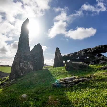
  • LATEST NEWS
    • Lost Cities
    • Archaeology's Greatest Finds
    • Underwater Discoveries
    • Greatest Inventions
    • Studies
    • Blog
  • PHILOSOPHY
  • HISTORY
  • RELIGIONS
    • Africa
    • Anatolia
    • Arabian Peninsula
    • Balkan Region
    • China - East Asia
    • Europe
    • Eurasian Steppe
    • Levant
    • Mesopotamia
    • Oceania - SE Asia
    • Pre-Columbian Civilizations of America
    • Iranian Plateau - Central Asia
    • Indus Valley - South Asia
    • Japan
    • The Archaeologist Editor Group
    • Scientific Studies
    • Aegean Prehistory
    • Historical Period
    • Byzantine Middle Ages
    • Predynastic Period
    • Dynastic Period
    • Greco-Roman Egypt
  • Rome
  • PALEONTOLOGY
  • About us
Menu

The Archaeologist

  • MAIN PAGE
  • LATEST NEWS
  • DISCOVERIES
    • Lost Cities
    • Archaeology's Greatest Finds
    • Underwater Discoveries
    • Greatest Inventions
    • Studies
    • Blog
  • PHILOSOPHY
  • HISTORY
  • RELIGIONS
  • World Civilizations
    • Africa
    • Anatolia
    • Arabian Peninsula
    • Balkan Region
    • China - East Asia
    • Europe
    • Eurasian Steppe
    • Levant
    • Mesopotamia
    • Oceania - SE Asia
    • Pre-Columbian Civilizations of America
    • Iranian Plateau - Central Asia
    • Indus Valley - South Asia
    • Japan
    • The Archaeologist Editor Group
    • Scientific Studies
  • GREECE
    • Aegean Prehistory
    • Historical Period
    • Byzantine Middle Ages
  • Egypt
    • Predynastic Period
    • Dynastic Period
    • Greco-Roman Egypt
  • Rome
  • PALEONTOLOGY
  • About us
No results found

Ness of Brodgar: Orkney's 5,000-Year Ritual Complex

August 31, 2026

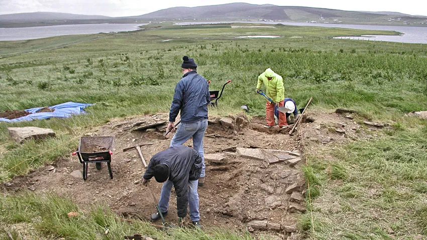
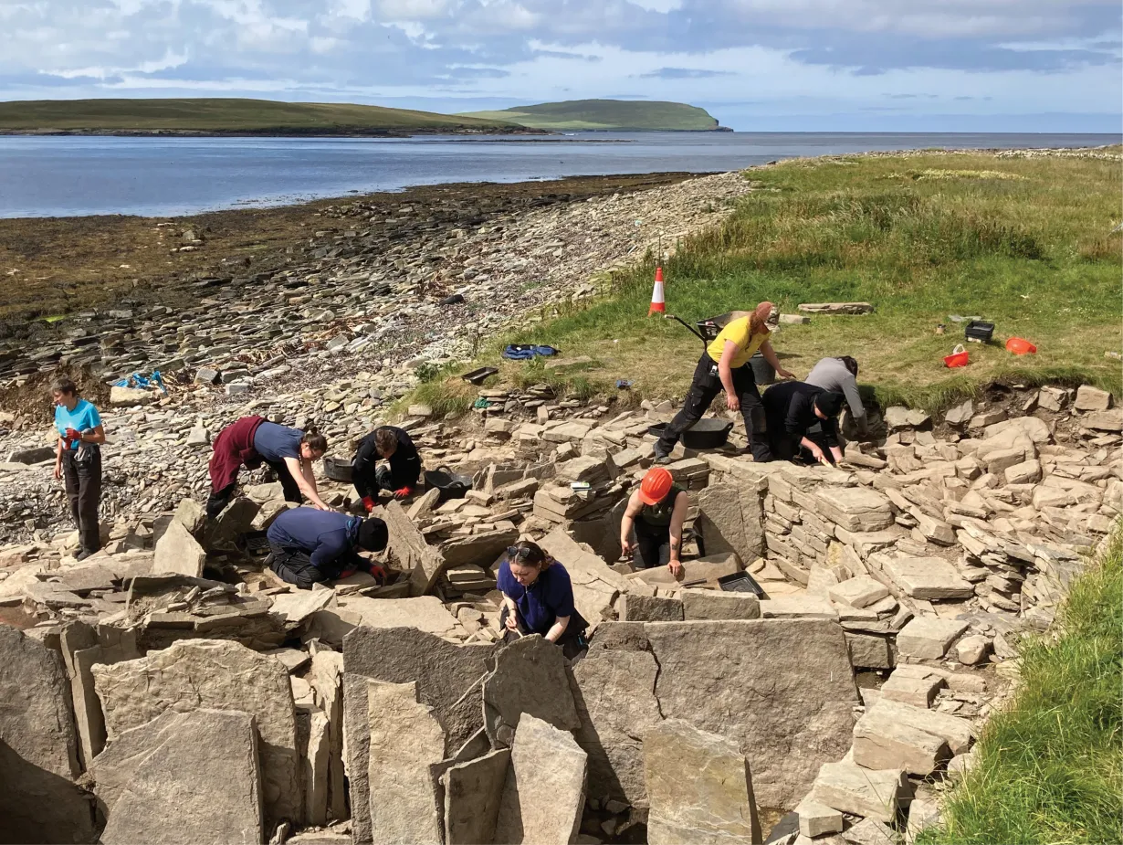
The Ness of Brodgar is one of the most remarkable archaeological discoveries in Britain.

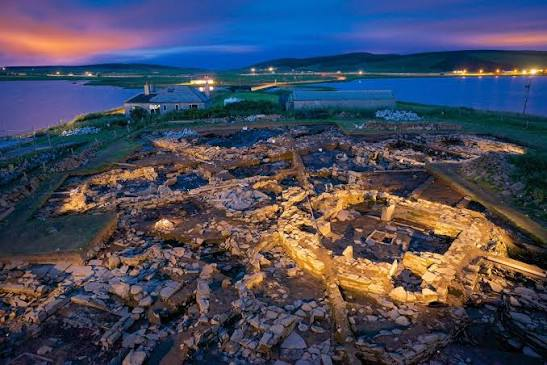
Located between the Lochs of Harray and Stenness in Orkney, the site contains the remains of a large Neolithic complex occupied approximately 5,000 years ago.

The scale and sophistication of the architecture have led archaeologists to consider it a major ceremonial and social center.

A Vast Neolithic Complex

The Ness of Brodgar contains:

  • monumental stone buildings;

  • decorated stonework;

  • painted walls;

  • pottery;

  • animal remains;

  • tools;

  • and evidence of repeated ceremonial activity.

The scale is unusual for prehistoric Britain.

The Location

The Ness lies on a narrow strip of land between two major bodies of water.

This position may have been significant.

The surrounding landscape includes several monumental sites.

These include:

  • Maeshowe;

  • the Ring of Brodgar;

  • the Stones of Stenness;

  • and Barnhouse.

Monumental Architecture

The buildings at the Ness are much larger and more complex than ordinary houses.

Some structures contained:

  • massive walls;

  • carefully laid floors;

  • internal chambers;

  • decorated stones;

  • and large entrances.

Why Build Such Large Structures?

Large buildings require enormous investments of labor.

Communities had to organize:

  • quarrying;

  • transportation;

  • construction;

  • food supply;

  • and maintenance.

This suggests that the site had considerable social importance.

Painted Stone

Some stones at the Ness of Brodgar preserve traces of red and yellow pigment.

Painted architecture is extremely rare in British prehistory.

The use of color may have helped create a visually striking ceremonial environment.

Animal Feasting

Large quantities of animal bone have been discovered.

These include remains of:

  • cattle;

  • sheep;

  • deer;

  • and other animals.

Some deposits appear to represent large-scale feasting.

Feasting and Social Organization

Feasts can serve important social purposes.

They can:

  • strengthen alliances;

  • celebrate rituals;

  • reinforce political relationships;

  • redistribute food;

  • and establish community identity.

The evidence suggests that food consumption at the Ness could have been part of major communal events.

Pottery

Large quantities of pottery have been recovered.

Some vessels belong to the Grooved Ware tradition.

Their presence links the Ness to other major Neolithic sites in Britain.

Stone Tools

Archaeologists have discovered tools associated with:

  • woodworking;

  • food preparation;

  • hunting;

  • and craft production.

These artifacts reveal the range of activities carried out at the site.

A Ritual Center

The Ness was probably not simply a village.

Its monumental buildings and location among major ceremonial monuments suggest that it functioned as an important gathering place.

People may have traveled considerable distances to participate in ceremonies.

The Broader Landscape

The surrounding monuments form one of Europe's most impressive prehistoric ceremonial landscapes.

The arrangement of:

  • settlements;

  • tombs;

  • standing stones;

  • and circles

suggests that the landscape itself was carefully organized.

Abandonment

The Ness of Brodgar was eventually abandoned.

Some buildings were deliberately closed or filled.

This raises fascinating questions about ritual termination.

A building could be destroyed or buried as part of a ceremony rather than simply left to decay.

Why the Site Matters

The Ness of Brodgar has changed our understanding of Neolithic Britain.

It demonstrates that prehistoric communities could create:

  • monumental architecture;

  • ceremonial centers;

  • large-scale feasts;

  • artistic environments;

  • and complex social institutions.

Conclusion

The Ness of Brodgar is one of the clearest indications that Neolithic Orkney was a major center of cultural innovation.

Its enormous buildings, painted stones, feasting deposits, and relationship with nearby monuments reveal a society capable of organizing large communities around shared ceremonial activities.

The site transforms our understanding of prehistoric Britain from a landscape of isolated farming villages into one containing sophisticated ceremonial centers and interconnected communities.
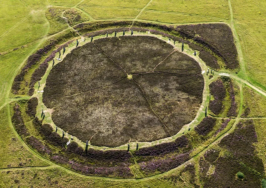
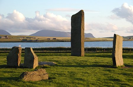
Ring of Brodgar: Orkney's 5,000-Year Stone Circle

August 31, 2026

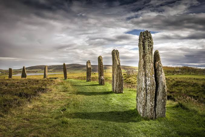
The Ring of Brodgar is one of the most spectacular prehistoric stone circles in Britain.

Located on the Orkney Mainland between the Lochs of Harray and Stenness, the monument forms part of the extraordinary Heart of Neolithic Orkney landscape.

Its enormous circular arrangement of standing stones demonstrates the ability of Neolithic communities to organize labor, transport heavy materials, and create monuments with powerful visual and symbolic effects.

The Stone Circle

The Ring of Brodgar originally contained many standing stones arranged in a large circle.

Although some stones have fallen or disappeared, a substantial number survive.

The circle is surrounded by a large ditch.

The Ditch

The ditch was excavated into the underlying rock.

Creating it required enormous quantities of labor.

The ditch may have helped define the monument as a special or separate space.

Monumental Labor

Moving and erecting standing stones was difficult.

Workers needed to:

  1. locate suitable stones;

  2. extract or transport them;

  3. move them across the landscape;

  4. prepare the ground;

  5. raise them;

  6. and stabilize them.

This required cooperation among many people.

Why Make a Circle?

The exact purpose of the Ring of Brodgar remains uncertain.

Possibilities include:

  • ceremonial gatherings;

  • seasonal rituals;

  • astronomical observation;

  • social meetings;

  • or religious ceremonies.

The monument may have served several purposes simultaneously.

Astronomy

Researchers have investigated possible astronomical relationships at Brodgar.

The positions of stones and surrounding monuments may relate to:

  • the Sun;

  • the Moon;

  • seasonal events;

  • and horizon positions.

However, identifying intentional astronomical alignments requires careful statistical analysis.

The Surrounding Landscape

The Ring of Brodgar forms part of a remarkable cluster.

Nearby are:

  • the Stones of Stenness;

  • Maeshowe;

  • the Ness of Brodgar;

  • and Barnhouse.

The proximity of these sites suggests that the area was a major ceremonial center.

Visibility

The monument is highly visible across the surrounding landscape.

Standing stones can serve as powerful landmarks.

Their visibility may have helped people identify gathering places and establish relationships between different communities.

Ritual Space

The ditch and circle could have separated the interior from the surrounding landscape.

Entering the monument may therefore have involved a transition from ordinary space into a ceremonial environment.

Neolithic Community

The builders were farming communities.

They cultivated crops and raised animals while continuing to exploit marine resources.

The monument demonstrates that agricultural societies could devote substantial labor to activities that were not directly related to food production.

Preservation

Orkney's harsh climate presents conservation challenges.

Wind, rain, frost, and biological growth can affect the stones and surrounding archaeological deposits.

Modern preservation therefore requires careful management.

UNESCO Recognition

The Ring of Brodgar is part of the Heart of Neolithic Orkney World Heritage Site.

Its importance is recognized internationally because of the extraordinary concentration of prehistoric monuments in the region.

Why the Ring Matters

The monument demonstrates:

  • engineering skill;

  • social cooperation;

  • ritual organization;

  • landscape planning;

  • and cultural continuity.

Conclusion

The Ring of Brodgar is one of the most powerful surviving monuments of Neolithic Britain.

Its immense circular arrangement, surrounding ditch, and relationship with nearby tombs and settlements reveal a society capable of organizing large-scale communal projects.

Although its exact purpose remains unknown, the monument clearly occupied an important place within the ceremonial landscape of Neolithic Orkney.

Stones of Stenness: Orkney's Neolithic Henge

August 31, 2026

The Stones of Stenness are among the oldest and most dramatic stone monuments in the British Isles.

Located in central Orkney, the surviving standing stones form part of a prehistoric ceremonial landscape that includes the Ring of Brodgar, Maeshowe, the Ness of Brodgar, and Barnhouse.

The monument demonstrates the extraordinary importance of communal ritual in Neolithic Orkney.

One of Britain's Earliest Stone Circles

The Stones of Stenness date to the Neolithic period.

The monument is generally considered earlier than or broadly contemporary with other major Orkney ceremonial structures.

Its massive stones were deliberately positioned within a defined ceremonial space.

The Henge

The monument belongs to the broad category known as a henge.

Henges typically consist of:

  • an enclosed area;

  • a ditch;

  • and an external bank.

However, their exact functions varied considerably.

Massive Stones

The surviving stones are enormous.

Their size would have made transportation and erection a major engineering challenge.

The builders needed to coordinate:

  • manpower;

  • ropes;

  • timber;

  • stone movement;

  • and construction planning.

The Central Hearth

Archaeological evidence suggests that activities took place within the ceremonial enclosure.

A large central hearth or stone setting may have been associated with ritual activity.

Ritual Gatherings

The monument could have hosted gatherings involving:

  • feasting;

  • ceremonies;

  • music;

  • dancing;

  • storytelling;

  • and social negotiation.

We cannot reconstruct the exact rituals, but the scale of the monument indicates that communal activity was important.

The Landscape Connection

The Stones of Stenness are visually connected with other major monuments.

This creates an interconnected ceremonial landscape.

People moving across central Orkney would encounter:

  • standing stones;

  • burial mounds;

  • villages;

  • and monumental enclosures.

Astronomy

Like several Orkney monuments, Stenness has been examined for possible astronomical alignments.

The orientation of stones and entrances may correspond to seasonal solar positions.

However, not every alignment necessarily had an astronomical purpose.

The Importance of Stone

Stone has exceptional durability.

A monument made from stone could survive for thousands of years.

This allowed communities to create enduring landmarks that outlasted individual generations.

Ancestors and Memory

Standing stones may have helped communities maintain connections with the past.

A monument could represent:

  • ancestral memory;

  • territorial identity;

  • shared history;

  • or collective religious beliefs.

Later History

The monument continued to attract people long after its construction.

Medieval and early modern communities interacted with the stones.

Some stones were removed or damaged over time.

Why Stenness Matters

The Stones of Stenness provide evidence for:

  • monumental construction;

  • social organization;

  • ritual gathering;

  • landscape planning;

  • and long-term cultural memory.

Conclusion

The Stones of Stenness demonstrate that Neolithic Orkney was a society capable of monumental communal projects.

The standing stones were not simply isolated objects.

They formed part of a carefully organized landscape containing settlements, tombs, ceremonial centers, and other monuments.

Barnston: Orkney's Bronze Age Cairn Circle

August 31, 2026

The name Barnston is associated with the prehistoric archaeological landscape of Orkney, although specific site identification and terminology should be treated carefully because several prehistoric cairns and circular monuments across the islands have similar descriptive names.

The broader phenomenon of Bronze Age cairn circles provides important evidence for changing burial traditions after the Neolithic monumental period.

From Neolithic to Bronze Age

The transition from the Neolithic into the Bronze Age brought major social and technological changes.

Communities increasingly used:

  • copper;

  • bronze;

  • new forms of pottery;

  • and different burial practices.

However, many older traditions continued.

Bronze Age Cairns

A cairn is a mound made primarily from stones.

Bronze Age cairns could function as:

  • burial monuments;

  • commemorative structures;

  • territorial landmarks;

  • or ceremonial sites.

Circular Design

Circular monuments were particularly common in prehistoric Britain.

A circular form may have had symbolic associations with:

  • the Sun;

  • cycles;

  • seasons;

  • or community identity.

However, the meaning of the circle cannot be known with certainty.

Burial Practices

Bronze Age burial customs varied.

People could be buried:

  • individually;

  • collectively;

  • in cists;

  • beneath cairns;

  • or after cremation.

Cremation became increasingly important in many parts of Britain.

Cists

A stone cist is a small box-like burial structure made from stone slabs.

The deceased or cremated remains could be placed inside before the structure was covered.

Bronze Objects

Some Bronze Age burials contain objects such as:

  • knives;

  • axes;

  • pins;

  • ornaments;

  • and weapons.

These objects can provide evidence for technological development and social status.

Orkney's Landscape

Orkney remained an important agricultural region during the Bronze Age.

Communities continued to use:

  • farmland;

  • grazing areas;

  • coastal resources;

  • and earlier monumental landscapes.

Reuse of Earlier Monuments

Bronze Age communities sometimes reused Neolithic monuments.

This suggests that older monuments retained significance.

People could reinterpret ancestral structures according to changing beliefs.

Environmental Change

During the Bronze Age, climate and vegetation patterns changed.

These changes affected:

  • agriculture;

  • grazing;

  • woodland;

  • and settlement patterns.

Why Cairn Circles Matter

Cairn circles reveal how communities transformed the landscape through burial and commemoration.

Their construction required labor and organization even when the structures were smaller than earlier monumental complexes.

Conclusion

Bronze Age cairn circles such as those represented in the Orkney archaeological landscape demonstrate that monumental traditions continued after the great Neolithic ceremonial period.

The people of the Bronze Age inherited an already ancient landscape and added their own burial monuments, technologies, and traditions.

Their cairns provide evidence for changing beliefs about death, identity, ancestry, and the landscape.

Bookan Chambered Cairn: Orkney's Tripartite Tomb

August 31, 2026

The Bookan Chambered Cairn is a prehistoric funerary monument on Mainland Orkney associated with the island's remarkable Neolithic chambered-tomb tradition.

Its internal organization and relationship to other Orkney monuments make it important for understanding how prehistoric communities designed burial spaces and maintained relationships with the dead.

Chambered Tombs

Chambered cairns were among the most important monuments built by Neolithic communities.

They combined:

  • stone architecture;

  • burial;

  • ritual;

  • and landscape symbolism.

The Tripartite Arrangement

The description “tripartite tomb” refers to the division of the internal monument into multiple spaces.

Such divisions could create different ritual zones.

The architecture controlled how people moved through the tomb.

Passage and Chamber

A typical chambered cairn could contain:

  • an entrance;

  • a passage;

  • and internal chambers.

The movement from the exterior into the interior may have had symbolic significance.

Collective Burial

These monuments often received multiple individuals.

The tomb could therefore serve as a communal ancestral space.

Rather than representing one person's final resting place, it may have represented a group's relationship with its predecessors.

The Importance of Ancestors

Ancestors could provide communities with a sense of:

  • identity;

  • continuity;

  • belonging;

  • and connection to the land.

A monumental tomb created a permanent physical reminder of those relationships.

Construction

The builders used local stone.

Large slabs had to be:

  • quarried;

  • transported;

  • positioned;

  • and stabilized.

The construction process required coordinated labor.

The Orkney Tomb Tradition

Bookan belongs to a much larger family of prehistoric monuments across Orkney.

Other important examples include:

  • Maeshowe;

  • Unstan;

  • Cuween Hill;

  • Quoyness;

  • Taversoe Tuick;

  • and Knowe of Yarso.

Pottery and Artifacts

Archaeological material from chambered cairns can include:

  • pottery;

  • stone tools;

  • animal remains;

  • and human remains.

These artifacts help researchers reconstruct how monuments were used.

Landscape Position

Orkney's tombs were frequently placed in prominent landscapes.

A monument could be visible from:

  • settlements;

  • fields;

  • coastlines;

  • and neighboring monuments.

This visibility may have reinforced its role as a territorial or ancestral landmark.

Ritual Activities

Possible activities included:

  • burial ceremonies;

  • offerings;

  • feasting;

  • and visits to ancestral remains.

The archaeological evidence does not preserve the spoken words, songs, or beliefs that accompanied these activities.

Why Bookan Matters

Bookan contributes to our understanding of:

  • Neolithic funerary architecture;

  • collective burial;

  • ritual movement;

  • social identity;

  • and landscape organization.

Conclusion

Bookan Chambered Cairn demonstrates how Neolithic communities used architecture to structure relationships with death and ancestry.

Its divided internal spaces were not simply practical burial chambers.

They formed part of a broader ceremonial system in which architecture, human remains, community identity, and the surrounding Orkney landscape were closely connected.

Quoyness Chambered Cairn: Sanday's Maeshowe-Type Tomb

August 31, 2026

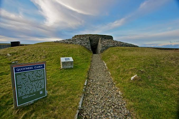
The Quoyness Chambered Cairn, located on the island of Sanday in Orkney, is an important Neolithic passage tomb.

Its architectural design is associated with the Maeshowe-type tradition, making it valuable for understanding the development and distribution of sophisticated funerary architecture across prehistoric Orkney.

The Island of Sanday

Sanday is one of Orkney's northern islands.

Its landscape includes:

  • fertile farmland;

  • beaches;

  • dunes;

  • wetlands;

  • and coastal resources.

The island offered diverse opportunities for prehistoric communities.

The Chambered Cairn

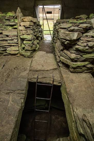
Quoyness consists of a stone-built cairn covering a central burial chamber.

A passage provides access to the interior.

The architecture required substantial engineering knowledge.

Maeshowe-Type Architecture

Maeshowe-type tombs generally feature:

  • long entrance passages;

  • substantial central chambers;

  • and carefully constructed stone walls.

These monuments demonstrate a sophisticated approach to architectural design.

The Central Chamber

The central chamber could contain human remains.

The space may have been reused repeatedly.

This suggests that the tomb was connected to long-term ancestral traditions.

Human Remains

The discovery of human remains within chambered cairns provides evidence for communal burial practices.

Individuals may have been deposited over generations.

The monument could therefore preserve the remains of a community's ancestors.

Ritual Access

The passage controlled entry.

This means that people could not simply walk into the central chamber casually.

Entering required deliberate movement.

This may have created a ritual experience.

Solstice Connections

Some Maeshowe-type tombs show evidence of astronomical orientation.

The alignment of entrances may have been connected with the seasonal movement of the Sun.

Whether Quoyness itself had a precise astronomical function requires careful archaeological analysis.

Construction Materials

Local stone formed the primary building material.

The availability of stone made durable architecture possible on Sanday.

Coastal Environment

The tomb's location within an island landscape also connected it to:

  • the sea;

  • farmland;

  • settlements;

  • and other monuments.

The placement of the tomb therefore contributed to the cultural organization of the landscape.

Why Quoyness Matters

Quoyness demonstrates that sophisticated monumental traditions extended beyond central Mainland Orkney.

Its architecture shows that island communities participated in broader cultural systems.

Conclusion

Quoyness Chambered Cairn is a powerful example of Neolithic funerary architecture on Sanday.

Its Maeshowe-type design demonstrates that prehistoric communities across Orkney shared architectural ideas while adapting them to their own local landscapes.

The tomb preserves evidence of collective burial, ritual movement, engineering skill, and the importance of ancestors in Neolithic society.

Taversoe Tuick: Rousay's Two-Story Neolithic Tomb

August 31, 2026

Taversoe Tuick, located on the island of Rousay in Orkney, is one of the most unusual chambered tombs in Britain.

Its most remarkable feature is its two-level construction, with separate chambers arranged vertically.

This unusual architecture provides evidence for the diversity and complexity of Neolithic funerary traditions in Orkney.

An Unusual Tomb

Most chambered cairns are organized horizontally.

Taversoe Tuick is different.

It contains:

  • an upper chamber;

  • a lower chamber;

  • and associated passages.

The vertical arrangement makes the monument particularly distinctive.

Why Build Two Levels?

The reason for the two-story design is unknown.

Possible explanations include:

  • different burial phases;

  • different ritual functions;

  • architectural experimentation;

  • or symbolic distinctions between spaces.

No interpretation can currently be confirmed.

Collective Burial

Like many Neolithic chambered tombs, Taversoe Tuick was used for multiple individuals.

The monument therefore represents a communal approach to burial.

The Upper Chamber

The upper level would have been accessible from the surface.

It formed part of the monument's overall ritual architecture.

The Lower Chamber

The lower chamber is particularly interesting because it created a more enclosed and subterranean environment.

Moving downward could have carried symbolic significance.

Architecture and Ritual

Prehistoric architecture often manipulated:

  • light;

  • darkness;

  • movement;

  • visibility;

  • and enclosure.

The transition from the outside world into an enclosed chamber could have created a dramatic ritual experience.

The Landscape of Rousay

Rousay contains numerous prehistoric monuments.

These include:

  • Knowe of Yarso;

  • Blackhammer;

  • Taversoe Tuick;

  • and other chambered cairns.

The concentration demonstrates that the island was an important center of Neolithic activity.

Farming Communities

The people who constructed these monuments were agriculturalists.

They raised livestock and cultivated crops while also exploiting:

  • fish;

  • shellfish;

  • birds;

  • and wild plants.

Monument Construction

Building the tomb required:

  • stone quarrying;

  • transportation;

  • engineering;

  • and communal labor.

The effort demonstrates strong social organization.

Ancestors and Identity

A tomb used by generations could become a central symbol of group identity.

It could connect living communities with:

  • ancestors;

  • territory;

  • and shared history.

Why Taversoe Tuick Matters

The tomb demonstrates that Neolithic builders did not follow a single architectural formula.

They experimented with unusual spatial arrangements.

This diversity suggests that ritual architecture was flexible and responsive to local traditions.

Conclusion

Taversoe Tuick is remarkable because its two-story design challenges the assumption that prehistoric tombs were architecturally simple.

The monument demonstrates careful planning and sophisticated manipulation of space.

Its upper and lower chambers created different environments within one structure, providing prehistoric communities with multiple spaces for burial and ritual activity.

Knowe of Yarso: Rousay's Stalled Cairn

August 31, 2026

The Knowe of Yarso is a Neolithic chambered cairn on the island of Rousay in Orkney.

It belongs to the distinctive stalled cairn tradition found particularly in Orkney and northern Scotland.

The monument provides valuable evidence for prehistoric burial practices, architectural design, and the social importance of ancestors.

What Is a Stalled Cairn?

A stalled cairn contains a long chamber divided by upright stone slabs or “stalls.”

These stones create separate compartments within the main chamber.

The architecture resembles a series of internal bays.

The Purpose of the Stalls

The exact purpose of these divisions remains uncertain.

They may have:

  • separated groups of human remains;

  • organized burial deposits;

  • structured ritual movement;

  • or symbolically divided the chamber.

Collective Burial

The Knowe of Yarso contained numerous human remains.

This is consistent with the use of stalled cairns as collective burial monuments.

The individuals may have belonged to several generations of the same community.

Handling of Human Remains

Neolithic burial practices could be very different from modern customs.

Bodies may have been:

  • placed in tombs;

  • allowed to decompose;

  • rearranged;

  • and sometimes moved within the monument.

This suggests that the relationship with the dead was an ongoing process.

Ancestor Ritual

The cairn may have been used to maintain connections with deceased members of the community.

Ritual visits could reinforce:

  • lineage;

  • identity;

  • territorial relationships;

  • and collective memory.

Architecture

The monument's construction required carefully arranged stone.

The builders needed to create:

  • stable walls;

  • internal divisions;

  • a roof;

  • and an outer cairn.

The engineering knowledge involved was substantial.

Rousay's Neolithic Landscape

Knowe of Yarso is part of a remarkable concentration of prehistoric monuments on Rousay.

Other important sites include:

  • Taversoe Tuick;

  • Blackhammer;

  • and other chambered cairns.

This concentration suggests that the island had a significant prehistoric population and ceremonial tradition.

Farming and Food

The communities who built the cairn practiced agriculture and animal husbandry.

They raised livestock and cultivated cereals.

They also exploited the sea and wild resources.

Visibility and Landscape

The location of a burial monument could communicate its importance.

A cairn placed prominently in the landscape could act as:

  • a territorial marker;

  • an ancestral landmark;

  • and a reminder of community history.

Comparison With Other Tombs

Stalled cairns differ architecturally from:

  • Maeshowe-type tombs;

  • passage graves;

  • and other chambered monuments.

This diversity demonstrates that prehistoric Orkney contained multiple funerary traditions.

Why Knowe of Yarso Matters

The monument is valuable for studying:

  • collective burial;

  • architecture;

  • social organization;

  • ancestor traditions;

  • and regional cultural diversity.

Conclusion

Knowe of Yarso provides a remarkable glimpse into how Neolithic communities treated their dead.

Its internal stone stalls divided the chamber into organized spaces, while the monument itself transformed human remains into a permanent feature of the landscape.

Together with other tombs on Rousay, it demonstrates that Neolithic Orkney was home to sophisticated communities with diverse architectural and funerary traditions.

The Knowe of Yarso ultimately reminds us that prehistoric monuments were not simply structures of stone. They were places where communities expressed identity, remembered ancestors, and connected generations to the landscapes they inhabited.

Midhowe Chambered Cairn: Rousay's Longest Tomb

August 31, 2026

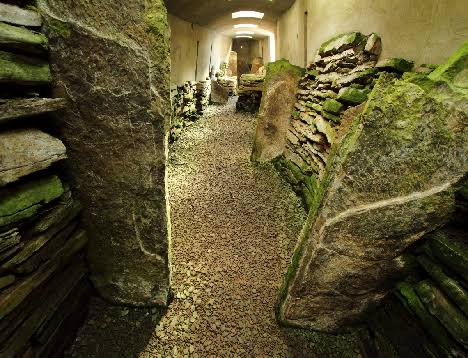
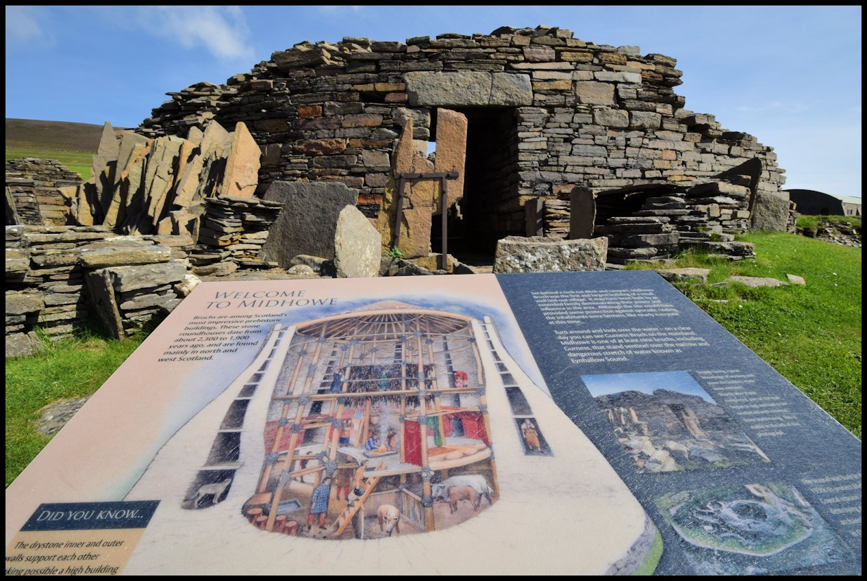
The Midhowe Chambered Cairn on the island of Rousay in Orkney is one of the most impressive prehistoric burial monuments in Scotland. Sometimes described as one of the longest and most elaborate stalled chambered cairns in Orkney, the monument provides exceptional evidence for Neolithic funerary architecture and the ways prehistoric communities organized relationships with their dead.

Located within a landscape containing numerous prehistoric monuments, Midhowe demonstrates that Rousay was an important center of Neolithic activity.

The Architecture of Midhowe

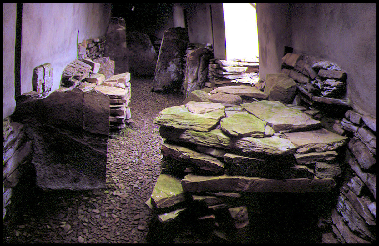
Midhowe is a long, stone-built chambered cairn.

Its internal chamber is divided by upright stone slabs, creating a series of compartments or “stalls.”

This architectural feature gives the monument its classification as a stalled cairn.

The structure originally had a substantial stone covering, creating a large cairn visible across the surrounding landscape.

A Monument Built for the Dead

Midhowe was a funerary monument rather than an ordinary dwelling.

The chamber was used for the deposition of human remains.

Multiple individuals were associated with the monument, demonstrating that it was probably used repeatedly rather than serving as the tomb of a single person.

Collective Burial

The presence of numerous human remains is important because it indicates a collective approach to burial.

Instead of each individual receiving a completely separate grave, members of a community could become part of a shared ancestral monument.

This may have reinforced ideas of:

  • family;

  • lineage;

  • community;

  • ancestry;

  • and territorial identity.

The Stalls

The internal upright stones divide the long chamber into separate spaces.

Archaeologists do not know exactly why these divisions were created.

They may have helped organize:

  • individual burial deposits;

  • different groups of remains;

  • ritual activities;

  • or movement through the monument.

The architecture therefore controlled how people interacted with the dead.

Construction

Building Midhowe required substantial labor.

Workers had to:

  • locate suitable stone;

  • quarry or extract it;

  • transport it;

  • build the chamber walls;

  • position the internal stalls;

  • construct the roof;

  • and cover the structure with a large cairn.

Such work could only have been accomplished through coordinated community activity.

Farming Communities

The people who built Midhowe lived during the Neolithic period.

They practiced agriculture and animal husbandry.

Their economy included:

  • cereal cultivation;

  • cattle keeping;

  • sheep and goat husbandry;

  • fishing;

  • shellfish collection;

  • and hunting.

The Sea Around Rousay

Rousay's island environment provided access to rich marine resources.

The surrounding waters could provide:

  • fish;

  • shellfish;

  • seabirds;

  • and marine mammals.

This complemented agricultural production.

A Monumental Landscape

Midhowe was not isolated.

Rousay contains a remarkable concentration of Neolithic chambered tombs.

These include:

  • Taversoe Tuick;

  • Knowe of Yarso;

  • Blackhammer;

  • and other monuments.

The density of monuments suggests that the island was a significant prehistoric cultural landscape.

Visibility

Large cairns were highly visible.

Their presence could mark important locations and establish connections between communities and the land.

A tomb could therefore function simultaneously as:

  • a burial place;

  • a landmark;

  • a ritual location;

  • and a symbol of ancestral ownership.

Why Midhowe Matters

Midhowe is particularly important because of its impressive length and internal organization.

It demonstrates that Neolithic builders were capable of creating complex architectural spaces for collective funerary activity.

Conclusion

Midhowe Chambered Cairn is one of Rousay's greatest prehistoric monuments.

Its long chamber, internal stone stalls, human remains, and monumental construction demonstrate that Neolithic communities possessed sophisticated architectural skills and strong traditions surrounding ancestry and death.

The monument is ultimately evidence not only of how people buried their dead, but of how they organized society, memory, and relationships with the landscape

Blackhammer Chambered Cairn: Rousay's Passage Grave

August 31, 2026

The Blackhammer Chambered Cairn is another remarkable Neolithic monument on Rousay.

It belongs to the rich funerary tradition of Orkney's chambered cairns and provides evidence for the sophisticated architectural techniques used by prehistoric communities to create permanent monuments for collective burial.

Its carefully constructed passage and chamber demonstrate how movement through a tomb could be deliberately controlled.

The Chambered Cairn Tradition

Across Neolithic Orkney, communities constructed different types of chambered tombs.

These included:

  • stalled cairns;

  • passage graves;

  • Maeshowe-type tombs;

  • and other local variations.

Blackhammer belongs to this diverse architectural tradition.

The Passage

The entrance passage creates a transition between the outside landscape and the enclosed burial chamber.

This arrangement may have had practical and symbolic functions.

Visitors had to move deliberately through the passage before reaching the interior.

The Burial Chamber

The chamber provided a controlled space for human remains.

Multiple individuals could be deposited within the monument over time.

This indicates that the tomb probably served a community rather than one individual.

Collective Ancestry

The use of a shared tomb suggests that the dead remained socially important after death.

Ancestors may have helped communities establish:

  • identity;

  • continuity;

  • lineage;

  • and connections to territory.

Construction

The monument's stone walls required careful planning.

Builders had to create stable structures capable of supporting the cairn above.

The engineering involved demonstrates considerable knowledge of:

  • stone weight;

  • balance;

  • pressure;

  • and structural stability.

Light and Darkness

Passage graves create a dramatic contrast between the bright outside world and the darker interior.

Although we cannot know whether this was deliberately symbolic, such architectural transitions may have influenced ritual experiences.

Farming and Settlement

The people who constructed Blackhammer were farmers.

They raised livestock and cultivated crops.

They also continued to exploit wild and marine resources.

Rousay's Prehistoric Population

The number of chambered cairns on Rousay indicates repeated occupation and substantial population during the Neolithic.

The island was clearly part of a wider cultural network.

Relationship With Other Monuments

Blackhammer can be studied alongside:

  • Midhowe;

  • Taversoe Tuick;

  • Knowe of Yarso;

  • and other Rousay monuments.

Comparing their architecture allows archaeologists to investigate changing funerary traditions.

Why Blackhammer Matters

Blackhammer provides evidence for:

  • collective burial;

  • ritual architecture;

  • stone engineering;

  • social organization;

  • and ancestral traditions.

Conclusion

Blackhammer Chambered Cairn demonstrates how Neolithic communities transformed stone and earth into carefully organized funerary spaces.

The passage and chamber created a controlled journey into the monument, while the collective burial tradition connected generations of people to one another.

Its survival helps reveal the complex social and ritual world of prehistoric Rousay.

Knowe of Rowie: Rousay's Wedge-Shaped Cairn

August 31, 2026

The Knowe of Rowie is part of the extraordinary prehistoric archaeological landscape of Rousay in Orkney.

The monument is associated with the island's chambered-cairn tradition and is notable for its distinctive wedge-shaped form.

Its architecture contributes to our understanding of how Neolithic communities adapted funerary monument designs to local landscapes and cultural traditions.

What Is a Wedge-Shaped Cairn?

A wedge-shaped cairn is a type of prehistoric funerary monument in which the structure gradually narrows toward one end.

The shape gives the monument its characteristic wedge-like appearance.

Funerary Function

Like other chambered cairns, the monument was associated with burial and the treatment of human remains.

The dead could be placed within internal chambers or compartments.

Monumental Construction

Even relatively small cairns required coordinated labor.

Builders had to:

  • gather stone;

  • transport it;

  • create internal chambers;

  • build supporting walls;

  • and construct the outer cairn.

Local Architectural Traditions

The variety of tomb forms across Orkney demonstrates that Neolithic communities did not follow one universal design.

Different groups could develop:

  • stalled chambers;

  • passage graves;

  • wedge-shaped cairns;

  • and more elaborate passage tombs.

Rousay as a Monumental Center

Rousay is exceptional because numerous chambered tombs survive on the island.

This suggests a strong local tradition of monument building.

The monuments may represent different communities or different generations.

The Landscape

The tombs were built within landscapes containing:

  • farmland;

  • hills;

  • coastlines;

  • settlements;

  • and other monuments.

Their placement was therefore part of a larger spatial system.

Ancestors and Territory

A permanent burial monument could establish a relationship between a community and a particular place.

Ancestors buried within the landscape could become part of its social memory.

The monument could therefore help communicate claims of belonging.

Farming Society

The builders practiced agriculture and animal husbandry.

They cultivated cereals and maintained livestock.

Marine resources provided additional food.

Why the Shape Matters

Architecture is not merely decorative.

The shape of a monument determines:

  • how people move around it;

  • what they see;

  • how the structure appears from a distance;

  • and how internal space is organized.

The wedge shape therefore formed part of the monument's identity.

Conclusion

The Knowe of Rowie illustrates the diversity of Neolithic funerary architecture in Orkney.

Its wedge-shaped form demonstrates that prehistoric communities experimented with monument design while maintaining broader traditions of collective burial and ancestor remembrance.

Together with Rousay's other tombs, it reveals an island landscape deeply shaped by prehistoric ideas about death, community, and place.

Holm of Papa Westray: Orkney's Neolithic Farmstead

August 31, 2026

The Holm of Papa Westray is associated with the prehistoric settlement and agricultural landscape of Papa Westray in Orkney.

The island contains important evidence for Neolithic farming and domestic life, providing insight into how prehistoric communities established settlements within a challenging northern island environment.

Neolithic Life on Papa Westray

By approximately 5,000 years ago, communities in Orkney had developed agricultural economies.

They combined:

  • crop cultivation;

  • livestock raising;

  • fishing;

  • shellfish collection;

  • and gathering.

The Farmstead

A Neolithic farmstead would have required permanent or semi-permanent structures.

These could include:

  • houses;

  • storage areas;

  • working spaces;

  • animal areas;

  • and food-processing facilities.

Stone Architecture

Stone was the primary building material in Orkney.

The islands had limited woodland, making timber less suitable for large permanent buildings.

Stone provided:

  • durability;

  • insulation;

  • and protection from wind.

Agriculture

Cereals were important.

Barley was especially well suited to the cool climate.

People could grind grain into meal using stone tools.

Livestock

Animals provided multiple resources.

Cattle, sheep, goats, and pigs could provide:

  • meat;

  • milk;

  • hides;

  • bones;

  • and labor.

Marine Resources

Farming did not eliminate coastal exploitation.

People living on Papa Westray could obtain:

  • fish;

  • shellfish;

  • seabirds;

  • and marine mammals.

The Importance of Islands

Island communities had to carefully manage resources.

They could not always depend on importing food.

This encouraged diversified economies.

Seasonal Activity

Some resources were strongly seasonal.

For example:

  • seabirds nested during particular periods;

  • fish populations changed seasonally;

  • crops were harvested at specific times;

  • and livestock management followed annual cycles.

Community Organization

Building stone houses and maintaining agricultural land required cooperation.

Families or households had to coordinate:

  • farming;

  • construction;

  • food storage;

  • and animal management.

Why Farmsteads Matter Archaeologically

Large monuments often dominate archaeological discussions.

However, farmsteads reveal how ordinary people lived.

They provide evidence for:

  • cooking;

  • sleeping;

  • farming;

  • storage;

  • craft production;

  • and household organization.

Conclusion

The Neolithic farmstead landscape of Papa Westray demonstrates that prehistoric Orkney was not only a place of monumental tombs and stone circles.

It was also a landscape of farms and households.

People created durable homes, cultivated crops, raised animals, and exploited the sea, establishing a sustainable way of life in one of northern Europe's most demanding environments.

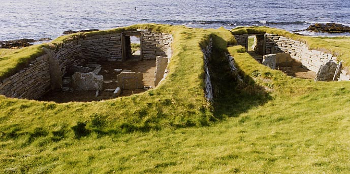
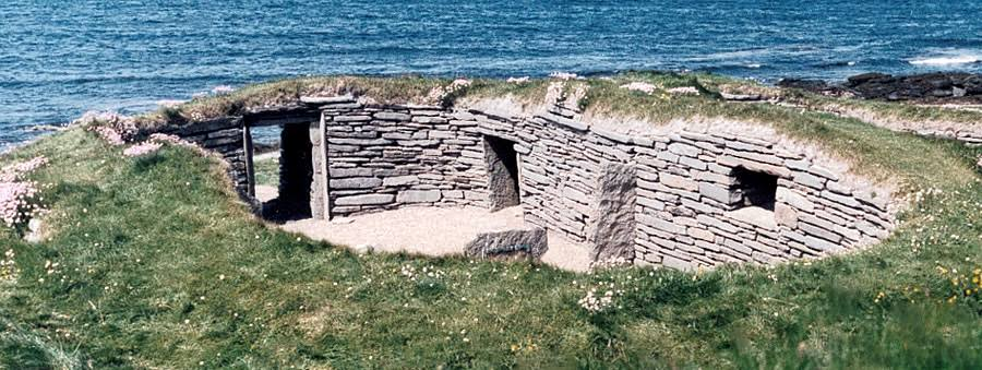
Knap of Trewieglen: Westray's Neolithic Houses

August 31, 2026

The Knap of Trewieglen is associated with the Neolithic settlement landscape of Westray in Orkney.

The site's houses provide valuable evidence for the domestic architecture of prehistoric island communities and help demonstrate how Neolithic Orcadians created permanent living spaces from locally available stone.

Westray's Neolithic Communities

Westray was home to farming communities thousands of years ago.

The island offered:

  • fertile land;

  • grazing areas;

  • marine resources;

  • freshwater;

  • and abundant building stone.

Stone Houses

The houses were constructed from stone rather than relying heavily on timber.

This was a logical response to the local environment.

Stone walls provided excellent protection against:

  • wind;

  • rain;

  • and cold temperatures.

Internal Organization

Neolithic houses could contain:

  • central hearths;

  • sleeping platforms;

  • storage areas;

  • and working spaces.

The arrangement of these features reveals how domestic activities were organized.

The Hearth

The hearth was often the center of household life.

It provided:

  • heat;

  • light;

  • cooking;

  • and a place for social interaction.

Food Production

The inhabitants combined agriculture with other food sources.

Their diet could include:

  • cereals;

  • livestock;

  • fish;

  • shellfish;

  • and wild plants.

Pottery

Ceramic vessels were essential for food preparation and storage.

Pottery fragments can help archaeologists reconstruct:

  • cooking practices;

  • cultural traditions;

  • and trade connections.

Tools

Stone tools were used for:

  • woodworking;

  • butchering;

  • food processing;

  • hunting;

  • and craft production.

Households

A house was not simply a physical structure.

It was the center of:

  • family life;

  • food production;

  • social relationships;

  • and identity.

Coastal Connections

Westray's residents could access the sea relatively easily.

This created an economy combining:

farm + coast + livestock + marine resources.

Why the Houses Matter

Domestic structures provide an alternative perspective to monumental archaeology.

Instead of focusing on tombs and ceremonial sites, they reveal everyday life.

Conclusion

The Neolithic houses associated with the Knap of Trewieglen demonstrate how Westray's inhabitants adapted architecture to the northern island environment.

Their stone homes provided protection, while their agricultural and marine economy allowed them to establish stable communities.

These houses remind us that behind Orkney's famous monuments were ordinary households whose daily activities made monumental society possible.

Pool Site: Sanday's Multi-Period Settlement

August 31, 2026

The Pool archaeological site on Sanday in Orkney is important because it preserves evidence of human activity across multiple periods.

Rather than representing a single moment in history, multi-period sites such as Pool allow archaeologists to investigate how settlement, economy, and technology changed over thousands of years.

A Long Archaeological Sequence

The Pool site contains evidence associated with prehistoric occupation extending across different periods.

This makes it particularly valuable for understanding:

  • continuity;

  • abandonment;

  • rebuilding;

  • technological change;

  • and environmental transformation.

Neolithic Activity

Early occupation reflects the development of farming communities.

People cultivated crops and raised livestock while continuing to exploit marine resources.

Bronze Age Changes

Later communities introduced new technologies and cultural practices.

Bronze became increasingly important.

Burial traditions also changed.

Iron Age Occupation

Iron Age societies developed more complex forms of:

  • metalworking;

  • agriculture;

  • settlement organization;

  • and trade.

The site provides evidence for the continuation of human activity through these transformations.

Houses and Structures

Different phases of occupation can leave:

  • foundations;

  • hearths;

  • walls;

  • floors;

  • storage areas;

  • and refuse deposits.

By studying their sequence, archaeologists can reconstruct how settlements changed.

Food

Animal bones and plant remains reveal diet.

Researchers can identify:

  • cattle;

  • sheep;

  • pigs;

  • fish;

  • shellfish;

  • and cereals.

Changes in diet can indicate economic or environmental changes.

Pottery

Ceramic traditions changed over time.

Different forms and decorative styles can help archaeologists distinguish occupation phases.

Metalworking

Later prehistoric settlements could include evidence for metal production.

Ironworking required:

  • ore;

  • fuel;

  • furnaces;

  • and specialized knowledge.

Environmental Evidence

Soil layers preserve information about past environments.

Pollen, seeds, charcoal, and animal remains can reveal:

  • vegetation;

  • farming;

  • woodland;

  • climate;

  • and land use.

Why Multi-Period Sites Matter

A single-period site gives a snapshot.

A multi-period site provides a sequence.

It allows archaeologists to ask:

What changed?

and

What remained the same?

Continuity

Even when technology changes, certain aspects of life can remain stable.

Communities may continue using the same:

  • fields;

  • coastlines;

  • water sources;

  • or settlement locations.

Conclusion

The Pool site is valuable because it demonstrates that Orkney's archaeological record is not simply a collection of isolated prehistoric monuments.

People repeatedly returned to productive places and adapted them to changing circumstances.

The site's long sequence provides a window into the transformation of Orkney society from early farming communities through later prehistoric periods.

Scar Boat Burial: Sanday's Viking Ship Grave

August 31, 2026

The Scar Boat Burial on the island of Sanday is one of the most remarkable Viking Age archaeological discoveries in Orkney.

Dating to approximately the late ninth or early tenth century, the burial contained a boat, human remains, animal remains, and numerous objects.

The discovery provides extraordinary evidence for Norse society in Orkney and demonstrates the importance of maritime identity in the Viking Age.

The Boat Burial

The burial involved a small boat placed within a grave.

The vessel formed the central element of the burial structure.

Boat burials were powerful expressions of Viking identity because boats represented:

  • travel;

  • warfare;

  • trade;

  • fishing;

  • and social status.

Human Remains

The burial contained several individuals.

The presence of multiple people raises questions about their relationships and roles.

Modern scientific techniques can examine:

  • age;

  • sex;

  • ancestry;

  • diet;

  • and genetic relationships.

Grave Goods

The burial contained numerous objects.

These included items associated with:

  • weapons;

  • clothing;

  • household activity;

  • fishing;

  • and personal identity.

Weapons

Weapons in Viking burials could include:

  • swords;

  • spears;

  • shields;

  • or axes.

Their presence could communicate martial identity or social status.

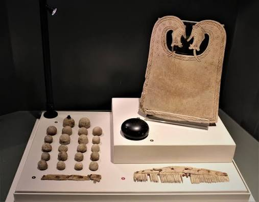
Household Objects

Other objects could include:

  • combs;

  • tools;

  • containers;

  • and domestic equipment.

These provide insight into everyday life.

Textiles and Clothing

Preserved artifacts can reveal aspects of Viking clothing and appearance.

Brooches, buckles, and other fittings may indicate how garments were worn.

Animals

Animal remains were also associated with the burial.

Animals could have practical or symbolic roles.

They might represent:

  • food;

  • transportation;

  • status;

  • companionship;

  • or ritual offerings.

Viking Orkney

By the Viking Age, Norse settlers had established themselves throughout Orkney.

They interacted with existing populations and transformed the islands politically and culturally.

Maritime Society

The sea was fundamental to Viking life.

Ships allowed people to:

  • trade;

  • raid;

  • migrate;

  • fish;

  • and maintain political connections.

A boat burial therefore expressed more than transportation technology.

It represented an entire way of life.

Burial and Status

Elaborate burials required substantial resources.

The construction of the grave and provision of goods could communicate the importance of the deceased.

Why Scar Matters

The Scar burial provides a rare combination of:

  • boat archaeology;

  • human remains;

  • animal remains;

  • weaponry;

  • domestic artifacts;

  • and clothing evidence.

Conclusion

The Scar Boat Burial is one of the most important Viking Age graves in Scotland.

It demonstrates how boats were central to Norse identity and how burial ceremonies could combine people, animals, objects, and maritime symbolism.

The grave provides an unusually intimate glimpse into Viking society in Orkney, where Scandinavian traditions became deeply embedded in the islands' history.

Bowser's Knowe: Westray's Neolithic Cairn

August 31, 2026

Bowser's Knowe is associated with the rich Neolithic archaeological landscape of Westray in Orkney.

The site belongs to the broader tradition of prehistoric cairns that transformed the island landscape into a network of monuments connected with burial, ancestry, and community identity.

Neolithic Westray

Westray was home to farming communities approximately 5,000 years ago.

The island provided:

  • fertile soils;

  • grazing;

  • freshwater;

  • marine resources;

  • and building stone.

The Cairn Tradition

Stone cairns could serve several purposes.

They might function as:

  • burial monuments;

  • memorials;

  • landmarks;

  • or ritual spaces.

Monument Construction

Constructing a cairn required coordinated labor.

People needed to:

  • gather stone;

  • transport it;

  • arrange internal structures;

  • and build the outer mound.

Burial

Human remains found in prehistoric cairns demonstrate that the dead could remain physically present within the community's landscape.

Ancestors

The monument could help maintain relationships between:

  • living people;

  • ancestors;

  • and territory.

This relationship may have reinforced social identity.

Landscape Visibility

A cairn visible from surrounding fields could act as a permanent landmark.

It could mark:

  • a sacred place;

  • a territorial boundary;

  • or an ancestral location.

Farming Communities

The builders cultivated crops and raised livestock.

They also exploited marine resources.

This mixed economy helped them survive the island's changing seasons.

Connections to Other Sites

Westray contains several important prehistoric sites.

These demonstrate that the island participated in the wider cultural world of Neolithic Orkney.

Why Bowser's Knowe Matters

The cairn contributes to the archaeological picture of Westray as a landscape shaped by both domestic settlement and ceremonial activity.

Conclusion

Bowser's Knowe represents the enduring importance of monuments in Neolithic Westray.

The cairn transformed stone into a permanent reminder of the dead and helped connect communities to their ancestors and landscape.

Links House: Westray's Neolithic Village

August 31, 2026

Links House is associated with the prehistoric settlement landscape of Westray and contributes to the island's exceptional record of Neolithic domestic architecture.

The site provides evidence for how farming communities organized their houses, food production, craft activities, and relationships with the surrounding environment.

A Neolithic Village

Unlike isolated tombs, a village provides evidence for everyday life.

Domestic archaeology can reveal:

  • cooking;

  • sleeping;

  • farming;

  • storage;

  • craft production;

  • and household relationships.

Stone Architecture

The houses were constructed from stone.

Orkney's limited woodland made stone a practical building material.

Stone houses were:

  • durable;

  • well insulated;

  • and resistant to the island's harsh weather.

Household Organization

A Neolithic house could contain different functional spaces.

These might include:

  • sleeping platforms;

  • hearths;

  • storage;

  • work areas;

  • and entrances.

Agriculture

The inhabitants practiced farming.

They cultivated cereals and raised livestock.

Barley was especially important in northern prehistoric agriculture.

Animal Husbandry

Livestock provided:

  • meat;

  • milk;

  • hides;

  • bones;

  • and possibly traction.

Animal management was a major part of household life.

Marine Resources

The village's location allowed people to exploit the sea.

Fish, shellfish, seabirds, and marine mammals could supplement agricultural food.

Pottery and Tools

Ceramics and stone tools reveal everyday activities.

Tools could be used for:

  • cutting;

  • grinding;

  • woodworking;

  • hunting;

  • and food preparation.

Community Life

A village represents more than individual households.

People had to cooperate in:

  • agriculture;

  • construction;

  • animal management;

  • and resource collection.

Cultural Connections

Westray's settlements shared architectural and artistic traditions with other Orkney communities.

This demonstrates that the islands were connected culturally.

Why Links House Matters

The settlement helps place Westray's famous monuments within their social context.

The people who constructed tombs and ceremonial structures also needed ordinary homes, farms, tools, and food systems.

Conclusion

Links House contributes to the understanding of everyday Neolithic life in Orkney.

Its domestic evidence demonstrates that prehistoric communities were not defined only by their monuments.

Behind every tomb and stone circle were households that farmed, cooked, worked, raised animals, and maintained relationships with their neighbors.

Pierowall: Westray's Viking Age Cemetery

August 31, 2026

Pierowall, on the island of Westray in Orkney, forms part of the island's important Viking and medieval archaeological landscape.

The cemetery evidence associated with Pierowall helps illuminate the transformation of Orkney under Norse influence and the development of Christian burial practices.

Westray in the Viking Age

During the Viking Age, Norse settlers established communities throughout Orkney.

They introduced or strengthened traditions associated with:

  • Norse language;

  • law;

  • maritime culture;

  • farming;

  • and religion.

Viking Cemeteries

Burial sites are particularly useful for studying past societies because human remains can reveal information about:

  • age;

  • sex;

  • health;

  • diet;

  • mobility;

  • and ancestry.

Pagan and Christian Traditions

The Viking Age was a period of religious transformation.

Earlier Norse pagan practices eventually gave way to Christianity.

This transition affected:

  • burial orientation;

  • grave goods;

  • cemetery organization;

  • and funerary rituals.

Grave Goods

Earlier Viking burials could contain objects such as:

  • weapons;

  • jewelry;

  • tools;

  • combs;

  • and personal equipment.

Christian burials generally placed less emphasis on grave goods.

This makes burial archaeology useful for studying religious change.

Maritime Identity

Westray's island environment meant that maritime culture remained important.

People depended on the sea for:

  • fishing;

  • transportation;

  • trade;

  • and communication.

Farming

Norse communities also practiced agriculture.

They raised:

  • cattle;

  • sheep;

  • pigs;

  • and other livestock.

They cultivated crops suited to Orkney's climate.

Church and Community

The spread of Christianity created new institutions.

Churches and cemeteries became important centers of community life.

Burial within a Christian cemetery could communicate membership in the Christian community.

Archaeological Science

Modern researchers can analyze human remains using:

  • isotopic studies;

  • DNA;

  • osteological examination;

  • and radiocarbon dating.

These techniques can reveal movement and relationships that are invisible from grave architecture alone.

Continuity With Earlier Populations

The arrival of Norse settlers did not necessarily mean that the existing population disappeared.

Archaeological and genetic evidence from the North Atlantic suggests that Scandinavian settlers interacted with existing communities.

The precise balance between migration and local continuity varied between places.

Why Pierowall Matters

The cemetery helps demonstrate how Westray changed from a prehistoric farming landscape into a Norse medieval community.

It provides evidence for:

  • migration;

  • religious transformation;

  • burial customs;

  • maritime society;

  • and cultural integration.

Conclusion

Pierowall's Viking Age cemetery is an important part of Westray's long archaeological history.

The graves preserve evidence of a society undergoing profound cultural transformation.

Norse settlers brought new languages, political traditions, and religious practices, while island communities continued to depend on the land and sea.

The cemetery therefore represents not simply death, but the transformation of Westray into an important part of the medieval Norse world.

Pierowall Kirk: Westray's Medieval Church Ruins

August 31, 2026

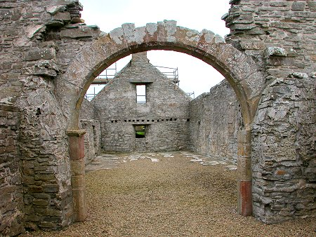
Pierowall Kirk, located on the island of Westray in Orkney, is an important part of the island's medieval religious landscape. The surviving church remains provide evidence for the spread and development of Christianity in an island society that had previously been deeply influenced by Norse culture and religion.

The ruins are particularly valuable because they represent the transformation of Westray from a Viking-age community into a Christian medieval society.

Christianity Comes to Orkney

Christianity gradually became established in Orkney during the Viking Age and early medieval period.

The transition was not instantaneous.

For generations, Christian beliefs existed alongside older Norse religious traditions.

Eventually, Christianity became the dominant religious system.

The Church as a Community Center

A medieval church was more than a building for worship.

It could serve as a center for:

  • baptism;

  • marriage;

  • burial;

  • prayer;

  • festivals;

  • and community gatherings.

The church therefore played an important role in organizing social life.

Stone Construction

Medieval churches in Orkney were commonly constructed from locally available stone.

Stone was an ideal material because it was:

  • durable;

  • abundant;

  • resistant to weather;

  • and capable of supporting substantial walls.

The Norse-Christian Transition

Westray had been part of the Norse world for centuries.

The adoption of Christianity transformed burial traditions and religious practices.

Earlier pagan burials could include weapons and other objects.

Christian cemeteries generally emphasized burial within consecrated ground.

The Medieval Parish

As Christianity became institutionalized, churches became associated with organized parishes.

A parish could include:

  • farms;

  • villages;

  • crofts;

  • and surrounding communities.

The church therefore served a broad geographic population.

Burial

Churchyards were important places of burial.

Being buried in or near a church could communicate membership in the Christian community.

Graves also created physical connections between generations.

Architecture

The surviving remains can reveal:

  • wall construction;

  • doorway arrangements;

  • floor levels;

  • and later modifications.

Architectural changes may indicate rebuilding or changing religious needs.

Westray's Medieval Landscape

Pierowall was not isolated.

The island contained:

  • farms;

  • harbors;

  • cemeteries;

  • churches;

  • and earlier archaeological sites.

The church formed one component of this broader settlement system.

Archaeological Importance

Medieval churches can preserve evidence for social changes that written records may not fully document.

Archaeologists can study:

  • building materials;

  • graves;

  • ceramics;

  • metal objects;

  • and architectural phases.

Why Pierowall Kirk Matters

The church represents the long-term transformation of Westray.

The island moved from a society strongly influenced by Norse pagan traditions toward a Christian medieval political and social system.

Conclusion

Pierowall Kirk's ruins preserve evidence of an important stage in Westray's history.

The church became part of a Christian landscape in which worship, burial, community identity, and local administration were closely connected.

Its remains demonstrate how religious transformation could reshape the physical landscape as well as the beliefs of the people who lived there.

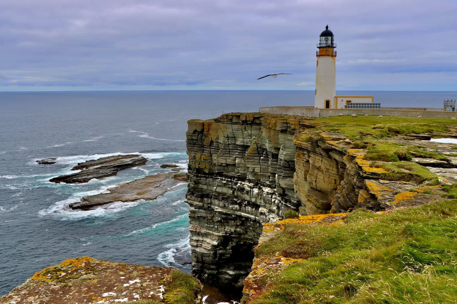
Noup Head: Westray's Iron Age Fort

August 31, 2026

Noup Head, on the western coast of Westray, forms part of a dramatic archaeological landscape where prehistoric settlement and defensive structures are associated with the island's rugged coastal cliffs.

Iron Age forts in northern Scotland demonstrate how communities used naturally defensible landscapes to protect settlements and control access to strategic locations.

The Iron Age in Orkney

The Iron Age followed the Bronze Age and was characterized by increasing use of iron technology.

Communities developed:

  • iron tools;

  • weapons;

  • fortified settlements;

  • farming systems;

  • and increasingly complex social structures.

Coastal Fortifications

Coastal cliffs provided natural defenses.

A settlement positioned near a cliff could be protected on one or more sides by steep drops.

Additional walls or banks could strengthen the defensive position.

Why Build a Fort?

A fort could serve several purposes.

It might provide:

  • protection;

  • a settlement;

  • a place of refuge;

  • control over territory;

  • or a symbol of social authority.

Not every fort was necessarily occupied during warfare.

The Importance of Location

Noup Head overlooks the surrounding sea and coastline.

From elevated positions, inhabitants could observe:

  • approaching boats;

  • movement along the coast;

  • and surrounding territory.

Iron Age Agriculture

People living in fortified settlements remained dependent on agriculture.

They raised:

  • cattle;

  • sheep;

  • pigs;

  • and other animals.

They also cultivated cereals.

Ironworking

Iron tools were particularly useful for:

  • woodworking;

  • agriculture;

  • hunting;

  • and warfare.

Iron production required specialized knowledge of:

  • ore;

  • charcoal;

  • furnace construction;

  • and metalworking.

Social Organization

Building defensive walls required coordinated labor.

This may indicate the presence of organized communities capable of collective projects.

Coastal Resources

The inhabitants also had access to marine resources.

Fishing and shellfish collection supplemented farming.

Why Noup Head Matters

Coastal forts provide insight into Iron Age settlement strategies.

They show that communities were actively managing:

  • security;

  • territory;

  • resources;

  • and social organization.

Conclusion

Noup Head's Iron Age landscape demonstrates how prehistoric communities used Orkney's natural geography to their advantage.

The combination of cliffs, defensive structures, agriculture, and maritime resources created settlements capable of surviving in a challenging environment.

← Newer Posts Older Posts →
Featured
images (85).jpeg
September 14, 2026
Birka: Sweden's Viking Trading Island
September 14, 2026
Read more →
September 14, 2026
images (84).jpeg
September 14, 2026
Uppåkra: Sweden's Iron Age Power Center
September 14, 2026
Read more →
September 14, 2026
images (83).jpeg
September 14, 2026
Tissø: Denmark's Viking Age Lake Village
September 14, 2026
Read more →
September 14, 2026
images (82).jpeg
September 14, 2026
Lejre: Denmark's Royal Iron Age Hal
September 14, 2026
Read more →
September 14, 2026
images (81).jpeg
September 14, 2026
Gudme: Denmark's Iron Age Gold Hoard Site
September 14, 2026
Read more →
September 14, 2026
images (80).jpeg
September 14, 2026
Nonnebakken: Odense's Viking Fort Remains
September 14, 2026
Read more →
September 14, 2026
read more

Powered by The archaeologist