• MAIN PAGE
  • LATEST NEWS
    • Lost Cities
    • Archaeology's Greatest Finds
    • Underwater Discoveries
    • Greatest Inventions
    • Studies
    • Blog
  • PHILOSOPHY
  • HISTORY
  • RELIGIONS
    • Africa
    • Anatolia
    • Arabian Peninsula
    • Balkan Region
    • China - East Asia
    • Europe
    • Eurasian Steppe
    • Levant
    • Mesopotamia
    • Oceania - SE Asia
    • Pre-Columbian Civilizations of America
    • Iranian Plateau - Central Asia
    • Indus Valley - South Asia
    • Japan
    • The Archaeologist Editor Group
    • Scientific Studies
    • Aegean Prehistory
    • Historical Period
    • Byzantine Middle Ages
    • Predynastic Period
    • Dynastic Period
    • Greco-Roman Egypt
  • Rome
  • PALEONTOLOGY
  • About us
Menu

The Archaeologist

  • MAIN PAGE
  • LATEST NEWS
  • DISCOVERIES
    • Lost Cities
    • Archaeology's Greatest Finds
    • Underwater Discoveries
    • Greatest Inventions
    • Studies
    • Blog
  • PHILOSOPHY
  • HISTORY
  • RELIGIONS
  • World Civilizations
    • Africa
    • Anatolia
    • Arabian Peninsula
    • Balkan Region
    • China - East Asia
    • Europe
    • Eurasian Steppe
    • Levant
    • Mesopotamia
    • Oceania - SE Asia
    • Pre-Columbian Civilizations of America
    • Iranian Plateau - Central Asia
    • Indus Valley - South Asia
    • Japan
    • The Archaeologist Editor Group
    • Scientific Studies
  • GREECE
    • Aegean Prehistory
    • Historical Period
    • Byzantine Middle Ages
  • Egypt
    • Predynastic Period
    • Dynastic Period
    • Greco-Roman Egypt
  • Rome
  • PALEONTOLOGY
  • About us
No results found

Pollachlean: Argyll's Early Christian Site

September 9, 2026

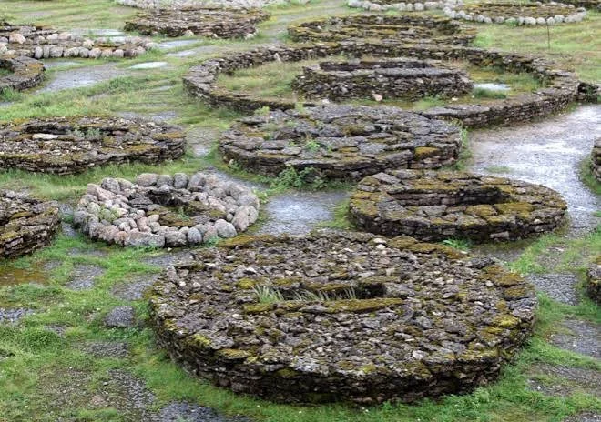
Pollachlean belongs to the broader archaeological record of early Christian activity in Argyll, a region that played an important role in the development of Christianity in western Scotland.

The early medieval period was a time of significant cultural transformation, during which Christianity became increasingly integrated into political, social, and artistic life.

Christianity in Western Scotland

Christianity reached western Scotland through several interconnected routes.

Irish missionary traditions were particularly important.

The foundation of Iona by St Columba in the sixth century became one of the best-known centers of Christianity in the region.

Local Christian Sites

Early Christian sites in Argyll often include relatively modest remains.

They may consist of:

  • chapels;

  • burial grounds;

  • crosses;

  • carved stones;

  • grave markers;

  • or small monastic settlements.

Such sites demonstrate that Christianity was not confined to major monasteries.

The Landscape of Worship

Early Christian communities often established religious places within existing landscapes.

Some sacred locations may have continued traditions associated with earlier communities.

This created complex layers of cultural memory.

Burial

Christian burial practices are particularly important archaeologically.

Graveyards can reveal:

  • population patterns;

  • social organization;

  • diet;

  • disease;

  • mobility;

  • and changing religious traditions.

Early Medieval Argyll

Argyll was closely connected to the kingdom of Dál Riata.

The region's maritime geography connected communities in western Scotland with Ireland and other parts of the Irish Sea world.

Christianity developed within this interconnected environment.

Material Culture

Early Christian archaeological sites may contain:

  • carved stones;

  • crosses;

  • metal objects;

  • pottery;

  • and ecclesiastical structures.

These objects provide evidence for artistic and religious exchange.

Conclusion

Pollachlean: Argyll's Early Christian Site forms part of the wider story of Christianity's development in western Scotland.

Its significance lies in demonstrating how religious traditions became embedded within local communities and landscapes during the formative centuries of medieval Scotland.
Kilchoan: Argyll's Medieval Chapel

September 9, 2026

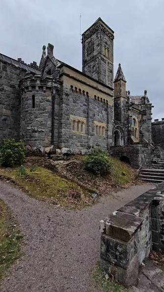
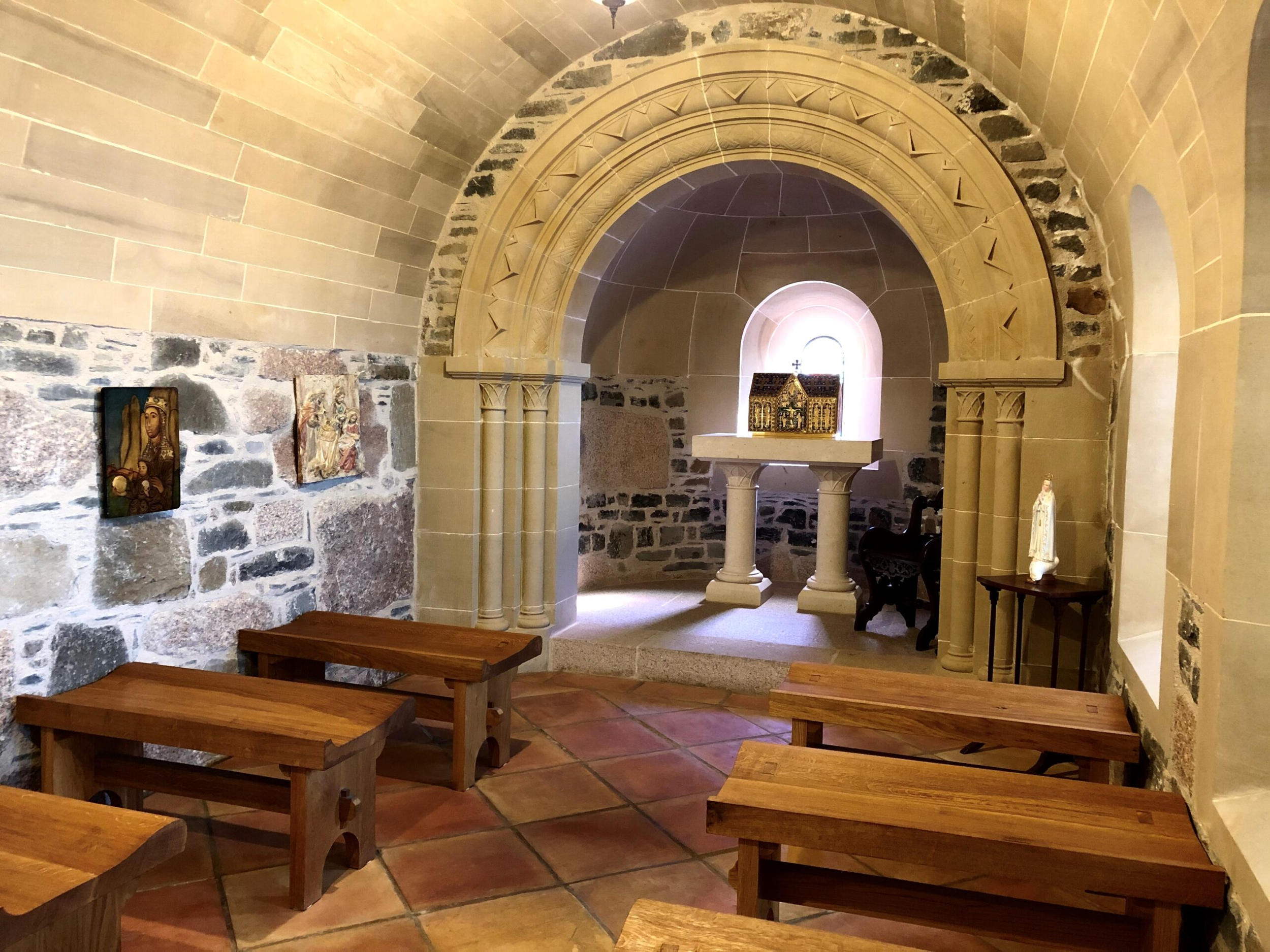
Kilchoan represents the type of small religious site that helps archaeologists reconstruct medieval life beyond Scotland's major monasteries and cathedrals.

Medieval chapels served communities that could be geographically isolated yet deeply connected to wider religious traditions.

Medieval Chapels in Scotland

A medieval chapel was generally smaller than a major parish church.

It could serve:

  • local communities;

  • estates;

  • pilgrimage routes;

  • burial grounds;

  • or remote settlements.

Religious Life in Argyll

Argyll's geography strongly influenced medieval religious organization.

The region contained:

  • islands;

  • sea lochs;

  • mountains;

  • peninsulas;

  • and scattered settlements.

Travel by sea could sometimes be easier than travel over land.

The Maritime Church

Religious communities in western Scotland were connected through maritime routes.

Monks, clergy, travelers, and pilgrims could move between islands and mainland communities by boat.

Architecture

Medieval chapels were often relatively simple structures.

Common architectural elements included:

  • stone walls;

  • narrow doorways;

  • small windows;

  • a simple rectangular plan;

  • and nearby burial grounds.

Even modest buildings could possess considerable spiritual importance.

Burial and Memory

Chapels were frequently associated with cemeteries.

Burial around a sacred building connected the living community with its ancestors.

Medieval Argyll and Clan Society

Religious sites could also become associated with local elites and clans.

Patronage of churches and chapels could reinforce political authority.

Archaeological Evidence

Even when only ruins survive, archaeologists can examine:

  • wall construction;

  • foundations;

  • graves;

  • carved stones;

  • pottery;

  • and landscape relationships.

These remains help reconstruct the site's history.

Conclusion

Kilchoan: Argyll's Medieval Chapel illustrates the importance of small religious buildings in medieval Scotland.
Such chapels remind us that medieval Christianity was experienced not only in famous monasteries but also in remote communities where worship, burial, identity, and local social life were closely intertwined.

Castle Tioram: Lochaber’s Jacobite Stronghold

September 9, 2026

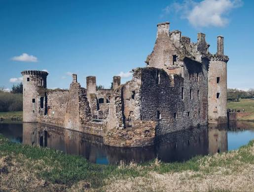
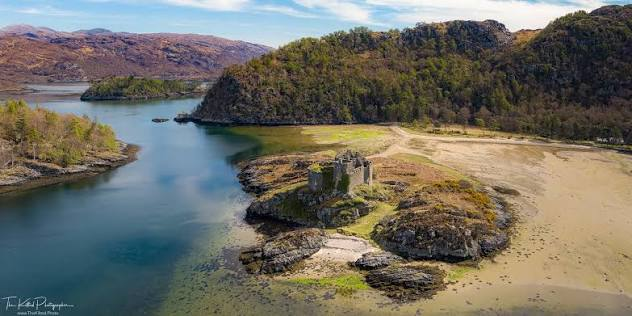
Castle Tioram is one of the most dramatic medieval fortifications in the western Highlands.

Situated on a tidal island at the entrance to Loch Moidart, the castle was associated with the Clan MacDonald of Clanranald and became closely connected with the political struggles of the seventeenth and eighteenth centuries.

Its ruined walls preserve evidence of a turbulent period in Highland history.

The Island Fortress

Castle Tioram occupies a naturally defensive location.

The surrounding waters provided protection from land-based attack, while the castle's position allowed its occupants to control access through the surrounding sea routes.

Clanranald

The castle became an important stronghold of the MacDonalds of Clanranald.

Clanranald was one of the major branches of the powerful MacDonald political network in the western Highlands and Islands.

The Lordship of the Isles

The castle's historical setting cannot be separated from the wider history of the Lordship of the Isles.

The MacDonalds controlled extensive territories across the western seaboard.

Their power depended heavily on:

  • land;

  • maritime transport;

  • alliances;

  • kinship;

  • and armed retainers.

The Jacobite Era

Castle Tioram became particularly associated with the Jacobite cause.

During the early eighteenth century, political divisions between supporters of the Stuart monarchy and the Hanoverian government deeply affected Highland society.

The castle was destroyed or deliberately rendered unusable during the 1715 Jacobite Rising. The destruction reflects the government's concern about fortified Highland strongholds.

The 1745 Rising

The Jacobite Rising of 1745 further transformed the region.

Prince Charles Edward Stuart's campaign attracted support from numerous Highland clans.

The failure of the rising eventually resulted in severe political consequences for Jacobite families.

Architecture

Castle Tioram consists primarily of a substantial stone enclosure and tower structures.

Its walls adapted to the island's natural shape.

The defensive position was particularly advantageous because attackers approaching by land had limited options.

A Maritime Stronghold

Unlike many mainland castles, Castle Tioram's environment was fundamentally maritime.

Boats could transport:

  • people;

  • food;

  • weapons;

  • messages;

  • and supplies.

The sea was therefore both a defensive barrier and a transportation network.

Archaeological Importance

The ruined castle preserves evidence of centuries of occupation and adaptation.

Its significance lies not only in its architecture but in its association with clan politics and the changing relationship between Highland communities and the Scottish state.

Conclusion

Castle Tioram: Lochaber’s Jacobite Stronghold is a powerful symbol of Highland political history.

Its island location, medieval architecture, MacDonald connections, and association with the Jacobite era demonstrate how castles functioned as both military structures and expressions of political authority.

Eilean Donan: Skye’s Iconic Island Castle Ruins

September 9, 2026

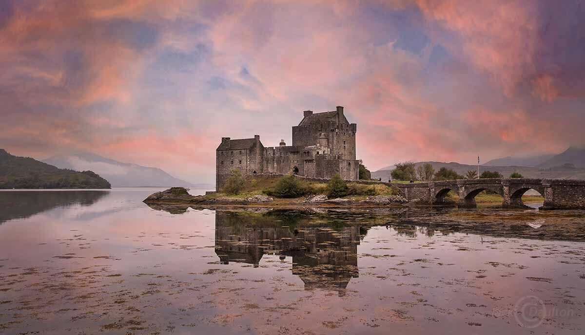
Eilean Donan is among Scotland's most recognizable castles.

Although often associated with the landscapes of Skye and the western Highlands, the castle itself stands near Dornie on the mainland, at the meeting point of three sea lochs. Its position illustrates the extraordinary strategic importance of maritime geography in the Highlands.

The castle's modern appearance is the result of extensive twentieth-century reconstruction, but its history stretches back many centuries.

The Island of Donan

The name Eilean Donan means “Island of Donan.”

The site is traditionally associated with Saint Donnan, an early Christian figure.

According to the castle's historical tradition, the island may have hosted a religious community before the construction of the medieval fortress.

Medieval Fortification

The first fortified castle was constructed during the medieval period, probably in the thirteenth century.

Its purpose was connected with the defense of the surrounding territory of Kintail and the western seaboard.

The island's location was exceptionally advantageous.

The Sea as a Highway

In medieval western Scotland, the sea was not simply an obstacle.

It was a major transportation network.

Ships and galleys could move people and supplies between coastal settlements.

Eilean Donan therefore occupied an ideal location for controlling movement through the sea lochs.

The Mackenzies and MacRaes

Over the centuries, the castle became strongly associated with the Mackenzies of Kintail and the MacRae clan.

The MacRaes later became closely associated with the castle's defense and administration.

Changing Fortifications

The castle was repeatedly modified.

At different times it included:

  • curtain walls;

  • towers;

  • a keep;

  • defensive platforms;

  • and artillery positions.

The development of firearms eventually changed the castle's military architecture.

The Jacobite Rising of 1719

Eilean Donan played a major role during the Jacobite rising of 1719.

Spanish troops supporting the Jacobites occupied the castle.

Government naval forces attacked it.

The castle was bombarded for several days before government troops captured it.

A large store of gunpowder was discovered and subsequently used to destroy much of the remaining structure.

Two Centuries of Ruin

After 1719, Eilean Donan remained largely abandoned.

Its ruined walls became part of the landscape.

For nearly two centuries, the castle existed primarily as a romantic ruin.

Reconstruction

In 1911, Lieutenant Colonel John MacRae-Gilstrap purchased the island.

A major restoration project began.

Over approximately two decades, the castle was reconstructed according to surviving evidence and historical plans.

The restored castle reopened in 1932.

Historical Interpretation

Modern Eilean Donan is therefore a combination of:

  • medieval remains;

  • eighteenth-century destruction;

  • twentieth-century reconstruction;

  • and modern heritage interpretation.

Understanding this distinction is essential when studying the site academically.

Conclusion

Eilean Donan: Skye’s Iconic Island Castle Ruins is a title that captures the castle's association with the wider Skye and western Highland landscape, although geographically the castle stands on the mainland near Dornie.

Its history demonstrates the importance of maritime defense, clan politics, Jacobite warfare, and heritage restoration.

The castle's present appearance is not simply a medieval survival—it is also the product of a remarkable twentieth-century reconstruction project.

Dunvegan Castle: Skye's Clan MacLeod Seat

September 9, 2026

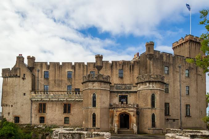
Dunvegan Castle stands on the Isle of Skye and has served as the ancestral seat of the chiefs of Clan MacLeod for approximately eight centuries.

It is one of the most important surviving Highland castles and is particularly valuable because its architecture preserves evidence of repeated construction and modification from the medieval period through the nineteenth century.

A Castle of Eight Centuries

Dunvegan's history extends back to the medieval period.

The castle was continuously associated with the MacLeod chiefs.

The present structure is not a single building from one period. Instead, it consists of multiple phases of construction.

The castle authority identifies at least ten major building periods ranging from the 1200s to the 1850s.

The MacLeods

Clan MacLeod became one of the major Highland and Hebridean clans.

Their authority depended upon:

  • land ownership;

  • kinship;

  • military power;

  • maritime connections;

  • and relationships with the Scottish Crown.

Dunvegan served as the physical center of this authority.

A Natural Fortress

The castle occupies a dramatic rocky position overlooking Loch Dunvegan.

The landscape provided natural defensive advantages.

The castle's location also allowed the MacLeods to maintain access to maritime routes.

Architecture Through Time

Dunvegan's present appearance reflects centuries of rebuilding.

Medieval defensive structures were gradually supplemented by more comfortable residential spaces.

By the eighteenth and nineteenth centuries, elite expectations had changed.

Castles increasingly needed to function as residences as well as fortifications.

Victorian Transformation

During the nineteenth century, significant remodeling gave Dunvegan its distinctive romantic appearance.

Defensive-looking architectural features were incorporated into the later design.

This demonstrates how nineteenth-century Highland architecture often deliberately emphasized medieval imagery.

The Fairy Flag

One of the castle's most famous treasures is the Fairy Flag.

According to MacLeod tradition, the flag possesses supernatural properties and could provide protection to the clan under particular circumstances.

Whether understood as folklore, cultural heritage, or historical tradition, the Fairy Flag illustrates the role of legendary objects in maintaining clan identity.

The Castle Collection

Dunvegan preserves numerous historical objects.

The collections include:

  • portraits;

  • weapons;

  • ceremonial objects;

  • documents;

  • clan heirlooms;

  • and objects associated with Highland history.

Famous Visitors

Dunvegan has attracted numerous visitors over the centuries.

Among those associated with the castle are literary and political figures who traveled through the Highlands.

The Gardens

The castle's gardens reflect later transformations in elite Highland estates.

Formal gardens, woodland planting, and landscaped grounds became important aspects of aristocratic identity.

Conclusion

Dunvegan Castle: Skye's Clan MacLeod Seat is more than a medieval fortress.

It is a living record of approximately eight centuries of MacLeod history.

Its architecture demonstrates changing military, residential, and aesthetic priorities, while its collections and legends preserve the cultural memory of one of Scotland's most famous Highland clans.

Dun Sgurr: Sleat's Iron Age Dun

September 9, 2026

Dun Sgurr represents the tradition of fortified prehistoric settlements found throughout the Scottish Highlands and Islands.

The term dun generally refers to a fortified site or hillfort, although individual examples vary greatly in form, date, and function.

In Sleat, such monuments demonstrate how communities used naturally defensible landscapes to establish settlements and protected places.

The Iron Age Landscape

The Iron Age in Scotland was characterized by a wide variety of settlements.

These included:

  • hillforts;

  • brochs;

  • duns;

  • enclosed settlements;

  • and undefended farmsteads.

Not every fortified site functioned as a permanent military fortress.

Natural Defense

Duns were often constructed on elevated or naturally protected locations.

Steep slopes could reduce the amount of artificial walling required.

Stone Construction

Many Highland and Island forts used locally available stone.

Dry-stone construction allowed builders to create substantial defensive walls without mortar.

Settlement and Defense

Archaeologists increasingly recognize that fortified settlements could have served social as well as military purposes.

A defended settlement could communicate:

  • wealth;

  • authority;

  • status;

  • security;

  • and community identity.

The Importance of Landscape

The location of a dun could allow its inhabitants to observe surrounding territory.

Visibility was particularly important in landscapes where communities were dispersed.

Iron Age Society

The existence of multiple fortified sites across Scotland suggests that Iron Age society was organized into local communities with varying degrees of social hierarchy.

The monuments may have served elite households or broader communities.

Conclusion

Dun Sgurr: Sleat's Iron Age Dun provides an opportunity to examine the defensive architecture and social organization of Iron Age Skye.

Although the precise function of individual duns remains difficult to determine, such monuments demonstrate that prehistoric communities deliberately shaped the landscape to create places of protection.

Armadale Castle: Sleat's Highland History Museum Site

September 9, 2026

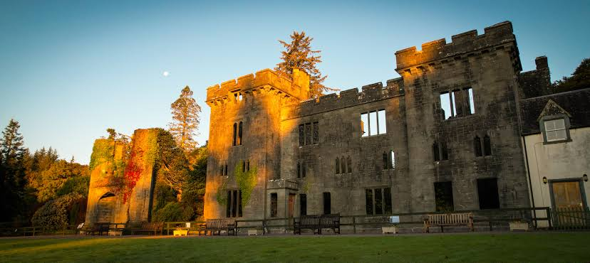
Armadale Castle occupies a dramatic position on the Isle of Skye overlooking the Sound of Sleat.

The ruined castle and surrounding estate are strongly associated with Clan Donald, one of the most powerful political families in Highland and Hebridean history.

Today, the site combines historic ruins, gardens, and the Museum of the Isles, creating a major center for understanding the history of the Highlands and Islands.

Clan Donald in Sleat

Clan Donald established itself on Skye during the fifteenth century.

The MacDonalds of Sleat became an important branch of the wider Clan Donald network.

Their history was closely connected to the former Lordship of the Isles.

The Earlier Estate

The Armadale estate existed before the present castle.

Clan Donald's earlier residence was destroyed in 1690 in the aftermath of Jacobite-related political conflict.

By the eighteenth century, the family had increasingly established Armadale as a principal residence.

The Mansion of the Eighteenth Century

Around 1790, a new mansion house was constructed.

This building formed the basis of the later castle complex.

The Nineteenth-Century Castle

In 1815, architect James Gillespie Graham was commissioned to transform and extend the mansion into Armadale Castle.

The resulting building reflected the romantic architectural tastes of the period.

The Fire of 1855

A major fire destroyed the central portion of the castle in 1855.

Architect David Bryce was subsequently involved in designing replacement work.

Decline and Ruin

By the twentieth century, the family no longer required the large residence as a principal home.

The castle was increasingly affected by deterioration.

In 1925 the Macdonald family moved to a smaller house.

Eventually, the ruined western section became unsafe and was demolished in 1981 while preserving significant architectural remnants.

Museum of the Isles

Today, the Museum of the Isles preserves and interprets the history of Clan Donald and the wider Highlands and Islands.

Its collections cover approximately 1,500 years of regional history.

Exhibits include:

  • weapons;

  • portraits;

  • manuscripts;

  • archaeological objects;

  • clan memorabilia;

  • and materials concerning the Jacobites and Highland Clearances.

Flora Macdonald

Armadale is also associated with Flora Macdonald, the Jacobite heroine who helped Bonnie Prince Charlie evade capture after the defeat of the Jacobites.

She was married at Armadale in 1750.

Gardens and Landscape

The estate contains extensive woodland and formal gardens.

The landscaped environment reflects changing attitudes toward aristocratic estate design.

Conclusion

Armadale Castle: Sleat's Highland History Museum Site demonstrates how a ruined aristocratic residence can become an important center for historical interpretation.

The site connects Clan Donald's medieval origins, Jacobite politics, nineteenth-century architecture, and modern heritage.

Knock Roman Fort: Skye’s Antonine Wall Outpost

September 9, 2026

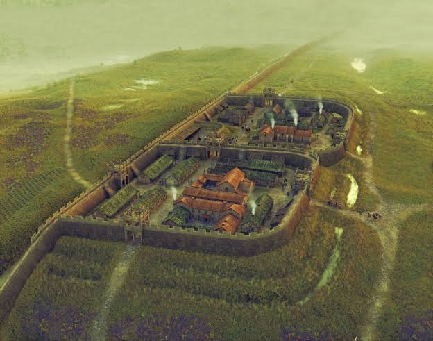
The title “Knock Roman Fort: Skye’s Antonine Wall Outpost” requires an important historical qualification.

The Antonine Wall was located across central Scotland, running roughly between the Firth of Forth and the Firth of Clyde. It did not extend to the Isle of Skye.

Consequently, Knock should not be described literally as an outpost of the Antonine Wall without strong archaeological evidence establishing such a connection.

Rome and Northern Scotland

Roman armies entered Scotland repeatedly during the first and second centuries CE.

Their campaigns sought to establish control over northern Britain, but Roman occupation was uneven and frequently temporary.

The Antonine Wall

The Antonine Wall was constructed during the reign of Emperor Antoninus Pius, beginning around AD 142.

It consisted of:

  • a turf rampart;

  • a substantial ditch;

  • forts;

  • fortlets;

  • roads;

  • and associated military infrastructure.

The wall represented an attempt to establish a northern frontier across central Scotland.

Roman Activity Beyond the Frontier

Roman military activity was not restricted to the wall itself.

Roman armies campaigned farther north.

Temporary marching camps, roads, forts, and other military installations demonstrate that Roman forces could operate beyond the frontier.

Skye and the Roman World

Skye was geographically distant from the Antonine Wall.

Nevertheless, the island existed within a broader environment affected by Roman expansion.

Roman coins and imported objects found in northern Scotland provide evidence for contact between local communities and the Roman world.

Archaeological Caution

It is important to distinguish:

Roman presence in Scotland

from

permanent Roman occupation of Skye.

The Roman military system did not establish Skye as an integrated province in the way it occupied southern Britain.

What a Roman Site Would Mean

If a securely identified Roman military installation were established on Skye, it would be extremely significant.

It could provide evidence for:

  • reconnaissance;

  • military movement;

  • diplomacy;

  • trade;

  • intelligence gathering;

  • or temporary occupation.

Conclusion

Knock Roman Fort: Skye’s Antonine Wall Outpost should therefore be approached cautiously.

The Antonine Wall itself did not extend to Skye, and the phrase “Antonine Wall outpost” can create a misleading geographical impression.

The broader subject remains fascinating because Roman military activity reached far into northern Britain, while communities on islands such as Skye interacted with the changing political and economic environment created by Rome.

Dun Beag: Skye's Broch Tower

September 9, 2026

Dun Beag is one of the best-preserved broch towers on the Isle of Skye and provides an excellent example of Scotland's distinctive Iron Age monumental architecture.

Brochs are circular dry-stone towers found exclusively in Scotland, particularly in northern and western regions.

Dun Beag demonstrates that these structures were not simply defensive buildings. Their architecture also communicated status, wealth, engineering ability, and social organization.

What Is a Broch?

A broch is a circular stone tower constructed with two concentric walls.

The space between the walls often contains:

  • stairs;

  • chambers;

  • passageways;

  • and structural features.

The central interior was generally open to the sky or contained timber structures supporting upper levels.

Construction

Dun Beag has thick stone walls.

Its entrance is reached through a narrow passage.

Door-checks indicate that the entrance could be secured with a wooden door.

The architecture demonstrates careful planning and sophisticated dry-stone construction.

Defensive Features

Dun Beag occupies a rocky hilltop overlooking Loch Bracadale.

Its position provides excellent visibility across the surrounding landscape.

The narrow entrance and substantial walls offered defensive advantages.

However, archaeologists increasingly caution against interpreting every broch primarily as a military fortress.

Symbols of Status

The enormous effort required to build a broch suggests that social status was an important component of its design.

A broch could serve as a residence for an elite household.

Its monumental architecture would have communicated power to people living in the surrounding territory.

Internal Chambers

Dun Beag contains small chambers within the thickness of its walls.

One ground-level chamber may have functioned as a guardroom or storage space.

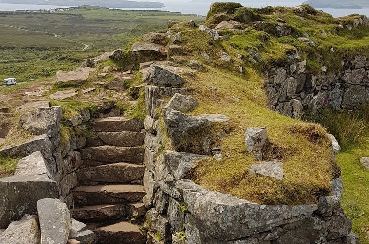
A surviving stone staircase provides access within the wall structure.

Approximately twenty steps survive from one section of the staircase.

Height

The original height of Dun Beag is unknown.

Comparisons with better-preserved brochs suggest that it may once have reached approximately ten meters.

The surviving structure is considerably lower.

Long-Term Occupation

Evidence suggests that Dun Beag may have remained significant after its original Iron Age construction.

Medieval and later coins were reportedly recovered during excavations in the early twentieth century.

These finds do not necessarily prove continuous occupation, but they indicate that people returned to the site at later periods.

Brochs and Iron Age Society

More than 500 broch sites are known in Scotland.

Their distribution is particularly dense in:

  • Orkney;

  • Shetland;

  • Caithness;

  • Sutherland;

  • the Hebrides;

  • and western Scotland.

Their construction reflects distinctive regional traditions in prehistoric architecture.

Why Were Brochs Built?

Several explanations have been proposed.

They may have served as:

  • elite residences;

  • defensive settlements;

  • community gathering places;

  • symbols of authority;

  • storage centers;

  • or combinations of these functions.

The answer may have differed from one broch to another.

Conclusion

Dun Beag: Skye's Broch Tower provides an exceptional example of Iron Age Scottish architecture.

Its thick dry-stone walls, internal chambers, staircase, narrow entrance, and commanding position reveal sophisticated construction.

More importantly, Dun Beag demonstrates that prehistoric monumental buildings could communicate both security and social prestige.

Rather than viewing the broch simply as a fortress, it is better understood as a complex social building whose architecture reflected the organization and ambitions of Iron Age communities.

Dun Telve: Glenelg's Double-Walled Broch

September 9, 2026

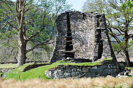
Dun Telve is one of the most impressive surviving brochs in mainland Scotland. Located near Glenelg in the western Highlands, the monument represents the remarkable architectural tradition of Iron Age Scotland, when communities constructed enormous circular dry-stone towers without mortar.

Together with nearby Dun Troddan, Dun Telve forms one of the most important concentrations of broch architecture on the Scottish mainland.

A Monument of Iron Age Scotland

Dun Telve is generally dated to the Iron Age, although the exact chronology of broch construction remains debated.

The broch is built from massive stone blocks arranged into two concentric walls.

This double-wall construction is one of the defining characteristics of Scottish brochs.

The builders created a hollow wall containing internal spaces, stairways, and chambers.

The Double-Walled Structure

The phrase “double-walled” describes the architectural arrangement of the broch.

The outer wall and inner wall were connected by carefully constructed stonework.

This created a thick structural shell capable of supporting substantial height.

The wall also incorporated internal features that could be used for:

  • movement;

  • storage;

  • protection;

  • and possibly accommodation.

Engineering Without Mortar

Dun Telve demonstrates the sophistication of prehistoric dry-stone construction.

Instead of cement or mortar, builders relied on:

  • carefully selected stones;

  • weight;

  • friction;

  • interlocking blocks;

  • and precise placement.

Large stones at the base created a stable foundation.

Smaller stones could then be used to fill gaps and strengthen the wall.

Why Build Such a Tower?

The exact purpose of brochs remains one of the major questions in Scottish archaeology.

Earlier interpretations frequently described them as defensive towers.

Modern archaeological scholarship generally favors a more complex understanding.

Brochs may have served simultaneously as:

  • elite residences;

  • defensive structures;

  • symbols of authority;

  • community gathering places;

  • storage facilities;

  • and centers of local political power.

The Landscape of Glenelg

Dun Telve occupies a commanding position within Glenelg.

The surrounding landscape contains mountains, valleys, and coastal routes.

Its location would have provided excellent visibility.

This would have been valuable for observing movement through the surrounding territory.

Dun Telve and Dun Troddan

The proximity of Dun Troddan is especially significant.

The two brochs are only a short distance apart.

Their coexistence raises interesting questions about Iron Age society.

They may have belonged to related communities, competing groups, or different social units operating within the same territory.

Later History

Like many prehistoric monuments, Dun Telve remained visible long after its original occupation.

Later communities could reuse or reinterpret ancient structures.

The survival of the tower is therefore important not only for Iron Age archaeology but also for understanding the changing relationship between Highland communities and their prehistoric past.

Archaeological Significance

Dun Telve provides evidence for:

  • prehistoric engineering;

  • dry-stone architecture;

  • social hierarchy;

  • settlement organization;

  • and Iron Age landscape use.

Its substantial survival makes it particularly valuable for reconstructing how brochs were built.

Conclusion

Dun Telve: Glenelg's Double-Walled Broch is a remarkable example of prehistoric Scottish engineering.

Its massive circular walls and internal construction demonstrate that Iron Age communities possessed considerable architectural knowledge.

Although the precise function of Dun Telve remains uncertain, the monument clearly represented an important investment in both construction and social identity.

Dun Troddan: Glenelg's Twin Broch

September 9, 2026

Dun Troddan is one of Scotland's most remarkable surviving Iron Age brochs.

Located near Glenelg and close to Dun Telve, the structure forms part of a distinctive prehistoric landscape where two monumental circular towers were constructed within the same general area.

The survival of Dun Troddan provides archaeologists with valuable evidence for prehistoric architecture, construction techniques, and social organization.

A Twin to Dun Telve

Dun Troddan is often described alongside Dun Telve because of their geographical proximity and similar architectural traditions.

Both demonstrate the characteristic double-wall construction associated with brochs.

Their closeness has made Glenelg an important destination for studying Scottish Iron Age architecture.

Circular Architecture

The central feature of Dun Troddan is its circular plan.

The builders constructed:

  • an outer wall;

  • an inner wall;

  • internal galleries;

  • stairways;

  • and chambers.

This created a highly specialized architectural form.

The Entrance

The entrance was deliberately narrow and controlled.

Broch entrances commonly contained architectural features that allowed occupants to regulate access.

These could include:

  • doorways;

  • guard chambers;

  • door-checks;

  • and stone-built passageways.

Such features demonstrate that movement through the building was carefully controlled.

The Internal Staircase

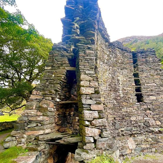
One of the most impressive features of Dun Troddan is its surviving internal staircase.

The staircase was incorporated into the thickness of the wall.

This is a characteristic feature of many brochs.

It demonstrates that the wall itself functioned as usable architectural space.

A Tall Tower

Dun Troddan is unusually well preserved.

Its surviving walls allow archaeologists to visualize how a complete broch may have appeared.

The original upper levels are not completely preserved, so the precise height remains uncertain.

However, comparisons with other brochs suggest that some structures could have risen many meters above ground level.

Defense or Residence?

The traditional interpretation of brochs emphasized defense.

Their thick walls and restricted entrances certainly provided defensive advantages.

However, a purely military interpretation does not explain all broch features.

The internal spaces may have supported residential activity and social gatherings.

The broch could therefore have functioned as a fortified residence belonging to an influential household.

Social Power

Building Dun Troddan would have required substantial resources.

Large quantities of stone had to be:

  1. quarried or collected;

  2. transported;

  3. shaped;

  4. positioned;

  5. and carefully stacked.

The ability to coordinate this work indicates a degree of social organization.

The Two Brochs of Glenelg

The existence of Dun Troddan and Dun Telve together makes Glenelg particularly valuable.

The monuments demonstrate that broch construction was not an isolated phenomenon.

Rather, it formed part of a regional tradition.

Conclusion

Dun Troddan: Glenelg's Twin Broch represents one of Scotland's finest surviving examples of Iron Age dry-stone architecture.

Its internal staircase, massive walls, and carefully controlled entrance provide insight into both engineering and social organization.

Together with Dun Telve, it makes Glenelg an exceptional archaeological landscape for studying Scotland's prehistoric monumental.

Dun Grugaig: Glenelg's Wheelhouse Broch

September 9, 2026

Dun Grugaig is associated with the distinctive Iron Age architecture of western Scotland and is particularly interesting because of its relationship to the wheelhouse tradition.

Wheelhouses are circular stone structures in which internal radial walls or piers create a plan resembling the spokes of a wheel.

They are particularly characteristic of the Iron Age Atlantic zone.

The Wheelhouse Tradition

Wheelhouses are concentrated especially in:

  • the Western Isles;

  • parts of Skye;

  • the northern Highlands;

  • and other areas of Atlantic Scotland.

Their construction reflects regional architectural traditions.

Circular Design

The basic principle of a wheelhouse is straightforward but ingenious.

A circular outer wall surrounds a central area.

Inside, stone piers project inward.

These create compartments or bays around the central space.

The arrangement resembles the spokes of a wheel.

Engineering Advantages

The internal piers may have helped support a roof.

Stone architecture presents a major challenge because large spans are difficult to cover without timber.

By using internal supports, builders could create more manageable structural spans.

Social Function

Wheelhouses were not necessarily purely defensive.

Archaeological evidence from comparable sites suggests that some were occupied as residences.

Activities could include:

  • cooking;

  • craft production;

  • storage;

  • animal management;

  • and domestic life.

Brochs and Wheelhouses

The relationship between brochs and wheelhouses is complex.

Both belong to the broader Iron Age architectural tradition of Atlantic Scotland, but they are not identical structures.

Some sites combine characteristics of both forms.

This demonstrates that prehistoric architecture was flexible.

Builders could adapt established designs to local needs.

The Highland Environment

Glenelg's mountainous and coastal environment provided access to:

  • stone;

  • marine resources;

  • grazing land;

  • woodland resources;

  • and maritime routes.

The location of prehistoric settlements must therefore be understood in relation to the surrounding landscape.

The Importance of Architecture

Architecture provides information about prehistoric society even when written records are absent.

The size and complexity of a structure can reveal:

  • labor organization;

  • technical knowledge;

  • social hierarchy;

  • and settlement patterns.

Archaeological Caution

The exact chronology and function of individual structures in the Glenelg region can be difficult to reconstruct because many sites have been disturbed by later activity.

Therefore, interpretations should distinguish established architectural features from hypotheses about their use.

Conclusion

Dun Grugaig: Glenelg's Wheelhouse Broch represents the remarkable architectural diversity of Iron Age western Scotland.

Its wheelhouse tradition illustrates how prehistoric builders combined circular planning, dry-stone engineering, and internal supports to create sophisticated buildings.

The site contributes to a broader understanding of how Iron Age communities adapted architecture to local environmental and social conditions.

Smoo Cave: Sutherland's Viking Age Use

September 9, 2026

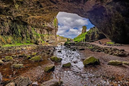
Smoo Cave is one of the most spectacular natural caves in northern Scotland.

Located near Durness on the coast of Sutherland, the cave combines dramatic geology with evidence for human activity spanning multiple periods.

Its location near the sea made it particularly well positioned within the maritime world of northern Scotland, including the period of Norse influence.

A Natural Monument

Smoo Cave was formed through geological processes involving both marine erosion and freshwater activity.

The cave contains a large entrance chamber and additional passages.

A waterfall enters one section of the cave, creating an unusually dramatic subterranean environment.

Human Activity

Archaeological evidence demonstrates that people used Smoo Cave during prehistoric and later periods.

The cave's sheltered interior would have provided protection from:

  • wind;

  • rain;

  • and harsh coastal weather.

The Norse World

From the Viking Age onward, Norse settlement and political influence became increasingly important in northern Scotland.

Norse communities established themselves throughout:

  • Orkney;

  • Shetland;

  • Caithness;

  • the Hebrides;

  • and parts of the northern mainland.

Cave Use and the Vikings

The title's reference to “Viking Age use” should be understood cautiously.

Evidence for human activity during the Norse period does not necessarily mean that Vikings permanently lived inside the cave.

Caves could have served temporary or specialized purposes.

Possible activities could include:

  • shelter;

  • storage;

  • ritual activity;

  • travel;

  • or temporary occupation.

Maritime Geography

The location of Smoo Cave near the northern coast is important.

The sea connected northern Scotland with:

  • Orkney;

  • Shetland;

  • Norway;

  • the Hebrides;

  • and Ireland.

The Norse world was therefore fundamentally maritime.

Archaeological Importance

Caves are valuable archaeological environments because certain deposits can remain protected from weathering.

Organic materials can sometimes survive better underground than in exposed settlements.

Archaeologists can therefore use cave deposits to reconstruct past human activity.

Folklore

Smoo Cave has also accumulated legends and stories.

As with many dramatic natural locations, later communities associated the cave with supernatural activity.

Such traditions should be distinguished from archaeological evidence but remain culturally significant.

Conclusion

Smoo Cave: Sutherland's Viking Age Use illustrates the intersection of geology, archaeology, and Norse history.

The cave should not necessarily be imagined as a permanent Viking settlement.

Rather, evidence for human activity must be interpreted within the broader maritime environment of medieval northern Scotland.

Strathnaver Clearances Sites: Sutherland's Deserted Villages

September 9, 2026

The Strathnaver Clearances Sites preserve some of the most important archaeological evidence for the social consequences of the Highland Clearances.

Across northern Sutherland, former settlements were abandoned as traditional communities were displaced during a period of profound economic and social transformation.

What Were the Highland Clearances?

The Highland Clearances were a series of processes, particularly prominent from the late eighteenth into the nineteenth centuries, in which Highland tenants were removed from traditional agricultural settlements.

Landowners increasingly sought to reorganize estates.

Large areas were converted to sheep farming.

Strathnaver

Strathnaver lies in northern Sutherland.

Before the Clearances, the valley contained numerous settlements where families practiced forms of mixed agriculture and pastoralism.

People cultivated crops while raising livestock.

Clearance and Displacement

Clearance operations resulted in the abandonment of many settlements.

Families were:

  • relocated;

  • forced toward coastal areas;

  • encouraged to emigrate;

  • or otherwise displaced from their traditional homes.

Archaeological Evidence

Today, abandoned settlement remains may include:

  • stone walls;

  • house foundations;

  • field boundaries;

  • enclosures;

  • clearance cairns;

  • and roads.

These apparently ordinary features provide direct evidence of former communities.

The Human Cost

The Clearances were not simply an agricultural modernization project.

For displaced families, removal could mean losing:

  • homes;

  • farmland;

  • community networks;

  • burial connections;

  • and ancestral landscapes.

Archaeology of Abandonment

Archaeologists can study deserted villages to reconstruct everyday life.

House dimensions reveal household organization.

Field systems reveal agricultural practices.

Animal remains can indicate diet and livestock management.

Artifacts can reveal household consumption.

Emigration

Many Highland families eventually emigrated.

Destinations included:

  • Canada;

  • the United States;

  • Australia;

  • New Zealand;

  • and other parts of the British Empire.

The Clearances therefore contributed to the transformation of Highland society both locally and globally.

Memory and Heritage

Clearance sites remain emotionally significant.

They represent not only archaeological remains but also the memories of communities whose descendants may live far beyond Sutherland.

Conclusion

Strathnaver Clearances Sites: Sutherland's Deserted Villages preserve the physical remains of communities transformed by the Highland Clearances.

Their ruined houses and fields demonstrate that historical change is not merely a political process.

It can reshape entire landscapes, families, economies, and patterns of settlement.

Badbea: Caithness's Clearance Village

September 9, 2026

Badbea is one of the most evocative surviving landscapes associated with the Highland Clearances.

Situated on a steep coastal slope in Caithness, the abandoned settlement preserves the remains of homes occupied by families who had been displaced from traditional Highland communities.

Its harsh environment became part of the story of survival, migration, and forced relocation.

The Settlement

Badbea was established in the late eighteenth century by people displaced during Highland estate clearances.

The settlement's inhabitants faced difficult environmental conditions.

The land was poor, exposed, and steep.

Life on the Edge

Residents had to adapt to the coastal environment.

Agriculture was difficult.

People relied on combinations of:

  • small-scale cultivation;

  • livestock;

  • fishing;

  • gathering;

  • and other forms of subsistence.

The Cliff

Badbea's dramatic location is one of its defining characteristics.

The settlement sits on a steep coastal landscape overlooking the sea.

Strong winds and difficult terrain made everyday life challenging.

Clearance Communities

Badbea illustrates an important aspect of the Clearances.

People were not always transported directly overseas.

Some displaced families were relocated within Scotland.

They often ended up on marginal lands where agricultural opportunities were limited.

Archaeological Remains

Today the settlement contains traces of:

  • houses;

  • walls;

  • fields;

  • enclosures;

  • and paths.

These remains allow visitors to reconstruct the physical structure of the community.

The Memorial

A memorial at Badbea commemorates the people who lived there and their descendants.

It connects archaeology with family history.

Emigration

Like many Highland communities, Badbea became part of a larger migration story.

Some residents eventually emigrated.

Their descendants can be found in communities around the world.

Historical Significance

Badbea is important because it makes the Clearances tangible.

Instead of encountering the Clearances only through written documents, visitors can see the actual landscape where displaced families attempted to rebuild their lives.

Conclusion

Badbea: Caithness's Clearance Village is a powerful archaeological and historical reminder of the Highland Clearances.

Its exposed landscape and ruined houses reveal the difficult conditions faced by families who lost access to their traditional homes.

The site stands as a memorial to resilience, displacement, and the global consequences of Highland migration.

Helmsdale: Sutherland's Emigration Memorial Site

September 9, 2026

Helmsdale occupies an important position in the history of Sutherland's nineteenth-century population movements.

The coastal settlement became associated with people displaced during the Highland Clearances and with the wider migration of Highland communities.

A Coastal Settlement

Helmsdale lies on the eastern coast of Sutherland.

Its position gave residents access to the North Sea and the fishing economy.

The coastal location became increasingly important as traditional Highland agricultural communities were transformed.

The Highland Clearances

During the Clearances, large numbers of people were removed from inland settlements.

Some were relocated to coastal communities.

These settlements were expected to support themselves through alternative economic activities.

Fishing and Coastal Life

Fishing became increasingly important.

Families could combine fishing with:

  • small-scale farming;

  • livestock;

  • craft production;

  • and seasonal labor.

Emigration

For many families, however, coastal resettlement did not provide sufficient economic security.

Some emigrated overseas.

The movement of people from Sutherland contributed to the creation of Highland diaspora communities.

Memorialization

Memorial sites in and around Helmsdale help preserve the memory of this period.

They recognize both the suffering caused by displacement and the resilience of those who rebuilt their lives.

Archaeological Landscape

The history of emigration is not represented only by monuments.

It is also visible through:

  • abandoned settlements;

  • old roads;

  • ruined houses;

  • burial grounds;

  • and changes in land use.

Family History

Helmsdale's Clearances history is particularly significant to genealogists.

Records of:

  • births;

  • marriages;

  • deaths;

  • tenancy;

  • migration;

  • and shipping

can sometimes be combined with archaeological evidence to reconstruct individual family histories.

Conclusion

Helmsdale: Sutherland's Emigration Memorial Site represents a landscape shaped by displacement and migration.

Its history demonstrates how the Highland Clearances transformed not only where people lived but also where their descendants would eventually establish new communities around the world.

Freswick Links: Caithness's Viking Longhouse

September 9, 2026

Freswick Links, on the northern coast of Caithness, forms part of a landscape with strong evidence for Norse settlement and maritime activity.

The area's archaeological importance lies in its ability to reveal how Scandinavian settlers adapted to the coastal environment of northern Scotland.

Norse Settlement

The Viking Age brought major changes to northern Scotland.

Norse settlers established farms and communities across Caithness and the Northern Isles.

These settlements were integrated into a wider maritime economy.

The Longhouse

The longhouse was an important building form within Scandinavian settlement traditions.

Longhouses could combine:

  • living space;

  • working areas;

  • storage;

  • and animal accommodation.

Their size and design varied according to local conditions and social status.

Building Materials

In northern Scotland, builders adapted Scandinavian building traditions to locally available resources.

Stone became particularly important in areas where timber was scarce.

Farming

Norse settlers practiced agriculture adapted to northern conditions.

They raised livestock such as:

  • cattle;

  • sheep;

  • goats;

  • and pigs.

They also cultivated crops where environmental conditions permitted.

Fishing and the Sea

Coastal settlements also exploited marine resources.

Fishing and shellfish collection could supplement agricultural production.

The sea additionally provided transportation routes.

Trade

Norse communities participated in extensive trade networks.

Goods could move between Scotland and Scandinavia through:

  • boats;

  • coastal settlements;

  • market centers;

  • and seasonal trading routes.

Archaeological Evidence

Settlement archaeology can reveal:

  • house construction;

  • food remains;

  • animal husbandry;

  • craft production;

  • and imported goods.

This provides a much richer picture than written sources alone.

Conclusion

Freswick Links: Caithness's Viking Longhouse represents the wider archaeological evidence for Norse settlement on Scotland's northern coast.

The combination of longhouse architecture, farming, fishing, and maritime trade demonstrates how Norse communities adapted Scandinavian traditions to the distinctive environment of Caithness.

Sanday Ness: Orkney's Neolithic Cairn

September 9, 2026

Sanday is one of Orkney's most archaeologically rich islands.

Its prehistoric landscape contains evidence of Neolithic settlement, farming, burial, and ceremonial activity.

The cairns and monuments around Sanday demonstrate that the island was deeply integrated into Orkney's Neolithic culture.

Neolithic Orkney

The Neolithic period transformed Orkney.

Communities built:

  • houses;

  • chambered tombs;

  • stone circles;

  • standing stones;

  • and ceremonial complexes.

Cairns

A Neolithic cairn could serve as a burial monument.

Chambered cairns were frequently designed for repeated funerary activity.

They may have housed the remains of multiple individuals over generations.

Sanday's Landscape

Sanday's fertile land and coastal environment supported prehistoric communities.

The island provided:

  • agricultural land;

  • marine resources;

  • stone;

  • and access to sea routes.

Monumental Construction

Building a cairn required organized labor.

Large stones had to be transported and positioned.

This implies cooperation and community organization.

Ancestral Memory

Burial monuments could create a physical connection between living communities and their ancestors.

The continued use or modification of monuments suggests that prehistoric people maintained relationships with earlier generations.

Archaeological Importance

The Sanday monuments help archaeologists understand how prehistoric communities used islands.

Orkney was not peripheral.

It was a major center of Neolithic innovation.

Conclusion

Sanday Ness: Orkney's Neolithic Cairn represents the island's important prehistoric heritage.

Its burial architecture provides evidence for Neolithic ideas about death, ancestry, community, and landscape.

The monument also demonstrates how Orkney's island communities created enduring structures from locally available stone.

Saville Game: Orkney's Mesolithic Site

September 9, 2026

The title “Saville Game” appears to refer to archaeological work or a site designation that requires careful verification before assigning a precise interpretation.

The broader subject of Mesolithic archaeology in Orkney is nevertheless extremely important because it reveals human activity before the famous Neolithic monuments transformed the islands.

Mesolithic Orkney

The Mesolithic period refers broadly to hunter-gatherer societies living before the widespread adoption of farming.

In Orkney, Mesolithic communities exploited both terrestrial and marine resources.

Coastal Resources

Orkney's coastline provided abundant food.

People could collect:

  • shellfish;

  • limpets;

  • mussels;

  • fish;

  • seabirds;

  • and marine mammals.

Hunting

Land animals also contributed to subsistence.

Mesolithic communities could hunt deer and other wild animals.

Mobility

Hunter-gatherer communities were often highly mobile.

They could move between seasonal resource zones.

Boats may have allowed travel among islands, although direct evidence for Mesolithic boats is extremely limited.

Archaeological Evidence

Mesolithic sites can contain:

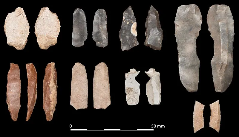
  • stone tools;

  • animal bones;

  • shell middens;

  • hearths;

  • and charcoal.

These remains provide clues about daily life.

Transition to Farming

One of the most important questions in Orkney archaeology concerns the transition from hunter-gatherer societies to farming communities.

By the fourth millennium BCE, Orkney became famous for substantial Neolithic settlements and monuments.

Conclusion

Saville Game: Orkney's Mesolithic Site should be treated cautiously unless a specific archaeological identification is established.

Nevertheless, Mesolithic Orkney is an important field of research because it reveals the human communities that occupied the islands before the construction of monuments such as Skara Brae.

Braes of Ha'Breck: Wyre's Neolithic Houses

September 9, 2026

The Braes of Ha'Breck on the island of Wyre provides important evidence for Neolithic settlement in Orkney.

The site is particularly significant because it reveals that Neolithic communities were not only constructing monumental tombs and ceremonial structures but were also building substantial houses in which people lived, worked, and organized their communities.

Neolithic Wyre

Wyre is a small island in Orkney.

Despite its modest size, it preserves remarkable prehistoric archaeological evidence.

The Braes of Ha'Breck settlement demonstrates that small islands could support substantial farming communities during the Neolithic period.

Houses

The settlement contained stone-built structures.

The houses included:

  • walls;

  • floors;

  • hearths;

  • working spaces;

  • and internal divisions.

Farming

Neolithic communities practiced agriculture.

They cultivated crops and raised livestock.

Animal husbandry likely included:

  • cattle;

  • sheep;

  • goats;

  • and pigs.

Domestic Life

Archaeological remains can reveal everyday activities.

Grinding stones may indicate grain processing.

Pottery can reveal cooking and storage.

Animal bones provide evidence for diet and livestock management.

Community Organization

The construction of multiple houses indicates that the settlement was not merely a temporary campsite.

People lived together within an organized community.

Island Networks

Wyre was connected to other Orkney islands by sea.

This allowed communities to exchange:

  • stone;

  • food;

  • pottery;

  • tools;

  • and other materials.

Monumental Orkney

The Braes of Ha'Breck settlement is particularly important because it complements Orkney's famous monuments.

While sites such as Maeshowe and the Ring of Brodgar reveal ceremonial life, settlements reveal ordinary domestic activity.

Conclusion

Braes of Ha'Breck: Wyre's Neolithic Houses provides a valuable window into everyday life in prehistoric Orkney.

Its houses demonstrate that Neolithic island communities possessed sophisticated architectural traditions and organized agricultural economies.

The site reminds us that the people who built Orkney's monumental landscape also lived in ordinary homes where they cooked, worked, raised animals, and raised families.

← Newer Posts Older Posts →
Featured
images (88).jpeg
September 20, 2026
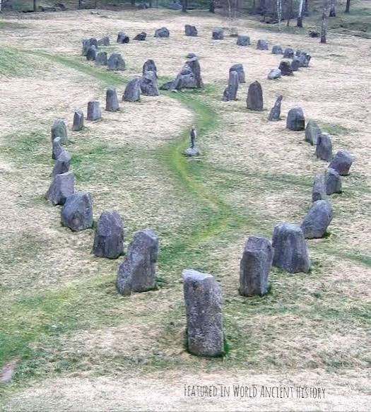
Vendel Cemetery: Sweden's Pre-Viking Elite Graves
September 20, 2026
Read more →
September 20, 2026
images (89).jpeg
September 20, 2026
Valsgärde: Sweden's Ship Burials
September 20, 2026
Read more →
September 20, 2026
images (90).jpeg
September 20, 2026
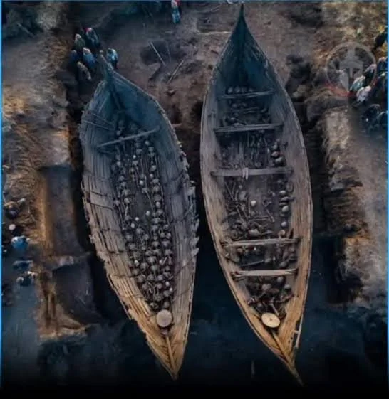
Boat Graves of Salme: Estonia's 8th-Century Warriors
September 20, 2026
Read more →
September 20, 2026
images (92).jpeg
September 20, 2026
Rõuge: Estonia's Bronze Age Hillfort
September 20, 2026
Read more →
September 20, 2026
images (93).jpeg
September 20, 2026
Asva: Saaremaa's Iron Age Fort
September 20, 2026
Read more →
September 20, 2026
images (94).jpeg
September 20, 2026
Ridala: Estonia's Stone Cist Graves
September 20, 2026
Read more →
September 20, 2026
read more

Powered by The archaeologist