• MAIN PAGE
  • LATEST NEWS
    • Lost Cities
    • Archaeology's Greatest Finds
    • Underwater Discoveries
    • Greatest Inventions
    • Studies
    • Blog
  • PHILOSOPHY
  • HISTORY
  • RELIGIONS
    • Africa
    • Anatolia
    • Arabian Peninsula
    • Balkan Region
    • China - East Asia
    • Europe
    • Eurasian Steppe
    • Levant
    • Mesopotamia
    • Oceania - SE Asia
    • Pre-Columbian Civilizations of America
    • Iranian Plateau - Central Asia
    • Indus Valley - South Asia
    • Japan
    • The Archaeologist Editor Group
    • Scientific Studies
    • Aegean Prehistory
    • Historical Period
    • Byzantine Middle Ages
    • Predynastic Period
    • Dynastic Period
    • Greco-Roman Egypt
  • Rome
  • PALEONTOLOGY
  • About us
Menu

The Archaeologist

  • MAIN PAGE
  • LATEST NEWS
  • DISCOVERIES
    • Lost Cities
    • Archaeology's Greatest Finds
    • Underwater Discoveries
    • Greatest Inventions
    • Studies
    • Blog
  • PHILOSOPHY
  • HISTORY
  • RELIGIONS
  • World Civilizations
    • Africa
    • Anatolia
    • Arabian Peninsula
    • Balkan Region
    • China - East Asia
    • Europe
    • Eurasian Steppe
    • Levant
    • Mesopotamia
    • Oceania - SE Asia
    • Pre-Columbian Civilizations of America
    • Iranian Plateau - Central Asia
    • Indus Valley - South Asia
    • Japan
    • The Archaeologist Editor Group
    • Scientific Studies
  • GREECE
    • Aegean Prehistory
    • Historical Period
    • Byzantine Middle Ages
  • Egypt
    • Predynastic Period
    • Dynastic Period
    • Greco-Roman Egypt
  • Rome
  • PALEONTOLOGY
  • About us
No results found

Kyiv's Desyatynna Church: Ukraine's First Stone Cathedral

September 20, 2026

Introduction

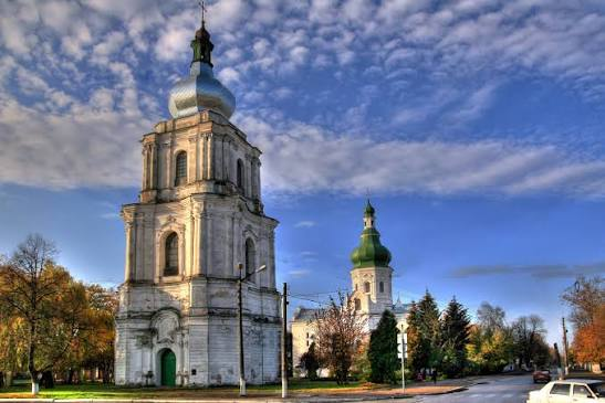
The Desyatynna Church, or Church of the Tithes, occupies a special place in the history of Kyiv and the Christianization of Rus'.

Although its remains are fragmentary, the building represented an extraordinary architectural and political transformation.

Constructed in the aftermath of the Christianization of Rus' under Prince Vladimir, the church became a major symbol of the new Christian order.

The name derives from the traditional association with a tithe, or tenth, of princely revenues dedicated to the church.

Christianity Comes to Rus'

The construction of the church followed Prince Vladimir's adoption of Christianity in 988.

This event was not simply religious.

Christianity affected:

  • political legitimacy;

  • diplomacy;

  • art;

  • architecture;

  • literacy;

  • burial customs;

  • administration;

  • cultural connections with Byzantium.

Kyiv became increasingly connected to the Christian world of Eastern Europe and Byzantium.

Byzantine Influence

The Desyatynna Church was constructed using techniques associated with Byzantine architectural traditions.

Stone and brick construction represented a major technological departure from the predominantly wooden architecture common in the region.

Its construction required specialists capable of working with masonry, mortar, architectural planning, and monumental decoration.

Monumental Construction

The church was much more than a religious building.

It demonstrated the resources available to the ruling elite.

Large-scale architecture required:

  • organized labor;

  • skilled craftsmen;

  • building materials;

  • transportation;

  • financial resources;

  • centralized authority.

The church consequently functioned as a visible statement of princely power.

The Tithe

The traditional name "Church of the Tithes" reflects the idea that Prince Vladimir assigned a portion of his revenues to its maintenance.

This illustrates an important development in medieval political organization.

Religion became integrated with systems of taxation and princely administration.

Decoration

The church was richly decorated.

Historical evidence associates the building with:

  • frescoes;

  • mosaics;

  • marble;

  • imported architectural materials.

Such decoration reflected the prestige of Byzantine Christianity.

Archaeological Evidence

The original church was destroyed during the Mongol sack of Kyiv in 1240.

Subsequent construction and urban development further complicated the archaeological record.

Researchers have nevertheless recovered foundations and architectural fragments that allow aspects of the original structure to be reconstructed.

Historical Significance

The church represented the physical arrival of monumental Christianity in Kyiv.

Its significance was therefore symbolic as much as architectural.

It demonstrated that Christianity had become closely connected to the ruling dynasty and the political identity of Kyiv.

Conclusion

The Desyatynna Church stands as one of the defining monuments of the Christianization of Rus'.

Although the building itself no longer survives intact, archaeological remains and historical references demonstrate its extraordinary importance.

It marked the beginning of a new architectural tradition in Kyiv and helped establish Christianity as a major institution within medieval Rus'.

Pereyaslav: Ukraine's 10th-Century Fortified Town

September 20, 2026

Introduction

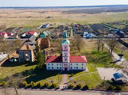
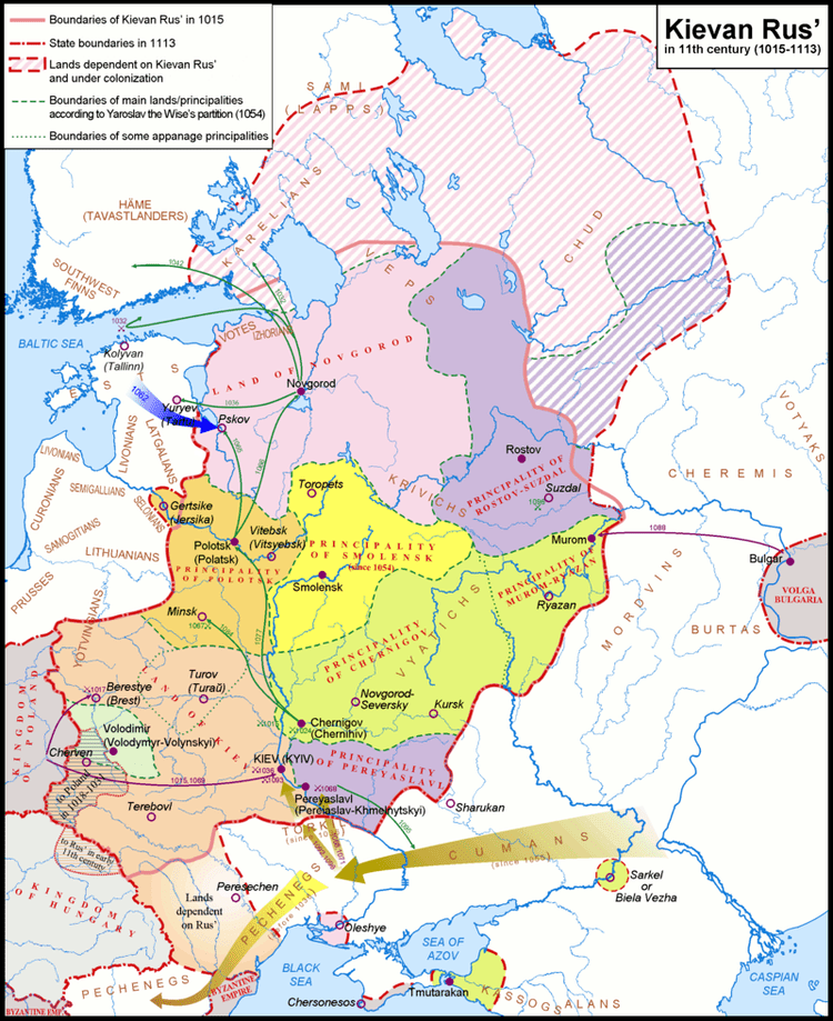
Pereyaslav, corresponding to modern Pereiaslav, was an important fortified center of medieval Rus'.

Its strategic importance derived largely from its location on the Dnieper frontier and its relationship with territories inhabited by steppe peoples.

The city therefore occupied a position between agricultural settlements to the north and the increasingly dangerous steppe frontier to the south.

A Frontier City

Medieval Rus' faced repeated threats from nomadic groups.

The southern frontier was particularly vulnerable.

Pereyaslav formed part of a defensive network intended to protect the political and agricultural heartlands of Rus'.

Its fortifications included earthworks and defensive structures.

The Fortified Settlement

The city's defenses were designed to control movement and protect inhabitants.

Earth ramparts were particularly effective because they could be constructed using locally available materials.

Timber palisades and gates could be placed on top of these earthworks.

Political Importance

Pereyaslav became a major princely center.

Its ruler was often a member of the wider Rurikid dynasty.

Control over the city therefore had political as well as military importance.

Religious Development

Like other major Rus' centers, Pereyaslav became an important Christian center after the conversion of Rus'.

Church construction and ecclesiastical administration reinforced the city's role within the developing medieval political order.

Trade and Economy

Despite its frontier position, Pereyaslav participated in economic networks.

Farmers supplied food.

Craft workers produced tools and household goods.

Merchants moved goods along river routes.

The military character of the city did not prevent economic development.

Relations with the Steppe

The frontier environment produced both conflict and interaction.

Nomadic peoples were not simply enemies.

Trade, diplomacy, warfare, intermarriage, migration, and cultural exchange all occurred across the frontier.

Archaeology can reveal these interactions through artifacts and burial practices.

The Mongol Period

Like many cities of Rus', Pereyaslav suffered severely during the Mongol invasions.

The destruction of urban infrastructure weakened its earlier political importance.

Nevertheless, the settlement continued to exist and retained historical significance.

Conclusion

Pereyaslav illustrates the complex nature of medieval frontier society.

It was simultaneously:

  • a military center;

  • a princely residence;

  • a Christian settlement;

  • an agricultural market;

  • a trading location;

  • a frontier community.

Its history demonstrates how geography shaped political and military development in medieval Eastern Europe.

Belz: Ukraine's Medieval Trade Center

September 20, 2026

Introduction

Belz was an important medieval settlement in the western Ukrainian historical landscape.

Its position near routes connecting the lands of Rus' with Central Europe contributed to its economic and political importance.

Unlike monumental capitals whose significance is immediately visible through surviving architecture, places such as Belz demonstrate the importance of regional towns within medieval economic systems.

Geography and Trade

Belz was located in a region characterized by agricultural production and connections toward Poland and other Central European territories.

Medieval trade depended heavily on overland routes.

Merchants transported:

  • salt;

  • furs;

  • wax;

  • honey;

  • textiles;

  • metal goods;

  • ceramics;

  • luxury objects.

Fortification

Medieval towns frequently required defensive structures.

Belz developed as a fortified settlement, reflecting the political instability of the region.

Defensive systems could include:

  • earth ramparts;

  • wooden palisades;

  • ditches;

  • gates;

  • towers.

Political Changes

The region experienced repeated political transformations.

Belz was connected at different times with Rus' principalities and later with Polish and other political structures.

These changes affected taxation, administration, trade routes, and cultural institutions.

Archaeological Evidence

Archaeology is particularly valuable for reconstructing Belz's medieval history.

Artifacts can reveal:

  • household activities;

  • craft production;

  • commercial connections;

  • dietary practices;

  • military activity.

Ceramic imports are particularly useful because they can indicate connections between settlements.

Craft Production

Medieval towns depended on specialized craftsmen.

Evidence may include traces of:

  • blacksmithing;

  • pottery;

  • leatherworking;

  • woodworking;

  • textile production.

Such industries were essential to urban life.

Religion

Christian institutions played an important role in medieval Belz.

Churches and monasteries were not only religious centers but also important landowners and cultural institutions.

Religious buildings helped shape the social geography of medieval towns.

Conclusion

Belz illustrates the importance of regional medieval towns in the economic and political development of Eastern Europe.

Its location allowed it to participate in commercial networks connecting Rus' with Central Europe.

Its archaeological record helps demonstrate that medieval urbanism extended far beyond the famous capitals.

Halych: Ukraine's 12th-Century Princely Seat

September 20, 2026

Introduction

Halych was one of the most important political centers of medieval western Rus'.

Located in present-day western Ukraine, the settlement became the center of the Principality of Halych and later contributed its name to the larger political entity known as the Kingdom of Galicia–Volhynia.

During the twelfth and thirteenth centuries, Halych became a major center of political power, religion, trade, and culture.

The Galician Landscape

Halych benefited from fertile agricultural lands and access to important regional routes.

Its territory was also associated with valuable resources, including salt.

Salt was one of the most important commodities of medieval Europe.

It was essential for:

  • food preservation;

  • animal husbandry;

  • trade;

  • taxation.

The Princely Center

Halych developed a fortified political center where the ruling dynasty exercised authority.

The princely residence represented more than a defensive structure.

It was a center of:

  • administration;

  • diplomacy;

  • military planning;

  • taxation;

  • religious patronage.

Religious Architecture

Christianity was deeply integrated into Halych's political culture.

Churches and monasteries served as religious centers while simultaneously demonstrating princely wealth.

Stone architecture required substantial investment and skilled craftsmen.

International Connections

Halych interacted with neighboring powers including:

  • Poland;

  • Hungary;

  • Byzantium;

  • other Rus' principalities;

  • steppe societies.

Political alliances and conflicts brought the city into broader European affairs.

The Formation of Galicia–Volhynia

In the late twelfth and early thirteenth centuries, political developments connected Halych with Volhynia.

The resulting political entity became one of the most important Rus' successor states following the fragmentation and Mongol conquest of earlier political centers.

Archaeological Significance

Archaeological research around Halych has revealed evidence of:

  • fortifications;

  • churches;

  • residences;

  • craft production;

  • cemeteries;

  • imported goods.

These findings allow researchers to reconstruct the city's development beyond what written chronicles record.

Decline

Political changes eventually reduced Halych's importance as a primary political center.

Nevertheless, its legacy survived in the names and political traditions associated with Galicia.

Conclusion

Halych demonstrates the complexity of medieval western Rus'.

Its prosperity depended on agriculture, trade, natural resources, religious institutions, and princely authority.

The city was not isolated from Europe but participated in a dynamic political environment connecting Eastern and Central Europe.

Tmutarakan: Ukraine's 10th-Century Greek Colony

September 20, 2026

Introduction

Tmutarakan occupies a fascinating position in the history of medieval Eastern Europe because it connected the world of Rus', Byzantium, and the Black Sea.

The medieval settlement is associated with the ancient and medieval settlement of Tmutarakan, located on the Taman Peninsula in the northern Black Sea region.

The site's history stretches far beyond the tenth century and includes Greek, Roman, Byzantine, and later political influences.

A Black Sea Crossroads

The Taman Peninsula occupied a strategically important position between the Black Sea and Sea of Azov.

Its geography placed it near routes connecting:

  • the Caucasus;

  • Crimea;

  • the Black Sea;

  • the steppe;

  • Byzantium;

  • eastern Europe.

Greek Foundations

The region had a long Greek colonial history.

Greek settlements around the Black Sea were established centuries before the emergence of Rus'.

This means that describing Tmutarakan simply as a "Greek colony" does not capture its entire history.

Instead, the site represents multiple successive cultural phases.

Tmutarakan and Rus'

During the medieval period, Tmutarakan became associated with the political world of Rus'.

Rurikid princes exercised authority in the region.

This was remarkable because the settlement was geographically distant from Kyiv.

Its importance reflected Rus' expansion into the Black Sea and Caucasian frontier.

Trade

The settlement participated in maritime and overland trade.

Commercial goods could move through the region from different directions.

Archaeological evidence from Black Sea settlements often demonstrates the circulation of:

  • ceramics;

  • amphorae;

  • metals;

  • coins;

  • glass;

  • luxury objects.

Byzantine Connections

Byzantine influence remained strong in the Black Sea.

Christianity, architecture, coinage, diplomacy, and commercial relationships connected Tmutarakan to the Byzantine world.

Multicultural Society

Tmutarakan's historical significance lies partly in its multicultural character.

Greek traditions interacted with:

  • Byzantine culture;

  • Rus' political structures;

  • steppe societies;

  • Caucasian populations.

The Black Sea frontier was therefore a zone of interaction rather than a strict cultural boundary.

Archaeological Challenges

The identification and interpretation of individual structures at Tmutarakan can be complicated because the settlement developed through many historical periods.

Archaeologists must carefully separate layers belonging to different centuries.

Conclusion

Tmutarakan demonstrates how interconnected medieval Eastern Europe was.

Rather than being a remote outpost, it belonged to a network of Black Sea communities linked by trade, warfare, diplomacy, and cultural exchange.

Its history is particularly valuable for understanding the relationship between Rus', Byzantium, the Caucasus, and the Black Sea world.

Chersonesos: Crimea's 5th-Century Greek City

September 20, 2026

Introduction

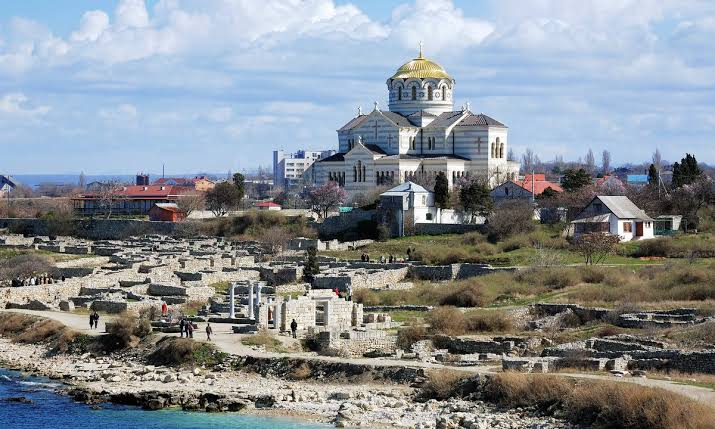
Chersonesos, located near modern Sevastopol in Crimea, was one of the most important ancient Greek cities of the northern Black Sea.

Founded by Greek settlers in the fifth century BCE, the city survived for centuries and became a major center of trade, agriculture, Christianity, and diplomacy.

Its archaeological remains provide an unusually rich record of ancient urban life.

Greek Colonization

Greek colonies were established around the Black Sea beginning in the first millennium BCE.

Chersonesos emerged within this wider movement.

The settlers brought Greek traditions of:

  • urban planning;

  • civic institutions;

  • religion;

  • language;

  • coinage;

  • architecture.

Urban Structure

The city contained streets, residential buildings, public spaces, religious structures, workshops, and defensive walls.

Its planned environment demonstrates the importance of organized urban development.

Agriculture

Although Chersonesos was a maritime city, agriculture was fundamental to its economy.

The surrounding territory supported vineyards and grain cultivation.

Wine production became particularly important.

The relationship between urban centers and their agricultural territories was essential to ancient Greek colonial economies.

Trade

Chersonesos participated in extensive Black Sea trade.

Ships connected the city with other coastal communities.

Goods included:

  • wine;

  • grain;

  • pottery;

  • fish products;

  • metals;

  • agricultural commodities.

Roman and Byzantine Periods

The city later came under Roman influence and subsequently became an important Byzantine center.

Its strategic location made it valuable to successive powers.

Christianity

Chersonesos became particularly important in the history of Christianity in the region.

Christian monuments, churches, and inscriptions demonstrate the transformation of the city from a pagan Greek community into a Christian urban center.

Archaeological Preservation

The ruins contain:

  • defensive walls;

  • streets;

  • houses;

  • churches;

  • workshops;

  • public buildings;

  • cisterns;

  • burial areas.

This makes Chersonesos one of the most important archaeological sites for understanding the ancient Black Sea.

Conclusion

Chersonesos represents more than a Greek colonial settlement.

Its long history illustrates the transformation of the northern Black Sea from a Greek commercial frontier into a Roman and Byzantine cultural zone.

The site provides extraordinary evidence for urbanism, trade, agriculture, religion, and cultural change.

Kerch: Crimea's Ancient Panticapaeum

September 20, 2026

Introduction

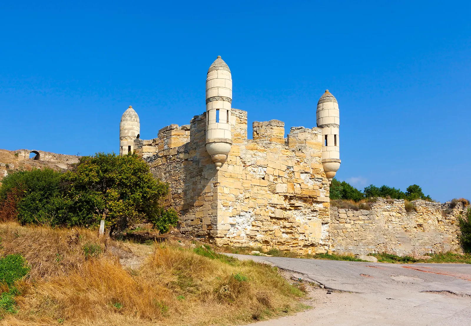
Kerch occupies the site of ancient Panticapaeum, one of the most important Greek cities of the northern Black Sea.

Founded by Greek settlers in the seventh century BCE, Panticapaeum eventually became the capital of the Bosporan Kingdom.

Its history demonstrates how Greek colonies developed into powerful regional states.

Foundation of Panticapaeum

Greek settlers established Panticapaeum on the eastern side of the Crimean Peninsula.

The location was strategically excellent.

The city overlooked the Kerch Strait, connecting the Black Sea with the Sea of Azov.

This gave Panticapaeum control over maritime routes and access to agricultural territories.

The Bosporan Kingdom

Panticapaeum became the political center of the Bosporan Kingdom.

Unlike a simple Greek colony, the Bosporan Kingdom was a complex state incorporating Greek cities, rural populations, and communities with strong connections to the steppe.

Grain Production

Agriculture was fundamental to the kingdom's prosperity.

The northern Black Sea region was capable of producing large quantities of grain.

Greek cities could export agricultural products to the wider Mediterranean world.

This relationship became especially important for cities such as Athens, which depended heavily on imported grain.

Maritime Trade

Panticapaeum's position allowed merchants to participate in long-distance trade.

Ships transported agricultural products and imported luxury goods.

Archaeological evidence includes:

  • amphorae;

  • coins;

  • pottery;

  • jewelry;

  • architectural fragments.

Coinage

The Bosporan rulers issued coins.

Coinage provides important evidence for political authority, economic activity, and royal ideology.

Images placed on coins could communicate the identity and legitimacy of rulers.

Elite Burials

The Kerch region is famous for monumental burial structures known as kurgans.

Some contain elaborate chambers and valuable grave goods.

These monuments demonstrate the wealth of Bosporan elites and their interaction with surrounding cultural traditions.

Greek and Steppe Cultures

Panticapaeum existed at the intersection of Mediterranean and steppe worlds.

Greek artistic traditions interacted with Scythian and other regional cultures.

This produced distinctive forms of art and material culture.

Later History

Panticapaeum remained important through Roman and later periods.

Its strategic location continued to attract powerful states.

Conclusion

Ancient Panticapaeum demonstrates how Greek colonization could produce sophisticated regional kingdoms.

Its economy combined agriculture, maritime trade, political administration, and cultural interaction.

The archaeological remains of Kerch provide some of the clearest evidence for the complex relationship between the Greek Mediterranean and the Eurasian steppe.

Olbia: Ukraine's Greek Black Sea Colony

September 20, 2026

Introduction

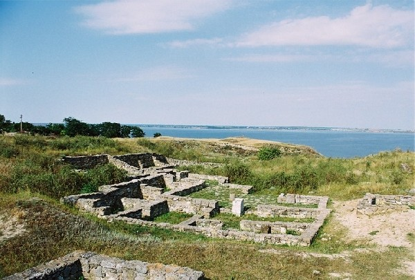
Olbia Pontica was one of the major Greek settlements of the northern Black Sea.

Established by Greek colonists during the sixth century BCE near the modern Ukrainian Black Sea region, Olbia developed into an important commercial and cultural center.

Its history provides exceptional evidence for the interaction between Greek communities and the peoples of the Pontic steppe.

Greek Colonization of the Black Sea

Greek expansion into the Black Sea created a network of coastal settlements.

These communities were established for several reasons:

  • trade;

  • access to agricultural resources;

  • fishing;

  • maritime expansion;

  • political and commercial opportunity.

Olbia became one of the important links in this network.

The Name Olbia

The name is connected with the Greek concept of prosperity or blessedness.

The settlement was sometimes described in ancient sources as Olbia Pontica, distinguishing it from other places with similar names.

Urban Development

Olbia developed a complex urban landscape.

Archaeological investigations have uncovered:

  • residential areas;

  • streets;

  • workshops;

  • temples;

  • public buildings;

  • defensive walls;

  • burial grounds.

The city therefore followed recognizable Greek urban traditions while adapting to its Black Sea environment.

Trade With the Steppe

Olbia's greatest importance came from its relationship with surrounding peoples.

Greek merchants interacted with Scythian communities and other populations of the Pontic steppe.

Trade involved commodities such as:

  • grain;

  • fish;

  • animal products;

  • pottery;

  • wine;

  • metals;

  • luxury goods.

Scythian Connections

The relationship between Olbia and the Scythians was not simply one of warfare.

There was extensive economic and cultural exchange.

Greek objects found in steppe contexts demonstrate the reach of Black Sea trade.

Likewise, steppe artistic influences appear in material culture associated with Greek settlements.

Religion

Olbia possessed temples and sanctuaries dedicated to Greek gods.

Religious practices were adapted to the local environment while maintaining connections with Greek traditions.

The archaeological discovery of inscriptions and votive objects provides valuable information about religious life.

Coinage

Olbia produced its own coinage.

Some of its early monetary forms are particularly distinctive and demonstrate the city's economic independence.

Coins are also valuable historical evidence because they contain images, symbols, inscriptions, and references to political authority.

Democracy and Political Institutions

Ancient evidence indicates that Olbia possessed civic institutions based on Greek political traditions.

Citizens participated in political life, although—as in other Greek communities—citizenship was restricted and did not extend equally to every resident.

This distinction is important when discussing ancient Greek political systems.

Decline and Transformation

Olbia experienced periods of political instability, economic change, and external pressure.

Its importance declined and revived at different points.

The city was ultimately transformed by broader changes affecting the Black Sea world.

Archaeological Importance

Olbia is especially valuable because archaeologists can study an entire ancient community rather than a single monument.

Its remains reveal how Greek colonists adapted their institutions and economic systems to a frontier environment.

Conclusion

Olbia was far more than an isolated Greek colony.

It was a major node connecting the Mediterranean world with the societies of the Pontic steppe.

Its history demonstrates that ancient Greek civilization extended beyond mainland Greece and the Aegean, creating diverse communities whose identities were shaped by continuous interaction with neighboring cultures.

Olbia therefore occupies an important position in the archaeology of the Black Sea and in the wider history of ancient Mediterranean globalization.

Spiro Mounds Caddo: Oklahoma's Salt Dome Temple

September 20, 2026

Introduction

Spiro Mounds is one of the most important archaeological sites associated with the Caddoan Mississippian tradition of the southern Great Plains and southeastern North America. Located in what is now eastern Oklahoma, the site was a major ceremonial and political center between approximately the ninth and fifteenth centuries CE.

Spiro is particularly remarkable because of the extraordinary quantity and diversity of objects that once accumulated there. Archaeologists have recovered evidence of long-distance exchange involving materials that originated hundreds, and in some cases more than a thousand, kilometers away. Marine shell from the Gulf Coast, copper from the Great Lakes region, obsidian from western sources, and other exotic materials demonstrate that the people associated with Spiro participated in extensive networks of communication and exchange.

The reference to a "Salt Dome Temple" should therefore be treated carefully. Spiro was a ceremonial center containing mounds and structures, but its archaeological significance extends far beyond a single temple. Its importance lies in the combination of monumental architecture, ritual activity, elite authority, craft production, and long-distance interaction.

The Caddoan World

The Caddoan peoples occupied a large region encompassing parts of present-day Oklahoma, Arkansas, Texas, Louisiana, and surrounding areas.

Their societies were characterized by:

  • agricultural production;

  • permanent or semi-permanent settlements;

  • mound construction;

  • ceremonial institutions;

  • specialized craftsmanship;

  • regional exchange networks;

  • complex social organization.

Maize agriculture was particularly important, although Caddoan communities also cultivated other crops and relied on hunting, fishing, and gathering.

The Archaeological Landscape

Spiro consisted of a complex arrangement of mounds and associated habitation areas.

Monumental mounds were not simply piles of earth.

Their construction required:

  1. gathering soil;

  2. transporting it;

  3. organizing labor;

  4. constructing platforms;

  5. maintaining ceremonial spaces.

The largest mounds could have supported buildings or ceremonial structures.

This type of architecture communicated social and religious authority.

The Great Mortuary Context

One of Spiro's most famous archaeological features is the structure commonly known as the Craig Mound.

It contained extraordinary quantities of ritual and prestige objects.

Among the discoveries were:

  • carved shell objects;

  • copper ornaments;

  • engraved stone;

  • wooden artifacts;

  • textiles;

  • ceremonial equipment;

  • human remains.

Some objects had been carefully placed in contexts suggesting ritual significance rather than ordinary domestic use.

Long-Distance Exchange

Spiro provides particularly strong evidence for long-distance interaction.

Objects and raw materials came from distant regions, demonstrating that the community was connected to a vast exchange system.

These networks moved not only goods but also:

  • artistic motifs;

  • religious concepts;

  • technological knowledge;

  • social relationships;

  • political influence.

It is important not to assume that every exotic object arrived through a single centralized trading system. Exchange could involve multiple intermediaries, gift relationships, pilgrimage, diplomacy, and movement of people.

The Spiro Art Style

Spiro is famous for a distinctive body of imagery sometimes referred to as the Braden style.

Art associated with the site depicts supernatural beings, human figures, animals, warriors, and ritual scenes.

These images provide clues about Caddoan religious concepts.

However, interpretation remains difficult because archaeologists cannot directly interview the people who created the objects.

Images must therefore be interpreted alongside archaeological context and comparative evidence.

Salt and the Regional Economy

Salt was an important resource in many Indigenous societies because it was necessary for diet and food preservation.

The broader region around Spiro contained access to saline resources.

Salt could therefore have played a role in exchange and subsistence.

Nevertheless, it is important not to reduce Spiro's economy to salt alone.

Agriculture, hunting, craft production, exchange, and ceremonial activities all contributed to the site's importance.

Religion and Political Authority

Spiro demonstrates the close relationship between religion and political organization.

Ceremonial centers could bring together:

  • religious specialists;

  • political leaders;

  • craft specialists;

  • farmers;

  • traders;

  • visitors from surrounding communities.

Monumental architecture created a physical environment in which authority could be displayed.

The End of the Site

Spiro's political and ceremonial importance declined during the fifteenth century.

The reasons remain a subject of archaeological investigation.

Changes in regional political networks, population movement, environmental factors, and transformations in exchange systems may all have contributed.

Conclusion

Spiro Mounds represents one of the most extraordinary archaeological windows into the Indigenous civilizations of precolonial North America.

Its mounds, ritual objects, artistic traditions, and long-distance trade connections demonstrate that the Caddoan world possessed sophisticated political, religious, and economic systems.

Rather than being an isolated settlement, Spiro belonged to a vast network connecting communities across much of North America.

Paquimé Casas Grandes: Chihuahua's 14th-Century Pueblo

September 20, 2026

Introduction

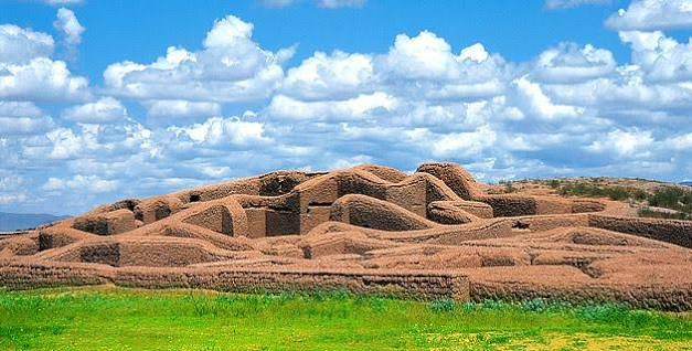
Paquimé, also known as Casas Grandes, was one of the most important archaeological centers of northern Mexico.

Located in the state of Chihuahua, Paquimé flourished particularly between the thirteenth and fifteenth centuries CE.

The settlement is famous for its massive adobe architecture, sophisticated water-management systems, ceremonial structures, craft production, and connections with communities far to the south and north.

Its location makes it particularly important for understanding the interaction between the cultural traditions of Mesoamerica and those of the ancient American Southwest.

The Casas Grandes Culture

The archaeological tradition associated with Paquimé is generally known as the Casas Grandes culture.

It developed in an environmentally challenging region.

Water was therefore fundamental to settlement.

Communities had to develop ways to:

  • collect water;

  • distribute it;

  • store it;

  • manage wastewater;

  • support agriculture.

Monumental Adobe Architecture

Paquimé's architecture is immediately recognizable.

Buildings were constructed primarily from adobe and earth.

Some structures contained multiple rooms and levels.

The settlement therefore differed considerably from smaller villages.

Large residential compounds may have housed extended families or specialized social groups.

Water Engineering

One of Paquimé's most impressive features is its hydraulic infrastructure.

Archaeologists have documented systems involving:

  • canals;

  • reservoirs;

  • water conduits;

  • drainage features;

  • controlled water distribution.

These installations demonstrate that water management was central to urban life.

In an arid environment, the ability to control water was closely connected with political authority.

Macaws and Long-Distance Trade

Paquimé is famous for evidence of scarlet macaws.

These birds were not native to the Chihuahua region and therefore had to be transported over enormous distances.

Macaws were valuable for:

  • feathers;

  • ritual symbolism;

  • prestige;

  • ceremonial display.

Their presence demonstrates long-distance exchange with regions of Mesoamerica.

Turquoise and Trade

Turquoise was another important material in the wider Southwest.

Paquimé participated in exchange networks involving:

  • ceramics;

  • shells;

  • copper;

  • turquoise;

  • feathers;

  • exotic animals.

These networks connected distant communities.

Mesoamerican Connections

Some architectural and ceremonial features at Paquimé have parallels with Mesoamerican traditions.

Ballcourt-like structures, ceremonial architecture, and exotic goods have contributed to debates about the site's cultural connections.

However, Paquimé should not be viewed simply as a "Mesoamerican colony."

Its inhabitants developed their own distinctive architectural and cultural traditions.

Pottery

Casas Grandes pottery is among the most recognizable ceramic traditions of northern Mexico.

Some vessels feature elaborate geometric and naturalistic designs.

Pottery provides information about:

  • artistic traditions;

  • trade;

  • household activities;

  • food preparation;

  • ritual practices.

Urban Organization

Paquimé was not simply a collection of houses.

Its architecture indicates differentiated spaces.

Certain areas appear to have been associated with specialized production, ritual activity, administration, or elite residence.

This suggests a complex social structure.

Decline

Paquimé's major occupation ended during the fifteenth century.

Evidence indicates episodes of violence and abandonment.

The exact causes remain debated.

Environmental pressures, political instability, changing trade routes, and conflict may have contributed.

Conclusion

Paquimé is one of the most important archaeological sites for understanding the ancient cultural connections between northern Mexico and the American Southwest.

Its adobe architecture, water systems, exotic animals, pottery, and trade networks reveal a sophisticated urban society capable of organizing labor and maintaining long-distance relationships.

Kuwahowi: Hawaii's Prehistoric Temple Platform

September 20, 2026

Introduction

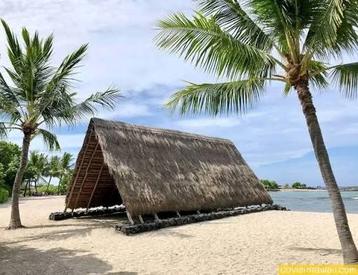
Kuwahowi is associated with the archaeological landscape of Hawaiʻi's traditional ceremonial architecture, particularly the raised platforms and sacred spaces known as heiau.

Traditional Hawaiian religious landscapes included temples, offering places, agricultural shrines, fishery shrines, and other sacred structures.

These sites were not simply architectural monuments. They were institutions embedded in Hawaiian political organization, environmental management, genealogy, and religious practice.

Because archaeological interpretations of individual Hawaiian sites can vary, Kuwahowi should be understood within this broader cultural context.

The Hawaiian Heiau

A heiau was a sacred structure or complex used for religious purposes.

Different heiau served different functions.

They could be associated with:

  • agriculture;

  • fishing;

  • warfare;

  • healing;

  • chiefly authority;

  • communication with the gods;

  • community rituals.

Their physical form varied according to purpose and location.

Stone Platform Construction

Many Hawaiian ceremonial structures used stone terraces and platforms.

Construction involved gathering and arranging volcanic stone.

Workers had to:

  1. select appropriate stones;

  2. transport them;

  3. establish foundations;

  4. build retaining walls;

  5. create terraces;

  6. maintain the structure.

The construction of such monuments required organized labor.

Religion and Landscape

Hawaiian religion did not separate sacred space completely from the natural environment.

Mountains, valleys, springs, forests, coastlines, and volcanic landscapes could all have spiritual significance.

A ceremonial platform therefore formed part of a much larger sacred geography.

Political Authority

Chiefly authority was connected to religious institutions.

High-ranking leaders could control access to important sacred sites.

Ceremonial architecture could consequently reinforce political hierarchy.

Offerings and Ritual

Religious practices could involve offerings of food and other valuable resources.

The exact rituals varied according to the type of heiau and the deity involved.

Archaeological evidence can sometimes identify activity areas associated with offerings, although reconstructing specific ceremonies requires caution.

Agricultural Connections

Some Hawaiian religious structures were connected to agricultural productivity.

Hawaiian communities developed sophisticated systems of cultivation, including irrigated taro agriculture.

Religious practices reinforced relationships between people, land, ancestors, and supernatural forces.

Archaeological Preservation

Stone structures survive much better than organic materials.

As a result, archaeologists often rely on:

  • stone foundations;

  • terraces;

  • walls;

  • alignments;

  • surface artifacts;

  • landscape relationships.

Ethnohistoric records and oral traditions can complement archaeological evidence.

Conclusion

Kuwahowi belongs to a wider Hawaiian tradition in which architecture, religion, politics, and landscape were deeply interconnected.

Studying ceremonial platforms helps reveal how ancient Hawaiian communities organized labor, expressed religious beliefs, and established relationships between people and the natural world.

Pu'u o Kai: Hawaii's Fishpond Complex

September 20, 2026

Introduction

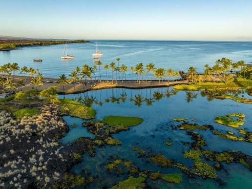
Hawaiian fishponds were among the most sophisticated forms of traditional aquaculture in the Pacific.

The complex associated with Pu'u o Kai can be understood within this broader tradition of Hawaiian coastal resource management.

Fishponds allowed communities to manipulate coastal environments to increase the availability of edible fish.

They were therefore not merely passive fishing locations.

They represented carefully managed food-production systems.

The Hawaiian Fishpond

Traditional Hawaiian fishponds came in several forms.

They could involve:

  • stone walls;

  • earthen embankments;

  • tidal channels;

  • gates;

  • enclosed coastal areas.

Different types were adapted to local environments.

How Fishponds Worked

A coastal pond could allow small fish to enter through controlled openings while limiting their ability to escape.

As fish grew, they could be harvested.

The system effectively transformed a natural coastal ecosystem into a managed food reserve.

Species Management

Fishponds could contain multiple species.

Management practices involved understanding:

  • tides;

  • water circulation;

  • fish behavior;

  • seasonal cycles;

  • plant growth;

  • freshwater inputs.

This required extensive ecological knowledge.

Labor

Construction and maintenance were labor-intensive.

Workers had to repair:

  • stone walls;

  • channels;

  • gates;

  • embankments.

The continued productivity of a fishpond therefore depended on organized community labor.

Political Organization

Large fishponds could be associated with chiefly authority.

Control over productive resources was an important component of Hawaiian political power.

A chief's ability to provide food strengthened social relationships and political legitimacy.

Environmental Knowledge

Traditional fishpond systems demonstrate detailed understanding of coastal ecology.

Builders had to understand how:

  • waves affected walls;

  • tides moved water;

  • fish entered ponds;

  • freshwater interacted with seawater;

  • vegetation affected productivity.

Sustainability

Fishponds can be interpreted as a form of intensive resource management.

Rather than simply harvesting wild populations, communities created environments designed to increase predictable food supplies.

This does not mean all ponds were always ecologically sustainable. Their success depended on careful maintenance and appropriate management.

Cultural Importance

Fishponds were economically important but also connected to Hawaiian concepts of land stewardship and social responsibility.

Food production was integrated into wider relationships between families, chiefs, communities, and the environment.

Conclusion

Pu'u o Kai represents the sophisticated ecological engineering associated with traditional Hawaiian fishpond systems.

These complexes demonstrate that ancient Pacific communities possessed advanced knowledge of aquaculture, coastal ecology, labor organization, and resource management.

Lapakahi: Hawaii's 14th-Century Dryland Settlement

September 20, 2026

Introduction

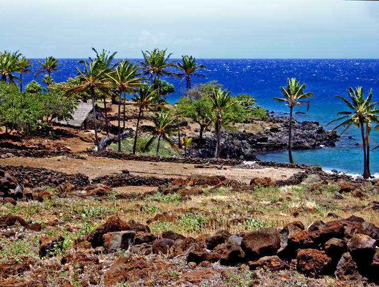
Lapakahi is one of Hawaiʻi's most important archaeological landscapes for understanding traditional Hawaiian settlement and subsistence.

Located on the northwestern coast of Hawaiʻi Island, the area preserves evidence of a community that adapted to a relatively dry environment.

Unlike the lush volcanic landscapes often associated with Hawaiʻi, northern Kohala contains areas where freshwater and agricultural resources were limited.

Lapakahi therefore demonstrates how Hawaiian communities adapted their settlement strategies to environmental constraints.

Settlement Organization

The archaeological landscape includes evidence of:

  • residential structures;

  • agricultural areas;

  • trails;

  • religious sites;

  • fishing installations;

  • storage features;

  • work areas.

This demonstrates that the settlement was organized around multiple economic activities.

Dryland Agriculture

Agriculture in dry environments requires careful resource management.

Hawaiian farmers cultivated crops including:

  • sweet potato;

  • taro where conditions permitted;

  • bananas;

  • sugar cane;

  • gourds;

  • other plants.

Sweet potato was particularly suitable for relatively dry environments.

Stone Features

Lapakahi contains numerous stone structures.

These include:

  • house foundations;

  • walls;

  • terraces;

  • platforms;

  • field boundaries.

Stone was readily available from the volcanic landscape and became an essential construction material.

Fishing

The coastal environment provided another major source of food.

Fishing methods included:

  • hook-and-line fishing;

  • netting;

  • trapping;

  • shoreline gathering.

Archaeological fish remains provide evidence of dietary practices.

Social Organization

Household remains can reveal differences in activities and access to resources.

However, archaeologists must be careful when assigning social status solely on architectural size.

Hawaiian communities had complex systems of kinship, rank, land use, and political authority.

Religious Sites

The settlement landscape included structures associated with traditional Hawaiian religious practices.

These demonstrate that religion was embedded within daily life.

Sacred sites could be associated with:

  • ancestors;

  • agricultural productivity;

  • fishing;

  • household protection;

  • community ceremonies.

Environmental Adaptation

Lapakahi is particularly valuable because it illustrates how people modified their activities according to environmental conditions.

The community did not simply depend on abundant natural resources.

Instead, residents combined agriculture, fishing, gathering, construction, and water management.

Archaeological Preservation

Because many structures were constructed from stone, substantial archaeological remains survive.

Researchers can therefore reconstruct settlement organization more effectively than at sites dominated by organic architecture.

Conclusion

Lapakahi provides an exceptional example of Hawaiian environmental adaptation.

Its archaeological record demonstrates how communities developed sophisticated systems for living, farming, fishing, worshipping, and organizing social life in a relatively dry coastal environment.Introduction

Lapakahi is one of Hawaiʻi's most important archaeological landscapes for understanding traditional Hawaiian settlement and subsistence.

Located on the northwestern coast of Hawaiʻi Island, the area preserves evidence of a community that adapted to a relatively dry environment.

Unlike the lush volcanic landscapes often associated with Hawaiʻi, northern Kohala contains areas where freshwater and agricultural resources were limited.

Lapakahi therefore demonstrates how Hawaiian communities adapted their settlement strategies to environmental constraints.

Settlement Organization

The archaeological landscape includes evidence of:

  • residential structures;

  • agricultural areas;

  • trails;

  • religious sites;

  • fishing installations;

  • storage features;

  • work areas.

This demonstrates that the settlement was organized around multiple economic activities.

Dryland Agriculture

Agriculture in dry environments requires careful resource management.

Hawaiian farmers cultivated crops including:

  • sweet potato;

  • taro where conditions permitted;

  • bananas;

  • sugar cane;

  • gourds;

  • other plants.

Sweet potato was particularly suitable for relatively dry environments.

Stone Features

Lapakahi contains numerous stone structures.

These include:

  • house foundations;

  • walls;

  • terraces;

  • platforms;

  • field boundaries.

Stone was readily available from the volcanic landscape and became an essential construction material.

Fishing

The coastal environment provided another major source of food.

Fishing methods included:

  • hook-and-line fishing;

  • netting;

  • trapping;

  • shoreline gathering.

Archaeological fish remains provide evidence of dietary practices.

Social Organization

Household remains can reveal differences in activities and access to resources.

However, archaeologists must be careful when assigning social status solely on architectural size.

Hawaiian communities had complex systems of kinship, rank, land use, and political authority.

Religious Sites

The settlement landscape included structures associated with traditional Hawaiian religious practices.

These demonstrate that religion was embedded within daily life.

Sacred sites could be associated with:

  • ancestors;

  • agricultural productivity;

  • fishing;

  • household protection;

  • community ceremonies.

Environmental Adaptation

Lapakahi is particularly valuable because it illustrates how people modified their activities according to environmental conditions.

The community did not simply depend on abundant natural resources.

Instead, residents combined agriculture, fishing, gathering, construction, and water management.

Archaeological Preservation

Because many structures were constructed from stone, substantial archaeological remains survive.

Researchers can therefore reconstruct settlement organization more effectively than at sites dominated by organic architecture.

Conclusion

Lapakahi provides an exceptional example of Hawaiian environmental adaptation.

Its archaeological record demonstrates how communities developed sophisticated systems for living, farming, fishing, worshipping, and organizing social life in a relatively dry coastal environment.

Kaloko-Honokohau: Hawaii's Ancient Salt Pans

September 18, 2026

Introduction

Kaloko-Honokōhau is a significant traditional Hawaiian cultural landscape on the western coast of Hawaiʻi Island.

The area is famous for its fishponds, coastal features, agricultural remains, religious sites, and traditional resource-management systems.

The association of the area with salt production reflects the importance of coastal resources in Hawaiian subsistence.

A Complex Coastal Landscape

Kaloko-Honokōhau was not a single-purpose industrial site.

It contained a combination of:

  • fishponds;

  • salt-making areas;

  • agricultural features;

  • habitation areas;

  • religious structures;

  • trails;

  • coastal gathering zones.

This integrated landscape demonstrates how Hawaiian communities used different ecological zones together.

Salt Production

Salt can be produced through evaporation.

Seawater is exposed to sunlight and allowed to evaporate until salt crystals remain.

In traditional settings, this process requires careful control of:

  • water movement;

  • evaporation;

  • cleanliness;

  • collection;

  • storage.

Salt was valuable for food preparation and preservation.

Fishponds

The area is especially well known for Kaloko Fishpond.

The massive stone wall enclosing the pond demonstrates the scale of traditional Hawaiian coastal engineering.

Construction required enormous quantities of stone and coordinated labor.

Honokōhau Fishpond

Another important feature is the Honokōhau coastal fishpond system.

Such ponds were integrated into the surrounding environment.

Freshwater springs, seawater, tides, and biological productivity all influenced their operation.

Religious Landscapes

Kaloko-Honokōhau also contains traditional sacred structures.

This demonstrates that food production and religion were not separate spheres.

Agricultural and fishing success could be understood through spiritual relationships with gods, ancestors, and the land.

Social Organization

Large engineering projects required social coordination.

Chiefly authorities and local communities played roles in organizing labor and managing resources.

The ability to maintain fishponds and agricultural lands contributed to political stability.

Archaeological Research

Researchers study:

  • stone walls;

  • fish remains;

  • shell;

  • botanical remains;

  • habitation features;

  • soil deposits;

  • religious structures.

These materials reveal how people interacted with the coastal environment.

Conclusion

Kaloko-Honokōhau demonstrates the sophistication of traditional Hawaiian coastal management.

Its salt-making areas, fishponds, agricultural features, and sacred sites reveal an integrated system in which food production, engineering, religion, and social organization were inseparable.

Anasazi Chacoan Outliers: New Mexico's Road Network

September 18, 2026

Introduction

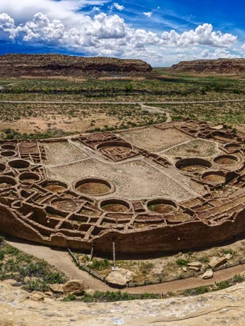
The archaeological tradition historically called Anasazi, now more commonly discussed using terms such as Ancestral Puebloan, produced one of the most remarkable architectural landscapes in the ancient American Southwest.

The center of this network was Chaco Canyon in northwestern New Mexico.

However, Chaco was not an isolated settlement.

Hundreds of sites across the surrounding region show architectural and cultural connections to the canyon.

These are commonly described as Chacoan outliers.

The Chacoan System

Chacoan communities flourished primarily between the ninth and thirteenth centuries CE.

The central canyon contained enormous structures known as great houses.

Examples include:

  • Pueblo Bonito;

  • Chetro Ketl;

  • Pueblo del Arroyo;

  • Kin Kletso.

Similar architectural traditions appeared at distant locations.

The Great Houses

Chacoan great houses contained numerous rooms and sometimes multiple stories.

Construction required:

  • stone quarrying;

  • timber harvesting;

  • masonry;

  • plastering;

  • transportation;

  • organized labor.

The scale of construction suggests sophisticated social organization.

The Road Network

One of Chaco's most fascinating features is its extensive road system.

Roads were often remarkably straight.

Some appear to connect great houses and communities over substantial distances.

These routes were not necessarily equivalent to modern highways.

They may have had:

  • ceremonial functions;

  • political functions;

  • economic functions;

  • pilgrimage functions;

  • communication purposes.

Why Were the Roads So Straight?

The extraordinary linearity of some roads has generated considerable debate.

Possible explanations include:

  1. surveying traditions;

  2. ceremonial movement;

  3. astronomical relationships;

  4. political integration;

  5. communication between settlements.

No single explanation necessarily applies to every road.

Water and Agriculture

The Southwest presented difficult agricultural conditions.

Ancestral Puebloan farmers depended heavily on rainfall and carefully selected agricultural locations.

Crops included:

  • maize;

  • beans;

  • squash.

Agricultural productivity varied with climate.

Outliers and Political Organization

The relationship between Chaco Canyon and distant outliers remains debated.

Some archaeologists interpret the system as evidence of centralized political authority.

Others emphasize networks of ritual interaction and regional cooperation.

The archaeological evidence does not necessarily support a simple model of a centralized "Chacoan empire."

Astronomy

Some Chacoan structures appear to have relationships with solar and lunar cycles.

Sunlight entering particular architectural spaces may have had ceremonial significance.

However, claims about specific astronomical alignments must be evaluated individually.

Long-Distance Exchange

Chacoan sites contained materials transported from distant regions.

These included:

  • turquoise;

  • shells;

  • macaws;

  • copper bells;

  • ceramics.

Such objects demonstrate that the Southwest was connected to extensive exchange networks.

Decline

By the thirteenth century, the Chacoan system changed dramatically.

Population movements and abandonment affected many sites.

Environmental changes, drought, political transformation, and social reorganization probably contributed.

Conclusion

The Chacoan road network is one of the most extraordinary archaeological transportation systems in ancient North America.

Its roads and outlier communities reveal a society capable of coordinating architecture, movement, agriculture, ritual, and long-distance exchange across a vast landscape.

Salmon Ruins: New Mexico's Chaco Colony

September 18, 2026

Introduction

Salmon Ruins is a major archaeological site in northwestern New Mexico associated with the broader Chacoan cultural world.

Constructed during the eleventh century, the site represents an important example of a great house outside Chaco Canyon.

Its archaeological record provides valuable evidence for architecture, household life, craft production, migration, trade, and changing social organization.

The Great House

Salmon Ruins was a large masonry complex.

Its construction involved:

  • sandstone masonry;

  • timber beams;

  • plaster;

  • extensive labor.

The scale of the building demonstrates that it was more than an ordinary household.

Chacoan Architecture

Salmon contains architectural characteristics associated with Chacoan great houses.

These include:

  • large room blocks;

  • plazas;

  • kivas;

  • formal construction techniques;

  • planned architectural arrangements.

Such similarities suggest connections with Chaco Canyon.

Migration and Population

Archaeological research indicates that Salmon was occupied by communities with connections to Chaco.

However, population history was complex.

People moved into and out of the settlement at different times.

This means the site should not be understood as a permanent colony controlled directly from Chaco.

Kivas and Ritual Life

Kivas were important ceremonial spaces.

They were often circular and partly subterranean.

Their functions likely included:

  • ritual activities;

  • community gatherings;

  • social organization;

  • religious ceremonies.

Craft Production

Salmon contains evidence of specialized production.

Archaeologists have identified areas associated with:

  • pottery manufacture;

  • stone working;

  • woodworking;

  • food preparation.

Craft activities reveal the economic diversity of the settlement.

Agriculture

Residents relied heavily on agriculture.

Maize formed an important component of the diet.

The surrounding environment required careful management of water and soil.

Trade

Objects recovered at Salmon demonstrate regional exchange.

Materials moved between communities through networks involving:

  • stone;

  • pottery;

  • shell;

  • turquoise;

  • food;

  • other specialized goods.

Destruction and Abandonment

Salmon eventually experienced a major episode of destruction and was abandoned.

Evidence suggests violent conflict may have played a role.

After abandonment, parts of the site were reused or modified by later populations.

Archaeological Importance

Because Salmon contains multiple occupation phases, it provides a valuable record of social change.

Researchers can compare early Chacoan-associated occupation with later local developments.

Conclusion

Salmon Ruins demonstrates the complexity of the Chacoan world.

Rather than representing a simple colonial outpost, it was a dynamic community connected to broader networks of architecture, migration, trade, ritual, and political change.

Aztec West: New Mexico's Great House Community

September 18, 2026

Introduction

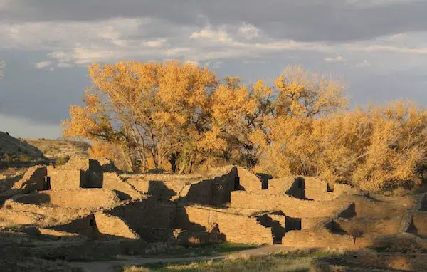
Aztec West, generally associated with the Aztec Ruins complex near present-day Aztec, New Mexico, is one of the most significant Ancestral Puebloan great-house communities in the American Southwest.

Despite its name, the site was not built by the Aztecs of central Mexico.

The name was assigned much later by Euro-American settlers who initially misunderstood the archaeological remains.

The community flourished primarily during the twelfth and thirteenth centuries and appears to have maintained strong connections with the Chacoan tradition.

Architecture

The great house contains hundreds of rooms.

Its architecture includes:

  • masonry room blocks;

  • plazas;

  • ceremonial spaces;

  • kivas;

  • storage areas;

  • residential rooms.

The scale demonstrates substantial labor investment.

Chacoan Connections

Architectural similarities with Chaco Canyon suggest that the community participated in a wider regional tradition.

These similarities include:

  • planned room arrangements;

  • masonry techniques;

  • great kivas;

  • formal plazas;

  • architectural orientation.

The Great Kiva

One of the site's most impressive features is its reconstructed great kiva.

Large ceremonial spaces could accommodate significant numbers of people.

They may have supported community rituals and helped create shared social identities.

Everyday Life

Despite monumental architecture, most residents still depended on ordinary household activities.

They needed to:

  • prepare food;

  • cultivate crops;

  • make pottery;

  • repair tools;

  • process hides;

  • gather fuel;

  • maintain homes.

Archaeology makes it possible to reconstruct these activities through microscopic and macroscopic evidence.

Agriculture

Maize agriculture was fundamental.

Farmers also cultivated beans and squash.

Agriculture was vulnerable to drought and seasonal variability.

Food storage therefore played an important role in community survival.

Water Management

The region's environment required careful water management.

Residents relied on natural water sources and agricultural strategies adapted to local conditions.

Trade and Interaction

Artifacts indicate connections extending beyond the immediate area.

Trade networks moved:

  • turquoise;

  • shell;

  • ceramics;

  • stone;

  • food resources.

These exchanges helped connect communities throughout the Southwest.

Migration and Cultural Change

The settlement experienced significant demographic changes.

People with connections to different regions may have moved into the area.

This means that architectural similarities do not necessarily indicate political domination.

Cultural interaction could occur through migration, marriage, exchange, and religious relationships.

Abandonment

Like many major Ancestral Puebloan settlements, Aztec West was abandoned during the thirteenth century.

The reasons were complex.

Researchers consider:

  • drought;

  • resource stress;

  • social conflict;

  • migration;

  • political transformation.

The descendants of these communities did not simply disappear. Many later Pueblo peoples maintain cultural traditions connected to the broader ancestral landscape.

Conclusion

Aztec West is an extraordinary example of Ancestral Puebloan architecture and social organization.

Its great house, ceremonial spaces, household remains, and regional connections reveal a society capable of monumental construction while maintaining sophisticated agricultural and social systems.

Casamero Pueblo: New Mexico's Chaco Outlier

September 18, 2026

Introduction

Casamero Pueblo is an archaeological site associated with the broader Chacoan architectural tradition of the American Southwest.

Located in northwestern New Mexico, the site forms part of a larger landscape of communities that shared architectural styles and cultural connections with Chaco Canyon.

Its importance lies not simply in its physical structures but in what it reveals about how communities participated in regional systems of architecture, ritual, agriculture, and exchange.

What Was a Chaco Outlier?

The term "Chaco outlier" refers to settlements outside Chaco Canyon that display significant architectural or cultural connections with the Chacoan system.

These communities were not necessarily colonies.

They could have maintained their own local identities while participating in regional networks.

Architecture

Casamero contains masonry structures characteristic of Ancestral Puebloan construction.

Stone was carefully shaped and arranged to create:

  • residential rooms;

  • ceremonial spaces;

  • walls;

  • plazas;

  • storage areas.

Construction required substantial investment.

Great Houses and Social Organization

Large buildings may have functioned as more than residences.

They could serve as:

  • ceremonial centers;

  • gathering places;

  • administrative spaces;

  • symbols of community identity.

Architecture therefore provides clues about social organization.

Agricultural Life

Residents depended on farming.

Maize was central to the diet, while beans and squash supplemented agricultural production.

Farmers also relied on wild plants and animals.

This mixed economy reduced dependence on a single food source.

The Importance of Water

Agriculture in the Southwest was highly sensitive to precipitation.

Rainfall could vary significantly between years.

Communities therefore developed strategies for maximizing agricultural productivity.

These included:

  • selecting productive soils;

  • managing fields;

  • storing food;

  • exploiting multiple ecological zones.

Ritual Architecture

Ceremonial structures such as kivas were important components of Ancestral Puebloan communities.

Their presence demonstrates that ritual activity was integrated into settlement planning.

Regional Networks

Casamero's relationship with other Chacoan sites demonstrates that communities were connected.

Networks could involve:

  • exchange;

  • pilgrimage;

  • marriage;

  • migration;

  • religious relationships;

  • political alliances.

The archaeological record does not require all of these relationships to have been centrally controlled.

Abandonment and Migration

The eventual abandonment of Chacoan settlements was part of a much larger transformation across the Southwest.

People relocated to other regions where their descendants established new communities.

Modern Pueblo peoples maintain cultural traditions connected to these ancestral landscapes.

Archaeological Importance

Casamero contributes to the study of how large regional systems functioned without modern transportation or centralized bureaucratic states.

Its existence demonstrates that communities separated by considerable distances could share architectural, religious, and social traditions.

Conclusion

Casamero Pueblo provides another important piece of the Chacoan archaeological puzzle.

Its architecture and regional connections reveal a sophisticated system of interaction across the ancient Southwest.

The site reminds us that Chacoan society was not simply concentrated in one canyon. It was part of a much larger cultural landscape in which distant communities participated in shared traditions while maintaining their own local histories.

Chimney Rock: Colorado's Astronomical Great House

September 18, 2026

Introduction

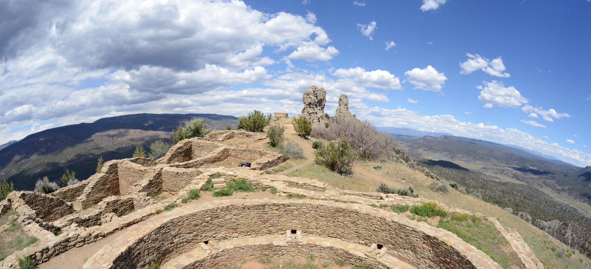
Rising dramatically above the valleys of southwestern Colorado, Chimney Rock is one of the most visually striking archaeological landscapes of the American Southwest. The site consists of two towering rock formations that dominate the surrounding landscape and an associated settlement constructed by Ancestral Puebloan communities during the late eleventh and early twelfth centuries.

What makes Chimney Rock particularly fascinating is not simply its architecture or spectacular setting. Archaeological research indicates that the site had an important relationship with astronomical observations, particularly the movements of the Moon. Its unusual location, architecture, and apparent astronomical alignments have led researchers to consider Chimney Rock a place where architecture, landscape, religion, political authority, and celestial observation came together.

Chimney Rock should therefore not be understood merely as an ancient village. It was part of a broader cultural landscape in which the movements of celestial bodies could have been incorporated into ceremonial practices, agricultural planning, social organization, and religious belief.

The Landscape of Chimney Rock

Chimney Rock lies in southwestern Colorado between the modern communities of Durango and Pagosa Springs. The archaeological area is positioned at approximately 7,600 feet above sea level, making it a relatively high-elevation settlement compared with many other Ancestral Puebloan sites.

The site's most recognizable features are its two enormous natural pillars. These formations rise above the surrounding terrain and would have been visible from considerable distances.

For people living in the region centuries ago, such a dramatic landscape feature would have had practical as well as symbolic significance.

The surrounding environment provided access to:

  • forests;

  • wild plants;

  • game animals;

  • water sources;

  • agricultural land;

  • stone;

  • clay;

  • and other natural resources.

The combination of natural resources and exceptional visibility helped make the location suitable for settlement and ceremonial activity.

The Ancestral Puebloans

The people who constructed Chimney Rock belonged to the broader cultural tradition archaeologists call the Ancestral Puebloans.

This term describes ancient communities that occupied portions of present-day Colorado, Utah, Arizona, and New Mexico. These societies were not a single centralized civilization. Instead, they consisted of numerous communities connected through trade, shared architectural traditions, religious practices, artistic styles, and social relationships.

During the eleventh and twelfth centuries, some communities constructed remarkably complex settlements.

Chimney Rock belongs to this period of increasing architectural and social complexity.

Construction of the Great House

The principal archaeological complex at Chimney Rock includes a large pueblo structure containing numerous rooms. Archaeologists have identified residential and ceremonial components within the settlement.

The architecture demonstrates considerable planning.

Stone walls were constructed using locally available materials, and some structures contained carefully arranged rooms and passageways. The builders had to transport stone, prepare construction materials, organize labor, and maintain structures in a challenging high-elevation environment.

The scale of the complex suggests that the site was not simply an isolated household.

Instead, it appears to have attracted people for activities extending beyond ordinary domestic life.

Chimney Rock and Chaco Canyon

One of the most important questions surrounding Chimney Rock concerns its relationship with Chaco Canyon, the major cultural center of the eleventh-century Southwest.

Chacoan communities constructed enormous great houses, roads, ceremonial structures, and settlements across the Four Corners region.

Chimney Rock shares several architectural and cultural characteristics with Chacoan sites.

This has led archaeologists to interpret Chimney Rock as part of a wider Chacoan interaction sphere.

However, it is important not to assume that Chimney Rock was simply a colony controlled directly by Chaco Canyon.

The relationship between Chaco Canyon and outlying communities remains debated.

Rather than imagining a centralized empire, many researchers emphasize networks involving:

  • pilgrimage;

  • trade;

  • ritual relationships;

  • political alliances;

  • shared religious traditions;

  • and elite interaction.

Chimney Rock may therefore have functioned as a regional center connected to these broader networks.

The Astronomical Mystery

The most famous feature of Chimney Rock is its potential astronomical significance.

The two natural rock pillars create a distinctive horizon feature. Researchers have identified relationships between the structures and the movements of the Moon.

In particular, the site has been associated with the major lunar standstill, a relatively rare astronomical phenomenon occurring approximately every 18.6 years.

During a major lunar standstill, the Moon reaches particularly extreme positions along the horizon.

From specific locations at Chimney Rock, the Moon can appear in relationship to the twin rock formations.

This is one reason the site has been described as an astronomical center.

Why Would the Moon Matter?

For modern observers, celestial alignments may seem purely scientific.

For ancient societies, however, astronomy could have been deeply integrated with religion.

The Sun, Moon, stars, and planets were visible without the interference of modern artificial lighting. Their movements were predictable but sometimes mysterious.

Celestial cycles could therefore become connected with:

  • agricultural seasons;

  • ceremonies;

  • mythology;

  • religious authority;

  • calendrical systems;

  • and community identity.

The Moon was particularly important because its phases provided an obvious recurring cycle.

The approximately 18.6-year lunar standstill cycle is much longer than an agricultural year, making recognition of the phenomenon especially interesting.

If ancient observers intentionally tracked such movements, maintaining that knowledge would have required careful observation across generations.

Architecture as an Astronomical Instrument

Chimney Rock demonstrates an important principle in ancient architecture: buildings do not necessarily need mechanical instruments to function as observational devices.

A mountain, rock formation, wall, doorway, or window can act as a reference point.

By positioning a structure carefully in relation to the surrounding landscape, builders could create a natural observational framework.

The twin rock formations at Chimney Rock provide an especially striking example.

The natural pillars themselves become part of the architectural experience.

The site demonstrates that ancient astronomy could be practiced through:

  • horizon observation;

  • repeated visual observation;

  • architectural alignment;

  • landscape orientation;

  • and long-term record keeping.

Ceremonial Architecture

Chimney Rock also contains structures that archaeologists interpret as having ceremonial functions.

Among the most significant is a great kiva.

Kivas were subterranean or semi-subterranean ceremonial structures found throughout Ancestral Puebloan communities.

Their precise functions varied, but they were commonly associated with communal and ritual activities.

The presence of ceremonial architecture strengthens the argument that Chimney Rock had significance beyond ordinary domestic settlement.

Social Organization

Large construction projects require organized labor.

The construction and maintenance of a substantial settlement at high elevation would have required cooperation.

People had to:

  1. acquire building materials;

  2. transport them;

  3. prepare construction areas;

  4. build walls;

  5. create roofs and floors;

  6. maintain structures;

  7. provide food for workers;

  8. and organize community activities.

This indicates that Chimney Rock was embedded within a society capable of coordinating substantial collective projects.

Such organization does not necessarily mean that the site was ruled by a king or centralized government.

Instead, authority may have been expressed through religious specialists, community leaders, lineage groups, or ceremonial institutions.

Food and Agriculture

Despite the high elevation, the inhabitants of the region practiced agriculture.

Maize was a fundamental crop throughout much of the Ancestral Puebloan world.

Other crops and wild resources supplemented agricultural production.

Living at high elevation would have presented environmental challenges, including:

  • shorter growing seasons;

  • cold temperatures;

  • unpredictable precipitation;

  • and limited arable land.

These conditions made successful agriculture dependent on careful environmental knowledge.

Astronomical observation could potentially have contributed to understanding seasonal cycles, although the exact relationship between astronomy and agricultural decision-making at Chimney Rock remains difficult to establish.

Trade and Long-Distance Connections

Archaeological evidence from Chimney Rock demonstrates that its inhabitants participated in broader exchange networks.

Materials found at the site originated from regions beyond its immediate surroundings.

Such discoveries demonstrate that communities in the ancient Southwest were not isolated.

Goods, technologies, people, and ideas moved across considerable distances.

These networks may have connected Chimney Rock with other settlements in Colorado, New Mexico, Arizona, Utah, and northern Mexico.

Why Was Chimney Rock Abandoned?

Like many Ancestral Puebloan settlements, Chimney Rock was eventually abandoned.

The reasons for abandonment were probably complex.

Environmental changes may have played an important role.

The thirteenth century witnessed major transformations throughout the Southwest, including drought and changing settlement patterns.

However, abandonment should not be interpreted simply as societal collapse.

Ancestral Puebloan descendants continued living elsewhere.

People moved, reorganized communities, and established new settlements.

Therefore, abandonment of Chimney Rock represents a change in settlement location rather than the disappearance of the people themselves.

Archaeology and Interpretation

Chimney Rock illustrates the importance of distinguishing archaeological evidence from modern interpretation.

Archaeologists can demonstrate architectural alignments, construction dates, material remains, and settlement patterns.

Determining exactly what ancient inhabitants believed about the Moon is more difficult.

There are no written documents from Chimney Rock explaining its purpose.

Consequently, interpretations must be based on archaeological evidence and comparison with other Southwestern traditions.

The astronomical interpretation is compelling because the site's architecture and landscape create measurable celestial relationships.

Nevertheless, researchers continue examining how deliberate these alignments were and how they functioned socially and religiously.

Preservation

Chimney Rock is an exceptionally fragile archaeological landscape.

Stone structures that have survived for centuries can be damaged by erosion, weather, vegetation, and human activity.

Archaeological preservation therefore requires careful management.

The site is important not only to researchers but also to Indigenous communities whose cultural histories are connected to the broader Southwest.

Modern archaeological interpretation increasingly recognizes the importance of Indigenous perspectives alongside scientific investigation.

Conclusion

Chimney Rock represents one of the most remarkable intersections of architecture, astronomy, landscape, and society in the ancient American Southwest.

Its monumental natural pillars, substantial settlement, ceremonial structures, and possible lunar alignments demonstrate that the ancient inhabitants understood their environment in sophisticated ways.

The site reminds us that ancient astronomy was not necessarily separated from religion or daily life. The sky could be simultaneously a calendar, a sacred realm, a source of symbolism, and a guide to understanding the natural world.

Chimney Rock therefore deserves attention not merely as an archaeological ruin, but as a carefully constructed cultural landscape in which human communities interacted with mountains, architecture, celestial cycles, and one another.

Its enduring mystery lies in the fact that the stones remain, while many of the explanations that once gave those stones meaning have been lost. Archaeology can reconstruct portions of that story, but Chimney Rock continues to invite questions about how its builders understood the universe above them.

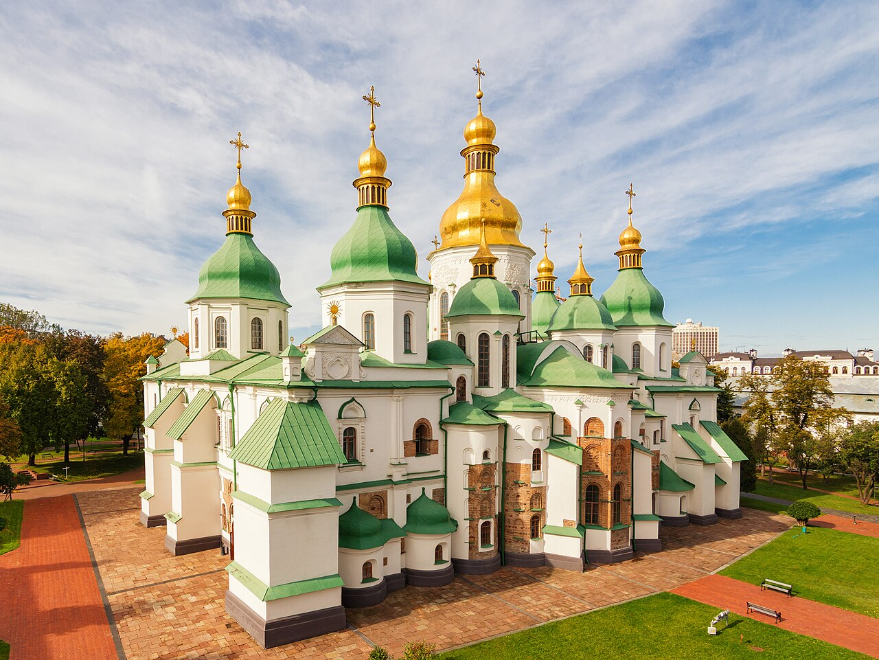
Hovenweep: Utah's Tower Villages

September 18, 2026

Introduction

Scattered across the rugged landscape along the Utah–Colorado border, Hovenweep preserves one of the most extraordinary concentrations of ancient stone architecture in the American Southwest. Its towers, pueblos, walls, reservoirs, and agricultural features were constructed primarily by Ancestral Puebloan communities between approximately the thirteenth century and the periods immediately preceding it.

The word Hovenweep is derived from a Ute word commonly translated as something resembling "deserted valley", an appropriate description of the quiet landscape surrounding the ruins today.

Yet the archaeological evidence reveals that these places were once active communities.

Hovenweep's towers are particularly famous. Rising from canyon rims and isolated rock formations, they appear almost fortress-like. Their exact functions remain debated. Some may have been residential structures, others storage facilities, ceremonial buildings, lookout points, or combinations of several functions.

The mystery of Hovenweep is therefore not simply why people built towers in such an environment, but how those structures fitted into the larger social and environmental system of Ancestral Puebloan life.

A Landscape of Canyons and Water

Hovenweep is located in a relatively dry region characterized by mesas, sandstone formations, shallow canyons, and limited water.

This environment presented serious challenges to human settlement.

Water availability was especially important.

The inhabitants developed strategies for capturing and conserving rainfall.

Archaeological features include:

  • check dams;

  • reservoirs;

  • agricultural terraces;

  • diversion structures;

  • and carefully positioned fields.

These features demonstrate that survival depended on detailed knowledge of the local landscape.

The Hovenweep Towers

The towers are the site's defining architectural feature.

Some are circular.

Others are square or D-shaped.

Several contain carefully constructed masonry that demonstrates considerable technical skill.

Walls were made from locally available sandstone and carefully fitted together.

The builders did not possess modern machinery, but they were capable of constructing stable multi-story structures using stone, mortar, wooden beams, and other locally available materials.

Why Build Towers?

The function of the towers remains one of Hovenweep's most intriguing archaeological questions.

A tower could serve several purposes.

It might have been:

  • a dwelling;

  • a storage building;

  • a ceremonial structure;

  • a defensive structure;

  • an observation point;

  • or a combination of functions.

The assumption that towers were military fortifications is tempting because their appearance resembles medieval defensive architecture.

However, there is limited evidence for warfare being the sole reason for their construction.

In the ancient Southwest, architecture could have multiple overlapping functions.

A tower could simultaneously provide storage, social space, visibility, and symbolic importance.

Square Tower and Its Architecture

Square Tower is one of the best-known structures at Hovenweep.

The building's masonry demonstrates the sophistication of Ancestral Puebloan construction.

Stone blocks were carefully arranged to produce relatively smooth walls.

Interior spaces were divided into rooms and levels.

The structure's position near the canyon edge also provided a dramatic relationship between architecture and landscape.

This relationship appears repeatedly throughout Hovenweep.

The Importance of Water

Water management was essential to the survival of Hovenweep communities.

Rainfall in the region is limited and unpredictable.

Rather than depending solely on permanent streams, inhabitants developed systems for collecting seasonal runoff.

Small dams could slow water movement.

Reservoirs could store water.

Terraces could reduce erosion and preserve soil moisture.

These strategies demonstrate sophisticated environmental adaptation.

Farming in a Difficult Environment

Agriculture was central to Ancestral Puebloan society.

Maize was the most important crop, supplemented by beans, squash, wild plants, and hunted animals.

Dry farming required careful attention to soil and water.

Farmers needed to select locations where moisture could remain available long enough for crops to mature.

The landscape itself could therefore become an agricultural technology.

Stone terraces and check dams modified natural drainage patterns to improve cultivation.

Social Organization

The construction of Hovenweep's buildings required substantial labor.

People had to quarry and transport stone, prepare mortar, collect timber, construct roofs, and maintain agricultural systems.

Such projects suggest organized communities.

However, Hovenweep was not necessarily a single unified settlement.

Instead, it consisted of multiple communities distributed across the landscape.

These settlements may have maintained close social relationships while retaining local autonomy.

Hovenweep and the Wider Southwest

Hovenweep belonged to a much larger network of Ancestral Puebloan communities.

Its inhabitants were connected through trade, migration, shared architectural traditions, religious practices, and cultural exchange.

Similar masonry techniques appear elsewhere in the Four Corners region.

Artifacts also demonstrate long-distance connections.

The movement of materials and ideas suggests that ancient Southwestern communities were part of interconnected regional systems.

Agriculture, Trade, and Food Security

Local agriculture could be supplemented through exchange.

Trade networks provided access to materials unavailable locally.

These could include:

  • shells;

  • minerals;

  • pigments;

  • pottery;

  • stone;

  • and other goods.

Exchange was not necessarily conducted through a formal market economy.

It could involve reciprocal relationships, ceremonial exchange, marriage networks, or political alliances.

The Thirteenth-Century Transformation

Hovenweep communities experienced major changes during the thirteenth century.

This period was characterized by widespread transformations throughout the Four Corners region.

Climate change and drought likely contributed to these changes.

Population movements also occurred.

Communities were reorganized and eventually many settlements were abandoned.

Hovenweep's abandonment therefore belongs to a much broader regional process.

Abandonment Was Not the End

It is important not to describe Hovenweep as evidence that Ancestral Puebloan civilization simply disappeared.

The people who left these settlements did not vanish.

Their descendants are associated with modern Pueblo communities.

Migration and resettlement transformed the geography of Southwestern society.

Archaeological sites such as Hovenweep therefore represent ancestral places within a living Indigenous history.

Preservation Challenges

The remote location of Hovenweep has helped preserve its archaeological character, but it also creates conservation challenges.

Wind, rain, temperature fluctuations, erosion, and biological growth gradually damage masonry.

Human visitors can also unintentionally contribute to deterioration.

Preservation therefore requires careful management and respect for archaeological structures.

Conclusion

Hovenweep is remarkable because its architecture appears to emerge directly from the landscape.

The towers stand on canyon edges, above reservoirs, beside agricultural areas, and among natural rock formations.

They demonstrate that Ancestral Puebloan builders were not simply constructing buildings. They were creating an integrated landscape in which architecture, water, agriculture, community, and environment were interconnected.

The exact purpose of every tower may never be known.

That uncertainty, however, does not diminish their importance.

Hovenweep demonstrates the ability of ancient communities to survive in difficult environments while producing sophisticated architecture and complex social landscapes.

Its deserted towers are therefore not symbols of a vanished civilization but enduring evidence of the ingenuity, adaptability, and cultural continuity of the Indigenous peoples of the American Southwest.

← Newer Posts Older Posts →
Featured
images (88).jpeg
September 20, 2026
Vendel Cemetery: Sweden's Pre-Viking Elite Graves
September 20, 2026
Read more →
September 20, 2026
images (89).jpeg
September 20, 2026
Valsgärde: Sweden's Ship Burials
September 20, 2026
Read more →
September 20, 2026
images (90).jpeg
September 20, 2026
Boat Graves of Salme: Estonia's 8th-Century Warriors
September 20, 2026
Read more →
September 20, 2026
images (92).jpeg
September 20, 2026
Rõuge: Estonia's Bronze Age Hillfort
September 20, 2026
Read more →
September 20, 2026
images (93).jpeg
September 20, 2026
Asva: Saaremaa's Iron Age Fort
September 20, 2026
Read more →
September 20, 2026
images (94).jpeg
September 20, 2026
Ridala: Estonia's Stone Cist Graves
September 20, 2026
Read more →
September 20, 2026
read more

Powered by The archaeologist