• MAIN PAGE
  • LATEST NEWS
    • Lost Cities
    • Archaeology's Greatest Finds
    • Underwater Discoveries
    • Greatest Inventions
    • Studies
    • Blog
  • PHILOSOPHY
  • HISTORY
  • RELIGIONS
    • Africa
    • Anatolia
    • Arabian Peninsula
    • Balkan Region
    • China - East Asia
    • Europe
    • Eurasian Steppe
    • Levant
    • Mesopotamia
    • Oceania - SE Asia
    • Pre-Columbian Civilizations of America
    • Iranian Plateau - Central Asia
    • Indus Valley - South Asia
    • Japan
    • The Archaeologist Editor Group
    • Scientific Studies
    • Aegean Prehistory
    • Historical Period
    • Byzantine Middle Ages
    • Predynastic Period
    • Dynastic Period
    • Greco-Roman Egypt
  • Rome
  • PALEONTOLOGY
  • About us
Menu

The Archaeologist

  • MAIN PAGE
  • LATEST NEWS
  • DISCOVERIES
    • Lost Cities
    • Archaeology's Greatest Finds
    • Underwater Discoveries
    • Greatest Inventions
    • Studies
    • Blog
  • PHILOSOPHY
  • HISTORY
  • RELIGIONS
  • World Civilizations
    • Africa
    • Anatolia
    • Arabian Peninsula
    • Balkan Region
    • China - East Asia
    • Europe
    • Eurasian Steppe
    • Levant
    • Mesopotamia
    • Oceania - SE Asia
    • Pre-Columbian Civilizations of America
    • Iranian Plateau - Central Asia
    • Indus Valley - South Asia
    • Japan
    • The Archaeologist Editor Group
    • Scientific Studies
  • GREECE
    • Aegean Prehistory
    • Historical Period
    • Byzantine Middle Ages
  • Egypt
    • Predynastic Period
    • Dynastic Period
    • Greco-Roman Egypt
  • Rome
  • PALEONTOLOGY
  • About us
No results found

Proosa: Estonia's Viking Age Settlement

September 20, 2026

Introduction

Proosa provides important evidence for settlement and everyday life in Estonia during the Viking Age.

While famous Viking archaeological sites often emphasize spectacular weapons, ships, and treasure, settlements such as Proosa reveal another side of the period.

They show how ordinary communities lived.

People cultivated land, raised animals, manufactured tools, prepared food, built houses, traded with neighbors, and participated in the wider economic networks of the Baltic Sea.

Life in the Viking Age Baltic

The Viking Age was not simply an era of Scandinavian raids.

Across the Baltic, communities developed complex economies.

Estonia occupied an important geographical position between Scandinavia, Finland, the eastern Baltic, and eastern European regions.

This encouraged interaction.

Goods and ideas traveled along maritime and overland routes.

Houses and Settlement

Viking Age Estonian houses were generally constructed using locally available materials.

Wood was particularly important.

Buildings could include living spaces, storage areas, workshops, and animal-related structures.

Hearths served as sources of heat and cooking.

The archaeological remains of these structures are often fragmentary because organic materials decay.

Nevertheless, postholes, hearths, floors, and refuse deposits can reveal the organization of settlements.

Agriculture

Agriculture formed the economic foundation of most settled communities.

Farmers cultivated cereals and maintained livestock.

Cattle provided meat, milk, hides, and labor.

Sheep supplied wool.

Pigs provided meat.

Horses were important for transportation and status.

Agriculture was supplemented by fishing, hunting, gathering, and trade.

Craft Production

Settlement archaeology often reveals small-scale manufacturing.

People produced pottery, textiles, wooden objects, bone tools, leather goods, and metal items.

Some craftsmen may have specialized.

Others likely combined craft production with farming.

This flexible economy allowed households to survive changing conditions.

Trade

The Baltic Sea created a major transportation network.

Estonian settlements could participate in exchange with Scandinavian communities and other Baltic regions.

Goods could include:

  • furs;

  • amber;

  • iron;

  • textiles;

  • ceramics;

  • salt;

  • ornaments;

  • weapons.

Trade also transmitted cultural practices.

Religion and Belief

Viking Age communities practiced religious traditions that combined local beliefs with influences from neighboring cultures.

Burial practices, ornaments, symbols, and ritual objects can provide evidence for belief systems.

Christianity was beginning to spread through the Baltic during the later Viking Age, although conversion occurred gradually.

Warfare

The Viking Age was also an era of conflict.

Weapons found in settlements or nearby graves demonstrate the importance of military preparedness.

Yet most inhabitants were not professional warriors.

Farmers, craftsmen, and merchants could possess weapons for defense.

Military activity should therefore be understood within the broader social structure.

Archaeological Importance

Proosa contributes to understanding the ordinary foundations of Viking Age society.

A settlement provides different evidence from a royal burial.

Instead of focusing on one elite individual, archaeologists can investigate households and communities.

This helps correct the impression that the Viking Age was dominated exclusively by kings and warriors.

Conclusion

Proosa represents the everyday world behind the Viking Age.

Its significance lies not necessarily in spectacular monuments but in the evidence of ordinary human activity.

Agriculture, craft production, trade, domestic life, and regional interaction formed the foundation of the Baltic societies that existed during this period.

By studying settlements such as Proosa, archaeologists can reconstruct the lives of the people whose labor sustained the more famous warriors, merchants, and rulers of the Viking world.
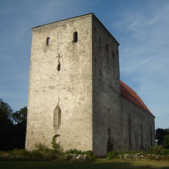
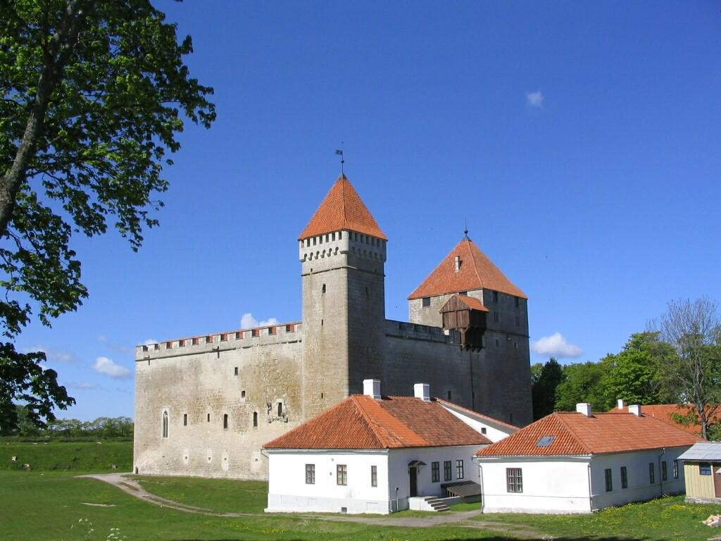
Pöide: Estonia's Medieval Castle Hill

September 20, 2026

Introduction

Pöide represents an important chapter in the medieval history of Saaremaa and Estonia.

The site's fortified landscape reflects the political transformations that reshaped the eastern Baltic during the medieval period.

Fortified centers were essential to medieval societies because they combined military defense with political administration.

A castle or fortified hill could protect territory, control movement, provide a residence for authorities, and serve as a visible symbol of power.

Pöide's history reflects the complicated interaction between local communities, Christian institutions, and expanding political powers.

Saaremaa in the Medieval Period

Saaremaa occupied an important position in the Baltic Sea.

Its inhabitants had long participated in maritime networks.

During the medieval period, the island became increasingly drawn into the political struggles involving Scandinavian kingdoms, German crusading powers, and local communities.

This transformed the strategic importance of fortified locations.

The Castle

The fortified center at Pöide developed as part of a wider medieval defensive system.

Stone became increasingly important in medieval fortification.

Unlike temporary wooden defenses, masonry structures could withstand fire and provide stronger protection.

Walls, towers, gates, and internal buildings could be combined into a carefully organized defensive complex.

Military Function

A castle had several military purposes.

It could protect soldiers.

It could store supplies.

It could serve as a refuge during conflict.

It could control roads, waterways, or surrounding territory.

Its psychological function was equally important.

A large stone fortress demonstrated that its builders possessed resources, labor, and political authority.

Christianity and Political Change

Medieval Saaremaa experienced major religious transformation.

Christian institutions became increasingly influential.

Churches and fortified centers sometimes developed together because political and religious authority were closely connected.

Conversion was not simply a matter of personal belief.

It was connected to changes in law, taxation, political allegiance, and international diplomacy.

Local Resistance and Conquest

The Baltic region experienced prolonged political conflict during the medieval period.

Local populations defended their autonomy against expanding powers.

Fortifications became central to these struggles.

Pöide must therefore be understood within a broader history of conquest, resistance, and political consolidation.

Architecture

Medieval defensive architecture was based on several principles.

Walls needed sufficient thickness.

Entrances were carefully controlled.

Elevated locations provided defensive advantages.

Stone construction required skilled masons.

Timber could supplement masonry structures.

The resulting fortress combined engineering with strategic planning.

Everyday Life Inside a Fortress

A medieval fortification was not occupied only by soldiers.

It could contain administrators, craftsmen, servants, religious personnel, and other residents.

Food had to be stored.

Weapons had to be maintained.

Buildings required constant repair.

Animals and supplies needed management.

A castle was therefore a functioning community.

Trade and Administration

Fortified centers could also function as administrative hubs.

Authorities could collect taxes, regulate trade, enforce laws, and manage surrounding territories.

Their strategic location made them useful for controlling economic activity.

This demonstrates why castles were instruments of government as well as military structures.

Archaeological Evidence

Archaeologists reconstruct medieval fortified sites through architectural remains, artifacts, and landscape analysis.

Stone walls reveal construction techniques.

Ceramics provide information about domestic activity.

Metal objects reveal tools and weapons.

Animal bones reveal diet and livestock.

Coins can indicate economic connections.

Together these materials create a picture of life within the fortress.

The Legacy of Pöide

Pöide's importance extends beyond its physical ruins.

The site represents the broader transformation of Estonia from prehistoric and Viking Age societies into medieval Christian political structures.

It illustrates how military architecture became a tool of state formation.

Conclusion

Pöide's medieval castle hill reflects a period when the eastern Baltic underwent profound political and religious transformation.

Its fortifications demonstrate the importance of military technology.

Its settlement history reveals changing systems of administration.

Its Christian context illustrates the transformation of religious and political authority.

Most importantly, Pöide demonstrates that medieval castles were not isolated military structures.

They were centers of power, administration, economy, religion, and community life.

The ruins that survive today are therefore fragments of a much larger medieval world—one shaped by warfare, commerce, conversion, and the struggle for control of the Baltic.

Kuressaare: Saaremaa's Episcopal Castle Site

September 20, 2026

Introduction

Rising from the shores of Saaremaa in western Estonia, Kuressaare Castle is one of the most impressive surviving medieval fortifications in the eastern Baltic. The castle developed as an important center of ecclesiastical and political authority under the bishops of Ösel-Wiek, whose territory encompassed Saaremaa and neighboring regions.

Today, the fortress is one of Estonia's best-preserved medieval castles. Its massive stone walls, towers, courtyard, and defensive architecture provide an unusually clear picture of how religious authority, military power, and territorial administration were combined during the Middle Ages.

Kuressaare is particularly fascinating because it was not simply a military fortress. It was also a residence, administrative center, religious institution, and symbol of episcopal authority.

Saaremaa in the Medieval Baltic

Saaremaa occupies a strategic position in the Baltic Sea.

The island lies close to important maritime routes connecting Estonia with Latvia, Sweden, Finland, and other parts of northern Europe. Long before the castle was constructed, Saaremaa communities participated in Baltic commerce and maritime activity.

During the medieval period, however, the island became increasingly incorporated into the political and religious structures of Christian Europe.

The conquest and Christianization of the eastern Baltic during the thirteenth century transformed Saaremaa's political landscape.

The Bishopric of Ösel-Wiek

Kuressaare's history is closely connected with the medieval Bishopric of Ösel-Wiek.

The bishop was both a religious leader and a territorial ruler. This combination of spiritual and secular authority was common in medieval Europe.

The bishop required fortified centers from which territory could be governed and defended.

Kuressaare eventually became one of the most important episcopal centers on Saaremaa.

Construction of the Castle

The stone fortress visible today developed over several stages.

Earlier defensive structures existed before the great stone complex reached its mature form. Construction and modification continued over generations as military technology and political circumstances changed.

The castle's design reflects the evolution of medieval fortress architecture.

Its thick walls were capable of resisting attacks using contemporary siege equipment, while towers provided elevated positions for defenders.

The Square Fortress

One of the most recognizable features of Kuressaare Castle is its strong geometric organization.

The central courtyard is surrounded by substantial defensive walls and buildings.

This arrangement created a protected internal space where residents could live and work while remaining inside the fortified complex.

The castle's architecture demonstrates the importance of controlled access.

A hostile force could not simply enter the central residential areas without first overcoming multiple defensive obstacles.

Religious and Secular Authority

Kuressaare illustrates an important characteristic of medieval political organization: religion and government were deeply interconnected.

The bishop's authority was religious, but he also exercised political and administrative power.

The castle therefore represented both:

  • ecclesiastical authority;

  • territorial government;

  • military power;

  • economic administration;

  • aristocratic residence.

Its architecture communicated this authority to the surrounding population.

Daily Life Inside the Castle

Life within a medieval castle was not exclusively military.

Residents would have included clergy, administrators, servants, guards, craftsmen, and other personnel.

The castle needed food storage, kitchens, water supplies, heating systems, workshops, and areas for religious activities.

During periods of peace, the fortress functioned as a working administrative center.

During periods of conflict, its defensive architecture became much more important.

Saaremaa and the Baltic Crusades

The establishment of Christian rule in Saaremaa occurred within the broader context of the Northern Crusades.

German, Danish, Scandinavian, and local powers competed for influence across the eastern Baltic.

The Christianization of the region was therefore not simply a religious process.

It involved conquest, political restructuring, economic change, and the establishment of new systems of landholding.

Kuressaare became part of this transformed political order.

Military Importance

The castle's defensive strength was particularly valuable because Saaremaa's position exposed it to maritime threats.

Control of the island could influence shipping routes across the Baltic.

A fortified episcopal residence could protect political officials while also serving as a base for military operations.

Its walls were designed to withstand attacks from weapons that were becoming increasingly sophisticated during the later Middle Ages.

Later Historical Development

Kuressaare Castle continued to be modified and reused after the medieval period.

As artillery transformed European warfare, traditional medieval fortifications became increasingly vulnerable.

Nevertheless, the castle remained politically and strategically important.

Its later history reflects the changing powers that controlled Saaremaa and the wider Baltic region.

Archaeological Significance

Archaeological and architectural research has revealed information about the castle's construction phases and changing functions.

Researchers can examine masonry techniques, architectural alterations, artifacts, and surviving structural elements to reconstruct how the fortress developed.

Such evidence helps historians understand not only military architecture but also medieval administration and everyday life.

Conclusion

Kuressaare Castle is one of the most significant medieval monuments in Estonia.

Its importance extends far beyond its impressive walls.

The fortress represents the intersection of Christianity, political authority, military technology, maritime geography, and medieval state formation.

Standing on Saaremaa's Baltic shores, Kuressaare preserves the physical remains of a period when religious institutions could also function as territorial governments and fortified castles served simultaneously as residences, administrative centers, and symbols of power.

For understanding medieval Estonia and the wider eastern Baltic world, Kuressaare is an essential archaeological landmark.

Haapsalu: Estonia's 13th-Century Fortress

September 20, 2026

Introduction

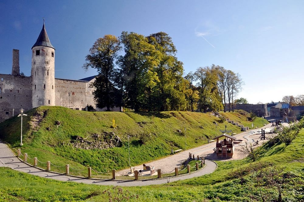
Haapsalu Castle is one of Estonia's most important medieval architectural complexes and a major reminder of the political transformation that occurred in the eastern Baltic during the thirteenth century.

The fortress developed as a major center of the Bishopric of Ösel-Wiek. Unlike a purely military stronghold, Haapsalu served as a religious center, episcopal residence, administrative headquarters, and defensive complex.

Its ruins preserve evidence of centuries of political competition, religious transformation, military development, and urban growth.

Medieval Haapsalu

Haapsalu developed during the medieval period in an area that offered access to the Baltic Sea and regional transportation routes.

Its location made it valuable for both administration and trade.

The establishment of Christian political authority created new centers of power, and Haapsalu became one of the most important of these.

The Bishopric of Ösel-Wiek

The bishopric controlled territory across western Estonia.

Its rulers required fortified residences from which they could administer lands, collect revenues, conduct religious activities, and organize military defense.

Haapsalu became a principal episcopal center.

The castle therefore functioned as part of a larger territorial system rather than as an isolated fortress.

Architectural Development

Construction began during the thirteenth century and continued over subsequent generations.

The complex incorporated religious and defensive structures.

Its walls enclosed substantial areas, while towers strengthened vulnerable points.

The cathedral church was especially important because it demonstrated the religious role of the site.

The combination of cathedral and fortress architecture is one of Haapsalu's defining characteristics.

The Cathedral

The cathedral was the spiritual heart of the complex.

Its presence demonstrates that Haapsalu was more than a military installation.

Religious ceremonies, ecclesiastical administration, and the activities of clergy all formed part of the site's daily life.

The cathedral's architecture also reflected the wealth and authority of the bishopric.

Defensive Functions

The surrounding walls provided protection against armed attack.

During periods of political instability, fortified episcopal centers could become essential refuges.

Medieval warfare in the Baltic involved raids, sieges, territorial disputes, and struggles between competing political powers.

A strong fortress therefore represented a substantial political advantage.

The Castle as a Residence

The bishop and his household required suitable accommodation.

The complex included spaces for administration, storage, domestic activities, and religious life.

High-status medieval residences were designed to communicate authority.

Visitors entering the castle would encounter architecture that demonstrated the resources and organizational capacity of the bishopric.

Political Context

Haapsalu existed within a complicated political environment.

The eastern Baltic was contested by local communities and external powers including Danish, German, Swedish, and later other regional authorities.

The establishment of castles helped these powers maintain control over strategically important territories.

Haapsalu consequently became part of the broader history of medieval Baltic state formation.

Urban Development

The fortress influenced the development of Haapsalu itself.

Settlements commonly grew around medieval castles and religious institutions because these sites generated demand for craftsmen, merchants, food suppliers, and services.

The castle therefore contributed to the development of a wider urban economy.

Archaeological Evidence

Archaeological investigation of Haapsalu has uncovered artifacts and structural evidence that reveal aspects of medieval life.

Objects recovered from the site can provide information about:

  • diet;

  • trade;

  • craftsmanship;

  • religious practice;

  • warfare;

  • domestic life.

Architectural analysis also helps identify different construction phases.

Later History

Haapsalu's importance continued after the Middle Ages, although changing political circumstances altered the castle's functions.

Military technology also transformed.

The introduction and increasing use of gunpowder artillery reduced the effectiveness of traditional medieval fortifications.

Parts of the complex eventually fell into ruin.

Yet the surviving remains preserve the medieval plan and architectural character of the site.

Conclusion

Haapsalu Castle represents the complex relationship between religion, government, and military power in medieval Estonia.

Its cathedral, walls, towers, and residential structures demonstrate how an episcopal center could serve several purposes simultaneously.

Today, the ruins provide an unusually valuable window into the medieval eastern Baltic and the centuries when Christian institutions became central to political organization.

Haapsalu is therefore not merely a picturesque ruin. It is a physical record of the transformation of Estonia.

Padise: Estonia's Cistercian Monastery Ruins

September 20, 2026

Introduction

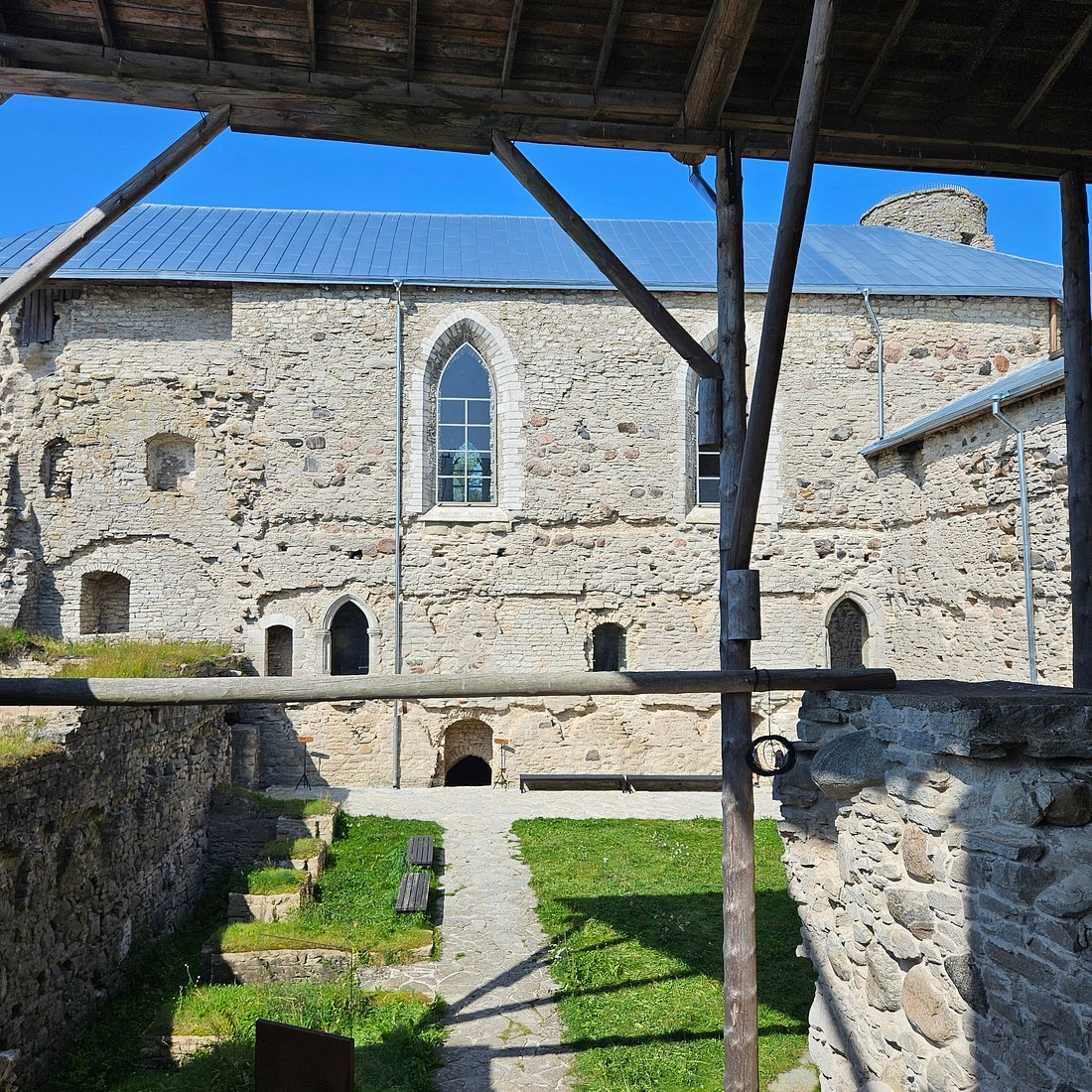
The ruins of Padise Monastery preserve the remains of one of medieval Estonia's most significant religious institutions. Founded by Cistercian monks, Padise became an important center of religious life, agriculture, landholding, and economic organization in western Estonia.

The monastery illustrates how medieval monasteries were far more than places where monks prayed.

They were agricultural enterprises, landowners, educational institutions, centers of manuscript culture, and important components of regional economies.

The Cistercian Tradition

The Cistercian Order emerged in western Europe during the late eleventh century as a reform movement within Western monasticism.

Cistercians emphasized disciplined religious life, manual labor, simplicity, and agricultural self-sufficiency.

Their monasteries often became major economic institutions.

Padise belonged to this wider European network.

Foundation of Padise

The monastery developed during the medieval period following the Christianization and political restructuring of Estonia.

Cistercian monks from another Baltic monastery established the religious community at Padise.

The location provided access to agricultural land and transportation routes.

This allowed the monastery to support itself while participating in regional economic networks.

Monastic Architecture

Padise's architecture reflected both religious requirements and practical necessities.

A medieval monastery typically required:

  • a church;

  • cloisters;

  • dormitories;

  • kitchens;

  • storage rooms;

  • workshops;

  • agricultural facilities;

  • administrative spaces.

At Padise, these functions were incorporated into a substantial stone complex.

A Monastery and Agricultural Enterprise

Agriculture was fundamental to monastic life.

Monks and lay workers cultivated crops, raised animals, managed forests, and maintained other resources.

The monastery's agricultural activities could support both the resident community and broader economic exchange.

The Cistercian approach emphasized productive landscapes.

Land management therefore became an important component of religious practice.

Economic Networks

Padise did not exist in isolation.

Monasteries exchanged goods with surrounding communities and participated in regional markets.

Surplus agricultural products could be traded.

Specialized crafts could also be performed within or around the monastery.

The monastery's economic power allowed it to acquire additional land and resources.

Political Relationships

Medieval monasteries often depended upon relationships with secular rulers.

Land grants, privileges, taxation arrangements, and legal protections affected their prosperity.

Padise's history therefore reflects the interaction between religious institutions and political authorities.

Defensive Architecture

One of Padise's most unusual characteristics is the substantial defensive character of its later architecture.

Political instability in the Baltic could threaten religious institutions.

The monastery was therefore fortified.

This transformation demonstrates that medieval religious communities sometimes had to adapt to military realities.

The boundary between monastery and fortress could become surprisingly thin.

Daily Life of the Monks

Monastic life followed a structured schedule.

The monks divided their day between:

  • prayer;

  • religious services;

  • work;

  • meals;

  • study;

  • rest.

The rhythm of life was regulated by the liturgical calendar.

Work was not regarded simply as economic necessity. Within the Cistercian tradition, labor could be considered an important component of disciplined religious life.

Archaeological Importance

The surviving ruins allow researchers to reconstruct aspects of monastic organization.

Architectural remains reveal the relationship between sacred and practical spaces.

Artifacts provide additional evidence for food consumption, trade, craft production, and domestic activity.

Together, these discoveries show how a medieval religious community functioned materially.

Destruction and Decline

Like many medieval institutions in the Baltic, Padise experienced periods of conflict and political disruption.

The Reformation and subsequent changes in religious and political organization fundamentally altered the monastery's role.

The monastic institution was eventually dissolved.

The buildings lost their original purpose and gradually deteriorated.

Conclusion

Padise Monastery provides a remarkable illustration of medieval religious life in Estonia.

Its history combines spirituality, agriculture, architecture, economics, politics, and warfare.

The ruins remind us that monasteries were major institutions capable of transforming landscapes and shaping regional economies.

Padise therefore represents much more than a ruined religious building. It is an archaeological record of the complex organization of medieval European society on the eastern Baltic frontier.

Tallinn's Toompea: Estonia's Danish Castle

September 20, 2026

Introduction

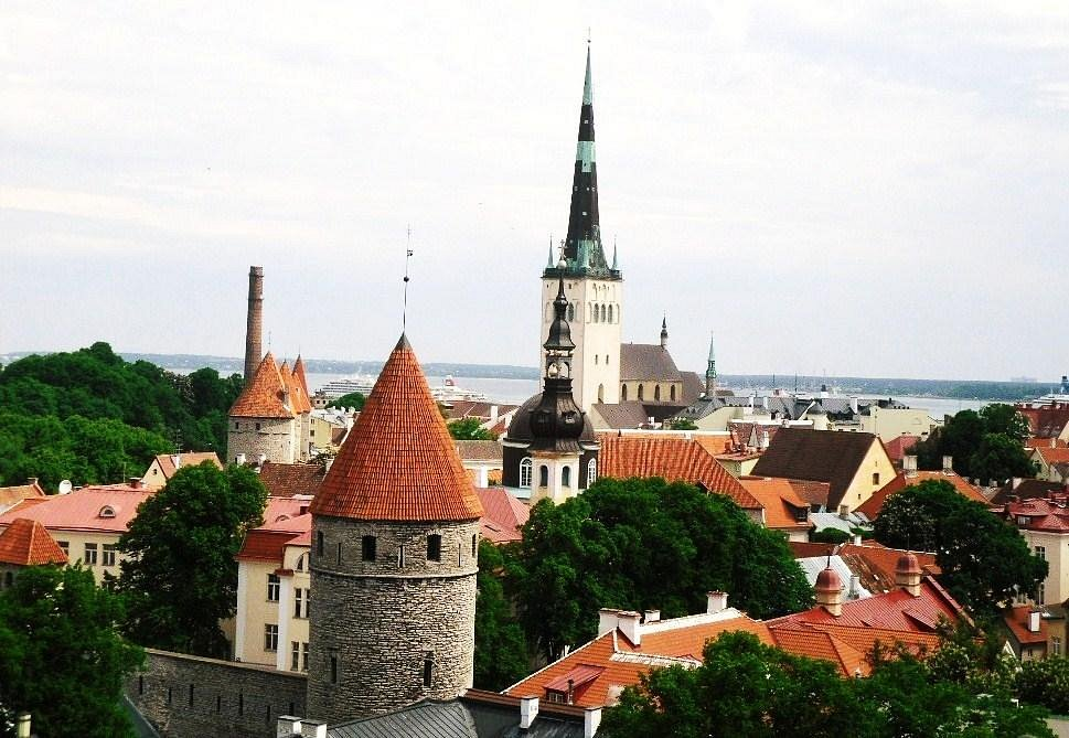
Toompea Hill dominates the historic skyline of Tallinn and has served as a center of political power for centuries. Its strategic elevation made it an ideal location for a fortress, while its position overlooking the surrounding city and Baltic approaches made it valuable to successive rulers.

The medieval history of Toompea is closely connected with Danish expansion into northern Estonia.

The castle represents an important stage in the formation of medieval Tallinn and illustrates how fortifications could become the foundations of political administration.

A Strategic Hill

Toompea's greatest advantage was its elevation.

A fortress located on a high hill could observe surrounding territory and provide defenders with a significant tactical advantage.

From the hill, authorities could oversee the settlement below and monitor important approaches.

This strategic geography helps explain why the location remained politically important for so long.

Danish Conquest

During the early thirteenth century, Danish forces became deeply involved in northern Estonia.

The conquest of Tallinn and surrounding territory brought the region into the Danish political sphere.

A fortified center was essential for maintaining authority.

Toompea consequently became a major seat of power.

The Danish Castle

The castle was developed and rebuilt repeatedly.

Medieval fortifications rarely remained unchanged because political requirements and military technology evolved.

Walls were strengthened, towers modified, and internal buildings reconstructed.

The result was a complex architectural palimpsest in which different periods of Estonian and Baltic history can be identified.

Tallinn and the Hanseatic World

Tallinn eventually became one of the major commercial cities of the eastern Baltic.

Its harbor connected the city to the wider Hanseatic trading system.

Toompea, however, represented a different form of power.

While the lower town became increasingly associated with merchants and urban commerce, Toompea was strongly connected with political and aristocratic authority.

The geographical division between the upper and lower town reflected social and institutional differences.

Nobility and Government

Throughout later medieval and early modern history, Toompea remained associated with governing elites.

Political institutions developed around the castle.

This made the hill a center from which territory could be administered.

The castle's importance consequently survived changes in ruling dynasties and political systems.

Architecture

Toompea's architecture combines defensive and residential elements.

Medieval castles required strong walls, controlled entrances, towers, storage areas, and accommodation for rulers and officials.

Later periods added new architectural styles and administrative buildings.

The modern appearance of Toompea therefore represents centuries of reconstruction rather than a single medieval building phase.

Archaeological Evidence

Archaeological research on Toompea has revealed evidence for earlier occupation beneath later structures.

Excavations and architectural studies can identify different phases of fortification and settlement.

Such evidence demonstrates that the hill was strategically significant before and after the Danish conquest.

The Symbolism of Toompea

Toompea became more than a physical fortress.

It became a symbol of authority.

Control of the hill represented control over the city and, more broadly, over northern Estonia.

The ability of the site to remain politically significant for centuries is one of its most remarkable characteristics.

Conclusion

Tallinn's Toompea demonstrates how geography can shape political history.

A naturally defensible hill became a fortified center, a seat of rulers, and eventually one of the most important political landscapes in Estonia.

Its Danish medieval origins form only one chapter in a much longer story.

Today, Toompea remains a powerful reminder that Tallinn's political importance was rooted in a strategic hill overlooking the Baltic world.

Narva Fortress: Estonia's 13th-Century Border Stronghold

September 20, 2026

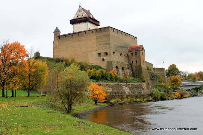
Narva Fortress stands beside the Narva River at one of the most strategically important points in northeastern Estonia. For centuries, the river formed a major political and military boundary, and control of the crossing was crucial for states competing for influence in the eastern Baltic.

The fortress therefore represents much more than medieval military architecture.

It is a physical expression of centuries of competition between Scandinavian, Baltic, German, and Russian political powers.

The Narva River

Geography determined Narva's importance.

The Narva River connects Lake Peipus with the Baltic Sea.

This created a natural transportation corridor between inland territories and maritime routes.

A fortified crossing could therefore control movement through a large region.

Medieval Origins

Fortifications developed at Narva during the medieval period as external powers expanded their influence across northeastern Europe.

The Danish rulers of northern Estonia played an important role in establishing a fortified presence.

The site subsequently underwent repeated reconstruction.

Hermann Castle

The most famous surviving fortress structure is Hermann Castle.

Its massive stone walls and tower dominate the riverbank.

Across the river stands the fortress of Ivangorod, creating one of Europe's most dramatic fortified landscapes.

The two castles face each other across the water, reflecting centuries of political competition.

A Frontier Fortress

Narva's importance came from its frontier position.

Border regions were often unstable because political authority could change rapidly.

Fortresses helped rulers:

  • control roads;

  • supervise river crossings;

  • collect customs;

  • protect settlements;

  • project military power;

  • deter hostile forces.

Narva performed many of these functions.

Trade and Customs

Military power was not the only reason to control Narva.

Merchants traveling between the Baltic and inland regions could pass through the area.

Authorities could regulate commercial movement and collect taxes.

The fortress therefore had an economic function as well as a military one.

Russian Expansion

During the late medieval and early modern periods, Russian political power expanded toward the Baltic.

Narva became increasingly important in conflicts involving Muscovite Russia, Sweden, Denmark, and other powers.

The fortress was repeatedly attacked, captured, modified, and incorporated into different defensive systems.

Gunpowder Warfare

The development of firearms transformed fortress design.

Traditional medieval walls were increasingly vulnerable to artillery.

Narva's defenses therefore evolved in response to changing military technology.

This illustrates a broader transformation in European warfare from medieval siege methods toward artillery-dominated warfare.

The Great Northern War

Narva became particularly famous during the Great Northern War.

The Battle of Narva in 1700 resulted in a major Swedish victory over Russian forces.

Although the battle itself occurred outside the immediate medieval period, it demonstrates how the strategic importance of the fortress continued long after its original construction.

Archaeological Research

Archaeologists can examine layers of construction, destruction, and rebuilding to reconstruct Narva's complicated history.

Artifacts from different periods reveal changing military technologies, commercial relationships, and patterns of everyday life.

The fortress therefore serves as a historical archive constructed from stone, soil, and material culture.

Conclusion

Narva Fortress represents the long history of the eastern Baltic frontier.

Its position beside the Narva River made it strategically important for medieval rulers and later European states.

From its medieval origins through centuries of warfare, Narva remained a critical military and commercial gateway.

Its surviving architecture provides a powerful reminder that geography, trade, and warfare were inseparable in the political history of the baltic.

Izborsk: Russia's 9th-Century Hillfort

September 20, 2026

Introduction

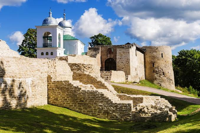
Izborsk is one of the most historically significant fortified settlements in the northwestern Russian lands. Its origins reach back to the early medieval period, when fortified hilltop settlements served as centers of political authority, defense, trade, and community organization.

Located west of Pskov, near the modern Estonian border, Izborsk occupied an important position between the eastern Baltic and the emerging political centers of medieval Rus'.

Its history provides valuable insight into the development of fortified communities before the rise of the great medieval Russian principalities.

Early Origins

Izborsk is traditionally associated with the early medieval period and appears in historical traditions connected with the early rulers of Rus'.

Its elevated location offered natural defensive advantages.

A settlement built on a hill could observe surrounding territory while making direct assault more difficult.

Fortified Settlement

Early hillforts were not simply military bases.

They were communities.

Residents could include:

  • farmers;

  • craftsmen;

  • merchants;

  • warriors;

  • political leaders;

  • religious figures.

The fortification protected both people and valuable resources.

Strategic Location

Izborsk's location placed it near important routes connecting the Baltic region with the interior of eastern Europe.

This made it strategically important to rulers seeking control over regional trade and transportation.

The settlement could serve as a defensive outpost as well as a commercial center.

The Development of Stone Fortifications

Over time, the earlier settlement was transformed into a much stronger stone fortress.

The later medieval walls demonstrate sophisticated defensive engineering.

Towers projected from the walls, allowing defenders to attack enemies approaching from different directions.

Medieval Warfare

The western frontier of medieval Rus' was politically contested.

Izborsk experienced military pressure from neighboring powers, particularly from forces associated with the German and Livonian spheres.

Repeated attacks encouraged continued investment in the fortress.

Its survival depended on the ability of its defenders and rulers to adapt to changing forms of warfare.

Community Life

Even though the fortress had military functions, ordinary life continued within its walls.

Residents needed food, water, tools, clothing, and housing.

Craft production would have supported the settlement.

Agricultural communities in the surrounding landscape supplied food and raw materials.

Religious History

Christianity gradually became a major component of the region's cultural landscape.

Churches and religious institutions developed alongside fortified settlements.

Izborsk's later religious monuments reflect this transformation.

Archaeological Importance

Archaeology is particularly important for understanding Izborsk because written sources provide only partial information.

Excavations can reveal:

  • settlement layers;

  • pottery;

  • metal objects;

  • weapons;

  • agricultural tools;

  • building remains;

  • food remains.

These discoveries allow researchers to reconstruct daily life as well as political history.

Conclusion

Izborsk represents the evolution of a fortified community from an early medieval hillfort into a substantial stone fortress.

Its strategic position connected the Baltic frontier with the political world of Rus'.

The site demonstrates that medieval fortifications were not isolated military structures. They were living communities whose survival depended upon agriculture, craftsmanship, trade, political organization, and military defense.

Izborsk therefore provides an important archaeological window into the formative centuries of northwestern Rus'.

Pskov Krom: Russia's Medieval Citadel

September 20, 2026

Introduction

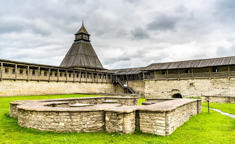
The Pskov Krom, commonly known as the Pskov Kremlin, is the historic fortified heart of Pskov. Rising above the confluence of the Velikaya and Pskova Rivers, the citadel became the center of political, religious, and military life in one of medieval Russia's most important frontier cities.

Its walls and towers reflect centuries of warfare, political development, religious authority, and commercial expansion.

Geography and Defense

Pskov's location was strategically exceptional.

The city developed around major waterways that connected inland territories with the Baltic region.

The Krom occupied a naturally defensible position.

Rivers provided additional protection, while fortified walls controlled access to the central settlement.

Early Fortifications

The earliest defenses were likely constructed from timber and earth.

Such fortifications were common in early medieval eastern Europe.

As political power and military threats increased, stone construction became increasingly important.

The later stone walls transformed the Krom into a formidable citadel.

Religious Center

The Krom was also the spiritual center of Pskov.

The Trinity Cathedral became one of the most important religious buildings in the city.

The close association between fortress and cathedral reflects the medieval belief that political and religious communities were interconnected.

Political Authority

Pskov developed a distinctive political tradition.

The city enjoyed considerable autonomy during parts of the medieval period and developed institutions of collective government.

The Krom therefore represented civic authority as well as military defense.

Warfare on the Western Frontier

Pskov was repeatedly involved in conflicts with neighboring powers.

The city faced military pressure from German crusading orders, Swedish forces, and other rivals.

The Krom's walls provided essential protection.

Its defensive importance increased as siege warfare became more sophisticated.

Towers and Walls

The fortress incorporated multiple towers and defensive lines.

Towers allowed defenders to observe attackers and launch attacks from protected positions.

Walls created controlled zones that could slow or repel invading armies.

The architectural complexity of Pskov's defenses demonstrates the importance of accumulated military experience.

Economic Importance

Pskov's strategic location also made it commercially significant.

Merchants traveled along routes linking Russia with the Baltic.

The city's economy depended on agriculture, craft production, fishing, trade, and taxation.

The Krom protected the political center that regulated this economic system.

Archaeological Research

Archaeological excavations in Pskov have produced enormous quantities of information.

Organic materials survive unusually well in some layers, allowing researchers to study wooden structures and everyday objects.

Artifacts can reveal details about food, clothing, trade, literacy, craft production, and domestic life.

Cultural Significance

Pskov developed distinctive architectural and artistic traditions.

Its churches became famous for their characteristic forms.

The Krom therefore belongs not only to military history but also to the history of Russian architecture and religious culture.

Conclusion

Pskov Krom is one of the most important medieval fortified complexes in Russia.

Its strategic location, political role, religious significance, and military architecture demonstrate the complexity of medieval urban life.

The fortress protected more than a city.

It protected a political community, a religious center, and a major regional economy.

For this reason, the Pskov Krom remains one of the clearest physical expressions of medieval Pskov's independence and strategic importance.

Novgorod Detinets: Russia's 9th-Century Kremlin

September 20, 2026

Introduction

Novgorod Detinets is the historic fortified center of Veliky Novgorod and one of the most important archaeological and architectural complexes in medieval Russia.

Situated beside the Volkhov River, the fortress developed at the heart of a city that became one of the most powerful commercial and political centers of medieval eastern Europe.

Although the title identifies the site with a ninth-century origin, the surviving fortress is the product of many centuries of rebuilding and expansion.

Novgorod's Strategic Location

The Volkhov River connected Lake Ilmen with Lake Ladoga and the Baltic Sea.

This waterway formed part of an extensive network connecting northern Europe with the lands of Rus'.

Novgorod's location allowed merchants and travelers to move between Scandinavia, the Baltic, and the interior.

The Birth of a Major City

Novgorod grew into a major urban center during the early medieval period.

Its economy depended heavily on trade.

Merchants exchanged:

  • furs;

  • wax;

  • honey;

  • timber;

  • metals;

  • textiles;

  • luxury goods.

The city became an important meeting point between different cultural and economic worlds.

The Detinets

The Detinets functioned as the city's fortified political and religious center.

The walls enclosed important buildings and provided protection during warfare.

The fortress's position beside the river gave it additional strategic value.

The Cathedral of Saint Sophia

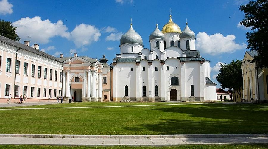
One of the most important buildings within the Detinets is the Cathedral of Saint Sophia.

Constructed in the eleventh century, it became a major symbol of Novgorod.

The cathedral demonstrates the city's wealth and the importance of Christianity in its political culture.

Novgorod's Political Tradition

Novgorod developed a distinctive form of political organization.

The city was associated with the veche, a public assembly that played an important role in political decision-making.

Political authority was therefore distributed differently from the more centralized monarchies that later emerged elsewhere in Russia.

The Detinets stood at the center of this political landscape.

Trade and the Baltic World

Novgorod was deeply connected with northern European commerce.

Its merchants interacted with Scandinavian and German traders.

The city's economic influence extended across enormous distances.

Archaeological finds demonstrate connections reaching far beyond the immediate region.

Birch-Bark Documents

Perhaps the most remarkable evidence from Novgorod comes from birch-bark documents.

These writings preserved everyday communications, financial records, requests, complaints, and other messages.

They reveal that literacy was not restricted exclusively to religious elites.

The documents provide an unusually intimate view of medieval urban society.

Archaeological Importance

Novgorod's archaeological layers are exceptionally valuable.

Waterlogged soil can preserve organic materials that would normally disappear.

Researchers have recovered:

  • wooden structures;

  • tools;

  • leather;

  • seeds;

  • food remains;

  • household objects;

  • writing materials.

This makes Novgorod one of the world's most important medieval archaeological cities.

Conclusion

Novgorod Detinets represents the political and religious heart of one of medieval Europe's most influential cities.

Its walls protected institutions that controlled a vast commercial network.

The combination of fortress, cathedral, political assembly, and urban economy demonstrates the complexity of medieval Novgorod.

The archaeological evidence from the city makes its history especially valuable because it allows historians to move beyond the lives of rulers and examine the experiences of ordinary residents.

Novgorod was not simply a medieval Russian city.

It was a major bridge between the Baltic world and eastern Europe.

Ladoga: Russia's First Viking Settlement

September 20, 2026

Introduction

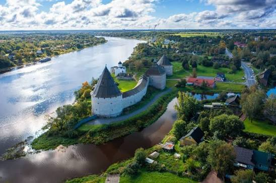
Staraya Ladoga, known historically as Ladoga, occupies a crucial position in the early history of eastern Europe and the Viking Age.

Located near the Volkhov River and Lake Ladoga, the settlement developed at the intersection of Scandinavian, Finnic, Slavic, and eastern trading networks.

Its archaeological remains provide important evidence for the formation of early urban and commercial communities in the lands that later became associated with Rus'.

A Strategic Waterway

Ladoga's importance was primarily geographical.

The settlement stood near the route connecting the Baltic Sea with the river systems of eastern Europe.

From the Baltic, ships could travel through Lake Ladoga and along the Volkhov toward Lake Ilmen and Novgorod.

Other river routes eventually connected the region toward the Dnieper and the Black Sea.

Scandinavian Connections

Archaeological discoveries demonstrate strong Scandinavian connections.

Objects associated with Scandinavian material culture have been recovered alongside local artifacts.

This evidence suggests that Scandinavians were active participants in the settlement's life.

However, Ladoga should not be understood as simply a Scandinavian colony.

Its population and culture were probably highly mixed.

A Multicultural Community

Ladoga brought together people from different cultural backgrounds.

Scandinavian merchants and warriors interacted with local Finnic and Slavic populations.

Such interaction produced cultural exchange.

Languages, technologies, artistic styles, and economic practices could spread through these contacts.

Trade

Ladoga became an important trading center.

Goods passing through the region could include:

  • furs;

  • amber;

  • metal;

  • beads;

  • weapons;

  • textiles;

  • food products;

  • imported luxury goods.

The settlement therefore participated in long-distance economic systems.

Craft Production

Archaeological evidence indicates local manufacturing.

Metalworking, woodworking, bone and antler working, pottery production, and other crafts supported the community.

Craft specialization is one of the characteristics that distinguishes major trading settlements from small rural villages.

Viking Age Networks

Ladoga formed part of the larger Viking-Age network extending across northern Europe.

Scandinavian ships connected settlements around the Baltic with river routes leading deep into eastern Europe.

This network ultimately contributed to the development of political structures associated with early Rus'.

The Rurikid Tradition

Medieval traditions connect Ladoga with the early history of the Rurikid dynasty.

Although later written accounts must be treated critically, archaeological evidence confirms that Ladoga was already an important settlement during the period associated with the emergence of early Rus'.

Fortifications

Ladoga was fortified at different stages of its history.

Defensive structures protected valuable economic and political assets.

The presence of fortifications demonstrates the instability of the region and the importance of controlling trade routes.

Archaeological Significance

Ladoga is exceptionally important because archaeological research can trace changes over several centuries.

Excavations have revealed buildings, workshops, imported goods, weapons, jewelry, coins, and other artifacts.

These materials demonstrate the settlement's participation in extensive networks of exchange.

Conclusion

Ladoga provides one of the clearest archaeological windows into the emergence of the Viking-Age world in eastern Europe.

Its location connected the Baltic with the great river routes leading into the interior.

Its multicultural population, craft production, trade, and political connections demonstrate that the origins of Rus' were shaped by interaction between many different communities.

Ladoga was therefore not simply a Viking settlement.

It was a meeting point between Scandinavia, the Baltic, and eastern Europe—and one of the places where the foundations of a new political world were taking shape.

Gnezdovo: Russia's 10th-Century Trade Hub

September 20, 2026

Introduction

Gnezdovo, located near modern Smolensk in western Russia, was one of the most important archaeological settlements associated with the tenth-century world of early Rus'.

The site developed near the Dnieper River and occupied a strategically important position along routes connecting the Baltic Sea with Byzantium and the Black Sea.

Gnezdovo's importance comes from its extraordinary combination of settlement remains, workshops, imported objects, weapons, jewelry, and burial mounds.

Together, these discoveries reveal a society deeply connected to long-distance trade.

The Dnieper Trade Route

The Dnieper River was one of the great transportation corridors of medieval eastern Europe.

It connected northern regions with the Black Sea.

Merchants and travelers could move south toward Byzantine territories and the Black Sea, while goods and cultural influences could travel north.

Gnezdovo was positioned directly along this network.

A Major Commercial Settlement

During the tenth century, Gnezdovo developed into a substantial settlement.

Its population participated in trade and specialized craft production.

The site contained residential areas, workshops, and other structures associated with economic activity.

Its size and diversity distinguish it from an ordinary rural settlement.

Scandinavian Connections

Gnezdovo contains numerous artifacts associated with Scandinavian culture.

Weapons, jewelry, and other objects demonstrate contact with Scandinavia.

Scandinavian merchants and warriors were likely among the people moving along the Dnieper trade route.

At the same time, local Slavic and other eastern European populations were also present.

Byzantine Connections

The southern trade routes brought Gnezdovo into contact with Byzantium.

Archaeologists have discovered objects reflecting Byzantine influence.

Such finds demonstrate that cultural exchange occurred alongside commercial exchange.

The movement of luxury objects also provides evidence for the wealth generated by long-distance trade.

Burial Mounds

One of Gnezdovo's most distinctive features is its extensive collection of burial mounds.

These mounds, or kurgans, preserve evidence of burial practices among the community.

Grave goods can include:

  • weapons;

  • jewelry;

  • tools;

  • imported objects;

  • household equipment;

  • personal ornaments.

These artifacts help archaeologists reconstruct social status, cultural identity, and trade connections.

Weapons and Warriors

Weapons discovered at Gnezdovo indicate the presence of a warrior population.

Swords, spearheads, axes, shields, and other equipment reflect the military culture of the period.

However, warriors were not necessarily independent raiders.

They could also function as guards, political retainers, merchants, or members of elite households.

Craft Production

Gnezdovo was an important manufacturing center.

Craftspeople produced objects from iron, bronze, silver, bone, antler, and other materials.

Metalworking was particularly important.

The discovery of furnaces, slag, tools, and unfinished objects demonstrates local production.

Silver and Coinage

Silver objects and coins provide valuable evidence of Gnezdovo's participation in international exchange.

Coins could originate from different regions, including Islamic territories and Byzantium.

Their presence demonstrates the enormous geographical reach of tenth-century trade.

The Multicultural Character of Gnezdovo

Perhaps the most important lesson from Gnezdovo is that early Rus' society was culturally diverse.

Scandinavian, Slavic, Finnic, Baltic, Byzantine, and other influences could intersect along major trade routes.

Cultural identity was not necessarily fixed.

People adopted objects, technologies, artistic styles, and customs from communities with which they interacted.

Political Significance

Gnezdovo's location along the Dnieper route made it strategically important.

Control over such settlements allowed emerging political authorities to influence trade.

The relationship between Gnezdovo and Smolensk remains an important subject of archaeological and historical research.

The site clearly belonged to a broader regional system of political and economic power.

Archaeological Importance

Gnezdovo is one of the most important archaeological sites for understanding tenth-century eastern Europe.

Unlike written chronicles, which tend to focus on rulers and major political events, archaeology reveals the activities of merchants, craftspeople, warriors, and ordinary residents.

The combination of settlement evidence and burial archaeology is particularly valuable.

Conclusion

Gnezdovo was one of the great crossroads of the early medieval eastern European world.

Its location along the Dnieper connected the Baltic with Byzantium and the Black Sea.

Its workshops reveal sophisticated craft production, while its burial mounds preserve evidence of social hierarchy, warfare, and cultural interaction.

The site's archaeological record demonstrates that the formation of early Rus' was driven not only by political rulers but also by merchants, craftspeople, travelers, and communities participating in enormous international networks.

Gnezdovo therefore stands as one of the clearest archaeological examples of how trade helped shape the medieval world of eastern Europe.

Timans: Russia's Kurgan Cemetery

September 20, 2026

Introduction

Timans represents the broader archaeological world of kurgan cemeteries, the burial landscapes that spread across large parts of Eastern Europe and the Eurasian steppe. A kurgan is an artificial burial mound constructed over one or more graves. Such monuments were used by different peoples over thousands of years, meaning that the presence of a kurgan does not automatically identify a particular ethnic group or historical period.

Across the territories of present-day Russia and neighboring regions, burial mounds provide some of the most important evidence for reconstructing ancient societies. Their contents can reveal information about social hierarchy, religious beliefs, warfare, trade, mobility, diet, craftsmanship, and relationships between communities.

Timans is therefore best understood within this much wider archaeological tradition. The cemetery landscape illustrates how burial was not simply an individual event but could become a way of permanently marking territory, ancestry, and social identity.

What Is a Kurgan?

The Russian term kurgan is widely used by archaeologists to describe a burial mound.

A typical mound could consist of:

  • a burial pit or chamber;

  • human remains;

  • grave goods;

  • wooden structural elements;

  • stone features;

  • an earthen mound;

  • sometimes secondary burials added later.

Construction required considerable labor. Even relatively modest mounds represented the coordinated efforts of multiple people.

The size and complexity of a mound could also communicate status. A prominent individual might receive a larger monument than ordinary members of a community.

Burial and Social Organization

Archaeological burial evidence demonstrates that prehistoric and early medieval communities were not socially uniform.

Some graves contain relatively few objects, while others contain:

  • weapons;

  • jewelry;

  • metal vessels;

  • horse equipment;

  • imported objects;

  • ornaments;

  • tools;

  • ceremonial items.

These differences can indicate inequalities in wealth or social position.

However, archaeologists must be cautious. A wealthy grave does not necessarily represent a politically powerful person, and a simple grave does not necessarily indicate poverty during life. Burial practices were influenced by ritual traditions, age, gender, occupation, and religious beliefs.

Kurgans as Territorial Monuments

One of the most important aspects of burial mounds is their visibility.

A mound rising above an otherwise relatively flat landscape could remain visible for generations.

This gave kurgans a geographical function.

They could serve as:

  • ancestral monuments;

  • territorial markers;

  • landmarks for travelers;

  • symbols of community identity;

  • places of later ritual activity.

Ancient landscapes were therefore structured not only by settlements and roads but also by burial monuments.

Archaeological Investigation

Excavating a kurgan is a complex process.

Researchers examine the mound's construction layers and determine whether the monument was built in a single phase or developed gradually.

They may also use:

  • radiocarbon dating;

  • osteological analysis;

  • ancient DNA;

  • isotope analysis;

  • metallurgical examination;

  • ceramic analysis;

  • pollen studies;

  • soil chemistry.

These methods allow archaeologists to reconstruct aspects of life that cannot be understood from artifacts alone.

The Importance of Context

One of the greatest dangers in studying burial mounds is removing artifacts from their archaeological context.

A bronze ornament by itself tells relatively little.

Its position within a grave, association with other objects, relationship to the skeleton, and location within the mound can reveal much more.

Archaeology therefore treats context as essential evidence.

Later Reuse of Ancient Mounds

Many kurgans were reused.

Later communities sometimes placed new burials into existing monuments.

As a result, one mound can contain evidence from several chronological periods.

This creates both opportunities and challenges for researchers.

A mound may reveal centuries of changing burial customs while simultaneously making it difficult to determine which objects belong to which burial.

Conclusion

Timans and comparable kurgan cemeteries demonstrate the enormous archaeological importance of burial landscapes across Russia and Eurasia.

Their value extends beyond individual graves. Kurgans reveal how communities understood ancestry, status, territory, death, and memory.

Even when individual details remain uncertain, the archaeological study of such cemeteries provides a powerful means of reconstructing societies that left few written records.

Chernigov: Ukraine's 10th-Century Princely Capital

September 20, 2026

Introduction

Chernigov, known today as Chernihiv, was one of the most important political and cultural centers of medieval Rus'. Located in northern Ukraine, it developed into a major princely center during the medieval period and became particularly prominent between the tenth and twelfth centuries.

The city's archaeological remains reveal a complex urban society containing fortifications, churches, elite residences, craft areas, cemeteries, and trading connections.

Chernigov's importance was closely connected with the political development of Kyivan Rus', the medieval East Slavic polity centered initially on Kyiv.

The Strategic Location

Chernigov occupied a strategically important position near the Desna River.

Rivers were essential transportation routes in medieval Eastern Europe.

They provided:

  • transportation;

  • communication;

  • fishing;

  • access to agricultural territories;

  • military mobility;

  • connections to other settlements.

Chernigov could therefore participate in networks linking northern and southern parts of Rus'.

The Rise of a Princely Center

During the tenth century, Chernigov emerged as one of the major centers of the expanding Rus' political system.

Its ruling elites were connected with the princely dynasty associated with Kyiv.

The city eventually became particularly associated with the Chernihiv branch of the Rurikid dynasty.

Political authority was expressed through fortifications, monumental architecture, elite burials, and control of economic resources.

The Detinets

The fortified central area, traditionally described as the detinets, formed the political heart of the city.

Such fortified centers typically contained important buildings and provided protection during periods of conflict.

Chernigov's defensive landscape consisted of earthworks, wooden structures, and natural terrain.

The scale of these defenses indicates the city's significance.

Monumental Architecture

Chernigov became famous for its medieval churches.

Among the most important surviving monuments is the Transfiguration Cathedral, traditionally dated to the eleventh century.

Its construction reflects the profound transformation of Rus' following the Christianization associated with Prince Vladimir in 988.

Christian architecture became an important expression of political legitimacy.

Religion and Political Authority

Churches were not merely places of worship.

They could serve as:

  • burial locations;

  • centers of administration;

  • symbols of princely authority;

  • repositories of sacred objects;

  • architectural statements of wealth.

The construction of monumental churches required skilled masons, labor, imported materials, and organizational capacity.

Trade and Craft Production

Archaeological discoveries from Chernigov demonstrate extensive craft activity.

Objects associated with:

  • metalworking;

  • pottery;

  • jewelry production;

  • bone carving;

  • glass;

  • textile production

have contributed to the reconstruction of urban life.

The city was connected to broader trade routes, allowing goods and technologies to circulate over considerable distances.

Burial Archaeology

Chernigov's burial evidence is especially important.

Large burial mounds and elite graves provide evidence of social hierarchy and cultural interaction.

Some early medieval burials contain weapons, ornaments, and other objects reflecting connections with Scandinavian, steppe, and East European traditions.

These discoveries demonstrate that medieval Rus' was not culturally isolated.

The Wider Political World

Chernigov existed within a competitive political environment.

Kyiv, Novgorod, Pereyaslav, and other centers possessed their own political importance.

Princely succession frequently generated rivalry.

The struggle for control of major cities was therefore central to medieval Rus' politics.

The Mongol Invasion

Chernigov suffered catastrophic destruction during the Mongol invasions of the thirteenth century.

The devastation transformed the political geography of the region.

Although the city survived, its earlier position within the political system was permanently altered.

Conclusion

Chernigov's archaeological remains provide an exceptional window into medieval Eastern Europe.

Its fortifications, churches, burials, crafts, and urban structures reveal a sophisticated princely center that participated in religious transformation, long-distance commerce, dynastic politics, and warfare.

Its history demonstrates that medieval Rus' consisted of multiple powerful centers rather than a single undifferentiated state.

Kyiv's Desyatynna Church: Ukraine's First Stone Cathedral

September 20, 2026

Introduction

The Desyatynna Church, or Church of the Tithes, occupies a special place in the history of Kyiv and the Christianization of Rus'.

Although its remains are fragmentary, the building represented an extraordinary architectural and political transformation.

Constructed in the aftermath of the Christianization of Rus' under Prince Vladimir, the church became a major symbol of the new Christian order.

The name derives from the traditional association with a tithe, or tenth, of princely revenues dedicated to the church.

Christianity Comes to Rus'

The construction of the church followed Prince Vladimir's adoption of Christianity in 988.

This event was not simply religious.

Christianity affected:

  • political legitimacy;

  • diplomacy;

  • art;

  • architecture;

  • literacy;

  • burial customs;

  • administration;

  • cultural connections with Byzantium.

Kyiv became increasingly connected to the Christian world of Eastern Europe and Byzantium.

Byzantine Influence

The Desyatynna Church was constructed using techniques associated with Byzantine architectural traditions.

Stone and brick construction represented a major technological departure from the predominantly wooden architecture common in the region.

Its construction required specialists capable of working with masonry, mortar, architectural planning, and monumental decoration.

Monumental Construction

The church was much more than a religious building.

It demonstrated the resources available to the ruling elite.

Large-scale architecture required:

  • organized labor;

  • skilled craftsmen;

  • building materials;

  • transportation;

  • financial resources;

  • centralized authority.

The church consequently functioned as a visible statement of princely power.

The Tithe

The traditional name "Church of the Tithes" reflects the idea that Prince Vladimir assigned a portion of his revenues to its maintenance.

This illustrates an important development in medieval political organization.

Religion became integrated with systems of taxation and princely administration.

Decoration

The church was richly decorated.

Historical evidence associates the building with:

  • frescoes;

  • mosaics;

  • marble;

  • imported architectural materials.

Such decoration reflected the prestige of Byzantine Christianity.

Archaeological Evidence

The original church was destroyed during the Mongol sack of Kyiv in 1240.

Subsequent construction and urban development further complicated the archaeological record.

Researchers have nevertheless recovered foundations and architectural fragments that allow aspects of the original structure to be reconstructed.

Historical Significance

The church represented the physical arrival of monumental Christianity in Kyiv.

Its significance was therefore symbolic as much as architectural.

It demonstrated that Christianity had become closely connected to the ruling dynasty and the political identity of Kyiv.

Conclusion

The Desyatynna Church stands as one of the defining monuments of the Christianization of Rus'.

Although the building itself no longer survives intact, archaeological remains and historical references demonstrate its extraordinary importance.

It marked the beginning of a new architectural tradition in Kyiv and helped establish Christianity as a major institution within medieval Rus'.

Pereyaslav: Ukraine's 10th-Century Fortified Town

September 20, 2026

Introduction

Pereyaslav, corresponding to modern Pereiaslav, was an important fortified center of medieval Rus'.

Its strategic importance derived largely from its location on the Dnieper frontier and its relationship with territories inhabited by steppe peoples.

The city therefore occupied a position between agricultural settlements to the north and the increasingly dangerous steppe frontier to the south.

A Frontier City

Medieval Rus' faced repeated threats from nomadic groups.

The southern frontier was particularly vulnerable.

Pereyaslav formed part of a defensive network intended to protect the political and agricultural heartlands of Rus'.

Its fortifications included earthworks and defensive structures.

The Fortified Settlement

The city's defenses were designed to control movement and protect inhabitants.

Earth ramparts were particularly effective because they could be constructed using locally available materials.

Timber palisades and gates could be placed on top of these earthworks.

Political Importance

Pereyaslav became a major princely center.

Its ruler was often a member of the wider Rurikid dynasty.

Control over the city therefore had political as well as military importance.

Religious Development

Like other major Rus' centers, Pereyaslav became an important Christian center after the conversion of Rus'.

Church construction and ecclesiastical administration reinforced the city's role within the developing medieval political order.

Trade and Economy

Despite its frontier position, Pereyaslav participated in economic networks.

Farmers supplied food.

Craft workers produced tools and household goods.

Merchants moved goods along river routes.

The military character of the city did not prevent economic development.

Relations with the Steppe

The frontier environment produced both conflict and interaction.

Nomadic peoples were not simply enemies.

Trade, diplomacy, warfare, intermarriage, migration, and cultural exchange all occurred across the frontier.

Archaeology can reveal these interactions through artifacts and burial practices.

The Mongol Period

Like many cities of Rus', Pereyaslav suffered severely during the Mongol invasions.

The destruction of urban infrastructure weakened its earlier political importance.

Nevertheless, the settlement continued to exist and retained historical significance.

Conclusion

Pereyaslav illustrates the complex nature of medieval frontier society.

It was simultaneously:

  • a military center;

  • a princely residence;

  • a Christian settlement;

  • an agricultural market;

  • a trading location;

  • a frontier community.

Its history demonstrates how geography shaped political and military development in medieval Eastern Europe.

Belz: Ukraine's Medieval Trade Center

September 20, 2026

Introduction

Belz was an important medieval settlement in the western Ukrainian historical landscape.

Its position near routes connecting the lands of Rus' with Central Europe contributed to its economic and political importance.

Unlike monumental capitals whose significance is immediately visible through surviving architecture, places such as Belz demonstrate the importance of regional towns within medieval economic systems.

Geography and Trade

Belz was located in a region characterized by agricultural production and connections toward Poland and other Central European territories.

Medieval trade depended heavily on overland routes.

Merchants transported:

  • salt;

  • furs;

  • wax;

  • honey;

  • textiles;

  • metal goods;

  • ceramics;

  • luxury objects.

Fortification

Medieval towns frequently required defensive structures.

Belz developed as a fortified settlement, reflecting the political instability of the region.

Defensive systems could include:

  • earth ramparts;

  • wooden palisades;

  • ditches;

  • gates;

  • towers.

Political Changes

The region experienced repeated political transformations.

Belz was connected at different times with Rus' principalities and later with Polish and other political structures.

These changes affected taxation, administration, trade routes, and cultural institutions.

Archaeological Evidence

Archaeology is particularly valuable for reconstructing Belz's medieval history.

Artifacts can reveal:

  • household activities;

  • craft production;

  • commercial connections;

  • dietary practices;

  • military activity.

Ceramic imports are particularly useful because they can indicate connections between settlements.

Craft Production

Medieval towns depended on specialized craftsmen.

Evidence may include traces of:

  • blacksmithing;

  • pottery;

  • leatherworking;

  • woodworking;

  • textile production.

Such industries were essential to urban life.

Religion

Christian institutions played an important role in medieval Belz.

Churches and monasteries were not only religious centers but also important landowners and cultural institutions.

Religious buildings helped shape the social geography of medieval towns.

Conclusion

Belz illustrates the importance of regional medieval towns in the economic and political development of Eastern Europe.

Its location allowed it to participate in commercial networks connecting Rus' with Central Europe.

Its archaeological record helps demonstrate that medieval urbanism extended far beyond the famous capitals.

Halych: Ukraine's 12th-Century Princely Seat

September 20, 2026

Introduction

Halych was one of the most important political centers of medieval western Rus'.

Located in present-day western Ukraine, the settlement became the center of the Principality of Halych and later contributed its name to the larger political entity known as the Kingdom of Galicia–Volhynia.

During the twelfth and thirteenth centuries, Halych became a major center of political power, religion, trade, and culture.

The Galician Landscape

Halych benefited from fertile agricultural lands and access to important regional routes.

Its territory was also associated with valuable resources, including salt.

Salt was one of the most important commodities of medieval Europe.

It was essential for:

  • food preservation;

  • animal husbandry;

  • trade;

  • taxation.

The Princely Center

Halych developed a fortified political center where the ruling dynasty exercised authority.

The princely residence represented more than a defensive structure.

It was a center of:

  • administration;

  • diplomacy;

  • military planning;

  • taxation;

  • religious patronage.

Religious Architecture

Christianity was deeply integrated into Halych's political culture.

Churches and monasteries served as religious centers while simultaneously demonstrating princely wealth.

Stone architecture required substantial investment and skilled craftsmen.

International Connections

Halych interacted with neighboring powers including:

  • Poland;

  • Hungary;

  • Byzantium;

  • other Rus' principalities;

  • steppe societies.

Political alliances and conflicts brought the city into broader European affairs.

The Formation of Galicia–Volhynia

In the late twelfth and early thirteenth centuries, political developments connected Halych with Volhynia.

The resulting political entity became one of the most important Rus' successor states following the fragmentation and Mongol conquest of earlier political centers.

Archaeological Significance

Archaeological research around Halych has revealed evidence of:

  • fortifications;

  • churches;

  • residences;

  • craft production;

  • cemeteries;

  • imported goods.

These findings allow researchers to reconstruct the city's development beyond what written chronicles record.

Decline

Political changes eventually reduced Halych's importance as a primary political center.

Nevertheless, its legacy survived in the names and political traditions associated with Galicia.

Conclusion

Halych demonstrates the complexity of medieval western Rus'.

Its prosperity depended on agriculture, trade, natural resources, religious institutions, and princely authority.

The city was not isolated from Europe but participated in a dynamic political environment connecting Eastern and Central Europe.

Tmutarakan: Ukraine's 10th-Century Greek Colony

September 20, 2026

Introduction

Tmutarakan occupies a fascinating position in the history of medieval Eastern Europe because it connected the world of Rus', Byzantium, and the Black Sea.

The medieval settlement is associated with the ancient and medieval settlement of Tmutarakan, located on the Taman Peninsula in the northern Black Sea region.

The site's history stretches far beyond the tenth century and includes Greek, Roman, Byzantine, and later political influences.

A Black Sea Crossroads

The Taman Peninsula occupied a strategically important position between the Black Sea and Sea of Azov.

Its geography placed it near routes connecting:

  • the Caucasus;

  • Crimea;

  • the Black Sea;

  • the steppe;

  • Byzantium;

  • eastern Europe.

Greek Foundations

The region had a long Greek colonial history.

Greek settlements around the Black Sea were established centuries before the emergence of Rus'.

This means that describing Tmutarakan simply as a "Greek colony" does not capture its entire history.

Instead, the site represents multiple successive cultural phases.

Tmutarakan and Rus'

During the medieval period, Tmutarakan became associated with the political world of Rus'.

Rurikid princes exercised authority in the region.

This was remarkable because the settlement was geographically distant from Kyiv.

Its importance reflected Rus' expansion into the Black Sea and Caucasian frontier.

Trade

The settlement participated in maritime and overland trade.

Commercial goods could move through the region from different directions.

Archaeological evidence from Black Sea settlements often demonstrates the circulation of:

  • ceramics;

  • amphorae;

  • metals;

  • coins;

  • glass;

  • luxury objects.

Byzantine Connections

Byzantine influence remained strong in the Black Sea.

Christianity, architecture, coinage, diplomacy, and commercial relationships connected Tmutarakan to the Byzantine world.

Multicultural Society

Tmutarakan's historical significance lies partly in its multicultural character.

Greek traditions interacted with:

  • Byzantine culture;

  • Rus' political structures;

  • steppe societies;

  • Caucasian populations.

The Black Sea frontier was therefore a zone of interaction rather than a strict cultural boundary.

Archaeological Challenges

The identification and interpretation of individual structures at Tmutarakan can be complicated because the settlement developed through many historical periods.

Archaeologists must carefully separate layers belonging to different centuries.

Conclusion

Tmutarakan demonstrates how interconnected medieval Eastern Europe was.

Rather than being a remote outpost, it belonged to a network of Black Sea communities linked by trade, warfare, diplomacy, and cultural exchange.

Its history is particularly valuable for understanding the relationship between Rus', Byzantium, the Caucasus, and the Black Sea world.

Chersonesos: Crimea's 5th-Century Greek City

September 20, 2026

Introduction

Chersonesos, located near modern Sevastopol in Crimea, was one of the most important ancient Greek cities of the northern Black Sea.

Founded by Greek settlers in the fifth century BCE, the city survived for centuries and became a major center of trade, agriculture, Christianity, and diplomacy.

Its archaeological remains provide an unusually rich record of ancient urban life.

Greek Colonization

Greek colonies were established around the Black Sea beginning in the first millennium BCE.

Chersonesos emerged within this wider movement.

The settlers brought Greek traditions of:

  • urban planning;

  • civic institutions;

  • religion;

  • language;

  • coinage;

  • architecture.

Urban Structure

The city contained streets, residential buildings, public spaces, religious structures, workshops, and defensive walls.

Its planned environment demonstrates the importance of organized urban development.

Agriculture

Although Chersonesos was a maritime city, agriculture was fundamental to its economy.

The surrounding territory supported vineyards and grain cultivation.

Wine production became particularly important.

The relationship between urban centers and their agricultural territories was essential to ancient Greek colonial economies.

Trade

Chersonesos participated in extensive Black Sea trade.

Ships connected the city with other coastal communities.

Goods included:

  • wine;

  • grain;

  • pottery;

  • fish products;

  • metals;

  • agricultural commodities.

Roman and Byzantine Periods

The city later came under Roman influence and subsequently became an important Byzantine center.

Its strategic location made it valuable to successive powers.

Christianity

Chersonesos became particularly important in the history of Christianity in the region.

Christian monuments, churches, and inscriptions demonstrate the transformation of the city from a pagan Greek community into a Christian urban center.

Archaeological Preservation

The ruins contain:

  • defensive walls;

  • streets;

  • houses;

  • churches;

  • workshops;

  • public buildings;

  • cisterns;

  • burial areas.

This makes Chersonesos one of the most important archaeological sites for understanding the ancient Black Sea.

Conclusion

Chersonesos represents more than a Greek colonial settlement.

Its long history illustrates the transformation of the northern Black Sea from a Greek commercial frontier into a Roman and Byzantine cultural zone.

The site provides extraordinary evidence for urbanism, trade, agriculture, religion, and cultural change.

← Newer Posts Older Posts →
Featured
images (28).jpeg
October 23, 2026
The Mnemotechnique of Landscapes: Memory Mapping in Preliterate Societies
October 23, 2026
Read more →
October 23, 2026
images (29).jpeg
October 23, 2026
The Use of Blue Pigments Outside Egypt: Sources and Symbolism
October 23, 2026
Read more →
October 23, 2026
images (30).jpeg
October 23, 2026
Urban Clay Pipes: Smoking, Sanitation and Class in Early Modern Cities
October 23, 2026
Read more →
October 23, 2026
images (31).jpeg
October 23, 2026
The Archaeology of Small Sacred Groves in West Africa
October 23, 2026
Read more →
October 23, 2026
images (32).jpeg
October 23, 2026
Reconstructing Nomadic Winter Camps from Minimal Features
October 23, 2026
Read more →
October 23, 2026
images (33).jpeg
October 23, 2026
Buried Game Drives: Prehistoric Mass Hunting Strategies Revealed by LiDAR
October 23, 2026
Read more →
October 23, 2026
read more

Powered by The archaeologist