• MAIN PAGE
  • LATEST NEWS
    • Lost Cities
    • Archaeology's Greatest Finds
    • Underwater Discoveries
    • Greatest Inventions
    • Studies
    • Blog
  • PHILOSOPHY
  • HISTORY
  • RELIGIONS
    • Africa
    • Anatolia
    • Arabian Peninsula
    • Balkan Region
    • China - East Asia
    • Europe
    • Eurasian Steppe
    • Levant
    • Mesopotamia
    • Oceania - SE Asia
    • Pre-Columbian Civilizations of America
    • Iranian Plateau - Central Asia
    • Indus Valley - South Asia
    • Japan
    • The Archaeologist Editor Group
    • Scientific Studies
    • Aegean Prehistory
    • Historical Period
    • Byzantine Middle Ages
    • Predynastic Period
    • Dynastic Period
    • Greco-Roman Egypt
  • Rome
  • PALEONTOLOGY
  • About us
Menu

The Archaeologist

  • MAIN PAGE
  • LATEST NEWS
  • DISCOVERIES
    • Lost Cities
    • Archaeology's Greatest Finds
    • Underwater Discoveries
    • Greatest Inventions
    • Studies
    • Blog
  • PHILOSOPHY
  • HISTORY
  • RELIGIONS
  • World Civilizations
    • Africa
    • Anatolia
    • Arabian Peninsula
    • Balkan Region
    • China - East Asia
    • Europe
    • Eurasian Steppe
    • Levant
    • Mesopotamia
    • Oceania - SE Asia
    • Pre-Columbian Civilizations of America
    • Iranian Plateau - Central Asia
    • Indus Valley - South Asia
    • Japan
    • The Archaeologist Editor Group
    • Scientific Studies
  • GREECE
    • Aegean Prehistory
    • Historical Period
    • Byzantine Middle Ages
  • Egypt
    • Predynastic Period
    • Dynastic Period
    • Greco-Roman Egypt
  • Rome
  • PALEONTOLOGY
  • About us
No results found

Main Caves: South Africa's Battle Paintings

October 4, 2026

Introduction

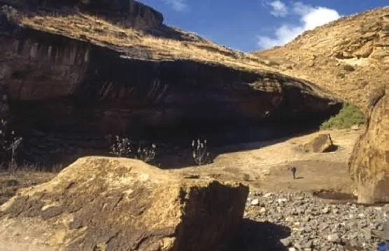
Main Caves, in the Giant’s Castle area of the Drakensberg, is associated with an important concentration of San rock paintings. The site provides a setting for examining how Indigenous artists represented animals, people, and events within the mountain landscape.

The title “Battle Paintings” points to one category of imagery found in southern African rock art: scenes that appear to depict conflict between groups of people. Such images can be valuable records of historical encounters, but interpreting them requires caution. A scene that resembles a battle may depict a real event, a symbolic narrative, or an activity whose original meaning is no longer fully understood.

The distinction between older San rock art and later historical paintings is particularly important. The Drakensberg contains works produced during different periods, and not every image belongs to the same artistic tradition or historical context.

Main Caves and the Drakensberg Landscape

The Giant’s Castle area lies within the central Drakensberg, where sandstone cliffs create shelters that protect painted surfaces from some forms of weathering. The surrounding grasslands and valleys have supported wildlife and human activity for long periods.

A rock shelter could serve several purposes, including temporary refuge, a stopping place during travel, or a location of cultural significance. Its archaeological history must be reconstructed from the evidence rather than assumed from its physical form.

The survival of rock paintings depends on the stability of the rock surface and the environmental conditions within the shelter. Water, mineral deposits, and biological growth can damage pigments, while human contact may accelerate deterioration.

Recognising a Battle Scene

A painting may be interpreted as a battle scene when it contains groups of human figures positioned in apparent opposition, sometimes with weapons, shields, or other objects. Differences in posture and the direction of movement may suggest confrontation.

However, visual resemblance is not sufficient to establish a historical battle. The figures could represent hunting, a ceremonial performance, a symbolic narrative, or another activity. Researchers need to examine the entire composition and compare it with other evidence.

When a painting appears to depict a historically recognisable event, scholars may investigate whether the equipment, clothing, or other details correspond to a known period. Such comparisons can sometimes provide chronological clues, but they must be based on identifiable features rather than general resemblance.

San Rock Art and Historical Conflict

San rock art traditions include many depictions of animals and human figures, with some compositions interpreted in relation to hunting or ritual practice. The Drakensberg also contains historical paintings that may relate to encounters between different groups during later periods.

The region’s history includes changing relationships among hunter-gatherers, herding communities, agricultural societies, and colonial settlers. These relationships involved exchange, movement, competition, and conflict, although the circumstances varied from place to place.

A painting that appears to show armed confrontation may contribute to the study of this history if its date and context can be established. It should not, however, be used to construct a detailed narrative of a battle without corroborating evidence.

Dating Historical Paintings

The age of a painting can sometimes be investigated through its subject matter and the material culture depicted. The appearance of particular weapons or other historically distinctive objects may provide a broad chronological clue.

Researchers may also study pigment composition, overlapping images, and the relationship between paintings and archaeological deposits. Yet these methods rarely provide an exact date for every figure.

A shelter can contain several generations of paintings, and later artists may have added images beside or over earlier ones. Consequently, a group of figures that appears to form a single scene may not necessarily have been painted at the same time.

What Battle Imagery Can Reveal

Where a conflict interpretation is well supported, battle imagery can contribute to understanding how people represented violence, group identity, and social relationships. The positioning of figures and the inclusion of particular objects may indicate what the artist considered important about the event.

Even then, a painting is not a neutral photograph. Artists select details, simplify forms, and communicate through the conventions of their own traditions. A scene may emphasise certain participants or actions while leaving other aspects unrepresented.

Researchers should therefore compare visual evidence with historical records, oral traditions, archaeological findings, and the broader chronology of the region.

Conservation and Interpretation

Battle scenes and other rock paintings are vulnerable to vandalism and environmental damage. Conservation efforts should prioritise the preservation of the original surface and the accurate recording of the images.

Public interpretation must also avoid presenting uncertain readings as established facts. Descriptions should explain why researchers consider a scene to be a battle, what evidence supports the interpretation, and what remains uncertain.

Conclusion

Main Caves forms part of the Drakensberg’s important rock-art landscape. Images interpreted as battle scenes can offer insight into historical conflict and the ways people represented encounters between groups, but each interpretation requires careful examination.

The term “battle paintings” should not obscure the diversity of the site’s artistic record or the possibility that some images have different meanings. Through detailed documentation and comparison with independent evidence, researchers can explore the historical significance of these paintings while respecting their cultural and archaeological value.

Didima: South Africa's Mythological Figures

October 4, 2026

Introduction

Didima, in the KwaZulu-Natal Drakensberg, is associated with the region’s rich heritage of San rock paintings. The surrounding mountains contain numerous sandstone shelters in which Indigenous artists created images of animals, human figures, and unusual combinations of human and animal characteristics.

Some of these images have been interpreted as mythological or spiritual figures. They are particularly interesting because they challenge the idea that rock art simply records everyday activities. A painting may communicate ideas about animals, spiritual forces, healing, transformation, or relationships between people and the natural world.

However, the term “mythological figures” requires careful interpretation. The original meanings of many images are not known with certainty, and a figure that appears supernatural to a modern viewer may have had a different significance within the artist’s cultural tradition.

The Didima Landscape

The Didima area lies within the dramatic mountain environment of the Drakensberg. Sandstone cliffs, valleys, grasslands, and streams created a landscape that supported wildlife and offered shelter to human communities.

Rock shelters could be used for temporary refuge, rest, or other activities. Some may also have held particular cultural significance. The relationship between a shelter and its surrounding landscape can help researchers understand why people repeatedly visited particular locations.

The rock surfaces themselves influenced the preservation and appearance of the paintings. Pigments applied to sheltered walls could survive for centuries or longer, although moisture, mineral deposits, and natural weathering gradually alter their appearance.

Human and Animal Figures

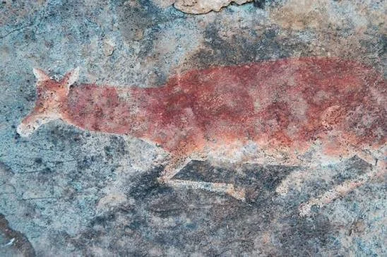
San rock art in the Drakensberg includes many images of eland and other animals, alongside human figures in a variety of postures. Some compositions contain figures whose bodies appear partly human and partly animal, or whose movements differ from ordinary activities.

These unusual characteristics have encouraged interpretations involving spiritual transformation and ritual experience. In some documented San traditions, animals held spiritual significance beyond their practical value as food. Certain ceremonies involved beliefs about healing, potency, and interactions between human and spiritual worlds.

Such cultural information helps researchers interpret the art, but it does not provide a definitive explanation for every figure. Different communities could attach different meanings to similar images, and traditions changed over time.

What Does Mythological Mean?

In everyday language, mythological often refers to supernatural beings or stories involving gods and extraordinary events. In the study of Indigenous art, however, the term must be used with care.

A figure that appears unusual may represent a spiritual being, a ritual specialist, a symbolic transformation, or an artistic convention. It may also be difficult to identify because parts of the painting have faded or disappeared.

Researchers therefore begin by describing the visible evidence. They examine body shape, posture, associated animals, the arrangement of figures, and the location of the painting within the shelter. They then compare these observations with other rock art and relevant cultural knowledge.

This approach reduces the risk of imposing modern assumptions on an image whose original meaning may have been very different.

Rock Art and Spiritual Experience

Some scholars interpret particular Drakensberg paintings in relation to healing ceremonies and altered states of consciousness. In certain San traditions documented by ethnographers, ritual specialists participated in ceremonies involving dancing, healing, and spiritual potency.

Researchers have suggested that some unusual figures and compositions may represent experiences associated with these practices. Animal-human combinations, for example, have been examined as possible expressions of transformation or relationships between different forms of existence.

Nevertheless, these interpretations remain dependent on context. Not every animal-human figure depicts a ritual specialist, and not every unusual posture indicates an altered state. The strongest interpretations are those supported by several features of the artwork and by relevant cultural evidence.

Dating and Preserving the Paintings

The age of individual paintings at Didima cannot be established solely from their appearance. Different images may have been produced during different periods, and some shelters contain overlapping paintings.

Researchers may use pigment analysis, archaeological context, stylistic comparison, and other suitable scientific methods to develop chronological estimates. Each method has limitations, so conclusions should distinguish between established dates and broader estimates.

Conservation is equally important. Rock art can be damaged by touching, graffiti, uncontrolled access, and environmental changes. Photography and digital documentation help preserve a record of the paintings, but the original surface must also be protected.

Conclusion

Didima’s rock-art heritage provides a valuable opportunity to study how San artists represented animals, human figures, and possible spiritual concepts. Images interpreted as mythological figures demonstrate the richness of southern Africa’s artistic traditions, but their meanings cannot always be reconstructed with certainty.

Careful observation, archaeological research, and respect for Indigenous perspectives are essential to understanding these paintings. By preserving the artworks and explaining the limits of interpretation, researchers can help ensure that Didima remains an important part of South Africa’s cultural heritage.

Injisuthi: South Africa's Procession Friezes

October 4, 2026

Introduction

Injisuthi, located in the central Drakensberg of KwaZulu-Natal, forms part of a landscape known for its San rock paintings. The region’s shelters contain images of animals, human figures, and complex arrangements that preserve evidence of artistic practice and Indigenous cultural traditions.

A frieze is a series of figures or designs arranged along a continuous surface. In rock art, a procession-like frieze may appear to show several people or animals moving in the same direction or arranged in a repeated sequence.

The title “Procession Friezes” provides a useful starting point for examining how figures are organised in rock paintings. However, an arrangement that resembles a procession does not necessarily depict a formal ceremony. The meaning of a composition must be established through its visual details and archaeological context.

The Injisuthi Environment

Injisuthi lies among the Drakensberg’s high cliffs, valleys, and grasslands. Sandstone shelters provided protected surfaces on which artists could apply pigments, and the wider landscape offered resources that supported human activity.

The relationship between a shelter and its surroundings may have influenced its use. A location near water or a route through the mountains could have practical importance, while a particular rock surface might have held cultural significance.

Rock paintings are affected by the environment in which they survive. Moisture, changes in temperature, mineral deposits, and biological growth can alter pigment and make some figures difficult to distinguish.

Understanding a Procession Frieze

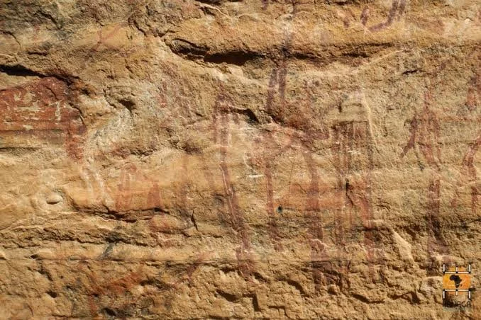
A procession-like composition may consist of a series of human figures, animals, or both. The figures might face in a common direction, repeat similar postures, or appear to move across the rock surface.

The arrangement can create a sense of movement even when the images are static. Artists can suggest motion by varying the position of limbs, changing the direction of bodies, or placing figures in a sequence.

Nevertheless, the visual impression of a procession does not establish what the figures were doing. The composition could represent movement between locations, a hunting activity, a gathering, a dance, or a symbolic narrative. It could also contain figures painted at different times.

Researchers examine differences in pigment, style, overlapping lines, and the condition of the rock to determine whether the figures belong to a single composition.

Social and Ritual Interpretations

Human figures arranged in groups are often discussed in relation to collective activities. These may include hunting, dancing, ceremonies, or other forms of social interaction.

Some San rock paintings have been interpreted through ethnographic evidence concerning healing ceremonies and ritual practices. Such research provides important context for understanding certain images, particularly when the composition contains unusual postures or combinations of human and animal forms.

However, not every group of figures should be described as a ritual procession. Researchers must distinguish what is visible in the painting from the explanation proposed for it.

A careful interpretation considers the entire composition, comparable works from other sites, and the limitations of the available evidence.

Artistic Technique and Composition

Creating a long sequence of figures requires attention to spacing, proportion, and the relationship between images. Artists worked on irregular rock surfaces, adapting the composition to the shape of the shelter wall.

Differences in figure size may reflect perspective, artistic convention, or the relative importance of particular figures. They do not necessarily indicate the actual physical size of the people represented.

Pigment analysis and detailed recording can help identify the order in which images were produced. When one figure overlaps another, the overlapping relationship may show which image was painted later, although weathering and damage can complicate the analysis.

Conservation

Procession-like compositions can be especially vulnerable when figures extend across a broad section of a shelter wall. Damage to one area may obscure the relationship between individual figures and make the overall composition more difficult to interpret.

Conservation measures include documenting the entire painted surface, monitoring environmental changes, controlling visitor access, and preventing vandalism. Digital photography can help researchers compare the condition of a painting over time.

Conclusion

Injisuthi’s rock-art landscape provides an opportunity to investigate how artists arranged figures to create movement and visual relationships. Procession-like friezes can raise questions about social life, ritual, and artistic composition, but their meanings must be established through careful analysis.

The importance of these paintings lies in their ability to preserve visual traditions that are not fully represented in written historical records. Responsible interpretation and conservation can help protect this heritage while acknowledging the uncertainty that remains about the original purpose of particular scenes.

Sehonghong Shelter: Lesotho's 4,000-Year Rock Art

October 4, 2026

Introduction

Sehonghong Shelter is an important archaeological locality in Lesotho, known for its contribution to research on prehistoric settlement, stone-tool technology, and the history of human occupation in the region. It is part of a wider southern African archaeological landscape in which caves and shelters preserve evidence of people adapting to mountain and highland environments.

The title refers to rock art approximately four thousand years old. That age should be treated as a claim requiring site-specific confirmation, rather than a date that can automatically be assigned to every painting or archaeological deposit at Sehonghong. A shelter may have been visited over a long period, and its archaeological deposits may contain material from different episodes of occupation.

The site’s broader importance lies in its archaeological record and its position within Lesotho’s highland environment. Rock art, where documented, must be considered alongside the evidence for settlement, subsistence, and technological change.

The Highland Environment

Lesotho’s landscape is dominated by highlands, steep valleys, river systems, and mountain slopes. These environments offered access to water, plant resources, and animals, while also presenting challenges associated with cold temperatures, changing weather, and difficult travel routes.

Shelters could provide protection from wind and rain. Their locations may have made them useful during movement through the highlands or during particular seasonal activities.

The surrounding landscape has changed over thousands of years. Climate fluctuations influenced vegetation and animal distributions, while erosion and other geological processes shaped the terrain. Archaeologists use environmental evidence to reconstruct the conditions under which people lived.

Archaeological Importance

Sehonghong is known in southern African archaeology for its deposits and the evidence they provide about long-term human occupation. Archaeological sequences from shelters can contain stone artefacts, animal remains, charcoal, and other materials introduced through human activity or natural processes.

Stone tools reveal how people selected raw materials and shaped them into implements. Animal remains can provide information about hunting and the availability of food resources. Sediment layers help establish the sequence in which these materials accumulated.

A long archaeological sequence does not necessarily indicate continuous occupation. People may have visited the shelter repeatedly, with long intervals between visits. Researchers therefore examine the structure of the deposits and the dating evidence before reconstructing patterns of settlement.

Rock Art and Its Chronology

Rock art is an important source of evidence for Indigenous artistic traditions in southern Africa. Painted images may depict animals, human figures, and abstract or symbolic forms.

However, the age of a shelter is not the same as the age of its paintings. A location may have been used long before an image was created, and later visitors may have added new paintings beside older ones.

Dating rock art is challenging because pigments do not always contain material suitable for direct analysis. Researchers may rely on pigment studies, comparisons with other sites, and relationships with dated archaeological deposits. These methods may establish a broad range rather than an exact year.

For Sehonghong specifically, any claim that particular images date to four thousand years ago should be supported by a documented study that identifies the paintings and explains the dating method.

Art, Environment, and Cultural Memory

Rock art can reflect close observation of the natural world, but its meaning may extend beyond a simple record of animals or daily activities. Images can carry symbolic significance and may be associated with particular places in the landscape.

The highland setting is relevant because the environment shaped how people moved, found food, and interacted with other communities. Yet the location of a painting alone cannot reveal whether it was created for practical, social, or spiritual reasons.

Researchers should distinguish direct evidence from interpretations based on comparisons with other traditions. Indigenous knowledge may offer important perspectives, but similarities between images do not necessarily establish identical meanings.

Conservation in Lesotho

Rock shelters and their archaeological deposits are vulnerable to erosion, uncontrolled collecting, vandalism, and damage caused by visitors. Once a layer is disturbed, the relationships between artefacts and sediment may be lost.

Conservation involves recording sites, managing access, preserving collections, and working with heritage authorities and local communities. It is also important to communicate the significance of archaeological sites without overstating what is known about them.

Conclusion

Sehonghong Shelter is an important part of Lesotho’s archaeological heritage and contributes to understanding human occupation of southern Africa’s highlands. Its archaeological record offers opportunities to investigate technology, subsistence, and environmental adaptation.

The specific claim of four-thousand-year-old rock art should be verified through evidence that directly relates to the images in question. By distinguishing the age of the site from the age of individual artworks, researchers can produce a more reliable account of Lesotho’s past while protecting its cultural heritage.

Metolong Dam Sites: Lesotho's Iron Age Villages

October 4, 2026

Introduction

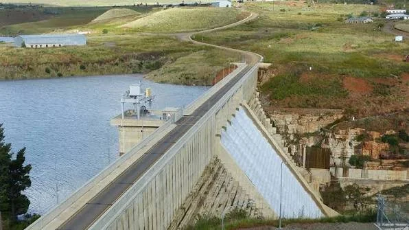
The Metolong Dam project in western Lesotho led to extensive archaeological investigations before the development of the reservoir and associated infrastructure. These investigations are significant because large construction projects can affect archaeological sites that might otherwise remain undocumented.

The archaeological work around Metolong revealed evidence of human activity from different periods, contributing to research on prehistoric settlement and the development of farming communities in Lesotho. The region’s record includes evidence relevant to the Later Stone Age and later periods, including the Iron Age.

The phrase “Iron Age Villages” refers to an important subject within this broader archaeological history: the development of communities that used iron technology, cultivated crops, and, in many cases, kept domestic animals. However, the presence of Iron Age material at a locality does not automatically mean that every site was a permanent village. Settlement patterns must be established from the archaeological evidence.

The Metolong Landscape

Metolong lies within the western highlands of Lesotho, where valleys and watercourses provided resources for human communities. The area’s position made it part of a wider landscape through which people could move between settlements, grazing areas, and agricultural land.

The construction of a dam can transform a landscape by creating a reservoir and altering river systems. Before construction, archaeological surveys and excavations are often undertaken to identify and document sites that may be affected.

This kind of work is commonly called development-led or rescue archaeology. It aims to record archaeological evidence before it is disturbed or submerged, although excavation cannot preserve every aspect of a site in its original condition.

Archaeological Surveys and Excavations

Archaeologists investigating an area such as Metolong begin by identifying locations likely to contain evidence of past human activity. Surface artefacts, geological features, historical information, and local knowledge can all help guide survey work.

Excavation then reveals the relationships between artefacts, structures, and sediment layers. Researchers record the position of stone tools, pottery, animal bones, hearths, and other materials.

These relationships are essential for determining whether a site represents a temporary camp, a repeated occupation location, or a more permanent settlement. A collection of artefacts found near one another does not automatically prove that they were used at the same time.

Understanding the Iron Age

The Iron Age in southern Africa is associated with the development and spread of communities that used iron technology and practised forms of farming and livestock keeping. Pottery, metal objects, domestic animal remains, and settlement features can provide evidence of these activities.

Iron technology made it possible to produce tools and other objects with properties different from those of stone. However, ironworking required specialised knowledge and access to suitable materials, fuel, and technical processes.

Iron Age communities were not identical. Their economies, settlement arrangements, and relationships with neighbouring groups varied according to local conditions and historical circumstances.

Researchers therefore avoid treating the Iron Age as a single uniform culture. The term is a broad chronological and technological category that covers many different communities.

What Makes a Village?

Archaeologists identify villages through combinations of evidence rather than a single artefact type. Possible indicators include the remains of houses, repeated domestic activity areas, storage features, hearths, pottery assemblages, and evidence of food production.

Settlement patterns can also be investigated through the spatial distribution of artefacts and structures. If domestic activities occurred repeatedly in the same area, the evidence may suggest sustained or recurrent occupation.

However, the distinction between a village and a temporary settlement is not always straightforward. Seasonal occupation can leave substantial deposits, while permanent settlements may preserve relatively little evidence if conditions are unfavourable.

For this reason, claims about Iron Age villages around Metolong should be tied to the specific excavated features and their chronology.

Agriculture, Livestock, and Exchange

Iron Age farming communities often combined crop cultivation with livestock keeping and other activities. Crops provided food, while domestic animals could supply meat, milk, hides, and other products.

The balance between farming, herding, hunting, and gathering varied by region. Communities could also exchange goods and knowledge with neighbouring groups, creating networks that connected settlements across the landscape.

Pottery styles, metal objects, and other artefacts can provide clues about these relationships. Yet an object made elsewhere does not necessarily prove that its owner travelled to that place. It may have reached the settlement through trade, exchange, inheritance, or several stages of movement.

Why the Metolong Project Matters

The Metolong archaeological investigations demonstrate the importance of documenting heritage before major development changes a landscape. Without survey and excavation, some sites could be lost beneath a reservoir or affected by construction without a scientific record.

The findings also contribute to a broader understanding of Lesotho’s history. Archaeology can show that the region was connected to wider patterns of technological development, farming, settlement, and exchange rather than existing in isolation.

Conclusion

The Metolong Dam archaeological sites provide valuable evidence for the long history of human occupation in western Lesotho. The Iron Age material is particularly relevant to the study of farming, livestock keeping, iron technology, and settlement patterns.

However, not every archaeological locality should automatically be described as an Iron Age village. That classification depends on evidence of settlement structures, domestic activities, and a secure chronology.

Through careful excavation and documentation, the Metolong project has helped preserve information about Lesotho’s past that might otherwise have been lost during major infrastructure development.

Liphofung Cave: Lesotho's San Paintings

October 4, 2026

Introduction

Liphofung Cave, located in northern Lesotho, is an important cultural and historical site. Its rock shelter is associated with San rock paintings and provides an opportunity to explore the artistic traditions of Indigenous hunter-gatherer communities in southern Africa.

The cave also holds significance within Lesotho’s broader heritage landscape. It demonstrates how natural shelters can preserve artistic evidence while also serving as places connected to the movement and activities of people across the highlands.

San paintings should not be viewed simply as decorative images on stone. They can provide evidence of artistic skill, environmental knowledge, and cultural traditions. Some have been interpreted in relation to spiritual beliefs and ritual activities, although the meaning of any individual painting must be considered carefully.

The Physical Setting

Liphofung is a sandstone shelter in a landscape of highlands, valleys, and mountain slopes. Such shelters offered protection from the weather and could provide convenient places to stop during movement through the region.

The shelter’s rock surfaces offered a durable medium for painting. Where the surface remained relatively dry and protected, pigments could survive for long periods. Nevertheless, weathering, moisture, and biological growth can cause gradual deterioration.

The cave’s location is also important for understanding its heritage value. Natural shelters often occupy positions within wider routes and resource landscapes, making them relevant to studies of mobility and settlement.

San Artistic Traditions

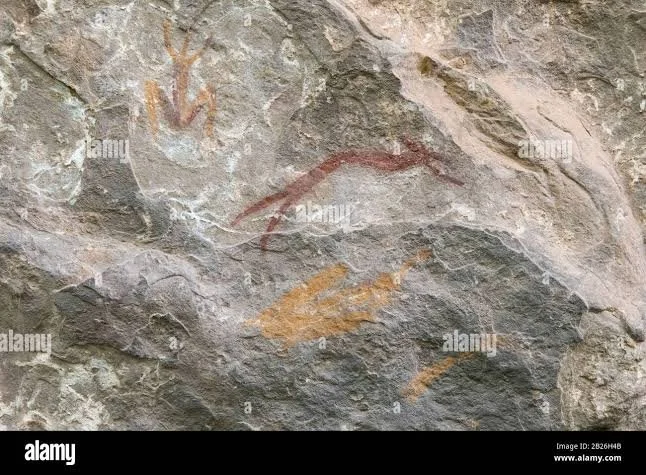
San rock art is among the most important bodies of Indigenous artistic evidence in southern Africa. Paintings may depict animals, human figures, and unusual combinations of forms that invite questions about their original meanings.

Artists used mineral pigments, including ochres, to create images on the rock. The choice of colour, the shape of a figure, and the arrangement of several images could all contribute to a composition.

Some paintings display detailed observation of animal anatomy and movement. Others use simplified or stylised forms. These differences reflect the diversity of artistic practice and should not be reduced to a single style.

The people who produced the paintings belonged to communities with their own knowledge, social relationships, and traditions. Although modern researchers can document the physical characteristics of an image, its full cultural meaning may not be recoverable.

Animals and Human Figures

Animals are prominent in many San rock paintings, and the eland is particularly significant in several documented traditions. Human figures may appear alone or in groups, sometimes alongside animals or in unusual postures.

These images have been interpreted in different ways. Some may relate to hunting or the observation of wildlife, while others may have symbolic or ritual significance.

Ethnographic research has helped scholars understand the importance of healing practices and spiritual potency in some San traditions. However, those interpretations should not be applied automatically to every painting at Liphofung. A particular figure’s meaning depends on its context and the evidence available.

Dating and Documentation

The age of the paintings at Liphofung must be distinguished from the age of the cave itself. A shelter may have been used repeatedly over thousands of years, and the paintings may represent several episodes of artistic activity.

Researchers may examine pigment composition, the condition of the surface, overlapping images, and relationships with archaeological deposits. Depending on the evidence available, these methods may provide broad chronological estimates rather than exact dates.

Careful documentation is essential. Photographs, measured drawings, and digital records can preserve information about the paintings’ condition and allow future researchers to compare changes over time.

Cultural Heritage and Conservation

Liphofung’s paintings are fragile and irreplaceable. Touching the painted surface, adding graffiti, or attempting to clean the rock can damage the artwork.

Conservation involves protecting the site, managing visitor access, recording changes, and educating the public about the importance of the paintings. Local communities and heritage authorities have important roles in decisions about interpretation and preservation.

The San should also be recognised as living Indigenous peoples with diverse contemporary communities. Ancient rock art forms part of a wider cultural history, not merely a vanished past.

Conclusion

Liphofung Cave is an important part of Lesotho’s cultural heritage and contributes to the study of San artistic traditions in southern Africa. Its paintings preserve evidence of artistic expression and provide opportunities to investigate the relationships between people, animals, and the landscape.

The interpretation of individual images requires caution, particularly when assigning dates or spiritual meanings. By combining archaeological research with respectful heritage management, Liphofung can continue to provide a valuable connection to the region’s long history.

Quthing District: Lesotho's Rock Engravings

October 4, 2026

Introduction

Quthing District, in southern Lesotho, forms part of a highland landscape rich in archaeological and historical significance. The district’s valleys, rocky slopes, and natural shelters have supported human activity over long periods, creating opportunities for the preservation of artefacts and other traces of the past.

The title “Rock Engravings” refers to images made by cutting, pecking, or abrading a rock surface. Rock engravings are distinct from paintings, which use pigments applied to stone. Both forms of rock art occur across southern Africa, but their distribution, age, and cultural associations vary.

Before attributing a particular set of engravings to a specific location in Quthing, the relevant site records and archaeological descriptions should be verified. The district’s broader archaeological importance provides context, but individual claims about motifs, dates, and meanings require site-specific evidence.

The Landscape of Quthing

Quthing lies within Lesotho’s southern highlands and foothills. The landscape contains river valleys, exposed rock surfaces, and sheltered locations that could have been used by people travelling through the region.

The natural environment influenced both human activity and the preservation of archaeological material. Shelters provided protection, while exposed rock surfaces could serve as places for engraving. Erosion, weathering, and changes in moisture affected how well such marks survived.

Rock engravings may remain visible for long periods, but their appearance changes as the surrounding surface weathers. Some marks become faint, while others are difficult to distinguish from natural cracks or accidental damage.

How Engravings Are Created

Engravings are made by physically altering the rock. Artists may use repeated pecking to create a series of small depressions, incise lines into the surface, or abrade areas to form shapes.

The technique affects the final appearance. Pecked images may have rough interiors, while incised lines can appear narrow and continuous. The type of stone also matters because some surfaces are easier to work than others.

Researchers examine the form and depth of the marks, the sequence of overlapping lines, and the relationship between the image and the surrounding rock. These details can help establish whether the marks were deliberately made.

Modern documentation may include scaled photographs, measured drawings, and three-dimensional surface recording. Such records are useful for comparing images and monitoring their condition.

Possible Subjects and Meanings

Southern African engravings can depict animals, tracks, geometric patterns, and abstract forms. Some images are recognisable, while others are difficult to interpret.

An animal engraving might reflect observation of wildlife, but it could also carry symbolic significance. Geometric forms may have had meanings that are no longer understood, particularly when there is little contextual information.

It would be inappropriate to assign a single purpose to all engravings in Quthing. Different images may have been created by different communities, at different times, and for different reasons.

The most reliable interpretations begin with the visible features of the image and then consider relevant archaeological and cultural evidence.

Dating Rock Engravings

Dating engravings is difficult because the marks themselves often lack material suitable for direct radiocarbon dating. Researchers may investigate mineral deposits that formed over or beneath an engraving, examine its relationship with archaeological layers, or compare it with other documented images.

Each method has limitations. A mineral crust may constrain the age of an engraving without establishing the exact date it was made. Stylistic similarities may suggest a broad relationship between images but cannot independently prove that they are contemporary.

The age of a shelter should also not be confused with the age of its engravings. A site may have been used long before the marks were made, and later visitors may have added new designs.

Archaeological Context and Indigenous Heritage

Rock art must be interpreted within the wider history of the communities who used the landscape. Archaeological evidence can help researchers investigate settlement, mobility, technology, and relationships between groups.

However, cultural attribution should not be based solely on the appearance of an image. Researchers need to consider the site’s documented history, the archaeological material associated with it, and relevant Indigenous knowledge where available.

The meaning of a design may not be fully recoverable, and acknowledging that uncertainty is part of responsible archaeological interpretation.

Conservation

Rock engravings are vulnerable to vandalism, graffiti, uncontrolled collecting, and damage caused by people walking or climbing over the rock surface. Attempts to trace or deepen the marks can permanently alter the original evidence.

Conservation involves documenting the site, protecting vulnerable surfaces, managing access, and informing visitors about the importance of the artwork. Digital records can help preserve detailed information, but the original surface remains irreplaceable.

Conclusion

Quthing District forms part of Lesotho’s wider archaeological landscape, where natural shelters and rock surfaces preserve evidence of human activity. Rock engravings, where securely documented, can provide information about artistic practice and the ways people engaged with their environment.

The interpretation of specific engravings requires verified site information, careful dating, and respect for the cultural context. By combining documentation, archaeological research, and conservation, researchers can protect this heritage while developing a more complete understanding of Lesotho’s past.

Moyeni Rock Art: Lesotho's Hunter Scenes

October 4, 2026

Introduction

Moyeni is associated with the historical and cultural landscape of southern Lesotho. The title “Hunter Scenes” points to an important subject in the study of southern African rock art: images that appear to depict people, animals, and activities related to hunting.

Hunting scenes can provide insight into how artists represented animals and human movement. However, the interpretation of a particular image requires care. A group of human figures near animals may depict a hunt, a symbolic narrative, or another activity. The visual resemblance alone cannot establish its original purpose.

For Moyeni specifically, claims about particular paintings should be connected to documented archaeological evidence. The wider regional history of rock art provides context, but it cannot substitute for a verified record of the individual site.

The Southern Lesotho Landscape

Southern Lesotho contains mountain slopes, river valleys, grasslands, and rocky shelters. These environments supported a range of human activities and provided access to wild animals, plants, and water.

A shelter could offer protection and serve as a stopping point during movement through the landscape. Its location near a valley or route might have made it useful for activities associated with hunting or resource gathering.

The environment also influenced the preservation of rock art. Sheltered rock surfaces can protect pigment from direct rainfall, although moisture and mineral growth may still damage paintings over time.

Hunting in the Archaeological Record

Hunting required detailed knowledge of animals and their environments. Hunters needed to understand where animals gathered, how they moved through the landscape, and how their behaviour changed according to season and weather.

Archaeological evidence for hunting can include animal bones, stone tools, projectile points, and traces of processing. Cut marks and other modifications on bones may help researchers determine whether animals were butchered by people.

Rock art provides a different kind of evidence. It records images selected and arranged by artists, potentially preserving aspects of how people understood animals and hunting. Yet the paintings do not necessarily document a particular hunt in the same way that a collection of butchered bones might document animal processing.

Identifying a Hunting Scene

A composition may be interpreted as a hunting scene if it contains figures carrying apparent weapons, animals positioned in relation to human figures, or body postures that suggest pursuit.

Even these features require careful assessment. Objects that resemble weapons may be difficult to identify, and human figures may represent activities other than hunting. Artists may also have used symbolic conventions that are not immediately obvious to modern viewers.

Researchers compare the composition with other paintings and examine the archaeological context. When possible, they also consider Indigenous knowledge and relevant historical accounts.

The interpretation should explain which features support the hunting hypothesis and which aspects remain uncertain.

Hunting, Symbolism, and Spiritual Meaning

Hunting was a practical activity, but animals could also have cultural or spiritual significance. In some San traditions, particular animals held symbolic roles associated with healing, potency, or ritual practice.

Consequently, an image of an animal and a human figure may have meanings that extend beyond the act of hunting. A scene could combine observation of wildlife with cultural beliefs about the relationship between humans and animals.

This possibility does not mean that every hunting-like image is spiritual. The purpose of a painting must be evaluated from the full composition and available contextual evidence.

Dating the Artwork

The age of a hunting scene can be difficult to determine. Pigments may not be suitable for direct dating, and the same type of scene could be produced during different periods.

Researchers may study pigment composition, the relationship between images and archaeological layers, and similarities with paintings from other sites. Overlapping images can sometimes establish relative order, but they do not necessarily provide an absolute date.

Any specific claim about the age of the Moyeni paintings should therefore be supported by documented research.

Conservation and Cultural Respect

Rock paintings are vulnerable to natural deterioration and human damage. Touching the surface, applying chemicals, or adding new marks can destroy evidence.

Conservation involves recording the artwork, managing access, and working with heritage authorities and local communities. Interpretive material should acknowledge uncertainty and avoid presenting Indigenous traditions as though they were uniform across all places and periods.

Conclusion

Moyeni Rock Art provides a useful subject for exploring the relationship between hunting and artistic representation in Lesotho’s wider cultural landscape. Hunter scenes, when securely documented, can reveal how artists represented animals, movement, and human activity.

However, the meaning of a particular composition cannot be established from appearance alone. Archaeological context, careful dating, and relevant cultural knowledge are necessary to distinguish a likely hunting scene from other possible interpretations.

Maseru District Shelters: Lesotho's Pastoral Art

October 4, 2026

Introduction

Maseru District, which includes Lesotho’s capital and surrounding rural areas, occupies a landscape of valleys, foothills, and highland routes. The region has a long history of human activity, including hunting and gathering, farming, livestock keeping, and settlement.

The title “Pastoral Art” suggests rock art connected with herding communities or imagery associated with domestic animals and pastoral life. This is an interesting subject because the introduction and development of livestock keeping changed the ways communities used land and organised their economies.

However, the term should not be treated as confirmation that a specific set of paintings in Maseru District depicts pastoralism. Each shelter and artwork requires site-specific documentation before particular subjects, dates, or cultural associations can be assigned.

The Landscape and Its Shelters

The Maseru region contains varied terrain, including river valleys, rocky slopes, and areas suitable for cultivation and grazing. Natural shelters could provide temporary protection for people moving through the landscape.

For pastoral communities, access to water and grazing land was especially important. The location of a shelter near a route or resource area might have made it useful during seasonal movement, although the presence of a shelter alone does not prove that it was used by herders.

Archaeological research examines the location of sites alongside the evidence found within them. Stone tools, pottery, animal remains, and other materials may help establish how a place was used and during which period.

What Is Pastoral Art?

The term pastoral art generally refers to artistic representations of herding, livestock, and rural life. In the context of archaeological rock art, it may describe images that appear to depict domestic animals, people managing herds, or other activities associated with pastoral communities.

Such imagery can be valuable because it may preserve evidence of changes in subsistence and social life. Yet identifying a domestic animal in a painting can be difficult, particularly when the image is faded or stylised.

A convincing interpretation requires attention to anatomical details, the arrangement of figures, and the archaeological context. Researchers may compare the painting with documented representations from other sites, but similarities do not automatically prove that the images were created by the same community.

Pastoralism in Southern Africa

Pastoralism involves the management of domestic animals such as sheep or cattle. Herding can provide meat, milk, hides, and other resources, but it also requires knowledge of grazing, water availability, animal health, and seasonal movement.

In southern Africa, pastoralism developed within a wider history of interaction among communities with different economic practices. Hunting and gathering continued alongside herding in some places, and people could exchange goods and knowledge across community boundaries.

This history should not be represented as a simple replacement of hunter-gatherers by pastoralists. Communities adopted and combined different practices according to local conditions, social relationships, and historical circumstances.

Can Rock Art Prove Pastoral Activity?

A painting that appears to show livestock may provide evidence relevant to pastoralism, but its interpretation depends on the identification of the animals and the age of the image.

The presence of domestic animals in a painting could indicate familiarity with herding, but it does not by itself establish whether the artist was a herder, whether the shelter was used as a livestock camp, or how the animals were managed.

Archaeological evidence from animal bones, pottery, settlement features, and other materials may help provide a more secure context. The chronology is especially important because an image may have been created long after the first introduction of livestock into the region.

Dating and Cultural Attribution

Dating rock art is difficult because pigments do not always contain material suitable for direct analysis. Researchers may rely on indirect evidence, including archaeological context, comparisons with other sites, and analysis of suitable mineral deposits.

Cultural attribution also requires caution. A painting may reflect contact between communities rather than the identity of the artist. People could adopt new artistic subjects or techniques through exchange and interaction.

For the Maseru District shelters, any claim about pastoral art should identify the documented shelter and explain the evidence that supports the interpretation.

Heritage Protection

Rock art can be damaged by weathering, vandalism, and uncontrolled visitation. Conservation includes documenting the paintings, protecting vulnerable surfaces, and providing accurate information to visitors.

Local communities are important partners in heritage protection. Their knowledge of the landscape and its history can contribute to the interpretation and preservation of archaeological sites.

Conclusion

The idea of pastoral art in Maseru District offers a way to explore the relationship between rock imagery and the history of livestock keeping in Lesotho. Pastoralism shaped resource use, mobility, and social relationships across southern Africa, making it an important subject for archaeological research.

Nevertheless, specific claims about pastoral paintings must be supported by verified site records. By combining rock-art analysis with evidence from settlements, animal remains, and other archaeological materials, researchers can investigate the history of herding while avoiding unsupported interpretations.

Thaba Bosiu: Lesotho's Moshoeshoe Fortress

October 4, 2026

Introduction

Thaba Bosiu is one of Lesotho’s most important historical and cultural landmarks. Located near Maseru, this flat-topped sandstone plateau is closely associated with Moshoeshoe I, the founder of the Basotho nation, and the formation of the Basotho kingdom during the nineteenth century.

Unlike the prehistoric rock-art shelters discussed in the preceding articles, Thaba Bosiu is primarily significant as a historical stronghold and a place of national memory. Its importance comes from the role it played in political leadership, defence, community organisation, and the survival of the Basotho during a period of regional upheaval.

The name Thaba Bosiu is commonly translated as “Mountain at Night.” Historical tradition connects the name with the mountain’s defensive reputation and the difficulty opponents faced when attempting to attack it. The site remains an important symbol of Lesotho’s history and national identity.

Moshoeshoe I and the Formation of the Basotho Kingdom

Moshoeshoe I emerged as a major leader during a period of profound change in southern Africa. During the late eighteenth and early nineteenth centuries, political competition, population movement, conflict, and economic disruption affected many communities across the region.

Moshoeshoe built relationships with different groups and brought communities together under his leadership. His approach combined diplomacy, alliance-building, military organisation, and the establishment of a defensible centre from which he could protect his people.

Thaba Bosiu became closely associated with this process. Its elevated position and relatively accessible plateau made it a strategic location where communities could seek refuge and organise their defence.

The development of the Basotho kingdom was not an isolated event. It occurred within a wider regional history involving neighbouring African polities, expanding settler communities, and changing patterns of trade and warfare.

The Geography of a Fortress

Thaba Bosiu’s physical form contributed significantly to its defensive value. The plateau rises above the surrounding landscape, and its steep sides restrict the number of practical approaches.

A strong defensive position could make it difficult for an attacking force to approach in large numbers. The elevated terrain also provided visibility over surrounding routes and settlements.

The mountain’s usefulness depended on more than geography, however. Defence required organised leadership, knowledge of the terrain, access to food and water, and the cooperation of the people living there.

Thaba Bosiu therefore represents the combination of a natural stronghold and a human system of political and military organisation.

Conflict and Regional Politics

During Moshoeshoe I’s leadership, the Basotho faced multiple challenges, including conflict with neighbouring groups and expanding colonial forces. The history of Thaba Bosiu is closely connected to the efforts made to protect the emerging kingdom and maintain its political independence.

The mountain provided refuge during periods of conflict, but its importance should not be reduced to military defence alone. It was also a centre of leadership and a place where political relationships were negotiated.

Moshoeshoe’s diplomatic strategy was an important part of his leadership. He sought alliances and negotiated with neighbouring powers when doing so could protect his people. These efforts unfolded within a changing political environment in which military strength, land, trade, and recognition were closely connected.

Thaba Bosiu and the Basotho Identity

Thaba Bosiu has become a powerful symbol of Basotho history and identity. Its association with Moshoeshoe I links the landscape to the formation of the nation and to the experiences of communities that sought security during a period of upheaval.

Historical sites often serve as places where national memory is maintained. Stories about leaders, battles, and collective survival are transmitted through education, oral traditions, commemorations, and public ceremonies.

These traditions are important, but historical research also examines how stories developed and how different sources describe the same events. Oral traditions, written records, archaeology, and the physical landscape can provide complementary perspectives.

A balanced history recognises the significance of national memory while continuing to investigate the details of the past.

The Historical Landscape

Thaba Bosiu contains places associated with the history of Moshoeshoe and the Basotho kingdom. The mountain and its surrounding landscape can help researchers investigate how people used natural features for defence and settlement.

Archaeological evidence may provide information about occupation, material culture, and the use of space, while historical documents and oral accounts contribute information about political events and community relationships.

The interpretation of the site should distinguish between what is supported by historical documentation and what belongs to later tradition. This distinction does not diminish the cultural significance of the mountain; it helps explain how historical knowledge is developed.

Preservation and Cultural Heritage

Thaba Bosiu is a place of national significance, and its preservation is important for historical research, education, and cultural continuity.

Heritage management involves protecting archaeological features, maintaining visitor access responsibly, and ensuring that development does not damage important parts of the landscape. Public interpretation should communicate the site’s history accurately and recognise its significance to Basotho communities.

Visitors can learn about the mountain not only as a military stronghold but also as a place associated with leadership, diplomacy, resilience, and the formation of a kingdom.

Conclusion

Thaba Bosiu stands as one of Lesotho’s most important historical landmarks. Its association with Moshoeshoe I and the formation of the Basotho kingdom makes it central to understanding the country’s nineteenth-century history.

The mountain’s natural defences helped provide a secure base, but its historical importance also depended on leadership, diplomacy, and the organisation of communities. Today, Thaba Bosiu remains a place where geography, political history, and national memory come together.

Preserving the site and interpreting it responsibly ensures that its significance continues to be understood by future generations, both as a historical stronghold and as an enduring symbol of Basotho heritage.

Ntsuanatsatsi: Lesotho's Initiation Lodges

October 4, 2026

Introduction

Lesotho's cultural landscape contains a rich history of settlement, community organization, and traditional education. Among the subjects that invite closer investigation are the places associated with initiation, a significant institution in many Southern African societies. The title Ntsuanatsatsi: Lesotho's Initiation Lodges raises important questions about how traditional communities prepared young people for adulthood, transmitted cultural knowledge, and maintained social responsibilities across generations.

However, it is important to distinguish between documented initiation traditions and the archaeological identification of particular buildings as initiation lodges. Without clear site-specific evidence, Ntsuanatsatsi should not automatically be described as a confirmed archaeological complex of initiation structures. Instead, it can be explored within the broader history of Basotho settlement, customary education, and the cultural significance of places used for instruction and community ceremonies.

Initiation as a Cultural Institution

In many Southern African societies, initiation has historically served as an important transition between childhood and adulthood. Rather than representing a single ceremony, initiation can involve a period of instruction, discipline, social preparation, and the transmission of knowledge. Participants may learn about family obligations, community expectations, respect for elders, appropriate conduct, and their future responsibilities.

Such traditions have often connected individual development with the well-being of the wider community. Becoming an adult was not simply a matter of reaching a particular age. It also involved learning how to contribute to family life, participate in community affairs, and uphold shared values.

Among Basotho communities, customary institutions developed within a broader social system shaped by kinship, chiefly authority, pastoralism, agriculture, and the historical formation of the Basotho nation. These institutions changed over time in response to Christianity, colonial administration, formal schooling, urbanization, and other social developments.

The Importance of Place

A location associated with initiation may possess cultural significance beyond its physical structures. Seclusion, distance from everyday activities, privacy, and a connection to the surrounding landscape can all influence the selection of ceremonial or instructional places.

If archaeological evidence were to establish the existence of initiation facilities at Ntsuanatsatsi, researchers would need to examine the site's layout, construction methods, associated artefacts, and relationship to nearby settlements. Archaeologists might investigate whether the buildings were domestic dwellings, communal structures, livestock enclosures, or spaces used for specialized activities.

The presence of a stone enclosure or isolated building would not, by itself, prove that initiation took place there. Stronger conclusions would require several forms of evidence, potentially including oral histories, historical documentation, architectural comparisons, and archaeological deposits consistent with the proposed function.

This distinction is particularly important because cultural activities do not always leave distinctive material remains. Teaching, storytelling, singing, and oral instruction may have occurred in temporary structures or ordinary buildings that later generations used for different purposes.

Oral Tradition and Community Knowledge

Oral history can help researchers understand how places acquired meaning. Community elders, cultural practitioners, and local historians may preserve accounts of historical gatherings, traditional practices, and the people associated with particular landscapes.

Such knowledge should be approached respectfully and in collaboration with the communities concerned. Researchers should not treat oral traditions as inferior to written documents simply because they are transmitted differently. At the same time, interpretations should recognize that memories may vary between families and generations, and that traditions can evolve as communities respond to new circumstances.

Where a site is associated with restricted cultural knowledge, consultation should also establish what information may appropriately be recorded or published. Not every culturally important practice should be made public for academic or tourism purposes.

Archaeology, Heritage, and Preservation

Potential initiation-related sites can contribute to a broader understanding of how Basotho communities organized education, identity, and social continuity. Their protection may also help younger generations engage with cultural history in ways that go beyond written textbooks.

Preservation requires attention to both tangible and intangible heritage. Stone structures, pottery, pathways, and settlement remains may be physically vulnerable to erosion, construction, agricultural activity, and the removal of building materials. Cultural knowledge can face different pressures, including the loss of fluent knowledge holders and the weakening of opportunities for intergenerational teaching.

Documentation should therefore combine archaeological recording with community-led interpretation. Any restoration or tourism development should be planned carefully so that the site's significance is not reduced to an attractive collection of ruins.

Conclusion

Ntsuanatsatsi provides an opportunity to explore the relationship between place, initiation, and cultural education in Lesotho. Although the specific identification of archaeological structures as initiation lodges requires reliable evidence, the wider subject reveals how traditional institutions have helped communities transmit knowledge and prepare younger generations for adult responsibilities.

A responsible interpretation brings archaeology, oral history, and contemporary community knowledge together. By doing so, it recognizes that heritage is not only about surviving buildings or ancient objects. It is also about the values, relationships, and memories that give places their enduring meaning.

Makoaneng: Lesotho's Stone-Built Kraals

October 4, 2026

Introduction

Across the highlands and foothills of Lesotho, stone construction offers an important way to investigate how people adapted their settlements to a rugged environment. Stone walls, livestock enclosures, terraces, and the remains of domestic structures can reveal how communities organized space and managed the relationship between households, animals, and agricultural land.

The title Makoaneng: Lesotho's Stone-Built Kraals focuses attention on kraals, or enclosures commonly associated with livestock management. In a society where cattle and other domestic animals have long held economic, social, and cultural importance, these structures can provide valuable evidence of everyday life. However, the exact age and historical function of particular enclosures at Makoaneng would need to be established through site-specific research rather than inferred from their appearance alone.

What Is a Kraal?

A kraal is generally an enclosure used to contain livestock. In Southern African pastoral and agro-pastoral settings, kraals have served practical purposes such as keeping animals together, protecting them from predators, controlling their movement, and making it easier for people to supervise and manage herds.

Their design varies according to the landscape, available building materials, livestock species, household needs, and local traditions. Some enclosures are constructed from timber or thorn branches, while others use stone, particularly where suitable rock is readily available.

A stone kraal may consist of a circular or irregular wall built from locally gathered stones. Its entrance may be narrow to control the movement of animals. Larger settlement complexes can contain multiple enclosures, suggesting that livestock management formed part of a wider system of household organization.

Nevertheless, shape alone cannot establish a structure's age. A stone enclosure may have been built recently, reused over generations, or modified several times.

Livestock and Basotho Society

Livestock has played a significant role in the history of Basotho communities. Cattle can provide milk, meat, hides, and other resources, while also carrying social and symbolic importance. Animals may be involved in exchanges between families, ceremonial obligations, bridewealth arrangements, and the expression of wealth or status.

Herd ownership has never been distributed equally across all households. Differences in livestock holdings could influence a family's economic security, relationships with other households, and ability to recover from drought, disease, or conflict.

Kraals therefore represent more than simple architectural features. They are connected to household economies and social relationships. A well-maintained enclosure could protect valuable animals, while the organization of several enclosures might reflect the needs of a larger household or community.

It would nevertheless be incorrect to assume that every large enclosure belonged to a wealthy chief or that every small enclosure represented a poor household. Such interpretations require supporting evidence from the wider settlement.

Stone Construction and the Landscape

Lesotho's mountainous terrain provides abundant examples of how people have used local stone in building. Stone walls can withstand weathering better than some temporary materials, although they remain vulnerable to erosion, frost damage, vegetation, and the removal of stones for modern construction.

Building with stone also requires considerable labor. Constructing an enclosure involves selecting suitable material, transporting it, arranging the stones, and maintaining the wall over time. The labor may have been performed by individual households, extended families, or larger groups cooperating for a shared purpose.

Researchers examining Makoaneng would consider the relationship between kraals and nearby dwellings, water sources, grazing areas, cultivated fields, and routes through the surrounding terrain. A location that provides convenient access to pasture and water may have been especially useful for livestock management.

The arrangement of structures can also reveal whether the settlement developed according to a single plan or expanded gradually as households grew and land use changed.

Archaeological Investigation

Archaeologists can investigate stone kraals by recording their dimensions, construction techniques, wall thickness, entrances, and relationship to other structures. Mapping the entire settlement is essential because an enclosure's meaning often becomes clearer when it is studied alongside nearby features.

Surface artefacts may include pottery fragments, stone tools, metal objects, or evidence of domestic activity. If suitable deposits survive, scientific dating methods may help establish when particular phases of occupation occurred. Organic material associated with a structure can sometimes provide a more reliable date than the wall itself.

Researchers must also account for reuse. A kraal might have been repaired, enlarged, or repurposed long after its original construction. The age of a nearby artefact does not automatically establish the age of the enclosure.

Oral histories and local knowledge can help identify traditional land uses and remembered settlement patterns. These accounts are particularly valuable when combined with careful archaeological documentation.

Preservation and Heritage Value

Stone kraals can be damaged by road construction, housing expansion, agriculture, uncontrolled tourism, and the removal of stones. Because their materials may appear ordinary, they are sometimes overlooked in heritage assessments.

Protecting these structures means documenting them before they disappear and consulting local communities about their significance. Conservation plans should also recognize that some enclosures may remain part of active rural landscapes rather than being abandoned archaeological monuments.

Conclusion

Makoaneng's stone-built kraals offer a useful framework for examining livestock management, household organization, and architectural adaptation in Lesotho. Their importance lies not only in the walls themselves but also in the economic and social activities they supported.

To establish the history of any particular kraal, researchers must combine architectural evidence, archaeological dating, landscape analysis, and community knowledge. With this careful approach, stone enclosures can help reconstruct the practical decisions through which generations of Basotho households managed animals, land, and community life.

Ha Thetsane: Lesotho's Iron Age Pottery

October 4, 2026

Introduction

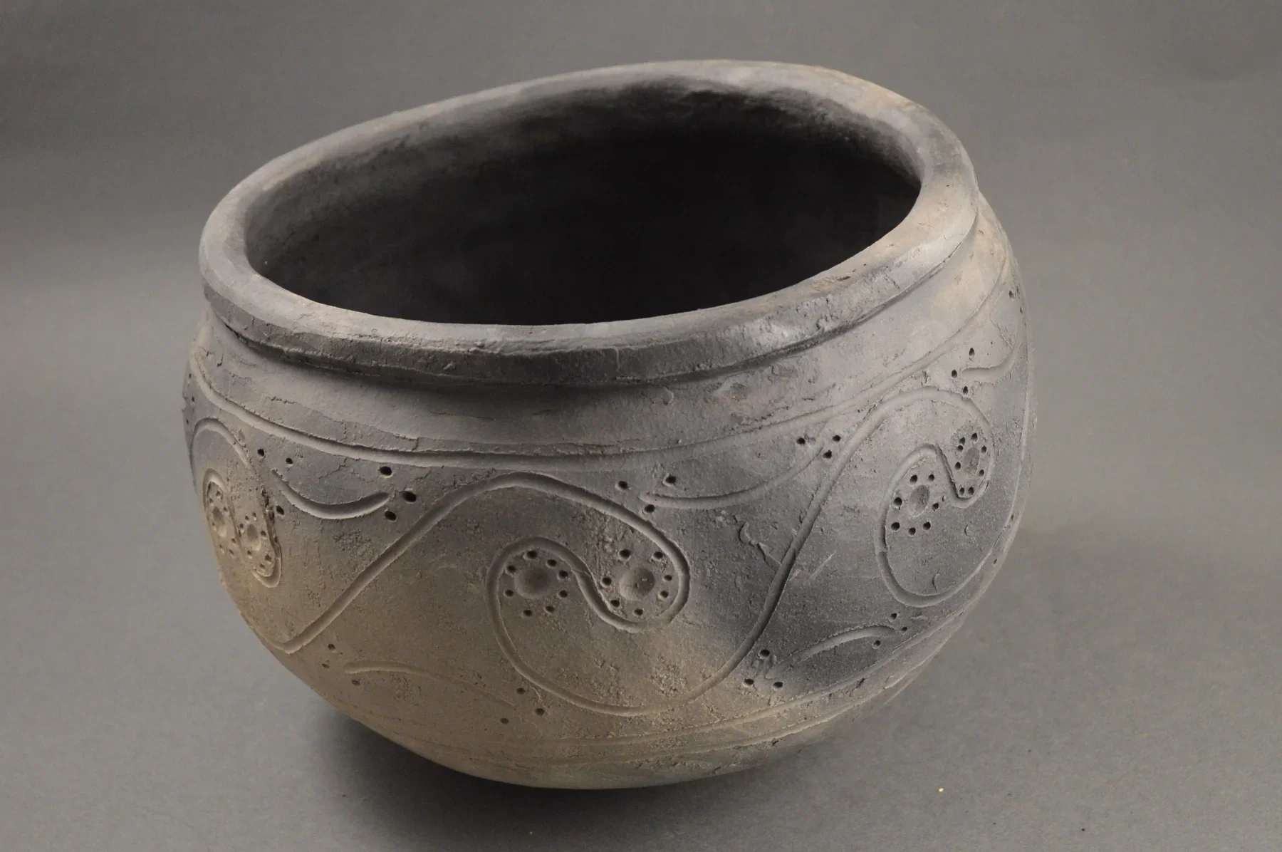
Pottery is among the most informative forms of archaeological evidence for understanding past communities. Unlike many organic materials that decay over time, fired clay can survive for centuries or even millennia under suitable conditions. Fragments of pots may reveal how people prepared food, stored grain, transported liquids, exchanged goods, and expressed cultural identity through decoration.

The title Ha Thetsane: Lesotho's Iron Age Pottery places this important material evidence within the archaeological history of Lesotho. The Iron Age is generally associated with communities that practiced farming and livestock keeping and made use of iron technology, although the timing and character of these developments varied across Southern Africa. The presence of pottery at a site does not, by itself, prove that every associated activity belongs to a single Iron Age occupation.

Understanding the Iron Age in Southern Africa

The term Iron Age is an archaeological classification rather than a claim that iron was the only important material used by a society. Communities classified within the Iron Age could also use stone tools, wooden implements, bone, clay, and other materials.

In Southern Africa, the development and spread of farming, livestock keeping, ironworking, and pottery production occurred through complex processes involving migration, interaction, local innovation, and the exchange of knowledge. These processes did not happen everywhere at the same time.

Archaeologists therefore study individual regions carefully rather than assuming that a single timeline applies to the entire subcontinent. In the highlands of present-day Lesotho, settlement patterns were influenced by elevation, climate, water availability, grazing opportunities, and access to agricultural land.

Pottery provides one way to investigate how communities living in this environment organized their domestic activities and maintained connections with neighboring groups.

How Ancient Pottery Was Made

Traditional pottery production involved several stages. First, potters collected clay from suitable deposits. They might process it to remove stones and other unwanted material, then mix it with temper, such as crushed rock or other substances, to alter its working properties and reduce cracking during drying and firing.

Vessels could be formed by pinching, coiling, or combining techniques. Coiling involved adding successive rolls of clay and smoothing them together to create the desired shape. The potter then refined the vessel's walls, rim, base, and surface.

Decoration could be applied using impressions, incisions, grooves, ridges, or other techniques. These patterns were not merely aesthetic. They may reflect learned traditions, individual choices, practical requirements, or the influence of neighboring communities.

The vessel was dried before firing. In many traditional production systems, firing took place in an open fire or a relatively simple firing arrangement rather than a large permanent kiln. Differences in temperature, oxygen supply, fuel, and the vessel's position could influence its final color and strength.

What Pottery Can Reveal

Pottery fragments are valuable because they preserve evidence of both technology and behavior. The thickness of a vessel's walls, its rim shape, and the composition of its clay can help researchers infer how it was made and used.

Large, sturdy vessels may have been suitable for storage or cooking, while smaller vessels could have served other domestic or ceremonial purposes. However, function should not be assigned from size alone. Residue analysis, wear patterns, vessel shape, and comparison with ethnographic evidence can strengthen an interpretation.

Decoration can also help researchers identify similarities between assemblages from different sites. If vessels from Ha Thetsane resemble pottery from other parts of Lesotho or neighboring regions, this may indicate shared manufacturing traditions or interaction between communities.

Such similarities do not necessarily prove direct migration. Ideas and styles can spread through exchange, intermarriage, visits, imitation, and the movement of individual craftspeople.

Pottery and Everyday Life

The manufacture and use of pottery were closely connected to household routines. Cooking vessels helped transform cultivated crops and animal products into meals. Storage containers could protect food from moisture, insects, and other sources of spoilage, depending on their design and the conditions in which they were kept.

Pottery also provides a window into labor and knowledge. Producing a durable vessel requires familiarity with clay, moisture, shaping, drying, and firing. Such expertise may have been passed between generations through observation and practice.

A pottery assemblage can therefore reveal aspects of daily life that written records rarely describe. Even a small fragment may preserve a rim profile, decorative pattern, or manufacturing mark that helps researchers reconstruct a broader technological tradition.

Dating and Archaeological Context

The archaeological context of pottery is essential. A fragment found on the surface may have been moved from its original location by erosion, farming, construction, or later occupation. A fragment recovered from a carefully excavated layer provides stronger contextual information.

Pottery itself is not always directly datable. Researchers often establish its age through associated charcoal, seeds, bones, or other materials that can be dated using appropriate scientific methods. The reliability of the date depends on whether the dated material genuinely belongs to the same occupation.

Archaeologists must also consider that a settlement may have been occupied repeatedly. Pottery from different periods can become mixed, especially where later people dug into earlier deposits.

Conservation and Research

Pottery fragments are vulnerable to careless handling, weathering, and the loss of their archaeological context. Collecting objects without recording where they were found can destroy information that may be more valuable than the object itself.

Systematic recording, photography, specialist analysis, and collaboration with local heritage institutions can preserve this evidence for future study.

Conclusion

Ha Thetsane's pottery offers a valuable subject through which to explore technology, food preparation, household organization, and cultural interaction in Lesotho's past. The significance of the material lies in the combination of its physical characteristics and the archaeological context in which it is found.

When carefully studied, pottery can help researchers reconstruct how communities adapted to their environment, maintained craft traditions, and interacted with others. It reminds us that ordinary objects used in daily life often provide some of the clearest evidence for understanding the complexity of the past.

Machong: Lesotho's Early Farming Site

October 4, 2026

Introduction

The history of farming in Lesotho is part of a much wider story about how communities across Southern Africa adapted to changing environments, developed new food-production strategies, and organized increasingly complex relationships with land and livestock. The title Machong: Lesotho's Early Farming Site invites an exploration of these transformations and the archaeological evidence that can help explain them.

It is important, however, to distinguish between the general history of early farming in the region and claims about a specific archaeological site. To establish Machong's precise role in the development of agriculture, researchers would need reliable excavation records, dated material, and evidence of farming-related activities. The broader context nevertheless shows why early farming sites are so valuable for understanding Lesotho's settlement history.

From Foraging to Food Production

For thousands of years, human communities in Southern Africa relied on diverse combinations of hunting, gathering, fishing, and other ways of obtaining food. These strategies required detailed knowledge of seasonal resources, animal behavior, edible plants, water sources, and changing weather conditions.

The introduction and development of farming did not mean that all earlier subsistence practices immediately disappeared. Communities often combined cultivation and livestock keeping with hunting and gathering. Different activities could provide food at different times of the year and reduce the risks associated with drought, crop failure, or fluctuations in animal populations.

Food production therefore developed through gradual and varied processes rather than a single universal transition. Communities adapted agricultural practices to local conditions, and the resulting systems differed according to rainfall, soil, elevation, available crops, and access to grazing.

In Lesotho, the highland environment presented particular challenges. Shorter growing seasons in some areas, cold winters, steep slopes, and uneven access to arable land influenced where cultivation was practical and how households managed their resources.

Farming in the Lesotho Landscape

Agriculture depends on more than the presence of seeds and suitable soil. Farmers must understand rainfall patterns, soil fertility, seasonal temperature, water availability, and the risks posed by pests and extreme weather.

In mountainous landscapes, cultivated fields may be concentrated in valleys and gentler slopes, while steeper terrain is more useful for grazing or other activities. The relationship between fields, water, houses, and livestock enclosures can reveal how a community organized its daily work.

Livestock keeping could complement cultivation by providing milk, meat, hides, manure, and social or economic resources. Animals also required access to grazing and water, making seasonal movement an important part of land management.

These systems involved decisions about labor. Preparing fields, planting, weeding, harvesting, processing grain, caring for animals, and maintaining buildings all required time and cooperation. Household members may have specialized in different tasks according to age, experience, seasonal demands, and social expectations.

An archaeological site associated with early farming could preserve evidence of several of these activities, although not every activity would necessarily leave identifiable remains.

What Archaeologists Look For

Researchers investigating an early farming settlement may search for charred seeds, grain impressions in pottery, grinding stones, animal bones, storage features, domestic structures, and tools associated with food processing.

Charred plant remains are especially valuable because they can survive when ordinary plant material decays. They may reveal which crops were present, although the small quantities preserved at a site do not necessarily represent the full range of plants cultivated by its inhabitants.

Grinding stones can indicate food processing, but their interpretation requires care because they may have been used for several purposes. Similarly, animal bones can provide information about diet and animal management, but identifying domesticated species and reconstructing herd composition requires specialist analysis.

The position of these materials matters. Seeds recovered from a storage feature may have a different significance from seeds scattered in a hearth or deposited by later natural processes.

Scientific dating can help establish when particular activities occurred. Researchers must also consider whether different layers represent separate periods of occupation rather than a single continuous settlement.

Settlement and Social Organization

Farming can influence the relationship between people and place. Cultivated fields require repeated attention, and investments in soil preparation, storage, and buildings can encourage people to return to the same locations over successive seasons.

Yet farming does not automatically create permanent villages. Some communities may have maintained seasonal mobility, moving people or animals between different areas while cultivating selected fields.

The form of a settlement can help researchers examine these possibilities. Closely grouped houses, storage areas, and enclosures may indicate a different pattern of organization from scattered dwellings connected by paths and shared agricultural spaces.

Researchers should avoid assuming that every settlement had a uniform social structure. Household size, access to land, ownership of animals, and relationships with neighboring communities could vary considerably.

Climate, Risk, and Adaptation

Farming in mountainous regions requires flexibility. Rainfall can vary between seasons, while cold conditions and frost can damage crops. A household dependent on a single crop or a narrow range of resources may be especially vulnerable when conditions deteriorate.

Diversification can reduce these risks. Combining cultivation with livestock keeping, collecting wild foods, storing grain, and exchanging goods with neighboring communities may improve resilience.

Archaeological evidence can help researchers investigate whether food production became more important over time or whether households continued to rely on mixed subsistence strategies. Changes in animal remains, plant remains, storage features, and settlement locations can reveal shifts in how people responded to environmental pressures.

Why Machong Matters

If Machong is investigated as an early farming site, its significance would depend on the quality of its archaeological evidence and how that evidence compares with other settlements in Lesotho. A well-documented site could help clarify when particular farming practices were introduced, how households combined cultivation with livestock keeping, and how communities adapted agricultural techniques to local terrain.

Such research would also contribute to a more nuanced understanding of regional history. The development of farming was not simply a replacement of one lifestyle by another. It involved the combination of new practices with established environmental knowledge and social traditions.

Conclusion

Machong provides a useful starting point for exploring the history of early farming in Lesotho. By studying plant remains, animal bones, tools, pottery, settlement layouts, and environmental evidence, archaeologists can reconstruct how people obtained food and managed the risks of life in a demanding landscape.

The strongest interpretation of Machong will depend on verified site-specific findings. Within the broader history of Lesotho, however, early farming remains an important subject because it reveals how communities developed practical strategies for sustaining households, managing resources, and adapting to environmental change.

Ntloane: Lesotho's Rock Shelter Village

October 4, 2026

Introduction

Rock shelters are among the most revealing places for investigating human settlement in mountainous environments. Formed by natural geological processes, they can provide protection from rain, wind, and direct sunlight. When people repeatedly use these spaces, archaeological deposits may accumulate beneath the overhang, preserving evidence of activities that occurred over long periods.

The title Ntloane: Lesotho's Rock Shelter Village suggests a relationship between a natural shelter and a wider settlement. The word “village” should be treated carefully, however. A rock shelter may have been occupied by a single household, visited seasonally by small groups, used for specialized activities, or incorporated into a larger settlement system. Its actual role must be established through archaeological evidence.

Why Rock Shelters Attracted People

A rock shelter can offer several practical advantages. Its overhanging roof provides some protection from precipitation, while nearby rock surfaces may reduce exposure to wind. A shelter situated close to water, grazing, wild foods, or travel routes could be especially useful.

The advantages depend on the shelter's orientation, size, accessibility, and surrounding landscape. Some shelters are spacious enough to accommodate repeated domestic activity, while others provide only limited protection.

People may have used shelters differently across seasons. A group could occupy a location temporarily while hunting, gathering plants, tending animals, or traveling between settlements. Other shelters may have been used more intensively or repeatedly over generations.

The discovery of hearths, food remains, tools, and domestic artefacts can help researchers identify activities that took place within a shelter. Yet the presence of a hearth alone does not establish permanent residence, since fires can be used during short visits.

How Archaeological Deposits Form

Everyday activities can leave traces beneath a rock overhang. Ash from fires, fragments of broken pottery, animal bones, discarded tools, plant remains, and sediment carried by wind or water may accumulate over time.

In favorable conditions, the shelter's roof can help protect deposits from some forms of weathering. This does not mean that all archaeological material survives intact. Water movement, animal burrowing, rockfall, erosion, and later human activity can disturb or destroy deposits.

The depth of an archaeological layer does not automatically indicate its age. Sediment can accumulate at different rates, and later disturbances may move older objects into younger layers or bring younger material into earlier deposits.

Careful excavation therefore records the position of each find in relation to the surrounding soil, structures, and other artefacts. This contextual information helps researchers reconstruct the sequence of occupation.

From Shelter to Settlement

The idea of a “rock shelter village” raises an important question: what evidence distinguishes a temporary shelter from part of a larger settlement?

Researchers might investigate whether the shelter is surrounded by the remains of houses, livestock enclosures, pathways, terraces, or other structures. The presence of several nearby shelters may suggest a wider pattern of landscape use, although proximity alone does not prove that all were occupied at the same time.

A settlement can also extend beyond visible buildings. Paths connecting water sources, fields, grazing areas, and sheltered locations may reveal how people moved through the landscape. Archaeological survey can identify features that are difficult to see from a single excavation trench.

If the evidence indicates repeated occupation by different groups over long periods, the site may be better understood as a persistent place within a settlement network rather than a continuously inhabited village.

Rock Shelters and Earlier Communities

Rock shelters throughout Southern Africa are associated with a long record of human activity. Depending on their location and archaeological sequence, they may preserve evidence from hunter-gatherer communities, later farming populations, or more recent historical periods.

In Lesotho, rock shelters are also relevant to the study of San history and rock art. Some shelters contain paintings or other cultural traces, but not every shelter has rock art, and not every archaeological deposit is associated with the same community or period.

San communities should not be represented solely as people of the distant past. Contemporary San communities maintain diverse identities and cultural connections, and archaeological interpretations should acknowledge this continuity rather than suggesting that San history simply ended with the appearance of later populations.

Where rock art is present, it should be studied within its cultural and archaeological context. Researchers should avoid assuming that every image is a straightforward record of hunting or that the meaning of a painting can be determined from appearance alone.

Investigating Ntloane

A detailed investigation of Ntloane would begin with recording the shelter's dimensions, orientation, geological formation, and relationship to nearby natural resources. Researchers would then document visible archaeological material and identify areas where deposits may survive.

Excavation, where appropriate and authorized, could reveal the sequence of occupation. Charcoal, seeds, animal remains, and other suitable materials may help establish dates. Artefact analysis could provide information about tool production, food preparation, craft activities, and contact with other communities.

Oral histories and local knowledge could contribute information about remembered uses of the shelter and its place in the surrounding landscape. Researchers should consult relevant communities before publicizing sensitive information or conducting interventions.

Conservation Challenges

Rock shelters can be vulnerable to vandalism, graffiti, uncontrolled fires, litter, construction, and the removal of artefacts. Visitors may damage fragile deposits by walking across exposed archaeological layers or moving stones to create seating and fire pits.

Protecting a shelter requires both physical conservation and public education. Clear access guidelines, community involvement, and careful monitoring can reduce damage while allowing appropriate research and visitation.

Conclusion

Ntloane offers a compelling subject for examining how natural shelters may have supported human activity in Lesotho's mountainous landscape. Its potential significance lies in the relationship between geology, settlement, subsistence, and movement.

Whether the evidence supports a permanent village, repeated seasonal occupation, or a more specialized role must be determined through systematic research. By combining archaeological excavation, landscape survey, scientific dating, and community knowledge, researchers can develop a more reliable account of how people used rock shelters and incorporated them into the wider geography of everyday life.

Qiloane Falls: Lesotho's Prehistoric Tools

October 4, 2026

Introduction

The mountainous landscape of Lesotho contains rivers, streams, waterfalls, valleys, and exposed rock formations that have shaped both human activity and archaeological preservation. Water sources could attract people and animals, while river terraces and nearby rock surfaces might preserve evidence of earlier activity. The title Qiloane Falls: Lesotho's Prehistoric Tools therefore invites an investigation into the relationship between water landscapes and the material record of prehistoric communities.

The presence of prehistoric tools at a particular waterfall, however, requires archaeological confirmation. Stone artefacts found near a river may have been left by people, transported by water, or displaced by erosion. Establishing their origin and age depends on their physical characteristics, archaeological context, and relationship to surrounding deposits.

Why Water Sources Matter

Water is essential for human survival, food preparation, and many daily activities. In prehistoric landscapes, rivers and streams also attract wildlife and support plant growth. Locations near dependable water may therefore provide opportunities for hunting, gathering, travel, and temporary occupation.

Waterfalls can create distinctive local environments. The movement of water exposes rock surfaces, deposits sediment, and reshapes river channels. Nearby terraces or relatively level ground may provide places where people can stop, prepare food, or work with stone.

Nevertheless, a waterfall is not necessarily an ideal settlement location. Steep slopes, slippery surfaces, flooding, and limited access to usable land may make some areas unsuitable for extended residence. The surrounding landscape must be examined before researchers can determine how people used the location.

What Counts as a Prehistoric Tool?

Prehistoric tools were made from a range of materials, including stone, bone, wood, and other substances. Stone tools are particularly important archaeologically because stone can survive for long periods even when organic materials disappear.

Common stone artefacts include flakes removed from a larger piece of rock, cores from which flakes were struck, and tools shaped for cutting, scraping, piercing, or other tasks. Some tools were produced through relatively simple techniques, while others required considerable planning and skill.

A sharp stone flake could be used to cut animal tissue or process plants. Scrapers could help remove material from hides or work other substances. The precise function of an artefact, however, is not always obvious from its shape. Researchers may examine microscopic wear, residues, manufacturing marks, and comparisons with experimentally produced tools.

Not every naturally sharp stone is an artefact. Geological processes can fracture rock in ways that resemble deliberate tool production. Archaeologists therefore look for patterns such as repeated flake removal, recognizable striking platforms, bulbs of percussion, and other features consistent with human manufacture.

Stone Technology and Human Adaptation

Stone-tool technology changed over long periods as human populations developed different ways of obtaining and processing materials. The types of stone available in a particular landscape influenced what tools people could make and how far they might travel to obtain suitable raw materials.

Some stones fracture predictably and can produce sharp edges. Others are less suitable for controlled flaking. A prehistoric group might collect stone from riverbeds, exposed outcrops, or particular geological formations.

Researchers can sometimes identify where artefacts originated by comparing their mineral composition and geological characteristics with local and regional sources. If tools were made from stone not naturally available nearby, this may indicate that people transported raw material or finished artefacts across the landscape.

Such movement could reflect seasonal travel, exchange, or repeated use of particular resource areas. It does not automatically prove long-distance trade, because people may have collected material during ordinary journeys.

The Challenge of River Archaeology

River environments can both preserve and destroy archaeological evidence. Sediment deposited during floods may bury artefacts and protect them from later disturbance. At other times, flowing water can move objects away from their original locations, mix material from different periods, or expose deposits that were previously buried.

This creates a major challenge when prehistoric tools are found on a riverbank. An artefact may have been manufactured nearby, but it could also have been carried downstream from another location.

The surrounding geological context is therefore crucial. Researchers examine the sediment, the position of the artefacts, signs of water transport, and the relationship between the finds and nearby archaeological features.

A concentration of tools found within an undisturbed archaeological layer provides stronger evidence than isolated objects collected from loose gravel. Even then, the age of the layer must be established using appropriate dating techniques or geological evidence.

Investigating the Qiloane Falls Area

A systematic investigation would begin with a survey of the area around the falls, including river terraces, exposed rock surfaces, nearby caves or shelters, and relatively level ground. Archaeologists would record the location of artefacts rather than removing them without documentation.

If a promising concentration were identified, researchers could investigate whether it represents a tool-production area, a place where people used finished tools, or material transported by natural processes.

Analysis of flakes, cores, raw materials, and manufacturing techniques could help reconstruct how tools were produced. Use-wear analysis may provide additional evidence of cutting, scraping, or other activities.

Scientific dating might be possible if the artefacts occur in a suitable stratified deposit. Stone tools themselves are not usually dated directly using the same methods applied to charcoal or bone, so researchers often date the surrounding geological or archaeological context.

Protecting Prehistoric Evidence

Stone tools may appear durable, but removing them from their original location can destroy essential information. A tool's position relative to other artefacts and sediment can be as important as the tool itself.

Visitors should avoid collecting suspected artefacts from archaeological sites. Photography, location recording by authorized researchers, and reporting discoveries to appropriate heritage authorities are more responsible ways to help protect the record.

Conclusion

Qiloane Falls provides an opportunity to explore how water landscapes may have influenced prehistoric movement, resource use, and stone-tool production in Lesotho. The falls' archaeological importance would depend on verified finds and the quality of their context.

By combining geological study, careful survey, stone-tool analysis, and scientific dating, researchers can distinguish human-made artefacts from naturally fractured stones and reconstruct the activities associated with them. Such work can reveal how prehistoric communities adapted to a varied landscape and used available materials to meet the practical demands of daily life.

Muela: Lesotho's Medieval Trading Post

October 4, 2026

Introduction

Trade has long connected communities across Southern Africa, enabling the movement of food, livestock, tools, ornaments, raw materials, and ideas. In mountainous regions such as Lesotho, routes through valleys and passes could link settlements that were separated by difficult terrain. The title Muela: Lesotho's Medieval Trading Post raises questions about how exchange operated before the development of modern borders and how archaeologists might identify places where goods changed hands.

The phrase “medieval trading post” should not be accepted as a confirmed classification without supporting evidence. The medieval period is commonly used in European historical chronology and does not automatically provide the most suitable framework for every Southern African context. A more precise interpretation of Muela would require local archaeological evidence, reliable dates, and a clear understanding of regional exchange systems.

Trade and Exchange in Southern Africa

Trade does not always take place in permanent markets or purpose-built trading posts. In many societies, goods move through networks of personal relationships, seasonal gatherings, marriage connections, political alliances, and exchanges between neighboring communities.

Livestock, agricultural products, metal objects, pottery, beads, and other goods may circulate through these networks. Some exchanges are direct, while others involve several groups passing materials between regions.

It is also important to distinguish trade from other forms of exchange. Gifts, ceremonial transfers, marriage-related exchanges, and political tribute may move valuable objects without operating according to the same principles as commercial transactions.

A place where people gathered to exchange goods may therefore have served several purposes. It could have been a settlement, a meeting place, a route junction, or a location used periodically rather than a permanent market.

Lesotho's Geography and Routes

Lesotho's mountainous terrain has influenced movement for generations. Valleys and passes can provide routes through otherwise difficult landscapes, while rivers, ridges, and steep slopes may limit travel or require detours.

The location of a settlement relative to water, grazing areas, cultivated land, and routes to neighboring regions can help researchers understand its economic role. Communities living in different ecological zones may have had complementary resources. Exchange could allow households to obtain materials or products that were scarce in their own area.

For example, livestock-keeping households and farming households may have exchanged different products according to local needs. Metal objects and decorative materials could also move through wider networks, although identifying the precise route of an object requires evidence beyond its presence at a site.

A route that appears convenient on a modern map may not have been equally practical in the past. Researchers must consider historical climate, vegetation, transport methods, political relationships, and the distribution of settlements.

What Would Identify a Trading Post?

Archaeologists cannot identify a trading post simply because objects from different regions occur at one location. A strong interpretation requires several lines of evidence.

A settlement may contain imported materials, specialized craft production, storage facilities, and evidence of repeated gatherings. The presence of diverse goods could suggest interaction with distant communities, especially when the materials can be traced to particular geological or manufacturing sources.

However, imported objects can reach a site through many mechanisms. They may be gifts, personal possessions, heirlooms, or items carried by people who moved for reasons unrelated to trade.

Researchers must also establish the chronology of the objects. Material from different periods may accumulate at a site through repeated occupation. A collection of artefacts spanning several centuries does not necessarily indicate that a single trading post operated continuously throughout that time.

Historical documents, where available, may provide information about routes, markets, political authorities, and regional exchanges. Yet written accounts often reflect the interests of the people who produced them and may omit the activities of ordinary households.

Material Culture and Long-Distance Connections

Small objects can sometimes provide evidence of wider connections. Beads, metal items, and distinctive pottery may be compared with examples from other archaeological sites. Scientific analysis can help determine the composition of metal or the source of particular stone materials.

These comparisons can reveal whether objects were locally produced or obtained from elsewhere. They may also help reconstruct changing patterns of interaction.

But an object's origin does not automatically identify the person who transported it. A bead manufactured far away may have passed through several communities before reaching Muela. Archaeologists therefore distinguish between the place where an object was made, the route through which it traveled, and the people who ultimately used it.

Trade can also involve knowledge rather than physical goods. Techniques for metalworking, pottery production, animal management, and craft design may spread through contact between communities.

Political and Social Dimensions of Exchange

Exchange networks are influenced by relationships of trust, authority, and obligation. Leaders may facilitate gatherings, regulate access to routes, or benefit from the movement of goods. Households may rely on relatives and neighbors to obtain resources during difficult seasons.

Trade can strengthen relationships, but it can also create competition over access to valuable goods or strategic locations. Changes in political authority, conflict, or environmental conditions may redirect routes and alter the importance of particular settlements.

For this reason, an alleged trading post should be studied within its regional settlement system rather than as an isolated point on a map.

Research and Preservation at Muela

Further investigation of Muela would require a reliable site description, archaeological survey, artefact recording, and dating of suitable deposits. Researchers should examine whether the site contains imported materials, evidence of craft production, or structures consistent with repeated gatherings.

Oral histories and local historical knowledge may help clarify the site's place in regional movement and exchange. Such information should be documented collaboratively and compared carefully with archaeological findings.

Conclusion

Muela provides a useful framework for examining exchange networks and movement through Lesotho's mountainous landscape. Whether it can be accurately described as a medieval trading post depends on evidence that establishes both its date and function.

A careful study would investigate the movement of goods, the relationships between settlements, and the ways people used routes to access resources beyond their immediate surroundings. By distinguishing confirmed evidence from interpretation, researchers can develop a more accurate understanding of Lesotho's economic connections and the historical importance of places where communities met, exchanged resources, and shared knowledge.

Mapoteng: Lesotho's Basotho Village Ruins

October 4, 2026

Introduction

The remains of former settlements can reveal how communities built homes, organized households, managed livestock, and adapted to changes in their social and political environment. In Lesotho, the archaeological study of village ruins is particularly valuable because the country's mountainous landscape contains a wide range of settlement locations, from sheltered valleys to elevated slopes and open plateaus.

The title Mapoteng: Lesotho's Basotho Village Ruins invites an investigation into the material traces of Basotho settlement. The exact date and character of any particular ruins at Mapoteng would need to be verified through archaeological and historical research. Nevertheless, the wider study of Basotho villages offers an important way to understand the development of domestic life, community organization, and rural landscapes.

The Development of Basotho Communities

The formation of the Basotho nation took place within a period of significant regional change during the late eighteenth and early nineteenth centuries. Under Moshoeshoe I, communities facing conflict and displacement increasingly gathered under a political leadership that helped establish a durable Basotho polity.

This process did not mean that all communities immediately adopted identical ways of living. Families brought different histories, practices, and relationships into the emerging political community. Settlement patterns were shaped by local conditions, livestock ownership, agricultural opportunities, political circumstances, and access to protection.

The growth of Basotho communities also took place within a wider Southern African environment of migration, conflict, trade, and interaction. These regional developments influenced where people settled and how they organized their households.

Village ruins can potentially preserve traces of these processes, but their interpretation requires careful dating. A building associated with the nineteenth century should not automatically be described as an early Basotho structure without supporting evidence.

The Organization of a Village

A village is more than a collection of houses. Its layout can reflect relationships between households, livestock, fields, water sources, paths, and communal spaces.

Domestic buildings may be grouped closely together or distributed across a wider area. Livestock enclosures can occupy positions that provide access to grazing while keeping animals near enough for supervision. Paths may connect houses to cultivated land, water sources, meeting places, and routes leading to neighboring settlements.

These arrangements often develop gradually. A settlement may begin with a small number of households and expand as families grow, new relatives arrive, or land-use patterns change. Structures may be rebuilt in the same locations or moved as practical needs evolve.

Researchers examining Mapoteng would therefore need to establish whether visible ruins belong to a single settlement phase or represent several periods of occupation. Differences in construction methods, building orientation, and associated artefacts may help distinguish these phases.

Building Materials and Domestic Architecture

Traditional architecture in Lesotho reflects the use of locally available materials and the demands of the climate. Depending on the period and household resources, buildings may incorporate stone, earth, timber, thatch, and other materials.

Stone walls can survive after roofs and other perishable components disappear. As a result, the remains visible today may represent only part of the original building. A low stone foundation does not reveal the full height of the structure or the materials once used for its roof and upper walls.

The design of a dwelling must also be understood in relation to its use. A house may contain spaces for sleeping, cooking, storage, or other domestic activities, but these functions cannot always be identified from surviving foundations alone.

Ethnographic comparisons can help researchers develop possible interpretations, provided they recognize that architecture changes over time. A building technique used in a recent village cannot automatically be projected unchanged into a much earlier period.

Household Economies and Livestock

Livestock and cultivation have played important roles in many Basotho households. Cattle and other animals can provide food and materials, while also contributing to social relationships, wealth, and ceremonial life. Cultivated fields support household subsistence, and stored food can help families manage seasonal shortages.

A village's layout may reflect the practical demands of these activities. Enclosures, storage spaces, paths, and nearby fields can indicate how households organized their work. The proximity of a dwelling to an enclosure may suggest a connection between domestic life and livestock management, although the precise relationship requires evidence.

Not all households would have possessed the same resources. Access to land, animals, labor, and political connections could differ, affecting the size and arrangement of domestic spaces.

Archaeologists may investigate these differences through building dimensions, storage capacity, artefact assemblages, and evidence of food production. Such findings must be interpreted cautiously because the survival of archaeological materials is uneven.

Political Change and Settlement Movement

Basotho settlement history has been shaped by conflict, changing political relationships, colonial pressure, economic transformation, and environmental challenges. These factors could encourage households to move, rebuild, consolidate, or abandon particular locations.

A village may have been occupied for a relatively short period because conditions changed, or it may have developed through several generations of rebuilding. Abandonment does not necessarily mean that a settlement was destroyed in a single dramatic event.

Researchers should distinguish between evidence of deliberate destruction, gradual decline, relocation, and the ordinary deterioration of buildings. Burned material, collapsed walls, and scattered artefacts can have different explanations depending on the wider context.

Historical records may help establish the circumstances of settlement changes, while oral histories can preserve accounts of family movements and local traditions. These sources should be considered alongside archaeological evidence rather than treated as interchangeable forms of proof.

Investigating the Ruins at Mapoteng

A systematic study would map surviving structures and document their construction methods, dimensions, and relationships to the surrounding landscape. Surface artefacts could provide preliminary information about activities and possible occupation periods.

Where appropriate, controlled excavation might reveal floors, hearths, storage features, and layers of domestic refuse. Suitable charcoal or other organic materials could help establish dates. Researchers would also examine whether the ruins correspond with historical maps, written records, or local accounts.

Community participation is essential. The ruins may be connected to family histories, land rights, ancestral memories, or places that retain cultural significance. Archaeological work should respect those relationships and avoid presenting inhabited or remembered landscapes as if they were disconnected from contemporary communities.

Heritage Preservation

Village ruins can be damaged by construction, farming, erosion, vegetation, and the reuse of stone for new buildings. Their protection requires recording their location and condition, assessing development risks, and consulting local residents.

Interpretation should explain how the settlement fits into the broader history of Lesotho without claiming more certainty than the evidence permits.

Conclusion

Mapoteng's village ruins offer a valuable subject for examining Basotho domestic architecture, household economies, and settlement history. Their significance depends on understanding how buildings relate to one another, how residents used the surrounding land, and how historical events influenced patterns of occupation.

By combining archaeology, historical documentation, landscape analysis, and community knowledge, researchers can move beyond the appearance of abandoned walls to reconstruct the lives and decisions of the people who once lived there. These ruins can help preserve a more detailed understanding of Lesotho's past and the changing organization of Basotho communities.

Semonkong Valley: Lesotho's Remote Settlements

October 4, 2026

Introduction

Semonkong Valley is associated with the dramatic highland landscape of Lesotho, where steep terrain, deep valleys, flowing water, and scattered settlements create a distinctive environment for human life. The title Semonkong Valley: Lesotho's Remote Settlements invites an exploration of how people have established communities in places where travel, communication, and access to services can be challenging.

The word “remote” is relative. A settlement may appear isolated to an outside visitor while remaining closely connected to neighboring communities through family networks, livestock routes, markets, schools, religious institutions, and seasonal movement. Understanding settlement in Semonkong Valley therefore requires attention not only to geography but also to the relationships that connect people across the highlands.

The Influence of Highland Geography

Lesotho's mountainous terrain has shaped where communities build homes, cultivate crops, keep livestock, and travel. Elevation, slope, rainfall, temperature, and access to water can vary considerably over relatively short distances.

Valley floors may offer access to water and some relatively level land, while surrounding slopes provide grazing areas or routes between settlements. Yet not all valley land is suitable for cultivation. Flooding, steep banks, shallow soils, and the risk of erosion can limit agricultural use.

The placement of a settlement often reflects several practical considerations at once. Households need water, shelter, access to food-producing land, and routes to other communities. They may also consider the availability of building materials and the suitability of nearby grazing.

A location that offers one advantage may create another difficulty. A remote hillside might provide good grazing but make travel to markets or schools more demanding. Settlement decisions therefore reflect compromises between environmental opportunity and social need.

How Remote Settlements Function

A settlement's relationship with the wider region is often more important than its distance from a major town. Families may maintain strong connections with relatives living elsewhere, while households exchange labor, food, livestock, and other resources.

Seasonal activities can also connect settlements. Livestock management may require movement between grazing areas, while agricultural work follows the cycle of planting, tending, harvesting, and storage. People may travel to attend ceremonies, visit relatives, obtain supplies, or participate in community events.

These movements create networks that are not always visible in maps showing roads and permanent buildings. Footpaths, tracks, river crossings, and customary routes can be essential parts of the local transport system.

The idea of isolation should therefore be examined in practical terms. A community may be geographically distant from a town but socially and economically well connected to nearby settlements.

Architecture and Adaptation

Building practices in highland settlements must respond to cold conditions, wind, rain, and the availability of materials. Stone, earth, timber, thatch, and modern construction materials may be used in different combinations depending on household resources and local traditions.

The placement of buildings can influence their exposure to wind and water. A structure located on a slope may require drainage arrangements, while buildings near streams must account for changing water levels and flooding.

Households may also adapt their living spaces as needs change. A family might add storage space, construct an enclosure, repair a roof, or build additional rooms as its circumstances evolve.

Settlement patterns are therefore not static. What appears to be a traditional village may contain buildings from several different periods, reflecting gradual changes in materials, income, family size, and access to transport.

Agriculture, Livestock, and Local Resources

Many highland households combine several livelihood strategies rather than depending on a single activity. Cultivation, livestock keeping, wage employment, small-scale trade, and other sources of income may contribute to household security.

Livestock can be particularly important in environments where access to agricultural land is limited. Grazing patterns must respond to seasonal conditions, and households may need to balance animal health with the availability of pasture and water.

Cultivation is influenced by the length of the growing season, soil quality, rainfall, and exposure to frost. In difficult years, households may rely more heavily on stored food, purchased supplies, assistance from relatives, or alternative income.

The economic life of a remote settlement should not be described only in terms of hardship. Residents develop detailed environmental knowledge, practical skills, and systems of cooperation that help them manage local conditions. At the same time, challenges such as limited transport, changing weather, and unequal access to services can create significant pressures.

Roads, Tourism, and Economic Change

Improved roads and transport can strengthen connections between remote settlements and regional centers. Better access may make it easier to obtain medical care, attend school, transport agricultural products, and reach markets.

Tourism can also create opportunities in highland areas. Visitors may be attracted by mountain scenery, waterfalls, traditional architecture, local food, and outdoor activities. Tourism can support guides, accommodation providers, craftspeople, and small businesses.

However, tourism does not automatically benefit every household. Income may be concentrated among a limited number of businesses, while increased traffic, waste, and pressure on land can create local problems.

Responsible tourism should involve local residents in planning and decision-making. Community members should have opportunities to shape how their heritage is presented and to benefit fairly from visitor spending.

Climate and Settlement Resilience

Highland settlements face environmental risks that may include severe storms, erosion, changing rainfall, and periods of cold weather. These pressures can affect roads, buildings, crops, livestock, and access to essential services.

Resilience depends on more than infrastructure. Strong community networks, access to reliable information, diversified livelihoods, and the ability to maintain or repair local facilities can all help households respond to difficult conditions.

Research into settlement history can reveal how communities adjusted to earlier environmental and economic changes. Archaeological and historical evidence may show movement between locations, changes in building techniques, or shifts in the use of land.

Conclusion

Semonkong Valley provides a valuable setting for examining the relationship between geography, settlement, and community life in Lesotho's highlands. Its settlements should not be understood simply as isolated places but as parts of networks connecting households to land, livestock, markets, institutions, and neighboring communities.

A detailed account of the valley would combine local history, settlement mapping, environmental research, and the experiences of residents. Such an approach reveals both the challenges of highland life and the knowledge, adaptability, and social connections that allow communities to thrive in a demanding landscape.

Afrikos: Lesotho's Dinosaur Footprints

October 4, 2026

Introduction

Dinosaur footprints offer a rare opportunity to investigate the behavior of animals that lived millions of years before humans appeared. Unlike bones, which preserve parts of an animal's body, footprints record an interaction between a living animal and the ground beneath it. They can provide evidence of movement, posture, trackway direction, and the conditions under which the tracks formed.

The title Afrikos: Lesotho's Dinosaur Footprints draws attention to the country's geological heritage and the possibility of investigating fossil trackways in its ancient sedimentary deposits. The specific identification of a dinosaur-footprint locality at Afrikos, however, requires verified geological or paleontological documentation. The wider geology of Lesotho provides an important context for understanding why fossil footprints can survive in the region and what they can reveal.

Lesotho's Ancient Landscape

The mountains visible in Lesotho today are the result of geological processes that took place over immense periods of time. The present landscape should not be confused with the environments that existed when dinosaurs lived.

During parts of the Mesozoic Era, which extended from approximately 252 to 66 million years ago, environments in what is now Southern Africa differed substantially from those of the modern highlands. Sediments accumulated in ancient landscapes, sometimes under rivers, lakes, floodplains, or other conditions suitable for preserving traces of animal activity.

Later geological processes buried, compressed, uplifted, and exposed these deposits. Erosion gradually removed overlying material, revealing layers that had formed in much earlier environments.

The rocks exposed in modern Lesotho can therefore preserve evidence of ancient ecosystems. Understanding this evidence requires geological mapping, analysis of sedimentary layers, and comparison with other fossil-bearing deposits in the region.

How Dinosaur Footprints Formed

A footprint begins when an animal steps onto a surface soft enough to record its weight and the shape of its foot. Mud, fine sediment, or damp sand can preserve a track if conditions are suitable.

The preservation process is delicate. If the sediment is too hard, it may not record a clear impression. If it is too soft, the footprint may collapse. Rain, flowing water, trampling, or rapid erosion can destroy the track before it is preserved.

In favorable circumstances, the footprint may be covered by additional sediment. Burial protects it from immediate erosion, while later compaction turns the surrounding sediment into rock. Over time, erosion can expose the track again.

The visible fossil may be an impression in the original surface or a natural cast formed when sediment filled the impression and later hardened. Researchers distinguish these forms by examining the rock layers and the shape of the preserved feature.

Identifying the Trackmaker

Dinosaur footprints can provide information about the animal that made them, but identifying the exact species is often difficult. A footprint records the shape and movement of the foot under particular conditions, not the entire skeleton.

Researchers examine the number and arrangement of toes, the shape of the heel region, the dimensions of the track, the spacing between successive footprints, and the overall structure of the trackway.

Some footprints may be broadly consistent with bipedal animals, while others may indicate movement on four limbs. Certain track shapes are associated with particular broad groups of dinosaurs, but different animals can produce similar impressions.

The size of a footprint may provide a rough indication of the animal's size, although the relationship is affected by the depth of the impression, the softness of the sediment, and the angle at which the foot contacted the ground.

For this reason, paleontologists often assign footprints to a track type rather than claiming that a specific dinosaur species has been identified.

What Trackways Reveal About Behavior

A single footprint provides limited information. A series of footprints forming a trackway can reveal more about movement.

The distance between successive steps, the width of the trackway, and changes in direction can help researchers estimate aspects of locomotion. A trackway may indicate that an animal was walking at a steady pace or changing its direction across the surface.

However, footprints rarely prove complex behavior on their own. Several parallel trackways might suggest that animals moved through the same area in a similar direction, but they do not automatically demonstrate coordinated group behavior. The tracks may have formed at different times.

Likewise, trackways of different sizes do not necessarily establish a family group. Researchers need to consider the timing of track formation, the preservation of the tracks, and the geological context before making behavioral claims.

Ancient Environments and Ecosystems

Footprints can also reveal the conditions of the environment in which they formed. The sediment surrounding a track may indicate whether the surface was muddy, sandy, wet, or exposed to repeated flooding.

Other fossils may provide additional information. Plant remains, freshwater organisms, or traces of invertebrates can help reconstruct the wider ecosystem.

When several kinds of evidence occur in the same geological sequence, researchers can develop a more detailed account of the ancient environment. They may investigate whether the area contained rivers, floodplains, lakes, or seasonally wet surfaces.

Such reconstructions remain interpretations based on multiple clues. A single footprint cannot establish the complete climate or vegetation of an ancient landscape.

Investigating Afrikos

A reliable study of the Afrikos locality would begin by confirming the location and geological formation in which the tracks occur. Researchers would document the footprints through photography, measurements, and three-dimensional recording where appropriate.

The sedimentary layers above and below the track surface would be examined to establish geological context. The trackways could then be compared with documented examples from other fossil sites in Southern Africa.

Researchers should also record the condition of the exposed surface. Weathering, vandalism, foot traffic, and uncontrolled collecting can damage footprints that have survived for millions of years.

Conservation and Scientific Value

Fossil trackways are often more vulnerable than they appear. Once exposed, they can deteriorate through weathering, water movement, and repeated contact. Removing a footprint from its geological context can also destroy information about its relationship to other tracks and sedimentary layers.

Protection may involve restricting access to particularly fragile surfaces, improving drainage where appropriate, documenting the site, and developing educational materials that encourage responsible visitation.

Conclusion

Afrikos provides a starting point for exploring the scientific value of dinosaur footprints in Lesotho's geological landscape. Any claim about a specific footprint site must be supported by verified paleontological evidence, but the broader subject demonstrates how fossil tracks can preserve information about ancient animals and their environments.

Through geological analysis, trackway measurement, and careful comparison with other fossils, researchers can investigate how dinosaurs moved across ancient landscapes. These traces transform a seemingly ordinary rock surface into a record of life from a distant chapter in Earth's history, offering a rare connection between modern observers and animals that disappeared millions of years ago.

← Newer Posts Older Posts →
Featured
images - 2026-10-04T025445.267.jpeg
October 7, 2026
Gladysvale: South Africa's 2M-Year Hominin Cave
October 7, 2026
Read more →
October 7, 2026
images - 2026-10-04T025527.747.jpeg
October 7, 2026
Gondolin: South Africa's Sabertooth Den
October 7, 2026
Read more →
October 7, 2026
images - 2026-10-04T025554.418.jpeg
October 7, 2026
Swartkrans: South Africa's Homo erectus Fire Use
October 7, 2026
Read more →
October 7, 2026
images - 2026-10-04T025622.209.jpeg
October 7, 2026
Drimolen: South Africa's Earliest Homo
October 7, 2026
Read more →
October 7, 2026
images - 2026-10-04T025648.082.jpeg
October 7, 2026
Rising Star Cave: South Africa's Homo naledi System
October 7, 2026
Read more →
October 7, 2026
images - 2026-10-04T025717.936.jpeg
October 4, 2026
Cradle of Humankind UNESCO Sites: 2026 New Finds
October 4, 2026
Read more →
October 4, 2026
read more

Powered by The archaeologist