• MAIN PAGE
  • LATEST NEWS
    • Lost Cities
    • Archaeology's Greatest Finds
    • Underwater Discoveries
    • Greatest Inventions
    • Studies
    • Blog
  • PHILOSOPHY
  • HISTORY
  • RELIGIONS
    • Africa
    • Anatolia
    • Arabian Peninsula
    • Balkan Region
    • China - East Asia
    • Europe
    • Eurasian Steppe
    • Levant
    • Mesopotamia
    • Oceania - SE Asia
    • Pre-Columbian Civilizations of America
    • Iranian Plateau - Central Asia
    • Indus Valley - South Asia
    • Japan
    • The Archaeologist Editor Group
    • Scientific Studies
    • Aegean Prehistory
    • Historical Period
    • Byzantine Middle Ages
    • Predynastic Period
    • Dynastic Period
    • Greco-Roman Egypt
  • Rome
  • PALEONTOLOGY
  • About us
Menu

The Archaeologist

  • MAIN PAGE
  • LATEST NEWS
  • DISCOVERIES
    • Lost Cities
    • Archaeology's Greatest Finds
    • Underwater Discoveries
    • Greatest Inventions
    • Studies
    • Blog
  • PHILOSOPHY
  • HISTORY
  • RELIGIONS
  • World Civilizations
    • Africa
    • Anatolia
    • Arabian Peninsula
    • Balkan Region
    • China - East Asia
    • Europe
    • Eurasian Steppe
    • Levant
    • Mesopotamia
    • Oceania - SE Asia
    • Pre-Columbian Civilizations of America
    • Iranian Plateau - Central Asia
    • Indus Valley - South Asia
    • Japan
    • The Archaeologist Editor Group
    • Scientific Studies
  • GREECE
    • Aegean Prehistory
    • Historical Period
    • Byzantine Middle Ages
  • Egypt
    • Predynastic Period
    • Dynastic Period
    • Greco-Roman Egypt
  • Rome
  • PALEONTOLOGY
  • About us
No results found

Youra Dog Cave: Aegean’s 7,000-Year Canine Fossils

July 10, 2026

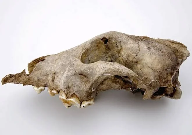
The isolated, uninhabited island of Youra, located in the northernmost reaches of the Sporades archipelago, is a rugged, wind-blasted limestone rock defined by vertical sea cliffs and dense wild goat populations. Near the island's southern ridge sits the legendary "Cave of the Cyclops," a massive subterranean cavern system that has yielded some of the most important prehistoric discoveries in southeastern Europe. While the cave is famous for its early maritime fishhooks, current zooarchaeological focus has centered on an extraordinary, well-preserved cache of 7,000-year-old canine skeletons excavated from a secure Neolithic context.

Known colloquially among field researchers as the "Dog Cave" layer, this stratigraphic horizon has yielded multiple nearly complete skeletons of domesticated dogs (Canis lupus familiaris). Finding intact canine fossils from this era is rare in the Mediterranean, making the Youra specimens a crucial evolutionary and historical link for understanding how dogs were integrated into the early maritime economies of Europe.

Osteological profiling and 3D geometric morphometrics of the skulls and jawbones indicate that these were medium-sized, athletic animals, standing roughly 45 to 50 centimeters at the shoulder. They possessed strong, robust jaws with a distinct dental crowding pattern that is characteristic of domestic dogs, differentiating them clearly from wild European wolves or jackals. The physical build of the Youra canines suggests they were highly agile animals, built for navigating the steep, treacherous limestone karst terrain of the island.

The real breakthrough came from stable isotope analysis of the bone collagen extracted from the canine ribs. The isotopic signatures revealed a diet that was surprisingly high in marine protein, consisting almost entirely of deep-sea fish scraps and marine mammal meat. This matches the exact dietary profile of the human hunters who occupied the cave during the Mesolithic and Neolithic periods.

This dietary overlap proves that these dogs were not feral scavengers living on the margins of human camps. They were fully domesticated companions, completely integrated into the human social unit and systematically fed from the community’s primary catches. On an isolated island like Youra, where the primary human survival strategy relied on hunting wild goats across cliff faces and launching open-sea fishing trips, these dogs would have been invaluable assets. They likely functioned as tracking animals, sentinels protecting camps from predators, and active hunting partners, showing that the human conquest of the Aegean islands was a multi-species effort from its very inception.

Prassa Cave: Kythira's Neolithic Seafarer Shelter

July 10, 2026

The island of Kythira occupies a vital geographic position in the southwestern Aegean, acting as a natural maritime stepping stone and radar post between the western tip of Crete and the southern coast of the Peloponnese. On the steep, wave-beaten cliffs of the island’s northern coast sits Prassa Cave, a deep limestone cavern that has become the focus of intense prehistoric research. Recent stratigraphic excavations inside the cave's main chamber have exposed a remarkably deep, uninterrupted sequence of human occupation extending from the Late Mesolithic straight through the Early and Middle Neolithic periods (c. 7000–4500 BCE).

Prassa Cave did not function as a permanent, sedentary farming village. Instead, the architectural and artifactual data proves it served as a highly specialized, seasonal base camp and shelter for the Mediterranean’s earliest blue-water seafarers. The cave’s cultural layers provide clear evidence of the complex logistical strategies developed by prehistoric humans to conquer the open sea long before the rise of the first palaces.

The floor of the cave is dense with maritime refuse. The faunal assemblage is dominated by the bones of large, pelagic fish species, most notably the Atlantic bluefin tunny (Thunnus thynnus). Capturing these massive, fast-moving fish required open-water coordination, specialized watercraft, and the manufacture of heavy fiber nets or bone harpoons. The presence of these bones inside Prassa Cave demonstrates that these early mariners were regularly venturing out into deep blue water, exploiting migratory fish routes that ran past the cliffs of Kythira.

Alongside the marine remains, the cave has yielded an astonishing quantity of stone tool technology made from Melian obsidian—a black, volcanic glass that can only be sourced from the island of Melos, located over 100 kilometers of open sea to the east. The excavation team recovered thousands of micro-blades, cores, and specialized debitage flakes. A detailed study of the wear patterns on these blades reveals they were primarily used for processing fish, repairing wooden boats, and scraping animal hides.

The presence of raw obsidian cores shows that mariners were sailing to Melos, quarrying large blocks of volcanic glass, and transporting them back to Prassa Cave to craft tools on-site. The site shatters the old historical narrative that Neolithic humans were isolated, land-bound farmers terrified of the deep sea. Prassa Cave proves that 7,000 years ago, the Aegean was already a connected highway, navigated by confident groups of seafarers who used Kythira as a vital base camp to manage long-distance trade, fish extraction, and raw material supply lines across the Mediterranean.

Palekastro Minoan Peak: Sanctuary Animal Bones

July 10, 2026

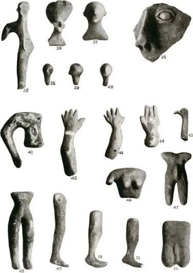
At the absolute eastern tip of Crete, the isolated mountain summit of Petsophas looms directly over the sprawling Bronze Age coastal town of Palekastro. During the Protopalatial and Neopalatial eras, Petsophas served as one of the most active peak sanctuaries on the island. While past excavations focused heavily on the recovery of human and animal terracotta votive figurines, recent field campaigns have prioritized a meticulous, multi-year recovery and analysis of the site's massive, deeply stratified faunal bone beds.

Led by a specialized team of zooarchaeologists, this project has analyzed tens of thousands of highly fragmented, calcined animal bones recovered from the deep rock clefts and ash altars of the summit. This faunal assembly provides a clear, unvarnished look at the exact mechanics of Minoan sacrificial practices and communal dining rituals, showing how the elite managed public gatherings to forge a unified regional identity.

The overwhelming statistical majority of the animal bones—surpassing 92 percent of the total recovered sample—belong to young domestic artiodactyls, specifically sheep (Ovis aries) and goats (Capra hircus). Through careful microscopic analysis of the bone surfaces, researchers identified distinct, repetitive tool marks left by heavy bronze butchery cleavers and fine slicing blades. These marks show a highly standardized process: the animals were slaughtered at the base of the mountain or upon arrival at the terrace, then efficiently skinned, dismembered, and portioned out.

A critical discovery lies in the specific anatomical distribution of the surviving bone elements. The ash layers surrounding the central rock altar contain a disproportionately high concentration of skull fragments, jawbones, and the lower extremities of the legs—parts of the animal that carry little to no meat. Conversely, the dense, unburned refuse pits flanking the sanctuary terraces are packed with meat-heavy limb bones, such as femurs and humeri, which bear clear evidence of having been boiled or roasted over large open hearths.

This distribution reveals the exact ritual logic of Minoan sacrifice. The gods were given the symbolic, smoke-producing elements—the fat-wrapped bones and skull—which were burned to ash on the high altar so the sweet-smelling smoke could ascend into the sky. The nutritious, meat-heavy portions were kept by the human community. The scale of the refuse pits indicates that hundreds of people participated in massive, synchronized public banquets on the mountaintop.

By consuming meat—a luxury food source in the Bronze Age—in a shared, sacred space high above their daily fields, the citizens of Palekastro participated in a powerful ritual of social cohesion. The peak sanctuary was not just a place of quiet, private prayer; it was a highly organized communal kitchen and assembly venue where religious feasting was systematically deployed to ease social friction and reinforce the authority of the local elite.

Mochlos Underwater: LMIB Shipwreck Gold Ingots

July 10, 2026

The islet of Mochlos, located in the Gulf of Mirabello in northeastern Crete, was a bustling, prosperous coastal town during the Minoan Bronze Age, separated from the main island by only a narrow, shallow strip of water that served as a natural double harbor. While the land excavations have yielded rich residential quarters and elite tombs, the most significant discovery has come from the seabed. Marine archaeologists running high-resolution side-scan sonar and sub-bottom profiling sweeps have located the intact hull outline of a Late Minoan IB (LMIB, c. 1500–1450 BCE) merchant vessel buried beneath deep layers of marine sediment.

The wreck sits at a depth of 35 meters along a treacherous underwater reef line that has historically claimed vessels across millennia. As the excavation team systematically vacuumed away centuries of protective silt, they exposed the lower structural timbers of the ship's hull, constructed using traditional Mediterranean mortise-and-tenon joints. Packed tightly within the hold was a diverse maritime cargo that provides an explicit look into the high-finance world of Late Bronze Age metal trading.

The primary ballast and commercial weight of the ship consisted of standard copper "oxhide" ingots—large, heavy slabs of copper shaped with four protruding handles to facilitate easy carrying by harbor laborers. Metallurgical isotope testing has traced the chemical signature of this copper directly to the rich mines of Cyprus, confirming the ship's role in a long-distance trade loop. However, the discovery that has electrified the archaeological community is a small, heavy wooden chest lined with lead that contained a cache of small, cast gold ingots.

These gold ingots are distinct from the loose jewelry or recycled scrap metal typically found on Bronze Age shipwrecks. They are clean, rectangular bars and small, circular planchets cast in precise weight increments that conform to the Aegean standard unit of value. Many of these gold bars bear deeply stamped administrative punch marks featuring Minoan linear signs, indicating they had been verified, weighed, and certified by an official palatial authority before being loaded onto the vessel.

The presence of certified gold ingots onboard an LMIB vessel changes our understanding of the prehistoric Aegean economy. It demonstrates that long before the invention of formal coinage in western Asia Minor during the 7th century BCE, the Minoan maritime network was utilizing standardized, pre-weighed precious metal bullion as a true currency to settle high-value international trade imbalances. The ship was likely en route to deliver this wealth to the elite artisans of Mochlos or the nearby palace of Gournia when it struck the reef, preserving a multi-million-dollar Bronze Age financial transaction for the modern world.

Zakros Minoan Villa: Eastern Crete's Trade Hub

July 10, 2026

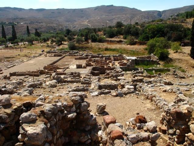
estled within a protected, rock-rimmed bay on the absolute eastern coast of Crete, the palace of Zakros served as the Minoan gateway to the kingdoms of the eastern Mediterranean. While excavations have focused heavily on the central palace complex, current archaeological work has shifted to a sprawling, multi-story elite architectural complex—popularly designated as the "Grand Villa"—situated on the ridge overlooking the harbor. This structure has changed our understanding of how the Minoan palatial economy operated, revealing that elite provincial families held immense wealth and autonomy over international trade long before goods ever reached the central authorities.

The Zakros villa is an architectural marvel of local stone masonry, featuring large ashlar blocks, internal lightwells designed to maximize ventilation, and expansive storage basements. As teams cleared the subterranean magazines, they exposed an unprecedented concentration of unworked exotic raw materials, imported luxury goods, and administrative clay sealings. The site was effectively an elite private custom house operating directly above the Minoan docks.

Among the most spectacular discoveries within the villa's lower magazines are multiple whole elephant tusks (ivory) imported from the Syrian coast, alongside large, semi-processed nodules of blue lapis lazuli tracing back to ancient Afghan supply lines. Nearby, rows of heavy Canaanite transport jars (amphorae) were found lined up against the plastered walls. Gas chromatography analysis of the organic residues inside these jars revealed they were packed with premium Terebinth resin and frankincense, highly prized materials used by Minoan elites to manufacture perfumed oils and sacred incense.

What makes the Zakros Villa an invaluable historical index is the direct physical union of this massive import wealth with advanced administrative tools. In a small, upper-floor archive room that collapsed into the basement during the site's final destruction, archaeologists recovered dozens of clay Linear A tablets alongside hundreds of "hanging nodules"—small pieces of clay baked around strings that once sealed wooden boxes, leather scrolls, or papyrus documents.

The inscriptions on these tablets, deciphered through structural comparative analysis, detail precise quantities of agricultural products, textiles, and raw metals being distributed to specialized local craftsmen. The villa was not merely storing foreign imports; its elite residents were acting as independent entrepreneurial distributors. They received raw materials from Eastern merchant vessels, processed them using a localized network of dependent artisans, and logged the entire transaction using the palace’s official script. This decentralized trade model suggests that the Minoan economic system was far more flexible and capitalistic than the highly centralized, top-down redistribution models traditionally associated with Near Eastern palace economies.

Phaistos Disk: Linear A Breakthrough with AI?

July 10, 2026

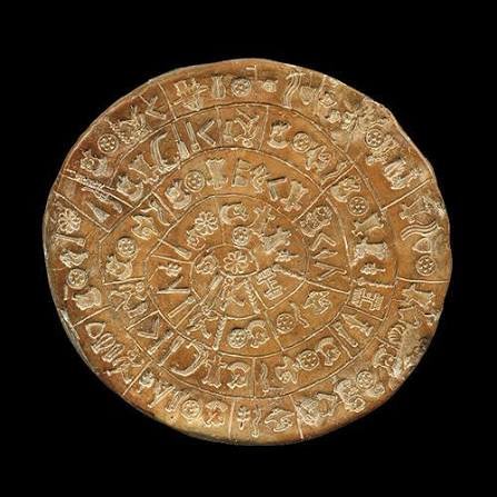
Since its excavation in 1908 from a baseline storage magazine within the Minoan palace of Phaistos, the Phaistos Disk has resisted every attempt at decipherment. The 15-centimeter-wide circle of fired clay, covered on both sides with 242 unique pictographic symbols stamped into a spiraling track, has long driven philologists to frustration. Because it represents a completely isolated linguistic sample—the world’s earliest known document created using movable type—scholars have lacked the comparative data necessary to break its code. However, a major development has emerged from a project applying advanced machine learning models to the undeciphered scripts of the Bronze Age Aegean.

The project uses a deep-learning transformer architecture specifically trained on the corpus of known Aegean scripts, particularly Linear A (the administrative script of the Minoan palaces) and Cretan Hieroglyphics. Rather than trying to directly guess the meaning of individual signs, the AI was programmed to execute a highly complex structural analysis. It treated the disk as a spatial and statistical map, analyzing the exact distribution frequencies of signs, the mathematical intervals at which specific symbols repeat, and the behavior of prefixes and suffixes across different segments of the spiral track.

The AI's processing power yielded its first major breakthrough by establishing that the syntax of the disk is not an isolated anomaly. When the model mapped the disk’s sign groups against the broader database of Linear A inscriptions found on clay administrative tablets and stone libation vessels across Crete, it identified striking structural overlaps. The algorithmic analysis showed that several recurring sign clusters on the disk match the exact prefix-root-suffix patterns found in Linear A formulas associated with sacred offerings and agricultural inventory listings.

Crucially, the AI has shed new light on the disk's internal mechanics. By analyzing the deep impressions left in the clay, the model verified the sequence of production: the scribe used pre-carved wooden or metal stamps to press the symbols into the wet clay, working from the outer rim inward toward the center. The AI also isolated several instances where the scribe made mistakes, smoothing over a sign to stamp a different one over it. These structural corrections align perfectly with the administrative corrections seen on standard Minoan palace tablets.

The computational data strongly suggests that the Phaistos Disk is not a foreign artifact imported from the Anatolian coast or a modern forgery, as some critics have argued. Instead, it appears to be a deeply indigenous product of the palatial administration, utilizing a specialized, high-status variant of the logosyllabic script system common to Bronze Age Crete. While a word-for-word translation remains a work in progress, the AI has established a firm linguistic bridge between the disk and Linear A, proving that this legendary artifact was a core component of the Minoan administrative and religious apparatus.

2026 Drone Surveys: Rediscovering Crete's Peak Sanctuaries

July 10, 2026

The archaeological topography of Bronze Age Crete is being fundamentally remapped. Throughout the Middle and Late Minoan periods, the rugged mountain ridges of the island were crowned with peak sanctuaries—sacred, open-air enclosures where civic communities gathered to interact with the divine. For more than a century, investigating these high-altitude sites meant enduring grueling, multi-day mountain ascents, with teams limited to what they could carry on foot. In 2026, a revolutionary shift occurred. Armed with custom-engineered autonomous drones carrying an array of advanced sensors, archaeological teams are conducting non-invasive aerial sweeps over Crete’s most hostile terrains.

The primary technological drivers of this initiative are drone-mounted Light Detection and Ranging (LiDAR) and multi-band thermal sensors. These devices pulse laser light down through the dense, wind-stunted garigue and maquis scrub that covers the Cretan ridges. By measuring the flight time of millions of individual laser pulses, a computational system builds a high-density, three-dimensional point cloud of the underlying terrain. This lets researchers digitally peel back layers of vegetation, exposing hidden architectural features down to a centimeter scale.

The initial data reveals that these peak sanctuaries were much more structurally complex than previously assumed. Rather than simple, flat rock clearings, the drone scans show a series of carefully planned terraces, subterranean storage clefts, and large boundary walls (periboloi) designed to manage the flow of ancient crowds. On remote summits in the Dikti and Asterousia ranges, the surveys have pinpointed previously unrecorded rectangular foundations that likely served as priestly quarters or secure treasuries for valuable votive offerings.

Beyond locating isolated structures, this aerial work has provided an empirical map of how these shrines functioned as an integrated network. By feeding the 3D terrain models into geographic information systems (GIS), researchers can execute highly precise "Viewshed Analyses." The results show that peak sanctuaries were positioned using a meticulous logic of inter-visibility. A fire lit on one peak would be directly visible to a chain of neighboring sanctuaries and, critically, to the lowland palatial centers below, such as Knossos, Malia, and Phaistos.

This suggests that the mountains functioned as a massive, island-wide signaling and ritual apparatus. When a crisis or celebration occurred, coordinated smoke or fire signals could transmit messages across the island within minutes. The 2026 surveys are shifting our view of Minoan religion away from isolated nature worship toward a tightly organized state network designed to project palatial authority into the absolute margins of the Cretan landscape.

Cycladic Marble Idols: Paros' 5,000-Year Factory Site

July 10, 2026

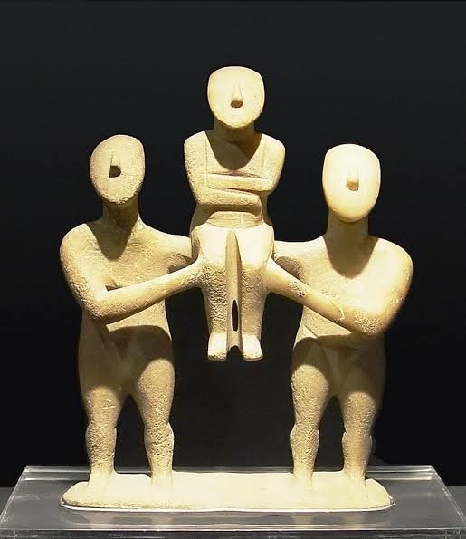
The minimalist, folded-arm marble figurines of the Early Cycladic period (c. 3200–2000 BCE) have long been celebrated as masterpieces of prehistoric art. Yet, because a vast majority of these sculptures were pulled from the ground by looters during the 19th and 20th centuries, their actual manufacturing contexts have remained an archaeological mystery. This gap has been filled by a major discovery on the island of Paros: a massive, highly organized Early Bronze Age workshop complex dedicated entirely to the industrial-scale production of Cycladic marble idols.

Located along a sloping valley just a short distance from the island’s famous underground veins of pure white, semi-translucent lychnites marble, the Paros site functions as a frozen 5,000-year-old factory floor. What makes the discovery so significant is that it preserves the entire chaîne opératoire—the complete sequence of human actions, choices, and techniques required to transform a raw stone block into a finished ritual object.

The excavation trenches have revealed thousands of stone artifacts left behind by ancient craftsmen. Among the most illuminating finds are the figurines abandoned at early or mid-stages of production. Prehistoric sculptors did not simply carve a figure out of a block; they used a highly conservative, grid-based system of geometric proportions. The unfinished pieces show how a craftsman first selected a flat, water-worn marble slab or rough quarry block, then used coarse stone chisels to block out the basic triangular silhouette of the head and the rectangular mass of the torso.

The site highlights the extreme physical difficulty and material cost of this ancient industry. Because the Cycladic islanders did not yet possess hard bronze tools capable of carving marble efficiently, the entire reduction process relied on abrasive technology. The workshop floor is dense with thousands of discarded tools made from imported materials. Master artisans used heavy percussion blocks of local basalt to knock off large fragments, followed by a meticulous scraping and grinding process using high-grade emery stone brought across the sea from Naxos.

The final, glassy smooth polish was achieved using flat rubbing stones coated with fine pumice slurry. The sheer volume of broken figurines abandoned at the workshop underscores the high failure rate of this technique. If an artisan hit a hidden fault line in the brittle Paros marble or applied too much pressure while incising the delicate groove between the folded arms, the figurine would snap, forcing them to abandon the project.

Furthermore, the workshop clarifies the role of color in Cycladic art. Soil chemistry and multi-spectral imaging of the workshop’s discard pits have turned up traces of cinnabar (a bright red mercuric sulfide) and azurite (a deep blue copper carbonate), along with tiny clay mixing palettes. These idols were never meant to be cold, white, minimalist silhouettes. Instead, the factory floor shows they were painted with bright, sometimes jarring facial features, body stripes, and complex hair patterns, presenting a vivid, multi-colored look to their original Bronze Age viewers.

Thessalian Meteora Monasteries: Byzantine Cliff Dwellings

July 9, 2026

Rising dramatically from the flat plains of Thessaly in central Greece, the monolithic sandstone rock pillars of Meteora (literally meaning "suspended in the air") host one of the most spectacular and architecturally daring monastic complexes in Eastern Orthodox Christendom. Beginning in the 11th century, hermit monks sought absolute isolation from the world, carving out small cave dwellings high up the sheer, vertical rock faces.

  • Architectural Defiance of Gravity: As the Byzantine Empire collapsed in the 14th century and Ottoman Turkish incursions intensified, these isolated hermits banded together for security. They began constructing monumental stone monasteries directly on top of the narrow, inaccessible summits of the stone pillars, some rising over 400 meters above the valley floor.

  • Built Without Roads: To construct these architectural marvels, every single stone, wooden beam, mortar bucket, and human worker had to be hauled up the vertical cliffs using an elaborate, terrifying system of long wooden ladders tied together, folding scaffolding, and manual windlasses operating heavy rope nets. Of the 24 original medieval monasteries built under these extreme conditions, only six remain active today.

  • The Engineering of Survival: The internal layout of a Meteora monastery was a masterpiece of space optimization. Due to the tiny, uneven surface areas of the rock tops, the buildings were constructed vertically. They featured multi-story monk cells, hidden subterranean granaries, rain-collecting cisterns carved deep into the sandstone, and beautiful, cross-in-square Byzantine churches (Catholika) adorned with vibrant, post-Byzantine frescoes. These frescos often depicted graphic scenes of martyrdom, reflecting the monks' constant psychological state of siege and their absolute devotion to spiritual survival in the face of worldly destruction.

Epirote Oracle of Dodona: 2026 Bronze Tablets Found

July 9, 2026

Deep within the isolated, rain-swept valleys of Epirus in northwestern Greece lies Dodona, universally recognized by the ancient world as the oldest of all Hellenic oracular sanctuaries. Long before Delphi and its Pythia gained geopolitical dominance, people traveled to Dodona to hear the will of Zeus Naos and his divine consort Dione, which was interpreted by barefoot priests (the Selloi) who slept on the bare earth to maintain constant contact with the ground, listening to the rustling leaves of a towering, sacred oak tree.

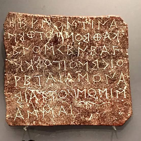
  • The Metal Archives of Human Anxiety: Unlike Delphi, which primarily answered grand state queries about war and colonies, Dodona was the oracle of the common person. Worshippers bought small, thin strips of lead (lamellae), scratched their intimate questions onto the surface with an iron stylus, folded or rolled the metal tight to conceal the text, and handed it to the priests. Over 4,000 of these lead strips have been recovered over the decades, offering an unparalleled look into ancient daily life.

  • The 2026 Materiality Breakthrough: Recent academic work and spatial material studies published in 2026 have drastically shifted focus onto the site's rarer, high-status metal artifacts. While lead was used by commoners, elite travelers and state ambassadors scratched their queries into highly polished bronze tablets. The latest cataloging and metallic analyses have brought several highly specific, deeply personal bronze inquiries to light, focusing on health crises, missing household property, and treacherous commercial sea voyages.

  • Voices from the Metal: These tablets showcase the raw vulnerability of ancient people facing uncertainty. The translated inscriptions show a society obsessed with divine reassurance:

"To Zeus Naios and Dione: Is it safe for me to sail to the colony? Will my business venture succeed, or am I being deceived by my partners?"

Another tablet, likely written by a worried landowner, reads:

"They ask Zeus and Dione regarding the stolen sheep: did Agathocles steal them from the pasture, or was it the slaves? Show us the truth so we may have justice."

Paionian Tombs: North Macedonia's Forgotten Kingdom

July 9, 2026

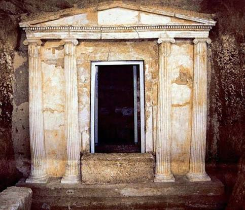
Situated along the fertile valleys of the Axios (Vardar) and Strymon rivers in modern North Macedonia and southwestern Bulgaria, the Paionians were a powerful coalition of tribes that formed a highly distinct, wealthy kingdom during the Bronze and Iron Ages. Frequently caught in the crossfire between the expanding kingdoms of Macedonia, Thrace, and Illyria, the Paionians are often reduced to a mere footnote in classical texts—but recent archaeology is completely rewriting their history.

  • The Wealth of the Axios Valley: Excavations of unlooted elite royal tombs in North Macedonia (such as those at the site of Vardarski Rid and the Stobi region) have revealed an incredibly rich material culture. Paionian kings minted their own highly artistic silver coins, which circulated widely across the Balkans.

  • The Fusion Style: The contents of their monumental tombs show a unique cultural fusion: exquisite Greek-style silver tetradrachms, bronze crested helmets, and stylized gold burial masks are found alongside heavy iron weaponry and horse trappings that display deep ties to the northern nomadic Scythian world.

  • The Sacred Cult of the Sun: Paionian religious life was distinct from the Olympian pantheon. Cultic artifacts found within the tombs—including bronze solar discs, stylized bird pendants, and multi-headed ox figurines—point to an intense, deeply rooted solar cult. They worshipped the sun in the form of a small round disc fixed to the top of a pole. Despite maintaining their fiercely independent identity and military power for centuries, they were eventually subdued and systematically integrated into the expanding empire of Philip II of Macedon in the 4th century BCE.

Dacian Gold Mines: Romania's Sarmizegetusa Secrets

July 9, 2026

Inhabiting the rugged Carpathian Mountains of modern Romania, the Dacians (closely related to the Thracians) forged a centralized, wealthy state that became Rome's most formidable northern rival. At the heart of their empire was Sarmizegetusa Regia, a massive sacred and military capital hidden deep within the Orăștie Mountains, surrounded by a complex web of high-altitude stone fortresses.

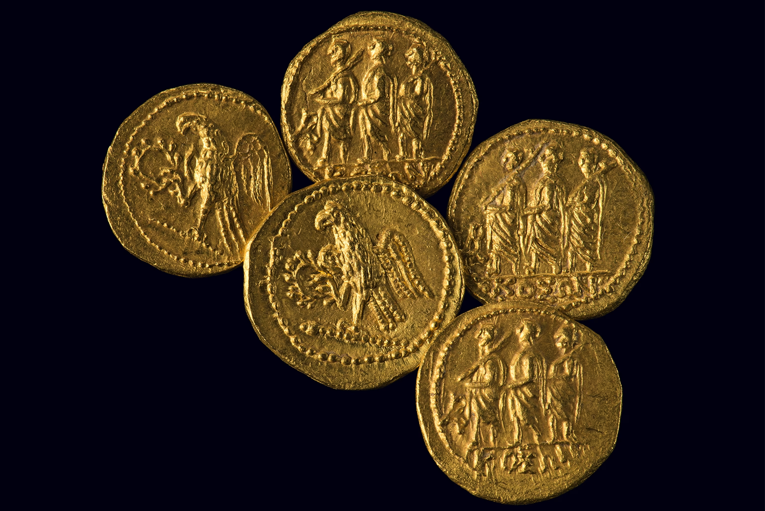
  • The Subterranean Wealth: The power of the Dacian kings, particularly Burebista and Decebalus, was directly fueled by their absolute monopoly over the rich gold and silver veins of the Apuseni Mountains. The Dacians were master mining engineers, utilizing both extensive alluvial panning in mountain rivers and deep, hard-rock underground mining galleries. They accumulated an almost legendary amount of precious metal wealth, which they used to fund a professional army and construct monumental sacred stone circles used for astronomical calculations and religious sacrifices.

  • LiDAR Revelations: In recent years, airborne LiDAR (Light Detection and Ranging) technology has stripped away the dense Carpathian forest canopy, revealing that Sarmizegetusa Regia was far larger and more interconnected than previously thought. The scans have exposed miles of terraced mountain slopes, hidden agricultural fields, and an extensive network of advanced stone watchtowers and military outposts that protected the sacred core from Roman legions.

  • The Spoils of Trajan: The sheer volume of Dacian gold was confirmed when Roman Emperor Trajan finally conquered Dacia in 106 CE after two brutal wars. Roman chronicler Joannes Lydus records that the imperial booty was staggering: roughly 165,000 kilograms of pure gold and 331,000 kilograms of silver. This immense plunder single-handedly rescued the Roman Empire from a severe financial crisis, funded a global tax exemption for Roman citizens, paid for a massive 120-day gladiatorial game celebration, and financed the construction of Trajan’s Forum and Column in Rome.

Thracian DNA: Bulgaria's Golden Warriors' Heritage

July 9, 2026

The Thracians were a vast collection of Indo-European tribes who inhabited the dense forests and rolling plains of modern Bulgaria, southeastern Romania, and northern Greece. Described by Herodotus as the most numerous nation in the world after the Indians, they left behind spectacular underground tombs, massive golden treasures, and a reputation as elite, terrifying warriors.

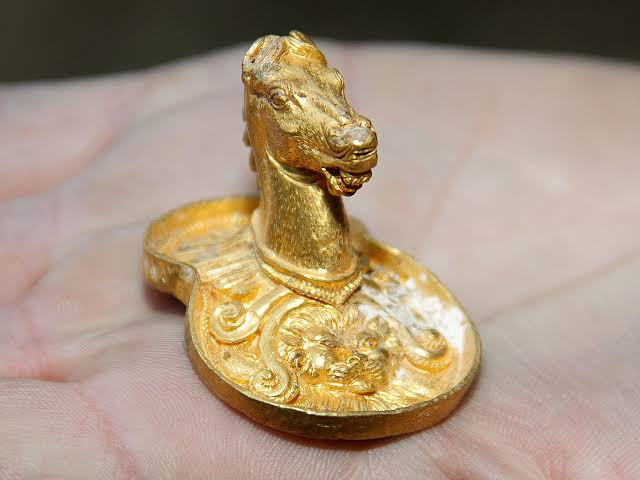
  • The Elite Genomic Profile: To understand who these "Golden Warriors" actually were, recent genetic studies scaled up the sequencing of human remains from elite Thracian contexts, particularly from the iconic Valley of the Thracian Kings in central Bulgaria. The results painted a picture of a highly dynamic, cosmopolitian population.

  • A Tapestry of Ancestry: Thracian DNA shows a highly complex ancestral mix: a deep, resilient layer of local Balkan Neolithic farmer ancestry, heavily overlaid with a massive influx of Yamnaya Steppe pastoralist DNA (bringing the R1a and R1b paternal lineages), and further enriched by distinct Aegean/East Mediterranean genetic components.

  • High Mobility and Dynastic Alliances: This genetic admix confirms that Thrace was never a isolated, barbaric fringe. Instead, the Thracian aristocracy practiced high regional mobility, engaging in heavy trade, political intermarriages, and military alliances with both the Greek poleis to the south and the Scythian nomads to the north. This genetic fluidity mirrors their material culture, where traditional Thracian weapons and animal-style art were frequently rendered in pure Greek-style goldsmithing.

Albanian Genetic Archaeology: Illyrian-Pelasgian Links

July 9, 2026

For over two centuries, the origins of the Albanian people and their highly unique, non-Slavic, non-Hellenic language have been a source of intense academic debate and romantic speculation. Recent high-resolution paleogenomic mapping of the Western Balkans from the Neolithic period through the Middle Ages has finally separated nationalist myth from biological reality.

  • The Illyrian Foundation: The latest archaeogenetic papers show deep, unbroken roots in the West Balkan Bronze and Iron Ages. DNA extracted from ancient skeletons found in tumuli (burial mounds) across Albania reveals a profound genetic continuity lasting thousands of years. The ancient Illyrians—the collection of tribes that contested Roman and Greek expansion—form the overwhelming genetic ancestral core of modern Albanians.

  • The Y-DNA Markers: This lineage is overwhelmingly traced through the paternal Y-chromosome haplogroup J2b2-L283 and specific subclades of R1b-BY611, which show a massive local population expansion in the Albanian mountains during the Bronze Age, long before any Slavic or Roman migrations occurred.

  • Dismantling the Pelasgian Myth: During the 19th-century Albanian National Awakening (Rilindja), writers popularized the theory that Albanians were descended from the Pelasgians—the mythical, semi-divine pre-Greek population mentioned by Homer and Herodotus. This was used to establish historical primacy over neighboring groups.

  • The Genetic Verdict: Modern genetic archaeology has contextualized this. While there is a deep European hunter-gatherer and Anatolian Neolithic substrate shared across the Aegean and Balkans, there is no distinct "Pelasgian" genetic isolate. Instead, the data proves that the direct autochthonous (indigenous) transformation of local Illyrian tribes into the medieval Arbanon culture is what preserved the unique language and genetic signature seen today.

Pomeranian Culture: Baltic Sword Sacrifices Decoded

July 9, 2026

Developing directly out of the northern factions of the Lusatian culture during the 7th century BCE, the Pomeranian culture occupied the Baltic coastal regions of modern Poland before expanding southward. They are renowned in European archaeology for their intensely evocative, individualized art styles and complex aquatic ritual landscapes.

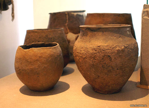
  • The Cult of the Face Urns: The defining artifact of this culture is the face urn (Gesichtsurne). Unlike the abstract vessels of their Lusatian predecessors, Pomeranian cremation urns were sculpted to resemble distinct human faces. The necks of the urns featured realistic representations of human eyes, noses, and ears.

  • Individualized Identities: Many were fitted with actual bronze earrings, pectorals, or necklaces, and some were engraved with scenes of hunting, horse-riding, or schematic human figures. Archaeologists believe these vessels were designed to preserve the specific, post-cremation identity of the deceased elite, transforming the cold clay pot into an everlasting ritual portrait.

  • Waterlogged Sword Sacrifices: Beyond their ceramic achievements, the Pomeranians operated a sophisticated votive economy focused on peat bogs, rivers, and lakes near the Baltic Sea. Recent chemical and micro-wear analyses of bronze and early iron swords recovered from these waterlogged environments have "decoded" their sacrifice patterns.

  • Killing the Blade: Warriors did not simply drop weapons into the water by accident or lose them in chaotic battles. Instead, status swords were intentionally "killed"—subjected to high heat, bent at 90-degree angles, or deliberately notched along the blade edge—before being deposited. This ritual defacement permanently removed the object from the physical economy of war and transitioned it into the spirit realm as an offering to Baltic water deities.

Lusatian Culture: Poland's Iron Age Urn Fields

July 9, 2026

Flourishing from the Late Bronze Age through the Early Iron Age (c. 1300–500 BCE), the Lusatian culture formed a dense network of highly organized communities across Poland, extending into parts of eastern Germany, Czechia, and Slovakia. They are defined by their unique funerary landscape, characterized by sprawling, multigenerational "urn fields" that contain thousands of cremation burials.

  • The Cremation Shift: The transition from traditional inhumation to cremation was not merely a change in burial preference; it represented a massive ideological and spiritual revolution across Central Europe. Bodies were burned on large pyres, and the remaining bone fragments were carefully washed and placed inside beautifully decorated ceramic urns. These urns were often accompanied by mini "accessory vessels" meant to hold food and drink for the journey to the afterlife.

  • The Biskupin Masterpiece: The ultimate expression of Lusatian societal complexity is found at Biskupin in northwestern Poland. Discovered in northern marshes, this lakeside settlement dates precisely to the winter of 748–747 BCE based on tree-ring dating (dendrochronology). Biskupin was a masterclass in prehistoric urban planning.

  • Communal Engineering: The site featured a fortified oval layout built on a swampy island, ringed by a massive breakwater and a wooden, earth-filled rampart over 6 meters wide. Inside, a single wooden corduroy road connected 11 parallel streets, lined with 105 identical, interconnected log cabins. This strict architectural uniformity strongly suggests an egalitarian communal structure with highly synchronized labor coordination, capable of housing over 1,000 people in a heavily defended, hostile environment.

Unetice Culture: Czech Bronze Age Hoard Genetics

July 9, 2026

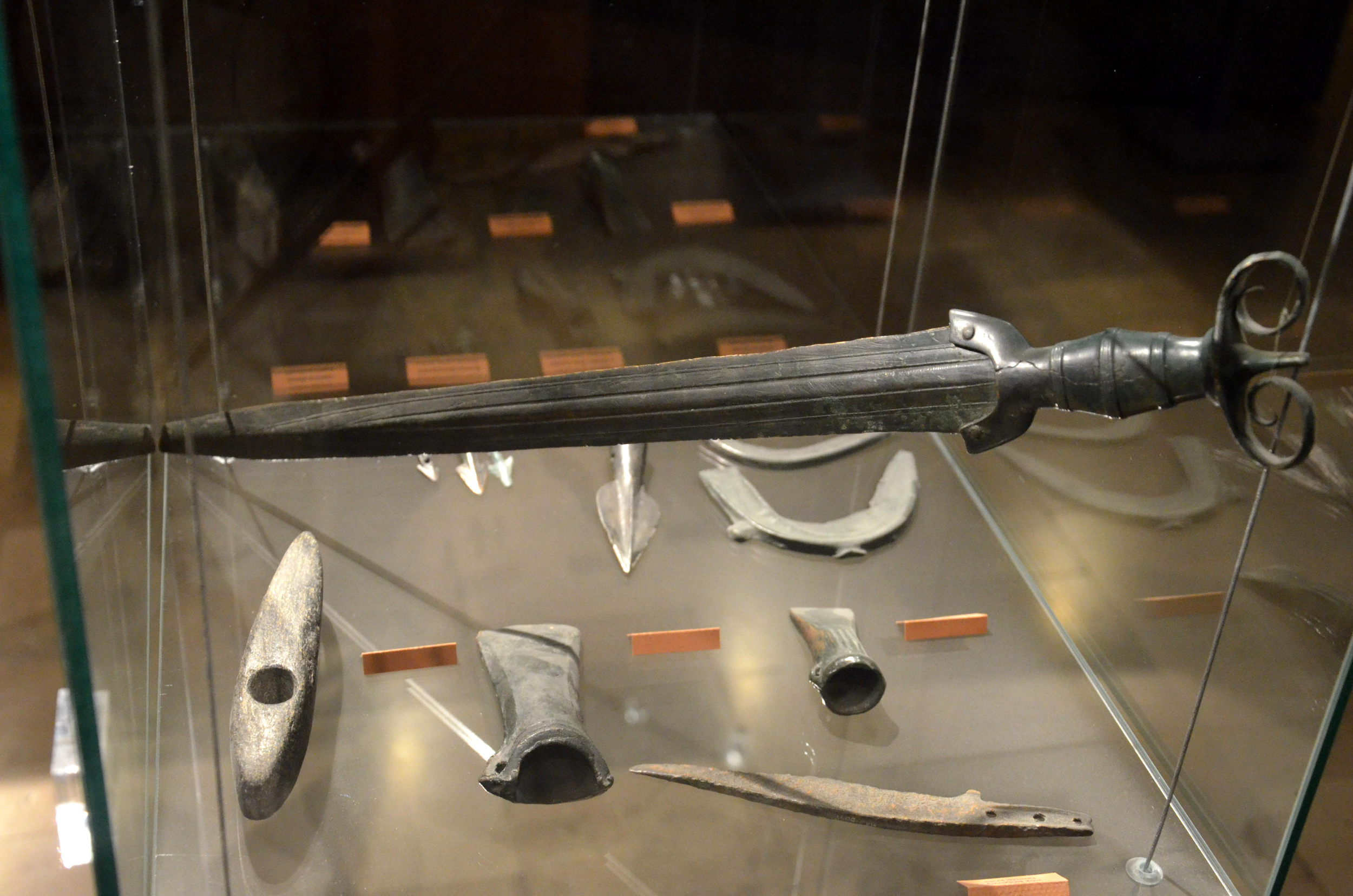
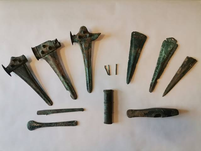
The Metallurgy Elite: Únětician artisans are famous for their massive metal hoards, which often contain hundreds of uniform bronze objects like axe heads, heavy neck rings (Ösenringe), and beautifully crafted daggers. These hoards were long debated: were they merchant warehouses, currency reserves, or religious offerings? Modern spatial analysis points heavily to ritualized landscape deposition, meant to mark territories or appease chthonic deities.

  1. The Genetic Revolution: Recent paleogenomic sequencing of individuals from elite Únětice burials—including those from massive princely barrows like Leubingen—has provided profound insights into Bronze Age population dynamics. The data shows a massive genetic shift heavily dominated by Y-haplogroup I2 and various subclades of R1b-M269, linking them directly to the earlier Corded Ware and Bell Beaker expansions.

  2. Social Inequality Inherited: What makes the Únětice genetic data groundbreaking is the evidence of strict social stratification. Kinship mapping reveals that wealth, status, and nutrition (measured via stable isotope analysis) were passed down strictly through patrilineal lines. Elite males enjoyed highly varied diets rich in animal proteins, while lower-class individuals buried in simple flat graves shows high rates of physiological stress and nutritional deficiencies.

The "Disappearing Immigrant" Phenomenon

July 9, 2026

The rapid disappearance of the European genetic signature highlights a profound socio-cultural reality of the ancient world. While the Philistines maintained a highly distinct, separate cultural identity for centuries—continuing to eat pork and bayer (non-local species), practicing unique weaving traditions, and remaining politically distinct from their Judean and Canaanite neighbors—they were heavily outnumbered by the indigenous population.

From the very moment they established their pentapolis, European Philistine men and women intermarried extensively with the local Levantine populations. Because there were no subsequent, massive waves of reinforcements arriving from the Aegean to replenish their distinct gene pool, the foreign genetic signature was rapidly diluted into the massive local Levantine genetic ocean. Within 200 years, the Philistines became a classic example of cultural preservation existing alongside complete genetic assimilation. They remained "Philistines" in name, politics, and material practice, but their biological roots had become thoroughly, undeniably Levantine.

The DNA Evidence: A European Signature in the Levant

July 9, 2026

The genetic data recovered from the cemetery at Ashkelon tracked this historical migration with astonishing precision, revealing a sudden, dramatic genetic shift at the dawn of the Iron Age.


1. Pre-Philistine Baseline (Late Bronze Age)

The genomes of individuals extracted from Late Bronze Age burials at Ashkelon (circa 1400–1200 BCE) were completely identical to the broader, indigenous Canaanite population of the southern Levant. They possessed no traceable European ancestry, reflecting a stable, localized Near Eastern gene pool that had occupied the region for centuries.

2. The Early Iron Age Influx (circa 1200–1150 BCE)

In samples extracted from infant burials buried beneath the floors of early Philistine houses, the genome altered drastically. These infants possessed a distinct, highly visible Southern European genetic signature that was completely absent in the preceding Bronze Age layers. Detailed ancestral modeling demonstrated that this European component comprised roughly 25–49% of their total DNA. The closest matching ancestral sources for this European signature were found in:

  • Crete and the Aegean Islands

  • Mainland Greece

  • Sardinia and the Italian Peninsula

This sudden, massive infusion of European DNA in early Iron Age infants provides irrefutable proof of a significant maritime migration event, matching both the Egyptian textual accounts of the Sea Peoples and the archaeological appearance of Aegean-style "Philistine Bichrome" pottery.

3. The Later Iron Age Transience (circa 1000–800 BCE)

When geneticists analyzed individuals from the later Iron Age Philistine cemetery at Ashkelon, buried just two centuries after the initial settlement, they encountered a fascinating genetic phenomenon: the European signature had completely vanished. Within a few generations, the descendant Philistines were genetically indistinguishable from the local Levantine population.

The Late Bronze Age Collapse and the "Sea Peoples"

July 1, 2026

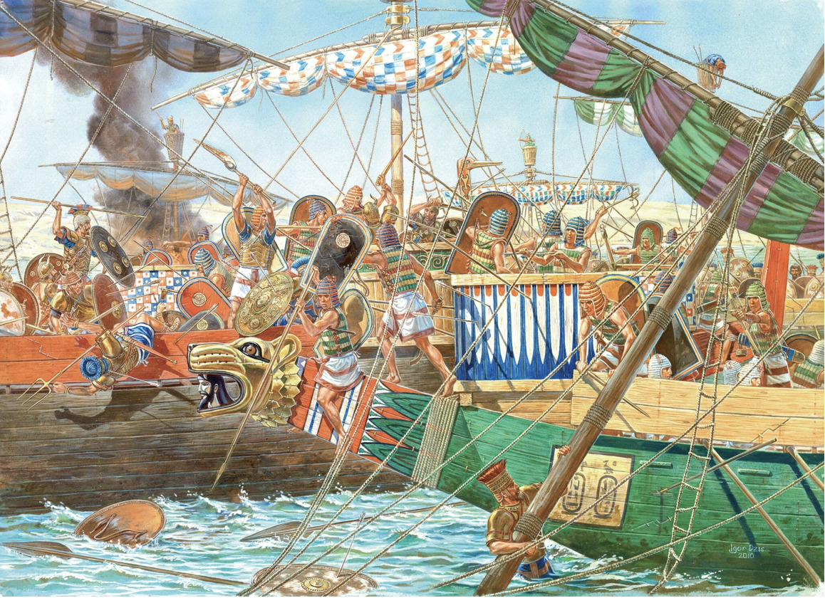
To understand the context of the Philistine migration, one must examine the geopolitical catastrophe that struck the ancient world around 1200 BCE. Within a matter of decades, the great empires of the Late Bronze Age—the Hittite Empire in Anatolia, the Mycenaean palatial civilizations of Greece, and the New Kingdom of Egypt's networks in the Levant—either collapsed entirely or were severely fractured. Ancient Egyptian hieroglyphic inscriptions from the reign of Pharaoh Ramesses III at Medinet Habu vividly describe a confederation of seafaring invaders known collectively as the "Sea Peoples." Among these displaced groups, the Egyptians specifically named the "Peleset"—a group that historical linguists and archaeologists have long equated with the biblical Philistines.

The Egyptian reliefs depict these Peleset as migrating with their entire families, loading women, children, and household goods into ox-carts while their warships battled Egyptian forces along the Nile Delta. Defeated by Ramesses III but unable to be completely driven back, these groups ultimately settled along the southern coast of Canaan, strategically positioning themselves along the vital maritime and overland trade routes connecting Egypt with Mesopotamia.

← Newer Posts Older Posts →
Featured
image_2026-07-13_202427823.png
July 13, 2026
Schroda: Limpopo's Early Trading Post
July 13, 2026
Read more →
July 13, 2026
image_2026-07-13_202528435.png
July 13, 2026
Pontdrift: South Africa's Leopard's Kopje Culture
July 13, 2026
Read more →
July 13, 2026
image_2026-07-13_202644554.png
July 13, 2026
Skutwater: Kalahari's Forgotten Rock Art Site
July 13, 2026
Read more →
July 13, 2026
image_2026-07-13_202742596.png
July 13, 2026
Tsodilo Hills: Botswana's 100,000-Year Engravings
July 13, 2026
Read more →
July 13, 2026
image_2026-07-13_203219705.png
July 13, 2026
Divuyu Hill: Botswana's 2,000-Year Village
July 13, 2026
Read more →
July 13, 2026
image_2026-07-13_203258529.png
July 13, 2026
Munsa Earthworks: Uganda's 500-Year Ditch System
July 13, 2026
Read more →
July 13, 2026
read more

Powered by The archaeologist