• MAIN PAGE
  • LATEST NEWS
    • Lost Cities
    • Archaeology's Greatest Finds
    • Underwater Discoveries
    • Greatest Inventions
    • Studies
    • Blog
  • PHILOSOPHY
  • HISTORY
  • RELIGIONS
    • Africa
    • Anatolia
    • Arabian Peninsula
    • Balkan Region
    • China - East Asia
    • Europe
    • Eurasian Steppe
    • Levant
    • Mesopotamia
    • Oceania - SE Asia
    • Pre-Columbian Civilizations of America
    • Iranian Plateau - Central Asia
    • Indus Valley - South Asia
    • Japan
    • The Archaeologist Editor Group
    • Scientific Studies
    • Aegean Prehistory
    • Historical Period
    • Byzantine Middle Ages
    • Predynastic Period
    • Dynastic Period
    • Greco-Roman Egypt
  • Rome
  • PALEONTOLOGY
  • About us
Menu

The Archaeologist

  • MAIN PAGE
  • LATEST NEWS
  • DISCOVERIES
    • Lost Cities
    • Archaeology's Greatest Finds
    • Underwater Discoveries
    • Greatest Inventions
    • Studies
    • Blog
  • PHILOSOPHY
  • HISTORY
  • RELIGIONS
  • World Civilizations
    • Africa
    • Anatolia
    • Arabian Peninsula
    • Balkan Region
    • China - East Asia
    • Europe
    • Eurasian Steppe
    • Levant
    • Mesopotamia
    • Oceania - SE Asia
    • Pre-Columbian Civilizations of America
    • Iranian Plateau - Central Asia
    • Indus Valley - South Asia
    • Japan
    • The Archaeologist Editor Group
    • Scientific Studies
  • GREECE
    • Aegean Prehistory
    • Historical Period
    • Byzantine Middle Ages
  • Egypt
    • Predynastic Period
    • Dynastic Period
    • Greco-Roman Egypt
  • Rome
  • PALEONTOLOGY
  • About us
No results found

Provo Tabernacle Site: Utah's Historic Fire Aftermath

September 27, 2026

Introduction

The Provo Tabernacle site provides an unusual example of how disaster can become part of architectural history.

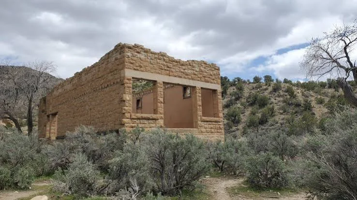
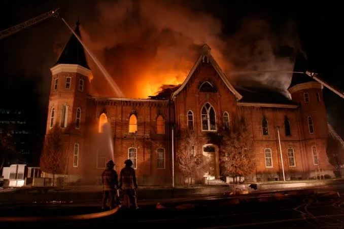
The Provo Tabernacle, constructed in the nineteenth century as a major religious and community building, was severely damaged by fire in 2010. Rather than being erased, the surviving structure became the foundation for a major preservation and adaptive-reuse project.

The site's history therefore spans construction, community use, destruction, preservation, and transformation.

Construction of the Tabernacle

The Provo Tabernacle was built during the nineteenth century as a major gathering place for the local Latter-day Saint community.

Large tabernacles served multiple purposes.

They hosted religious meetings but could also accommodate conferences, performances, lectures, civic events, and community gatherings.

Their architecture therefore reflected both religious and civic ambitions.

Architecture

The building was designed to accommodate large numbers of people.

Its construction required significant quantities of timber, masonry, and other materials.

The structure demonstrated the organizational capacity of the nineteenth-century community.

Large public buildings required planning, fundraising, skilled labor, and long-term maintenance.

Community Significance

The tabernacle became part of Provo's civic landscape.

Generations of residents encountered the building as a familiar landmark.

Its significance therefore extended beyond its architectural form.

It represented collective memory.

The 2010 Fire

A major fire severely damaged the building in December 2010.

The event dramatically altered the structure.

Roof and interior components were destroyed or weakened.

Yet substantial portions of the historic masonry remained.

The surviving ruins raised a fundamental preservation question:

Should the damaged building be stabilized as a ruin, restored, or adapted for another use?

Preservation Philosophy

Historic preservation often involves difficult decisions.

Authentic historic fabric has value.

At the same time, buildings can survive more effectively if they receive new functions.

The Provo Tabernacle became an example of adaptive preservation.

Rather than reconstructing the building as an exact nineteenth-century replica, preservationists retained significant historic elements while incorporating modern structural and functional requirements.

The Provo City Center

The restored structure eventually became the Provo City Center, demonstrating how historic buildings can acquire new public and commercial functions.

The project incorporated surviving historic masonry and architectural elements into a contemporary interior environment.

This approach preserved the building's physical identity while allowing continued use.

Archaeology and Historic Fabric

The fire revealed architectural information that might otherwise have remained hidden.

Exposed walls, construction layers, structural connections, and surviving materials provided opportunities to examine how the original building was constructed and modified.

Disaster can therefore unintentionally create archaeological opportunities.

Memory and Interpretation

The fire became part of the building's historical narrative.

The surviving structure is not simply a restored nineteenth-century building.

It is a building that passed through destruction and reconstruction.

That history contributes to its significance.

Preservation Lessons

The Provo Tabernacle demonstrates several principles of heritage conservation.

First, historic buildings can survive severe damage.

Second, preservation does not necessarily mean freezing a structure in its original condition.

Third, adaptive reuse can provide a practical means of ensuring continued stewardship.

Finally, community attachment can influence preservation decisions.

Conclusion

The Provo Tabernacle site demonstrates how historic architecture can survive disaster through preservation, adaptation, and continued community engagement.

Its history is now defined by multiple phases: construction, religious and civic use, fire, stabilization, restoration, and adaptive reuse.

The result is a powerful example of how historic places can remain meaningful even after major physical transformation.

Ogden Union Station: Utah's Railroad Museum Site

September 27, 2026

Introduction

Ogden Union Station stands as one of Utah's most important railroad heritage sites.

Its significance derives from Ogden's strategic location at the intersection of major transportation routes and from the station's role in connecting Utah with national railroad networks.

Today, the historic station complex serves as a museum and cultural site, preserving the technological and social history of rail transportation.

Ogden and the Railroad

Before the railroad, transportation across Utah depended heavily on wagon roads, stage routes, and other overland systems.

Railroads transformed the geography of transportation.

Ogden became especially important because it developed as a major railroad junction.

The city became a gateway between the East and West.

The Transcontinental Railroad

The completion of the first transcontinental railroad in 1869 dramatically altered Utah's economy.

The Central Pacific and Union Pacific railroads met at Promontory Summit.

Ogden subsequently became a major connection point for western railroad transportation.

The city grew as rail traffic increased.

Union Station

The station complex served passengers and rail operations.

Large railroad stations were not simply buildings where people waited for trains.

They contained ticketing facilities, waiting rooms, restaurants, offices, baggage facilities, communication systems, and operational spaces.

They were transportation hubs.

Architecture

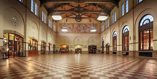
Ogden Union Station reflects the architectural ambition of major railroad companies.

The building's design communicated permanence and institutional importance.

Large public spaces accommodated passengers.

Decorative elements reinforced the idea that railroad stations were civic landmarks.

Railroads and Economic Transformation

Railroads transformed Utah's economy.

Agricultural products could reach distant markets.

Mining companies could ship ore more efficiently.

Manufactured goods could enter Utah more cheaply.

Tourism became more accessible.

Population movement accelerated.

Railroads therefore contributed to the integration of Utah into the national economy.

Workers

Railroads employed enormous numbers of workers.

Engineers, conductors, brakemen, maintenance crews, telegraph operators, station workers, mechanics, and laborers formed a specialized workforce.

Railroad employment required discipline and coordination.

Timetables were critical.

Communication systems had to function accurately.

A mistake could produce catastrophic consequences.

Immigrant Labor

Railroad construction relied heavily on immigrant workers, including large numbers of Chinese laborers who built the Central Pacific across the Sierra Nevada and Great Basin.

Irish, European, Mexican, and other workers also participated in railroad construction and operation at different times and locations.

The history of railroad expansion is therefore inseparable from labor migration.

Museum Preservation

Ogden Union Station now preserves artifacts associated with railroad history.

These can include locomotives, passenger cars, tools, photographs, uniforms, communication equipment, and historical documents.

Railroad museums are especially valuable because transportation technology is difficult to understand from photographs alone.

Visitors can see the scale of locomotives and equipment directly.

Social History

Stations were also places where people experienced migration, separation, reunion, tourism, commerce, and wartime transportation.

The social history of railroads therefore extends far beyond technology.

A station could be the location where families said goodbye, workers began new jobs, soldiers departed, or travelers entered a new region.

Conclusion

Ogden Union Station preserves the history of a transportation system that transformed Utah's relationship with the rest of the United States.

Its architecture, collections, railroad equipment, and location together demonstrate how railroads reshaped economic development, labor, migration, communication, and urban life.

Golden Spike: Utah's Transcontinental Join

September 27, 2026

Introduction

The Golden Spike symbolizes one of the most famous moments in American transportation history: the ceremonial joining of the Union Pacific and Central Pacific railroads at Promontory Summit, Utah, on May 10, 1869.

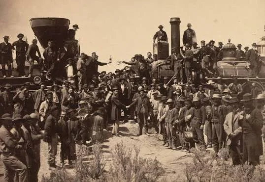
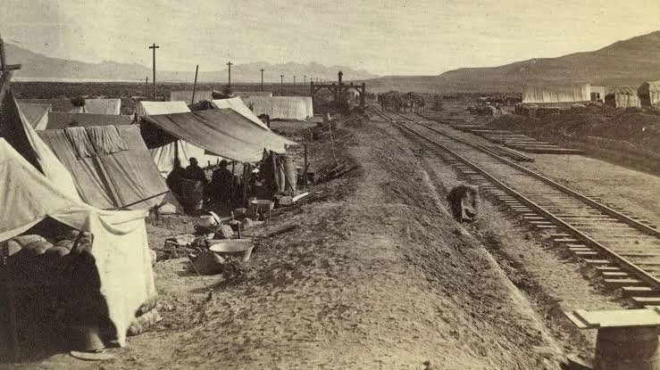
The event is often remembered through the famous photograph showing railroad executives and workers gathered around the final ceremonial connection.

Yet the completion of the railroad was more than a symbolic celebration. It represented the culmination of enormous engineering, financial, political, and labor efforts.

The Transcontinental Railroad Project

The idea of connecting the eastern and western United States by railroad had existed for decades.

The Pacific Railway Act of 1862 authorized federal support for railroad construction.

Two companies received major roles.

The Union Pacific built westward from the Missouri River.

The Central Pacific built eastward from Sacramento.

The two lines eventually met in Utah.

Engineering the West

Railroad construction across the American West required overcoming enormous geographical challenges.

Workers crossed deserts, mountains, rivers, and rugged terrain.

They built grades, bridges, tunnels, cuts, embankments, and drainage systems.

The work was physically demanding and frequently dangerous.

Chinese Railroad Workers

Chinese workers formed a crucial part of the Central Pacific workforce.

Thousands participated in constructing the railroad, particularly through the Sierra Nevada and across the Great Basin.

They performed demanding manual labor involving grading, blasting, track laying, and construction.

Their contributions were historically marginalized for many years but are now recognized as central to understanding the railroad's construction.

Mormon Labor

Mormon workers also participated substantially in railroad construction in Utah.

Many communities supplied laborers who worked for the railroads during the period surrounding completion.

Their participation reflects the complicated relationship between the railroad companies and Utah's predominantly Mormon population.

The Meeting Point

Promontory Summit was selected as the ceremonial meeting location.

The physical joining of rails represented the connection of two enormous construction projects.

A final ceremonial spike was driven into the track.

Although the famous golden spike was symbolic rather than an ordinary operational component, it became one of the most recognizable objects associated with American railroad history.

The Famous Photograph

The completion ceremony was documented photographically.

The image became a powerful representation of national technological progress.

Yet photographs also have limitations.

The famous image primarily presents railroad executives and dignitaries.

The thousands of laborers whose work made the project possible are largely absent from the central visual narrative.

Modern interpretation therefore seeks to broaden the story beyond the ceremony itself.

Economic Consequences

Railroad completion reduced travel times dramatically.

Goods could move across the continent much faster.

Markets became more integrated.

Mining, agriculture, manufacturing, tourism, and migration were transformed.

Utah became more directly connected to national economic systems.

Indigenous Consequences

The railroad also transformed Indigenous landscapes.

Construction crossed Native lands and contributed to increased settler migration, military movement, commercial development, and resource extraction.

Railroads therefore represent both technological achievement and a major force in the transformation of Indigenous territories.

The Golden Spike Today

The Golden Spike site is preserved as a major historic landmark.

Interpretation includes locomotives, reenactments, historic demonstrations, and educational programs.

The site helps visitors understand the technological scale of railroad construction.

Conclusion

The Golden Spike represents both a symbolic moment and a massive historical process.

The ceremony at Promontory Summit was only the visible culmination of years of engineering, investment, labor, migration, and political development.

Understanding the Golden Spike therefore requires looking beyond the ceremonial photograph to the thousands of people and enormous physical infrastructure that made continental rail connection possible.

Promontory Summit: Utah's 1869 Railroad Ceremony

September 27, 2026

Introduction

Promontory Summit is one of the most recognizable historical landscapes in Utah. On May 10, 1869, the Central Pacific and Union Pacific railroads were ceremonially joined there, creating the first continuous railroad connection across the United States.

The event became known as the "Golden Spike" ceremony.

Promontory Summit, however, is significant not only because of the ceremony itself. The location preserves evidence of a rapidly changing transportation system that reshaped the American West.

Why Promontory?

The railroad companies had to determine where the two construction lines would meet.

Promontory Summit provided a practical meeting location along the route through northern Utah.

The landscape contained difficult terrain but offered a workable railroad grade.

The location eventually became the site of the ceremonial connection.

May 10, 1869

The ceremony brought together executives, politicians, workers, journalists, photographers, and other observers.

A final ceremonial spike was driven into the railroad tie.

The event symbolized national technological integration.

Telegraph communication allowed news of the completion to travel rapidly across the country.

The Railroad as Infrastructure

The ceremony represented only a small fraction of the physical infrastructure required.

Railroads required:

  • tracks;

  • bridges;

  • culverts;

  • grades;

  • stations;

  • water facilities;

  • maintenance shops;

  • telegraph lines;

  • fuel stations;

  • rolling stock.

The railroad was therefore an enormous technological system rather than simply a line of rails.

The Human Workforce

Thousands of laborers constructed the railroad.

Chinese workers were particularly important to the Central Pacific.

Irish and other immigrant laborers were heavily represented on the Union Pacific.

Mormon workers also played a major role in Utah.

The workforce faced dangerous conditions, low wages in many cases, difficult weather, and exhausting physical labor.

Indigenous Landscapes

Promontory and the surrounding Great Basin were already Indigenous landscapes before railroad construction.

The railroad entered territories connected to Native communities and altered patterns of movement, hunting, trade, and settlement.

The expansion of rail transportation accelerated the arrival of settlers and commercial development.

This transformed the region permanently.

Railroad Towns

After the ceremonial completion, Promontory developed as a railroad community.

Stations, businesses, hotels, saloons, warehouses, and other facilities appeared.

Such towns could develop rapidly because railroad construction generated enormous economic activity.

But their fortunes were equally vulnerable to changes in railroad routing.

The Relocation of the Line

Promontory's long-term importance changed after the railroad route was altered.

A more efficient alignment through the Great Salt Lake region eventually bypassed the original summit route.

This is an important reminder that transportation infrastructure is dynamic.

A location that becomes strategically important can lose that importance when engineering solutions change.

Archaeological Evidence

The former railroad town left behind foundations, artifacts, grades, and other archaeological remains.

Archaeologists can use these materials to reconstruct the settlement.

Artifacts can reveal consumer behavior.

Building remains show the organization of businesses and residences.

Railroad features reveal technological practices.

Modern Interpretation

Today, Promontory Summit is preserved as a major historical site.

The site presents reconstructed locomotives and demonstrations that help visitors understand nineteenth-century railroad technology.

The ceremonial story is only one part of the interpretation.

Modern historical scholarship also emphasizes the laborers, Indigenous communities, businesses, engineers, and transportation systems involved in the railroad's development.

Legacy

The transcontinental railroad transformed the United States.

It shortened travel times.

It reduced transportation costs.

It accelerated migration.

It expanded commercial markets.

It encouraged industrial development.

It transformed western landscapes.

Its effects were therefore economic, technological, demographic, environmental, and political.

Conclusion

Promontory Summit represents a pivotal moment in American transportation history.

The 1869 ceremony became a national symbol of connection, but the deeper historical significance lies in the immense process behind it.

The summit preserves the memory of engineering achievement while also providing an opportunity to examine the labor, Indigenous history, economic transformation, and environmental consequences associated with the railroad.

For that reason, Promontory Summit is best understood not simply as the place where a golden spike was driven, but as a landscape where the American West entered a new technological and economic era.

Corinne: Utah's Gentile Boomtown

September 27, 2026

Introduction

Corinne occupies a distinctive place in Utah's nineteenth-century history because its development was closely connected to the arrival of the railroad and to the growth of a non-Mormon commercial community in a territory where Latter-day Saint settlers dominated many established settlements.

Founded in 1868 near the Bear River and shortly before the completion of the transcontinental railroad, Corinne rapidly became a center of commerce, transportation, warehousing, and freight distribution. Its population included merchants, railroad workers, freight operators, entrepreneurs, migrants, and others who were attracted by the opportunities created by the new transportation network.

The term "Gentile" was widely used in nineteenth-century Utah to refer to non-Latter-day Saints. It was a historical social category rather than a neutral modern demographic description. Corinne's reputation as a "Gentile boomtown" therefore reflects the city's role as an important non-Mormon commercial center during the territorial period.

The Railroad and the Birth of Corinne

Corinne's development was inseparable from the transcontinental railroad.

When the Union Pacific and Central Pacific railroads approached their meeting point in Utah, communities located along transportation corridors suddenly acquired new economic opportunities.

Corinne was strategically positioned near the Bear River and railroad lines.

Its founders recognized that the settlement could serve as a distribution point for goods moving into Utah's interior.

The timing was crucial.

The city was established in 1868, only months before the ceremonial completion of the transcontinental railroad in 1869.

That coincidence allowed Corinne to benefit from the dramatic expansion of transportation across the Great Basin.

A Commercial Alternative

Most established settlements in northern Utah were strongly associated with the Latter-day Saint community.

Corinne developed differently.

Merchants who were not members of the Church of Jesus Christ of Latter-day Saints established businesses there.

The city became associated with an economy based on trade rather than primarily on agricultural colonization.

Warehouses stored goods arriving by rail.

Freighters transported merchandise into surrounding communities.

Hotels accommodated travelers.

Saloons, restaurants, stores, and other businesses served workers and visitors.

Corinne thus became a commercial gateway.

Freight and the Interior

Railroads dramatically reduced the cost and time of moving goods across long distances, but rail access did not eliminate the need for local freight transportation.

Goods unloaded at railroad facilities still had to reach communities beyond the tracks.

Wagon freight therefore remained important.

Teams of horses and oxen transported supplies into Utah's interior.

This created a transitional economy in which railroads and traditional overland freight systems operated together.

Competition with Salt Lake City

Corinne's commercial ambitions brought it into competition with Salt Lake City.

The new railroad created possibilities for merchants to bypass established distribution networks.

Corinne's boosters envisioned the settlement becoming a major commercial city.

Its location made this vision plausible.

Yet transportation routes, business networks, and political relationships ultimately favored other centers.

The city's rapid rise was therefore followed by a gradual decline in its regional economic dominance.

Social Diversity

Corinne's population was more diverse than many rural Mormon settlements of the period.

Railroad workers, merchants, immigrants, freight operators, and travelers created a cosmopolitan environment.

The city contained people from different religious and cultural backgrounds.

This diversity also produced social tensions.

The community was part of a larger territorial environment characterized by religious divisions and competing economic interests.

The End of the Boom

Corinne's decline demonstrates a central principle of transportation geography.

A town can prosper because of a particular route, but transportation systems are constantly changing.

As rail connections expanded and other communities developed better commercial relationships with the railroad, Corinne's strategic advantage diminished.

The city never became the enormous metropolis imagined by its boosters.

Nevertheless, it survived.

Archaeological and Architectural Evidence

Historic buildings, streets, commercial structures, transportation corridors, and archaeological deposits provide evidence of Corinne's boom period.

Domestic artifacts can reveal household consumption.

Commercial buildings demonstrate the organization of trade.

Transportation-related remains reveal how goods were moved between railroad and wagon networks.

The archaeological record therefore complements written accounts of the city's ambitions.

Corinne's Historical Significance

Corinne is important because it reveals that Utah's settlement history was not politically or culturally uniform.

The territory contained communities with different religious affiliations, economic strategies, and visions for the future.

Its emergence as a railroad-centered commercial town illustrates how transportation could challenge established economic systems.

Conclusion

Corinne's history is the story of a frontier boomtown created by the railroad.

Its identity as a "Gentile" community reflects its nineteenth-century position outside the dominant Latter-day Saint settlement network.

Its warehouses, freight operations, commercial institutions, and railroad connections reveal how the transcontinental railroad transformed Utah.

Although its commercial ambitions eventually diminished, Corinne remains an important historical example of the intersection of transportation, religion, migration, and western economic development.

Kelton: Utah's Freight Wagon Town

September 27, 2026

Introduction

Kelton was one of the important settlements associated with transportation across western Utah during the era when railroads and wagon freight worked together to move people and goods through the Great Basin.

Located in a remote region near the Great Salt Lake Desert, Kelton developed as a railroad and freight community. Its history demonstrates that the completion of the transcontinental railroad did not immediately eliminate overland transportation.

Instead, railroads created new freight-transfer points where goods could be moved from trains to wagons and then transported into surrounding regions.

The Great Basin Transportation Problem

Western Utah presented enormous transportation challenges.

Distances were long.

Water was scarce.

Mountain ranges interrupted travel.

The Great Salt Lake Desert created a particularly difficult environment for travelers and livestock.

Before railroads, overland freight routes depended upon carefully spaced water sources.

The railroad dramatically changed this system but did not eliminate the importance of local freight.

The Railroad Station

Kelton became significant because of its position along the railroad.

Railroad stations in remote regions served multiple purposes.

They provided water, fuel, maintenance, communication, freight handling, and passenger services.

A station could become the nucleus of a settlement.

Kelton developed within this transportation environment.

Freight Transfer

One of Kelton's most important functions was associated with wagon freight.

Goods arriving by railroad could be loaded onto wagons and transported to destinations beyond the immediate railroad corridor.

This created a hybrid transportation economy.

Railroads handled long-distance movement.

Wagons handled regional distribution.

The two systems depended upon one another.

Teamsters

Freight transportation required experienced teamsters.

Driving a wagon across the Great Basin required knowledge of terrain, water sources, weather, livestock management, and route conditions.

Teamsters also faced economic pressures.

They had to maintain animals, equipment, and supplies while transporting heavy cargo over difficult terrain.

Community Life

Kelton developed the institutions typical of a transportation town.

Businesses served railroad employees and travelers.

Hotels and boardinghouses provided accommodation.

Restaurants and saloons served workers.

Warehouses stored goods.

Blacksmiths and mechanics maintained transportation equipment.

The settlement therefore had an economy larger than the railroad station itself.

The Desert Environment

Kelton's location made water especially important.

Water determined where animals could travel and where freight routes could operate.

Railroads solved some of the logistical problems by developing water infrastructure, but the broader desert environment remained demanding.

This relationship between infrastructure and natural resources is central to understanding western transportation history.

Decline

Transportation towns were vulnerable to changes in railroad logistics.

When railroads altered routes or developed alternative freight systems, communities dependent on transfer operations could decline quickly.

The automobile and improved highways later transformed freight transportation again.

As motor vehicles became more capable of crossing long distances, traditional wagon-based distribution declined.

Kelton gradually lost its earlier economic importance.

Archaeological Evidence

The remains of transportation towns can include foundations, roads, loading areas, wells, commercial structures, and discarded objects.

Such evidence can reveal how people interacted with transportation infrastructure.

A bottle discarded near a hotel may provide evidence of commercial life.

A building foundation can reveal the scale of a business.

A loading area can demonstrate how freight moved between transportation systems.

Historical Importance

Kelton illustrates the transitional character of western transportation.

It belongs to a period when railroads were transforming long-distance movement but wagons remained essential for local distribution.

This hybrid economy existed for decades.

Conclusion

Kelton's significance lies in its role as a freight and transportation community in the Great Basin.

Its history demonstrates that the railroad did not simply replace older transportation systems. Instead, rail and wagon freight initially worked together.

The eventual disappearance of the town reflects another transportation transformation: the replacement of wagon freight by more flexible highway and motor-vehicle systems.

Terrace: Utah's Railroad Section Houses

September 27, 2026

Introduction

Terrace was one of the many railroad settlements that emerged along the transcontinental route across Utah. Unlike major railroad cities such as Ogden, Terrace was shaped primarily by the operational requirements of the railway.

Its remains illustrate a less glamorous but essential part of railroad history: the workers and facilities responsible for maintaining the line.

Railroad Section Crews

A railroad could not function simply by laying tracks.

Tracks had to be inspected, repaired, cleared, and maintained continuously.

Railroad companies therefore divided routes into sections and assigned workers to each.

Section crews maintained stretches of track and associated infrastructure.

They repaired rails, replaced ties, cleared debris, maintained drainage, and responded to emergencies.

Section Houses

Railroad companies constructed section houses to provide accommodation for workers and their families.

These buildings were practical rather than monumental.

Their importance comes from what they reveal about railroad labor.

The section house placed workers close to the tracks they maintained.

This reduced response time and allowed crews to monitor the railroad.

Life Along the Railroad

Life in railroad section settlements could be isolated.

Workers and families lived far from major population centers.

Supplies arrived through railroad networks.

Social life developed within small communities.

Children might attend small schools or travel considerable distances for education.

The railroad was simultaneously workplace, transportation system, and connection to the outside world.

Maintenance as an Industrial System

Railroad maintenance required standardized procedures.

Workers used specialized tools.

Track geometry had to remain within acceptable tolerances.

Bridges and culverts required inspection.

Snow, flooding, erosion, and heat could damage infrastructure.

The seemingly simple railroad track therefore represented a constantly maintained industrial system.

Chinese and Other Railroad Workers

The construction of western railroads depended heavily on immigrant labor, especially Chinese workers on the Central Pacific.

After construction, railroad maintenance continued to involve workers from many backgrounds.

Understanding settlements such as Terrace helps broaden railroad history beyond the famous executives and ceremonial events.

The Landscape

Terrace's remote location demonstrates how railroads imposed a new geographic order on the Great Basin.

Before railroad construction, the region was characterized by Indigenous travel routes, natural resources, ranching, and overland transportation.

The railroad introduced an industrial corridor.

Stations, section houses, telegraph lines, water facilities, and maintenance areas appeared along it.

Abandonment

When railroad routes changed, the settlements supporting them could disappear.

A section house might be abandoned because the railroad consolidated maintenance operations elsewhere.

A station could close after a route was bypassed.

Once workers left, buildings deteriorated rapidly.

Archaeological Interpretation

Railroad archaeology can reveal the ordinary lives of workers.

Building foundations can establish settlement organization.

Household artifacts reveal what families purchased and consumed.

Railroad tools provide evidence of occupational activities.

Telegraph-related remains can reveal communication infrastructure.

Conclusion

Terrace is important because it represents the everyday infrastructure behind the transcontinental railroad.

Its section houses were not grand landmarks, but they supported one of the most important transportation systems in American history.

Studying such places shifts attention from famous ceremonies to the workers who maintained the tracks day after day.

Alazon: Utah's Abandoned Rail Stop

September 27, 2026

Introduction

Alazon represents the many small railroad stops that once punctuated Utah's western transportation corridor.

Such places could appear insignificant when compared with major railroad cities, but they formed essential components of the railway system.

A railroad required a network of stops, sidings, maintenance points, water facilities, communication stations, and worker settlements.

Alazon's abandoned landscape therefore preserves evidence of the infrastructure that made long-distance rail transportation possible.

Railroad Geography

Railroad construction created new geographic relationships.

Locations that had previously been remote became connected to national markets.

A railroad stop could provide access to freight, mail, passengers, and communication.

The importance of each stop depended upon its operational function.

Some became towns.

Others remained small maintenance or service points.

Why Stops Were Established

Railroads needed strategically placed facilities.

Trains required water and fuel.

Crews needed places to rest.

Tracks required maintenance.

Freight sometimes needed to be loaded or unloaded.

Telegraph systems required stations.

A small settlement could therefore exist because of one specific railroad function.

Everyday Railroad Life

Workers at small stops lived in environments very different from major cities.

They were surrounded by open desert and long stretches of track.

Their work schedules were determined by trains.

A delay or mechanical problem could change the rhythm of the settlement.

Families adapted their lives around railroad timetables.

Communication

The telegraph was essential.

Before modern telecommunications, railroad operators relied on telegraph messages to coordinate train movements.

Small stations could therefore become nodes in a national communication network.

This was one of the railroad's most transformative effects.

The physical tracks moved people and goods, while telegraph wires moved information.

Abandonment

Railroad landscapes are particularly vulnerable to technological change.

When locomotives became more efficient, watering stations could become unnecessary.

Dieselization eliminated many steam-era facilities.

Improved signaling reduced the need for some staffed locations.

Changes in routes could bypass older stops.

Alazon's abandonment should therefore be understood as part of technological modernization.

Archaeological Remains

An abandoned railroad stop can preserve foundations, railroad grades, loading areas, debris, and household artifacts.

These remains allow archaeologists to reconstruct settlement organization.

Even fragments of glass and ceramics can help establish periods of occupation.

Industrial remains can reveal the functions of the station.

Cultural Landscape

Alazon also demonstrates how railroad infrastructure created cultural landscapes.

Railroads were not merely transportation corridors.

They were communities.

They shaped employment, migration, commerce, communication, and settlement patterns.

Conclusion

Alazon's significance lies in its representation of the small-scale infrastructure behind the great railroad system.

Its abandonment reminds us that transportation technology is constantly changing.

The railroad stops that once seemed permanent could disappear when the technology supporting them changed.

Matlin: Utah's Chinese Railroad Labor Camp

September 27, 2026

Introduction

The history of the transcontinental railroad cannot be understood without examining Chinese railroad workers.

Matlin is associated with the broader landscape of Chinese labor camps and railroad construction in Utah and the Great Basin. Such places are important because they preserve evidence of workers whose contributions were essential but whose stories were frequently minimized in older accounts of railroad history.

Chinese Immigration and Railroad Labor

Large numbers of Chinese immigrants came to the United States during the nineteenth century.

Many settled in the American West.

Railroad companies recruited Chinese workers because they had established reputations for disciplined and highly organized labor.

The Central Pacific became particularly dependent upon Chinese workers during construction across the Sierra Nevada and Great Basin.

The Work

Railroad construction was physically demanding.

Workers cleared vegetation.

They graded the ground.

They moved enormous quantities of earth and rock.

They drilled holes for explosives.

They laid ties and rails.

They constructed bridges, culverts, and other infrastructure.

Much of the work was performed manually.

Labor Camps

Construction camps were temporary communities.

Workers required sleeping quarters, cooking areas, food storage, water supplies, and work equipment.

Some camps moved as construction advanced.

Others became associated with more permanent railroad infrastructure.

Archaeological remains can include ceramics, bottles, metal objects, food remains, and structural traces.

Chinese Material Culture

Archaeologists have sometimes identified Chinese-associated sites through distinctive ceramic forms, coins, gaming materials, food remains, and other artifacts.

However, interpretation requires caution.

Artifacts do not automatically reveal ethnicity.

Researchers combine multiple forms of evidence, including historical documents, spatial organization, artifact patterns, and oral histories.

Food and Community

Food was particularly important in railroad camps.

Chinese workers maintained culinary practices while adapting to locally available ingredients.

Food remains can therefore provide information about cultural adaptation and community organization.

Chinese workers did not simply abandon their cultural identities when they entered railroad employment.

Working Conditions

Railroad construction was dangerous.

Explosives could cause injuries.

Rockfalls and construction accidents occurred.

Workers endured extreme heat and cold.

The desert environment presented serious logistical challenges.

Chinese workers also faced discrimination and unequal treatment.

Their historical experience must therefore be understood within the broader context of nineteenth-century racial exclusion.

The Chinese Exclusion Act

In 1882, the United States enacted the Chinese Exclusion Act, severely restricting Chinese immigration.

This law reflected widespread anti-Chinese sentiment and had profound effects on Chinese American communities.

Railroad labor history therefore intersects directly with American immigration history.

Archaeological Importance

Chinese railroad camps are important because written records often emphasize company management and construction milestones.

Archaeology can provide evidence of the workers themselves.

Artifacts reveal what they ate, purchased, repaired, discarded, and carried.

This creates a more complete historical record.

Preservation

Many railroad camps were temporary.

Their structures disappeared soon after workers moved.

Weather and later development further damaged archaeological remains.

Consequently, even small artifact concentrations can have major historical value.

Conclusion

Matlin's significance lies in the broader story it represents: the Chinese workers whose labor helped construct and maintain the railroad system across the American West.

Railroad history becomes much richer when the famous golden spike is placed alongside the camps, tools, meals, hardships, and communities of the laborers who made the ceremony possible.

Shoshone: Utah's Pony Express Station

September 27, 2026

Introduction

The name Shoshone evokes one of the major Indigenous cultural traditions of the Great Basin and Intermountain West. In the context of nineteenth-century transportation history, however, it is important to distinguish between Indigenous geography and the later Euro-American transportation infrastructure that passed through it.

The Pony Express operated only from April 1860 to October 1861, but its brief existence has left a powerful historical legacy. Stations were established at carefully selected points along the route, particularly where travelers and riders could obtain water, horses, food, and shelter.

Sites associated with the name Shoshone should therefore be interpreted through both Indigenous geography and the short-lived transportation network imposed upon it.

The Pony Express

The Pony Express was established to move mail rapidly between Missouri and California.

Riders traveled through a chain of relay stations.

At each station, a rider could exchange horses and continue toward the next point.

This system allowed mail to travel much faster than conventional stagecoach service.

The Great Basin Route

The route crossed difficult terrain.

Riders encountered deserts, mountain passes, rivers, and long stretches without reliable water.

Stations therefore had to be carefully located.

Water sources were among the most valuable geographic features.

Indigenous Landscapes

The transportation route did not cross an empty wilderness.

Indigenous communities had used these landscapes for generations.

The Shoshone and other Great Basin peoples possessed detailed knowledge of springs, plants, animals, trails, and seasonal resources.

European-American transportation routes frequently followed corridors that Indigenous people already knew and used.

This is an important archaeological and historical principle.

Station Infrastructure

A Pony Express station could be simple.

Some consisted of ranch buildings adapted for mail service.

Others were purpose-built facilities.

A station needed horse-changing facilities and basic accommodations.

The apparent simplicity of these structures should not obscure their importance within the national communication system.

Riders

Pony Express riders developed a legendary reputation.

They traveled rapidly and faced difficult environmental conditions.

Riders needed horsemanship, endurance, route knowledge, and reliability.

The job was dangerous.

Yet the service itself existed for only a short period.

The Telegraph

The Pony Express became obsolete when the transcontinental telegraph was completed in 1861.

The telegraph could transmit messages almost instantaneously compared with physical transportation.

This demonstrates one of the central patterns of technological history:

A successful technology can disappear rapidly when a fundamentally different technology solves the same problem more efficiently.

Archaeological Evidence

Station archaeology can reveal how transportation systems functioned.

Foundations, wells, corrals, ceramics, bottles, horseshoes, and other artifacts can identify the activities carried out at a station.

Archaeological research is particularly important where buildings have disappeared.

Indigenous Continuity

Modern interpretation should avoid treating Indigenous history as merely a prelude to the Pony Express.

Shoshone communities survived the transportation transformation and remain culturally present.

The arrival of Euro-American transportation changed their environment, but it did not erase their history.

Conclusion

The history associated with Shoshone and the Pony Express belongs to a larger story of transportation crossing an already inhabited Indigenous landscape.

The Pony Express was short-lived, but its stations became important historical markers.

Their significance lies in the intersection of Indigenous geography, western migration, communication technology, and the rapid transformation of transportation in the nineteenth century.

Deep Creek: Utah's Stagecoach Stop

September 27, 2026

Introduction

Deep Creek Station was one of the most important transportation stops in western Utah during the nineteenth century.

Located in the homeland of the Goshute people, Deep Creek became a crucial point along the overland route connecting Salt Lake City with the settlements and transportation networks farther west.

The site is especially significant because it served multiple transportation systems: the Pony Express, Overland Stage, and telegraph.

The National Park Service notes that a ranch established there by Howard Egan became a Pony Express home station in 1860–1861 and also supported the Overland Stage.

The Deep Creek Environment

Water determined transportation geography in the Great Basin.

Deep Creek provided an important source of water in a region where reliable springs and streams were widely separated.

This made the location valuable long before the arrival of Euro-American transportation.

The Goshute people had longstanding knowledge of the area.

Howard Egan's Ranch

Howard Egan established a ranch on Deep Creek in the late 1850s.

The ranch became a transportation facility.

Its agricultural production also supported the larger transportation network.

Egan produced hay, grain, mutton, and beef.

The station was therefore not simply a stopping place.

It was an agricultural enterprise integrated into the overland transportation economy.

Pony Express

During 1860–1861, Deep Creek served as a Pony Express home station.

Riders could change horses and obtain supplies.

The station's location was strategically important because the Pony Express depended upon reliable intervals between stops.

Overland Stage

The site also supported stagecoach transportation.

Stage travelers required food, water, rest, and fresh animals.

The station therefore served multiple transportation networks simultaneously.

Richard Burton's Account

English traveler Richard Burton visited Deep Creek during his 1860s journey through the American West.

His observations provide an unusually detailed contemporary description of the station.

He described buildings, agricultural fields, waterways, and livestock.

Such firsthand accounts are valuable historical evidence because they provide information about the physical landscape that archaeology can later investigate.

Telegraph

The completion of the transcontinental telegraph in October 1861 transformed the station's role.

The Pony Express quickly became obsolete.

A telegraph repeater station replaced the Pony Express operation.

This technological transition demonstrates how rapidly communication systems could change.

Agriculture and Transportation

Deep Creek demonstrates the importance of agriculture to transportation.

Stage stations could not survive on transportation alone.

They required hay for horses, grain for livestock and people, meat, water, and other supplies.

Agricultural production therefore became part of the transportation infrastructure.

Goshute Homeland

The history of Deep Creek cannot be separated from the Goshute people.

The station was established within an Indigenous landscape.

The development of the ranch and transportation route altered patterns of land use and resource access.

Modern interpretation must therefore include both the Indigenous history of the region and the later overland transportation history.

Archaeology

The original station buildings are largely gone.

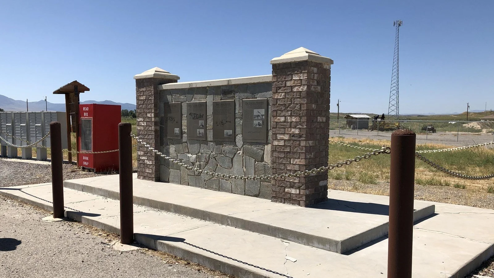
Archaeological remains and historical markers can nevertheless preserve evidence of the site's former importance.

The combination of documentary sources and archaeology makes Deep Creek an excellent case study in frontier transportation history.

Conclusion

Deep Creek was far more than a stagecoach stop.

It was an agricultural enterprise, Pony Express station, Overland Stage facility, telegraph site, and strategic water source.

Its history demonstrates how transportation networks depended upon environmental knowledge, agriculture, and Indigenous landscapes.

Ibapah: Utah's Western Shoshone Village

September 27, 2026

Introduction

Ibapah lies in western Utah near the Deep Creek Mountains and the Nevada border. The community occupies a landscape with a long Indigenous history and is strongly associated with Goshute people.

Although the title uses the term "Western Shoshone," the historical identity of the community must be handled carefully because Indigenous territorial, linguistic, and political boundaries do not always correspond neatly to modern state or county lines.

Ibapah is especially important as a place where Indigenous continuity can be studied alongside the transportation, ranching, and settlement history of western Utah.

Indigenous Geography

The Great Basin was home to numerous Indigenous communities whose economies depended upon detailed knowledge of an arid environment.

The region's peoples hunted, gathered, traveled seasonally, traded, and managed relationships with springs and other water sources.

Rather than being an empty desert, the Great Basin was a culturally organized landscape.

The Deep Creek Region

The Deep Creek Mountains provided water, elevation, plants, wildlife, and shelter.

Communities could move between ecological zones according to seasonal availability.

This flexibility was crucial in an environment where rainfall was unpredictable.

European-American Settlement

During the nineteenth century, ranchers, miners, travelers, and transportation companies entered the region.

New settlement patterns introduced fences, private property claims, agricultural fields, livestock, and roads.

These changes affected Indigenous access to traditional resources.

Deep Creek Station

The nearby Deep Creek transportation station became part of the Pony Express and Overland Stage network.

This increased the strategic importance of the region.

Transportation corridors encouraged additional settlement.

Ibapah as a Community

Ibapah survived beyond the temporary transportation era.

This is historically important.

Many western transportation settlements disappeared when railroads and highways replaced earlier routes.

Indigenous communities, however, cannot be understood simply as transportation settlements.

Their histories extend across much longer periods.

Cultural Continuity

Modern Indigenous communities preserve language, traditions, family relationships, religious practices, and cultural knowledge.

Historical interpretation should therefore avoid presenting Indigenous communities as remnants of a vanished past.

The existence of Ibapah demonstrates continuity through enormous economic and political changes.

Archaeological Evidence

Archaeological research in the Great Basin has documented long sequences of human occupation.

Stone tools, food remains, hearths, shelter sites, and other evidence reveal adaptations extending thousands of years.

The modern community belongs to this much larger cultural landscape.

Water

Water remains one of the central themes of western Utah history.

Springs and streams determined settlement patterns.

Deep Creek supported both Indigenous lifeways and later agricultural and transportation enterprises.

This continuity illustrates how the same environmental resources can support very different economic systems over time.

Transportation and Change

The arrival of stage routes, telegraph lines, railroads, and highways transformed the region.

Each new technology altered distances and accessibility.

Yet none completely replaced the importance of local environmental knowledge.

Conclusion

Ibapah is significant because it represents Indigenous continuity within a landscape dramatically transformed by nineteenth- and twentieth-century transportation.

Its history connects Goshute and neighboring Great Basin traditions with ranching, stage routes, and modern settlement.

Rather than viewing Indigenous history as something confined to the distant past, Ibapah demonstrates that Indigenous communities remain active participants in the cultural landscape of the American West.

Callao: Utah's Tintic Freight Hub

September 27, 2026

Introduction

The history of Callao requires some caution because the name is associated with western Utah transportation and settlement, while the better-known Tintic mining district lies much farther east.

Rather than treating the title as evidence of a major Tintic railroad center without qualification, it is more useful to examine Callao within the broader system of freight movement that connected Utah's mining districts, ranches, stage routes, railroad corridors, and desert settlements.

Freight in Western Utah

Freight was essential to frontier economies.

Mining camps required machinery, timber, food, fuel, clothing, and tools.

Ranches required agricultural equipment.

Stage stations required hay and grain.

Small settlements depended upon merchants who could obtain goods from larger cities.

This produced a complex web of wagon routes.

The Importance of Geography

Western Utah is characterized by broad desert basins separated by mountain ranges.

Travelers had to identify reliable routes through difficult terrain.

Water sources were particularly important.

Freight operators planned routes around springs, wells, and ranches.

Wagon Transportation

Before widespread motorization, freight depended heavily on wagons.

Large freight wagons could carry substantial loads, but their movement was slow.

Animals consumed food and water.

Roads could become impassable after storms.

Sand and mud created serious obstacles.

Freight and Mining

Mining districts created enormous demand.

A mine could not operate without supplies.

Machinery had to be transported.

Timber was required for underground supports.

Food had to reach workers.

Ore had to leave the district.

This created economic opportunities for freight operators.

Callao in the Regional Network

Callao's historical importance is best understood through this regional network rather than through a simplistic model of one town serving one mining district.

Western Utah settlements often changed roles as transportation systems evolved.

A location might function as a ranching center, freight stop, postal station, or transportation waypoint at different periods.

Decline of Wagon Freight

Railroads eventually reduced the importance of long-distance wagon transportation.

Later, automobiles and trucks transformed freight once again.

Roads could reach areas that railroads never served.

Motor transport became more flexible.

The old wagon network declined.

Archaeological Evidence

Historic freight routes can leave surprisingly subtle archaeological traces.

Wheel ruts may survive in dry environments.

Foundations can identify former stations.

Metal hardware can indicate wagon repair.

Bottles and cans reveal the presence of travelers and workers.

Water infrastructure may preserve evidence of transportation use.

Historical Interpretation

Sites such as Callao should not be evaluated only by the size of their surviving buildings.

A small settlement can be historically important because of its position within a larger transportation network.

Conclusion

Callao's historical value lies in understanding the interconnected freight economy of western Utah.

Its story illustrates how mining, ranching, stage transportation, water sources, and wagon freight created a regional system before the dominance of modern highways.

The landscape preserves the memory of an era when transportation depended upon animals, human endurance, environmental knowledge, and carefully spaced sources of water.

Fish Springs: Utah's Pony Express Relay

September 27, 2026

Introduction

Fish Springs was one of the most important water and transportation sites in the western Great Basin.

Located at the southern edge of the Great Salt Lake Desert, Fish Springs is today protected as a wildlife refuge. The springs form a significant wetland in an otherwise extremely arid environment.

For thousands of years, Indigenous people used the oasis.

In the nineteenth century, it became part of the overland transportation network.

The National Park Service notes that a mail station was established there in 1859 and that Fish Springs later served mail contractors, the Pony Express, the Overland Stage, and the transcontinental telegraph.

An Ancient Oasis

Fish Springs is fundamentally a water landscape.

The surrounding desert is extremely dry, making the springs exceptionally valuable.

Archaeological evidence indicates that Indigenous peoples used the area for at least 11,000 years.

This long history places the Pony Express episode within a much larger human landscape.

The 1859 Mail Station

In 1859, Captain J. H. Simpson and a U.S. Army Topographical Engineers expedition established a mail station at Fish Springs.

Its importance came from its water supply.

The springs were brackish and relatively warm, but they were among the most reliable sources between important transportation points.

Pony Express

When the Pony Express began operating in 1860, Fish Springs became part of its relay system.

Riders needed fresh horses and access to water.

The station's remote location made it particularly valuable.

Overland Stage

The site also supported the Overland Stage.

Stagecoaches needed places where horses could be rested and replaced.

Passengers needed food and water.

Drivers needed reliable routes.

Fish Springs therefore functioned within multiple transportation systems.

Telegraph

The arrival of the transcontinental telegraph transformed communications.

The physical movement of messages by horse became increasingly unnecessary.

Fish Springs subsequently supported telegraph operations.

This sequence illustrates the rapid evolution of nineteenth-century communications.

The Station Structure

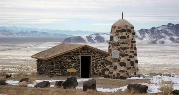
Historical descriptions indicate that the original Fish Springs station was a simple stone structure with a brush-and-dirt roof.

Very little of the original building survives.

The absence of major ruins should not be interpreted as evidence that the site was unimportant.

Its historical value comes from its position within the transportation system and its extraordinary environmental setting.

Indigenous History

The springs were already part of Indigenous geography long before the arrival of the U.S. military or mail routes.

Great Basin peoples possessed extensive knowledge of water sources and desert ecology.

Transportation infrastructure often depended on places that Indigenous communities already understood as critical resources.

Environmental Importance

Today Fish Springs is a major wetland refuge.

Its biological significance is remarkable because the springs create habitat in an otherwise extremely arid region.

The contrast between historical transportation and modern wildlife conservation is especially interesting.

The same water source that once supported horses and stage travelers now supports fish, birds, and other wildlife.

Conclusion

Fish Springs demonstrates how environmental geography shaped transportation history.

The oasis supported Indigenous communities for thousands of years before becoming a military mail station, Pony Express relay, stage stop, and telegraph station.

Its story is therefore not simply about the Pony Express.

It is about the extraordinary historical importance of water in the Great Basin.

Dugway Proving Ground: Utah's WWII Relics

September 27, 2026

Introduction

Dugway Proving Ground occupies an enormous and highly restricted landscape in western Utah. Established during World War II, it became an important U.S. military testing facility in the development and evaluation of chemical, biological, incendiary, and other weapons and defensive technologies.

The site is historically significant because its physical remains preserve evidence of a less visible side of World War II: the enormous expansion of military research, testing, training, and logistical infrastructure required to fight a global industrial war.

The U.S. Army states that Dugway was established in 1942 after the federal government withdrew more than 126,000 acres for War Department use, with testing beginning that same year.

Why Utah?

The location of Dugway was deliberate.

Military testing required large areas where dangerous experiments could be conducted away from major population centers.

Western Utah provided:

  • enormous open spaces;

  • low population density;

  • varied desert terrain;

  • controlled access;

  • proximity to existing military infrastructure.

The desert therefore became a military laboratory.

Establishment in 1942

Dugway Proving Ground was officially activated on March 1, 1942.

The initial mission involved testing chemical warfare defenses and weapons.

Testing began during the first year of operation.

The urgency reflected the global circumstances of World War II.

The United States feared chemical warfare and needed to understand both offensive weapons and defensive measures.

Chemical Warfare

Chemical warfare research involved studying substances capable of incapacitating or killing personnel.

Testing required controlled environments, specialized equipment, protective measures, and carefully monitored experiments.

The history is therefore part of the development of modern military science.

Biological Warfare

Dugway's responsibilities expanded.

In 1943, biological warfare testing facilities were established at the installation.

The existence of these facilities demonstrates the breadth of wartime military research.

Biological weapons posed different scientific and logistical problems from chemical weapons.

They required different methods of containment, testing, dissemination, and detection.

Incendiary Testing

Dugway also tested incendiary bombs.

Such weapons were particularly important in the context of aerial warfare.

Testing helped military planners understand how weapons behaved under different conditions.

The Landscape as Laboratory

The desert environment itself became part of the testing infrastructure.

Open areas could be divided into test ranges.

Observation stations could be positioned at controlled distances.

Roads and communications systems connected test areas to administrative facilities.

Buildings housed laboratories, personnel, equipment, and storage.

The entire landscape functioned as a military-industrial system.

WWII Relics

Historic military remains can include:

  • barracks;

  • administrative buildings;

  • test structures;

  • roads;

  • observation facilities;

  • foundations;

  • storage areas;

  • communication infrastructure.

Some evidence is highly visible.

Other remains are subtle.

Because military facilities were frequently designed for secrecy, documentation and archaeological interpretation are particularly important.

Postwar Development

Dugway did not simply disappear after World War II.

The proving ground continued to evolve.

After the war, the facility experienced periods of reduced activity and later reactivation.

During the Cold War, its mission expanded into new areas of military testing.

Ethical and Environmental Questions

Military testing creates difficult historical questions.

Weapons testing can contaminate environments.

Some materials can remain hazardous decades later.

Historical preservation must therefore be balanced against public safety.

Restricted access can also limit archaeological investigation.

Interpreting a Secret Landscape

One of the most interesting aspects of Dugway's history is secrecy.

During wartime, information was intentionally limited.

Workers might understand only part of a project's purpose.

Official records could remain classified for years.

Archaeology and declassified documents can therefore help reconstruct activities that were once hidden.

Conclusion

Dugway Proving Ground represents the transformation of the western desert into a military testing landscape during World War II.

Its surviving infrastructure reflects the enormous scale of wartime scientific research.

The site also raises important questions about secrecy, environmental consequences, technological development, and the responsibilities involved in preserving military heritage.

Wendover Airfield: Utah's Enola Gay Base

September 27, 2026

Introduction

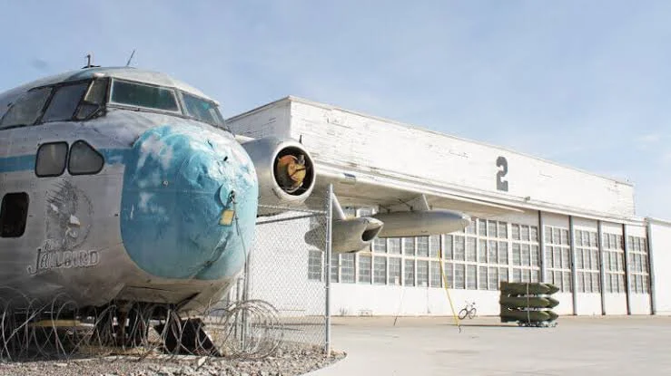
Wendover Airfield is one of the most significant World War II aviation sites in Utah.

Located in the remote western part of the state, the airfield began as a training facility for heavy bomber crews. It later became the secret training base of the 509th Composite Group, the unit associated with the atomic bombing missions against Japan in August 1945.

The National Park Service describes Wendover as an important training site for heavy bombardment crews and as the base where the 509th Composite Group trained before moving to Tinian.

Construction of the Airfield

The military began developing Wendover in the late 1930s.

The location offered extensive open space suitable for bombing and gunnery training.

The desert environment also reduced the risk of accidental damage to densely populated areas.

By 1942, training operations were well established.

Heavy Bomber Training

Wendover trained crews for some of the largest aircraft used by the United States during World War II.

Heavy bombers required specialized crews.

Pilots, navigators, bombardiers, engineers, radio operators, and gunners had to coordinate their activities.

Training emphasized precision.

The 509th Composite Group

In late 1944, Wendover became the home of the newly organized 509th Composite Group.

The unit had a highly specialized mission.

Its aircraft had to be modified to carry the enormous atomic bombs being developed through the Manhattan Project.

The group's training was conducted under extraordinary secrecy.

The Enola Gay

The B-29 known as the Enola Gay was associated with the 509th Composite Group.

The aircraft later carried the atomic bomb used against Hiroshima on August 6, 1945.

The crew had trained at Wendover before the group moved to Tinian in the Pacific.

It is therefore historically accurate to describe Wendover as the training base associated with the Enola Gay, while recognizing that the Hiroshima mission itself departed from Tinian, not Utah.

Secrecy

Security at Wendover became extremely strict.

The 509th operated as a specialized and relatively self-contained unit.

Personnel were not necessarily informed about the full purpose of their activities.

The secrecy reflected the military importance of the Manhattan Project.

Infrastructure

Wendover became a substantial military installation.

At its height, the base included hundreds of buildings, long runways, hangars, barracks, administrative facilities, maintenance areas, and specialized training infrastructure.

The scale of the installation illustrates how much physical infrastructure was required to operate heavy bomber forces.

Atomic-Bomb Training

The crews practiced specialized bombing techniques.

The B-29 had to be modified.

Bomb-loading procedures had to be developed.

Crews practiced flight patterns and release techniques.

The objective was to make an unprecedented weapon compatible with an operational aircraft.

Tinian

The 509th left Wendover for Tinian in 1945.

The Pacific base became the operational location for the atomic bombing missions.

The transition from Utah to Tinian demonstrates how Wendover functioned primarily as a training and preparation site.

Preservation

Wendover's historic buildings are valuable because they preserve the physical setting of World War II aviation.

Unlike a conventional museum display, the landscape allows visitors to understand the spatial scale of military aviation.

The National Park Service has described the surviving installation as exceptionally well preserved for a World War II Army Air Forces training base.

Historical Debate

Wendover's history cannot be separated from the broader history of nuclear warfare.

The atomic bombings of Hiroshima and Nagasaki remain major subjects of historical debate.

The airfield itself, however, can be studied without reducing its history to a single argument.

Its importance includes aviation technology, military training, secrecy, logistics, engineering, and the development of nuclear warfare.

Conclusion

Wendover Airfield preserves one of the most consequential military landscapes in Utah.

Its connection to the Enola Gay and the 509th Composite Group gives the site global historical significance.

At the same time, the airfield preserves the broader story of World War II aviation and the thousands of personnel who operated the vast infrastructure necessary to prepare for the final stages of the war.

Skull Valley: Utah's Goshute Indian Farmsteads

September 27, 2026

Introduction

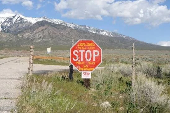
Skull Valley contains a long and complicated history of Indigenous adaptation, settlement, agriculture, ranching, transportation, and federal land policy.

The Goshute people have deep historical connections to the Great Basin, including western Utah's valleys and mountain ranges. Their traditional lifeways were highly adapted to an arid environment.

Later agricultural settlements and government policies introduced new economic pressures and land-use patterns.

The Goshute Homeland

The Great Basin is one of North America's most challenging environments for agriculture.

Rainfall is limited.

Water sources are scattered.

Temperatures vary dramatically.

Goshute communities developed strategies based on hunting, gathering, seasonal movement, and intimate knowledge of local ecological resources.

Seasonal Mobility

It is important not to interpret mobility as a lack of territorial organization.

Indigenous communities could have highly structured relationships with particular places while moving between them seasonally.

Knowledge of plant communities, animal habitats, springs, and weather patterns was essential.

The Arrival of Agriculture

European-American settlement introduced different concepts of land use.

Agricultural fields required fixed locations.

Fences established property boundaries.

Livestock competed with wildlife and Indigenous resource use.

Irrigation altered water distribution.

These changes transformed the landscape.

Farmsteads

Indigenous farmsteads, where documented, are important because they demonstrate adaptation to changing economic and political conditions.

Agriculture could become a strategy for maintaining communities under new circumstances.

Growing crops required access to water and labor.

It also created opportunities for greater food security.

Government Policies

Federal policies toward Indigenous peoples frequently encouraged or imposed agricultural settlement.

The stated goal was often assimilation into Euro-American farming systems.

In practice, these policies could restrict mobility and undermine traditional economic systems.

The history of Indigenous agriculture must therefore be understood within the context of colonial pressure.

Water

Water is central to the history of Skull Valley.

Irrigation required diverting or controlling scarce water resources.

The construction of wells, ditches, canals, and reservoirs changed hydrology.

For communities dependent upon both wild and cultivated foods, such changes could have significant consequences.

Archaeological Evidence

Farmsteads can preserve:

  • field boundaries;

  • irrigation features;

  • foundations;

  • storage structures;

  • agricultural tools;

  • ceramics;

  • animal remains;

  • food remains.

These materials reveal how people adapted to changing economic systems.

Continuity

Goshute history did not end with the arrival of settlers.

Indigenous communities continued to adapt.

Some incorporated wage labor.

Others engaged in ranching or agriculture.

Families maintained cultural practices while navigating new political realities.

Historical Interpretation

Older histories sometimes presented Indigenous agriculture as evidence that Native communities were becoming "civilized" according to Euro-American standards.

Modern scholarship treats the issue differently.

Agricultural adoption can be understood as strategic adaptation rather than cultural replacement.

Conclusion

Skull Valley's farmsteads represent an important chapter in Goshute history.

They reveal how Indigenous communities adapted to new economic and political conditions while maintaining relationships with their homeland.

The landscape demonstrates that Indigenous history in Utah is not simply an ancient archaeological story.

It continues into the modern era.

Promontory Point: Utah's Land Art Installation

September 27, 2026

Introduction

Promontory Point is closely associated with the extraordinary landscape of the Great Salt Lake and the wider Promontory Peninsula. The title's reference to a "land art installation" requires an important distinction: the famous Utah earthwork Spiral Jetty is located at Rozel Point, on the northeastern shore of the Great Salt Lake, rather than at Promontory Point itself. The Utah Museum of Fine Arts identifies Rozel Point as the location of Robert Smithson's 1970 earthwork.

Promontory Point nevertheless belongs to the broader landscape through which Utah's land-art history is often understood.

The Great Salt Lake as Artistic Landscape

The Great Salt Lake has unusual geological and visual characteristics.

Salt crusts, shallow water, exposed lakebed, black volcanic rocks, distant mountains, and changing water levels create a landscape that can appear dramatically different from season to season.

These qualities attracted artists interested in landscape, scale, geological processes, and environmental change.

Robert Smithson and Land Art

In 1970, artist Robert Smithson created Spiral Jetty using basalt rocks and earth at Rozel Point.

The earthwork extends approximately 1,500 feet into the lake and forms a large counterclockwise spiral.

The work became one of the defining examples of American Land art.

Why the Site Mattered

Smithson's choice of location was connected to the landscape itself.

The north arm of the Great Salt Lake could display striking contrasts between pinkish water, white salt, and dark basalt.

The work was designed not simply to sit in the landscape but to interact with it.

Water levels could cover the structure.

Salt could accumulate on its rocks.

Drought could expose more of the earthwork.

Art and Geological Time

Land art often challenges conventional ideas about permanence.

A painting remains within a controlled frame.

A sculpture can be maintained.

An earthwork can change through erosion, weather, water, and geological processes.

Spiral Jetty is particularly suited to this concept.

Its visibility depends partly on lake levels.

The lake becomes part of the artwork.

The Great Salt Lake Environment

The lake is itself a dynamic environmental system.

Its water levels fluctuate.

Salinity changes.

Wetlands expand and contract.

Bird populations depend on ecological conditions.

An earthwork placed within this environment inevitably becomes connected to ecological processes.

Promontory Peninsula

The Promontory Peninsula contains layers of natural and human history.

Indigenous peoples used the region long before Euro-American settlement.

Railroads transformed the peninsula in the nineteenth century.

Military and industrial activities later altered portions of the landscape.

Modern land art exists within this much older historical setting.

The Importance of Correct Location

Confusing Promontory Point with Rozel Point is understandable because both are associated with the Great Salt Lake and the Promontory Peninsula.

However, historical accuracy matters.

Spiral Jetty was constructed at Rozel Point.

The Utah Geological Survey identifies the earthwork as being at Rozel Point in the north arm of the lake.

Land Art and Preservation

Preserving land art is different from preserving a conventional building.

Should an earthwork be restored when erosion changes it?

Should salt deposits be removed?

Should natural deterioration be allowed?

What happens when climate and water-level changes alter visibility?

These questions have no simple answers.

Contemporary Significance

Spiral Jetty became an important symbol of environmental art and Utah's cultural landscape.

The work is also an example of how art can transform perceptions of remote landscapes.

A location once viewed primarily through geology, transportation, and industry became an international destination for contemporary art.

Conclusion

Promontory Point belongs to the broader landscape of Utah's extraordinary relationship between environment and land art, but the most famous earthwork associated with the region—Robert Smithson's Spiral Jetty—is specifically located at Rozel Point.

That distinction makes the broader story even more interesting.

The Promontory landscape demonstrates how Indigenous history, railroad history, geology, ecology, and contemporary art can occupy the same physical region while representing dramatically different periods of human interaction with the Great Salt Lake.

Great Salt Lake Marshes: Utah's Fremont Duck Decoys

September 27, 2026

Introduction

The Great Salt Lake marshes preserve one of Utah's most remarkable archaeological environments. Wetlands around the lake supported Indigenous communities through fishing, hunting, gathering, and access to diverse plant and animal resources.

The Fremont archaeological tradition is particularly important to understanding central Utah's prehistoric inhabitants.

The term "Fremont" is a modern archaeological designation rather than the name of a historically documented Indigenous nation. Archaeologists use it to describe a distinctive archaeological complex found across much of Utah and surrounding regions.

The Natural History Museum of Utah describes Fremont lifeways as spanning approximately CE 300–1300 and involving agriculture combined with substantial hunting and gathering.

The Great Salt Lake Wetlands

Wetlands around the Great Salt Lake are extraordinarily productive environments.

Marshes provide habitat for birds, fish, insects, plants, and other organisms.

For Indigenous communities, these environments offered concentrated sources of food.

Compared with the surrounding desert, wetlands provided unusual ecological abundance.

The Fremont

Fremont communities occupied a large region of what is now Utah.

Their archaeological remains include:

  • pottery;

  • stone tools;

  • basketry;

  • moccasins;

  • pithouses;

  • storage facilities;

  • rock art;

  • hunting equipment.

The Fremont combined agriculture with hunting and gathering rather than relying exclusively on farming.

Waterfowl

Birds were an important component of Great Basin wetland ecosystems.

Waterfowl provided meat, feathers, bones, and other useful materials.

Hunting birds in marsh environments required knowledge of animal behavior and seasonal migration.

The Question of "Duck Decoys"

The phrase "duck decoys" requires particular caution.

Archaeological materials from Great Basin wetlands can include bird-related artifacts, but interpreting every bird-shaped object as a hunting decoy would be inappropriate without secure archaeological context.

A true decoy implies an intentionally constructed object used to attract or manipulate the behavior of waterfowl.

Archaeologists therefore need evidence of form, manufacture, use-wear, context, and comparison with securely identified examples before assigning such a function.

Organic Preservation

Wetlands can preserve materials that normally decay.

Wood, fiber, feathers, and other organic substances may survive under waterlogged or otherwise favorable conditions.

This makes wetland archaeology especially valuable.

An artifact made from organic material might disappear almost completely in a dry desert environment but survive for centuries in protected sediments.

Hunting Technology

Fremont hunting technology included sophisticated tools adapted to local environments.

Bows and arrows became increasingly important in many Fremont contexts.

Netting, traps, and other technologies could also have been used.

The exact technologies employed for waterfowl hunting varied according to local ecology and cultural practice.

Fremont Agriculture

The Fremont did not depend exclusively on wetlands.

Many communities cultivated corn, beans, and squash.

Agriculture was combined with wild food collection and hunting.

This flexible subsistence strategy allowed communities to exploit multiple ecological zones.

Archaeological Context

One of the most important principles in archaeology is context.

An isolated artifact can tell us relatively little.

An artifact found alongside tools, food remains, structures, sediments, and other objects provides much more information.

Therefore, claims about "Fremont duck decoys" should be tied to documented archaeological contexts rather than generalized assumptions about bird-shaped artifacts.

Great Salt Lake and Changing Environments

The lake's water levels have fluctuated dramatically over geological and historical time.

These changes have affected marshes, islands, shorelines, and archaeological sites.

Some archaeological sites that were once near water may now be far from the modern shoreline.

Others can be threatened by erosion or exposure.

Preservation Challenges

Great Salt Lake archaeology faces several threats.

Changing water levels can expose sites to erosion.

Development can disturb archaeological deposits.

Collecting artifacts removes them from their context.

Organic artifacts are especially vulnerable when environmental conditions change.

Climate variability can therefore affect archaeological preservation.

Indigenous Heritage

The people represented by Fremont archaeology should not be treated as a mysterious vanished population.

The archaeological tradition represents Indigenous communities whose descendants and cultural histories belong to the broader Indigenous history of the Great Basin and Colorado Plateau.

Archaeology provides evidence of past lifeways, but it does not replace Indigenous oral histories and living cultural identities.

Conclusion

The Great Salt Lake marshes represent an extraordinary archaeological environment where water, wildlife, agriculture, hunting, and human settlement intersected.

The Fremont archaeological tradition demonstrates that Indigenous communities developed flexible economies combining farming with hunting and gathering.

While claims about specific "duck decoys" must be supported by archaeological evidence rather than assumption, the broader importance of waterfowl and wetland resources is clear.

The marshes therefore preserve evidence of sophisticated relationships between people and one of Utah's most unusual ecosystems—a relationship extending across thousands of years and continuing to shape the cultural and environmental history of the Great Salt Lake.

Malapa Cave: South Africa's 2M-Year-Old Australopithecus

September 27, 2026

Introduction

Malapa Cave, located within South Africa's Cradle of Humankind region, is one of the most important paleoanthropological discoveries of the twenty-first century. The site became internationally famous after the discovery of remarkably preserved remains of Australopithecus sediba, a hominin species that lived approximately 1.98 million years ago.

The fossils from Malapa are especially significant because they preserve unusually complete parts of the skeleton. Rather than providing researchers with only isolated teeth or fragments of skull, the Malapa discoveries include substantial portions of the skeleton. This allows scientists to investigate anatomy, locomotion, diet, growth, and evolutionary relationships in unusual detail. The Smithsonian's Human Origins Program dates Australopithecus sediba to approximately 1.977–1.98 million years ago.

Malapa therefore provides something much more valuable than another fossil specimen. It offers a detailed snapshot of a hominin living during a crucial period when several different human relatives occupied Africa.

The Discovery of Malapa

The Malapa fossils were discovered in 2008 during excavations associated with the Cradle of Humankind World Heritage landscape.

One of the most important specimens was a juvenile skeleton designated MH1.

Another major specimen, MH2, represented an adult individual.

The exceptional preservation of these individuals immediately attracted international attention.

The fossils included portions of the skull, teeth, spine, pelvis, hands, arms, legs, and feet.

This level of anatomical representation allowed researchers to reconstruct aspects of the body that are normally impossible to understand from fragmentary fossil material.

Australopithecus sediba

The species name Australopithecus sediba combines the genus Australopithecus with the Sesotho word "sediba," meaning "fountain" or "wellspring."

The name reflected the hope that the fossils would provide new information about human evolutionary origins.

The species displayed a remarkable combination of anatomical characteristics.

Some features resembled earlier australopithecines.

Others appeared more similar to members of the genus Homo.

The mosaic nature of its anatomy became central to the scientific debate surrounding Malapa.

A Mosaic Anatomy

MH1's skeleton demonstrates why human evolution cannot be represented as a simple ladder.

The skull retained several australopithecine characteristics.

The teeth also showed a combination of traits.

The pelvis, however, contained features that researchers considered more derived.

The hand anatomy suggested sophisticated grasping abilities.

The lower limbs indicated a form of bipedal locomotion.

This combination is important because evolution does not necessarily change every part of an organism simultaneously.

Different anatomical systems can evolve at different speeds.

Walking and Locomotion

One of the major questions surrounding Australopithecus sediba concerns how it moved.

The species was clearly adapted to some form of habitual bipedalism.

However, its anatomy does not simply reproduce the modern human pattern.

The pelvis and lower limbs suggest an unusual form of walking.

The foot and ankle anatomy also provides evidence for a locomotor system that combined older and more derived characteristics.

This makes Malapa particularly valuable for studying the evolution of upright walking.

The Hands

The hands of A. sediba are especially interesting.

The fossils suggest a combination of strong grasping capabilities and anatomical features that could have supported precision manipulation.

This raises questions about the relationship between locomotion, climbing, and tool-related behaviors.

However, the presence of an anatomically capable hand does not automatically prove that A. sediba made stone tools.

Stone artifacts and biological fossils must be associated carefully before a behavioral connection can be established.

The Brain

The skull of MH1 also provides information about brain evolution.

Although the brain was relatively small compared with that of later Homo, aspects of its shape have been investigated through endocranial reconstruction.

Researchers have debated whether the cerebral organization of A. sediba provides clues about the evolutionary changes that eventually produced the much larger brains of later humans.

The broader lesson is that brain evolution was gradual and complex.

Diet and Teeth

Dental anatomy provides evidence about diet.

The teeth of A. sediba contain features that distinguish the species from both earlier australopithecines and later hominins.

Researchers have also used microscopic wear and chemical analysis to investigate the foods consumed by the Malapa individuals.

The goal is not merely to identify individual foods but to understand the ecological strategy of the species.

The Malapa Environment

The cave did not exist in isolation.

The surrounding landscape contained woodland, grassland, water sources, and diverse animal life.

Understanding the environment is essential because human evolution is fundamentally connected to ecological change.

Hominins did not evolve in laboratories.

They responded to changing food resources, predators, climate, vegetation, and terrain.

Did Malapa Produce Tools?

The chronological position of Malapa is especially interesting because it overlaps with major changes in hominin technology.

Stone tools are known from Africa by at least several million years ago, although the exact identities of their makers remain uncertain in many cases. The Smithsonian notes that the earliest known stone tools currently extend to approximately 3.3 million years ago, demonstrating that stone technology considerably predates A. sediba.

However, this does not establish that A. sediba made those tools.

The association must remain cautious.

Evolutionary Significance

One of the most important debates concerns where Australopithecus sediba fits within the human family tree.

Some anatomical characteristics appear sufficiently unusual that the species may represent a side branch of hominin evolution.

Other characteristics have been interpreted as potentially relevant to the emergence of Homo.

The fossils therefore do not provide a simple answer to the question of ancestry.

Instead, they demonstrate the diversity of hominins living around two million years ago.

Conclusion

Malapa Cave has transformed the study of human evolution by providing exceptionally complete remains of Australopithecus sediba.

The fossils show that human evolution was not a straightforward march from ape-like ancestors toward modern humans. Different anatomical systems changed at different rates, producing organisms with combinations of primitive and derived characteristics.

Malapa's greatest contribution may therefore be conceptual as much as anatomical: it demonstrates the complexity of evolutionary experimentation within the human lineage.

← Newer Posts Older Posts →
Featured
images (28).jpeg
October 23, 2026
The Mnemotechnique of Landscapes: Memory Mapping in Preliterate Societies
October 23, 2026
Read more →
October 23, 2026
images (29).jpeg
October 23, 2026
The Use of Blue Pigments Outside Egypt: Sources and Symbolism
October 23, 2026
Read more →
October 23, 2026
images (30).jpeg
October 23, 2026
Urban Clay Pipes: Smoking, Sanitation and Class in Early Modern Cities
October 23, 2026
Read more →
October 23, 2026
images (31).jpeg
October 23, 2026
The Archaeology of Small Sacred Groves in West Africa
October 23, 2026
Read more →
October 23, 2026
images (32).jpeg
October 23, 2026
Reconstructing Nomadic Winter Camps from Minimal Features
October 23, 2026
Read more →
October 23, 2026
images (33).jpeg
October 23, 2026
Buried Game Drives: Prehistoric Mass Hunting Strategies Revealed by LiDAR
October 23, 2026
Read more →
October 23, 2026
read more

Powered by The archaeologist