• MAIN PAGE
  • LATEST NEWS
    • Lost Cities
    • Archaeology's Greatest Finds
    • Underwater Discoveries
    • Greatest Inventions
    • Studies
    • Blog
  • PHILOSOPHY
  • HISTORY
  • RELIGIONS
    • Africa
    • Anatolia
    • Arabian Peninsula
    • Balkan Region
    • China - East Asia
    • Europe
    • Eurasian Steppe
    • Levant
    • Mesopotamia
    • Oceania - SE Asia
    • Pre-Columbian Civilizations of America
    • Iranian Plateau - Central Asia
    • Indus Valley - South Asia
    • Japan
    • The Archaeologist Editor Group
    • Scientific Studies
    • Aegean Prehistory
    • Historical Period
    • Byzantine Middle Ages
    • Predynastic Period
    • Dynastic Period
    • Greco-Roman Egypt
  • Rome
  • PALEONTOLOGY
  • About us
Menu

The Archaeologist

  • MAIN PAGE
  • LATEST NEWS
  • DISCOVERIES
    • Lost Cities
    • Archaeology's Greatest Finds
    • Underwater Discoveries
    • Greatest Inventions
    • Studies
    • Blog
  • PHILOSOPHY
  • HISTORY
  • RELIGIONS
  • World Civilizations
    • Africa
    • Anatolia
    • Arabian Peninsula
    • Balkan Region
    • China - East Asia
    • Europe
    • Eurasian Steppe
    • Levant
    • Mesopotamia
    • Oceania - SE Asia
    • Pre-Columbian Civilizations of America
    • Iranian Plateau - Central Asia
    • Indus Valley - South Asia
    • Japan
    • The Archaeologist Editor Group
    • Scientific Studies
  • GREECE
    • Aegean Prehistory
    • Historical Period
    • Byzantine Middle Ages
  • Egypt
    • Predynastic Period
    • Dynastic Period
    • Greco-Roman Egypt
  • Rome
  • PALEONTOLOGY
  • About us
No results found

Early Milking Paraphernalia in Mountain Pastures: Dairy On-the-Move

October 28, 2026

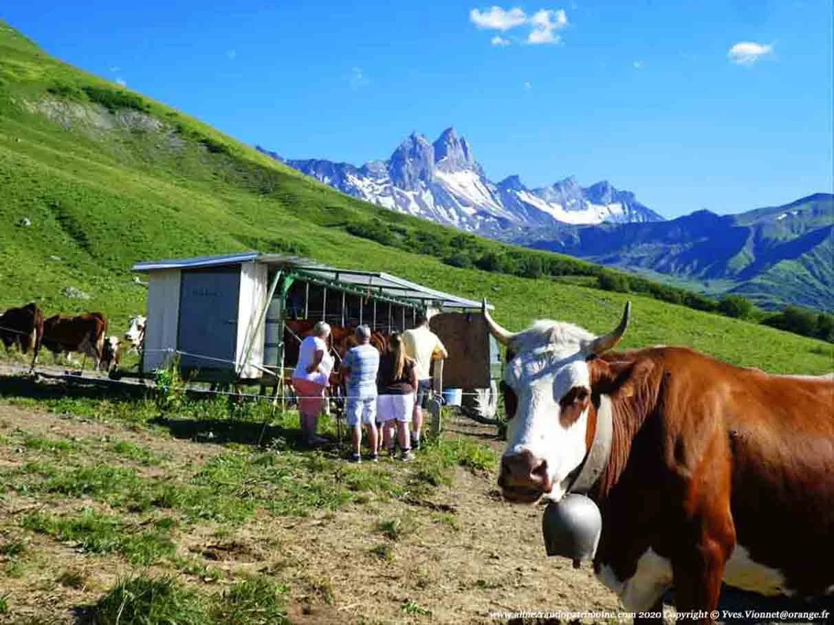
Mountain pastures have supported mobile herding communities for thousands of years. Seasonal movement between valleys, upland meadows, and sheltered winter settlements allowed pastoralists to take advantage of changing vegetation and water availability. Dairy production could be an important part of these systems because milk provided a renewable source of nutrition without requiring animals to be slaughtered. Reconstructing early milking practices in mountainous environments is challenging, however, because many tools used for milking, straining, fermenting, and storing dairy products were made from perishable materials. Archaeologists must therefore combine the study of surviving equipment with chemical residues, animal remains, settlement patterns, and environmental evidence.

The first challenge is identifying the material culture associated with dairy production. Ceramic vessels may have been used to collect, heat, ferment, or store milk, while strainers and perforated containers could have helped separate curds from whey. Wooden pails, leather bags, woven baskets, and other organic containers may also have been used, although they are less likely to survive in ordinary archaeological conditions. Not every vessel found in a pastoral settlement was intended for dairy processing. Similar containers could have held water, grain, meat, oils, or other substances. Their interpretation depends on the combination of vessel shape, surface treatment, residues, wear patterns, and archaeological context.

Chemical residue analysis has become an important tool for investigating ancient dairy practices. Milk fats can leave characteristic lipid residues in pottery, and the molecular composition of these residues may help distinguish broad categories of animal products. In favorable circumstances, researchers can use combinations of fatty-acid patterns and other molecular markers to investigate whether vessels were used to process milk from ruminants or other animals. These methods have helped expand knowledge of early dairying beyond regions where written records describe pastoral life. However, residue analysis does not always identify a particular animal species or distinguish every stage of dairy processing, and results must be evaluated alongside other evidence.

Animal remains provide another source of information. The age and sex profiles of recovered livestock can sometimes reveal whether herds were managed primarily for meat, milk, wool, traction, or a combination of products. Dairy-oriented herding may involve keeping adult females for longer periods while managing young animals according to the needs of milk production and herd replacement. Yet animal mortality patterns can be influenced by climate, disease, seasonal slaughter, and cultural preferences. Archaeologists therefore avoid interpreting a single age profile as definitive proof of dairying. Evidence from several sites and periods is generally more informative.

Mountain environments create particular demands for mobile dairy production. Herds may need to travel considerable distances between seasonal grazing areas, and milk is a perishable product that can be difficult to transport without processing. Communities could have consumed fresh milk close to the herd, converted it into fermented products, or transformed it into curds, cheese, butter, or other forms of preserved food. These practices would have depended on local animal species, climate, available containers, and established food traditions. Fermentation and other forms of processing could extend the useful life of dairy products, although the exact techniques used in early mountain communities may remain archaeologically difficult to identify.

Portable equipment would have been particularly valuable in seasonal pastoral systems. Lightweight containers and tools could be carried between camps, while more durable or bulky installations might remain at repeatedly used locations. Archaeologists can investigate this distinction by comparing the kinds of artifacts found at temporary camps with those recovered from permanent settlements. A mountain campsite with few heavy vessels may still have supported dairy production if much of the equipment was made from wood, hide, or woven materials. The absence of ceramic equipment should therefore not automatically be interpreted as evidence that milk was not processed there.

The seasonal organization of mountain herding can be reconstructed through environmental and settlement evidence. Pollen records may reveal changes in vegetation associated with grazing, while animal remains and plant macrofossils can help establish the resources available to a community. The locations of corrals, shelters, storage facilities, and water sources may indicate where herders stayed during different periods of the year. In some regions, archaeological sites at different elevations may represent stages of a seasonal movement cycle. However, researchers must distinguish pastoral activity from other land uses, including hunting, forestry, agriculture, and temporary travel.

Dairy production also involved social organization and the transmission of practical knowledge. Milking required familiarity with animal behavior, herd management, hygiene, and the timing of seasonal reproduction. Processing milk into storable foods involved additional skills that could be passed between generations through observation and repeated practice. The archaeological record rarely identifies who performed particular tasks, and it would be inappropriate to assume that the division of dairy labor was identical across all societies. Household organization, gender roles, age, status, and local custom could all have influenced who managed animals and processed their products.

The spread of dairying into new environments raises questions about adaptation and cultural exchange. Evidence of milk processing in a mountain region may reflect the movement of herding populations, the adoption of livestock management by established communities, or contact between groups with different food traditions. Genetic evidence from ancient livestock and humans, when available, can contribute to these discussions, but it does not independently establish how a particular community organized dairy production. Archaeological residues, animal husbandry patterns, and settlement evidence remain essential for understanding the actual practices of daily life.

Early milking paraphernalia in mountain pastures reveals how communities adapted food production to demanding and mobile environments. By combining vessel analysis, lipid chemistry, animal bone studies, and landscape reconstruction, archaeologists can investigate the relationship between livestock, seasonal movement, and dairy processing. The evidence can show how milk became part of a flexible subsistence system in which food had to be produced, consumed, or preserved across changing elevations and seasons. Even where the equipment itself has disappeared, residues and settlement patterns can preserve important clues about the organization of pastoral life.
Underwater Wood Preservation in Brackish Estuaries: Case Studies

October 28, 2026

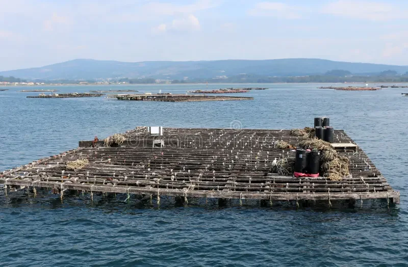
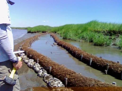
Brackish estuaries are environments where freshwater from rivers mixes with seawater, creating conditions that can vary considerably according to tides, rainfall, river discharge, and seasonal changes. These transitional landscapes have long attracted human settlement because they provide access to fish, transport routes, fertile wetlands, and sheltered anchorages. Archaeological remains in estuaries may include wooden boats, landing structures, fish traps, piles, tools, and other objects associated with everyday life. When wood survives underwater, it can provide valuable information about construction techniques, resource management, and the relationship between past communities and their aquatic environments.

Wood is an organic material that normally decomposes through the activity of fungi, bacteria, insects, and other organisms. Underwater conditions can slow some forms of decay, particularly when oxygen is limited and the surrounding sediment protects wood from physical disturbance. However, submersion does not guarantee preservation. The rate of deterioration depends on water temperature, oxygen availability, salinity, sediment composition, microbial activity, and the type of wood. Brackish environments are especially complex because these conditions may change over relatively short distances and fluctuate throughout the year.

The archaeological importance of preserved wood lies partly in the information it retains about how objects were made. Wooden structures can preserve tool marks, joints, fastening holes, shaping techniques, and evidence of repairs. Dendrochronology, which examines annual growth rings in suitable timber, may help determine when a tree was felled and sometimes identify the region in which it grew. When a timber retains enough growth rings and can be compared with an appropriate reference chronology, researchers may establish a precise felling date. Such evidence can help reconstruct the construction and maintenance of docks, bridges, boats, and other wooden installations.

The preservation of wooden structures in estuaries is closely connected to sedimentation. Fine mud and silt can gradually cover timbers, reducing exposure to oxygen and limiting physical damage. If sediment accumulates rapidly enough, it may protect a structure from later erosion. Conversely, changes in tidal currents or river channels can expose buried wood, allowing deterioration to accelerate. Archaeologists therefore examine the relationship between wooden remains and the surrounding sediment layers. Sediment cores, grain-size analysis, and environmental reconstruction can help establish whether a structure was originally built on a stable shoreline, in a shallow channel, or within a changing wetland.

Brackish water also creates chemical and biological challenges. Salinity influences the organisms that can colonize submerged wood, while variations in oxygen levels affect the processes responsible for decay. Some bacteria can degrade the structural components of wood even when conditions are unfavorable for many fungi. Marine wood-boring organisms may be active where salinity permits, although their distribution varies according to species and environmental conditions. As a result, two wooden objects recovered from the same estuary may show very different levels of preservation. Researchers must evaluate each specimen rather than assuming that all underwater wood has undergone the same process.

The archaeological study of estuarine wood can be organized around several types of evidence. A preserved boat fragment may reveal construction methods and patterns of repair, while wooden posts arranged along a shoreline could indicate a landing stage, fish trap, barrier, or building foundation. In some cases, the function of a structure remains uncertain because similar arrangements can serve different purposes. The spacing of posts, their orientation, associated artifacts, and the local hydrology all help narrow the possibilities. Comparisons with other securely identified structures are useful, but they must account for differences in environment and cultural practice.

Excavating underwater wood requires specialized methods because recovery can alter the conditions that enabled its survival. Waterlogged timber may contain substantial moisture and have weakened internal structures. If it dries too quickly after excavation, the wood can shrink, crack, warp, or collapse. Archaeological teams therefore document the structure in place, record its dimensions and orientation, and develop conservation plans before removal whenever possible. Some objects can be studied underwater without excavation, while others require controlled recovery to protect them from damage caused by currents, construction, or environmental change.

Conservation continues after the wood has been recovered. Waterlogged timber often requires gradual treatment to replace or stabilize the water within its structure before it can be safely dried. The appropriate method depends on the object's size, condition, composition, and intended display or storage environment. Long-term preservation also requires stable humidity, temperature, and handling conditions. Conservation records are essential because treatment can affect the physical and chemical properties of the specimen, influencing future analysis. Samples intended for dating or chemical investigation should be selected and documented carefully so that conservation procedures do not compromise the research.

Estuarine archaeological sites can also preserve evidence of environmental change. Wood from boats and structures may be associated with pollen, seeds, shells, microfossils, and sedimentary deposits that help reconstruct past vegetation and water conditions. These records can reveal whether a shoreline was once more exposed, sheltered, freshwater-dominated, or influenced by tidal movement. Such information is valuable for understanding how communities adapted to changing coastlines, floods, and shifts in aquatic resources. Nevertheless, environmental interpretations require multiple lines of evidence because no single sediment or biological indicator provides a complete reconstruction.

The study of underwater wood in brackish estuaries demonstrates the close relationship between archaeological preservation and environmental conditions. Waterlogged timbers can preserve evidence of craft skills, transport, fishing, construction, and changing settlement patterns that would otherwise disappear. By combining underwater survey, wood identification, dendrochronology, sediment analysis, and conservation science, researchers can reconstruct both the human activities that produced these remains and the environmental processes that preserved them. These investigations are particularly important because estuarine landscapes continue to change, placing many submerged archaeological sites at risk from erosion, dredging, development, and rising sea levels.

The Archaeology of Small-Scale Clay Thermal Baths in Roman Provinces

October 27, 2026

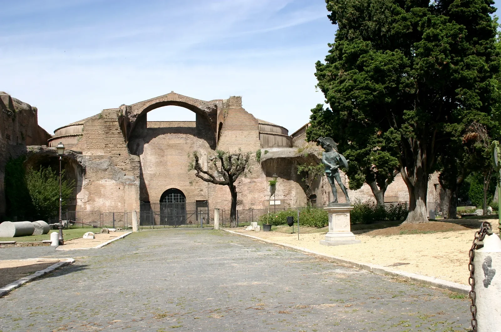
Bathing was an important part of Roman life, serving purposes that extended beyond personal cleanliness. Public bathhouses could function as places for exercise, relaxation, conversation, and social interaction, while bathing facilities in private homes and smaller settlements reflected local approaches to comfort and hygiene. Although large Roman bath complexes are among the most recognizable examples of Roman engineering, smaller bathing installations also deserve archaeological attention. Compact facilities that incorporated clay, ceramic building materials, or clay-lined heating and water systems may help researchers understand how bathing practices were adapted to different communities, economic circumstances, and provincial environments.

Roman bathing technology depended on the controlled movement of heat and water. In many established bath complexes, furnaces heated air that circulated beneath raised floors and through wall cavities, allowing rooms to reach different temperatures. These systems, often associated with hypocaust heating, required careful construction and regular maintenance. Smaller facilities could have used simpler arrangements, depending on the building's purpose, available resources, and the desired temperature. Archaeologists must therefore examine each installation individually rather than assuming that every heated room followed the same design as a major urban bathhouse.

Clay and fired-clay materials were useful in Roman construction because they could be shaped, fired, and incorporated into a variety of architectural systems. Ceramic tiles might form parts of floors, roof coverings, drainage channels, or heating structures. Clay-based materials could also be used in waterproofing layers or in the preparation of surfaces exposed to heat and moisture. The term clay thermal bath, however, should not imply that all such baths were constructed entirely from clay. In many cases, clay or ceramic components would have been only one part of a structure that also used stone, brick, mortar, timber, and other materials.

Identifying a small bathing installation begins with the archaeological context. Researchers look for evidence of controlled heating, water supply, drainage, waterproofed surfaces, and spaces arranged to accommodate bathing activities. A furnace, heated floor, or ceramic-lined channel may indicate a thermal installation, but these features can also occur in kitchens, workshops, and other buildings. The interpretation becomes stronger when several features appear together in a layout consistent with bathing. Archaeologists also consider whether the structure was connected to a residence, an agricultural property, a military installation, a roadside settlement, or a larger public complex.

The size and arrangement of a bathing facility can reveal how its users organized the experience of heat and water. Some installations may have provided a heated room and a simple washing area, while others could have included several spaces with different thermal conditions. A compact bath might have served a household or a small group of residents rather than the general public. Yet size alone cannot establish ownership or social status. A small installation might have been part of a wealthy residence, a rural estate, a military building, or a facility serving a limited population. Architectural relationships and associated finds are necessary to determine its likely function.

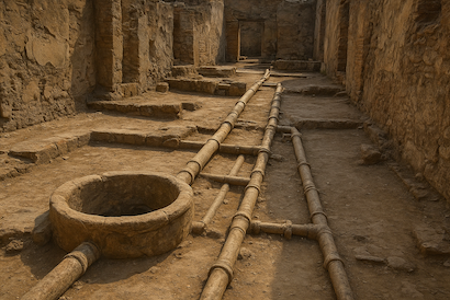
Water management was another essential part of bathing. Facilities required a source of water and a way to dispose of used water without damaging the building. Archaeologists may investigate pipes, wells, cisterns, drains, channels, and waterproofed floors to reconstruct these arrangements. Ceramic pipes and channels could be particularly important in areas where stone infrastructure was expensive or difficult to obtain. The position of a bath relative to a water source can also help researchers understand the labor and resources needed to operate it. However, the presence of a nearby well or drain does not automatically prove that it supplied or served the bathing installation.

The provincial setting is crucial for understanding differences in Roman bathing practices. The Roman Empire included environments with varied climates, local building traditions, geological resources, and access to fuel. In colder regions, heated bathing spaces may have been especially useful during certain seasons, while in warmer regions builders could adapt designs to reduce excessive heat or make better use of available water. Local craftspeople may have incorporated established regional construction techniques into Roman-style buildings. Consequently, variations in bath architecture need not represent a decline in technical ability; they may reflect practical responses to local conditions and different community needs.

Small bathing facilities also provide evidence of cultural exchange. Roman-style bathing practices spread across the empire, but their adoption was not identical everywhere. Some communities may have incorporated bathing into existing traditions, while others adapted Roman architectural forms to local expectations. Building layouts, bathing equipment, personal objects, and patterns of repair can help researchers investigate these changes. It is important, however, not to assume that the presence of a Roman-style bath means that every aspect of Roman social life was adopted along with it. Architectural features can be borrowed, modified, or used in ways that differ from their original settings.

The operation of a heated bath required fuel, labor, and maintenance. Furnaces needed to be supplied with wood or another suitable fuel, while heating systems and water channels required periodic cleaning and repair. Archaeobotanical evidence, charcoal analysis, ash deposits, and wear on structural components may help researchers investigate these demands. The scale of fuel consumption would have depended on the size of the facility, how often it was used, the desired temperatures, and the efficiency of the heating system. Even a relatively small bath could therefore represent a meaningful investment in household or community resources.

Dating these installations can be difficult because buildings often underwent several phases of construction and alteration. A bath may have been added to an existing structure, rebuilt after damage, or converted to another use when bathing practices changed. Pottery, coins, inscriptions, and other datable materials can help establish the chronology of associated deposits, but objects found near a building do not necessarily date its original construction. Archaeologists need to distinguish between the initial installation, later renovations, and the final period of use. Scientific analysis of suitable building materials may provide additional information where the method is appropriate.

The study of small-scale clay and ceramic thermal installations expands our understanding of how Roman bathing technology operated beyond monumental urban complexes. These facilities can reveal how households and communities adapted heating, water supply, and building techniques to their circumstances. By examining their construction materials, spatial organization, fuel requirements, and archaeological context, researchers can investigate the practical and cultural significance of bathing in the provinces. Their remains demonstrate that Roman bathing was not limited to grand public architecture but could take many forms, shaped by local resources, community needs, and changing patterns of daily life.

Petroglyph Lichenometry: Dating Shallow Engravings in Temperate Climates

October 27, 2026

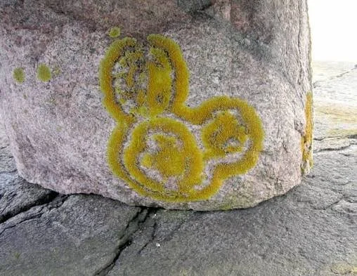
Petroglyphs are images or symbols carved, pecked, or engraved into rock surfaces. They may depict animals, people, geometric patterns, or abstract designs, and they provide important evidence of how past communities represented their environments and expressed cultural ideas. Dating petroglyphs is often difficult because the images themselves may contain no organic material suitable for conventional scientific dating. In temperate climates, lichenometry has been investigated as one possible method for estimating the relative or approximate age of exposed rock surfaces and their markings. The method can be useful in certain circumstances, but it requires careful evaluation because lichen growth is influenced by many environmental and biological factors.

Lichenometry uses the growth characteristics of lichens to help estimate how long a rock surface has been exposed. Lichens are organisms formed through a partnership between a fungus and a photosynthetic partner, usually an alga or cyanobacterium. They grow on many exposed surfaces, including stone, and their size or distribution can sometimes be related to the time available for growth. In suitable environments, researchers can compare lichen measurements on surfaces of known age with those on undated surfaces. This relationship may provide a basis for estimating the age of certain rock exposures or deposits.

Applying lichenometry to petroglyphs is more complicated than dating a newly exposed rock surface. An engraving changes the physical characteristics of the rock by creating grooves, edges, and small depressions. These altered surfaces may retain moisture differently, collect dust, or provide protected areas where lichens can establish themselves. The growth pattern on an engraving may therefore differ from that on the surrounding rock, even when both surfaces have been exposed for the same amount of time. Shallow engravings present a particular challenge because their edges may be difficult to distinguish from natural surface irregularities or weathering.

One possible approach is to compare lichen growth on an engraved feature with growth on nearby surfaces whose exposure history is better understood. Researchers may measure the largest suitable lichens, document their distribution, and assess whether the rock surface has remained stable. However, the largest lichen on a surface does not necessarily represent the oldest organism present. Lichens can die, fragment, grow at different rates, or be replaced by other species. Disturbances caused by animals, people, fire, frost, or cleaning can also reset or alter growth patterns. Reliable interpretation therefore requires more than a simple relationship between lichen size and age.

Temperate climates contain a wide range of environmental conditions that affect lichen development. Temperature, humidity, precipitation, sunlight, wind exposure, and air quality can all influence growth. A rock face exposed to direct sunlight may support different lichen communities from a shaded surface nearby. Coastal locations may experience salt spray, while mountainous areas can undergo repeated freezing and thawing. Even surfaces only a short distance apart may therefore provide unsuitable comparisons if their microclimates differ. Researchers need to establish whether a calibration developed for one location can reasonably be applied to another.

The relationship between lichen growth and the creation of an engraving also needs to be considered. If a petroglyph was carved into an old, already lichen-covered rock, some existing organisms may have been removed during engraving. New growth might then provide information about the period after the surface was disturbed, but only if the relevant lichen communities can be distinguished from surviving older growth. If the engraving was made on a relatively bare surface, the relationship may be different. Without understanding the surface history, lichen measurements could produce an age estimate that reflects environmental exposure rather than the actual creation of the image.

Researchers can improve confidence by combining lichenometry with independent dating evidence. Archaeological deposits beneath or around a carved surface may provide information about when the feature became accessible or how it was used, although the age of associated material does not automatically date the engraving. Historical records, inscriptions, securely dated nearby structures, and changes in the surrounding landscape may also offer useful constraints. In some settings, other rock-surface dating methods may help establish whether an estimate is plausible. Each method has its own assumptions, and agreement between independent approaches is generally more informative than relying on a single measurement.

Documentation is essential because petroglyph surfaces can be fragile. Researchers should record the location, orientation, dimensions, and condition of the engraving, as well as the species and distribution of lichens where identification is possible. High-resolution photography, photogrammetry, and three-dimensional surface recording can help preserve the shape of shallow marks for future study. Sampling or removing lichens may damage the archaeological surface and should not be undertaken casually. Research must follow local heritage protections and involve the relevant communities, especially where the engravings remain culturally significant.

Lichenometry can contribute to the study of petroglyphs, but it should be treated as a specialized method rather than a universal dating solution. Its reliability depends on the stability of the rock surface, the ecology of the lichens, the availability of appropriate calibration data, and the relationship between biological growth and the engraving process. In temperate climates, where environmental conditions can vary substantially over short distances, these factors are particularly important. Used alongside archaeological context and independent dating techniques, lichenometry may help constrain the history of rock engravings while making clear where uncertainty remains.

The Distribution of Miniature Figurines: Domestic Shrines and Playspaces

October 27, 2026

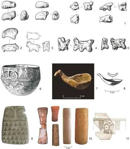
Miniature figurines are small representations of humans, animals, supernatural beings, or everyday objects that appear in archaeological contexts around the world. Their size, material, and repeated discovery in domestic spaces make them particularly interesting to archaeologists studying household life. Some figurines may have been used in religious practices or personal acts of devotion, while others may have served as toys, teaching objects, decorative items, or components of games. Their distribution within settlements can help researchers investigate how objects participated in domestic rituals, childhood activities, and the organization of household space.

The interpretation of miniature figurines begins with their physical characteristics. Researchers examine their dimensions, manufacturing techniques, materials, surface decoration, and degree of wear. A carefully shaped figure made from clay may have been produced for a different purpose from a roughly modeled object made by a child or household member. Repeated forms can suggest shared conventions or established production practices, although similarity alone does not prove that figurines were mass-produced or used in the same way. Evidence of breakage, repair, polishing, or repeated handling can provide additional clues about how an object was treated during its lifetime.

The archaeological context is equally important. Figurines found near hearths, storage areas, entrances, or designated household installations may have occupied different roles within domestic life. An object placed repeatedly in a particular location could have been part of a household practice, especially if other features suggest deliberate arrangement. Figurines found in groups may indicate storage, disposal, ritual deposition, or the use of several figures together in an activity. However, their position at the time of excavation may not reflect their original placement. Objects can be moved by later construction, cleaning, animal activity, flooding, or the gradual accumulation of household refuse.

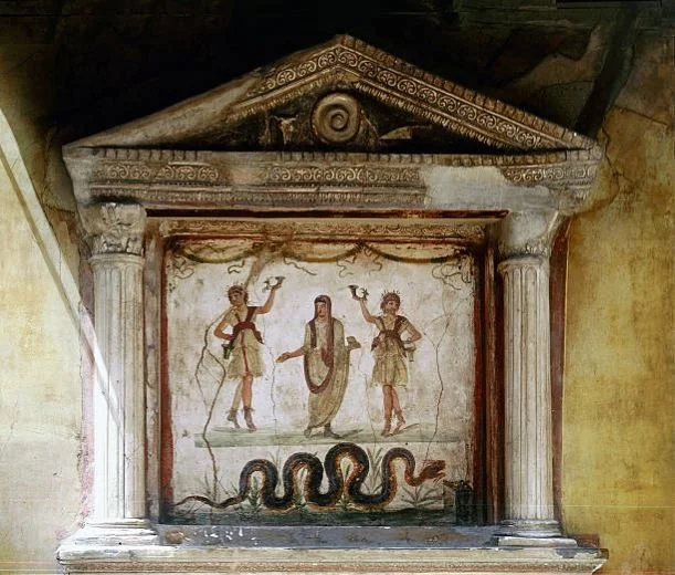
The concept of a domestic shrine offers one possible explanation for certain figurine distributions. In some archaeological settings, small objects appear alongside miniature altars, offering vessels, lamps, incense-related materials, or other features that may indicate household devotion. A figurine repeatedly positioned within such an arrangement could have represented a deity, ancestor, protective figure, or other culturally significant presence. Yet a figurine alone does not establish that a shrine existed. Archaeologists need to evaluate the entire assemblage, including the architectural setting, patterns of deposition, and evidence for repeated activities.

Playspaces offer another possible interpretation. Miniature animals, people, vessels, furniture, and other objects could have supported imaginative play, social learning, or the imitation of adult activities. A small representation of a cooking pot, for example, might have been used in play, but similar objects could also have served symbolic or ritual functions. Evidence of repeated handling, simplified construction, and association with other miniature objects may strengthen an interpretation involving play. Nevertheless, these characteristics are not exclusive to toys, and the distinction between play, learning, and ritual may not have been clear-cut in every society.

Distribution analysis can help reveal patterns that individual objects cannot. By mapping figurine discoveries within houses, courtyards, neighborhoods, and broader settlement areas, researchers can examine whether certain types cluster in particular spaces. A concentration near domestic installations may suggest repeated household use, while a more dispersed distribution could reflect ordinary loss, disposal, or circulation between rooms. Spatial patterns must be interpreted cautiously because excavation coverage, preservation conditions, and collection methods can influence the apparent distribution. A site where only selected rooms were excavated cannot provide a complete picture of how figurines were used throughout the settlement.

Differences in figurine materials may also reveal information about household resources and production. Clay figures might have been made locally from readily available materials, while stone, imported ceramics, or other less accessible substances could indicate broader exchange networks. Petrographic and chemical analyses can sometimes help identify the origin of raw materials or finished objects. Manufacturing marks may reveal whether figurines were produced by specialists or made within households. However, inexpensive materials do not necessarily imply low cultural value, just as costly materials do not automatically indicate religious importance or elite ownership.

Age and social identity are difficult to reconstruct from miniature objects. It can be tempting to assign all small figurines to children or to interpret all human figures as representations of particular social groups. Such conclusions require stronger evidence than size or appearance alone. Archaeologists may investigate the relationship between figurines and age-related burial evidence, domestic activity areas, or other objects associated with learning and play. Even then, the identities of users and the meanings attached to the figures may remain uncertain. The same object could have passed between generations or changed its purpose during its use-life.

The distribution of miniature figurines provides a useful way to investigate the intersection of domestic space, symbolic behavior, and everyday activity. Some objects may have participated in household devotion, while others supported play, teaching, decoration, or several activities at different times. Their interpretation depends on the relationship between material characteristics, spatial context, associated finds, and broader cultural evidence. Rather than forcing every figurine into a single category, archaeologists can use careful comparative analysis to reconstruct the diverse ways small objects contributed to the social and imaginative lives of past households.

Coastal Beacon Stones: Marking Safe Channels Before Lighthouses

October 27, 2026

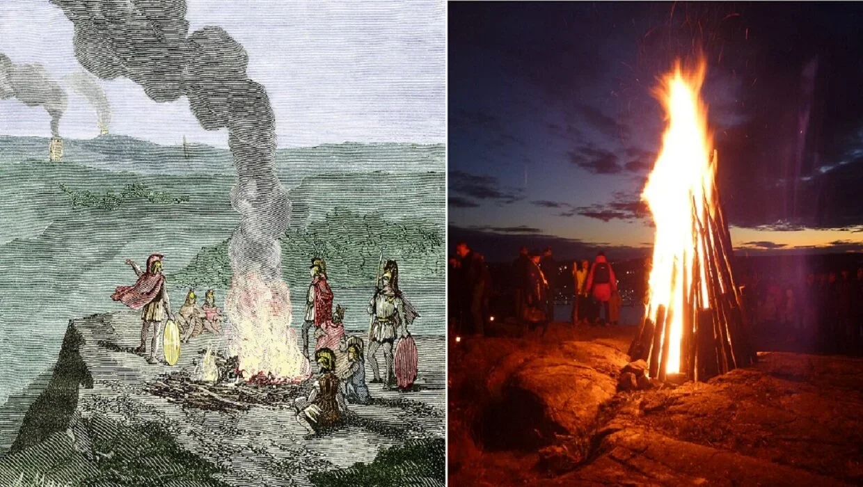
Before the development of modern lighthouses and standardized maritime navigation systems, coastal communities relied on a combination of natural landmarks, local knowledge, and constructed markers to guide vessels through dangerous waters. Rocky shorelines, shallow reefs, sandbars, and narrow channels created serious risks for sailors, particularly in areas where tides and currents changed rapidly. Stones placed along the coast or near navigable passages may have helped identify routes, mark hazards, or indicate important landing locations. The archaeological study of these features offers an opportunity to investigate how communities managed maritime travel before modern navigation infrastructure became widespread.

The term beacon stone requires careful interpretation because not every prominent coastal stone was deliberately placed for navigation. Natural rock formations may have served as recognizable landmarks without any human modification. In other cases, people may have arranged stones, constructed low cairns, or positioned distinctive markers to make a shoreline feature easier to identify from the water. Archaeologists must distinguish naturally occurring formations from intentional constructions by examining their arrangement, geological context, evidence of human modification, and relationship to historical or archaeological navigation routes. A stone feature's apparent usefulness to sailors does not, by itself, prove that it was built for that purpose.

Coastal environments offer several advantages for the preservation of navigation-related features, but they also create substantial archaeological challenges. Wave action can displace stones, storms can destroy markers, and rising sea levels can submerge former shorelines. Sediment accumulation may conceal old landing places, while erosion can expose structures that were previously buried. Researchers therefore need to reconstruct the historical shoreline before deciding whether a stone feature would have been visible or useful to a vessel at the time it was constructed. A marker that now stands far inland may once have been located directly beside a navigable channel.

The placement of possible beacon stones can reveal how people understood local maritime geography. Markers positioned near narrow passages, dangerous reefs, river mouths, or sheltered anchorages may have helped travelers recognize particular sections of the coast. Their arrangement could also have related to known approaches into harbors or landing areas. However, archaeologists should not assume that all markers formed a coordinated signaling system. Some may have functioned as simple visual references, while others may have marked boundaries, burial places, ritual locations, or territorial claims. Determining their original role requires comparing their physical characteristics with the wider archaeological landscape.

Visibility is a central consideration in reconstructing how coastal markers were used. The height of a stone, its color, the contrast with surrounding terrain, and its position relative to the horizon would have affected how easily sailors could recognize it. Researchers can use terrain models and viewshed analysis to estimate whether a feature would have been visible from particular locations offshore. Such analysis should account for changing sea levels, vegetation, atmospheric conditions, and the height of the observer above the water. A marker that appears clearly visible on a modern map may have been difficult to distinguish from a vessel during poor weather or at a distance.

The practical knowledge behind coastal navigation was often transmitted through experience and community teaching. Local fishers and sailors learned about currents, tides, submerged hazards, safe anchorage, and the appearance of coastlines under different conditions. A constructed stone marker may have supported this knowledge, but it would not necessarily have replaced it. Navigators could have combined visible landmarks with knowledge of wind direction, water depth, the behavior of seabirds, and observations of waves breaking over submerged rocks. Archaeological evidence of markers therefore needs to be understood within a broader system of environmental knowledge rather than as an isolated technological invention.

Coastal markers may also have carried social and political significance. A stone feature could indicate access to a harbor, identify the territory of a community, or distinguish a commonly used landing place from a restricted location. In some contexts, the same feature might have served practical and ceremonial purposes. A marker could help travelers recognize a safe route while also holding cultural significance for the people who maintained it. These interpretations must remain grounded in local evidence because the meaning of stone structures varied between societies and historical periods.

Establishing the age of a coastal marker can be difficult when the structure consists of unworked stones. Archaeologists may investigate associated deposits, nearby settlements, construction materials, or datable objects found within a secure archaeological context. Radiocarbon dating may be useful when organic materials associated with construction survive, although the age of nearby charcoal or shell does not automatically establish the construction date. Historical maps and maritime records may also provide comparative evidence, but they must be checked against archaeological observations rather than treated as definitive proof.

The study of coastal beacon stones helps reconstruct the relationship between maritime technology, environmental knowledge, and community organization. Even modest stone markers may preserve evidence of how people identified safe passages and managed the risks of coastal travel. By combining archaeological survey, geological analysis, landscape reconstruction, and historical research, scholars can distinguish deliberate navigation features from natural landmarks and other structures. This approach reveals how coastal communities developed practical systems for moving through difficult waters long before modern lighthouses became a familiar part of maritime landscapes.

The Archaeology of Minor River Bridges and Their Community Roles

October 27, 2026

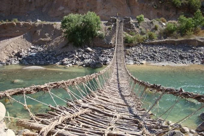
Minor river bridges are important features of past landscapes because they connected settlements, fields, markets, religious sites, and neighboring communities across streams and small rivers. Unlike major bridges associated with prominent cities or imperial roads, these smaller crossings may have been constructed from timber, stone slabs, packed earth, or combinations of locally available materials. Many were repeatedly repaired or replaced as floods, erosion, and ordinary use damaged their structures. Their archaeological remains can be subtle, but they offer valuable evidence about local movement, engineering knowledge, cooperation, and the everyday organization of communities.

The first challenge in identifying an ancient minor river bridge is distinguishing a constructed crossing from natural features. Stone concentrations near a riverbank may represent a bridge foundation, but they could also result from erosion, river deposits, retaining walls, or later agricultural activity. Archaeologists therefore examine the arrangement of stones, the relationship between opposing banks, changes in the river channel, and the presence of constructed approaches. Regularly spaced supports, aligned stonework, or evidence of timber sockets may strengthen the interpretation that a crossing once existed. Surveying the surrounding landscape can reveal whether the feature connects with an ancient road, settlement, field system, or other route.

The materials used to build minor bridges depended on local resources and environmental conditions. Timber bridges could be relatively quick to construct, particularly where suitable trees were available, but their remains are often poorly preserved in ordinary soil conditions. Waterlogged environments may preserve wooden posts, planks, and other structural components that would otherwise decay. Stone bridges or stone-supported crossings may survive more visibly, especially when foundations were designed to withstand flowing water. In some settings, builders may have used a combination of stone abutments and wooden superstructures, leaving only the foundations for archaeologists to investigate.

The construction of a bridge required knowledge of water movement, soil stability, and the behavior of building materials. Even a small crossing needed to withstand the pressure of flowing water, the weight of people and animals, and seasonal changes in river level. Builders may have raised approaches above flood-prone ground, strengthened banks with stones or timber, or placed supports where the current was less destructive. Evidence of repeated repairs can show how communities responded to changing environmental conditions. However, identifying the precise construction method often requires excavation and careful analysis because later repairs can obscure the original design.

Minor bridges also reveal how communities organized their daily activities. A crossing might shorten the journey between a village and its agricultural land, provide access to a water source, or connect households with a market or workshop. Its importance could be especially significant during harvest periods, when crops and equipment needed to move between fields and settlements. Livestock movement, the transport of building materials, and visits to neighboring communities may also have depended on reliable crossings. By mapping bridges alongside roads, field boundaries, and settlement locations, archaeologists can explore how infrastructure influenced the practical geography of everyday life.

The community role of a bridge extended beyond transportation. A shared crossing could become a place where residents encountered one another, exchanged information, or coordinated activities. In some communities, construction and maintenance may have required collective labor, contributions from landholders, or support from local authorities. Archaeological evidence alone rarely identifies the exact social arrangements behind a bridge, but the scale of the structure, its location, and patterns of repair can help researchers develop plausible interpretations. Historical documents, inscriptions, local traditions, and settlement records, where available, may provide further information about responsibility for maintenance and access.

The position of a bridge can also reveal differences in access and control. Some crossings served routes used by many residents, while others may have provided access primarily to a particular estate, religious institution, or agricultural area. A crossing located along a major route could have supported trade and communication, whereas a small bridge in a remote valley might have been essential mainly to nearby households. Archaeologists should avoid assuming that every bridge was designed for public use. Its function needs to be evaluated through the surrounding landscape and evidence of who may have benefited from the route.

Environmental change complicates the archaeological study of minor river bridges. Rivers migrate, channels become silted, banks collapse, and floods may bury or displace structural remains. A bridge that now appears isolated from any settlement may once have stood beside a major route before the river changed course. Sediment analysis, geomorphological mapping, aerial photography, and geophysical survey can help reconstruct earlier river conditions. Dating bridge materials, when suitable samples survive, may establish when a crossing was built or repaired, although the age of reused timber or stone does not always correspond to the construction date.

The study of minor river bridges demonstrates that significant infrastructure does not need to be monumental to shape a community. Small crossings could support agriculture, exchange, communication, and cooperation while linking people to the resources and institutions on which they depended. By combining structural analysis with landscape reconstruction and evidence from nearby settlements, archaeologists can investigate how these bridges functioned within broader networks of movement. Their remains provide a valuable perspective on the practical engineering and shared responsibilities that helped communities remain connected across rivers and streams.

Reconstructing Night-Time Cooking Practices from Soot and Lipids

October 27, 2026

Cooking is often discussed in archaeology through pottery, hearths, animal bones, plant remains, and other evidence of food preparation. Yet an important aspect of daily life is more difficult to reconstruct: the timing of domestic activities. Night-time cooking may have influenced household routines, fuel consumption, food storage, social interaction, and the organization of indoor spaces. Because direct evidence of the hour at which an ancient meal was prepared is rarely preserved, archaeologists must investigate indirect traces. Soot deposits and absorbed lipid residues offer valuable information about the use of cooking equipment, although neither evidence type can independently establish that cooking occurred after dark.

Soot forms when carbon-rich fuel burns incompletely. It may accumulate on the exterior of cooking vessels, the undersides of pots, the walls of enclosed hearths, and surfaces exposed to smoke. The thickness, distribution, and composition of soot can provide clues about how an object was positioned in relation to a fire. For example, localized deposits may reflect repeated exposure to flames, while widespread darkening can indicate prolonged contact with smoke. Changes in soot layers may also reveal that a vessel was used in different ways over time. However, soot accumulation is affected by fuel type, ventilation, fire temperature, cooking duration, vessel shape, and cleaning practices. A heavily blackened pot cannot be interpreted simply as evidence of frequent night-time meals.

Lipid residues provide a different line of evidence. During cooking, fats and oils from plants, animals, fish, and other ingredients can be absorbed into the porous surfaces of pottery. Even after visible food remains have disappeared, some chemical compounds may survive within the vessel walls. Archaeologists can extract these residues and analyze their molecular composition to investigate the substances that came into contact with the pottery. Certain lipid patterns can be associated with particular broad food sources, although the results often require careful interpretation because different ingredients may produce overlapping chemical signatures.

The strongest investigations combine residue analysis with the study of soot and the broader archaeological context. If a cooking vessel contains lipid residues consistent with repeated food preparation and also exhibits several soot layers, researchers may infer that it was used regularly over an extended period. When this evidence appears alongside hearth installations, ash deposits, food remains, and domestic storage facilities, it becomes possible to reconstruct aspects of household cooking practices. Even then, the evidence usually demonstrates repeated cooking rather than identifying a specific time of day.

Establishing whether cooking occurred at night requires additional contextual clues. Archaeologists might investigate the arrangement of hearths in relation to sleeping areas, the placement of lighting equipment, the accessibility of fuel supplies, and the organization of food preparation spaces. Small lamps, burned plant material, or residues associated with illumination may indicate that artificial light was available. Nevertheless, the presence of lamps does not prove that they were used during cooking, and lighting equipment could have served many purposes. Similarly, an indoor hearth may have supported evening meals, daytime cooking during cold weather, heating, or other domestic activities.

Environmental conditions also influence the possibility of night-time cooking. In cold regions, households may have maintained fires for warmth throughout the night, allowing cooking to take place alongside heating activities. In hot climates, people might have preferred to prepare meals during cooler hours, although this possibility would need to be evaluated against local food practices and archaeological evidence. Seasonal changes in daylight, work schedules, fuel availability, and household size could also have influenced when meals were prepared. These factors make it difficult to establish a single pattern for all communities or historical periods.

Experimental archaeology can help researchers understand how soot and lipid residues develop under controlled conditions. By using replica vessels with different fuels, ingredients, fire structures, and cooking durations, researchers can observe the resulting deposits and compare them with archaeological specimens. Experiments can test whether particular soot patterns are associated with certain vessel positions or whether repeated cleaning removes or redistributes residue layers. They can also help assess the effects of heating on absorbed lipids. Such experiments do not reproduce every ancient circumstance, but they provide a framework for evaluating competing explanations rather than relying solely on visual impressions.

Microstratigraphic analysis may further clarify the sequence of vessel use. Closely examining layers of soot, ash, mineral deposits, and other residues can reveal whether a pot experienced repeated heating events or changes in its use history. Chemical analysis can sometimes distinguish broad categories of substances that were cooked or heated, while microscopic examination can identify surface alterations caused by fire and handling. Researchers must account for post-depositional processes, including soil chemistry, water movement, contamination, and modern handling, all of which can affect the reliability of the evidence.

Reconstructing night-time cooking practices is therefore less about identifying a single definitive sign and more about combining several independent forms of evidence. Soot reveals aspects of exposure to combustion, lipid residues provide clues about food preparation, and household features help establish the setting in which these activities occurred. Together, these findings can contribute to a richer understanding of domestic schedules, fuel management, and the relationship between cooking and social life. Although the exact timing of ancient meals may remain uncertain, careful analysis can show how food preparation was organized and how households adapted their routines to environmental and cultural conditions.

The Use of Volcanic Glass in Decorative Inlays Across the Pacific

October 27, 2026

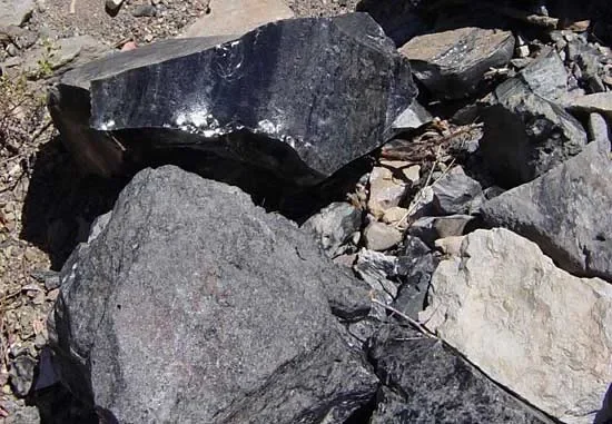
Volcanic glass, commonly known as obsidian, is a naturally occurring material formed when lava cools rapidly without developing a fully crystalline structure. Its smooth surface, sharp edges, and distinctive colors have made it valuable to many communities throughout human history. Although obsidian is often associated with the manufacture of cutting tools, its visual qualities also made it suitable for ornaments, decorative objects, and other forms of artistic expression. Across the Pacific, the study of volcanic glass offers an opportunity to investigate how communities obtained unusual materials, developed specialized craft traditions, and expressed social relationships through objects.

The Pacific region contains a wide variety of geological environments, including volcanic islands where obsidian can occur naturally. However, the distribution of suitable deposits is uneven. Some communities lived close to sources of volcanic glass, while others would have needed to obtain it through exchange, travel, or contact with neighboring groups. This uneven distribution is archaeologically important because the presence of obsidian at a site does not automatically indicate that the material was locally available. Geological sourcing can help researchers identify the origins of recovered specimens and reconstruct possible pathways through which materials moved across islands and coastal settlements.

Identifying decorative use requires careful examination of the archaeological objects themselves. Obsidian artifacts may display polished surfaces, carefully shaped edges, deliberate color arrangements, or placement within another material. Microscopic analysis can reveal whether an object's surface was modified through grinding, polishing, or repeated handling. Researchers must distinguish these characteristics from marks produced during tool manufacture, accidental breakage, or natural weathering. In some cases, a fragment that appears decorative may originally have belonged to a functional implement, making its original purpose difficult to establish without contextual evidence.

Decorative inlays are particularly challenging to identify because they may survive only as small fragments. A piece of volcanic glass could have been inserted into wood, bone, shell, stone, or another material that has since deteriorated. Archaeologists may encounter traces of adhesives, grooves, sockets, or surrounding materials that suggest the fragment once formed part of a composite object. The preservation conditions of tropical and coastal environments can complicate this investigation because organic materials often decay more rapidly than stone. Consequently, the absence of a complete decorated object does not necessarily mean that composite craftsmanship was absent from a community.

The movement of obsidian across the Pacific also raises questions about exchange and social relationships. Geochemical techniques, including elemental analysis, can compare archaeological specimens with known geological sources. When the source of an artifact lies far from the place where it was discovered, researchers can investigate the routes through which the material may have traveled. Nevertheless, long-distance movement does not automatically prove the existence of a formal trade network. Materials might have passed through several communities by gift exchange, marriage relationships, ceremonial obligations, individual journeys, or repeated small-scale transactions.

The meaning of volcanic glass depended on the cultural setting in which it was used. Its reflective surface, dark appearance, or unusual origin may have contributed to its appeal, but these qualities should not be treated as universal symbols. A material considered prestigious in one community might have served a practical purpose in another. Archaeologists therefore need to examine the context of discovery, the quality of workmanship, the frequency of similar objects, and any available evidence from burials, ceremonial spaces, or domestic settlements. Comparisons with living cultural traditions may provide useful perspectives, although these must be developed collaboratively and without assuming that present-day meanings remained unchanged throughout the past.

Craft specialization is another important issue. If decorative obsidian objects display consistent shapes, carefully controlled dimensions, and repeated production techniques, they may indicate shared manufacturing knowledge. Concentrations of unfinished pieces, fragments, polishing materials, and production waste could suggest that particular locations were used for crafting. However, a standardized appearance alone does not prove that a full-time specialist workshop existed. Skilled production may have occurred within households, during particular seasons, or as an activity undertaken by people who also performed other work.

Studying volcanic glass as a decorative material broadens the archaeological understanding of Pacific societies beyond subsistence, technology, and migration. It highlights the importance of visual design, craftsmanship, and the movement of valued materials between communities. By combining geological sourcing, microscopic examination, archaeological context, and culturally informed interpretation, researchers can investigate how volcanic glass was acquired, transformed, displayed, and valued. The evidence may ultimately reveal that even small fragments of a striking natural material can preserve important clues about creativity, social connection, and the cultural significance of objects in the Pacific past.

The Archaeology of Clay Impressions from Basketry and Cordage

October 27, 2026

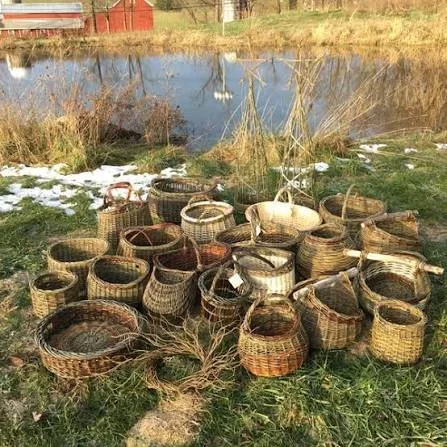
Basketry and cordage were essential technologies in many ancient societies. Woven containers could be used for gathering food, carrying materials, storing goods, and transporting objects, while cords and ropes supported fishing, construction, fastening, and a wide range of domestic activities. Because baskets, fibers, and ropes are usually made from perishable materials, they often disappear from archaeological deposits. However, their shapes and textures can sometimes survive as impressions in clay, mud, plaster, and other materials that hardened around them. These impressions provide valuable evidence of technologies that would otherwise remain largely invisible.

A clay impression forms when a soft surface comes into contact with a textured object and preserves part of that object's pattern. If wet clay is pressed against a woven basket, the weave may leave a recognizable mark. Similar impressions can form when cordage is pressed into clay during pottery manufacture, construction, or the preparation of other objects. Once the clay dries or is fired, the surface pattern may survive long after the original plant fibers have decayed.

The study of these impressions begins with careful documentation. Archaeologists record the shape, dimensions, orientation, and location of the mark before attempting to interpret it. High-resolution photography, microscopic examination, and three-dimensional scanning can preserve fine details that may be difficult to see under ordinary lighting. These methods allow researchers to compare the spacing and direction of the marks and investigate how the original woven object or cord may have been constructed.

Basketry impressions can reveal different weaving techniques. The arrangement of crossing fibers may indicate whether a container was made using simple interlacing, coiling, twining, or another method. The spacing between the strands can provide information about the thickness and flexibility of the original materials. Repeated patterns may also suggest the use of a particular construction tradition, although similar techniques can develop independently in different communities.

Cordage impressions can preserve clues about how fibers were twisted together. A cord made from several strands may leave a pattern reflecting the direction of the twist and the number of components. These details can help researchers reconstruct how the cord was produced and what kinds of fibers might have been used. However, the impression may not preserve enough information to identify the original plant species, particularly if the fibers were soft, degraded, or compressed during manufacture.

One important question is how the basketry or cordage was used. A woven impression on the base of a clay object may indicate that a basket or mat supported the clay while it was being shaped or dried. In pottery production, woven materials could serve as temporary supports, liners, or surfaces that helped prevent clay from sticking to a working area. Cord impressions might result from binding, fastening, or reinforcing a structure. The precise function depends on the object's form and the location of the impression.

Impressions can also help researchers investigate the relationship between basketry and pottery. In some manufacturing traditions, clay vessels were shaped over baskets or other woven supports. If the clay retained the weave pattern, the impression could preserve evidence of the basket's structure even when no basket fragments survived. Such findings can illuminate the interaction between different craft technologies and show how one material was used to assist in the production of another.

However, an impression does not necessarily mean that the original woven object was designed for the purpose represented by the clay. A basket used in everyday life might have been repurposed as a support during pottery manufacture. A cord could have left a mark because it was tied around an object rather than deliberately pressed into the surface. Researchers must distinguish the function of the original object from the reason its impression was preserved.

Experimental archaeology offers an effective way to investigate these possibilities. Researchers can make baskets and cords using different materials and techniques, then press them into clay under controlled conditions. By comparing the resulting impressions with archaeological examples, they can determine which methods produce similar patterns. Experiments may also explore how pressure, moisture, and the drying process affect the clarity of the impression. These comparisons help narrow the range of possible explanations, although they do not prove that ancient craftspeople followed an identical procedure.

The materials used for basketry and cordage varied according to local ecology. Communities might work with reeds, grasses, bark, roots, willow branches, animal hair, or other available fibers. Wetland environments can preserve plant materials particularly well when oxygen levels are low, while dry caves and arid deposits may preserve other types of organic remains. In many settings, however, impressions are the main evidence available for reconstructing weaving techniques.

The study of impressions can also contribute to understanding the transmission of craft knowledge. Similar weaving patterns at several sites may indicate shared techniques, contact between communities, or the movement of craftspeople. Differences in the construction of baskets and cords may reflect local preferences, available materials, or specialized purposes. Yet a shared technique does not necessarily prove direct cultural contact, because practical solutions can emerge independently when people work with similar materials.

Clay impressions also have implications for understanding the development of early technology. They show that basketry and cordage were not simply secondary crafts but could be integrated into other production processes. Woven supports, bindings, and containers helped people handle clay, transport resources, and construct objects. The impressions therefore provide evidence of relationships between crafts rather than documenting isolated technologies.

The archaeology of clay impressions from basketry and cordage demonstrates how delicate and perishable technologies can survive indirectly. By examining the texture, structure, and context of impressions, researchers can reconstruct weaving methods, investigate manufacturing processes, and explore how communities used plant fibers and cords in daily life. When combined with preserved organic remains, experimental studies, and broader archaeological evidence, these impressions offer a valuable record of practical knowledge that might otherwise have disappeared entirely.

Ancient Ditch-Fenced Orchards: Agro-ritual Landscape Management

October 27, 2026

Orchards have long connected agricultural production with the organization and meaning of landscapes. Trees provide fruit, nuts, shade, timber, and other useful resources, while their long life cycles require communities to plan planting and maintenance over extended periods. In some historical and archaeological settings, orchards were enclosed by ditches, banks, fences, or combinations of these features. Such boundaries could protect valuable trees, control the movement of animals, manage water, or define ownership. The possibility that some enclosed orchards also held ritual significance offers a way to investigate how agricultural management and cultural practices interacted in the past.

A ditch-fenced orchard is a cultivated area in which a ditch or associated boundary feature helped define or protect the growing space. A ditch could discourage livestock from entering an orchard, improve drainage, or provide soil that could be used to create a raised bank. Where timber was available, posts and wooden fencing might have supplemented the ditch. In other cases, hedges, stone walls, or living barriers could have served similar purposes. The design depended on local materials, terrain, climate, and the needs of the community.

Archaeological identification begins with the landscape itself. A surviving ditch may appear as a shallow depression, a linear soil mark, or a buried feature detectable through geophysical survey. If the ditch forms a closed or nearly closed enclosure and contains evidence of tree cultivation, researchers may consider an orchard interpretation. Yet enclosed areas could also have served as animal pens, gardens, fields, defensive works, or boundaries between properties. The shape of the enclosure alone is not sufficient to establish its function.

Environmental evidence can help identify the vegetation that once grew within an enclosure. Pollen analysis may reveal the presence of particular tree groups, while seeds, fruit stones, nutshells, and charcoal can provide additional clues about cultivated or collected plants. Phytoliths and other microscopic botanical remains may also contribute to the reconstruction, depending on the species and preservation conditions. However, pollen can travel considerable distances, and charcoal may have originated from fuel brought from elsewhere. The strongest interpretations combine several forms of evidence from securely dated deposits.

The structure of the ditch may reveal how the enclosure was managed. Its depth and width can indicate the amount of labor invested in construction, while the distribution of sediment within it may show whether it was cleaned, recut, or allowed to fill gradually. Repeated episodes of maintenance suggest that the boundary remained important to its users. If the ditch also controlled drainage, its position in relation to slopes and watercourses may reveal how farmers managed soil moisture around the trees.

The agricultural value of an enclosed orchard would have depended on the species cultivated and the local environment. Fruit trees often require protection during early growth, and livestock can damage young trunks or eat developing vegetation. Enclosures could also help establish property boundaries and regulate access to valuable harvests. In some landscapes, orchards may have been maintained by individual households, while larger enclosed areas could have belonged to estates, religious institutions, or communal organizations.

The concept of agro-ritual landscape management introduces the possibility that cultivation was linked to ceremonies, beliefs, or practices that gave agricultural spaces additional meaning. Trees may have been associated with fertility, seasonal renewal, ancestors, sacred places, or community identity in particular cultural settings. An orchard could therefore serve practical purposes while also forming part of a ritual landscape. However, this interpretation requires evidence beyond the presence of fruit trees or an enclosure.

Possible evidence of ritual activity might include deliberately placed deposits, repeated offerings, unusual structures, or a clear spatial relationship between the orchard and a ceremonial site. Historical texts or ethnographic information may also provide relevant context, provided that comparisons are made carefully. Objects found within a ditch could have entered through ordinary refuse disposal, accidental loss, or later disturbance rather than through ritual deposition. Researchers must evaluate these alternatives before attributing ceremonial meaning to an agricultural feature.

The relationship between agriculture and ritual was not necessarily a division between practical and symbolic behavior. A community could perform ceremonies connected with planting or harvest while also using the orchard as a productive resource. Boundaries might have had social meanings because they defined access to land, marked inherited property, or separated spaces with different responsibilities. These functions could coexist, even if the archaeological evidence does not allow every aspect to be reconstructed.

Dating an orchard enclosure can be challenging because ditches may remain in use for long periods. Sediment accumulating in a ditch may contain organic materials suitable for radiocarbon dating, but the material could be older than the deposit in which it was found. Pottery and other artifacts can provide chronological clues, although objects may have been redeposited. Researchers must establish the sequence of construction, maintenance, and abandonment rather than treating the entire enclosure as a single event.

Landscape analysis can reveal how orchards related to nearby settlements, water sources, paths, and other agricultural areas. An enclosure positioned near a dwelling might have supported household consumption, while one connected to larger agricultural installations could indicate more extensive production. If several enclosures occur together, their arrangement may reflect a planned agricultural landscape, although the pattern could have developed gradually through successive generations.

Ancient ditch-fenced orchards demonstrate that agricultural landscapes were shaped by both practical needs and social choices. Ditches and fences could protect trees, manage water, define property, and organize access, while some cultivated spaces may also have held cultural or ceremonial importance. By combining botanical analysis, landscape archaeology, excavation, and historical evidence, researchers can investigate these functions without assuming that every enclosed orchard had a ritual purpose. The result is a richer understanding of how ancient communities managed productive land and assigned meaning to the environments they cultivated.

The Microarchaeology of Weaving Floors: Loom Weights and Footprints

October 27, 2026

Textile production was an important part of everyday life in many ancient communities. Woven fabrics provided clothing, blankets, coverings, bags, and materials used in trade and domestic activities. Although textiles frequently decay in archaeological deposits, the tools and spaces associated with their production can survive. Loom weights, compacted floors, microscopic plant remains, and other traces may help researchers reconstruct where weaving took place and how craftspeople organized their work. The microarchaeology of weaving floors examines these small-scale remains to understand textile production beyond the finished objects themselves.

Microarchaeology focuses on evidence that may be too small to recognize through ordinary excavation. This includes microscopic fibers, plant fragments, mineral particles, residues, and subtle changes in the structure of soil. By examining these traces in their original context, researchers can investigate activities that took place within a room or working area. A floor that appears relatively ordinary during excavation may preserve evidence of repeated movement, equipment placement, cleaning, and the accumulation of production debris.

Loom weights are among the most recognizable artifacts associated with certain ancient weaving technologies. In a warp-weighted loom, vertical threads are held under tension by weights attached near their lower ends. These weights help maintain the alignment of the threads as the weaver passes horizontal threads through them. Loom weights were commonly made from clay or stone, although their form and material varied across cultures and periods. Their size, shape, mass, and arrangement can provide clues about the loom's construction and possible operating requirements.

The discovery of loom weights within a building does not automatically identify the exact location where weaving occurred. The weights may have been stored, discarded, reused, or moved after the loom was dismantled. In some cases, they may have entered a deposit during the collapse or rebuilding of a structure. Researchers therefore examine whether the weights form a coherent arrangement, whether their chronology matches the floor beneath them, and whether other evidence supports textile production in the same area.

A group of weights found in a line or concentrated near a wall may indicate the position of a loom, particularly if the pattern is consistent with the tensioning system of the relevant loom type. However, the original arrangement may be difficult to reconstruct if the building collapsed or the floor was disturbed. Archaeologists may use experimental reconstruction to compare different weight arrangements and determine which configurations are consistent with the surviving evidence.

Floors can also preserve traces of repeated activity. Walking, sitting, moving equipment, and placing heavy objects can compress soil in different ways. Microscopic examination may reveal compacted layers, fine particles, and localized deposits that differ from the surrounding surface. Yet these traces are not uniquely associated with weaving. Similar patterns can result from cooking, food processing, storage, or other household activities, so interpretation depends on the wider archaeological context.

Footprints are especially intriguing but require careful treatment. In favorable conditions, impressions left in soft clay, mud, or other materials may survive after the surface hardens or becomes buried. Such impressions can indicate where people stood or moved during a particular activity. If footprints occur near a suspected weaving installation, they may help researchers understand how the working area was arranged. However, footprints are rarely preserved on ordinary domestic floors, and their absence does not mean that people did not work in the space.

Microscopic botanical evidence can contribute to the reconstruction. Fibers from flax, wool, and other textile materials may leave residues, although the identification of specific fibers is often difficult after long burial. Plant fragments may indicate the preparation of raw materials, while animal hair or other organic traces may be consistent with textile work. These findings must be distinguished from materials introduced through bedding, clothing, food preparation, or natural environmental processes.

The organization of a weaving area may also be inferred from the relationship between tools and other household features. A space with loom weights, spindle whorls, fiber-processing tools, and suitable working room may have supported several stages of textile production. If the building also contains domestic installations, weaving may have occurred as part of household work rather than in a separate workshop. This arrangement would have allowed people to combine textile production with other responsibilities.

The scale of production is another important question. A small number of weaving tools may indicate occasional or household production, while repeated concentrations of equipment and production debris could suggest more intensive activity. Nevertheless, the number of surviving tools does not directly measure the amount of cloth produced. Looms could be dismantled and reused, and many components were made from wood or other materials that rarely survive.

Textile production also involved specialized knowledge. Weavers needed to understand thread tension, pattern formation, material properties, and the relationship between yarn thickness and fabric structure. These skills could be transmitted through observation and practice within households or communities. Archaeological evidence may reveal the tools and working spaces involved, while comparisons with surviving textiles and historical records can help reconstruct the technical traditions.

The microarchaeology of weaving floors demonstrates how small traces can reveal activities that are otherwise difficult to observe in the archaeological record. Loom weights, floor sediments, microscopic residues, and occasional impressions can help reconstruct the layout and use of textile-working spaces. When these findings are combined with architectural evidence and experimental studies, researchers can develop a clearer understanding of how ancient communities organized weaving and integrated textile production into daily life.

Small-Scale Road Tolling: Archaeological Traces of Ancient Levies

October 27, 2026

Roads and tracks were essential to the movement of people, animals, goods, and information in ancient societies. They connected settlements with agricultural land, markets, ports, religious centers, and political boundaries. Maintaining these routes could require substantial labor, particularly where roads crossed rivers, climbed steep terrain, or passed through difficult landscapes. In some societies, authorities and local communities collected payments or levies from travelers using particular routes. The archaeology of small-scale road tolling examines how these systems may have operated and what physical traces they left behind.

A road toll is a payment required for using a route, crossing a bridge, passing through a controlled entrance, or accessing a particular transport facility. Such payments could support maintenance, provide revenue to local authorities, or form part of broader systems of taxation and administration. The form of payment varied across periods and societies. Travelers might provide coins, goods, livestock, labor, or other resources, depending on local economic practices and the rules governing the route.

Archaeologically identifying a toll station is difficult because the physical structures may have resembled ordinary buildings or checkpoints. A small structure beside a road could have served as a guard post, shelter, storage facility, market stall, or administrative office. A narrow passage between walls might have helped control movement, but it could also have been designed for defense or to guide animals. The function of such a feature must be assessed through its architecture, location, artifacts, and historical context.

The position of a possible toll station can provide useful clues. Routes crossing rivers, mountain passes, bridges, or narrow valleys naturally concentrate movement because travelers have fewer alternative paths. A structure located at one of these points could have provided an opportunity to monitor traffic and collect payments. However, these locations were also suitable for guarding strategic passages, providing accommodation, inspecting goods, or controlling access to settlements. Geography alone cannot establish that tolls were collected.

Artifacts may offer additional evidence. Coins found near a roadside structure could indicate commercial activity or routine monetary exchange, but they might also represent lost personal possessions or later deposits. Weights, measuring equipment, seals, storage containers, and writing materials may suggest administrative tasks. Yet even a combination of these objects requires careful interpretation because they could have been used for trade, taxation, transport management, or other activities unrelated to toll collection.

The distribution of coins is particularly challenging to interpret. A concentration of small-denomination coins near a road could be consistent with repeated transactions, but archaeologists must consider the date, circulation patterns, and likelihood of accidental loss. Coins may remain in use long after they were minted, and deposits can accumulate over many generations. A secure association between coins and a clearly identified control point would strengthen the interpretation, especially if supported by documentary evidence.

Road construction and maintenance can also provide clues about the organization of transport. Paved surfaces, drainage channels, bridges, retaining walls, and repair layers reveal the labor invested in keeping routes usable. If a road was maintained by a central authority, local community, private landowner, or religious institution, the arrangement may have influenced how travel costs were managed. However, evidence of road maintenance does not necessarily indicate that travelers paid tolls. Roads could be supported through taxation, compulsory labor, military organization, or other systems.

Small-scale levies may have operated at several levels. A local authority might collect payments at a bridge, while a larger political organization imposed taxes on goods transported through a region. Merchants could also face fees at settlement entrances or market areas. These systems might overlap, creating a complex network of charges that affected the cost of moving goods. Archaeological evidence is rarely sufficient to reconstruct every payment, but it can help identify places where transport and administration intersected.

Historical records, inscriptions, and legal texts can be especially useful where they survive. They may describe toll rights, bridge maintenance obligations, market fees, or the responsibilities of officials. Nevertheless, written regulations do not always reflect everyday practice, and records from one region cannot automatically be applied to another. Archaeologists must compare documentary evidence with the physical remains and establish whether the records refer to the same period and location.

The economic effects of road tolling could extend beyond the point where a payment was collected. Additional charges might influence which routes traders selected, how goods were priced, and whether certain markets became more attractive than others. A toll station could also generate demand for lodging, food, animal care, and repair services. The surrounding area might therefore develop into a small service center even if the original installation consisted of little more than a checkpoint and a shelter.

Researchers can investigate route networks through geographic analysis. By mapping roads, bridges, settlements, and potential control points, they can identify locations where movement was likely to be concentrated. Least-cost path modeling can help estimate plausible travel routes across terrain, although actual ancient routes also depended on political boundaries, local knowledge, seasonal conditions, and historical traditions. Such models can guide fieldwork but cannot independently establish where tolls were collected.

The archaeology of small-scale road tolling illustrates the difficulty of identifying administrative activities from physical remains. A roadside structure, coin deposit, or controlled passage may be consistent with toll collection, but each can have alternative explanations. The strongest interpretations combine archaeological context, transport geography, dating, and historical documentation. Through this approach, researchers can investigate how ancient societies managed movement, financed infrastructure, and regulated the exchange of goods along the routes that connected their communities.

Prehistoric Salted-Game Trade: Evidence from Coastal Middens

October 27, 2026

Food preservation has played a major role in human subsistence throughout history. By extending the period during which meat and other foods could be stored safely, preservation methods allowed communities to manage seasonal shortages, transport resources, and support people who were not directly involved in food production. Salting is one such method, using salt to reduce the availability of water needed by many microorganisms and thereby slow certain forms of spoilage. The possibility of prehistoric trade in salted game raises important questions about how communities preserved animal products and exchanged food across coastal landscapes.

A midden is an archaeological deposit containing accumulated refuse, often including animal bones, shells, charcoal, pottery, and other discarded materials. Coastal middens are especially valuable because they can preserve evidence of fishing, shellfish gathering, terrestrial hunting, and domestic activity. Their contents may reveal which animals people consumed, how they processed food, and how their diets changed over time. However, a midden is not necessarily a simple record of meals. It may contain materials from different activities and occupation periods, and its composition can be affected by disposal practices, scavenging, erosion, and later disturbance.

Evidence of game processing can sometimes be identified through animal bones that show cut marks, deliberate breakage, burning, or other modifications associated with butchery. The species represented may indicate whether people hunted deer, wild boar, rabbits, or other locally available animals. Age profiles and anatomical patterns can provide clues about hunting strategies and carcass processing. Yet bones alone generally cannot establish whether the meat was salted, dried, smoked, consumed fresh, or transported elsewhere.

Salt preservation is particularly difficult to identify archaeologically because salt dissolves readily in water and may disappear from deposits over time. The presence of salt crystals or mineral residues in a vessel is not necessarily evidence of food preservation, as salts can accumulate naturally or enter through later contamination. Researchers therefore need to combine chemical analysis with the shape and function of containers, evidence of animal processing, and the broader environmental context.

Coastal environments could provide access to salt through seawater evaporation, salt-rich soils, or naturally occurring brine, depending on local geology and climate. Communities might collect seawater in shallow basins and allow evaporation to concentrate the dissolved salts. In other circumstances, they could heat brine, although this would require fuel and suitable containers. Archaeological evidence of salt production could help establish whether a settlement had the resources and technology necessary to preserve meat on a substantial scale.

If game was preserved and transported, the process would have involved several stages. Animals would need to be hunted and butchered, and the meat prepared using an appropriate method. Salting could help extend storage life, but its effectiveness would depend on the amount of salt used, the size and condition of the meat, temperature, humidity, and the handling conditions. Preserved meat could then be transported in containers, wrapped in organic materials, or carried using other forms of packaging that might not survive archaeologically.

Trade in salted game would have connected hunters, processors, and consumers. Communities with access to hunting grounds might have supplied meat to coastal settlements, while coastal producers could have exchanged preserved animal products for fish, shells, salt, tools, or other goods. Such exchanges might have taken place through direct barter, reciprocal relationships, seasonal gatherings, or more formal trading arrangements. However, evidence of animal remains at a coastal site does not automatically demonstrate long-distance trade.

Researchers can investigate the movement of animal products through several lines of evidence. Stable isotope analysis may sometimes help determine whether animals were raised or hunted in different environmental zones, although it does not directly identify the movement of preserved meat. Ancient DNA and other biological methods may help characterize animal populations. Differences in butchery patterns, the distribution of particular species, and the presence of transport containers can provide additional clues about how animal products circulated.

The archaeological context of coastal middens is particularly important when considering trade. If a settlement contains animal species that were not naturally available nearby, researchers may investigate whether the remains arrived through exchange, human migration, or the movement of live animals. If the bones occur alongside evidence of specialized processing and storage, a food-production interpretation may become more plausible. Nevertheless, the remains may represent fresh meat brought to the settlement rather than salted products intended for resale.

Chronology also matters. Prehistoric communities did not all possess the same food-preservation technologies, and practices varied across regions. The earliest evidence for the use of salt in food processing may be difficult to distinguish from evidence of salt collection for other purposes. Researchers must establish when the relevant activities occurred and avoid assuming that methods documented in later historical periods were already widespread in earlier societies.

Experimental studies can help test how preservation might have worked. Researchers can examine the effects of salt concentration, drying, temperature, and packaging on animal tissues under controlled conditions. They can then compare the resulting residues and changes with archaeological evidence. Such experiments demonstrate whether a proposed process is feasible, but they cannot independently prove that prehistoric communities used a specific recipe or trading system.

The study of prehistoric salted-game trade highlights the complexity of reconstructing food economies from archaeological remains. Coastal middens provide valuable evidence of hunting, processing, and consumption, while salt-production sites and transport-related artifacts may offer clues about preservation and exchange. A convincing case for trade in salted game requires several independent lines of evidence rather than the presence of animal bones alone. By combining zooarchaeology, chemical analysis, environmental reconstruction, and settlement studies, researchers can investigate how prehistoric communities preserved food and connected different landscapes through the movement of resources.

Ancient Icehouses in the Lowlands: Cold Storage with Ingenious Insulation

October 27, 2026

Before mechanical refrigeration became available, people developed ingenious ways to preserve ice and snow for use during warmer months. In regions where winter temperatures were low enough to produce natural ice, communities sometimes collected frozen water and stored it in specially designed structures. These facilities, commonly called icehouses or ice pits, could preserve ice for extended periods when their construction and insulation limited exposure to heat. Archaeological evidence of ancient icehouses in lowland environments can reveal how people managed temperature, organized seasonal labor, and developed technologies for food preservation and other practical needs.

The basic principle of an icehouse was to reduce the rate at which stored ice melted. Because heat naturally moves from warmer surroundings toward colder materials, an effective storage structure needed to limit heat transfer through its walls, roof, floor, and entrance. Some icehouses were built partly or entirely underground, where soil temperatures could remain relatively stable. Others used thick masonry, timber, thatch, straw, leaves, sawdust, or other insulating materials. Their effectiveness depended on local climate, the design of the structure, the amount of ice stored, and the frequency with which the storage chamber was opened.

Lowland locations presented particular challenges. Unlike high mountain environments, where snow and ice might remain available for longer periods, many lowland areas experience warmer temperatures during much of the year. Communities that wished to maintain ice stores therefore needed to collect ice during suitable cold periods, transport it to storage sites, and protect it from melting. The process could require substantial coordination, especially where ice was gathered from distant ponds, lakes, rivers, or artificial freezing basins.

Archaeologically identifying an icehouse can be difficult because many structures were designed to be simple and partly concealed. A circular or rectangular pit, a chamber with thick walls, a drainage feature, or a narrow entrance might be consistent with cold storage, but similar structures could have served as wells, cellars, grain stores, or refuse pits. Researchers must examine the dimensions, construction materials, ventilation, drainage, and relationship to nearby buildings before assigning a specific function.

Drainage was an important component of ice storage. As ice melted, water needed to escape without accumulating around the remaining ice or entering the chamber from the surrounding soil. A drainage channel or permeable floor could help remove meltwater, while a raised entrance or carefully designed roof might reduce the entry of rainwater. These features can sometimes survive archaeologically and provide clues about the intended operation of a storage structure.

Insulating materials are often more difficult to identify. Straw, leaves, wool, sawdust, and other organic materials decay under many burial conditions, leaving little direct evidence. However, researchers may find traces of plant fibers, organic residues, or distinctive layers of sediment within a storage chamber. The arrangement of surviving construction materials can also suggest where insulation was placed. Such interpretations require caution because organic deposits may have accumulated after the structure was abandoned.

The location of an icehouse can reveal its intended users. A structure near a large residence, public building, religious institution, or administrative complex might have supplied a household or institution with cold storage. Facilities associated with markets or food-processing areas could have supported the preservation of perishable goods. Yet the presence of an icehouse does not necessarily mean that ice was used for everyday food refrigeration by the wider population. Access may have been limited by cost, social status, or the availability of ice.

Ice could serve several purposes beyond keeping food cold. It might be used to cool drinks, preserve selected ingredients, prepare certain foods, or provide relief during hot weather. In some historical settings, cold storage was associated with medicine or the care of particular patients. The precise use of an icehouse must be established through the archaeological and historical context rather than assumed from its design alone.

Experimental archaeology and engineering analysis can help explain how ancient icehouses worked. Researchers can model heat transfer through different wall materials, estimate the influence of underground placement, and test the effects of ventilation and drainage. Comparisons with surviving historical icehouses can provide practical examples of how insulation systems were constructed and maintained. These investigations can show whether a proposed design could plausibly preserve ice under the climate conditions of a particular region.

Chronology is essential because ice storage technologies developed in different places and periods. A chamber that resembles a known icehouse may have been constructed for another purpose before being converted to cold storage. Archaeologists can use stratigraphic evidence, construction techniques, associated artifacts, and suitable dating methods to establish when the structure was built and how it changed during use.

Ancient icehouses demonstrate that effective temperature management did not require electricity or modern refrigeration equipment. Through careful construction, insulation, drainage, and seasonal planning, people could preserve naturally occurring ice in environments where it would otherwise melt quickly. By studying the remains of these structures, archaeologists can investigate how communities adapted to local climates and developed practical technologies for storing perishable resources.

The Archaeology of Small Cannons and Defense in Island Communities

October 27, 2026

Island communities have often depended on the sea for transportation, trade, fishing, and communication. These connections brought economic opportunities, but they could also expose islands to piracy, rival powers, military expeditions, and other maritime threats. In different historical periods, small cannons became part of the defensive equipment used to protect harbors, settlements, fortifications, and important coastal approaches. Their archaeological remains can reveal how island communities organized defense, acquired military technology, and adapted their strategies to the challenges of maritime security.

Small cannons varied widely in design, material, and purpose. Some were mounted on ships, where they could be used against other vessels or coastal positions. Others were installed on land to defend harbor entrances, walls, towers, and fortified settlements. Their effectiveness depended on their size, construction, ammunition, mounting arrangements, and the training of the people operating them. A cannon's physical dimensions can help researchers understand its capabilities, but its intended role must also be considered in relation to the setting in which it was found.

Archaeological evidence may include cannon barrels, cannonballs, fragments of gun carriages, metal fittings, ammunition storage areas, and structural remains associated with artillery positions. Some guns were cast from bronze, while others were manufactured from iron using different production techniques. Casting marks, inscriptions, bore dimensions, and manufacturing characteristics can sometimes help identify the period and origin of a weapon. Corrosion, marine encrustation, and damage caused by impact or burial may make such identification difficult.

The discovery of a cannon on an island does not automatically indicate that it was used for local defense. It may have belonged to a ship that sank offshore, been transported as cargo, or been moved to the location long after its original use. A cannon recovered from a harbor could have been part of a defensive battery, a merchant vessel, a military ship, or a later salvage operation. Researchers must therefore examine the object's archaeological context, its condition, associated artifacts, and the history of the surrounding site.

The placement of artillery can reveal how island communities assessed potential threats. Cannons positioned near narrow harbor entrances might have been intended to control access by hostile vessels. Guns installed on elevated ground could provide a wider field of view over the sea, while those placed along fortified walls might protect the approaches to a settlement. The relationship between gun positions, sightlines, harbor geometry, and nearby defensive structures can help researchers reconstruct the intended coverage of a defensive system.

However, the range and effectiveness of historical artillery varied considerably. A small cannon could be useful against lightly armed vessels or in close-range defense, but it might have limited effectiveness against larger, heavily armed ships. The positioning of several guns could create overlapping fields of fire, although this arrangement depended on the available terrain and the technology of the period. Archaeologists can investigate these possibilities through architectural surveys and digital models of historical coastlines.

The logistics of artillery defense were as important as the weapons themselves. Cannons required suitable ammunition, maintenance, mounting structures, and trained operators. Gunpowder had to be stored and protected from moisture, while ammunition needed to be transported and kept ready for use. Evidence of storage rooms, defensive platforms, workshops, and access routes can therefore reveal how a community supported its artillery rather than simply possessing it.

The availability of weapons also reflects economic and political relationships. Island communities might acquire cannons through trade, military supply systems, local manufacture, gifts, or the capture of enemy equipment. Imported weapons could connect an island to a distant state or commercial network. Differences in cannon design and composition may help identify these connections, although the movement of weapons between owners can complicate attempts to determine their original source.

Small cannons also had uses beyond direct combat. Some were fired to signal arrivals, communicate warnings, mark ceremonies, or participate in public celebrations. A cannon recovered near a harbor or public building might therefore have served a ceremonial or administrative role rather than a purely defensive one. Researchers should consider historical documentation, wear patterns, mounting arrangements, and the surrounding architecture before assigning a military function.

The archaeological record can sometimes help reconstruct episodes of conflict. Cannonballs, damaged fortifications, ammunition deposits, and weapons found in secure destruction layers may indicate violent events. Yet linking such evidence to a particular battle or attack requires reliable dating and historical comparison. A cannonball could have been stored for years before use, and damage to a fortification might result from later rebuilding, natural deterioration, or a different conflict.

Island environments create special conservation challenges. Cannons recovered from the sea may contain extensive corrosion, while the removal of marine deposits can expose unstable metal surfaces. Conservation specialists must assess the material, stabilize the object, and control the drying process where necessary. Some underwater military remains may also present hazards if unexploded ammunition or other dangerous materials are present. Such sites should be investigated only by qualified professionals following appropriate safety procedures.

The archaeology of small cannons provides insight into how island communities responded to maritime threats and organized the resources required for defense. By studying weapons, fortifications, ammunition, and harbor layouts together, researchers can reconstruct the relationship between military technology and local geography. The evidence also reveals that artillery was part of a broader system involving supply, training, communication, and political authority. Understanding that system helps explain how island communities protected their settlements and maintained connections with the wider maritime world.

Submerged Ritual Pathways: Ceremonial Access Routes Now Underwater

October 27, 2026

Coastal landscapes have changed dramatically throughout human history. Rising sea levels, tectonic movement, coastal erosion, and the construction of reservoirs have submerged areas that were once accessible on foot. In some locations, these lost landscapes may contain pathways, steps, causeways, or other structures that once connected settlements with ceremonial spaces. The possibility of submerged ritual pathways offers an opportunity to investigate how people organized movement through sacred landscapes and how environmental change transformed places of cultural importance.

A ritual pathway is a route used as part of a religious or ceremonial activity. It may connect a settlement with a shrine, burial ground, sacred spring, temple, or other significant location. Some pathways could have been formally constructed, using stone paving, steps, walls, or raised causeways. Others may have followed natural ridges, shorelines, or established footpaths that acquired ceremonial meaning through repeated use. The archaeological challenge is to determine whether a route served a ritual purpose or was primarily intended for ordinary transportation.

Submergence can occur through several processes. Global sea-level rise can flood low-lying coastal terrain, while local subsidence may lower land relative to the sea. Earthquakes can alter the elevation of shorelines, and erosion can remove sections of a route before or after inundation. Inland, the creation of reservoirs may cover older settlements and paths beneath artificial lakes. Each process creates different archaeological conditions, influencing how structures survive and how researchers can investigate them.

A submerged pathway might be recognized through a linear arrangement of stones, a series of steps descending beneath the water, or a constructed surface extending between two identifiable locations. Walls or embankments may indicate that the route was deliberately stabilized. Associated structures, such as platforms or designated gathering areas, could suggest that the pathway formed part of a larger architectural complex. Yet underwater linear features can also represent natural rock formations, geological fractures, ordinary roads, fish traps, or modern infrastructure.

Establishing the function of a pathway requires evidence from its surrounding landscape. A route connecting a settlement with a burial area or a known ceremonial site might support a ritual interpretation, particularly if the route contains features associated with repeated gatherings or offerings. However, proximity alone is not conclusive. A path could have served several purposes, and a route used for ordinary travel might later have acquired religious significance.

Underwater archaeological survey begins with mapping the submerged terrain. Multibeam sonar can record the shape of the seafloor, while side-scan sonar can help identify objects and surface features. Remotely operated vehicles and carefully planned diving surveys may allow researchers to examine suspected structures more closely. Photogrammetry can combine overlapping images into detailed three-dimensional models, making it possible to document features without removing them from their original context.

Sediment analysis can help reconstruct the environmental history of the site. Layers of sand, mud, shells, and other deposits may reveal whether the area was once a beach, marsh, riverbank, or terrestrial surface. Changes in sediment composition can sometimes indicate when water began to cover a location. Dating organic remains or suitable materials associated with the pathway may help establish its age, although researchers must ensure that the samples are directly related to the construction or use of the route.

The interpretation of ceremonial movement can also draw on the architecture of the pathway. Steps may have controlled the pace of movement, while changes in width or direction could have guided participants toward a particular destination. A route might have passed through visually prominent locations or followed a natural feature regarded as significant by the community. Nevertheless, these interpretations require caution because the same architectural characteristics can occur in ordinary access routes.

Offerings and associated objects may provide additional evidence of ritual activity. Objects deliberately placed near a pathway, repeated deposits in a specific location, or unusual concentrations of material may indicate ceremonial use. Underwater currents can move artifacts away from their original positions, however, and objects may also have entered the water accidentally. Their distribution must be evaluated alongside sediment movement, preservation conditions, and the possibility of later disturbance.

The cultural significance of submerged sites extends beyond their physical remains. Some underwater landscapes may retain meaning for descendant communities, particularly where local traditions remember former coastlines, sacred places, or ancestral activities. Archaeological research should therefore involve appropriate consultation and respect for cultural knowledge. The fact that a site is underwater does not make it an abandoned or culturally insignificant place.

Submerged ritual pathways also demonstrate how changing environments can transform the accessibility of sacred landscapes. A route once walked during ceremonies may now lie beneath the sea, while a former coastal shrine may have become isolated from the land that connected it to a community. Reconstructing these changes can help researchers understand how people adapted their ceremonial practices to shifting shorelines and how cultural landscapes developed over time.

The study of submerged ritual pathways combines underwater archaeology, geology, environmental reconstruction, and the study of religious landscapes. By establishing the construction, chronology, and context of underwater routes, researchers can investigate whether they were associated with ceremonial movement and how they functioned within wider settlement systems. Careful interpretation is essential, because the presence of a submerged structure alone cannot establish its ritual purpose. When several forms of evidence support the same explanation, however, these lost pathways can reveal important connections between human belief, movement, and environmental change.

The Spatial Signatures of Itinerant Metalworkers in Rural Landscape

October 27, 2026

The Spatial Signatures of Itinerant Metalworkers in Rural Landscapes

Metalworking was an important craft in many ancient societies, providing tools, weapons, ornaments, agricultural equipment, and objects used in domestic and religious activities. While some metalworkers operated permanent workshops in towns or established settlements, others may have traveled between rural communities to repair objects, produce small items, or provide specialized services. These mobile craftspeople, often described as itinerant metalworkers, present a particular challenge for archaeologists because their work may have left only temporary traces in the landscape.

Unlike a permanent workshop, a temporary metalworking site may contain few substantial structures. A craftsperson could establish a small hearth, prepare a working surface, use portable tools, and leave after completing a particular task. Such an activity might occur in a village courtyard, beside a farmstead, near a rural gathering place, or within a temporary shelter. After the worker departed, the site could return to its ordinary use, leaving behind only small fragments of production debris.

The spatial signatures of these activities can include slag, charcoal, metal droplets, furnace or hearth remains, fragments of crucibles, tuyère pieces, and discarded metal objects. Slag forms during certain metallurgical processes and can provide evidence of heating, smelting, or metalworking. Small droplets of metal may result from casting or hammering, while crucible fragments can indicate that metals were heated in specialized containers. Tuyères, which are tubes or fittings used to direct air into a fire, may indicate installations that required controlled airflow.

However, these materials do not all indicate the same process. Smelting involves extracting metal from ore, whereas smithing generally involves shaping or repairing metal that has already been produced. Casting requires melting metal and pouring it into a mold, while other activities may involve heating, joining, or finishing objects. The presence of slag or a hearth must therefore be interpreted in relation to the materials and equipment found nearby.

The location of metalworking debris can provide clues about how production was organized. Small concentrations of charcoal, metal fragments, and heat-affected soil near a rural dwelling might indicate a short period of craft activity. Several isolated concentrations distributed across a settlement could suggest that metalworking took place in different locations or at different times. Yet such a pattern does not automatically prove that itinerant workers were involved. Multiple household workshops, discarded material moved from its original location, or repeated use of the same area could create a similar distribution.

Archaeologists can investigate these possibilities by mapping artifacts and features in detail. Geographic information systems allow researchers to compare the distribution of metalworking remains with houses, roads, water sources, agricultural areas, and communal spaces. If production traces occur at several settlements along a plausible travel route, the pattern may support the possibility of mobile craft services. Reliable dating is essential, because sites that appear connected geographically may have been active in entirely different periods.

Metallurgical analysis can help identify the type of work performed. Researchers may examine the chemical composition of slag, crucibles, metal fragments, and finished objects to determine which materials were processed. Microscopic examination can reveal evidence of heating, hammering, corrosion, and other manufacturing processes. Such analysis may also distinguish local production from the repair or recycling of imported metal objects.

The raw materials used by a metalworker can provide further information about the relationship between rural settlements and wider economic networks. Iron, copper, tin, lead, and other metals were obtained through different geological and commercial systems. A craftsperson might carry finished metal stock, recycle broken objects, or obtain materials from local customers. The presence of metal from a distant source would not necessarily mean that the worker traveled to that source; materials could have passed through several intermediaries before reaching a rural workshop.

Itinerant metalworking may have offered practical advantages to communities that lacked permanent specialists. Farmers needed tools repaired, households required metal fittings, and local authorities might need equipment maintained. Traveling craftspeople could provide these services without requiring every settlement to support a full-time metalworker. In return, they might receive food, lodging, raw materials, payment, or other forms of compensation, depending on the economic practices of the society.

The social position of itinerant craftspeople remains difficult to reconstruct archaeologically. Metalworking required specialized knowledge, but the status of practitioners varied across cultures and periods. Some may have been independent craftspeople, while others could have been attached to larger households, estates, military organizations, or political authorities. The archaeological evidence may reveal the nature of their work more clearly than their legal or social position.

Seasonality could also influence mobile craft activity. Agricultural communities might have had greater demand for repairs before planting or harvesting, while certain gatherings and markets could bring customers together at particular times of the year. However, such patterns must be demonstrated through archaeological and historical evidence rather than assumed from the rural setting alone.

The study of itinerant metalworkers illustrates how small concentrations of debris can reveal connections between technology and movement. By combining spatial analysis, metallurgical science, chronology, and settlement archaeology, researchers can investigate whether metalworking occurred in temporary locations and how those activities supported rural communities. Although proving that a particular craftsperson traveled from place to place may be difficult, the distribution of production evidence can help reconstruct the broader systems through which technical knowledge and metal goods circulated beyond permanent urban workshops.

Beadwork Production and Gendered Economies in Coastal Villages

October 27, 2026

Beadwork has played an important role in personal decoration, cultural expression, trade, and social identity across many societies. Beads made from shell, stone, bone, glass, ceramic materials, and other substances have been used in necklaces, bracelets, clothing, ceremonial objects, and decorative accessories. In coastal villages, access to marine resources could support the production of shell beads and other ornaments, while maritime exchange might introduce materials from distant regions. Archaeological evidence of beadwork production can therefore illuminate both local craft activities and the wider economic networks connecting coastal communities.

The production of beads often involves several stages. Raw materials must first be collected or acquired, then shaped, drilled, polished, and sometimes decorated. The techniques depend on the material being used. Shell may be cut into blanks and ground into a desired shape, while stone beads may require repeated abrasion and drilling. Glass beads can involve specialized heating and shaping techniques, depending on the period and production tradition. Each stage can leave distinctive traces, including unfinished pieces, broken beads, drilling debris, polishing materials, and tools.

Archaeologists can use these production remains to distinguish manufacturing sites from locations where finished beads were simply worn, traded, or discarded. A settlement containing many finished ornaments may have participated in bead consumption or exchange without producing them locally. By contrast, concentrations of unfinished beads, raw materials, drilling fragments, and specialized tools provide stronger evidence of production. The spatial arrangement of these remains can help researchers identify particular working areas within a village.

Coastal environments may have provided access to shell species suitable for beadmaking. However, not every shell found at a coastal site was used for ornament production. Shells could have been collected for food, used as tools, or deposited naturally by marine processes. Researchers must examine modifications such as perforations, grinding, shaping, and polishing to determine whether a shell was intentionally transformed into a bead. Microscopic analysis can sometimes reveal tool marks that indicate how the object was manufactured.

The circulation of bead materials can also reveal connections between coastal communities and distant trading networks. Beads made from materials unavailable locally may have arrived through exchange, migration, or other forms of movement. Chemical and mineralogical analysis can help identify the origins of some raw materials, although provenance is not always precise. If similar bead styles appear at several sites, researchers may investigate whether they reflect shared production traditions, trade, imitation, or independent development.

Beads could carry meanings beyond their physical value. They might communicate age, social affiliation, wealth, marital status, religious beliefs, or membership in a particular community. Their significance would depend on local customs and the context in which they were worn or exchanged. A bead found in a burial, for example, may have been included as personal property, a ritual offering, or part of a broader funerary arrangement. Its meaning cannot be established from its material or shape alone.

Gender is an important but difficult dimension of beadwork research. In some societies, particular forms of ornament production or wearing may have been associated with women, men, or specific social roles. However, archaeologists should not assume that beadmaking was universally women's work or that the presence of beads in a burial identifies the gender of the person who produced them. Craft activities may have been shared across households, organized through apprenticeships, or performed by specialists whose roles changed over time.

The concept of a gendered economy helps researchers examine how production, exchange, and access to resources were organized among people with different social responsibilities. If independent evidence suggests that certain individuals or groups controlled bead production or trade, researchers can investigate how this work contributed to household income and community relationships. Yet identifying such patterns requires more than finding beads in a particular type of domestic space. Architectural context, burial evidence, historical sources, and comparisons with other crafts may all be necessary.

The scale of production is another important question. Some households may have made beads for personal use or local exchange, while specialized workshops could have produced larger quantities for distribution beyond the village. Repeated production debris, standardized manufacturing techniques, and evidence of substantial raw-material supply may suggest more intensive activity. Even so, large numbers of beads can accumulate through long-term use or repeated deposition, so production volume must be evaluated in relation to chronology and context.

Archaeological science can help reconstruct the techniques involved. Microscopic examination of drill holes may reveal whether holes were made from one side or both, while surface analysis can identify polishing and abrasion. Experimental replication can test how different tools and materials produce particular marks. These findings may help researchers identify technological traditions and compare manufacturing practices between coastal communities.

Beadwork also connects material culture with the movement of people and ideas. Changes in bead styles may reflect new trade contacts, shifting preferences, technological innovations, or cultural interaction. The arrival of imported beads does not necessarily mean that a community adopted the social meanings associated with them elsewhere. Local people could reinterpret foreign materials and incorporate them into their own traditions.

The archaeology of beadwork production in coastal villages offers a way to investigate the relationship between craft skills, local resources, trade, and social identity. By studying raw materials, manufacturing debris, finished ornaments, and their archaeological contexts, researchers can explore how beads were made and exchanged. A careful approach to gender interpretation is essential, allowing archaeologists to investigate differences in labor and social roles without imposing assumptions that the evidence cannot support.

Willow Weaving Workshops: Basketry Production Sites in Wetlands

October 27, 2026

Basketry has been one of the most versatile forms of craft production throughout human history. Woven containers, mats, traps, screens, and other objects could be made from flexible plant materials gathered from nearby environments. Willow, in particular, has characteristics that make it suitable for weaving when its branches are prepared correctly. In wetland landscapes, where suitable plants may have been abundant, communities could develop specialized basketry traditions that supported domestic life, fishing, farming, storage, and trade. Archaeological investigations of possible willow weaving workshops can reveal how people transformed renewable plant resources into useful products.

Willow branches are generally flexible when young and can be processed to create strips or rods suitable for weaving. Depending on the species and intended product, branches may be harvested, sorted, soaked, peeled, or otherwise prepared before use. Skilled craftspeople can manipulate these materials into strong structures by interlacing them in repeated patterns. Different weaving techniques produce different textures and levels of flexibility, allowing baskets to be adapted for carrying heavy loads, storing food, collecting plants, or transporting goods.

Wetlands could provide favorable conditions for obtaining weaving materials. Riverbanks, marshes, and other moist environments may support willow growth, although the distribution of suitable species depends on local climate, hydrology, and soil conditions. Wetland communities could also obtain reeds, rushes, grasses, and other fibers for related crafts. The availability of several plant materials would allow craftspeople to select the most appropriate resources for each object.

Identifying an ancient basketry workshop is difficult because plant materials usually decay unless preservation conditions are favorable. In waterlogged, oxygen-poor deposits, woven objects may survive for long periods. In dry or well-aerated soils, however, baskets and willow rods may disappear almost completely. Archaeologists may therefore encounter indirect evidence such as impressions left in clay, fragments of plant fibers, concentrations of prepared branches, specialized working areas, or tools associated with plant processing.

Plant identification can help determine which materials were used. Microscopic examination of preserved wood may reveal anatomical features that distinguish willow from other woody plants, although species-level identification is not always possible. Botanical remains recovered through careful excavation can also indicate which plants grew near the site. Researchers must distinguish raw materials gathered for weaving from vegetation that entered the deposit naturally through flooding, wind, or other environmental processes.

The organization of a workshop may be reflected in the distribution of materials and equipment. Repeated concentrations of prepared rods, cutting tools, discarded plant fragments, and finished basketry could suggest a place where weaving occurred regularly. If these materials are found within a defined working area, researchers may be able to reconstruct the stages of production, from gathering and preparation to weaving and repair. Nevertheless, plant debris can accumulate during ordinary household activity, so the presence of basketry remains does not necessarily indicate a specialized workshop.

Impressions left by woven materials can be especially informative. When wet clay or other soft substances harden around a basket, the weave may leave a recognizable pattern on the surface. Such impressions can preserve details about the direction of the fibers, the spacing of the rods, and the construction technique. They may also reveal that baskets were used in activities beyond carrying objects, such as lining containers, supporting clay during production, or separating materials.

Experimental archaeology helps researchers interpret these traces. By recreating baskets with different plant materials and weaving techniques, researchers can compare the resulting impressions and structural patterns with archaeological examples. Experiments can also explore how different harvesting and preparation methods affect flexibility and durability. Although experimental results cannot prove that an ancient craftsperson used a particular method, they can help identify techniques consistent with the surviving evidence.

Basketry production may have been closely connected to other economic activities. Farmers could use baskets for gathering crops, while fishing communities might manufacture traps, nets, and containers suited to wet environments. Traders could use woven packaging to transport food or other goods. A workshop's products might therefore support several parts of the local economy, even if the craft itself required relatively simple equipment.

The social organization of basketry production is another important consideration. Weaving skills could be transmitted within households or learned through apprenticeship and observation. Some communities may have produced baskets mainly for their own needs, while others may have developed specialized production for exchange. Differences in object quality, weaving complexity, and the distribution of finished products may offer clues about the scale of production, although they cannot independently identify the gender, status, or identity of individual craftspeople.

Wetland environments can also preserve evidence of the relationship between craft production and landscape management. Repeated harvesting may have influenced the availability of useful plants, while seasonal flooding could affect when branches were accessible. Communities with detailed knowledge of local vegetation could plan harvesting around growth cycles and environmental conditions. Such practices demonstrate how craft traditions depended on ecological knowledge as well as manual skill.

The archaeology of willow weaving workshops highlights the importance of perishable technologies that are often underrepresented in the archaeological record. Through botanical analysis, preserved basketry, impressions, tools, and spatial evidence, researchers can investigate how communities gathered plant materials and organized production. Even where the woven objects themselves have disappeared, their traces can reveal the role of basketry in domestic life, wetland economies, and the development of specialized craft knowledge.

← Newer Posts Older Posts →
Featured
pompeii.webp
November 8, 2026
The Archaeology of Small-Scale Water Filtration Systems in Arid Zones
November 8, 2026
Read more →
November 8, 2026
images - 2026-11-08T152443.003.jpeg
November 8, 2026
The Life Cycle of a Pottery Sherd: Repairing, Recycling, Reusing
November 8, 2026
Read more →
November 8, 2026
cultivation-mussels-oysters-semi-submerged-platform-batea-marine-cultivation-o-grove-galicia-spain-cultivation-mussels-158592606.webp
November 8, 2026
Submerged Platforms for Shellfish Cultivation in Estuaries
November 8, 2026
Read more →
November 8, 2026
images - 2026-11-08T152317.218.jpeg
November 8, 2026
The Archaeology of Hedge‑row Folklore: Material Correlates of Rituals
November 8, 2026
Read more →
November 8, 2026
Fryktoria+a+fire+communication+system+of+ancient+Greece.webp
November 8, 2026
Ancient Beacon Fires: Detecting Signal Networks via Charcoal Trails
November 8, 2026
Read more →
November 8, 2026
images - 2026-11-08T151855.502.jpeg
November 8, 2026
The Use of Ostrich Egg Sacs in Prehistoric Container Technologies
November 8, 2026
Read more →
November 8, 2026
read more

Powered by The archaeologist